institute for urban design - sustainable cities: converting military bases into sustainable cities
DESCRIPTION
May 25, 2006 Sustainable Cities: Converting Military Bases Into Sustainable Cities The Century Association, New York Moderator: Lance Jay Brown; Panelists: Timothy Delorm, Ken Smith, John Clarke, Michael Stepner, Robert Pirani, Michael Kwartler, Robert Fox; Respondents: Robert Campbell, Robert Ouellette, Laurie KerrTRANSCRIPT
SUSTAINABLE CITIES:
Regional, Park and Building ScaleAnd
Base Conversion Workshop
Fellow Proceedings' Ð The Institute for Urban Design
The Century AssociationNew York, New York
May 25, 2006
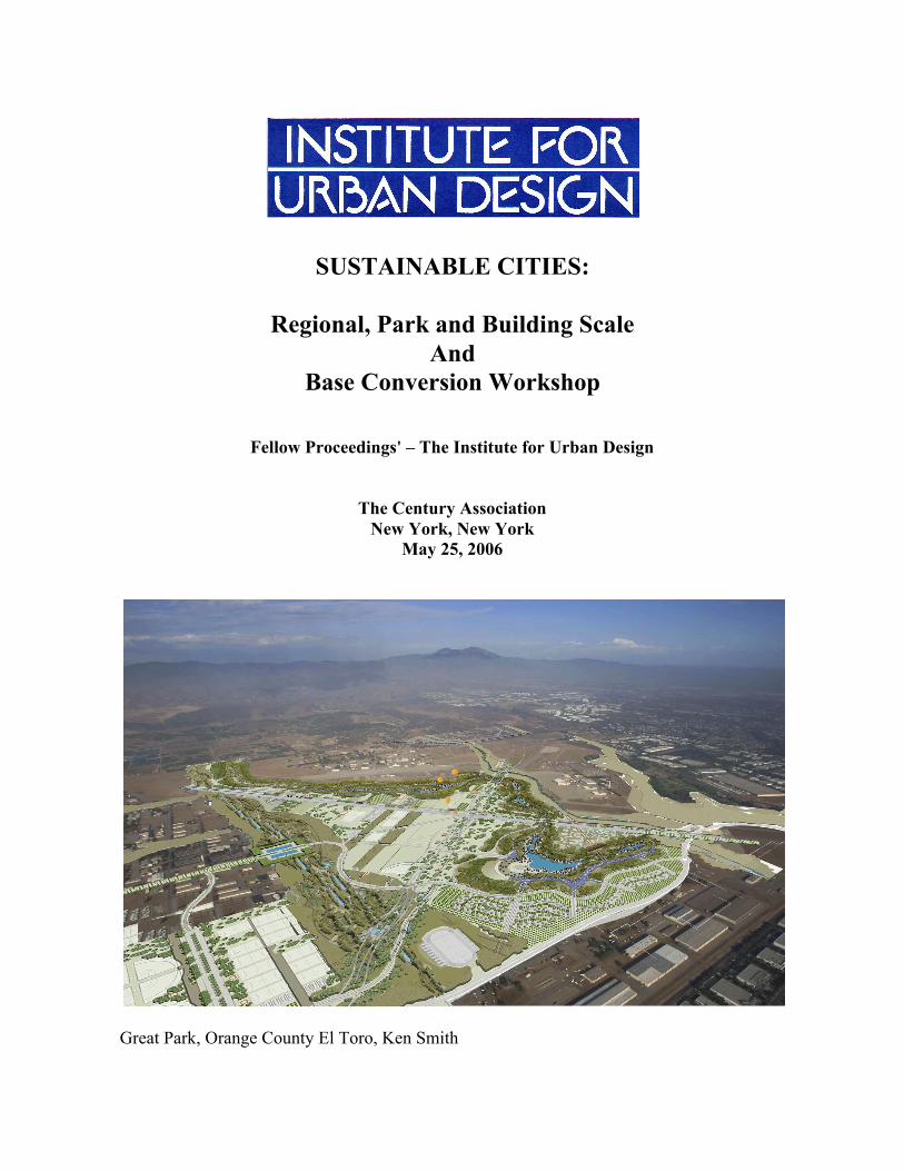
Great Park, Orange County El Toro, Ken Smith
SUSTAINABLE CITIES:
Regional, Park and Building ScaleAnd
Base Conversion Workshop
Sponsored by:
The Durst Organization, NYEDAW, NY
Fellow Proceedings Ð The Institute for Urban Design
The Century AssociationNew York, New York
May 25, 2006
TABLE OF CONTENTS
Introduction: Ann Ferebee, Director, Institute for Urban Design
Workshop: Base Conversion to Sustainable Cities
Moderator: Lance Jay Brown, CUNY
Panelists: Timothy N. Delorm, EDAW, NY, NY Ken Smith, Ken Smith Landscape Architecture, NY, NY John Clarke, Executive Director, NJ, NY Michael Stepner, Stepner Design Group, San Diego, CA Robert Pirani, Ex. Director, Governors Island Alliance, NY, NY
Respondents: Robert Campbell, The Boston Globe, Boston, MA Robert Ouellette, National Post, Toronto, Canada Laurie Kerr, NYC DOC and Wall Street Journal, NY, NY
Commentary: Robert Ouellette, Toronto Post, Toronto, Canada
Fellows Panel: Sustainable Cities: Regional, Park and Building Scale
Moderator: Lance Jay Brown, CUNY
Panelists: Michael Kwartler, Environmental Simulation Center, NY, NY Ken Smith, Ken Smith Landscape Architecture, NY, NY Robert Fox, Cook + Fox Architects, NY, NY
Respondent: Robert Campbell, Boston, MA
Event Speakers
Program Registration List
Converting Bases To Civilian Communities
Governors Island has a new director: Leslie Koch. Bayonne RedevelopmentAuthority is announcing new developers with new strategies for finance. Thesetopics were on the table when the Institute hosted a Base Conversion Workshopon May 25 at 2:00 in New York. Land from decommissioned basesÊrepresentssome of the last land available within cities as states, including New Jersey andCalifornia, toughen zoning laws.
Since December 29,1988 when the first Base Realignment and ClosureCommission released its report, some 451 installations have been recommendedfor closure, 97 of them major bases. Less than three months ago, on February25, another 24 major bases were recommended for closure. Naval bases, oftenlocated within existing cities, are providing new, denser,Êcommunities withinold cities, especially in California. The biggest hurdle to base conversionremains removal of environmental contaminants and improvement ofinfrastructure says Tim Delorm, Vice President, EDAW, New York.
San Diego, with two base conversions near downtown and El Toro Marine AirStation with new housing by LennarÊlinking two Irvine suburbs, are among themost interesting conversions now.
Ann Ferebee, DirectorInstitute for Urban DesignJune 9, 2006

WORKSHOP
BASE CONVERSIONTO SUSTAINABLE CITIES
LANCE BROWN
TodayÕs discussion is on the process of converting selectedmilitary bases in the US to civilian use. While our first speakerwill no doubt give a more pragmatic and precise history anddescription of this program I want to offer a broad view of thesubject and some issues for consideration.
Carcassonne, France
(1) First, in a way, we are not involved in anything unique.Every civilization has had to confront issues of defense andthe changing nature of defensive techniques and technologies.Classically, cities were built for defense and their conversioncame naturally as technologies advanced beyond theirpurpose. Vitruvius in his treatise The Ten books ofArchitecture discusses issues of defense from the getgo. InBook One, Ch 4 ,The Site of the City, his first line reads Òforfortified towns the following principles are to be observedÓAnd goes on to describe site selection, climate, wind, walls,etc. So, much of what the old world inherited were towns andcities designed according to those ever evolving principles ofplace making discussed by Vitruvius. They were, in the end,places where community developed and grew and many of themajor global cities and their adjacent hinterlands grew fromthose defensive, and often dramatically aggressive,beginnings.
(2) Today we will discuss how we in the new world deal withour obsolete defensive installations. But, we might also bear inmind as our culture develops what we might be doing with thenext generation of encampments, how they may be designedup front for conversion from obsolete uses to more convertible
environments. Why not design our military bases as well aswas done in classical times, in a sustainable way so conversionmight not be such a challenge to future generations.
This is what we are doing with our buildings, doesnÕt oururban scale deserve at least that attention.
(3) There are obviously many facets to todayÕs topic. One ofmy academic colleagues talked to me about the globaleconomic issues raised by the topic. He referenced thepublication whose title sums up his concern: The Socio-Economics of Conversion from War to Peace. And at onepoint we thought Swords to Ploughshares might be a good titlefor this panel. The topics contained in the book arecompelling. It illuminates issues about industrial conversion,retraining, social program and many others. We might listenfor these references today.
(4) And I am hoping that we can, we here interested in urbandesign, focus on just that, Design, making Place makingenduring Place from places now being reassigned. We willhere from five colleagues speaking about different aspects ofthis undertaking, this phenomena. We will then haveresponses from three individuals that write on design and theenvironment.
Aigues-Mortes, France

TIM DELORM
For most of its existence, the U.S. military has persistentlyprotected the status of its bases, although after the KoreanWar, Congress frequently sought to close bases which, fromits perspective, may no longer serve the national defense. TheBRAC concept was first considered in the 1960s in an attemptto achieve the government's goal of closing and realigningmilitary installations despite the political challenges whichoften arise when facilities face reduction or elimination.Because a military base can bring millions of dollars in federalmoney and economic vitality to its surrounding area each year,challenges raised by members of Congress from affecteddistricts made such initiatives very difficult.
In view of the political and economic ramifications associatedwith the closures, Congress decided that it had to be involvedin the process and passed legislation in 1965 that requiredDoD to report any base closure programs to it. However,President Lyndon B. Johnson vetoed the bill. This permittedDoD to continue realigning and closing bases withoutcongressional oversight throughout the rest of the 1960s. Buteconomic and political pressures eventually forced Congressto intervene in the BRAC process and to end DoD'sindependence. On August 1, 1977, President Jimmy Carterapproved Public Law 95-82 that required DoD to notifyCongress when a base was a candidate for reduction orclosure; to prepare studies on the strategic, environmental, andlocal economic consequences of such action; and to wait 60days for a congressional response. Codified as Section 2687,Title 10, United States Code, the legislation along with therequirements of the National Environmental Policy Act(NEPA) gave Congress an integral role in the process andpermitted Congress to thwart any DoD proposals to initiatebase realignment and closure studies unilaterally by refusingto approve them.
As economic pressures mounted, the drive to realign and closemilitary installations intensified. In 1983, the President'sPrivate Sector Survey on Cost Control (the GraceCommission) concluded in its report that economies could bemade in structure, and simultaneously recommended thecreation of a nonpartisan, independent commission to studybase realignment and closure. Although nothing came of thisrecommendation, the defense budget that had been decliningsince 1985, and was predicted to continue todecrease in coming years, prompted the Secretary of Defenseto take decisive action. In 1988, the secretary acknowledgedthe requirement to close excess bases to save money andchartered the first Commission on Base Realignment andClosure that year to recommend military bases within the U.S.for realignment and closure. From 1988 to 1995, there werefour successive bipartisan BRAC commissions thatrecommended the closure of 125 major military facilities and225 minor military bases and installations, and the realignment
in operations and functions of 145 others. This resulted in netsavings to taxpayers of over $16 billion through 2001, andover $6 billion in additional savings annually.
For the 2005 BRAC round, DoD Secretary Donald Rumsfeldstated that the primary goal was Òmilitary transformation.ÓThe BRAC selection process began at the Department ofDefense where the secretary had the responsibility to selectbases to be closed and those to be realigned. The criteria forthe 2005 round included 1) military value, 2) the extent andtiming of potential costs and savings of base realignment andclosure actions on the entire Federal budget and the DoD, 3)economic impact on existing communities in the vicinity ofmilitary installations, 4) the ability of infrastructure of bothexisting and potential receiving communities to supportmilitary operations and personnel and their families, and 5) theenvironmental impact on receiving locations. The DoDpresented its closure and realignment recommendations to the2005 BRAC commission appointed by President Bush in May2005. The commissionÕs charter was to provide an objective,non-partisan, and independent review and analysis of the listof military installation recommendations issued by DoD. Thecommission conducted an extensive study of therecommendations including numerous public hearings, morethan 100 site visits, and exhaustive analysis. The commissionsubmitted its recommendations to the President in September2005, who in turn sent the recommendations to Congress. The2005 BRAC recommendations were enacted into law inNovember 2005 without congressional action.
The commission concluded its study and analysis with 22major bases being designated for closing and 33 major basesfor realignment, including realignment of seven installationsinitially proposed for closure by the DoD. Over the next 20years, the total savings to the federal government and U.S.taxpayers resulting from the BRAC.
CommissionÕs recommendations are estimated at $35.6billion or about $4.2 billion annually. By law, the basesdesignated for closure must close by 2011.
Although historically the bases recommended for closureremain that way, there are exceptions. One of the major onesfor 2005 was Navy submarine base in New London, and thePortsmouth (ME) Naval Shipyard. State officials andcommunity leaders mounted sophisticated campaigns to keepthe bases operational. Flying in the face of BRAC history andpolitical realities, the bases were removed from the closure listby the commission in August 2005. Although a rarity, in thesecases, persistent and political clout paid off.
When a base is selected for closure, the potential economicfallout often strikes fear into the heart of a community inwhich an installation is being closed. However, frequentlythese communities have nothing to fear but fear itself. A1998 study undertaken by the General Accountability Office
(GAO) found that Òthe majority of the communitiessurrounding closed bases are faring well. Since 1988,107,000 jobs have been created in the communities whereinstallations were closed or realigned. The GAO activelytracks 75 of the 97 major base closures and reports annuallyon the employment picture in those markets. The GAOreported that of the 62 communities that experienced majorclosures, 70% had 2002 unemployment rates lower than theU.S. average and 48% had annual real per capita incomegrowth rates above the national average. ÒAs of October 31,2003, almost 72 percent (92,921) of the 129,649 DOD civilianjobs lost on military bases as a result of realignments orclosures in the prior BRAC rounds (have) been replaced,Ó theGAO pointed out.
What fearful communities often lose sight of is the fact thatbase realignment frequently means new opportunities forcommunity revitalization and economic development. Basesare often well-positioned in relation to freeway, railway, andwaterway access, and many of them abut woodlands andwaterfronts. Additionally, many bases contain well designedand constructed buildings suitable for such civilian uses ashospitals, housing, clinics, recreation facilities and the like,which can often be transformed into community amenitieswith minimal conversion expense. The airfields and shipyardsthat are part of many military bases may also have adecommissioned afterlife, such as at the air operations of theformer Loring Air Force Base in Limestone, ME; and theWilliams Air Force Base in Mesa, AZ; and the shipyardoperations of the former Philadelphia Naval Yards.
The Local Redevelopment Agency
During the previous BRAC rounds, cities or counties acquiredthe land gratis or at minimal cost through an economicdevelopment conveyance (EDC) or public benefit conveyance(PBC), authorized under BRAC to facilitate job creation andeconomic recovery. First, a local redevelopment agency(LRA) must be organized and a redevelopment plan created.There are two types of LRAs Ð the planning LRA and theimplementation LRA. Historically, LRAs served as themaster developer for the bases, configuring it for civilian use,subdividing it into development parcels, installing and/orupgrading infrastructure, and marketing the project. LRAs arerecognized as the primary local planning and implementationentity for base reuse by DoD through the Office of EconomicAdjustment. Since 1988, 92 closed military installationshave been actively engaged in redevelopment and all haveutilized LRAs in some form; there are four types ofimplementation LRAs: local government, public authority,joint powers authority, and private non-profit corporation.
Before an EDC application can be submitted, the LRA mustadopt a conceptual redevelopment plan that has beensubmitted to the appropriate military department (e.g. NavyDepartment for the Philadelphia Naval Yard) for consideration
in its review under NEPA. The responsible militarydepartment will then establish a reasonable timeframe forsubmission of an EDC application, which is communicated tothe LRA in writing. The LRA always has the option ofacquiring property under the Federal Property andAdministrative Services Act (FPASA), and if so, it would notbe necessary to complete an application for an EDC within thestated timetables.
If there is payment for the property, a note would be structuredbetween the military department (e.g. Department of theNavy) and the LRA. For example, a note might be negotiatedfor a purchase price of $4 million, with no payment due orinterest accruing until the fifth year after the sale, at whichtime the loan for the purchase price would begin to amortizeover a 20-year term at 7 percent interest per annum. The loancould be structured to require payment on a regular schedulefor the next 10 years, with a balloon payment at the end of theterm for the remaining unpaid balance of the loan. Now theDoD may be changing its approach to generate more revenuefrom these BRAC transactions. A model for at least somefuture deals could be the closed El Toro Marine Air Station inOrange County, CA, for which homebuilder Lennar Corp.paid the DoD $650 million for this prime piece of real estate.The proceeds from the sale will be used for the baseÕsenvironmental cleanup.
Communities will find that negotiating with developersthrough the EDC, as well as arranging the cleanup ofcontaminated land and facilities, and crafting deals with cities,can be tricky and time-consuming. They must collaboratewith federal and state governments Ð usually through the LRA- and their constituents/stakeholders to create acceptable land-use and development plans. To further assist communities,Congress in 1994 passed the Base Communities AssistanceAct (BCAA). Among other activities, the BCAA supportseconomic development through such measures as maintainingcivilian job-generating uses to the maximum extent possible;expediting environmental cleanup; providing larger economicplanning grants; and assisting civilian worker transition tonon-military jobs.
In any case, the BRAC process from the actual closure to theactual planning and development is a complex enterprise thatmust necessarily occur over a long time. Developers lookingto swoop in and effect a quick transformation could findthemselves stymied, particularly if the surrounding communityis edgy and inexperienced with large-scale redevelopment, andwary of its effects. Developers who acquire bases for reusewill likely have to make a number of concessions to localgovernment entities and the community, including thebuilding of new utility systems, roads, parks, schools, andpublic service facilities. (The Lennar Corp. will pay the Cityof Irvine $400 million for a 1,000-acre Great Park the citywants to create on the former El Toro base as part of LennarÕsnew community development. This is in addition to the $650million Lennar paid DoD.) Developers must also collaborate
with state, county, and local governments Ð again, usuallythrough the LRA - and the state and localconstituents/stakeholders to create acceptable land-use anddevelopment plans.
Although military installations pose unique challenges from aplanning and development point of view, they neverthelesspresent outstanding opportunities to create a special place thatcontributes to the economic, business, residential, recreationaland lifestyle diversity and vitality of the surroundingcommunities and region. Based on our firmÕs experience fromparticipating in more than 30 base reuse programs, we believethe 10 key principles for successful development ofdecommissioned military installations are:
1. Join the Army (Navy or Air Force) -- Early partnering withthe military can lead to a smoother transition.
2. Think Big: Create a Vision -- Determining the highest andbest new use for a closed base is critical to its ultimatesuccess, and redeveloping a military base may be one of a fewlifetime chances for a community to do something really bigand significant.
3. Partner for Success: Involve the Entire Community -- Asuccessful reuse effort will be the result of close cooperationbetween public and private interests and this is a potentiallyfruitful area for interested community leaders to get involved.
4. Know the Market -- A community (or developerÕs) visionfor the property must be supported by market realities.
5. Know the Politics -- Get to know the local officials andstakeholders and what they might have in mind for theproperty. In addition, work with other elected officials outsideof the immediate area.
6. Understand Potential Hurdles and How to Overcome Them-- Local jurisdictions and developers need to understand fullythe physical and legal obstacles to reuse; these can besignificant, but they also can be overstated. Among the mostcommon is environmental contamination, as well as otherconsiderations such as historic buildings, sensitive speciesÕhabitats, and unexploded ordnance.
7. Knit the Installation Back Into the Community -- Look foropportunities to connect roads and other infrastructure.
8. Create a New Image as early as possible, take the baseÕsfences down, open the base golf course to the public, create awelcome center, let the local college use a building or two fora satellite campus, and open recreation facilities
9. Take It One Step at a Time -- Successful redevelopmentrequires multiple simultaneous deals and land transfernegotiations. The community and the developers should
embrace the vision created early in the process; stayingconsistent with that vision ensures community support willremain strong and on course.
10. Be Flexible -- Plans will change as markets and localconditions change, and new markets of opportunity mayemerge over time. Implementation tools such as zoning andother land use controls must also be flexible to respond tochanges without always requiring burdensome rezoning andvariance processes.
Numerous major bases have been or are now beingredeveloped, including El Toro Marine Air Station (OrangeCounty, CA); Tustin Helicopter Station (Tustin, CA);Philadelphia Navy Yard; Glenview Naval Air Station(Chicago); Williams Air Force Base (Mesa, AZ); and MyrtleBeach (SC) Air Force Base. A key to successfulredevelopment is selecting the right plan coupled with a strongvision for each base and its location. In some cases, such asWilliams AFB and Loring AFB, the more rural locations andthe existence of extensive flight operations facilities andrunways dictated more commercial/industrial and institutionaluses. These two bases have been successfully redevelopedinto thriving business and education centers. At the other endof the planning spectrum is the former Glenview NAS locatedin an urban area 20 miles north of downtown Chicago.Planned and developed as an urban Ònew town,Ó The Glentoday is a 1,121 acre mixed-use district, with homes, offices,and retail space.
Not all closed bases evolve into redevelopment successstories, usually due to location or other issues such asextensive environmental impacts. A case in point is ChanuteAFB about 111 south of Chicago and 15 miles fromChampaign, IL. Contiguous to the small Village of Rantoul,IL, the base was closed in 1993 and since that time has notblossomed into new uses comparable to other success stories.One of the primary reasons is the more remote location withmarginal economic value, coupled with extensiveenvironmental impacts that are still being remediated.
In the final analysis, a community that is fully informed aboutcurrent BRAC issues and equipped to handle the reuse task islikely to find reinventing a closed base a rewardingundertaking.
KEN SMITH
Ken SmithÕs discussion on the El Toro project is covered inthe panel discussion.
JOHN CLARKE
Peninsula at Bayonne Master Plan
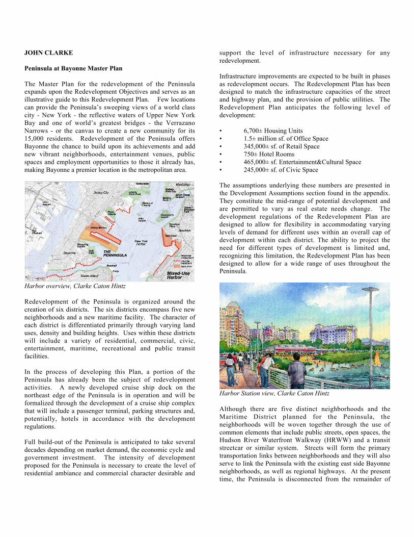
The Master Plan for the redevelopment of the Peninsulaexpands upon the Redevelopment Objectives and serves as anillustrative guide to this Redevelopment Plan. Few locationscan provide the PeninsulaÕs sweeping views of a world classcity - New York - the reflective waters of Upper New YorkBay and one of worldÕs greatest bridges - the VerrazanoNarrows - or the canvas to create a new community for its15,000 residents. Redevelopment of the Peninsula offersBayonne the chance to build upon its achievements and addnew vibrant neighborhoods, entertainment venues, publicspaces and employment opportunities to those it already has,making Bayonne a premier location in the metropolitan area.
Harbor overview, Clarke Caton Hintz
Redevelopment of the Peninsula is organized around thecreation of six districts. The six districts encompass five newneighborhoods and a new maritime facility. The character ofeach district is differentiated primarily through varying landuses, density and building heights. Uses within these districtswill include a variety of residential, commercial, civic,entertainment, maritime, recreational and public transitfacilities.
In the process of developing this Plan, a portion of thePeninsula has already been the subject of redevelopmentactivities. A newly developed cruise ship dock on thenortheast edge of the Peninsula is in operation and will beformalized through the development of a cruise ship complexthat will include a passenger terminal, parking structures and,potentially, hotels in accordance with the developmentregulations.
Full build-out of the Peninsula is anticipated to take severaldecades depending on market demand, the economic cycle andgovernment investment. The intensity of developmentproposed for the Peninsula is necessary to create the level ofresidential ambiance and commercial character desirable and
support the level of infrastructure necessary for anyredevelopment.
Infrastructure improvements are expected to be built in phasesas redevelopment occurs. The Redevelopment Plan has beendesigned to match the infrastructure capacities of the streetand highway plan, and the provision of public utilities. TheRedevelopment Plan anticipates the following level ofdevelopment:
¥ 6,700± Housing Units¥ 1.5± million sf. of Office Space¥ 345,000± sf. of Retail Space¥ 750± Hotel Rooms¥ 465,000± sf. Entertainment&Cultural Space¥ 245,000± sf. of Civic Space
The assumptions underlying these numbers are presented inthe Development Assumptions section found in the appendix.They constitute the mid-range of potential development andare permitted to vary as real estate needs change. Thedevelopment regulations of the Redevelopment Plan aredesigned to allow for flexibility in accommodating varyinglevels of demand for different uses within an overall cap ofdevelopment within each district. The ability to project theneed for different types of development is limited and,recognizing this limitation, the Redevelopment Plan has beendesigned to allow for a wide range of uses throughout thePeninsula.
Harbor Station view, Clarke Caton Hintz
Although there are five distinct neighborhoods and theMaritime District planned for the Peninsula, theneighborhoods will be woven together through the use ofcommon elements that include public streets, open spaces, theHudson River Waterfront Walkway (HRWW) and a transitstreetcar or similar system. Streets will form the primarytransportation links between neighborhoods and they will alsoserve to link the Peninsula with the existing east side Bayonneneighborhoods, as well as regional highways. At the presenttime, the Peninsula is disconnected from the remainder of
Bayonne by Rt. 440 and the track system employed forpassengers and freight. When the Peninsula was a militarybase, its isolation was an asset. Now, that the objectives are tocreate a vibrant mixed-use district for the majority of theredevelopment area, a reconnection to the City street system isessential for a successful project.
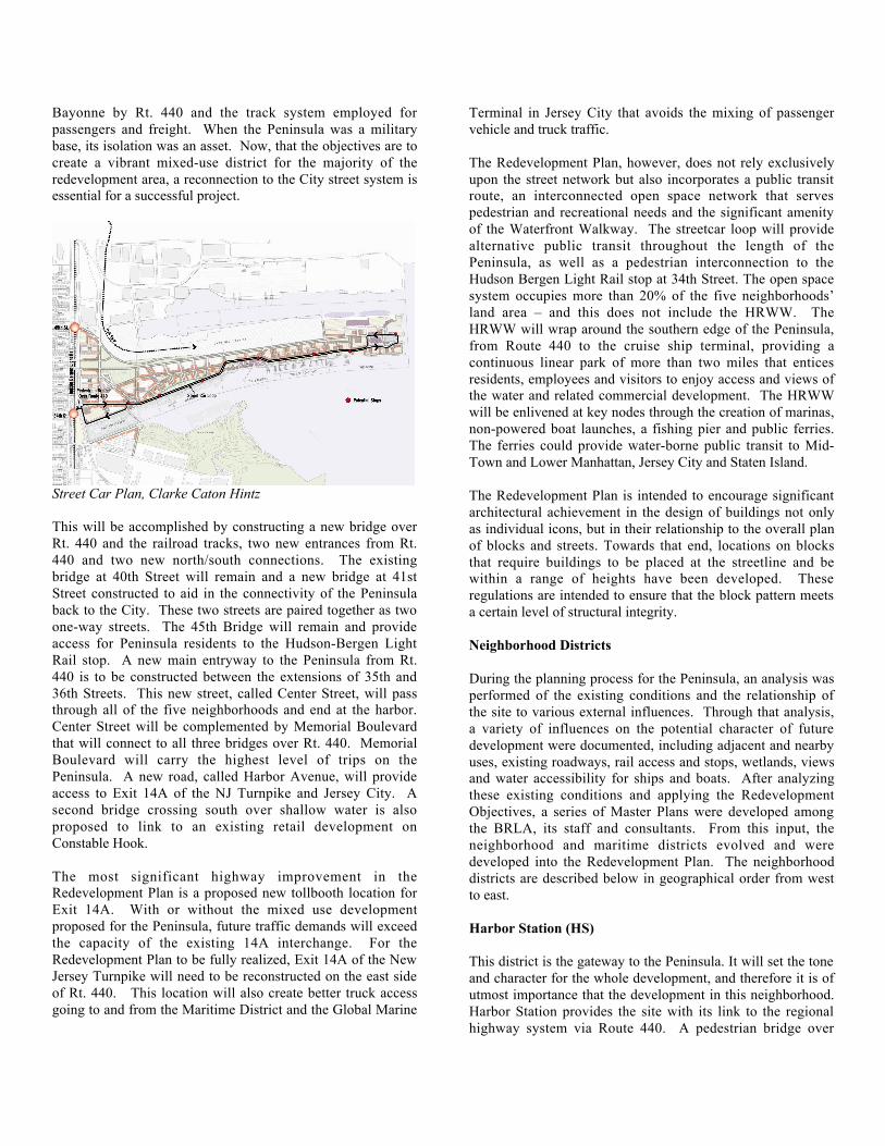
Street Car Plan, Clarke Caton Hintz
This will be accomplished by constructing a new bridge overRt. 440 and the railroad tracks, two new entrances from Rt.440 and two new north/south connections. The existingbridge at 40th Street will remain and a new bridge at 41stStreet constructed to aid in the connectivity of the Peninsulaback to the City. These two streets are paired together as twoone-way streets. The 45th Bridge will remain and provideaccess for Peninsula residents to the Hudson-Bergen LightRail stop. A new main entryway to the Peninsula from Rt.440 is to be constructed between the extensions of 35th and36th Streets. This new street, called Center Street, will passthrough all of the five neighborhoods and end at the harbor.Center Street will be complemented by Memorial Boulevardthat will connect to all three bridges over Rt. 440. MemorialBoulevard will carry the highest level of trips on thePeninsula. A new road, called Harbor Avenue, will provideaccess to Exit 14A of the NJ Turnpike and Jersey City. Asecond bridge crossing south over shallow water is alsoproposed to link to an existing retail development onConstable Hook.
The most significant highway improvement in theRedevelopment Plan is a proposed new tollbooth location forExit 14A. With or without the mixed use developmentproposed for the Peninsula, future traffic demands will exceedthe capacity of the existing 14A interchange. For theRedevelopment Plan to be fully realized, Exit 14A of the NewJersey Turnpike will need to be reconstructed on the east sideof Rt. 440. This location will also create better truck accessgoing to and from the Maritime District and the Global Marine
Terminal in Jersey City that avoids the mixing of passengervehicle and truck traffic.
The Redevelopment Plan, however, does not rely exclusivelyupon the street network but also incorporates a public transitroute, an interconnected open space network that servespedestrian and recreational needs and the significant amenityof the Waterfront Walkway. The streetcar loop will providealternative public transit throughout the length of thePeninsula, as well as a pedestrian interconnection to theHudson Bergen Light Rail stop at 34th Street. The open spacesystem occupies more than 20% of the five neighborhoodsÕland area Ð and this does not include the HRWW. TheHRWW will wrap around the southern edge of the Peninsula,from Route 440 to the cruise ship terminal, providing acontinuous linear park of more than two miles that enticesresidents, employees and visitors to enjoy access and views ofthe water and related commercial development. The HRWWwill be enlivened at key nodes through the creation of marinas,non-powered boat launches, a fishing pier and public ferries.The ferries could provide water-borne public transit to Mid-Town and Lower Manhattan, Jersey City and Staten Island.
The Redevelopment Plan is intended to encourage significantarchitectural achievement in the design of buildings not onlyas individual icons, but in their relationship to the overall planof blocks and streets. Towards that end, locations on blocksthat require buildings to be placed at the streetline and bewithin a range of heights have been developed. Theseregulations are intended to ensure that the block pattern meetsa certain level of structural integrity.
Neighborhood Districts
During the planning process for the Peninsula, an analysis wasperformed of the existing conditions and the relationship ofthe site to various external influences. Through that analysis,a variety of influences on the potential character of futuredevelopment were documented, including adjacent and nearbyuses, existing roadways, rail access and stops, wetlands, viewsand water accessibility for ships and boats. After analyzingthese existing conditions and applying the RedevelopmentObjectives, a series of Master Plans were developed amongthe BRLA, its staff and consultants. From this input, theneighborhood and maritime districts evolved and weredeveloped into the Redevelopment Plan. The neighborhooddistricts are described below in geographical order from westto east.
Harbor Station (HS)
This district is the gateway to the Peninsula. It will set the toneand character for the whole development, and therefore it is ofutmost importance that the development in this neighborhood.Harbor Station provides the site with its link to the regionalhighway system via Route 440. A pedestrian bridge over
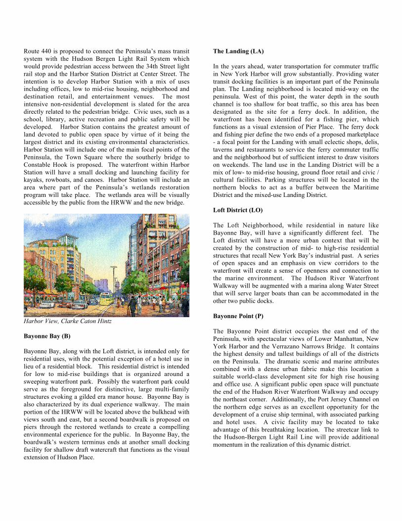
Route 440 is proposed to connect the PeninsulaÕs mass transitsystem with the Hudson Bergen Light Rail System whichwould provide pedestrian access between the 34th Street lightrail stop and the Harbor Station District at Center Street. Theintention is to develop Harbor Station with a mix of usesincluding offices, low to mid-rise housing, neighborhood anddestination retail, and entertainment venues. The mostintensive non-residential development is slated for the areadirectly related to the pedestrian bridge. Civic uses, such as aschool, library, active recreation and public safety will bedeveloped. Harbor Station contains the greatest amount ofland devoted to public open space by virtue of it being thelargest district and its existing environmental characteristics.Harbor Station will include one of the main focal points of thePeninsula, the Town Square where the southerly bridge toConstable Hook is proposed. The waterfront within HarborStation will have a small docking and launching facility forkayaks, rowboats, and canoes. Harbor Station will include anarea where part of the PeninsulaÕs wetlands restorationprogram will take place. The wetlands area will be visuallyaccessible by the public from the HRWW and the new bridge.
Harbor View, Clarke Caton Hintz
Bayonne Bay (B)
Bayonne Bay, along with the Loft district, is intended only forresidential uses, with the potential exception of a hotel use inlieu of a residential block. This residential district is intendedfor low to mid-rise buildings that is organized around asweeping waterfront park. Possibly the waterfront park couldserve as the foreground for distinctive, large multi-familystructures evoking a gilded era manor house. Bayonne Bay isalso characterized by its dual experience walkway. The mainportion of the HRWW will be located above the bulkhead withviews south and east, but a second boardwalk is proposed onpiers through the restored wetlands to create a compellingenvironmental experience for the public. In Bayonne Bay, theboardwalkÕs western terminus ends at another small dockingfacility for shallow draft watercraft that functions as the visualextension of Hudson Place.
The Landing (LA)
In the years ahead, water transportation for commuter trafficin New York Harbor will grow substantially. Providing watertransit docking facilities is an important part of the Peninsulaplan. The Landing neighborhood is located mid-way on thepeninsula. West of this point, the water depth in the southchannel is too shallow for boat traffic, so this area has beendesignated as the site for a ferry dock. In addition, thewaterfront has been identified for a fishing pier, whichfunctions as a visual extension of Pier Place. The ferry dockand fishing pier define the two ends of a proposed marketplace- a focal point for the Landing with small eclectic shops, delis,taverns and restaurants to service the ferry commuter trafficand the neighborhood but of sufficient interest to draw visitorson weekends. The land use in the Landing District will be amix of low- to mid-rise housing, ground floor retail and civic /cultural facilities. Parking structures will be located in thenorthern blocks to act as a buffer between the MaritimeDistrict and the mixed-use Landing District.
Loft District (LO)
The Loft Neighborhood, while residential in nature likeBayonne Bay, will have a significantly different feel. TheLoft district will have a more urban context that will becreated by the construction of mid- to high-rise residentialstructures that recall New York BayÕs industrial past. A seriesof open spaces and an emphasis on view corridors to thewaterfront will create a sense of openness and connection tothe marine environment. The Hudson River WaterfrontWalkway will be augmented with a marina along Water Streetthat will serve larger boats than can be accommodated in theother two public docks.
Bayonne Point (P)
The Bayonne Point district occupies the east end of thePeninsula, with spectacular views of Lower Manhattan, NewYork Harbor and the Verrazano Narrows Bridge. It containsthe highest density and tallest buildings of all of the districtson the Peninsula. The dramatic scenic and marine attributescombined with a dense urban fabric make this location asuitable world-class development site for high rise housingand office use. A significant public open space will punctuatethe end of the Hudson River Waterfront Walkway and occupythe northeast corner. Additionally, the Port Jersey Channel onthe northern edge serves as an excellent opportunity for thedevelopment of a cruise ship terminal, with associated parkingand hotel uses. A civic facility may be located to takeadvantage of this breathtaking location. The streetcar link tothe Hudson-Bergen Light Rail Line will provide additionalmomentum in the realization of this dynamic district.
MICHAEL STEPNER
THE REUSE OF MILITARY BASESINFILL REDEVELOPMENT OPPORTUNITY
TWO SAN DIEGO CASE STUDIES
In recent years, many cities have been involved in theredevelopment of brownfields (no longer used industrial areas)that present challenges and opportunities for communities.We are now looking, also, at grayfields (usually shoppingcenters, office parks that no longer function as they once didand that should/could be reused to better serve the community.These are usually privately-owned properties that may or maynot go into public hands and, then, go back into privateownership.
I would like to talk about a third category that I will callÒkhakifieldsÓÐmilitary bases that may be brownfields orgrayfields or bothÐthat are owned by the public in stewardshipwith the military services who have been told they must divestthemselves of the property. The property must go through arigorous reuse planning process that is a joint federal-localprocess. Who is in charge may be a function of political clout.The reuse plan may keep all or some of the base in public useand ownership or may e turned over to the private sector forreuse.
San Diego is a Navy town. It contains the nationÕs largestnaval base; and, the Navy and related defense. businessescomprise one of our major employers. However, the Navy isno longer in the position that once was when the commandantof the 11th Naval District was called the Navy Mayor andoften gave strong suggestions to the civilian mayor of how hemight want to handle city business.
Contrary to the impression of many, most military bases arenot out in the boondocks. Rather, they are located in urbanareas and in many cases in the heart of urban areas. This isespecially true of Navy facilities.
San Diego case studies:
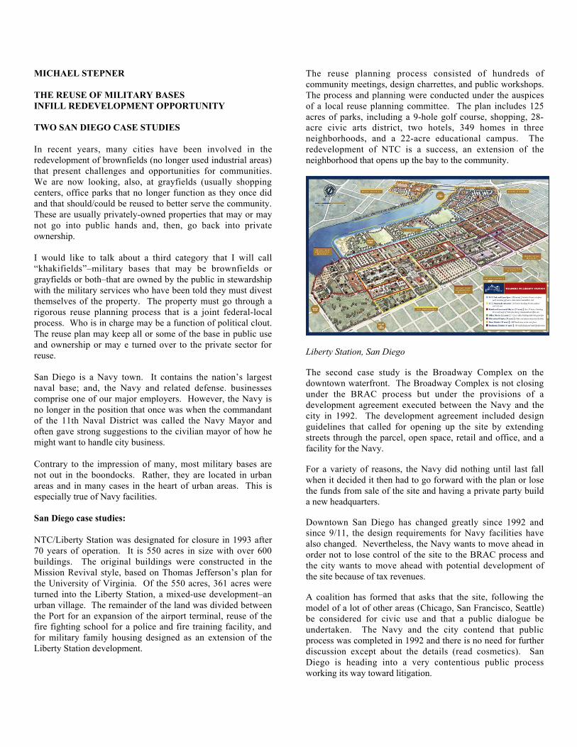
NTC/Liberty Station was designated for closure in 1993 after70 years of operation. It is 550 acres in size with over 600buildings. The original buildings were constructed in theMission Revival style, based on Thomas JeffersonÕs plan forthe University of Virginia. Of the 550 acres, 361 acres wereturned into the Liberty Station, a mixed-use developmentÐanurban village. The remainder of the land was divided betweenthe Port for an expansion of the airport terminal, reuse of thefire fighting school for a police and fire training facility, andfor military family housing designed as an extension of theLiberty Station development.
The reuse planning process consisted of hundreds ofcommunity meetings, design charrettes, and public workshops.The process and planning were conducted under the auspicesof a local reuse planning committee. The plan includes 125acres of parks, including a 9-hole golf course, shopping, 28-acre civic arts district, two hotels, 349 homes in threeneighborhoods, and a 22-acre educational campus. Theredevelopment of NTC is a success, an extension of theneighborhood that opens up the bay to the community.
Liberty Station, San Diego
The second case study is the Broadway Complex on thedowntown waterfront. The Broadway Complex is not closingunder the BRAC process but under the provisions of adevelopment agreement executed between the Navy and thecity in 1992. The development agreement included designguidelines that called for opening up the site by extendingstreets through the parcel, open space, retail and office, and afacility for the Navy.
For a variety of reasons, the Navy did nothing until last fallwhen it decided it then had to go forward with the plan or losethe funds from sale of the site and having a private party builda new headquarters.
Downtown San Diego has changed greatly since 1992 andsince 9/11, the design requirements for Navy facilities havealso changed. Nevertheless, the Navy wants to move ahead inorder not to lose control of the site to the BRAC process andthe city wants to move ahead with potential development ofthe site because of tax revenues.
A coalition has formed that asks that the site, following themodel of a lot of other areas (Chicago, San Francisco, Seattle)be considered for civic use and that a public dialogue beundertaken. The Navy and the city contend that publicprocess was completed in 1992 and there is no need for furtherdiscussion except about the details (read cosmetics). SanDiego is heading into a very contentious public processworking its way toward litigation.
ROBERT PIRANI
GOVERNORS ISLAND: IN NEW YORK HARBOR
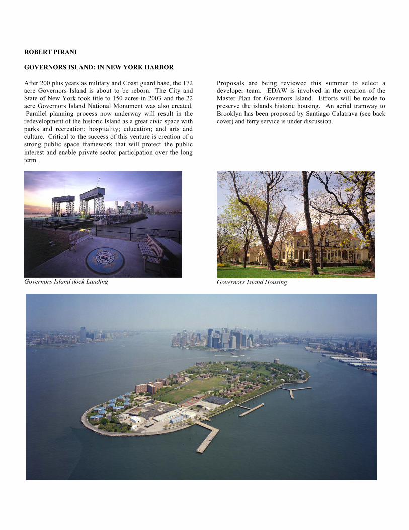
After 200 plus years as military and Coast guard base, the 172acre Governors Island is about to be reborn. ÊThe City andState of New York took title to 150 acres in 2003 and the 22acre Governors Island National Monument was also created.ÊParallel planning process now underway will result in theredevelopment of the historic Island as a great civic space withparks and recreation; hospitality; education; and arts andculture. ÊCritical to the success of this venture is creation of astrong public space framework that will protect the publicinterest and enable private sector participation over the longterm.
Governors Island dock Landing
Proposals are being reviewed this summer to select adeveloper team. EDAW is involved in the creation of theMaster Plan for Governors Island. Efforts will be made topreserve the islands historic housing. An aerial tramway toBrooklyn has been proposed by Santiago Calatrava (see backcover) and ferry service is under discussion.
Governors Island Housing
ROBERT OULLETTE
GOVERNORS ISLAND: INTERNATIONAL CENTREFOR SUSTAINABLE URBANISM?
When Robert Ouellette, a pioneer in city reportage via web,agreed to attend the May 25 program, the Institute also invitedhim to visit Governors Island and prepare a report for theInstituteÕs website. Herewith is the report.
By Robert Ouellette, National Post TorontoMay 31, 2006
When the Dutch came to Governors Island, they saw a landgreen with promise. To them, AmericaÕs pristine forestsbreathed opportunity. We wonder though, has GovernorsIsland lost its symbolic promise of a better life based on thenatural richness of the land? Has America? The pilgrimsmoved on to Manhattan but the islandÕs strategic location atthe mouth of New YorkÕs harbor made it an ideal militarystronghold.
The Coast Guard left Governors Island in 1996. Their moveended a string of military stewardships going back to beforethe British. In fact, the island helped save George Washingtonand his revolution. The old military buildings here smell ofhistory. They became a national monument in 2001. In 2003,ownership of the Island transferred to the people of the Stateof New York. It awaits its next great purpose.
A few hundred yards away, alone in an occasional driftingfog, stands the Statue of Liberty. Governor IslandÕs old flintbattlements guard this symbolic gateway to America wherethe poor of the world came in search of opportunity.
Instead of a gateway to a land green with promise, the islandarchipelago of New York now risks becoming a gateway to anation in environmental decline. Even oil barons know we areat a turning point. The American continent that once nurtureddreams of prosperity is in peril. Cities and their users have tochange - and they know it.
Can we start again Ð here, where we began? Can we build asustainable America?
The island could be for urban sustainability what SiliconValley is for high technology Ð a center where the best andbrightest gather to solve complex problems. Imagine thewhole of Governors Island as a 21st century laboratory for thedevelopment of sustainable cities (and, of course, a sustainableNew York). It would house a human enterprise on the scale ofthe Manhattan Project but dedicated to life not death. There isalso the advantage of having the worldÕs greatest urban test-bed just across the harbor.
What would it look like? When urban designers get the job ofimagining a Governors Island of the future, they mustacknowledge that this is not just another green-field sitewaiting to be planted with so much architectural stuff. These172 acres need a grand vision.
Santiago Calatrava offers one part of that vision. His schemefor a gondola system connecting the island with Brooklyn andManhattan is the essence of innovation. In plan, the systemlooks like a fragile web supporting a pendulum. Maybe,figuratively, it is. CalatravaÕs scheme solves the problem oftransporting people to and from Brooklyn to the islandquickly. It is an essential first step in the adaptive reuse of thistremendous resource.
A further step might be to create a special kind of park.Imagine a place similar in scale to ChicagoÕs Millennium Parkwhere artists, designers, and researchers create sustainabilitythemed installations. It would be a beacon for internationaltourism. Many will wonder what a New York hotel designedin consultation with sustainability guru William McDonoughmight look like. How will the island get its power? What willit do with its waste? How will users get around? Answeringthese questions will define the place.
So far, only a few talented and capable urban designers andarchitects have worked on the Governors Island project. Sincethis is a new, information-driven millennium, there are otherways to generate ideas for the islandÕs future. Why not openup an urban design and ideas competition to the global wiredcommunity? Make it an open-source project for designers (andpeople) everywhere and see what happens. It worked for LinusTorvald and his Linux software. TorvaldÕs motto is, ÒGivenenough eyeballs, all bugs are shallow.Ó Governors Islandcould offer a similar motto: ÒGiven enough design input,sustainability is possible.Ó
The island is unique. To trivialize its history and geographicalsignificance by suggesting mundane and predictable urbandesign solutions would be a disaster. For a host of symbolicand historical reasons the island can represent the best that isAmerica.
For centuries, Governors Island was part of a gateway thatswept human resources into America. As a sustainabilityresearch center, it could export visions of a better future out tothe world and might just help improve the lives of everyone,everywhere.
Robert Ouellette is the former Director of the University ofTorontoÕs Information Technology Design Centre, at theFaculty of Architecture, Landscape, and Design. He receivedthe City of Toronto Urban Design Award for the John StreetMedia Corridor Project 1994. He is an Architectural Criticfor CanadaÕs National Post.

FELLOWS PANEL DISSCUSSION
SUSTAINABLE CITIES: REGIONAL,PARK AND BUILDING SCALE
Lance Jay Brown
It's my pleasure to welcome you to the Institute's fall programon sustainable cities. We all know that the President recentlyacknowledged that there was an energy problem in the UnitedStates. That's good news. Al Gore's film, An InconvenientTruth, is opening in New York. There seems to be some issueabout how well it is received here. So while you're in NewYork, if you're from out of town, go and see it.
Sustainability for me fundamentally is a social issue and anissue of communication. I really was convinced of that by[Oka Kopor], a long-time friend and colleague of AliyeÕs, whowrote a paper entitled "Sustainable Environments, Holistic andIncremental Processes" in 1997. She listed five areas ofconcern that I think are very useful when thinking about anddiscussing this subject.
• Her first area of concern was the enhancement ofdiversity.
• The second was the intensification of connectionswith nature.
• The third was the supporting of community andsocial interaction.
• The fourth was the maintaining of continuity withhistory and cultural values.
• Fifth was appropriating sustainable technology andthe use of renewable energy resources.
I found that to be a really nice umbrella of concerns. So Ioffer those for your consideration while we hear from today'sspeakers. Widely varying geographic areas. We'll be inHawaii -- hopefully we can stay there longest. We'll be on theWest Coast, and we'll be back here in New York.
The first presentation will be by Michael Kwartler. Michael isthe principal of Michael Kwartler and Associates and thefounding director of the Environmental Simulation Center
Michael has served as the Deputy Director of the Mayor'sUrban Design Council and later joined the City PlanningDepartment as Associate Director of the Division of LandPlanning & Environmental Management. He was the directorof Columbia University's program in Historic Preservation.
Following Michael's talk, we will hear from Ken Smith who,for those of you who were here earlier, will continue hispresentation. Ken is the principal of Ken Smith LandscapeArchitecture in New York, a design critic at HarvardUniversity's Graduate School of Design, from where hereceived his MLA. Ken is a favorite son of the City CollegeSchool of Architecture where he taught. We claim him aswell.
Third, we'll hear from Robert Fox. Bob Fox joined RichardCook to form Cook + Fox, a firm devoted to creatingenvironmental and responsible high-performance buildings.Winner of the Urban Visionary Award from the CooperUnion, he's been a guest lecturer at the National BuildingMuseum, Northeast Sustainable Energy Association, and theAIA and United Nations Health and the EnvironmentConference. Bob has a degree from Cornell and a Mastersfrom Harvard University.
With that, I will give the floor to Michael Kwartler and lookforward to hearing some interesting presentations.
Michael Kwartler, ESL, New York Kona, Hawaii:From Green Forest to New Community
What I want to talk about is really less about the urban designand more about the process of how the public makesdecisions. It's not just a matter of participation. It literally ispublic decision-making. The project that we've been involvedin is plan for the Big Island of Hawaii, the Kona region. Theinteresting part of all of this is about behavior modificationand the politics of it. One is that unless the folks are reallybehind it and it really is their plan, there won't be any behaviormodification. Kona probably more than any other place in theUnited States has very high values and is a desirable place tobe. It's very expensive. There's a disparity in terms of wherepeople live and where they work. There are transportationissues and they're consuming land at a rate that far exceeds thepopulation growth.
The second part of it is that the only way this actually getsimplemented, even though it will be adopted by the county, isthat the folks will actively hold the county's feet to the fire,and if they don't like what's happening, they throw the bumsout. So this is very much a bottom-up plan, and I think ifyou're going to have any sustainable development, it has to bebottom-up because if it's top-down people tend not to do it.They have to buy into it, they want to be part of it, and it hasto come basically from them.
Let me jump into this. I'm not really going to talk to theseslides, but these are the basics. It's actually not a very largepopulation but it's growing dramatically and it's growing byabout a third in the next twenty years. It's growing much
faster than most areas in the U.S. Also, the housing is reallymuch more of an issue in part because of second homes andthings like that, which also create disparities in the overallpopulation between rich and poor. You can see the vacancyrate, as the census calls it. That means your second homes.It's really huge compared to other parts of the country.
The other part of this is that they're eating up land, as theywould say in New York, until it's going out of style. They'veactually realized this, and that's very much what this wholeplan is about -- are there any other alternatives? That's wherethe whole behavior modification part comes in. Because theway in which they're growing is the way other parts of thiscountry grow, which is to eat up land and end up with nothingat the end of the day.
WORKSHOPS
The presentation I'll show you is really the one that we've beenusing in the workshops. This is a fragment of a whole seriesof workshops, and there will be a final workshop in aboutthree weeks in Hawaii. What I'm showing you is actuallywhat the folks in Hawaii have seen as part of theirintroductions to the various workshops. WeÕve gottenenormous turnouts given the size of the population, over 350people show up for the workshops and they're there for theentire day. That's not an insignificant number given theoverall population and the enthusiasm. Notwithstanding thecynicism of twenty years of plans, all of which are on the shelf-- they fill up a whole bookshelf. But there's some sense thatsomething has to be done and that they're more than willing toparticipate.
It's a whole process of education as well, because most folksdon't know what the alternatives are. It isn't that the marketnecessarily would provide them. The market will respond toit, if in fact the folks say this is really what we want. Thenwe'll tend to weed out the developers who are less responsiveto what the folks are interested in.
Let me very quickly take you through some of this. We dividethe workshops into where we grow and how we grow. We dothis with Johnny Longo, who was one of the peopleresponsible for some of these processes, who's fabulous towork with in terms of public process. We've been joining a lotof the technology to this in order to make complex problemssensible for folks rather than trying to dumb them down. Sothere's an education that goes along with it. These are a seriesof critical questions, and the critical questions really came outof a series of almost 105 small workshops that were done inpeople's kitchens, with facilitators who we trained. They werethe ones who actually bubbled up what they thought were theimportant issues that really needed to be addressed.
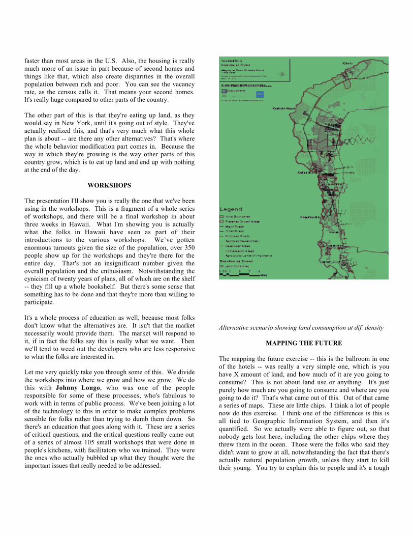
Alternative scenario showing land consumption at dif. density
MAPPING THE FUTURE
The mapping the future exercise -- this is the ballroom in oneof the hotels -- was really a very simple one, which is youhave X amount of land, and how much of it are you going toconsume? This is not about land use or anything. It's justpurely how much are you going to consume and where are yougoing to do it? That's what came out of this. Out of that camea series of maps. These are little chips. I think a lot of peoplenow do this exercise. I think one of the differences is this isall tied to Geographic Information System, and then it'squantified. So we actually were able to figure out, so thatnobody gets lost here, including the other chips where theythrew them in the ocean. Those were the folks who said theydidn't want to grow at all, notwithstanding the fact that there'sactually natural population growth, unless they start to killtheir young. You try to explain this to people and it's a tough

one. The idea of using the G.I.S. here is that nobody's voteactually goes unmeasured. This is really important whenthere's a public process, because there's a tendency in a publicprocess that you come up with the average of the average ofthe average of the average. So this is a way to make sure thateverybody's position is recorded. Then second is how muchof a consensus there is for specific locations as well. That'swhat this is actually reporting.
GREEN INFRASTRUCTURE
What came out of this is that there were a series of preferredlocations, not only for growth for also for a greeninfrastructure network. The idea is to really mesh thelandscape with where the future development would be, andnot to think of this as you have the landscape and you haveurbanism, particularly in a place like Hawaii where that's, infact, why people are there. And also because this is theoriginal island of the kingdom. This place is just littered withcultural artifacts. Green infrastructure is basically acombination of culture, because it's so integrated with thelandscape itself.
20 YEAR PLAN
There are three outcomes that came out of these workshops.One was development principles, performance indicators,which we're going to respond to what those principles are. Soin part, as the plan goes forward and it gets adopted, and this isbasically a twenty-year plan, there's a way for folks to seewhether, as Ed Koch would have said, how am I doing? So itholds everybody accountable and the principles and theperformance indicators will be incorporated and voted uponand adopted as part of the overall plan. Some of these arerather obvious, but the important thing is that these were notthings that we did, or said this is the answer for you. This allcame through a process that's gone on for the last nine months.Where the growth should be. People actually were very clearabout this, because it's interesting because the region is linear,people travel back and forth pretty much on the same road andknow every square inch of this. So where they put thosechips was very...as we developed the G.I.S. maps with thecounty, people always had something to say -- that's wrong,this is wrong, etc. The county now has probably the mostaccurate and up-to-date G.I.S., in part because we've hadalmost a thousand people contribute to making it moreaccurate than it ordinarily would be.Essentially what they came up with, which in a way if we allsat down as professionals you would have said the same thing,is you really need to grow compactly. What they realized, andI'll show you in a couple of other scenarios, the amount ofland that was being consumed meant that in twenty years therewould be nothing left. That was not acceptable both to thenative Hawaiians, as well as the newcomers.
PERFORMANCE INDICATORS
We're in the process of putting together the performanceindicators. There's about twenty of them. Generally morethan twenty doesn't work because nobody could rememberthem and they get so complicated that they're impossible. Sothe idea is to winnow them down to the ones that areabsolutely critical, and even those get re-evaluatedperiodically. Let's look at the growth scenario. Taking wherepeople located the chips and where their preferences were interms of the locations, we said if you continue with a baselineas zone, to absorb the future population there will be no landleft in the growth area. The second was this is your currentpractice. It's pretty much the same thing. Nothing will be left.The land is actually typically somewhere between a five to tenpercent slope, otherwise, known as a volcano. There are threeactive volcanoes. They call them mountains. It's a little scary.They're very large volcanoes. They are 13,000 feet tall, theheight of Mt. Blanc. This is where there's snow on top. Youcould ski on some of these if they're not erupting. And younever know where it comes out. The lava fields are quitesomething.
We also then, based on the way in which they were suggestingwhere they had layered the chips, in terms of how many,potential growth scenarios in terms of the number of units peracre. It was a way to get them to really begin to understandwhat these numbers meant, not in the abstract but in the realwhen you put them down on a piece of land, as well as [wordsounds like eight D or something] use to the acre. So we try tohelp folks understand what this really meant. So landconsumption, if we had to accommodate almost 3,000 newhousing units and you looked at scenario A, it would take upthat much land. Scenario B, scenario C, and a modest 8D useper acre, which actually is below what they build in Queens.So as a New Yorker, it was beginning to make me twitch thateight was the high-density. But it really is high density for theKona area.
You can see the dramatic difference just in terms of sheer landconsumption. The second has to do with infrastructure cost,affordable housing. The more you sprawl, the more it costsfor roads, basically with the gray infrastructure, all of theplumbing and so on. And that in part is driving folks tocommute literally across the island, from one side of the islandto the other, where the housing is a lot cheaper. Or said inanother way, this is what it buys you, on the same piece ofland.
Then we did some quick and dirty visualizations and issuesabout connectivity and walkability. These are differentdevelopment patterns that we superimposed on a photographfrom the G.I.S. that shows the way in which they are currentlydeveloping based on the different scenarios that I just
mentioned, the A, B, C and D scenarios. The blue square isbasically a half mile, so it makes it essentially quite walkable.The same again with development patterns. Then we justshowed what it would like as a carpet over the landscape.This is A, B, C and D. All of these were a way to convey theabstraction of numbers in ways that were meant to be quitevisceral.
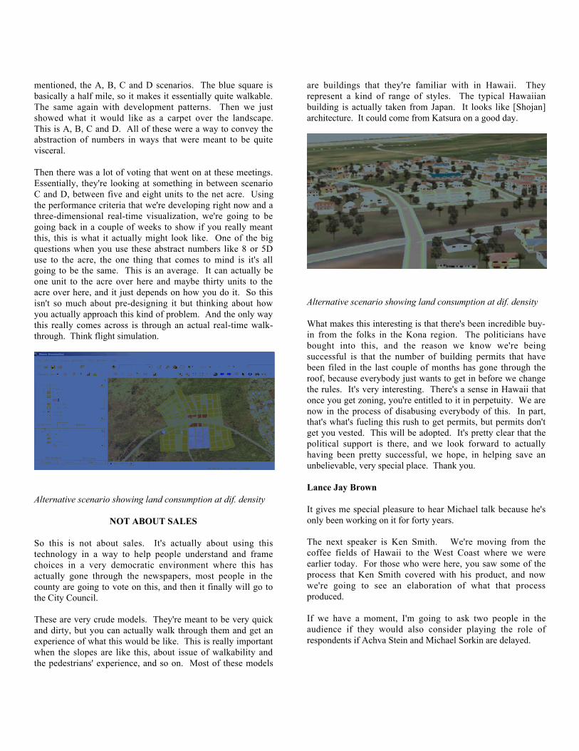
Then there was a lot of voting that went on at these meetings.Essentially, they're looking at something in between scenarioC and D, between five and eight units to the net acre. Usingthe performance criteria that we're developing right now and athree-dimensional real-time visualization, we're going to begoing back in a couple of weeks to show if you really meantthis, this is what it actually might look like. One of the bigquestions when you use these abstract numbers like 8 or 5Duse to the acre, the one thing that comes to mind is it's allgoing to be the same. This is an average. It can actually beone unit to the acre over here and maybe thirty units to theacre over here, and it just depends on how you do it. So thisisn't so much about pre-designing it but thinking about howyou actually approach this kind of problem. And the only waythis really comes across is through an actual real-time walk-through. Think flight simulation.
Alternative scenario showing land consumption at dif. density
NOT ABOUT SALES
So this is not about sales. It's actually about using thistechnology in a way to help people understand and framechoices in a very democratic environment where this hasactually gone through the newspapers, most people in thecounty are going to vote on this, and then it finally will go tothe City Council.
These are very crude models. They're meant to be very quickand dirty, but you can actually walk through them and get anexperience of what this would be like. This is really importantwhen the slopes are like this, about issue of walkability andthe pedestrians' experience, and so on. Most of these models
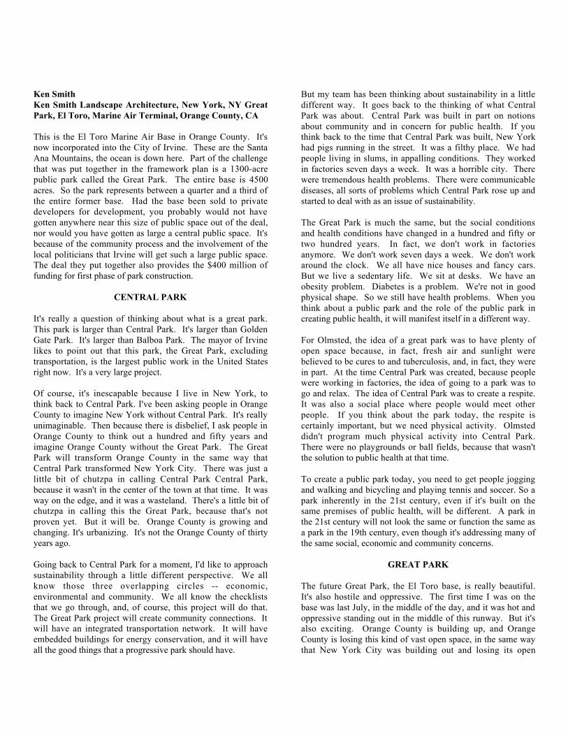
are buildings that they're familiar with in Hawaii. Theyrepresent a kind of range of styles. The typical Hawaiianbuilding is actually taken from Japan. It looks like [Shojan]architecture. It could come from Katsura on a good day.
Alternative scenario showing land consumption at dif. density
What makes this interesting is that there's been incredible buy-in from the folks in the Kona region. The politicians havebought into this, and the reason we know we're beingsuccessful is that the number of building permits that havebeen filed in the last couple of months has gone through theroof, because everybody just wants to get in before we changethe rules. It's very interesting. There's a sense in Hawaii thatonce you get zoning, you're entitled to it in perpetuity. We arenow in the process of disabusing everybody of this. In part,that's what's fueling this rush to get permits, but permits don'tget you vested. This will be adopted. It's pretty clear that thepolitical support is there, and we look forward to actuallyhaving been pretty successful, we hope, in helping save anunbelievable, very special place. Thank you.
Lance Jay Brown
It gives me special pleasure to hear Michael talk because he'sonly been working on it for forty years.
The next speaker is Ken Smith. We're moving from thecoffee fields of Hawaii to the West Coast where we wereearlier today. For those who were here, you saw some of theprocess that Ken Smith covered with his product, and nowwe're going to see an elaboration of what that processproduced.
If we have a moment, I'm going to ask two people in theaudience if they would also consider playing the role ofrespondents if Achva Stein and Michael Sorkin are delayed.
Ken SmithKen Smith Landscape Architecture, New York, NY GreatPark, El Toro, Marine Air Terminal, Orange County, CA
This is the El Toro Marine Air Base in Orange County. It'snow incorporated into the City of Irvine. These are the SantaAna Mountains, the ocean is down here. Part of the challengethat was put together in the framework plan is a 1300-acrepublic park called the Great Park. The entire base is 4500acres. So the park represents between a quarter and a third ofthe entire former base. Had the base been sold to privatedevelopers for development, you probably would not havegotten anywhere near this size of public space out of the deal,nor would you have gotten as large a central public space. It'sbecause of the community process and the involvement of thelocal politicians that Irvine will get such a large public space.The deal they put together also provides the $400 million offunding for first phase of park construction.
CENTRAL PARK
It's really a question of thinking about what is a great park.This park is larger than Central Park. It's larger than GoldenGate Park. It's larger than Balboa Park. The mayor of Irvinelikes to point out that this park, the Great Park, excludingtransportation, is the largest public work in the United Statesright now. It's a very large project.
Of course, it's inescapable because I live in New York, tothink back to Central Park. I've been asking people in OrangeCounty to imagine New York without Central Park. It's reallyunimaginable. Then because there is disbelief, I ask people inOrange County to think out a hundred and fifty years andimagine Orange County without the Great Park. The GreatPark will transform Orange County in the same way thatCentral Park transformed New York City. There was just alittle bit of chutzpa in calling Central Park Central Park,because it wasn't in the center of the town at that time. It wasway on the edge, and it was a wasteland. There's a little bit ofchutzpa in calling this the Great Park, because that's notproven yet. But it will be. Orange County is growing andchanging. It's urbanizing. It's not the Orange County of thirtyyears ago.
Going back to Central Park for a moment, I'd like to approachsustainability through a little different perspective. We allknow those three overlapping circles -- economic,environmental and community. We all know the checkliststhat we go through, and, of course, this project will do that.The Great Park project will create community connections. Itwill have an integrated transportation network. It will haveembedded buildings for energy conservation, and it will haveall the good things that a progressive park should have.
But my team has been thinking about sustainability in a littledifferent way. It goes back to the thinking of what CentralPark was about. Central Park was built in part on notionsabout community and in concern for public health. If youthink back to the time that Central Park was built, New Yorkhad pigs running in the street. It was a filthy place. We hadpeople living in slums, in appalling conditions. They workedin factories seven days a week. It was a horrible city. Therewere tremendous health problems. There were communicablediseases, all sorts of problems which Central Park rose up andstarted to deal with as an issue of sustainability.
The Great Park is much the same, but the social conditionsand health conditions have changed in a hundred and fifty ortwo hundred years. In fact, we don't work in factoriesanymore. We don't work seven days a week. We don't workaround the clock. We all have nice houses and fancy cars.But we live a sedentary life. We sit at desks. We have anobesity problem. Diabetes is a problem. We're not in goodphysical shape. So we still have health problems. When youthink about a public park and the role of the public park increating public health, it will manifest itself in a different way.
For Olmsted, the idea of a great park was to have plenty ofopen space because, in fact, fresh air and sunlight werebelieved to be cures to and tuberculosis, and, in fact, they werein part. At the time Central Park was created, because peoplewere working in factories, the idea of going to a park was togo and relax. The idea of Central Park was to create a respite.It was also a social place where people would meet otherpeople. If you think about the park today, the respite iscertainly important, but we need physical activity. Olmsteddidn't program much physical activity into Central Park.There were no playgrounds or ball fields, because that wasn'tthe solution to public health at that time.
To create a public park today, you need to get people joggingand walking and bicycling and playing tennis and soccer. So apark inherently in the 21st century, even if it's built on thesame premises of public health, will be different. A park inthe 21st century will not look the same or function the same asa park in the 19th century, even though it's addressing many ofthe same social, economic and community concerns.
GREAT PARK
The future Great Park, the El Toro base, is really beautiful.It's also hostile and oppressive. The first time I was on thebase was last July, in the middle of the day, and it was hot andoppressive standing out in the middle of this runway. But it'salso exciting. Orange County is building up, and OrangeCounty is losing this kind of vast open space, in the same waythat New York City was building out and losing its open
space. You can stand on this runway and have a two-milevista of the Santa Ana Mountains and turn the other way andsee the Pacific Ocean. It's quite astonishing. If we canpreserve this sense of open space, we will preserve somethingthat is part of Orange County's history.
There are three principal parts to our park. They deal withthree kinds of sustainability. There's the habitat park. This isdealing with the environmental aspects of the site, the naturalsystems, the ecology of the site. This is the part that StephenHandel is working on. There are two former streams that ranthrough the site. There's a wildlife corridor here, the BellagioCanyon stream is over here. Those streams and corridors havebeen badly abused and will need to be restored and thewildlife populations brought back. The second part to the siteare the fields and memorial. We're going to preserve portionsof that runway. We're going to preserve some of the old1940's hangars. We're going to replant orchards which speakto the agricultural history of the site. One of the biggestchallenges is not to erase the site.
THE CANYON
The third part of the site is the canyon. This is the mostsynthetic part. If you think about Central Park, Olmstedimposed a vision of a new kind of nature on the site. And thecanyon is a similar kind of imposition. The habitats play acritical role in connections to the mountains and the coast.
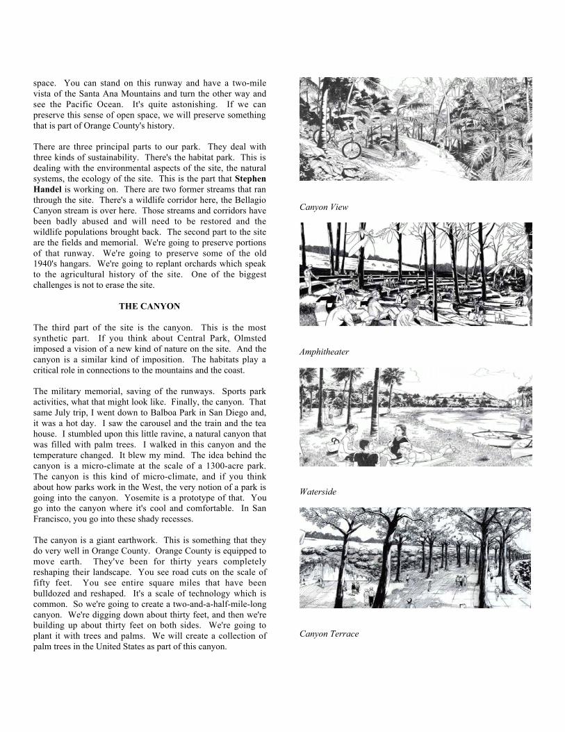
The military memorial, saving of the runways. Sports parkactivities, what that might look like. Finally, the canyon. Thatsame July trip, I went down to Balboa Park in San Diego and,it was a hot day. I saw the carousel and the train and the teahouse. I stumbled upon this little ravine, a natural canyon thatwas filled with palm trees. I walked in this canyon and thetemperature changed. It blew my mind. The idea behind thecanyon is a micro-climate at the scale of a 1300-acre park.The canyon is this kind of micro-climate, and if you thinkabout how parks work in the West, the very notion of a park isgoing into the canyon. Yosemite is a prototype of that. Yougo into the canyon where it's cool and comfortable. In SanFrancisco, you go into these shady recesses.
The canyon is a giant earthwork. This is something that theydo very well in Orange County. Orange County is equipped tomove earth. They've been for thirty years completelyreshaping their landscape. You see road cuts on the scale offifty feet. You see entire square miles that have beenbulldozed and reshaped. It's a scale of technology which iscommon. So we're going to create a two-and-a-half-mile-longcanyon. We're digging down about thirty feet, and then we'rebuilding up about thirty feet on both sides. We're going toplant it with trees and palms. We will create a collection ofpalm trees in the United States as part of this canyon.
Canyon View
Amphitheater
Waterside
Canyon Terrace
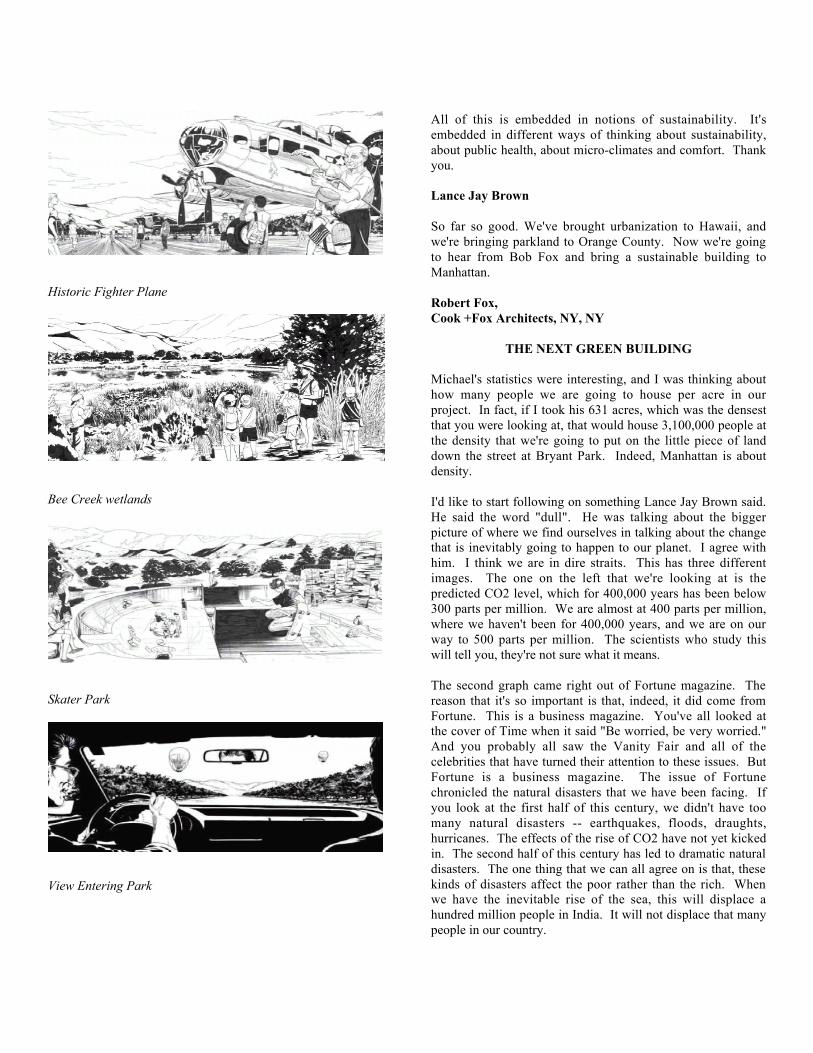
Historic Fighter Plane
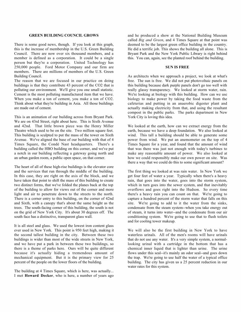
Bee Creek wetlands
Skater Park
View Entering Park
All of this is embedded in notions of sustainability. It'sembedded in different ways of thinking about sustainability,about public health, about micro-climates and comfort. Thankyou.
Lance Jay Brown
So far so good. We've brought urbanization to Hawaii, andwe're bringing parkland to Orange County. Now we're goingto hear from Bob Fox and bring a sustainable building toManhattan.
Robert Fox,Cook +Fox Architects, NY, NY
THE NEXT GREEN BUILDING
Michael's statistics were interesting, and I was thinking abouthow many people we are going to house per acre in ourproject. In fact, if I took his 631 acres, which was the densestthat you were looking at, that would house 3,100,000 people atthe density that we're going to put on the little piece of landdown the street at Bryant Park. Indeed, Manhattan is aboutdensity.
I'd like to start following on something Lance Jay Brown said.He said the word "dull". He was talking about the biggerpicture of where we find ourselves in talking about the changethat is inevitably going to happen to our planet. I agree withhim. I think we are in dire straits. This has three differentimages. The one on the left that we're looking at is thepredicted CO2 level, which for 400,000 years has been below300 parts per million. We are almost at 400 parts per million,where we haven't been for 400,000 years, and we are on ourway to 500 parts per million. The scientists who study thiswill tell you, they're not sure what it means.
The second graph came right out of Fortune magazine. Thereason that it's so important is that, indeed, it did come fromFortune. This is a business magazine. You've all looked atthe cover of Time when it said "Be worried, be very worried."And you probably all saw the Vanity Fair and all of thecelebrities that have turned their attention to these issues. ButFortune is a business magazine. The issue of Fortunechronicled the natural disasters that we have been facing. Ifyou look at the first half of this century, we didn't have toomany natural disasters -- earthquakes, floods, draughts,hurricanes. The effects of the rise of CO2 have not yet kickedin. The second half of this century has led to dramatic naturaldisasters. The one thing that we can all agree on is that, thesekinds of disasters affect the poor rather than the rich. Whenwe have the inevitable rise of the sea, this will displace ahundred million people in India. It will not displace that manypeople in our country.
GREEN BUILDING COUNCIL GROWS
There is some good news, though. If you look at this graph,this is the increase of membership in the U.S. Green BuildingCouncil. There are now over six thousand members, and amember is defined as a corporation. It could be a singleperson but they're a corporation. United Technology has250,000 people. Ford Motor Company and our firm aremembers. There are millions of members of the U.S. GreenBuilding Council.The reason that we are focused in our practice on doingbuildings is that they contribute 43 percent of the CO2 that ispolluting our environment. We'll give you one small statistic.Cement is the most polluting manufactured item that we have.When you make a ton of cement, you make a ton of CO2.Think about what they're building in Asia. All those buildingsare made out of cement.
This is an animation of our building across from Bryant Park.We are on 43rd Street, right about here. This is Sixth Avenueand 42nd. That little brown piece was the Henry MillerTheatre which used to be on the site. Two million square feet.This building is sculpted to put the mass of the tower on SixthAvenue. We've aligned the base of our building with that of 4Times Square, the Cond� Nast headquarters. There's abuilding called the HBO building on this corner, and we've puta notch in our building reflecting a gateway going north andan urban garden room, a public open space, on that corner.
The heart of all of these high-rise buildings is the elevator coreand the services that run through the middle of the building.In this case, they are right on the axis of the block, and wehave taken that point to shift the mass of this building to createtwo distinct forms, that we've folded the planes back at the topof the building to allow for views out of the corner and morelight and air to penetrate down to the streets to the north.There is a corner entry to this building, on the corner of 42ndand Sixth, with a canopy that's about the same height as thetrees. The south-facing corner of this building, the south is noton the grid of New York City. It's about 30 degrees off. Thesouth face has a distinctive, transparent glass wall.
It is all steel and glass. We used the lowest iron content glassever used in New York. This point is 950 feet high, making itthe second tallest building in the city. Between these twobuildings is wider than most of the wide streets in New York,and we have put a park in between these two buildings, sothere is a theme of parks here. Ours will be quite differentbecause it's actually hiding a tremendous amount ofmechanical equipment. But it is the primary view for 25percent of the people on the lower floors of the building.
The building at 4 Times Square, which is here, was actually...I met Howard Decker, who is here, a number of years ago
and he produced a show at the National Building Museumcalled Big and Green, and 4 Times Square at that point wasdeemed to be the largest green office building in the country.He did a terrific job. This shows the building all alone. This isBryant Park and the New York Public Library is right behindthis. You can, again, see the planted roof behind the building.
SUN IS FREE
As architects when we approach a project, we look at what'sfree. The sun is free. We did not put photovoltaic panels onthis building because dark purple panels don't go too well withreally glassy transparency. We looked at storm water, rain.We're looking at biology with this building. How can we usebiology to make power by taking the food waste from thecafeterias and putting in an anaerobic digester plant andactually making electricity from that, and using the resultantcompost in the public parks. The parks department in NewYork City is loving this idea.
We looked at the earth, how can we extract energy from theearth, because we have a deep foundation. We also looked atwind. This tall a building should be able to generate somepower from wind. We put an anemometer on the top of 4Times Square for a year, and found that the amount of windthat was there was just not enough with today's turbines tomake any reasonable amount of power. We also looked athow we could responsibly make our own power on site. Wasthere a way that we could do this to some significant amount?
The first thing we looked at was rain water. In New York weget four feet of water a year. Typically when there's a heavyrain, that goes into the water, goes into the storm system,which in turn goes into the sewer system, and that inevitablyoverflows and goes right into the Hudson. So every timethere's a heavy rain you can count on that. We're going tocapture a hundred percent of the storm water that falls on thissite. We're going to add to it the water from the sinks,condensate from the steam system--when you take energy outof steam, it turns into water--and the condensate from our airconditioning system. We're going to use that to flush toiletsand for cooling tower makeup.
We will also be the first building in New York to havewaterless urinals. All of the men's rooms will have urinalsthat do not use any water. It's a very simple system, a normal-looking urinal with a cartridge in the bottom that has achemical inner liquid that is lighter than urine. The urineflows under this seal--it's mainly an odor seal--and goes downthe trap. We're going to use half the water of a typical officebuilding. The city has given us a 25 percent reduction in ourwater rates for this system.
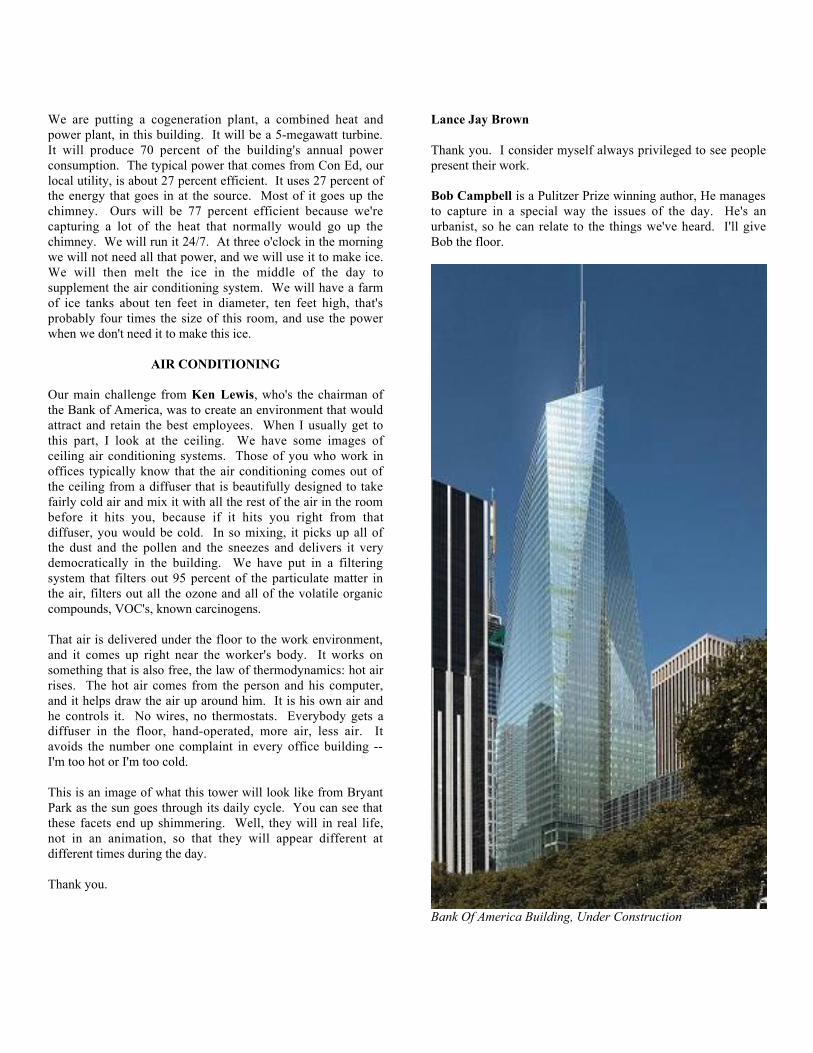
We are putting a cogeneration plant, a combined heat andpower plant, in this building. It will be a 5-megawatt turbine.It will produce 70 percent of the building's annual powerconsumption. The typical power that comes from Con Ed, ourlocal utility, is about 27 percent efficient. It uses 27 percent ofthe energy that goes in at the source. Most of it goes up thechimney. Ours will be 77 percent efficient because we'recapturing a lot of the heat that normally would go up thechimney. We will run it 24/7. At three o'clock in the morningwe will not need all that power, and we will use it to make ice.We will then melt the ice in the middle of the day tosupplement the air conditioning system. We will have a farmof ice tanks about ten feet in diameter, ten feet high, that'sprobably four times the size of this room, and use the powerwhen we don't need it to make this ice.
AIR CONDITIONING
Our main challenge from Ken Lewis, who's the chairman ofthe Bank of America, was to create an environment that wouldattract and retain the best employees. When I usually get tothis part, I look at the ceiling. We have some images ofceiling air conditioning systems. Those of you who work inoffices typically know that the air conditioning comes out ofthe ceiling from a diffuser that is beautifully designed to takefairly cold air and mix it with all the rest of the air in the roombefore it hits you, because if it hits you right from thatdiffuser, you would be cold. In so mixing, it picks up all ofthe dust and the pollen and the sneezes and delivers it verydemocratically in the building. We have put in a filteringsystem that filters out 95 percent of the particulate matter inthe air, filters out all the ozone and all of the volatile organiccompounds, VOC's, known carcinogens.
That air is delivered under the floor to the work environment,and it comes up right near the worker's body. It works onsomething that is also free, the law of thermodynamics: hot airrises. The hot air comes from the person and his computer,and it helps draw the air up around him. It is his own air andhe controls it. No wires, no thermostats. Everybody gets adiffuser in the floor, hand-operated, more air, less air. Itavoids the number one complaint in every office building --I'm too hot or I'm too cold.
This is an image of what this tower will look like from BryantPark as the sun goes through its daily cycle. You can see thatthese facets end up shimmering. Well, they will in real life,not in an animation, so that they will appear different atdifferent times during the day.
Thank you.
Lance Jay Brown
Thank you. I consider myself always privileged to see peoplepresent their work.
Bob Campbell is a Pulitzer Prize winning author, He managesto capture in a special way the issues of the day. He's anurbanist, so he can relate to the things we've heard. I'll giveBob the floor.
Bank Of America Building, Under Construction
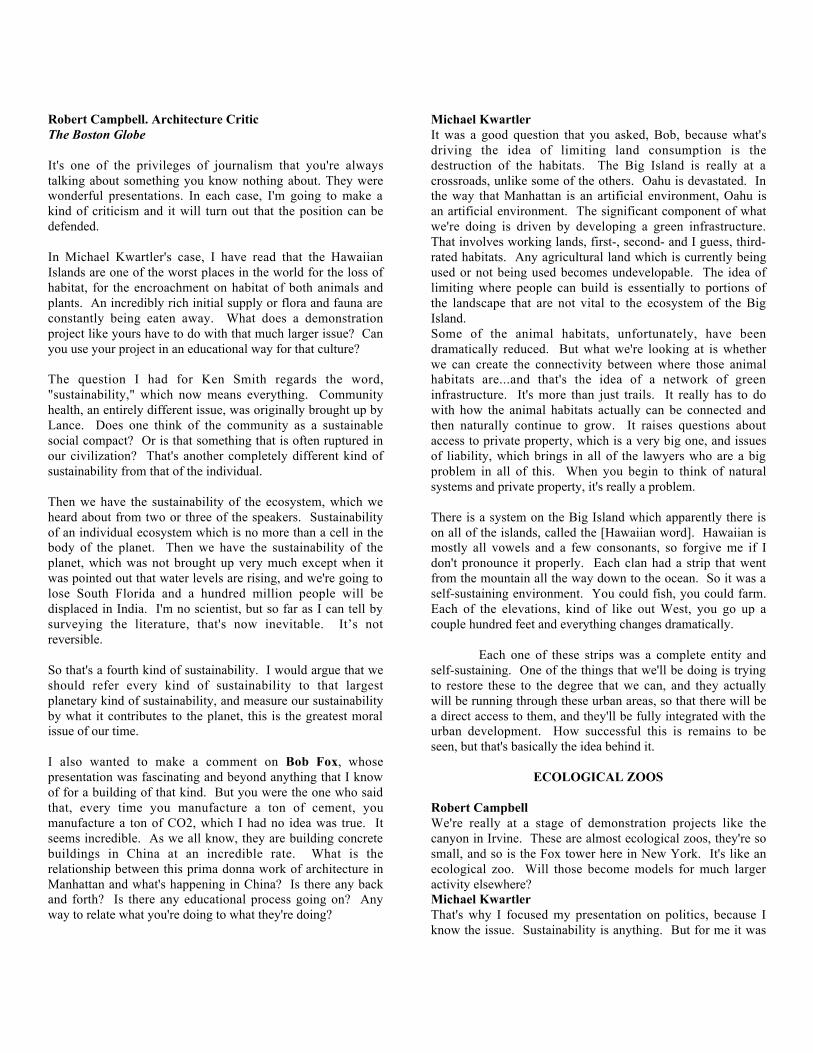
Robert Campbell. Architecture CriticThe Boston Globe
It's one of the privileges of journalism that you're alwaystalking about something you know nothing about. They werewonderful presentations. In each case, I'm going to make akind of criticism and it will turn out that the position can bedefended.
In Michael Kwartler's case, I have read that the HawaiianIslands are one of the worst places in the world for the loss ofhabitat, for the encroachment on habitat of both animals andplants. An incredibly rich initial supply or flora and fauna areconstantly being eaten away. What does a demonstrationproject like yours have to do with that much larger issue? Canyou use your project in an educational way for that culture?
The question I had for Ken Smith regards the word,"sustainability," which now means everything. Communityhealth, an entirely different issue, was originally brought up byLance. Does one think of the community as a sustainablesocial compact? Or is that something that is often ruptured inour civilization? That's another completely different kind ofsustainability from that of the individual.
Then we have the sustainability of the ecosystem, which weheard about from two or three of the speakers. Sustainabilityof an individual ecosystem which is no more than a cell in thebody of the planet. Then we have the sustainability of theplanet, which was not brought up very much except when itwas pointed out that water levels are rising, and we're going tolose South Florida and a hundred million people will bedisplaced in India. I'm no scientist, but so far as I can tell bysurveying the literature, that's now inevitable. ItÕs notreversible.
So that's a fourth kind of sustainability. I would argue that weshould refer every kind of sustainability to that largestplanetary kind of sustainability, and measure our sustainabilityby what it contributes to the planet, this is the greatest moralissue of our time.
I also wanted to make a comment on Bob Fox, whosepresentation was fascinating and beyond anything that I knowof for a building of that kind. But you were the one who saidthat, every time you manufacture a ton of cement, youmanufacture a ton of CO2, which I had no idea was true. Itseems incredible. As we all know, they are building concretebuildings in China at an incredible rate. What is therelationship between this prima donna work of architecture inManhattan and what's happening in China? Is there any backand forth? Is there any educational process going on? Anyway to relate what you're doing to what they're doing?
Michael KwartlerIt was a good question that you asked, Bob, because what'sdriving the idea of limiting land consumption is thedestruction of the habitats. The Big Island is really at acrossroads, unlike some of the others. Oahu is devastated. Inthe way that Manhattan is an artificial environment, Oahu isan artificial environment. The significant component of whatwe're doing is driven by developing a green infrastructure.That involves working lands, first-, second- and I guess, third-rated habitats. Any agricultural land which is currently beingused or not being used becomes undevelopable. The idea oflimiting where people can build is essentially to portions ofthe landscape that are not vital to the ecosystem of the BigIsland.Some of the animal habitats, unfortunately, have beendramatically reduced. But what we're looking at is whetherwe can create the connectivity between where those animalhabitats are...and that's the idea of a network of greeninfrastructure. It's more than just trails. It really has to dowith how the animal habitats actually can be connected andthen naturally continue to grow. It raises questions aboutaccess to private property, which is a very big one, and issuesof liability, which brings in all of the lawyers who are a bigproblem in all of this. When you begin to think of naturalsystems and private property, it's really a problem.
There is a system on the Big Island which apparently there ison all of the islands, called the [Hawaiian word]. Hawaiian ismostly all vowels and a few consonants, so forgive me if Idon't pronounce it properly. Each clan had a strip that wentfrom the mountain all the way down to the ocean. So it was aself-sustaining environment. You could fish, you could farm.Each of the elevations, kind of like out West, you go up acouple hundred feet and everything changes dramatically.
Each one of these strips was a complete entity andself-sustaining. One of the things that we'll be doing is tryingto restore these to the degree that we can, and they actuallywill be running through these urban areas, so that there will bea direct access to them, and they'll be fully integrated with theurban development. How successful this is remains to beseen, but that's basically the idea behind it.
ECOLOGICAL ZOOS
Robert CampbellWe're really at a stage of demonstration projects like thecanyon in Irvine. These are almost ecological zoos, they're sosmall, and so is the Fox tower here in New York. It's like anecological zoo. Will those become models for much largeractivity elsewhere?Michael KwartlerThat's why I focused my presentation on politics, because Iknow the issue. Sustainability is anything. But for me it was
can you actually sustain this? That means that you really needthe political wherewithal and the buy-in by the population tomake sure that, in fact, this does happen. Otherwise, we coulddo all these plans and it's really wonderful. At the scale of theKona region, unless there's really buy-in, they're the only oneswho are...and they'll change the market. We're seeingdevelopers really responding to this. There are other issueshaving to do with transportation, affordable housing. It's avery complicated problem. But there are groups of developerswho are responsive to it, and, hopefully, the other developerswill just go someplace else. Ultimately, maybe we'll put themall out of business. But in the short run, they're the ones who,if this is what people are looking for, they will come and theywill build it, and hopefully will change things.
Robert FoxIt's really great to hear the idea of the strips down themountain. That's exciting. It's a nice balance against thewonderful book, Snow Crash, about the future of a digitalatmosphere in which we would all live and none of thesethings would matter anymore. This idea of sustainability . . .so far the term has already caused many little explosions to gooff. The one that I was thinking of as Bob Campbell framedthat question is that little piece of property that I think most ofus now know on Houston Street and LaGuardia where there'sa fenced-in piece of Manhattan landscape that has beentailored to be what Manhattan was when it was first occupiedby the Colonials in 1600.
I was actually standing across the street with a student tryingto explain to him what that was, and the students couldn't quiteget it. They said, yes, but where are the flowers? Who takescare of them? I said no, it's a preserved piece of landscape.And it's different. This idea of the preserved landscape asopposed to the managed landscape. We're on an evolutionarypath with that, as well. I don't know what the preserved versusthe managed landscape may be. I think that's why it was sointeresting to listen to Ken's discussion.
Ken SmithBob Campbell has asked the appropriate question. Everybodywants sustainability. If you ask them what it is, well, thingsget fuzzy. Everybody's for it but nobody really knows what itis. Certainly on a project like the Great Park, even though it'sa big project, it's not going to solve global warming problemsand hydrocarbon problems. It's not even going to solve thetransportation problem in Southern California. But byfocusing it on the individual, we've been thinking of it as threeconcentric circles. At the center is this notion of personalhealth, that if you can actually engage people with somethingthey really understand, that's a start.
LOCAL ECOSYSTEMS
Then the next step out, at a regional level, are the issues of thelocal ecosystems, the wildlife corridors, the drainage ways,and the ground water. If you can start to make a connectionbetween people and their understanding their personal healthwith the health of the region, then that's a start. Or if we havea polluted ground water plume, which we have on our site, theregion isn't healthy. And people in Southern California maystart to understand that the transportation system isn't healthy.They don't know how to solve it.
Then the next level is really the global level, the problem withthe ozone, the carbons and global warming. We don't knowhow to solve that. But if you can start at the individual leveland help people understand that it's really a question of globalhealth, and that personal health is related to global health, westart to set in place a mechanism where we can start to thinkabout these problems in a way we might solve them. Becausethe Great Park alone won't solve them, but it could be anagent.
Lance Jay BrownIt comes back to the problem that Bob Campbell raised aboutyour work. It's significant that he was as impressed as he was.I especially liked the calculation of the habitat density againstMichael's presentation. It sheds a new light on density, whichI'm always talking about. I'll be using that.
Robert FoxI want to talk about cement, because you brought it up. We'reactually using blast furnace slag, a waste product of the steelindustry, for 45 percent of the cement on this project. Thatwill save 56,000 tons of CO2. It's amazing. It sets up a littlebetter than regular cement and it's 10 percent stronger. Throwa little garbage in your concrete mix and you're better off.
One project I think can make a little bit of a difference. WhatHoward Decker did with 4 Times Square, it did reverberatearound the globe. This project is indeed getting a fair amountof attention, but in terms of where the effort is needed in theFar East, the Natural Resource Defense Council has beenincredibly active there for five, six, or eight years. There wasa big conference with the U.S. Green Building Council thereabout a month ago. They are very committed to be in China.They get it probably a lot better than we do, and they arecommitted to being members of the World Green BuildingCouncil. There are seventeen or eighteen countries that arepart of that. But their problem is enormous. In China everyyear sixteen million people move from the fields into the cities-- two New Yorks every year. There's a city in the middle ofChina that has 32 million people. They are urbanizing at therate of acres an hour. And every one of those people wantsexactly what everybody in this room has. All of it.

EVENT SPEAKERS
Lance BrownLance Jay Brown served two terms as elected Chair, School ofArchitecture, Urban Design and Landscape Architecture at theCity College of New York / CUNY where he is nowCoordinator for Design. Principal of Lance Jay Brown,Architecture + Urban Design, Brown served as AssistantDirector, Design Arts Program, and National Endowment forthe Arts and served as Director, Design Excellence Project.ÊHe served as Professional Advisor to the WTC Site 9/11International Memorial Design Competition; co-Directed the2003 NEA funded Upper Manhattan Heritage Project; servedas special advisor to the Mostar 2004 Urban ReconstructionWorkshop, Bosnia Hercegovina and recently returned from anUrban Design Workshop in Tbilisi, Georgia. Awards includethe 2004 New York State AIA PresidentÕs Award forExcellence in Non-traditional Architecture, the 2003 ACSADistinguished Professorship for Life; 2003 Fellowship,American Institute of Architects and was elected two terms asBoard Member for Educational Affairs, AIA New YorkChapter. In 2005 he was Chair of the AIA national RUDCAdvisory Group. He is Program Advisor to the Institute forUrban Design and Co-Chair of the AIA/NYNV DisasterPreparedness Task Force.
Tim DelormTim Delorm is the Managing Principal of EDAWÕs New Yorkoffice. He is a registered landscape architect and urbandesigner whose practice focuses on the development ofsustainable urban frameworks for public and private sectorclients nationally and internationally. His approach to urbandesign and redevelopment emerges from a pragmatic analysisof existing conditions, his belief that effective publicparticipation is essential, and a commitment to creatingpowerful public realm plans as the primary determinant ofurban character. EDAWÕs New York office is emerging as apractice leader in the area of green infrastructure and theconcept of applied ecological research in designed landscapes.Mr. Delorm is currently leading the Governors Island MasterPlan Advisory Team working with the Governors IslandPreservation and Education Corporation and recentlycompleted the Yankee Stadium Community Parks Master Planfor NYCEDC/NYCDPR. His BRAC related work includesthe preparation of the Fort Totten Reuse Master Plan inQueens and the Philadelphia Navy Yard Master Plan. He is aformer Councilman and Planning Board Member for theBorough of Glen Ridge, New Jersey, is a member of NJULIÕsExecutive Committee currently serving as Vice-Chair of theirSmart Growth Recognition Program initiative, and is a Fellowof the Institute of Urban Design in New York.
Ken SmithKen Smith is the principal of Ken Smith LandscapeArchitecture in New York and a design critic at HarvardUniversity's Graduate School of Design, from which hereceived an MLA. His projects are in the realm of urbanpublic space, often exploiting existing, reworked, or complexurban sites. Current endeavors include a light rail project inSan Francisco and streetscape projects in Harlem. Smith wonthe Trust for Public Land's 2002 Santa Fe Rail yard Parkcompetition and received an Honorable Mention in the VanAlen Institute's 2001 Queens Plaza competition. He has beeninvolved with a group of artists, architects, and landscapearchitects working to commemorate the events of Sept. 11,2001, in New York.
John Clarke John Clarke has over 30 years experience with the planning,design and construction of large-scale public and privateprojects in New Jersey. From 1971 to 1977 Mr. Clarke wasDirector of the Department of Planning and Development forthe City of Trenton, and in that capacity had responsibility forall of the CityÕs redevelopment efforts. As a privateconsultant, Mr. Clarke has designed and implementedredevelopment plans for many New Jersey communitiesincluding Newark, Bayonne, Paterson and Jersey City. Heholds a Bachelor of Architecture degree from The CooperUnion and an MS degree in Urban Planning from ColumbiaUniversity.
Michael J. StepnerMichael Stepner, during his tenure with the City of San Diego,from 1971 to 1997, was responsible for the cityÕs general planand growth management efforts. His diverse experienceincludes advising other cities about cities, city planning, andurban design. He was director of Land Use and Housing forthe San Diego Regional Economic Development Corporationfrom August 2001 to August 2003 and serves as professor ofArchitecture and Urban Planning at the NewSchool ofArchitecture & Design and as adjunct faculty at WoodburyUniversity and University of California, San Diego. In 2004,he received the Distinguished Leadership to ProfessionalPlanners Award from the American Planning Association, SanDiego Chapter. In 1997, the San Diego Chapter of theAmerican Institute of Architects awarded Mr.ÊStepner theCommunity Design Award and officially changed the name ofthe award to the Michael J. Stepner Community DesignAward.
Robert PiraniRobert Pirani is Regional Plan Association's Director ofEnvironmental Programs and Executive Director of theGovernors Island Alliance. His responsibilities includedeveloping and directing programs in parks and open space
advocacy, land use planning, water quality protection, and thereuse of abandoned industrial sites. He has been invited totestify before the United States Congress, the states of NewYork and New Jersey, the City of New York. Mr. Piranireceived the 2003 Advocate Award from EnvironmentalAdvocates of New York and the 2003 PresidentÕs AdvisoryCouncil on Historic Preservation/National Trust for HistoricPreservation Joint Award for Federal Partnerships in HistoricPreservation. He is an adjunct faculty member of the PrattInstitute Graduate Center for Planning and Environment andserves on the Board of the fourÐstate Highlands Coalition,Brooklyn Greenway Initiative, and the Governors IslandAlliance. His publications include: New York- New JerseyHighlands Regional Study Update (USDA Forest Service,2002), Transforming the Places of Production (EdizioniOlivares, 2002); ÒRelaunching Governors IslandÓ (New YorkTimes Op-Ed, 2002). Mr. Pirani holds a Master's Degree inRegional Planning from Cornell University and a Bachelor'sDegree in Environmental Studies from Hampshire College.
Aliye CelikAliye Celik has joined the Institute staff as a ManagingDirector as of January. For five years previous to that she wasChief, Economic and Social Council (ECOSOC) at the UnitedNations Department of Economic and Social Affairs. Celikholds degrees in architecture from Istanbul TechnicalUniversity and from Princeton.
Michael KwartlerMichael Kwartler is principal of Michael Kwartler andAssociates and founding director of the EnvironmentalSimulation Center, a non-profit research laboratory created todevelop innovative applications of digital technology. Histhirty years of practice and teaching have focused on thetheory and practice of legislating aesthetics/good cityform.ÊExamples of his work include Housing Quality ZoningRegulations (1976) and the Midtown Zoning Regulations(1982), which recognize the power of zoning to determineurban form; Westside Futures (1985), a community basedpreservation and development plan; "Legislating Aesthetics:The Role of Zoning in Designing Cities": in Zoning and theAmerican Dream (Haar and Kayden, 1990); and most recentlyRegulatory Strategies for Central Tokyo, a project done inconjunction with the Massachusetts Institute of Technologyand the Institute for Behavioral Studies, Tokyo (1992).Kwartler has done numerous urban design plans including: theNew York Circle Line Piers; Geneva New York DowntownWaterfront; Franklin Development in Queens; an integratedhousing development and community garden/open-space planfor the Lower East Side. Michael Kwartler received hisarchitectural and planning education at Cooper Union andColumbia University respectively.ÊEntering the New YorkCity government in 1969, he served as Deputy Director of theMayor's Urban Design Council and later joined the CityPlanning Department as Associate Director of the Division ofLand Planning.ÊHe has taught at the University of Oregon,
Renneselaer, M.I.T., Columbia and the New School's MilanoSchool of Management and Urban Policy.Ê
Robert FoxIn 2003, Robert Fox joined with Richard Cook to formCook+Fox Architects, a firm devoted to creatingenvironmentally responsible high-performance buildings.Winner of the Urban Visionary Award from The CooperUnion and he has been guest lecturer at the National BuildingMuseum, the Northeast Sustainable Energy Association, theAmerican Institute of Architects, and the United NationsHealth and the Environment Conference. He has taught atCornell University and the Graduate School of Design atHarvard University. A founding partner of Fox & FowleArchitects, Bob guided that firm to a prominent position ofnational leadership in the design of sustainable high-risebuildings and urban design. Under his direction, Fox & Fowlecompleted more than 30 major projects in New York City.Among them was the influential 4 Times Square - Conde NastHeadquarters, which set new standards for energy efficienthigh-rise buildings, received the National Honor Award fromthe American Institute of Architects. Beginning in 1999, Bobdirected a team that created Green Residential andCommercial Guidelines for the Battery Park City Authority.Bob continues to be the lead Sustainable Design Consultantfor the New York City Transit Authority. Robert Fox receiveda Bachelor of Architecture degree from Cornell University anda Master of Architecture from Harvard University.
Robert CampbellRobert Campbell in 1996 received the Pulitzer Prize for hiswork as architecture critic for the Boston Globe. He is acontributing editor of the magazine Architectural Record, forwhich he writes a bimonthly column. Of his book Cityscapesof Boston: An American City Through Time, a collaborationwith photographer Peter Vanderwarker, the St. Louis Post-Dispatch wrote: ÒCampbell is esteemed by many to be theleading architectural critic in America.Ó Mr. Campbell hasbeen in private practice as an architect since 1975, chiefly as aconsultant for the improvement or expansion of culturalinstitutions, including the Isabella Stewart Gardner Museumand (since 1983) the Boston Symphony Orchestra. He is anadvisor to the Mayors Institute for City Design, which hehelped to found. Mr. Campbell is a Fellow of the AmericanInstitute of Architects. He has received the AIAÕs Medal forCriticism; the Commonwealth Award of the Boston Society ofArchitects; a Design Fellowship from the National Endowmentfor the Arts; and grants from the Graham Foundation and the J.M. Kaplan Fund. He is a graduate of Harvard, where he waselected to Phi Beta Kappa; the Columbia Graduate School ofJournalism; and the Harvard Graduate School of Design, wherehe received the Appleton Traveling Fellowship and FrancisKelley Prize.

Robert OuelleteRobert Ouellette is the Producer and Editor ofwww.readingtoronto.com & www.readingmontreal.comonline communities dedicated to the design, culture, andpolitics that shape those cities. His column on those sametopics, ÒToronto Unbuilt,Ó runs in the National Post. Hisexploration into the impact of new communicationstechnologies on the design and use of modern cities earned aCity of Toronto Urban Design Award for the ÒJohn StreetMedia Corridor ProjectÓ. A CD-ROM derived from the projecthas toured internationally as part of the ÒContact ZonesÓexhibition sponsored by Cornell University. It is in thecollection of major museums. He is the former Director of theInformation Technology Design Centre at the University ofToronto Faculty of Architecture, Landscape, and Design. Hisinterest in how design affects the economic life of cities ledhim to acquire an MBA from the Ivey School of Business.Prior to earning a Lieutenant-GovernorÕs Award of Excellenceand the AIA Henry Adams Medal in architecture, he was aSenior Analyst at the Boeing / de Havilland AircraftCompany. There he used early versions of the CAD/CAMsystems that have since revolutionized architecture.
Laurie KerrLaurie Kerr is the Chief of Sustainable Research for NewYork CityÕs Department of Design and Construction (DDC).ÊDDC has been a major force in the cityÕs progress towardsustainability, having introduced sustainable practices toroughly 30 municipal building projects and advising onprojects such as Governors Island and Willets Point.ÊÊLauriewas an agency representative on the multi-agency MayoralTask Force on Sustainability, and was the author a preliminaryframework for a citywide sustainability plan. Her writing onarchitectural issues has appeared in The Wall Street Journal,Slate, and Architectural Record.Ê Prior to receiving her M.Arch. from Harvard, Laurie earned degrees in engineering andphysics from Yale and Cornell, respectively.
Michael SorkinThe Michael Sorkin Studio has a New York basedarchitectural practice devoted to both practical and theoreticalprojects at all scales with a special interest in the city and ingreen architecture. Recent projects include planning anddesign for a highly sustainable 5000-unit community inPenang, Malaysia, master planning for Hamburg, Leipzig, andSchwerin, Germany, planning for a Palestinian capital in EastJerusalem. The Sorkin Studio is active in research in issues ofurban morphology, sustainability, and equity and has been therecipient of awards from Progressive Architecture, ID, and theNew York AIA. Michael Sorkin is the Director of theGraduate Urban Design Program at the City College of NewYork. From 1993 to 2000 he was Professor of Urbanism andDirector of the Institute of Urbanism at the Academy of FineArts in Vienna. His books include Variations on A ThemePark, Exquisite Corpse, Local Code, Giving Ground (editedwith Joan Copjec).
REGISTRATION FOR WORKSHOP AND FELLOWS PANEL
JOSEPH ALIOTTASwanke Hayden Connell Arch.New York, NY
ANURUPA BADRINATHPratt InstituteBrooklyn, NY
JOYCE BATTERTONInstitute for Urban DesignNew York, NY
FREDRIC BELLAIA New York ChapterNew York, NY
LANCE JAY BROWNSchool of Architecture, CUNYNew York, NY
META BRUNZEMAMeta Brunzema Architects P.C.New York, NY
ROBERT CAMPBELLThe Boston GlobeBoston, MA
ALIYE CELIKInstitute for Urban DesignNew York, NY
LISA CHAMBERLAINNew York TimesNew York, NY
BETTY CHENGIPECNew York, NY
JOHN CLARKEClarke, Caton, HintzNewark, NJ
CHARLES CROSSCUNYNew York, NY
HOWARD DECKEREhrenkrantz Eckstut & KuhnNew York, NY
TIMOTHY DELORMEDAW, Inc.New York, NY
ROBERT DIMILIALiberty Harbour AssociatesStaten Island, NY
MAYOR JOSEPH DORIABayonne, NJ
KENNETH DRUCKERHOKNew York, NY
KAREN FAIRBANKSMarble FairbanksNew York, NY
ANN FEREBEEInstitute for Urban DesignNew York, NY
JAYSON FINKBayonne JournalBayonne, NJ
KENNETH FISHER, ESQ.Wolf BlockNew York, NY
MICHAEL FISHMANHalcrowNew York, NY
GLORIA FOXNew York, NY
ROBERT FOXCook + Fox ArchitectsNew York, NY
JEAN MARIE GATHPfeiffer Partners, Inc.Los Angeles and New York, NY
AXUMITE GEBRE-EGZIABERUN HabitatNew York, NY
STEPHANIE GELBBattery Park City AuthorityNew York, NY
RON HARWICKJames, Harwick & Partners, Inc.Dallas, TX
CATHY LANG HOThe Architects' NewspaperNew York, NY
ANNA HOLTZMANUpdateNew York, NY
BHAVANA INGALEPratt InstituteBrooklyn, NY
SUDHIR JAMBHEKARFX & Fowle ArchitectsNew York, NY
KATHLEEN JOHN-ALDERYale School of ArchitectureNew Haven, CT
BETTINA KAESInstitute for Urban DesignNew York, NY
LAURIE KERRThe Wall Street JournalNew York, NY
NANCY KISTBayonne LRABayonne, NJ
MICHAEL KWARTLERESLNew York, NY
JASON LANGCUNY Landscape ArchitectureNew York, NY
LEONIE MANHARDTArchitecture AckteulleMunich, Germany
VICTORIA MARSHALLTill Landscape + Urban DesignHoboken, NJ
PETER MC COURTBattery Park City AuthorityNew York, NY
WILLIAM MENKINGThe Architect's NewspaperNew York, NY
JAYNE MERKELArchitecture ReviewLondon, England
DAVID B. MIDDLETONHandel Architects LLPNew York, NY
ROBERT OUELLETTENational PostToronto, Canada
MEG PARSANTHPA, Inc.New York, NY
ROB PIRANIGovernors Island Alliance / RPANew York, NY
ALMA PLUMMERPhiladelphia Industrial Dev. Corp.Philadelphia, PA
ELLEN POSNERNewman InstituteNew York, N
RONNETTE RILEYRonnette Riley ArchitectsNew York, NY
JANET RISERVATOInstitute for Urban DesignNew York, NY
ROSEMARY RUGGIEROInstitute for Urban DesignNew York, NY
MARTINA RUHFASSPratt InstituteBrooklyn, NY
WILLIAM SCHACHTTeam 7New York, NY
MICHAEL SCHWARTINGNY Institute of TechnologyCentral Islip, NY
PATRICK SEEBSt. Paul Riverfront CorporationSt. Paul, Minnesota
SUSAN SHOEMAKEREhrenkrantz Eckstut & Kuhn Arch.New York, NY
KEN SMITHKen Smith Landscape ArchitectsNew York, NY
NORMA SMITHInstitute for Urban DesignNew York, NY
MICHAEL SORKINMichael Sorkin StudioNew York, NY
JEFFREY SOULEAmerican Planning AssociationWashington, DC
NED SOWDERCUNYNew York, NY
ACHVA STEINCUNY Landscape ArchitectureNew York, NY
MICHAEL STEPNERStepner Design GroupSan Diego, CA
MARK STRAUSSFX & FowleNew York, NY
EVAN SUPCOFFHNTB ArchitectureNew York, NY
ALLEN SWERDLOWDesign Seven AssociatesNew York, NY
DIANE TANCHAKNew York, NY
LEITH TER MEULENLandAir Project Resources, Inc.New York, NY
JANE THOMPSONThompson Design GroupCambridge, MA
PABLO VENGOECHEAZone ArchitectureStaten Island, NY
JOHN WILLIAMSHDR, Inc.New York, NY
BEVERLY WILLISWomens Architecture FoundationBranford, CT
SOFIA ZUBERBUHLERA. Billie Cohen, Ltd. LandscapeDesignNew York, NY
CHARLES ZUCKERWashington, DC
Special thanks to:ÊLance Jay BrownProgram ChairÊBettina KaesProgram coordinator andProceedings Managing Editor
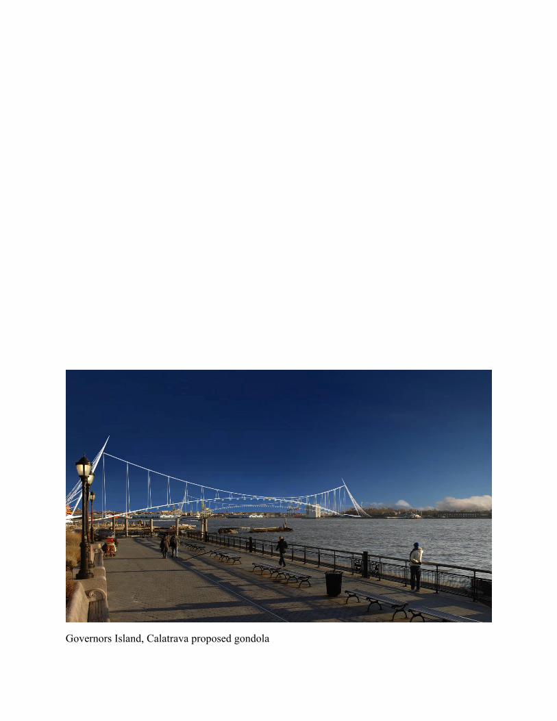
Governors Island, Calatrava proposed gondola