inner estuary airport call for evidence - hr...
TRANSCRIPT

May 2014P11799-RT01-R02-00
Inner Estuary Airport Call for EvidenceTechnical submission by HR Wallingford to Airports Commission

Inner Estuary Airport Call for Evidence
Technical submission by HR Wallingford to Airports Commission
P11789-RT01-R02-00
Document information
Document permissions Unrestricted
Project number P11789
Project name Inner Estuary Airport Call for Evidence
Report title Technical submission by HR Wallingford to Airports Commission
Report number RT01
Release number R02-00
Report date May 2014
Client Airports Commission
Client representative Fiona James
Project manager Tom Matthewson
Project director Mike Dearnaley
Document history
Date Release Prepared Approved Authorised Notes
22 May 2014 02-00 TJM JVB MPD Updated following review.
15 May 2014 01-00 TJM JVB MPD
Document authorisation
Prepared Approved Authorised
© HR Wallingford Ltd
This report has been prepared for HR Wallingford’s client and not for any other person. Only our client should rely upon the contents of this report and any methods or results which are contained within it and then only for the purposes for which the report was originally prepared. We accept no liability for any loss or damage suffered by any person who has relied on the contents of this report, other than our client.
This report may contain material or information obtained from other people. We accept no liability for any loss or damage suffered by any person, including our client, as a result of any error or inaccuracy in third party material or information which is included within this report.
To the extent that this report contains information or material which is the output of general research it should not be relied upon by any person, including our client, for a specific purpose. If you are not HR Wallingford’s client and you wish to use the information or material in this report for a specific purpose, you should contact us for advice.

Inner Estuary Airport Call for Evidence
Technical submission by HR Wallingford to Airports Commission
P11789-RT01-R02-00
Summary This document is HR Wallingford’s technical response to the Airports Commission Call for Evidence in relation to an inner Thames Estuary airport proposal. It is based on our expertise developed over 60 years of studies examining the effects of major infrastructure on the Estuary.
We have conducted preliminary numerical modelling of a schematic Inner Thames Estuary proposal with the airport platform located in the Inner Estuary at the Isle of Grain. Using our in-house hydrodynamic models of the Thames Estuary, we have assessed the potential effects of an airport platform scheme on estuary tidal flow magnitude, directions and water level, and on wave propagation. This provides an initial indication of the area and magnitude of potential effects of an Inner Thames Estuary proposal on navigation, flood defence and estuary habitats.
Our preliminary technical assessment concludes that:
There is a likelihood of minor changes in maximum and minimum water levels associated with the modelled Inner Thames Estuary proposal;
Current speeds and directions will be altered adjacent to the airport platform;
Wave reflection may increase wave heights on the north bank of the estuary opposite the platform increasing erosional forces in this area;
Some morphological change of the nearby inter- and sub-tidal areas will occur due to: the footprint of the scheme, raised low water levels, and the likelihood of areas of change to the patterns or magnitudes of sediment erosion and deposition;
The intertidal estuary habitats that are at risk of loss or change from the currently defined scheme have been initially estimated to extend to approximately 3,700ha.
The magnitude of impacts should be considered as indicative. If a proposal of this type is taken forward, a degree of optimisation of the design would be expected to be undertaken to minimise or mitigate impacts both of the final scheme and of the impacts arising during the construction programme. It is our view that, with refinement of the form of the airport platform, it should be possible to reduce the scale of losses and changes to the estuary regime that might arise. However, it will not be possible to eliminate the losses and changes altogether. The magnitude of potential losses and changes indicated by this assessment has not been seen on the inner Thames Estuary for at least a Century.
This submission has been prepared by HR Wallingford on a pro bono and independent basis, to support an evidence-based review of airport options.

Inner Estuary Airport Call for Evidence
Technical submission by HR Wallingford to Airports Commission
P11789-RT01-R02-00
Contents
1. Introduction _________________________________________________________ 1 1.1. Call for evidence................................................................................................................................ 1 1.2. About HR Wallingford ........................................................................................................................ 1 1.3. Flow modelling - the Thames Estuary 2D base model ..................................................................... 1 1.4. Wave modelling ................................................................................................................................. 2 1.5. Option considered ............................................................................................................................. 3 1.6. Tests conducted ................................................................................................................................ 4
2. Results ____________________________________________________________ 5 2.1. Effects on water levels ...................................................................................................................... 5 2.2. Effects on estuary current speeds and directions ............................................................................. 6
3. Waves _____________________________________________________________ 8
4. Morphology ________________________________________________________ 10
5. Construction issues __________________________________________________ 11
6. Mitigation and compensation __________________________________________ 12
7. Further studies _____________________________________________________ 12
8. Conclusions ________________________________________________________ 13
Figures Figure 1.1: Thames estuary base model extents ........................................................................................ 2 Figure 1.2: The Inner Thames Estuary airport proposal ............................................................................. 4 Figure 2.1: Predicted Change in maximum spring tide water level ............................................................ 5 Figure 2.2: Predicted change in minimum spring tide water level .............................................................. 6 Figure 2.3: Change in peak spring tide current magnitude ......................................................................... 7 Figure 2.4: Flood tide current pattern with Inner Thames Estuary proposal .............................................. 8 Figure 3.1: Difference in significant wave height, wind direction 030º ........................................................ 9 Figure 3.2: Difference in significant wave height, wind direction 090º ...................................................... 10 Figure 4.1: Changes in Peak Shear Stress (% over baseline) ................................................................. 11

Inner Estuary Airport Call for Evidence
Technical submission by HR Wallingford to Airports Commission
P11789-RT01-R02-00 1
1. Introduction 1.1. Call for evidence The Airports Commission has issued a Call for Evidence for interested parties to submit analysis, evidence, additional research or comments in relation to an inner Thames Estuary airport proposal 1.
This document provides HR Wallingford’s preliminary technical analysis of such a proposal. It is an independent submission, on a pro bono basis with no third party support or interest.
These studies provide a precursor to more-detailed development studies that would be required to assess the impacts of an inner estuary airport on the estuary hydrodynamic, sediment transport and morphological regimes.
1.2. About HR Wallingford HR Wallingford is a research and consultancy organisation that specialises in civil engineering and hydraulics studies in the marine, estuary and freshwater environment. We have a long-record of achievement on the Thames, stretching over 60 years. Over this time we have developed many of the techniques and tools that are used to consider the estuary impacts of major infrastructure such as ports, bridges, reclamations, flood risk management,wastewater projects and associated compensation measures.
HR Wallingford’s expertise is focused on understanding physical processes at work in the estuary - tidal currents, waves, sediment movement, morphological change, water quality and the effects of constructing and operating infrastructure on these processes and on the environmental regime of the Thames Estuary; and this is reflected in our extensive historical data holdings and established tools to support our studies.
Our recent activities on the Thames include hydrodynamic, sediment and morphological studies of the new port development at DP World London Gateway (Shell Haven) in the lower tidal Thames Estuary. We also examined the proposed new Thames Gateway Bridge, and undertook studies fundamental to estuary flood risk management (Environment Agency’s TE2100 flood risk management programme). We have also provided input on estuary and coastal processes regarding the proposed London Britannia Airport in the outer Thames Estuary.
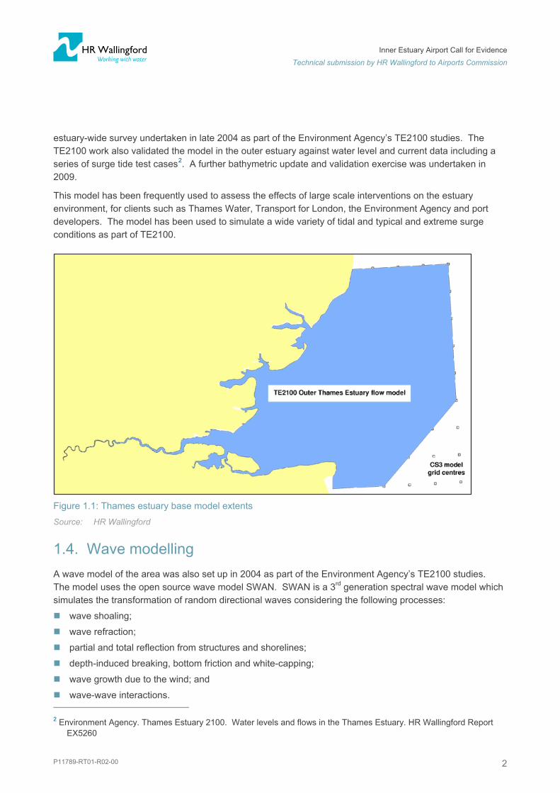
1.3. Flow modelling - the Thames Estuary 2D base model HR Wallingford’s Thames Estuary 2D/3D flow model covers the entire estuary to its very outer limits (Figure 1.1). This model was set up by HR Wallingford under a joint venture between the Environment Agency and the Port of London Authority as an aid to their regulatory responsibilities. This existing model provides the facility to assess the effects of new infrastructure on the estuary’s tidal currents. From this, many other effects on the estuary environment (sediment transport, morphology, water quality) can be inferred, or modelled in detail if necessary.
The model was initially established and successively validated against a wide set of tidal level, current and total discharge data throughout the estuary in 2001. The model was subsequently validated against the
1 Airports Commission, 2014. Introductory Note: Inner Thames Estuary Feasibility Studies. January 2014.
Inner Estuary Airport Call for Evidence
Technical submission by HR Wallingford to Airports Commission
P11789-RT01-R02-00 2
estuary-wide survey undertaken in late 2004 as part of the Environment Agency’s TE2100 studies. The TE2100 work also validated the model in the outer estuary against water level and current data including a series of surge tide test cases2. A further bathymetric update and validation exercise was undertaken in 2009.
This model has been frequently used to assess the effects of large scale interventions on the estuary environment, for clients such as Thames Water, Transport for London, the Environment Agency and port developers. The model has been used to simulate a wide variety of tidal and typical and extreme surge conditions as part of TE2100.
Figure 1.1: Thames estuary base model extents
Source: HR Wallingford
1.4. Wave modelling A wave model of the area was also set up in 2004 as part of the Environment Agency’s TE2100 studies. The model uses the open source wave model SWAN. SWAN is a 3rd generation spectral wave model which simulates the transformation of random directional waves considering the following processes:
wave shoaling;
wave refraction;
partial and total reflection from structures and shorelines;
depth-induced breaking, bottom friction and white-capping;
wave growth due to the wind; and
wave-wave interactions. 2 Environment Agency. Thames Estuary 2100. Water levels and flows in the Thames Estuary. HR Wallingford Report
EX5260

Inner Estuary Airport Call for Evidence
Technical submission by HR Wallingford to Airports Commission
P11789-RT01-R02-00 3
The SWAN wave model is designed for modelling waves over coastal areas and is widely used in academia and industry. For the present study, a subset of the wave conditions used for the TE2100 studies were repeated with an Inner Thames Estuary airport option included. The model was run with bathymetry and shorelines representing the inner estuary prior to the construction of London Gateway Port. This provides an initial assessment of the type of effect on the wave regime which might be expected due to the change in the coastline ‘form’ and alignment associated with the airport platform.
1.5. Option considered We have conducted a preliminary analysis of the Inner Thames Estuary option that was created by the Commission in 2013, following receipt by the Commission of responses from various promoters (see Figure 1.2). To do this, and to inform an initial assessment of the potential effects of the scheme, we have estimated the overall footprint from the interim report published by the Commission3.
The Inner Thames Estuary proposal assessed:
has an estimated footprint of 1,100 ha over intertidal and subtidal areas of the estuary (i.e. below high water);
extends up to 2,100 m into the estuary from the existing flood defence line;
at its closest is 370 m from the main deep water navigation channel;
reduces estuary cross section by 20% at low water, and by up to 27% at high water.
At this stage we have not developed any ‘optimised’ schemes, nor tested any specific proposals presented by any of the inner estuary airport promoters. Therefore, the Inner Thames Estuary proposal is still hypothetical in nature, and has been considered only to inform our response to the call for evidence. It is also possible that other schemes will be proposed in this part of the estuary, which are predominately or entirely located on land.
This hypothetical scheme is useful for indicating the type of estuary regime impacts that may be anticipated. However the magnitude of impacts can only be considered as indicative; and should a proposal be taken forward a degree of optimisation would be undertaken to minimise or mitigate impacts both of the final scheme and of the construction programme.
3 Airports Commission, 2013. Interim Report, December 2013, Figure 6.1.

Inner Estuary Airport Call for Evidence
Technical submission by HR Wallingford to Airports Commission
P11789-RT01-R02-00 4
Figure 1.2: The Inner Thames Estuary airport proposal
1.6. Tests conducted We have applied our 2D estuary models4 to the Inner Thames Estuary proposal to quantify its effect upon:
Maximum and minimum spring tide water level;
Estuary tidal flow speed and directions; and
Impact on wave propagation into the estuary.
From these tests, it is possible to provide a preliminary assessment of the risk of effects upon estuary morphology and habitats, navigation, and flood risk. Further more-detailed studies would be required to refine the design of the scheme and to quantify the associated impacts. Studies would also be required to consider construction sequencing, sourcing of fill material and the release of plumes of fine material during construction.
4 A mean daily freshwater flow of 65 m3/s was assumed.

Inner Estuary Airport Call for Evidence
Technical submission by HR Wallingford to Airports Commission
P11789-RT01-R02-00 5
2. Results 2.1. Effects on water levels The effects of the Inner Thames Estuary proposal upon peak water levels in the estuary are shown in Figure 2.1 and Figure 2.2 below.
The vicinity of the airport platform as modelled would see a reduction of around 20mm in spring tide high water levels in the area around the platform. There would also be an increase of around 10mm in high water levels in the area of the Swale. This quantification can inform the assessment and management of flood risk management for the scheme.
Both the navigation and flood defence effects could be reduced through alteration to the footprint of the scheme, either in its shape or extent. These effects could also be addressed through mitigation measures such as flood defence improvements and possibly capital dredging of the navigation channel.
Figure 2.1: Predicted Change in maximum spring tide water level
Source: HR Wallingford

Inner Estuary Airport Call for Evidence
Technical submission by HR Wallingford to Airports Commission
P11789-RT01-R02-00 6
Figure 2.2: Predicted change in minimum spring tide water level Source: HR Wallingford
The whole of the inner estuary would see an increase of up to about 40mm in minimum tide levels. This will result in the loss of intertidal habitat, which we have estimated at about 100ha based on the existing slopes of the intertidal. This estimate would need to be quantified robustly to inform an assessment of the habitat compensation requirement.
To set these changes in context, water levels in the Thames Estuary are likely to rise by between 200 mm and 900 mm over the next century due to thermal expansion of the oceans and additional water from melting glaciers and ice sheets caused by climate change 5.
The type of effect predicted by the modelling here is consistent with our experience elsewhere. The blockage associated with the platform impedes and very slightly modifies the shape of the incoming and outgoing tidal wave. In this case, the modified tide shape results in a local reduction of high water but a more general small increase in low water. A different form (shape, size) of platform would be expected to modify the tide differently, however the above demonstrates the general type and order of magnitude of effect which may be anticipated for a scheme of this size in this location in the inner estuary.
2.2. Effects on estuary current speeds and directions The effect of the Inner Thames Estuary proposal on current speed and direction is shown on Figure 2.3 and Figure 2.4.
5 Met Office, 2012. Thames Estuary 2100 Project. http://www.metoffice.gov.uk/services/climate-services/case-
studies/barrier . Last updated 18 May 2012. Website accessed 10 April 2014.

Inner Estuary Airport Call for Evidence
Technical submission by HR Wallingford to Airports Commission
P11789-RT01-R02-00 7
The analysis shows that there will be a decrease in current speed over Grain Spit and an increase current speed in the main channel adjacent to the platform. This can be expected to lead to some morphological changes in these areas of the estuary, with potential for consequential effects for navigation and intertidal habitats. The Inner Thames Estuary proposal is shown to deflect tidal flows towards the north during the flood tide, increasing speeds and altering current direction in the navigation channel. This is unsurprising, given the angular shape of the scheme as modelled.
These changes may be reduced through a more ‘streamlined’ shape and footprint to the scheme. This could be developed through additional modelling and assessment; based on knowledge of the existing current patterns and the distribution of flow across the width of the estuary.
Figure 2.3: Change in peak spring tide current magnitude
Source: HR Wallingford

Inner Estuary Airport Call for Evidence
Technical submission by HR Wallingford to Airports Commission
P11789-RT01-R02-00 8
Figure 2.4: Flood tide current pattern with Inner Thames Estuary proposal Source: HR Wallingford
3. Waves The Inner Thames Estuary proposal is likely to influence the wave climate of the inner estuary. This will have implications for other users of the estuary, and also may impact upon the extent and shape of the estuary’s intertidal areas.
We have undertaken a preliminary analysis of the changes to the wave climate using our SWAN wave model of the Thames Estuary, for waves driven by winds coming from 030º and 090º directions. The results are shown in Figure 3.1 and Figure 3.2. For the purposes of the wave modelling, it has been assumed that the Inner Thames Estuary proposal has sloping revetment walls, which partially reflect some of the incident wave energy.
It can be seen that reflection from the seaward faces of the structure causes an increase in wave exposure to the north bank of the estuary. This has morphological and flood risk implications, which would need to be addressed through an optimised design to the scheme.

Inner Estuary Airport Call for Evidence
Technical submission by HR Wallingford to Airports Commission
P11789-RT01-R02-00 9
Figure 3.1: Difference in significant wave height, wind direction 030º
Source: HR Wallingford

Inner Estuary Airport Call for Evidence
Technical submission by HR Wallingford to Airports Commission
P11789-RT01-R02-00 10
Figure 3.2: Difference in significant wave height, wind direction 090º Source: HR Wallingford
4. Morphology The Inner Thames Estuary proposal will have a direct impact on the estuary through loss of intertidal area (under the reclaimed area) and affecting the pattern of flows and waves. The Inner Thames Estuary proposal also has the potential to alter the long term morphology of the estuary’s intertidal. That is, the extent, level and quality of the estuary's areas of sand and mudflat. These intertidal areas are of great conservation importance and also serve as part of the flood defences for inland areas.
We have conducted an initial assessment of the area of intertidal that may be at risk of change, based on our predicted alterations in tidal current patterns. By looking at changes in a metric called ‘peak shear stress’ – the force of the water flow on the sea bed, we can start to identify the areas at risk of change (see Figure 4.1). This metric provides an indication of areas that may be subject to change towards erosion (increased peak shear stress) or change towards accretion (reduced peak shear stress). Such changes may lead to changes in the physical character of the sea bed and the temporary or permanent loss of ecological function.
This assessment provides a first indication of the footprint of effect on intertidal areas. The risk of morphological change actually occurring is linked to many other parameters such as sediment supply, bed composition and strength and anthropogenic influences. As an indication of footprint of area with a potential to experience change depending on these other factors, Figure 4.1 shows the percentage change in peak shear stress. Yellow to orange colouring indicates an increase in peak shear stress suggesting increase

Inner Estuary Airport Call for Evidence
Technical submission by HR Wallingford to Airports Commission
P11789-RT01-R02-00 11
force on the seabed potentially leading to erosion. Increasingly dark blue colours indicate areas of reduced peak shear stress indicating areas which may experience increased sediment deposition. In both cases some degree of change in habitat and/or habitat function would be expected, although identifying the magnitude and duration of any impact and the nature of the future new regime that evolves over time would need further assessment and modelling.
For the purposes of the present assessment a 10% change in peak flow induced shear stress has been used as a threshold for the initiating of some sort of morphological change. We have estimated the intertidal area thus affected to extend to 2,500 ha. This represents the first-order estimate of the intertidal area that could be affected by changed patterns or magnitude of sediment erosion and accretion, potentially leading to changes in ecological function. This estimate does not take into account the wave analysis described in Section 3 which will further modify intertidal processes.
In all probability, interventions bringing risks of change to the estuary of this scale have not been seen in the last 100 years.
Figure 4.1: Changes in Peak Shear Stress (% over baseline)
Source: HR Wallingford
5. Construction issues The construction works for major estuary infrastructure projects can give a larger effect on the factors described above, as the temporary works deployed can be less hydraulically sympathetic. We know from experience of major construction in estuaries, that the morphology of an estuary can respond rapidly to the different stages involved in constructing the final scheme.

Inner Estuary Airport Call for Evidence
Technical submission by HR Wallingford to Airports Commission
P11789-RT01-R02-00 12
Depending on the construction method and the proposed design of the platform with regards to flood defence, a very large quantity of fill material may be required to form the airport platform. For context we have estimated that about 140 Mm3 of fill material would be required to raise the platform to the approximate 1:1000 year return period water level6. This compares to the dredging requirement for the construction of London Gateway Port and the associated deepening of the main navigational channel at about 30 Mm3.
There will be impacts associated with the sourcing and placement of this material, not least from the dispersion of plumes of suspended sediment from the construction site.
6. Mitigation and compensation An optimised design should seek to mitigate the impact on tidal flows in the estuary. It should be possible to minimise the blockage of flow in the adjacent cross section in the estuary, by giving a streamlined form to the platform and possibly further deepening the navigation channel.
Keeping the maximum possible distance from the estuary navigation channel is also highly desirable; or alternatively widening the existing navigation channel. The latter would allow greater room for manoeuvre for ships affected by the modified current and wave regime associated with the airport platform.
Construction phasing and monitoring may also offer the means to manage the construction process to reduce its effect, for example, in relation to sediment plumes from dredging. This approach was adopted at London Gateway Port.
The morphological changes predicted from an Inner Thames Estuary proposal may also require measures to improve the flood defences in areas at risk of raised water levels, loss of intertidal and / or increased wave attack.
Regardless of the approaches adopted, a scheme such as the Inner Thames Estuary proposal will require compensation for potential intertidal habitat loss and change which can be anticipated to occur permanently and/or temporarily following commencement of the construction works. Our first order estimate of the scale of impact is up to 1,000 ha loss for the direct impact for the footprint of the scheme, 100 ha indirectly lost due to the raising of low water and 2,600 ha indirectly altered through morphological changes. These requirements may each be reduced by refining the platform position/shape, but are unlikely to be removed altogether. The spatial scale of compensation required, which is likely to be significantly greater than the actual footprint of habitat loss, will be unprecedented in the Thames Estuary.
7. Further studies There is presently some uncertainty about the design and construction of an Inner Estuary airport scheme. This leads to uncertainties over its potential impacts as outlined here. That said, there is already a well-established set of modelling tools for the Thames Estuary, and expertise in their application. These include validated 3D flow, mud and sand transport models. These tools and expertise could be readily applied to any scheme that might be taken forward for further investigation, to reduce the uncertainties over the impacts of a scheme as well as to optimise the scheme to reduce these impacts.
6 6.03 m OD(N) used for 2050 with High+ climate change scenario in TE2100, with an allowance for waves with a similar
return period (1;1000 year return period waves from offshore, 1.44 m, predicted near the site for TE2100).

Inner Estuary Airport Call for Evidence
Technical submission by HR Wallingford to Airports Commission
P11789-RT01-R02-00 13
Detailed investigation, if taken a scheme is forward, would need to be informed by a suitably scoped programme of field investigations and comprehensive baseline monitoring to inform environmental impact assessment and monitoring of any construction works. It is our view though, that there is sufficient information already available to undertake the next stage of development work for a scheme, should that be desirable, without further data collection.
8. Conclusions HR Wallingford has conducted a preliminary technical analysis of the Inner Thames Estuary option that was created by the Commission in 2013, following receipt by the Commission of responses from various promoters. Preliminary assessment of a schematic Inner Thames Estuary proposal indicates that:
There is a likelihood of minor changes in maximum and minimum water levels associated with the Inner Thames Estuary proposal;
Current speeds and directions will be altered adjacent to the airport platform;
Wave reflection may increase wave heights on the north bank of the estuary opposite the platform increasing erosional forces in this area;
Some morphological change of the nearby inter- and sub-tidal areas will occur due to: the footprint of the scheme, raised low water levels, and the likelihood of areas of change to the patterns or magnitudes of erosion and deposition;
The intertidal estuary habitats that are at risk of loss or change from the currently defined scheme have been initially estimated to extend to approximately 3,700ha.
The magnitude of impacts should be considered as indicative; and should the proposal be taken forward a degree of optimisation would be undertaken to minimise or mitigate impacts both of the final scheme and of the construction programme. It is our view that, with refinement of the form of the airport platform, it should be possible to reduce the scale of changes to the estuary regime that might arise. However, it will not be possible to eliminate the changes altogether. The magnitude of potential changes indicated by this assessment has not been seen on the inner Thames Estuary for at least a Century.

FS 516431EMS 558310OHS 595357
© HR Wallingford
HR Wallingford, Howbery Park, Wallingford, Oxfordshire OX10 8BA, United Kingdomtel +44 (0)1491 835381 fax +44 (0)1491 832233 email [email protected]
HR Wallingford is an independent engineering and environmental hydraulics organisation. We deliver practical solutions to the complex water-related challenges faced by our international clients. A dynamic research programme underpins all that we do and keeps us at the leading edge. Our unique mix of know-how, assets and facilities includes state of the art physical modelling laboratories, a full range of numerical modelling tools and, above all, enthusiastic people with world-renowned skills and expertise.