in conjunction with - university of oregon
TRANSCRIPT

October 2003Effective April 7, 2004Effective April 7, 2004Effective April 7, 2004Effective April 7, 2004Effective April 7, 2004
Prepared by
The Citizens of West SalemThe Citizens of West SalemThe Citizens of West SalemThe Citizens of West SalemThe Citizens of West Salem
In Conjunction with
The City of SalemThe City of SalemThe City of SalemThe City of SalemThe City of SalemCommunity Development DepartmentCommunity Development DepartmentCommunity Development DepartmentCommunity Development DepartmentCommunity Development Department
Planning DivisionPlanning DivisionPlanning DivisionPlanning DivisionPlanning Division

i
West Salem Neighborhood Plan Steering Committee
AdministrationRobert DeLong, City Manager
Robert Wells, Assistant City Manager
Project StaffVickie Hardin Woods, Director, Community Development Department
David Pratt, Planning AdministratorCecilia DeSantis Urbani, Principal Planner
Lisa Van de Water, Project Manager, Senior Planner
Contributing StaffDan Riordan, Senior Planner, Urban Development
Alan Kessler, GIS Planner
Barbara Michels, ChairTim Klarr, Vice ChairLinda BierlySharyn BrunkalCarolyn CarrTom Clark
Craig ClineE.M. EasterlyTerry KellyGarth LarsonTom Ritchey
Salem City CouncilMike Swaim, Mayor (through Dec. ‘02)
Janet Taylor, Mayor (start Jan. ‘03)Kasia QuillinanBill Smaldone (through Dec. ‘02)Jim Randall (start Jan. ‘03)Brad NankeWes Bennett
Rick StuckyBob Wallace (through Dec. ‘02)Bruce Rogers (start Jan. ‘03)Anna BraunGlenn Wheeler (through July ‘02)Linda Bierly (July ‘02 - Dec. ‘02)Dan Clem (start Jan. ‘03)
Planning CommissionSharyn BrunkalWendy KrogerKelly MungerCameron La Follette (Start Feb. ‘02)
Anthony NielsenRoz ShirackDavid Skilton

ii
Citizen Volunteers
Rosalie BaerDiane BarnesStan BartlettLouise BatesBetsy BelshawVicki BergerRoy BennettGordon BergmanKen BierlyMelvin BitikoferDale BoeseMark BuchholzBill BurichJim BurnessPat CarmanJim CastleShirley ChristiansenCherie ClineFred CooperBob CortrightGeorge CrispinBob DePayDoug DeteringJean DuboisCy EberhartScott EricksonNick ForteyEvelyne FowlerRuss FowlerBill FreyBill FrohnmayerTerri FrohnmayerDave GalatiMark Gehlar
Richard GitschlagLynn HalladeyBarbara HallidayPaul HammerRick HammerquistBetty HartLisa HemesathArnella HennigDavid HigginsHarold JensenBrent JohnsonDuane JohnsonMarvel JohnsonPatricia JohnsonSuzy KlassenDave KnielingRobert KraftBarbara LathamJanet LienAdel MartinLynnette MartinoTim McGeeDennis McIntireMichael MeaghersJudy MearsSandra MeredithDixie MontagueLyle MordhorstBill OlsonEva OlsonJay OrandErnest PerezBill PutneyMary Raney
Darla RiceTerry RitnerAlee RobbinsRichard RobbinsDan SaltzPat SaltzHelen SchaferDiane Schauer-VolkmanStuart ShawWayne SimmonsKaren SjogrenTom SternJim StevensonGerry StewartDorald StoltzLoraine StuartEdith TankersleyJack TankersleyBetty ThedeRalph ThedeEric ThompsonDavid TruittGenene ValleauDelight WalkerAlice WatsonBill WeaverGlenn WelleverLaura WillcoxenPatricia WoodKim Wood

West Salem Neighborhood Plan
Table of Contents
Table of Contents ....................................................................................................... iii
Chapter 1 - Introduction .......................................................................................... 5
Chapter 2 - History and Profile ............................................................................. 9
Chapter 3 - Land Use, Urban Design, & Housing ...................................... 11
Chapter 4 - Generalized Land Use Map .......................................................... 19
Chapter 5 - Transportation and Public Facilities ........................................... 23
Chapter 6 - Parks, Open Space and Environmental Quality.............. 29
Chapter 7 - Parks and Natural Resource Opportunities Map............. 35
Chapter 8 - Edgewater Street-Wallace Road Planning Area ............. 39
Glossary of Terms ..................................................................................................... 43

West Salem Neighbohood Plan
Intentionally Blank

5West Salem Neighborhood Plan
Chapter 1 - Introduction
THE PURPOSE of the neighborhood plan-ning process is to identify a broad range ofissues that are of concern to the residents,business owners, and property owners of theneighborhood and devise goals and policies tohelp guide future development in light of thoseconcerns. In conjunction with broader policiesand implementation measures contained withinthe Salem Area Comprehensive Plan (SACP),the neighborhood planning process is intendedto protect and enhance livability within theWest Salem community.
Relationship to the Comprehensive Plan
In general, a comprehensive plan is intended toprovide broad policy direction that is thenimplemented through more specific develop-ment regulations and capital expenditureprograms over a twenty-year period. Compre-hensive plans do not, however, typically addressthe more detailed needs and concerns of indi-vidual neighborhoods. This is the purpose of aneighborhood plan–a plan that provides formore detailed goals and policies of the neigh-borhood as a refinement of and consistent withthe SACP (SRC 64.360).
At the time the West Salem NeighborhoodPlan (PLAN) was adopted the City of Salemwas undergoing review of its ComprehensivePlan. In a three-phrase process titled SalemFutures, extensive public involvement helped todetermine the preferred land uses for Salem inthe next 50 years. Phase III of this process, not
yet initiated at the time of PLAN approval, willguide the implementation of the preferred landuse alternative.
The Neighborhood Planning Process
The PLAN was developed by a group of WestSalem citizens representing the West SalemNeighborhood Association, West Salem Busi-ness Association, Glenn & Gibson CreeksWatershed Council, Polk County Board ofCommissioners, and generally interested resi-dents and property owners, with assistance andguidance from the City of Salem CommunityDevelopment Department Planning Division.The actual preparation of the PLAN wascoordinated by the Neighborhood Plan Steer-ing Committee, whose members were ap-pointed by the Neighborhood and BusinessAssociations to represent the interests of theneighborhood as a whole. Additionally, fourWorking Groups comprised of citizen volun-teers helped to establish goals and policies basedon community input.
A draft version of the PLAN was advertised andmade available for review and comment by allresidents of the neighborhood. After consider-ing and reconciling comments from the resi-dents, the PLAN was endorsed by the Neigh-borhood and Business Associations and for-warded to the Planning Commission for itsconsideration. The City Council adopted theOctober 2003 PLAN by legislative amendmenton March 8, 2004.

6 Introduction
This PLAN is intended for use by all thosewho have concerns with land use actions in theWest Salem community, including localofficials, persons with development interests,state, county, regional, and federal agencies,neighborhood and community groups, andcitizens of all interests.
Overview of the Plan – Definitions andObligations of Goals, Policies and Neighbor-hood Action Items
The PLAN includes three issue area chapters asfollows:
* Land Use, Urban Design, and Housing;
* Transportation and Public Facilities; and
* Parks, Open Space, and EnvironmentalQuality.
These chapters contain goals, policies, andneighborhood action items relevant to theidentified issue areas. In addition, there are twomaps that have central importance to thePLAN:
* The Generalized Land Use Map (GLUM);and
* The Parks and Natural Resource Opportuni-ties Map.
The GLUM represents the land use plan forthe next 20 years, but anticipates the 50-year
preferred land use plan identified in the SalemFutures process.
Goals, policies and neighborhood action itemsidentify the intent of the community and theCity to accomplish certain results. The differ-ent types of plan statements vary in specificity.Goals are the most general, and policies andneighborhood action items are the mostspecific. The City’s obligations under thesestatements vary according to the type ofstatement.
The goals and policies are intended to relate toone another. The goals are followed by sup-portive policies. The neighborhood actionitems relate to the general issue areas of eachchapter.
Only the goals, policies and generalized landuse map are adopted as part of the SACP.Specific recommendations as to zoning orpublic improvements and the neighborhoodaction items are not adopted, but are consid-ered and acted upon separately.
The Comprehensive Plan and its Neighbor-hood Plan elements are the general guide forthe City in matters relating to land use. How-ever, a number of other factors should berecognized:
1. The PLAN is not the only documentthat establishes City policies and planningactivities. For example, the City must also

7West Salem Neighborhood Plan
conform to the Facilities Plan, MunicipalCode, state and federal regulations, and inter-governmental agreements. To the extentpossible, these requirements are referenced inthe PLAN.
2. If the PLAN statements do not addressa project or process, the City may still takeappropriate action to address it. However, ifnecessary, the PLAN should be amended inthis circumstance.
Although the goals and policies do not specifi-cally address disaster situations (washed outroads, fire, broken utility lines, etc.), the City’sresponsibility in area of safety and public healthmay occasionally require emergency actionsthat would otherwise require adherence tospecific permit requirements and findings ofPLAN compliance.
PLAN Statements:
I. GOAL
Definition – A stated ideal or value towardwhich effort is directed for achievement.
Obligation – The City shall make land use andlimited land use decisions in compliance withSACP and PLAN goals unless actions are beingtaken that clearly supports another goal andthere are sufficient facts and findings indicatingthe goal being supported takes precedence (in a
particular case) over another goal.
II. POLICY
Definition – A definite course or method ofaction from among alternatives and in light ofgiven conditions to guide and determinepresent and future decisions.
Obligation – Policies are more specific thangoals. They often identify the City’s positionin regard to implementing goals. However,they are not the only actions the City can taketo accomplish goals. In the instance wherespecific PLAN policies appear to be conflict-ing, the City shall seek solutions that maximizeeach applicable policy objective within theoverall context of the SACP and StatewidePlanning Goals. As part of this balancing andweighing process, the City shall considerwhether the policy contains mandatory lan-guage (e.g. “shall”, “require”) or more advisoryor discretionary language (e.g. “should”,“encourage”).
The West Salem Neighborhood Plan wasdeveloped to be consistent with and imple-ment the Salem Area Comprehensive Plan.The PLAN policies have been constructed in amanner specifically applicable to the WestSalem community’s unique character andcircumstances; however they are not indepen-dently regulatory. They illustrate how existingregulatory SACP policies are applied to WestSalem’s community circumstances.

8 Introduction
III. NEIGHBORHOOD ACTIONITEMS
Definition – a statement that summarizes aspecific project or standard that is important tothe West Salem community. Neighborhoodaction items also refer to specific projects,standards, or courses of action the communitydesires the City or other jurisdictions to take inregard to specific issues.
Neighborhood action items, also referred to as“guidelines” in SRC 64.390, may providepolicy direction to the neighborhood associa-tion.
Obligation – Completion of projects, adop-tion of standards, or the creation of certainrelationships or agreements with other jurisdic-tions and agencies will depend on, but is notlimited to citizen priorities, finances, and staffavailability.
The City should review neighborhood actionitems biennially to determine which are apriority to be accomplished in view of currentcircumstances, community needs, availabilityof staff and financial resources, and the City’sgoal and policy obligations.
Neighborhood action items are suggestions tofuture City decision-makers as ways to imple-ment the goals of the West Salem community.The listing of the neighborhood action itemsin the PLAN does not obligate the City to
accomplish them. Neither do the neighbor-hood action items impose obligations onapplicants who request amendments or changesto the SACP or its Neighborhood Plan com-ponents.
The list of neighborhood action items is notall-inclusive, and may be added to or amended.

9West Salem Neighborhood Plan
Settlement in eastern Polk County began in themid- to late-19th century. By 1880 there were11 homes in the West Salem area in addition toWest Salem’s first school, the Fairview School.At the time the West Salem Addition was firstplatted in 1889, most of the undeveloped areawas orchards and hop fields. By 1920, WestSalem had more than 100 residents, a passengerrail stop, a railroad bridge, a recently re-builtCenter Street Bridge, two grocery stores, and anew elementary School. Much of this growthoccurred with the incorporation of West Salem,Oregon in 1913.
West Salem provided a convenient location foragricultural processing plants, which weresupported by fertile cropland from theWillamette River to the Coast Range. Thisindustry remains a prominent part of WestSalem’s economy.
In 1949, after significant growth, the 2,000citizens of West Salem voted to give up theircity charter. The City of Salem was ready toextend their city limits west of the WillametteRiver and into Polk County, making Salem atwo-county city with a population of 45,000.
Today, West Salem is primarily a residentialcommunity with some supporting commercialand retail development. The majority of theexisting development is in the form of me-dium- to large-lot single-family residences.Many remnant and working farmhouses andestates exist at the periphery of the community.
Smaller lot dwellings are located in the areaclosest to the Willamette River. Historically,this area was the West Salem “town center” andhome to a long line of produce packagingfacilities and other industrial users. Homes inthis area were built to accommodate shiftworkers for the adjacent industries.
The topography of West Salem rises from theWillamette River west to the Eola Hills some800 feet. Small perennial and intermittentstreams that drain east and northeast to theWillamette dissect the hills. This topographyprovides both challenges and opportunities todevelopment in West Salem. Many of theparks and natural areas take advantage of nativevegetation and slopes provided by streams andriparian areas along those streams. While thehill slopes present a challenge for builders, theyalso provide amenities and prime views of theWillamette River Valley.
In recent years, West Salem has experiencedsignificant growth in residential development,more so than any other part of the city. At thesame time, the percentage of commercialdevelopment has not kept up with this growth.While keeping West Salem a primarily residen-tial community, this growth pattern has addedto an imbalance in the housing-to-jobs ratio,which in turn adds to increased traffic conges-tion on the bridges as residents are required tocross the bridges for their jobs and daily needs.The completion of the West Salem HighSchool in 2002 will provide some relief to
Chapter 2 - History and Profile

10 History and Profile
parents, who must now shuttle their childrenacross the bridges for school and activities.Despite this, greater relief in the form of jobopportunities and commercial services isneeded.
In 2001, the West Salem Urban GrowthBoundary encompassed approximately 8 squaremiles or approximately 5200 acres. Thisincludes area inside and out side the city limits.
As of the 2000 Census, the population of WestSalem was 19,668, or roughly 15% of the totalSalem population (171,072). Using the 2000Census categories, the racial composition ofWest Salem is as follows:
White alone 91.72%Black or African American alone 0.45%American Indian & Alaska Native alone 0.95%Asian alone 1.64%Native Hawaiian & Other Pacific Islander 0.23%Some other race alone 2.76%Two or more races 2.28%
The 2000 Census also collected data onethnicity. Of the 19,883 persons in WestSalem, 8.09%, or 1,611 persons identifiedthemselves as being Hispanic or Latino. Notethat using the Census methodology, thesepersons can be of any race.
West Salem is home to three elementaryschools, one middle school, and a new highschool scheduled to open Fall 2002. Addition-ally, there is one private Christian school in
West Salem.
Currently, West Salem has 163 acres of devel-oped parkland. Included in this inventory arefour neighborhood parks, one community parkand one large urban park, as designated in theComprehensive Park System Master Plan.
The Salem Transportation System Plan identi-fies two major north-south arterial and fiveminor east-west arterial roads in West Salem inaddition to a freeway – State Highway 22. Theremainder of the road network is comprised ofcollector and local streets. The Transit Districtrecently built a transfer station in West Salemand operates six bus routes, five of whichoperate within West Salem and one that trans-ports passengers to the downtown transit mall.

11West Salem Neighborhood Plan
Chapter 3 - Land Use, UrbanDesign, & Housing
The West Salem community willhave a unique character with di-versity, improved livability, and ahigh quality of life. Thecommunity’s economy will besustainable and neighborhoodswill be vibrant, safe, and friendly.A variety of housing opportunitieswill be available within eachneighborhood. Older neighbor-hoods will preserve their historicheritage and unique character,whereas new neighborhoods willhave their own identities, and mayinclude desirable aspects of otherneighborhoods. Commercial andindustrial areas will be designed asneighborhood assets invitingpeople to live near shopping, ser-vices, and employment.
VIS
ION

12 Land Use, Urban Design, and Housing
GOAL 1
To achieve a pattern of land use and develop-ment that:
a) maximizes the use of land within thecurrent UGB;
b) provides a mixture of housing types forall income levels;
c) promotes the long-term economichealth and self-sufficiency of WestSalem;
d) is supportive of neighborhood busi-nesses;
e) accommodates a wide range of ages andlifestyles;
f ) is pedestrian and transit friendly; andg) is sensitive to existing urban form in
historically sensitive areas.
(note: the above order is based on theorder of the Salem Area Comprehen-sive Plan Salem Urban Area Goals andPolicies, not priority of importance.)
POLICIES
Maximize Use of Land
1.1 Encourage higher densities, infill, andmixed-use opportunities, where appropriate, tominimize the need for UGB expansion.
1.2 Allow higher densities and greaterflexibility as part of a Planned Unit Develop-ment (PUD), provided mixed uses and pedes-trian amenities are incorporated into the project.
Housing
1.3 Require 15 percent alternative (non-single-family-detached) housing types (i.e.duplexes, row houses, townhouses, apartments,and/or condominiums) in new single-familysubdivisions greater than 5 acres to promotediversity of housing throughout West Salem.
1.4 Locate multiple-family housing com-plexes (greater than 20 units) near existing orproposed shopping and services.
1.5 Encourage infill development that iscompatible with the adjacent established neigh-borhood character.

13West Salem Neighborhood Plan
POLICIES
Self-Sufficient Economic Infrastructure
1.6 Encourage non-residential uses thatprovide a range of jobs to support the employ-ment needs of residents in West Salem.
1.7 Allow large retail uses in West Salem,provided they
a) are pedestrian friendly;
b) are compatible with the surroundingneighborhood;
c) are built at a scale and design that isconsistent with pedestrian use;
d) incorporate design features that mini-mize the visual impact of a large building;and
e) are able to provide transportationsystem improvements that accommodatethe anticipated usage and consider the safetyand quality of life of the surroundingneighborhood.
Support Neighborhood Businesses
1.8 Encourage the short-term (0-15 years)redevelopment of the industrial Edgewater/Wallace area with compatible pedestrian-oriented retail and office uses, while supportingexisting industrial uses consistent with the WestSalem Urban Renewal Plan, which is generallydescribed in Chapter 8 of this document.
1.9 Encourage the long-term (10-30 years)development of neighborhood centers thatsupport existing and future residential develop-ment at or near the following intersections:
a) Eola Drive and Doaks Ferry Road;
b) Orchard Heights Road and Doaks FerryRoad, in the vicinity of West Salem HighSchool; and
c) Brush College Road and Wallace Road.
Livability and Urban Design
1.10 Support zone changes to allow neigh-borhood and pedestrian friendly uses whiletaking measures (i.e. Planned Unit Develop-ment (PUD), development agreements, mixeduse zoning) to achieve compatibility and anappropriate scale and design of office, commer-cial, and residential development.
1.11 Encourage the development of privateand public facilities that promote interaction ofcommunity members of all ages.
1.12 Landscaping should be sensitive to andcompatible with the character and topographyof West Salem.
1.13 Provide adequate transition betweensingle-family and multi-family development,including, but not limited to, consideration ofheight, building setback, and landscaping.

14 Land Use, Urban Design, and Housing
Pedestrian and Transit Friendly
1.14 New development, excluding single-family, shall reasonably provide safe and conve-nient public outdoor space(s) relative to the sizeof the development, such as small plazas,sidewalks with benches, and/or weather protec-tion.
1.15 New development shall reasonablyprovide onsite, safe and convenient pedestrianand bicycle connections to adjacent streets, thetransit system, adjacent residential areas, andneighborhood activity centers.
Historic Areas
1.16 Encourage new commercial develop-ment and redevelopment to be sensitive to anyexisting urban form and architectural features ofthe surrounding area.
1.17 Promote the revitalization of existinghousing stock in the Edgewater District andencourage the design of new housing that iscompatible with the historical character of thisarea.
1.18 Identified historic structures withNational Register designation or the City’sLocal Resource designation shall be protectedfor future generations. If proposed uses conflictwith the preservation of the original character ofthese structures, these structures shall be pro-
POLICIES
tected by acquisition or through the limiting ofthe intensity of development to promoteconservation.

15West Salem Neighborhood Plan
NEIGHBORHOOD ACTION ITEMS
Community Focal Point
Encourage the West Salem Neighborhood andBusiness Associations to work with the City ofSalem to design and install “welcome” signageat the gateways to West Salem.
Community and Commercial Services
Give the following uses priority as developmentoccurs in West Salem: community center,aquatic center, skate park and other youthoriented development, medical providers,assisted living facilities, non-fast food restau-rants, neighborhood friendly retail stores or ashopping mall.
Design Standards
Work with City government to develop com-mercial design standards to ensure compatible,pedestrian friendly uses and minimize stripdevelopment.
Landscaping
Work with City government to review existinglandscaping requirements and develop a subsetof requirements for West Salem that is sensitiveto the topography and existing rural character.
Residential Zoning Districts
Work with City government to develop newresidential zoning districts with differentminimum lot size standards to allow for areasof urban and suburban densities.
Historic Properties
Encourage that historic properties that currentlydo not have historic designation receive suchdesignation and that development of these andadjacent properties are mindful of their historiccharacter. Such properties include, but are notlimited to, the Straub House. The redevelop-ment and conservation of the Straub Houseshould include connectivity to the StraubNature Park.
Changes to the Generalized Land Use Map
Encourage the Salem Planning Commission toinitiate immediate changes to the GeneralizedLand Use Map consistent with the “Recom-mended Changes to the Generalized Land UseMap” below. These changes require amend-ments to the Salem Area Comprehensive Plan(SACP) and the West Salem NeighborhoodPlan (WSNP) and represent the planningefforts of the citizens of West Salem.
Generally, these changes include:
a) The “cleanup” of minor inconsistencies

16 Land Use, Urban Design, and Housing
that occur between the SACP and Salem zoningmap;
b) The City Council has requested that theWEST SALEM NEIGHBORHOOD ASSO-CIATION designate an additional 130 acres ofproperty for Multi-family Residential Housing.The plan includes the identification of therequested 130 acres as required. This is withoutthe specific support or approval of the 130 acresidentified or the specific support or approval ofthe amount of 130 acres needed for Multi-family Residential Housing; and
c) The development of a “Mixed-UseCenter” SACP land use designation that pro-vides for coordinated development within theareas that allow for residential, neighborhoodretail, restaurants, employment, public space,and/or civic uses. Centers may include any orall of these uses, but should be developed asspecific area plans with the prevailing economicmarket and neighborhood needs in mind.Centers should be developed in such a manneras to provide a sense of place, a compact urbanform, neighborhood vitality, and innovativedesign. Within Centers, buildings should beoriented to the pedestrian, there should beaccessibility to transit and major roads, andthere should be connectivity with the surround-ing neighborhood, while still accommodatingthe use of the automobile. Any plan under theCenter land use designation must be brought toand affirmed by the WEST SALEM NEIGH-BORHOOD ASSOCIATION.

17West Salem Neighborhood Plan
INSERT MAP

18 Land Use, Urban Design, and Housing

19West Salem Neighborhood Plan
Chapter 4 - Generalized Land Use Map
The Generalized Land Use Map represents theland use pattern in West Salem for the next 20years, but anticipates the 50-year preferred landuse plan identified through the Salem Futuresprocess.
The land use designations are consistent withthe Salem Area Comprehensive Plan.
While the land use boundaries may appear tofall on lot or parcel lines, they are intended onlyto be a conceptual representation of the futureland uses in West Salem.

20 Generalized Land Use Map
Intentionally Blank

21West Salem Neighborhood Plan
Insert Map

22 Generalized Land Use Map
23West Salem Neighborhood Plan
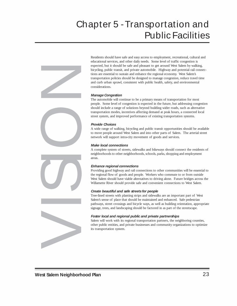
Chapter 5 - Transportation andPublic Facilities
VIS
ION
Residents should have safe and easy access to employment, recreational, cultural andeducational services, and other daily needs. Some level of traffic congestion isexpected, but it should be safe and pleasant to get around West Salem by walking,bicycling, public transit, and private automobile. Highway and potential rail connec-tions are essential to sustain and enhance the regional economy. West Salem’stransportation policies should be designed to manage congestion, reduce travel timeand curb urban sprawl, consistent with public health, safety, and environmentalconsiderations.
Manage CongestionThe automobile will continue to be a primary means of transportation for mostpeople. Some level of congestion is expected in the future, but addressing congestionshould include a range of solutions beyond building wider roads, such as alternativetransportation modes, incentives affecting demand at peak hours, a connected localstreet system, and improved performance of existing transportation systems.
Provide ChoicesA wide range of walking, bicycling and public transit opportunities should be availableto move people around West Salem and into other parts of Salem. The arterial streetnetwork will support intra-city movement of goods and services.
Make local connectionsA complete system of streets, sidewalks and bikeways should connect the residents ofneighborhoods to other neighborhoods, schools, parks, shopping and employmentareas.
Enhance regional connectionsProviding good highway and rail connections to other communities will be essential tothe regional flow of goods and people. Workers who commute to or from outsideWest Salem should have viable alternatives to driving alone. Future bridges across theWillamette River should provide safe and convenient connections to West Salem.
Create beautiful and safe streets for peopleTree-lined streets with planting strips and sidewalks are an important part of WestSalem’s sense of place that should be maintained and enhanced. Safe pedestrianpathways, street crossings and bicycle ways, as well as building orientation, appropriatesignage, trees, and landscaping should be factored in as part of the streetscape.
Foster local and regional public and private partnershipsSalem will work with its regional transportation partners, the neighboring counties,other public entities, and private businesses and community organizations to optimizeits transportation system.

24 Transportation and Public Facilites
GOAL 2
To improve vehicle and pedestrian trafficcirculation, safety, and access management onall streets in West Salem.
Wallace/Glen Creek:
2.5 Future improvements and developmentof Wallace Road between Glen Creek Roadand the bridge shall accommodate improve-ments to incorporate safety features for vehiclesand pedestrians such as:
a) Pedestrian safety islands to reducecrossing distances at the intersection ofWallace and Glen Creek Roads;
b) Improvements to Glen Creek west ofWallace Road to accommodate turn lanesonto Wallace Road and Glen Creek; and
c) Safe and convenient pedestrian connec-tions across Wallace Road.
Future Needs
2.6 New development should providetransportation system improvements concurrentwith the Salem Transportation System Plan.These improvements should accomodateanticipated usage while providing for the safetyof West Salem residents.
Pedestrian connectivity
2.1 Preserve, where existing, and establish,where not currently existing, safe neighborhoodpathway connections for both bicycle andpedestrian traffic to reduce vehicle trips withinWest Salem.
2.2 Safe and convenient pathways shouldconnect all neighborhoods to transit, employ-ment centers, shopping, and schools.
Access management
2.3 Where practical, the number of accessdriveways on arterials shall be minimized bycombining access driveways for adjacent uses/properties/parcels.
Safety
2.4 Where appropriate, and following theNeighborhood Traffic Management Program,utilize traffic management devices to preventspeeding, discourage cut-through traffic, andenhance pedestrian safety on local streets.
POLICIES

25West Salem Neighborhood Plan
GOAL 3
To make public transit convenient, accessible,and inviting to all.
POLICIES
3.1 Alternative modes of transportationshould be available within ¼ mile of the major-ity of West Salem residents.
3.2 Design and locate bus stops that are safeand accessible to the residents of West Salem.
3.3 Provide Park and Ride options inlocations that are convenient for transit users inWest Salem.
GOAL 4
To contribute to the community’s quality oflife as specified in the City’s Public FacilitiesPlan throuth water, sewer, utilities, and publicsafety systems.
4.1 Encourage the City to secure funds tore-locate public utilities underground whenconsidering neighborhood improvementprojects.
POLICY

26 Transportation and Public Facilites
GOAL 5
To make vehicle and pedestrian crossing of theWillamette River convenient and safe.
Bridgehead improvements
5.1 While the need for another bridgecrossing over the Willamette River in the Salemarea is inevitable, interim measures should betaken to design and improve bridgehead con-nections to arterial streets on both sides of theexisting bridges.
Bridge
5.2 City, county, state, and federal agenciesshould initiate/continue environmental studiesfor proposed bridge location(s).
POLICIES

27West Salem Neighborhood Plan
NEIGHBORHOOD ACTION ITEMS
Pedestrian connectivity to downtown
Encourage the City to develop and maintainpedestrian and bike connection between WestSalem and downtown Salem.
Highway 22
Work with the City of Salem, Polk County andODOT to enhance roadside vegetation andimplement other measures, such as new pave-ment materials, to reduce noise on State High-way 22. In this instance, noise mitigation doesnot include concrete walls.
Construct improvements on State Highway 22and take other necessary safety actions to ensurethe road’s ability to function as a major trans-portation corridor. Construct improvements toprevent traffic diversion onto local residentialstreets.
Special event parking
To reduce traffic congestion on the bridges,during special events in the greater Salem/Keizerarea, the Transit district should make use oftemporary “park and ride” locations withregular shuttle busses from West Salem to eventlocations.
Bridgehead
Replace the stop sign with a signal at the base ofthe northbound Center Street bridge ramp andmodify the intersection to allow more bridgetraffic to exit onto northbound Front Street.
Provide two dedicated right turn lanes fromsouthbound Commercial Street to westboundMarion Street Bridge traffic.
Promote the construction of a new northboundramp off the existing Marion Street Bridgeconnecting to Glen Creek via a new collectorstreet.
Fire station
Continue to monitor the progress of locatingand constructing the new West Salem firestation or expanding the existing fire station toprovide an adequate level of service and re-sponse time.
Bridge
Encourage and actively support city, county,state and federal studies to address questionsand concerns surrounding the need, size,location and jurisdiction of bridge structurescrossing the Willamette River.

28 Transportation and Public Facilites
Intentionally Blank

29West Salem Neighborhood Plan
Chapter 6 - Parks, Open Space andEnvironmental Quality
VIS
ION
West Salem’s quality of life will depend on clean air, clean water, open space andtrees. Urban design will respect the natural environment. Managing growth willinclude preservation of the surrounding farm and forest land. Trees, streams,wetlands and public spaces, as components of the developed portions of WestSalem, will enhance the places where people live.
Keep West Salem GreenWherever possible, the natural terrain, trees, drainageways and associatednatural vegetation will be preserved. Landscaping should be added to enhancethe community.
Support clean air and waterNatural systems that support clean air and clean water have intrinsic value andshould be maintained and encouraged.
Support healthy watershedsWest Salem’s streams and creeks should be enhanced as trail corridors, naturalareas, and/or fish and wildlife corridors. They also should be part of water-shed-wide approaches to improve environmental quality. Floodplains andriparian corridors are recognized as integral components of the waterway andshould be preserved as parks and open spaces.
Rediscover the Willamette RiverThe Willamette River Greenway should be expanded and extended to providemore opportunities to access the river throughout West Salem.
Preserve and expand natural resource areasNatural resources and open spaces should be preserved and enhanced.
Preserve farm and forest landFuture growth beyond the current UGB will be managed to preserve as muchfarm and forest land as possible.
Encourage development of parks and public spacesEfforts should be made to develop, maintain, and connect parks and publicopen spaces throughout West Salem with links to other riverfront parks andnatural areas.
Encourage sustainable developmentEnvironmentally sustainable building practices should be encouraged.

30 Parks, Open Space and Environmental Quality
GOAL 7
To conserve, restore, and reclaim open spaceand natural resources including the WillametteRiver Greenway, stream corridors, wildlifehabitat, tree groves, and significant mature trees.
POLICIES
Natural Resource Function
7.1 Maintain, and when possible, restorethe natural resource functions and intrinsicvalues of all designated stream corridors, signifi-cant wetlands, designated riparian areas, andsignificant trees in West Salem.
Open Space & Vegetation
7.2 Require preservation and maintenanceof open space consistent with conditions ofdevelopment approval including:
a) Preventing the removal of trees andnon-invasive vegetation except as providedby the City of Salem Tree Ordinance (SRCChapter 68) and
b) Removal of invasive vegetation andreplanting with native species where appro-priate, unless such action compromisesslope stability.
GOAL 6
To provide for the recreation needs of theWest Salem area through the acquisitionand development of adequate parks andrecreation facilities for all age groups.
Parks System Master Plan
6.1 Acquire, develop, and maintain publicparks as recommended by the ComprehensiveParks System Master Plan. Early acquisition ofpark sites shall be considered in anticipation offuture needs and to minimize land costs asdescribed in the Urban Growth ManagementProgram.
Youth facilities
6.2 Encourage the development of publicand private facilities to provide locations forneighborhood youth events.
Future Sites
6.3 Give special consideration to sitesidentified on the Parks and Natural ResourceOpportunities map. Development of thesesites or adjacent properties should consider thatthey are potentially valuable community ornatural resources.
POLICIES

31West Salem Neighborhood Plan
Willamette River
7.3 Regard the Willamette River as asignificant natural resource and public amenity.New development shall give priority to riverand floodplain functions, provide public accessto the banks of the river, and encourage restora-tion and other compatible uses of the banks.
Urban Forest
7.4 Preserve and where possible enhanceWest Salem’s urban forest (tree canopy) by:
a) Requiring developers to maximize thepreservation of trees to maintain andenhance the cohesive quality of existing treegroves;
b) Requiring, when new development isproposed, reasonable protection of signifi-cant existing trees by including these re-sources as part of the required landscapearea; and
c) Enforcing the City of Salem TreeOrdinance (SRC Chapter 68).
Heritage Trees
7.5 Provide property owners the opportu-nity to preserve trees through participation inthe City Heritage Tree Program (SRC Chapter86).
Density Bonus
7.6 Provide a housing density bonus todevelopers who preserve more than the requiredopen space adjacent to streams, significantwetlands, riparian areas, and wildlife corridors.
Wildlife Corridors
7.7 Require developers to identify wildlifecorridors and provide measures, where practi-cable, to protect and enhance such corridors.
Slopes
7.8 Preserve existing native vegetation andtrees on vegetated slopes to maintain slopestability, consistent with SRC 69 – LandslideHazards. Mitigate future erosion and instabilityon non-vegetated slopes by planting native treesand vegetation.

32 Parks, Open Space and Environmental Quality
GOAL 8
To protect, preserve, and improve theenvironmental quality of West Salem’sland, water, and air.
Pollution Control
8.1 Protect the natural surface water drain-age systems, the area’s groundwater, and enhancewater quality by treating and controllingpollution at the source.
Surface and Groundwater Resources
8.2 Require that all development or landuses that could impact surface and groundwaterresources comply with all applicable local, stateand federal regulations to prevent “downstream”impacts within West Salem and to theWillamette River.
Air Quality
8.3 Require that all development or landuses that could impact air quality comply withall applicable local, state and federal regulations.
POLICIES
Storm Water Detention & Treatment Facili-ties
8.4 Require that surface water detentionand treatment facilities be designed in such away that they contribute aesthetically to theneighborhood and do not interfere with naturaland floodplain function.
8.5 Require, where practicable, waterdetention areas to be constructed for multipleuses, e.g. a detention basin that serves as a ballfield or play area when not detaining water.
8.6 Encourage, where suitable, the locationof open vegetated channels or bioswales toconvey storm water from roadways and otherimpervious surfaces.
Impervious Surfaces
8.7 Minimize impervious surfaces inaccordance with all applicable local and stateregulations by encouraging shared driveways,shared parking agreements, alternative pavingmaterials such as porous asphalt materials andpervious pavements, and un-paved natural areasin community gathering places.

33West Salem Neighborhood Plan
NEIGHBORHOOD ACTION ITEMS
Parks and Natural Resource Opportunities
Work with City government to acquire or seekjoint use agreements for properties identified onthe Parks and Natural Resource Opportunitiesmap as parks, trails, or designated open spaces.
Parks facilities
Encourage an amendment to the Parks SystemMaster Plan that requires permanent restroomsfor all neighborhood parks in West Salem.
Encourage the City to develop an aquatic centerin West Salem for joint use with the WestSalem High School.
Safety
Encourage the Police Department to provideincreased patrols of West Salem parks.
Pocket Parks
Encourage an amendment to the Parks SystemMaster Plan that provides for the acquisitionand maintenance of smaller parks (< 5 acres) orpocket parks in developed neighborhoods andnew subdivisions that are underserved.
Stream buffers
Encourage the City to implement the use ofbuffers along stream corridors that follow theidentified FEMA flood plain boundaries wherepracticable to allow for maximum flood plainfunctionality. Buffers may include buildingsetbacks, restricted or limited use areas, or othermethods that protect the flood plain functionof the stream corridor.
Parks System Master Plan Levels of Service
Encourage an amendment to the Parks SystemMaster Plan that provides minimum levels ofservice for historic areas, natural resource areas,special use facilities, and connector trails.
Significant Natural Resource and ProtectedAreas
Work with City, County, State, and Federalagencies to recognize the critical nature ofSignificant Natural Resource Areas by pursuingpermanent protection for these areas throughthe use of natural resource overlay zones,conservation easements and acquisition whenpossible.
Water Quality
Work with City government to pursueopportunities that minimize the impactsof nonpoint source pollution includinglooking for alternatives to the current

34 Parks, Open Space and Environmental Quality
Intentionally Blank

35West Salem Neighborhood Plan
Chapter 7 - Parks and Natural ResourceOpportunities Map
The Parks and Natural Resource OpportunitiesMap represents sites identified by the citizens ofWest Salem that have potential for preservation,restoration, or recreation activities.
With the anticipated increase in population anddensity, these areas would provide beneficialopen space, enhance the urban environment,and preserve the quality of life in West Salem.
Note: this map represents suggestions forfuture consideration by the City or otherjurisdictions and agencies. Just like the Neigh-borhood Action Items, this map is not anadopted part of the Salem Area ComprehensivePlan.

36 Parks & Natural Resource Opportunities
Intentionally Blank

37West Salem Neighborhood Plan
Insert Map

38 Parks & Natural Resource Opportunities

39West Salem Neighborhood Plan
Chapter 8 - Edgewater Street-WallaceRoad Planning Area
The Edgewater Street/Wallace Road area is richin character and history. A walk alongEdgewater Street quickly reveals the beginningsof the once thriving City of West Salem.Examples of this heritage include historichomes, the old West Salem City Hall, smallscale, neighborhood-oriented retailers andexamples of West Salem’s industrial roots.Canneries still exist in the Edgewater Street/Wallace Road area reflecting the continuedimportance of agriculture in the daily lives ofmany West Salem residents.
The Edgewater Street/Wallace Road area playsan important role for the West Salem neighbor-hood and much of eastern Polk County. Thisis no more evident than along Wallace Road.Over time the Wallace Road corridor hasevolved into a major commercial destinationserving a large market area. Many diverseactivities take place in and around Wallace Roadincluding shopping, housing, manufacturing,and recreation. Although many activities takeplace along the corridor, it is apparent that thisarea did not develop in a consistent or compre-hensive manner. The result is lack of compat-ibility among uses with poor connections forpedestrians and motorists.
A group of citizen volunteers began working in1995 to take a comprehensive look at theEdgewater Street/Wallace Road area’s strengthsand weaknesses. This volunteer effort culmi-nated in three planning documents: TheEdgewater District Neighborhood Environ-
ment Evaluation Design Study, the WallaceRoad Local Access and Circulation Study, andthe Willamette River Bridgehead EngineeringStudy. These documents were conceptuallyapproved by the Salem City Council in 1997and 1998. Together, these documents providerecommendations on ways to overcome thearea’s weaknesses as well as strengthen the area’sassets and unique character. Implementation ofthese studies began in 2001, when a group ofcitizen volunteers representing property owners,business owners, the neighborhood association,along with city and county representatives,initiated a process to develop measures to ensurepedestrian-oriented, neighborhood-centereddevelopment.
This planning work resulted in adoption of theWest Salem Urban Renewal Plan in 2001. TheRenewal Plan provides a framework for publicand private investment in the community overa twenty-eight year period. Approximately $30million in public investment is expected withinthe Renewal Area during the life of the plan.Projects include streetscape improvements alongthe Edgewater Street corridor, including placingoverhead utility lines underground, redevelop-ment of unused land and obsolete buildings,public facility improvements including side-walks, streets, and alleys, and incentives to helpbusinesses improve their buildings.
As a result of the previous planning workundertaken by the community, significantrefinement to the Zoning Code for the

40 Edgewater-Wallace Planning Area
Edgewater Street/Wallace Road area took placein 2002. A major step toward implementationof the community’s recommendations in-cluded adding a chapter to the Zoning Codecalled the Edgewater Street/Wallace RoadOverlay Zone. This chapter includes require-ments for development that promote pedes-trian-oriented buildings along the EdgewaterStreet and Wallace Road rights-of-way, require-ments for pedestrian access, and sign controls.In general, the land use concept adopted for theEdgewater Street/Wallace Road Area OverlayZone includes, but is not limited to thefollowing elements:
• Commercial design guidelines and standardsfor commercial development along theWallace Road corridor to minimize the dis-tance between buildings and the Wallace Roadright-of-way and to promote defined pedes-trian ways from the site to the public side-walk system (Map Area 1);
• Establishment of the “West Salem Gateway”to encourage mixed-use development (MapArea 2);
• Provisions for retail and office uses alongwith industrial activities in the West SalemIndustrial District (Map Area 3);
• Residential and office uses along thePatterson Street corridor (Map Area 4);
• “Main Street” pedestrian-oriented retail, of-fice and residential uses and design guidelines
and standards to promote pedestrian-orienteddevelopment along the Edgewater Street cor-ridor including encouraging storefronts, lim-iting parking along the street, provision ofweather protection and discouraging longmonotonous walls facing Edgewater Street(Map Area 5);
• Live/work home occupation opportunitiesalong Second Street (Map Area 6); and
• Compatibility design guidelines and stan-dards for multiple family and single familycompact development within the WalkerSchool area (Map Area 7).
In addition to the development standardsoutlined in the overlay zone, design guidelinesand standards apply to development alongWallace Road, Edgewater Street and within theWalker School area. Together these measuresprovide a vision for the area and establish alevel of expectation for future development.As a result, it is certain that the EdgewaterStreet/Wallace Road area will remain animportant asset for West Salem residents andthe entire Salem community for years to come.As this area develops and re-develops, it will beimportant, however, to respond to new chal-lenges that arise. Only through continuedeffort will the uniqueness and viability of theEdgewater Street-Wallace Road area as acommercial, residential and employment areabe sustained.

41West Salem Neighborhood Plan

42 Edgewater-Wallace Planning Area
Intentionally Blank

43West Salem Neighborhood Plan
Glossary of Terms
Development agreementDevelopment agreementDevelopment agreementDevelopment agreementDevelopment agreement means a legis-latively approved contract between a jurisdic-tion and a person having legal or equitable in-terest in real property within the jurisdiction that“freezes” certain rules, regulations, and policiesapplicable to development of a property for aspecified period of time, usually in exchangefor certain concession by the owner.4
Floodplain functionFloodplain functionFloodplain functionFloodplain functionFloodplain function means the natural val-ues of floodplains including: (a) Water resourcevalues (natural moderation of floods, waterquality maintenance, groundwater recharge); (b)living resource values (fish, wildlife, plant re-sources and habitats); (c) cultural resource val-ues (open space, natural beauty, scientific study,outdoor education, archeological and historicsites, recreation); and (d) cultivated resourcevalues (agriculture, aquaculture, forestry).
Housing density bonusHousing density bonusHousing density bonusHousing density bonusHousing density bonus means the allo-cation of development rights that allow a par-cel to accommodate additional square footageor additional residential units beyond the maxi-mum for which the parcel is zoned, usually inexchange for the provision or preservation ofan amenity at the same site or at another loca-tion.4 For example, developments may be per-mitted a percentage increase in density for ev-ery additional foot of setback from an identi-fied stream corridor, significant wetland, or ri-parian corridor.
Locally Significant WetlandsLocally Significant WetlandsLocally Significant WetlandsLocally Significant WetlandsLocally Significant Wetlands meansthose wetland sites that provide functions orexhibit characteristics that are pertinent to com-
munity planning decisions made at a local scale,for example within an Urban Growth Bound-ary. These wetland sites shall be identified bylocal governments according to the criteria andprocedures in sections 141-086-0340 and 141-086-0350 of the Oregon Revised Statutes.2 (Seealso SRC 126.020(e) and SRC 68.020(r))
Native vegetationNative vegetationNative vegetationNative vegetationNative vegetation means plant species thatare indigenous to the area and appropriate tolocal site conditions such as hydrology, soils,light availability, and slope aspect.3 (See alsoSRC 126.020(g), SRC 132.120(h), and SRC68.020(i)).
Neighborhood Traffic ManagementNeighborhood Traffic ManagementNeighborhood Traffic ManagementNeighborhood Traffic ManagementNeighborhood Traffic ManagementProgramProgramProgramProgramProgram means a program administered bythe Transportation Services Division of theSalem Public Works Department to address thenegative impacts of unchecked traffic speed andvolume on neighborhood streets. See SalemTransportation System Plan, NeighborhoodTraffic Management Element for details regard-ing the program.
Pedestrian friendlyPedestrian friendlyPedestrian friendlyPedestrian friendlyPedestrian friendly means developmentdesigned with an emphasis primarily on the streetsidewalk and on pedestrian access to the siteand building, rather than on auto access andparking areas. The building is generally placedclose to the street and the main entrance is ori-ented to the street sidewalk. There are gener-ally windows or display cases along buildingfacades that face the street. Typically, build-ings cover a large portion of the site. Whenparking areas are provided, they are generally

44 Glossary
limited in size and they are not emphasized bythe design of the site.7
“Plan”“Plan”“Plan”“Plan”“Plan” means the West Salem NeighborhoodPlan.
Public Facilities PlanPublic Facilities PlanPublic Facilities PlanPublic Facilities PlanPublic Facilities Plan means the publicfacilities plan as defined in OAR 660-011-0005(1). The public facilities plan describesthe water, sewer, stormwater and transporta-tion facilities that are to support the land usesdesignated in the comprehensive plan withinthe urban growth boundary. The public facili-ties plan is adopted as a detailed plan and is asupport document tothe comprehensive plan.(See also SACP, “General Definitions”)
PUDPUDPUDPUDPUD (Planned Unit Development) means aparcel of land planned as a single unit, ratherthan as an aggregate of individual lots, withdesign flexibility from traditional siting regula-tions (such as side yards, setbacks, and heightlimitations) or land-use restrictions (such asprohibitions against mixing land uses within adevelopment). The greater flexibility in locat-ing buildings and in combining various land usesoften make it possible to achieve certain eco-nomics in construction, as well as the preser-vation of open space and the inclusion of manyamenities.4 (See also SRC Chapter 121)
Riparian area Riparian area Riparian area Riparian area Riparian area means the vegetative andwildlife areas adjacent to perennial and inter-mittent streams, ponds, lakes, wetlands, andheadwater areas. These areas are delineatedby the existence of plant species normally
found near freshwater.4 The width of a ripar-ian area along a single side of a stream is deter-mined by a site potential tree, which includestrees on site measured at maturity or trees thatwould have likely been on the site prior to landuse activities or natural causes, such as landslides. (See also SRC 68.020(o))
Large retailLarge retailLarge retailLarge retailLarge retail means a retail business with asquare footage greater than 25,000 square feet.
“Safe and convenient”“Safe and convenient”“Safe and convenient”“Safe and convenient”“Safe and convenient” refers to bicycleand pedestrian routes, facilities and improve-ments that: (a) Are reasonably free from haz-ards, particularly types or levels of automobiletraffic that would interfere with or discouragepedestrian or cycle travel for short trips; (b)Provide a reasonably direct route of travel be-tween destinations such as between a transitstop and a store; and (c) Meet travel needs ofcyclists and pedestrians considering destinationand length of trip and considering that the op-timum trip length of pedestrians is generally ¼to ½ mile.8
Significant tree Significant tree Significant tree Significant tree Significant tree means (a) a heritage, rare,threatened or endangered tree of any size asdefined or designated under state or federal lawand identified in records maintained by thePlanning Administrator, or (b) a heritage treedefined in SRC 86.010, designated by counciland identified in records maintained by thePlanning Administrator.3 (See also SRC68.020(q) and SRC 132.120(q))
Stream corridorStream corridorStream corridorStream corridorStream corridor means a course of water

45West Salem Neighborhood Plan
flowing along a bed in the earth.1 A watercoursecreated by natural processes, or one that wouldbe in a natural state if it were not for human-caused alterations.2 A channel such as a riveror creek that carries flowing surface water, in-cluding perennial streams and intermittentstreams with defined channels, and excludingman-made irrigation and drainage channels.The corridor includes the adjacent upland ar-eas that support protective bands of vegeta-tion that line the water’s edge.4
Traffic management devicesTraffic management devicesTraffic management devicesTraffic management devicesTraffic management devices meansmeasures used to mitigate the speed and vol-ume of vehicle traffic on local streets. Devicesinclude, but are not limited to, traffic circles,speed humps, diverters, truck or turn restric-tions, and street trees.
TreeTreeTreeTreeTree means any living, standing, woody plant,having a trunk eight (8) inches or more in di-ameter or 25 inches or more in circumference,measured at a point four feet above grade atthe base of the trunk as additionally defined inSRC 68.020(t).
Tree groveTree groveTree groveTree groveTree grove means a stand of three (3) ormore deciduous trees or six (6) or more conifertrees (of the same species or a mixture) thatform a visual and biological unit, including thearea between the forest floor and the canopy,including skyline trees, and including any un-derstory vegetation existing with the canopiedarea. A stand of trees must be at least 15 feetin height to qualify as a tree grove.10
Urban forest Urban forest Urban forest Urban forest Urban forest means all trees within the ur-ban and urbanizable area, including naturalgrowth and trees planted throughout the years.The retention of trees and wooded areas, andthe establishment of street trees, adds to thelivability of the community by enhancing itsaesthetic beauty, minimizing surface water andgroundwater run-off and diversion, filteringnoise and air pollution, and promoting soil sta-bility.6
WetlandsWetlandsWetlandsWetlandsWetlands means those areas that are inun-dated or saturated by surface water or groundwater at a frequency and duration to support,and that under normal circumstances do sup-port, a prevalence of vegetation typicallyadapted for life in saturated soil conditions;wetlands generally include swamps, marshes,bogs, and similar areas.1 (See also SRC68.020(z) and SRC 126.020(l))
Wildlife corridorWildlife corridorWildlife corridorWildlife corridorWildlife corridor means a strip of land hav-ing vegetation that provides habitat and a safepassageway for wildlife.4

46 Glossary
SourcesSourcesSourcesSourcesSources
1 Non-point Source Pollution Control Guidebook, Oregon De-partment of Environmental Quality and Oregon Departmentof Land Conservation and Development, 1994
2 OAR 141-086
3 SRC 68.020
4 A Glossary of Zoning, Development, and Planning Terms,APA, 1999
5 Salem Futures Design Types
6 Gresham Land Use Code
7 Commercial and Mixed-Use Development Code Handbook,Oregon TGM Program, 2001
8 OAR 660-012, Transportation Planning Rule
9 OAR 660-023, Goal 5 Compliance
10 Glenmorrie Neighborhood Plan, Lake Oswego, Oregon, 2000.

ORCHARD HEIGHTS
EOLA
WALLACE
DOAK
S FERRY
EDGEWATER
EOLAROSEMONT
SALEM-DALLAS HIGHWAY
7TH
RIVERBEND
DOAK
S FER
RY
BRUSH COLLEGE
37TH
PATTERSON
GLEN CREEK
N
EW
S
0.5 0 0.5 Miles
Recommended Changes to theGeneralized Land Use Map
October 2003
CommercialMulti-FamilyCenter over Existing CommercialCenter - Employment OnlyCenterUrban Service AreaCity Limits (2003)Urban Growth Boundary (2003)
The "Center" designation provides for coordinated development within the areashown that allows for residential, neighborhood retail, restaurant, employment,public space, and/or civic uses. Centers may include any or all of these uses,but should be developed as specific area plans with the prevailing economicmarket and neighborhood needs in mind. Centers should be developed in sucha manner as to provide a sense of place, a compact urban form, neighborhoodvitality, and innovative design. Within Centers, buildings should be oriented tothe pedestrian, there should be accessibility to transit and major roads, andthere should be connectivity with the surrounding neighborhood, while stillaccommodating the use of the automobile.17-18

ORCHARD HEIGHTS
EOLA
WALLACEDO
AKS F
ERRY
EDGEWATER
EOLAROSEMONT
SALEM-DALLAS HIGHWAY
7TH
RIVERBENDDO
AKS F
ERRY
BRUSH COLLEGE
37TH
PATTERSON
GLEN CREEK
N
EW
S
0.5 0 0.5 Miles
Generalized Land Use Map
October 2003
Recommended for Land Use Changes *Employment without ResidentialCommercialSchoolFuture Parks and Open SpaceExisting Parks and Open SpaceMulti-FamilySingle/Multi-FamilySingle FamilyUrban Service AreaCity Limits (2003)Urban Growth Boundary (2003)
1
2
1
2
The multi-family designation in this area represents single-family zoningwith a Compact Development Overlay. Within this area, a maximumof 12 dwelling units per acre is permitted with additional designguidelines and standards, as stipulated by the Salem Zoning Code.The multi-family designation in this area represents an average of 16dwelling units per acre with limited-size commercial uses to serve theretail and service needs of the adjacent neighborhood.
* Recommended land use changes are shown on the "Recommened Changesto the Generalized Land Use Map" map within the Land Use, Urban Design, andHousing Neighborhood Action Items. The existing Salem Area Comprehensive Plan(SACP) land use designations remains in effect until the Generalized Land Use Mapand SACP are amended.
21-22

r
r
r
r
r r
r
r
r
r
Pringle C
Michig
an Sw
ale
Belved
ere Br
ook
Glenn Creek
Wilark
Brook
Gibson Creek
Archer Brook
South Gibson Creek
Dahlia Swale
Emerald
Swale
Middle Michigan Swale
Mic higan Swa le
College S
wale
Turnage SwalePowe
r Stat
ion Sw
ale
Willamette River
Farme rs Br o ok
North G ibson Creek
Brush College Brook
Trail follows BPA power line
Trail uses abandonned railroadright-of-way and connects withexisting multi-purpose trail alongHighway 22
Includes children'sfishing ponds.
Trail follows newMarine Drive.
Goldcrest Br ook
GLEN CREEK RD
ORCHARD HEIGHTS
BRUSH COLLEGE
WALLACE
RIVERBEND
SALEM-DALLAS HIGHWAY
EDGEWATER
EOLA ROSEMONT
GLEN CREEK RD
EOLA
DOAKS FERRY
Winslow Creek
Bonnie Swal
e
Protection buffer on all creeks
Wetland area follows FEMAfloodplain boundary
West SalemHigh School
City LimitUrban Growth BoundaryCreek BufferCreeksRestoration OpportunityWetland OpportunityPark Opportunity - lotTrail Opportunity
r Park Opportunityr Natural Area Opportunity Parks and Natural ResourceOpportunities Map
N
EW
S
0.5 0 0.5 Miles
March 2003
37-38

ORCHARD HEIGHTS
EOLA
WALLACE
DOAK
S FERRY
EDGEWATER
EOLAROSEMONT
SALEM-DALLAS HIGHWAY
7TH
RIVERBEND
DOAK
S FER
RY
BRUSH COLLEGE
37TH
PATTERSON
GLEN CREEK
N
EW
S
0.5 0 0.5 Miles
Recommended Changes to theGeneralized Land Use Map*
October 2003
CommercialMulti-FamilyCenter over Existing CommercialCenter - Employment OnlyCenterUrban Service AreaCity Limits (2003)Urban Growth Boundary (2003)
The "Center" designation provides for coordinated development within the areashown that allows for residential, neighborhood retail, restaurant, employment,public space, and/or civic uses. Centers may include any or all of these uses,but should be developed as specific area plans with the prevailing economicmarket and neighborhood needs in mind. Centers should be developed in sucha manner as to provide a sense of place, a compact urban form, neighborhoodvitality, and innovative design. Within Centers, buildings should be oriented tothe pedestrian, there should be accessibility to transit and major roads, andthere should be connectivity with the surrounding neighborhood, while stillaccommodating the use of the automobile.
*As edited by City Council October 13, 2003 to show expansionof the "Center" generally located around West Salem High Schooland removal of the larger areas proposed for Multi-familydesignation adjacent to this "Center." This map represents the City Council's direction for staff in theimplementation of the neighborhood plan.
EXHIBIT