impact of climate change on agriculture & allied...
TRANSCRIPT
A study in Khasi Hills Districts of Meghalaya 1
-
I n K h a s i H i l l s D i s t r i c t s o f M e g h a l aya
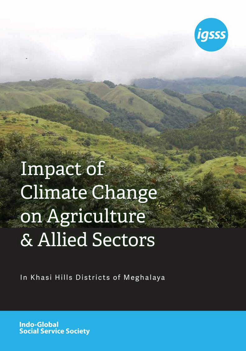
Impact of Climate Change on Agriculture & Allied Sectors

Indo-Global Social Service Society (IGSSS) is a not for profit development organization established in 1961 to support development programs across India, especially providing services to the vulnerable communities and grass root community based organizations. Our vision is establishing a humane social order based on the tenets of equity, liberty and justice in which the human rights and dignity of every individual is upheld. IGSSS is an autonomous, secular and apolitical organization and its programs do not discriminate people on the basis of their caste, creed, gender and ethnicity. IGSSS implements and supports quality development programs across 22 States and one Union Territory of India.
IGSSS reaches out to more than one lakh families every year through its programs on sustainable livelihood, disaster risk reduction, gender equity, urban poverty reduction and youth development. The programs at IGSSS are targeted towards the poor, marginalized and vulnerable sections of the society with special emphasis on women and children.
Year: 2015-16The report may be reproduced for public interest purposes with appropriate acknowledgement.
Indo-Global Social Service Society28, Institutional Area, Lodhi Road, New Delhi, 110003Phones: +91 11 4570 5000 / 2469 8360E-Mail: [email protected]
Website: www.igsss.orgFacebook: www.facebook.com/IGSSSTwitter: https://twitter.com/_IGSSS

A study in Khasi Hills Districts of Meghalaya 3
We express our deep sense of gratitude to our Sustainable Options for Uplifting Livelihood (SOUL) project partners namely Bethany Society and Ferrando Development Educational and Welfare Society (FDEWS) for facilitating the field trips and insightful observations on the socio-economic issues in the study area. We sincerely thank the communities of the villages where
study was conducted for sharing their perceptions on climate change and its implications on agriculture, fisheries, forests and local livelihoods. We heartily thank authors and organizations whose contributions helped us in shaping the study. We extend our heartfelt gratitude to MISEREOR for supporting the Sustainable Options for Uplifting Livelihood (SOUL) Programme.
Acknowledgement
3

1. Introduction 7 1.1. Climate Change scenario in Meghalaya 8
2. Study Area 10 2.1. East Khasi Hills District 10 2.2. South West Khasi Hills District 11
3. Methodology 12 3.1. Secondary data collection 12 3.2. Primary data collection 13
4. Results and Discussion 14 4.1. Main livelihood and socio-economic profile 14 4.1.1. Agricultural cropping practices 14 4.1.2. Animal husbandry 15 4.1.3. Fisheries 15 4.1.4. Forest and grazing land 15 4.1.5. Social institutions and local governance 16 4.1.6. Division of work- gender dimension 16 4.2. Climate trend of climate variability in Meghalaya 16 4.2.1. Climate and climate variability in Khasi hills districts 17 4.2.2. Rainfall variability analysis 17 4.2.3. Temperature variability 18 4.3. Climate pattern of study area 18
5. Community perception about normal season, normal weather pattern and felt changes 19
5.1. Perceived changes in weather and climate 20 5.2. Cropping pattern and implication of climate variability 21 5.3. Impact of climate variability in paddy cultivation 22 5.4. Impact of climate variability in potato cultivation 23 5.5. Impact of climate variability in maize and vegetable cultivation 23
6. Indigenous Coping Mechanism 24 6.1. Bamboo drip irrigation system 24 6.2. Bun/terrace cultivation 25 6.3. Traditional storage structure for potato 25 6.4. Common Property Resource Management (CPRM) by community based organization 25 6.5. Existing policy framework 26
7. Conclusion and Recommendations 27
Annexures 31
References 36
Table of Contents
5


A study in Khasi Hills Districts of Meghalaya 7
Climate change has drawn wide concerns across the world since it has wider implications on food, water, livelihood and energy security of the populations in turn affecting domestic and international
policies, trading patterns, resource use and food security. Inter governmental Panel on Climate Change (IPCC) pointed out serious damage to natural resources, socio-economic conditions and livelihood of the people due to climate change. In India, societies depends on climate sensitive sectors (agriculture, fisheries, forestry and animal husbandry), the consequences of climate change on food and livelihood security of millions has already been noticed (Aggarwal et. al, 2004; Mall et al., 2006; Rupa Kumar et al., 2006; Joshi and Rajeevan, 2006 and Samui and Kamble, 2009). Some of the most significant findings based on long term changes in precipitation and temperature trends across India show a warming trend due to increase in temperature by 0.7°C per century, non-significant trend in rainfall on all-India basis, but decreasing/increasing trends at some locations, increase in extreme rainfall events in North-West during summer monsoon, lower number of rainy days along east coast over the last few decades and so on.
Rain-fed agriculture is practiced in two thirds of the total cropped area of 162 million hectares (66%) and
dominates the food grain production chain of entire country. The importance of rainfed agriculture is obvious from the fact that 55 per cent of rice, 91 per cent coarse grains, 90 per cent pulses, 85 per cent oil seeds and 65 per cent cotton are grown in rain fed areas. These areas receive an annual rainfall between 400 mm to 1000 mm,which is unevenly distributed, highly uncertain and erratic. Any abrupt change in climate variables, such as rainfall patterns temperature and sunlight disturbs the agricultural ecosystem. Biological changes including the change of flowering and harvesting seasons, changes in quality, spread of blights and pests, cause population movement and change in biodiversity due to shift in climatic pattern further influencing the arable, livestock, and hydrology sectors. The evidence shows that impact of changing climate is not uniform as those communities will be more vulnerable having lack of resources and in-adequate coping mechanism. In India the geographical and socio-economic setting of many regions and communities are vulnerable.
The North East Region (NER) is one of the highly vulnerable regions in the country. It consists of eight states covering a geographic area of 26.2 mha (Million Hectare) and a population of 40 million. It is characterized by large rural population (82%), low population density, large percentage of indigenous tribal
1
Introduction
7

Climate Change Scenario in Meghalaya1.1
8
communities (34–91%) and large area under forests (60%, Ravindranath et. al., 2011). The region has about 72% area under hilly ecosystem which is characterized by fragile, inaccessible terrain, excessive sloping land, rich biodiversity and unique social set-up. The varied type of physiographical features and altitudinal differences gives rise to diverse climate regimes which are highly dependent on the southwest monsoon (Mid May–October). Over 60% of the crop area is under rain-fed agriculture which is main livelihood practice of more than two third of population. Besides, a substantial proportion of the people are dependent on other climate sensitive sectors i.e. forests based livelihoods and animal husbandry. Further the shifting cultivation practices, small landholdings, shortening of shifting cultivation cycle, lack of land ownership rights, conversion of natural forests into plantations for horticultural crops, mining, overgrazing, and forest fire are adding to the vulnerability of the natural resources and communities.
In the recent years, the region has been subject to several climate induced risks which adversely affect the state and dynamics of natural resources. Generally, the climate is predominantly humid sub-tropical with hot, humid summers, severe monsoon sand mild winters. The annual rainfall in the region is received mainly from
The state of Meghalaya is highly prone to the effects of climate change because of its geo-ecological fragility, humid monsoon climate, and socio-economic conditions. Demographically, the State harbors over 2.96 million population (source: 2011 population census), of this approximately 80% of the population is rural. The population of the state is diverse, and comprises primarily a number of tribal ethnic groups, with approximately 85% classified by the Government as scheduled tribes (source: the Eleventh Five Year Plan, 2007-2012). The communities to a large extent continue to depend on the local natural resources and nature services. More than 70% of the total work force engaged either directly or indirectly in agriculture and allied sectors (forestry, horticulture, fisheries- DoNER, GoI, 2011). These communities, find themselves grappling to find appropriate ideas and examples to make their livelihood secure and sustainable in face of large scale degradation of the livelihood resources due to host of factors at the community and other levels as well.
Majority of the districts of Meghalaya have experienced variation in precipitation (i.e. West and East Garo hills
south-west monsoon from middle of May till October. Annual rainfall varies from as high as 11,000-13,000 mm in the southern Khasi hills, Meghalaya, to as low as 800-1,200 mm in the rain shadow area in the south-central part of the Brahmaputra valley, Assam (DoNER, GoI, 2011). The region also showed great variation in temperature regime, generally varying from 15 to 32 degree Celsius in summer and 0 to 26 degree Celsius in winter.
Studies on rainfall and the temperature regimes of Northeast India indicate that there is no significant trend in rainfall for the region as a whole i.e. rainfall is neither increasing nor decreasing appreciably (Das and Goswami, 2003; Das, 2004). However, for a part of the region that the meteorologists of the country officially refer to as the ‘South Assam Meteorological Subdivision’ (that covers mainly the hill states of Nagaland, Manipur, Mizoram and Tripura and parts of the Barail Hills in southern Assam), the summer monsoon rainfall is found to be decreasing at an approximate rate of 11 mm per decade (Das 2004, Mirza et al.,1998). Significant change in seasonal rainfall (pattern/intensity/unequal distribution), and high surface temperature has been observed in the region. Deficit and excess rainfall contributing towards adverse climatic conditions like droughts and floods.
districts showed decrease in precipitation, West Khasi hills district has the highest increase in precipitation) and temperature (West part of the state increase in minimum temperature as compared to the eastern part Central parts have increase in maximum temperature-
9
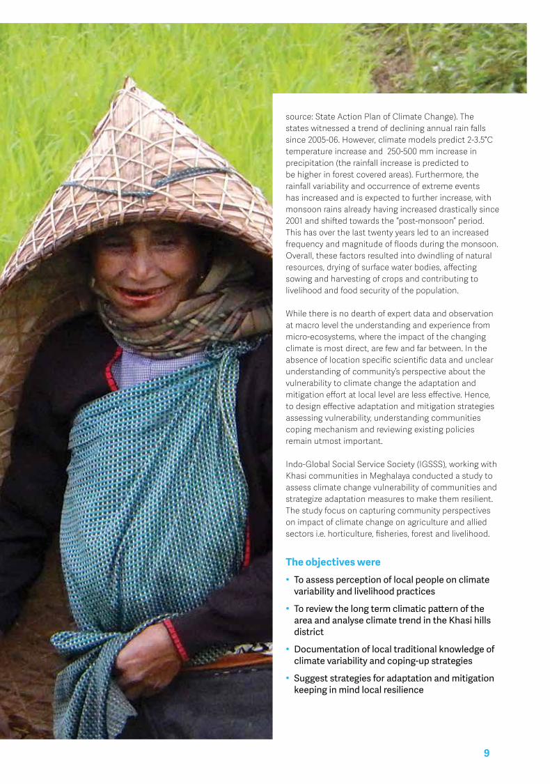
source: State Action Plan of Climate Change). The states witnessed a trend of declining annual rain falls since 2005-06. However, climate models predict 2-3.5°C temperature increase and 250-500 mm increase in precipitation (the rainfall increase is predicted to be higher in forest covered areas). Furthermore, the rainfall variability and occurrence of extreme events has increased and is expected to further increase, with monsoon rains already having increased drastically since 2001 and shifted towards the “post-monsoon” period. This has over the last twenty years led to an increased frequency and magnitude of floods during the monsoon. Overall, these factors resulted into dwindling of natural resources, drying of surface water bodies, affecting sowing and harvesting of crops and contributing to livelihood and food security of the population.
While there is no dearth of expert data and observation at macro level the understanding and experience from micro-ecosystems, where the impact of the changing climate is most direct, are few and far between. In the absence of location specific scientific data and unclear understanding of community’s perspective about the vulnerability to climate change the adaptation and mitigation effort at local level are less effective. Hence, to design effective adaptation and mitigation strategies assessing vulnerability, understanding communities coping mechanism and reviewing existing policies remain utmost important.
Indo-Global Social Service Society (IGSSS), working with Khasi communities in Meghalaya conducted a study to assess climate change vulnerability of communities and strategize adaptation measures to make them resilient. The study focus on capturing community perspectives on impact of climate change on agriculture and allied sectors i.e. horticulture, fisheries, forest and livelihood.
The objectives were• Toassessperceptionoflocalpeopleonclimatevariabilityandlivelihoodpractices
• ToreviewthelongtermclimaticpatternoftheareaandanalyseclimatetrendintheKhasihillsdistrict
• Documentationoflocaltraditionalknowledgeofclimatevariabilityandcoping-upstrategies
• Suggeststrategiesforadaptationandmitigationkeepinginmindlocalresilience

The study was conducted in Khasi Hills of Meghalaya. Administratively, the Khasi Hills comprises of East, West and South West Khasi Hills Districts. For the study purpose, three villages namely
Marshillong, Mawthong, Mawjyrsiem, Mawsep and Photjaud Rangthong villages of Mawkyarwat CD Block of South West Khasi Hills and Kpermasi, Willoi and Nongdommawria of Mawsynrum CD Block of East Khasi Hills were selected. The selected villages have poor infrastructures (civic amenities, roads etc.), good
proportion of marginal farmers, dominance of BPL families and high out migration out flow. Bio-physically, Khasi hills are characterized by undulating topography comprises of denudational high and low hills with deep gorges. Soil type of an area is dependent on factors like geology, relief, climate and vegetation. Red loamy soil is a product of weathering of rocks like granites, gneisses etc. which are relatively rich in clay forming minerals. This soil type are rich in organic matter, nitrogen and acidic in nature. A brief profile of both the studied district is given hereunder:
Study Area
10
East Khasi Hills District2.1East Khasi Hills District forms a central part of Meghalaya and covers a total geographical area of 2,748 sq. kms. It lies approximately between 25°07” & 25°41” N Lat. and 91°21” & 92°09” E Long. The district has a forest area of 1068 sq. km., i.e. about 39% of the total geographical area. The net area sown is 377.85 sq. km. and the total cropped area is 456.26 sq. km. Fallow land covers about 4%, net area sown is about 14%, while the total cropped area is about 17% (Directorate of Economics and Statistics, Meghalaya).
The climate of East Khasi Hills varies according to elevation and exposure. The high altitude areas of the district experience temperate humid climate and low altitude areas experience tropical to sub-tropical humid climate. Southwest monsoon originating from the Bay of Bengal and the Arabian Sea directly influences this high rainfall (viz. Pynursla-Cherrapunji- Mawsynram) receive an average of over 9000-11000mm of rain annually. This region experiences a short water deficit of about 50-130mm during post monsoon. The whole year can be
2

South West Khasi Hills District2.2The South West Khasi Hills district was carved out of the West Khasi Hills districts in 2012 which occupy 1,341 km² area. The district comprises of two CD Blocks namely Mawkyrwat and Ranikor. Mawkyrwat is district headquarter and located in between 25 10’ and 25 51’ N- 90 44’ and 91 49’ E at an altitude of 1401 masl (above sea level). The climate of the district is mildly tropical in the northern and southern foothills, while in the central upland zone, the climate is temperate and places at medium altitude in the northern, western and southern parts of the district, experience sub-tropical climate. The district is influenced by the south-west monsoon and rainfall is assured during summer, but differs greatly in intensity from area to area within the district. The
average rainfall ranges from 1200 mm to 3000 mm per annum.
With very poor infrastructure facilities, most of the area under the district is rural and incomes of the people are dependent mainly on agriculture. The main food crops are rice and maize, the other agriculture produces are ginger, turmeric, black pepper, areca nut etc. Besides, people also practice piggery, poultry and dairy farming to earn their livelihoods. For people living in urban areas, the main occupations are government service, business, etc. The area is very rich in minerals resources (Coal, Limestone & Uranium) hence men migrate to mining areas for livelihood during lean season.
divided into four seasons namely summer, rainy, autumn and winter. The temperature varies from 1.7 °C to 24 °C. The soils of district are light to heavy in texture. They range from acidic to soil rich in organic matter but poor phosphorous. Potash content varies from medium to high. Red Soil are commonly found in the central and sub-montane regions while black and red loam occurs in the low lying hills. Principal crops grown in the district are rice, maize, millets, oilseeds and pulses. Horticulture products include orange, pineapple, pears, peaches, plums, sohiong, sophi, betel nut and many local fruits. Vegetables like potato, sweet potato, ginger, garlic etc. are also grown.
11
Map of Study Area

In this study different methods and techniques were used to collect qualitative and quantitative data from both primary and secondary sources.
3
Methodology
Secondary Data Collection3.1Secondary data, relevant to the study, were obtained through reviews of both published and unpublished literature from various sources, and as well as from Internet. Examples of such information include climate, demographic characteristics, biophysical and policy related information. Results from these reviews have been used to support various arguments related to the study. Meghalaya State Action Plan on Climate Change reviewed in depth to identify climate change trends, projections, strategies relevant for the studied villages. Climate related data of both the districts collected from Indian Meteorological Department website and India Water Portal (IWP) Website. Besides, the climate data of studied blocks of both the districts were taken from climate-data.org
12
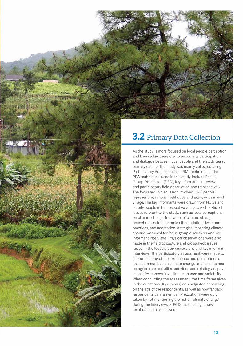
Primary Data Collection3.2As the study is more focused on local people perception and knowledge, therefore, to encourage participation and dialogue between local people and the study team, primary data for the study was mainly collected using Participatory Rural appraisal (PRA) techniques. The PRA techniques, used in this study, include Focus Group Discussion (FGD), key informants interview and participatory field observation and transect walk. The focus group discussion involved 10-15 people, representing various livelihoods and age groups in each village. The key informants were drawn from NGOs and elderly people in the respective villages. A checklist of issues relevant to the study, such as local perceptions on climate change, indicators of climate change, household socio-economic differentiation, livelihood practices, and adaptation strategies impacting climate change, was used for focus group discussion and key informant interviews. Physical observations were also made in the field to capture and crosscheck issues raised in the focus group discussions and key informant interviews. The participatory assessment were made to capture among others experience and perceptions of local communities on climate change and its influence on agriculture and allied activities and existing adaptive capacities concerning climate change and variability. When conducting the assessment, the time frame given in the questions (10/20 years) were adjusted depending on the age of the respondents, as well as how far back respondents can remember. Precautions were duly taken by not mentioning the notion ‘climate change’ during the interviews or FGDs as this might have resulted into bias answers.
13
4
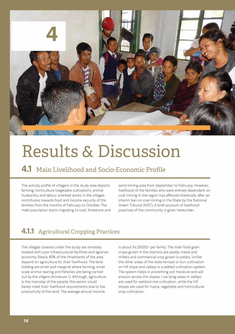
Results & Discussion Main Livelihood and Socio-Economic Profile
Agricultural Cropping Practices
4.1
4.1.1
The activity profile of villagers in the study area depicts farming, horticulture (vegetable cultivation), animal husbandry and labour oriented works in the villages contributes towards food and income security of the families from the months of February to October. The male population starts migrating to coal, limestone and
The villages covered under the study are remotely located with poor infrastructural facilities and agrarian economy. Nearly 80% of the inhabitants of the area depend on agriculture for their livelihood. The land holding are small and marginal where farming, small scale animal rearing and fisheries are being carried out by the villgers (Annexure 1). Although, agriculture is the mainstay of the people, this sector could barely meet their livelihood requirements due to low productivity of the land. The average annual income
sand mining area from September to February. However, livelihood of the families who were entirely dependent on coal mining in the region has affected drastically after an interim ban on coal mining in the State by the National Green Tribunal (NGT). A brief account of livelihood practices of the community is given hereunder:
is about Rs.35000/- per family. The main food grain crops grown in the districts are paddy, maize and millets and commercial crop grown is potato. Unlike the other areas of the state terrace or bun cultivation on hill slope and valleys is a settled cultivation system. The system helps in preventing soil moisture and soil erosion across the slopes. Low lying areas in valleys are used for wetland rice cultivation, while the hill slopes are used for maize, vegetable and horticultural crop cultivation.
14
Animal Husbandry4.1.2
Due to its topography, climatic conditions and socio-economic profile of Khasi community farming operations have limitations, thus, livestock and poultry provide alternative vocation to the villagers. In the study area, family maintains local variety of pig, poultry, cows, goat and rabbit for self-consumption and for selling as well . However, dairy rearing is comparatively less. Agricultural by products like rice bran, broken rice, maize, sweet potato, green fodder, tree leaves, kitchen waste, vegetables fed in summer and rainy season. In winter, there is shortage of feed and fodder. Although people
have complete access and control over resources like water, forest, grazing land but scarcity of feed and fodder during winter poses difficulties in livestock rearing. The women respondents who have been involved in managing livestock identified various diseases common in different months and their treatments during group discussion (Annexure 2). While discussing the impact of climate variability on livestocks the respondent could not make specific comments, however, their observations were related to seasonal pattern of disease commonly found in the area.
Fisheries4.1.3
The wet climate and numerous rivers, streams, lakes and reservoir offer ideal habitat for fisheries. The FDG conducted with villagers identify availability of variety of fishes in the water bodies i.e. paddy field, river, streams which constitute sizable part of the diet of local people (Annexure 3). People use several traditional harvesting practices like use of bamboo basket trap and use of plants. The people are quite contended to protect the fish population which reflected in the decision taken by
the village councils. Fish catching using poison or any unsustainable mean is completely prohibited as the norms and if someone violate the rule fine is imposed. Still decline of fish population was reported due to use of agricultural pesticides or insecticides in the fields (mostly for Eel-Dohthli, Byrthech/Shalynnai and Doh shear as these fish found in canal across the paddy fields), use of bleaching powder, dynamiting for fishing in the river.
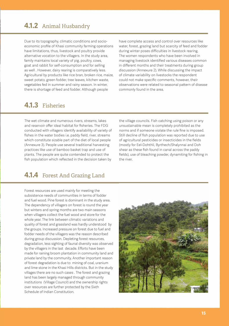
Forest And Grazing Land 4.1.4
Forest resources are used mainly for meeting the subsistence needs of communities in terms of fodder and fuel wood. Pine forest is dominant in the study area. The dependency of villagers on forest is round the year but winters and spring months are two main seasons when villagers collect the fuel wood and store for the whole year. The link between climatic variations and quality of forest and grassland was hardly understood by the groups. Increased pressure on forest due to fuel and fodder needs of the villagers was the reason described during group discussion. Depleting forest resources, degradation, less sighting of faunal diversity was observed by the villagers in the last decade. Efforts have been made for raining broom plantation in community land and private land by the community. Another important reason of forest degradation is due to mining of coal, uranium and lime stone in the Khasi Hills districts. But in the study villages there are no such cases . The forest and grazing land has been largely managed through community institutions (Village Council) and the ownership rights over resources are further protected by the Sixth Schedule of Indian Constitution.
15

Social Institutions and Local Governance4.1.5
Khasi tribal community is matrilineal and has their own language, tradition, governance system, and social order. The property is passed from mother to daughter in a family and the brother of the mother functions as the manager of such property. On the other hand, the community affairs and village administration are the responsibilities of men, which means that the participation of women in the Village Council (durbar/nokma) is limited. The landholding system is complex owing to the prevalence of the community and clan-based land ownership. In the case of community-owned land, the head of village council will have control over the decision where one should cultivate and what crops to be planted. In the studied villages most of the land is owned by a Clan which is managed by the clan members
collectively. The land is being given to the families by Clan for cultivation. The brief profile of studied villages present in Table 1 clearly indicates small and fragmented landholding. In almost every villages the land holding is below 5 acre and given by the Clan to the villagers for cultivation.
The village level institutions play a significant role in the villages (Annexure 4). Dorbar-Village Council is the main village level body and has authority to manage village affairs. The council has representation of man and all adult men of the village are members of the Dorbar. Every permanent resident of the village and belonging to a clan enjoys the right of protection from the Village Council and also the use of common property resources.
Division of Work-Gender Dimension4.1.6
As the matrilineal society it is presumed that the women have stake in decision making but female are not allowed to take part in the meeting or decision-making in village related issues as they are not members and do not have power to vote in village dorbar. However, as far as work responsibilities at household and livelihood activities are concerned they hold equal responsibilities as their counterparts. The group discussion conducted during the study with the male, female and mixed groups reveals that the activities carried out in the farm by the farmers vary depending on the type of work accomplished. It is seen
Climate Trend of Climate Variability in Meghalaya 4.2A review of available literature on climate variability at regional and local level in North East was carried out to support people’s perception about the change. Subsequently, efforts have been made to develop linkages of livelihood with the felt changes. The long term study on climate variables based on time series data has been previously studied for North East, Meghalaya and a few weather stations data (Choudhury, et al. 2012; Ray, et al, 2014; Ray, et al, 2013; Ravindranath et al, 2011). The studies provide evidences of change in climate at regional, district and weather station level. For Northeast India, Meghalaya in particular, rainfall analysis work have been done to
find out the maximum probable rainfall, meteorological drought assessment, annual trend in rainfall etc. The high resolution daily gridded rainfall dataset of 35 years (1971-2005) and monthly dataset of temperature (1901-2002) of various districts of Meghalaya reveals highest increase in precipitation about 6.01 mm/day in the West Khasi Hills. This is also a very high increase and may lead to flooding if the trend continues. At micro level Williamnagar, Tura and Cherapunjee stations of Meghalaya shows an increasing trend in rainfall(Ray et al. 2012).A brief summary of climate variability studied in some of the weather station is given in Annexure 6.
that men and women share most responsibilities, which is a characteristic of tribal communities. The access and control of men and women over various resources are given in Annexure 5. In the villages resources are accessible by both the sexes but interestingly the control and ownership rests with the women. This is because the ownership of resources is governed by the matriliny, which has remained intact. Disparity in wage rate for male and female (male Rs 250-300/-day, female-Rs120-150/-) was largely highlighted in discussion. However, in Govt. sponsored schemes like MGNREGA it is equal.
16

Climate and Climate Variability in Khasi Hills Districts4.2.1
The average annual rainfall of S.W. Khasi hills is 3273.26 mm whereas it is 1600-12000mm in East Khasi hills. The hills are influenced by the south-west monsoon which begins generally from May and continues till September. The weather is humid for the major portion of the
year except for the relatively dry spell usually between December and March. As there are no separate time series data available for South West Khasi Hills the data of West Khasi Hills analysed using data available in India water portal and IMD website.
Rainfall Variability Analysis4.2.2
Thirty two years (1971-2002) of rainfall data were analysed for the West Khasi Hills district and forty two years (1971-2013) of rainfall data were analysed for the East Khasi Hills district to assess seasonal distribution of rainfall and average number of rainy days. E. Khasi and West Khasi hills Districts have 107 and 97 average rainy days accordingly. In W. Khasi hills the maximum annual rainfall recorded was 6,295 mm corresponding to the year 1974; and the minimum recorded 1283mm corresponding to
the year 1980. The maximum annual rainfall recorded was 9935 mm corresponding to the year 2004; and the minimum recorded 1444 mm corresponding to the year 1980 in E. Khasi Hills. Monsoon months (June, July, August and September) contributes 67.5 to 69.1% of the total annual rainfall, followed by pre-monsoon (February to May) and post monsoon (Oct to Jan). The annual rainy days are more than 10 for April, May to September month (Fig 1, below).
17
Yearly distribution of rainfall in West Khasi Hills (1971-2002)
7%
68%25%
Monsoon Pre-Monsoon Post-Monsoon
Yearly distribution of rainfall in East Khasi Hills (1971-2002)
7%
69%
24%
Monsoon Pre-Monsoon Post-Monsoon

Temperature Variability4.2.3
The minimum and maximum temperature trend over the past 100 years shows an overall increase in the region. The East and West Khasi hills exhibit a high increase in the maximum temperature (about 1.2°C). There is a gradual increase in extreme events in East Khasi hills exhibiting an increase in 2 or more days of extreme events in the past 100 years(Source: Meghalaya State Action Plan on Climate Change).
According to Ravindranath et al., (2010), East and West Khasi Hills (incl. South West Khasi Hills) districts projected to experience a higher increase in temperature
ranging from 1.6-1.8°C by 2021-50. Whereas, East Khasi Hills projected to increase 10-15% total annual and season (south west monsoon) rainfall. The increase of rainfall will be smaller 5-10% in West Khasi Hills. Projected increase in rainfall and accelerated summer flows may give rise to more intense flooding and flood hazards. Further, most parts of Meghalaya the probability of drought is relatively high. Under such projections decline of crop yield (especially paddy) due to water stress during cropping season, lack of irrigational facility along with large number of small and marginal land holding is likely to exacerbate the impact of climate change.
18
West Khasi Hills-Average number of rainy days in a month (1971-2002)
Num
ber o
f rai
ny d
ays
Months
20.0Ja
nFe
b
Mar
Apr
May
Jun
Jul
Aug
Sep
Oct
Nov
Dec
15.0
10.0
5.0
0.0
20.0
15.0
10.0
5.0
0.0
East Khasi Hills-Average number of rainy days in a month (1971-2002)
Months
Jan
Feb
Mar
Apr
May
Jun
Jul
Aug
Sep
Oct
Nov
Dec
Num
ber o
f rai
ny d
ays
Climate Pattern of Study Area4.3The villages covered in the study falls under Mawsynrum (East Khasi Hills) and Mawkyarwat blocks (S.W. Khasi Hills) where the climate is mild, and generally warm and temperate. The summers are much rainier than the winters. The average annual temperature is 17.1 °C (in Mawsynram) and 16.3 °C in Mawkyarwat. The annual rainfall varies from 9527 mm (Mawsynram) to 6345 mm Mawkyarwat. Precipitation is the lowest in December, with an average of 9-11 mm. The greatest amount of precipitation occurs in July, with an average of 2467 mm in Mawsynram while it is 1561 mm. At an average temperature of 20.4 °C, August is the hottest month of the year in Mawsynrum and 19.9 °C, July is the hottest month of the year Mawkyarwat. The lowest average temperatures in the year occur in January, when it is around 10.1°C to 11.2 °C.
At micro level the trend of change in climatic factor is not available as there are no weather observatories located.
However, it is well known that the impact of climate variability is not homogenous it varies from place to place. In simple terms, this means greater deviation from the set weather pattern, reduced or increased number of rainy days, extreme rain events and increase/decline of temperature. The adverse impact of the changes would be relatively greater in the present situation owing to wide range of factors: degraded livelihood resource base, small land holdings, marginal farming and allied activities, inadequate infrastructure, low adaptive capacity, substantial change in peoples need and life style etc. Therefore, it is important to understand the micro-level changes in climate as felt by the occupational groups. Linking impacts on their livelihood practices, their coping mechanism to reduce risk and uncertainties will guide to develop programmes addressing adaptation and mitigation. The following section highlights the communities perception on climate variability and its implication on their occupations.
A study in Khasi Hills Districts of Meghalaya 19
The FDG conducted with different groups of male, female and mix group indicated varying perception towards the climatic elements. The target groups were asked to
differentiate normal weather pattern and felt changes over 5-10 years in the climatic elements. A compilation of the perceptions received from respondents is as follows:
5
Community Perception About Normal Seasonal, Weather Pattern and Changes
19

Impact of Climate Change on Agriculture and Allied Sectors 20
Perceived Changes in Weather and Climate 5.1
People’s perception and experience of climate variability is more or less similar with the scientific studies carried out at temporal and spatial scale. The summary of responses collected during key informant interviews and group discussions are as follows:
• Shiftinrainfallpattern-theregularandconstantpatternofraininthepast,hasbecomeirregularandharsh
• Monsoonrainsstartlateandpeopledonotgetrainatthetimeofsowingbutexperiencerainatthetimeofharvestingofcrops
• Numberofrainydaysreducedinlast5-6years,however,thisyear(2015),therainsstartedfromMarchonwardsimpactingfarmingactivities(landpreparation,plantingofpotatoandmaize)
• Increasedintensityofrainfallresultinginflashfloods,landslidesandincreasedsoilerosion
• Decreaseinwinterseason,comparativelywarmerdaytemperature
• Drinkingwaterscarcityduringwintermonths
• Moreinstancesofhailstorm(especiallyinApril-
MayandSept.-Oct)resultinexcessivedamagetothestandingmaize,paddycropsandvegetables(brinjal,tomatoes)inthefield
• Intensefoginmonsoonperiod-negativeeffectonpotato
• Increasedinsectandpestattackinpaddy,potatoandmaizeatvariousstages
Season Communitiesperceptionaboutnormalweatherpattern
Characteristics(asperpeoplesobservation)
FeltChanges
Winter Mid October to Mid- February Temperature drops, plenty of frost, scanty rains, water scarcity
Day temperature becomes warm, in some instances frost is less.
Variation (abnormal) in rainfall pattern in pre-monsoon
Drinking water scarcity during winter months
Spring Mid- February to May second week
Temperature rise coupled with shower/drizzle (5-10 min), Thin fog, hailstorm in March April , clear sky,
Variation in onset of rains (experience of having rain starting from March onward- no spring season is felt- varies from late arrival of monsoon rain
Summer (monsoon)
May second week to August third week
Thick fog-difficult to see around, heavy rain, thunderstorm
Intense hailstorm in August –September- result in excessive damage to the crops
Autumn August to October mid Scanty rain, clear sky, sunny, thunderstorm, pleasant temperature
Monsoon rains start late and people do not get rain at the time of sowing but experience rain at the time of harvesting of crops.
(Source:Group discussions conducted in studied villages)
20

A study in Khasi Hills Districts of Meghalaya 2121
Cropping Pattern and Implication of Climate Variability5.2
The exercise carried out with respondent through FGD to identify linkages of climate variability with the main crops (paddy, maize, potato, sweet potato) and cropping pattern clearly designate how small and marginal farmers are facing adverse impacts in different farming activities. Rainfall pattern which determine the agriculture production in the area has been the main indication of climate variability for the community. The observation of irregular and harsh pattern as compared to the regular and constant rainfall in the past is in-line with the scientific studies carried out previously using time series data of weather station located nearby the study area/at similar altitude (ex. Nongstoin weather station data). Generally, both the districts receive good amount of rainfall both in the months of April and May, which is considered as pre-monsoon showers,help in seed bed preparation. The Monsoon months (June, July, August and September) which contribute 67.5 to 69.1% of the total annual rainfall as depicted in Fig 1, have significance for sowing and growth of main food crop i.e. paddy. Any change in rainfall pattern have wider implication of productivity of paddy and hence food security of the farmers.
The responses showed that the settled cultivation in the villages faces challenges from changes in climate – irregularities in rainfall i.e. early onset of rain, high intensity of hailstorm, thunderstorm, labour intensity and pest infestation and subsequent low productivity. Farmers expressed that the type of pest and disease attack is similar but the incidences has increased in comparison to the past and are widespread in wet and terrace land. Extensive use of chemical fertilizers and pesticides are the common coping mechanism adopted by farmers. These factors along with fragmented landholding significantly contribute to food insecurity and poverty in the region. Since, post monsoon months gets only 07 percent of total annual rainfall, the villages face water scarcity and hardly any crops is grown in these months.
• Moreexpenditureinfarmingoperationsintermsofpurchasingseeds,chemicalfertilisersandpesticides
A detail account of perceived changes and their impacts on agricultural practices are as follows:
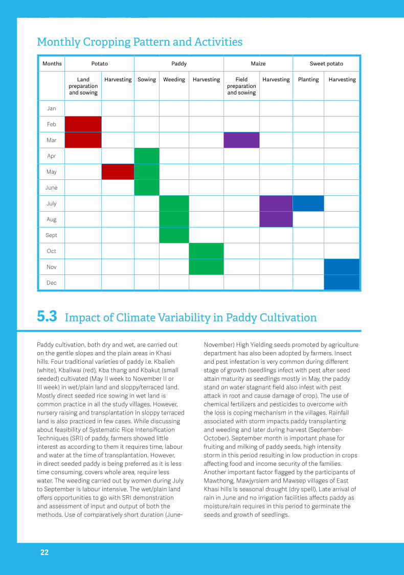
Impact of Climate Variability in Paddy Cultivation5.3Paddy cultivation, both dry and wet, are carried out on the gentle slopes and the plain areas in Khasi hills. Four traditional varieties of paddy i.e. Kbalieh (white), Kbaliwai (red), Kba thang and Kbakut (small seeded) cultivated (May II week to November II or III week) in wet/plain land and sloppy/terraced land. Mostly direct seeded rice sowing in wet land is common practice in all the study villages. However, nursery raising and transplantation in sloppy terraced land is also practiced in few cases. While discussing about feasibility of Systematic Rice Intensification Techniques (SRI) of paddy, farmers showed little interest as according to them it requires time, labour and water at the time of transplantation. However, in direct seeded paddy is being preferred as it is less time consuming, covers whole area, require less water. The weeding carried out by women during July to September is labour intensive. The wet/plain land offers opportunities to go with SRI demonstration and assessment of input and output of both the methods. Use of comparatively short duration (June-
November) High Yielding seeds promoted by agriculture department has also been adopted by farmers. Insect and pest infestation is very common during different stage of growth (seedlings infect with pest after seed attain maturity as seedlings mostly in May, the paddy stand on water stagnant field also infest with pest attack in root and cause damage of crop). The use of chemical fertilizers and pesticides to overcome with the loss is coping mechanism in the villages. Rainfall associated with storm impacts paddy transplanting and weeding and later during harvest (September-October). September month is important phase for fruiting and milking of paddy seeds, high intensity storm in this period resulting in low production in crops affecting food and income security of the families. Another important factor flagged by the participants of Mawthong, Mawjyrsiem and Mawsep villages of East Khasi hills is seasonal drought (dry spell). Late arrival of rain in June and no irrigation facilities affects paddy as moisture/rain requires in this period to germinate the seeds and growth of seedlings.
Months Potato Paddy Maize Sweetpotato
Landpreparationandsowing
Harvesting Sowing Weeding Harvesting Fieldpreparationandsowing
Harvesting Planting Harvesting
Jan
Feb
Mar
Apr
May
June
July
Aug
Sept
Oct
Nov
Dec
22
Monthly Cropping Pattern and Activities

Impact of Climate Variability in Potato Cultivation5.4Potato is the most important cash crop in the summer season that prevails from February to May. Indigenous way that is called bun method is carried out for land preparation-this refer to one raised bed, a ridge and furrow method suitable for mountain terrain and heavy rainfall conditions during the growing season. Framers cultivate traditional varieties of potato (Phanlieh/Jati, Phan saw) in wet and sloppy land during Feb- May and June months. Comparatively early sowing of seeds (by the first or second week of February), and harvest it in the first fortnight of June reduce chance of blight disease. Also, after harvest, farmers prepare land and sow paddy by the end of June. In this way, the potato crop has three months to mature before it dies with late blight incidence. Respondent highlighted the problem of potato leaves turn from green to black. Farmers
relate this with foggy weather conditions. Gurjar et al., 2014 also reported that due to foggy weather condition, there is chance of late & early blight disease in potato in Meghalaya. The tuber yield is affected by initial rainfall during planting and late blight pressure during crop growth period. Early onset of rain in the crop season facilitates to raise normal potato crop and contributes to higher yields; which, in turn, encourages the disease creating condition favorable for blight in the hills (Gurjar et al., 2014). Heavy rains in June hamper potato harvesting and destroy harvested crop. As storage facilities are not upto the mark the farmers sell potato in cheap rate in the market. In month of April - May intense hailstorm damage vegetable crops mainly tomato, potato, brinjal in both the districts. The damage was intense in 2004.
Impact of Climate Variability in Maize and Vegetable Cultivation5.5
Gentle slopes up to 20% put under maize, sweet potato, vegetables and paddy in terrace which not only contribute towards food security but also generate substantial income for the family. The transect walk and discussion with villagers reveals that traditional maize varieties find place in Slope/Up-land. In East Khasi villages maize is mixed with Colocasia and potato crops. Farmers linked the productivity with climate variability- at the time of flowering washed away flowers hence reduce the production. Besides, main crops, farmers cultivate green vegetables, Mustard, Raddish, Pumpkin, Cucumber, Green peas squash from March
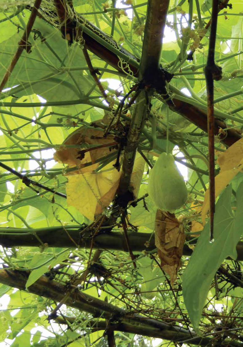
to October months for self-consumption and selling in local market. The main climatic factor destroy vegetable is high intensity hail storm in March and April months. Cultivation of squash (requires less investment) in slope around the homestead provide good income. Another promising vegetable Sohphlang (March-November), a nutritious edible roots or tuber like fruit naturally grown in mountain slopeshas good potential due to its disease resistant characteristics in the area. The disease resistant characteristics of sophalang and squash have good opportunity to enhance food, nutritional and income security of the family.
23

Impact of Climate Change on Agriculture and Allied Sectors 24
The survey and discussion carried out in the villages demonstrate that the people are resource constraints. The small land-holding, lack of irrigation, recurrent damage of crops, prevalence of insect and pest attack with
fluctuation in climatic variable (current and projected climate trend) the vulnerability of peoples will be more. However, various traditional coping mechanisms
and traditional wisdom associated with the society help them in climate change adaptation. Besides, a number of policies and programme at regional and state level have been devised to address the issue. In the present study attempts have been made to document traditional knowledge/practices available in the area through interaction with the community and available in secondary sources.
Indigenous Coping Mechanism
24
Bamboo Drip Irrigation System 6.1The indigenous method of bamboo drip irrigation of tapping stream and spring water and taking them to the plant on the field by using bamboo pipes in Khasi hills is a perfected 200 years old system. Under the system water from an uphill source is tapped and brought to the field by a main bamboo channel through gravity.
The water is then regulated through a complex bamboo network of secondary and tertiary channels to all the parts and corners of a plantation,right up to the bottom of the hill. About 18-20 litres of water enter the pipes per minute, is transported over several hundreds of metres and finally gets reduced to 20-80 drops per minute at
6

A study in Khasi Hills Districts of Meghalaya 25
Bun/Terrace Cultivation6.2In Bun cultivation practiced in hill slopes and valley is a settled cultivation system being practiced for last three decades. This method improves production of crops, conserves soil moisture, and prevents land degradation and soil erosion, In this system bench terraces are constructed on hill slopes with vertical interval of
1m, which helps retain rainwater within the benches, disposes the excess runoff from the slopes to the lower bench and eventually to the foothill. Such measures help to prevent soil erosion and retaining maximum rainwater within the slopes and safely disposing off the excess runoff from the slopes to the foothills
the site of the plant. This system is mainly used for plantation crops such as areca nut (Areca catechu Linn.), betel vines (Piper betle Linn.) and black pepper (Piper nigrum Linn.) are irrigated following this system (Jeeva
25
et. al, 2005, India Water Partnership (IWP). This tradition practice demonstrates use of locally available material for irrigation and drinking water purposes and suited to climate change adaptation.
Traditional Storage Structure for Potato 6.3Small wooden structures like small rooms are built on a slightly raised site in the field or near residential area for storing potatoes. These structures are made of wooden planks nailed into each other. The planks are nailed horizontally on four supporting structures (forming the four corners of the store) so that the second plan overlaps half of the first one and simultaneously the third overlaps the second one and this is continued till the desired height usually about 10 feet is reached. The structure thus made is covered on top with tin roof. A gap is left between the roof and walls for aeration. These storage structures are utilized for short term as well as long term storage for seed as well as ware potatoes. These storage structures are sometimes covered with tin at the base or the entire structure is covered for protection against rainfall seeping into the store. The four walls of the store made of overlapping horizontal wooden plants help in rainfall of rain water without seeping into
the store, thus the produce stored inside is protected. The lantana leaves are placed in the periphery of the wooden plank to control pest infestation.
Common Property Resource Management (CPRM) by Community Based Organization6.4
The Village Council plays an important role in managing the common property resources (community forest, community ponds, land, grazing land etc.). The strong and effective traditional institutions preserved the forest especially Sacred Forest drawing strength from traditional religious beliefs, which provided the foundation of effective social fencing. Since last five centuries was a coping mechanism against depletion
of natural resources and the practice is almost five centuries old. In the current climate scenario these areas has significance in carbon footprint capturing and biodiversity conservation.
To conserve fish population in natural stream only net fishing is allowed. Fishing using poison/bleaching powder is completely prohibited to stop extinction
Existing Policy Framework6.5Besides, indigenous coping mechanism there are policy and regulatory mechanism exist to deal with the growing concerns of climate change. The State Action Plan on Climate Change (SAPCC) of Meghalaya, State Water Policy and State Mining Policy are in place to guide different stakeholders to deal with the issue. However, the translation of these polices into District level, awareness, and capacity of stakeholders in implementation at district level is a great area of concern. The main guiding policy document of the State i.e. SAPCC has objective to strategize adaptation and mitigation initiative towards emission stabilization and enhance the resilience of the ecosystem. High rainfall variability, weather shift and projection of water stress,wreak weather events in recent past and susceptability to flood and soil erosion, vulnerability of agriculture, water and forest sectors are well defined in the document. The action plan has proposed key priorities in agri and allied sectors:
1. Assessment of soil quality & soil moisture content for better productivity through generation of climatic information
2. Promotion of rain water harvesting through construction of eco-friendly mini check dams.
3. Increasing the area under perennial fruit plantation crops and low volume high value crops to help cope
with uncertain weather patterns.
4. Improving post- harvest management such as cold chain for perishable crops and winter cultivation practices
5. Optimization of jhum cultivation through conservation of arable land, water utilization management, parallel cultivation of alternative crops
6. Promotion of organic farming through usage of compost and vermi-compost
7. Assessment study and demonstration of Systematic Rice Intensification (SRI) cultivation
8. Assessment of impact of climate change in livestock and reduction of impact of vector borne diseases through vaccination of farm animals, breeding policy for climate adaptation
9. Development of water management for minor irrigation through construction of check dams, rain water harvesting and revival of existing water bodies as adaption measures.
10. Impact assessment of climate change on fishery and development of watershed vulnerable to climate variations.
of fish species. The vigilance and norms of village council for forest conservation and management of commonly owned resources is followed strictly in the villages. Restriction on tree cutting, provision of
imposing fine in illegal lopping, washing in community pond demarcated for drinking water purposes are commendable effort that can be replicated elsewhere as adaptation mechanism.
26
A study in Khasi Hills Districts of Meghalaya 27
The study indicates that the fluctuating climatic pattern have a direct impact on livelihoods of the villagers as more than 80% depends on marginal agriculture, and small scale livestock rearing. The previous studies on climate trend
in the region and future projections clearly demonstrate the vulnerability of communities and ecosystem. The increase of rainfall, temperature, and extreme events has been observed by the community. However, their understanding of these changes and long term planning is very limited. The short term coping mechanism for example use of hybrids, chemical fertilizers and pesticides has been well adopted in all the villages. Crop loss due to extreme events is largely recognized but considered as routine affair. Instead of receiving good amount of rainfall the villagers face drinking/irrigation water shortage in post monsoon months/winter. There are hardly any livelihood options available for winter months, as a result male population migrate to nearby mining areas for income.
The traditional local institutions has strong stake in power to allot resources like land for farming or grazing, management of forest, use of water bodies. As matrilineal society the women have right and access over the resources. Likewise in other areas women are the backbone of the agricultural sector and are engaged as agricultural workers. They work in the fields during the planting, weeding and harvesting season. Their major work comprises rice sowing, transplanting, followed by weeding, then harvesting and then winnowing and finally pounding the rice to separate it from the husk. However, women role in decision making and their representation in village institutions are not recognized.
Based on the findings of the study and learning of experiences of communities in similar climatic conditions following workable strategies is proposed for the studied villages:
7
Conclusion and Recommendations
27
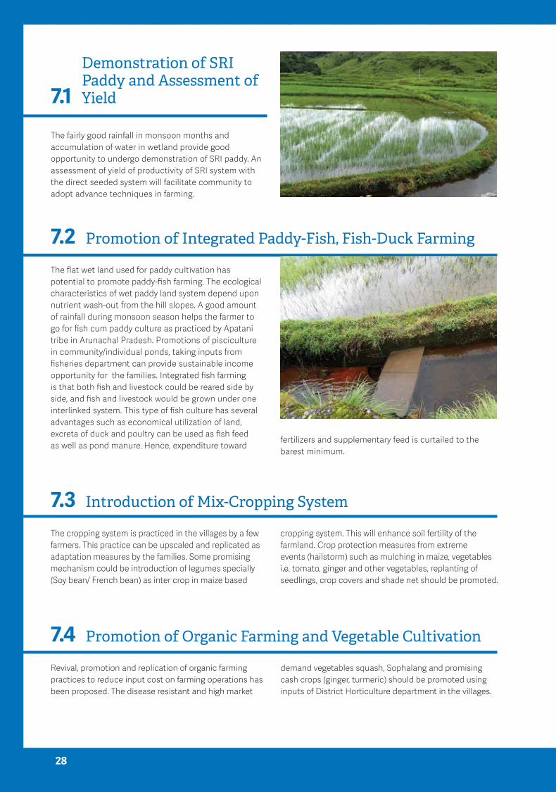
Demonstration of SRI Paddy and Assessment of Yield7.1
The fairly good rainfall in monsoon months and accumulation of water in wetland provide good opportunity to undergo demonstration of SRI paddy. An assessment of yield of productivity of SRI system with the direct seeded system will facilitate community to adopt advance techniques in farming.
Promotion of Integrated Paddy-Fish, Fish-Duck Farming7.2The flat wet land used for paddy cultivation has potential to promote paddy-fish farming. The ecological characteristics of wet paddy land system depend upon nutrient wash-out from the hill slopes. A good amount of rainfall during monsoon season helps the farmer to go for fish cum paddy culture as practiced by Apatani tribe in Arunachal Pradesh. Promotions of pisciculture in community/individual ponds, taking inputs from fisheries department can provide sustainable income opportunity for the families. Integrated fish farming is that both fish and livestock could be reared side by side, and fish and livestock would be grown under one interlinked system. This type of fish culture has several advantages such as economical utilization of land, excreta of duck and poultry can be used as fish feed as well as pond manure. Hence, expenditure toward
Introduction of Mix-Cropping System7.3The cropping system is practiced in the villages by a few farmers. This practice can be upscaled and replicated as adaptation measures by the families. Some promising mechanism could be introduction of legumes specially (Soy bean/ French bean) as inter crop in maize based
fertilizers and supplementary feed is curtailed to the barest minimum.
cropping system. This will enhance soil fertility of the farmland. Crop protection measures from extreme events (hailstorm) such as mulching in maize, vegetables i.e. tomato, ginger and other vegetables, replanting of seedlings, crop covers and shade net should be promoted.
Promotion of Organic Farming and Vegetable Cultivation7.4Revival, promotion and replication of organic farming practices to reduce input cost on farming operations has been proposed. The disease resistant and high market
demand vegetables squash, Sophalang and promising cash crops (ginger, turmeric) should be promoted using inputs of District Horticulture department in the villages.
28

Efficient Use of Land
Construction and Management of Water Harvesting System
7.5
7.6
The small land holdings and homestead land need to be utilized gainfully. Combination of crops grown in shady
It is necessary to construct water harvesting systems, to store excess water during rainy season, which can further be utilized as life-saving irrigation for vegetables and other cash crops during winter season. Roof top water
conditions (Colocasia, ginger, turmeric) and in aerial spaces (squash) can be promoted.
harvesting and water storage mechanism needs to be popularized. The mechanism to construct such structure at community/individual level mobilizing resources form Govt. line department can be explored.
29
Livestock Management 7.7As almost every family engaged in small scale livestock rearing which in turn depends on community forest and grazing land for the fodder. The efforts of plantation of perennial fodder grasses
on bunds and waste land on community basis can be encouraged. Establishment of fodder banks after post monsoon and hedge row species for fodder crops can be initiated.
Awareness and Capacity Building of Community Based Organisation
7.8
The strong local institutions can serve as one of the most important institutions for climate change adaptation and mitigation. The proposed strategies are:
1. Sensitization, awareness and capacity building of village councils, youth and women groups to understand and deal with adverse impact of climate change
2. Mobilization for sustainable utilization of natural resources and generation of additional income for the marginalized families
3. Involvement of villagers in developing village development plans and integration of climate resilient measures
4. Capacity building of village institutions for successful implementation of policies through
convergence with the govt. department and civil society organization.
Likewise other areas in the country, the community of Khasi hill districts are also experiencing changes in the normal climatic pattern and observing its impact on their day to day life. With vast traditional knowledge and strong community based organizations on one hand while on other hand poor coping and adaptation capacities of the community makes them vulnerable in projected impacts of climate change. The study advocates to ensure that the voice of community is heard and they are involved in decision making. The present study is an attempt to record communities’ perception and their involvement in identifying locally available options to deal with the threats of climate change at micro-level.
30
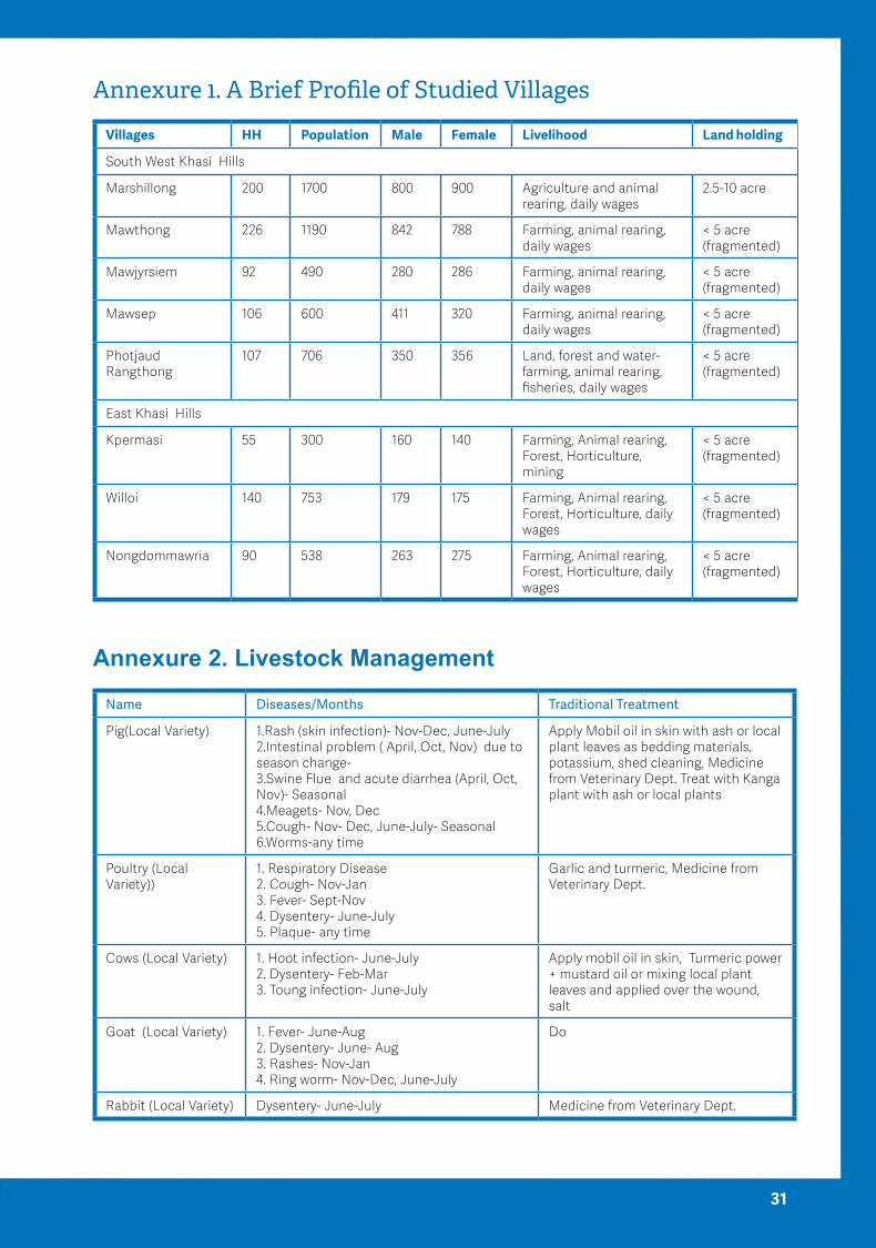
Annexure 1. A Brief Profile of Studied Villages
Villages HH Population Male Female Livelihood Land holding
South West Khasi Hills
Marshillong 200 1700 800 900 Agriculture and animal rearing, daily wages
2.5-10 acre
Mawthong 226 1190 842 788 Farming, animal rearing, daily wages
< 5 acre (fragmented)
Mawjyrsiem 92 490 280 286 Farming, animal rearing, daily wages
< 5 acre (fragmented)
Mawsep 106 600 411 320 Farming, animal rearing, daily wages
< 5 acre (fragmented)
Photjaud Rangthong
107 706 350 356 Land, forest and water- farming, animal rearing, fisheries, daily wages
< 5 acre (fragmented)
East Khasi Hills
Kpermasi 55 300 160 140 Farming, Animal rearing, Forest, Horticulture, mining
< 5 acre (fragmented)
Willoi 140 753 179 175 Farming, Animal rearing, Forest, Horticulture, daily wages
< 5 acre (fragmented)
Nongdommawria 90 538 263 275 Farming, Animal rearing, Forest, Horticulture, daily wages
< 5 acre (fragmented)
Annexure 2. Livestock Management
Name Diseases/Months TraditionalTreatment
Pig(Local Variety) 1.Rash (skin infection)- Nov-Dec, June-July 2.Intestinal problem ( April, Oct, Nov) due to season change- 3.Swine Flue and acute diarrhea (April, Oct, Nov)- Seasonal 4.Meagets- Nov, Dec 5.Cough- Nov- Dec, June-July- Seasonal 6.Worms-any time
Apply Mobil oil in skin with ash or local plant leaves as bedding materials, potassium, shed cleaning, Medicine from Veterinary Dept. Treat with Kanga plant with ash or local plants
Poultry (Local Variety))
1. Respiratory Disease 2. Cough- Nov-Jan 3. Fever- Sept-Nov 4. Dysentery- June-July 5. Plaque- any time
Garlic and turmeric, Medicine from Veterinary Dept.
Cows (Local Variety) 1. Hoot infection- June-July 2. Dysentery- Feb-Mar 3. Toung infection- June-July
Apply mobil oil in skin, Turmeric power + mustard oil or mixing local plant leaves and applied over the wound, salt
Goat (Local Variety) 1. Fever- June-Aug 2. Dysentery- June- Aug 3. Rashes- Nov-Jan 4. Ring worm- Nov-Dec, June-July
Do
Rabbit (Local Variety) Dysentery- June-July Medicine from Veterinary Dept.
31

Annexure 3. Fish Diversity of Study Area
Local Name of the fish Habitat Time of fishing Remarks
Khapyllum (round fish) Pond June, Sept, Oct Promoted by fisheries Dept. in individual ponds
Khabamphland (grass eater) Pond June-July Promoted by fisheries Dept. in individual ponds
Khablang (goat fish) Pond July- Aug Promoted by fisheries Dept. in individual ponds
Khasaw (red fish) River March, June-Sep Availability decreasing
Eel-Dohthli Paddy field (canal)
March-Oct Availability decreasing
Byrthech/Shalynnai Canal/paddy field/river
March-Oct Availability decreasing
Sangkai River Sept-Nov Availability decreasing
Dohmain River Sept-Nov Catch at night, Availability decreasing
Dohjai River June-Aug Fishing by net, Availability decreasing
Dohkoitlum Canal, river Feb/March/Oct Availability decreasing
Doh shear Paddy field Sept-Oct Availability decreasing
32

Annexure 4. Local Institutions and Their Role and Responsibilities (Source-FDG)
Name of the institutions Functions
Dorbar (village council with male members)
1. Maintenance of law and order
2. Settlement of intra-village disputes
3. Community property resources (forest, river, pond etc.) management
4. Protecting customary beliefs and practices
5. Interaction with government departments for initiating and implementing development programmes for overall village development
Sengkynthei (Women group and is like the task force or wings of the Dorbar- Handle and manage women related issues but have no power to elect the members for dorbar
1. Check and monitor village discipline
2. Control social issues like alcoholism, gambling etc.
3. Though the sengkynthei is a wings of dorbar, the women members do not have the right to vote during the dobar election or nomination
Sengsamla (Youth group- Handle and manage youth related issues)
1. Act as a mobilizer and organise social events related to youths
2. Check village discipline
3. Money collection at village level/household level under the instructions and norms of Dorbar whenever such collection take place in the village
Federation of Khasi, Jaintia & Garo (a pressure group comprising of members from all walks of life (Male, female, students, working people)
1. It acts as pressure group. It monitors and check the functioning of the different group, political group, dorbar, students group and women group at central level, village level and society level.
33

Annexure5. Division of Work in Different Secotral Activities
Sectors Activity Gender
Male Female
Agriculture Cleaning, ploughing and filed preparation √
Sowing/planting √
Weeding √
Harvesting, sorting and storage of produce √
Off farm Firewood collection √ √
Harvesting of wood √
Collection and bringing to home and storage
√
Livestock management
Cattle herding √ √
Shed management √
Milking √
Day to day basis caring √
Kitchen gardening Fencing √
Management √
Homestead Carrying water √
Cooking √
Child Care √
Washing & Cleaning √
34

Annexure 6. Climate Variability of Some of the Locations (Source-secondary Data)
Location (time series)/authors
Climate variables studied
Findings
Umiam- 1010m (1983-2010)
Choudhury, et al. 2012
Rainfall pattern Relatively lesser rainfall in early (June) and later (September) as a result Umiam experienced 26 times different degrees (low to very severe) of meteorological drought- This has negative effect on Kharif crop (paddy).
Seasonal rain- decreasing trend (non-significant) of monsoon months rainfall with an annual declining rate of 1.70 mm, decline number of rainy days in monsoon months, pre monsoon and post monsoon months rain increased non-significantly
Number of rainy days
Marginal, non- significant increase trend in annual rainy days (@0.17 days/year)
Decreased trend during monsoon, increase during pre and post monsoon months
Extreme rainfall event
Overall 32 extreme rainfall events in (>100m Rain in 1 day) last three decades
Surface temperature Rising trend in maximum temperature at the rate of 0.086°C/year- 8 times higher than the reported rise over NER.
Decreasing trend at an annual rate of 0.011°C/year. Non-significant increase of summer temperature. Significant increase of winter temperature
Nongstoin (1409 m asl) (1983-2010) Ray, et al, 2014
Rainfall pattern The annual variation of rainfall at Nongstoin station is erratic. The yearly rainfall showed more or less linear fashion, but a decreasing trend
Barapani – 1010 m (1983-2010) Ray et al, 2012
Meteorological drought
No scanty drought year experienced. There was one moderate drought year corresponds to the year 1998
Umiam (1983-2009) Rainfall distribution Drastic rise in monsoon rainfall (June to Sept) from the year 2001-09
35

References
Aggarwal, P.K., Joshi, P.K., Ingram, J.S. and Gupta,R.K. (2004). Adapting food systems of the Indo-Gangetic plains to global environmental change: key information needs to improve policy formulation. Environ.Sci.Policy.7:487-498
Mall, R.K., Gupta, A., Singh, R., Singh, R.S. and Rathore, L. S. (2006). Water resources and Climate change: An Indian perspective. Curr.Sci.90(12):1610-1626.
Rupa Kumar, K., Sahai, A. K., Krishna Kumar, K., Patwardhan, S. K., Mishra, P. K., Revadekar, J.V., Kamala, K. and G. B. Pant. (2006). High resolution climate change scenarios for India for the 21st century. Curr.Sci.90(3):334-345.
Joshi, U. R. and Rajeevan, M. (2006). Trends in Precipitation Extremes over India. National Climate Centre, India Meteorological Department, Research Report No: 3/2006, Pune, India- 411005
Samui, R.P. and Kamble, M.V. (2009). Indian Agriculture under Climate Change Scenario. In S. Panigrahy, S.S. Ray, J.S. Parihar (ed.) Impact of Climate Change on Agriculture. ISPRS ArchivesXXXVIII-8/W3 Workshop Proceedings. Space Application Centre, Ahmedabad. pp. 399-401.
N. H. Ravindranath, Sandhya Rao, Nitasha Sharma, Malini Nair, Ranjith Gopalakrishnan, Ananya S. Rao, Sumedha Malaviya, Rakesh Tiwari, Anitha Sagadevan, Madhushree Munsi, Niharika Krishna and Govindasamy Bala (2011). Climate change vulnerability profiles for North East India. Curr. Sci.,101(3):384-394
Ministry of Development of North Eastern Region (DoNER, Govt. of India) (2011). North East Climate
Change Adaptation Programme (NECCAP). Project Document
Das, P.J. and Goswami, D.C. (2003). Long-term variability of rainfall over northeast India. IndianJournalofLandscapeSystemsandEcologicalStudies.26(1):1-20.
Das, P.J. (2004). Rainfall Regime of Northeast India: A Hydrometeorological Study with Special Emphasis on the Brahmaputra Basin. Unpublished Ph.D. Thesis. Gauhati University
Mirza, M.M.Q., Warrick, R.A., Ericksen, N.J. and Kenny, G.J. (1998). Trends and persistence in precipitation in the Ganges, Brahmaputra and Meghna river basins. HydrologicalSciences-Journal-desHydrologiques.43(6):845-858
Choudhury B.U., Das.A., Ngachan, S.V., Slong, A., Bordoloi, I.J. and Chowdhury, P. (2012). Trend Analysis of Long Term Weather Variables in Mid Altitude Meghalaya, North-East India. JournalofAgriculturalPhysics.12(1),12-22.
Ray,L.I.P, Bora, P.K., Singh, A.K., Singh, N.J., Singh, R. and Feroze, S.M. (2014). Rainfall characteristics, pattern and distribution of Central Meghalaya. JournalofIndianWaterResourcesSociety,34(2):9-16.
Ray Lala IP, Bora PK, Ram V, Singh AK, Singh R, and Feroze SM. (2012). Meteorological drought assessment in Barapani. JournalofIndianWaterResourcesSociety,32(1-2):56-61.
Gurjar, M.S., Bag, T.K., Srivastava, A.K., Sharma, S., Sagar V., Singh, B.P. and Suraj Singh, K. (2014). Evaluation of fungicide application on late blight in popular potato cultivars of the north eastern Himalayan hills of India. AfricanJ.Microbiol.Res.8:3230-34.
Jeeva et.al, 2005, India Water Partnership (IWP)
36
A study in Khasi Hills Districts of Meghalaya 37

Impact of Climate Change on Agriculture and Allied Sectors 38

This Study has been conceived and executed by :
Dr. Gayatri MaharAssistant Manager, Climate Change
Photo Credit: Dr. Gayatri Mahar

28,InstitutionalArea,LodiRoad,NewDelhi–110003Tel:911145705000E–mail:[email protected]
Website:www.igsss.orgFacebook:www.facebook.com/igsss
Twitter:@_igsss