image interpretation dichotomous keyslearnline.cdu.edu.au/units/ses201/lectures/env202_l5.pdf•...
TRANSCRIPT
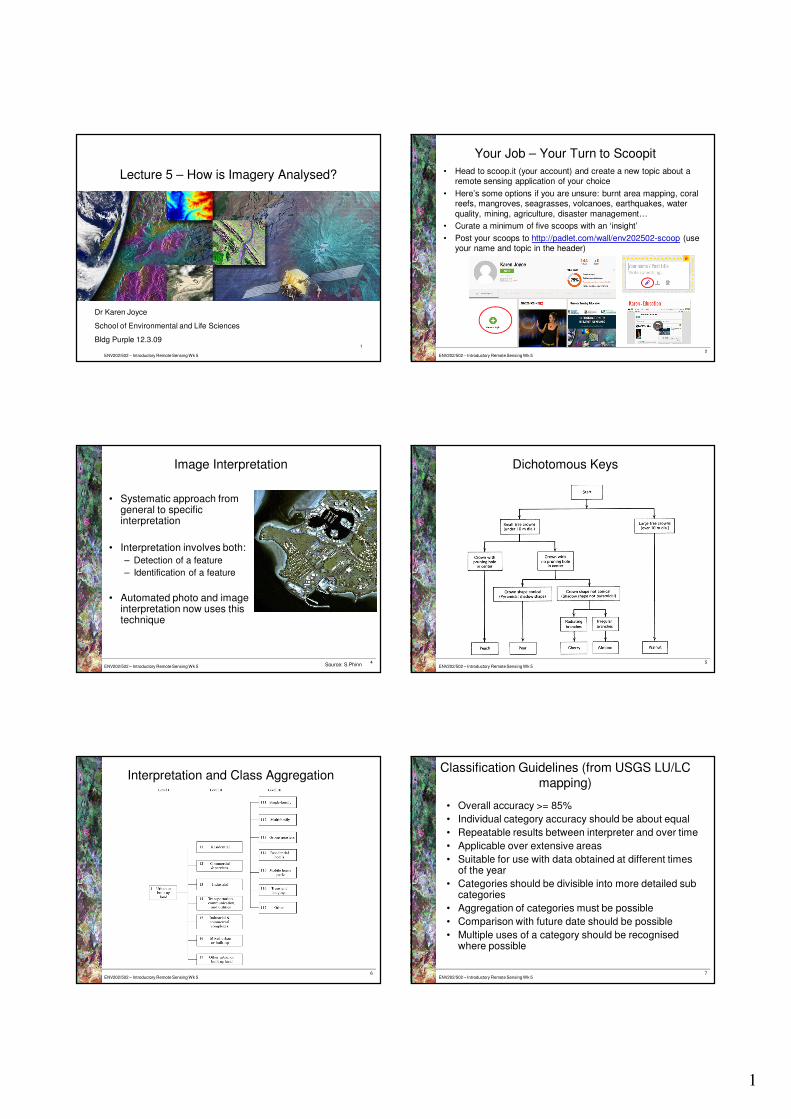
1
ENV202/502 – Introductory Remote Sensing Wk 5
Dr Karen Joyce
School of Environmental and Life Sciences
Bldg Purple 12.3.091
Lecture 5 – How is Imagery Analysed?
ENV202/502 – Introductory Remote Sensing Wk 5
Your Job – Your Turn to Scoopit
• Head to scoop.it (your account) and create a new topic about a remote sensing application of your choice
• Here’s some options if you are unsure: burnt area mapping, coral reefs, mangroves, seagrasses, volcanoes, earthquakes, water
quality, mining, agriculture, disaster management…
• Curate a minimum of five scoops with an ‘insight’
• Post your scoops to http://padlet.com/wall/env202502-scoop (use your name and topic in the header)
2
ENV202/502 – Introductory Remote Sensing Wk 54
Image Interpretation
• Systematic approach from general to specific interpretation
• Interpretation involves both:
– Detection of a feature
– Identification of a feature
• Automated photo and image interpretation now uses this technique
Source: S.Phinn ENV202/502 – Introductory Remote Sensing Wk 55
Dichotomous Keys
ENV202/502 – Introductory Remote Sensing Wk 56
Interpretation and Class Aggregation
ENV202/502 – Introductory Remote Sensing Wk 57
Classification Guidelines (from USGS LU/LC
mapping)
• Overall accuracy >= 85%
• Individual category accuracy should be about equal
• Repeatable results between interpreter and over time
• Applicable over extensive areas
• Suitable for use with data obtained at different times of the year
• Categories should be divisible into more detailed sub categories
• Aggregation of categories must be possible
• Comparison with future date should be possible
• Multiple uses of a category should be recognised where possible

2
ENV202/502 – Introductory Remote Sensing Wk 58
Minimum Mapping Units
• Smallest size entity to be mapped as a discrete feature
• Small MMU = high detail
• Large MMU = low detail
• Small MMU can be a step in the hierarchy of a large
MMU – e.g. river, lake, stream, creek, can be grouped together to the larger MMU of water body
ENV202/502 – Introductory Remote Sensing Wk 59
Interpretation CuesCue Terminology Example
Tone /
Colour
Dark, light, bright,
dull
Dark Blue (water)
Texture Smooth, rough Rough (urban area); Smooth (grass) –
function of scale
Shape Rectangular,
eliptical, regular,
irregular
Rectangular (crops)
Size Relative or
absolute
Small / large or 200x100m
Pattern Regular, random,
gridlike
Repeating linear rows (vineyard)
Shadow Presence,
absence
Long shadows observed to the SW of the
feature (can indicate height of object, time of
day, southern hemisphere). Influences tone
and texture
Site /
Association
Description of
spatial
relationships
Large carpark beside large building (may
indicate shopping centre rather than factory)
ENV202/502 – Introductory Remote Sensing Wk 510
Analysing Imagery – Your Job
• Identify as many classes as you can in your image
• Identify their interpretation cues
• Identify the most important or unique cue /
cue combo
• Develop a classification
key including categories
and sub categories -http://mindmapfree.com/
ENV202/502 – Introductory Remote Sensing Wk 5
Classification Example
11
Worldview 2 Image
Non Water Water
LandInter-tidal
Trees Grasses Artificial Surfaces
Housing Commercial /
Industrial
Roads Jetty WaterInter-tidal Trees Grasses
Dark or bright?
Small, urban pattern
Assoc. trees,
grass
Not greenGreenCircular, rough,
shadows
Irregular shape, smooth
Large, Assoc. main roads
Long, thin
Surrounded by water
Btn land and water
ENV202/502 – Introductory Remote Sensing Wk 5
Classification Example - Mindmapping
12
http://mindmapfree.com/

1
Studying overseas with CDU
Charles Darwin University| March 2014CRICOS Provider No. 00300K (NT) | CRICOS Provider No. 03286A (NSW)
• Funds a range of mobility programs for inbound (non-Australian) and outbound (Australian) students
• Department of Foreign Affairs and Trade
• Department of Education and Training
Australian Government
Charles Darwin University| March 2014CRICOS Provider No. 00300K (NT) | CRICOS Provider No. 03286A (NSW)
New Colombo Plan (NCP)
Program Destination Eligibility Study Options Grant Value
NCP Scholarship
Program
38 locations
Indo-Pacific
- U/G
- 18-28 years
- 70% graded av or equiv
Up to 1 full
academic year
TBA
NCP Mobility
Program
38 locations
Indo-Pacific
- U/G
- 18-28 years (90%)
- >28 years (10%)
Short-term or
semester
TBA
Left: 2015 Scholarship recipient Jared Ivory with Minister BishopBelow: 2015 SoLaw mobility students visit Borobudur Temple, Central Java
Charles Darwin University| March 2014CRICOS Provider No. 00300K (NT) | CRICOS Provider No. 03286A (NSW)
Scholarships
• One scholarship recipient in 2015
• School of Law student Jared Ivory
• Will study 1 year of law at Universitas Gadjah Mada, Yogyakarta
• To commence in September
Mobility
• 1 grant in 2014 (T1) – School of Law, Indonesia
• 3 grants in 2014 (T2)
1 x School of Law, Indonesia
1 x School of Education, Hong Kong (T2)
1 x SCAH, Indonesia as part of the RUILI consortia
• 3 grants in 2015
1 x School of Law, China
1 x combined - School of Law and School of Environment, Indonesia
1 x School of Eng & IT, India
• Total NCP grants > $300,000
New Colombo Plan – 2014/2015
Charles Darwin University| March 2014CRICOS Provider No. 00300K (NT) | CRICOS Provider No. 03286A (NSW)
Summary of 2016 Endeavour Mobility Programs
Program Destination Eligibility Study Options Grant Value
International
Student Exchange
Program Incl
ECKSEP
TBA UG & PG 1 – 2 Semesters
full-time
TBA
Study Overseas
Short-term
Mobility Program
TBA - U/G & P/G Short-term, up to 6
months
TBA
VET Outbound
Mobility Program
TBA - VET Short-term, up to 6
months
TBA
Asia Postgraduate
Program (New)
TBA - P/G Short-term or
semester
TBA
Asia VET Program
(New)
TBA - VET Short-term, up to 6
months
TBA
Charles Darwin University| March 2014CRICOS Provider No. 00300K (NT) | CRICOS Provider No. 03286A (NSW)
• CDU has exchange partnerships with universities in Asia, Europe, Scandinavia and North America
• As a CDU exchange student you pay your normal CDU tuition fees and remain enrolled as a CDU student
• CDU has 9 exchange scholarships worth A$5000 for study at our partner universities in Canada and the USA.
• You can study at other partner universities in Asia, Europe and Scandinavia however at this stage there are no Endeavour scholarships to these destinations
• Funding is also available through OS – HELP (loan)
Exchange

2
Charles Darwin University| March 2014CRICOS Provider No. 00300K (NT) | CRICOS Provider No. 03286A (NSW)
• If you want to go to a university that is not a partner of CDU – no problems - you would apply under the study abroad program.
• As a study abroad student you pay fees to the host university and do not remain enrolled at CDU for the duration of your studies abroad.
• Funding is available through OS – HELP (loan)
Study Abroad
Charles Darwin University| March 2014CRICOS Provider No. 00300K (NT) | CRICOS Provider No. 03286A (NSW)
• Exchange and study abroad applications for fall semester (August) – 30 April.
• Endeavour and NCP mobility applications – see coordinating school/course coordinator
• 2016 NCP scholarship nominations - 31 July
Key deadlines
Charles Darwin University| March 2014CRICOS Provider No. 00300K (NT) | CRICOS Provider No. 03286A (NSW)
Questions?
Global Mobility Websitewww.cdu.edu.au/global-mobility
Charles Darwin University| March 2014CRICOS Provider No. 00300K (NT) | CRICOS Provider No. 03286A (NSW)
NCP Scholarships and general mobility programs
Sally Hodgetts: [email protected]
NCP and general mobility programs
Megan Whitty: [email protected]
Student Exchange and Study Abroad
Brett Smith: [email protected]
OIS staff – Contact details
Charles Darwin University| March 2014CRICOS Provider No. 00300K (NT) | CRICOS Provider No. 03286A (NSW)
Thank you!

31/03/2015
1
4 DIVISIONS
4 DIVISIONS
• Bridge the gap between NASA Earth Science
and society
• Enabling the next generation to accelerate
innovative applications in technology,
resource management, policy development,
and decision making.

31/03/2015
2
• 10 Week program
• 15 locations
• Each location has its own project topic/s
• Individual topics are dictated by the project
partners.
• At the end of the 10 week program each group gives
a presentation outlining the research results and
benefits achieved for the project partners.
UGA Fall 2014
1. Colombia Ecological Forecasting: Utilizing NASA
Earth Observations to Enhance the Conservation
Efforts of Colombia’s Most Endangered Primate, the
Cotton- top Tamarin.
2. Georgia Inland Water Quality: Developing a
Cyanobacteria Detection Tool for Georgia Inland
Waters Using NASA Landsat-8 OLI Data for Water
Quality Protection and Restoration
Colombia Ecological Forecasting
• Colombia Ecological Forecasting team partnered
with Proyecto Titi and Disneys Animal Kingdom
(Orlando, FL).
• The team used NASA satellite data to aid in
working towards the partners goals of increasing
habitat suitability for the endangered primate:
The Cotton-Top Tamarin.
Colombia Ecological Forecasting
Satellites Used
Colombia Ecological Forecasting

31/03/2015
3
Results
Outcome
• Data derived from NASA imagery utilized in
the CTSFM identified practical areas to
implement reforestation and conservation
efforts
• Results will assist project partners in
purchasing and protecting land with the
most potential for forest connectivity