ig south fork u.s. department of interior & recreation
TRANSCRIPT

Big South Fork
National Park Service
U.S. Department of Interior
Big South Fork National River
& Recreation Area KY, TN
Forest Ecosystem at Bandy Creek - Teacher’s Resource Packet
"Life is a great adventure…
accept it in such a spirit."
~ Theodore Roosevelt
Letter To The Teacher 1
Dear educator,
Thank you for participating in the Big South Fork’s Environmental Education Programs. These programs
provide an interdisciplinary learning experience for students integrating the natural and cultural resources
of our park with Tennessee and Kentucky curriculum.
By visiting Big South Fork National River and Recreation Area your students have a unique opportunity to
explore and learn in an outdoor laboratory.
On this trip, your students will be exploring one of the park’s most beautiful areas—Bandy Creek. You and
your students will hike through the woods on a 1 mile loop and through hands-on and inquiry based
lessons they will learn about the forest ecosystem including animal habitats and the components that keep
the forest healthy. If you have further questions, please feel free to contact us at: 423-286-7275
Thank you again for taking part in these exciting programs, we look forward to working with you and your
students.
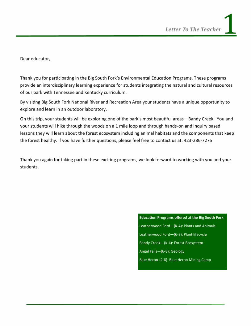
Education Programs offered at the Big South Fork
Leatherwood Ford—(K-4): Plants and Animals
Leatherwood Ford—(6-8): Plant lifecycle
Bandy Creek—(K-4): Forest Ecosystem
Angel Falls—(6-8): Geology
Blue Heron-(2-8): Blue Heron Mining Camp

2 The Big South Fork
Background:
National Park Service: The (NPS) is charged with the
management and preservation of the nation’s most precious
natural and cultural resources. These resources are woven
into our heritage, and they provide opportunities for
recreation, appreciation of beauty, historical reflection,
cultural enrichment, and environmental education.
The future vision of the NPS includes protection of park
resource; access and enjoyment for all people; education
and interpretation to convey contributions of each park unit
and the National Park System to the nation’s values,
character, and experience; continuing science, research and
resource management to manage and protect park
resources.
Big South Fork: The Big South Fork National River and
Recreation Area of the Cumberland River drains an area of
1,382 square miles in Tennessee's Scott, Fentress, Pickett,
and Morgan Counties and in Kentucky's Wayne and
McCreary Counties. It threads through 106,000 acres of
federally protected recreation area, established by Congress
in 1974, giving the river traveler a true sense of wilderness.
This is an ancient river, cutting through gorges more than 250 million years old and is one of only three rivers in the
United States designated by Congress as a "national river," that is, distinguished by its historical significance as well
as its wild and scenic beauty. The Big South Fork is also one of the few rivers in the eastern United States that has
not been dammed for power generation or flood control. The U.S. Corps of Engineers first proposed to dam the
river in 1933, and construction was authorized several times in the 1950s and 1960s by the U.S. Senate, but the
House of Representatives never agreed. Canoers, kayakers, and rafters of every skill level--from novice to expert--
can find a stretch of the Big South Fork that offers them relaxation or challenge. The river's rapids range in difficulty
from Class I to Class V. The best period to be on the river falls between March and the first part of June, before the
water supply becomes problematic.
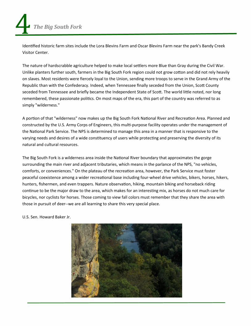
The Big South Fork National River and Recreation Area features spectacular scenery. Looking down from the
Cumberland cliffs into the Big South Fork gorge hundreds of feet below, visitors have the feeling of standing on top
of the world, and there is nothing quite like it. No visitor to the Cumberland wilderness can miss the extraordinary
stone formations sculpted by the violent collision of continents and by the patient insistence of water flowing over--
and after millions of years--through solid rock. Thousands of rock shelters and scores of natural arches are in the

3 The Big South Fork
area, but the most spectacular are the Twin Arches, one of
the largest natural bridges in the world. Within the
Tennessee section of the park, the larger South Arch has a
clearance of 70 feet and a span of more than 135 feet. The
North Arch has a clearance of 51 feet and a span of 93 feet.
The area boasts massive sandstone bluffs carved in semicircles, and white and scarlet oaks, tulip poplars, sugar
maples, umbrella and cucumber magnolias, white ash, willows, sycamores, sweet gums, and river birch and
hickory trees populate the forests. The spreading branches of hemlocks and the smooth bark of the American
beech stand out amid a profusion of rhododendron, dogwood, holly, sassafras, mountain laurel, and azalea.
Animals are plentiful and include white-tailed deer, black bear, wild hogs, southern flying squirrels, gray squirrels,
red and gray foxes, chipmunks, beaver, muskrat, mink, otter, bobcats, coyotes, long-tailed weasels, cottontail
rabbits, and eastern spotted skunks. Birds--132 catalogued varieties--are seen and heard everywhere, including
the ruffed grouse, the bobwhite, the hairy and the pileated woodpecker, the screech owl, the red-tailed hawk, an
occasional osprey, the scarlet tanager, the crow, the whippoorwill, the cardinal, the mockingbird, the turkey, and
the turkey vulture.
Human history in the Big South Fork area began about 12,000 years ago with the nomadic tribes of hunters who
followed the elk, bison, deer, bear, and other large game animals to what is now Tennessee and Kentucky. The
rock shelters that nature created were used as homesteads by these hunters, and about 4,000 such shelters can
be found within Big South Fork National River and Recreation Area. The National Park Service lists approximately
1,700 archaeological sites in the area. (The Park Service also estimates that at one time there was one moonshine
still for every 116 acres of the Big South Fork.)
There is evidence at these ancient sites of tremendous activity between 7,000-12,000 years ago. There is evidence
of mussel gathering and of intentional burning of forests to clear land for primitive planting. Evidence also
indicates that beginning about 7,000 years ago, and for the next 2,000 years human life in the Big South Fork area
virtually vanished.
When they returned after 2,000 years, the people of the Big South Fork were hunting smaller game, collecting
plants, living in primitive campsites, and moving with the seasons. Between 900 ACE and 1000 ACE, these people
left the plateau for good and founded agricultural communities along the Tennessee and Cumberland Rivers.
Occasional hunting forays into the mountains were all that linked people with the Big South Fork for the next
1000 years.
Long hunters changed all that when they first came to the area in the late 1700s. By 1800 several permanent
homesteads had been established, but the fact that life was as hard for these settlers as their prehistoric
predecessors is obvious from their choice of place names such as Difficulty, Troublesome, and No Business.
4 The Big South Fork
Identified historic farm sites include the Lora Blevins Farm and Oscar Blevins Farm near the park's Bandy Creek
Visitor Center.
The nature of hardscrabble agriculture helped to make local settlers more Blue than Gray during the Civil War.
Unlike planters further south, farmers in the Big South Fork region could not grow cotton and did not rely heavily
on slaves. Most residents were fiercely loyal to the Union, sending more troops to serve in the Grand Army of the
Republic than with the Confederacy. Indeed, when Tennessee finally seceded from the Union, Scott County
seceded from Tennessee and briefly became the Independent State of Scott. The world little noted, nor long
remembered, these passionate politics. On most maps of the era, this part of the country was referred to as
simply "wilderness."
A portion of that "wilderness" now makes up the Big South Fork National River and Recreation Area. Planned and
constructed by the U.S. Army Corps of Engineers, this multi-purpose facility operates under the management of
the National Park Service. The NPS is determined to manage this area in a manner that is responsive to the
varying needs and desires of a wide constituency of users while protecting and preserving the diversity of its
natural and cultural resources.
The Big South Fork is a wilderness area inside the National River boundary that approximates the gorge
surrounding the main river and adjacent tributaries, which means in the parlance of the NPS, "no vehicles,
comforts, or conveniences." On the plateau of the recreation area, however, the Park Service must foster
peaceful coexistence among a wider recreational base including four-wheel drive vehicles, bikers, horses, hikers,
hunters, fishermen, and even trappers. Nature observation, hiking, mountain biking and horseback riding
continue to be the major draw to the area, which makes for an interesting mix, as horses do not much care for
bicycles, nor cyclists for horses. Those coming to view fall colors must remember that they share the area with
those in pursuit of deer--we are all learning to share this very special place.
U.S. Sen. Howard Baker Jr.

5 Your Field Trip
Logistics:
This field trip is designed to take approximately 3 hours.
The park ranger(s) who will be leading your group will be waiting
for your bus at Leatherwood Ford. When you arrive, rangers will
board the bus, introduce students to the National Park Service
and its mission, briefly review the day’s schedule and set program
expectations. Once introductions are completed, students will
disembark the bus and line up with their class (or group).
Lunches, backpacks, and other items should remain on the bus.
Students are permitted to carry a water bottle on the trail.
Schedule:
The following schedule represents a typical trip. However,
please keep in mind that changes in weather, wildlife, and/or
transportation may require schedule adjustments. Flexibility
is essential to having an enjoyable visit to the park.
10:00 am Arrive at Park (Bandy Creek Visitor Center)
10:00 am—10:15 am Meet Ranger at Bandy Creek
10:30 am—11:15 am Animal Program at Visitor Center
11:15 am—11:45 am Lunch
11:45 am—12:45 pm Activities on Bandy Creek Loop
12:45 pm—1:00 pm Wrap-up
1:00 pm—Return to School

6 Preparing For Your Field Trip
Nametags: For safety and courtesy, the rangers prefer to address students and adults by name. Even a single piece
of masking tape with a participant’s first name written on it in big letters works well. If you choose to make name
tags as a pre-site activity, be sure they are legible and do not fall off easily.
Lunch: School lunches or bag lunches with disposable items are best. Before leaving school, please label and
organize the lunches by class to save time. Having lunches marked and organized for easy distribution will decrease
the time spent passing them out and increase the time on the trail. A cooler per class is permitted for cold drinks.
Remember, you will be outside for a few hours; if the school packs the lunches, we suggest you include water,
juice, or cold drinks other than milk. If students pack their own lunches, remind them to bring an additional drink
for lunch. As a reminder, food and drinks to purchase are not available at the picnic site. Students and chaperones
are responsible for leaving the picnic area clean.
What to Wear: Comfortable pants or shorts, socks, and closed-toed shoes are suggested for both students and
adults. Shoes should be comfortable for hiking along an unpaved trail.
Inclement Weather: If rain or cold weather is in the forecast, please communicate with parents that students
should come properly dressed to be outside during the entire field trip. Layers work best and can always be left on
the bus if they are not needed.
Bug Spray: Flying gnats, chiggers and ticks are common and can cause discomfort. Teachers should recommend
that parents send appropriate insect repellent that they can use with their children.
Transportation: Each school must arrange and pay for its own transportation to and from the park. Most schools
use district approved bus transportation. Some schools choose to transport children in private vehicles. Whichever
method you choose, it must meet all school district safety regulations and care should be taken in safely packing
and stowing lunches.
To maximize your time in the park, plan to depart from school as early as possible in the morning.
Chaperones: Chaperones are an integral part of the field trip experience. They provide support to the park ranger
and teachers as well as guidance for the students. Please encourage chaperones to assist in maintaining discipline
and to be on the lookout for potential safety hazards. We ask that adults refrain from using cell phones and from
smoking in front of the students. Chaperones should be reminded to be active participants in all program activities.
When the adults are actively engaged and modeling attentive
behavior, the students will follow. Chaperones may be parents,
school staff, or other responsible adults. Chaperones are chosen by
the lead teacher with a minimum of one adult for every ten
students (1:10 ratio) and with a maximum of eight adults total. Too
many adults can be a distraction during the visit, but a minimum is
required to maintain a safe learning environment. Having a
chaperone stand-by list ready in case of last minute cancellations is
always recommended.

7 Preparing For Your Field Trip
Before Your Visit: This section provides suggestions on classroom activities and techniques to get you started in planning lessons to integrate the Big South Fork into your overall educational goals. Use your imagination in building your lesson plans.
Pre-Site Activities: Pre-site preparation conducted by classroom educators prior to field trips is a crucial part of the program. If students learn about the Big South Fork before the trip, they will have the opportunity to make tangible connections with what they previously learned. Additionally, the ranger will be able to build on their prior knowledge instead of covering the basics.
Predict, Observe, Explain: This strategy can be used in the classroom to predict what wildlife you will see on your field trip and in which habitats certain animals will be found. Record your predictions on the board or in notebooks. Observations can be made during the trip, and then discussed and compared to predictions afterwards. Were the original predictions accurate? What predictions can you make about wildlife activity at different times of the day and year? How about the future? Will habitats and wildlife populations change over time? What other evidence could you use to make more accurate predictions?
Animals: The following questions may be used for an inquiry based class discussion. What is a mammal? - Warm blooded with fur or hair. They are vertebrates, and their young are born alive. What is a reptile? Cold blooded—this means they do not generate enough heat internally to keep them warm, they must seek external heat sources. Reptiles are vertebrates. They have scaly skin and most reproduce by laying eggs. What are birds? Warm blooded, have feathers and are vertebrates. All birds have wings though some can not fly. They have bills with beaks and reproduce laying eggs. What are insects? Invertebrates with 6 legs, 3 body parts that are segmented and usually 2 pair of wings. What are amphibians? Cold blooded with soft slippery skin. Spend much of their time in and around water in order to keep their skin moist. They lay soft eggs in and around the water. What are fish? Vertebrates with gills instead of lungs What are vertebrates? Creatures with backbones. What are invertebrates? Creatures without backbones.
Online Resources: National parks offer a variety of materials for teachers and students. Virtual visits, electronic field trips, and WebRangers provide technology-based experiences. Visit www.nps.gov and www.webrangers.us.
Post-Site Activities: Follow-up classroom activities that allow for reflection on the experience are a great way to wrap up programming. We encourage teachers to conduct activities that allow students to share their experience and express their new awareness with others. Artwork, displays, reports, and essays are all great ways to keep students thinking and learning about their backyard national park.
The Forest: What is a forest? A large area of land covered by trees and
other woody vegetation. There are different kinds of forests: temperate
rainforests, tropical rainforests, coniferous forests, and deciduous
forests. The forest at Bandy Creek is a deciduous forest. Forests have
medium to heavy rainfall, so there are a lot of different plants and animals
that live in forests. What are the layers of a forest? There are three—
Canopy, Understory, and Forest Floor. Each layer is unique and is home to
specific animals.

8 Evaluation, Safety, Rules & Emergencies
Evaluations: In an effort to continually
improve our programming, after your
field trip you will be given an evaluation
form. Several questions are listed on the
evaluations, but there is also space
provided for general comments. Specific
suggestions and honest comments, both
on what worked and what did not, are
welcome.
Protect Our National Park : Remind your students and chaperones that in a national park, collecting or damaging any plants, rocks, historic sites or animals is prohibited.
Wildlife: Feeding or harassing animals in the park is illegal. Remember that these are wild animals. Maintaining a safe distance of at least 10 to 15 feet between people and small animals is recommended. A distance of 150 feet is recommended for deer, bears, or other large animals. In addition to protecting ourselves, this also protects the wild nature of the animals.
Plants: Picking flowers or breaking off leaves damages the plants. Collecting pine cones, feathers, rocks, or other natural objects is not allowed in Big South Fork National River and Recreation Area or any national park.
Other Visitors: Loud noises and disruptive behavior may disturb wildlife or other visitors.
Stay Together: Remind students to always stay with their group. Each group should be led by a teacher or ranger, with an adult chaperone at the end.
Be Aware: Biting/stinging insects and snakes are common in the park so avoid exposure or injuries by being aware of
your surroundings, especially where you put your hands or feet.
Leave No Trace: Except for one water bottle each, we ask students to leave all belongings on the bus. This helps keep our trails clean. Likewise, after lunch, your group is responsible for picking up all pieces of trash and crumbs.
Emergencies: Park rangers carry radios and can
request emergency medical assistance. If a student
in your group is injured or falls ill, notify a ranger
immediately. If a child is not feeling well, assign an
adult chaperone to stay with him or her. For an
emergency in the park, dial 9-1-1.

9 Directions To Your Program Location
Bandy Creek Visitor Center:
BANDY CREEK VISITOR CENTER: Location: Adjacent to Bandy Creek Campground; approximately 15 miles
west of Oneida and 24 miles east of Jamestown, off Highway 297. For Specific directions, Click Here.
Address:
151 Stable Road
Oneida, TN 37841