idanha-a-nova presentation
DESCRIPTION
A presentation produced by Manchester School of Architecture students Sean Savage Craig MitchellTRANSCRIPT

PORT U -GAL

Iberian Peninsula


Halfway between Lisbon and Madrid, the Municipality of Idanha-a-Nova could not be better located. With the highway da Beira Interior (A23) and IC31 to the border of Monfortinho, currently has good access, just 286 km from Lisbon.
By car, Coria / Navalmoral de la Mata and Caceres are only 320km to Madrid and much less to Cáceres, Badajoz and Salamanca. Inside, it has a network of national and municipal roads in good repair. Today, as then, Idanha-a-Nova is at the center of the Iberian Peninsula.
Idanha-A-NovaMunicipality in context
B
C
A
B
C
D
Idanha-A-Nova
546.9 Square Miles
10,929 Residents
20 People Per Square Mile
North AtlanticOcean
150 Square Miles
1.3m Residents
14,856 People Per Square Mile
370Square Miles
3m+ Residents
16,726 People Per Square Mile
233.89 Square Miles (City)
3.3m Residents
14,000 People Per Square Mile
Porto
Lisbon
Madrid

A
D
Mediterranean Sea
North AtlanticOcean

AIdanha-A-Nova
BLisbon
CBadajoz
B
162.3 miles
140.3 miles
126.2 miless

A
C
162.3 miles
140.3 miles
126.2 miless

C
A
D

B
Idanha-A-Velha
Penha Garcia
Albufeira da Barragem de Marechal Carmona
Idanha-A-Nova
A
B
C
D

The municipality of Idanha-A-Nova is located in the district of Castelo Branco. This district is situated on the Eastern coast of Portugal and boarders with Spain.
The municipality of Idanha-A-Nova itself consists of 17 small parishes. The municipality is very scarcely populated with only 10,929 residents over the area of 547 square miles.
This is put into perspective when comparingit to one of our major cities such as Lodnonwhich has a density of 13,466 people per square mile.
Castelo Branco gets its name from the prior existence of a Luso-Roman castrum or fortified settlement called Castra Leuca, on the summit of the hill of Colina da Cardosa.
The population grew on the slopes of this hill.
Around 1215 the walls to the castle were built.
In 1510 a new foral was conceded by Manuel I and in 1642 the town acquired the status of Vila de Castelo Branco.
In 1771 Castelo Branco became a city and Pope Clement XIV created the diocese of Castelo Branco in 1881.
The most important monument in Castelo Branco is the Jardim do Paço Episcopal (Garden of the Episcopal Palace).
It is one of the most beautiful baroque gardens in Portugal and contains statues of allegories, kings and zodiacal signs, arranged around ponds, terraces and staircases.
Idanha-A-NovaThe Physical Make up
Castelo Branco

Idanha-A-Nova
Map illustrating the geographical position of the municipality within the Castelo Branco district.

Alcafozes
Aldeia de Santa Margarida Idanha-A-Nova Idanha-a-Velha Ladoeiro Medelim Monfortinho Monsanto
Oledo Penha Garcia Proença-a-Velha Rosmaninhal Salvaterra do Extremo São Miguel de Acha Segura (Idanha-a-Nova)|Segura Toulões Zebreira
Parishes are small administrative areas which typically have their own church and a priest or pastor.
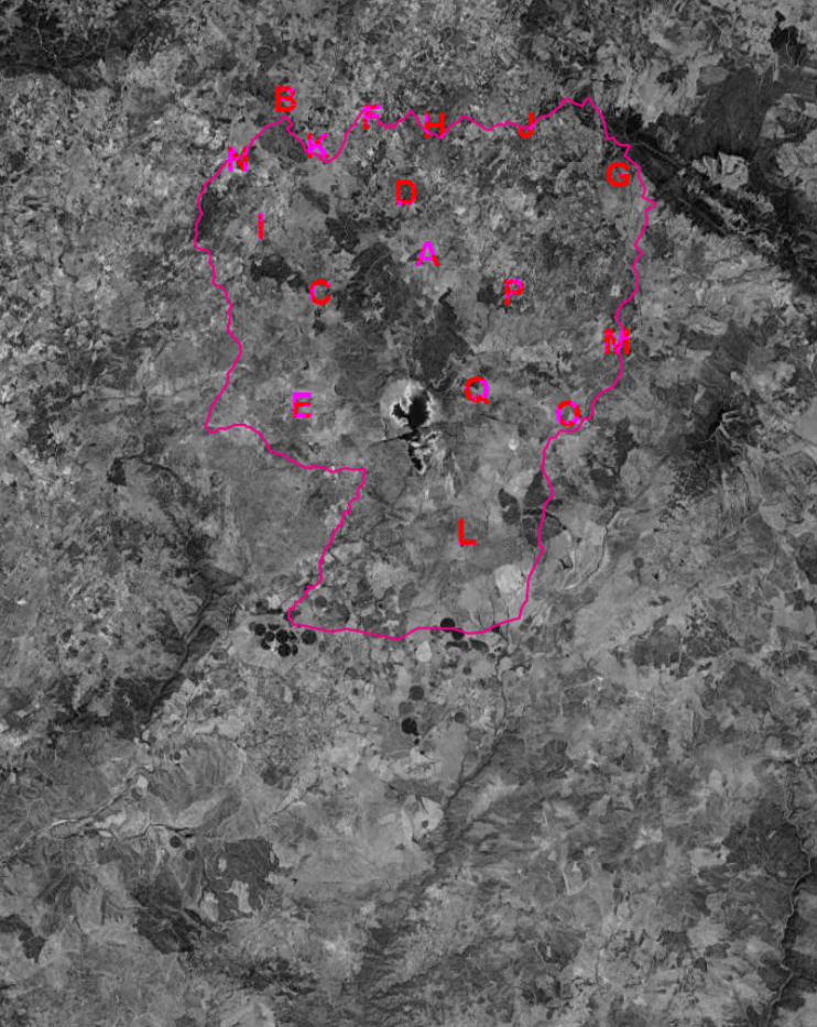
A I
B J
C KD LE MF N
G O
H PQ
Idanha-A-NovaThe Parishes within

A
B
C
D
E
F
I
KN
Idanha-a-Velha
The small village in the Idanha-a-Nova municipality we are focusing on.

G
H
J
L
M
O
P
Q


“A land
blessed by nature.
As unspoilt asyou can
get it.”
“Probably the most
portugese municipality in Por tuga l”

PortugalAgainst all oddsNumerous pre-Roman peoples of the Iberian Peninsula inhabited the territory when the Roman invasion occurred in the 3rd century BC. The Romanization of Hispania took several centuries, and the provinces that covered today’s Portugal were Lusitania in the south and Gallaecia in the north.
Numerous Roman sites are scattered around present-day Portugal, some urban remains are quite large, like Conimbriga and Mirobriga. Several works of engineering, such as baths, temples, bridges, roads, circus, theatres and layman’s homes are preserved throughout the country.
Coins, some of which coined in Portuguese land, sarcophagus and ceramics are numerous.
Idanha-A-VelhaAttempts and OpportunitiesIdanha-a-Velha is a village which relies heavily upon the practice of agricultural farming to produce staple foods and goods for the community.
The village has a rich agricultural history which at the peak of its period was producing wheat, olive oil, rye and even wild asparagus. The farming tradition is still echoed throughout the village in this modern era, but isn’t currently producing any income, tourism or interest, it is purely for personal use and gain. Any produce that is passed on is usually done so by trading amongst the residents, never sold with a monetary value.
The village has already undergone a small amount of regeneration and an attempt has been made to rectify some of the ancient ruins, turning them into desirable monuments and places of rich geological history.
REGENERATION PROCESS

REGENERATION PROCESS
LOCAL AGRICULTUREThe village has already undergone a small amount of regeneration and an attempt has been made to rectify some of the ancient ruins, turning them into desirable monuments and places of rich geological history.
An emphasis has been placed on the geological content of the site itself and the agricultural history of the area.
ATELIER 15 have already been commissioned to design a space which will hopefully attract visitors and tourists from around the globe. The space which was created was the result of an intelligent discission to use the geological content as sculpture and art. Visitors can now be educated on the historical value of the ancient roman architecture, all under one roof at the villages museum.
The olive press has also been beautifully revamped and equipped with educational plaques to inform the visitor of the importance of this to the local residents.

1. NORTHERN GATE
2. SEE
3. OIL PRESS
4.ROMAN DWELLING
5. ROCKS TO CROSS RIVER PONSUL
6. TOURIST OFFICE
7. PILLORY
8. MERCY CHURCH
1
4
5
7
13
162
3
98
14
14
12
11
6
10
Idanha-A-VelhaUrban Circuit

9. COMMUNAL OVEN
10. “TEMPLARIOS” TOWER
11. “SAO DAMASO” CHAPEL
12. SAO DAMASO” STREET LOVES
13. ROMAN BRIDGE
14. HOLY GHOST CHAPEL
15. ROMAN NECROPOLES
16. “SAO SEBASTIAO” CHAPEL
1
4
5
7
13
162
3
98
14
14
12
11
6
10

Idan
ha-A
-Nov
a P
rim
ary
Sch
ool


Figure 3View from our CRIB
Figure 4Local women baking in the communal ovens
Figure 2River banks Idanha-A-Velha
Figure 1The Adufe - A cultural icon
History - Idanha-a-VelhaCulture and Society
“Small picturesque village which holds a position of high standing among the archeological works.”
“On the fertile river banks we can see the village vegetable plots, which are very important for the peoples survival.”
“The official symbol of the municipality and the most traditional past time. [Adufe]”
“Women baking in the community oven to create some form of commerce.”

Hand crafting musical instruments

Geology A geologically rich environment
“The area of Castelo Branco houses a network of geoparks which are governed by Taejo International.”
“The main types of rock found within the landscape are Granite, Schist and Quartzite.”
Folds of Schist rock on the peak of Penha Garcia village
A mixed palette of materials used on a dwelling in Penha Garcia.


Idanha-a-Nova
Castelo Branco
Oleiros
Proenca-a-Nova
V.V. de Rodao
Spain
Spain
Borders group - schists and greywackes Neoproterozic (610-542 Million Years)
Armorican quartzite and shistsOrdovican (488-444 Million Years)
Conglomerates and breccias ArkosesEocene-Pilocene (50-1.8 Million Years)
Pre-Variscan granodiorites(490-480 Million Years)
Tardi-orogenic Variscan Granites(315-300 Million Years)
Basic Rocks, Alpites, Pegamitites
Quartz

Topography

Terrain model indicating how the majority of the municipality finds itself nested in a topographic bowl.