ice age floods institute—ellensburg chapter cheney ... scablands field trip field trip leaders:...
TRANSCRIPT

Cheney-Palouse-Snake Scablands
Field Trip
Field Trip Leaders:
Karl Lillquist, Geography Department, CWU
Nick Zentner, Geology Department, CWU
Ice Age Floods Institute—Ellensburg Chapter
Sunday 15 April 2012
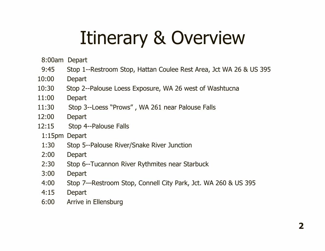
Itinerary & Overview8:00am Depart
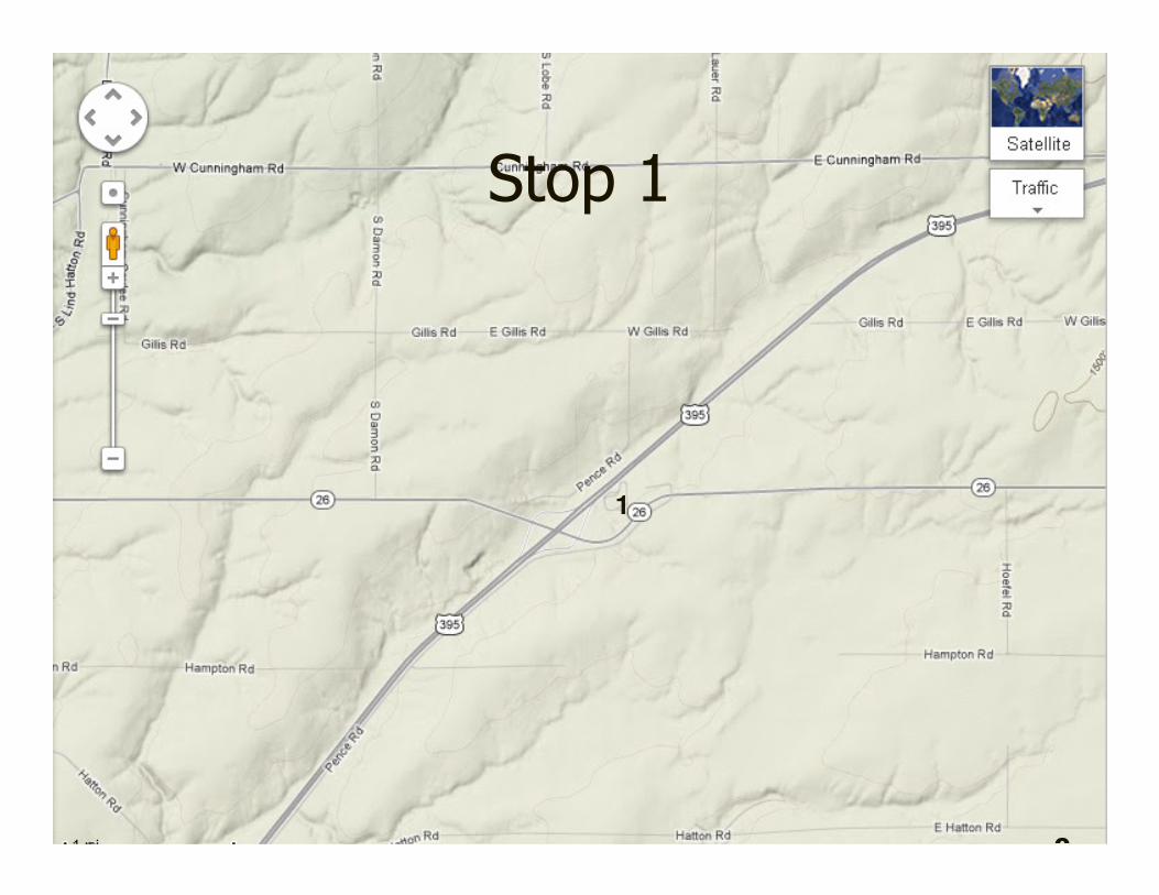
9:45 Stop 1--Restroom Stop, Hattan Coulee Rest Area, Jct WA 26 & US 395
10:00 Depart
10:30 Stop 2--Palouse Loess Exposure, WA 26 west of Washtucna
11:00 Depart
11:30 Stop 3--Loess “Prows” , WA 261 near Palouse Falls
12:00 Depart
12:15 Stop 4--Palouse Falls
1:15pm Depart
1:30 Stop 5--Palouse River/Snake River Junction
2:00 Depart
2:30 Stop 6--Tucannon River Rythmites near Starbuck
3:00 Depart
4:00 Stop 7—Restroom Stop, Connell City Park, Jct. WA 260 & US 395
4:15 Depart
6:00 Arrive in Ellensburg
2

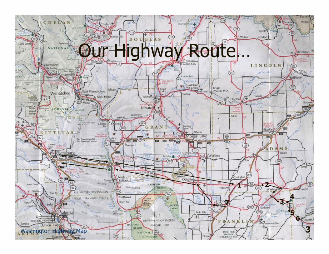
Our Highway Route…
1 2
34
5
7
3
6
Washington Highway Map

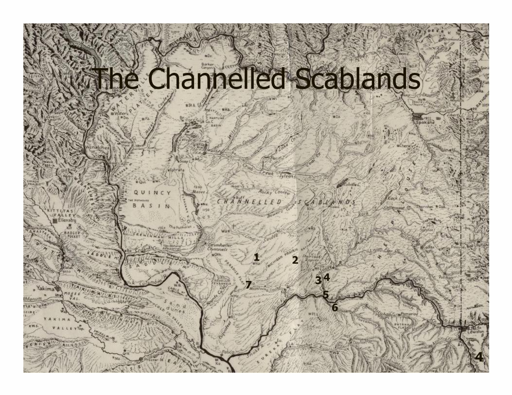
The Channelled Scablands
1 2
34
57
4
6

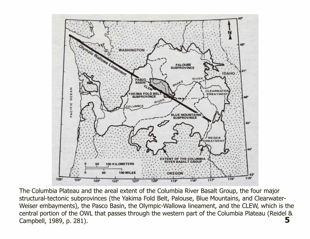
The Columbia Plateau and the areal extent of the Columbia River Basalt Group, the four major structural-tectonic subprovinces (the Yakima Fold Belt, Palouse, Blue Mountains, and Clearwater-Weiser embayments), the Pasco Basin, the Olympic-Wallowa lineament, and the CLEW, which is the central portion of the OWL that passes through the western part of the Columbia Plateau (Reidel & Campbell, 1989, p. 281). 5

6
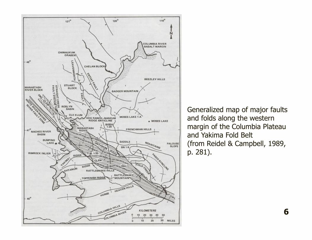
Generalized map of major faults and folds along the western margin of the Columbia Plateau and Yakima Fold Belt (from Reidel & Campbell, 1989, p. 281).

7
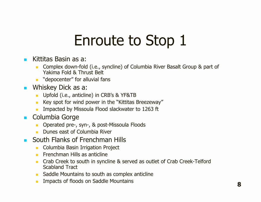
Enroute to Stop 1 � Kittitas Basin as a:
� Complex down-fold (i.e., syncline) of Columbia River Basalt Group & part of Yakima Fold & Thrust Belt
� “depocenter” for alluvial fans
� Whiskey Dick as a:� Upfold (i.e., anticline) in CRB’s & YF&TB
� Key spot for wind power in the “Kittitas Breezeway”
� Impacted by Missoula Flood slackwater to 1263 ft
� Columbia Gorge� Operated pre-, syn-, & post-Missoula Floods
� Dunes east of Columbia River
� South Flanks of Frenchman Hills� Columbia Basin Irrigation Project
� Frenchman Hills as anticline
� Crab Creek to south in syncline & served as outlet of Crab Creek-Telford Scabland Tract
� Saddle Mountains to south as complex anticline
� Impacts of floods on Saddle Mountains8

Stop 1
1
9
Enroute to Stop 2
10

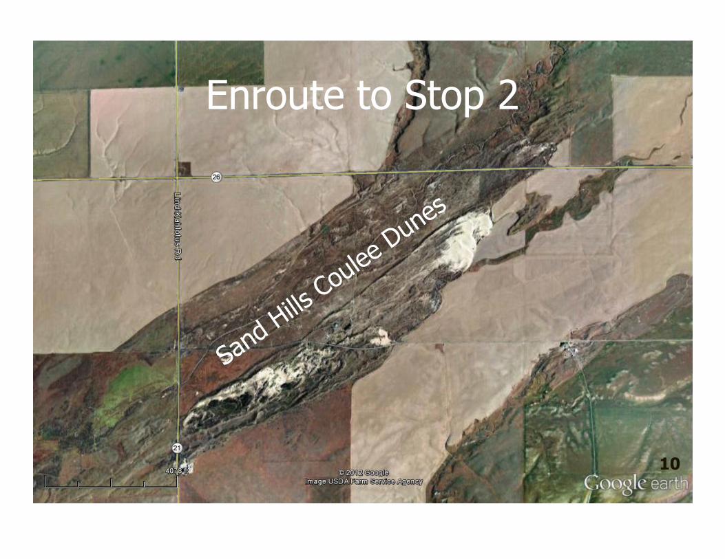
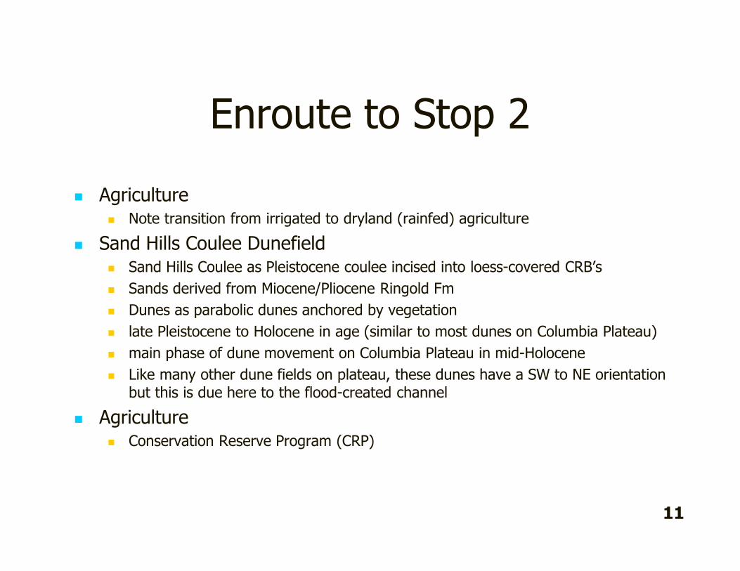
Enroute to Stop 2
� Agriculture� Note transition from irrigated to dryland (rainfed) agriculture
� Sand Hills Coulee Dunefield� Sand Hills Coulee as Pleistocene coulee incised into loess-covered CRB’s
� Sands derived from Miocene/Pliocene Ringold Fm
� Dunes as parabolic dunes anchored by vegetation
� late Pleistocene to Holocene in age (similar to most dunes on Columbia Plateau)
� main phase of dune movement on Columbia Plateau in mid-Holocene
� Like many other dune fields on plateau, these dunes have a SW to NE orientation but this is due here to the flood-created channel
� Agriculture� Conservation Reserve Program (CRP)
11
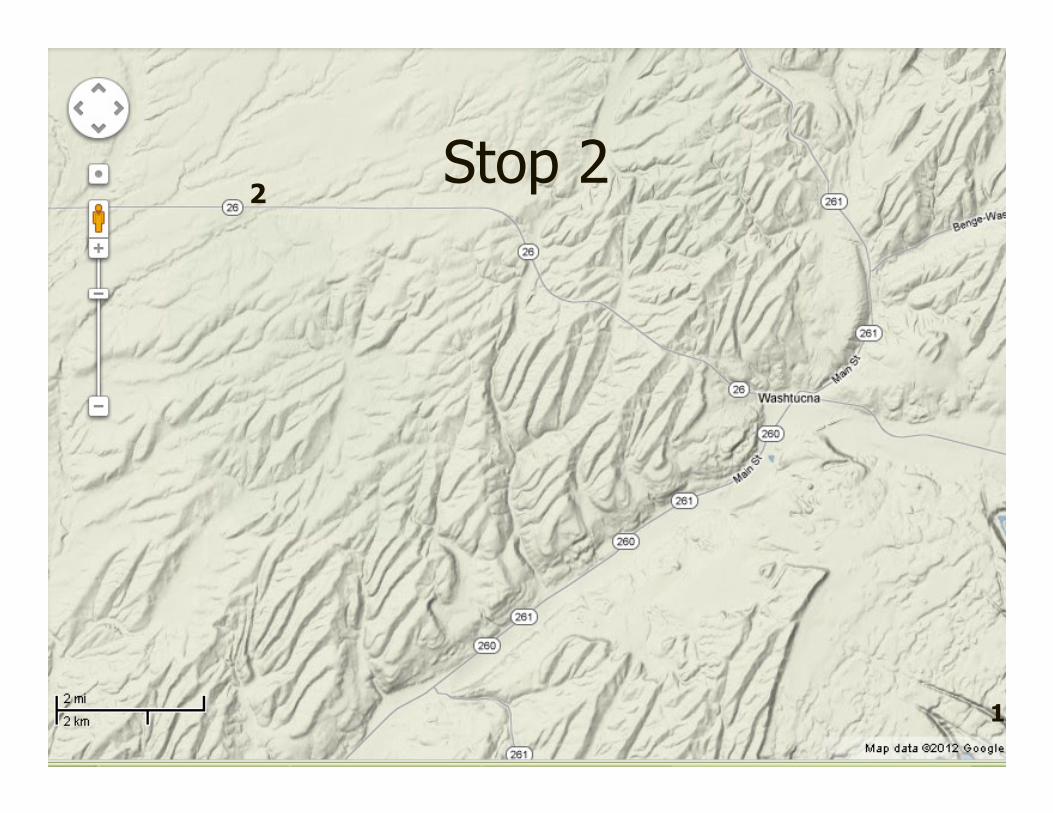
Stop 22
12

About Stop 2� Palouse Formation as loess “layer cake”
� Loess origins (see figure on page 15)
� Soil development� organics & darkening, B horizon reddening & carbonate translocation &
cementation of B horizons
� Accreting surfaces over time
� Evidence of flooding in Cheney-Palouse Scablands:� Faint channels/coulees adjacent
� Unconformities
� Erratics atop some unconformities
� Ripped up petrocalcic horizons
� Sheet sand
� At least 7 episodes of flooding:� 5 episodes of floods since 780,000 yr BP (normally magnetized)
� 1 or 2 episodes of floods before 780,000 yr BP (reversely magnetized)
�
13

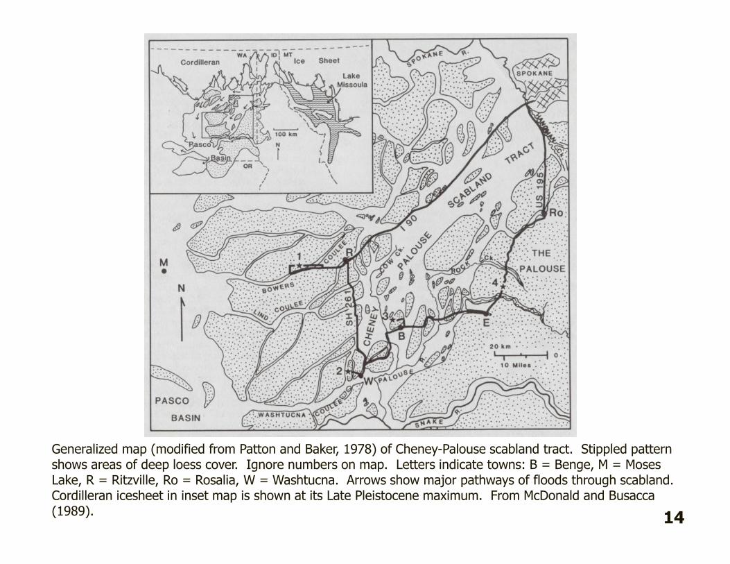
Generalized map (modified from Patton and Baker, 1978) of Cheney-Palouse scabland tract. Stippled pattern shows areas of deep loess cover. Ignore numbers on map. Letters indicate towns: B = Benge, M = Moses Lake, R = Ritzville, Ro = Rosalia, W = Washtucna. Arrows show major pathways of floods through scabland. Cordilleran icesheet in inset map is shown at its Late Pleistocene maximum. From McDonald and Busacca(1989).
14
Stop 2
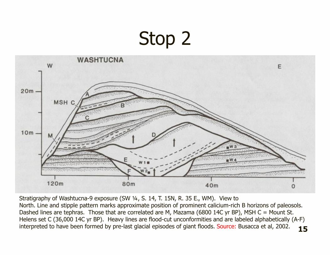
Stratigraphy of Washtucna-9 exposure (SW ¼, S. 14, T. 15N, R. 35 E., WM). View toNorth. Line and stipple pattern marks approximate position of prominent calicium-rich B horizons of paleosols. Dashed lines are tephras. Those that are correlated are M, Mazama (6800 14C yr BP), MSH C = Mount St. Helens set C (36,000 14C yr BP). Heavy lines are flood-cut unconformities and are labeled alphabetically (A-F) interpreted to have been formed by pre-last glacial episodes of giant floods. Source: Busacca et al, 2002.
15
Stop 2
16
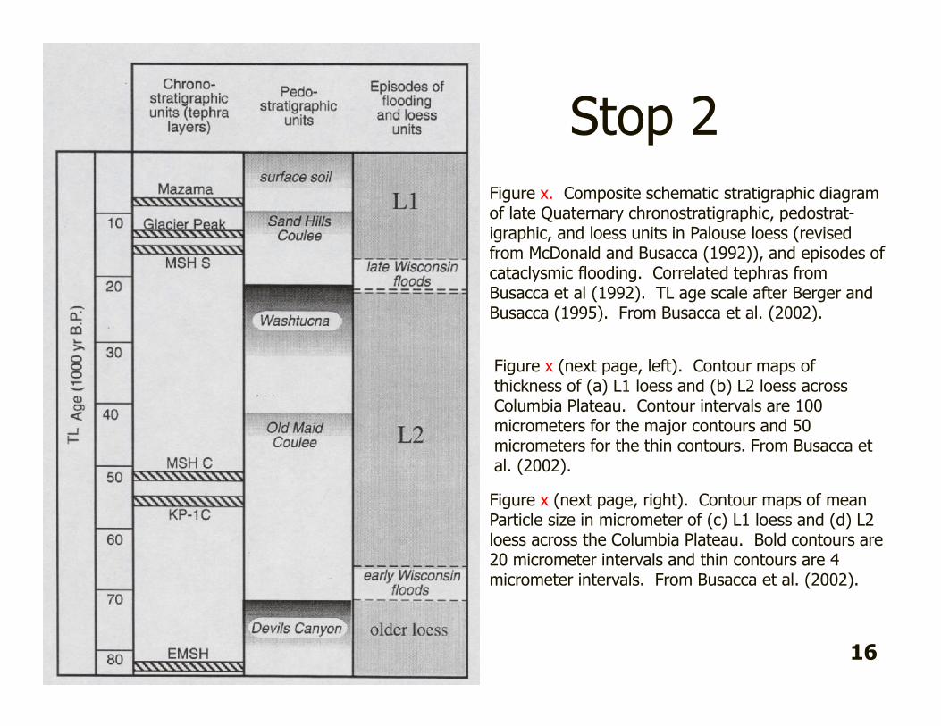
Figure x. Composite schematic stratigraphic diagramof late Quaternary chronostratigraphic, pedostrat-igraphic, and loess units in Palouse loess (revised from McDonald and Busacca (1992)), and episodes of cataclysmic flooding. Correlated tephras fromBusacca et al (1992). TL age scale after Berger andBusacca (1995). From Busacca et al. (2002).
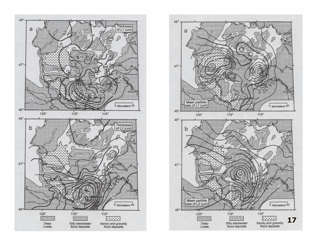
Figure x (next page, left). Contour maps of thickness of (a) L1 loess and (b) L2 loess across Columbia Plateau. Contour intervals are 100 micrometers for the major contours and 50 micrometers for the thin contours. From Busacca et al. (2002).
Figure x (next page, right). Contour maps of meanParticle size in micrometer of (c) L1 loess and (d) L2loess across the Columbia Plateau. Bold contours are20 micrometer intervals and thin contours are 4 micrometer intervals. From Busacca et al. (2002).

17

Enroute to Stop 3
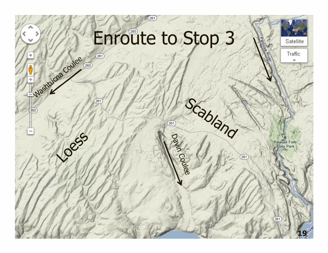
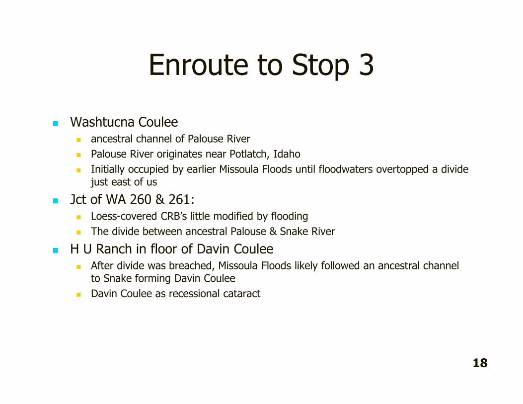
� Washtucna Coulee� ancestral channel of Palouse River
� Palouse River originates near Potlatch, Idaho
� Initially occupied by earlier Missoula Floods until floodwaters overtopped a divide just east of us
� Jct of WA 260 & 261:� Loess-covered CRB’s little modified by flooding
� The divide between ancestral Palouse & Snake River
� H U Ranch in floor of Davin Coulee � After divide was breached, Missoula Floods likely followed an ancestral channel
to Snake forming Davin Coulee
� Davin Coulee as recessional cataract
18
Enroute to Stop 3
19

Stop 3
3
20

Stop 3
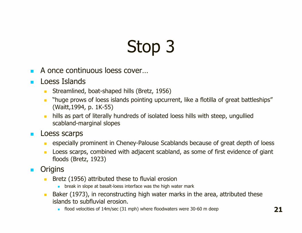
� A once continuous loess cover…
� Loess Islands � Streamlined, boat-shaped hills (Bretz, 1956)
� “huge prows of loess islands pointing upcurrent, like a flotilla of great battleships” (Waitt,1994, p. 1K-55)
� hills as part of literally hundreds of isolated loess hills with steep, ungulliedscabland-marginal slopes
� Loess scarps � especially prominent in Cheney-Palouse Scablands because of great depth of loess
� Loess scarps, combined with adjacent scabland, as some of first evidence of giant floods (Bretz, 1923)
� Origins� Bretz (1956) attributed these to fluvial erosion
� break in slope at basalt-loess interface was the high water mark
� Baker (1973), in reconstructing high water marks in the area, attributed these islands to subfluvial erosion.
� flood velocities of 14m/sec (31 mph) where floodwaters were 30-60 m deep 21

Stop 4—Palouse Falls
34
5 22

Stop 4
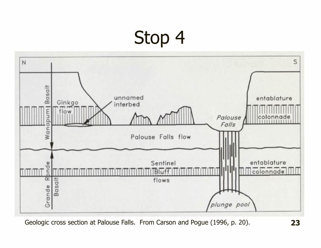
Geologic cross section at Palouse Falls. From Carson and Pogue (1996, p. 20). 23

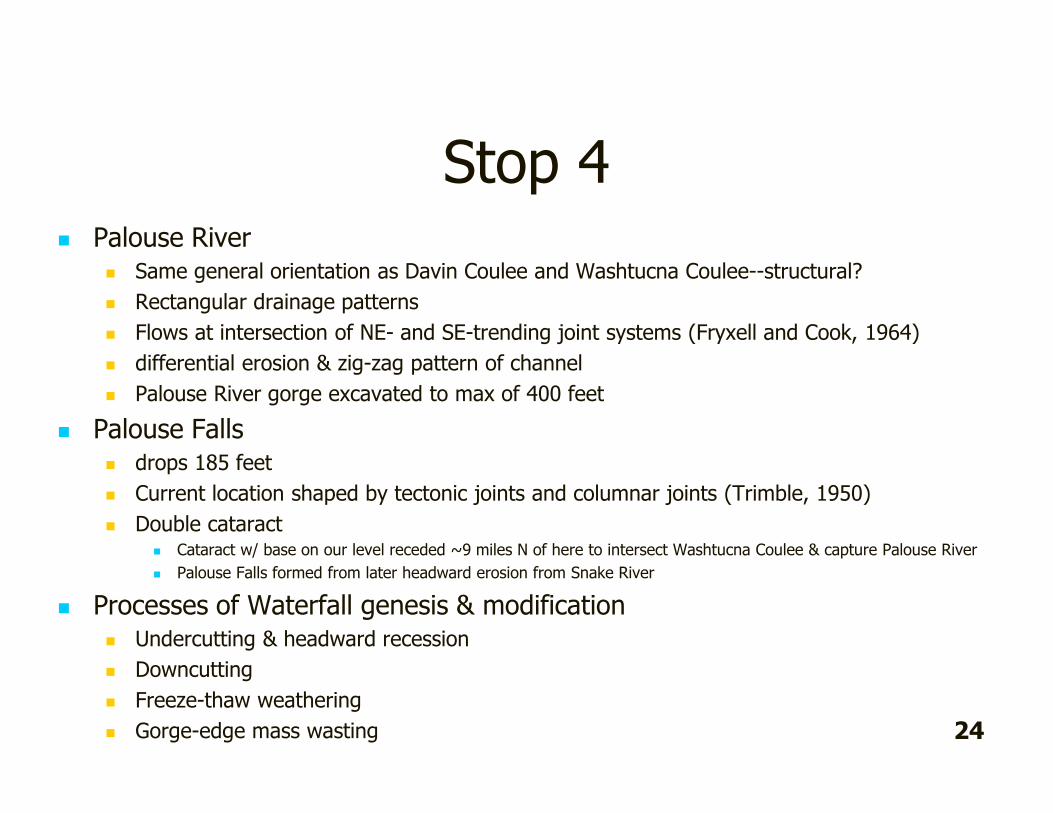
Stop 4� Palouse River
� Same general orientation as Davin Coulee and Washtucna Coulee--structural?
� Rectangular drainage patterns
� Flows at intersection of NE- and SE-trending joint systems (Fryxell and Cook, 1964)
� differential erosion & zig-zag pattern of channel
� Palouse River gorge excavated to max of 400 feet
� Palouse Falls� drops 185 feet
� Current location shaped by tectonic joints and columnar joints (Trimble, 1950)
� Double cataract� Cataract w/ base on our level receded ~9 miles N of here to intersect Washtucna Coulee & capture Palouse River
� Palouse Falls formed from later headward erosion from Snake River
� Processes of Waterfall genesis & modification� Undercutting & headward recession
� Downcutting
� Freeze-thaw weathering
� Gorge-edge mass wasting 24

Stop 5—Palouse-Snake River Jct.
5
25
ShoulderBar
Bar
No NameBar

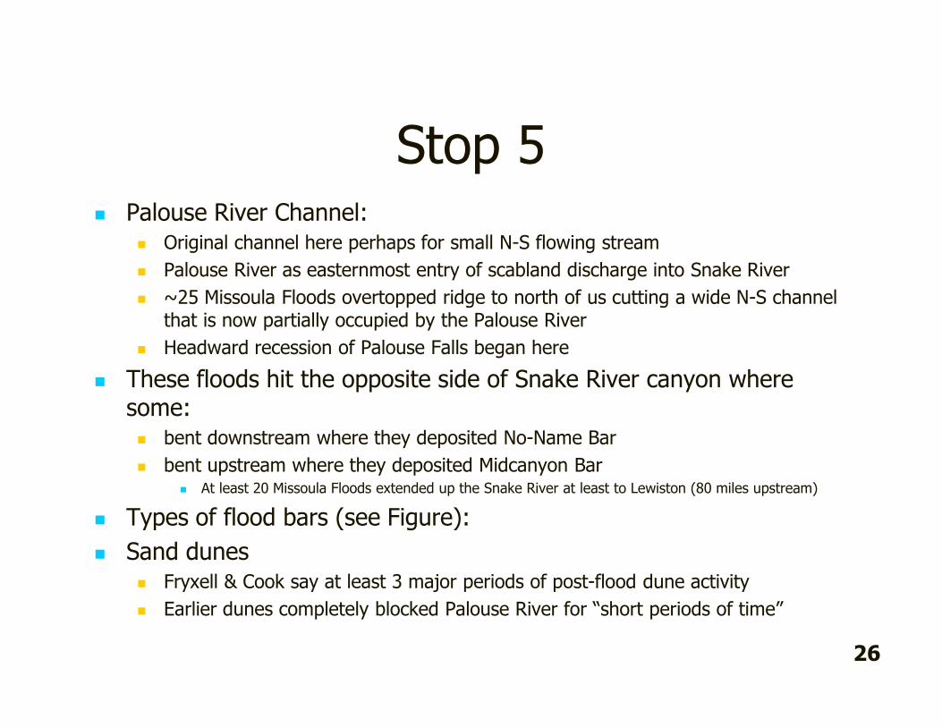
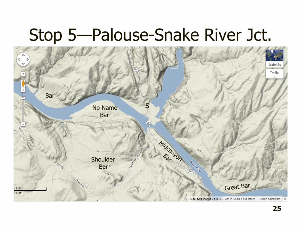
Stop 5� Palouse River Channel:
� Original channel here perhaps for small N-S flowing stream
� Palouse River as easternmost entry of scabland discharge into Snake River
� ~25 Missoula Floods overtopped ridge to north of us cutting a wide N-S channel that is now partially occupied by the Palouse River
� Headward recession of Palouse Falls began here
� These floods hit the opposite side of Snake River canyon where some:� bent downstream where they deposited No-Name Bar
� bent upstream where they deposited Midcanyon Bar� At least 20 Missoula Floods extended up the Snake River at least to Lewiston (80 miles upstream)
� Types of flood bars (see Figure):
� Sand dunes� Fryxell & Cook say at least 3 major periods of post-flood dune activity
� Earlier dunes completely blocked Palouse River for “short periods of time”
26

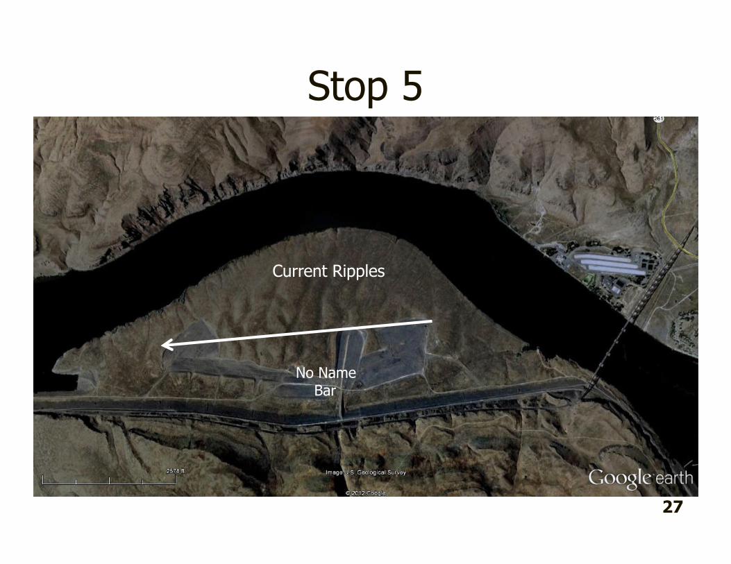
Stop 5
No NameBar
Current Ripples
27
Enroute to Stop 6
� Midcanyon Bar. � Giant current ripples spaced about 225 feet, crest to crest. This is much less
than the spacing of current ripples on Shoulder Bar which is also much higher. Waitt (1994) suggests that this indicates that Midcanyon Bar was last shaped by relatively shallow (and lower velocity) floods
� Asymmetry of ripples suggests they were created by upvalley flows
� Great Bar� Foreset bedding in bar on north side of Snake River dips steeply upvalley
suggesting that high velocity flows moving upstream constructed the feature.
� Bar at mouth of Tucannon River Valley� Foreset bedding here also suggests high velocity flows moving upstream
28

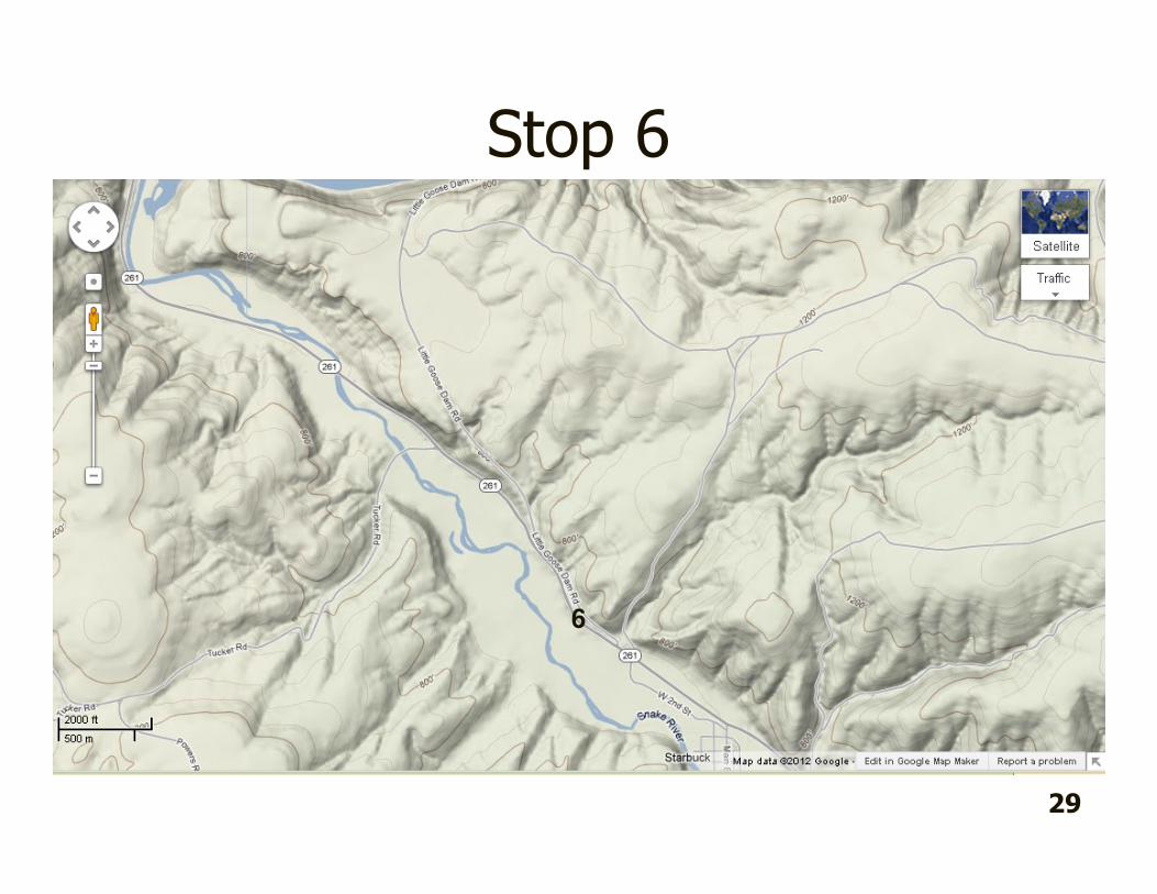
Stop 6
29
6

Stop 6
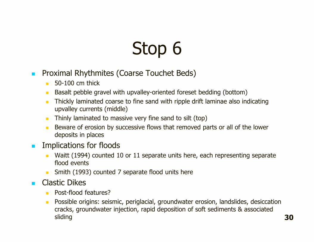
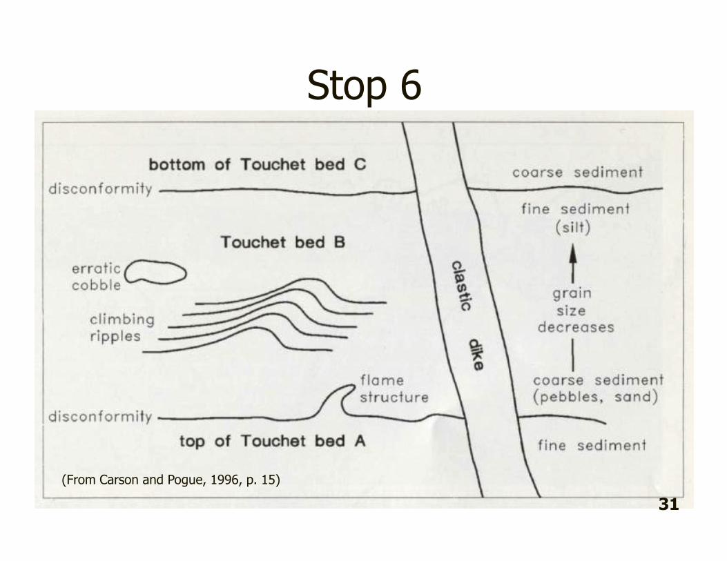
� Proximal Rhythmites (Coarse Touchet Beds)� 50-100 cm thick
� Basalt pebble gravel with upvalley-oriented foreset bedding (bottom)
� Thickly laminated coarse to fine sand with ripple drift laminae also indicating upvalley currents (middle)
� Thinly laminated to massive very fine sand to silt (top)
� Beware of erosion by successive flows that removed parts or all of the lower deposits in places
� Implications for floods� Waitt (1994) counted 10 or 11 separate units here, each representing separate
flood events
� Smith (1993) counted 7 separate flood units here
� Clastic Dikes� Post-flood features?
� Possible origins: seismic, periglacial, groundwater erosion, landslides, desiccation cracks, groundwater injection, rapid deposition of soft sediments & associated sliding 30

Stop 6
(From Carson and Pogue, 1996, p. 15)
31

7
Enroute to Stop 7
32
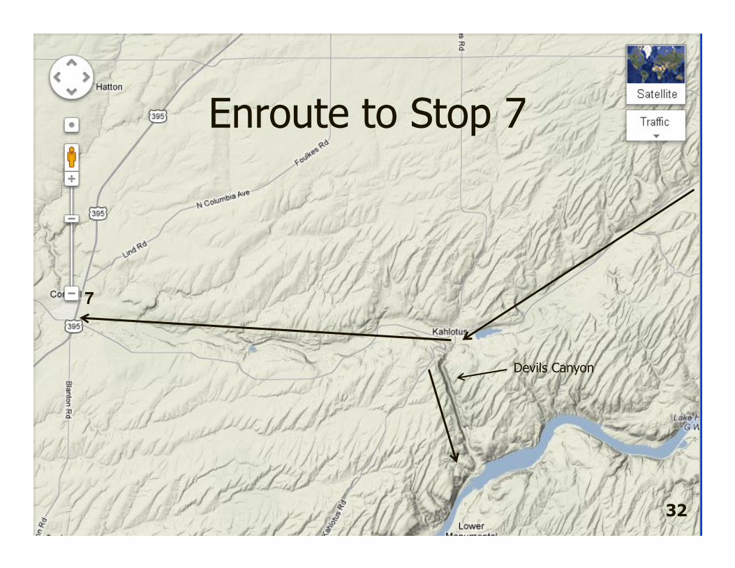
Devils Canyon

Enroute to Stop 7
� Washtucna Coulee � ancestral channel of Palouse River in its path to Pasco Basin
� Early Missoula Flood path to Pasco Basin prior to topping divide
� Huge gravel bars present throughout its length
� Lake Kahlotus (also known as Washtucna Lake) occupies a scour depression in bottom of Washtucna Coulee just N of Kahlotus
� Devil’s Canyon near here was 3rd place where Missoula Floods crossed divide between ancestral Palouse and Snake rivers.
33
Select References� Baker, 1973. Paleohydrology and sedimentology of Lake Missoula flooding in Eastern Washington: Geological Society
of America Special Paper 144, 79 p.
� Bretz, J.H. 1923. The channeled scablands of the Columbia Plateau. Journal of Geology 31: 617-649.
� Bretz, J H., H.T.U. Smith and G.E. Neff. 1956. Channeled Scabland of Washington: New data and interpretations. Geological Society of America Bulletin 67: 957-1049.
� Busacca, A.J., D.R. Gaylord and M.R. Sweeney. 2002. Paired Eolian Deposits and Megaflood Features, Columbia Plateau, Washington. Friends of the Pleistocene 10th Annual Pacific Northwest Cell Field Trip, 16-18 August.
� Carson, R.J. and K.R. Pogue. 1996. Flood Basalts and Glacier Floods: Roadside Geology of Parts of Walla Walla, Franklin, and Columbia Counties, Washington. Washington Division of Geology and Earth Resources Information Circular 90.
� Fryxell, R. and E.F. Cook. 1964. A Field Guide to the Loess Deposits and Channeled Scablands of the Palouse Area, Eastern Washington. Washington State University Laboratory of Anthropology Report of Investigations No. 27. 32 p.
� McDonald, E.V. and A.J. Busacca. 1988. Record of pre-late Wisconsin giant floods in the Channeled Scabland interpreted from loess deposits. Geology 16: 728-731.
� McDonald, E.V. and A.J. Busacca. 1989. Record of pre-late Wisconsin floods and of Late Wisconsin flood features in the Cheney-Palouse Scabland: Trip C. Pp. 337-346 in (N.L. Joseph, editor) Geologic Guidebook for Washington and Adjacent Areas. Washington Division of Geology and Earth Resources Information Circular 86.
� Patton, P.C. and V.R. Baker. 1978. Origin of the Cheney-Palouse Scabland Tract. Chapter 6 in The Channeled Scabland. A Guide to the Geomorphology of the Columbia Basin, Washington. NASA.
� Raisz, E. 1941. Landforms of the Northwestern States. Self-published map.
� Smith, G.A.1993. Missoula flood dynamics and magnitudes inferred from sedimentology of slack-water deposits on the Columbia Plateau, Washington. Geological Society of America Bulletin 105: 77-100.
� Trimble, D.E. 1950. Joint controlled channeling in the Columbia River Basalt. Northwest Science 24: 84-88.
� Waitt, R.B., 1994. Scores of gigantic, successively smaller Lake Missoula Floods Through Channeled Scabland and Columbia Valley. Pp. 1K 1-88 in D.A. Swanson and R.A. Haugerud, editors, Geologic Field Trips in the Pacific Northwest. Geological Society of America Annual Meeting.
34

Cheney-Palouse-Snake Scablands
Field Trip
Field Trip Leaders:
Karl Lillquist, Geography Department, CWU
Nick Zentner, Geology Department, CWU
Ice Age Floods Institute—Ellensburg Chapter
Sunday 15 April 2012

Itinerary & Overview8:00am Depart
9:45 Stop 1--Restroom Stop, Hattan Coulee Rest Area, Jct WA 26 & US 395
10:00 Depart
10:30 Stop 2--Palouse Loess Exposure, WA 26 west of Washtucna
11:00 Depart
11:30 Stop 3--Loess “Prows” , WA 261 near Palouse Falls
12:00 Depart
12:15 Stop 4--Palouse Falls
1:15pm Depart
1:30 Stop 5--Palouse River/Snake River Junction
2:00 Depart
2:30 Stop 6--Tucannon River Rythmites near Starbuck
3:00 Depart
4:00 Stop 7—Restroom Stop, Connell City Park, Jct. WA 260 & US 395
4:15 Depart
6:00 Arrive in Ellensburg
2

Our Highway Route…
1 2
34
5
7
3
6
Washington Highway Map
The Channelled Scablands
1 2
34
57
4
6

The Columbia Plateau and the areal extent of the Columbia River Basalt Group, the four major structural-tectonic subprovinces (the Yakima Fold Belt, Palouse, Blue Mountains, and Clearwater-Weiser embayments), the Pasco Basin, the Olympic-Wallowa lineament, and the CLEW, which is the central portion of the OWL that passes through the western part of the Columbia Plateau (Reidel & Campbell, 1989, p. 281). 5

6
Generalized map of major faults and folds along the western margin of the Columbia Plateau and Yakima Fold Belt (from Reidel & Campbell, 1989, p. 281).

7

Enroute to Stop 1 � Kittitas Basin as a:
� Complex down-fold (i.e., syncline) of Columbia River Basalt Group & part of Yakima Fold & Thrust Belt
� “depocenter” for alluvial fans
� Whiskey Dick as a:� Upfold (i.e., anticline) in CRB’s & YF&TB
� Key spot for wind power in the “Kittitas Breezeway”
� Impacted by Missoula Flood slackwater to 1263 ft
� Columbia Gorge� Operated pre-, syn-, & post-Missoula Floods
� Dunes east of Columbia River
� South Flanks of Frenchman Hills� Columbia Basin Irrigation Project
� Frenchman Hills as anticline
� Crab Creek to south in syncline & served as outlet of Crab Creek-Telford Scabland Tract
� Saddle Mountains to south as complex anticline
� Impacts of floods on Saddle Mountains8

Stop 1
1
9

Enroute to Stop 2
10
Enroute to Stop 2
� Agriculture� Note transition from irrigated to dryland (rainfed) agriculture
� Sand Hills Coulee Dunefield� Sand Hills Coulee as Pleistocene coulee incised into loess-covered CRB’s
� Sands derived from Miocene/Pliocene Ringold Fm
� Dunes as parabolic dunes anchored by vegetation
� late Pleistocene to Holocene in age (similar to most dunes on Columbia Plateau)
� main phase of dune movement on Columbia Plateau in mid-Holocene
� Like many other dune fields on plateau, these dunes have a SW to NE orientation but this is due here to the flood-created channel
� Agriculture� Conservation Reserve Program (CRP)
11

Stop 22
12

About Stop 2� Palouse Formation as loess “layer cake”
� Loess origins (see figure on page 15)
� Soil development� organics & darkening, B horizon reddening & carbonate translocation &
cementation of B horizons
� Accreting surfaces over time
� Evidence of flooding in Cheney-Palouse Scablands:� Faint channels/coulees adjacent
� Unconformities
� Erratics atop some unconformities
� Ripped up petrocalcic horizons
� Sheet sand
� At least 7 episodes of flooding:� 5 episodes of floods since 780,000 yr BP (normally magnetized)
� 1 or 2 episodes of floods before 780,000 yr BP (reversely magnetized)
�
13

Generalized map (modified from Patton and Baker, 1978) of Cheney-Palouse scabland tract. Stippled pattern shows areas of deep loess cover. Ignore numbers on map. Letters indicate towns: B = Benge, M = Moses Lake, R = Ritzville, Ro = Rosalia, W = Washtucna. Arrows show major pathways of floods through scabland. Cordilleran icesheet in inset map is shown at its Late Pleistocene maximum. From McDonald and Busacca(1989).
14

Stop 2
Stratigraphy of Washtucna-9 exposure (SW ¼, S. 14, T. 15N, R. 35 E., WM). View toNorth. Line and stipple pattern marks approximate position of prominent calicium-rich B horizons of paleosols. Dashed lines are tephras. Those that are correlated are M, Mazama (6800 14C yr BP), MSH C = Mount St. Helens set C (36,000 14C yr BP). Heavy lines are flood-cut unconformities and are labeled alphabetically (A-F) interpreted to have been formed by pre-last glacial episodes of giant floods. Source: Busacca et al, 2002.
15

Stop 2
16
Figure x. Composite schematic stratigraphic diagramof late Quaternary chronostratigraphic, pedostrat-igraphic, and loess units in Palouse loess (revised from McDonald and Busacca (1992)), and episodes of cataclysmic flooding. Correlated tephras fromBusacca et al (1992). TL age scale after Berger andBusacca (1995). From Busacca et al. (2002).
Figure x (next page, left). Contour maps of thickness of (a) L1 loess and (b) L2 loess across Columbia Plateau. Contour intervals are 100 micrometers for the major contours and 50 micrometers for the thin contours. From Busacca et al. (2002).
Figure x (next page, right). Contour maps of meanParticle size in micrometer of (c) L1 loess and (d) L2loess across the Columbia Plateau. Bold contours are20 micrometer intervals and thin contours are 4 micrometer intervals. From Busacca et al. (2002).

17

Enroute to Stop 3
� Washtucna Coulee� ancestral channel of Palouse River
� Palouse River originates near Potlatch, Idaho
� Initially occupied by earlier Missoula Floods until floodwaters overtopped a divide just east of us
� Jct of WA 260 & 261:� Loess-covered CRB’s little modified by flooding
� The divide between ancestral Palouse & Snake River
� H U Ranch in floor of Davin Coulee � After divide was breached, Missoula Floods likely followed an ancestral channel
to Snake forming Davin Coulee
� Davin Coulee as recessional cataract
18

Enroute to Stop 3
19

Stop 3
3
20

Stop 3
� A once continuous loess cover…
� Loess Islands � Streamlined, boat-shaped hills (Bretz, 1956)
� “huge prows of loess islands pointing upcurrent, like a flotilla of great battleships” (Waitt,1994, p. 1K-55)
� hills as part of literally hundreds of isolated loess hills with steep, ungulliedscabland-marginal slopes
� Loess scarps � especially prominent in Cheney-Palouse Scablands because of great depth of loess
� Loess scarps, combined with adjacent scabland, as some of first evidence of giant floods (Bretz, 1923)
� Origins� Bretz (1956) attributed these to fluvial erosion
� break in slope at basalt-loess interface was the high water mark
� Baker (1973), in reconstructing high water marks in the area, attributed these islands to subfluvial erosion.
� flood velocities of 14m/sec (31 mph) where floodwaters were 30-60 m deep 21

Stop 4—Palouse Falls
34
5 22

Stop 4
Geologic cross section at Palouse Falls. From Carson and Pogue (1996, p. 20). 23

Stop 4� Palouse River
� Same general orientation as Davin Coulee and Washtucna Coulee--structural?
� Rectangular drainage patterns
� Flows at intersection of NE- and SE-trending joint systems (Fryxell and Cook, 1964)
� differential erosion & zig-zag pattern of channel
� Palouse River gorge excavated to max of 400 feet
� Palouse Falls� drops 185 feet
� Current location shaped by tectonic joints and columnar joints (Trimble, 1950)
� Double cataract� Cataract w/ base on our level receded ~9 miles N of here to intersect Washtucna Coulee & capture Palouse River
� Palouse Falls formed from later headward erosion from Snake River
� Processes of Waterfall genesis & modification� Undercutting & headward recession
� Downcutting
� Freeze-thaw weathering
� Gorge-edge mass wasting 24

Stop 5—Palouse-Snake River Jct.
5
25
ShoulderBar
Bar
No NameBar
Stop 5� Palouse River Channel:
� Original channel here perhaps for small N-S flowing stream
� Palouse River as easternmost entry of scabland discharge into Snake River
� ~25 Missoula Floods overtopped ridge to north of us cutting a wide N-S channel that is now partially occupied by the Palouse River
� Headward recession of Palouse Falls began here
� These floods hit the opposite side of Snake River canyon where some:� bent downstream where they deposited No-Name Bar
� bent upstream where they deposited Midcanyon Bar� At least 20 Missoula Floods extended up the Snake River at least to Lewiston (80 miles upstream)
� Types of flood bars (see Figure):
� Sand dunes� Fryxell & Cook say at least 3 major periods of post-flood dune activity
� Earlier dunes completely blocked Palouse River for “short periods of time”
26

Stop 5
No NameBar
Current Ripples
27

Enroute to Stop 6
� Midcanyon Bar. � Giant current ripples spaced about 225 feet, crest to crest. This is much less
than the spacing of current ripples on Shoulder Bar which is also much higher. Waitt (1994) suggests that this indicates that Midcanyon Bar was last shaped by relatively shallow (and lower velocity) floods
� Asymmetry of ripples suggests they were created by upvalley flows
� Great Bar� Foreset bedding in bar on north side of Snake River dips steeply upvalley
suggesting that high velocity flows moving upstream constructed the feature.
� Bar at mouth of Tucannon River Valley� Foreset bedding here also suggests high velocity flows moving upstream
28

Stop 6
29
6
Stop 6
� Proximal Rhythmites (Coarse Touchet Beds)� 50-100 cm thick
� Basalt pebble gravel with upvalley-oriented foreset bedding (bottom)
� Thickly laminated coarse to fine sand with ripple drift laminae also indicating upvalley currents (middle)
� Thinly laminated to massive very fine sand to silt (top)
� Beware of erosion by successive flows that removed parts or all of the lower deposits in places
� Implications for floods� Waitt (1994) counted 10 or 11 separate units here, each representing separate
flood events
� Smith (1993) counted 7 separate flood units here
� Clastic Dikes� Post-flood features?
� Possible origins: seismic, periglacial, groundwater erosion, landslides, desiccation cracks, groundwater injection, rapid deposition of soft sediments & associated sliding 30

Stop 6
(From Carson and Pogue, 1996, p. 15)
31
7
Enroute to Stop 7
32
Devils Canyon
Enroute to Stop 7
� Washtucna Coulee � ancestral channel of Palouse River in its path to Pasco Basin
� Early Missoula Flood path to Pasco Basin prior to topping divide
� Huge gravel bars present throughout its length
� Lake Kahlotus (also known as Washtucna Lake) occupies a scour depression in bottom of Washtucna Coulee just N of Kahlotus
� Devil’s Canyon near here was 3rd place where Missoula Floods crossed divide between ancestral Palouse and Snake rivers.
33

Select References� Baker, 1973. Paleohydrology and sedimentology of Lake Missoula flooding in Eastern Washington: Geological Society
of America Special Paper 144, 79 p.
� Bretz, J.H. 1923. The channeled scablands of the Columbia Plateau. Journal of Geology 31: 617-649.
� Bretz, J H., H.T.U. Smith and G.E. Neff. 1956. Channeled Scabland of Washington: New data and interpretations. Geological Society of America Bulletin 67: 957-1049.
� Busacca, A.J., D.R. Gaylord and M.R. Sweeney. 2002. Paired Eolian Deposits and Megaflood Features, Columbia Plateau, Washington. Friends of the Pleistocene 10th Annual Pacific Northwest Cell Field Trip, 16-18 August.
� Carson, R.J. and K.R. Pogue. 1996. Flood Basalts and Glacier Floods: Roadside Geology of Parts of Walla Walla, Franklin, and Columbia Counties, Washington. Washington Division of Geology and Earth Resources Information Circular 90.
� Fryxell, R. and E.F. Cook. 1964. A Field Guide to the Loess Deposits and Channeled Scablands of the Palouse Area, Eastern Washington. Washington State University Laboratory of Anthropology Report of Investigations No. 27. 32 p.
� McDonald, E.V. and A.J. Busacca. 1988. Record of pre-late Wisconsin giant floods in the Channeled Scabland interpreted from loess deposits. Geology 16: 728-731.
� McDonald, E.V. and A.J. Busacca. 1989. Record of pre-late Wisconsin floods and of Late Wisconsin flood features in the Cheney-Palouse Scabland: Trip C. Pp. 337-346 in (N.L. Joseph, editor) Geologic Guidebook for Washington and Adjacent Areas. Washington Division of Geology and Earth Resources Information Circular 86.
� Patton, P.C. and V.R. Baker. 1978. Origin of the Cheney-Palouse Scabland Tract. Chapter 6 in The Channeled Scabland. A Guide to the Geomorphology of the Columbia Basin, Washington. NASA.
� Raisz, E. 1941. Landforms of the Northwestern States. Self-published map.
� Smith, G.A.1993. Missoula flood dynamics and magnitudes inferred from sedimentology of slack-water deposits on the Columbia Plateau, Washington. Geological Society of America Bulletin 105: 77-100.
� Trimble, D.E. 1950. Joint controlled channeling in the Columbia River Basalt. Northwest Science 24: 84-88.
� Waitt, R.B., 1994. Scores of gigantic, successively smaller Lake Missoula Floods Through Channeled Scabland and Columbia Valley. Pp. 1K 1-88 in D.A. Swanson and R.A. Haugerud, editors, Geologic Field Trips in the Pacific Northwest. Geological Society of America Annual Meeting.
34
Cheney-Palouse-Snake Scablands
Field Trip
Field Trip Leaders:
Karl Lillquist, Geography Department, CWU
Nick Zentner, Geology Department, CWU
Ice Age Floods Institute—Ellensburg Chapter
Sunday 15 April 2012

Itinerary & Overview8:00am Depart
9:45 Stop 1--Restroom Stop, Hattan Coulee Rest Area, Jct WA 26 & US 395
10:00 Depart
10:30 Stop 2--Palouse Loess Exposure, WA 26 west of Washtucna
11:00 Depart
11:30 Stop 3--Loess “Prows” , WA 261 near Palouse Falls
12:00 Depart
12:15 Stop 4--Palouse Falls
1:15pm Depart
1:30 Stop 5--Palouse River/Snake River Junction
2:00 Depart
2:30 Stop 6--Tucannon River Rythmites near Starbuck
3:00 Depart
4:00 Stop 7—Restroom Stop, Connell City Park, Jct. WA 260 & US 395
4:15 Depart
6:00 Arrive in Ellensburg
2

Our Highway Route…
1 2
34
5
7
3
6
Washington Highway Map

The Channelled Scablands
1 2
34
57
4
6

The Columbia Plateau and the areal extent of the Columbia River Basalt Group, the four major structural-tectonic subprovinces (the Yakima Fold Belt, Palouse, Blue Mountains, and Clearwater-Weiser embayments), the Pasco Basin, the Olympic-Wallowa lineament, and the CLEW, which is the central portion of the OWL that passes through the western part of the Columbia Plateau (Reidel & Campbell, 1989, p. 281). 5
6
Generalized map of major faults and folds along the western margin of the Columbia Plateau and Yakima Fold Belt (from Reidel & Campbell, 1989, p. 281).
7

Enroute to Stop 1 � Kittitas Basin as a:
� Complex down-fold (i.e., syncline) of Columbia River Basalt Group & part of Yakima Fold & Thrust Belt
� “depocenter” for alluvial fans
� Whiskey Dick as a:� Upfold (i.e., anticline) in CRB’s & YF&TB
� Key spot for wind power in the “Kittitas Breezeway”
� Impacted by Missoula Flood slackwater to 1263 ft
� Columbia Gorge� Operated pre-, syn-, & post-Missoula Floods
� Dunes east of Columbia River
� South Flanks of Frenchman Hills� Columbia Basin Irrigation Project
� Frenchman Hills as anticline
� Crab Creek to south in syncline & served as outlet of Crab Creek-Telford Scabland Tract
� Saddle Mountains to south as complex anticline
� Impacts of floods on Saddle Mountains8

Stop 1
1
9

Enroute to Stop 2
10

Enroute to Stop 2
� Agriculture� Note transition from irrigated to dryland (rainfed) agriculture
� Sand Hills Coulee Dunefield� Sand Hills Coulee as Pleistocene coulee incised into loess-covered CRB’s
� Sands derived from Miocene/Pliocene Ringold Fm
� Dunes as parabolic dunes anchored by vegetation
� late Pleistocene to Holocene in age (similar to most dunes on Columbia Plateau)
� main phase of dune movement on Columbia Plateau in mid-Holocene
� Like many other dune fields on plateau, these dunes have a SW to NE orientation but this is due here to the flood-created channel
� Agriculture� Conservation Reserve Program (CRP)
11

Stop 22
12

About Stop 2� Palouse Formation as loess “layer cake”
� Loess origins (see figure on page 15)
� Soil development� organics & darkening, B horizon reddening & carbonate translocation &
cementation of B horizons
� Accreting surfaces over time
� Evidence of flooding in Cheney-Palouse Scablands:� Faint channels/coulees adjacent
� Unconformities
� Erratics atop some unconformities
� Ripped up petrocalcic horizons
� Sheet sand
� At least 7 episodes of flooding:� 5 episodes of floods since 780,000 yr BP (normally magnetized)
� 1 or 2 episodes of floods before 780,000 yr BP (reversely magnetized)
�
13
Generalized map (modified from Patton and Baker, 1978) of Cheney-Palouse scabland tract. Stippled pattern shows areas of deep loess cover. Ignore numbers on map. Letters indicate towns: B = Benge, M = Moses Lake, R = Ritzville, Ro = Rosalia, W = Washtucna. Arrows show major pathways of floods through scabland. Cordilleran icesheet in inset map is shown at its Late Pleistocene maximum. From McDonald and Busacca(1989).
14

Stop 2
Stratigraphy of Washtucna-9 exposure (SW ¼, S. 14, T. 15N, R. 35 E., WM). View toNorth. Line and stipple pattern marks approximate position of prominent calicium-rich B horizons of paleosols. Dashed lines are tephras. Those that are correlated are M, Mazama (6800 14C yr BP), MSH C = Mount St. Helens set C (36,000 14C yr BP). Heavy lines are flood-cut unconformities and are labeled alphabetically (A-F) interpreted to have been formed by pre-last glacial episodes of giant floods. Source: Busacca et al, 2002.
15

Stop 2
16
Figure x. Composite schematic stratigraphic diagramof late Quaternary chronostratigraphic, pedostrat-igraphic, and loess units in Palouse loess (revised from McDonald and Busacca (1992)), and episodes of cataclysmic flooding. Correlated tephras fromBusacca et al (1992). TL age scale after Berger andBusacca (1995). From Busacca et al. (2002).
Figure x (next page, left). Contour maps of thickness of (a) L1 loess and (b) L2 loess across Columbia Plateau. Contour intervals are 100 micrometers for the major contours and 50 micrometers for the thin contours. From Busacca et al. (2002).
Figure x (next page, right). Contour maps of meanParticle size in micrometer of (c) L1 loess and (d) L2loess across the Columbia Plateau. Bold contours are20 micrometer intervals and thin contours are 4 micrometer intervals. From Busacca et al. (2002).
17

Enroute to Stop 3
� Washtucna Coulee� ancestral channel of Palouse River
� Palouse River originates near Potlatch, Idaho
� Initially occupied by earlier Missoula Floods until floodwaters overtopped a divide just east of us
� Jct of WA 260 & 261:� Loess-covered CRB’s little modified by flooding
� The divide between ancestral Palouse & Snake River
� H U Ranch in floor of Davin Coulee � After divide was breached, Missoula Floods likely followed an ancestral channel
to Snake forming Davin Coulee
� Davin Coulee as recessional cataract
18

Enroute to Stop 3
19

Stop 3
3
20
Stop 3
� A once continuous loess cover…
� Loess Islands � Streamlined, boat-shaped hills (Bretz, 1956)
� “huge prows of loess islands pointing upcurrent, like a flotilla of great battleships” (Waitt,1994, p. 1K-55)
� hills as part of literally hundreds of isolated loess hills with steep, ungulliedscabland-marginal slopes
� Loess scarps � especially prominent in Cheney-Palouse Scablands because of great depth of loess
� Loess scarps, combined with adjacent scabland, as some of first evidence of giant floods (Bretz, 1923)
� Origins� Bretz (1956) attributed these to fluvial erosion
� break in slope at basalt-loess interface was the high water mark
� Baker (1973), in reconstructing high water marks in the area, attributed these islands to subfluvial erosion.
� flood velocities of 14m/sec (31 mph) where floodwaters were 30-60 m deep 21

Stop 4—Palouse Falls
34
5 22

Stop 4
Geologic cross section at Palouse Falls. From Carson and Pogue (1996, p. 20). 23
Stop 4� Palouse River
� Same general orientation as Davin Coulee and Washtucna Coulee--structural?
� Rectangular drainage patterns
� Flows at intersection of NE- and SE-trending joint systems (Fryxell and Cook, 1964)
� differential erosion & zig-zag pattern of channel
� Palouse River gorge excavated to max of 400 feet
� Palouse Falls� drops 185 feet
� Current location shaped by tectonic joints and columnar joints (Trimble, 1950)
� Double cataract� Cataract w/ base on our level receded ~9 miles N of here to intersect Washtucna Coulee & capture Palouse River
� Palouse Falls formed from later headward erosion from Snake River
� Processes of Waterfall genesis & modification� Undercutting & headward recession
� Downcutting
� Freeze-thaw weathering
� Gorge-edge mass wasting 24
Stop 5—Palouse-Snake River Jct.
5
25
ShoulderBar
Bar
No NameBar

Stop 5� Palouse River Channel:
� Original channel here perhaps for small N-S flowing stream
� Palouse River as easternmost entry of scabland discharge into Snake River
� ~25 Missoula Floods overtopped ridge to north of us cutting a wide N-S channel that is now partially occupied by the Palouse River
� Headward recession of Palouse Falls began here
� These floods hit the opposite side of Snake River canyon where some:� bent downstream where they deposited No-Name Bar
� bent upstream where they deposited Midcanyon Bar� At least 20 Missoula Floods extended up the Snake River at least to Lewiston (80 miles upstream)
� Types of flood bars (see Figure):
� Sand dunes� Fryxell & Cook say at least 3 major periods of post-flood dune activity
� Earlier dunes completely blocked Palouse River for “short periods of time”
26

Stop 5
No NameBar
Current Ripples
27

Enroute to Stop 6
� Midcanyon Bar. � Giant current ripples spaced about 225 feet, crest to crest. This is much less
than the spacing of current ripples on Shoulder Bar which is also much higher. Waitt (1994) suggests that this indicates that Midcanyon Bar was last shaped by relatively shallow (and lower velocity) floods
� Asymmetry of ripples suggests they were created by upvalley flows
� Great Bar� Foreset bedding in bar on north side of Snake River dips steeply upvalley
suggesting that high velocity flows moving upstream constructed the feature.
� Bar at mouth of Tucannon River Valley� Foreset bedding here also suggests high velocity flows moving upstream
28

Stop 6
29
6

Stop 6
� Proximal Rhythmites (Coarse Touchet Beds)� 50-100 cm thick
� Basalt pebble gravel with upvalley-oriented foreset bedding (bottom)
� Thickly laminated coarse to fine sand with ripple drift laminae also indicating upvalley currents (middle)
� Thinly laminated to massive very fine sand to silt (top)
� Beware of erosion by successive flows that removed parts or all of the lower deposits in places
� Implications for floods� Waitt (1994) counted 10 or 11 separate units here, each representing separate
flood events
� Smith (1993) counted 7 separate flood units here
� Clastic Dikes� Post-flood features?
� Possible origins: seismic, periglacial, groundwater erosion, landslides, desiccation cracks, groundwater injection, rapid deposition of soft sediments & associated sliding 30

Stop 6
(From Carson and Pogue, 1996, p. 15)
31

7
Enroute to Stop 7
32
Devils Canyon

Enroute to Stop 7
� Washtucna Coulee � ancestral channel of Palouse River in its path to Pasco Basin
� Early Missoula Flood path to Pasco Basin prior to topping divide
� Huge gravel bars present throughout its length
� Lake Kahlotus (also known as Washtucna Lake) occupies a scour depression in bottom of Washtucna Coulee just N of Kahlotus
� Devil’s Canyon near here was 3rd place where Missoula Floods crossed divide between ancestral Palouse and Snake rivers.
33

Select References� Baker, 1973. Paleohydrology and sedimentology of Lake Missoula flooding in Eastern Washington: Geological Society
of America Special Paper 144, 79 p.
� Bretz, J.H. 1923. The channeled scablands of the Columbia Plateau. Journal of Geology 31: 617-649.
� Bretz, J H., H.T.U. Smith and G.E. Neff. 1956. Channeled Scabland of Washington: New data and interpretations. Geological Society of America Bulletin 67: 957-1049.
� Busacca, A.J., D.R. Gaylord and M.R. Sweeney. 2002. Paired Eolian Deposits and Megaflood Features, Columbia Plateau, Washington. Friends of the Pleistocene 10th Annual Pacific Northwest Cell Field Trip, 16-18 August.
� Carson, R.J. and K.R. Pogue. 1996. Flood Basalts and Glacier Floods: Roadside Geology of Parts of Walla Walla, Franklin, and Columbia Counties, Washington. Washington Division of Geology and Earth Resources Information Circular 90.
� Fryxell, R. and E.F. Cook. 1964. A Field Guide to the Loess Deposits and Channeled Scablands of the Palouse Area, Eastern Washington. Washington State University Laboratory of Anthropology Report of Investigations No. 27. 32 p.
� McDonald, E.V. and A.J. Busacca. 1988. Record of pre-late Wisconsin giant floods in the Channeled Scabland interpreted from loess deposits. Geology 16: 728-731.
� McDonald, E.V. and A.J. Busacca. 1989. Record of pre-late Wisconsin floods and of Late Wisconsin flood features in the Cheney-Palouse Scabland: Trip C. Pp. 337-346 in (N.L. Joseph, editor) Geologic Guidebook for Washington and Adjacent Areas. Washington Division of Geology and Earth Resources Information Circular 86.
� Patton, P.C. and V.R. Baker. 1978. Origin of the Cheney-Palouse Scabland Tract. Chapter 6 in The Channeled Scabland. A Guide to the Geomorphology of the Columbia Basin, Washington. NASA.
� Raisz, E. 1941. Landforms of the Northwestern States. Self-published map.
� Smith, G.A.1993. Missoula flood dynamics and magnitudes inferred from sedimentology of slack-water deposits on the Columbia Plateau, Washington. Geological Society of America Bulletin 105: 77-100.
� Trimble, D.E. 1950. Joint controlled channeling in the Columbia River Basalt. Northwest Science 24: 84-88.
� Waitt, R.B., 1994. Scores of gigantic, successively smaller Lake Missoula Floods Through Channeled Scabland and Columbia Valley. Pp. 1K 1-88 in D.A. Swanson and R.A. Haugerud, editors, Geologic Field Trips in the Pacific Northwest. Geological Society of America Annual Meeting.
34

Cheney-Palouse-Snake Scablands
Field Trip
Field Trip Leaders:
Karl Lillquist, Geography Department, CWU
Nick Zentner, Geology Department, CWU
Ice Age Floods Institute—Ellensburg Chapter
Sunday 15 April 2012

Itinerary & Overview8:00am Depart
9:45 Stop 1--Restroom Stop, Hattan Coulee Rest Area, Jct WA 26 & US 395
10:00 Depart
10:30 Stop 2--Palouse Loess Exposure, WA 26 west of Washtucna
11:00 Depart
11:30 Stop 3--Loess “Prows” , WA 261 near Palouse Falls
12:00 Depart
12:15 Stop 4--Palouse Falls
1:15pm Depart
1:30 Stop 5--Palouse River/Snake River Junction
2:00 Depart
2:30 Stop 6--Tucannon River Rythmites near Starbuck
3:00 Depart
4:00 Stop 7—Restroom Stop, Connell City Park, Jct. WA 260 & US 395
4:15 Depart
6:00 Arrive in Ellensburg
2
Our Highway Route…
1 2
34
5
7
3
6
Washington Highway Map

The Channelled Scablands
1 2
34
57
4
6
The Columbia Plateau and the areal extent of the Columbia River Basalt Group, the four major structural-tectonic subprovinces (the Yakima Fold Belt, Palouse, Blue Mountains, and Clearwater-Weiser embayments), the Pasco Basin, the Olympic-Wallowa lineament, and the CLEW, which is the central portion of the OWL that passes through the western part of the Columbia Plateau (Reidel & Campbell, 1989, p. 281). 5

6
Generalized map of major faults and folds along the western margin of the Columbia Plateau and Yakima Fold Belt (from Reidel & Campbell, 1989, p. 281).

7

Enroute to Stop 1 � Kittitas Basin as a:
� Complex down-fold (i.e., syncline) of Columbia River Basalt Group & part of Yakima Fold & Thrust Belt
� “depocenter” for alluvial fans
� Whiskey Dick as a:� Upfold (i.e., anticline) in CRB’s & YF&TB
� Key spot for wind power in the “Kittitas Breezeway”
� Impacted by Missoula Flood slackwater to 1263 ft
� Columbia Gorge� Operated pre-, syn-, & post-Missoula Floods
� Dunes east of Columbia River
� South Flanks of Frenchman Hills� Columbia Basin Irrigation Project
� Frenchman Hills as anticline
� Crab Creek to south in syncline & served as outlet of Crab Creek-Telford Scabland Tract
� Saddle Mountains to south as complex anticline
� Impacts of floods on Saddle Mountains8
Stop 1
1
9

Enroute to Stop 2
10

Enroute to Stop 2
� Agriculture� Note transition from irrigated to dryland (rainfed) agriculture
� Sand Hills Coulee Dunefield� Sand Hills Coulee as Pleistocene coulee incised into loess-covered CRB’s
� Sands derived from Miocene/Pliocene Ringold Fm
� Dunes as parabolic dunes anchored by vegetation
� late Pleistocene to Holocene in age (similar to most dunes on Columbia Plateau)
� main phase of dune movement on Columbia Plateau in mid-Holocene
� Like many other dune fields on plateau, these dunes have a SW to NE orientation but this is due here to the flood-created channel
� Agriculture� Conservation Reserve Program (CRP)
11

Stop 22
12

About Stop 2� Palouse Formation as loess “layer cake”
� Loess origins (see figure on page 15)
� Soil development� organics & darkening, B horizon reddening & carbonate translocation &
cementation of B horizons
� Accreting surfaces over time
� Evidence of flooding in Cheney-Palouse Scablands:� Faint channels/coulees adjacent
� Unconformities
� Erratics atop some unconformities
� Ripped up petrocalcic horizons
� Sheet sand
� At least 7 episodes of flooding:� 5 episodes of floods since 780,000 yr BP (normally magnetized)
� 1 or 2 episodes of floods before 780,000 yr BP (reversely magnetized)
�
13

Generalized map (modified from Patton and Baker, 1978) of Cheney-Palouse scabland tract. Stippled pattern shows areas of deep loess cover. Ignore numbers on map. Letters indicate towns: B = Benge, M = Moses Lake, R = Ritzville, Ro = Rosalia, W = Washtucna. Arrows show major pathways of floods through scabland. Cordilleran icesheet in inset map is shown at its Late Pleistocene maximum. From McDonald and Busacca(1989).
14

Stop 2
Stratigraphy of Washtucna-9 exposure (SW ¼, S. 14, T. 15N, R. 35 E., WM). View toNorth. Line and stipple pattern marks approximate position of prominent calicium-rich B horizons of paleosols. Dashed lines are tephras. Those that are correlated are M, Mazama (6800 14C yr BP), MSH C = Mount St. Helens set C (36,000 14C yr BP). Heavy lines are flood-cut unconformities and are labeled alphabetically (A-F) interpreted to have been formed by pre-last glacial episodes of giant floods. Source: Busacca et al, 2002.
15

Stop 2
16
Figure x. Composite schematic stratigraphic diagramof late Quaternary chronostratigraphic, pedostrat-igraphic, and loess units in Palouse loess (revised from McDonald and Busacca (1992)), and episodes of cataclysmic flooding. Correlated tephras fromBusacca et al (1992). TL age scale after Berger andBusacca (1995). From Busacca et al. (2002).
Figure x (next page, left). Contour maps of thickness of (a) L1 loess and (b) L2 loess across Columbia Plateau. Contour intervals are 100 micrometers for the major contours and 50 micrometers for the thin contours. From Busacca et al. (2002).
Figure x (next page, right). Contour maps of meanParticle size in micrometer of (c) L1 loess and (d) L2loess across the Columbia Plateau. Bold contours are20 micrometer intervals and thin contours are 4 micrometer intervals. From Busacca et al. (2002).

17
Enroute to Stop 3
� Washtucna Coulee� ancestral channel of Palouse River
� Palouse River originates near Potlatch, Idaho
� Initially occupied by earlier Missoula Floods until floodwaters overtopped a divide just east of us
� Jct of WA 260 & 261:� Loess-covered CRB’s little modified by flooding
� The divide between ancestral Palouse & Snake River
� H U Ranch in floor of Davin Coulee � After divide was breached, Missoula Floods likely followed an ancestral channel
to Snake forming Davin Coulee
� Davin Coulee as recessional cataract
18

Enroute to Stop 3
19

Stop 3
3
20

Stop 3
� A once continuous loess cover…
� Loess Islands � Streamlined, boat-shaped hills (Bretz, 1956)
� “huge prows of loess islands pointing upcurrent, like a flotilla of great battleships” (Waitt,1994, p. 1K-55)
� hills as part of literally hundreds of isolated loess hills with steep, ungulliedscabland-marginal slopes
� Loess scarps � especially prominent in Cheney-Palouse Scablands because of great depth of loess
� Loess scarps, combined with adjacent scabland, as some of first evidence of giant floods (Bretz, 1923)
� Origins� Bretz (1956) attributed these to fluvial erosion
� break in slope at basalt-loess interface was the high water mark
� Baker (1973), in reconstructing high water marks in the area, attributed these islands to subfluvial erosion.
� flood velocities of 14m/sec (31 mph) where floodwaters were 30-60 m deep 21

Stop 4—Palouse Falls
34
5 22
Stop 4
Geologic cross section at Palouse Falls. From Carson and Pogue (1996, p. 20). 23

Stop 4� Palouse River
� Same general orientation as Davin Coulee and Washtucna Coulee--structural?
� Rectangular drainage patterns
� Flows at intersection of NE- and SE-trending joint systems (Fryxell and Cook, 1964)
� differential erosion & zig-zag pattern of channel
� Palouse River gorge excavated to max of 400 feet
� Palouse Falls� drops 185 feet
� Current location shaped by tectonic joints and columnar joints (Trimble, 1950)
� Double cataract� Cataract w/ base on our level receded ~9 miles N of here to intersect Washtucna Coulee & capture Palouse River
� Palouse Falls formed from later headward erosion from Snake River
� Processes of Waterfall genesis & modification� Undercutting & headward recession
� Downcutting
� Freeze-thaw weathering
� Gorge-edge mass wasting 24

Stop 5—Palouse-Snake River Jct.
5
25
ShoulderBar
Bar
No NameBar

Stop 5� Palouse River Channel:
� Original channel here perhaps for small N-S flowing stream
� Palouse River as easternmost entry of scabland discharge into Snake River
� ~25 Missoula Floods overtopped ridge to north of us cutting a wide N-S channel that is now partially occupied by the Palouse River
� Headward recession of Palouse Falls began here
� These floods hit the opposite side of Snake River canyon where some:� bent downstream where they deposited No-Name Bar
� bent upstream where they deposited Midcanyon Bar� At least 20 Missoula Floods extended up the Snake River at least to Lewiston (80 miles upstream)
� Types of flood bars (see Figure):
� Sand dunes� Fryxell & Cook say at least 3 major periods of post-flood dune activity
� Earlier dunes completely blocked Palouse River for “short periods of time”
26
Stop 5
No NameBar
Current Ripples
27

Enroute to Stop 6
� Midcanyon Bar. � Giant current ripples spaced about 225 feet, crest to crest. This is much less
than the spacing of current ripples on Shoulder Bar which is also much higher. Waitt (1994) suggests that this indicates that Midcanyon Bar was last shaped by relatively shallow (and lower velocity) floods
� Asymmetry of ripples suggests they were created by upvalley flows
� Great Bar� Foreset bedding in bar on north side of Snake River dips steeply upvalley
suggesting that high velocity flows moving upstream constructed the feature.
� Bar at mouth of Tucannon River Valley� Foreset bedding here also suggests high velocity flows moving upstream
28

Stop 6
29
6

Stop 6
� Proximal Rhythmites (Coarse Touchet Beds)� 50-100 cm thick
� Basalt pebble gravel with upvalley-oriented foreset bedding (bottom)
� Thickly laminated coarse to fine sand with ripple drift laminae also indicating upvalley currents (middle)
� Thinly laminated to massive very fine sand to silt (top)
� Beware of erosion by successive flows that removed parts or all of the lower deposits in places
� Implications for floods� Waitt (1994) counted 10 or 11 separate units here, each representing separate
flood events
� Smith (1993) counted 7 separate flood units here
� Clastic Dikes� Post-flood features?
� Possible origins: seismic, periglacial, groundwater erosion, landslides, desiccation cracks, groundwater injection, rapid deposition of soft sediments & associated sliding 30

Stop 6
(From Carson and Pogue, 1996, p. 15)
31

7
Enroute to Stop 7
32
Devils Canyon

Enroute to Stop 7
� Washtucna Coulee � ancestral channel of Palouse River in its path to Pasco Basin
� Early Missoula Flood path to Pasco Basin prior to topping divide
� Huge gravel bars present throughout its length
� Lake Kahlotus (also known as Washtucna Lake) occupies a scour depression in bottom of Washtucna Coulee just N of Kahlotus
� Devil’s Canyon near here was 3rd place where Missoula Floods crossed divide between ancestral Palouse and Snake rivers.
33

Select References� Baker, 1973. Paleohydrology and sedimentology of Lake Missoula flooding in Eastern Washington: Geological Society
of America Special Paper 144, 79 p.
� Bretz, J.H. 1923. The channeled scablands of the Columbia Plateau. Journal of Geology 31: 617-649.
� Bretz, J H., H.T.U. Smith and G.E. Neff. 1956. Channeled Scabland of Washington: New data and interpretations. Geological Society of America Bulletin 67: 957-1049.
� Busacca, A.J., D.R. Gaylord and M.R. Sweeney. 2002. Paired Eolian Deposits and Megaflood Features, Columbia Plateau, Washington. Friends of the Pleistocene 10th Annual Pacific Northwest Cell Field Trip, 16-18 August.
� Carson, R.J. and K.R. Pogue. 1996. Flood Basalts and Glacier Floods: Roadside Geology of Parts of Walla Walla, Franklin, and Columbia Counties, Washington. Washington Division of Geology and Earth Resources Information Circular 90.
� Fryxell, R. and E.F. Cook. 1964. A Field Guide to the Loess Deposits and Channeled Scablands of the Palouse Area, Eastern Washington. Washington State University Laboratory of Anthropology Report of Investigations No. 27. 32 p.
� McDonald, E.V. and A.J. Busacca. 1988. Record of pre-late Wisconsin giant floods in the Channeled Scabland interpreted from loess deposits. Geology 16: 728-731.
� McDonald, E.V. and A.J. Busacca. 1989. Record of pre-late Wisconsin floods and of Late Wisconsin flood features in the Cheney-Palouse Scabland: Trip C. Pp. 337-346 in (N.L. Joseph, editor) Geologic Guidebook for Washington and Adjacent Areas. Washington Division of Geology and Earth Resources Information Circular 86.
� Patton, P.C. and V.R. Baker. 1978. Origin of the Cheney-Palouse Scabland Tract. Chapter 6 in The Channeled Scabland. A Guide to the Geomorphology of the Columbia Basin, Washington. NASA.
� Raisz, E. 1941. Landforms of the Northwestern States. Self-published map.
� Smith, G.A.1993. Missoula flood dynamics and magnitudes inferred from sedimentology of slack-water deposits on the Columbia Plateau, Washington. Geological Society of America Bulletin 105: 77-100.
� Trimble, D.E. 1950. Joint controlled channeling in the Columbia River Basalt. Northwest Science 24: 84-88.
� Waitt, R.B., 1994. Scores of gigantic, successively smaller Lake Missoula Floods Through Channeled Scabland and Columbia Valley. Pp. 1K 1-88 in D.A. Swanson and R.A. Haugerud, editors, Geologic Field Trips in the Pacific Northwest. Geological Society of America Annual Meeting.
34

Cheney-Palouse-Snake Scablands
Field Trip
Field Trip Leaders:
Karl Lillquist, Geography Department, CWU
Nick Zentner, Geology Department, CWU
Ice Age Floods Institute—Ellensburg Chapter
Sunday 15 April 2012

Itinerary & Overview8:00am Depart
9:45 Stop 1--Restroom Stop, Hattan Coulee Rest Area, Jct WA 26 & US 395
10:00 Depart
10:30 Stop 2--Palouse Loess Exposure, WA 26 west of Washtucna
11:00 Depart
11:30 Stop 3--Loess “Prows” , WA 261 near Palouse Falls
12:00 Depart
12:15 Stop 4--Palouse Falls
1:15pm Depart
1:30 Stop 5--Palouse River/Snake River Junction
2:00 Depart
2:30 Stop 6--Tucannon River Rythmites near Starbuck
3:00 Depart
4:00 Stop 7—Restroom Stop, Connell City Park, Jct. WA 260 & US 395
4:15 Depart
6:00 Arrive in Ellensburg
2

Our Highway Route…
1 2
34
5
7
3
6
Washington Highway Map

The Channelled Scablands
1 2
34
57
4
6

The Columbia Plateau and the areal extent of the Columbia River Basalt Group, the four major structural-tectonic subprovinces (the Yakima Fold Belt, Palouse, Blue Mountains, and Clearwater-Weiser embayments), the Pasco Basin, the Olympic-Wallowa lineament, and the CLEW, which is the central portion of the OWL that passes through the western part of the Columbia Plateau (Reidel & Campbell, 1989, p. 281). 5

6
Generalized map of major faults and folds along the western margin of the Columbia Plateau and Yakima Fold Belt (from Reidel & Campbell, 1989, p. 281).

7

Enroute to Stop 1 � Kittitas Basin as a:
� Complex down-fold (i.e., syncline) of Columbia River Basalt Group & part of Yakima Fold & Thrust Belt
� “depocenter” for alluvial fans
� Whiskey Dick as a:� Upfold (i.e., anticline) in CRB’s & YF&TB
� Key spot for wind power in the “Kittitas Breezeway”
� Impacted by Missoula Flood slackwater to 1263 ft
� Columbia Gorge� Operated pre-, syn-, & post-Missoula Floods
� Dunes east of Columbia River
� South Flanks of Frenchman Hills� Columbia Basin Irrigation Project
� Frenchman Hills as anticline
� Crab Creek to south in syncline & served as outlet of Crab Creek-Telford Scabland Tract
� Saddle Mountains to south as complex anticline
� Impacts of floods on Saddle Mountains8

Stop 1
1
9

Enroute to Stop 2
10

Enroute to Stop 2
� Agriculture� Note transition from irrigated to dryland (rainfed) agriculture
� Sand Hills Coulee Dunefield� Sand Hills Coulee as Pleistocene coulee incised into loess-covered CRB’s
� Sands derived from Miocene/Pliocene Ringold Fm
� Dunes as parabolic dunes anchored by vegetation
� late Pleistocene to Holocene in age (similar to most dunes on Columbia Plateau)
� main phase of dune movement on Columbia Plateau in mid-Holocene
� Like many other dune fields on plateau, these dunes have a SW to NE orientation but this is due here to the flood-created channel
� Agriculture� Conservation Reserve Program (CRP)
11

Stop 22
12

About Stop 2� Palouse Formation as loess “layer cake”
� Loess origins (see figure on page 15)
� Soil development� organics & darkening, B horizon reddening & carbonate translocation &
cementation of B horizons
� Accreting surfaces over time
� Evidence of flooding in Cheney-Palouse Scablands:� Faint channels/coulees adjacent
� Unconformities
� Erratics atop some unconformities
� Ripped up petrocalcic horizons
� Sheet sand
� At least 7 episodes of flooding:� 5 episodes of floods since 780,000 yr BP (normally magnetized)
� 1 or 2 episodes of floods before 780,000 yr BP (reversely magnetized)
�
13

Generalized map (modified from Patton and Baker, 1978) of Cheney-Palouse scabland tract. Stippled pattern shows areas of deep loess cover. Ignore numbers on map. Letters indicate towns: B = Benge, M = Moses Lake, R = Ritzville, Ro = Rosalia, W = Washtucna. Arrows show major pathways of floods through scabland. Cordilleran icesheet in inset map is shown at its Late Pleistocene maximum. From McDonald and Busacca(1989).
14

Stop 2
Stratigraphy of Washtucna-9 exposure (SW ¼, S. 14, T. 15N, R. 35 E., WM). View toNorth. Line and stipple pattern marks approximate position of prominent calicium-rich B horizons of paleosols. Dashed lines are tephras. Those that are correlated are M, Mazama (6800 14C yr BP), MSH C = Mount St. Helens set C (36,000 14C yr BP). Heavy lines are flood-cut unconformities and are labeled alphabetically (A-F) interpreted to have been formed by pre-last glacial episodes of giant floods. Source: Busacca et al, 2002.
15

Stop 2
16
Figure x. Composite schematic stratigraphic diagramof late Quaternary chronostratigraphic, pedostrat-igraphic, and loess units in Palouse loess (revised from McDonald and Busacca (1992)), and episodes of cataclysmic flooding. Correlated tephras fromBusacca et al (1992). TL age scale after Berger andBusacca (1995). From Busacca et al. (2002).
Figure x (next page, left). Contour maps of thickness of (a) L1 loess and (b) L2 loess across Columbia Plateau. Contour intervals are 100 micrometers for the major contours and 50 micrometers for the thin contours. From Busacca et al. (2002).
Figure x (next page, right). Contour maps of meanParticle size in micrometer of (c) L1 loess and (d) L2loess across the Columbia Plateau. Bold contours are20 micrometer intervals and thin contours are 4 micrometer intervals. From Busacca et al. (2002).

17

Enroute to Stop 3
� Washtucna Coulee� ancestral channel of Palouse River
� Palouse River originates near Potlatch, Idaho
� Initially occupied by earlier Missoula Floods until floodwaters overtopped a divide just east of us
� Jct of WA 260 & 261:� Loess-covered CRB’s little modified by flooding
� The divide between ancestral Palouse & Snake River
� H U Ranch in floor of Davin Coulee � After divide was breached, Missoula Floods likely followed an ancestral channel
to Snake forming Davin Coulee
� Davin Coulee as recessional cataract
18

Enroute to Stop 3
19

Stop 3
3
20

Stop 3
� A once continuous loess cover…
� Loess Islands � Streamlined, boat-shaped hills (Bretz, 1956)
� “huge prows of loess islands pointing upcurrent, like a flotilla of great battleships” (Waitt,1994, p. 1K-55)
� hills as part of literally hundreds of isolated loess hills with steep, ungulliedscabland-marginal slopes
� Loess scarps � especially prominent in Cheney-Palouse Scablands because of great depth of loess
� Loess scarps, combined with adjacent scabland, as some of first evidence of giant floods (Bretz, 1923)
� Origins� Bretz (1956) attributed these to fluvial erosion
� break in slope at basalt-loess interface was the high water mark
� Baker (1973), in reconstructing high water marks in the area, attributed these islands to subfluvial erosion.
� flood velocities of 14m/sec (31 mph) where floodwaters were 30-60 m deep 21

Stop 4—Palouse Falls
34
5 22

Stop 4
Geologic cross section at Palouse Falls. From Carson and Pogue (1996, p. 20). 23

Stop 4� Palouse River
� Same general orientation as Davin Coulee and Washtucna Coulee--structural?
� Rectangular drainage patterns
� Flows at intersection of NE- and SE-trending joint systems (Fryxell and Cook, 1964)
� differential erosion & zig-zag pattern of channel
� Palouse River gorge excavated to max of 400 feet
� Palouse Falls� drops 185 feet
� Current location shaped by tectonic joints and columnar joints (Trimble, 1950)
� Double cataract� Cataract w/ base on our level receded ~9 miles N of here to intersect Washtucna Coulee & capture Palouse River
� Palouse Falls formed from later headward erosion from Snake River
� Processes of Waterfall genesis & modification� Undercutting & headward recession
� Downcutting
� Freeze-thaw weathering
� Gorge-edge mass wasting 24

Stop 5—Palouse-Snake River Jct.
5
25
ShoulderBar
Bar
No NameBar

Stop 5� Palouse River Channel:
� Original channel here perhaps for small N-S flowing stream
� Palouse River as easternmost entry of scabland discharge into Snake River
� ~25 Missoula Floods overtopped ridge to north of us cutting a wide N-S channel that is now partially occupied by the Palouse River
� Headward recession of Palouse Falls began here
� These floods hit the opposite side of Snake River canyon where some:� bent downstream where they deposited No-Name Bar
� bent upstream where they deposited Midcanyon Bar� At least 20 Missoula Floods extended up the Snake River at least to Lewiston (80 miles upstream)
� Types of flood bars (see Figure):
� Sand dunes� Fryxell & Cook say at least 3 major periods of post-flood dune activity
� Earlier dunes completely blocked Palouse River for “short periods of time”
26

Stop 5
No NameBar
Current Ripples
27

Enroute to Stop 6
� Midcanyon Bar. � Giant current ripples spaced about 225 feet, crest to crest. This is much less
than the spacing of current ripples on Shoulder Bar which is also much higher. Waitt (1994) suggests that this indicates that Midcanyon Bar was last shaped by relatively shallow (and lower velocity) floods
� Asymmetry of ripples suggests they were created by upvalley flows
� Great Bar� Foreset bedding in bar on north side of Snake River dips steeply upvalley
suggesting that high velocity flows moving upstream constructed the feature.
� Bar at mouth of Tucannon River Valley� Foreset bedding here also suggests high velocity flows moving upstream
28
Stop 6
29
6

Stop 6
� Proximal Rhythmites (Coarse Touchet Beds)� 50-100 cm thick
� Basalt pebble gravel with upvalley-oriented foreset bedding (bottom)
� Thickly laminated coarse to fine sand with ripple drift laminae also indicating upvalley currents (middle)
� Thinly laminated to massive very fine sand to silt (top)
� Beware of erosion by successive flows that removed parts or all of the lower deposits in places
� Implications for floods� Waitt (1994) counted 10 or 11 separate units here, each representing separate
flood events
� Smith (1993) counted 7 separate flood units here
� Clastic Dikes� Post-flood features?
� Possible origins: seismic, periglacial, groundwater erosion, landslides, desiccation cracks, groundwater injection, rapid deposition of soft sediments & associated sliding 30
Stop 6
(From Carson and Pogue, 1996, p. 15)
31

7
Enroute to Stop 7
32
Devils Canyon

Enroute to Stop 7
� Washtucna Coulee � ancestral channel of Palouse River in its path to Pasco Basin
� Early Missoula Flood path to Pasco Basin prior to topping divide
� Huge gravel bars present throughout its length
� Lake Kahlotus (also known as Washtucna Lake) occupies a scour depression in bottom of Washtucna Coulee just N of Kahlotus
� Devil’s Canyon near here was 3rd place where Missoula Floods crossed divide between ancestral Palouse and Snake rivers.
33

Select References� Baker, 1973. Paleohydrology and sedimentology of Lake Missoula flooding in Eastern Washington: Geological Society
of America Special Paper 144, 79 p.
� Bretz, J.H. 1923. The channeled scablands of the Columbia Plateau. Journal of Geology 31: 617-649.
� Bretz, J H., H.T.U. Smith and G.E. Neff. 1956. Channeled Scabland of Washington: New data and interpretations. Geological Society of America Bulletin 67: 957-1049.
� Busacca, A.J., D.R. Gaylord and M.R. Sweeney. 2002. Paired Eolian Deposits and Megaflood Features, Columbia Plateau, Washington. Friends of the Pleistocene 10th Annual Pacific Northwest Cell Field Trip, 16-18 August.
� Carson, R.J. and K.R. Pogue. 1996. Flood Basalts and Glacier Floods: Roadside Geology of Parts of Walla Walla, Franklin, and Columbia Counties, Washington. Washington Division of Geology and Earth Resources Information Circular 90.
� Fryxell, R. and E.F. Cook. 1964. A Field Guide to the Loess Deposits and Channeled Scablands of the Palouse Area, Eastern Washington. Washington State University Laboratory of Anthropology Report of Investigations No. 27. 32 p.
� McDonald, E.V. and A.J. Busacca. 1988. Record of pre-late Wisconsin giant floods in the Channeled Scabland interpreted from loess deposits. Geology 16: 728-731.
� McDonald, E.V. and A.J. Busacca. 1989. Record of pre-late Wisconsin floods and of Late Wisconsin flood features in the Cheney-Palouse Scabland: Trip C. Pp. 337-346 in (N.L. Joseph, editor) Geologic Guidebook for Washington and Adjacent Areas. Washington Division of Geology and Earth Resources Information Circular 86.
� Patton, P.C. and V.R. Baker. 1978. Origin of the Cheney-Palouse Scabland Tract. Chapter 6 in The Channeled Scabland. A Guide to the Geomorphology of the Columbia Basin, Washington. NASA.
� Raisz, E. 1941. Landforms of the Northwestern States. Self-published map.
� Smith, G.A.1993. Missoula flood dynamics and magnitudes inferred from sedimentology of slack-water deposits on the Columbia Plateau, Washington. Geological Society of America Bulletin 105: 77-100.
� Trimble, D.E. 1950. Joint controlled channeling in the Columbia River Basalt. Northwest Science 24: 84-88.
� Waitt, R.B., 1994. Scores of gigantic, successively smaller Lake Missoula Floods Through Channeled Scabland and Columbia Valley. Pp. 1K 1-88 in D.A. Swanson and R.A. Haugerud, editors, Geologic Field Trips in the Pacific Northwest. Geological Society of America Annual Meeting.
34