iala and maritime information sharing · iala and maritime information sharing r.adm. jean-charles...
TRANSCRIPT

International Association of Marine Aids to Navigation and Lighthouse Authorities
Association Internationale de Signalisation Maritime
GMISS - 2010
IALA and Maritime Information Sharing
R.Adm. Jean-Charles Leclair (rtd.)IALA Accredited Representative to IMO
Dean, IALA World-Wide Academy
1GMISS - 2010

International Association of Marine Aids to Navigation and Lighthouse Authorities
Association Internationale de Signalisation Maritime
GMISS – 2010IALA and Maritime Information Sharing
1. IALA2. Context from an IALA perpective3. IALA-NET4. Problems to solve, Actions to be
taken.2GMISS - 2010

♦ Is a Non-Governemental Organization (NGO), created in 1957
– Not-for-profit– Secular and non-political
♦ Membership– National – Associate – Industrial– Honorary
… brings together services and organisations that deal with marine aids to navigation
… provides a forum to share expertise
IALA-AISM …
3GMISS - 2010
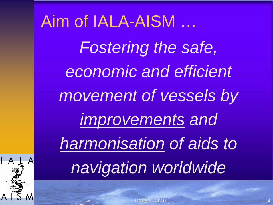
Aim of IALA-AISM …Fostering the safe,
economic and efficient movement of vessels by
improvements and harmonisation of aids to
navigation worldwide
4GMISS - 2010
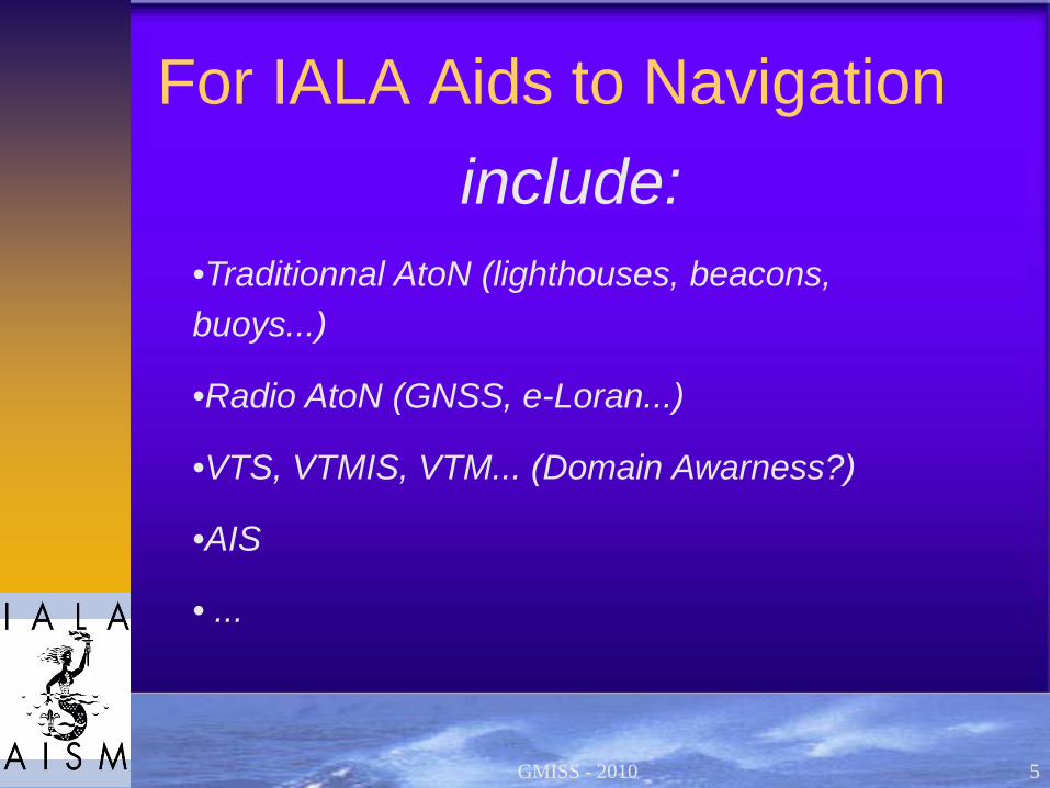
For IALA Aids to Navigationinclude:
•Traditionnal AtoN (lighthouses, beacons, buoys...)
•Radio AtoN (GNSS, e-Loran...)
•VTS, VTMIS, VTM... (Domain Awarness?)
•AIS
• ...
5GMISS - 2010

Sharing information is not newIt started long time ago by sharing
information on lights (lights list), charts,navigation, MSI (Navtex, SafetyNet),weather, ...
More recently by exchange of information such as PSC inspections (PSC MoUs, Equasis)
Through voluntary and mandatory ship reporting systems inside, but also outside territorial waters since 1993 (Valdés)
6GMISS - 2010
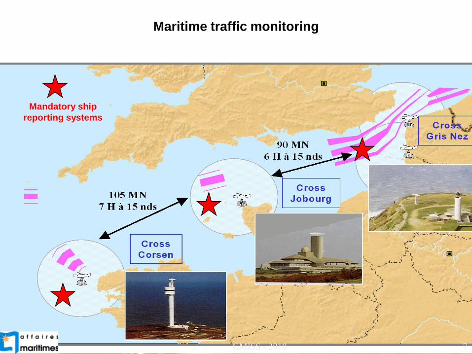
Mandatory ship reporting systems
Maritime traffic monitoring
7GMISS - 2010
Sharing information is not new
Lloyd’s List is very and rightly proud to explain that they have tracked ships and reported their situation for nearly three hundred years.
Local newspaper used to report position of ships of the national flag or calling at ports of the region.
8GMISS - 2010

For IALA and its Members, sharing information is essential
It is one of the main functions for a VTS, it is the main function for VTMIS and, to morrow, for a VTM.
It is why IALA was the promoter of AIS to ITU and to IMO.
9GMISS - 2010

Recommendation ITU-R M.1371-3Technical characteristics for an automatic
identification system using time division multiple access in the VHF maritime mobile band (150 pages).
SOLAS Chap. V - Reg. 19Mandatory carriage introduced in 1997,
accelerated implementation decided in 2002
10GMISS - 2010

AIS has changed the maritime world and made the shore
Authorities more responsible
♦ In the (recent) past, with signal stations / binoculars : no idea on traffic along the coast
♦ Radar : few ideas♦ Mandatory ship reporting system : major legal
evolution, improves the knowledge♦ AIS : all SOLAS ships are identified and the traffic
along the coast cannot be ignored any more (density, dangerous situations, efficiency of aids to navigation). Shore Authorities have the tool to implement SOLAS V-12 (VTS) and V-13 (AtoN).
11GMISS - 2010

12GMISS - 2010

Development of shore based AIS Networks
Very soon after the IMO decision to make the carriage of AIS mandatory, there were several public initiatives to develop systems of exchange of AIS information:
♦ On national basis (many countries)♦ On regional basis (few, Helcom, North-Sea,
SafeSeaNet...)♦ On world-wide basis (one, MSSIS).In the meantime, the private sector using the broadcast
function of AIS (no secrecy!) has developed several systems accessible to everyone through Internet, sometime for free, sometime by buying information. The next slide show half of the 1st page of Google on AIS tracking.
13GMISS - 2010

Live Ships Map - AIS - Vessel Traffic and Positions- Vessel positions tracking based on AIS data. Real-time ship locations and port arrivals
departures.www.marinetraffic.com/AIS Vessel Data live in Google Earth - vesseltracker.com- AIS vessel signalling reporting AIS data live in Google Earth.
www.vesseltracker.com/en/Googleearth.html -AIS Vessel tracking- Ships fitted with an AIS transponder automatically broadcast information, such as their position,
speed, and navigational status, at regular intervals via a ...www.sea-seek.com/real_time/index.php -
Vessel Tracking and Automated Identification System (AIS)- The first version was developed by Astra Paging Ltd. in 2006 and distributed among the
custommers of commercial AIS tracking service VT Explorer. ...www.vesseltracking.net/ -
AIS Live- THE FIRST GLOBAL AIS NETWORK. AISLIVE ... countries and is the most cost effective
method of tracking vessels in real time available today. ...www.aislive.com/ -
Your free source for vessel monitoring and tracking, live AIS ...- Digital-Seas.com is the popular free ship-spotting community and vessel-tracking website for
ship lovers, ship spotters, seamen and other ...www.digital-seas.com/ -
AIS free ship and vessel tracking. AIS data sharing in raw NMEA ...- AIS tracking services AIS is the mariner's most significant development in navigation safety since
the introduction of radar. The system was originally ...www.aishub.net/ - En cache - Pages similaires
14GMISS - 2010

♦(from Seasearcher web page)
Seasearcher/Lloyd's MIU “has purchased the necessary receivers for each of its existing reporting sources which allow us to offer our customers not only the world's largest AIS (Automatic Identification System) coverage but also the highest quality of information in the market.
The powerful Lloyd's MIU AIS functionality allows the user to study total AIS traffic patterns and it is possible to filter by type, classification, flag, gross and deadweight tonnages. Most importantly, with a lot of our AIS offerings it is possible to view both Seasearcher and our AIS system side by side switching seamlessly between the two applications, linking the vessels, ports or casualties plotted by each AIS station to the qualified ownership, characteristics, casualty and ports records recorded in the Lloyd's MIU database. Vessel, port and casualty positions are plotted against high level costal maps, but, as the user zooms in to take a closer look, electronic maritime charts are used to provide a detailed view of the port from which the AIS data was received. This enables precise identification of the position of each vessel within each port, improving on the historic reporting of movements.”
15GMISS - 2010

♦
Seasearcher/Lloyd's MIUAIS Station coverage
16GMISS - 2010

The reasons to create IALA-NET
Apart MSSIS, only private/commercial companies monitor the maritime traffic on a global mode. However, traffic monitoring includes security, safety, protection of marine environment and traffic organization missions.
Those missions are part of governmental responsibilities and the information used by the Authorities in charge of the missions shall not be dependent of the sole private sector.
17GMISS - 2010

IALA-NET is an IALA project1. Therefore, with the assistance of MSSIS, it was decided to start a trial through a demonstrator to verify the feasibility and the interest of the project to establish a global system of exchange of AIS information between Marine AtoN Authorities. 2. The demonstrator was provided to IALA and IALA Members free of charge thanks to the generosity of Denmark and the United States.3. The trial started in August 2008 and ended the 1st of July 2010 when the IALA Council decided to make the IALA-NET system permanent.
18GMISS - 2010

What is IALA-NET ?IALA-NET is a near real time AIS data
exchange service through Internet.It is a worldwide service only open to
national Authorities who provide the AIS data from their own country.
The service is intended to assist these Authorities to fulfill their duties regarding safety, security, protection of marine environment and efficiency of navigation.
19GMISS - 2010

What are the benefitsprovided by IALA-NET ?
Here are some examples : Maritime safety Search and Rescue Marine investigation accident Improving efficiencies of navigation Security Illegal activity Traffic analysis Environmental monitoring …
20GMISS - 2010

Who can access IALA-NET ?
Access to the IALA-NET data exchange will only be allowed to countries which provide AIS information themselves to the system. Furthermore, in each of these countries, the access to the information will only be permitted to Competent National Authorities, and under their control to those in charge of:
21GMISS - 2010
♦ Maritime Safety Administrations♦ Pollution preventing and combating♦ VTS(Vessel Traffic Services)♦ Port State Control (PSC)♦ Contingency planning♦ International Ship and Port Security (ISPS)♦ Search and Rescue (SAR)♦ Traffic planning, efficiency and management, incl. icebreaking
services♦ Mandatory reporting system and reporting requirements♦ Pilotage♦ Customs surveillance♦ Protection of marine resources♦ Science and research supporting the implementation of the
Helsinki Convention and for preparing IMO ships routeing measures
22GMISS - 2010

Regarding sharing information with LRITLRIT and AIS are two systems complementary. To
totally benefit from the LRIT system a flag State, a port State or a coastal State need to have the latest AIS information available received by a shore based station before the ship had left the A1 area, whatever her location around the world: it will be much more convenient and cheaper for the Authority in charge, when receiving LRIT information, to refer to the IALA-NET AIS data base rather than to exchange messages with the ship to have more detailed information.
But LRIT is a very complex and costly machine, with limited information and access …
23GMISS - 2010

IALA-NET uses 3 server centers, evenly spaced in time-zones, to provide back-up and a 24-hour service.
IALA–NET System
24GMISS - 2010

The USA, Denmark and China have agreed to establish each one a Data Center at their own cost. The three servers have the same functions and received the same information, but each one watch the system for eight hours during its working hours to limit the running cost of the system.
IALA-NET Global Data Center
25GMISS - 2010

IALA-NET
What’s next?
♦To organise the storage of historical data
♦To develop the system using other sources of information, including satellite AIS, radars, etc...
♦To prepare for e-Navigation
26GMISS - 2010

IALA-NET
Following countries are on-line or are pending connection
Denmark - USA - Finland - Montenegro Norway - Poland - Australia - Estonia
Ireland - Latvia - Oman - ChinaChile - Germany - Irak - Jamaica
Scotland - Senegal - Turkey - Vietnam Canada
Difficulties to recruit participants!
27GMISS - 2010

IALA-NET
Why the participation to IALA-NET is not growing faster?
♦ Lack of knowledge: many people still considered thatthe AIS information is secret and have not yetrealised that anyone can buy it on Internet.
♦ Lack of clear policy on the use of AIS information. Atits 79th session the MSC Committee agreed on principles, just after having learned the publication on the web site « AIS-Live » of live AIS information. Since that time the position of MSC/IMO remainsunchanged and blocks any discussion on the matter, in particular on the development of AIS Satellite.
28GMISS - 2010

IALA-NET ...At its 79th session, the Maritime Safety Committee decided to:♦ “urged masters of ships, notwithstanding the provisions of Guidelines for
the on-board operational use of AIS – Resolution A.917(22) as amended by Resolution A.956(23) – not to switch off the ship’s AIS on account of the publication on the world-wide web or elsewhere of the AIS data transmitted by their ships;
♦ urged Member Governments, subject to the provisions of their national laws, to discourage those who make available AIS data to others for publication on the world-wide web, or elsewhere from doing so;
♦ condemned the regrettable publication on the world-wide web or elsewhere of AIS data transmitted by ships;
♦ condemned those who irresponsibly publish AIS data transmitted by ships on the world-wide web or elsewhere, particularly if these offer other services to the shipping and port industries; and
♦ requested the Secretary General to bring to the attention of those who publish or who may publish AIS data transmitted by ships on the world-wide web or elsewhere, the conclusions of the Committee.”
29GMISS - 2010

•Needs to educate on the use and on the potential of AIS information (Model courses?)
•Needs to review the policy regarding the circulation of AIS information (Proposal to IMO?)
•Needs to promote IALA-NET
Conclusion
30GMISS - 2010

International Association of Marine Aids to Navigation and Lighthouse Authorities
Association Internationale de Signalisation Maritime
GMISS - 2010
Thank You
31GMISS - 2010