hyperspectral remote sensing assessment of mining-related environmental impacts: examples from the...
TRANSCRIPT
Hyperspectral remote sensing assessment of mining-related environmental impacts:
examples from the MINEO project
S. Chevrel, V.Kuosmanen, K.Groesel, S.Marsh et al.
www.brgm.fr/mineowww.brgm.fr/mineo
Assessing and monitoring the environmental impact of mining environments in Europe
using advanced EO techniques
MINEO objectivesMINEO objectives
• Use advanced (hyperspectral) Earth Observation (EO) to develop innovative tools and methods to update EU mining-related environmental databases
• Develop generic tools and methods to process and exploit these EO data in management information systems for monitoring environmental risk
• Guidelines and standards for data dissemination
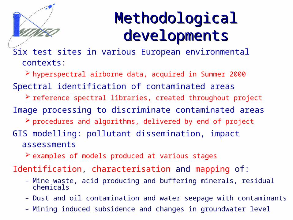
Methodological developmentsMethodological developments
Six test sites in various European environmental contexts: hyperspectral airborne data, acquired in Summer 2000
Spectral identification of contaminated areas reference spectral libraries, created throughout project
Image processing to discriminate contaminated areas procedures and algorithms, delivered by end of project
GIS modelling: pollutant dissemination, impact assessments examples of models produced at various stages
Identification, characterisation and mapping of:– Mine waste, acid producing and buffering minerals, residual chemicals
– Dust and oil contamination and water seepage with contaminants
– Mining induced subsidence and changes in groundwater level
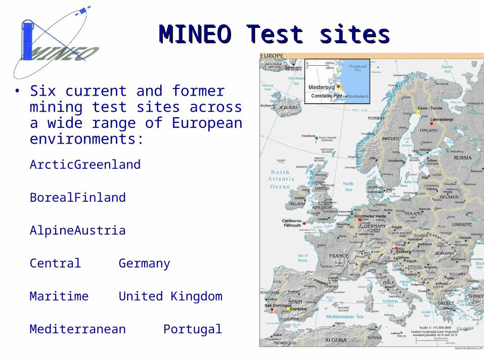
MINEO Test sitesMINEO Test sites
• Six current and former mining test sites across a wide range of European environments:
Arctic Greenland
Boreal Finland
Alpine Austria
Central Germany
Maritime United Kingdom
Mediterranean Portugal
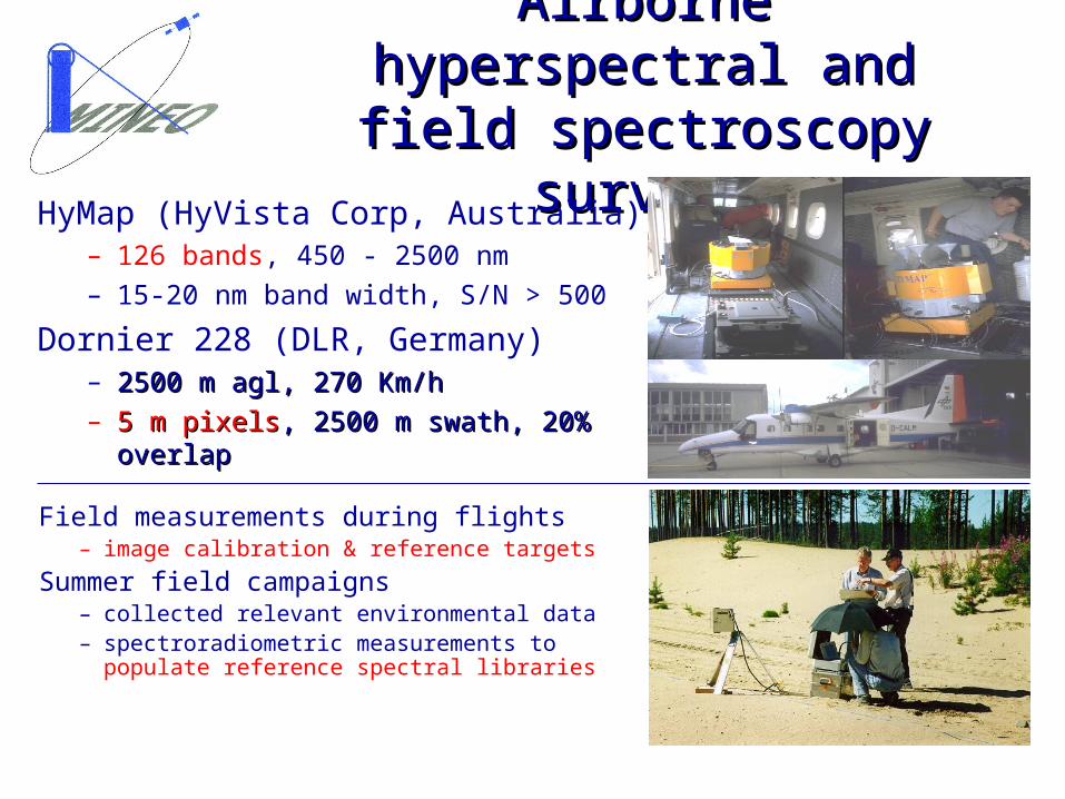
Airborne hyperspectral and Airborne hyperspectral and field spectroscopy surveysfield spectroscopy surveys
HyMap (HyVista Corp, Australia)– 126 bands, 450 - 2500 nm– 15-20 nm band width, S/N > 500
Dornier 228 (DLR, Germany)– 2500 m agl, 270 Km/h2500 m agl, 270 Km/h– 5 m pixels5 m pixels, 2500 m swath, 20% overlap, 2500 m swath, 20% overlap
Field measurements during flights– image calibration & reference targets
Summer field campaigns– collected relevant environmental data– spectroradiometric measurements to
populate reference spectral libraries
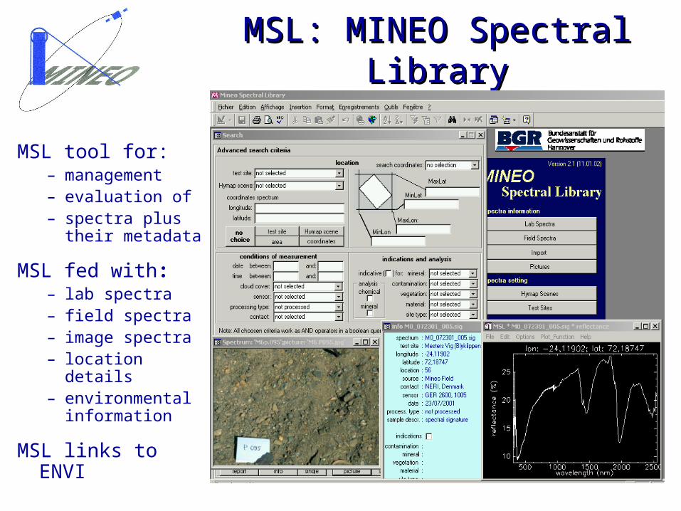
MSL: MINEO Spectral LibraryMSL: MINEO Spectral Library
MSL tool for:– management– evaluation of– spectra plus
their metadata
MSL fed with:– lab spectra– field spectra– image spectra– location details– environmental
information
MSL links to ENVI
Mine details:Mine details:– evidence of Bronze Age tin mining; massive expansion evidence of Bronze Age tin mining; massive expansion
in 18th century, accompanied by development of copperin 18th century, accompanied by development of copper– lead, silver, zinc, arsenic, tungsten, cobalt bismuth, lead, silver, zinc, arsenic, tungsten, cobalt bismuth,
uranium, antimony also produced at various timesuranium, antimony also produced at various times
Problem:Problem:– drainage contaminated by abandoned mines upstreamdrainage contaminated by abandoned mines upstream
Objective:Objective:– mapping iron-rich material, main minerals responsible mapping iron-rich material, main minerals responsible
for contamination, including AMD-generating materialfor contamination, including AMD-generating material
Method:Method:– Minimum Noise Fraction and Spectral Angle MapperMinimum Noise Fraction and Spectral Angle Mapper
Western-European environment test site:Western-European environment test site:Cornwall copper-tin mining district, UKCornwall copper-tin mining district, UK
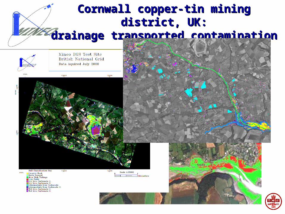
Cornwall copper-tin mining district, UK:Cornwall copper-tin mining district, UK:drainage transported contaminationdrainage transported contamination