hurricane dolly 2008: investigating the potential need for more...
TRANSCRIPT

Hurricane Dolly 2008: Investigating the Potential Need for More Effective Hurricane
Data, Education, and Awareness in South Texas
Jude A. Benavides, Ph.D.University of Texas, Brownsville

Study Area: Brownsville, Texas
• City of ~160,000 people – Pop (1990): 97,000– Pop (2000): 139,000– Pop (2008): 175,000
• “On the Border / By the Sea”

Study Area: Brownsville, Texas
• Lower Rio Grande Valley (LRGV)– Population (2005): 1.15
Million– Population (2020 est): 1.78
Million• Largest and fastest growing
region in Texas without Interstate Highway service– 4th fastest growing region in
the nation 1990-2004• Including Matamoros and
Reynosa, Mexico– Pop (2005): 1.8 Million– Pop (2020): ~ 2.7 Million
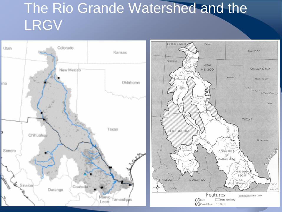
The Rio Grande Watershed and the LRGV

Three primary flood risks (Brownsville area)
• Localized flooding due to intense rainfalls over area (both frontal and tropical)– Flat slopes– Rapid / Semi-regulated
Growth– Deteriorating 1o and 2o
drainage systems• Storm surge due to tropical
activity– Recent and growing concern
• Out-of-bank flooding from the Rio Grande– A growing threat due to:
• Aging levees• Rapid development in
Northeastern Mexico
Arroyo Colorado
Brownsville Resacas andShip Channel Drainage
Rio Grande Watershed

Hurricane Emily – 2005 Track (stormpulse.com)

Hurricane Dolly – 2008 Track (stormpulse.com)
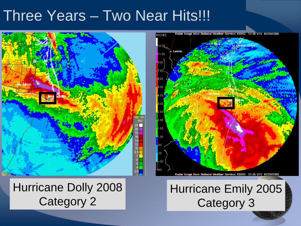
Hurricane Emily (2005)
(different rainfall scale)
Hurricane Dolly 2008Category 2
Hurricane Emily 2005Category 3
Three Years – Two Near Hits!!!

Unadjusted Rainfall Totals from “Storm Total” Radar Product
• “Near miss” or “Near hit”
• Path of Hurricane Dolly takes a step northward just prior to landfall
Credit: NOAA Environmental Visualization ProgramNote: Images processed by Mr. Anthony Reisinger – UTB/TSC Environmental ScienceStudent Interning with NOAA this summer!
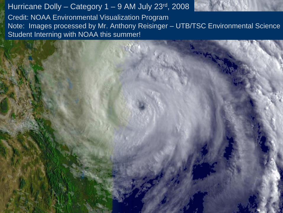
Hurricane Dolly – Category 1 – 9 AM July 23rd, 2008

Credit: NOAA Environmental Visualization ProgramNote: Images processed by Mr. Anthony Reisinger – UTB/TSC Environmental ScienceStudent Interning with NOAA this summer!
Hurricane Dolly – Category 2 – Noon (CDT) July 23rd, 2008

Gage Adjusted Rainfall

Rainfall Isohyets for Cameron County
15 m
i (24
km)
Brownsville
SouthPadreIsland
Harlingen


Impacts on Matamoros, Mexico
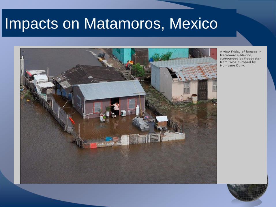
Impacts on Matamoros, Mexico

Impacts on Matamoros, Mexico
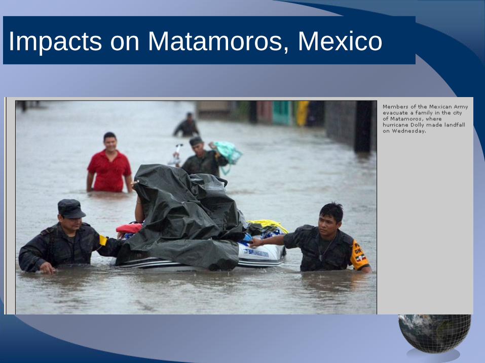
Impacts on Matamoros, Mexico

Impacts on Brownsville, Texas
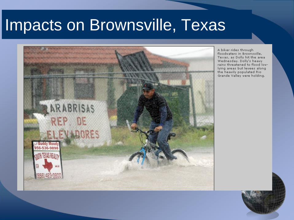
Impacts on Brownsville, Texas

Impacts on South Padre Island, Texas

Impacts on South Padre Island, Texas

Impacts on Port Isabel, Texas

Impacts on Cameron County, Texas
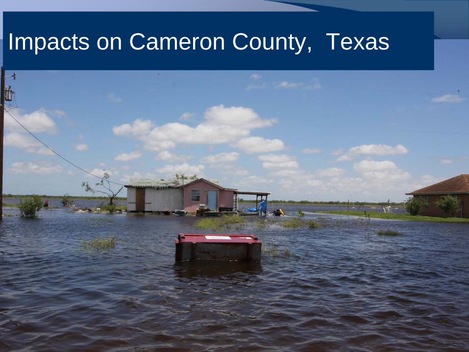
Impacts on Cameron County, Texas

Impacts on Cameron County, Texas


Lessons Learned: Rainfall and streamflow data needs
• LRGV effectively only covered by KBRO station in Brownsville– Outer edge of Corpus
Christi• Severe attenuation
during storm events• Proximity to station
results in routine underprediction and scatter– Definite need for rain and
stream gages• Strong need for a dense
network of rain gages– Some showing up but not
run by a collective agency

Lessons Learned : River Flooding – Out of Sight, Out of Mind• Persistent threat of
large scale flooding from Rio Grande is not appreciated by local public– Not advertised by
agencies• Aging system of levees
in dire need of repair– International Boundary
and Water Commission (IBWC)
– Binational governance / binational action = slow to act
Rio Grande River and Levees near University of Texas at Brownsville

Evacuation Route Chokepoints
• Limited inland highway evacuation routes
• Westward and Southward movement is restricted

30-40k
150-200k
100-125k300-350k
Shelter in Place Critical for Effective Evacuation

Lessons Learned: GIS and LIDAR are reaching out to public and government officials
• LIDAR data– Now available for all of
Brownsville– Cameron County
• GIS database– City wide at local utilities
board and UT Brownsville
– Valley wide• Efforts commencing at
both UT Pan Am and UT Brownsville
• Web-based information• Need: post-storm data
and communication
Rio Grande

Detailed Floodplain and Flood Damage Reduction Alternatives Analysis Completed master planning and emergency preparedness

Lessons Learned: Need for county-wide Flood Control District
• At present, there are too many administrative / governmental agencies dealing with flooding– Cities– Counties– Local Irrigation Districts– Local Drainage Districts– IBWC– U.S. Fish and Wildlife
• Wildlife Refuges– Texas Parks and Wildlife
• Rio Grande Wildlife Corridor
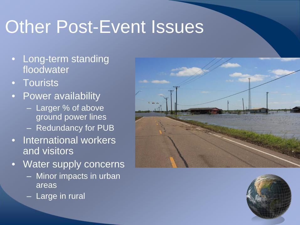
Other Post-Event Issues• Long-term standing
floodwater• Tourists• Power availability
– Larger % of above ground power lines
– Redundancy for PUB• International workers
and visitors• Water supply concerns
– Minor impacts in urban areas
– Large in rural

Summary• Many needs identified for the
LRGV / Brownsville, Texas area with respect to:– Hurricane preparedness– Hydrologic/Hydraulic
information – real-time– Evacuation planning– Agency interaction
• Continue to be extremely vulnerable for the following few hurricane seasons
• Improvement due to effectiveness of state actions– Need to relay that more to
local players• SSPEED can play a central
role in this– Education and Outreach– Improved technology and
utilization of this technology