housing and public services in a medium-sized russian...
TRANSCRIPT

114
Eurasian Geography and Economics, 2004, 45, No. 2, pp. 114-133.Copyright © 2004 by V. H. Winston & Son, Inc. All rights reserved.
Housing and Public Services in a Medium-Sized Russian City: Case Study of Tomsk
Anastassia Alexandrova, Ellen Hamilton, and Polina Kuznetsova1
Abstract: A team of Russian and American urban specialists examines variations in livingconditions across 26 microrayons of a medium-sized West Siberian city (Tomsk, 2002 popu-lation of 487,700) deemed to be fairly typical of urban settlements in that size class. Detailedinformation derived from the mapping of intra-urban variations in housing type and age,health facilities, schools and other educational institutions, and access to public transportationis used to construct three public service indices representing the relative level of deprivationof urban residents. Journal of Economic Literature, Classification Numbers: D32, I32, O18.9 figures, 2 tables, 17 references.
INTRODUCTION
nder the Soviet system, housing in cities was centrally planned, built, allocated, owned,and maintained. Since housing was provided at little or no cost, demand far outstripped
supply, and people waited for decades to receive a new housing unit (Smith, 1996). Althoughresidential differentiation under the Soviet regime was much less drastic than in Western coun-tries, some differentiation did exist (e.g., Bater, 1980, pp. 102-111; Smith, 1996). Generally,among the best housing was that used to reward especially meritorious workers, ranging fromskilled specialists to Party nomenklatura; these elites more often than not were situated in cen-tral parts of the city in higher quality housing stock. Cooperative housing, which requiredsome self-financing, was inhabited by those with relatively higher incomes. Ranking slightlylower in the housing hierarchy were blocks of apartments administered by municipalities, fol-lowed by flats built by enterprises to house their workers, and individual housing (often olderstructures lacking either indoor plumbing or electricity and located on the urban periphery).
In addition, housing quality tended to vary significantly by age of construction. Since largehousing blocks in Soviet cities were constructed to form new urban districts (mikrorayony) atroughly the same time, this also contributed to the spatial variation of housing by location.
Following the collapse of state socialism, the advent of housing markets has resulted inincreased residential differentiation. Prices for well located (i.e., central) and higher quality
1Respectively, Social Policy Team Leader, Institute for Urban Economics, 20/1, Tverskaya Ul., 125009 Mos-cow, Russia [[email protected]]; Urban Specialist, The World Bank, Europe and Central AsiaRegion, 1818 “H” Street, NW, Washington, DC 20433; and Lead Expert, Institute for Urban Economics, 20/1, Tver-skaya Ul., 125009 Moscow, Russia. The findings presented in the paper are based on materials developed by aWorld Bank–funded data-gathering project, implemented by the Institute for Urban Economics, Moscow. A team ofTomsk Polytechnic University specialists led by Alyona Zaharova produced detailed city maps based on limitedinformation that was difficult to access. Opinions expressed in this paper are solely the authors’ and should not beattributed to the World Bank or the Institute for Urban Economics. The authors are indebted to the Tomsk Oblast andTomsk city administrations for generous cooperation with this study.
U
Pub
lic D
iscl
osur
e A
utho
rized
Pub
lic D
iscl
osur
e A
utho
rized
Pub
lic D
iscl
osur
e A
utho
rized
Pub
lic D
iscl
osur
e A
utho
rized

ALEXANDROVA ET AL. 115
apartments have increased much more rapidly than prices for poor quality and poorly locatedunits. Thus, not surprisingly, more affluent people who privatized well located and largerunits in better-served areas obtained more valuable assets than did residents of collapsingvillages, small cities, or polluted, crime-ridden, and/or distant areas of larger cities. Sincehousing maintenance, heating, and other subsidized services are provided on a per squaremeter basis, owners or tenants in larger apartments de facto received higher subsidies. Aver-age housing prices per square meter in Tomsk, which provides the case study for this paper,in December 2003 (12,000 rubles or ca. $418 U.S.) generally resembled those of other citiesin Western and central Siberia—Novosibirsk 16,310 rubles (ca. $568), Omsk 11,063 ($385),Barnaul 12,200 ($425), and Krasnoyarsk and Kemerovo 11,800 ($411).2 Conversely, those indying single-enterprise towns or outlying districts of cities in Tomsk Oblast struggled to selltheir apartments for as little as a few thousand dollars in June 2003.3
In this paper, we observe that because the poverty rates in relatively prosperous cities(such as in the capitals of Russia’s 89 regions) are smaller than in other places, little attentionis paid to these cities’ poor, who must contend with multiple types of deprivation. Using thecity of Tomsk as a case study, we look at emerging areas of multiple deprivation wherehouseholds live in poor-quality housing (often under isolated conditions) with generally lim-ited access to jobs and services. With the introduction of housing markets, these areas are theleast desirable and most likely to become slums.4
We believe that this study is significant because it provides an alternative approach toidentifying and assessing these blighted areas by conventional survey methods. Local author-ities generally do not have the financial resources necessary to conduct household surveys atthe level of small communities or individual cities. In this paper, we attempt to demonstratehow the tools of spatial analysis (such as the mapping of dilapidated housing) incorporatedwithin a geographic information system (GIS) can improve our understanding of social riskarea. The results suggest the wisdom of adopting different planning strategies for differentparts of the city. We apply an index-based approach to assessing the quality of life in rela-tively small urban areas (mikrorayony) that can be used to track progress in addressing wel-fare issues in poor and high-risk neighborhoods.
We posit here that the city of Tomsk provides a reasonable choice for such a case study,as it can be viewed as a fairly typical regional capital in Russia. Although the northern rayonsof Tomsk Oblast fall within the region designated as the North (e.g., Slavin, 1972; Bradshaw,1995, p. 196), for which residents were (and to some extent still are) eligible for wage incre-ments, bonuses, and other benefits, the bulk of the region including the regional capital is not.Tomsk has a climate that is not extreme by Siberian standards, and its rural hinterland sup-ports a diversified agriculture.5 The city was founded in 1604 during the Russian Empire’slate 16th–early 17th century push to the east, as were many other Siberian capitals with250,000–500,000 inhabitants (e.g., Kurgan, Ulan-Ude, and Chita; Goskomstat Rossii, 2004),and together with nearby Tyumen’ and Tobolsk, dominated urban life in southwestern Siberiauntil nearly the end of the 19th century (e.g., see Lydolph, 1977, p. 389). Bypassed by the
2These data were obtained by the authors from real estate agencies in Tomsk (Privat realt), Omsk (MIEL),Barnaul (Dom), Novosibirsk (Doktor Klyuch), Krasnoyarsk (IZHI-ANNO), and Kemerovo (Institute of Realtors).
3Information on selected 2003 prices was communicated to the authors by Tomsk Oblast officials.4For the purposes of this study, “slums” are places where the poor are concentrated in substandard housing
with inadequate services.5Agriculture in the city’s hinterland typically is focused on dairying, other forms of livestock husbandry, and
wheat (largely spring-sown), rye, barley, flax, and potato production (Geograficheskiy, 1989, p. 483).

116 EURASIAN GEOGRAPHY AND ECONOMICS
Trans-Siberian Railroad to the south in the late 1800s, it stagnated relative to more recentlyestablished towns through which the mainline passed (e.g., Omsk, Novosibirsk). Morerecently, Tomsk has rebounded as a result of the completion of a 100-km rail spur connectingit with the Trans-Siberian, and the development of the West Siberian hydrocarbon depositsfrom the 1970s onward.6 A large share of Tomsk Oblast’s population (ca. 48 percent) residesin the city, as is typical of other Russian regional capitals (Koehn et al., 2001). Also typical isthe fact that the economy is rather diversified. Tomsk’s economy encompasses a variety ofactivities typical of administrative centers not only of Siberia but of the country as a whole:construction, transportation, finance, banking, electrical machinery,7 and petrochemicals.
In addition to being typical with respect to its economic profile and early history of col-onization, Tomsk has been shaped by the same general trends affecting Russian cities as awhole during the Soviet period and initial years of Russian independence. The city weath-ered the forced industrialization in the first half of the 20th century, the post-World War IIhousing boom featuring prefabricated construction,8 and more recently economic decline andpopulation loss (1990s) associated with Russia’s painful post-Soviet economic and socialtransformation.9
Finally, we argue here that Tomsk is a typical settlement in its size class (medium-sizedcities of 100,000-500,000 population)10 with respect to housing conditions. Medium-sizedcities experienced three waves of population expansion during the 20th century, when theygrew at far higher percentage rates than larger or smaller cities. The first wave occurred dur-ing industrialization, between 1926 and 1939, when the number of medium-sized citiesalmost tripled (from 18 to 48), and their population increased from 2.8 to 10 million. Duringthe second wave, from the end of World War II until 1959, medium-sized cities grew rapidlyas the result of the focus on restoring the country’s economy. By 1959, the population resid-ing in this size category burgeoned to 15 million. The final, third period of rapid growth ofmedium-sized cities was in the 1960s, when their population reached 23.3 million.
Because these waves of growth were linked to Soviet industrial development policies,and because urban housing was financed and built by the state, all rapidly growing citiesended up with similar housing stocks. During the “first wave” of urbanization, before WorldWar II, state resources were committed to industrialization with relatively small amountsallocated for housing construction (e.g., see Bater, 1980, pp. 98-99). As a result, increasingnumbers of people were housed in the existing stock such as wooden buildings, whilehostels were built to accommodate new people. The second wave of rapid urban growthcoincided with Khrushchev’s commitment to improving housing conditions by introducingstandard designs and largely pre-fabricated construction methods. Constructed rapidly,
6However, oil production in the Tomsk region is dwarfed by adjacent Tyumen’ Oblast, with Tomsk typicallyregistering only 2 or 3 percent of the output of its western neighbor over the period from 1980 to the present (e.g.,see Sagers, 2001, p. 161). Therefore its economy is much less dependent on hydrocarbon revenues, and less suscept-ible to the boom and bust cycles typical of that industry.
7Included in the city’s machinery manufacturing profile during the late Soviet period were the enterprisesSibkabel’, Sibelektromotor, and a number of other enterprises manufacturing ball bearings, lathes and other cuttingtools, pressure gauges, vacuum tubes, and radio components (Geograficheskiy, 1989, p. 483).
8Between 1965 and 1977, total apartment floor space in the USSR almost doubled (Bater, 1980, p. 105)9The impact of the decline, however, has been less severe than in surrounding rural areas in the oblast and
smaller urban centers with more monofunctional economies. In other words, as in other regional capitals, Tomsk’sdiversified economy and concentration of managerial, commercial, and financial functions have somewhat reducedthe hardship associatied with the transition.
10About one-third of all urban dwellers in Russia reside in cities ranging from 100,000 to 500,000 in population.

ALEXANDROVA ET AL. 117
Khrushchev-era apartments are found in all Russian cities. Poorly designed and shoddilybuilt, the decay of these units is an important social problem not just in Tomsk (see below),but in every other Russian city. By the 1960s and 1970s, and the third wave of urban growth,housing quality had improved somewhat as a result of improved standard designs and modu-lar components (so-called “large-panel construction”); however, standardization came at theexpense of individuality, as Russian cities became increasingly similar in terms of their inter-nal morphology (“urban fabric”; see French and Hamilton, 1979).
The paper is organized in four sections. The first outlines the methodology and identifiessources of information used in the study. The second focuses on the compilation of largescale maps of the city of Tomsk and the insights that they provide, while the third describesthe index-based assessments of the mikrorayony. The final section briefly notes some of theimplications of this study.
METHODOLOGY AND DATA
The city of Tomsk is divided into four administrative districts (or rayons), which are rel-atively equal in terms of population—Leninskiy, Oktyabr’skiy, Sovetskiy, and Kirovskiy(Fig. 1).11 All four rayons cover large areas and are quite heterogeneous in terms of theirhousing stock, presence of industrial enterprises, availability of transportation, and the loca-tion of schools and healthcare facilities. Given the heterogeneity and large size of the rayons,we have opted to utilize statistics for smaller areas of the city, the so-called mikrorayony (ormicrorayons). While the latter are the basic building blocks of Russian cities, they are notformal administrative units. Usually they are areas housing some 4,000–20,000 residents,forming around enterprises, historical sections of cities, sites of large-block apartment con-struction in the 1970s and 1980s, outlying (but distinct) districts, and former villages incor-porated with the city. Microrayons are natural areas in the sense that people refer to themwhen they describe where they live.
The average population of a microrayon in Tomsk is about 18,000. Those with thelargest populations were constructed during the 1970s and thereafter, since the buildingsthere are all multi-storey and usually clustered quite densely over space. Tomsk city isdivided into 26 such areas (Fig. 1).
In order to compensate for the lack of survey data derived from door-to-door interviewsof residents, specialists from Tomsk Polytechnic University developed a Geographic Infor-mation System (GIS) that included information on population, transportation, location andquality of housing, location of industry, and physical features such as rivers and green space.These spatial data were used to identify the spatial distribution of education and healthcarefacilities, transportation, housing type and quality, and industrial areas across the city’smicrorayons.12 By examining closely the locations of these facilities, it was possible to iden-tify areas that are underserved or where the housing stock is of poor quality. It is also
11The largest is Oktyabr’skiy, with a population of roughly 134,500, whereas the smallest is Sovetskiy(107,400) (see Rayony, 2002).
12Data used in the GIS were compiled largely from municipal government records. Thus, information on trans-portation routes were provided by the Tomsk Department of Transportation, on industrial enterprises by the city’sDepartment of Industry, and on housing by the city Housing Department. Initial data on health care and educationalfacilities were provided by the eponymous departments of the city administration, and were supplemented andupdated with information derived from the Yellow Pages and reference guides (primarily on private facilities).Finally, population data for city rayons and microrayons were made available by the Tomsk Oblast Statistical Com-mittee as estimates.

118 EURASIAN GEOGRAPHY AND ECONOMICS
possible to see that within each of the four rayons, there are microrayons that are spatiallyisolated, separated from the main part of the city by a string of enterprises or green space.Areas with inadequate basic services, where housing quality is substandard, and/or areasrelatively distant from the rest of the city, are likely to house increasing concentrations of thepoor and may well develop into slums, where poverty predominates.
In an effort to quantify some of the mapped data, we constructed three composite indicesbased on the information detailed below. Composite indices utilizing these variables wereconstructed in the following manner:13
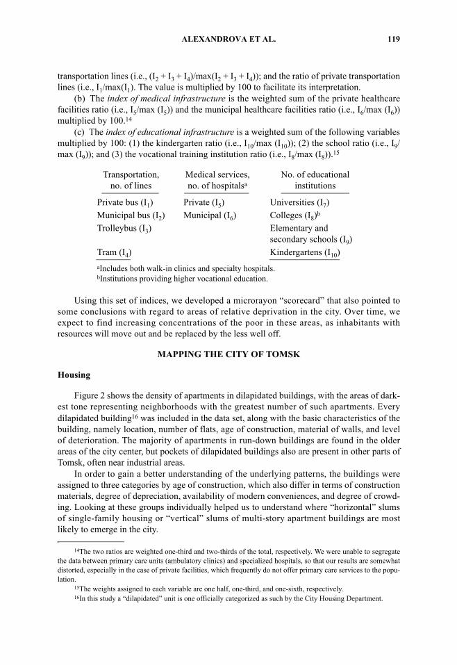
(a) The index of transportation infrastructure is the weighted sum of: a measure ofexisting municipal transportation facilities (i.e., Ind[I2 + I3 + I4 > 0] ); the ratio of municipal
13The weights of the three variables are equal, one-third each. When describing the calculation of the indices,the “ratio” is the index value of a particular microrayon divided by the maximum value of that index observedamong all microrayons.
Fig. 1. Administrative districts (identified on map) and microrayons of Tomsk. Key to microray-ons: 1 = Stepanovka; 2 = New Construction; 3 = Tomsk 1 (Railroad Station); 4 = Camp and Garden; 5 =Brewery; 6 = Kirova Avenue; 7 = Electric Lamp Factory; 8 = Academic Town 1; 9 = Housing Con-struction Factory; 10 = Electric Power Station 2; 11 = Frunze Avenue; 12 = Moscow Highway; 13 =Construction Materials Factory; 14 = Central Market; 15 = TV Center; 16 = Cheremoshniki; 17 =Machinery Equipment Production; 18 = Army and Navy Training Center; 19 = Tomsk 2 (Railroad Sta-tion); 20 = Kashtak; 21 = Auto Repair Factory; 22 = Irkutsk Highway; 23 = Match Factory; 24 = Indus-trial Zone and Psychiatric Clinic; 25 = Lower Warehouses; 26 = Academic Town 2.
ALEXANDROVA ET AL. 119
transportation lines (i.e., (I2 + I3 + I4)/max(I2 + I3 + I4)); and the ratio of private transportationlines (i.e., I1/max(I1). The value is multiplied by 100 to facilitate its interpretation.
(b) The index of medical infrastructure is the weighted sum of the private healthcarefacilities ratio (i.e., I5/max (I5)) and the municipal healthcare facilities ratio (i.e., I6/max (I6))multiplied by 100.14
(c) The index of educational infrastructure is a weighted sum of the following variablesmultiplied by 100: (1) the kindergarten ratio (i.e., I10/max (I10)); (2) the school ratio (i.e., I9/max (I9)); and (3) the vocational training institution ratio (i.e., I8/max (I8)).15
Using this set of indices, we developed a microrayon “scorecard” that also pointed tosome conclusions with regard to areas of relative deprivation in the city. Over time, weexpect to find increasing concentrations of the poor in these areas, as inhabitants withresources will move out and be replaced by the less well off.
MAPPING THE CITY OF TOMSK
Housing
Figure 2 shows the density of apartments in dilapidated buildings, with the areas of dark-est tone representing neighborhoods with the greatest number of such apartments. Everydilapidated building16 was included in the data set, along with the basic characteristics of thebuilding, namely location, number of flats, age of construction, material of walls, and levelof deterioration. The majority of apartments in run-down buildings are found in the olderareas of the city center, but pockets of dilapidated buildings also are present in other parts ofTomsk, often near industrial areas.
In order to gain a better understanding of the underlying patterns, the buildings wereassigned to three categories by age of construction, which also differ in terms of constructionmaterials, degree of depreciation, availability of modern conveniences, and degree of crowd-ing. Looking at these groups individually helped us to understand where “horizontal” slumsof single-family housing or “vertical” slums of multi-story apartment buildings are mostlikely to emerge in the city.
14The two ratios are weighted one-third and two-thirds of the total, respectively. We were unable to segregatethe data between primary care units (ambulatory clinics) and specialized hospitals, so that our results are somewhatdistorted, especially in the case of private facilities, which frequently do not offer primary care services to the popu-lation.
Transportation,no. of lines
Medical services,no. of hospitalsa
No. of educationalinstitutions
Private bus (I1) Private (I5) Universities (I7)Municipal bus (I2) Municipal (I6) Colleges (I8)b
Trolleybus (I3) Elementary and secondary schools (I9)
Tram (I4) Kindergartens (I10)aIncludes both walk-in clinics and specialty hospitals.bInstitutions providing higher vocational education.
15The weights assigned to each variable are one half, one-third, and one-sixth, respectively.16In this study a “dilapidated” unit is one officially categorized as such by the City Housing Department.

120 EURASIAN GEOGRAPHY AND ECONOMICS
The first group consists of buildings constructed before the 1917 revolution, when thecity was much smaller (Fig. 3). The buildings typically are small and range in size from 1 to35 apartments.17 Most are centrally located, rather attractive two- to three-storey woodenhouses shared by several families; they tend to characterize the architecture of central Tomsk.Inside, however, the residents of these houses paint a less appealing picture, reportingleaking roofs and the lack of modern conveniences, such as hot water. Some of thepre-revolutionary dilapidated structures are single-family dwellings usually not even
17However, in only 5 of the 14 microrayons where such buildings are found does the number of apartments ina building exceed 20.
Fig. 2. Relative density of flats in dilapidated buildings.

ALEXANDROVA ET AL. 121
equipped with sewage disposal and possessing inferior electrical wiring and connections.Built only of wood, they comprise fire hazards that are difficult to renovate.
Pre-revolutionary dilapidated individual houses also are more likely to be inhabited byhouseholds with limited means.18 Moreover, these smaller and older dwellings are locatedclose to each other. Microrayons 7, 11, and 12 have a fairly large share of this housing stock,accommodating not only 60 percent of all pre-revolutionary dilapidated buildings, but also64 percent of all apartments in such buildings from that era.
18A household survey covering the entire oblast, conducted by the Tomsk Regional Statistical Committee in2002 with the consulting assistance of the Institute of Urban Economics, found that residence in an individual housein an urban settlement represents a welfare risk factor.
Fig. 3. Location of dilapidated buildings constructed before the 1917 Revolution.

122 EURASIAN GEOGRAPHY AND ECONOMICS
The second group consists of dilapidated buildings constructed between 1920 and 1944(predominantly prior to World War II), during a period of industrialization and urbanizationwhen Tomsk expanded to the north and somewhat to the south, developing areas where manypresent-day industrial zones are located. Houses constructed in the 1920s and 1930s repre-sent a mix of individual wooden dwellings, brick or concrete high-rises (5 or 6 stories), andbarracks. The number of run-down buildings dating to the pre-World War II period, rarelyexceeding 10 units in size, is rather small (65).
Although the poor conditions of these units pose a problem for their occupants, the smallsize of the group does not pose a major problem for the city. As Figure 4 shows, the buildingsare dispersed throughout the city. Houses on valuable land in the city center should be attrac-tive to private investors, and sellers could use the proceeds to purchase relatively modernunits elsewhere. At the same time, clusters of dilapidated houses in microrayons 19, 23, and24 are of concern, and are unlikely to attract new investment.19
The third group of dilapidated buildings was built since World War II. It consists ofbuildings termed as “Stalin,” “Khrushchev,” or “Brezhnev” apartment blocks (Fig. 4). Eachname identifies not only the construction period, but also the apartment designs and con-struction materials. The Stalin buildings usually are of brick, with high ceilings and spaciouslayouts. In large cities, Stalin buildings are much sought after. Khrushchev apartments, incomparison, are small, with low ceilings, thin concrete walls, and inconvenient apartmentlayouts (primarily in five-story buildings). Brezhnev buildings, generally taller and conse-quently with more units, were better laid out than their Khrushchevki counterparts, and some-what larger, although not as large as apartments in Stalin buildings.
Despite the differences, grouping the three types of buildings makes sense because theyshare important similarities. All buildings house many apartments, they are equipped withmodern conveniences, concrete (not wood) is used to separate the floors, and their presentcondition depends to a great extent on their pre-reform ownership status. The latter meansthat buildings previously owned by richer, large enterprises or by regional government agen-cies are likely to remain in relatively good condition compared to those owned by smallerenterprises or the municipality.
Closer analysis of buildings in the above group suggests that they are less diverse than itappears at first glance. In fact, most were constructed in the 1950s and 1960s and belong tothe Khrushchev type noted earlier. These low-quality buildings were constructed quite rap-idly, were expected to be used for no more than 25 years, and have deteriorated so greatlythat most large municipalities have prioritized them for demolition and reconstruction.20 Infact, most pockets of densely concentrated flats in dilapidated buildings outside the center ofTomsk are linked to concentrations of Khrushchevki, inasmuch as only 11 out of the 248dilapidated buildings erected during this period were constructed after 1965.21
Given all of the above, one would expect housing prices to differ on the basis of housingquality and location. The cheapest units are a part (approximately one quarter or a third) ofan individual house that does not have all conveniences. Housing in very poor locations maynot even constitute a liquid asset, and even when saleable, prices are very low compared to
19These are urban areas that present social risks associated with concentrations of poor quality housing andimpoverished residents.
20See, for example, materials from the Second and Third International Congresses on Modernization of theFirst Series of Mass Construction Housing and Engineering Infrastructure of Cities (Modernization, 2003).
21For example, microrayon 17, built in the 1960s to house enterprise workers, has not been maintained since itstransfer to the municipality. Although not very old, and still rather modern-appearing, its buildings are quite shabby.

ALEXANDROVA ET AL. 123
the city center.22 A one-room apartment (36 m2, or not quite 400 ft2) in a nine-storey brickbuilding in Sovetskiy Rayon may cost from $10,000 (U.S.) (eastern part of AltayskayaStreet) to $21,000 (central part of Frunze Avenue) simply due to differences in location.23
22Indeed, microrayons 16, 21, and 23 are identified with the lowest housing prices in the city. The price of atwo-room Khrushchevka in these areas may vary between 280,000 rubles (Novaya Street, remote periphery) and550,000 rubles (Usova Street, downtown area, parallel to Kirova Prospekt; http://privat.tomsk.ru/info.asp).
23Costs also vary substantially by type of housing, suggesting that the emerging areas of undesirable housingare likely to be inhabited by the poor.
Fig. 4. Location of dilapidated buildings constructed during the periods 1918–1944 and 1945–1983.

124 EURASIAN GEOGRAPHY AND ECONOMICS
Vulnerable Location and/or Inadequate Service Provision
The desirability of a given microrayon is determined not only by the quality of housingstock, but also by its integration into the city as a whole, proximity to noxious factories, andaccess to transportation and social services. Problematic neighborhoods or areas usually areisolated, adjacent to industrial enterprises, or otherwise poorly connected to the rest of thecity.
Four microrayons are physically remote from the rest Tomsk, as shown in Figure 1. Onthe west, microrayon 25 is separated by the river. Although it is formally a part of the city,living standards and opportunities there seem to resemble most closely those of the adjacentrural rayon. Without a bridge or public transportation, residents of 25 are cut off from thecity. The nearest tram line is to the south and the nearest bridge is even farther south. Onlyone small country road connects this area with the rest of Tomsk. Microrayons 17, 8, and 26in the southeast also are spatially isolated from the rest of the city by green space, and rank inthe bottom quartile of the city’s microrayons in terms of access to transportation (see below).
Other microrayons are spatially isolated by a railway line, which crosses the eastern partof Tomsk from north to south (Fig. 5). Several pockets of dilapidated housing are found nextto the railroad in microrayons 19 and 23 adjoining the railroad, which serves as a physicalbarrier effectively cutting off microrayons 1, 2, 3, 22, and 23, as well as parts of 13 and 19.
Industrial areas also may isolate residential communities from the fabric of the city. InTomsk, as in other centrally planned Russian cities, the absence of land markets during theSoviet period resulted in a lack of correspondence between land use and land values. Once afactory was built, recycling the land for other purposes was not practical, since land could notbe sold and land use regulations were quite rigid.
Most factories and enterprises are concentrated in four rather large industrial areas,which surround the city on all sides except along the river (Fig. 5). Notionally, they may bedefined as Northeast (microrayons 19 and 23), Northwest (16 and 24), Southeast (2, 9, and10), and Southwest (4, 5, and 7). The location of the river and industrial enterprises makesphysical expansion difficult. Northern and eastern areas house a mix of industries producingeverything from equipment to pencils, rubber shoes, bread, and chocolate. The large group offactories in microrayon 16 (and to a lesser extent 24) are known polluters that block peoplesaccess to the river, so that its banks cannot be upgraded and used for recreation.
Another group of polluting factories is found in the northeast in microrayons 19 and 23,including the Tomsk asphalt factory and plants for construction and composite materials.These factories adjoin the railway, which seems rational until one realizes that residential areasin microrayon 23 are surrounded by factories and cut off from the city. To the south, artificiallakes built as wastewater receptacles for nearby enterprises serve as a physical barrier for resi-dential areas in microrayons 13 and 9. These lakes (otstoyniki in Russian) create problems fornearby residents in the spring, when they flood the surrounding areas. Additionally, enterprisesthat dump water in the lakes fail to treat it properly, creating environmental problems.
Enterprises in the southeastern part of the city generally serve the needs of the con-struction industry. The southeast also houses a large power generation plant and telegraph/telephone stations. More recently, smaller factories have appeared in this area, clusteringaround the largest. Most of the city’s electromechanical and machinery manufacturing enter-prises are concentrated in the southeast, especially in microrayons 2, 9, and 10.
From a residential point of view, the smaller factories (such as shoe or lamp makersin microrayons 4 and 7) are less problematic because: (1) many are not operating at fullcapacity due to reduced demand for their products; (2) they are not as heavily polluting; and

ALEXANDROVA ET AL. 125
(3) they are not concentrated as densely as in the other industrial zones, which makes devel-opment of nearby residential areas easier.
The fact that a city as small (relatively speaking) and compact as Tomsk has four majorindustrial areas seems excessive with regard to its impact on living conditions for residentsand development of housing markets, recreational areas, and other urban facilities. Manyindustrial enterprises in present-day Tomsk date from the evacuation of enterprises fromEuropean Russia to Tomsk and other remote locations during World War II (Pronin, 1962;Isupov and Moskovskiy, 1984). During that time, not much attention or importance wasgiven to the physical location of the evacuated factories within the city, but the result is thattoday the city is encircled by factories.24
24Not surprisingly, given the location of industrial areas in the city, no part of Tomsk can be considered envi-ronmentally clean.
Fig. 5. Location of railroad, industrial, and residential areas.

126 EURASIAN GEOGRAPHY AND ECONOMICS
Several microrayons are either “locked” between industrial areas or separated by themfrom the rest of the city. Industrial areas isolate residential areas in microrayons 1, 2, 3, 23,and parts of 16. The dispersion of industrial areas throughout the city means that only resi-dents in the five outlying microrayons (1, 26, 8, 17, and 25) and the three central microrayons(12, 11, and 14) do not reside in the immediate proximity of industrial enterprises.
Offices and service providers are more evenly distributed than enterprises, althoughhigher concentrations are found in the central microrayons (12, 14, and 15) and near thesoutheastern industrial zone. Microrayon 14, in the city center, in addition to residential uses,houses only offices, including those of the main petrochemical companies operating in theoblast, and those of administrative authorities.
At this point, some observations about the status of specific microrayons in Tomsk are inorder. Microrayon 1 has no factories, no service companies, and no offices. It is remote andits housing stock is of poor quality. This is likely a neglected neighborhood where poorpeople live. On the other hand, microrayon 22 also does not have any factories, but its hous-ing consists of higher-quality, multi-story apartment buildings, and it has schools, kinder-gartens, and other facilities for residents. A typical residential area, or “bedroomcommunity,” its residents work and socialize elsewhere.
Transportation
The existing transportation system does not compensate for spatial isolation. In fact,spatially isolated microrayons are less served than better-located microrayons. Figure 6depicts microrayons with the most limited access to transportation in the lightest tones.These include areas 1, 26, 8, 23, and 25. Microrayons shown in a medium shade of grey arebetter served. They include most of the industrial and other areas adjoining the downtownarea; the latter is depicted in a dark shade signifying the best transportation access.
Public transportation proper plays only a small role in the city’s transportation network.A limited number of municipal buses cover the very center of Tomsk (microrayons 12 and14), and several tram lines crisscross the city, covering an area from the southern outskirts(microrayons 2 and 4) to microrayon 17 in the east, and even crossing the river on the west.Trolleybuses serve the center and to some extent the north and northeast, but many remoteresidential areas are connected by at most one or two lines of public transportation.Fortunately for many city residents, private buses and minibuses supplement the publictransportation system. Currently, private transit providers serve nearly every microrayon.Thus, of the 33 transportation lines in the city, nearly one-half (16) are private bus lines,whereas 5 are municipal bus lines, 7 are trolleybuses, and 3 are trams. Most passengers rideprivate buses, which both cover a larger area and are more frequent—especially when com-pared to public trams and trolleybuses, which do not always function in the winter and areoften delayed for an hour or longer. Private buses cost more (5 rubles per ride instead of 3.5in public buses and 3 rubles on other public carriers), but only a few users are eligible to ridefor free.25
25These include World War II veterans, survivors of the Leningrad blockade, and Heroes of the USSR. Theshrinking city budget prompted the cancellation of privileges for most other groups, notably the disabled and pen-sioners.

ALEXANDROVA ET AL. 127
Access to Health Care and Educational Facilities
A look at the location of key social facilities (schools, preschools, and health clinics) indifferent neighborhoods again reveals salient spatial differences. Two trends emerge in termsof the location of educational facilities. First, the more remote microrayons are the least wellserved by preschools, schools, and vocational schools, as evidenced by a map of the index ofeducational infrastructure (Fig. 7). The spatially isolated microrayons 1, 26, 8, and 25 standout for the total absence of preschools, and possess either no (microrayons 1 and 26) or oneprimary or secondary school (8 and 25). The next tier of microrayons is slightly better off,with two to four preschools and primary/secondary schools; these include areas 3, 2, 5, 23,13, 19, 17, and 21.
The second trend indicates that microrayons consisting primarily of multi-story apart-ment buildings have better access to preschools and schools than do those comprised of
Fig. 6. Public transportation and index of transportation infrastructure values.

128 EURASIAN GEOGRAPHY AND ECONOMICS
single-family homes.26 As expected, areas of more recent construction are more likely tohave been built according to city development plans that provided for construction of educa-tional facilities. The analysis cannot be considered foolproof, inasmuch as we do not knowhow many people live in each microrayon, but a comparison of school location patterns withtype of residential buildings suggests that older areas where buildings are smaller are lesswell served than are those of more recent construction dating from the 1970s and later.
In general, educational facilities are not found in outlying areas where housing isdilapidated. On the one hand, this situation may be good in the sense that preschools andschools are not located in run-down and potentially dangerous buildings. On the other,people residing in run-down areas of the city face an additional burden since they must travelconsiderable distances in order to send their children to either preschools or schools. Singlemothers especially may not be able to work because childcare is not easily available.
26For example, note the low level of educational facilities in microrayons 21 and 23, and the high level inmicrorayon 22, which is a bedroom community.
Fig. 7. Values of the index of educational infrastructure by microrayon.

ALEXANDROVA ET AL. 129
Overall, Tomsk residents are well off with regard to health care facilities. The city hasthree basic levels of hospitals: clinical (mostly regional), city, and district hospitals (munici-pal).27 The three levels differ in terms of medical specialization, financing, and kinds of ser-vices provided. Generally speaking, more expensive and specialized care is provided athigher levels. As a regional center, Tomsk has both clinical and city hospitals, which offer avariety of services, such as psychiatric care, orthopedic surgery, HIV/AIDS prevention andtreatment, and several specialized hospitals for children.
Although people are willing to travel longer distances to access specialized care, pri-mary care facilities should be relatively evenly distributed. But analysis of the location ofgeneral (multi-service, primary) health care units that provide ambulatory care shows theyare quite unevenly distributed. In fact, the spatial distribution is similar to that of schools andkindergartens. Again, residents of certain microrayons have better access to primary healthcare than others.
In the north, only one municipal polyclinic serves the adjoining microrayons of 16, 21,and 24 (Fig. 8). Microrayons 17, 1, 13, and 23 have no health care facilities, and microrayons8 and 26 have only one clinic. Private clinics mushroomed in the late 1990s and are found inmost microrayons. Many private clinics offer dental services, but in the downtown area, suchclinics also offer either services for the entire family or specialized services in pre-natal andneonatal care. Private health care providers are not found in remote industrial neighborhoodswhere the population is likely less well off.
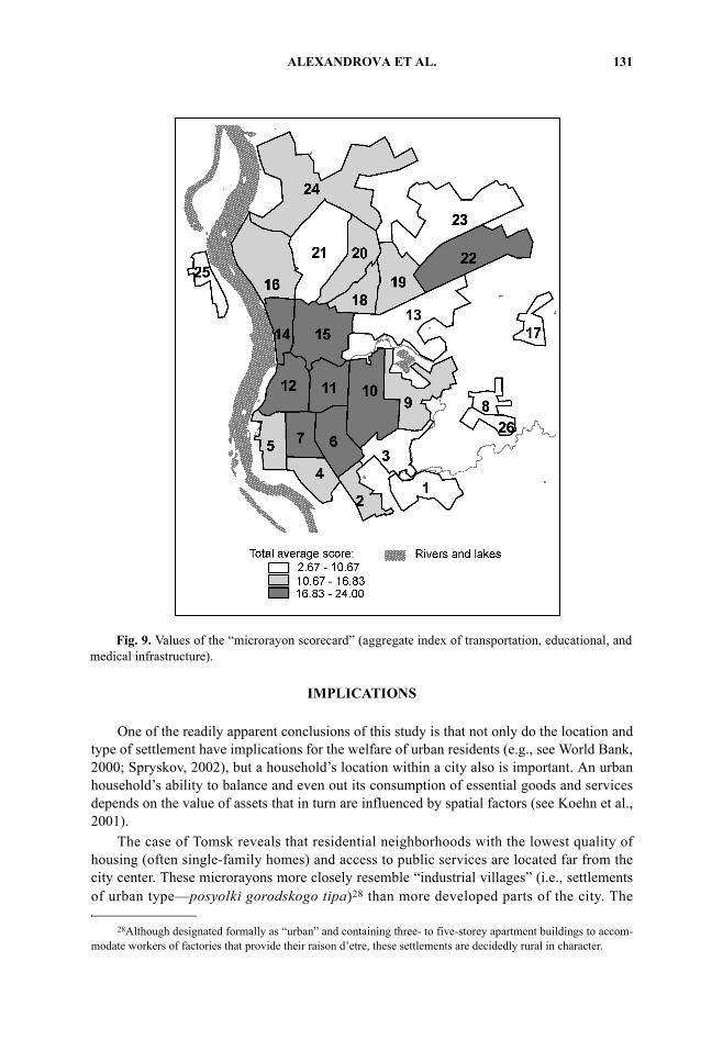
MICRORAYON SCORECARD
Based on the transportation, medical, and educational indices described above, it waspossible to compile an aggregate microrayon “scorecard” summarizing variations in well-being as measured by the mapped data. In order to simplify the data, the three indices wereranked and then summed to create the average rank for all three indices. A map showing thedistribution of this scorecard (average ranking) reinforces our observations that remoteneighborhoods in northwestern, eastern, and southeastern Tomsk are worse off with regard tohousing as well as public services (Fig. 9). The pattern of covariation visible on the map canbe verified statistically by producing a correlation matrix for the three indices (Table 1),which are significantly correlated.
The raw data table of transportation, education, and medical care infrastructure scoresfor each microrayon (Table 2) shows that outlying areas (microrayons 1, 26, 8, 17, and 25) allscore at the bottom, a not unexpected result. In other words, the poorly located microrayonswith few health or educational facilities and substandard housing are spatially coincidentwith those least served by public transportation, despite the fact that their residents also aremost likely to be dependent on such transportation. Microrayons 23 in the northeast and 21 inthe north also rank at the bottom. Microrayon 21 adjoins a major industrial area and consistsprimarily of single-family dwellings with a high concentration of dilapidated housing.Microrayon 23, with similar housing, is surrounded on three sides by industrial enterprises.In contrast, the best-provided microrayons are found in the center of the city, with the excep-tion of microrayon 22, a bedroom community of relatively recently constructed multi-familyapartment buildings.
27In the Russian system, the federal, regional, and municipal levels of government are each responsible for dif-ferent kinds of health care.

130 EURASIAN GEOGRAPHY AND ECONOMICS
Table 1. Correlations among Indices of Transportation, Medical, and Educational Infrastructure
Index Correlation and significance
Transportation infrastructure
Medical infrastructure
Educational infrastructure
Transportation infrastructure
Pearson correlationSignif. (two-tailed)
N
1.000—26
.658
.00026
.448
.02226
Medical infrastructure
Pearson correlationSignif. (two-tailed)
N
.658
.00026
1.000—26
.503
.00926
Educational infrastructure
Pearson correlationSignif. (two-tailed)
N
.448
.02226
.503
.00926
1.000—26
Fig. 8. Values of the index of medical infrastructure by microrayon.
ALEXANDROVA ET AL. 131
IMPLICATIONS
One of the readily apparent conclusions of this study is that not only do the location andtype of settlement have implications for the welfare of urban residents (e.g., see World Bank,2000; Spryskov, 2002), but a household’s location within a city also is important. An urbanhousehold’s ability to balance and even out its consumption of essential goods and servicesdepends on the value of assets that in turn are influenced by spatial factors (see Koehn et al.,2001).
The case of Tomsk reveals that residential neighborhoods with the lowest quality ofhousing (often single-family homes) and access to public services are located far from thecity center. These microrayons more closely resemble “industrial villages” (i.e., settlementsof urban type—posyolki gorodskogo tipa)28 than more developed parts of the city. The
28Although designated formally as “urban” and containing three- to five-storey apartment buildings to accom-modate workers of factories that provide their raison d’etre, these settlements are decidedly rural in character.
Fig. 9. Values of the “microrayon scorecard” (aggregate index of transportation, educational, andmedical infrastructure).

132 EURASIAN GEOGRAPHY AND ECONOMICS
situation in Tomsk indicates that, following the introduction of housing markets after the fallof the Soviet regime, poor residents (i.e., those least able to afford the high costs of accom-modation in the city center or more recently constructed bedroom communities) haveincreasingly been concentrated in neighborhoods characterized by a combination of substan-dard housing, inferior services, and remote location. This admittedly simple observationpoints to the need for similar studies in other relatively old Russian cities in a variety of sizecategories, in order to determine the extent to which this is an emerging post-Soviet phenom-enon.29 Further comparative analysis also is warranted of the experiences of residents ofdeprived areas in Russia’s regional capitals with those in secondary settlements in which the
Table 2. Transport, Medical, and Educational Index Scores by Microrayon
Microrayon code Rayona
Index of infrastructure:
Transportation Medical Educational
1 1 4 5.56 0.002 1 69 18.18 7.203 1 65 6.06 6.064 1 65 35.35 18.565 1 60 18.18 11.676 1 79 53.54 87.587 1 80 63.64 38.188 2 9 0.00 3.039 4 60 12.12 54.55
10 4 75 57.58 16.2911 4 73 58.59 22.7312 4 100 94.44 34.6213 2 73 0.00 10.5314 3 86 70.20 43.1815 2 84 29.80 23.7916 3 60 6.06 28.0317 2 39 0.00 10.2318 2 77 12.12 24.9219 2 67 6.06 12.4220 3 54 23.23 58.4821 3 56 0.00 10.2322 2 65 41.92 96.6723 2 4 0.00 7.2024 3 48 29.80 34.0925 3 0 0.00 3.0326 4 9 6.06 3.33
aRayon codes: 1 = Kirovskiy; 2 = Oktyabr’skiy; 3 = Leninskiy; 4 = Sovetskiy.
29For an assessment of emerging social polarization (e.g., income, housing, educational level) in post-SovietMoscow, see Vendina (2002).

ALEXANDROVA ET AL. 133
prevailing economic activity is not connected with lucrative raw material exports (e.g., oil).Research of this type has policy implications, in that it leads to the identification of the mostvulnerable urban neighborhoods where poor people are likely to be trapped, thus facilitatingthe targeting of resources and other forms of assistance.
REFERENCES
Bater, James H., The Soviet City: Ideal and Reality. Beverly Hills, CA: Sage Publications, 1980.Bradshaw, Michael J., “The Russian North in Transition: General Introduction,” Post-Soviet Geog-
raphy, 36, 4:195-203, April 1995.French, R. A., and F. E. Ian Hamilton, eds., The Socialist City. New York, NY: John Wiley and Sons,
1979.Geograficheskiy entsiklopedicheskiy slovar’. Geograficheskiy nazvaniya (Geographic Encyclopedic
Dictionary). Moscow, Russia: Sovetskaya entsiklopediya, 1989, 592 p.Goskomstat Rossii, “Goroda s chistennost’yu postoyannogo naseleniya 100 i boleye tysyach chelovek
(Cities with a De Jure Population of 100 Thousand and Greater)” [http://www.gks.ru/PEREPIS/tabl_2.htm], accessed January 2, 2004.
Isupov, V., and A. Moskovskiy, Formirovaniye gorodskogo naseleniya Sibiri (Formation of theSiberian Urban Population). Novosibirsk, Russia, 1984.
Koehn, J., N. E. Popson, and B. A. Ruble, Fragmented Space in the Russian Federation. Washington,DC: Woodrow Wilson Center Press, 2001.
Lydolph, Paul E., Geography of the U.S.S.R., third edition. New York, NY: John Wiley and Sons, Inc.,1977, 495 pp.
Modernization, Proceedings of Second and Third International Congresses on Modernization of theFirst Series of Mass Construction Housing and Engineering Infrastructure of Cities [http://aspinfo.ru/news/news.php?n_id=8471; www.stroygorhoz.ru; www.mned.ru/edition/12.05.2003].
Pronin, V., Naseleniye Sibiri za 50 let (Population in Siberia in 50 Years). Moscow, Russia, 1962.Rayony Tomskoy Oblasti, 2002. Statisticheskiy sbornik (Districts of Tomsk Oblast, 2002. A Statistical
Handbook). Tomsk, Russia, Tomsk Regional Committee for State Statistics, 2002.Sagers, Matthew J., “Developments in Russian Crude Oil Production in 2000,” Post-Soviet Geog-
raphy and Economics, 42, 3:153-201, April–May 2001.Slavin, S. V., The Soviet North: Present Development and Future Prospects. Moscow, Russia: Progress
Publishers, 1972.Smith, D. M., “The Socialist City,” in Gregory Andrusz, Michael Harloe, and Ivan Szelenyi, eds.,
Cities after Socialism. Oxford and Cambridge, UK: Blackwell, 1996, p. 70-99.Spryskov, D., “Permanent Poverty in Russia.” Moscow: New Economic School, 2002, Preprint #BSP/
2000/037.Vendina, Olga, “Social Polarization and Ethnic Segregation in Moscow,” Eurasian Geography and
Economics, 43, 3:216-243, April–May 2002.World Bank, Making Transition Work for Everyone. Washington, DC: The World Bank, 2000.