homebush bay cycling map...welcome to the homebush bay cycling map, a joint initiative by sydney...
TRANSCRIPT

Homebush Bay Cycling MapSeptember 2016
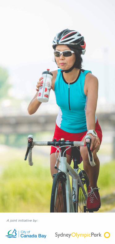
A joint initiative by:

Welcome to the Homebush Bay Cycling Map, a joint initiative by Sydney Olympic Park Authority and City of Canada Bay.
The recent opening of the Bennelong Bridge, connecting Rhodes and Wentworth Point, has unlocked cycle and shared path connections between these regionally significant places in our city.
This map has been developed as an interim information source for cyclists, pedestrians, residents and visitors to our area. We will continue to work in partnership to deliver updated online information about existing and future bike connections as new infrastructure develops.
Due to the fast paced development of new infrastructure in the region, we encourage you to check out our online information before setting out on your cycling adventure.
canadabay.nsw.gov.au/bicycles.html
sydneyolympicpark.com.au/cycling
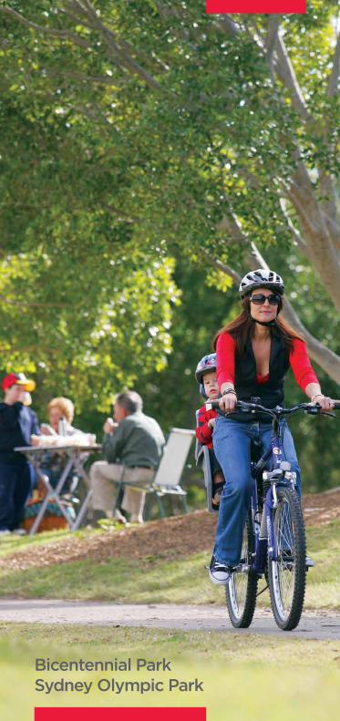
Bicentennial ParkSydney Olympic Park

Safe bike riding tips
• Pathways are there to share, but pedestrians have right of way
• Cycle at 20 km/h for cyclists on shared pathways
• Keep to the left so others can pass safely
• Use your bell to announce your presence especially when approaching from behind
• Look both ways when crossing roads. Practice your traffic safety skills
• It’s the law to always wear a helmet
• Stay on marked pathways and avoid cycling on gravel paths or timber boardwalks
• Help keep frogs, turtles and other wildlife safe by shutting all exclusion gates behind you
• Respect nature by leaving the plants and wildlife undisturbed for everyone to enjoy.
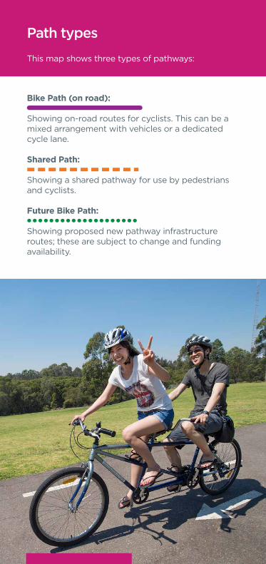
Path types
This map shows three types of pathways:
Bike Path (on road):
Showing on-road routes for cyclists. This can be a mixed arrangement with vehicles or a dedicated cycle lane.
Shared Path:
Showing a shared pathway for use by pedestrians and cyclists.
Future Bike Path:
Showing proposed new pathway infrastructure routes; these are subject to change and funding availability.

City of Canada Bay
Website: www.canadabay.nsw.gov.au Phone: 9911 6555Email: [email protected]
At the time of publication, it is proposed that the City of Canada Bay merge with Burwood and Strathfield Councils. In light of this, please refer to Council’s website for the most up to date contact information.
For other bike related information from the City of Canada Bay, check out www.canadabay.nsw.gov.au/bicycles.html

Sydney Olympic Park
Discover over 35km of cycling pathways and see Olympic icons, spectacular parklands, and areas of cultural heritage. Discover our hidden gems including lookouts, bird hides, wildlife refuges, mangrove boardwalks, shipwrecks and outdoor art. Choose from three great Bike Safari Circuits including the Olympic, Parklands and River Heritage circuits, suitable for ages five years and over.
For more info on cycling and to find out about upcoming events, competition, and special offers visit sydneyolympicpark.com.au/cycling
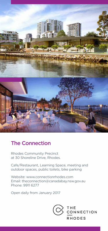
The Connection
Rhodes Community Precinct at 30 Shoreline Drive, Rhodes.
Cafe/Restaurant, Learning Space, meeting and outdoor spaces, public toilets, bike parking
Website: www.connectionrhodes.comEmail: [email protected]: 9911 6277
Open daily from January 2017

Bike Safari Circuits in Sydney Olympic Park
Sydney Olympic Park has three Bike Safari Circuits:• Olympic Circuit• River Heritage Circuit• Parklands Circuit
All circuits are close to facilities such as playgrounds, picnic areas, bubblers and toilets. Bike riding on these circuits is one of our most popular free activities for everyone.
For more information check out:sydneyolympicpark.com.au/cycling

Sydney-wide cycle informationFor more information about cycle routes throughout Sydney, check out:
Bicycle NSWhttps://bicyclensw.org.au/
Sydney Cyclewayshttp://www.sydneycycleways.net/
For information about NSW Governments upcoming cycle and walking projects:http://www.rms.nsw.gov.au/projects/walking-cycling/
Cycle finder – Roads and Maritime Services:http://www.rms.nsw.gov.au/roads/bicycles/cyclewayfinder/index.html
For information on traveling on public transport with your bike, bike parking and lockers:http://www.transportnsw.info/

Feedback about this map
We are always interested in improving the resources available for cyclists, residents and visitors to our places. As this map has been developed during a time of change with new facilities and information constantly being developed, we would like to hear your suggestions and requests for the next edition.
Please email through your ideas to:[email protected] or [email protected].
A joint initiative by:

River Walk
River Walk
Buses Only
Loui
se S
auva
ge P
athway
Bellfrog Boardwalk
Loui
se S
au
vage
Pathw
ay
Louise Sauvage Pathway
Lo
uise Sauvage
Pat
hway
Lorraine
Cra
pp S
po
rts
Wal
k
Louise Sauvage Pathw
ay
Heritage Railway
Her
itag
e R
ailw
ay
Murray Rose Avenue
Murray Rose Avenue
Park St
Parkview Driv
e
Herb Elliott
Avenue
Old Hill Link
Dawn Fraser Avenue
Dawn Fraser Avenue
Uhrig Road
Carter Street
Pondage Link
Figtre
e Driv
e
Shirley Strickland Avenue
Shirley Strickland Ave
nue
Rod Laver Drive
Shane Gould Avenue
B
irnie
Ave
nue
Mar
ine
Pde
Wal
ker
St
Wal
ker
St
Am
alfi
Dr
The
Piaz
za
Baywater Drive
Nuvolari Pl
Verona Dr
Burroway Road
Footbridge Blvd
Victoria Ave Victoria Ave
Geo
rge S
treet
Geo
rge S
t
Pomeroy St
Pomeroy St
Bicentennial Drive
Bicentennial Drive
Bicen
tennial Drive
Kevin Coombs Avenue
Grand Parade
Sarah Durack A
venue
Ed
win Flack A
venue
Olym
pic Boulevard
Australia A
venue
Hill R
oad
Marjorie Jackson Parkway
Ben
nelo
ng P
arkw
ay
M4 Motorway
Brickp
it Li
nk
John Ian Wing Parade
New
ing
ton
Dri
ve
New
ing
ton
Ro
ad
Holker Street
Jam
ieso
n S
tree
t
Showg
round R
oad
Hill
Roa
d
Hill Road
Bennelong Parkway
Homebush Bay Drive
M4 M
otorway
Parramatta Road
Parramatta Road
Holker Busw
ay
Parramatta River
WaterbirdRefuge
Brays Bay
Yaralla Bay
Majors BayKendall Bay
France Bay
Exile Bay
Canada Bay
Kings Bay
Fairmile Cove
Concord Golf Club
Massey Park Golf Club
HarmonyPoint
BayviewPark
Saint Lukes ParkBarnwell Park
Golf Club
Cabarita Park
Edwards Park
HomebushBay
Ermington
Camellia
BirdHide
Bus O
nly
ThePyramid
HaslamsField
VillageGreen
Lake Belvedere
NorthernWater
Feature
Haslams Pier
Shipwreck Viewing PlatformArchery
Centre
NuwiWetland
No Access
NarawangWetland
HaslamsCreekFlats
Kronos Hill
Haslams ReachWentworth
Common
BrickpitRestricted Access
Badu Mangroves
Bicentennial Park
Newington Armory
BlaxlandRiverside Park
The Lodge
Wilson Park
Woo-la-ra
WetlandNo Access
Newington Nature Reserve
WoodlandNo Access
Newington Nature Reserve
WentworthPoint
Silverwater
Newington
NewingtonMarketplace
NewingtonNeighbourhood
Community Centre
RhodesShopping
Centre
ConcordRepatriation
Hospital
Dame EdithWalker Hospital
The ConnectionRhodes Community
Precinct
RhodesCommunity
Centre
RhodesCorporate
Park
Thomas Walker Hospital
Yaralla House
Rivendell
Lidcombe
Homebush
Homebush
LibertyGrove
ConcordWest
StationVictoria AvCommunity
Precinct
ConcordLibrary
RhodesStation
Sydney Olympic ParkFerry Wharf
MeadowbankFerry Wharf
RydeFerry Wharf
Kissing PointFerry Wharf
Mortlake Wharf
CabaritaSwimming Pool
CabaritaFerry Wharf
ConcordWest
Meadowbank
Putney
TennysonPoint
Gladesville
Sydney Olympic Park
Rhodes
NorthStrathfield
Concord
Cabarita
Canada Bay
Breakfast Point
Mortlake
NorthStrathfield
Station
Mason ParkM
arq
uet
St
Jean Wailes Ave
Gauthorpe St
Bennelong Bridge
Leeds St
Llew
elly
n St
Nina Gray Ave
Rid
er Blvd
Sh
ore
line
Dr
Shor
elin
e D
r
Sh
ore
line
Dr
Brays BayReserve
RhodesPark
PegPaterson
ParkUnionSquare
Rocky Point
McllwainePark
Ho
meb
ush
Bay
Dri
ve
Co
ncord
Ro
ad
Co
ncord
Ro
ad
Co
ncord
Ro
ad
Concord
Road
Victoria Road
M4 Motorway
Silv
erw
ater
Ro
ad
Silv
erw
ater
Ro
ad
AthleticCentre
AquaticCentre
SportsCentre
Tom Wills Ovaland Field
NetballCentral
ANZStadium
Qudos BankArena
SpotlessStadium
Sydney Showground
HockeyCentre
Cathy Freeman
Park
Sports Halls
Warm UpArena
Novotel &ibis
PullmanHotel
TennisCentre
ibis budget
Quest
Olympic ParkRailway Station
RhodesForeshore
Park
PeninsulaPark
Mill Park
UhrsPoint
Reserve
TownSquare
HoskinsReserve
Phoenix Park
Fremont Street
Yaralla St
Mepunga St
Nirranda St
Wilga St
Myall St
The Dr
Iandra St
Yaralla St
Hillier
Patterson St
Princess Av
Wellbank St
Archer St
Brays Road
Smythes St
Cabarita Road
GreenleesAve
Brewer St
Correys Ave
Links Ave
Davidson Ave
Cro
ss St
Macnam
ara Ave
Gracemere St
Beronga St
Flavelle S
t
Lancelot S
tE
llis St
Sp
ring
St
Warb
rick St
Patterson St
Gipps St
Gipps St
Stanley St
Lyons Rd
Lyons Rd
To Five Dock �
Henry St
Har
ris
Rd
Crane St
Ian P
arade
Burwood Road
Burw
ood
Road
Mo
rtlake St
Gale S
t
Hilly S
t
Hilly S
t
Salt S
t
Bro
ught
on S
t
Hospita
l Road
Th
orp
e A
veC
har
lto
n D
r
Settlers Blvd
Wen
two
rth
Dr
Qu
een
Str
eet
Wallaroy St
Wunda Rd
Bangalla Rd
Coonong Rd
Castlestead St
Boroni
a St
Moala St
Colane St
Quandong St
MacK
enzie S
t
Co
nsett S
t
Qu
een S
treet
Queen S
treet
Nullawarra Ave
Nullaw
arra Ave
Majo
rs Bay R
oad
Majo
rs Bay R
oad
Underw
ood Road
Will
iam
s S
t
River Walk
Day
St
N
Wet
heri
ll S
t N
Toot
h A
ve
Owens
Ave
Theile Ave
Ave of O
ceania
Birn
ie A
venu
e
Bac
hell
Ave
Ost
end
St
Mon
s StJelli
coe
St
Plat
form
St
Bac
hell
Ave
Nicholas St
Princess St
Bom
bay
St
John
St
Nyr
ang
St
Maud St
Cen
tena
ry D
rive
Norman
Str
eet
Bike Path (on road)
Shared Path
Future Bike Path
Key
Retail/Shops
Café/Restaurant
Community Precinct
School
Library
Public Toilet
Train Station
Ferry Wharf
North
0 500m