high resolution satellite image map from the spot and landsat tm data
TRANSCRIPT

Adv. SpaceRes.Vol. 9, No. 1, pp. (1)115—(1)120, 1989 0273—1177/89 $0.00 + .0Printedin GreatBritain. All rights reserved. Copyright© 1989 COSPAR
HIGH RESOLUTION SATELLITE IMAGEMAP FROM THE SPOT AND LAND SAT TMDATA
S. Tanaka,~’T. Sugimura* and M. Higashi***RemoteSensingTechnologyCenterof Japan, 7—is—i7, Roppongi,
Minato-ku, Tokyo 106, Japan* * Tokyo InshokanPrinting Co. Ltd., 3—36—17, Narimasu, Itabschi-ku,
Tokyo175,Japan
ABSTRACT
Combining the Spot HRV data taken by P—mode and the Landsat TM data, animproved satellite image was generated. This new image is expressed in colorwith 10 meter spatial resolution. Selection of three TM bands for the colorcomposition and the histogram transformation of the band data for printingare examined. Next, a geographical information overlapped with thissatellite image was examined. Line segments as transformation networks ofroads and railways, administrative boundaries, location names are involved inthe Information. Thickness of the lines and superimposition techniques inprinting are discussed also, Finally, an experimental map of Tokyo andVicinity was compiled as a sightseeing map at a scale of 1:50,000.
INTRODUCTION
An advanced satellite image map is designed. Successful launches of varioustype of Earth observation satellites from various countries make possible tocollect the Earth surface information by different remote sensors. Mergingthe various sensor image data, a new type of information may be expressed.The authors have an experiment to produce a new satellite image mapcharacterized by the following two items using the Landsat TM and SPOT HRVpanchromatic data.(1) Background image of the map consists of a high resolution multi—spectralcolor composite. This is to generate a 10 meter resolution true color imagein actual.(2) Geographical informations are overlaid on the image in a moderatepopulation so as not to eliminate the background image . Purpose of this mapis to transmit a geographical information to wider observers in public usefrom administrative personnels to sightseeing travelers.
Technical points to achieve above objective are summarized as next threeitems.(1) Principle to high resolution color image using a high resolution pan—chromatic image and a low resolution multi—spectral image.(2) Concept to make a good feeling pictorial image map. I. e. , we need tothink the fundamental meanings of color, information and map.(3) Quantity and quality balance between the geographical information and theback ground satellite image. Too many or too few geographical informationsmay decrease the value of the map as regard the information transmissionability to the observer.
HIGH RESOLUTION COLOR IMAGE
The first subject of this work is to generate a high resolution colorsatellite image. This image becomes the background of our satellite imagemap. Our idea to produce a high resolution color image is to utilize thehigh resolution component of a high resolution satellite image and to utilizealso the color component of multi—spectral satellite image. In this way, wechose a SPOT/HRV 10 m resolution image and Landsat TM multi—spectral data.
The principal to generate the high resolution color image is a combiningof high spatial frequency image to a low spatial frequency color image. Totake this operation, a rigorous registration between two satellite images isrequi red.
(1)115

(1)116 S. Tanakaet at.
Iw~ SaiaIIii~ Dala C~ndiiinnFor the sake of initial discussion for a rigorous registration, a pair ofsatellite data of small undulation area taken just under the satellites wasselected as a test data. Also a coincidence of data acquisition season andtime leads to a good quality color composite. Landsat TM data and Spot HRVdata covering the palace side area of a 16 km square was chosen in ourpreliminary study. The data parameters are shown in Table 1. Fig. 1 showstwo satellite image frames, and Fig.2 shows a part of the final highresolution satellite image map in this study.
E1axaii~n d1LLa.r.an~aSatellite data involves a local distortion due to the elevation difference.Especially in SPOT image, the distortion by the elevation difference becomeslarge when it is viewed from a highly slant direction. Elevations in thetest area ranged from 0 to 40 m. The off nadir angle of the SPOT observationwas 2.3 degrees in right direction. A horizontal residual of 0.5 pixels inSPOT HRV 10 m image may occur in the test data. In this case, an elevationdifference which generates a horizontal shift of 5 m can be obtained as dH =
5 m / tan 2. 3 degrees = 124 m.
Saaa~nGround objects change the color in season. Especially, the color of grassland and forest turns the color expression in summer and winter. Whendifferent satellite images are combined, a variation of the reflectance ofthe ground object itself should be counted. We carefully selected theLandsat and SPOT imageries in same season as Landsat one is that of 9 October1986 and SPOT one is that of 17 October 1986. Because of the short seasonaldifference, the both images involve no significant seasonal effects.
limaThe sun changes the elevation and the azimuth with the time. The intensityof solar reflection on the Earth surface varies with the sun movement. Whentwo satellite imageries are chosen, the solar elevation and azimuth hadbetter to be similar as possible. As of the test data;
Landsat data: solar elevation = 39, solar azimuth = 142 degreesSpot data: solar elevation = 43, solar azimuth = 162 degrees
Gaamai.~i~aI High ~.ta~iaian RagiaiLaiianRegistration between two images needs to be precisely performed. Thesettlement of precision level was taken at a size of half SPOT/}IRV pixels,or, at a size of 1/6th Landsat TM pixels, i.e. , at a ground resolution of 5m. Experimentally 25 ground control points are chosen at well recognizedland marks mainly from road bridges. Affine transformation was used for thisregi strati on.
IMp = P1 HRVp + P2 HRV1 + P3TM1 = P4 HRVp + P5 MRV1 + P6 (1)
where, (TMp,TM1) and (HRVp,HRV1) are the image coordinates of GCP on LandsatTM and Spot HRV imageries respectively.Root mean square residuals of 25 GCPs after the registration becomes 6.3 m inpixel direction and 3.4 m in line direction. To obtain these high precision,we used an enlarged image on TV display. The Landsat image enlargement was 9times and the Spot image enlargement was 3 times of the original datarespectively. Using the 6 coefficients of Eq. Cl) obtained in this precision,Landsat TM image was transformed to the Spot image coordinates. We adoptedthe cubic convolution resampling method in this procedure, as a results ofour comparison with the other two type interpolations, i.e., nearest neighborand bi—linear Interpolation.
GanaLaii~n al High RaaaJ.ujian SaiaJ..Ljja .LmagaA 10 m resolution Landsat image Is generated by a re—sampling method so as tomatch the corresponding Spot image. Among three re—sampling methods; thecubic convolution gaves a moderate and well contrast image. Thus generatedLandsat 10 m resolution image, however, does not involve the spatialfrequency component of 10 m wavelength theoretically. But, Spot imageincludes the 10 m wave length spatial frequency component. We herewithdevise to weave the both image data.
Method I: Means of two data TMk’ = (TMk + HRV)/2 (2)where, TMk = Landsat TM k band value
HRV = Spot HRV valueTMk’= New Landsat TM k band value
Method 2: Parallel shift of TM value TMk’= TMk + (HRV — TM3)/2 (3)
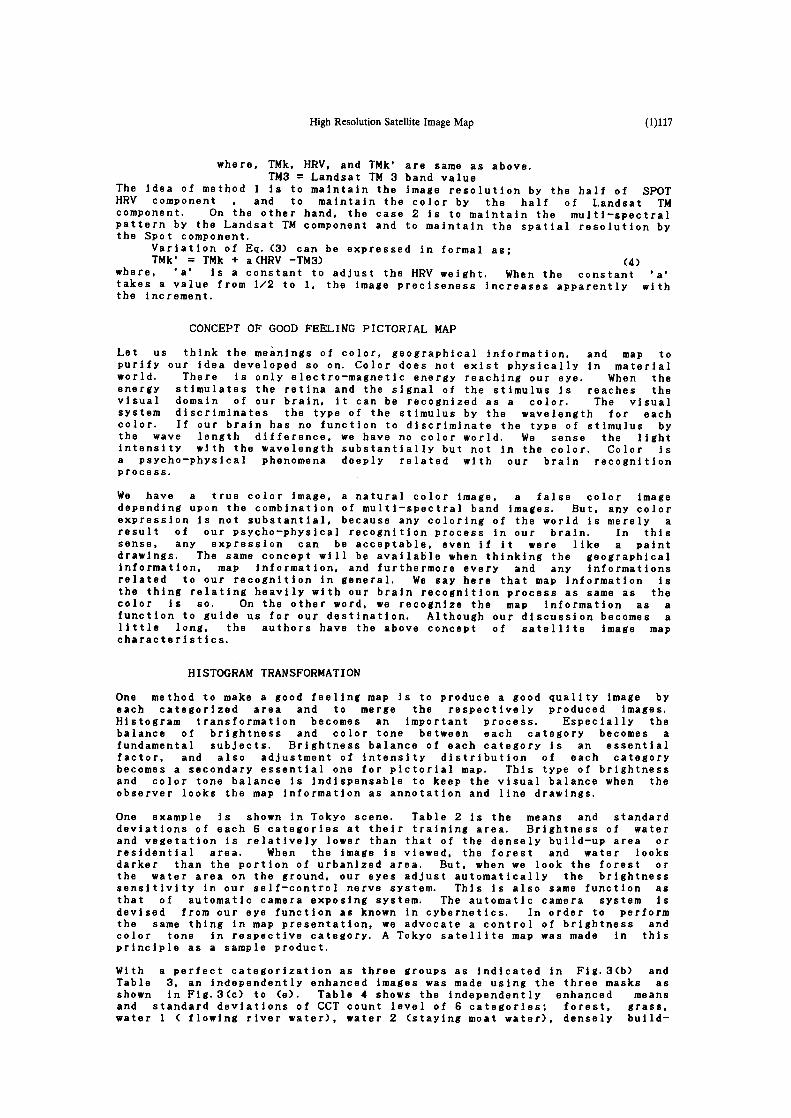
High ResolutionSatelliteImageMap (1)117
where, TMk, HRV, and TMk’ are same as above.TM3 = Landsat TM 3 band value
The idea of method 1 Is to maintain the image resolution by the half of SPOTHRV component , and to maintain the color by the half of Landsat TMcomponent. On the other hand, the case 2 Is to maintain the multi—spectralpattern by the Landsat TM component and to maintain the spatial resolution bythe Spot component.
Variation of Eq. (3) can be expressed in formal as;TMk’ = TMk + a (HRV —TM3) (4)
where, ‘a’ is a constant to adjust the HRV weight. When the constant ‘a’takes a value from 1/2 to 1. the image preciseness increases apparently withthe increment.
CONCEPTOF GOODFEELING PICTORIAL MAP
Let us think the meanings of color, geographical Information, and map topurify our idea developed so on. Color does not exist physically in materialworld. There is only electro—magnetic energy reaching our eye. When theenergy stimulates the retina and the signal of the stimulus is reaches thevisual domain of our brain, it can be recognized as a color. The visualsystem discriminates the type of the stimulus by the wavelength for eachcolor. If our brain has no function to discriminate the type of stimulus bythe wave length difference, we have no color world. We sense the lightintensity with the wavelength substantially but not in the color. Color isa psycho—physical phenomena deeply related with our brain recognitionprocess.
We have a true color image, a natural color image, a false color imagedepending upon the combination of multi—spectral band images. But, any colorexpression is not substantial, because any coloring of the world is merely aresult of our psycho—physical recognition process in our brain. In thissense, any expression can be acceptable, even if it were like a paintdrawings. The same concept will be available when thinking the geographicalinformation, map information, and furthermore every and any informationsrelated to our recognition in general. We say here that map information isthe thing relating heavily with our brain recognition process as same as thecolor is so. On the other word, we recognize the map information as afunction to guide us for our destination. Although our discussion becomes alittle long, the authors have the above concept of satellite image mapcharacteristics.
HISTOGRAM TRANSFORMATION
One method to make a good feeling map is to produce a good quality image byeach categorized area and to merge the respectively produced images.Histogram transformation becomes an important process. Especially thebalance of brightness and color tone between each category becomes afundamental subjects. Brightness balance of each category is an essentialfactor, and also adjustment of intensity distribution of each categorybecomes a secondary essential one for pictorial map. This type of brightnessand color tone balance Is indispensable to keep the visual balance when theobserver looks the map information as annotation and line drawings.
One example is shown in Tokyo scene. Table 2 is the means and standarddeviations of each 6 categories at their training area. Brightness of waterand vegetation is relatively lower than that of the densely build—up area orresidential area. When the image is viewed, the forest and water looksdarker than the portion of urbanized area. But, when we look the forest orthe water area on the ground, our eyes adjust automatically the brightnesssensitivity in our self—control nerve system. This is also same function asthat of automatic camera exposing system. The automatic camera system isdevised from our eye function as known in cybernetics. In order to performthe same thing in map presentation, we advocate a control of brightness andcolor tone in respective category. A Tokyo satellite map was made in thisprinciple as a sample product.
With a perfect categorization as three groups as indicated in Fig.3Cb) andTable 3, an independently enhanced images was made using the three masks asshown in Fig.3(c) to Ce). Table 4 shows the independently enhanced meansand standard deviations of CCT count level of 6 categories; forest, grass,water 1 C flowing river water), water 2 (staying moat water), densely build—

(1)118 5. Tanakaet at.
up area, and residential area. After the enhancement, we have a modifiedimage as shown In Fig.3(f). We have a good background satellite image bythis manner.
ANNOTATION AND DRAWINGS
The authors have a concept that the satellite image map should transmit thegeographical information sufficiently to the users who know less knowledgeabout the place. Annotation and drawings are need to be overlaid upon thesatellite image. The quantity and quality of annotation and drawings shouldbe kept in a well balanced ones with the background satellite image.
As our experimental map production, we decided to make a sightseeing map ofTokyo and vicinity at a scale of 1:50,000. Transportation by railway androads are key functions of sightseeing. From this view point, the annotationincludes major sightseeing points, major roads as Meiji—douri and Hakusan—douri, major intersections, administrative division name, station names ofrailway system. To attain this destination, we have three planimetricmanuscripts. One is these annotations put on one manuscript sheet. Theother two manuscripts are originated respectively in the sense of sightseeingmap. One is transportation lines including railways and major road networks,and another one is administrative boundaries in the level of Tokyo 23 wards,city, town, and villages as attached in Fig. 1. The above annotations andplanimetric line drawings are carefully chosen as the effect to thebackground satellite image becomes small as possible.
CONCLUDINGREMARKS
We have an experimental edition of ‘Sightseeing map of Tokyo 23 wards andvicinity’ at a scale of 1:50,000. We concludes the following points in thisexperimental work.
Cl) Ground objectives seen on the map includes large buildings and largeairplanes. Recognized planes are so—called jumbo—jet plane as Boeing 747.The size of 50 m square is corresponds five times larger than one pixel sizeof 10 m of SPOT/HRV resolution. Composition of high resolution and lowresolution images represents effectively ground details in these resolution.
(2) Coloring of the map Image becomes natural in our ordinary sense. Namely,blue see, green forest and grass, and gray tone urbanized area spread on themap. This color expression can be performed by the author’s new concept ofcoloring of satellite image map.
C3) Orientation of the objective place is easily and confortabily done on themap because of line drawings and annotations, and also due to the naturalcolor image.
(4) Colors of lines and annotations had better to be improved from ourpsychological aspects in a future work. Especially , the color balancebetween background satellite image and overlaid lines and annotation isimportant.
(5) The concept of satellite image map production in this study is applicableto all the same kind of satellite image production.
REFERENCES
1. L.A.Andrade, Les possibilites d’obtention de produits cartographiques avecl’utilisation de images du satellite SPOT, iS2RSKgaiaZCammiijan ~ 19882. S.Tanaka et al, A Study to Produce 1:100,000 Scale LFC Color Photomap,Ad~e...S~a~aRa itaL..2,Na..J.l,pp. (ll)237’-(ll)240, 19873. R.D.Kidwell et al, Landsat Image Map Production at the U.S. GeologicalSurvey, .IaunaJ. ai ~Lmaging Iaahnaiag~, Vol. 13, No. 3. 19874. T.Sakai et al, A Producing of 1:100.000 Scale Landsat Map Tokyo andVicinity”, .LauLna.L aL ~ha Ramaia Sansing Ssaiai~t aL Japan, Vol.5, No.3, 1985

High Resolution Satellite Image Map I ‘119
Table I Satellite Data Parameters
Satellite Sensor Observation Band Number Resolution Processing
Landsat TM 09 October 1986 7 28.5 a Bulk
Spot HRV 17 October 1986 1 10 m 1 B
—II —~._ —,
/ .~
/Ii Landsat / /
Ii..‘. / ~L ~lJ Regend
l~ W — . .— ..—~ _�~ - / ~ - 15 IR ~I W --—— OtherBoundanes
__________ J R ~ ShinkansenlJR)
/ ~ ~ ~ J R ~ ~— Japan Railways
L~ ~ ,~ ,/‘ / —~— Other Railways~ .S ç ( / * 4 Expressways
(I~T~1~—~)i ShutsExpressways
~ i -- .__T ~ l~l II NationalRoads
i ~‘ I l.auds.at ,nd ‘~p.t I is~i~fr~rIus i ri I his study ~i~±~igi Satellite Image Map
~
~ -
‘d~’7I~ ~ , vp.q -~ ~
- ~ ~ ~(t~s
~~~f!t~ ~
• 4’E~ç. ‘.~.1, ~ ~ ~
p~ ~p ‘-~~• ‘ -.. ~ , ,~4 •. ,. ... ~ ~
...‘.f. ~tM~:’ ~ . ~ ~ ~
Fi,..2 High r~soliit:ion satellite image map with drawings and annotations (a part.)

(1(120 S. Tanaka et at.
Table 2 Original CCT Counts of Landsat/TM1 to TM4 Data for 6 Land Categories
CATEGORY FOREST LAWN WATER 1 WATER 2 * BUILD—UP RESIDEN—ITEMS ~ AREA hAL AREA(Sample Number) ( 1,725) ( 243 ) ( 483 ) ( 745 ) ( 1,256) ( 685
Band I (m, a) 67.2 2.3 78.2 2.7 70.6 2,3 77.4 2.2 77.9 7.9 82.3 5.8Band 2 (m, a) 28.2 2.0 39.8 3.1 27.7 1.5 40.7 1.8 31.6 7.2 34,7 5,2Band 3 (m, a) 24.1 1.6 35.9 2.8 24.1 0.8 34.0 1.4 32,7 7.3 37,4 5.4Band 4 (m, a) 75,5 18.5 119 18.9 3.2 2.7 23.6 36.9 16.9 8.0 23.3 7,4
(WATER 2 * is a water surface with water weedsat a palace side moatTable 3 Persentagescategorizedas group
Mask la Mask lb Mask 2a Mask 2b Mask 3a Mask 3b
MASK la FOREST 95.2 0.4 0.2 0.6 3.1 0.5MASK lb LAWN 0.0 100.0 0.0 0.0 0.0 0.0MASK 2a WATER 1 0.0 0.0 97,3 0,0 2.7 0,0MASK 2b WATER 2 0.0 3.6 0.1 94.1 2.1 0.0MASK 3a BUILD—UP AREA 0.0 0.0 0.7 0.0 77.2 22.1MASK 3b RESIDENTIAL AREA 0.0 0.0 0.0 0.0 21.8 78.3
Table 4 Independly Enhanced CCT Counts of l,andsat/TM1 to TM4 Data for 6 Land Categories
CATEGORY FOREST LAWN WATER I WATER 2 * BUILD—UP RESIDEN—ITEMS ~ AREA TIAL AREA(Sample Number) ( 1,725) ( 243 ) ( 483 ) ( 745 ) ( 1,256) ( 685
Band 1 (m, a) 69.4 5.9 97.4 6.9 181 6.3 95.1 2.2 114 50.4 142 37.0Band 2 (m, a) 143 10.2 203 15.8 47.1 2.6 69.2 3.1 110 36.7 126 26.5Band 3 (m, a) 61.5 4.1 91.5 7.1 41.0 1.4 57.8 2.4 115 37.2 140 27.5
____________ Forest / water ____
_________ (b)
/ . .C -~ ____ .‘ ‘~T ~
* r ____
()• . :~.. ~ •,.~> (a) ____. ~ (f) ____________
Fig,3 Procedureto make an independentlyenhancedbase image(a.) Original high resolution image,, (b) Three categories for independent enhancement(c) Mask 1 for forest and grass, (d) Mask 2 for water zone,(e) Mask 3 for urbanized and residential area, (f) Independently enhanced image