high-resolution marine magnetic surveys for searching ... · pdf file1167 annals of...
TRANSCRIPT

1167
ANNALS OF GEOPHYSICS, VOL. 49, N. 6, December 2006
Key words High-resolution marine magnetic sur-veys – marine archaeological search – ship-wreck –amphorae
1. Introduction
The development and diffusion of marinegeophysical investigations for searching under-water and buried archaeological features (i.e.Chahuan and Almeida, 1988; Quinn et al., 2000)are hindered by the complexity of the executionand the very high costs involved.
A recent scientific cooperation among someItalian research institutions and the Italian Navyhas been crucial in overcoming these obstacles
and it has allowed the implementation of an in-teresting research program on methodological,technical and practical aspects of the high-reso-lution marine magnetic surveys.
The present paper discusses subjects con-nected with the use of modern instrumentationsand technologies and with appropriate data ac-quisition procedures. Then we describe two casehistories performed at different depths and char-acterized by different submerged and buried tar-gets.
In the first prospecting, a transverse gra-diometer configuration was applied in order todetect high-frequency anomalies generated by a20th-century shipwreck sunk at shallow depth(40 m). In the second case, the use of advancedtechnologies and appropriate data acquisitionprocedures were combined to execute a deep(350 m) magnetic survey resulting in fruitfulfinding of an extensive heap of Roman amphorae.
These satisfactory results establish an opti-mum starting-point to continue this interesting
High-resolution marine magnetic surveysfor searching underwater cultural resources
Fabio Caratori Tontini (1), Cosmo Carmisciano (1), Marcello Ciminale (2), Marco Grassi (3),Paolo Lusiani (3), Stefano Monti (4) and Paolo Stefanelli (1)
(1) Istituto Nazionale di Geofisica e Vulcanologia, Sede di Portovenere, Fezzano (SP), Italy(2) Dipartimento di Geologia e Geofisica, Università degli Studi di Bari, Italy
(3) Istituto Idrografico della Marina, Genova, Italy(4) Comando Operativo Vertice Interforze, Ufficio GEO-METOC, Roma, Italy
AbstractRecently two marine magnetic surveys, combined with the use of a multi-beam sonar (Kongsberg Marittime EM300 multibeam: 30 KHz frequency echosounder for hydrographic purposes; acoustic lobe composed of 128beams able to cover a 150° sector) a side-scan sonar (Simrad MS 992 dual-frequency sidescan sonar with echosounder transducers 150 Hz and 330 KHz) and a Remote Operated Vehicle (ROV – a mobile tools used in envi-ronments which are too dangerous for humans), were executed in two sites respectively in the Ligurian Sea andthe Asinara Gulf. The aim of these investigations was to test modern instrumentations and set new working pro-cedures for searching underwater cultural resources. The collected and processed magnetic data yielded very sat-isfactory results: we detected submerged and buried features of cultural interest at both sites, at depths of 40 mand 400 m respectively.
Mailing address: Dr. Cosmo Carmisciano, Istituto Na-zionale di Geofisica e Vulcanologia, via Pezzino Basso 2,19020 Fezzano (SP), Italy; e-mail: [email protected]

1168
Fabio Caratori Tontini et al.
research in a branch of Marine Applied Geo-physics which strongly requires considerableeconomic undertaking, a multi-disciplinary ap-proach and the use of modern technologies.
2. Aspects of the marine magnetic survey
The high-definition study of a marine geo-magnetic field structure involves the fundamen-tal technical problems of establishing the fol-lowing items:
i) the accuracy in positioning of the meas-urement points;
ii) the correct estimation of the geomagnet-ic time variation;
iii) high sensitivity instrumentations;iv) the use of a low-noise magnetic vessel;v) the survey procedure.An high definition assessment of the cross-
over error (the differences in the measurementsat the intersection of ship tracks) and an accu-rate positioning of the measurement points areof primary importance. These parameters aredirectly connected with the short-wavelengthfields, as well as with the presence of possiblemagnetic sources lying on the seabed. Thehighly detailed positioning of the measurementpoints can be carried out by means of a DGPS(Differential Global Positioning System) or aGPS coded P, usually equipped on board ofmilitary ships. Currently, more innovative posi-tioning techniques based on RTK (Real TimeKinematics) have being tested. This techniqueseems to be very successful, above all in thecoastal sea area where it is possible to install a«base receiver» which communicates with the«rover receiver» placed on board; the distancebetween the base and rover receivers definesthe «baseline». Once the base receiver has re-solved the ambiguities correctly, the accuracyof each position computation is within a fewcm, depending on the antenna multipath rejec-tion capability.
In order to make the geomagnetic fieldmeasurements independent from time varia-tions, setting up a temporary geomagnetic ob-servatory in the study area is particularly effec-tive. The site selection is made through the co-herence analysis (Parkinson and Jones, 1979).
The spatial stability of the observatory meas-urements, i.e. the evaluation of the coherence, isobtained by comparing one or more magne-tograms produced by coastal base stations (Fag-gioni et al., 1997; Faggioni and Caratori Tonti-ni, 2002).
During the surveys discussed herein, the ge-omagnetic observatories were equipped with aportable Geometrics G858 caesium magne-tometer with a sensitivity of 0.05nT at a sam-pling rate of 10 Hz.
The instrumentation used for collecting ma-rine magnetic data was a Geometrics G-880caesium magnetometer (sensitivity 0.05 nT at a0.1 Hz) equipped with two sensors. Beside thestandard arrangement (the use of one sensor on-ly), two basic gradiometer sensor array config-urations are possible: transverse horizontal orlongitudinal (fig. 1). In the first configuration, aparticular tow frame assembly holds the towpoints of the magnetometers apart at a fixed dis-tance (2 m). This frame consists of a triangularstructure composed of fibreglass spars and alu-minium couplings (fig. 2). A ballast fish pro-vides the necessary weight to maintain theframe in a horizontal position, thereby avoidingthe hydrodynamic «tilt». Due to the distancebetween the two sensors and to the hydrostaticsustenance of the whole structure, this configu-ration is particularly effective in shallow watersfor high frequency anomalies. On the contrary,if deep waters and long wavelengths are in-volved, the longitudinal configuration is com-monly adopted; in this case, the sensors aretowed along the same line at a fixed distanceone from the other, depending on the wave-length of the signal of interest. In both case thearray is towed by a Kevlar coax cable whichwas digital data immune from shipboard noise.In order to facilitate handling, a single coax ca-ble, supplied with a Telemetry Interface Unit,assure power supply, bidirectional communica-tion and control for all towfish systems to bemultiplexed down a single co-axial cable. Thetelemetry system employed a transmission fre-quency of 200 KHz in order to obtain the bestpropagation with the lowest attenuation.
The sensors of this magnetometer are also e-quipped with a depth transducer, particularly use-ful in vertical gradient application or for quick-

1169
High-resolution marine magnetic surveys for searching underwater cultural resources
Fig. 1. The geometry of the two G880 sensors: transverse and longitudinal gradiometric scheme.
Fig. 2. Instrumentation used for the transverse gradiometric array; the two sensors, the ballast and the triangu-lar frame are visible.
1170
Fabio Caratori Tontini et al.
connection integration to side-scan sonar systemsto communicate the sensor depth on-line.
A low-noise magnetic vessel allows the useof a short tow cable. In January 2002, Interma-
rine (an Italian naval shipyard, specializing inthe design and manufacturing of fiber rein-forced plastic marine crafts) delivered two newcatamaran-type Hydrographic Survey Vessels
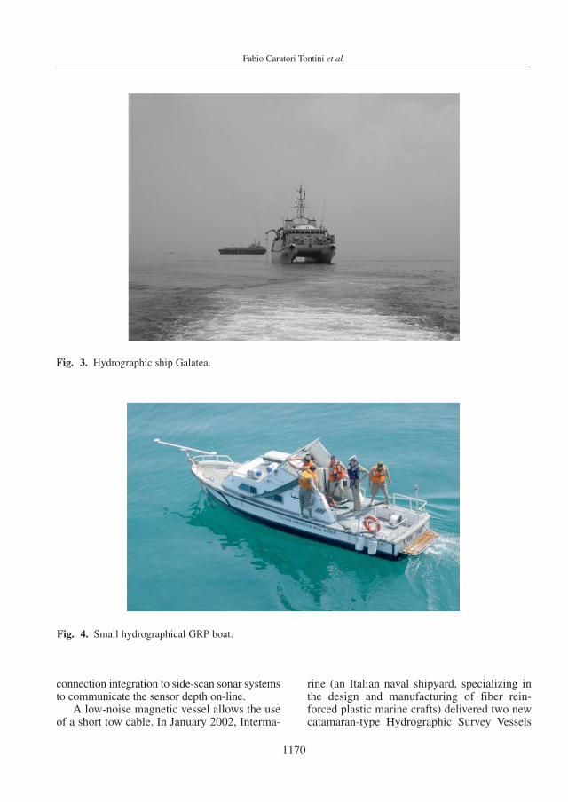
Fig. 3. Hydrographic ship Galatea.
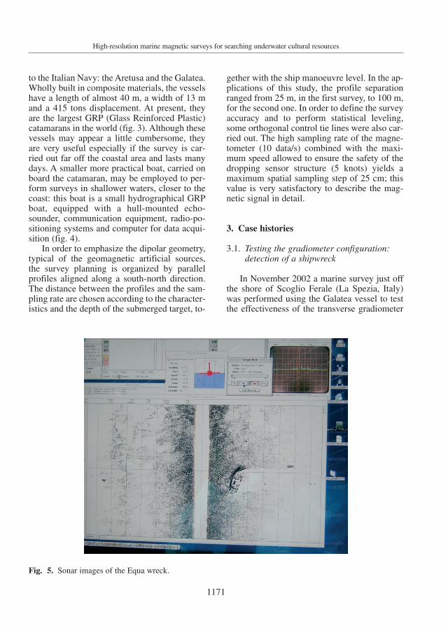
Fig. 4. Small hydrographical GRP boat.
1171
High-resolution marine magnetic surveys for searching underwater cultural resources
to the Italian Navy: the Aretusa and the Galatea.Wholly built in composite materials, the vesselshave a length of almost 40 m, a width of 13 mand a 415 tons displacement. At present, theyare the largest GRP (Glass Reinforced Plastic)catamarans in the world (fig. 3). Although thesevessels may appear a little cumbersome, theyare very useful especially if the survey is car-ried out far off the coastal area and lasts manydays. A smaller more practical boat, carried onboard the catamaran, may be employed to per-form surveys in shallower waters, closer to thecoast: this boat is a small hydrographical GRPboat, equipped with a hull-mounted echo-sounder, communication equipment, radio-po-sitioning systems and computer for data acqui-sition (fig. 4).
In order to emphasize the dipolar geometry,typical of the geomagnetic artificial sources,the survey planning is organized by parallelprofiles aligned along a south-north direction.The distance between the profiles and the sam-pling rate are chosen according to the character-istics and the depth of the submerged target, to-
gether with the ship manoeuvre level. In the ap-plications of this study, the profile separationranged from 25 m, in the first survey, to 100 m,for the second one. In order to define the surveyaccuracy and to perform statistical leveling,some orthogonal control tie lines were also car-ried out. The high sampling rate of the magne-tometer (10 data/s) combined with the maxi-mum speed allowed to ensure the safety of thedropping sensor structure (5 knots) yields amaximum spatial sampling step of 25 cm; thisvalue is very satisfactory to describe the mag-netic signal in detail.
3. Case histories
3.1. Testing the gradiometer configuration:detection of a shipwreck
In November 2002 a marine survey just offthe shore of Scoglio Ferale (La Spezia, Italy)was performed using the Galatea vessel to testthe effectiveness of the transverse gradiometer
Fig. 5. Sonar images of the Equa wreck.

1172
Fabio Caratori Tontini et al.
configuration. In the surveyed area, a ship-wreck is present at a depth of approximately 40m (fig. 5): it is the Italian armed cargo Equawhich was sunk in 1944 (www.relitti.it). Ma-
rine documents show that its original weightwas about 300 tons, and that its structure waspredominantly ferrous. Two sensors along par-allel paths were used for collecting measure-
Fig. 6. Transverse horizontal gradiometric map of the offshore site of Scoglio Ferale (black dot on the map)underlying the ship line-paths; values and colour range [−1.8 white, +12.7 black] nT/m.

1173
High-resolution marine magnetic surveys for searching underwater cultural resources
ments and to reduce the influence of time originsignal which could contaminate the measuredvalues.
One intense high-frequency gradient anom-alies can be observed in the centre of the map,corresponding to the location of the ship (fig.6). The positioning of the measurement pointscan be carried out by means of a DGPS, suffi-ciently accurate for this test. It is important tonote the decisive contribution given by the gra-dient field measurements to the correct inter-pretation of the magnetic sources: these meas-urements are approximately free of any timecontaminations which sometimes may generatespurious signals, superimposing and disturbingthe spatial anomalies.
3.2. Technological improvement:the amphorae site
In summer 2003, a detailed marine surveywas performed in the Asinara Gulf (NW of Sar-dinia Island, Italy) using the Galatea vessel. Ac-cording to historical evidence, some ships weresunk in this area during World War II. In thissurvey, the G880 magnetometer was used instandard configuration and quickly combinedwith a modern digital side scan sonar systemsin order to measure the geomagnetic field asclose as possible to the seabed. This investiga-tion was also carried out to test a deep towedconfiguration which is believed to be very ef-fective in archaeological applications in which
Fig. 8a,b. Two different views of the extensive submerged heap of Spanish amphorae.
Fig. 7. Magnetic field along the significant profile recorded in the Asinara Gulf.
a b

1174
Fabio Caratori Tontini et al.
the targets of interest lie above the sea bottom.Indeed, the advanced instrumentation perform-ance permits to use the magnetometer in deep-er waters. In the case studied, the depth trans-ducers are able to reach an operational depth ofabout 300 m, but it is possible to upgrade its op-erational performance to a depth of 1000 m.
The survey covered a series of 2×2 km sec-tors and, in each square, several parallel profileswere executed at a distance of 100 m; in thiscase, the accurate positioning of the measure-ment points was obtained by means of a DGPS.The ship was maintained at a steady speed be-tween 1 and 2 km. This interval rate allowed thesensor, connected to the vessel by a 400 mKevlar cable and a ballast of 100 kg, to reachdepths ranging between [350, 100] m. In thisway, in water depths less than 400 m, the mag-netic measurements were collected at a level ofabout 35 m above the seabed.
Figure 7 shows the magnetic field measure-ments along a significant profile. A dipolar highfrequency signal of about 14 nT in amplitude iswell isolated from the larger wavelength re-gional trend. In order to obtain the completemagnetic anomaly map, time variation reduc-tion and regional trend removal were carriedout by using a base station placed on the near-by coast and an appropriate second-degreepolynomial in latitude and longitude (De Santiset al., 2003) respectively. Moreover, final ad-justments of the data set were obtained throughthe procedures of statistical leveling and mi-croleveling, to avoid residual intersection errorsand line-path stretching along the surveyed pro-files (Minty, 1991; Ferraccioli et al., 1998).
The subsequent visual inspection executedby means of an ROV has brought to light an ex-tensive heap of amphorae (fig. 8a,b) at a depthof 400 m.
Archaeologists seem to be very interested inthis finding. The considerable depth at whichthis resource lies presents some problems withregard to its total or partial raising. However, atpresent, the study of its filmed images yields animportant contribution to the reconstruction ofthe commercial courses between Spain andItaly during the Imperial Age (I, II centuryA.D.). In fact, the two types of amphorae dis-covered are of Spanish manufacture (more ex-
actly from the Betica region, south of Spain)and were used to transport garum, a savouryfish sauce used in that period and highly appre-ciated in the city of Rome.
4. Conclusions
The marine magnetic survey for archaeo-logical prospecting has been considered by de-veloping technical and experimental aspects.The two cases reported demonstrated the highlevel of information that this type of investiga-tion may obtain, concerning both the locationof the sources (shallow or deep waters) andtheir magnetic origin. The obstacle representedby both the complexity of a marine investiga-tion and by the high costs involved may beovercome by establishing a sound scientific co-operation between Institutions which offer sci-entific capacity, grants and modern instrumentsas was the case in the present investigations dis-cussed.
Acknowledgements
We thank the reviewers M. Fedi and A. Pig-natelli for their useful comments.
REFERENCES
CHAHUAN, O.S. and F. ALMEIDA (1988): Geophysical meth-ods as a tool to explore submerged marine archaeolog-ical sites, in Marine Archaeology of Indian OceanCountries, edited by S.R. RAO (Goa, India: National In-stitute of Oceanography), 3-5.
DE SANTIS, A., L. GAYA-PIQUÉ, G. DOMINICI, A. MELONI,J.M. TORTA and R. TOZZI (2003): Italian GeomagneticReference Field (ITGRF): update for 2000 and secularvariation model up to 2005 by autoregressive forecast-ing, Ann. Geophysics, 46 (3), 491-500.
FAGGIONI, O. and F. CARATORI TONTINI (2002): Quantitativeevaluation of the time-line reduction performance inhigh definition marine magnetic surveys, Mar. Geo-phys. Res., 23, 353-365.
FAGGIONI, O., N. BEVERINI and C. CARMISCIANO (1997): Ge-omagnetic time variations and high definition study ofspace magnetic effects induced by artificial submergedsources, Boll. Geofis. Teor. Appl., 38, 915-930.
FERRACCIOLI, F., M. GAMBETTA and E. BOZZO (1998): Mi-crolevelling procedures applied to regional aeromag-netic data: an example from the Transantartic Moun-tains (Antartica), Geophys. Prosp., 46, 177-196.

1175
High-resolution marine magnetic surveys for searching underwater cultural resources
MINTY, B.R.S. (1991): Simple micro-levelling for aeromag-netic data, Expl. Geophys., 22, 591-592.
PARKINSON, W.D. and F.W. JONES (1979): The geomagneticcoast effect, Rev. Geophys. Sp. Phys., 17, 1999-2015.
QUINN, R., J.A.G. COOPER and B. WILLIAMS (2000): Marine
geophysical investigations of the inshore coastal watersof Northern Ireland, Int. J. Naut. Arch., 29, 294-298.
(received September 9, 2005;accepted May 30, 2006)