hickman road bridge replacement project€¦ · hickman road bridge replacement project ... federal...
TRANSCRIPT

Hickman Road Bridge Replacement Project
Initial Site Assessment (ISA)
Hickman Road Bridge Replacement Project Hickman Road at Tuolumne River
Stanislaus County, City of Waterford BRLO‐5938(199)
September 2016
Hickman Road Bridge Replacement i Initial Site Assessment September 2016
EXECUTIVE SUMMARY
The Hickman Road Bridge Replacement over Tuolumne River project site is located 0.15 mile south of State Route 132 near the town of Waterford in northern Stanislaus County. The proposed project involves replacing the existing, structurally deficient and scour critical bridge (Bridge No. 38C‐0004) with a new bridge at the same location. The property assessed for this initial site assessment (ISA) includes the area adjacent to the existing bridge, and is referred to as the “project area” or the “project site” in this report. Adjacent land uses consist of recreational, commercial retail, and public facilities. According to review of historical sources, including historical aerial photographs and topographic maps, the first development of the project site occurred prior to 1916. The Caltrans Historic Bridge Inventory indicates that the Hickman Road Bridge was built in 1946. This ISA identifies Recognized Environmental Conditions (RECs) for the project site that may adversely affect roadway construction or right‐of‐way acquisition. An REC is defined by the ASTM Practice E 1527‐05 as: “the presence or likely presence of any hazardous substances or petroleum products in, on, or at a property: (1) due to any release to the environment; (2) under conditions indicative of a release to the environment; or (3) under conditions that pose a material threat of a future release to the environment.” The term is not intended to include de minimis conditions that generally do not present a material risk of harm to public health or the environment and that generally would not be the subject of an enforcement action if brought to the attention of regulatory governmental agencies. Conditions determined to be de minimis are not recognized environmental conditions.
This ISA was conducted in general conformance with the scope and limitations of the ASTM Practice E 1527‐05. This ISA includes a summary of the site reconnaissance conducted on March 27, 2015, a review of environmental databases, and a review of historical data sources. Any exceptions to or deletions from these ASTM practices are described later in this report.
A database report was retained from Environmental Database Resources, Inc. (EDR) consisting of information compiled from various government records, such as Geotracker, National Priorities List and solid waste information system, for information regarding the project area. The EDR did not identify any potential environmental issues within the project area; however, the surrounding sites (within one mile) have the following potential environmental issues:
one open, inactive SLIC case within a one‐mile radius of the project site has very low potential to
impact the proposed project due to the distance and groundwater flow between the SLIC and
project sites; and
presence of asbestos containing materials due to the age and structure type (i.e. expansion joint
material at the hinges) of the Hickman Road Bridge.

Hickman Road Bridge Replacement ii Initial Site Assessment September 2016
TABLE OF CONTENTS
EXECUTIVE SUMMARY .......................................................................................................................... I
INTRODUCTION ................................................................................................................................... 1
PURPOSE AND INVOLVED PARTIES .................................................................................................................... 1 REGULATORY SETTING .................................................................................................................................... 1 SCOPE OF SERVICE, SIGNIFICANT ASSUMPTIONS, AND LIMITATIONS ....................................................................... 2
SITE DESCRIPTION ................................................................................................................................ 4
LOCATION AND DESCRIPTION ........................................................................................................................... 4 REPLACEMENT BRIDGE ................................................................................................................................... 4
Utility Relocation ................................................................................................................................................... 4 Right‐of‐Way ......................................................................................................................................................... 4 Detour Route ......................................................................................................................................................... 4 Demolition and Construction Staging ................................................................................................................... 4 Construction Activities .......................................................................................................................................... 7 Construction Schedule and Timing ........................................................................................................................ 7
SITE AND VICINITY CHARACTERISTICS ................................................................................................................ 7 DESCRIPTION OF STRUCTURES, ROAD AND OTHER SITE IMPROVEMENTS ................................................................. 9 AREA GEOLOGY AND HYDROGEOLOGY .............................................................................................................. 9
USER‐PROVIDED INFORMATION ........................................................................................................ 10
RECORD REVIEW ................................................................................................................................ 10
ENVIRONMENTAL RECORDS REVIEW ............................................................................................................... 10 SUMMARY OF RECORDS REVIEW FINDINGS ..................................................................................................... 12 HISTORICAL USE INFORMATION ..................................................................................................................... 13
Historical Topographic Maps .............................................................................................................................. 13 Fire Insurance Maps ............................................................................................................................................ 13 Historical Aerial Photographs ............................................................................................................................. 13
ENVIRONMENTAL LIENS AND ADDITIONAL INFORMATION ................................................................................... 14
SITE RECONNAISSANCE ...................................................................................................................... 14
UTILITIES AND POLYCHLORINATED BIPHENYLS (PCBS) ....................................................................................... 14
DATA GAP ANALYSIS .......................................................................................................................... 14
FINDINGS AND CONCLUSIONS ............................................................................................................ 15
RECOMMENDATIONS......................................................................................................................... 15
ASBESTOS AND LEAD .................................................................................................................................... 15 AERIALLY DEPOSITED LEAD (ADL) .................................................................................................................. 16 HEALTH AND SAFETY PLANS .......................................................................................................................... 16
QUALIFICATION OF ENVIRONMENTAL PROFESSIONALS ..................................................................... 16
QUALIFICATIONS OF ENVIRONMENTAL PROFESSIONAL ....................................................................................... 17
REFERENCES ....................................................................................................................................... 17
Hickman Road Bridge Replacement iii Initial Site Assessment September 2016
APPENDICES:
APPENDIX A EDR REPORT
APPENDIX B USGS 7.5 MINUTE TOPOGRAPHIC QUAD MAPS
APPENDIX C SANBORN MAP REPORT
APPENDIX D SITE PHOTOGRAPHS
APPENDIX E INITIAL SITE ASSESSMENT CHECKLIST
Hickman Road Bridge Replacement 1 Initial Site Assessment September 2016
INTRODUCTION
Purpose and Involved Parties
This Initial Site Assessment (ISA) has been prepared on behalf of the Stanislaus County (County) Department of Public Works for approval from the California Department of Transportation (Caltrans) on behalf of the Federal Highway Administration (FHWA).
The ISA report documents the evaluation of the project area for indications of “recognized environmental conditions (REC).” An REC is defined by the ASTM Practice E 1527‐05 as: “the presence or likely presence of any hazardous substances or petroleum products in, on, or at a property: (1) due to any release to the environment; (2) under conditions indicative of a release to the environment; or (3) under conditions that pose a material threat of a future release to the environment.” The term is not intended to include de minimis conditions that generally do not present a material risk of harm to public health or the environment and that generally would not be the subject of an enforcement action if brought to the attention of regulatory governmental agencies. Conditions determined to be de minimis are not recognized environmental conditions.
Regulatory Setting
Hazardous materials, including hazardous substances and wastes are regulated by many state and federal laws. Statutes govern the generation, treatment, storage and disposal of hazardous materials, substances, and waste, and also the investigation and mitigation of waste releases, air and water quality, human health and land use.
The primary federal laws regulating hazardous wastes/materials are the Comprehensive Environmental Response, Compensation and Liability Act of 1980 (CERCLA) and the Resource Conservation and Recovery Act of 1976 (RCRA). The purpose of CERCLA, often referred to as “Superfund,” is to identify and clean up abandoned contaminated sites so that public health and welfare are not compromised. RCRA provides for “cradle to grave” regulation of hazardous waste generated by operating entities. Other federal laws include:
Community Environmental Response Facilitation Act (CERFA) of 1992
Clean Water Act
Clean Air Act
Safe Drinking Water Act
Occupational Safety and Health Act (OSHA)
Atomic Energy Act
Toxic Substances Control Act (TSCA)
Federal Insecticide, Fungicide, and Rodenticide Act (FIFRA) In addition to the acts listed above, Executive Order (EO) 12088, Federal Compliance with Pollution Control Standards, mandates that necessary actions be taken to prevent and control environmental pollution when federal activities or federal facilities are involved.

Hickman Road Bridge Replacement 2 Initial Site Assessment September 2016
California regulates hazardous materials, waste, and substances under the authority of the California Health and Safety Code and is also authorized by the federal government to implement RCRA in the state. California law also addresses specific handling, storage, transportation, disposal, treatment, reduction, cleanup and emergency planning of hazardous waste. The Porter‐Cologne Water Quality Control Act also restricts disposal of wastes and requires clean‐up of wastes that are below hazardous waste concentrations but could impact ground and surface water quality. California regulations that address waste management and prevention and clean up contamination include Title 22 Division 4.5 Environmental Health Standards for the Management of Hazardous Waste, Title 23 Waters, and Title 27 Environmental Protection.
Worker and public health and safety are key issues when addressing hazardous materials that may affect human health and the environment. Proper management and disposal of hazardous material is vital if it is encountered, disturbed during, or generated during project construction.
Scope of Service, Significant Assumptions, and Limitations
The services provided for this project consisted of the following:
A description of the project area including current land uses;
A general description of the topography, soils, geology, and groundwater flow direction;
A review of regulatory information published by federal, state, local, tribal, health, and/or environmental agencies pertaining to the project area;
A review of historical data sources for the project area, including aerial photographs, topographic maps, fire insurance maps, city directories, and other readily available development data;
An area reconnaissance and an environmental review—including a visual inspection of adjoining properties—with a focus on indications of hazardous substances, petroleum products, wells, storage tanks, solid waste disposal pits and sumps, and utilities; and
Preparation of this report of methods, findings, and conclusions.
The goal of this ISA is to identify conditions in the project area that may indicate risks regarding hazardous materials storage, disposal, or other impacts. The resulting report may qualify the user for relief from liabilities per CERCLA Section 9607 (All Appropriate Inquiry [AAI] subsections) and satisfy one of the requirements as innocent landowners, contiguous property owner, or bona fide prospective purchaser.
Federal regulations at 40 Code of Federal Regulations [C.F.R.] Part 312, promulgated by the United States (U.S.) Environmental Protection Agency (EPA), require that liability release be based (in part) on completion of AAI prior to purchase of a property.
Those inquiries are documented by Phase I reports, or ISAs/Environmental Site Assessments (ESAs). EPA has agreed that the recently developed ASTM guidance (ASTM Practice E 1527‐ 05) specifies and interprets AAI requirements.
A user is defined by ASTM Practice E 1527‐05 as the party seeking to use Practice E 1527 to complete an ISA of the project area and may include a potential purchaser of land in the project area, a potential tenant of the project area, an owner of land in the project area, a lender, or a project area manager. This report was prepared for the Stanislaus County Department of Public Works. Investigative areas not included in the standard ASTM ISA scope include: asbestos, lead‐based paint (LBP), lead in drinking
Hickman Road Bridge Replacement 3 Initial Site Assessment September 2016
water, radon or urea formaldehyde, wetland issues, regulatory compliance, cultural and historic resources, industrial hygiene, health and safety, ecological resources, endangered species, indoor air quality, and high voltage power lines. Additionally, the scope of services does not include the completion of soil borings, the installation of groundwater monitoring wells, or the collection of soil or groundwater samples. Likely sources of vapor intrusion, from potential on‐site or off‐site sources, are identified. State and national policies and standards relevant to vapor intrusion are in flux and subject to change.
Per Caltrans site investigation guidance, Caltrans has a process for evaluating asbestos and lead within a project site, and separate guidance documents provide the methodology and technologies for these specific site investigations. Although asbestos and lead may be present, these issues would be addressed by the County under separate assessment(s). An REC, as defined by ASTM, would not include asbestos and LBP, as these are typical construction waste management issues.
The following assumptions were made in preparing the scope of this assessment:
Data gathered from public information sources (i.e., libraries or public regulatory agencies) are accurate and reliable.
Site operations reflect site conditions relative to potential releases and no intentional concealment of environmental conditions or releases has occurred.
Published geologic information and site observations made by the environmental professional are used to estimate likely contaminant migration pathways in the subsurface. These estimates by the environmental professional are limited in accuracy and are generally cross‐referenced with existing information about similar sites and environmental releases in the area.
Regulatory information is limited to sites discovered after the late 1980s because reliable records were not kept by regulatory agencies prior to that time frame. Where an REC has resulted from historical uses or conditions, but apparently no longer persists at the site, the term “historical REC” is used.
The findings and conclusions presented in this report are based on the procedures described in ASTM Practice E 1527‐05, informal discussions with various agencies, a review of the available literature cited in this report and conditions noted at the time of this ISA. The findings and conclusions are limited to the specific project and properties described in this report, and by the accuracy and completeness of the information provided by others.
An ISA cannot entirely eliminate uncertainty regarding the potential for RECs. Conducting this assessment is intended to reduce, but not eliminate, uncertainty regarding the potential for RECs in connection with a project area within reasonable limits of time and cost. In conducting its services, Drake Haglan and Associates (DHA) used a degree of care and skill ordinarily exercised under similar circumstances by reputable members of its profession practicing in the same locality. No other warranty is made or intended. This ISA generally conforms to the level of documentation required in ASTM Practice E 1527‐05.
Hickman Road Bridge Replacement 4 Initial Site Assessment September 2016
SITE DESCRIPTION
Location and Description
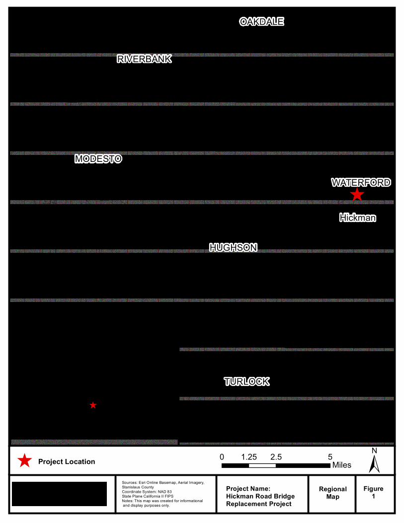
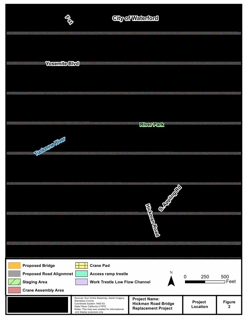
The Hickman Road Bridge Replacement over the Tuolumne River project site is located approximately 0.15 mile south of State Route 132 near the town of Waterford in northern Stanislaus County, California (Figures 1 and 2). Constructed in 1946, the existing Hickman Road over Tuolumne River Bridge is a reinforced concrete (RC) box girder on RC solid pier walls and RC wing abutments supported by steel piles. The bridge is 652.9 feet long, 33.5 feet wide, and within the existing 175 to 200 feet public right‐of‐way. The curb‐to‐curb width is 27.9 feet, with two 12‐foot‐wide travel lanes and two 2‐foot‐wide shoulders.
Replacement Bridge
The replacement bridge will likely consist of a cast‐in‐place (CIP) post‐tensioned box girder with two 12‐foot‐wide travel lanes and two 8‐foot‐wide shoulders. Design options include the addition of 5‐foot, 6‐inch ‐wide sidewalks along each side of the bridge or potentially along just the west side of the bridge. Pedestrian outlooks on the bridge placed at the bridge’s mid‐length will also be considered. In addition the use of a precast span over the low flow channel of the Tuolumne River will be investigated.
The replacement bridge will be constructed either immediately upstream or downstream of the existing structure, in order to keep the existing road and bridge open to public traffic during construction. Both of these alignment options would transition and connect back to the existing Hickman Road alignment using a design speed of 45 mph.
Utility Relocation
Several utilities run through the project site, including a PG&E gas pipe and AT&T telecommunication lines which are mounted to the bridge on the upstream and downstream face respectively. There are no overhead utilities located within the project area. All existing utilities will be relocated onto the new bridge without the need of a temporary relocation.
Right‐of‐Way
Construction of the new bridge will possibly require a permanent slope easement. In addition, temporary construction easements may be required for construction staging.
Detour Route
The new bridge will be constructed on a new alignment adjacent to the existing bridge. Traffic will be able to use the existing bridge to cross Tuolumne River during construction of the replacement bridge. The existing bridge will be demolished upon completion of the new bridge construction.
Demolition and Construction Staging
Demolition of the existing bridge will be performed in accordance with the Caltrans Standard Specifications modified to meet environmental permit requirements. All concrete and other debris resulting from the demolition of the existing bridge will be removed from the project site and disposed of by the contractor. The construction contractor will prepare a bridge demolition plan.
^
MODESTO
TURLOCK
RIVERBANK
OAKDALE
WATERFORD
HUGHSON
¯Sources: Esri Online Basemap, Aerial Imagery,Stanislaus CountyCoordinate System: NAD 83 State Plane California II FIPSNotes: This map was created for informational and display purposes only.
Project Name:Hickman Road Bridge Replacement Project
RegionalMap
Figure1
^
0 3 61.5Miles^ Project Location
Hickman
^ Project Location 0 2.5 51.25Miles ±
¯Sources: Esri Online Basemap, Aerial Imagery,Stanislaus CountyCoordinate System: NAD 83 State Plane California II FIPSNotes: This map was created for informational and display purposes only.
Project Name:Hickman Road BridgeReplacement Project
Project Location
Figure2
Yosemite Blvd
Hickman Road
Tuolomne River
S. Appl
ing Rd
River Park
F st
Proposed BridgeProposed Road AlignmnetStaging AreaCrane Assembly Area
Crane PadAccess ramp trestleWork Trestle Low Flow Channel
0 500250Feet
City of Waterford
Hickman Road Bridge Replacement 7 Initial Site Assessment September 2016
Construction Activities
Construction will consist of the following activities:
Tree removal, grubbing and clearing to accommodate the new bridge structure
Excavating for the new bridge foundations (maximum of 80 to 100 feet deep)
Constructing the new bridge and approaches, including excavating for and placing asphalt concrete on each approach
Remove the existing bridge
Table 1 provides a description of the type of equipment likely to be used during the construction of the
proposed project.
Table 1. Construction Equipment
Equipment Construction Purpose
drill rig construction of drilled shaft foundations
backhoe soil manipulation + drainage work
bobcat fill distribution
bulldozer / loader earthwork construction + clearing and grubbing
Crane placement of precast girders
dump truck fill material delivery
excavator soil manipulation
front‐end loader dirt or gravel manipulation
grader ground leveling
haul truck earthwork construction + clearing and grubbing
roller / compactor earthwork construction
truck with seed sprayer landscaping
water truck earthwork construction + dust control
Construction Schedule and Timing
Construction is currently scheduled to start in 2017 and take approximately 8 months to complete.
Site and Vicinity Characteristics
Hickman Road is a major collector road located near the City of Waterford. The road is used mostly by local residents, commuters, commercial vehicles, and visitors of the City. The project site includes the existing Hickman Road Bridge, which crosses the Tuolumne River. There are utilities located on the upstream and downstream side of the existing bridge and include gas and telecommunication lines.
The United States Geological Survey (USGS) 7.5‐minute series quadrangle map (37120‐F7 Waterford, CA, 1969) indicates that the project area is approximately 75 feet above mean sea level. The topography near the site slopes downward from the north and south.
Hickman Road Bridge Replacement 8 Initial Site Assessment September 2016
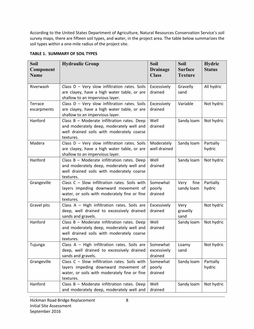
According to the United States Department of Agriculture, Natural Resources Conservation Service’s soil survey maps, there are fifteen soil types, and water, in the project area. The table below summarizes the soil types within a one‐mile radius of the project site.
TABLE 1. SUMMARY OF SOIL TYPES
Soil Component Name
Hydraulic Group Soil Drainage Class
Soil Surface Texture
Hydric Status
Riverwash Class D – Very slow infiltration rates. Soils are clayey, have a high water table, or are shallow to an impervious layer.
Excessively drained
Gravelly sand
All hydric
Terrace escarpments
Class D – Very slow infiltration rates. Soils are clayey, have a high water table, or are shallow to an impervious layer.
Excessively drained
Variable Not hydric
Hanford Class B – Moderate infiltration rates. Deep and moderately deep, moderately well and well drained soils with moderately coarse textures.
Well drained
Sandy loam
Not hydric
Madera Class D – Very slow infiltration rates. Soils are clayey, have a high water table, or are shallow to an impervious layer.
Moderately well drained
Sandy loam Partially hydric
Hanford Class B – Moderate infiltration rates. Deep and moderately deep, moderately well and well drained soils with moderately coarse textures.
Well drained
Sandy loam Not hydric
Grangeville Class C – Slow infiltration rates. Soils with layers impeding downward movement of water, or soils with moderately fine or fine textures.
Somewhat poorly drained
Very fine sandy loam
Partially hydric
Gravel pits Class A – High infiltration rates. Soils are deep, well drained to excessively drained sands and gravels.
Excessively drained
Very gravelly sand
Not hydric
Hanford Class B – Moderate infiltration rates. Deep and moderately deep, moderately well and well drained soils with moderately coarse textures.
Well drained
Sandy loam Not hydric
Tujunga Class A – High infiltration rates. Soils are deep, well drained to excessively drained sands and gravels.
Somewhat excessively drained
Loamy sand
Not hydric
Grangeville Class C – Slow infiltration rates. Soils with layers impeding downward movement of water, or soils with moderately fine or fine textures.
Somewhat poorly drained
Sandy loam Partially hydric
Hanford Class B – Moderate infiltration rates. Deep and moderately deep, moderately well and
Well drained
Sandy loam Not hydric
Hickman Road Bridge Replacement 9 Initial Site Assessment September 2016
well drained soils with moderately coarse textures.
San Joaquin Class D – Very slow infiltration rates. Soils are clayey, have a high water table, or are shallow to an impervious layer.
Moderately well drained
Sandy loam Partially hydric
Greenfield Class B – Moderate infiltration rates. Deep and moderately deep, moderately well and well drained soils with moderately coarse textures.
Well drained
Sandy loam Not hydric
Miscellaneous water
Class B – Moderate infiltration rates. Deep and moderately deep, moderately well and well drained soils with moderately coarse textures.
Not reported
Sandy loam Not hydric
Whitney Class C – Slow infiltration rates. Soils with layers impeding downward movement of water, or soils with moderately fine or fine textures.
Well drained
Sandy loam Not hydric
There is little to no potential for naturally‐occurring asbestos (per the “General Location Map for Ultramafic Rocks”). The project site is not located near any of the areas identified as containing ultramafic rocks (California Department of Conservation, 2000).
Description of Structures, Road and Other Site Improvements
Hickman Road has been in existence prior to 1937 (Environmental Database Resources, Inc. [EDR] Historic Aerial Photograph, 1937) and has remained in relatively the same alignment; however, the original bridge was located upstream of its current alignment, and was relocated between 1957 and 1967. The roadways and bridge paralleled the Southern Pacific Railroad alignment, until the line was decommissioned.
This roadway is the main thoroughfare for traffic within the City of Waterford to cross the Tuolumne River. The general setting is urban with adjacent land uses consisting of recreational, commercial retail, and public facilities. The bridge currently carries vehicular highway traffic on the bridge. There is no on‐street parking available on Hickman Road.
Area Geology and Hydrogeology
The project site lies within the Great Valley geomorphic province of California, which is an alluvial plain about 50 miles wide and 400 miles long in the central part of California (California Department of Conservation, 2002). Its northern part is the Sacramento Valley, drained by the Sacramento River and its southern part is the San Joaquin Valley drained by the San Joaquin River.
Within the Great Valley geomorphic province, the project site lies within the San Joaquin Valley and represents the southern portion of the Great Valley of California. The San Joaquin Valley is a structural trough up to 200 miles long and 70 miles wide. It is filled with up to 32,000 feet of marine and continental sediments deposited during periodic inundation by the Pacific Ocean and by erosion of the surrounding mountains, respectively. Continental deposits shed from the surrounding mountains form an alluvial wedge that thickens from the valley margins toward the axis of the structural trough. This
Hickman Road Bridge Replacement 10 Initial Site Assessment September 2016
depositional axis is below to slightly west of the series of rivers, lakes, sloughs, and marshes that mark the current and historic axis of surface drainage in the San Joaquin Valley (California Department of Water Resources, 2006).
Hydrologic data collected from federal and state wells within a one‐mile radius of the project site confirms that the groundwater flow in the project site flows from northeast to southwest. Recorded depth to groundwater in the vicinity of the project site varies from 60 ft to 65 ft below surface.
USER‐PROVIDED INFORMATION
The County’s intended use of the project site is to remove the existing structure, which has been determined to be structurally deficient and scour critical, and reconstruct with a bridge that will provide adequate and safe vehicle access; and that will be wider to meet current design standards for the traffic utilizing this roadway.
RECORD REVIEW
Environmental Records Review
County, State, and Federal listings were compiled and searched for this ISA by a nationwide regulatory agency database search company, EDR, and reviewed by DHA. The full EDR report is attached as Appendix A. Explanations of the federal and state listings/databases are provided in the portion of the EDR report entitled "Description of Databases Searched". The search radius distances are based on the minimum distances established by ASTM and commonly used for environmental site assessments. Findings in the County’s Certified Unified Program Agency Database (CUPA), Drycleaners, Recycling Facilities in California (SWRCY), EDR US Historic Auto, and EDR US Historic Cleaners lists are not included in the summary below due to the very low potential impact of the listed sites.
The primary databases with findings that may indicate potential impact to the construction of the proposed project are the underground storage tank databases (LUST, HIS UST, CA FID UST, SWEEPS UST); the RWQCB Spills, Leaks, and Investigation Cleanup cost recovery listing (SLIC); the aboveground storage tank database (AST); Resource Conservation and Recovery Act Non‐Generators listing (RCRA NonGen/NLR) and Small Quantity Generator (SQG) violation record; the Solid Waste Facilities/Landfill Site records (SWF/LF); and Hazardous Waste & Substance Sites (CORTESE, HIST CORTESE ). A table of significant regulatory database search findings that may indicate potential impacts to the project site are summarized in the following table and depicted on the following figure.
TABLE 2. SUMMARY OF SIGNIFICANT REGULATORY DATABASE SEARCH FINDINGS
Site Address and/or Business Name
Map ID Location and Distance/Direction from Project Site
Pertinent
Database(s) Status
DARNELL AG SUPPLY
E24
N 0.229 mi 132 E Street
SLIC
Open – Inactive since 1990; no other information is provided.

Sources: Esri Online Basemap, Aerial Imagery, Stanislaus CountyCoordinate System: NAD 83 State Plane California II FIPSNotes: This map was created for informational and display purposes only.
Project Name:Hickman Road BridgeReplacement Project
Figure3
Tuolumne River Parkwayand River Park Boundary
±Proposed BridgeProposed SidewalkProposed Road Alignmnet
Tuolumne River ParkwayRiver Park Boundary 0 1 20.5
Miles
Yosemite Blvd
Hickman Rd
Tuolumne River

Hickman Road Bridge Replacement 12 Initial Site Assessment September 2016
Summary of Records Review Findings
The following facilities were identified in the vicinity of the project area.
Leaking Underground Storage Tank (LUST) Cases
Six LUST cases were identified within a one‐mile radius of the project site. All of the cases have been closed by the regulating agency following soil and/or groundwater investigations.
Spills, Leaks, Investigation and Cleanup (SLIC) Facility
One SLIC facility was identified within a one‐mile‐radius of the project site. Darnell Ag Supply, located 1,207 feet north of the project site was identified; however no other information as to potential media contaminated, source of contamination or types of contaminants was provided. In addition, a search of the Department of Toxic Substances website and the Geotracker website provided no information on this site and the telephone number for this business in no longer in service. The SLIC case status remains Open ‐ Inactive as of January 1990. Groundwater flow of the region is generally from east to west, and this SLIC site is located north of and upstream of the project site and at a higher elevation; therefore, the potential for possible soil or groundwater contamination from the SLIC location to the project site is low. It is likely this business is no longer in operation and no further contamination has been proven since 1990. Additionally, based on the type of business, it is likely that the contaminated media would be soil and likely limited to surface staining possibly from fuel leaking from farm equipment or fertilizers.
Historical USTs, Active USTs, and Active ASTs
Thirty‐three (33) storage tanks within a one‐mile‐radius of the project site are recorded in the Statewide Environmental Evaluation and Planning System (SWEEPS UST), the California Facility Inventory Database (CAD FID UST), the Historical UST Registered Database (HIST UST), the underground storage tank database (UST), and/or the aboveground storage tank database (AST). Although historical UST closures and/or removals are generally undocumented, there is no evidence to suggest that possible soil or groundwater contamination from the UST/AST locations has an impact on the project site.
Small Quantity Generator (SQG) Sites
One SQG, within a one‐mile‐radius of the project site, is recorded in the RCRA database of Small Quantity Generators. No violations or areas of concern were reported to date at this site. Based on the available information, it is our conclusion that the SQG facility does not have the potential to impact the soils or groundwater of the project site.
Hazardous Waste & Substance Sites (CORTESE and HIST CORTESE)
Three Historical Hazardous Waste & Substance Sites (HIST CORTESE) were identified within one‐mile radius of the project site. The sites for the list are designated by the State Water Resources Control Board. The HIST CORTESE listing is no longer updated by the state agency. Based on our review of the available data posted on the SWRCB GeoTracker website and information provided by the EDR record search regarding these facilities, DHA identifies no evidence to suggest that possible soil or groundwater contamination from the HIST CORTESE sites has impact on the project site.
Hickman Road Bridge Replacement 13 Initial Site Assessment September 2016
Orphan Sites
Based on insufficient address information or other site identification issues, seventeen (17) orphan sites were identified within a one‐mile‐radius of the project site. DHA reviewed the complete list of orphan sites in our REC review process. Most of the listed sites are for database purpose and have no recorded violation or contamination. Based on our review of the available information provided by the EDR record search, DHA identifies no evidence to suggest that possible soil or groundwater contamination from the orphan sites has impact on the project site.
The EDR Orphan Summary and Orphan Details can be found in the EDR report enclosed in Appendix A.
Historical Use Information
The objective of reviewing historical use information is to develop a history of previous land uses in the vicinity of the project area and to assess these uses for potential hazardous materials impacts that may affect the project. Historical sources were reviewed up till 1916 that were readily available and reviewable and likely to provide useful information, given the time and cost constraints inherent in ISA projects. Based on aerial photographs, the historical land use in the project vicinity transitioned from predominately open space with scattered rural residences and associated agricultural fields to predominantly urban residential, commercial retail and agriculture by 1967.
Historical Topographic Maps
Historical topographic maps of the project site were requested from EDR. Four maps were available from the USGS of the project from 1916 to 1969. These maps depicted the Hickman Road alignment and surrounding area. According to these maps, the alignment of Hickman Road has remained stationary prior to 1916 (Appendix B).
Fire Insurance Maps
Fire insurance maps are produced by private fire insurance companies to indicate uses of the project area on specified dates. Fire insurance maps were requested from EDR, the copyright holder for the Sanborn map collection. EDR reported that no Sanborn fire insurance map coverage exists for the project site (Appendix C).
Historical Aerial Photographs
Historical aerial photographs are valuable for the environmental assessor to review features of properties along the project corridor over a long period of time. Historical aerial photographs were reviewed from EDR. Twelve historical aerial photographs were reviewed from 2012 back to 1937, with the longest gap in coverage being 11 years (between 1987 and 1998). The 1937 and each subsequent photograph showed Hickman Road and Tuolumne River in their current alignment, and the existing bridge. Adjacent properties transitioned from predominately open space and agricultural with scattered rural residences to predominately urban residential, commercial mixed‐use and agriculture by 1967.
Hickman Road Bridge Replacement 14 Initial Site Assessment September 2016
Environmental Liens and Additional Information
No information regarding the chain‐of‐title ownership history or environmental liens recorded against the project site was provided by the user. Environmental lien searches were not conducted as part of the scope of work for this project.
SITE RECONNAISSANCE
On March 27, 2015, DHA conducted a reconnaissance of the project site. The weather that day was sunny and clear, and the site was accessible from public locations. DHA was able to observe the exterior of the bridge and portion of the immediately adjacent properties that border the project site. The perimeter of the project site was observed for current land uses. As described previously, the project site crosses the Tuolumne River. Based on the results of the records review and reconnaissance, potential RECs were not observed on the project site. Photographs of the site are included in Appendix D and an Initial Site Assessment Checklist, which was prepared during the reconnaissance survey, is attached in Appendix E.
Adjacent properties were then observed for current land uses. Properties surrounding the project site consist of commercial buildings. Based on the results of the records review and reconnaissance, potential RECs were not observed on adjacent properties.
The Hickman Road Bridge is not painted (i.e., it is a concrete bridge) and does not have any painted bridge or guard rails, and no creosote treated timber or asbestos containing materials were observed. However, the existing expansion joint material in the bridge may contain asbestos.
Utilities and Polychlorinated Biphenyls (PCBs)
Several utilities run through the project site, including a PG&E gas pipe and AT&T telecommunication lines which are mounted to the bridge on the upstream and downstream face respectively. There are no overhead utilities located within the project area. No large power substations or step‐down transformers, which are known to contain PCBs, were noted. No spills or hazardous materials response events related to transformers were noted in the EDR report.
DATA GAP ANALYSIS
The ASTM E 1527‐05 standard requires a listing of “data gaps” encountered during the investigative process that may affect the validity of the conclusions drawn by the environmental professional. The ASTM E 1527‐05 standard also requires that the environmental professional estimate the relative importance of the data gaps. Generally, gaps in available data are related to the availability of historical data sources for specific sites of concern. The environmental professional uses multiple historical data sources as a method to provide coverage for data gaps. Historical information is collected on a recurring basis, and the passage of time between data sets may or may not constitute a significant gap in data coverage. For this project, the following items may constitute a data gap as defined by ASTM:
Absence of Sanborn fire insurance maps
Hickman Road Bridge Replacement 15 Initial Site Assessment September 2016
Absence of aerial photography prior to 1937
Absence of USGS topography map between 1916 and 1941.
The inability to obtain and review the above data do not appear to present significant data gaps because of the presence of other supporting historical information and the limited development in the area prior to 1967.
FINDINGS AND CONCLUSIONS
The ISA was performed in general conformance with the scope and limitations of ASTM Practice E 1527‐05. Any exceptions to, or deletions from, this practice are described previously in this report. Information presented in this ISA will be used as the basis for expanded assessments to evaluate and mitigate hazardous material issues within the final ESL. Potential RECs as defined in ASTM Practice E 1527‐05 observed during a site visit or by the EDR record search in connection with the project site shall be avoided, minimized, or mitigated.
RECOMMENDATIONS
Asbestos and Lead
Based on the results of the records review and reconnaissance, potential asbestos containing materials (ACMs) were not observed on the project site. However, presence of potential ACMs within the existing bridge structure is unknown. This ISA does not include verification of RECs or other environmental issues (such as ACMs and LBP) based upon environmental sampling and laboratory analysis. Should RECs or other environmental issues (such as potentially friable ACMs or LBP) be present within the existing bridge, such issues should be mitigated prior to renovation or demolition and would be addressed by the County under separate assessment(s). An REC, as defined by ASTM, would not include ACMs and LBP, as these are typical construction waste management issues.
New uses of ACMs were banned by the EPA in 1989. Revisions to regulations issued by OSHA on June 30, 1995, require that all thermal systems insulation, surfacing materials, and resilient flooring materials installed prior to 1981 be considered Presumed Asbestos Containing Materials (PAC) and treated accordingly. In order to rebut the designation as PAC, OSHA requires that these materials be surveyed, sampled, and assessed in accordance with 40 CFR 763 (Asbestos Hazard Emergency Response Act [AHERA]). ACM have also been documented in the rail shim sheet packing, bearing pads, support piers, and expansion joint material of bridges. The Caltrans Historic Bridge Inventory indicates that the Hickman Road bridge over the Tuolumne River was built in 1946; and due to the age and structure type (i.e. contains expansion joint material at the hinges), there is the potential to encounter ACMs during demolition of the existing bridge structure and should be addressed under separate assessment during the Plan, Specifications and Estimate (PS&E) process.
Lead has been used in commercial, residential, roadway, and ceramic paint; in electric batteries and other devises; as a gasoline additive; for weighting; in gunshot; and other purposes. It is recognized as toxic to human health and the environment and is widely regulated in the United States. Structures constructed prior to 1978 are presumed to contain lead‐based paint unless proven otherwise, although
Hickman Road Bridge Replacement 16 Initial Site Assessment September 2016
buildings constructed after 1978 may also contain lead‐based paints. Due to the construction age of the existing structure, the presence of pavement striping and thermoplastic paint on roadways may also be of concern due to the possible use of lead‐based paint. The potential exists for the bridge and associated features to contain LBP, and they should be addressed under separate assessment during the Plan, Specifications and Estimate (PS&E) process.
Aerially Deposited Lead (ADL)
Aerially Deposited Lead (ADL) is commonly present adjacent to heavily traveled roadways in service prior to 1987 as lead has been used as a gasoline additive prior to this time. Based on our review of air photos and topographical maps, Hickman Road was historically, and is currently, a major collector route across the Tuolumne River within the City of Waterford. However, historic deposition of vehicle exhaust particulates containing lead may not be significant along the roadway shoulder, as the bridge was realigned in the 1960’s. It is unlikely that the potential exists for the soil adjacent to the bridge and roadway approaches to contain ADL.
Health and Safety Plans
Health and safety considerations for construction workers and the general public must be taken into account during development of a Health and Safety Plan (HASP) for the project. The HASP should describe appropriate procedures to follow in the event that any contaminated soil or groundwater is encountered during construction activities. Any unknown substances should be tested, handled and disposed of in accordance with appropriate federal, state and local regulations.
QUALIFICATION OF ENVIRONMENTAL PROFESSIONALS
We declare that, to the best of our professional knowledge and belief, we meet the definition of environmental professional as defined in Section 312.10 of 42 Code of Federal Regulations [C.F.R.] Part 312. This ISA was conducted under the supervision of a qualified environmental professional. The preceding report has been prepared in general conformance with standard industry practice for performance of Environmental Site Assessments and includes the applicable portions of the investigation procedures codified in ASTM E 1527‐05, Standard Practice for Environmental Site Assessments: Environmental Site Assessment Process. The end user of this report may rely on the contents, findings, and conclusions to be accurate within the limitations stated in this report and in the ASTM standard. The report also complies with specific requirements supplied by the client.
________________________________
Qualified Environmental Professional Jennifer Hildebrandt, M.S. Environmental Coordinator
Hickman Road Bridge Replacement 17 Initial Site Assessment September 2016
Qualifications of Environmental Professional
This ISA was performed by Jennifer Hildebrandt, DHA’s qualified environmental professional, as defined by ASTM Practice E 1527‐05, has over 5 years of experience in the assessment of impacted properties and compliance with environmental regulations. She has a Masters of Science Degree in Environmental Management from the University of San Francisco and a Bachelors of Science in Anthropology from the University of California, Davis.
REFERENCES
ASTM Practice E 1527‐05. 2005. Standard Practice for Environmental Site Assessments: Phase I Environmental Site Assessment Process.
California Department of Conservation, Division of Mines and Geology. 2000. A General Location Guide for Ultramafic Rocks in California – Areas More Likely to Contain Naturally Occurring Asbestos. August 2000.
California Department of Conservation, California Geological Survey. 2002. California Geomorphic Provinces. December 2002.
California Department of Water Resources. 2006. California’s Groundwater Update 2003. Bulletin 118, Last updated January 20, 2006.
California Department of Transportation. 2010. Standard Environmental Reference, Chapter 10 ‐ Hazardous Materials, Hazardous Waste, and Contamination. Available at: http://www.dot.ca.gov/ser/vol1/sec3/physical/ch10haz/chap10.htm.
Environmental Data Resources, Inc., Report. 2013. Hickman Road Bridge, Hickman Road over Tuolumne River Hickman CA 95323. The EDR Radius Map Report with GeoCheck, Inquiry Number: 4265561.3. April 15, 2015.
California State Water Resources Control Board Geotracker website, http://geotracker.waterboards.ca.gov/
California State Water Resources Control Board Envirostor website, http://www.envirostor.dtsc.ca.gov/public/

Appendix A
EDR Record Search
FORM-LBC-MEM
®kcehCoeG htiw tropeR ™paM suidaR RDE ehT
6 Armstrong Road, 4th floorShelton, CT 06484Toll Free: 800.352.0050www.edrnet.com
Hickman Road BridgeHickman RoadHickman, CA 95323
Inquiry Number: 4265561.2sApril 16, 2015
SECTION PAGE
Executive Summary ES1
Overview Map 2
Detail Map 3
Map Findings Summary 4
Map Findings 8
Orphan Summary 74
Government Records Searched/Data Currency Tracking GR-1
GEOCHECK ADDENDUM
Physical Setting Source Addendum A-1
Physical Setting Source Summary A-2
Physical Setting SSURGO Soil Map A-5
Physical Setting Source Map A-20
Physical Setting Source Map Findings A-22
Physical Setting Source Records Searched PSGR-1
TC4265561.2s Page 1
Thank you for your business.Please contact EDR at 1-800-352-0050
with any questions or comments.
Disclaimer - Copyright and Trademark Notice
This Report contains certain information obtained from a variety of public and other sources reasonably available to Environmental DataResources, Inc. It cannot be concluded from this Report that coverage information for the target and surrounding properties does not exist fromother sources. NO WARRANTY EXPRESSED OR IMPLIED, IS MADE WHATSOEVER IN CONNECTION WITH THIS REPORT. ENVIRONMENTALDATA RESOURCES, INC. SPECIFICALLY DISCLAIMS THE MAKING OF ANY SUCH WARRANTIES, INCLUDING WITHOUT LIMITATION,MERCHANTABILITY OR FITNESS FOR A PARTICULAR USE OR PURPOSE. ALL RISK IS ASSUMED BY THE USER. IN NO EVENT SHALLENVIRONMENTAL DATA RESOURCES, INC. BE LIABLE TO ANYONE, WHETHER ARISING OUT OF ERRORS OR OMISSIONS, NEGLIGENCE,ACCIDENT OR ANY OTHER CAUSE, FOR ANY LOSS OF DAMAGE, INCLUDING, WITHOUT LIMITATION, SPECIAL, INCIDENTAL,CONSEQUENTIAL, OR EXEMPLARY DAMAGES. ANY LIABILITY ON THE PART OF ENVIRONMENTAL DATA RESOURCES, INC. IS STRICTLYLIMITED TO A REFUND OF THE AMOUNT PAID FOR THIS REPORT. Purchaser accepts this Report "AS IS". Any analyses, estimates, ratings,environmental risk levels or risk codes provided in this Report are provided for illustrative purposes only, and are not intended to provide, norshould they be interpreted as providing any facts regarding, or prediction or forecast of, any environmental risk for any property. Only a Phase IEnvironmental Site Assessment performed by an environmental professional can provide information regarding the environmental risk for anyproperty. Additionally, the information provided in this Report is not to be construed as legal advice.
Copyright 2015 by Environmental Data Resources, Inc. All rights reserved. Reproduction in any media or format, in wholeor in part, of any report or map of Environmental Data Resources, Inc., or its affiliates, is prohibited without prior written permission.
EDR and its logos (including Sanborn and Sanborn Map) are trademarks of Environmental Data Resources, Inc. or its affiliates. All othertrademarks used herein are the property of their respective owners.
TABLE OF CONTENTS

EXECUTIVE SUMMARY
TC4265561.2s EXECUTIVE SUMMARY 1
A search of available environmental records was conducted by Environmental Data Resources, Inc (EDR).The report was designed to assist parties seeking to meet the search requirements of EPA’s Standardsand Practices for All Appropriate Inquiries (40 CFR Part 312), the ASTM Standard Practice forEnvironmental Site Assessments (E 1527-13) or custom requirements developed for the evaluation ofenvironmental risk associated with a parcel of real estate.
TARGET PROPERTY INFORMATION
ADDRESS
HICKMAN ROADHICKMAN, CA 95323
COORDINATES
37.6360000 - 37˚ 38’ 9.60’’Latitude (North): 120.7585000 - 120˚ 45’ 30.60’’Longitude (West): Zone 10Universal Tranverse Mercator: 697784.3UTM X (Meters): 4167588.0UTM Y (Meters): 72 ft. above sea levelElevation:
USGS TOPOGRAPHIC MAP ASSOCIATED WITH TARGET PROPERTY
37120-F7 WATERFORD, CATarget Property Map:1969Most Recent Revision:
37120-F6 PAULSELL, CAEast Map:1976Most Recent Revision:
37120-E6 MONTPELIER, CASoutheast Map:1987Most Recent Revision:
37120-E7 DENAIR, CASouth Map:1987Most Recent Revision:
AERIAL PHOTOGRAPHY IN THIS REPORT
20120627, 20120628Portions of Photo from:USDASource:
4265561.2s Page 2
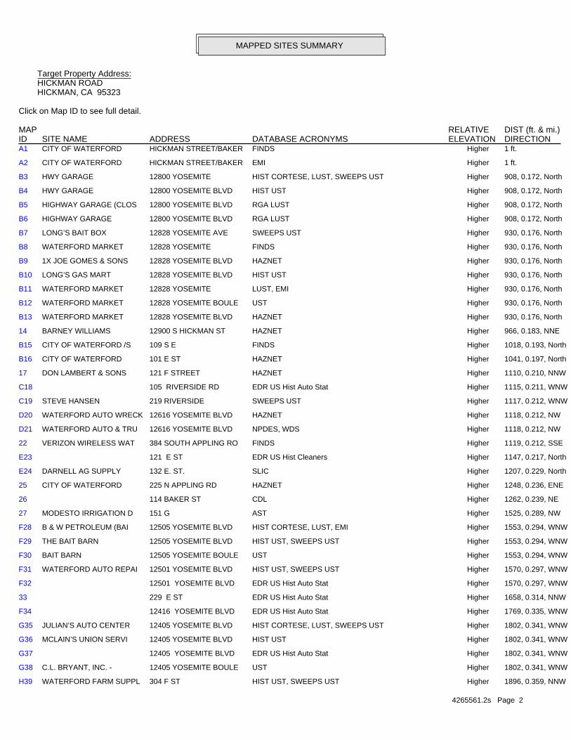
H39 WATERFORD FARM SUPPL 304 F ST HIST UST, SWEEPS UST Higher 1896, 0.359, NNW
G38 C.L. BRYANT, INC. - 12405 YOSEMITE BOULE UST Higher 1802, 0.341, WNW
G37 12405 YOSEMITE BLVD EDR US Hist Auto Stat Higher 1802, 0.341, WNW
G36 MCLAIN’S UNION SERVI 12405 YOSEMITE BLVD HIST UST Higher 1802, 0.341, WNW
G35 JULIAN’S AUTO CENTER 12405 YOSEMITE BLVD HIST CORTESE, LUST, SWEEPS UST Higher 1802, 0.341, WNW
F34 12416 YOSEMITE BLVD EDR US Hist Auto Stat Higher 1769, 0.335, WNW
33 229 E ST EDR US Hist Auto Stat Higher 1658, 0.314, NNW
F32 12501 YOSEMITE BLVD EDR US Hist Auto Stat Higher 1570, 0.297, WNW
F31 WATERFORD AUTO REPAI 12501 YOSEMITE BLVD HIST UST, SWEEPS UST Higher 1570, 0.297, WNW
F30 BAIT BARN 12505 YOSEMITE BOULE UST Higher 1553, 0.294, WNW
F29 THE BAIT BARN 12505 YOSEMITE BLVD HIST UST, SWEEPS UST Higher 1553, 0.294, WNW
F28 B & W PETROLEUM (BAI 12505 YOSEMITE BLVD HIST CORTESE, LUST, EMI Higher 1553, 0.294, WNW
27 MODESTO IRRIGATION D 151 G AST Higher 1525, 0.289, NW
26 114 BAKER ST CDL Higher 1262, 0.239, NE
25 CITY OF WATERFORD 225 N APPLING RD HAZNET Higher 1248, 0.236, ENE
E24 DARNELL AG SUPPLY 132 E. ST. SLIC Higher 1207, 0.229, North
E23 121 E ST EDR US Hist Cleaners Higher 1147, 0.217, North
22 VERIZON WIRELESS WAT 384 SOUTH APPLING RO FINDS Higher 1119, 0.212, SSE
D21 WATERFORD AUTO & TRU 12616 YOSEMITE BLVD NPDES, WDS Higher 1118, 0.212, NW
D20 WATERFORD AUTO WRECK 12616 YOSEMITE BLVD HAZNET Higher 1118, 0.212, NW
C19 STEVE HANSEN 219 RIVERSIDE SWEEPS UST Higher 1117, 0.212, WNW
C18 105 RIVERSIDE RD EDR US Hist Auto Stat Higher 1115, 0.211, WNW
17 DON LAMBERT & SONS 121 F STREET HAZNET Higher 1110, 0.210, NNW
B16 CITY OF WATERFORD 101 E ST HAZNET Higher 1041, 0.197, North
B15 CITY OF WATERFORD /S 109 S E FINDS Higher 1018, 0.193, North
14 BARNEY WILLIAMS 12900 S HICKMAN ST HAZNET Higher 966, 0.183, NNE
B13 WATERFORD MARKET 12828 YOSEMITE BLVD HAZNET Higher 930, 0.176, North
B12 WATERFORD MARKET 12828 YOSEMITE BOULE UST Higher 930, 0.176, North
B11 WATERFORD MARKET 12828 YOSEMITE LUST, EMI Higher 930, 0.176, North
B10 LONG’S GAS MART 12828 YOSEMITE BLVD HIST UST Higher 930, 0.176, North
B9 1X JOE GOMES & SONS 12828 YOSEMITE BLVD HAZNET Higher 930, 0.176, North
B8 WATERFORD MARKET 12828 YOSEMITE FINDS Higher 930, 0.176, North
B7 LONG’S BAIT BOX 12828 YOSEMITE AVE SWEEPS UST Higher 930, 0.176, North
B6 HIGHWAY GARAGE 12800 YOSEMITE BLVD RGA LUST Higher 908, 0.172, North
B5 HIGHWAY GARAGE (CLOS 12800 YOSEMITE BLVD RGA LUST Higher 908, 0.172, North
B4 HWY GARAGE 12800 YOSEMITE BLVD HIST UST Higher 908, 0.172, North
B3 HWY GARAGE 12800 YOSEMITE HIST CORTESE, LUST, SWEEPS UST Higher 908, 0.172, North
A2 CITY OF WATERFORD HICKMAN STREET/BAKER EMI Higher 1 ft.
A1 CITY OF WATERFORD HICKMAN STREET/BAKER FINDS Higher 1 ft.
MAPPED SITES SUMMARY
Target Property Address:HICKMAN ROADHICKMAN, CA 95323
Click on Map ID to see full detail.
MAP RELATIVE DIST (ft. & mi.)ID DATABASE ACRONYMS ELEVATION DIRECTIONSITE NAME ADDRESS

4265561.2s Page 3
61 RICHARD MOON ELEMENT NORTH REINWAY AVENUE SCH, ENVIROSTOR Higher 4516, 0.855, West
60 SPORT STOP 12070 YOSEMITE HIST CORTESE, LUST, EMI Higher 3712, 0.703, WNW
59 REPLANET LLC 12138 YOSEMITE BLVD SWRCY Higher 3185, 0.603, WNW
58 DAN’S BAIT & TACKLE 13433 YOSEMITE HIST CORTESE, LUST, SWEEPS UST Higher 3020, 0.572, ENE
57 WILLIAM D. GWIN 133 S WESTERN SWEEPS UST Higher 2564, 0.486, WNW
56 13160 YOSEMITE BLVD EDR US Hist Auto Stat Higher 2532, 0.480, ENE
55 CLARA HAYES 326 S WESTERN SWEEPS UST Higher 2503, 0.474, West
L54 ROYAL NUT PROCESSING 320 "G" ST HIST UST Higher 2223, 0.421, NW
L53 ROYAL NUT PROCESSING 320 G ST SWEEPS UST Higher 2216, 0.420, NW
K52 LELOA PEARSON 312 D SWEEPS UST Higher 2203, 0.417, North
H51 AT&T CALIFORNIA - UG 364 F ST RCRA-SQG, FINDS, EMI Higher 2171, 0.411, NNW
K50 WATERFORD SCHOOL BUS BENTLEY & D STREETES SWEEPS UST Higher 2139, 0.405, North
49 13231 YOSEMITE BLVD EDR US Hist Auto Stat Higher 2096, 0.397, NE
I48 CITY OF WATERFORD 320 E ST HIST UST, SWEEPS UST Higher 2074, 0.393, NNW
G47 WATERFORD GRANGE #55 12308 BENTLEY ST HIST UST, SWEEPS UST Higher 2073, 0.393, WNW
J46 WATERFORD FOOD AND F 12237 BENTLEY AVENUE UST Higher 2071, 0.392, WNW
J45 FOOD & FUEL MART 12237 BENTLEY HIST UST Higher 2071, 0.392, WNW
J44 FOOD & FUEL MART 12237 BENTLEY FINDS, SWEEPS UST Higher 2071, 0.392, WNW
J43 12237 BENTLEY ST EDR US Hist Auto Stat Higher 2071, 0.392, WNW
I42 WATERFORD-HERMAN FIR 321 E ST HIST UST, SWEEPS UST Higher 2070, 0.392, NNW
G41 12320 BENTLEY ST EDR US Hist Auto Stat Higher 2053, 0.389, WNW
40 MODESTO IRRIGATION D 12420 BENTLEY ST HIST UST Higher 1918, 0.363, NW
MAPPED SITES SUMMARY
Target Property Address:HICKMAN ROADHICKMAN, CA 95323
Click on Map ID to see full detail.
MAP RELATIVE DIST (ft. & mi.)ID DATABASE ACRONYMS ELEVATION DIRECTIONSITE NAME ADDRESS
EXECUTIVE SUMMARY
TC4265561.2s EXECUTIVE SUMMARY 4
TARGET PROPERTY SEARCH RESULTS
The target property was not listed in any of the databases searched by EDR.
DATABASES WITH NO MAPPED SITES
No mapped sites were found in EDR’s search of available ("reasonably ascertainable ") governmentrecords either on the target property or within the search radius around the target property for thefollowing databases:
STANDARD ENVIRONMENTAL RECORDS
Federal NPL site list
NPL National Priority ListProposed NPL Proposed National Priority List SitesNPL LIENS Federal Superfund Liens
Federal Delisted NPL site list
Delisted NPL National Priority List Deletions
Federal CERCLIS list
CERCLIS Comprehensive Environmental Response, Compensation, and Liability Information SystemFEDERAL FACILITY Federal Facility Site Information listing
Federal CERCLIS NFRAP site List
CERC-NFRAP CERCLIS No Further Remedial Action Planned
Federal RCRA CORRACTS facilities list
CORRACTS Corrective Action Report
Federal RCRA non-CORRACTS TSD facilities list
RCRA-TSDF RCRA - Treatment, Storage and Disposal
Federal RCRA generators list
RCRA-LQG RCRA - Large Quantity GeneratorsRCRA-CESQG RCRA - Conditionally Exempt Small Quantity Generator
Federal institutional controls / engineering controls registries
US ENG CONTROLS Engineering Controls Sites ListUS INST CONTROL Sites with Institutional ControlsLUCIS Land Use Control Information System

EXECUTIVE SUMMARY
TC4265561.2s EXECUTIVE SUMMARY 5
Federal ERNS list
ERNS Emergency Response Notification System
State- and tribal - equivalent NPL
RESPONSE State Response Sites
State and tribal landfill and/or solid waste disposal site lists
SWF/LF Solid Waste Information System
State and tribal leaking storage tank lists
INDIAN LUST Leaking Underground Storage Tanks on Indian Land
State and tribal registered storage tank lists
INDIAN UST Underground Storage Tanks on Indian LandFEMA UST Underground Storage Tank Listing
State and tribal voluntary cleanup sites
INDIAN VCP Voluntary Cleanup Priority ListingVCP Voluntary Cleanup Program Properties
ADDITIONAL ENVIRONMENTAL RECORDS
Local Brownfield lists
US BROWNFIELDS A Listing of Brownfields Sites
Local Lists of Landfill / Solid Waste Disposal Sites
DEBRIS REGION 9 Torres Martinez Reservation Illegal Dump Site LocationsODI Open Dump InventoryHAULERS Registered Waste Tire Haulers ListingINDIAN ODI Report on the Status of Open Dumps on Indian LandsWMUDS/SWAT Waste Management Unit Database
Local Lists of Hazardous waste / Contaminated Sites
US CDL Clandestine Drug LabsHIST Cal-Sites Historical Calsites DatabaseSCH School Property Evaluation ProgramToxic Pits Toxic Pits Cleanup Act SitesUS HIST CDL National Clandestine Laboratory Register
Local Lists of Registered Storage Tanks
CA FID UST Facility Inventory Database
Local Land Records
LIENS 2 CERCLA Lien Information
EXECUTIVE SUMMARY
TC4265561.2s EXECUTIVE SUMMARY 6
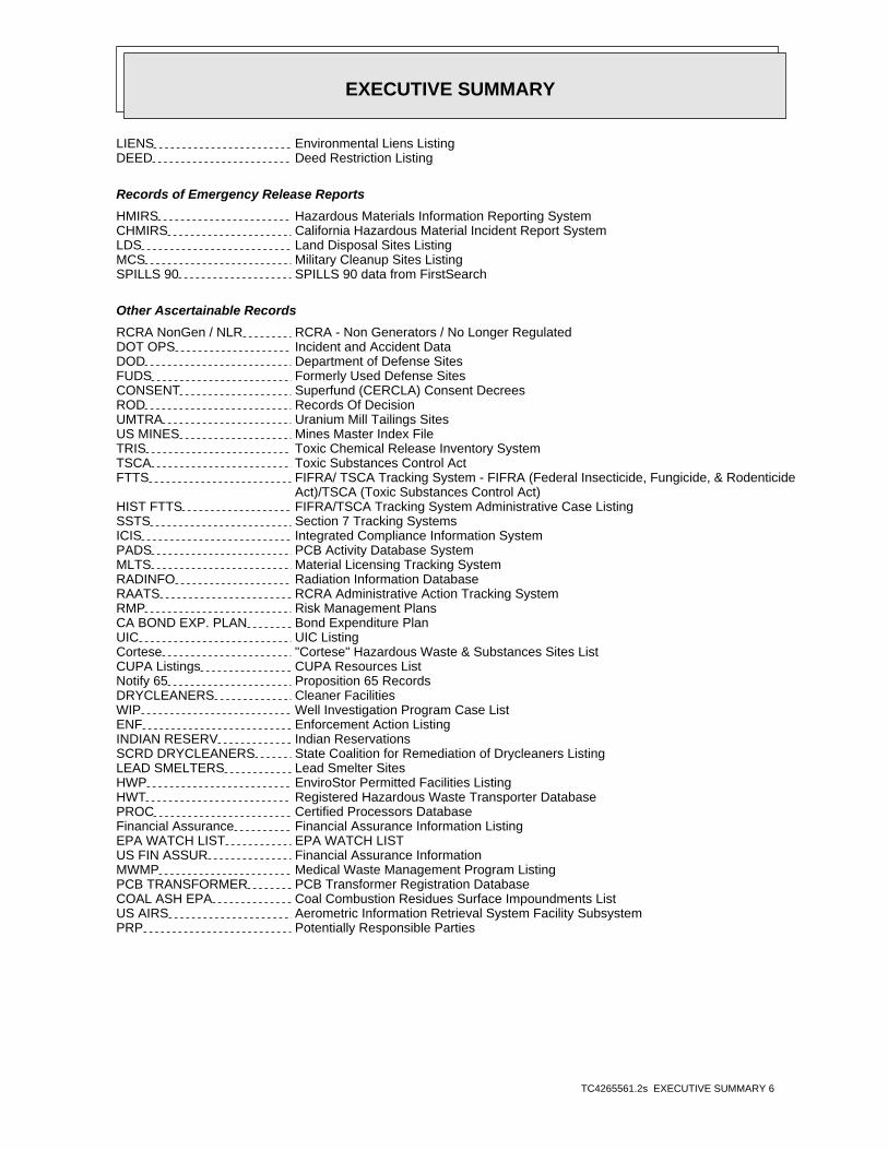
LIENS Environmental Liens ListingDEED Deed Restriction Listing
Records of Emergency Release Reports
HMIRS Hazardous Materials Information Reporting SystemCHMIRS California Hazardous Material Incident Report SystemLDS Land Disposal Sites ListingMCS Military Cleanup Sites ListingSPILLS 90 SPILLS 90 data from FirstSearch
Other Ascertainable Records
RCRA NonGen / NLR RCRA - Non Generators / No Longer RegulatedDOT OPS Incident and Accident DataDOD Department of Defense SitesFUDS Formerly Used Defense SitesCONSENT Superfund (CERCLA) Consent DecreesROD Records Of DecisionUMTRA Uranium Mill Tailings SitesUS MINES Mines Master Index FileTRIS Toxic Chemical Release Inventory SystemTSCA Toxic Substances Control ActFTTS FIFRA/ TSCA Tracking System - FIFRA (Federal Insecticide, Fungicide, & Rodenticide Act)/TSCA (Toxic Substances Control Act)HIST FTTS FIFRA/TSCA Tracking System Administrative Case ListingSSTS Section 7 Tracking SystemsICIS Integrated Compliance Information SystemPADS PCB Activity Database SystemMLTS Material Licensing Tracking SystemRADINFO Radiation Information DatabaseRAATS RCRA Administrative Action Tracking SystemRMP Risk Management PlansCA BOND EXP. PLAN Bond Expenditure PlanUIC UIC ListingCortese "Cortese" Hazardous Waste & Substances Sites ListCUPA Listings CUPA Resources ListNotify 65 Proposition 65 RecordsDRYCLEANERS Cleaner FacilitiesWIP Well Investigation Program Case ListENF Enforcement Action ListingINDIAN RESERV Indian ReservationsSCRD DRYCLEANERS State Coalition for Remediation of Drycleaners ListingLEAD SMELTERS Lead Smelter SitesHWP EnviroStor Permitted Facilities ListingHWT Registered Hazardous Waste Transporter DatabasePROC Certified Processors DatabaseFinancial Assurance Financial Assurance Information ListingEPA WATCH LIST EPA WATCH LISTUS FIN ASSUR Financial Assurance InformationMWMP Medical Waste Management Program ListingPCB TRANSFORMER PCB Transformer Registration DatabaseCOAL ASH EPA Coal Combustion Residues Surface Impoundments ListUS AIRS Aerometric Information Retrieval System Facility SubsystemPRP Potentially Responsible Parties

EXECUTIVE SUMMARY
TC4265561.2s EXECUTIVE SUMMARY 7
2020 COR ACTION 2020 Corrective Action Program ListCOAL ASH DOE Steam-Electric Plant Operation Data
EDR HIGH RISK HISTORICAL RECORDS
EDR Exclusive Records
EDR MGP EDR Proprietary Manufactured Gas Plants
EDR RECOVERED GOVERNMENT ARCHIVES
Exclusive Recovered Govt. Archives
RGA LF Recovered Government Archive Solid Waste Facilities List
SURROUNDING SITES: SEARCH RESULTS
Surrounding sites were identified in the following databases.
Elevations have been determined from the USGS Digital Elevation Model and should be evaluated ona relative (not an absolute) basis. Relative elevation information between sites of close proximityshould be field verified. Sites with an elevation equal to or higher than the target property have beendifferentiated below from sites with an elevation lower than the target property.Page numbers and map identification numbers refer to the EDR Radius Map report where detaileddata on individual sites can be reviewed.
Sites listed in bold italics are in multiple databases.
Unmappable (orphan) sites are not considered in the foregoing analysis.
STANDARD ENVIRONMENTAL RECORDS
Federal RCRA generators list
RCRA-SQG: RCRAInfo is EPA’s comprehensive information system, providing access to data supportingthe Resource Conservation and Recovery Act (RCRA) of 1976 and the Hazardous and Solid Waste Amendments (HSWA)of 1984. The database includes selective information on sites which generate, transport, store, treat and/ordispose of hazardous waste as defined by the Resource Conservation and Recovery Act (RCRA). Small quantitygenerators (SQGs) generate between 100 kg and 1,000 kg of hazardous waste per month.
A review of the RCRA-SQG list, as provided by EDR, and dated 12/09/2014 has revealed that there is 1 RCRA-SQG site within approximately 0.5 miles of the target property.
PageMap IDDirection / Distance Address Equal/Higher Elevation ____________________ ________ ___________________ _____ _____
AT&T CALIFORNIA - UG 364 F ST NNW 1/4 - 1/2 (0.411 mi.) H51 55

EXECUTIVE SUMMARY
TC4265561.2s EXECUTIVE SUMMARY 8
State- and tribal - equivalent CERCLIS
ENVIROSTOR: The Department of Toxic Substances Control’s (DTSC’s) Site Mitigation and BrownfieldsReuse Program’s (SMBRP’s) EnviroStor database identifes sites that have known contamination or sites for whichthere may be reasons to investigate further. The database includes the following site types: FederalSuperfund sites (National Priorities List (NPL)); State Response, including Military Facilities and StateSuperfund; Voluntary Cleanup; and School sites. EnviroStor provides similar information to the informationthat was available in CalSites, and provides additional site information, including, but not limited to,identification of formerly-contaminated properties that have been released for reuse, properties whereenvironmental deed restrictions have been recorded to prevent inappropriate land uses, and riskcharacterization information that is used to assess potential impacts to public health and the environment atcontaminated sites.
A review of the ENVIROSTOR list, as provided by EDR, and dated 03/11/2015 has revealed that there is 1 ENVIROSTOR site within approximately 1.25 miles of the target property.
PageMap IDDirection / Distance Address Equal/Higher Elevation ____________________ ________ ___________________ _____ _____
RICHARD MOON ELEMENT NORTH REINWAY AVENUE W 1/2 - 1 (0.855 mi.) 61 69Facility Id: 39010045Status: No Further Action
State and tribal leaking storage tank lists
LUST: The Leaking Underground Storage Tank Incident Reports contain an inventory of reportedleaking underground storage tank incidents. The data come from the State Water Resources Control Board LeakingUnderground Storage Tank Information System.
A review of the LUST list, as provided by EDR, and dated 03/13/2015 has revealed that there are 6 LUST sites within approximately 0.75 miles of the target property.
PageMap IDDirection / Distance Address Equal/Higher Elevation ____________________ ________ ___________________ _____ _____
HWY GARAGE 12800 YOSEMITE N 1/8 - 1/4 (0.172 mi.) B3 9Global Id: T0609900115Status: Completed - Case ClosedStatus: Case Closed
WATERFORD MARKET 12828 YOSEMITE N 1/8 - 1/4 (0.176 mi.) B11 15Global Id: T0609991230Status: Completed - Case ClosedStatus: Case Closed
B & W PETROLEUM (BAI 12505 YOSEMITE BLVD WNW 1/4 - 1/2 (0.294 mi.) F28 29Global Id: T0609900218Status: Completed - Case ClosedStatus: Case Closed
JULIAN’S AUTO CENTER 12405 YOSEMITE BLVD WNW 1/4 - 1/2 (0.341 mi.) G35 39Global Id: T0609900172Status: Completed - Case ClosedStatus: Case Closed
DAN’S BAIT & TACKLE 13433 YOSEMITE ENE 1/2 - 1 (0.572 mi.) 58 62Global Id: T0609900221Status: Completed - Case ClosedStatus: Case Closed
EXECUTIVE SUMMARY
TC4265561.2s EXECUTIVE SUMMARY 9
PageMap IDDirection / Distance Address Equal/Higher Elevation ____________________ ________ ___________________ _____ _____
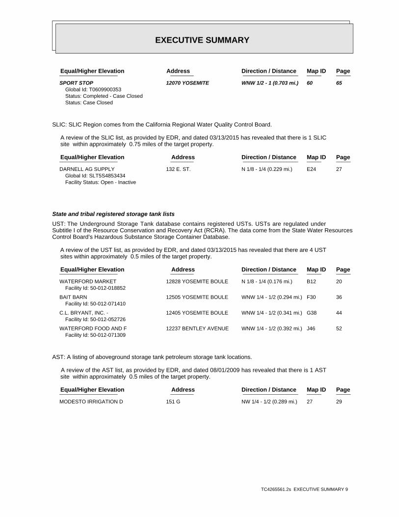
SPORT STOP 12070 YOSEMITE WNW 1/2 - 1 (0.703 mi.) 60 65Global Id: T0609900353Status: Completed - Case ClosedStatus: Case Closed
SLIC: SLIC Region comes from the California Regional Water Quality Control Board.
A review of the SLIC list, as provided by EDR, and dated 03/13/2015 has revealed that there is 1 SLIC site within approximately 0.75 miles of the target property.
PageMap IDDirection / Distance Address Equal/Higher Elevation ____________________ ________ ___________________ _____ _____
DARNELL AG SUPPLY 132 E. ST. N 1/8 - 1/4 (0.229 mi.) E24 27Global Id: SLT5S4853434Facility Status: Open - Inactive
State and tribal registered storage tank lists
UST: The Underground Storage Tank database contains registered USTs. USTs are regulated underSubtitle I of the Resource Conservation and Recovery Act (RCRA). The data come from the State Water ResourcesControl Board’s Hazardous Substance Storage Container Database.
A review of the UST list, as provided by EDR, and dated 03/13/2015 has revealed that there are 4 UST sites within approximately 0.5 miles of the target property.
PageMap IDDirection / Distance Address Equal/Higher Elevation ____________________ ________ ___________________ _____ _____
WATERFORD MARKET 12828 YOSEMITE BOULE N 1/8 - 1/4 (0.176 mi.) B12 20Facility Id: 50-012-018852
BAIT BARN 12505 YOSEMITE BOULE WNW 1/4 - 1/2 (0.294 mi.) F30 36Facility Id: 50-012-071410
C.L. BRYANT, INC. - 12405 YOSEMITE BOULE WNW 1/4 - 1/2 (0.341 mi.) G38 44Facility Id: 50-012-052726
WATERFORD FOOD AND F 12237 BENTLEY AVENUE WNW 1/4 - 1/2 (0.392 mi.) J46 52Facility Id: 50-012-071309
AST: A listing of aboveground storage tank petroleum storage tank locations.
A review of the AST list, as provided by EDR, and dated 08/01/2009 has revealed that there is 1 AST site within approximately 0.5 miles of the target property.
PageMap IDDirection / Distance Address Equal/Higher Elevation ____________________ ________ ___________________ _____ _____
MODESTO IRRIGATION D 151 G NW 1/4 - 1/2 (0.289 mi.) 27 29

EXECUTIVE SUMMARY
TC4265561.2s EXECUTIVE SUMMARY 10
ADDITIONAL ENVIRONMENTAL RECORDS
Local Lists of Landfill / Solid Waste Disposal Sites
SWRCY: A listing of recycling facilities in California.
A review of the SWRCY list, as provided by EDR, and dated 03/16/2015 has revealed that there is 1 SWRCY site within approximately 0.75 miles of the target property.
PageMap IDDirection / Distance Address Equal/Higher Elevation ____________________ ________ ___________________ _____ _____
REPLANET LLC 12138 YOSEMITE BLVD WNW 1/2 - 1 (0.603 mi.) 59 65Cert Id: RC158815.001
Local Lists of Hazardous waste / Contaminated Sites
CDL: A listing of drug lab locations. Listing of a location in this database does not indicatethat any illegal drug lab materials were or were not present there, and does not constitute a determinationthat the location either requires or does not require additional cleanup work.
A review of the CDL list, as provided by EDR, and dated 12/31/2014 has revealed that there is 1 CDL site within approximately 0.25 miles of the target property.
PageMap IDDirection / Distance Address Equal/Higher Elevation ____________________ ________ ___________________ _____ _____
Not reported 114 BAKER ST NE 1/8 - 1/4 (0.239 mi.) 26 29Facility Id: 200502014
Local Lists of Registered Storage Tanks
HIST UST: Historical UST Registered Database.
A review of the HIST UST list, as provided by EDR, and dated 10/15/1990 has revealed that there are 12 HIST UST sites within approximately 0.5 miles of the target property.
PageMap IDDirection / Distance Address Equal/Higher Elevation ____________________ ________ ___________________ _____ _____
HWY GARAGE 12800 YOSEMITE BLVD N 1/8 - 1/4 (0.172 mi.) B4 12Facility Id: 00000008363
LONG’S GAS MART 12828 YOSEMITE BLVD N 1/8 - 1/4 (0.176 mi.) B10 15Facility Id: 00000018852
THE BAIT BARN 12505 YOSEMITE BLVD WNW 1/4 - 1/2 (0.294 mi.) F29 34Facility Id: 00000014004
WATERFORD AUTO REPAI 12501 YOSEMITE BLVD WNW 1/4 - 1/2 (0.297 mi.) F31 36Facility Id: 00000002570
MCLAIN’S UNION SERVI 12405 YOSEMITE BLVD WNW 1/4 - 1/2 (0.341 mi.) G36 42Facility Id: 00000052726
WATERFORD FARM SUPPL 304 F ST NNW 1/4 - 1/2 (0.359 mi.) H39 44Facility Id: 00000018768
MODESTO IRRIGATION D 12420 BENTLEY ST NW 1/4 - 1/2 (0.363 mi.) 40 45Facility Id: 00000024227
EXECUTIVE SUMMARY
TC4265561.2s EXECUTIVE SUMMARY 11
PageMap IDDirection / Distance Address Equal/Higher Elevation ____________________ ________ ___________________ _____ _____
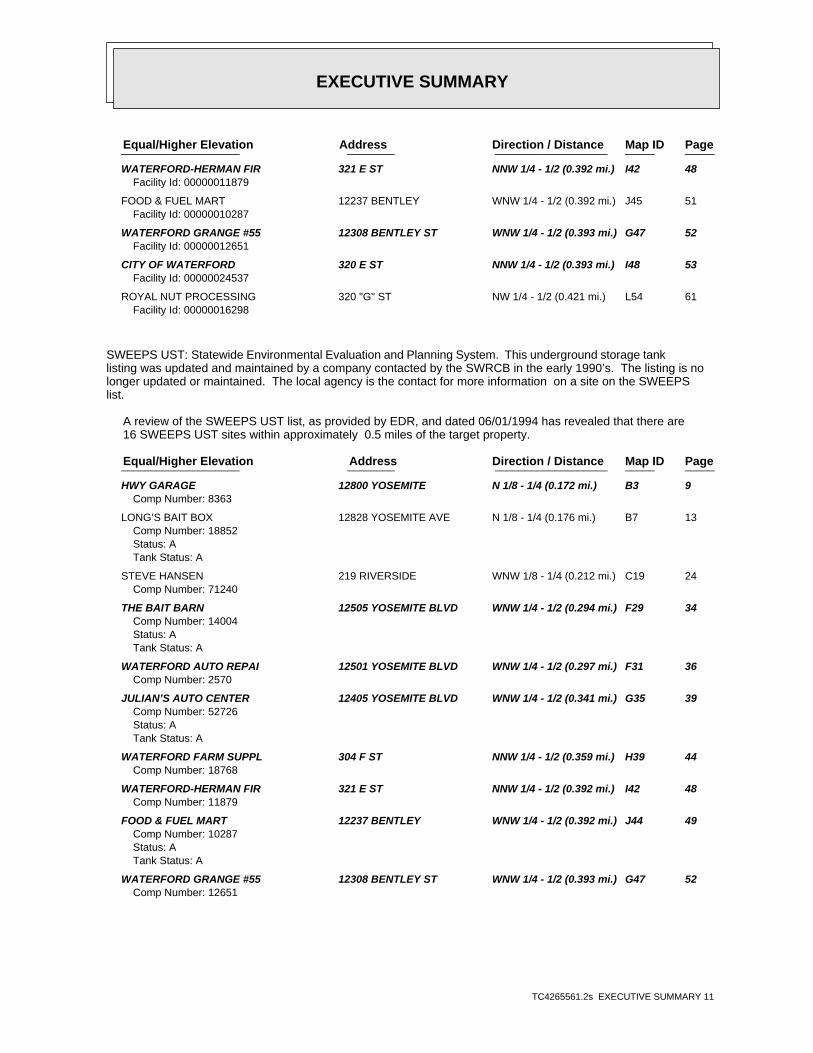
WATERFORD-HERMAN FIR 321 E ST NNW 1/4 - 1/2 (0.392 mi.) I42 48Facility Id: 00000011879
FOOD & FUEL MART 12237 BENTLEY WNW 1/4 - 1/2 (0.392 mi.) J45 51Facility Id: 00000010287
WATERFORD GRANGE #55 12308 BENTLEY ST WNW 1/4 - 1/2 (0.393 mi.) G47 52Facility Id: 00000012651
CITY OF WATERFORD 320 E ST NNW 1/4 - 1/2 (0.393 mi.) I48 53Facility Id: 00000024537
ROYAL NUT PROCESSING 320 "G" ST NW 1/4 - 1/2 (0.421 mi.) L54 61Facility Id: 00000016298
SWEEPS UST: Statewide Environmental Evaluation and Planning System. This underground storage tanklisting was updated and maintained by a company contacted by the SWRCB in the early 1990’s. The listing is nolonger updated or maintained. The local agency is the contact for more information on a site on the SWEEPSlist.
A review of the SWEEPS UST list, as provided by EDR, and dated 06/01/1994 has revealed that there are 16 SWEEPS UST sites within approximately 0.5 miles of the target property.
PageMap IDDirection / Distance Address Equal/Higher Elevation ____________________ ________ ___________________ _____ _____
HWY GARAGE 12800 YOSEMITE N 1/8 - 1/4 (0.172 mi.) B3 9Comp Number: 8363
LONG’S BAIT BOX 12828 YOSEMITE AVE N 1/8 - 1/4 (0.176 mi.) B7 13Comp Number: 18852Status: ATank Status: A
STEVE HANSEN 219 RIVERSIDE WNW 1/8 - 1/4 (0.212 mi.) C19 24Comp Number: 71240
THE BAIT BARN 12505 YOSEMITE BLVD WNW 1/4 - 1/2 (0.294 mi.) F29 34Comp Number: 14004Status: ATank Status: A
WATERFORD AUTO REPAI 12501 YOSEMITE BLVD WNW 1/4 - 1/2 (0.297 mi.) F31 36Comp Number: 2570
JULIAN’S AUTO CENTER 12405 YOSEMITE BLVD WNW 1/4 - 1/2 (0.341 mi.) G35 39Comp Number: 52726Status: ATank Status: A
WATERFORD FARM SUPPL 304 F ST NNW 1/4 - 1/2 (0.359 mi.) H39 44Comp Number: 18768
WATERFORD-HERMAN FIR 321 E ST NNW 1/4 - 1/2 (0.392 mi.) I42 48Comp Number: 11879
FOOD & FUEL MART 12237 BENTLEY WNW 1/4 - 1/2 (0.392 mi.) J44 49Comp Number: 10287Status: ATank Status: A
WATERFORD GRANGE #55 12308 BENTLEY ST WNW 1/4 - 1/2 (0.393 mi.) G47 52Comp Number: 12651
EXECUTIVE SUMMARY
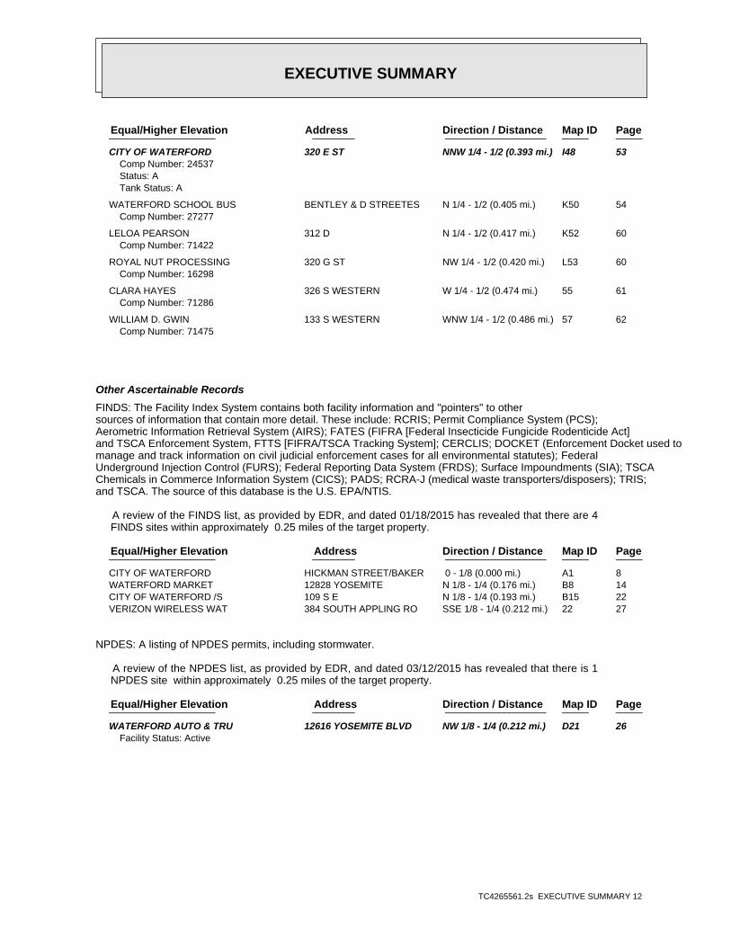
TC4265561.2s EXECUTIVE SUMMARY 12
PageMap IDDirection / Distance Address Equal/Higher Elevation ____________________ ________ ___________________ _____ _____
CITY OF WATERFORD 320 E ST NNW 1/4 - 1/2 (0.393 mi.) I48 53Comp Number: 24537Status: ATank Status: A
WATERFORD SCHOOL BUS BENTLEY & D STREETES N 1/4 - 1/2 (0.405 mi.) K50 54Comp Number: 27277
LELOA PEARSON 312 D N 1/4 - 1/2 (0.417 mi.) K52 60Comp Number: 71422
ROYAL NUT PROCESSING 320 G ST NW 1/4 - 1/2 (0.420 mi.) L53 60Comp Number: 16298
CLARA HAYES 326 S WESTERN W 1/4 - 1/2 (0.474 mi.) 55 61Comp Number: 71286
WILLIAM D. GWIN 133 S WESTERN WNW 1/4 - 1/2 (0.486 mi.) 57 62Comp Number: 71475
Other Ascertainable Records
FINDS: The Facility Index System contains both facility information and "pointers" to othersources of information that contain more detail. These include: RCRIS; Permit Compliance System (PCS);Aerometric Information Retrieval System (AIRS); FATES (FIFRA [Federal Insecticide Fungicide Rodenticide Act]and TSCA Enforcement System, FTTS [FIFRA/TSCA Tracking System]; CERCLIS; DOCKET (Enforcement Docket used tomanage and track information on civil judicial enforcement cases for all environmental statutes); FederalUnderground Injection Control (FURS); Federal Reporting Data System (FRDS); Surface Impoundments (SIA); TSCAChemicals in Commerce Information System (CICS); PADS; RCRA-J (medical waste transporters/disposers); TRIS;and TSCA. The source of this database is the U.S. EPA/NTIS.
A review of the FINDS list, as provided by EDR, and dated 01/18/2015 has revealed that there are 4 FINDS sites within approximately 0.25 miles of the target property.
PageMap IDDirection / Distance Address Equal/Higher Elevation ____________________ ________ ___________________ _____ _____
CITY OF WATERFORD HICKMAN STREET/BAKER 0 - 1/8 (0.000 mi.) A1 8 WATERFORD MARKET 12828 YOSEMITE N 1/8 - 1/4 (0.176 mi.) B8 14 CITY OF WATERFORD /S 109 S E N 1/8 - 1/4 (0.193 mi.) B15 22 VERIZON WIRELESS WAT 384 SOUTH APPLING RO SSE 1/8 - 1/4 (0.212 mi.) 22 27
NPDES: A listing of NPDES permits, including stormwater.
A review of the NPDES list, as provided by EDR, and dated 03/12/2015 has revealed that there is 1 NPDES site within approximately 0.25 miles of the target property.
PageMap IDDirection / Distance Address Equal/Higher Elevation ____________________ ________ ___________________ _____ _____
WATERFORD AUTO & TRU 12616 YOSEMITE BLVD NW 1/8 - 1/4 (0.212 mi.) D21 26Facility Status: Active
EXECUTIVE SUMMARY
TC4265561.2s EXECUTIVE SUMMARY 13
HIST CORTESE: The sites for the list are designated by the State Water Resource Control Board [LUST],the Integrated Waste Board [SWF/LS], and the Department of Toxic Substances Control [CALSITES]. Thislisting is no longer updated by the state agency.
A review of the HIST CORTESE list, as provided by EDR, and dated 04/01/2001 has revealed that there are 3 HIST CORTESE sites within approximately 0.5 miles of the target property.
PageMap IDDirection / Distance Address Equal/Higher Elevation ____________________ ________ ___________________ _____ _____
HWY GARAGE 12800 YOSEMITE N 1/8 - 1/4 (0.172 mi.) B3 9Reg Id: 500132
B & W PETROLEUM (BAI 12505 YOSEMITE BLVD WNW 1/4 - 1/2 (0.294 mi.) F28 29Reg Id: 500269
JULIAN’S AUTO CENTER 12405 YOSEMITE BLVD WNW 1/4 - 1/2 (0.341 mi.) G35 39Reg Id: 500196
HAZNET: The data is extracted from the copies of hazardous waste manifests received each year bythe DTSC. The annual volume of manifests is typically 700,000-1,000,000 annually, representing approximately350,000-500,000 shipments. Data from non-California manifests & continuation sheets are not included at thepresent time. Data are from the manifests submitted without correction, and therefore many contain someinvalid values for data elements such as generator ID, TSD ID, waste category, & disposal method. The sourceis the Department of Toxic Substance Control is the agency. This database begins with calendar year 1993.
A review of the HAZNET list, as provided by EDR, and dated 12/31/2013 has revealed that there are 7 HAZNET sites within approximately 0.25 miles of the target property.
PageMap IDDirection / Distance Address Equal/Higher Elevation ____________________ ________ ___________________ _____ _____
1X JOE GOMES & SONS 12828 YOSEMITE BLVD N 1/8 - 1/4 (0.176 mi.) B9 14GEPAID: CAC000898744
WATERFORD MARKET 12828 YOSEMITE BLVD N 1/8 - 1/4 (0.176 mi.) B13 20GEPAID: CAC001401936
BARNEY WILLIAMS 12900 S HICKMAN ST NNE 1/8 - 1/4 (0.183 mi.) 14 21GEPAID: CAC002627140
CITY OF WATERFORD 101 E ST N 1/8 - 1/4 (0.197 mi.) B16 22GEPAID: CAC002743682
DON LAMBERT & SONS 121 F STREET NNW 1/8 - 1/4 (0.210 mi.) 17 23GEPAID: CAL000034497
WATERFORD AUTO WRECK 12616 YOSEMITE BLVD NW 1/8 - 1/4 (0.212 mi.) D20 24GEPAID: CAD981652753
CITY OF WATERFORD 225 N APPLING RD ENE 1/8 - 1/4 (0.236 mi.) 25 28GEPAID: CAC002602918
EMI: Toxics and criteria pollutant emissions data collected by the ARB and local air pollutionagencies
A review of the EMI list, as provided by EDR, and dated 12/31/2012 has revealed that there are 2 EMI sites within approximately 0.25 miles of the target property.
PageMap IDDirection / Distance Address Equal/Higher Elevation ____________________ ________ ___________________ _____ _____
CITY OF WATERFORD HICKMAN STREET/BAKER 0 - 1/8 (0.000 mi.) A2 8Facility Id: 3782
EXECUTIVE SUMMARY
TC4265561.2s EXECUTIVE SUMMARY 14
PageMap IDDirection / Distance Address Equal/Higher Elevation ____________________ ________ ___________________ _____ _____
WATERFORD MARKET 12828 YOSEMITE N 1/8 - 1/4 (0.176 mi.) B11 15Facility Id: 2009
WDS: California Water Resources Control Board - Waste Discharge System.
A review of the WDS list, as provided by EDR, and dated 06/19/2007 has revealed that there is 1 WDS site within approximately 0.25 miles of the target property.
PageMap IDDirection / Distance Address Equal/Higher Elevation ____________________ ________ ___________________ _____ _____
WATERFORD AUTO & TRU 12616 YOSEMITE BLVD NW 1/8 - 1/4 (0.212 mi.) D21 26Facility Status: AFacility Id: 5S50I010060
EDR HIGH RISK HISTORICAL RECORDS
EDR Exclusive Records
EDR US Hist Auto Stat: EDR has searched selected national collections of business directories and has collectedlistings of potential gas station/filling station/service station sites that were available to EDRresearchers. EDR’s review was limited to those categories of sources that might, in EDR’s opinion, includegas station/filling station/service station establishments. The categories reviewed included, but were notlimited to gas, gas station, gasoline station, filling station, auto, automobile repair, auto service station,service station, etc. This database falls within a category of information EDR classifies as "High RiskHistorical Records", or HRHR. EDR’s HRHR effort presents unique and sometimes proprietary data about pastsites and operations that typically create environmental concerns, but may not show up in current governmentrecords searches.
A review of the EDR US Hist Auto Stat list, as provided by EDR, has revealed that there are 9 EDR US Hist Auto Stat sites within approximately 0.5 miles of the target property.
PageMap IDDirection / Distance Address Equal/Higher Elevation ____________________ ________ ___________________ _____ _____
Not reported 105 RIVERSIDE RD WNW 1/8 - 1/4 (0.211 mi.) C18 23 Not reported 12501 YOSEMITE BLVD WNW 1/4 - 1/2 (0.297 mi.) F32 38 Not reported 229 E ST NNW 1/4 - 1/2 (0.314 mi.) 33 38 Not reported 12416 YOSEMITE BLVD WNW 1/4 - 1/2 (0.335 mi.) F34 39 Not reported 12405 YOSEMITE BLVD WNW 1/4 - 1/2 (0.341 mi.) G37 43 Not reported 12320 BENTLEY ST WNW 1/4 - 1/2 (0.389 mi.) G41 47 Not reported 12237 BENTLEY ST WNW 1/4 - 1/2 (0.392 mi.) J43 48 Not reported 13231 YOSEMITE BLVD NE 1/4 - 1/2 (0.397 mi.) 49 54 Not reported 13160 YOSEMITE BLVD ENE 1/4 - 1/2 (0.480 mi.) 56 62

EXECUTIVE SUMMARY
TC4265561.2s EXECUTIVE SUMMARY 15
EDR US Hist Cleaners: EDR has searched selected national collections of business directories and has collectedlistings of potential dry cleaner sites that were available to EDR researchers. EDR’s review was limited tothose categories of sources that might, in EDR’s opinion, include dry cleaning establishments. The categoriesreviewed included, but were not limited to dry cleaners, cleaners, laundry, laundromat, cleaning/laundry, wash& dry etc. This database falls within a category of information EDR classifies as "High Risk HistoricalRecords", or HRHR. EDR’s HRHR effort presents unique and sometimes proprietary data about past sites andoperations that typically create environmental concerns, but may not show up in current government recordssearches.
A review of the EDR US Hist Cleaners list, as provided by EDR, has revealed that there is 1 EDR US Hist Cleaners site within approximately 0.5 miles of the target property.
PageMap IDDirection / Distance Address Equal/Higher Elevation ____________________ ________ ___________________ _____ _____
Not reported 121 E ST N 1/8 - 1/4 (0.217 mi.) E23 27
EDR RECOVERED GOVERNMENT ARCHIVES
Exclusive Recovered Govt. Archives
RGA LUST: The EDR Recovered Government Archive Leaking Underground Storage Tank database provides alist of LUST incidents derived from historical databases and includes many records that no longer appear incurrent government lists. Compiled from Records formerly available from the State Water Resources ControlBoard in California.
A review of the RGA LUST list, as provided by EDR, has revealed that there are 2 RGA LUST sites within approximately 0.25 miles of the target property.
PageMap IDDirection / Distance Address Equal/Higher Elevation ____________________ ________ ___________________ _____ _____
HIGHWAY GARAGE (CLOS 12800 YOSEMITE BLVD N 1/8 - 1/4 (0.172 mi.) B5 13 HIGHWAY GARAGE 12800 YOSEMITE BLVD N 1/8 - 1/4 (0.172 mi.) B6 13
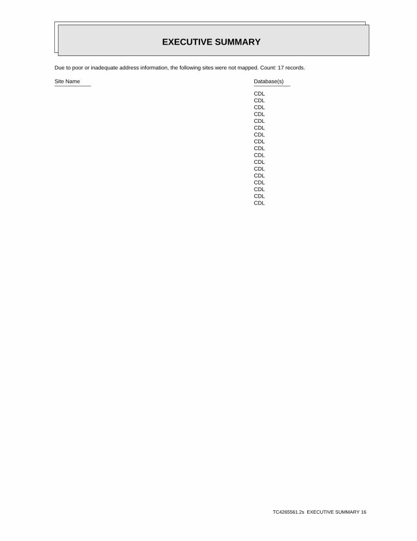
EXECUTIVE SUMMARY
TC4265561.2s EXECUTIVE SUMMARY 16
Due to poor or inadequate address information, the following sites were not mapped. Count: 17 records.
Site Name Database(s)____________ ____________
CDL CDL CDL CDL CDL CDL CDL CDL CDL CDL CDL CDL CDL CDL CDL CDL CDL

EDR Inc.EDR Inc.EDR Inc.EDR Inc.EDR Inc.EDR Inc.EDR Inc.EDR Inc.EDR Inc.EDR Inc.EDR Inc.EDR Inc.EDR Inc.EDR Inc.EDR Inc.EDR Inc.EDR Inc.EDR Inc.EDR Inc.EDR Inc.EDR Inc.EDR Inc.EDR Inc.EDR Inc.EDR Inc.EDR Inc.EDR Inc.EDR Inc.EDR Inc.EDR Inc.EDR Inc.EDR Inc.EDR Inc.EDR Inc.EDR Inc.EDR Inc.EDR Inc.EDR Inc.EDR Inc.EDR Inc.
1 20
16
0 16
0
12
0
1 2 0
12
0
1 2 01 2 0
12
0
1 2 0
0
1 6 0
1 6 0
16
0
1 6 0
1 6 0
1 6 0
1 6 0
80
1 2 0
1 2 0
1 2 0
8 0
8 0
80
8 0
8 0
80
1 2 0
12
0
1 6 0
1 6 0
1 2 01 2 0
200
20
0
1 6 0
200
20
0
200 2 0 0
2 0 0
200
2 40 2
4 0
2 00
2 0
2 0 0
2 0 0
2 00
20
0
20 0
2 0 0
2 00
20
0
2 0 0
2 0 0
20
0
20
0
20
0200 200 2
00
200
1 6 0
1 6 0
200
8 0
1 20
1 2 0
1 2 0
1 2 01 2 0
1
6 0
1 6 01 6 0
1 2 0
80
8 0
8 080
1 2 0
1 2 01 6 0
1
6 0
1 6 0
1 6 0
1
6 0
1 6 0 1 6 0
1 6 01 60
1 60
1 60
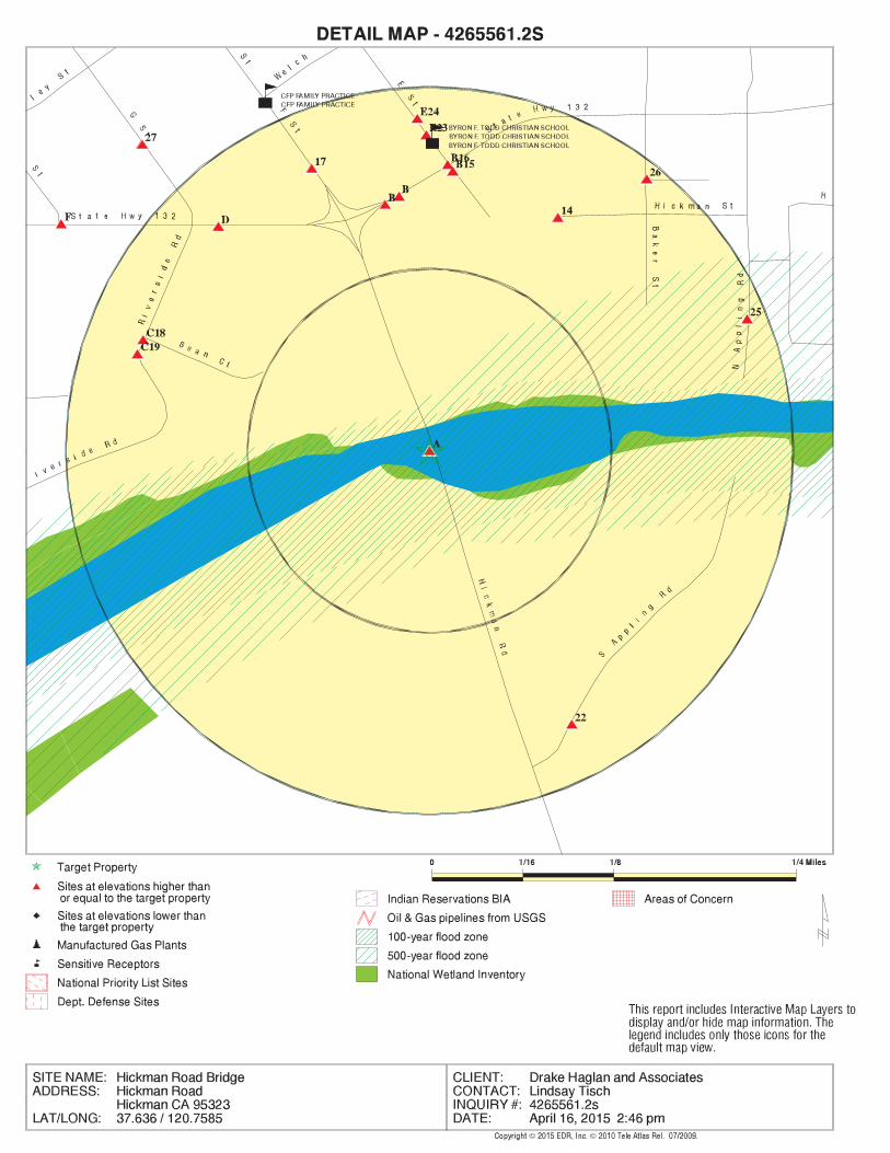
EDR Inc.EDR Inc.EDR Inc.EDR Inc.EDR Inc.EDR Inc.EDR Inc.EDR Inc.EDR Inc.EDR Inc.EDR Inc.EDR Inc.EDR Inc.EDR Inc.EDR Inc.EDR Inc.EDR Inc.EDR Inc.EDR Inc.EDR Inc.EDR Inc.EDR Inc.EDR Inc.EDR Inc.EDR Inc.EDR Inc.EDR Inc.EDR Inc.EDR Inc.EDR Inc.EDR Inc.EDR Inc.EDR Inc.EDR Inc.EDR Inc.EDR Inc.EDR Inc.EDR Inc.EDR Inc.EDR Inc.
120
120
80 80
80
120
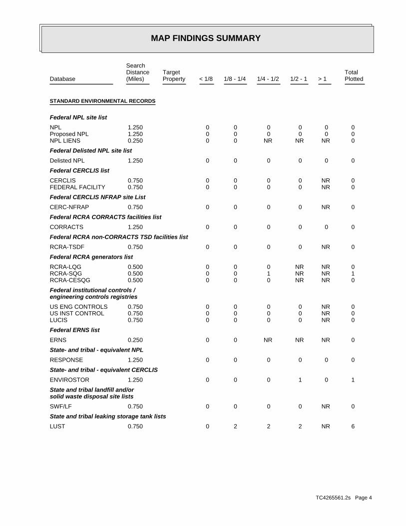
MAP FINDINGS SUMMARY
SearchTargetDistance Total
Database Property(Miles) < 1/8 1/8 - 1/4 1/4 - 1/2 1/2 - 1 > 1 Plotted
STANDARD ENVIRONMENTAL RECORDS
Federal NPL site list
0 0 0 0 0 0 1.250NPL 0 0 0 0 0 0 1.250Proposed NPL 0 NR NR NR 0 0 0.250NPL LIENS
Federal Delisted NPL site list
0 0 0 0 0 0 1.250Delisted NPL
Federal CERCLIS list
0 NR 0 0 0 0 0.750CERCLIS 0 NR 0 0 0 0 0.750FEDERAL FACILITY
Federal CERCLIS NFRAP site List
0 NR 0 0 0 0 0.750CERC-NFRAP
Federal RCRA CORRACTS facilities list
0 0 0 0 0 0 1.250CORRACTS
Federal RCRA non-CORRACTS TSD facilities list
0 NR 0 0 0 0 0.750RCRA-TSDF
Federal RCRA generators list
0 NR NR 0 0 0 0.500RCRA-LQG 1 NR NR 1 0 0 0.500RCRA-SQG 0 NR NR 0 0 0 0.500RCRA-CESQG
Federal institutional controls /engineering controls registries
0 NR 0 0 0 0 0.750US ENG CONTROLS 0 NR 0 0 0 0 0.750US INST CONTROL 0 NR 0 0 0 0 0.750LUCIS
Federal ERNS list
0 NR NR NR 0 0 0.250ERNS
State- and tribal - equivalent NPL
0 0 0 0 0 0 1.250RESPONSE
State- and tribal - equivalent CERCLIS
1 0 1 0 0 0 1.250ENVIROSTOR
State and tribal landfill and/orsolid waste disposal site lists
0 NR 0 0 0 0 0.750SWF/LF
State and tribal leaking storage tank lists
6 NR 2 2 2 0 0.750LUST
TC4265561.2s Page 4

MAP FINDINGS SUMMARY
SearchTargetDistance Total
Database Property(Miles) < 1/8 1/8 - 1/4 1/4 - 1/2 1/2 - 1 > 1 Plotted
1 NR 0 0 1 0 0.750SLIC 0 NR 0 0 0 0 0.750INDIAN LUST
State and tribal registered storage tank lists
4 NR NR 3 1 0 0.500UST 1 NR NR 1 0 0 0.500AST 0 NR NR 0 0 0 0.500INDIAN UST 0 NR NR 0 0 0 0.500FEMA UST
State and tribal voluntary cleanup sites
0 NR 0 0 0 0 0.750INDIAN VCP 0 NR 0 0 0 0 0.750VCP
ADDITIONAL ENVIRONMENTAL RECORDS
Local Brownfield lists
0 NR 0 0 0 0 0.750US BROWNFIELDS
Local Lists of Landfill / SolidWaste Disposal Sites
0 NR 0 0 0 0 0.750DEBRIS REGION 9 0 NR 0 0 0 0 0.750ODI 1 NR 1 0 0 0 0.750SWRCY 0 NR NR NR 0 0 0.250HAULERS 0 NR 0 0 0 0 0.750INDIAN ODI 0 NR 0 0 0 0 0.750WMUDS/SWAT
Local Lists of Hazardous waste /Contaminated Sites
0 NR NR NR 0 0 0.250US CDL 0 0 0 0 0 0 1.250HIST Cal-Sites 0 NR NR 0 0 0 0.500SCH 0 0 0 0 0 0 1.250Toxic Pits 1 NR NR NR 1 0 0.250CDL 0 NR NR NR 0 0 0.250US HIST CDL
Local Lists of Registered Storage Tanks
0 NR NR 0 0 0 0.500CA FID UST 12 NR NR 10 2 0 0.500HIST UST 16 NR NR 13 3 0 0.500SWEEPS UST
Local Land Records
0 NR NR NR 0 0 0.250LIENS 2 0 NR NR NR 0 0 0.250LIENS 0 NR 0 0 0 0 0.750DEED
Records of Emergency Release Reports
0 NR NR NR 0 0 0.250HMIRS 0 NR NR NR 0 0 0.250CHMIRS 0 NR NR NR 0 0 0.250LDS
TC4265561.2s Page 5
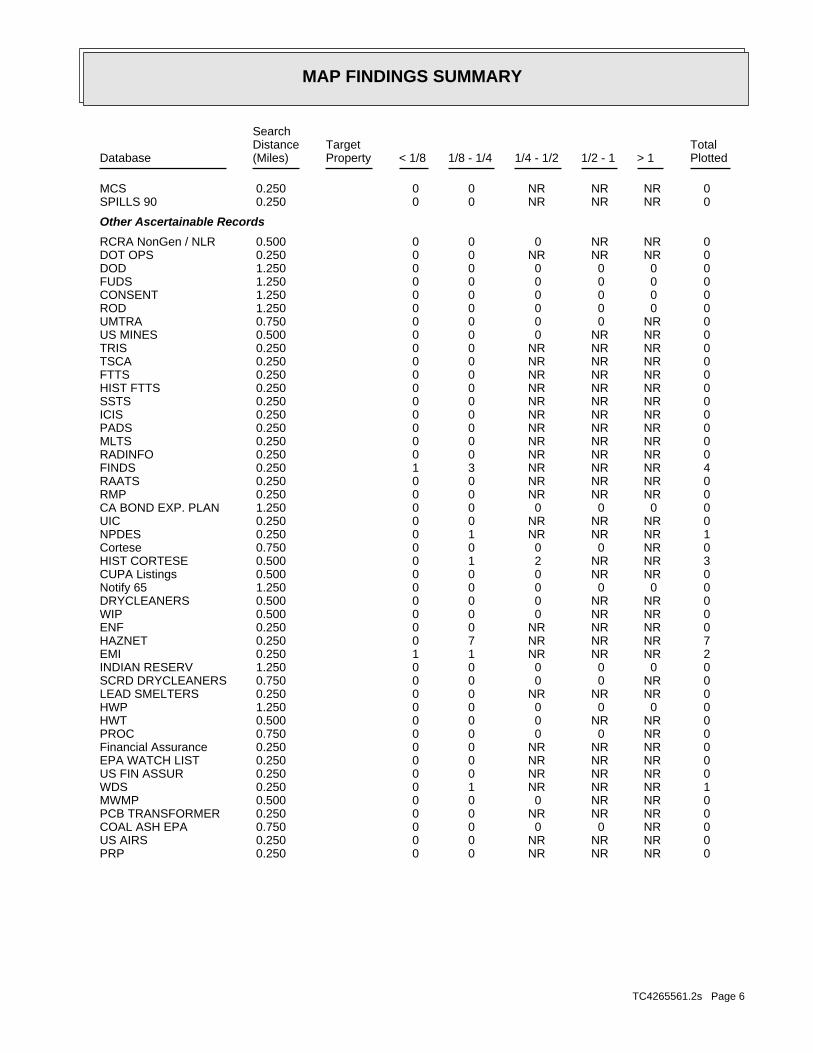
MAP FINDINGS SUMMARY
SearchTargetDistance Total
Database Property(Miles) < 1/8 1/8 - 1/4 1/4 - 1/2 1/2 - 1 > 1 Plotted
0 NR NR NR 0 0 0.250MCS 0 NR NR NR 0 0 0.250SPILLS 90
Other Ascertainable Records
0 NR NR 0 0 0 0.500RCRA NonGen / NLR 0 NR NR NR 0 0 0.250DOT OPS 0 0 0 0 0 0 1.250DOD 0 0 0 0 0 0 1.250FUDS 0 0 0 0 0 0 1.250CONSENT 0 0 0 0 0 0 1.250ROD 0 NR 0 0 0 0 0.750UMTRA 0 NR NR 0 0 0 0.500US MINES 0 NR NR NR 0 0 0.250TRIS 0 NR NR NR 0 0 0.250TSCA 0 NR NR NR 0 0 0.250FTTS 0 NR NR NR 0 0 0.250HIST FTTS 0 NR NR NR 0 0 0.250SSTS 0 NR NR NR 0 0 0.250ICIS 0 NR NR NR 0 0 0.250PADS 0 NR NR NR 0 0 0.250MLTS 0 NR NR NR 0 0 0.250RADINFO 4 NR NR NR 3 1 0.250FINDS 0 NR NR NR 0 0 0.250RAATS 0 NR NR NR 0 0 0.250RMP 0 0 0 0 0 0 1.250CA BOND EXP. PLAN 0 NR NR NR 0 0 0.250UIC 1 NR NR NR 1 0 0.250NPDES 0 NR 0 0 0 0 0.750Cortese 3 NR NR 2 1 0 0.500HIST CORTESE 0 NR NR 0 0 0 0.500CUPA Listings 0 0 0 0 0 0 1.250Notify 65 0 NR NR 0 0 0 0.500DRYCLEANERS 0 NR NR 0 0 0 0.500WIP 0 NR NR NR 0 0 0.250ENF 7 NR NR NR 7 0 0.250HAZNET 2 NR NR NR 1 1 0.250EMI 0 0 0 0 0 0 1.250INDIAN RESERV 0 NR 0 0 0 0 0.750SCRD DRYCLEANERS 0 NR NR NR 0 0 0.250LEAD SMELTERS 0 0 0 0 0 0 1.250HWP 0 NR NR 0 0 0 0.500HWT 0 NR 0 0 0 0 0.750PROC 0 NR NR NR 0 0 0.250Financial Assurance 0 NR NR NR 0 0 0.250EPA WATCH LIST 0 NR NR NR 0 0 0.250US FIN ASSUR 1 NR NR NR 1 0 0.250WDS 0 NR NR 0 0 0 0.500MWMP 0 NR NR NR 0 0 0.250PCB TRANSFORMER 0 NR 0 0 0 0 0.750COAL ASH EPA 0 NR NR NR 0 0 0.250US AIRS 0 NR NR NR 0 0 0.250PRP
TC4265561.2s Page 6
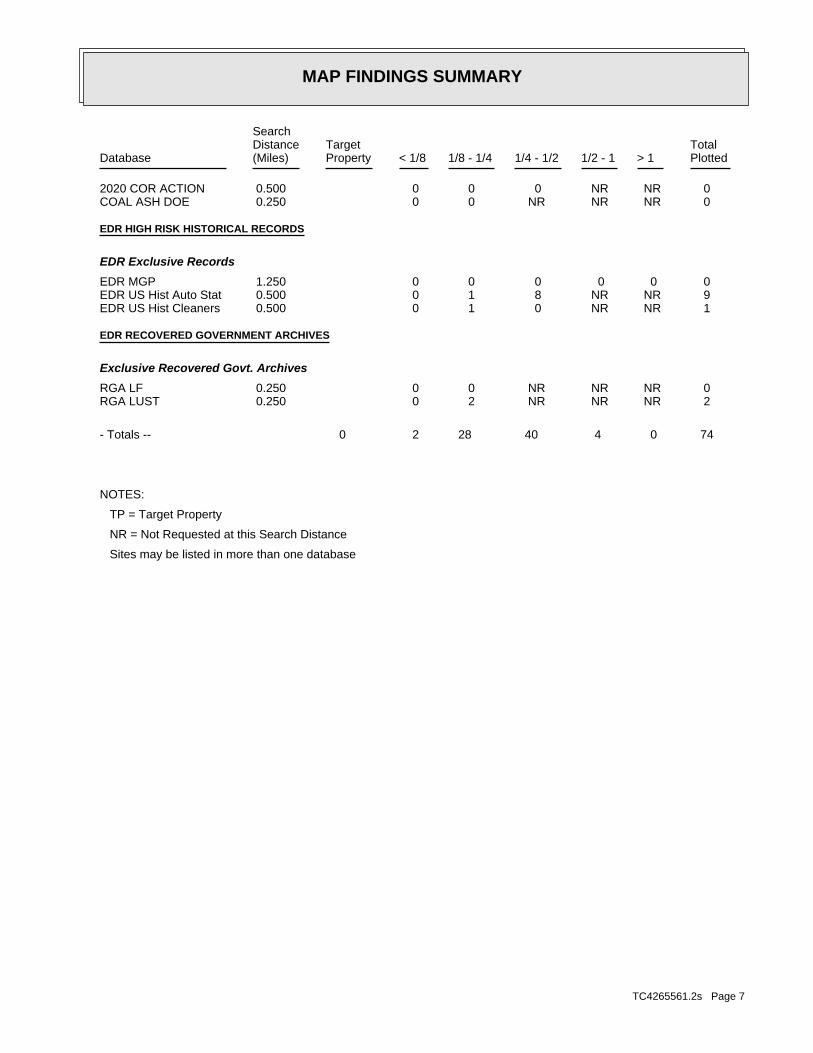
MAP FINDINGS SUMMARY
SearchTargetDistance Total
Database Property(Miles) < 1/8 1/8 - 1/4 1/4 - 1/2 1/2 - 1 > 1 Plotted
0 NR NR 0 0 0 0.5002020 COR ACTION 0 NR NR NR 0 0 0.250COAL ASH DOE
EDR HIGH RISK HISTORICAL RECORDS
EDR Exclusive Records
0 0 0 0 0 0 1.250EDR MGP 9 NR NR 8 1 0 0.500EDR US Hist Auto Stat 1 NR NR 0 1 0 0.500EDR US Hist Cleaners
EDR RECOVERED GOVERNMENT ARCHIVES
Exclusive Recovered Govt. Archives
0 NR NR NR 0 0 0.250RGA LF 2 NR NR NR 2 0 0.250RGA LUST
74 0 4 40 28 2 0- Totals --
NOTES:
TP = Target Property
NR = Not Requested at this Search Distance
Sites may be listed in more than one database
TC4265561.2s Page 7

MAP FINDINGSMap IDDirection
EDR ID NumberDistanceEPA ID NumberDatabase(s)SiteElevation
CRITERIA AND HAZARDOUS AIR POLLUTANT INVENTORY Environmental Interest/Information System
110037998441Registry ID:
FINDS:
Site 1 of 2 in cluster A1 ft.
Relative:Higher
Actual:72 ft.
< 1/8 WATERFORD, CA 95386HICKMAN STREET/BAKER STREET N/A
A1 FINDSCITY OF WATERFORD 1011988075
SJUAir District Name: 3782Facility ID: SJVAir Basin: 50County Code: 2005Year:
2.5E-05Part. Matter 10 Micrometers & Smllr Tons/Yr: 2.51509E-05Particulate Matter Tons/Yr: 1.75E-06SOX - Oxides of Sulphur Tons/Yr: 0.000695NOX - Oxides of Nitrogen Tons/Yr: 0.000645Carbon Monoxide Emissions Tons/Yr: 0.000415Reactive Organic Gases Tons/Yr: 0.004540481Total Organic Hydrocarbon Gases Tons/Yr: Not reportedConsolidated Emission Reporting Rule: Not reportedCommunity Health Air Pollution Info System: SAN JOAQUIN VALLEY UNIFIED APCDAir District Name: 9199SIC Code: SJUAir District Name: 3782Facility ID: SJVAir Basin: 50County Code: 2004Year:
0Part. Matter 10 Micrometers & Smllr Tons/Yr: 0Particulate Matter Tons/Yr: 0SOX - Oxides of Sulphur Tons/Yr: 0NOX - Oxides of Nitrogen Tons/Yr: 0Carbon Monoxide Emissions Tons/Yr: 0Reactive Organic Gases Tons/Yr: 0Total Organic Hydrocarbon Gases Tons/Yr: Not reportedConsolidated Emission Reporting Rule: Not reportedCommunity Health Air Pollution Info System: SAN JOAQUIN VALLEY UNIFIED APCDAir District Name: 9199SIC Code: SJUAir District Name: 3782Facility ID: SJVAir Basin: 50County Code: 2003Year:
EMI:
Site 2 of 2 in cluster A1 ft.
Relative:Higher
Actual:72 ft.
< 1/8 WATERFORD, CA 95386HICKMAN STREET/BAKER STREET N/A
A2 EMICITY OF WATERFORD S106920621
TC4265561.2s Page 8

MAP FINDINGSMap IDDirection
EDR ID NumberDistanceEPA ID NumberDatabase(s)SiteElevation
.0000249999994412065Part. Matter 10 Micrometers & Smllr Tons/Yr: .0000251509048704290Particulate Matter Tons/Yr: .0000017499999608844SOX - Oxides of Sulphur Tons/Yr: .000694999984465539NOX - Oxides of Nitrogen Tons/Yr: .000644999985583127Carbon Monoxide Emissions Tons/Yr: .000414999990724027Reactive Organic Gases Tons/Yr: .0045404812989499671Total Organic Hydrocarbon Gases Tons/Yr: Not reportedConsolidated Emission Reporting Rule: Not reportedCommunity Health Air Pollution Info System: SAN JOAQUIN VALLEY UNIFIED APCDAir District Name: 9199SIC Code:
CITY OF WATERFORD (Continued) S106920621
CENTRAL VALLEY RWQCB (REGION 5S)Organization Name: MICHAEL SMITHContact Name: Regional Board CaseworkerContact Type: T0609900115Global Id:
Not reportedPhone Number: [email protected]: MODESTOCity: 3800 CORNUCOPIA WAY STE# CAddress: STANISLAUS COUNTY LOPOrganization Name: NICOLE DAMINContact Name: Local Agency CaseworkerContact Type: T0609900115Global Id:
Contact:
Click here to access the California GeoTracker records for this facility:
Not reportedSite History: Waste Oil / Motor / Hydraulic / LubricatingPotential Contaminants of Concern: SoilPotential Media Affect: Not reportedFile Location: 98LOC Case Number: 500132RB Case Number: STANISLAUS COUNTY LOPLocal Agency: NDCase Worker: STANISLAUS COUNTY LOPLead Agency: 08/28/1989Status Date: Completed - Case ClosedStatus: LUST Cleanup SiteCase Type: -120.758781Longitude: 37.638064Latitude: T0609900115Global Id: STATERegion:
LUST:
500132Reg Id: LTNKAReg By: 50Facility County Code: CORTESERegion:
HIST CORTESE:
908 ft. Site 1 of 13 in cluster B0.172 mi.
Relative:Higher
Actual:169 ft.
1/8-1/4 SWEEPS USTWATERFORD, CA 95386North LUST12800 YOSEMITE N/AB3 HIST CORTESEHWY GARAGE S102431374
TC4265561.2s Page 9

MAP FINDINGSMap IDDirection
EDR ID NumberDistanceEPA ID NumberDatabase(s)SiteElevation
4Number Of Tanks: WASTE OILContent: WASTESTG: OILTank Use: Not reportedActive Date: 500Capacity: Not reportedTank Status: 50-000-008363-000001SWRCB Tank Id: Not reportedOwner Tank Id: Not reportedCreated Date: Not reportedAction Date: Not reportedReferral Date: 44-028494Board Of Equalization: Not reportedNumber: 8363Comp Number: Not reportedStatus:
SWEEPS UST:
N/AMTBE Code:LUSTProgram:LocalLead Agency:MTSStaff Initials:WASTE OILSubstance:Soil onlyCase Type:500132Case Number:Case ClosedStatus:5Region:
LUST REG 5:
Leak ReportedAction: 09/15/1988Date: OtherAction Type: T0609900115Global Id:
Notice of ResponsibilityAction: 05/31/1989Date: ENFORCEMENTAction Type: T0609900115Global Id:
Regulatory Activities:
08/28/1989Status Date: Completed - Case ClosedStatus: T0609900115Global Id:
09/15/1988Status Date: Open - Case Begin DateStatus: T0609900115Global Id:
Status History:
Not reportedPhone Number: [email protected]: RANCHO CORDOVACity: 11020 SUN CENTER DRIVE #200Address:
HWY GARAGE (Continued) S102431374
TC4265561.2s Page 10
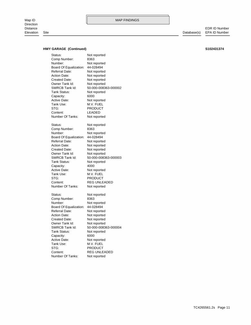
MAP FINDINGSMap IDDirection
EDR ID NumberDistanceEPA ID NumberDatabase(s)SiteElevation
Not reportedNumber Of Tanks: REG UNLEADEDContent: PRODUCTSTG: M.V. FUELTank Use: Not reportedActive Date: 6000Capacity: Not reportedTank Status: 50-000-008363-000004SWRCB Tank Id: Not reportedOwner Tank Id: Not reportedCreated Date: Not reportedAction Date: Not reportedReferral Date: 44-028494Board Of Equalization: Not reportedNumber: 8363Comp Number: Not reportedStatus:
Not reportedNumber Of Tanks: REG UNLEADEDContent: PRODUCTSTG: M.V. FUELTank Use: Not reportedActive Date: 4000Capacity: Not reportedTank Status: 50-000-008363-000003SWRCB Tank Id: Not reportedOwner Tank Id: Not reportedCreated Date: Not reportedAction Date: Not reportedReferral Date: 44-028494Board Of Equalization: Not reportedNumber: 8363Comp Number: Not reportedStatus:
Not reportedNumber Of Tanks: LEADEDContent: PRODUCTSTG: M.V. FUELTank Use: Not reportedActive Date: 6000Capacity: Not reportedTank Status: 50-000-008363-000002SWRCB Tank Id: Not reportedOwner Tank Id: Not reportedCreated Date: Not reportedAction Date: Not reportedReferral Date: 44-028494Board Of Equalization: Not reportedNumber: 8363Comp Number: Not reportedStatus:
HWY GARAGE (Continued) S102431374
TC4265561.2s Page 11
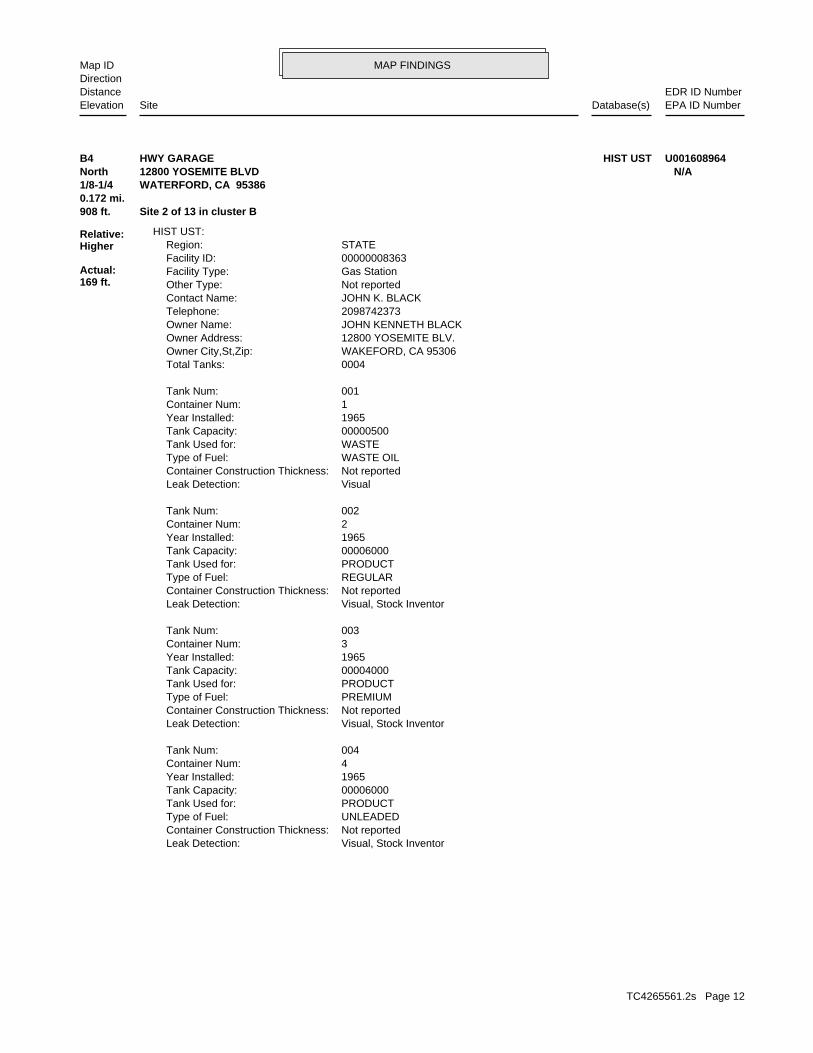
MAP FINDINGSMap IDDirection
EDR ID NumberDistanceEPA ID NumberDatabase(s)SiteElevation
Visual, Stock InventorLeak Detection: Not reportedContainer Construction Thickness: UNLEADEDType of Fuel: PRODUCTTank Used for: 00006000Tank Capacity: 1965Year Installed: 4Container Num: 004Tank Num:
Visual, Stock InventorLeak Detection: Not reportedContainer Construction Thickness: PREMIUMType of Fuel: PRODUCTTank Used for: 00004000Tank Capacity: 1965Year Installed: 3Container Num: 003Tank Num:
Visual, Stock InventorLeak Detection: Not reportedContainer Construction Thickness: REGULARType of Fuel: PRODUCTTank Used for: 00006000Tank Capacity: 1965Year Installed: 2Container Num: 002Tank Num:
VisualLeak Detection: Not reportedContainer Construction Thickness: WASTE OILType of Fuel: WASTETank Used for: 00000500Tank Capacity: 1965Year Installed: 1Container Num: 001Tank Num:
0004Total Tanks: WAKEFORD, CA 95306Owner City,St,Zip: 12800 YOSEMITE BLV.Owner Address: JOHN KENNETH BLACKOwner Name: 2098742373Telephone: JOHN K. BLACKContact Name: Not reportedOther Type: Gas StationFacility Type: 00000008363Facility ID: STATERegion:
HIST UST:
908 ft. Site 2 of 13 in cluster B0.172 mi.
Relative:Higher
Actual:169 ft.
1/8-1/4 WATERFORD, CA 95386North 12800 YOSEMITE BLVD N/AB4 HIST USTHWY GARAGE U001608964
TC4265561.2s Page 12
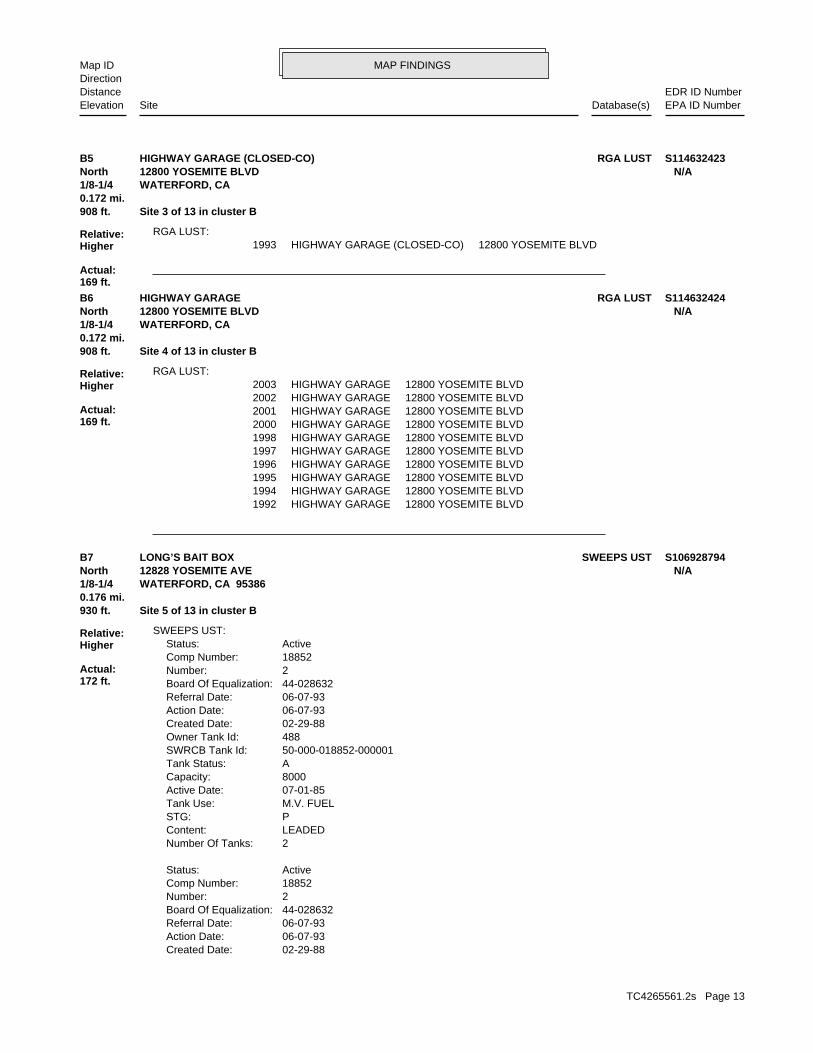
MAP FINDINGSMap IDDirection
EDR ID NumberDistanceEPA ID NumberDatabase(s)SiteElevation
1993 HIGHWAY GARAGE (CLOSED-CO) 12800 YOSEMITE BLVDRGA LUST:
908 ft. Site 3 of 13 in cluster B0.172 mi.
Relative:Higher
Actual:169 ft.
1/8-1/4 WATERFORD, CA North 12800 YOSEMITE BLVD N/AB5 RGA LUSTHIGHWAY GARAGE (CLOSED-CO) S114632423
1992 HIGHWAY GARAGE 12800 YOSEMITE BLVD1994 HIGHWAY GARAGE 12800 YOSEMITE BLVD1995 HIGHWAY GARAGE 12800 YOSEMITE BLVD1996 HIGHWAY GARAGE 12800 YOSEMITE BLVD1997 HIGHWAY GARAGE 12800 YOSEMITE BLVD1998 HIGHWAY GARAGE 12800 YOSEMITE BLVD2000 HIGHWAY GARAGE 12800 YOSEMITE BLVD2001 HIGHWAY GARAGE 12800 YOSEMITE BLVD2002 HIGHWAY GARAGE 12800 YOSEMITE BLVD2003 HIGHWAY GARAGE 12800 YOSEMITE BLVD
RGA LUST:
908 ft. Site 4 of 13 in cluster B0.172 mi.
Relative:Higher
Actual:169 ft.
1/8-1/4 WATERFORD, CA North 12800 YOSEMITE BLVD N/AB6 RGA LUSTHIGHWAY GARAGE S114632424
02-29-88Created Date: 06-07-93Action Date: 06-07-93Referral Date: 44-028632Board Of Equalization: 2Number: 18852Comp Number: ActiveStatus:
2Number Of Tanks: LEADEDContent: PSTG: M.V. FUELTank Use: 07-01-85Active Date: 8000Capacity: ATank Status: 50-000-018852-000001SWRCB Tank Id: 488Owner Tank Id: 02-29-88Created Date: 06-07-93Action Date: 06-07-93Referral Date: 44-028632Board Of Equalization: 2Number: 18852Comp Number: ActiveStatus:
SWEEPS UST:
930 ft. Site 5 of 13 in cluster B0.176 mi.
Relative:Higher
Actual:172 ft.
1/8-1/4 WATERFORD, CA 95386North 12828 YOSEMITE AVE N/AB7 SWEEPS USTLONG’S BAIT BOX S106928794
TC4265561.2s Page 13
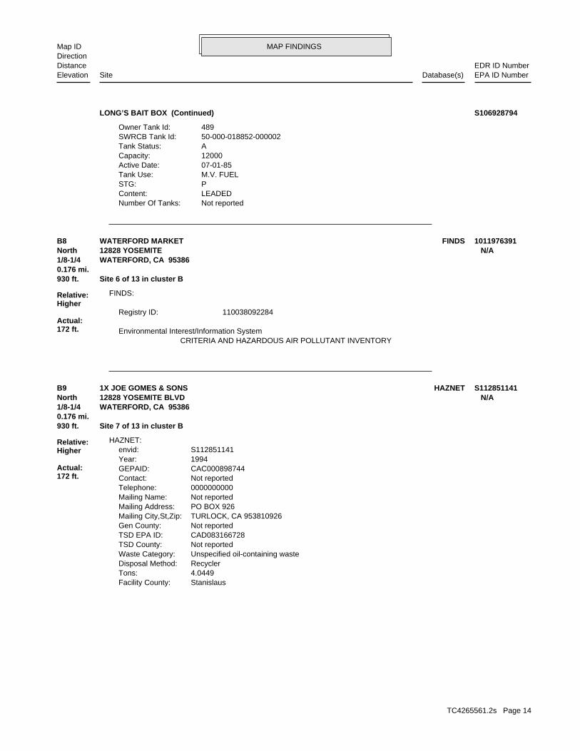
MAP FINDINGSMap IDDirection
EDR ID NumberDistanceEPA ID NumberDatabase(s)SiteElevation
Not reportedNumber Of Tanks: LEADEDContent: PSTG: M.V. FUELTank Use: 07-01-85Active Date: 12000Capacity: ATank Status: 50-000-018852-000002SWRCB Tank Id: 489Owner Tank Id:
LONG’S BAIT BOX (Continued) S106928794
CRITERIA AND HAZARDOUS AIR POLLUTANT INVENTORY Environmental Interest/Information System
110038092284Registry ID:
FINDS:
930 ft. Site 6 of 13 in cluster B0.176 mi.
Relative:Higher
Actual:172 ft.
1/8-1/4 WATERFORD, CA 95386North 12828 YOSEMITE N/AB8 FINDSWATERFORD MARKET 1011976391
StanislausFacility County: 4.0449Tons: RecyclerDisposal Method: Unspecified oil-containing wasteWaste Category: Not reportedTSD County: CAD083166728TSD EPA ID: Not reportedGen County: TURLOCK, CA 953810926Mailing City,St,Zip: PO BOX 926Mailing Address: Not reportedMailing Name: 0000000000Telephone: Not reportedContact: CAC000898744GEPAID: 1994Year: S112851141envid:
HAZNET:
930 ft. Site 7 of 13 in cluster B0.176 mi.
Relative:Higher
Actual:172 ft.
1/8-1/4 WATERFORD, CA 95386North 12828 YOSEMITE BLVD N/AB9 HAZNET1X JOE GOMES & SONS S112851141
TC4265561.2s Page 14

MAP FINDINGSMap IDDirection
EDR ID NumberDistanceEPA ID NumberDatabase(s)SiteElevation
Stock InventorLeak Detection: 1/4Container Construction Thickness: 06Type of Fuel: PRODUCTTank Used for: 00012000Tank Capacity: 1970Year Installed: 489Container Num: 002Tank Num:
Stock InventorLeak Detection: 1/4Container Construction Thickness: 06Type of Fuel: PRODUCTTank Used for: 00008000Tank Capacity: 1970Year Installed: 488Container Num: 001Tank Num:
0002Total Tanks: SEATTLE, WA 98199Owner City,St,Zip: 2737 W. COMMODORE WAYOwner Address: TIME OIL CO.Owner Name: 2098742880Telephone: VINCENT F. BLANKContact Name: Not reportedOther Type: Gas StationFacility Type: 00000018852Facility ID: STATERegion:
HIST UST:
930 ft. Site 8 of 13 in cluster B0.176 mi.
Relative:Higher
Actual:172 ft.
1/8-1/4 WATERFORD, CA 95386North 12828 YOSEMITE BLVD N/AB10 HIST USTLONG’S GAS MART U001608974
Not reportedSite History: Gasoline, Toluene, XylenePotential Contaminants of Concern: Aquifer used for drinking water supplyPotential Media Affect: Local AgencyFile Location: 480LOC Case Number: 500524RB Case Number: STANISLAUS COUNTY LOPLocal Agency: NDCase Worker: STANISLAUS COUNTY LOPLead Agency: 10/17/2006Status Date: Completed - Case ClosedStatus: LUST Cleanup SiteCase Type: -120.758339Longitude: 37.638528Latitude: T0609991230Global Id: STATERegion:
LUST:
930 ft. Site 9 of 13 in cluster B0.176 mi.
Relative:Higher
Actual:172 ft.
1/8-1/4 WATERFORD, CA 95386North EMI12828 YOSEMITE N/AB11 LUSTWATERFORD MARKET S107622399
TC4265561.2s Page 15
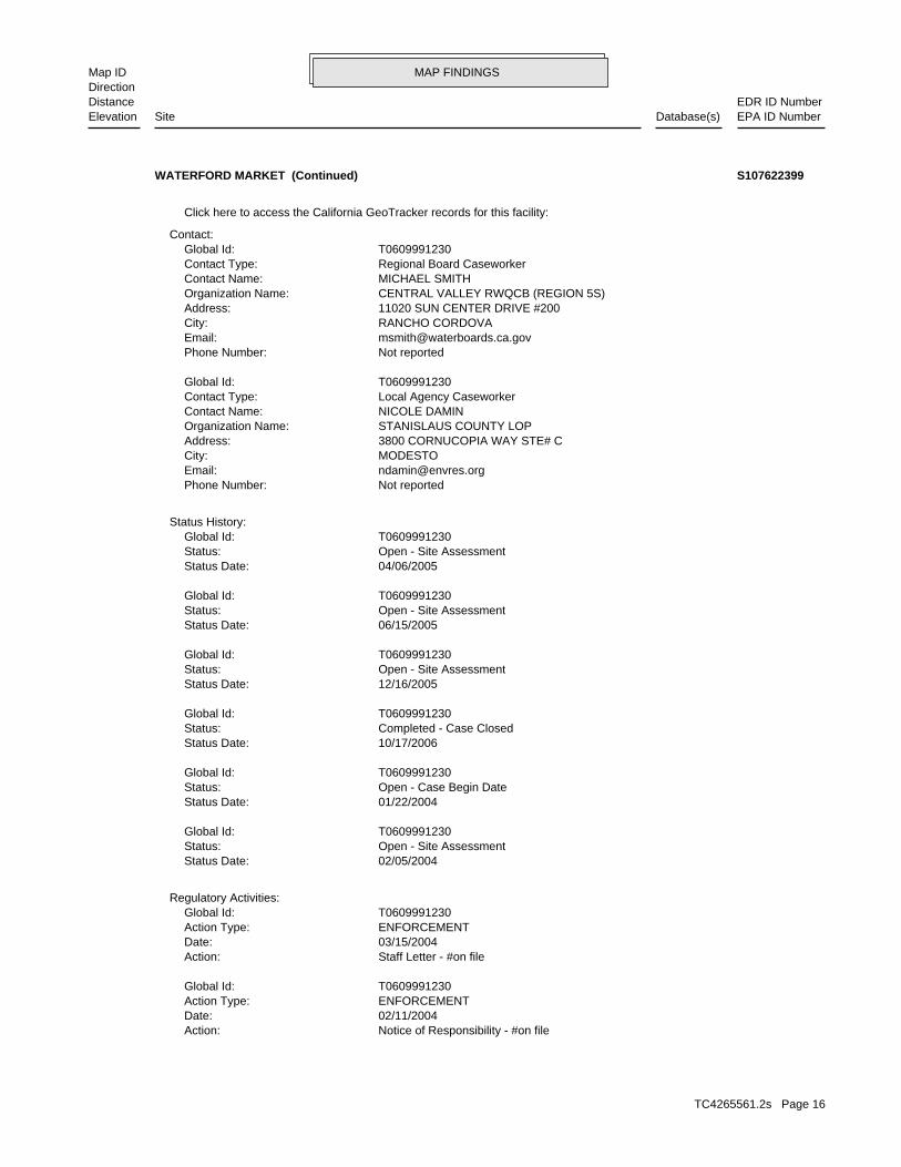
MAP FINDINGSMap IDDirection
EDR ID NumberDistanceEPA ID NumberDatabase(s)SiteElevation
Notice of Responsibility - #on fileAction: 02/11/2004Date: ENFORCEMENTAction Type: T0609991230Global Id:
Staff Letter - #on fileAction: 03/15/2004Date: ENFORCEMENTAction Type: T0609991230Global Id:
Regulatory Activities:
02/05/2004Status Date: Open - Site AssessmentStatus: T0609991230Global Id:
01/22/2004Status Date: Open - Case Begin DateStatus: T0609991230Global Id:
10/17/2006Status Date: Completed - Case ClosedStatus: T0609991230Global Id:
12/16/2005Status Date: Open - Site AssessmentStatus: T0609991230Global Id:
06/15/2005Status Date: Open - Site AssessmentStatus: T0609991230Global Id:
04/06/2005Status Date: Open - Site AssessmentStatus: T0609991230Global Id:
Status History:
Not reportedPhone Number: [email protected]: MODESTOCity: 3800 CORNUCOPIA WAY STE# CAddress: STANISLAUS COUNTY LOPOrganization Name: NICOLE DAMINContact Name: Local Agency CaseworkerContact Type: T0609991230Global Id:
Not reportedPhone Number: [email protected]: RANCHO CORDOVACity: 11020 SUN CENTER DRIVE #200Address: CENTRAL VALLEY RWQCB (REGION 5S)Organization Name: MICHAEL SMITHContact Name: Regional Board CaseworkerContact Type: T0609991230Global Id:
Contact:
Click here to access the California GeoTracker records for this facility:
WATERFORD MARKET (Continued) S107622399
TC4265561.2s Page 16
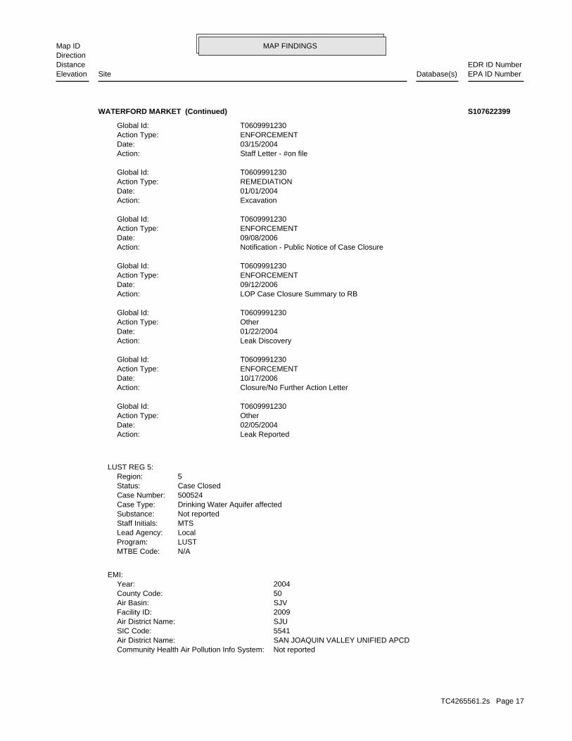
MAP FINDINGSMap IDDirection
EDR ID NumberDistanceEPA ID NumberDatabase(s)SiteElevation
Not reportedCommunity Health Air Pollution Info System: SAN JOAQUIN VALLEY UNIFIED APCDAir District Name: 5541SIC Code: SJUAir District Name: 2009Facility ID: SJVAir Basin: 50County Code: 2004Year:
EMI:
N/AMTBE Code:LUSTProgram:LocalLead Agency:MTSStaff Initials:Not reportedSubstance:Drinking Water Aquifer affectedCase Type:500524Case Number:Case ClosedStatus:5Region:
LUST REG 5:
Leak ReportedAction: 02/05/2004Date: OtherAction Type: T0609991230Global Id:
Closure/No Further Action LetterAction: 10/17/2006Date: ENFORCEMENTAction Type: T0609991230Global Id:
Leak DiscoveryAction: 01/22/2004Date: OtherAction Type: T0609991230Global Id:
LOP Case Closure Summary to RBAction: 09/12/2006Date: ENFORCEMENTAction Type: T0609991230Global Id:
Notification - Public Notice of Case ClosureAction: 09/08/2006Date: ENFORCEMENTAction Type: T0609991230Global Id:
ExcavationAction: 01/01/2004Date: REMEDIATIONAction Type: T0609991230Global Id:
Staff Letter - #on fileAction: 03/15/2004Date: ENFORCEMENTAction Type: T0609991230Global Id:
WATERFORD MARKET (Continued) S107622399
TC4265561.2s Page 17

MAP FINDINGSMap IDDirection
EDR ID NumberDistanceEPA ID NumberDatabase(s)SiteElevation
0SOX - Oxides of Sulphur Tons/Yr: 0NOX - Oxides of Nitrogen Tons/Yr: 0Carbon Monoxide Emissions Tons/Yr: .13196575Reactive Organic Gases Tons/Yr: .1326674766770060105Total Organic Hydrocarbon Gases Tons/Yr: Not reportedConsolidated Emission Reporting Rule: Not reportedCommunity Health Air Pollution Info System: SAN JOAQUIN VALLEY UNIFIED APCDAir District Name: 5541SIC Code: SJUAir District Name: 2009Facility ID: SJVAir Basin: 50County Code: 2007Year:
0Part. Matter 10 Micrometers & Smllr Tons/Yr: 0Particulate Matter Tons/Yr: 0SOX - Oxides of Sulphur Tons/Yr: 0NOX - Oxides of Nitrogen Tons/Yr: 0Carbon Monoxide Emissions Tons/Yr: .13196575Reactive Organic Gases Tons/Yr: .1326674766770060105Total Organic Hydrocarbon Gases Tons/Yr: Not reportedConsolidated Emission Reporting Rule: Not reportedCommunity Health Air Pollution Info System: SAN JOAQUIN VALLEY UNIFIED APCDAir District Name: 5541SIC Code: SJUAir District Name: 2009Facility ID: SJVAir Basin: 50County Code: 2006Year:
0Part. Matter 10 Micrometers & Smllr Tons/Yr: 0Particulate Matter Tons/Yr: 0SOX - Oxides of Sulphur Tons/Yr: 0NOX - Oxides of Nitrogen Tons/Yr: 0Carbon Monoxide Emissions Tons/Yr: .16705Reactive Organic Gases Tons/Yr: .1678857480052251371Total Organic Hydrocarbon Gases Tons/Yr: Not reportedConsolidated Emission Reporting Rule: Not reportedCommunity Health Air Pollution Info System: SAN JOAQUIN VALLEY UNIFIED APCDAir District Name: 5541SIC Code: SJUAir District Name: 2009Facility ID: SJVAir Basin: 50County Code: 2005Year:
0Part. Matter 10 Micrometers & Smllr Tons/Yr: 0Particulate Matter Tons/Yr: 0SOX - Oxides of Sulphur Tons/Yr: 0NOX - Oxides of Nitrogen Tons/Yr: 0Carbon Monoxide Emissions Tons/Yr: 0.16705Reactive Organic Gases Tons/Yr: 0.167885748Total Organic Hydrocarbon Gases Tons/Yr: Not reportedConsolidated Emission Reporting Rule:
WATERFORD MARKET (Continued) S107622399
TC4265561.2s Page 18

MAP FINDINGSMap IDDirection
EDR ID NumberDistanceEPA ID NumberDatabase(s)SiteElevation
SJVAir Basin: 50County Code: 2011Year:
0Part. Matter 10 Micrometers & Smllr Tons/Yr: 0Particulate Matter Tons/Yr: 0SOX - Oxides of Sulphur Tons/Yr: 0NOX - Oxides of Nitrogen Tons/Yr: 0Carbon Monoxide Emissions Tons/Yr: 1.1388000000000001E-2Reactive Organic Gases Tons/Yr: 0.0114501721666417Total Organic Hydrocarbon Gases Tons/Yr: Not reportedConsolidated Emission Reporting Rule: Not reportedCommunity Health Air Pollution Info System: SAN JOAQUIN VALLEY UNIFIED APCDAir District Name: 5541SIC Code: SJUAir District Name: 2009Facility ID: SJVAir Basin: 50County Code: 2010Year:
0Part. Matter 10 Micrometers & Smllr Tons/Yr: 0Particulate Matter Tons/Yr: 0SOX - Oxides of Sulphur Tons/Yr: 0NOX - Oxides of Nitrogen Tons/Yr: 0Carbon Monoxide Emissions Tons/Yr: 1.1388000000000001E-2Reactive Organic Gases Tons/Yr: 0.0114501721666417Total Organic Hydrocarbon Gases Tons/Yr: Not reportedConsolidated Emission Reporting Rule: Not reportedCommunity Health Air Pollution Info System: SAN JOAQUIN VALLEY UNIFIED APCDAir District Name: 5541SIC Code: SJUAir District Name: 2009Facility ID: SJVAir Basin: 50County Code: 2009Year:
0Part. Matter 10 Micrometers & Smllr Tons/Yr: 0Particulate Matter Tons/Yr: 0SOX - Oxides of Sulphur Tons/Yr: 0NOX - Oxides of Nitrogen Tons/Yr: 0Carbon Monoxide Emissions Tons/Yr: .011388Reactive Organic Gases Tons/Yr: .0114501721666417255Total Organic Hydrocarbon Gases Tons/Yr: Not reportedConsolidated Emission Reporting Rule: Not reportedCommunity Health Air Pollution Info System: SAN JOAQUIN VALLEY UNIFIED APCDAir District Name: 5541SIC Code: SJUAir District Name: 2009Facility ID: SJVAir Basin: 50County Code: 2008Year:
0Part. Matter 10 Micrometers & Smllr Tons/Yr: 0Particulate Matter Tons/Yr:
WATERFORD MARKET (Continued) S107622399
TC4265561.2s Page 19

MAP FINDINGSMap IDDirection
EDR ID NumberDistanceEPA ID NumberDatabase(s)SiteElevation
0Part. Matter 10 Micrometers & Smllr Tons/Yr: 0Particulate Matter Tons/Yr: 0SOX - Oxides of Sulphur Tons/Yr: 0NOX - Oxides of Nitrogen Tons/Yr: 0Carbon Monoxide Emissions Tons/Yr: 0.10556818431Reactive Organic Gases Tons/Yr: 0.10614452807Total Organic Hydrocarbon Gases Tons/Yr: Not reportedConsolidated Emission Reporting Rule: Not reportedCommunity Health Air Pollution Info System: SAN JOAQUIN VALLEY UNIFIED APCDAir District Name: 5541SIC Code: SJUAir District Name: 2009Facility ID: SJVAir Basin: 50County Code: 2012Year:
0Part. Matter 10 Micrometers & Smllr Tons/Yr: 0Particulate Matter Tons/Yr: 0SOX - Oxides of Sulphur Tons/Yr: 0NOX - Oxides of Nitrogen Tons/Yr: 0Carbon Monoxide Emissions Tons/Yr: 0.10556818431Reactive Organic Gases Tons/Yr: 0.10614452807Total Organic Hydrocarbon Gases Tons/Yr: Not reportedConsolidated Emission Reporting Rule: Not reportedCommunity Health Air Pollution Info System: SAN JOAQUIN VALLEY UNIFIED APCDAir District Name: 5541SIC Code: SJUAir District Name: 2009Facility ID:
WATERFORD MARKET (Continued) S107622399
-120.756981Longitude: 37.639898Latitude: STANISLAUS COUNTYPermitting Agency: 50-012-018852Facility ID:
UST:
930 ft. Site 10 of 13 in cluster B0.176 mi.
Relative:Higher
Actual:172 ft.
1/8-1/4 WATERFORD, CA 95386North 12828 YOSEMITE BOULEVARD N/AB12 USTWATERFORD MARKET U003783230
Not reportedMailing Name: 2098742880Telephone: DALVINDER SHAHI/OWNERContact: CAC001401936GEPAID: 2002Year: S112888320envid:
HAZNET:
930 ft. Site 11 of 13 in cluster B0.176 mi.
Relative:Higher
Actual:172 ft.
1/8-1/4 WATERFORD, CA 95386North 12828 YOSEMITE BLVD N/AB13 HAZNETWATERFORD MARKET S112888320
TC4265561.2s Page 20
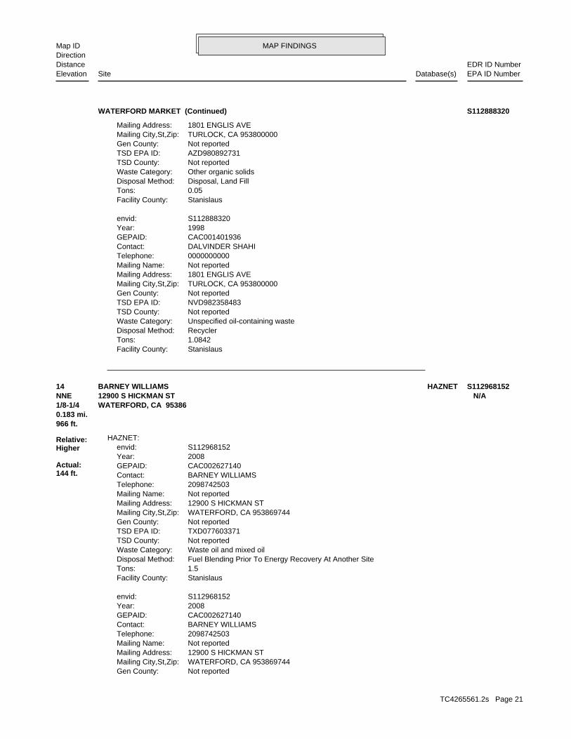
MAP FINDINGSMap IDDirection
EDR ID NumberDistanceEPA ID NumberDatabase(s)SiteElevation
StanislausFacility County: 1.0842Tons: RecyclerDisposal Method: Unspecified oil-containing wasteWaste Category: Not reportedTSD County: NVD982358483TSD EPA ID: Not reportedGen County: TURLOCK, CA 953800000Mailing City,St,Zip: 1801 ENGLIS AVEMailing Address: Not reportedMailing Name: 0000000000Telephone: DALVINDER SHAHIContact: CAC001401936GEPAID: 1998Year: S112888320envid:
StanislausFacility County: 0.05Tons: Disposal, Land FillDisposal Method: Other organic solidsWaste Category: Not reportedTSD County: AZD980892731TSD EPA ID: Not reportedGen County: TURLOCK, CA 953800000Mailing City,St,Zip: 1801 ENGLIS AVEMailing Address:
WATERFORD MARKET (Continued) S112888320
Not reportedGen County: WATERFORD, CA 953869744Mailing City,St,Zip: 12900 S HICKMAN STMailing Address: Not reportedMailing Name: 2098742503Telephone: BARNEY WILLIAMSContact: CAC002627140GEPAID: 2008Year: S112968152envid:
StanislausFacility County: 1.5Tons: Fuel Blending Prior To Energy Recovery At Another SiteDisposal Method: Waste oil and mixed oilWaste Category: Not reportedTSD County: TXD077603371TSD EPA ID: Not reportedGen County: WATERFORD, CA 953869744Mailing City,St,Zip: 12900 S HICKMAN STMailing Address: Not reportedMailing Name: 2098742503Telephone: BARNEY WILLIAMSContact: CAC002627140GEPAID: 2008Year: S112968152envid:
HAZNET:
966 ft.0.183 mi.
Relative:Higher
Actual:144 ft.
1/8-1/4 WATERFORD, CA 95386NNE 12900 S HICKMAN ST N/A14 HAZNETBARNEY WILLIAMS S112968152
TC4265561.2s Page 21
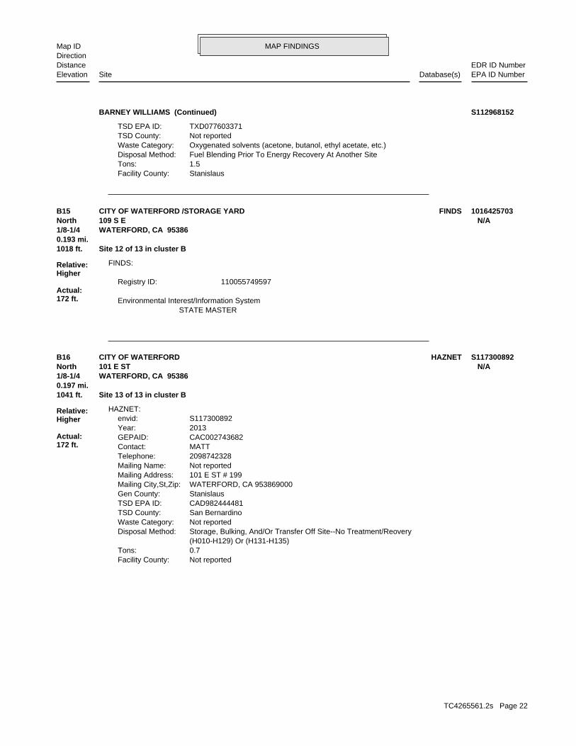
MAP FINDINGSMap IDDirection
EDR ID NumberDistanceEPA ID NumberDatabase(s)SiteElevation
StanislausFacility County: 1.5Tons: Fuel Blending Prior To Energy Recovery At Another SiteDisposal Method: Oxygenated solvents (acetone, butanol, ethyl acetate, etc.)Waste Category: Not reportedTSD County: TXD077603371TSD EPA ID:
BARNEY WILLIAMS (Continued) S112968152
STATE MASTER Environmental Interest/Information System
110055749597Registry ID:
FINDS:
1018 ft. Site 12 of 13 in cluster B0.193 mi.
Relative:Higher
Actual:172 ft.
1/8-1/4 WATERFORD, CA 95386North 109 S E N/AB15 FINDSCITY OF WATERFORD /STORAGE YARD 1016425703
Not reportedFacility County: 0.7Tons: (H010-H129) Or (H131-H135) Storage, Bulking, And/Or Transfer Off Site--No Treatment/ReoveryDisposal Method: Not reportedWaste Category: San BernardinoTSD County: CAD982444481TSD EPA ID: StanislausGen County: WATERFORD, CA 953869000Mailing City,St,Zip: 101 E ST # 199Mailing Address: Not reportedMailing Name: 2098742328Telephone: MATTContact: CAC002743682GEPAID: 2013Year: S117300892envid:
HAZNET:
1041 ft. Site 13 of 13 in cluster B0.197 mi.
Relative:Higher
Actual:172 ft.
1/8-1/4 WATERFORD, CA 95386North 101 E ST N/AB16 HAZNETCITY OF WATERFORD S117300892
TC4265561.2s Page 22
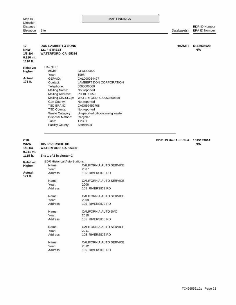
MAP FINDINGSMap IDDirection
EDR ID NumberDistanceEPA ID NumberDatabase(s)SiteElevation
StanislausFacility County: 1.2301Tons: RecyclerDisposal Method: Unspecified oil-containing wasteWaste Category: Not reportedTSD County: CAD099452708TSD EPA ID: Not reportedGen County: WATERFORD, CA 953860659Mailing City,St,Zip: PO BOX 659Mailing Address: Not reportedMailing Name: 0000000000Telephone: LAMBERT DON CORPORATIONContact: CAL000034497GEPAID: 1998Year: S113035029envid:
HAZNET:
1110 ft.0.210 mi.
Relative:Higher
Actual:171 ft.
1/8-1/4 WATERFORD, CA 95386NNW 121 F STREET N/A17 HAZNETDON LAMBERT & SONS S113035029
105 RIVERSIDE RDAddress: 2012Year: CALIFORNIA AUTO SERVICEName:
105 RIVERSIDE RDAddress: 2011Year: CALIFORNIA AUTO SERVICEName:
105 RIVERSIDE RDAddress: 2010Year: CALIFORNIA AUTO SVCName:
105 RIVERSIDE RDAddress: 2009Year: CALIFORNIA AUTO SERVICEName:
105 RIVERSIDE RDAddress: 2008Year: CALIFORNIA AUTO SERVICEName:
105 RIVERSIDE RDAddress: 2007Year: CALIFORNIA AUTO SERVICEName:
EDR Historical Auto Stations:
1115 ft. Site 1 of 2 in cluster C0.211 mi.
Relative:Higher
Actual:171 ft.
1/8-1/4 WATERFORD, CA 95386WNW 105 RIVERSIDE RD N/AC18 EDR US Hist Auto Stat 1015139014
TC4265561.2s Page 23
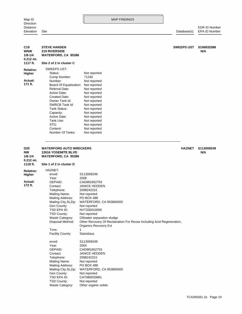
MAP FINDINGSMap IDDirection
EDR ID NumberDistanceEPA ID NumberDatabase(s)SiteElevation
Not reportedNumber Of Tanks: Not reportedContent: Not reportedSTG: Not reportedTank Use: Not reportedActive Date: Not reportedCapacity: Not reportedTank Status: Not reportedSWRCB Tank Id: Not reportedOwner Tank Id: Not reportedCreated Date: Not reportedAction Date: Not reportedReferral Date: Not reportedBoard Of Equalization: Not reportedNumber: 71240Comp Number: Not reportedStatus:
SWEEPS UST:
1117 ft. Site 2 of 2 in cluster C0.212 mi.
Relative:Higher
Actual:171 ft.
1/8-1/4 WATERFORD, CA 95386WNW 219 RIVERSIDE N/AC19 SWEEPS USTSTEVE HANSEN S106932588
Other organic solidsWaste Category: Not reportedTSD County: CAT080033681TSD EPA ID: Not reportedGen County: WATERFORD, CA 953860000Mailing City,St,Zip: PO BOX 488Mailing Address: Not reportedMailing Name: 2098242315Telephone: JANICE HEDDENContact: CAD981652753GEPAID: 2004Year: S113009249envid:
StanislausFacility County: 1Tons: Organics Recovery Ect Other Recovery Of Reclamation For Reuse Including Acid Regeneration,Disposal Method: Oil/water separation sludgeWaste Category: Not reportedTSD County: NVT330010000TSD EPA ID: Not reportedGen County: WATERFORD, CA 953860000Mailing City,St,Zip: PO BOX 488Mailing Address: Not reportedMailing Name: 2098242315Telephone: JANICE HEDDENContact: CAD981652753GEPAID: 2008Year: S113009249envid:
HAZNET:
1118 ft. Site 1 of 2 in cluster D0.212 mi.
Relative:Higher
Actual:172 ft.
1/8-1/4 WATERFORD, CA 95386NW 12616 YOSEMITE BLVD N/AD20 HAZNETWATERFORD AUTO WRECKERS S113009249
TC4265561.2s Page 24

MAP FINDINGSMap IDDirection
EDR ID NumberDistanceEPA ID NumberDatabase(s)SiteElevation
5 additional CA_HAZNET: record(s) in the EDR Site Report.Click this hyperlink while viewing on your computer to access
StanislausFacility County: .4587Tons: Disposal, Land FillDisposal Method: Unspecified oil-containing wasteWaste Category: Not reportedTSD County: CAT080033681TSD EPA ID: Not reportedGen County: WATERFORD, CA 953860000Mailing City,St,Zip: PO BOX 488Mailing Address: Not reportedMailing Name: 2098742315Telephone: ARCHIE BOOTHContact: CAD981652753GEPAID: 1999Year: S113009249envid:
StanislausFacility County: .4587Tons: Transfer StationDisposal Method: Other organic solidsWaste Category: Not reportedTSD County: CAD000088252TSD EPA ID: Not reportedGen County: WATERFORD, CA 953860000Mailing City,St,Zip: PO BOX 488Mailing Address: Not reportedMailing Name: 2098742315Telephone: ARCHIE BOOTHContact: CAD981652753GEPAID: 1999Year: S113009249envid:
StanislausFacility County: 0.83Tons: Transfer StationDisposal Method: Aqueous solution with total organic residues 10 percent or moreWaste Category: Not reportedTSD County: CAD044003556TSD EPA ID: Not reportedGen County: WATERFORD, CA 953860000Mailing City,St,Zip: PO BOX 488Mailing Address: Not reportedMailing Name: 2098242315Telephone: JANICE HEDDENContact: CAD981652753GEPAID: 2000Year: S113009249envid:
StanislausFacility County: 1.25Tons: Disposal, Land FillDisposal Method:
WATERFORD AUTO WRECKERS (Continued) S113009249
TC4265561.2s Page 25
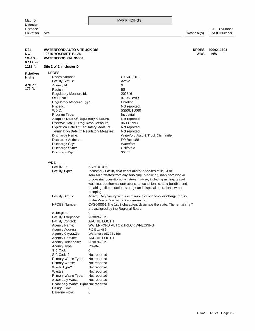
MAP FINDINGSMap IDDirection
EDR ID NumberDistanceEPA ID NumberDatabase(s)SiteElevation
0Baseline Flow: 0Design Flow: Not reportedSecondary Waste Type: Not reportedSecondary Waste: Not reportedPrimary Waste Type: Not reportedWaste2: Not reportedWaste Type2: Not reportedPrimary Waste: Not reportedPrimary Waste Type: Not reportedSIC Code 2: 0SIC Code: PrivateAgency Type: 2098742315Agency Telephone: ARCHIE BOOTHAgency Contact: Waterford 953860488Agency City,St,Zip: PO Box 488Agency Address: WATERFORD AUTO &TRUCK WRECKINGAgency Name: ARCHIE BOOTHFacility Contact: 2098242315Facility Telephone: 0Subregion: are assigned by the Regional Board CAS000001 The 1st 2 characters designate the state. The remaining 7NPDES Number: under Waste Discharge Requirements. Active - Any facility with a continuous or seasonal discharge that isFacility Status: pumping. repairing, oil production, storage and disposal operations, water washing, geothermal operations, air conditioning, ship building and processing operation of whatever nature, including mining, gravel semisolid wastes from any servicing, producing, manufacturing or Industrial - Facility that treats and/or disposes of liquid orFacility Type: 5S 50I010060Facility ID:
WDS:
95386Discharge Zip: CaliforniaDischarge State: WaterfordDischarge City: PO Box 488Discharge Address: Waterford Auto & Truck DismantlerDischarge Name: Not reportedTermination Date Of Regulatory Measure: Not reportedExpiration Date Of Regulatory Measure: 06/11/1993Effective Date Of Regulatory Measure: Not reportedAdoption Date Of Regulatory Measure: IndustrialProgram Type: 5S50I010060WDID: Not reportedPlace Id: EnrolleeRegulatory Measure Type: 97-03-DWQOrder No: 202546Regulatory Measure Id: 5SRegion: 0Agency Id: ActiveFacility Status: CAS000001Npdes Number:
NPDES:
1118 ft. Site 2 of 2 in cluster D0.212 mi.
Relative:Higher
Actual:172 ft.
1/8-1/4 WATERFORD, CA 95386NW WDS12616 YOSEMITE BLVD N/AD21 NPDESWATERFORD AUTO & TRUCK DIS 1000214798
TC4265561.2s Page 26
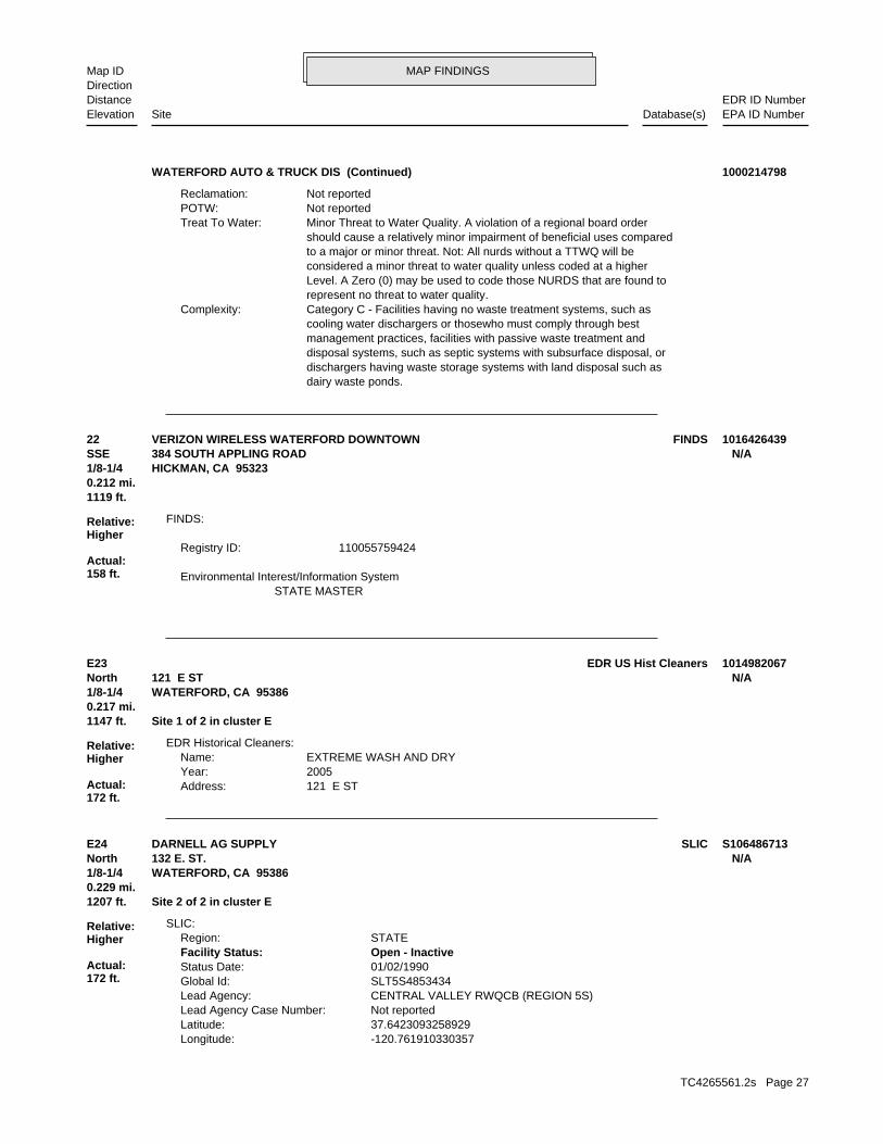
MAP FINDINGSMap IDDirection
EDR ID NumberDistanceEPA ID NumberDatabase(s)SiteElevation
dairy waste ponds. dischargers having waste storage systems with land disposal such as disposal systems, such as septic systems with subsurface disposal, or management practices, facilities with passive waste treatment and cooling water dischargers or thosewho must comply through best Category C - Facilities having no waste treatment systems, such asComplexity: represent no threat to water quality. Level. A Zero (0) may be used to code those NURDS that are found to considered a minor threat to water quality unless coded at a higher to a major or minor threat. Not: All nurds without a TTWQ will be should cause a relatively minor impairment of beneficial uses compared Minor Threat to Water Quality. A violation of a regional board orderTreat To Water: Not reportedPOTW: Not reportedReclamation:
WATERFORD AUTO & TRUCK DIS (Continued) 1000214798
STATE MASTER Environmental Interest/Information System
110055759424Registry ID:
FINDS:
1119 ft.0.212 mi.
Relative:Higher
Actual:158 ft.
1/8-1/4 HICKMAN, CA 95323SSE 384 SOUTH APPLING ROAD N/A22 FINDSVERIZON WIRELESS WATERFORD DOWNTOWN 1016426439
121 E STAddress: 2005Year: EXTREME WASH AND DRYName:
EDR Historical Cleaners:
1147 ft. Site 1 of 2 in cluster E0.217 mi.
Relative:Higher
Actual:172 ft.
1/8-1/4 WATERFORD, CA 95386North 121 E ST N/AE23 EDR US Hist Cleaners 1014982067
-120.761910330357Longitude: 37.6423093258929Latitude: Not reportedLead Agency Case Number: CENTRAL VALLEY RWQCB (REGION 5S)Lead Agency: SLT5S4853434Global Id: 01/02/1990Status Date: Open - InactiveFacility Status: STATERegion:
SLIC:
1207 ft. Site 2 of 2 in cluster E0.229 mi.
Relative:Higher
Actual:172 ft.
1/8-1/4 WATERFORD, CA 95386North 132 E. ST. N/AE24 SLICDARNELL AG SUPPLY S106486713
TC4265561.2s Page 27
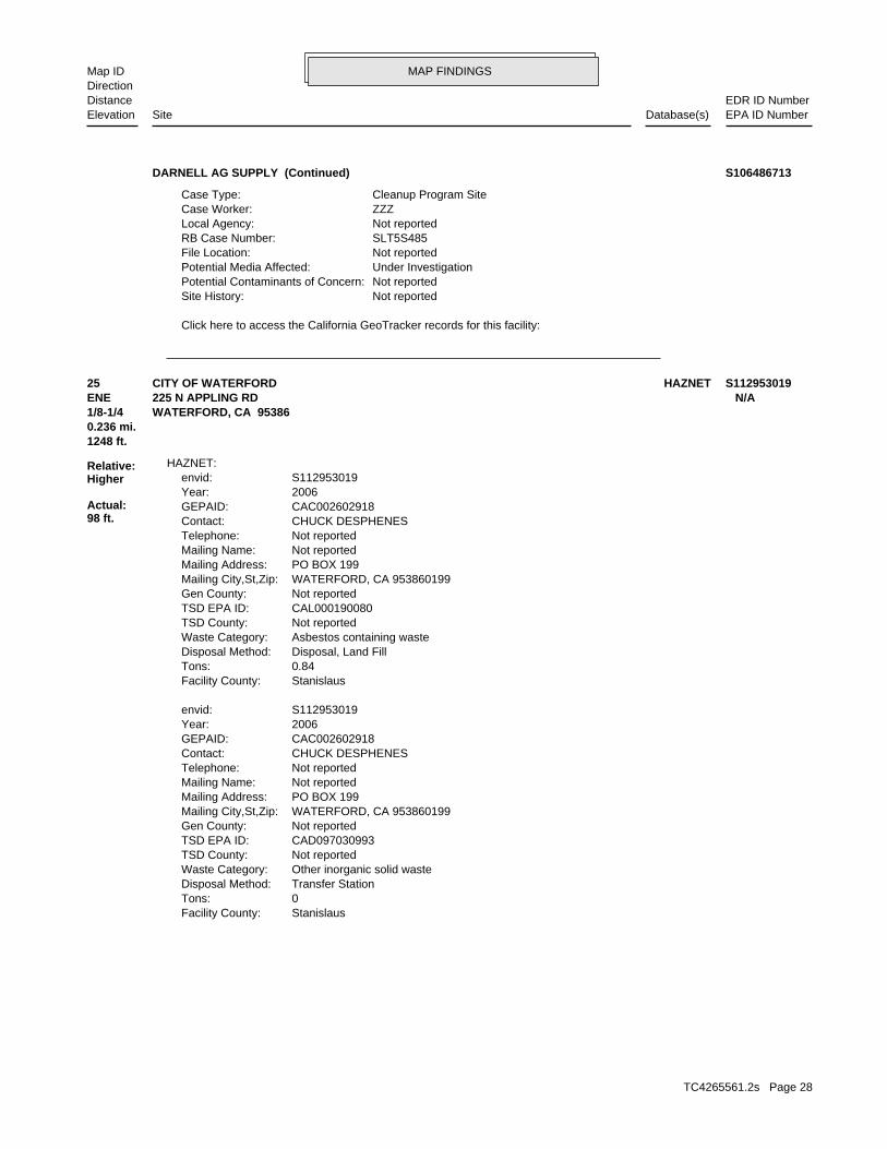
MAP FINDINGSMap IDDirection
EDR ID NumberDistanceEPA ID NumberDatabase(s)SiteElevation
Click here to access the California GeoTracker records for this facility:
Not reportedSite History: Not reportedPotential Contaminants of Concern: Under InvestigationPotential Media Affected: Not reportedFile Location: SLT5S485RB Case Number: Not reportedLocal Agency: ZZZCase Worker: Cleanup Program SiteCase Type:
DARNELL AG SUPPLY (Continued) S106486713
StanislausFacility County: 0Tons: Transfer StationDisposal Method: Other inorganic solid wasteWaste Category: Not reportedTSD County: CAD097030993TSD EPA ID: Not reportedGen County: WATERFORD, CA 953860199Mailing City,St,Zip: PO BOX 199Mailing Address: Not reportedMailing Name: Not reportedTelephone: CHUCK DESPHENESContact: CAC002602918GEPAID: 2006Year: S112953019envid:
StanislausFacility County: 0.84Tons: Disposal, Land FillDisposal Method: Asbestos containing wasteWaste Category: Not reportedTSD County: CAL000190080TSD EPA ID: Not reportedGen County: WATERFORD, CA 953860199Mailing City,St,Zip: PO BOX 199Mailing Address: Not reportedMailing Name: Not reportedTelephone: CHUCK DESPHENESContact: CAC002602918GEPAID: 2006Year: S112953019envid:
HAZNET:
1248 ft.0.236 mi.
Relative:Higher
Actual:98 ft.
1/8-1/4 WATERFORD, CA 95386ENE 225 N APPLING RD N/A25 HAZNETCITY OF WATERFORD S112953019
TC4265561.2s Page 28
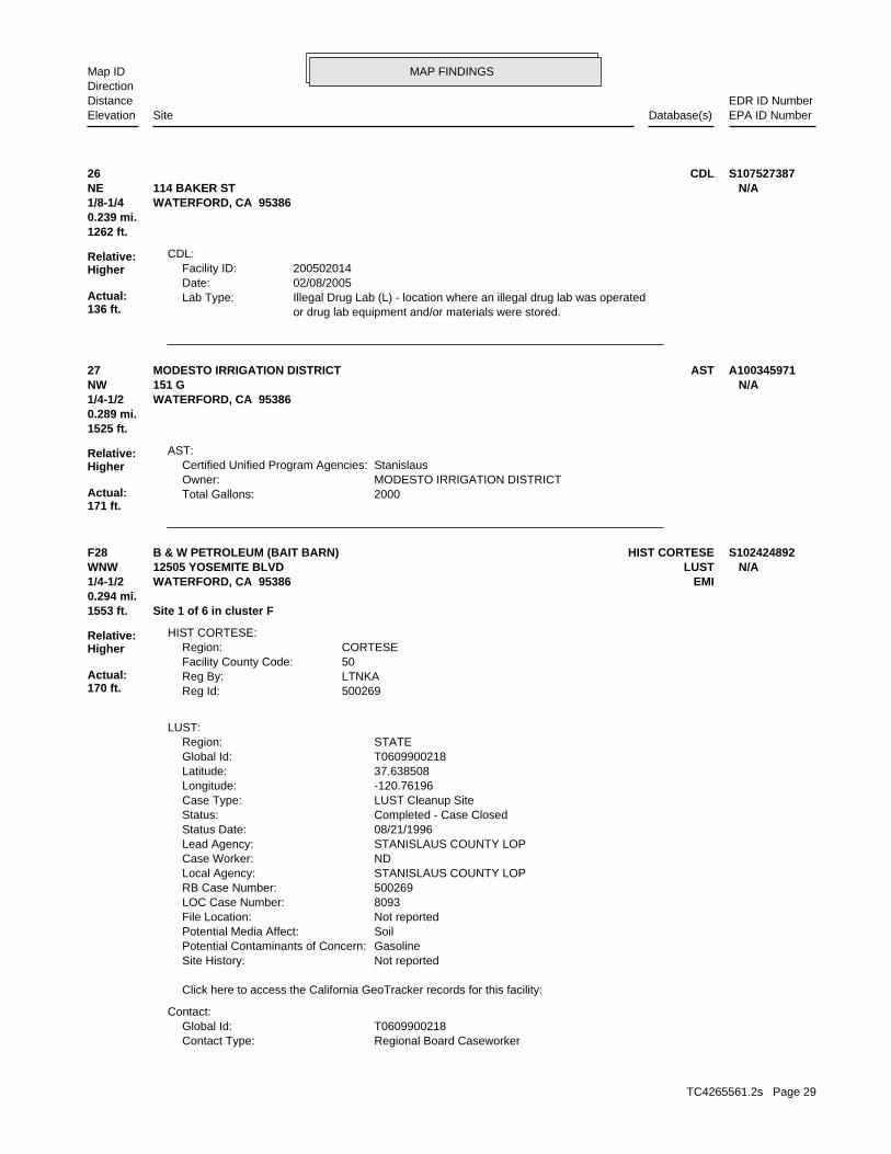
MAP FINDINGSMap IDDirection
EDR ID NumberDistanceEPA ID NumberDatabase(s)SiteElevation
or drug lab equipment and/or materials were stored. Illegal Drug Lab (L) - location where an illegal drug lab was operatedLab Type: 02/08/2005Date: 200502014Facility ID:
CDL:
1262 ft.0.239 mi.
Relative:Higher
Actual:136 ft.
1/8-1/4 WATERFORD, CA 95386NE 114 BAKER ST N/A26 CDL S107527387
2000Total Gallons: MODESTO IRRIGATION DISTRICTOwner: StanislausCertified Unified Program Agencies:
AST:
1525 ft.0.289 mi.
Relative:Higher
Actual:171 ft.
1/4-1/2 WATERFORD, CA 95386NW 151 G N/A27 ASTMODESTO IRRIGATION DISTRICT A100345971
Regional Board CaseworkerContact Type: T0609900218Global Id:
Contact:
Click here to access the California GeoTracker records for this facility:
Not reportedSite History: GasolinePotential Contaminants of Concern: SoilPotential Media Affect: Not reportedFile Location: 8093LOC Case Number: 500269RB Case Number: STANISLAUS COUNTY LOPLocal Agency: NDCase Worker: STANISLAUS COUNTY LOPLead Agency: 08/21/1996Status Date: Completed - Case ClosedStatus: LUST Cleanup SiteCase Type: -120.76196Longitude: 37.638508Latitude: T0609900218Global Id: STATERegion:
LUST:
500269Reg Id: LTNKAReg By: 50Facility County Code: CORTESERegion:
HIST CORTESE:
1553 ft. Site 1 of 6 in cluster F0.294 mi.
Relative:Higher
Actual:170 ft.
1/4-1/2 EMIWATERFORD, CA 95386WNW LUST12505 YOSEMITE BLVD N/AF28 HIST CORTESEB & W PETROLEUM (BAIT BARN) S102424892
TC4265561.2s Page 29
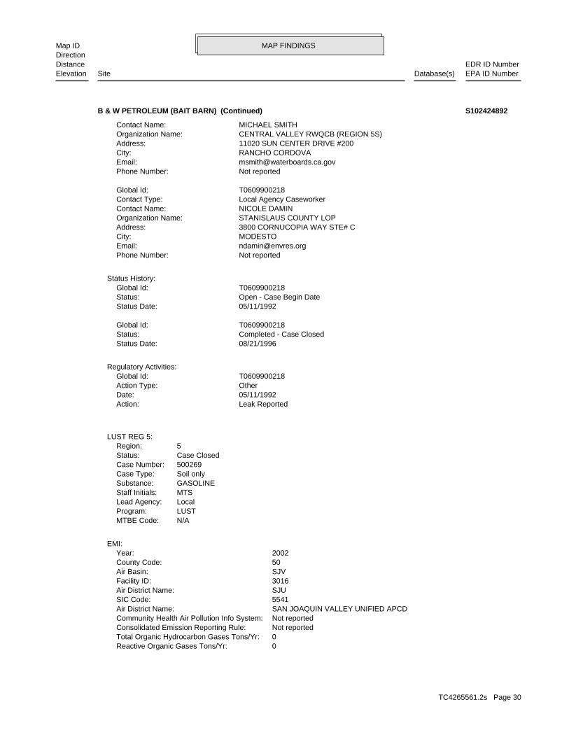
MAP FINDINGSMap IDDirection
EDR ID NumberDistanceEPA ID NumberDatabase(s)SiteElevation
0Reactive Organic Gases Tons/Yr: 0Total Organic Hydrocarbon Gases Tons/Yr: Not reportedConsolidated Emission Reporting Rule: Not reportedCommunity Health Air Pollution Info System: SAN JOAQUIN VALLEY UNIFIED APCDAir District Name: 5541SIC Code: SJUAir District Name: 3016Facility ID: SJVAir Basin: 50County Code: 2002Year:
EMI:
N/AMTBE Code:LUSTProgram:LocalLead Agency:MTSStaff Initials:GASOLINESubstance:Soil onlyCase Type:500269Case Number:Case ClosedStatus:5Region:
LUST REG 5:
Leak ReportedAction: 05/11/1992Date: OtherAction Type: T0609900218Global Id:
Regulatory Activities:
08/21/1996Status Date: Completed - Case ClosedStatus: T0609900218Global Id:
05/11/1992Status Date: Open - Case Begin DateStatus: T0609900218Global Id:
Status History:
Not reportedPhone Number: [email protected]: MODESTOCity: 3800 CORNUCOPIA WAY STE# CAddress: STANISLAUS COUNTY LOPOrganization Name: NICOLE DAMINContact Name: Local Agency CaseworkerContact Type: T0609900218Global Id:
Not reportedPhone Number: [email protected]: RANCHO CORDOVACity: 11020 SUN CENTER DRIVE #200Address: CENTRAL VALLEY RWQCB (REGION 5S)Organization Name: MICHAEL SMITHContact Name:
B & W PETROLEUM (BAIT BARN) (Continued) S102424892
TC4265561.2s Page 30
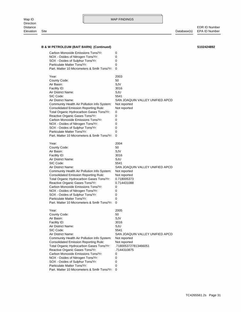
MAP FINDINGSMap IDDirection
EDR ID NumberDistanceEPA ID NumberDatabase(s)SiteElevation
0Part. Matter 10 Micrometers & Smllr Tons/Yr: 0Particulate Matter Tons/Yr: 0SOX - Oxides of Sulphur Tons/Yr: 0NOX - Oxides of Nitrogen Tons/Yr: 0Carbon Monoxide Emissions Tons/Yr: .7144310875Reactive Organic Gases Tons/Yr: .7180053727813466051Total Organic Hydrocarbon Gases Tons/Yr: Not reportedConsolidated Emission Reporting Rule: Not reportedCommunity Health Air Pollution Info System: SAN JOAQUIN VALLEY UNIFIED APCDAir District Name: 5541SIC Code: SJUAir District Name: 3016Facility ID: SJVAir Basin: 50County Code: 2005Year:
0Part. Matter 10 Micrometers & Smllr Tons/Yr: 0Particulate Matter Tons/Yr: 0SOX - Oxides of Sulphur Tons/Yr: 0NOX - Oxides of Nitrogen Tons/Yr: 0Carbon Monoxide Emissions Tons/Yr: 0.714431088Reactive Organic Gases Tons/Yr: 0.718005373Total Organic Hydrocarbon Gases Tons/Yr: Not reportedConsolidated Emission Reporting Rule: Not reportedCommunity Health Air Pollution Info System: SAN JOAQUIN VALLEY UNIFIED APCDAir District Name: 5541SIC Code: SJUAir District Name: 3016Facility ID: SJVAir Basin: 50County Code: 2004Year:
0Part. Matter 10 Micrometers & Smllr Tons/Yr: 0Particulate Matter Tons/Yr: 0SOX - Oxides of Sulphur Tons/Yr: 0NOX - Oxides of Nitrogen Tons/Yr: 0Carbon Monoxide Emissions Tons/Yr: 0Reactive Organic Gases Tons/Yr: 0Total Organic Hydrocarbon Gases Tons/Yr: Not reportedConsolidated Emission Reporting Rule: Not reportedCommunity Health Air Pollution Info System: SAN JOAQUIN VALLEY UNIFIED APCDAir District Name: 5541SIC Code: SJUAir District Name: 3016Facility ID: SJVAir Basin: 50County Code: 2003Year:
0Part. Matter 10 Micrometers & Smllr Tons/Yr: 0Particulate Matter Tons/Yr: 0SOX - Oxides of Sulphur Tons/Yr: 0NOX - Oxides of Nitrogen Tons/Yr: 0Carbon Monoxide Emissions Tons/Yr:
B & W PETROLEUM (BAIT BARN) (Continued) S102424892
TC4265561.2s Page 31
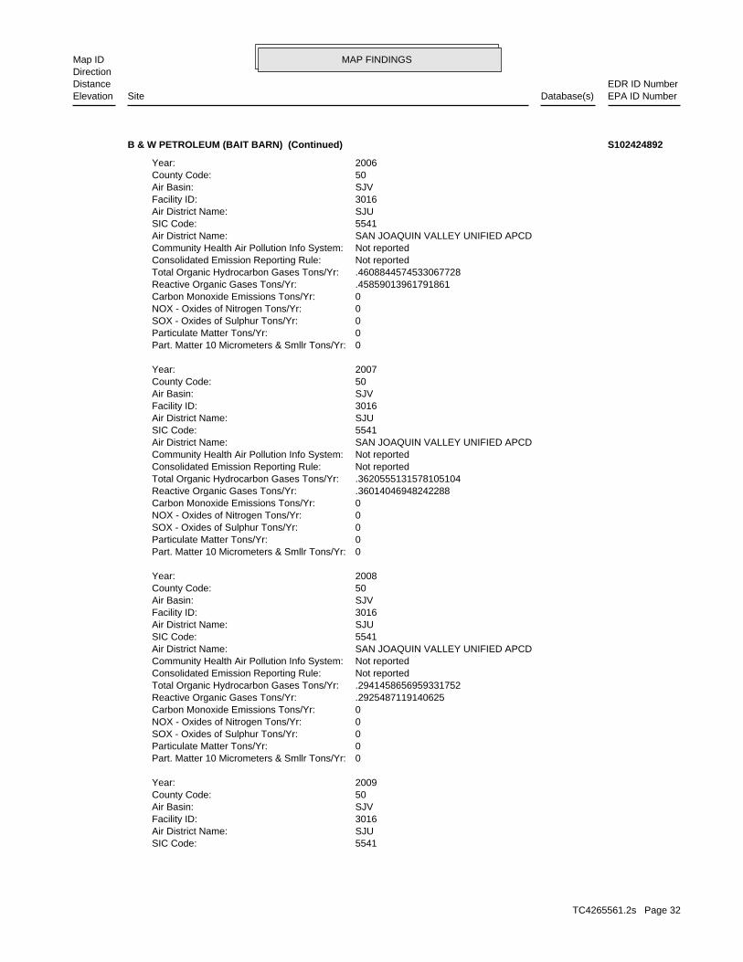
MAP FINDINGSMap IDDirection
EDR ID NumberDistanceEPA ID NumberDatabase(s)SiteElevation
5541SIC Code: SJUAir District Name: 3016Facility ID: SJVAir Basin: 50County Code: 2009Year:
0Part. Matter 10 Micrometers & Smllr Tons/Yr: 0Particulate Matter Tons/Yr: 0SOX - Oxides of Sulphur Tons/Yr: 0NOX - Oxides of Nitrogen Tons/Yr: 0Carbon Monoxide Emissions Tons/Yr: .2925487119140625Reactive Organic Gases Tons/Yr: .2941458656959331752Total Organic Hydrocarbon Gases Tons/Yr: Not reportedConsolidated Emission Reporting Rule: Not reportedCommunity Health Air Pollution Info System: SAN JOAQUIN VALLEY UNIFIED APCDAir District Name: 5541SIC Code: SJUAir District Name: 3016Facility ID: SJVAir Basin: 50County Code: 2008Year:
0Part. Matter 10 Micrometers & Smllr Tons/Yr: 0Particulate Matter Tons/Yr: 0SOX - Oxides of Sulphur Tons/Yr: 0NOX - Oxides of Nitrogen Tons/Yr: 0Carbon Monoxide Emissions Tons/Yr: .36014046948242288Reactive Organic Gases Tons/Yr: .3620555131578105104Total Organic Hydrocarbon Gases Tons/Yr: Not reportedConsolidated Emission Reporting Rule: Not reportedCommunity Health Air Pollution Info System: SAN JOAQUIN VALLEY UNIFIED APCDAir District Name: 5541SIC Code: SJUAir District Name: 3016Facility ID: SJVAir Basin: 50County Code: 2007Year:
0Part. Matter 10 Micrometers & Smllr Tons/Yr: 0Particulate Matter Tons/Yr: 0SOX - Oxides of Sulphur Tons/Yr: 0NOX - Oxides of Nitrogen Tons/Yr: 0Carbon Monoxide Emissions Tons/Yr: .45859013961791861Reactive Organic Gases Tons/Yr: .4608844574533067728Total Organic Hydrocarbon Gases Tons/Yr: Not reportedConsolidated Emission Reporting Rule: Not reportedCommunity Health Air Pollution Info System: SAN JOAQUIN VALLEY UNIFIED APCDAir District Name: 5541SIC Code: SJUAir District Name: 3016Facility ID: SJVAir Basin: 50County Code: 2006Year:
B & W PETROLEUM (BAIT BARN) (Continued) S102424892
TC4265561.2s Page 32
MAP FINDINGSMap IDDirection
EDR ID NumberDistanceEPA ID NumberDatabase(s)SiteElevation
0Carbon Monoxide Emissions Tons/Yr: 0.34482245737Reactive Organic Gases Tons/Yr: 0.34670499682Total Organic Hydrocarbon Gases Tons/Yr: Not reportedConsolidated Emission Reporting Rule: Not reportedCommunity Health Air Pollution Info System: SAN JOAQUIN VALLEY UNIFIED APCDAir District Name: 5541SIC Code: SJUAir District Name: 3016Facility ID: SJVAir Basin: 50County Code: 2012Year:
0Part. Matter 10 Micrometers & Smllr Tons/Yr: 0Particulate Matter Tons/Yr: 0SOX - Oxides of Sulphur Tons/Yr: 0NOX - Oxides of Nitrogen Tons/Yr: 0Carbon Monoxide Emissions Tons/Yr: 0.34482245737Reactive Organic Gases Tons/Yr: 0.34670499682Total Organic Hydrocarbon Gases Tons/Yr: Not reportedConsolidated Emission Reporting Rule: Not reportedCommunity Health Air Pollution Info System: SAN JOAQUIN VALLEY UNIFIED APCDAir District Name: 5541SIC Code: SJUAir District Name: 3016Facility ID: SJVAir Basin: 50County Code: 2011Year:
0Part. Matter 10 Micrometers & Smllr Tons/Yr: 0Particulate Matter Tons/Yr: 0SOX - Oxides of Sulphur Tons/Yr: 0NOX - Oxides of Nitrogen Tons/Yr: 0Carbon Monoxide Emissions Tons/Yr: 0.35003426599999998Reactive Organic Gases Tons/Yr: 0.35194522777110798Total Organic Hydrocarbon Gases Tons/Yr: Not reportedConsolidated Emission Reporting Rule: Not reportedCommunity Health Air Pollution Info System: SAN JOAQUIN VALLEY UNIFIED APCDAir District Name: 5541SIC Code: SJUAir District Name: 3016Facility ID: SJVAir Basin: 50County Code: 2010Year:
0Part. Matter 10 Micrometers & Smllr Tons/Yr: 0Particulate Matter Tons/Yr: 0SOX - Oxides of Sulphur Tons/Yr: 0NOX - Oxides of Nitrogen Tons/Yr: 0Carbon Monoxide Emissions Tons/Yr: 0.35001635568237299Reactive Organic Gases Tons/Yr: 0.35192725093990801Total Organic Hydrocarbon Gases Tons/Yr: Not reportedConsolidated Emission Reporting Rule: Not reportedCommunity Health Air Pollution Info System: SAN JOAQUIN VALLEY UNIFIED APCDAir District Name:
B & W PETROLEUM (BAIT BARN) (Continued) S102424892
TC4265561.2s Page 33

MAP FINDINGSMap IDDirection
EDR ID NumberDistanceEPA ID NumberDatabase(s)SiteElevation
0Part. Matter 10 Micrometers & Smllr Tons/Yr: 0Particulate Matter Tons/Yr: 0SOX - Oxides of Sulphur Tons/Yr: 0NOX - Oxides of Nitrogen Tons/Yr:
B & W PETROLEUM (BAIT BARN) (Continued) S102424892
Not reportedAction Date: Not reportedReferral Date: Not reportedBoard Of Equalization: Not reportedNumber: 14004Comp Number: Not reportedStatus:
SWEEPS UST:
Stock InventorLeak Detection: 1/4Container Construction Thickness: UNLEADEDType of Fuel: PRODUCTTank Used for: 00004000Tank Capacity: 1976Year Installed: #3Container Num: 003Tank Num:
Stock InventorLeak Detection: 1/4Container Construction Thickness: DIESELType of Fuel: PRODUCTTank Used for: 00010000Tank Capacity: 1976Year Installed: #2Container Num: 002Tank Num:
Stock InventorLeak Detection: 1/4Container Construction Thickness: REGULARType of Fuel: PRODUCTTank Used for: 00010000Tank Capacity: 1976Year Installed: #1Container Num: 001Tank Num:
0003Total Tanks: GLENCOE, CA 95232Owner City,St,Zip: P.O. BOX 242Owner Address: NOLAN W NICKELLOwner Name: 2098742766Telephone: ARCO DIST MARTIN OIL-FRESNO CAContact Name: Not reportedOther Type: Gas StationFacility Type: 00000014004Facility ID: STATERegion:
HIST UST:
1553 ft. Site 2 of 6 in cluster F0.294 mi.
Relative:Higher
Actual:170 ft.
1/4-1/2 WATERFORD, CA 95386WNW SWEEPS UST12505 YOSEMITE BLVD N/AF29 HIST USTTHE BAIT BARN U001609006
TC4265561.2s Page 34

MAP FINDINGSMap IDDirection
EDR ID NumberDistanceEPA ID NumberDatabase(s)SiteElevation
05-24-93Active Date: 8000Capacity: ATank Status: 50-000-014004-000004SWRCB Tank Id: 2Owner Tank Id: 02-29-88Created Date: 05-24-93Action Date: 05-24-93Referral Date: Not reportedBoard Of Equalization: 2Number: 14004Comp Number: ActiveStatus:
Not reportedNumber Of Tanks: REG UNLEADEDContent: PRODUCTSTG: M.V. FUELTank Use: Not reportedActive Date: 4000Capacity: Not reportedTank Status: 50-000-014004-000003SWRCB Tank Id: Not reportedOwner Tank Id: Not reportedCreated Date: Not reportedAction Date: Not reportedReferral Date: Not reportedBoard Of Equalization: Not reportedNumber: 14004Comp Number: Not reportedStatus:
Not reportedNumber Of Tanks: DIESELContent: PRODUCTSTG: M.V. FUELTank Use: Not reportedActive Date: 10000Capacity: Not reportedTank Status: 50-000-014004-000002SWRCB Tank Id: Not reportedOwner Tank Id: Not reportedCreated Date: Not reportedAction Date: Not reportedReferral Date: Not reportedBoard Of Equalization: Not reportedNumber: 14004Comp Number: Not reportedStatus:
3Number Of Tanks: LEADEDContent: PRODUCTSTG: M.V. FUELTank Use: Not reportedActive Date: 10000Capacity: Not reportedTank Status: 50-000-014004-000001SWRCB Tank Id: Not reportedOwner Tank Id: Not reportedCreated Date:
THE BAIT BARN (Continued) U001609006
TC4265561.2s Page 35

MAP FINDINGSMap IDDirection
EDR ID NumberDistanceEPA ID NumberDatabase(s)SiteElevation
Not reportedNumber Of Tanks: REG UNLEADEDContent: PSTG: M.V. FUELTank Use: 05-24-93Active Date: 4000Capacity: ATank Status: 50-000-014004-000005SWRCB Tank Id: 1Owner Tank Id: 02-29-88Created Date: 05-24-93Action Date: 05-24-93Referral Date: Not reportedBoard Of Equalization: 2Number: 14004Comp Number: ActiveStatus:
2Number Of Tanks: REG UNLEADEDContent: PSTG: M.V. FUELTank Use:
THE BAIT BARN (Continued) U001609006
-120.7605786Longitude: 37.6398104Latitude: STANISLAUS COUNTYPermitting Agency: 50-012-071410Facility ID:
UST:
1553 ft. Site 3 of 6 in cluster F0.294 mi.
Relative:Higher
Actual:170 ft.
1/4-1/2 WATERFORD, CA 95386WNW 12505 YOSEMITE BOULEVARD N/AF30 USTBAIT BARN U003879356
00000000Tank Capacity: Not reportedYear Installed: 1Container Num: 001Tank Num:
0002Total Tanks: WATERFORD, CA 95386Owner City,St,Zip: 12501 YOSEMITEOwner Address: WATERFORD AUTO REPAIROwner Name: 2098742744Telephone: ROBERT LEQUEContact Name: Not reportedOther Type: Gas StationFacility Type: 00000002570Facility ID: STATERegion:
HIST UST:
1570 ft. Site 4 of 6 in cluster F0.297 mi.
Relative:Higher
Actual:170 ft.
1/4-1/2 WATERFORD, CA 95386WNW SWEEPS UST12501 YOSEMITE BLVD N/AF31 HIST USTWATERFORD AUTO REPAIR U001609014
TC4265561.2s Page 36
MAP FINDINGSMap IDDirection
EDR ID NumberDistanceEPA ID NumberDatabase(s)SiteElevation
Not reportedNumber Of Tanks: LEADEDContent: PRODUCTSTG: M.V. FUELTank Use: Not reportedActive Date: 3000Capacity: Not reportedTank Status: 50-000-002570-000002SWRCB Tank Id: Not reportedOwner Tank Id: Not reportedCreated Date: Not reportedAction Date: Not reportedReferral Date: 44-028435Board Of Equalization: Not reportedNumber: 2570Comp Number: Not reportedStatus:
2Number Of Tanks: REG UNLEADEDContent: PRODUCTSTG: M.V. FUELTank Use: Not reportedActive Date: 4000Capacity: Not reportedTank Status: 50-000-002570-000001SWRCB Tank Id: Not reportedOwner Tank Id: Not reportedCreated Date: Not reportedAction Date: Not reportedReferral Date: 44-028435Board Of Equalization: Not reportedNumber: 2570Comp Number: Not reportedStatus:
SWEEPS UST:
NoneLeak Detection: Not reportedContainer Construction Thickness: REGULARType of Fuel: PRODUCTTank Used for: 00000000Tank Capacity: Not reportedYear Installed: 2Container Num: 002Tank Num:
Stock InventorLeak Detection: Not reportedContainer Construction Thickness: UNLEADEDType of Fuel: PRODUCTTank Used for:
WATERFORD AUTO REPAIR (Continued) U001609014
TC4265561.2s Page 37
MAP FINDINGSMap IDDirection
EDR ID NumberDistanceEPA ID NumberDatabase(s)SiteElevation
12501 YOSEMITE BLVDAddress: 2012Year: WATERFORD AUTO REPAIRName:
12501 YOSEMITE BLVDAddress: 2011Year: WATERFORD AUTO REPAIRName:
12501 YOSEMITE BLVDAddress: 2008Year: WATERFORD AUTO SERVICEName:
12501 YOSEMITE BLVDAddress: 2007Year: WATERFORD AUTO SERVICEName:
12501 YOSEMITE BLVDAddress: 2006Year: WATERFORD AUTO SERVICE SALESName:
12501 YOSEMITE BLVDAddress: 2003Year: WATERFORD AUTO SERVICEName:
12501 YOSEMITE BLVDAddress: 2002Year: WATERFORD AUTO SERVICE & SALESName:
12501 YOSEMITE BLVDAddress: 2001Year: WATERFORD AUTO SERVICE & SALESName:
EDR Historical Auto Stations:
1570 ft. Site 5 of 6 in cluster F0.297 mi.
Relative:Higher
Actual:170 ft.
1/4-1/2 WATERFORD, CA 95386WNW 12501 YOSEMITE BLVD N/AF32 EDR US Hist Auto Stat 1015193369
229 E STAddress: 2002Year: EL ARCOIRISName:
229 E STAddress: 2001Year: EL ARCOIRISName:
EDR Historical Auto Stations:
1658 ft.0.314 mi.
Relative:Higher
Actual:172 ft.
1/4-1/2 WATERFORD, CA 95386NNW 229 E ST N/A33 EDR US Hist Auto Stat 1015342703
TC4265561.2s Page 38
MAP FINDINGSMap IDDirection
EDR ID NumberDistanceEPA ID NumberDatabase(s)SiteElevation
12416 YOSEMITE BLVDAddress: 2010Year: WATERFORD AUTOMOTIVE REPAIRName:
12416 YOSEMITE BLVDAddress: 2008Year: WATERFORD AUTOMOTIVE REPAIRName:
EDR Historical Auto Stations:
1769 ft. Site 6 of 6 in cluster F0.335 mi.
Relative:Higher
Actual:168 ft.
1/4-1/2 WATERFORD, CA 95386WNW 12416 YOSEMITE BLVD N/AF34 EDR US Hist Auto Stat 1015191422
MICHAEL SMITHContact Name: Regional Board CaseworkerContact Type: T0609900172Global Id:
Not reportedPhone Number: [email protected]: MODESTOCity: 3800 CORNUCOPIA WAY STE# CAddress: STANISLAUS COUNTY LOPOrganization Name: NICOLE DAMINContact Name: Local Agency CaseworkerContact Type: T0609900172Global Id:
Contact:
Click here to access the California GeoTracker records for this facility:
Not reportedSite History: GasolinePotential Contaminants of Concern: SoilPotential Media Affect: Not reportedFile Location: 148LOC Case Number: 500196RB Case Number: STANISLAUS COUNTY LOPLocal Agency: NDCase Worker: STANISLAUS COUNTY LOPLead Agency: 06/12/1991Status Date: Completed - Case ClosedStatus: LUST Cleanup SiteCase Type: -120.763698Longitude: 37.638567Latitude: T0609900172Global Id: STATERegion:
LUST:
500196Reg Id: LTNKAReg By: 50Facility County Code: CORTESERegion:
HIST CORTESE:
1802 ft. Site 1 of 6 in cluster G0.341 mi.
Relative:Higher
Actual:168 ft.
1/4-1/2 SWEEPS USTWATERFORD, CA 95386WNW LUST12405 YOSEMITE BLVD N/AG35 HIST CORTESEJULIAN’S AUTO CENTER S102432027
TC4265561.2s Page 39
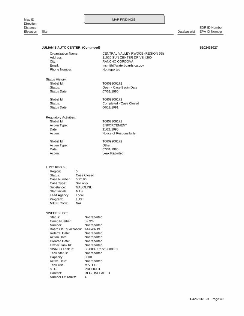
MAP FINDINGSMap IDDirection
EDR ID NumberDistanceEPA ID NumberDatabase(s)SiteElevation
4Number Of Tanks: REG UNLEADEDContent: PRODUCTSTG: M.V. FUELTank Use: Not reportedActive Date: 3000Capacity: Not reportedTank Status: 50-000-052726-000001SWRCB Tank Id: Not reportedOwner Tank Id: Not reportedCreated Date: Not reportedAction Date: Not reportedReferral Date: 44-648719Board Of Equalization: Not reportedNumber: 52726Comp Number: Not reportedStatus:
SWEEPS UST:
N/AMTBE Code:LUSTProgram:LocalLead Agency:MTSStaff Initials:GASOLINESubstance:Soil onlyCase Type:500196Case Number:Case ClosedStatus:5Region:
LUST REG 5:
Leak ReportedAction: 07/31/1990Date: OtherAction Type: T0609900172Global Id:
Notice of ResponsibilityAction: 11/21/1990Date: ENFORCEMENTAction Type: T0609900172Global Id:
Regulatory Activities:
06/12/1991Status Date: Completed - Case ClosedStatus: T0609900172Global Id:
07/31/1990Status Date: Open - Case Begin DateStatus: T0609900172Global Id:
Status History:
Not reportedPhone Number: [email protected]: RANCHO CORDOVACity: 11020 SUN CENTER DRIVE #200Address: CENTRAL VALLEY RWQCB (REGION 5S)Organization Name:
JULIAN’S AUTO CENTER (Continued) S102432027
TC4265561.2s Page 40

MAP FINDINGSMap IDDirection
EDR ID NumberDistanceEPA ID NumberDatabase(s)SiteElevation
11-05-93Action Date: 06-07-93Referral Date: 44-648719Board Of Equalization: 2Number: 52726Comp Number: ActiveStatus:
Not reportedNumber Of Tanks: REG UNLEADEDContent: PRODUCTSTG: M.V. FUELTank Use: Not reportedActive Date: 5000Capacity: Not reportedTank Status: 50-000-052726-000004SWRCB Tank Id: Not reportedOwner Tank Id: Not reportedCreated Date: Not reportedAction Date: Not reportedReferral Date: 44-648719Board Of Equalization: Not reportedNumber: 52726Comp Number: Not reportedStatus:
Not reportedNumber Of Tanks: DIESELContent: PRODUCTSTG: M.V. FUELTank Use: Not reportedActive Date: 1000Capacity: Not reportedTank Status: 50-000-052726-000003SWRCB Tank Id: Not reportedOwner Tank Id: Not reportedCreated Date: Not reportedAction Date: Not reportedReferral Date: 44-648719Board Of Equalization: Not reportedNumber: 52726Comp Number: Not reportedStatus:
Not reportedNumber Of Tanks: REG UNLEADEDContent: PRODUCTSTG: M.V. FUELTank Use: Not reportedActive Date: 2000Capacity: Not reportedTank Status: 50-000-052726-000002SWRCB Tank Id: Not reportedOwner Tank Id: Not reportedCreated Date: Not reportedAction Date: Not reportedReferral Date: 44-648719Board Of Equalization: Not reportedNumber: 52726Comp Number: Not reportedStatus:
JULIAN’S AUTO CENTER (Continued) S102432027
TC4265561.2s Page 41
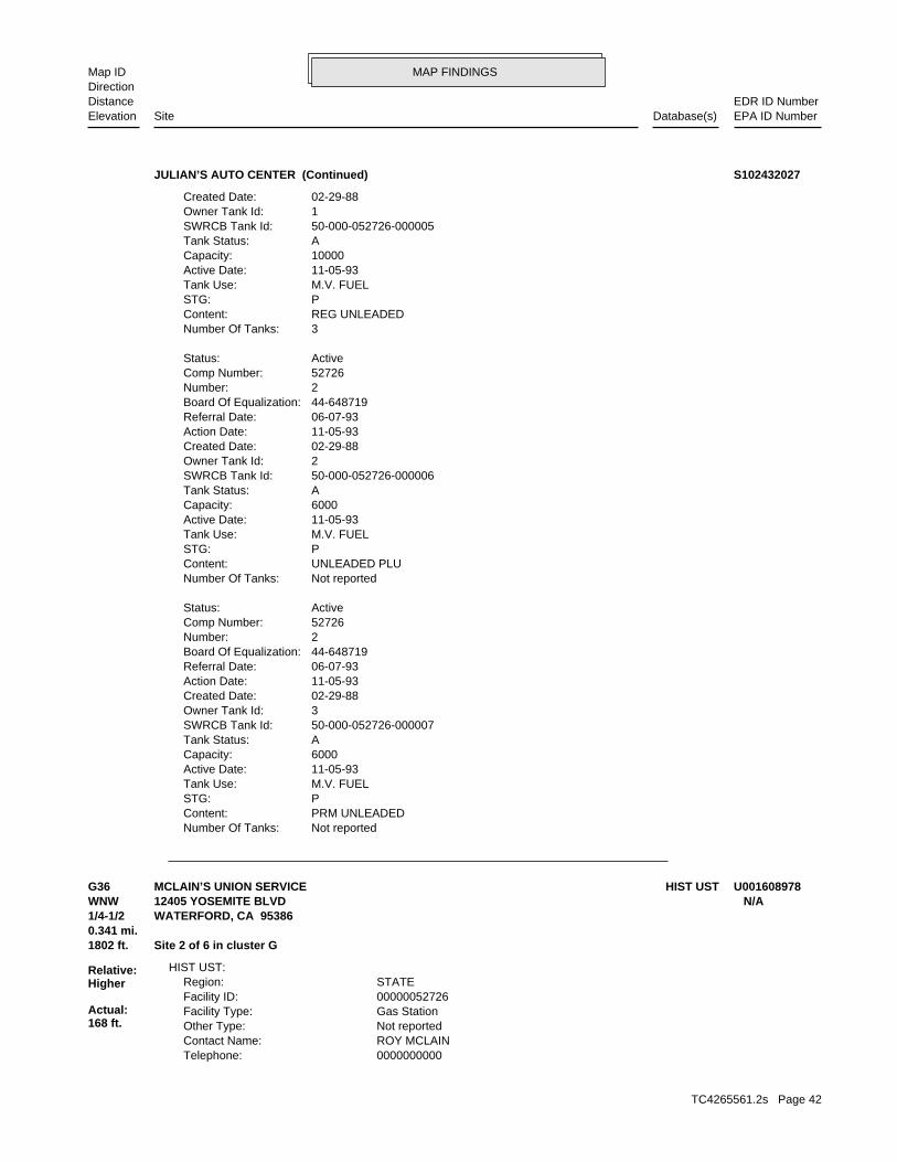
MAP FINDINGSMap IDDirection
EDR ID NumberDistanceEPA ID NumberDatabase(s)SiteElevation
Not reportedNumber Of Tanks: PRM UNLEADEDContent: PSTG: M.V. FUELTank Use: 11-05-93Active Date: 6000Capacity: ATank Status: 50-000-052726-000007SWRCB Tank Id: 3Owner Tank Id: 02-29-88Created Date: 11-05-93Action Date: 06-07-93Referral Date: 44-648719Board Of Equalization: 2Number: 52726Comp Number: ActiveStatus:
Not reportedNumber Of Tanks: UNLEADED PLUContent: PSTG: M.V. FUELTank Use: 11-05-93Active Date: 6000Capacity: ATank Status: 50-000-052726-000006SWRCB Tank Id: 2Owner Tank Id: 02-29-88Created Date: 11-05-93Action Date: 06-07-93Referral Date: 44-648719Board Of Equalization: 2Number: 52726Comp Number: ActiveStatus:
3Number Of Tanks: REG UNLEADEDContent: PSTG: M.V. FUELTank Use: 11-05-93Active Date: 10000Capacity: ATank Status: 50-000-052726-000005SWRCB Tank Id: 1Owner Tank Id: 02-29-88Created Date:
JULIAN’S AUTO CENTER (Continued) S102432027
0000000000Telephone: ROY MCLAINContact Name: Not reportedOther Type: Gas StationFacility Type: 00000052726Facility ID: STATERegion:
HIST UST:
1802 ft. Site 2 of 6 in cluster G0.341 mi.
Relative:Higher
Actual:168 ft.
1/4-1/2 WATERFORD, CA 95386WNW 12405 YOSEMITE BLVD N/AG36 HIST USTMCLAIN’S UNION SERVICE U001608978
TC4265561.2s Page 42
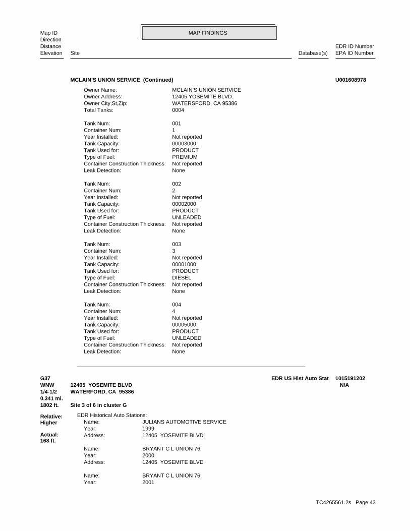
MAP FINDINGSMap IDDirection
EDR ID NumberDistanceEPA ID NumberDatabase(s)SiteElevation
NoneLeak Detection: Not reportedContainer Construction Thickness: UNLEADEDType of Fuel: PRODUCTTank Used for: 00005000Tank Capacity: Not reportedYear Installed: 4Container Num: 004Tank Num:
NoneLeak Detection: Not reportedContainer Construction Thickness: DIESELType of Fuel: PRODUCTTank Used for: 00001000Tank Capacity: Not reportedYear Installed: 3Container Num: 003Tank Num:
NoneLeak Detection: Not reportedContainer Construction Thickness: UNLEADEDType of Fuel: PRODUCTTank Used for: 00002000Tank Capacity: Not reportedYear Installed: 2Container Num: 002Tank Num:
NoneLeak Detection: Not reportedContainer Construction Thickness: PREMIUMType of Fuel: PRODUCTTank Used for: 00003000Tank Capacity: Not reportedYear Installed: 1Container Num: 001Tank Num:
0004Total Tanks: WATERSFORD, CA 95386Owner City,St,Zip: 12405 YOSEMITE BLVD.Owner Address: MCLAIN’S UNION SERVICEOwner Name:
MCLAIN’S UNION SERVICE (Continued) U001608978
2001Year: BRYANT C L UNION 76Name:
12405 YOSEMITE BLVDAddress: 2000Year: BRYANT C L UNION 76Name:
12405 YOSEMITE BLVDAddress: 1999Year: JULIANS AUTOMOTIVE SERVICEName:
EDR Historical Auto Stations:
1802 ft. Site 3 of 6 in cluster G0.341 mi.
Relative:Higher
Actual:168 ft.
1/4-1/2 WATERFORD, CA 95386WNW 12405 YOSEMITE BLVD N/AG37 EDR US Hist Auto Stat 1015191202
TC4265561.2s Page 43
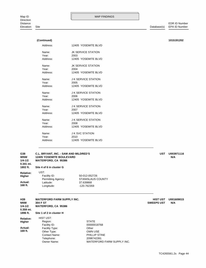
MAP FINDINGSMap IDDirection
EDR ID NumberDistanceEPA ID NumberDatabase(s)SiteElevation
12405 YOSEMITE BLVDAddress: 2010Year: J K SVC STATIONName:
12405 YOSEMITE BLVDAddress: 2008Year: J K SERVICE STATIONName:
12405 YOSEMITE BLVDAddress: 2007Year: J K SERVICE STATIONName:
12405 YOSEMITE BLVDAddress: 2006Year: J K SERVICE STATIONName:
12405 YOSEMITE BLVDAddress: 2005Year: J K SERVICE STATIONName:
12405 YOSEMITE BLVDAddress: 2004Year: JK SERVICE STATIONName:
12405 YOSEMITE BLVDAddress: 2003Year: JK SERVICE STATIONName:
12405 YOSEMITE BLVDAddress:
(Continued) 1015191202
-120.762359Longitude: 37.639868Latitude: STANISLAUS COUNTYPermitting Agency: 50-012-052726Facility ID:
UST:
1802 ft. Site 4 of 6 in cluster G0.341 mi.
Relative:Higher
Actual:168 ft.
1/4-1/2 WATERFORD, CA 95386WNW 12405 YOSEMITE BOULEVARD N/AG38 USTC.L. BRYANT, INC. - SAM AND MILDRED’S U003971116
WATERFORD FARM SUPPLY INC.Owner Name: 2098742391Telephone: PHILLIP STINEContact Name: OWN USEOther Type: OtherFacility Type: 00000018768Facility ID: STATERegion:
HIST UST:
1896 ft. Site 1 of 2 in cluster H0.359 mi.
Relative:Higher
Actual:169 ft.
1/4-1/2 WATERFORD, CA 95386NNW SWEEPS UST304 F ST N/AH39 HIST USTWATERFORD FARM SUPPLY INC. U001609015
TC4265561.2s Page 44
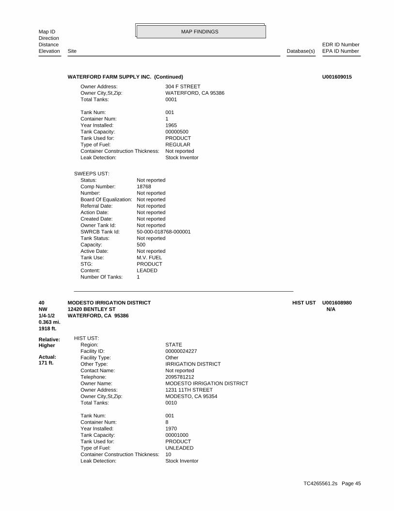
MAP FINDINGSMap IDDirection
EDR ID NumberDistanceEPA ID NumberDatabase(s)SiteElevation
1Number Of Tanks: LEADEDContent: PRODUCTSTG: M.V. FUELTank Use: Not reportedActive Date: 500Capacity: Not reportedTank Status: 50-000-018768-000001SWRCB Tank Id: Not reportedOwner Tank Id: Not reportedCreated Date: Not reportedAction Date: Not reportedReferral Date: Not reportedBoard Of Equalization: Not reportedNumber: 18768Comp Number: Not reportedStatus:
SWEEPS UST:
Stock InventorLeak Detection: Not reportedContainer Construction Thickness: REGULARType of Fuel: PRODUCTTank Used for: 00000500Tank Capacity: 1965Year Installed: 1Container Num: 001Tank Num:
0001Total Tanks: WATERFORD, CA 95386Owner City,St,Zip: 304 F STREETOwner Address:
WATERFORD FARM SUPPLY INC. (Continued) U001609015
Stock InventorLeak Detection: 10Container Construction Thickness: UNLEADEDType of Fuel: PRODUCTTank Used for: 00001000Tank Capacity: 1970Year Installed: 8Container Num: 001Tank Num:
0010Total Tanks: MODESTO, CA 95354Owner City,St,Zip: 1231 11TH STREETOwner Address: MODESTO IRRIGATION DISTRICTOwner Name: 2095781212Telephone: Not reportedContact Name: IRRIGATION DISTRICTOther Type: OtherFacility Type: 00000024227Facility ID: STATERegion:
HIST UST:
1918 ft.0.363 mi.
Relative:Higher
Actual:171 ft.
1/4-1/2 WATERFORD, CA 95386NW 12420 BENTLEY ST N/A40 HIST USTMODESTO IRRIGATION DISTRICT U001608980
TC4265561.2s Page 45
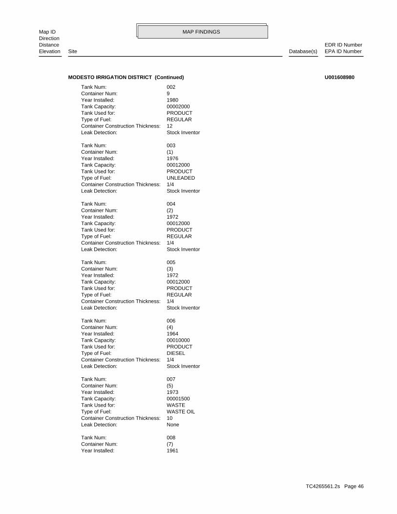
MAP FINDINGSMap IDDirection
EDR ID NumberDistanceEPA ID NumberDatabase(s)SiteElevation
1961Year Installed: (7)Container Num: 008Tank Num:
NoneLeak Detection: 10Container Construction Thickness: WASTE OILType of Fuel: WASTETank Used for: 00001500Tank Capacity: 1973Year Installed: (5)Container Num: 007Tank Num:
Stock InventorLeak Detection: 1/4Container Construction Thickness: DIESELType of Fuel: PRODUCTTank Used for: 00010000Tank Capacity: 1964Year Installed: (4)Container Num: 006Tank Num:
Stock InventorLeak Detection: 1/4Container Construction Thickness: REGULARType of Fuel: PRODUCTTank Used for: 00012000Tank Capacity: 1972Year Installed: (3)Container Num: 005Tank Num:
Stock InventorLeak Detection: 1/4Container Construction Thickness: REGULARType of Fuel: PRODUCTTank Used for: 00012000Tank Capacity: 1972Year Installed: (2)Container Num: 004Tank Num:
Stock InventorLeak Detection: 1/4Container Construction Thickness: UNLEADEDType of Fuel: PRODUCTTank Used for: 00012000Tank Capacity: 1976Year Installed: (1)Container Num: 003Tank Num:
Stock InventorLeak Detection: 12Container Construction Thickness: REGULARType of Fuel: PRODUCTTank Used for: 00002000Tank Capacity: 1980Year Installed: 9Container Num: 002Tank Num:
MODESTO IRRIGATION DISTRICT (Continued) U001608980
TC4265561.2s Page 46

MAP FINDINGSMap IDDirection
EDR ID NumberDistanceEPA ID NumberDatabase(s)SiteElevation
NoneLeak Detection: 12Container Construction Thickness: UNLEADEDType of Fuel: PRODUCTTank Used for: 00000550Tank Capacity: 1976Year Installed: ONEContainer Num: 010Tank Num:
Stock InventorLeak Detection: 12Container Construction Thickness: DIESELType of Fuel: PRODUCTTank Used for: 00000550Tank Capacity: 1976Year Installed: (6)Container Num: 009Tank Num:
Stock InventorLeak Detection: 12Container Construction Thickness: DIESELType of Fuel: PRODUCTTank Used for: 00000280Tank Capacity:
MODESTO IRRIGATION DISTRICT (Continued) U001608980
12320 BENTLEY STAddress: 2005Year: WATERFORD AUTO SERVICE & TOWINGName:
12320 BENTLEY STAddress: 2003Year: WATERFORD AUTOBODYName:
12320 BENTLEY STAddress: 2002Year: WATERFORD AUTOBODYName:
12320 BENTLEY STAddress: 2001Year: WATERFORD AUTO BODYName:
EDR Historical Auto Stations:
2053 ft. Site 5 of 6 in cluster G0.389 mi.
Relative:Higher
Actual:167 ft.
1/4-1/2 WATERFORD, CA 95386WNW 12320 BENTLEY ST N/AG41 EDR US Hist Auto Stat 1015189376
TC4265561.2s Page 47
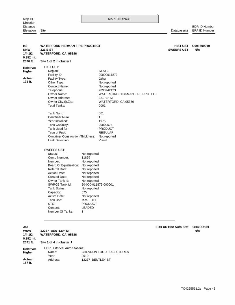
MAP FINDINGSMap IDDirection
EDR ID NumberDistanceEPA ID NumberDatabase(s)SiteElevation
1Number Of Tanks: LEADEDContent: PRODUCTSTG: M.V. FUELTank Use: Not reportedActive Date: 575Capacity: Not reportedTank Status: 50-000-011879-000001SWRCB Tank Id: Not reportedOwner Tank Id: Not reportedCreated Date: Not reportedAction Date: Not reportedReferral Date: Not reportedBoard Of Equalization: Not reportedNumber: 11879Comp Number: Not reportedStatus:
SWEEPS UST:
VisualLeak Detection: Not reportedContainer Construction Thickness: REGULARType of Fuel: PRODUCTTank Used for: 00000575Tank Capacity: 1975Year Installed: 1Container Num: 001Tank Num:
0001Total Tanks: WATERFORD, CA 95386Owner City,St,Zip: 321 "E" STOwner Address: WATERFORD-HICKMAN FIRE PROTECTOwner Name: 2098742123Telephone: Not reportedContact Name: Not reportedOther Type: OtherFacility Type: 00000011879Facility ID: STATERegion:
HIST UST:
2070 ft. Site 1 of 2 in cluster I0.392 mi.
Relative:Higher
Actual:171 ft.
1/4-1/2 WATERFORD, CA 95386NNW SWEEPS UST321 E ST N/AI42 HIST USTWATERFORD-HERMAN FIRE PROCTECT U001609019
12237 BENTLEY STAddress: 2010Year: CHEVRON FOOD FUEL STORESName:
EDR Historical Auto Stations:
2071 ft. Site 1 of 4 in cluster J0.392 mi.
Relative:Higher
Actual:167 ft.
1/4-1/2 WATERFORD, CA 95386WNW 12237 BENTLEY ST N/AJ43 EDR US Hist Auto Stat 1015187191
TC4265561.2s Page 48
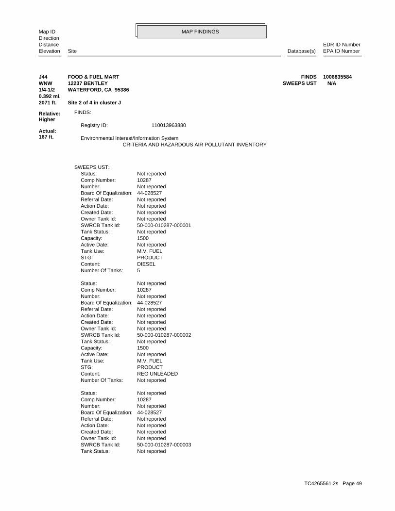
MAP FINDINGSMap IDDirection
EDR ID NumberDistanceEPA ID NumberDatabase(s)SiteElevation
Not reportedTank Status: 50-000-010287-000003SWRCB Tank Id: Not reportedOwner Tank Id: Not reportedCreated Date: Not reportedAction Date: Not reportedReferral Date: 44-028527Board Of Equalization: Not reportedNumber: 10287Comp Number: Not reportedStatus:
Not reportedNumber Of Tanks: REG UNLEADEDContent: PRODUCTSTG: M.V. FUELTank Use: Not reportedActive Date: 1500Capacity: Not reportedTank Status: 50-000-010287-000002SWRCB Tank Id: Not reportedOwner Tank Id: Not reportedCreated Date: Not reportedAction Date: Not reportedReferral Date: 44-028527Board Of Equalization: Not reportedNumber: 10287Comp Number: Not reportedStatus:
5Number Of Tanks: DIESELContent: PRODUCTSTG: M.V. FUELTank Use: Not reportedActive Date: 1500Capacity: Not reportedTank Status: 50-000-010287-000001SWRCB Tank Id: Not reportedOwner Tank Id: Not reportedCreated Date: Not reportedAction Date: Not reportedReferral Date: 44-028527Board Of Equalization: Not reportedNumber: 10287Comp Number: Not reportedStatus:
SWEEPS UST:
CRITERIA AND HAZARDOUS AIR POLLUTANT INVENTORY Environmental Interest/Information System
110013963880Registry ID:
FINDS:
2071 ft. Site 2 of 4 in cluster J0.392 mi.
Relative:Higher
Actual:167 ft.
1/4-1/2 WATERFORD, CA 95386WNW SWEEPS UST12237 BENTLEY N/AJ44 FINDSFOOD & FUEL MART 1006835584
TC4265561.2s Page 49
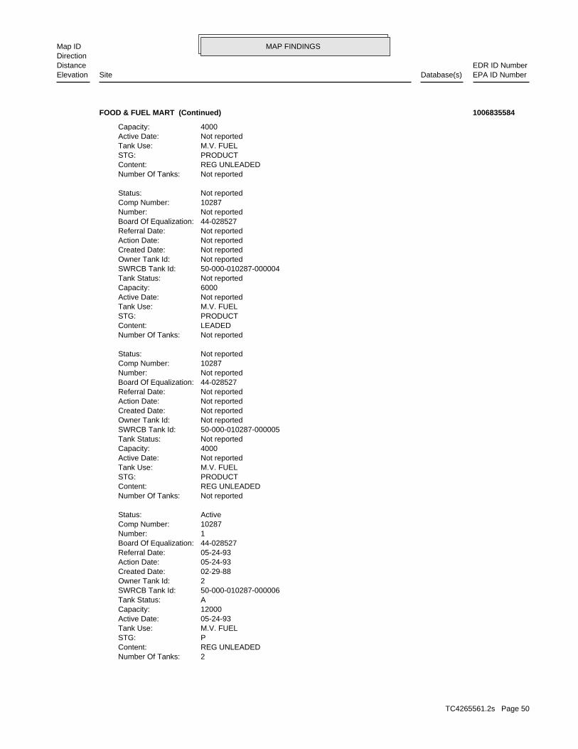
MAP FINDINGSMap IDDirection
EDR ID NumberDistanceEPA ID NumberDatabase(s)SiteElevation
2Number Of Tanks: REG UNLEADEDContent: PSTG: M.V. FUELTank Use: 05-24-93Active Date: 12000Capacity: ATank Status: 50-000-010287-000006SWRCB Tank Id: 2Owner Tank Id: 02-29-88Created Date: 05-24-93Action Date: 05-24-93Referral Date: 44-028527Board Of Equalization: 1Number: 10287Comp Number: ActiveStatus:
Not reportedNumber Of Tanks: REG UNLEADEDContent: PRODUCTSTG: M.V. FUELTank Use: Not reportedActive Date: 4000Capacity: Not reportedTank Status: 50-000-010287-000005SWRCB Tank Id: Not reportedOwner Tank Id: Not reportedCreated Date: Not reportedAction Date: Not reportedReferral Date: 44-028527Board Of Equalization: Not reportedNumber: 10287Comp Number: Not reportedStatus:
Not reportedNumber Of Tanks: LEADEDContent: PRODUCTSTG: M.V. FUELTank Use: Not reportedActive Date: 6000Capacity: Not reportedTank Status: 50-000-010287-000004SWRCB Tank Id: Not reportedOwner Tank Id: Not reportedCreated Date: Not reportedAction Date: Not reportedReferral Date: 44-028527Board Of Equalization: Not reportedNumber: 10287Comp Number: Not reportedStatus:
Not reportedNumber Of Tanks: REG UNLEADEDContent: PRODUCTSTG: M.V. FUELTank Use: Not reportedActive Date: 4000Capacity:
FOOD & FUEL MART (Continued) 1006835584
TC4265561.2s Page 50
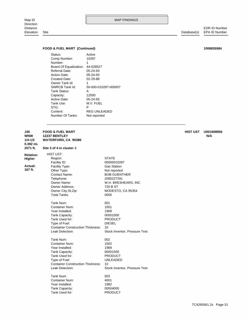
MAP FINDINGSMap IDDirection
EDR ID NumberDistanceEPA ID NumberDatabase(s)SiteElevation
Not reportedNumber Of Tanks: REG UNLEADEDContent: PSTG: M.V. FUELTank Use: 05-24-93Active Date: 12000Capacity: ATank Status: 50-000-010287-000007SWRCB Tank Id: 1Owner Tank Id: 02-29-88Created Date: 05-24-93Action Date: 05-24-93Referral Date: 44-028527Board Of Equalization: 1Number: 10287Comp Number: ActiveStatus:
FOOD & FUEL MART (Continued) 1006835584
PRODUCTTank Used for: 00004000Tank Capacity: 1982Year Installed: 4001Container Num: 003Tank Num:
Stock Inventor, Pressure TestLeak Detection: 10Container Construction Thickness: UNLEADEDType of Fuel: PRODUCTTank Used for: 00001500Tank Capacity: 1969Year Installed: 1502Container Num: 002Tank Num:
Stock Inventor, Pressure TestLeak Detection: 10Container Construction Thickness: DIESELType of Fuel: PRODUCTTank Used for: 00001500Tank Capacity: 1969Year Installed: 1501Container Num: 001Tank Num:
0005Total Tanks: MODESTO, CA 95354Owner City,St,Zip: 720 B STOwner Address: W.H. BRESHEARS, INCOwner Name: 2095227291Telephone: BOB GUENTHERContact Name: Not reportedOther Type: Gas StationFacility Type: 00000010287Facility ID: STATERegion:
HIST UST:
2071 ft. Site 3 of 4 in cluster J0.392 mi.
Relative:Higher
Actual:167 ft.
1/4-1/2 WATERFORD, CA 95386WNW 12237 BENTLEY N/AJ45 HIST USTFOOD & FUEL MART U001608956
TC4265561.2s Page 51
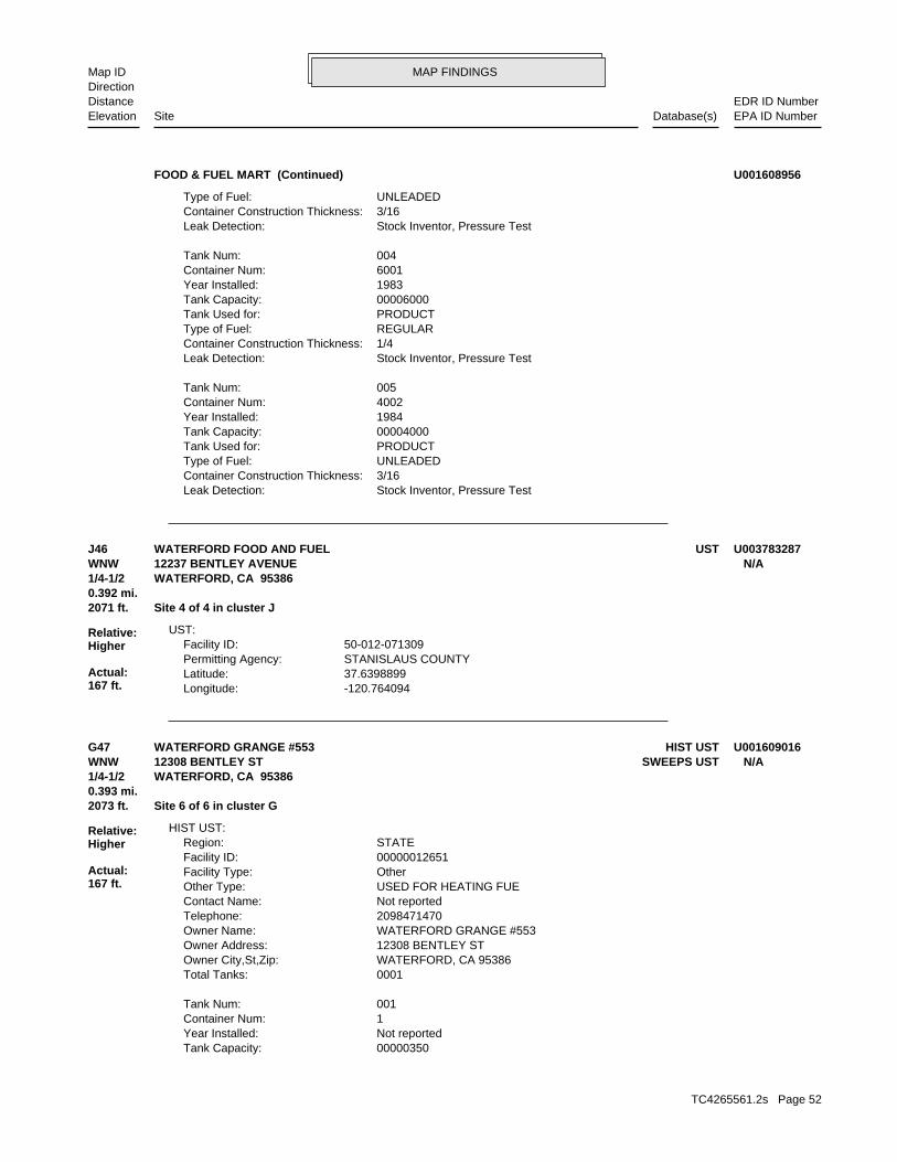
MAP FINDINGSMap IDDirection
EDR ID NumberDistanceEPA ID NumberDatabase(s)SiteElevation
Stock Inventor, Pressure TestLeak Detection: 3/16Container Construction Thickness: UNLEADEDType of Fuel: PRODUCTTank Used for: 00004000Tank Capacity: 1984Year Installed: 4002Container Num: 005Tank Num:
Stock Inventor, Pressure TestLeak Detection: 1/4Container Construction Thickness: REGULARType of Fuel: PRODUCTTank Used for: 00006000Tank Capacity: 1983Year Installed: 6001Container Num: 004Tank Num:
Stock Inventor, Pressure TestLeak Detection: 3/16Container Construction Thickness: UNLEADEDType of Fuel:
FOOD & FUEL MART (Continued) U001608956
-120.764094Longitude: 37.6398899Latitude: STANISLAUS COUNTYPermitting Agency: 50-012-071309Facility ID:
UST:
2071 ft. Site 4 of 4 in cluster J0.392 mi.
Relative:Higher
Actual:167 ft.
1/4-1/2 WATERFORD, CA 95386WNW 12237 BENTLEY AVENUE N/AJ46 USTWATERFORD FOOD AND FUEL U003783287
00000350Tank Capacity: Not reportedYear Installed: 1Container Num: 001Tank Num:
0001Total Tanks: WATERFORD, CA 95386Owner City,St,Zip: 12308 BENTLEY STOwner Address: WATERFORD GRANGE #553Owner Name: 2098471470Telephone: Not reportedContact Name: USED FOR HEATING FUEOther Type: OtherFacility Type: 00000012651Facility ID: STATERegion:
HIST UST:
2073 ft. Site 6 of 6 in cluster G0.393 mi.
Relative:Higher
Actual:167 ft.
1/4-1/2 WATERFORD, CA 95386WNW SWEEPS UST12308 BENTLEY ST N/AG47 HIST USTWATERFORD GRANGE #553 U001609016
TC4265561.2s Page 52
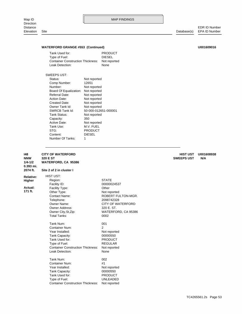
MAP FINDINGSMap IDDirection
EDR ID NumberDistanceEPA ID NumberDatabase(s)SiteElevation
1Number Of Tanks: DIESELContent: PRODUCTSTG: M.V. FUELTank Use: Not reportedActive Date: 350Capacity: Not reportedTank Status: 50-000-012651-000001SWRCB Tank Id: Not reportedOwner Tank Id: Not reportedCreated Date: Not reportedAction Date: Not reportedReferral Date: Not reportedBoard Of Equalization: Not reportedNumber: 12651Comp Number: Not reportedStatus:
SWEEPS UST:
NoneLeak Detection: Not reportedContainer Construction Thickness: DIESELType of Fuel: PRODUCTTank Used for:
WATERFORD GRANGE #553 (Continued) U001609016
Not reportedContainer Construction Thickness: UNLEADEDType of Fuel: PRODUCTTank Used for: 00000550Tank Capacity: Not reportedYear Installed: #1Container Num: 002Tank Num:
NoneLeak Detection: Not reportedContainer Construction Thickness: REGULARType of Fuel: PRODUCTTank Used for: 00000550Tank Capacity: Not reportedYear Installed: 2Container Num: 001Tank Num:
0002Total Tanks: WATERFORD, CA 95386Owner City,St,Zip: 320 E. ST.Owner Address: CITY OF WATERFORDOwner Name: 2098742328Telephone: ROBERT FULTON-MGR.Contact Name: Not reportedOther Type: OtherFacility Type: 00000024537Facility ID: STATERegion:
HIST UST:
2074 ft. Site 2 of 2 in cluster I0.393 mi.
Relative:Higher
Actual:171 ft.
1/4-1/2 WATERFORD, CA 95386NNW SWEEPS UST320 E ST N/AI48 HIST USTCITY OF WATERFORD U001608938
TC4265561.2s Page 53
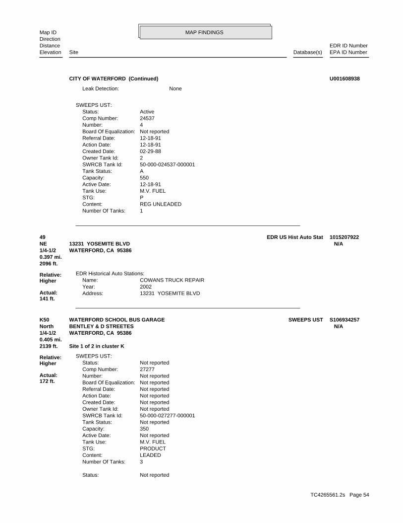
MAP FINDINGSMap IDDirection
EDR ID NumberDistanceEPA ID NumberDatabase(s)SiteElevation
1Number Of Tanks: REG UNLEADEDContent: PSTG: M.V. FUELTank Use: 12-18-91Active Date: 550Capacity: ATank Status: 50-000-024537-000001SWRCB Tank Id: 2Owner Tank Id: 02-29-88Created Date: 12-18-91Action Date: 12-18-91Referral Date: Not reportedBoard Of Equalization: 4Number: 24537Comp Number: ActiveStatus:
SWEEPS UST:
NoneLeak Detection:
CITY OF WATERFORD (Continued) U001608938
13231 YOSEMITE BLVDAddress: 2002Year: COWANS TRUCK REPAIRName:
EDR Historical Auto Stations:
2096 ft.0.397 mi.
Relative:Higher
Actual:141 ft.
1/4-1/2 WATERFORD, CA 95386NE 13231 YOSEMITE BLVD N/A49 EDR US Hist Auto Stat 1015207922
Not reportedStatus:
3Number Of Tanks: LEADEDContent: PRODUCTSTG: M.V. FUELTank Use: Not reportedActive Date: 350Capacity: Not reportedTank Status: 50-000-027277-000001SWRCB Tank Id: Not reportedOwner Tank Id: Not reportedCreated Date: Not reportedAction Date: Not reportedReferral Date: Not reportedBoard Of Equalization: Not reportedNumber: 27277Comp Number: Not reportedStatus:
SWEEPS UST:
2139 ft. Site 1 of 2 in cluster K0.405 mi.
Relative:Higher
Actual:172 ft.
1/4-1/2 WATERFORD, CA 95386North BENTLEY & D STREETES N/AK50 SWEEPS USTWATERFORD SCHOOL BUS GARAGE S106934257
TC4265561.2s Page 54
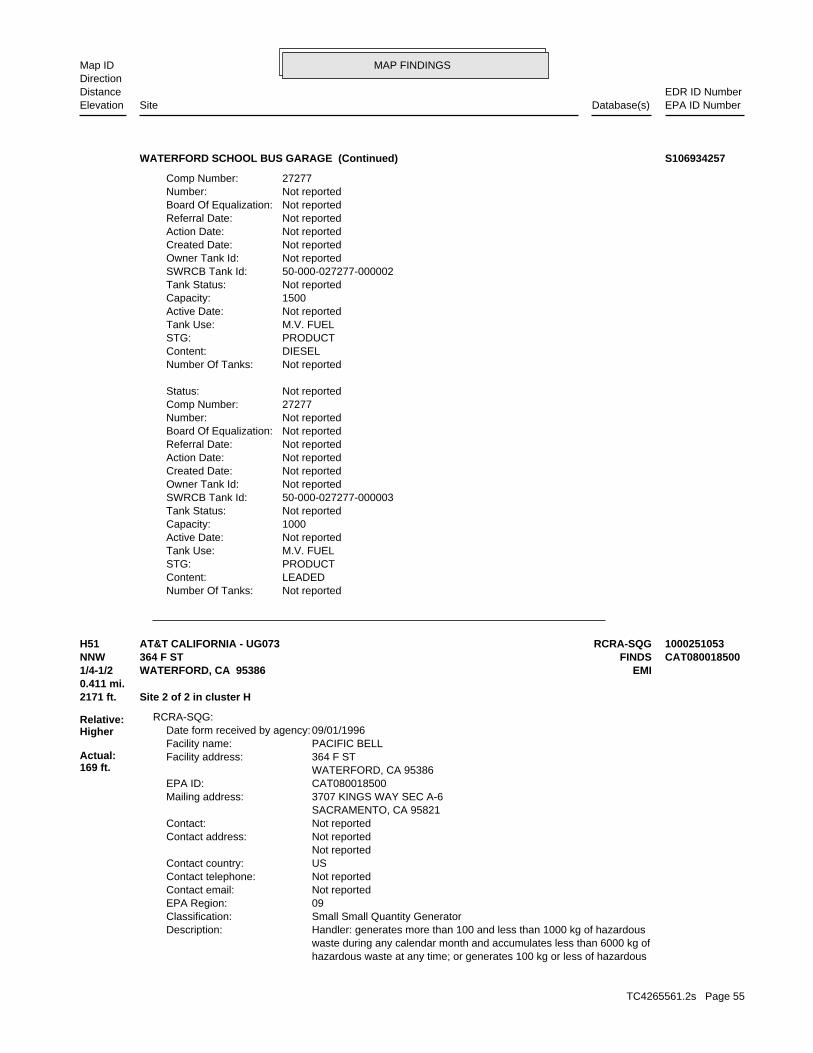
MAP FINDINGSMap IDDirection
EDR ID NumberDistanceEPA ID NumberDatabase(s)SiteElevation
Not reportedNumber Of Tanks: LEADEDContent: PRODUCTSTG: M.V. FUELTank Use: Not reportedActive Date: 1000Capacity: Not reportedTank Status: 50-000-027277-000003SWRCB Tank Id: Not reportedOwner Tank Id: Not reportedCreated Date: Not reportedAction Date: Not reportedReferral Date: Not reportedBoard Of Equalization: Not reportedNumber: 27277Comp Number: Not reportedStatus:
Not reportedNumber Of Tanks: DIESELContent: PRODUCTSTG: M.V. FUELTank Use: Not reportedActive Date: 1500Capacity: Not reportedTank Status: 50-000-027277-000002SWRCB Tank Id: Not reportedOwner Tank Id: Not reportedCreated Date: Not reportedAction Date: Not reportedReferral Date: Not reportedBoard Of Equalization: Not reportedNumber: 27277Comp Number:
WATERFORD SCHOOL BUS GARAGE (Continued) S106934257
hazardous waste at any time; or generates 100 kg or less of hazardous waste during any calendar month and accumulates less than 6000 kg of Handler: generates more than 100 and less than 1000 kg of hazardousDescription: Small Small Quantity GeneratorClassification: 09EPA Region: Not reportedContact email: Not reportedContact telephone: USContact country: Not reported Not reportedContact address: Not reportedContact: SACRAMENTO, CA 95821 3707 KINGS WAY SEC A-6Mailing address: CAT080018500EPA ID: WATERFORD, CA 95386 364 F STFacility address: PACIFIC BELLFacility name: 09/01/1996Date form received by agency:
RCRA-SQG:
2171 ft. Site 2 of 2 in cluster H0.411 mi.
Relative:Higher
Actual:169 ft.
1/4-1/2 EMIWATERFORD, CA 95386NNW FINDS364 F ST CAT080018500H51 RCRA-SQGAT&T CALIFORNIA - UG073 1000251053
TC4265561.2s Page 55
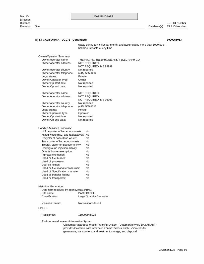
MAP FINDINGSMap IDDirection
EDR ID NumberDistanceEPA ID NumberDatabase(s)SiteElevation
generators, transporters, and treatment, storage, and disposalprovides California with information on hazardous waste shipments forCalifornia Hazardous Waste Tracking System - Datamart (HWTS-DATAMART) Environmental Interest/Information System
110002948026Registry ID:
FINDS:
No violations foundViolation Status:
Large Quantity GeneratorClassification: PACIFIC BELLSite name: 01/13/1981Date form received by agency:
Historical Generators:
NoUsed oil transporter: NoUsed oil transfer facility: NoUsed oil Specification marketer: NoUsed oil fuel marketer to burner: NoUser oil refiner: NoUsed oil processor: NoUsed oil fuel burner: NoFurnace exemption: NoOn-site burner exemption: NoUnderground injection activity: NoTreater, storer or disposer of HW: NoTransporter of hazardous waste: NoRecycler of hazardous waste: NoMixed waste (haz. and radioactive): NoU.S. importer of hazardous waste:
Handler Activities Summary:
Not reportedOwner/Op end date: Not reportedOwner/Op start date: OperatorOwner/Operator Type: PrivateLegal status: (415) 555-1212Owner/operator telephone: Not reportedOwner/operator country: NOT REQUIRED, ME 99999 NOT REQUIREDOwner/operator address: NOT REQUIREDOwner/operator name:
Not reportedOwner/Op end date: Not reportedOwner/Op start date: OwnerOwner/Operator Type: PrivateLegal status: (415) 555-1212Owner/operator telephone: Not reportedOwner/operator country: NOT REQUIRED, ME 99999 NOT REQUIREDOwner/operator address: THE PACIFIC TELEPHONE AND TELEGRAPH COOwner/operator name:
Owner/Operator Summary:
hazardous waste at any time waste during any calendar month, and accumulates more than 1000 kg of
AT&T CALIFORNIA - UG073 (Continued) 1000251053
TC4265561.2s Page 56

MAP FINDINGSMap IDDirection
EDR ID NumberDistanceEPA ID NumberDatabase(s)SiteElevation
SJUAir District Name: 2866Facility ID: SJVAir Basin: 50County Code: 2005Year:
0.001247688Part. Matter 10 Micrometers & Smllr Tons/Yr: 0.001278369Particulate Matter Tons/Yr: 0.001016634SOX - Oxides of Sulphur Tons/Yr: 0.009011088NOX - Oxides of Nitrogen Tons/Yr: 0.003789276Carbon Monoxide Emissions Tons/Yr: 0.001409424Reactive Organic Gases Tons/Yr: 0.001684503Total Organic Hydrocarbon Gases Tons/Yr: Not reportedConsolidated Emission Reporting Rule: Not reportedCommunity Health Air Pollution Info System: SAN JOAQUIN VALLEY UNIFIED APCDAir District Name: 4813SIC Code: SJUAir District Name: 2866Facility ID: SJVAir Basin: 50County Code: 2004Year:
0Part. Matter 10 Micrometers & Smllr Tons/Yr: 0Particulate Matter Tons/Yr: 0SOX - Oxides of Sulphur Tons/Yr: 0NOX - Oxides of Nitrogen Tons/Yr: 0Carbon Monoxide Emissions Tons/Yr: 0Reactive Organic Gases Tons/Yr: 0Total Organic Hydrocarbon Gases Tons/Yr: Not reportedConsolidated Emission Reporting Rule: Not reportedCommunity Health Air Pollution Info System: SAN JOAQUIN VALLEY UNIFIED APCDAir District Name: 4813SIC Code: SJUAir District Name: 2866Facility ID: SJVAir Basin: 50County Code: 2003Year:
EMI:
STATE MASTER Environmental Interest/Information System
110055749445Registry ID:
CRITERIA AND HAZARDOUS AIR POLLUTANT INVENTORY
corrective action activities required under RCRA.program staff to track the notification, permit, compliance, andand treat, store, or dispose of hazardous waste. RCRAInfo allows RCRAevents and activities related to facilities that generate, transport,Conservation and Recovery Act (RCRA) program through the tracking ofRCRAInfo is a national information system that supports the Resource
facilities.
AT&T CALIFORNIA - UG073 (Continued) 1000251053
TC4265561.2s Page 57
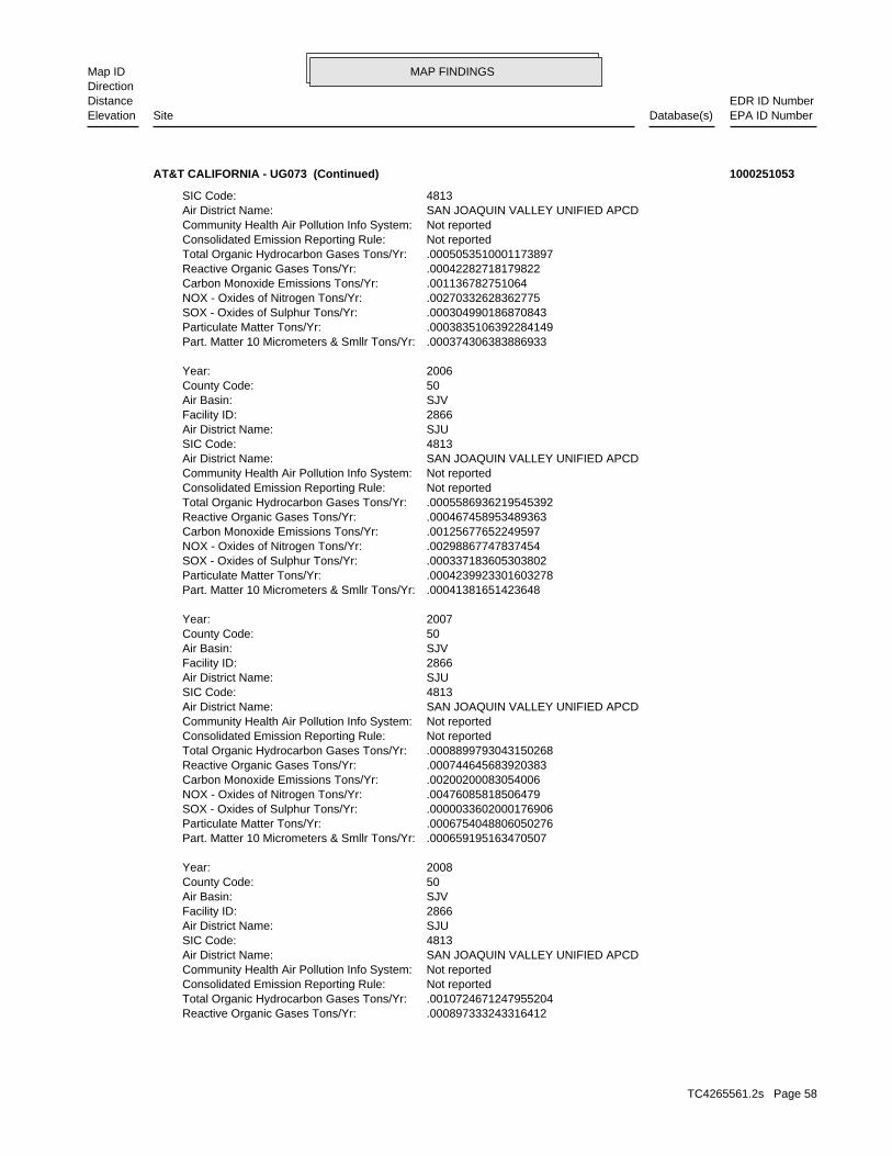
MAP FINDINGSMap IDDirection
EDR ID NumberDistanceEPA ID NumberDatabase(s)SiteElevation
.000897333243316412Reactive Organic Gases Tons/Yr: .0010724671247955204Total Organic Hydrocarbon Gases Tons/Yr: Not reportedConsolidated Emission Reporting Rule: Not reportedCommunity Health Air Pollution Info System: SAN JOAQUIN VALLEY UNIFIED APCDAir District Name: 4813SIC Code: SJUAir District Name: 2866Facility ID: SJVAir Basin: 50County Code: 2008Year:
.000659195163470507Part. Matter 10 Micrometers & Smllr Tons/Yr: .0006754048806050276Particulate Matter Tons/Yr: .0000033602000176906SOX - Oxides of Sulphur Tons/Yr: .00476085818506479NOX - Oxides of Nitrogen Tons/Yr: .00200200083054006Carbon Monoxide Emissions Tons/Yr: .000744645683920383Reactive Organic Gases Tons/Yr: .0008899793043150268Total Organic Hydrocarbon Gases Tons/Yr: Not reportedConsolidated Emission Reporting Rule: Not reportedCommunity Health Air Pollution Info System: SAN JOAQUIN VALLEY UNIFIED APCDAir District Name: 4813SIC Code: SJUAir District Name: 2866Facility ID: SJVAir Basin: 50County Code: 2007Year:
.00041381651423648Part. Matter 10 Micrometers & Smllr Tons/Yr: .0004239923301603278Particulate Matter Tons/Yr: .000337183605303802SOX - Oxides of Sulphur Tons/Yr: .00298867747837454NOX - Oxides of Nitrogen Tons/Yr: .00125677652249597Carbon Monoxide Emissions Tons/Yr: .000467458953489363Reactive Organic Gases Tons/Yr: .0005586936219545392Total Organic Hydrocarbon Gases Tons/Yr: Not reportedConsolidated Emission Reporting Rule: Not reportedCommunity Health Air Pollution Info System: SAN JOAQUIN VALLEY UNIFIED APCDAir District Name: 4813SIC Code: SJUAir District Name: 2866Facility ID: SJVAir Basin: 50County Code: 2006Year:
.000374306383886933Part. Matter 10 Micrometers & Smllr Tons/Yr: .0003835106392284149Particulate Matter Tons/Yr: .000304990186870843SOX - Oxides of Sulphur Tons/Yr: .00270332628362775NOX - Oxides of Nitrogen Tons/Yr: .001136782751064Carbon Monoxide Emissions Tons/Yr: .00042282718179822Reactive Organic Gases Tons/Yr: .0005053510001173897Total Organic Hydrocarbon Gases Tons/Yr: Not reportedConsolidated Emission Reporting Rule: Not reportedCommunity Health Air Pollution Info System: SAN JOAQUIN VALLEY UNIFIED APCDAir District Name: 4813SIC Code:
AT&T CALIFORNIA - UG073 (Continued) 1000251053
TC4265561.2s Page 58
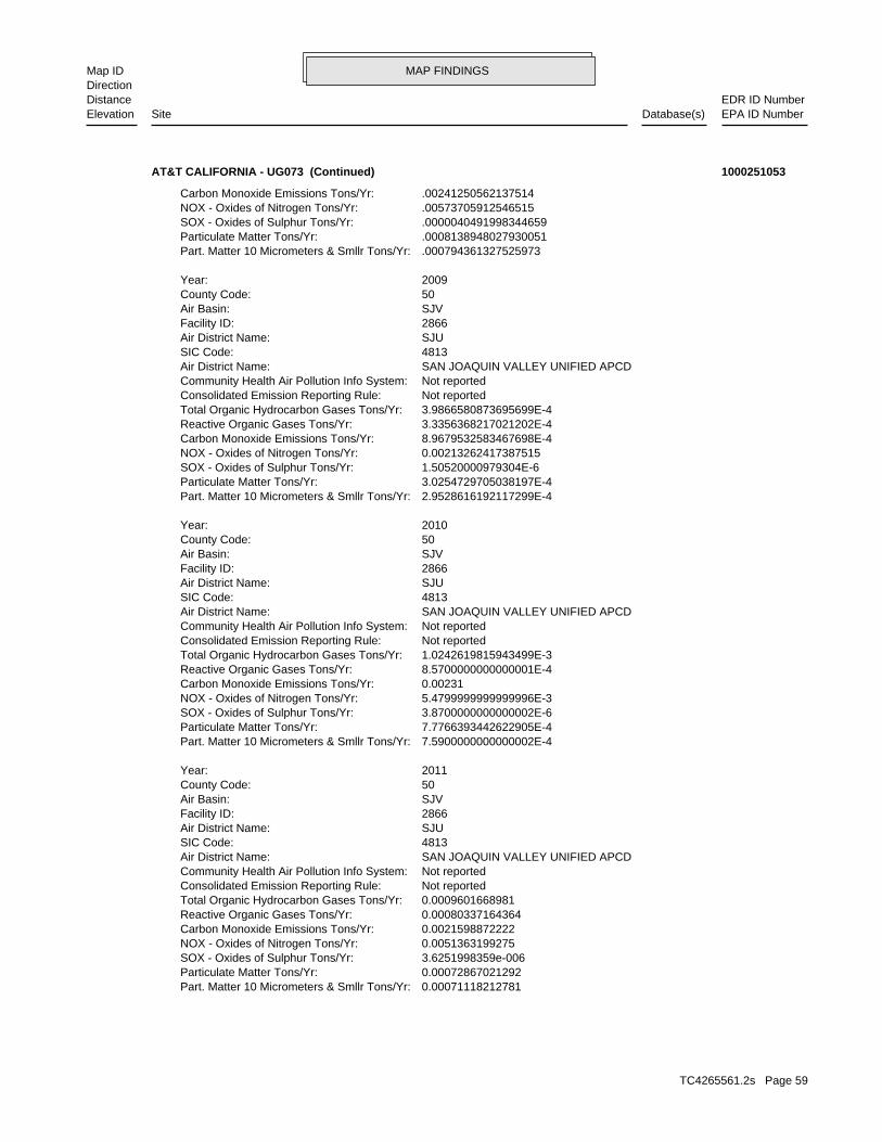
MAP FINDINGSMap IDDirection
EDR ID NumberDistanceEPA ID NumberDatabase(s)SiteElevation
0.00071118212781Part. Matter 10 Micrometers & Smllr Tons/Yr: 0.00072867021292Particulate Matter Tons/Yr: 3.6251998359e-006SOX - Oxides of Sulphur Tons/Yr: 0.0051363199275NOX - Oxides of Nitrogen Tons/Yr: 0.0021598872222Carbon Monoxide Emissions Tons/Yr: 0.00080337164364Reactive Organic Gases Tons/Yr: 0.0009601668981Total Organic Hydrocarbon Gases Tons/Yr: Not reportedConsolidated Emission Reporting Rule: Not reportedCommunity Health Air Pollution Info System: SAN JOAQUIN VALLEY UNIFIED APCDAir District Name: 4813SIC Code: SJUAir District Name: 2866Facility ID: SJVAir Basin: 50County Code: 2011Year:
7.5900000000000002E-4Part. Matter 10 Micrometers & Smllr Tons/Yr: 7.7766393442622905E-4Particulate Matter Tons/Yr: 3.8700000000000002E-6SOX - Oxides of Sulphur Tons/Yr: 5.4799999999999996E-3NOX - Oxides of Nitrogen Tons/Yr: 0.00231Carbon Monoxide Emissions Tons/Yr: 8.5700000000000001E-4Reactive Organic Gases Tons/Yr: 1.0242619815943499E-3Total Organic Hydrocarbon Gases Tons/Yr: Not reportedConsolidated Emission Reporting Rule: Not reportedCommunity Health Air Pollution Info System: SAN JOAQUIN VALLEY UNIFIED APCDAir District Name: 4813SIC Code: SJUAir District Name: 2866Facility ID: SJVAir Basin: 50County Code: 2010Year:
2.9528616192117299E-4Part. Matter 10 Micrometers & Smllr Tons/Yr: 3.0254729705038197E-4Particulate Matter Tons/Yr: 1.50520000979304E-6SOX - Oxides of Sulphur Tons/Yr: 0.00213262417387515NOX - Oxides of Nitrogen Tons/Yr: 8.9679532583467698E-4Carbon Monoxide Emissions Tons/Yr: 3.3356368217021202E-4Reactive Organic Gases Tons/Yr: 3.9866580873695699E-4Total Organic Hydrocarbon Gases Tons/Yr: Not reportedConsolidated Emission Reporting Rule: Not reportedCommunity Health Air Pollution Info System: SAN JOAQUIN VALLEY UNIFIED APCDAir District Name: 4813SIC Code: SJUAir District Name: 2866Facility ID: SJVAir Basin: 50County Code: 2009Year:
.000794361327525973Part. Matter 10 Micrometers & Smllr Tons/Yr: .0008138948027930051Particulate Matter Tons/Yr: .0000040491998344659SOX - Oxides of Sulphur Tons/Yr: .00573705912546515NOX - Oxides of Nitrogen Tons/Yr: .00241250562137514Carbon Monoxide Emissions Tons/Yr:
AT&T CALIFORNIA - UG073 (Continued) 1000251053
TC4265561.2s Page 59
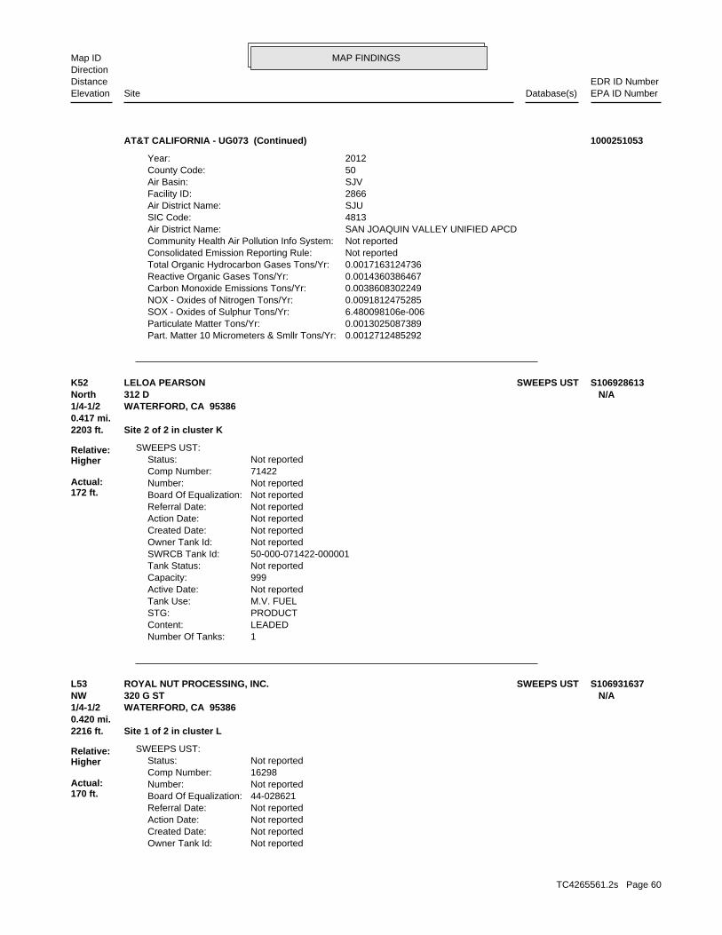
MAP FINDINGSMap IDDirection
EDR ID NumberDistanceEPA ID NumberDatabase(s)SiteElevation
0.0012712485292Part. Matter 10 Micrometers & Smllr Tons/Yr: 0.0013025087389Particulate Matter Tons/Yr: 6.480098106e-006SOX - Oxides of Sulphur Tons/Yr: 0.0091812475285NOX - Oxides of Nitrogen Tons/Yr: 0.0038608302249Carbon Monoxide Emissions Tons/Yr: 0.0014360386467Reactive Organic Gases Tons/Yr: 0.0017163124736Total Organic Hydrocarbon Gases Tons/Yr: Not reportedConsolidated Emission Reporting Rule: Not reportedCommunity Health Air Pollution Info System: SAN JOAQUIN VALLEY UNIFIED APCDAir District Name: 4813SIC Code: SJUAir District Name: 2866Facility ID: SJVAir Basin: 50County Code: 2012Year:
AT&T CALIFORNIA - UG073 (Continued) 1000251053
1Number Of Tanks: LEADEDContent: PRODUCTSTG: M.V. FUELTank Use: Not reportedActive Date: 999Capacity: Not reportedTank Status: 50-000-071422-000001SWRCB Tank Id: Not reportedOwner Tank Id: Not reportedCreated Date: Not reportedAction Date: Not reportedReferral Date: Not reportedBoard Of Equalization: Not reportedNumber: 71422Comp Number: Not reportedStatus:
SWEEPS UST:
2203 ft. Site 2 of 2 in cluster K0.417 mi.
Relative:Higher
Actual:172 ft.
1/4-1/2 WATERFORD, CA 95386North 312 D N/AK52 SWEEPS USTLELOA PEARSON S106928613
Not reportedOwner Tank Id: Not reportedCreated Date: Not reportedAction Date: Not reportedReferral Date: 44-028621Board Of Equalization: Not reportedNumber: 16298Comp Number: Not reportedStatus:
SWEEPS UST:
2216 ft. Site 1 of 2 in cluster L0.420 mi.
Relative:Higher
Actual:170 ft.
1/4-1/2 WATERFORD, CA 95386NW 320 G ST N/AL53 SWEEPS USTROYAL NUT PROCESSING, INC. S106931637
TC4265561.2s Page 60
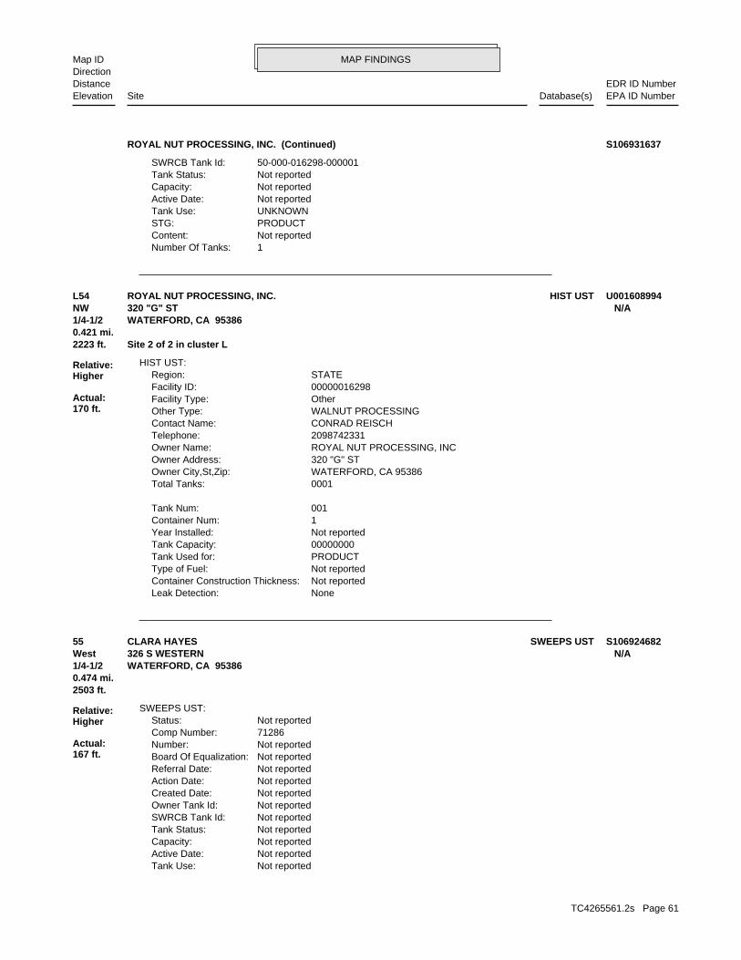
MAP FINDINGSMap IDDirection
EDR ID NumberDistanceEPA ID NumberDatabase(s)SiteElevation
1Number Of Tanks: Not reportedContent: PRODUCTSTG: UNKNOWNTank Use: Not reportedActive Date: Not reportedCapacity: Not reportedTank Status: 50-000-016298-000001SWRCB Tank Id:
ROYAL NUT PROCESSING, INC. (Continued) S106931637
NoneLeak Detection: Not reportedContainer Construction Thickness: Not reportedType of Fuel: PRODUCTTank Used for: 00000000Tank Capacity: Not reportedYear Installed: 1Container Num: 001Tank Num:
0001Total Tanks: WATERFORD, CA 95386Owner City,St,Zip: 320 "G" STOwner Address: ROYAL NUT PROCESSING, INCOwner Name: 2098742331Telephone: CONRAD REISCHContact Name: WALNUT PROCESSINGOther Type: OtherFacility Type: 00000016298Facility ID: STATERegion:
HIST UST:
2223 ft. Site 2 of 2 in cluster L0.421 mi.
Relative:Higher
Actual:170 ft.
1/4-1/2 WATERFORD, CA 95386NW 320 "G" ST N/AL54 HIST USTROYAL NUT PROCESSING, INC. U001608994
Not reportedTank Use: Not reportedActive Date: Not reportedCapacity: Not reportedTank Status: Not reportedSWRCB Tank Id: Not reportedOwner Tank Id: Not reportedCreated Date: Not reportedAction Date: Not reportedReferral Date: Not reportedBoard Of Equalization: Not reportedNumber: 71286Comp Number: Not reportedStatus:
SWEEPS UST:
2503 ft.0.474 mi.
Relative:Higher
Actual:167 ft.
1/4-1/2 WATERFORD, CA 95386West 326 S WESTERN N/A55 SWEEPS USTCLARA HAYES S106924682
TC4265561.2s Page 61
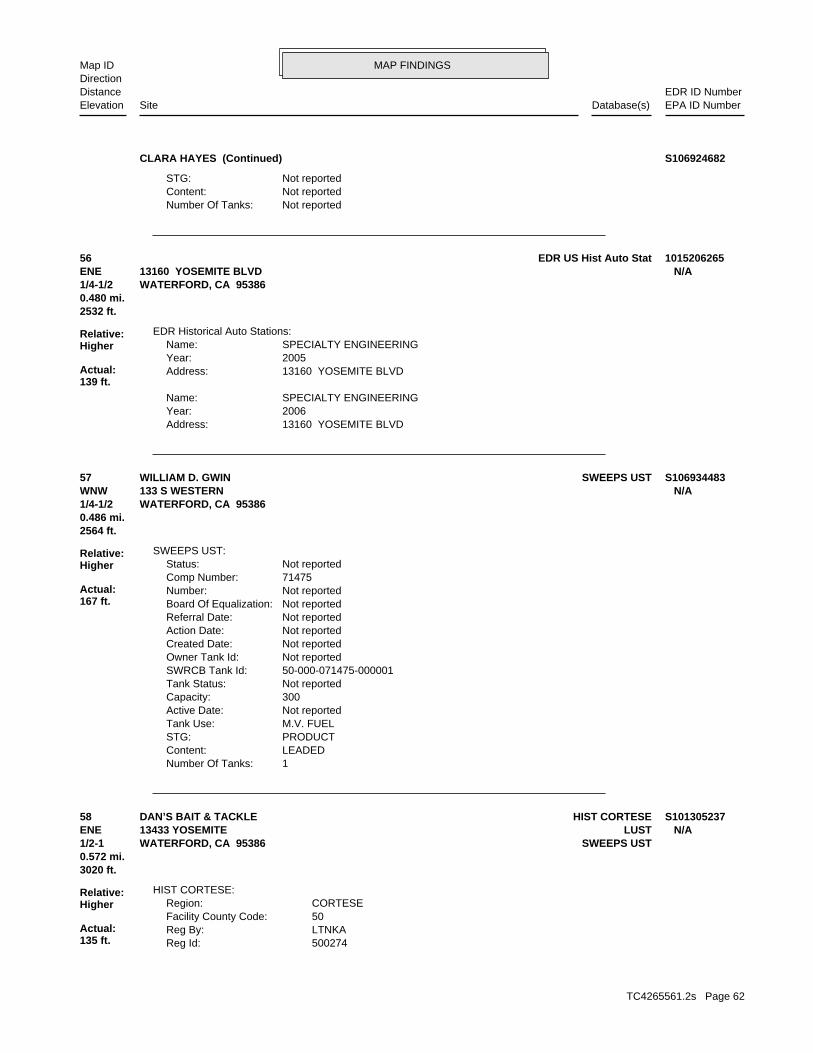
MAP FINDINGSMap IDDirection
EDR ID NumberDistanceEPA ID NumberDatabase(s)SiteElevation
Not reportedNumber Of Tanks: Not reportedContent: Not reportedSTG:
CLARA HAYES (Continued) S106924682
13160 YOSEMITE BLVDAddress: 2006Year: SPECIALTY ENGINEERINGName:
13160 YOSEMITE BLVDAddress: 2005Year: SPECIALTY ENGINEERINGName:
EDR Historical Auto Stations:
2532 ft.0.480 mi.
Relative:Higher
Actual:139 ft.
1/4-1/2 WATERFORD, CA 95386ENE 13160 YOSEMITE BLVD N/A56 EDR US Hist Auto Stat 1015206265
1Number Of Tanks: LEADEDContent: PRODUCTSTG: M.V. FUELTank Use: Not reportedActive Date: 300Capacity: Not reportedTank Status: 50-000-071475-000001SWRCB Tank Id: Not reportedOwner Tank Id: Not reportedCreated Date: Not reportedAction Date: Not reportedReferral Date: Not reportedBoard Of Equalization: Not reportedNumber: 71475Comp Number: Not reportedStatus:
SWEEPS UST:
2564 ft.0.486 mi.
Relative:Higher
Actual:167 ft.
1/4-1/2 WATERFORD, CA 95386WNW 133 S WESTERN N/A57 SWEEPS USTWILLIAM D. GWIN S106934483
500274Reg Id: LTNKAReg By: 50Facility County Code: CORTESERegion:
HIST CORTESE:
3020 ft.0.572 mi.
Relative:Higher
Actual:135 ft.
1/2-1 SWEEPS USTWATERFORD, CA 95386ENE LUST13433 YOSEMITE N/A58 HIST CORTESEDAN’S BAIT & TACKLE S101305237
TC4265561.2s Page 62
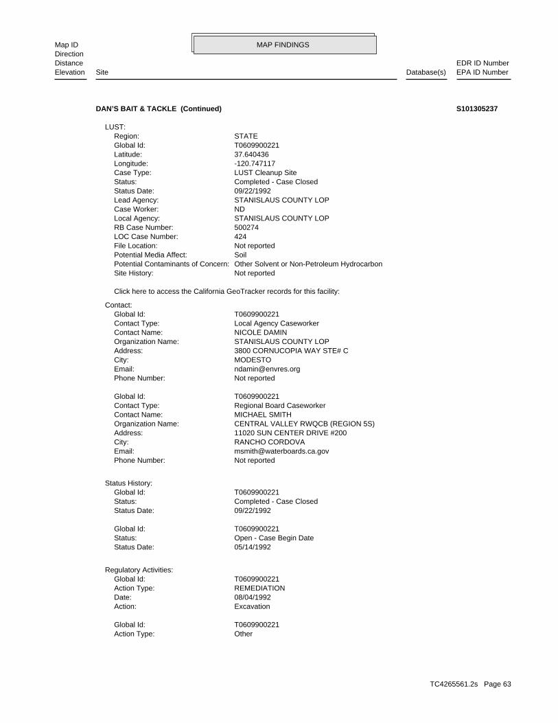
MAP FINDINGSMap IDDirection
EDR ID NumberDistanceEPA ID NumberDatabase(s)SiteElevation
OtherAction Type: T0609900221Global Id:
ExcavationAction: 08/04/1992Date: REMEDIATIONAction Type: T0609900221Global Id:
Regulatory Activities:
05/14/1992Status Date: Open - Case Begin DateStatus: T0609900221Global Id:
09/22/1992Status Date: Completed - Case ClosedStatus: T0609900221Global Id:
Status History:
Not reportedPhone Number: [email protected]: RANCHO CORDOVACity: 11020 SUN CENTER DRIVE #200Address: CENTRAL VALLEY RWQCB (REGION 5S)Organization Name: MICHAEL SMITHContact Name: Regional Board CaseworkerContact Type: T0609900221Global Id:
Not reportedPhone Number: [email protected]: MODESTOCity: 3800 CORNUCOPIA WAY STE# CAddress: STANISLAUS COUNTY LOPOrganization Name: NICOLE DAMINContact Name: Local Agency CaseworkerContact Type: T0609900221Global Id:
Contact:
Click here to access the California GeoTracker records for this facility:
Not reportedSite History: Other Solvent or Non-Petroleum HydrocarbonPotential Contaminants of Concern: SoilPotential Media Affect: Not reportedFile Location: 424LOC Case Number: 500274RB Case Number: STANISLAUS COUNTY LOPLocal Agency: NDCase Worker: STANISLAUS COUNTY LOPLead Agency: 09/22/1992Status Date: Completed - Case ClosedStatus: LUST Cleanup SiteCase Type: -120.747117Longitude: 37.640436Latitude: T0609900221Global Id: STATERegion:
LUST:
DAN’S BAIT & TACKLE (Continued) S101305237
TC4265561.2s Page 63
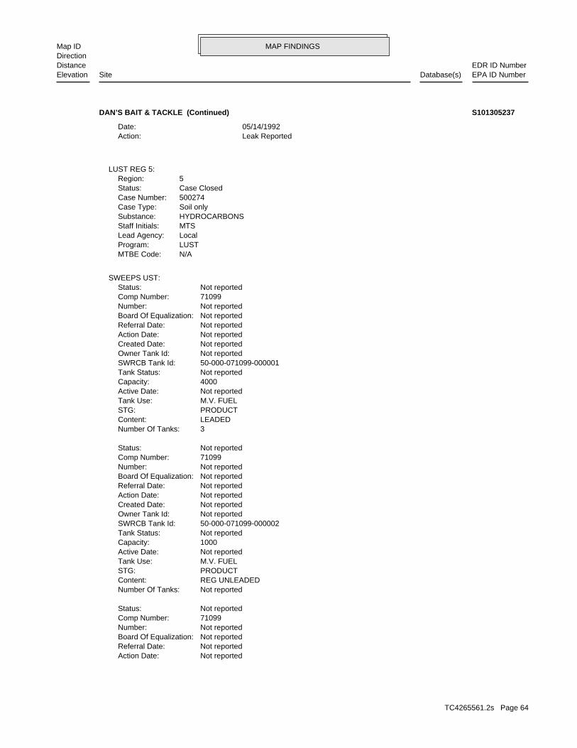
MAP FINDINGSMap IDDirection
EDR ID NumberDistanceEPA ID NumberDatabase(s)SiteElevation
Not reportedAction Date: Not reportedReferral Date: Not reportedBoard Of Equalization: Not reportedNumber: 71099Comp Number: Not reportedStatus:
Not reportedNumber Of Tanks: REG UNLEADEDContent: PRODUCTSTG: M.V. FUELTank Use: Not reportedActive Date: 1000Capacity: Not reportedTank Status: 50-000-071099-000002SWRCB Tank Id: Not reportedOwner Tank Id: Not reportedCreated Date: Not reportedAction Date: Not reportedReferral Date: Not reportedBoard Of Equalization: Not reportedNumber: 71099Comp Number: Not reportedStatus:
3Number Of Tanks: LEADEDContent: PRODUCTSTG: M.V. FUELTank Use: Not reportedActive Date: 4000Capacity: Not reportedTank Status: 50-000-071099-000001SWRCB Tank Id: Not reportedOwner Tank Id: Not reportedCreated Date: Not reportedAction Date: Not reportedReferral Date: Not reportedBoard Of Equalization: Not reportedNumber: 71099Comp Number: Not reportedStatus:
SWEEPS UST:
N/AMTBE Code:LUSTProgram:LocalLead Agency:MTSStaff Initials:HYDROCARBONSSubstance:Soil onlyCase Type:500274Case Number:Case ClosedStatus:5Region:
LUST REG 5:
Leak ReportedAction: 05/14/1992Date:
DAN’S BAIT & TACKLE (Continued) S101305237
TC4265561.2s Page 64

MAP FINDINGSMap IDDirection
EDR ID NumberDistanceEPA ID NumberDatabase(s)SiteElevation
Not reportedNumber Of Tanks: LEADEDContent: PRODUCTSTG: M.V. FUELTank Use: Not reportedActive Date: 1000Capacity: Not reportedTank Status: 50-000-071099-000003SWRCB Tank Id: Not reportedOwner Tank Id: Not reportedCreated Date:
DAN’S BAIT & TACKLE (Continued) S101305237
rePLANET LLCOrganization Name: 151891Organization ID: CLOSEDSunday Hours Of Operation: 10:00 am - 4:30 pm; Closed 1:00 pm - 1:30 pmSaturday Hours Of Operation: 10:00 am - 4:30 pm; Closed 1:00 pm - 1:30 pmFriday Hours Of Operation: 10:00 am - 4:30 pm; Closed 1:00 pm - 1:30 pmThursday Hours Of Operation: 10:00 am - 4:30 pm; Closed 1:00 pm - 1:30 pmWednesday Hours Of Operation: 10:00 am - 4:30 pm; Closed 1:00 pm - 1:30 pmTuesday Hours Of Operation: CLOSEDMonday Hours Of Operation: N/AAgency: YBimetal: YPlastic: YGlass: YAluminium: 06/01/2012Operation Begin Date: YRural: NGrand Father: (951) 520-1700Phone Number: [email protected]: http://www.replanetusa.comWebsite: 91764Mailing Zip Code: CAMailing State: OntarioMailing City: 800 N Haven Ave Suite 120Mailing Address: RC158815.001Cert Id: 158815Reg Id:
SWRCY:
3185 ft.0.603 mi.
Relative:Higher
Actual:167 ft.
1/2-1 WATERFORD, CA 95386WNW 12138 YOSEMITE BLVD N/A59 SWRCYREPLANET LLC S107138233
500415Reg Id: LTNKAReg By: 50Facility County Code: CORTESERegion:
HIST CORTESE:
3712 ft.0.703 mi.
Relative:Higher
Actual:166 ft.
1/2-1 EMIWATERFORD, CA 95386WNW LUST12070 YOSEMITE N/A60 HIST CORTESESPORT STOP S103989018
TC4265561.2s Page 65
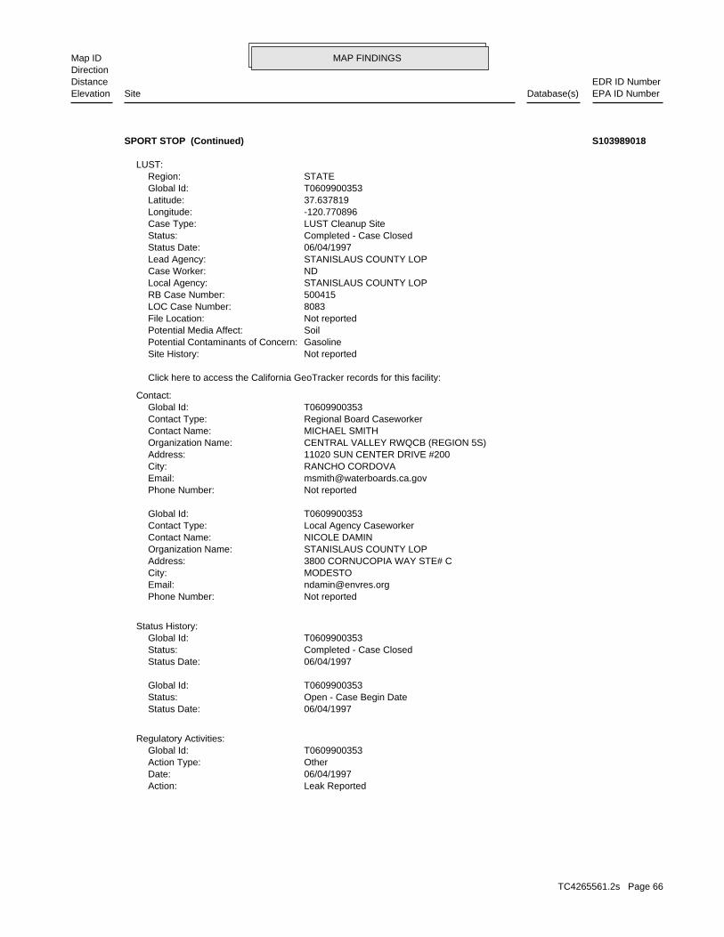
MAP FINDINGSMap IDDirection
EDR ID NumberDistanceEPA ID NumberDatabase(s)SiteElevation
Leak ReportedAction: 06/04/1997Date: OtherAction Type: T0609900353Global Id:
Regulatory Activities:
06/04/1997Status Date: Open - Case Begin DateStatus: T0609900353Global Id:
06/04/1997Status Date: Completed - Case ClosedStatus: T0609900353Global Id:
Status History:
Not reportedPhone Number: [email protected]: MODESTOCity: 3800 CORNUCOPIA WAY STE# CAddress: STANISLAUS COUNTY LOPOrganization Name: NICOLE DAMINContact Name: Local Agency CaseworkerContact Type: T0609900353Global Id:
Not reportedPhone Number: [email protected]: RANCHO CORDOVACity: 11020 SUN CENTER DRIVE #200Address: CENTRAL VALLEY RWQCB (REGION 5S)Organization Name: MICHAEL SMITHContact Name: Regional Board CaseworkerContact Type: T0609900353Global Id:
Contact:
Click here to access the California GeoTracker records for this facility:
Not reportedSite History: GasolinePotential Contaminants of Concern: SoilPotential Media Affect: Not reportedFile Location: 8083LOC Case Number: 500415RB Case Number: STANISLAUS COUNTY LOPLocal Agency: NDCase Worker: STANISLAUS COUNTY LOPLead Agency: 06/04/1997Status Date: Completed - Case ClosedStatus: LUST Cleanup SiteCase Type: -120.770896Longitude: 37.637819Latitude: T0609900353Global Id: STATERegion:
LUST:
SPORT STOP (Continued) S103989018
TC4265561.2s Page 66
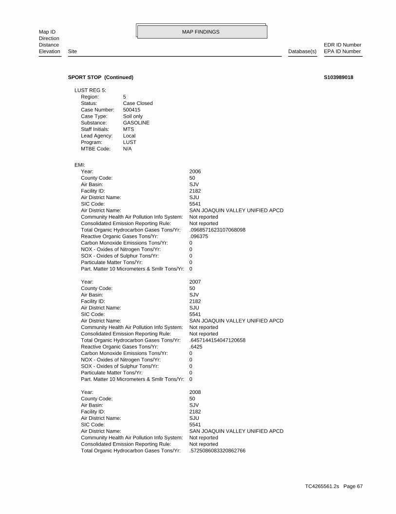
MAP FINDINGSMap IDDirection
EDR ID NumberDistanceEPA ID NumberDatabase(s)SiteElevation
.5725086083320862766Total Organic Hydrocarbon Gases Tons/Yr: Not reportedConsolidated Emission Reporting Rule: Not reportedCommunity Health Air Pollution Info System: SAN JOAQUIN VALLEY UNIFIED APCDAir District Name: 5541SIC Code: SJUAir District Name: 2182Facility ID: SJVAir Basin: 50County Code: 2008Year:
0Part. Matter 10 Micrometers & Smllr Tons/Yr: 0Particulate Matter Tons/Yr: 0SOX - Oxides of Sulphur Tons/Yr: 0NOX - Oxides of Nitrogen Tons/Yr: 0Carbon Monoxide Emissions Tons/Yr: .6425Reactive Organic Gases Tons/Yr: .6457144154047120658Total Organic Hydrocarbon Gases Tons/Yr: Not reportedConsolidated Emission Reporting Rule: Not reportedCommunity Health Air Pollution Info System: SAN JOAQUIN VALLEY UNIFIED APCDAir District Name: 5541SIC Code: SJUAir District Name: 2182Facility ID: SJVAir Basin: 50County Code: 2007Year:
0Part. Matter 10 Micrometers & Smllr Tons/Yr: 0Particulate Matter Tons/Yr: 0SOX - Oxides of Sulphur Tons/Yr: 0NOX - Oxides of Nitrogen Tons/Yr: 0Carbon Monoxide Emissions Tons/Yr: .096375Reactive Organic Gases Tons/Yr: .0968571623107068098Total Organic Hydrocarbon Gases Tons/Yr: Not reportedConsolidated Emission Reporting Rule: Not reportedCommunity Health Air Pollution Info System: SAN JOAQUIN VALLEY UNIFIED APCDAir District Name: 5541SIC Code: SJUAir District Name: 2182Facility ID: SJVAir Basin: 50County Code: 2006Year:
EMI:
N/AMTBE Code:LUSTProgram:LocalLead Agency:MTSStaff Initials:GASOLINESubstance:Soil onlyCase Type:500415Case Number:Case ClosedStatus:5Region:
LUST REG 5:
SPORT STOP (Continued) S103989018
TC4265561.2s Page 67
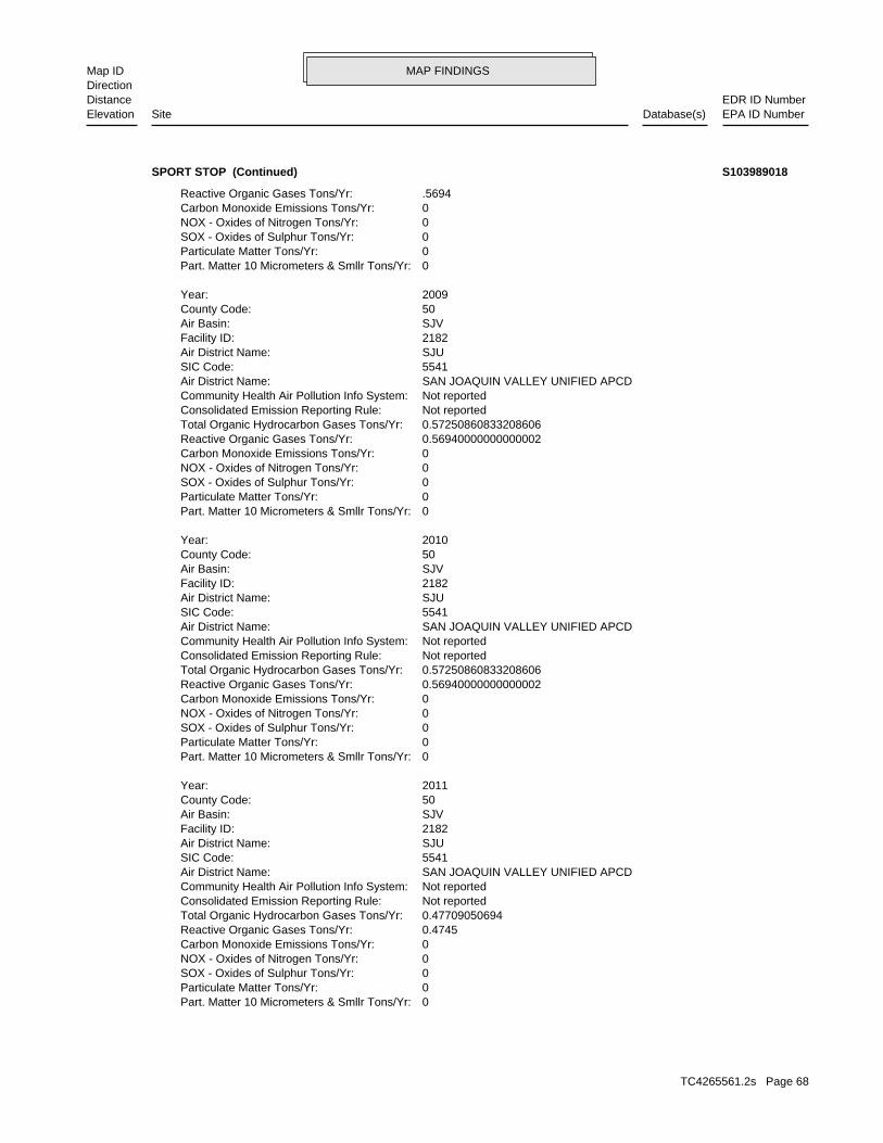
MAP FINDINGSMap IDDirection
EDR ID NumberDistanceEPA ID NumberDatabase(s)SiteElevation
0Part. Matter 10 Micrometers & Smllr Tons/Yr: 0Particulate Matter Tons/Yr: 0SOX - Oxides of Sulphur Tons/Yr: 0NOX - Oxides of Nitrogen Tons/Yr: 0Carbon Monoxide Emissions Tons/Yr: 0.4745Reactive Organic Gases Tons/Yr: 0.47709050694Total Organic Hydrocarbon Gases Tons/Yr: Not reportedConsolidated Emission Reporting Rule: Not reportedCommunity Health Air Pollution Info System: SAN JOAQUIN VALLEY UNIFIED APCDAir District Name: 5541SIC Code: SJUAir District Name: 2182Facility ID: SJVAir Basin: 50County Code: 2011Year:
0Part. Matter 10 Micrometers & Smllr Tons/Yr: 0Particulate Matter Tons/Yr: 0SOX - Oxides of Sulphur Tons/Yr: 0NOX - Oxides of Nitrogen Tons/Yr: 0Carbon Monoxide Emissions Tons/Yr: 0.56940000000000002Reactive Organic Gases Tons/Yr: 0.57250860833208606Total Organic Hydrocarbon Gases Tons/Yr: Not reportedConsolidated Emission Reporting Rule: Not reportedCommunity Health Air Pollution Info System: SAN JOAQUIN VALLEY UNIFIED APCDAir District Name: 5541SIC Code: SJUAir District Name: 2182Facility ID: SJVAir Basin: 50County Code: 2010Year:
0Part. Matter 10 Micrometers & Smllr Tons/Yr: 0Particulate Matter Tons/Yr: 0SOX - Oxides of Sulphur Tons/Yr: 0NOX - Oxides of Nitrogen Tons/Yr: 0Carbon Monoxide Emissions Tons/Yr: 0.56940000000000002Reactive Organic Gases Tons/Yr: 0.57250860833208606Total Organic Hydrocarbon Gases Tons/Yr: Not reportedConsolidated Emission Reporting Rule: Not reportedCommunity Health Air Pollution Info System: SAN JOAQUIN VALLEY UNIFIED APCDAir District Name: 5541SIC Code: SJUAir District Name: 2182Facility ID: SJVAir Basin: 50County Code: 2009Year:
0Part. Matter 10 Micrometers & Smllr Tons/Yr: 0Particulate Matter Tons/Yr: 0SOX - Oxides of Sulphur Tons/Yr: 0NOX - Oxides of Nitrogen Tons/Yr: 0Carbon Monoxide Emissions Tons/Yr: .5694Reactive Organic Gases Tons/Yr:
SPORT STOP (Continued) S103989018
TC4265561.2s Page 68

MAP FINDINGSMap IDDirection
EDR ID NumberDistanceEPA ID NumberDatabase(s)SiteElevation
0Part. Matter 10 Micrometers & Smllr Tons/Yr: 0Particulate Matter Tons/Yr: 0SOX - Oxides of Sulphur Tons/Yr: 0NOX - Oxides of Nitrogen Tons/Yr: 0Carbon Monoxide Emissions Tons/Yr: 0.3796Reactive Organic Gases Tons/Yr: 0.38167240555Total Organic Hydrocarbon Gases Tons/Yr: Not reportedConsolidated Emission Reporting Rule: Not reportedCommunity Health Air Pollution Info System: SAN JOAQUIN VALLEY UNIFIED APCDAir District Name: 5541SIC Code: SJUAir District Name: 2182Facility ID: SJVAir Basin: 50County Code: 2012Year:
SPORT STOP (Continued) S103989018
WATERFORD USD-RICHARD MOON ELEM SCHOOLAlias Name: Alternate NameAlias Type: WATERFORD USD-PRPSD RICHARD MOON ES EXPAlias Name: SOILPotential Description: 3002502-NO 30006-NO, 30007-NO, 30008-NO, 30013-NO, No Contaminants found, 30018-NO, 30023-NO, 30024-NO, 30025-NO, 30001-NO, 30004-NO,Confirmed COC: biphenyls (PCBs, Toxaphene, TPH-diesel, TPH-gas, TPH-MOTOR OIL Arsenic, Arsenic, Chlordane, DDD, DDE, DDT, Lead, PolychlorinatedPotential COC: AGRICULTURAL - ROW CROPSPast Use: NONE SPECIFIEDAPN: -120.7743Longitude: 37.6385Latitude: School DistrictFunding: NORestricted Use: 11/03/2005Status Date: No Further ActionStatus: Not reportedSpecial Program Status: 14Senate: 12Assembly: 104433Site Code: Northern California Schools & Santa SusanaDivision Branch: Mark MalinowskiSupervisor: Jose LuevanoProject Manager: DTSC - Site Cleanup ProgramLead Agency Description: SMBRPLead Agency: SMBRPCleanup Oversight Agencies: NONational Priorities List: 8Acres: NONE SPECIFIEDSite Mgmt. Req.: SchoolSite Type Detail: School InvestigationSite Type: 39010045Facility ID:
SCH:
4516 ft.0.855 mi.
Relative:Higher
Actual:163 ft.
1/2-1 WATERFORD, CA 95386West ENVIROSTORNORTH REINWAY AVENUE/YOSEMITE BOULEVARD N/A61 SCHRICHARD MOON ELEMENTARY SCHOOL S106568143
TC4265561.2s Page 69
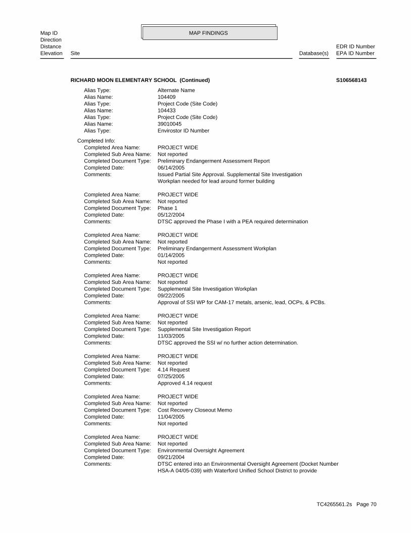
MAP FINDINGSMap IDDirection
EDR ID NumberDistanceEPA ID NumberDatabase(s)SiteElevation
HSA-A 04/05-039) with Waterford Unified School District to provide DTSC entered into an Environmental Oversight Agreement (Docket NumberComments: 09/21/2004Completed Date: Environmental Oversight AgreementCompleted Document Type: Not reportedCompleted Sub Area Name: PROJECT WIDECompleted Area Name:
Not reportedComments: 11/04/2005Completed Date: Cost Recovery Closeout MemoCompleted Document Type: Not reportedCompleted Sub Area Name: PROJECT WIDECompleted Area Name:
Approved 4.14 requestComments: 07/25/2005Completed Date: 4.14 RequestCompleted Document Type: Not reportedCompleted Sub Area Name: PROJECT WIDECompleted Area Name:
DTSC approved the SSI w/ no further action determination.Comments: 11/03/2005Completed Date: Supplemental Site Investigation ReportCompleted Document Type: Not reportedCompleted Sub Area Name: PROJECT WIDECompleted Area Name:
Approval of SSI WP for CAM-17 metals, arsenic, lead, OCPs, & PCBs.Comments: 09/22/2005Completed Date: Supplemental Site Investigation WorkplanCompleted Document Type: Not reportedCompleted Sub Area Name: PROJECT WIDECompleted Area Name:
Not reportedComments: 01/14/2005Completed Date: Preliminary Endangerment Assessment WorkplanCompleted Document Type: Not reportedCompleted Sub Area Name: PROJECT WIDECompleted Area Name:
DTSC approved the Phase I with a PEA required determinationComments: 05/12/2004Completed Date: Phase 1Completed Document Type: Not reportedCompleted Sub Area Name: PROJECT WIDECompleted Area Name:
Workplan needed for lead around former building Issued Partial Site Approval. Supplemental Site InvestigationComments: 06/14/2005Completed Date: Preliminary Endangerment Assessment ReportCompleted Document Type: Not reportedCompleted Sub Area Name: PROJECT WIDECompleted Area Name:
Completed Info:
Envirostor ID NumberAlias Type: 39010045Alias Name: Project Code (Site Code)Alias Type: 104433Alias Name: Project Code (Site Code)Alias Type: 104409Alias Name: Alternate NameAlias Type:
RICHARD MOON ELEMENTARY SCHOOL (Continued) S106568143
TC4265561.2s Page 70
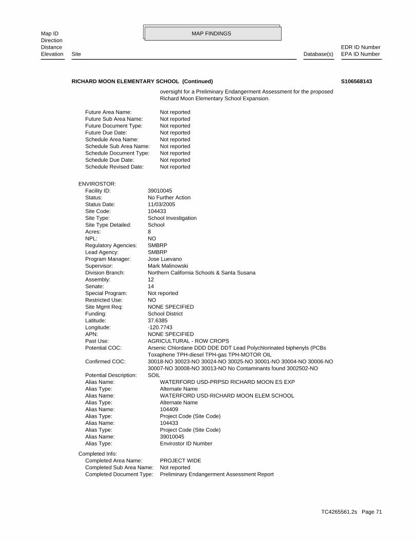
MAP FINDINGSMap IDDirection
EDR ID NumberDistanceEPA ID NumberDatabase(s)SiteElevation
Preliminary Endangerment Assessment ReportCompleted Document Type: Not reportedCompleted Sub Area Name: PROJECT WIDECompleted Area Name:
Completed Info:
Envirostor ID NumberAlias Type: 39010045Alias Name: Project Code (Site Code)Alias Type: 104433Alias Name: Project Code (Site Code)Alias Type: 104409Alias Name: Alternate NameAlias Type: WATERFORD USD-RICHARD MOON ELEM SCHOOLAlias Name: Alternate NameAlias Type: WATERFORD USD-PRPSD RICHARD MOON ES EXPAlias Name: SOILPotential Description: 30007-NO 30008-NO 30013-NO No Contaminants found 3002502-NO 30018-NO 30023-NO 30024-NO 30025-NO 30001-NO 30004-NO 30006-NOConfirmed COC: Toxaphene TPH-diesel TPH-gas TPH-MOTOR OIL Arsenic Chlordane DDD DDE DDT Lead Polychlorinated biphenyls (PCBsPotential COC: AGRICULTURAL - ROW CROPSPast Use: NONE SPECIFIEDAPN: -120.7743Longitude: 37.6385Latitude: School DistrictFunding: NONE SPECIFIEDSite Mgmt Req: NORestricted Use: Not reportedSpecial Program: 14Senate: 12Assembly: Northern California Schools & Santa SusanaDivision Branch: Mark MalinowskiSupervisor: Jose LuevanoProgram Manager: SMBRPLead Agency: SMBRPRegulatory Agencies: NONPL: 8Acres: SchoolSite Type Detailed: School InvestigationSite Type: 104433Site Code: 11/03/2005Status Date: No Further ActionStatus: 39010045Facility ID:
ENVIROSTOR:
Not reportedSchedule Revised Date: Not reportedSchedule Due Date: Not reportedSchedule Document Type: Not reportedSchedule Sub Area Name: Not reportedSchedule Area Name: Not reportedFuture Due Date: Not reportedFuture Document Type: Not reportedFuture Sub Area Name: Not reportedFuture Area Name:
Richard Moon Elementary School Expansion. oversight for a Preliminary Endangerment Assessment for the proposed
RICHARD MOON ELEMENTARY SCHOOL (Continued) S106568143
TC4265561.2s Page 71
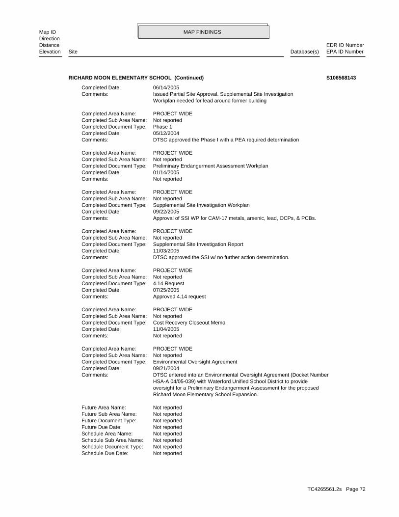
MAP FINDINGSMap IDDirection
EDR ID NumberDistanceEPA ID NumberDatabase(s)SiteElevation
Not reportedSchedule Due Date: Not reportedSchedule Document Type: Not reportedSchedule Sub Area Name: Not reportedSchedule Area Name: Not reportedFuture Due Date: Not reportedFuture Document Type: Not reportedFuture Sub Area Name: Not reportedFuture Area Name:
Richard Moon Elementary School Expansion. oversight for a Preliminary Endangerment Assessment for the proposed HSA-A 04/05-039) with Waterford Unified School District to provide DTSC entered into an Environmental Oversight Agreement (Docket NumberComments: 09/21/2004Completed Date: Environmental Oversight AgreementCompleted Document Type: Not reportedCompleted Sub Area Name: PROJECT WIDECompleted Area Name:
Not reportedComments: 11/04/2005Completed Date: Cost Recovery Closeout MemoCompleted Document Type: Not reportedCompleted Sub Area Name: PROJECT WIDECompleted Area Name:
Approved 4.14 requestComments: 07/25/2005Completed Date: 4.14 RequestCompleted Document Type: Not reportedCompleted Sub Area Name: PROJECT WIDECompleted Area Name:
DTSC approved the SSI w/ no further action determination.Comments: 11/03/2005Completed Date: Supplemental Site Investigation ReportCompleted Document Type: Not reportedCompleted Sub Area Name: PROJECT WIDECompleted Area Name:
Approval of SSI WP for CAM-17 metals, arsenic, lead, OCPs, & PCBs.Comments: 09/22/2005Completed Date: Supplemental Site Investigation WorkplanCompleted Document Type: Not reportedCompleted Sub Area Name: PROJECT WIDECompleted Area Name:
Not reportedComments: 01/14/2005Completed Date: Preliminary Endangerment Assessment WorkplanCompleted Document Type: Not reportedCompleted Sub Area Name: PROJECT WIDECompleted Area Name:
DTSC approved the Phase I with a PEA required determinationComments: 05/12/2004Completed Date: Phase 1Completed Document Type: Not reportedCompleted Sub Area Name: PROJECT WIDECompleted Area Name:
Workplan needed for lead around former building Issued Partial Site Approval. Supplemental Site InvestigationComments: 06/14/2005Completed Date:
RICHARD MOON ELEMENTARY SCHOOL (Continued) S106568143
TC4265561.2s Page 72
MAP FINDINGSMap IDDirection
EDR ID NumberDistanceEPA ID NumberDatabase(s)SiteElevation
Not reportedSchedule Revised Date:
RICHARD MOON ELEMENTARY SCHOOL (Continued) S106568143
TC4265561.2s Page 73
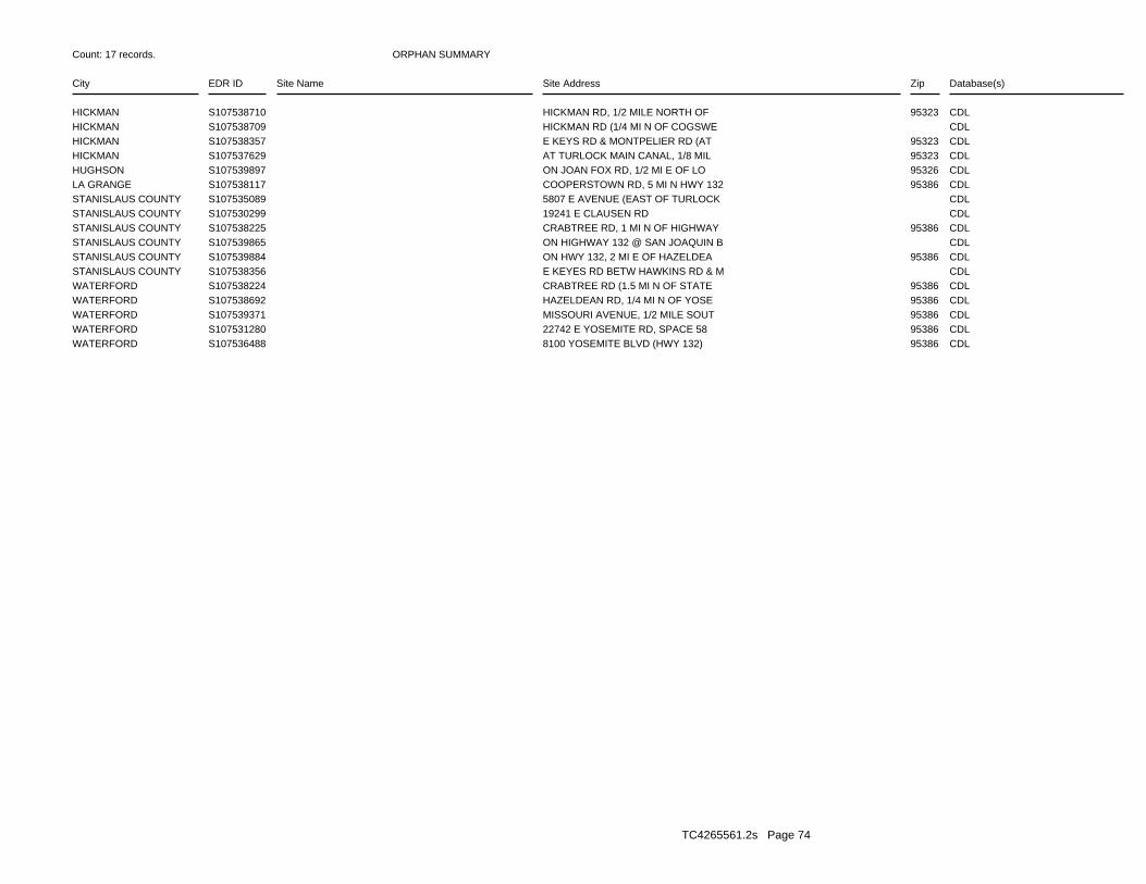
ORPHAN SUMMARY
City EDR ID Site Name Site Address Zip Database(s)
Count: 17 records.
HICKMAN S107538710 HICKMAN RD, 1/2 MILE NORTH OF 95323 CDLHICKMAN S107538709 HICKMAN RD (1/4 MI N OF COGSWE CDLHICKMAN S107538357 E KEYS RD & MONTPELIER RD (AT 95323 CDLHICKMAN S107537629 AT TURLOCK MAIN CANAL, 1/8 MIL 95323 CDLHUGHSON S107539897 ON JOAN FOX RD, 1/2 MI E OF LO 95326 CDLLA GRANGE S107538117 COOPERSTOWN RD, 5 MI N HWY 132 95386 CDLSTANISLAUS COUNTY S107535089 5807 E AVENUE (EAST OF TURLOCK CDLSTANISLAUS COUNTY S107530299 19241 E CLAUSEN RD CDLSTANISLAUS COUNTY S107538225 CRABTREE RD, 1 MI N OF HIGHWAY 95386 CDLSTANISLAUS COUNTY S107539865 ON HIGHWAY 132 @ SAN JOAQUIN B CDLSTANISLAUS COUNTY S107539884 ON HWY 132, 2 MI E OF HAZELDEA 95386 CDLSTANISLAUS COUNTY S107538356 E KEYES RD BETW HAWKINS RD & M CDLWATERFORD S107538224 CRABTREE RD (1.5 MI N OF STATE 95386 CDLWATERFORD S107538692 HAZELDEAN RD, 1/4 MI N OF YOSE 95386 CDLWATERFORD S107539371 MISSOURI AVENUE, 1/2 MILE SOUT 95386 CDLWATERFORD S107531280 22742 E YOSEMITE RD, SPACE 58 95386 CDLWATERFORD S107536488 8100 YOSEMITE BLVD (HWY 132) 95386 CDL
TC4265561.2s Page 74
To maintain currency of the following federal and state databases, EDR contacts the appropriate governmental agencyon a monthly or quarterly basis, as required.
Number of Days to Update: Provides confirmation that EDR is reporting records that have been updated within 90 daysfrom the date the government agency made the information available to the public.
STANDARD ENVIRONMENTAL RECORDS
Federal NPL site list
NPL: National Priority ListNational Priorities List (Superfund). The NPL is a subset of CERCLIS and identifies over 1,200 sites for prioritycleanup under the Superfund Program. NPL sites may encompass relatively large areas. As such, EDR provides polygoncoverage for over 1,000 NPL site boundaries produced by EPA’s Environmental Photographic Interpretation Center(EPIC) and regional EPA offices.
Date of Government Version: 12/16/2014Date Data Arrived at EDR: 01/08/2015Date Made Active in Reports: 02/09/2015Number of Days to Update: 32
Source: EPATelephone: N/ALast EDR Contact: 04/08/2015Next Scheduled EDR Contact: 07/20/2015Data Release Frequency: Quarterly
NPL Site Boundaries
Sources:
EPA’s Environmental Photographic Interpretation Center (EPIC)Telephone: 202-564-7333
EPA Region 1 EPA Region 6Telephone 617-918-1143 Telephone: 214-655-6659
EPA Region 3 EPA Region 7Telephone 215-814-5418 Telephone: 913-551-7247
EPA Region 4 EPA Region 8Telephone 404-562-8033 Telephone: 303-312-6774
EPA Region 5 EPA Region 9Telephone 312-886-6686 Telephone: 415-947-4246
EPA Region 10Telephone 206-553-8665
Proposed NPL: Proposed National Priority List SitesA site that has been proposed for listing on the National Priorities List through the issuance of a proposed rulein the Federal Register. EPA then accepts public comments on the site, responds to the comments, and places onthe NPL those sites that continue to meet the requirements for listing.
Date of Government Version: 12/16/2014Date Data Arrived at EDR: 01/08/2015Date Made Active in Reports: 02/09/2015Number of Days to Update: 32
Source: EPATelephone: N/ALast EDR Contact: 04/08/2015Next Scheduled EDR Contact: 07/20/2015Data Release Frequency: Quarterly
NPL LIENS: Federal Superfund LiensFederal Superfund Liens. Under the authority granted the USEPA by CERCLA of 1980, the USEPA has the authorityto file liens against real property in order to recover remedial action expenditures or when the property ownerreceived notification of potential liability. USEPA compiles a listing of filed notices of Superfund Liens.
Date of Government Version: 10/15/1991Date Data Arrived at EDR: 02/02/1994Date Made Active in Reports: 03/30/1994Number of Days to Update: 56
Source: EPATelephone: 202-564-4267Last EDR Contact: 08/15/2011Next Scheduled EDR Contact: 11/28/2011Data Release Frequency: No Update Planned
TC4265561.2s Page GR-1
GOVERNMENT RECORDS SEARCHED / DATA CURRENCY TRACKING
Federal Delisted NPL site list
DELISTED NPL: National Priority List DeletionsThe National Oil and Hazardous Substances Pollution Contingency Plan (NCP) establishes the criteria that theEPA uses to delete sites from the NPL. In accordance with 40 CFR 300.425.(e), sites may be deleted from theNPL where no further response is appropriate.
Date of Government Version: 12/16/2014Date Data Arrived at EDR: 01/08/2015Date Made Active in Reports: 02/09/2015Number of Days to Update: 32
Source: EPATelephone: N/ALast EDR Contact: 04/08/2015Next Scheduled EDR Contact: 07/20/2015Data Release Frequency: Quarterly
Federal CERCLIS list
CERCLIS: Comprehensive Environmental Response, Compensation, and Liability Information SystemCERCLIS contains data on potentially hazardous waste sites that have been reported to the USEPA by states, municipalities,private companies and private persons, pursuant to Section 103 of the Comprehensive Environmental Response, Compensation,and Liability Act (CERCLA). CERCLIS contains sites which are either proposed to or on the National PrioritiesList (NPL) and sites which are in the screening and assessment phase for possible inclusion on the NPL.
Date of Government Version: 10/25/2013Date Data Arrived at EDR: 11/11/2013Date Made Active in Reports: 02/13/2014Number of Days to Update: 94
Source: EPATelephone: 703-412-9810Last EDR Contact: 04/02/2015Next Scheduled EDR Contact: 06/08/2015Data Release Frequency: Quarterly
FEDERAL FACILITY: Federal Facility Site Information listingA listing of National Priority List (NPL) and Base Realignment and Closure (BRAC) sites found in the ComprehensiveEnvironmental Response, Compensation and Liability Information System (CERCLIS) Database where EPA Federal FacilitiesRestoration and Reuse Office is involved in cleanup activities.
Date of Government Version: 07/21/2014Date Data Arrived at EDR: 10/07/2014Date Made Active in Reports: 10/20/2014Number of Days to Update: 13
Source: Environmental Protection AgencyTelephone: 703-603-8704Last EDR Contact: 04/08/2015Next Scheduled EDR Contact: 07/20/2015Data Release Frequency: Varies
Federal CERCLIS NFRAP site List
CERCLIS-NFRAP: CERCLIS No Further Remedial Action PlannedArchived sites are sites that have been removed and archived from the inventory of CERCLIS sites. Archived statusindicates that, to the best of EPA’s knowledge, assessment at a site has been completed and that EPA has determinedno further steps will be taken to list this site on the National Priorities List (NPL), unless information indicatesthis decision was not appropriate or other considerations require a recommendation for listing at a later time.This decision does not necessarily mean that there is no hazard associated with a given site; it only means that,based upon available information, the location is not judged to be a potential NPL site.
Date of Government Version: 10/25/2013Date Data Arrived at EDR: 11/11/2013Date Made Active in Reports: 02/13/2014Number of Days to Update: 94
Source: EPATelephone: 703-412-9810Last EDR Contact: 04/02/2015Next Scheduled EDR Contact: 06/08/2015Data Release Frequency: Quarterly
Federal RCRA CORRACTS facilities list
CORRACTS: Corrective Action ReportCORRACTS identifies hazardous waste handlers with RCRA corrective action activity.
TC4265561.2s Page GR-2
GOVERNMENT RECORDS SEARCHED / DATA CURRENCY TRACKING
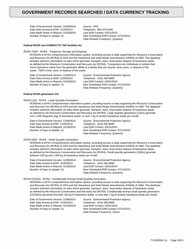
Date of Government Version: 12/09/2014Date Data Arrived at EDR: 12/29/2014Date Made Active in Reports: 01/29/2015Number of Days to Update: 31
Source: EPATelephone: 800-424-9346Last EDR Contact: 03/31/2015Next Scheduled EDR Contact: 07/13/2015Data Release Frequency: Quarterly
Federal RCRA non-CORRACTS TSD facilities list
RCRA-TSDF: RCRA - Treatment, Storage and DisposalRCRAInfo is EPA’s comprehensive information system, providing access to data supporting the Resource Conservationand Recovery Act (RCRA) of 1976 and the Hazardous and Solid Waste Amendments (HSWA) of 1984. The databaseincludes selective information on sites which generate, transport, store, treat and/or dispose of hazardous wasteas defined by the Resource Conservation and Recovery Act (RCRA). Transporters are individuals or entities thatmove hazardous waste from the generator offsite to a facility that can recycle, treat, store, or dispose of thewaste. TSDFs treat, store, or dispose of the waste.
Date of Government Version: 12/09/2014Date Data Arrived at EDR: 12/29/2014Date Made Active in Reports: 01/29/2015Number of Days to Update: 31
Source: Environmental Protection AgencyTelephone: (415) 495-8895Last EDR Contact: 03/31/2015Next Scheduled EDR Contact: 07/13/2015Data Release Frequency: Quarterly
Federal RCRA generators list
RCRA-LQG: RCRA - Large Quantity GeneratorsRCRAInfo is EPA’s comprehensive information system, providing access to data supporting the Resource Conservationand Recovery Act (RCRA) of 1976 and the Hazardous and Solid Waste Amendments (HSWA) of 1984. The databaseincludes selective information on sites which generate, transport, store, treat and/or dispose of hazardous wasteas defined by the Resource Conservation and Recovery Act (RCRA). Large quantity generators (LQGs) generateover 1,000 kilograms (kg) of hazardous waste, or over 1 kg of acutely hazardous waste per month.
Date of Government Version: 12/09/2014Date Data Arrived at EDR: 12/29/2014Date Made Active in Reports: 01/29/2015Number of Days to Update: 31
Source: Environmental Protection AgencyTelephone: (415) 495-8895Last EDR Contact: 03/31/2015Next Scheduled EDR Contact: 07/13/2015Data Release Frequency: Quarterly
RCRA-SQG: RCRA - Small Quantity GeneratorsRCRAInfo is EPA’s comprehensive information system, providing access to data supporting the Resource Conservationand Recovery Act (RCRA) of 1976 and the Hazardous and Solid Waste Amendments (HSWA) of 1984. The databaseincludes selective information on sites which generate, transport, store, treat and/or dispose of hazardous wasteas defined by the Resource Conservation and Recovery Act (RCRA). Small quantity generators (SQGs) generatebetween 100 kg and 1,000 kg of hazardous waste per month.
Date of Government Version: 12/09/2014Date Data Arrived at EDR: 12/29/2014Date Made Active in Reports: 01/29/2015Number of Days to Update: 31
Source: Environmental Protection AgencyTelephone: (415) 495-8895Last EDR Contact: 03/31/2015Next Scheduled EDR Contact: 07/13/2015Data Release Frequency: Quarterly
RCRA-CESQG: RCRA - Conditionally Exempt Small Quantity GeneratorsRCRAInfo is EPA’s comprehensive information system, providing access to data supporting the Resource Conservationand Recovery Act (RCRA) of 1976 and the Hazardous and Solid Waste Amendments (HSWA) of 1984. The databaseincludes selective information on sites which generate, transport, store, treat and/or dispose of hazardous wasteas defined by the Resource Conservation and Recovery Act (RCRA). Conditionally exempt small quantity generators(CESQGs) generate less than 100 kg of hazardous waste, or less than 1 kg of acutely hazardous waste per month.
Date of Government Version: 12/09/2014Date Data Arrived at EDR: 12/29/2014Date Made Active in Reports: 01/29/2015Number of Days to Update: 31
Source: Environmental Protection AgencyTelephone: (415) 495-8895Last EDR Contact: 03/31/2015Next Scheduled EDR Contact: 07/13/2015Data Release Frequency: Varies
TC4265561.2s Page GR-3
GOVERNMENT RECORDS SEARCHED / DATA CURRENCY TRACKING
Federal institutional controls / engineering controls registries
US ENG CONTROLS: Engineering Controls Sites ListA listing of sites with engineering controls in place. Engineering controls include various forms of caps, buildingfoundations, liners, and treatment methods to create pathway elimination for regulated substances to enter environmentalmedia or effect human health.
Date of Government Version: 09/18/2014Date Data Arrived at EDR: 09/19/2014Date Made Active in Reports: 10/20/2014Number of Days to Update: 31
Source: Environmental Protection AgencyTelephone: 703-603-0695Last EDR Contact: 02/26/2015Next Scheduled EDR Contact: 06/15/2015Data Release Frequency: Varies
US INST CONTROL: Sites with Institutional ControlsA listing of sites with institutional controls in place. Institutional controls include administrative measures,such as groundwater use restrictions, construction restrictions, property use restrictions, and post remediationcare requirements intended to prevent exposure to contaminants remaining on site. Deed restrictions are generallyrequired as part of the institutional controls.
Date of Government Version: 09/18/2014Date Data Arrived at EDR: 09/19/2014Date Made Active in Reports: 10/20/2014Number of Days to Update: 31
Source: Environmental Protection AgencyTelephone: 703-603-0695Last EDR Contact: 02/26/2015Next Scheduled EDR Contact: 06/15/2015Data Release Frequency: Varies
LUCIS: Land Use Control Information SystemLUCIS contains records of land use control information pertaining to the former Navy Base Realignment and Closureproperties.
Date of Government Version: 12/03/2014Date Data Arrived at EDR: 12/12/2014Date Made Active in Reports: 01/29/2015Number of Days to Update: 48
Source: Department of the NavyTelephone: 843-820-7326Last EDR Contact: 02/16/2015Next Scheduled EDR Contact: 06/01/2015Data Release Frequency: Varies
Federal ERNS list
ERNS: Emergency Response Notification SystemEmergency Response Notification System. ERNS records and stores information on reported releases of oil and hazardoussubstances.
Date of Government Version: 09/29/2014Date Data Arrived at EDR: 09/30/2014Date Made Active in Reports: 11/06/2014Number of Days to Update: 37
Source: National Response Center, United States Coast GuardTelephone: 202-267-2180Last EDR Contact: 03/31/2015Next Scheduled EDR Contact: 07/13/2015Data Release Frequency: Annually
State- and tribal - equivalent NPL
RESPONSE: State Response SitesIdentifies confirmed release sites where DTSC is involved in remediation, either in a lead or oversight capacity.These confirmed release sites are generally high-priority and high potential risk.
Date of Government Version: 03/11/2015Date Data Arrived at EDR: 03/12/2015Date Made Active in Reports: 03/18/2015Number of Days to Update: 6
Source: Department of Toxic Substances ControlTelephone: 916-323-3400Last EDR Contact: 03/12/2015Next Scheduled EDR Contact: 05/18/2015Data Release Frequency: Quarterly
State- and tribal - equivalent CERCLIS
TC4265561.2s Page GR-4
GOVERNMENT RECORDS SEARCHED / DATA CURRENCY TRACKING
ENVIROSTOR: EnviroStor DatabaseThe Department of Toxic Substances Control’s (DTSC’s) Site Mitigation and Brownfields Reuse Program’s (SMBRP’s)EnviroStor database identifes sites that have known contamination or sites for which there may be reasons to investigatefurther. The database includes the following site types: Federal Superfund sites (National Priorities List (NPL));State Response, including Military Facilities and State Superfund; Voluntary Cleanup; and School sites. EnviroStorprovides similar information to the information that was available in CalSites, and provides additional site information,including, but not limited to, identification of formerly-contaminated properties that have been released forreuse, properties where environmental deed restrictions have been recorded to prevent inappropriate land uses,and risk characterization information that is used to assess potential impacts to public health and the environmentat contaminated sites.
Date of Government Version: 03/11/2015Date Data Arrived at EDR: 03/12/2015Date Made Active in Reports: 03/18/2015Number of Days to Update: 6
Source: Department of Toxic Substances ControlTelephone: 916-323-3400Last EDR Contact: 03/12/2015Next Scheduled EDR Contact: 05/18/2015Data Release Frequency: Quarterly
State and tribal landfill and/or solid waste disposal site lists
SWF/LF (SWIS): Solid Waste Information SystemActive, Closed and Inactive Landfills. SWF/LF records typically contain an inve ntory of solid waste disposalfacilities or landfills. These may be active or i nactive facilities or open dumps that failed to meet RCRA Section4004 criteria for solid waste landfills or disposal sites.
Date of Government Version: 02/16/2015Date Data Arrived at EDR: 02/17/2015Date Made Active in Reports: 03/03/2015Number of Days to Update: 14
Source: Department of Resources Recycling and RecoveryTelephone: 916-341-6320Last EDR Contact: 02/17/2015Next Scheduled EDR Contact: 06/01/2015Data Release Frequency: Quarterly
State and tribal leaking storage tank lists
LUST REG 2: Fuel Leak ListLeaking Underground Storage Tank locations. Alameda, Contra Costa, Marin, Napa, San Francisco, San Mateo, SantaClara, Solano, Sonoma counties.
Date of Government Version: 09/30/2004Date Data Arrived at EDR: 10/20/2004Date Made Active in Reports: 11/19/2004Number of Days to Update: 30
Source: California Regional Water Quality Control Board San Francisco Bay Region (2)Telephone: 510-622-2433Last EDR Contact: 09/19/2011Next Scheduled EDR Contact: 01/02/2012Data Release Frequency: Quarterly
LUST: Geotracker’s Leaking Underground Fuel Tank ReportLeaking Underground Storage Tank Incident Reports. LUST records contain an inventory of reported leaking undergroundstorage tank incidents. Not all states maintain these records, and the information stored varies by state. Formore information on a particular leaking underground storage tank sites, please contact the appropriate regulatoryagency.
Date of Government Version: 03/13/2015Date Data Arrived at EDR: 03/18/2015Date Made Active in Reports: 03/24/2015Number of Days to Update: 6
Source: State Water Resources Control BoardTelephone: see region listLast EDR Contact: 03/18/2015Next Scheduled EDR Contact: 06/29/2015Data Release Frequency: Quarterly
LUST REG 6V: Leaking Underground Storage Tank Case ListingLeaking Underground Storage Tank locations. Inyo, Kern, Los Angeles, Mono, San Bernardino counties.
Date of Government Version: 06/07/2005Date Data Arrived at EDR: 06/07/2005Date Made Active in Reports: 06/29/2005Number of Days to Update: 22
Source: California Regional Water Quality Control Board Victorville Branch Office (6)Telephone: 760-241-7365Last EDR Contact: 09/12/2011Next Scheduled EDR Contact: 12/26/2011Data Release Frequency: No Update Planned
TC4265561.2s Page GR-5
GOVERNMENT RECORDS SEARCHED / DATA CURRENCY TRACKING
LUST REG 7: Leaking Underground Storage Tank Case ListingLeaking Underground Storage Tank locations. Imperial, Riverside, San Diego, Santa Barbara counties.
Date of Government Version: 02/26/2004Date Data Arrived at EDR: 02/26/2004Date Made Active in Reports: 03/24/2004Number of Days to Update: 27
Source: California Regional Water Quality Control Board Colorado River Basin Region (7)Telephone: 760-776-8943Last EDR Contact: 08/01/2011Next Scheduled EDR Contact: 11/14/2011Data Release Frequency: No Update Planned
LUST REG 4: Underground Storage Tank Leak ListLos Angeles, Ventura counties. For more current information, please refer to the State Water Resources ControlBoard’s LUST database.
Date of Government Version: 09/07/2004Date Data Arrived at EDR: 09/07/2004Date Made Active in Reports: 10/12/2004Number of Days to Update: 35
Source: California Regional Water Quality Control Board Los Angeles Region (4)Telephone: 213-576-6710Last EDR Contact: 09/06/2011Next Scheduled EDR Contact: 12/19/2011Data Release Frequency: No Update Planned
LUST REG 5: Leaking Underground Storage Tank DatabaseLeaking Underground Storage Tank locations. Alameda, Alpine, Amador, Butte, Colusa, Contra Costa, Calveras, ElDorado, Fresno, Glenn, Kern, Kings, Lake, Lassen, Madera, Mariposa, Merced, Modoc, Napa, Nevada, Placer, Plumas,Sacramento, San Joaquin, Shasta, Solano, Stanislaus, Sutter, Tehama, Tulare, Tuolumne, Yolo, Yuba counties.
Date of Government Version: 07/01/2008Date Data Arrived at EDR: 07/22/2008Date Made Active in Reports: 07/31/2008Number of Days to Update: 9
Source: California Regional Water Quality Control Board Central Valley Region (5)Telephone: 916-464-4834Last EDR Contact: 07/01/2011Next Scheduled EDR Contact: 10/17/2011Data Release Frequency: No Update Planned
LUST REG 6L: Leaking Underground Storage Tank Case ListingFor more current information, please refer to the State Water Resources Control Board’s LUST database.
Date of Government Version: 09/09/2003Date Data Arrived at EDR: 09/10/2003Date Made Active in Reports: 10/07/2003Number of Days to Update: 27
Source: California Regional Water Quality Control Board Lahontan Region (6)Telephone: 530-542-5572Last EDR Contact: 09/12/2011Next Scheduled EDR Contact: 12/26/2011Data Release Frequency: No Update Planned
LUST REG 9: Leaking Underground Storage Tank ReportOrange, Riverside, San Diego counties. For more current information, please refer to the State Water ResourcesControl Board’s LUST database.
Date of Government Version: 03/01/2001Date Data Arrived at EDR: 04/23/2001Date Made Active in Reports: 05/21/2001Number of Days to Update: 28
Source: California Regional Water Quality Control Board San Diego Region (9)Telephone: 858-637-5595Last EDR Contact: 09/26/2011Next Scheduled EDR Contact: 01/09/2012Data Release Frequency: No Update Planned
LUST REG 3: Leaking Underground Storage Tank DatabaseLeaking Underground Storage Tank locations. Monterey, San Benito, San Luis Obispo, Santa Barbara, Santa Cruz counties.
Date of Government Version: 05/19/2003Date Data Arrived at EDR: 05/19/2003Date Made Active in Reports: 06/02/2003Number of Days to Update: 14
Source: California Regional Water Quality Control Board Central Coast Region (3)Telephone: 805-542-4786Last EDR Contact: 07/18/2011Next Scheduled EDR Contact: 10/31/2011Data Release Frequency: No Update Planned
LUST REG 1: Active Toxic Site InvestigationDel Norte, Humboldt, Lake, Mendocino, Modoc, Siskiyou, Sonoma, Trinity counties. For more current information,please refer to the State Water Resources Control Board’s LUST database.
TC4265561.2s Page GR-6
GOVERNMENT RECORDS SEARCHED / DATA CURRENCY TRACKING
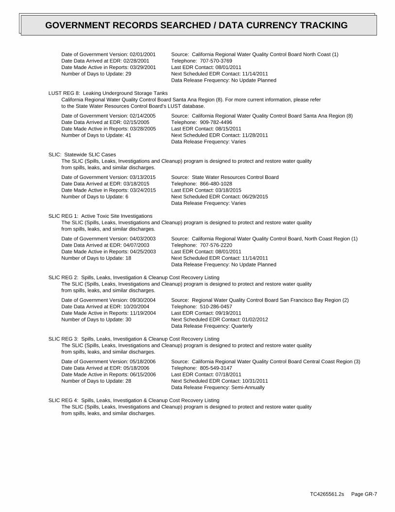
Date of Government Version: 02/01/2001Date Data Arrived at EDR: 02/28/2001Date Made Active in Reports: 03/29/2001Number of Days to Update: 29
Source: California Regional Water Quality Control Board North Coast (1)Telephone: 707-570-3769Last EDR Contact: 08/01/2011Next Scheduled EDR Contact: 11/14/2011Data Release Frequency: No Update Planned
LUST REG 8: Leaking Underground Storage TanksCalifornia Regional Water Quality Control Board Santa Ana Region (8). For more current information, please referto the State Water Resources Control Board’s LUST database.
Date of Government Version: 02/14/2005Date Data Arrived at EDR: 02/15/2005Date Made Active in Reports: 03/28/2005Number of Days to Update: 41
Source: California Regional Water Quality Control Board Santa Ana Region (8)Telephone: 909-782-4496Last EDR Contact: 08/15/2011Next Scheduled EDR Contact: 11/28/2011Data Release Frequency: Varies
SLIC: Statewide SLIC CasesThe SLIC (Spills, Leaks, Investigations and Cleanup) program is designed to protect and restore water qualityfrom spills, leaks, and similar discharges.
Date of Government Version: 03/13/2015Date Data Arrived at EDR: 03/18/2015Date Made Active in Reports: 03/24/2015Number of Days to Update: 6
Source: State Water Resources Control BoardTelephone: 866-480-1028Last EDR Contact: 03/18/2015Next Scheduled EDR Contact: 06/29/2015Data Release Frequency: Varies
SLIC REG 1: Active Toxic Site InvestigationsThe SLIC (Spills, Leaks, Investigations and Cleanup) program is designed to protect and restore water qualityfrom spills, leaks, and similar discharges.
Date of Government Version: 04/03/2003Date Data Arrived at EDR: 04/07/2003Date Made Active in Reports: 04/25/2003Number of Days to Update: 18
Source: California Regional Water Quality Control Board, North Coast Region (1)Telephone: 707-576-2220Last EDR Contact: 08/01/2011Next Scheduled EDR Contact: 11/14/2011Data Release Frequency: No Update Planned
SLIC REG 2: Spills, Leaks, Investigation & Cleanup Cost Recovery ListingThe SLIC (Spills, Leaks, Investigations and Cleanup) program is designed to protect and restore water qualityfrom spills, leaks, and similar discharges.
Date of Government Version: 09/30/2004Date Data Arrived at EDR: 10/20/2004Date Made Active in Reports: 11/19/2004Number of Days to Update: 30
Source: Regional Water Quality Control Board San Francisco Bay Region (2)Telephone: 510-286-0457Last EDR Contact: 09/19/2011Next Scheduled EDR Contact: 01/02/2012Data Release Frequency: Quarterly
SLIC REG 3: Spills, Leaks, Investigation & Cleanup Cost Recovery ListingThe SLIC (Spills, Leaks, Investigations and Cleanup) program is designed to protect and restore water qualityfrom spills, leaks, and similar discharges.
Date of Government Version: 05/18/2006Date Data Arrived at EDR: 05/18/2006Date Made Active in Reports: 06/15/2006Number of Days to Update: 28
Source: California Regional Water Quality Control Board Central Coast Region (3)Telephone: 805-549-3147Last EDR Contact: 07/18/2011Next Scheduled EDR Contact: 10/31/2011Data Release Frequency: Semi-Annually
SLIC REG 4: Spills, Leaks, Investigation & Cleanup Cost Recovery ListingThe SLIC (Spills, Leaks, Investigations and Cleanup) program is designed to protect and restore water qualityfrom spills, leaks, and similar discharges.
TC4265561.2s Page GR-7
GOVERNMENT RECORDS SEARCHED / DATA CURRENCY TRACKING
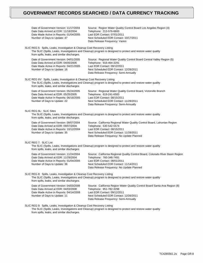
Date of Government Version: 11/17/2004Date Data Arrived at EDR: 11/18/2004Date Made Active in Reports: 01/04/2005Number of Days to Update: 47
Source: Region Water Quality Control Board Los Angeles Region (4)Telephone: 213-576-6600Last EDR Contact: 07/01/2011Next Scheduled EDR Contact: 10/17/2011Data Release Frequency: Varies
SLIC REG 5: Spills, Leaks, Investigation & Cleanup Cost Recovery ListingThe SLIC (Spills, Leaks, Investigations and Cleanup) program is designed to protect and restore water qualityfrom spills, leaks, and similar discharges.
Date of Government Version: 04/01/2005Date Data Arrived at EDR: 04/05/2005Date Made Active in Reports: 04/21/2005Number of Days to Update: 16
Source: Regional Water Quality Control Board Central Valley Region (5)Telephone: 916-464-3291Last EDR Contact: 09/12/2011Next Scheduled EDR Contact: 12/26/2011Data Release Frequency: Semi-Annually
SLIC REG 6V: Spills, Leaks, Investigation & Cleanup Cost Recovery ListingThe SLIC (Spills, Leaks, Investigations and Cleanup) program is designed to protect and restore water qualityfrom spills, leaks, and similar discharges.
Date of Government Version: 05/24/2005Date Data Arrived at EDR: 05/25/2005Date Made Active in Reports: 06/16/2005Number of Days to Update: 22
Source: Regional Water Quality Control Board, Victorville BranchTelephone: 619-241-6583Last EDR Contact: 08/15/2011Next Scheduled EDR Contact: 11/28/2011Data Release Frequency: Semi-Annually
SLIC REG 6L: SLIC SitesThe SLIC (Spills, Leaks, Investigations and Cleanup) program is designed to protect and restore water qualityfrom spills, leaks, and similar discharges.
Date of Government Version: 09/07/2004Date Data Arrived at EDR: 09/07/2004Date Made Active in Reports: 10/12/2004Number of Days to Update: 35
Source: California Regional Water Quality Control Board, Lahontan RegionTelephone: 530-542-5574Last EDR Contact: 08/15/2011Next Scheduled EDR Contact: 11/28/2011Data Release Frequency: No Update Planned
SLIC REG 7: SLIC ListThe SLIC (Spills, Leaks, Investigations and Cleanup) program is designed to protect and restore water qualityfrom spills, leaks, and similar discharges.
Date of Government Version: 11/24/2004Date Data Arrived at EDR: 11/29/2004Date Made Active in Reports: 01/04/2005Number of Days to Update: 36
Source: California Regional Quality Control Board, Colorado River Basin RegionTelephone: 760-346-7491Last EDR Contact: 08/01/2011Next Scheduled EDR Contact: 11/14/2011Data Release Frequency: No Update Planned
SLIC REG 8: Spills, Leaks, Investigation & Cleanup Cost Recovery ListingThe SLIC (Spills, Leaks, Investigations and Cleanup) program is designed to protect and restore water qualityfrom spills, leaks, and similar discharges.
Date of Government Version: 04/03/2008Date Data Arrived at EDR: 04/03/2008Date Made Active in Reports: 04/14/2008Number of Days to Update: 11
Source: California Region Water Quality Control Board Santa Ana Region (8)Telephone: 951-782-3298Last EDR Contact: 09/12/2011Next Scheduled EDR Contact: 12/26/2011Data Release Frequency: Semi-Annually
SLIC REG 9: Spills, Leaks, Investigation & Cleanup Cost Recovery ListingThe SLIC (Spills, Leaks, Investigations and Cleanup) program is designed to protect and restore water qualityfrom spills, leaks, and similar discharges.
TC4265561.2s Page GR-8
GOVERNMENT RECORDS SEARCHED / DATA CURRENCY TRACKING

Date of Government Version: 09/10/2007Date Data Arrived at EDR: 09/11/2007Date Made Active in Reports: 09/28/2007Number of Days to Update: 17
Source: California Regional Water Quality Control Board San Diego Region (9)Telephone: 858-467-2980Last EDR Contact: 08/08/2011Next Scheduled EDR Contact: 11/21/2011Data Release Frequency: Annually
INDIAN LUST R10: Leaking Underground Storage Tanks on Indian LandLUSTs on Indian land in Alaska, Idaho, Oregon and Washington.
Date of Government Version: 02/03/2015Date Data Arrived at EDR: 02/12/2015Date Made Active in Reports: 03/13/2015Number of Days to Update: 29
Source: EPA Region 10Telephone: 206-553-2857Last EDR Contact: 01/26/2015Next Scheduled EDR Contact: 05/11/2015Data Release Frequency: Quarterly
INDIAN LUST R9: Leaking Underground Storage Tanks on Indian LandLUSTs on Indian land in Arizona, California, New Mexico and Nevada
Date of Government Version: 01/08/2015Date Data Arrived at EDR: 01/08/2015Date Made Active in Reports: 02/09/2015Number of Days to Update: 32
Source: Environmental Protection AgencyTelephone: 415-972-3372Last EDR Contact: 01/08/2015Next Scheduled EDR Contact: 05/11/2015Data Release Frequency: Quarterly
INDIAN LUST R8: Leaking Underground Storage Tanks on Indian LandLUSTs on Indian land in Colorado, Montana, North Dakota, South Dakota, Utah and Wyoming.
Date of Government Version: 01/28/2015Date Data Arrived at EDR: 01/30/2015Date Made Active in Reports: 03/13/2015Number of Days to Update: 42
Source: EPA Region 8Telephone: 303-312-6271Last EDR Contact: 01/26/2015Next Scheduled EDR Contact: 05/11/2015Data Release Frequency: Quarterly
INDIAN LUST R7: Leaking Underground Storage Tanks on Indian LandLUSTs on Indian land in Iowa, Kansas, and Nebraska
Date of Government Version: 09/23/2014Date Data Arrived at EDR: 11/25/2014Date Made Active in Reports: 01/29/2015Number of Days to Update: 65
Source: EPA Region 7Telephone: 913-551-7003Last EDR Contact: 01/26/2015Next Scheduled EDR Contact: 05/11/2015Data Release Frequency: Varies
INDIAN LUST R6: Leaking Underground Storage Tanks on Indian LandLUSTs on Indian land in New Mexico and Oklahoma.
Date of Government Version: 01/23/2015Date Data Arrived at EDR: 02/10/2015Date Made Active in Reports: 03/13/2015Number of Days to Update: 31
Source: EPA Region 6Telephone: 214-665-6597Last EDR Contact: 01/26/2015Next Scheduled EDR Contact: 05/11/2015Data Release Frequency: Varies
INDIAN LUST R4: Leaking Underground Storage Tanks on Indian LandLUSTs on Indian land in Florida, Mississippi and North Carolina.
Date of Government Version: 09/30/2014Date Data Arrived at EDR: 03/03/2015Date Made Active in Reports: 03/13/2015Number of Days to Update: 10
Source: EPA Region 4Telephone: 404-562-8677Last EDR Contact: 01/26/2015Next Scheduled EDR Contact: 05/11/2015Data Release Frequency: Semi-Annually
TC4265561.2s Page GR-9
GOVERNMENT RECORDS SEARCHED / DATA CURRENCY TRACKING
INDIAN LUST R5: Leaking Underground Storage Tanks on Indian LandLeaking underground storage tanks located on Indian Land in Michigan, Minnesota and Wisconsin.
Date of Government Version: 01/30/2015Date Data Arrived at EDR: 02/05/2015Date Made Active in Reports: 03/09/2015Number of Days to Update: 32
Source: EPA, Region 5Telephone: 312-886-7439Last EDR Contact: 01/26/2015Next Scheduled EDR Contact: 05/11/2015Data Release Frequency: Varies
INDIAN LUST R1: Leaking Underground Storage Tanks on Indian LandA listing of leaking underground storage tank locations on Indian Land.
Date of Government Version: 02/01/2013Date Data Arrived at EDR: 05/01/2013Date Made Active in Reports: 11/01/2013Number of Days to Update: 184
Source: EPA Region 1Telephone: 617-918-1313Last EDR Contact: 01/30/2015Next Scheduled EDR Contact: 05/11/2015Data Release Frequency: Varies
State and tribal registered storage tank lists
UST: Active UST FacilitiesActive UST facilities gathered from the local regulatory agencies
Date of Government Version: 03/13/2015Date Data Arrived at EDR: 03/18/2015Date Made Active in Reports: 03/26/2015Number of Days to Update: 8
Source: SWRCBTelephone: 916-341-5851Last EDR Contact: 03/18/2015Next Scheduled EDR Contact: 06/29/2015Data Release Frequency: Semi-Annually
AST: Aboveground Petroleum Storage Tank FacilitiesA listing of aboveground storage tank petroleum storage tank locations.
Date of Government Version: 08/01/2009Date Data Arrived at EDR: 09/10/2009Date Made Active in Reports: 10/01/2009Number of Days to Update: 21
Source: California Environmental Protection AgencyTelephone: 916-327-5092Last EDR Contact: 07/13/2015Next Scheduled EDR Contact: 04/13/2015Data Release Frequency: Quarterly
INDIAN UST R6: Underground Storage Tanks on Indian LandThe Indian Underground Storage Tank (UST) database provides information about underground storage tanks on Indianland in EPA Region 6 (Louisiana, Arkansas, Oklahoma, New Mexico, Texas and 65 Tribes).
Date of Government Version: 01/23/2015Date Data Arrived at EDR: 02/13/2015Date Made Active in Reports: 03/13/2015Number of Days to Update: 28
Source: EPA Region 6Telephone: 214-665-7591Last EDR Contact: 01/26/2015Next Scheduled EDR Contact: 05/11/2015Data Release Frequency: Semi-Annually
INDIAN UST R7: Underground Storage Tanks on Indian LandThe Indian Underground Storage Tank (UST) database provides information about underground storage tanks on Indianland in EPA Region 7 (Iowa, Kansas, Missouri, Nebraska, and 9 Tribal Nations).
Date of Government Version: 09/23/2014Date Data Arrived at EDR: 11/25/2014Date Made Active in Reports: 01/29/2015Number of Days to Update: 65
Source: EPA Region 7Telephone: 913-551-7003Last EDR Contact: 01/26/2015Next Scheduled EDR Contact: 05/11/2015Data Release Frequency: Varies
INDIAN UST R8: Underground Storage Tanks on Indian LandThe Indian Underground Storage Tank (UST) database provides information about underground storage tanks on Indianland in EPA Region 8 (Colorado, Montana, North Dakota, South Dakota, Utah, Wyoming and 27 Tribal Nations).
TC4265561.2s Page GR-10
GOVERNMENT RECORDS SEARCHED / DATA CURRENCY TRACKING

Date of Government Version: 01/29/2015Date Data Arrived at EDR: 01/30/2015Date Made Active in Reports: 03/13/2015Number of Days to Update: 42
Source: EPA Region 8Telephone: 303-312-6137Last EDR Contact: 01/26/2015Next Scheduled EDR Contact: 05/11/2015Data Release Frequency: Quarterly
INDIAN UST R9: Underground Storage Tanks on Indian LandThe Indian Underground Storage Tank (UST) database provides information about underground storage tanks on Indianland in EPA Region 9 (Arizona, California, Hawaii, Nevada, the Pacific Islands, and Tribal Nations).
Date of Government Version: 12/14/2014Date Data Arrived at EDR: 02/13/2015Date Made Active in Reports: 03/13/2015Number of Days to Update: 28
Source: EPA Region 9Telephone: 415-972-3368Last EDR Contact: 01/26/2015Next Scheduled EDR Contact: 05/11/2015Data Release Frequency: Quarterly
INDIAN UST R1: Underground Storage Tanks on Indian LandThe Indian Underground Storage Tank (UST) database provides information about underground storage tanks on Indianland in EPA Region 1 (Connecticut, Maine, Massachusetts, New Hampshire, Rhode Island, Vermont and ten TribalNations).
Date of Government Version: 02/01/2013Date Data Arrived at EDR: 05/01/2013Date Made Active in Reports: 01/27/2014Number of Days to Update: 271
Source: EPA, Region 1Telephone: 617-918-1313Last EDR Contact: 01/30/2015Next Scheduled EDR Contact: 05/11/2015Data Release Frequency: Varies
INDIAN UST R5: Underground Storage Tanks on Indian LandThe Indian Underground Storage Tank (UST) database provides information about underground storage tanks on Indianland in EPA Region 5 (Michigan, Minnesota and Wisconsin and Tribal Nations).
Date of Government Version: 01/30/2015Date Data Arrived at EDR: 02/05/2015Date Made Active in Reports: 03/13/2015Number of Days to Update: 36
Source: EPA Region 5Telephone: 312-886-6136Last EDR Contact: 01/26/2015Next Scheduled EDR Contact: 05/11/2015Data Release Frequency: Varies
INDIAN UST R4: Underground Storage Tanks on Indian LandThe Indian Underground Storage Tank (UST) database provides information about underground storage tanks on Indianland in EPA Region 4 (Alabama, Florida, Georgia, Kentucky, Mississippi, North Carolina, South Carolina, Tennesseeand Tribal Nations)
Date of Government Version: 09/30/2014Date Data Arrived at EDR: 03/03/2015Date Made Active in Reports: 03/13/2015Number of Days to Update: 10
Source: EPA Region 4Telephone: 404-562-9424Last EDR Contact: 01/26/2015Next Scheduled EDR Contact: 05/11/2015Data Release Frequency: Semi-Annually
INDIAN UST R10: Underground Storage Tanks on Indian LandThe Indian Underground Storage Tank (UST) database provides information about underground storage tanks on Indianland in EPA Region 10 (Alaska, Idaho, Oregon, Washington, and Tribal Nations).
Date of Government Version: 02/03/2015Date Data Arrived at EDR: 02/12/2015Date Made Active in Reports: 03/13/2015Number of Days to Update: 29
Source: EPA Region 10Telephone: 206-553-2857Last EDR Contact: 01/26/2015Next Scheduled EDR Contact: 05/11/2015Data Release Frequency: Quarterly
FEMA UST: Underground Storage Tank ListingA listing of all FEMA owned underground storage tanks.
TC4265561.2s Page GR-11
GOVERNMENT RECORDS SEARCHED / DATA CURRENCY TRACKING

Date of Government Version: 01/01/2010Date Data Arrived at EDR: 02/16/2010Date Made Active in Reports: 04/12/2010Number of Days to Update: 55
Source: FEMATelephone: 202-646-5797Last EDR Contact: 04/13/2015Next Scheduled EDR Contact: 07/27/2015Data Release Frequency: Varies
State and tribal voluntary cleanup sites
INDIAN VCP R7: Voluntary Cleanup Priority LisitngA listing of voluntary cleanup priority sites located on Indian Land located in Region 7.
Date of Government Version: 03/20/2008Date Data Arrived at EDR: 04/22/2008Date Made Active in Reports: 05/19/2008Number of Days to Update: 27
Source: EPA, Region 7Telephone: 913-551-7365Last EDR Contact: 04/20/2009Next Scheduled EDR Contact: 07/20/2009Data Release Frequency: Varies
INDIAN VCP R1: Voluntary Cleanup Priority ListingA listing of voluntary cleanup priority sites located on Indian Land located in Region 1.
Date of Government Version: 09/29/2014Date Data Arrived at EDR: 10/01/2014Date Made Active in Reports: 11/06/2014Number of Days to Update: 36
Source: EPA, Region 1Telephone: 617-918-1102Last EDR Contact: 04/02/2015Next Scheduled EDR Contact: 07/13/2015Data Release Frequency: Varies
VCP: Voluntary Cleanup Program PropertiesContains low threat level properties with either confirmed or unconfirmed releases and the project proponentshave request that DTSC oversee investigation and/or cleanup activities and have agreed to provide coverage forDTSC’s costs.
Date of Government Version: 03/11/2015Date Data Arrived at EDR: 03/12/2015Date Made Active in Reports: 03/18/2015Number of Days to Update: 6
Source: Department of Toxic Substances ControlTelephone: 916-323-3400Last EDR Contact: 03/12/2015Next Scheduled EDR Contact: 05/18/2015Data Release Frequency: Quarterly
ADDITIONAL ENVIRONMENTAL RECORDS
Local Brownfield lists
US BROWNFIELDS: A Listing of Brownfields SitesBrownfields are real property, the expansion, redevelopment, or reuse of which may be complicated by the presenceor potential presence of a hazardous substance, pollutant, or contaminant. Cleaning up and reinvesting in theseproperties takes development pressures off of undeveloped, open land, and both improves and protects the environment.Assessment, Cleanup and Redevelopment Exchange System (ACRES) stores information reported by EPA Brownfieldsgrant recipients on brownfields properties assessed or cleaned up with grant funding as well as information onTargeted Brownfields Assessments performed by EPA Regions. A listing of ACRES Brownfield sites is obtained fromCleanups in My Community. Cleanups in My Community provides information on Brownfields properties for which informationis reported back to EPA, as well as areas served by Brownfields grant programs.
Date of Government Version: 12/22/2014Date Data Arrived at EDR: 12/22/2014Date Made Active in Reports: 01/29/2015Number of Days to Update: 38
Source: Environmental Protection AgencyTelephone: 202-566-2777Last EDR Contact: 03/24/2015Next Scheduled EDR Contact: 07/06/2015Data Release Frequency: Semi-Annually
Local Lists of Landfill / Solid Waste Disposal Sites
TC4265561.2s Page GR-12
GOVERNMENT RECORDS SEARCHED / DATA CURRENCY TRACKING
DEBRIS REGION 9: Torres Martinez Reservation Illegal Dump Site LocationsA listing of illegal dump sites location on the Torres Martinez Indian Reservation located in eastern RiversideCounty and northern Imperial County, California.
Date of Government Version: 01/12/2009Date Data Arrived at EDR: 05/07/2009Date Made Active in Reports: 09/21/2009Number of Days to Update: 137
Source: EPA, Region 9Telephone: 415-947-4219Last EDR Contact: 01/26/2015Next Scheduled EDR Contact: 05/11/2015Data Release Frequency: No Update Planned
ODI: Open Dump InventoryAn open dump is defined as a disposal facility that does not comply with one or more of the Part 257 or Part 258Subtitle D Criteria.
Date of Government Version: 06/30/1985Date Data Arrived at EDR: 08/09/2004Date Made Active in Reports: 09/17/2004Number of Days to Update: 39
Source: Environmental Protection AgencyTelephone: 800-424-9346Last EDR Contact: 06/09/2004Next Scheduled EDR Contact: N/AData Release Frequency: No Update Planned
SWRCY: Recycler DatabaseA listing of recycling facilities in California.
Date of Government Version: 03/16/2015Date Data Arrived at EDR: 03/18/2015Date Made Active in Reports: 03/26/2015Number of Days to Update: 8
Source: Department of ConservationTelephone: 916-323-3836Last EDR Contact: 03/18/2015Next Scheduled EDR Contact: 06/29/2015Data Release Frequency: Quarterly
HAULERS: Registered Waste Tire Haulers ListingA listing of registered waste tire haulers.
Date of Government Version: 04/04/2015Date Data Arrived at EDR: 04/07/2015Date Made Active in Reports: 04/13/2015Number of Days to Update: 6
Source: Integrated Waste Management BoardTelephone: 916-341-6422Last EDR Contact: 02/16/2015Next Scheduled EDR Contact: 06/01/2015Data Release Frequency: Varies
INDIAN ODI: Report on the Status of Open Dumps on Indian LandsLocation of open dumps on Indian land.
Date of Government Version: 12/31/1998Date Data Arrived at EDR: 12/03/2007Date Made Active in Reports: 01/24/2008Number of Days to Update: 52
Source: Environmental Protection AgencyTelephone: 703-308-8245Last EDR Contact: 02/02/2015Next Scheduled EDR Contact: 05/18/2015Data Release Frequency: Varies
WMUDS/SWAT: Waste Management Unit DatabaseWaste Management Unit Database System. WMUDS is used by the State Water Resources Control Board staff and theRegional Water Quality Control Boards for program tracking and inventory of waste management units. WMUDS is composedof the following databases: Facility Information, Scheduled Inspections Information, Waste Management Unit Information,SWAT Program Information, SWAT Report Summary Information, SWAT Report Summary Data, Chapter 15 (formerly Subchapter15) Information, Chapter 15 Monitoring Parameters, TPCA Program Information, RCRA Program Information, ClosureInformation, and Interested Parties Information.
Date of Government Version: 04/01/2000Date Data Arrived at EDR: 04/10/2000Date Made Active in Reports: 05/10/2000Number of Days to Update: 30
Source: State Water Resources Control BoardTelephone: 916-227-4448Last EDR Contact: 02/09/2015Next Scheduled EDR Contact: 05/25/2015Data Release Frequency: No Update Planned
TC4265561.2s Page GR-13
GOVERNMENT RECORDS SEARCHED / DATA CURRENCY TRACKING
Local Lists of Hazardous waste / Contaminated Sites
US CDL: Clandestine Drug LabsA listing of clandestine drug lab locations. The U.S. Department of Justice ("the Department") provides thisweb site as a public service. It contains addresses of some locations where law enforcement agencies reportedthey found chemicals or other items that indicated the presence of either clandestine drug laboratories or dumpsites.In most cases, the source of the entries is not the Department, and the Department has not verified the entryand does not guarantee its accuracy. Members of the public must verify the accuracy of all entries by, for example,contacting local law enforcement and local health departments.
Date of Government Version: 02/25/2015Date Data Arrived at EDR: 03/10/2015Date Made Active in Reports: 03/25/2015Number of Days to Update: 15
Source: Drug Enforcement AdministrationTelephone: 202-307-1000Last EDR Contact: 03/03/2015Next Scheduled EDR Contact: 06/15/2015Data Release Frequency: Quarterly
HIST CAL-SITES: Calsites DatabaseThe Calsites database contains potential or confirmed hazardous substance release properties. In 1996, CaliforniaEPA reevaluated and significantly reduced the number of sites in the Calsites database. No longer updated by thestate agency. It has been replaced by ENVIROSTOR.
Date of Government Version: 08/08/2005Date Data Arrived at EDR: 08/03/2006Date Made Active in Reports: 08/24/2006Number of Days to Update: 21
Source: Department of Toxic Substance ControlTelephone: 916-323-3400Last EDR Contact: 02/23/2009Next Scheduled EDR Contact: 05/25/2009Data Release Frequency: No Update Planned
SCH: School Property Evaluation ProgramThis category contains proposed and existing school sites that are being evaluated by DTSC for possible hazardousmaterials contamination. In some cases, these properties may be listed in the CalSites category depending on thelevel of threat to public health and safety or the environment they pose.
Date of Government Version: 03/11/2015Date Data Arrived at EDR: 03/12/2015Date Made Active in Reports: 03/18/2015Number of Days to Update: 6
Source: Department of Toxic Substances ControlTelephone: 916-323-3400Last EDR Contact: 03/12/2015Next Scheduled EDR Contact: 05/18/2015Data Release Frequency: Quarterly
TOXIC PITS: Toxic Pits Cleanup Act SitesToxic PITS Cleanup Act Sites. TOXIC PITS identifies sites suspected of containing hazardous substances where cleanuphas not yet been completed.
Date of Government Version: 07/01/1995Date Data Arrived at EDR: 08/30/1995Date Made Active in Reports: 09/26/1995Number of Days to Update: 27
Source: State Water Resources Control BoardTelephone: 916-227-4364Last EDR Contact: 01/26/2009Next Scheduled EDR Contact: 04/27/2009Data Release Frequency: No Update Planned
CDL: Clandestine Drug LabsA listing of drug lab locations. Listing of a location in this database does not indicate that any illegal druglab materials were or were not present there, and does not constitute a determination that the location eitherrequires or does not require additional cleanup work.
Date of Government Version: 12/31/2014Date Data Arrived at EDR: 03/10/2015Date Made Active in Reports: 03/18/2015Number of Days to Update: 8
Source: Department of Toxic Substances ControlTelephone: 916-255-6504Last EDR Contact: 04/13/2015Next Scheduled EDR Contact: 07/27/2015Data Release Frequency: Varies
TC4265561.2s Page GR-14
GOVERNMENT RECORDS SEARCHED / DATA CURRENCY TRACKING
US HIST CDL: National Clandestine Laboratory RegisterA listing of clandestine drug lab locations. The U.S. Department of Justice ("the Department") provides thisweb site as a public service. It contains addresses of some locations where law enforcement agencies reportedthey found chemicals or other items that indicated the presence of either clandestine drug laboratories or dumpsites.In most cases, the source of the entries is not the Department, and the Department has not verified the entryand does not guarantee its accuracy. Members of the public must verify the accuracy of all entries by, for example,contacting local law enforcement and local health departments.
Date of Government Version: 02/25/2015Date Data Arrived at EDR: 03/10/2015Date Made Active in Reports: 03/25/2015Number of Days to Update: 15
Source: Drug Enforcement AdministrationTelephone: 202-307-1000Last EDR Contact: 03/03/2015Next Scheduled EDR Contact: 06/15/2015Data Release Frequency: No Update Planned
Local Lists of Registered Storage Tanks
CA FID UST: Facility Inventory DatabaseThe Facility Inventory Database (FID) contains a historical listing of active and inactive underground storagetank locations from the State Water Resource Control Board. Refer to local/county source for current data.
Date of Government Version: 10/31/1994Date Data Arrived at EDR: 09/05/1995Date Made Active in Reports: 09/29/1995Number of Days to Update: 24
Source: California Environmental Protection AgencyTelephone: 916-341-5851Last EDR Contact: 12/28/1998Next Scheduled EDR Contact: N/AData Release Frequency: No Update Planned
UST MENDOCINO: Mendocino County UST DatabaseA listing of underground storage tank locations in Mendocino County.
Date of Government Version: 09/23/2009Date Data Arrived at EDR: 09/23/2009Date Made Active in Reports: 10/01/2009Number of Days to Update: 8
Source: Department of Public HealthTelephone: 707-463-4466Last EDR Contact: 02/26/2015Next Scheduled EDR Contact: 06/15/2015Data Release Frequency: Annually
HIST UST: Hazardous Substance Storage Container DatabaseThe Hazardous Substance Storage Container Database is a historical listing of UST sites. Refer to local/countysource for current data.
Date of Government Version: 10/15/1990Date Data Arrived at EDR: 01/25/1991Date Made Active in Reports: 02/12/1991Number of Days to Update: 18
Source: State Water Resources Control BoardTelephone: 916-341-5851Last EDR Contact: 07/26/2001Next Scheduled EDR Contact: N/AData Release Frequency: No Update Planned
SWEEPS UST: SWEEPS UST ListingStatewide Environmental Evaluation and Planning System. This underground storage tank listing was updated andmaintained by a company contacted by the SWRCB in the early 1990’s. The listing is no longer updated or maintained.The local agency is the contact for more information on a site on the SWEEPS list.
Date of Government Version: 06/01/1994Date Data Arrived at EDR: 07/07/2005Date Made Active in Reports: 08/11/2005Number of Days to Update: 35
Source: State Water Resources Control BoardTelephone: N/ALast EDR Contact: 06/03/2005Next Scheduled EDR Contact: N/AData Release Frequency: No Update Planned
Local Land Records
LIENS 2: CERCLA Lien InformationA Federal CERCLA (’Superfund’) lien can exist by operation of law at any site or property at which EPA has spentSuperfund monies. These monies are spent to investigate and address releases and threatened releases of contamination.CERCLIS provides information as to the identity of these sites and properties.
TC4265561.2s Page GR-15
GOVERNMENT RECORDS SEARCHED / DATA CURRENCY TRACKING
Date of Government Version: 02/18/2014Date Data Arrived at EDR: 03/18/2014Date Made Active in Reports: 04/24/2014Number of Days to Update: 37
Source: Environmental Protection AgencyTelephone: 202-564-6023Last EDR Contact: 01/30/2015Next Scheduled EDR Contact: 05/11/2015Data Release Frequency: Varies
LIENS: Environmental Liens ListingA listing of property locations with environmental liens for California where DTSC is a lien holder.
Date of Government Version: 03/11/2015Date Data Arrived at EDR: 03/13/2015Date Made Active in Reports: 03/24/2015Number of Days to Update: 11
Source: Department of Toxic Substances ControlTelephone: 916-323-3400Last EDR Contact: 03/09/2015Next Scheduled EDR Contact: 06/22/2015Data Release Frequency: Varies
DEED: Deed Restriction ListingSite Mitigation and Brownfields Reuse Program Facility Sites with Deed Restrictions & Hazardous Waste ManagementProgram Facility Sites with Deed / Land Use Restriction. The DTSC Site Mitigation and Brownfields Reuse Program(SMBRP) list includes sites cleaned up under the program’s oversight and generally does not include currentor former hazardous waste facilities that required a hazardous waste facility permit. The list represents deedrestrictions that are active. Some sites have multiple deed restrictions. The DTSC Hazardous Waste ManagementProgram (HWMP) has developed a list of current or former hazardous waste facilities that have a recorded landuse restriction at the local county recorder’s office. The land use restrictions on this list were required bythe DTSC HWMP as a result of the presence of hazardous substances that remain on site after the facility (orpart of the facility) has been closed or cleaned up. The types of land use restriction include deed notice, deedrestriction, or a land use restriction that binds current and future owners.
Date of Government Version: 03/09/2015Date Data Arrived at EDR: 03/10/2015Date Made Active in Reports: 03/18/2015Number of Days to Update: 8
Source: DTSC and SWRCBTelephone: 916-323-3400Last EDR Contact: 03/10/2015Next Scheduled EDR Contact: 06/22/2015Data Release Frequency: Semi-Annually
Records of Emergency Release Reports
HMIRS: Hazardous Materials Information Reporting SystemHazardous Materials Incident Report System. HMIRS contains hazardous material spill incidents reported to DOT.
Date of Government Version: 12/29/2014Date Data Arrived at EDR: 12/30/2014Date Made Active in Reports: 03/09/2015Number of Days to Update: 69
Source: U.S. Department of TransportationTelephone: 202-366-4555Last EDR Contact: 03/31/2015Next Scheduled EDR Contact: 07/13/2015Data Release Frequency: Annually
CHMIRS: California Hazardous Material Incident Report SystemCalifornia Hazardous Material Incident Reporting System. CHMIRS contains information on reported hazardous materialincidents (accidental releases or spills).
Date of Government Version: 01/21/2015Date Data Arrived at EDR: 01/28/2015Date Made Active in Reports: 02/26/2015Number of Days to Update: 29
Source: Office of Emergency ServicesTelephone: 916-845-8400Last EDR Contact: 01/28/2015Next Scheduled EDR Contact: 05/11/2015Data Release Frequency: Varies
LDS: Land Disposal Sites ListingThe Land Disposal program regulates of waste discharge to land for treatment, storage and disposal in waste managementunits.
Date of Government Version: 03/13/2015Date Data Arrived at EDR: 03/18/2015Date Made Active in Reports: 03/24/2015Number of Days to Update: 6
Source: State Water Qualilty Control BoardTelephone: 866-480-1028Last EDR Contact: 03/18/2015Next Scheduled EDR Contact: 06/29/2015Data Release Frequency: Quarterly
TC4265561.2s Page GR-16
GOVERNMENT RECORDS SEARCHED / DATA CURRENCY TRACKING
MCS: Military Cleanup Sites ListingThe State Water Resources Control Board and nine Regional Water Quality Control Boards partner with the Departmentof Defense (DoD) through the Defense and State Memorandum of Agreement (DSMOA) to oversee the investigationand remediation of water quality issues at military facilities.
Date of Government Version: 03/13/2015Date Data Arrived at EDR: 03/18/2015Date Made Active in Reports: 03/24/2015Number of Days to Update: 6
Source: State Water Resources Control BoardTelephone: 866-480-1028Last EDR Contact: 03/18/2015Next Scheduled EDR Contact: 06/29/2015Data Release Frequency: Quarterly
SPILLS 90: SPILLS90 data from FirstSearchSpills 90 includes those spill and release records available exclusively from FirstSearch databases. Typically,they may include chemical, oil and/or hazardous substance spills recorded after 1990. Duplicate records that arealready included in EDR incident and release records are not included in Spills 90.
Date of Government Version: 06/06/2012Date Data Arrived at EDR: 01/03/2013Date Made Active in Reports: 02/22/2013Number of Days to Update: 50
Source: FirstSearchTelephone: N/ALast EDR Contact: 01/03/2013Next Scheduled EDR Contact: N/AData Release Frequency: No Update Planned
Other Ascertainable Records
RCRA NonGen / NLR: RCRA - Non GeneratorsRCRAInfo is EPA’s comprehensive information system, providing access to data supporting the Resource Conservationand Recovery Act (RCRA) of 1976 and the Hazardous and Solid Waste Amendments (HSWA) of 1984. The databaseincludes selective information on sites which generate, transport, store, treat and/or dispose of hazardous wasteas defined by the Resource Conservation and Recovery Act (RCRA). Non-Generators do not presently generate hazardouswaste.
Date of Government Version: 12/09/2014Date Data Arrived at EDR: 12/29/2014Date Made Active in Reports: 01/29/2015Number of Days to Update: 31
Source: Environmental Protection AgencyTelephone: (415) 495-8895Last EDR Contact: 03/31/2015Next Scheduled EDR Contact: 07/13/2015Data Release Frequency: Varies
DOT OPS: Incident and Accident DataDepartment of Transporation, Office of Pipeline Safety Incident and Accident data.
Date of Government Version: 07/31/2012Date Data Arrived at EDR: 08/07/2012Date Made Active in Reports: 09/18/2012Number of Days to Update: 42
Source: Department of Transporation, Office of Pipeline SafetyTelephone: 202-366-4595Last EDR Contact: 02/03/2015Next Scheduled EDR Contact: 05/18/2015Data Release Frequency: Varies
DOD: Department of Defense SitesThis data set consists of federally owned or administered lands, administered by the Department of Defense, thathave any area equal to or greater than 640 acres of the United States, Puerto Rico, and the U.S. Virgin Islands.
Date of Government Version: 12/31/2005Date Data Arrived at EDR: 11/10/2006Date Made Active in Reports: 01/11/2007Number of Days to Update: 62
Source: USGSTelephone: 888-275-8747Last EDR Contact: 04/14/2015Next Scheduled EDR Contact: 07/27/2015Data Release Frequency: Semi-Annually
FUDS: Formerly Used Defense SitesThe listing includes locations of Formerly Used Defense Sites properties where the US Army Corps of Engineersis actively working or will take necessary cleanup actions.
TC4265561.2s Page GR-17
GOVERNMENT RECORDS SEARCHED / DATA CURRENCY TRACKING
Date of Government Version: 06/06/2014Date Data Arrived at EDR: 09/10/2014Date Made Active in Reports: 09/18/2014Number of Days to Update: 8
Source: U.S. Army Corps of EngineersTelephone: 202-528-4285Last EDR Contact: 03/13/2015Next Scheduled EDR Contact: 06/22/2015Data Release Frequency: Varies
CONSENT: Superfund (CERCLA) Consent DecreesMajor legal settlements that establish responsibility and standards for cleanup at NPL (Superfund) sites. Releasedperiodically by United States District Courts after settlement by parties to litigation matters.
Date of Government Version: 01/23/2015Date Data Arrived at EDR: 02/13/2015Date Made Active in Reports: 03/09/2015Number of Days to Update: 24
Source: Department of Justice, Consent Decree LibraryTelephone: VariesLast EDR Contact: 03/30/2015Next Scheduled EDR Contact: 07/13/2015Data Release Frequency: Varies
ROD: Records Of DecisionRecord of Decision. ROD documents mandate a permanent remedy at an NPL (Superfund) site containing technicaland health information to aid in the cleanup.
Date of Government Version: 11/25/2013Date Data Arrived at EDR: 12/12/2013Date Made Active in Reports: 02/24/2014Number of Days to Update: 74
Source: EPATelephone: 703-416-0223Last EDR Contact: 03/10/2015Next Scheduled EDR Contact: 06/22/2015Data Release Frequency: Annually
UMTRA: Uranium Mill Tailings SitesUranium ore was mined by private companies for federal government use in national defense programs. When the millsshut down, large piles of the sand-like material (mill tailings) remain after uranium has been extracted fromthe ore. Levels of human exposure to radioactive materials from the piles are low; however, in some cases tailingswere used as construction materials before the potential health hazards of the tailings were recognized.
Date of Government Version: 09/14/2010Date Data Arrived at EDR: 10/07/2011Date Made Active in Reports: 03/01/2012Number of Days to Update: 146
Source: Department of EnergyTelephone: 505-845-0011Last EDR Contact: 02/27/2015Next Scheduled EDR Contact: 06/08/2015Data Release Frequency: Varies
US MINES: Mines Master Index FileContains all mine identification numbers issued for mines active or opened since 1971. The data also includesviolation information.
Date of Government Version: 12/30/2014Date Data Arrived at EDR: 12/31/2014Date Made Active in Reports: 01/29/2015Number of Days to Update: 29
Source: Department of Labor, Mine Safety and Health AdministrationTelephone: 303-231-5959Last EDR Contact: 03/06/2015Next Scheduled EDR Contact: 06/15/2015Data Release Frequency: Semi-Annually
TRIS: Toxic Chemical Release Inventory SystemToxic Release Inventory System. TRIS identifies facilities which release toxic chemicals to the air, water andland in reportable quantities under SARA Title III Section 313.
Date of Government Version: 12/31/2011Date Data Arrived at EDR: 07/31/2013Date Made Active in Reports: 09/13/2013Number of Days to Update: 44
Source: EPATelephone: 202-566-0250Last EDR Contact: 01/29/2015Next Scheduled EDR Contact: 06/08/2015Data Release Frequency: Annually
TSCA: Toxic Substances Control ActToxic Substances Control Act. TSCA identifies manufacturers and importers of chemical substances included on theTSCA Chemical Substance Inventory list. It includes data on the production volume of these substances by plantsite.
TC4265561.2s Page GR-18
GOVERNMENT RECORDS SEARCHED / DATA CURRENCY TRACKING
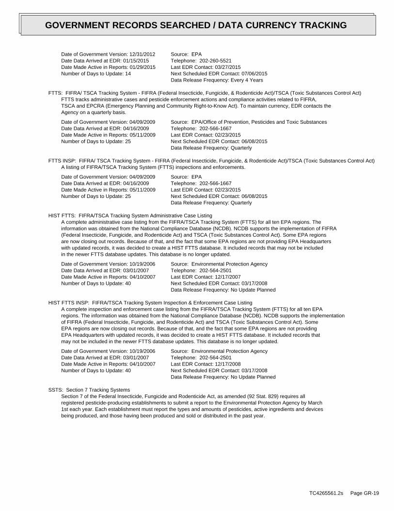
Date of Government Version: 12/31/2012Date Data Arrived at EDR: 01/15/2015Date Made Active in Reports: 01/29/2015Number of Days to Update: 14
Source: EPATelephone: 202-260-5521Last EDR Contact: 03/27/2015Next Scheduled EDR Contact: 07/06/2015Data Release Frequency: Every 4 Years
FTTS: FIFRA/ TSCA Tracking System - FIFRA (Federal Insecticide, Fungicide, & Rodenticide Act)/TSCA (Toxic Substances Control Act)FTTS tracks administrative cases and pesticide enforcement actions and compliance activities related to FIFRA,TSCA and EPCRA (Emergency Planning and Community Right-to-Know Act). To maintain currency, EDR contacts theAgency on a quarterly basis.
Date of Government Version: 04/09/2009Date Data Arrived at EDR: 04/16/2009Date Made Active in Reports: 05/11/2009Number of Days to Update: 25
Source: EPA/Office of Prevention, Pesticides and Toxic SubstancesTelephone: 202-566-1667Last EDR Contact: 02/23/2015Next Scheduled EDR Contact: 06/08/2015Data Release Frequency: Quarterly
FTTS INSP: FIFRA/ TSCA Tracking System - FIFRA (Federal Insecticide, Fungicide, & Rodenticide Act)/TSCA (Toxic Substances Control Act)A listing of FIFRA/TSCA Tracking System (FTTS) inspections and enforcements.
Date of Government Version: 04/09/2009Date Data Arrived at EDR: 04/16/2009Date Made Active in Reports: 05/11/2009Number of Days to Update: 25
Source: EPATelephone: 202-566-1667Last EDR Contact: 02/23/2015Next Scheduled EDR Contact: 06/08/2015Data Release Frequency: Quarterly
HIST FTTS: FIFRA/TSCA Tracking System Administrative Case ListingA complete administrative case listing from the FIFRA/TSCA Tracking System (FTTS) for all ten EPA regions. Theinformation was obtained from the National Compliance Database (NCDB). NCDB supports the implementation of FIFRA(Federal Insecticide, Fungicide, and Rodenticide Act) and TSCA (Toxic Substances Control Act). Some EPA regionsare now closing out records. Because of that, and the fact that some EPA regions are not providing EPA Headquarterswith updated records, it was decided to create a HIST FTTS database. It included records that may not be includedin the newer FTTS database updates. This database is no longer updated.
Date of Government Version: 10/19/2006Date Data Arrived at EDR: 03/01/2007Date Made Active in Reports: 04/10/2007Number of Days to Update: 40
Source: Environmental Protection AgencyTelephone: 202-564-2501Last EDR Contact: 12/17/2007Next Scheduled EDR Contact: 03/17/2008Data Release Frequency: No Update Planned
HIST FTTS INSP: FIFRA/TSCA Tracking System Inspection & Enforcement Case ListingA complete inspection and enforcement case listing from the FIFRA/TSCA Tracking System (FTTS) for all ten EPAregions. The information was obtained from the National Compliance Database (NCDB). NCDB supports the implementationof FIFRA (Federal Insecticide, Fungicide, and Rodenticide Act) and TSCA (Toxic Substances Control Act). SomeEPA regions are now closing out records. Because of that, and the fact that some EPA regions are not providingEPA Headquarters with updated records, it was decided to create a HIST FTTS database. It included records thatmay not be included in the newer FTTS database updates. This database is no longer updated.
Date of Government Version: 10/19/2006Date Data Arrived at EDR: 03/01/2007Date Made Active in Reports: 04/10/2007Number of Days to Update: 40
Source: Environmental Protection AgencyTelephone: 202-564-2501Last EDR Contact: 12/17/2008Next Scheduled EDR Contact: 03/17/2008Data Release Frequency: No Update Planned
SSTS: Section 7 Tracking SystemsSection 7 of the Federal Insecticide, Fungicide and Rodenticide Act, as amended (92 Stat. 829) requires allregistered pesticide-producing establishments to submit a report to the Environmental Protection Agency by March1st each year. Each establishment must report the types and amounts of pesticides, active ingredients and devicesbeing produced, and those having been produced and sold or distributed in the past year.
TC4265561.2s Page GR-19
GOVERNMENT RECORDS SEARCHED / DATA CURRENCY TRACKING
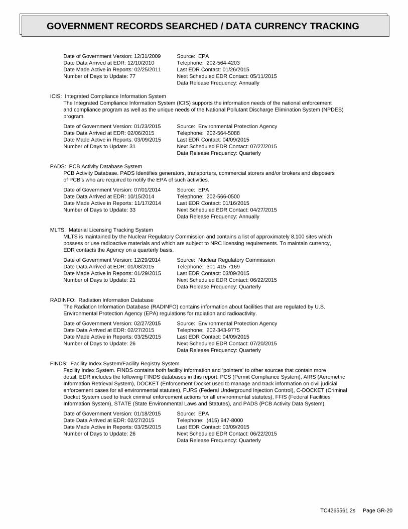
Date of Government Version: 12/31/2009Date Data Arrived at EDR: 12/10/2010Date Made Active in Reports: 02/25/2011Number of Days to Update: 77
Source: EPATelephone: 202-564-4203Last EDR Contact: 01/26/2015Next Scheduled EDR Contact: 05/11/2015Data Release Frequency: Annually
ICIS: Integrated Compliance Information SystemThe Integrated Compliance Information System (ICIS) supports the information needs of the national enforcementand compliance program as well as the unique needs of the National Pollutant Discharge Elimination System (NPDES)program.
Date of Government Version: 01/23/2015Date Data Arrived at EDR: 02/06/2015Date Made Active in Reports: 03/09/2015Number of Days to Update: 31
Source: Environmental Protection AgencyTelephone: 202-564-5088Last EDR Contact: 04/09/2015Next Scheduled EDR Contact: 07/27/2015Data Release Frequency: Quarterly
PADS: PCB Activity Database SystemPCB Activity Database. PADS Identifies generators, transporters, commercial storers and/or brokers and disposersof PCB’s who are required to notify the EPA of such activities.
Date of Government Version: 07/01/2014Date Data Arrived at EDR: 10/15/2014Date Made Active in Reports: 11/17/2014Number of Days to Update: 33
Source: EPATelephone: 202-566-0500Last EDR Contact: 01/16/2015Next Scheduled EDR Contact: 04/27/2015Data Release Frequency: Annually
MLTS: Material Licensing Tracking SystemMLTS is maintained by the Nuclear Regulatory Commission and contains a list of approximately 8,100 sites whichpossess or use radioactive materials and which are subject to NRC licensing requirements. To maintain currency,EDR contacts the Agency on a quarterly basis.
Date of Government Version: 12/29/2014Date Data Arrived at EDR: 01/08/2015Date Made Active in Reports: 01/29/2015Number of Days to Update: 21
Source: Nuclear Regulatory CommissionTelephone: 301-415-7169Last EDR Contact: 03/09/2015Next Scheduled EDR Contact: 06/22/2015Data Release Frequency: Quarterly
RADINFO: Radiation Information DatabaseThe Radiation Information Database (RADINFO) contains information about facilities that are regulated by U.S.Environmental Protection Agency (EPA) regulations for radiation and radioactivity.
Date of Government Version: 02/27/2015Date Data Arrived at EDR: 02/27/2015Date Made Active in Reports: 03/25/2015Number of Days to Update: 26
Source: Environmental Protection AgencyTelephone: 202-343-9775Last EDR Contact: 04/09/2015Next Scheduled EDR Contact: 07/20/2015Data Release Frequency: Quarterly
FINDS: Facility Index System/Facility Registry SystemFacility Index System. FINDS contains both facility information and ’pointers’ to other sources that contain moredetail. EDR includes the following FINDS databases in this report: PCS (Permit Compliance System), AIRS (AerometricInformation Retrieval System), DOCKET (Enforcement Docket used to manage and track information on civil judicialenforcement cases for all environmental statutes), FURS (Federal Underground Injection Control), C-DOCKET (CriminalDocket System used to track criminal enforcement actions for all environmental statutes), FFIS (Federal FacilitiesInformation System), STATE (State Environmental Laws and Statutes), and PADS (PCB Activity Data System).
Date of Government Version: 01/18/2015Date Data Arrived at EDR: 02/27/2015Date Made Active in Reports: 03/25/2015Number of Days to Update: 26
Source: EPATelephone: (415) 947-8000Last EDR Contact: 03/09/2015Next Scheduled EDR Contact: 06/22/2015Data Release Frequency: Quarterly
TC4265561.2s Page GR-20
GOVERNMENT RECORDS SEARCHED / DATA CURRENCY TRACKING
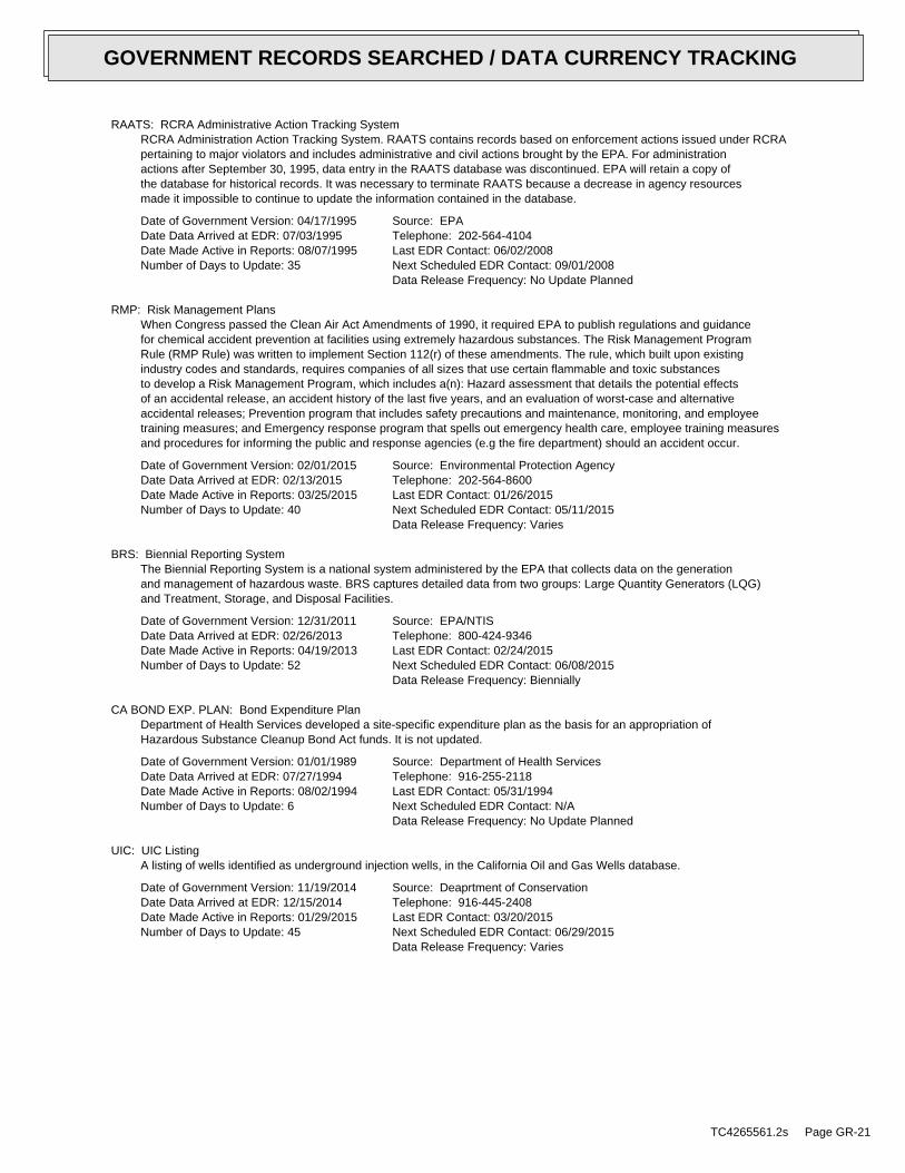
RAATS: RCRA Administrative Action Tracking SystemRCRA Administration Action Tracking System. RAATS contains records based on enforcement actions issued under RCRApertaining to major violators and includes administrative and civil actions brought by the EPA. For administrationactions after September 30, 1995, data entry in the RAATS database was discontinued. EPA will retain a copy ofthe database for historical records. It was necessary to terminate RAATS because a decrease in agency resourcesmade it impossible to continue to update the information contained in the database.
Date of Government Version: 04/17/1995Date Data Arrived at EDR: 07/03/1995Date Made Active in Reports: 08/07/1995Number of Days to Update: 35
Source: EPATelephone: 202-564-4104Last EDR Contact: 06/02/2008Next Scheduled EDR Contact: 09/01/2008Data Release Frequency: No Update Planned
RMP: Risk Management PlansWhen Congress passed the Clean Air Act Amendments of 1990, it required EPA to publish regulations and guidancefor chemical accident prevention at facilities using extremely hazardous substances. The Risk Management ProgramRule (RMP Rule) was written to implement Section 112(r) of these amendments. The rule, which built upon existingindustry codes and standards, requires companies of all sizes that use certain flammable and toxic substancesto develop a Risk Management Program, which includes a(n): Hazard assessment that details the potential effectsof an accidental release, an accident history of the last five years, and an evaluation of worst-case and alternativeaccidental releases; Prevention program that includes safety precautions and maintenance, monitoring, and employeetraining measures; and Emergency response program that spells out emergency health care, employee training measuresand procedures for informing the public and response agencies (e.g the fire department) should an accident occur.
Date of Government Version: 02/01/2015Date Data Arrived at EDR: 02/13/2015Date Made Active in Reports: 03/25/2015Number of Days to Update: 40
Source: Environmental Protection AgencyTelephone: 202-564-8600Last EDR Contact: 01/26/2015Next Scheduled EDR Contact: 05/11/2015Data Release Frequency: Varies
BRS: Biennial Reporting SystemThe Biennial Reporting System is a national system administered by the EPA that collects data on the generationand management of hazardous waste. BRS captures detailed data from two groups: Large Quantity Generators (LQG)and Treatment, Storage, and Disposal Facilities.
Date of Government Version: 12/31/2011Date Data Arrived at EDR: 02/26/2013Date Made Active in Reports: 04/19/2013Number of Days to Update: 52
Source: EPA/NTISTelephone: 800-424-9346Last EDR Contact: 02/24/2015Next Scheduled EDR Contact: 06/08/2015Data Release Frequency: Biennially
CA BOND EXP. PLAN: Bond Expenditure PlanDepartment of Health Services developed a site-specific expenditure plan as the basis for an appropriation ofHazardous Substance Cleanup Bond Act funds. It is not updated.
Date of Government Version: 01/01/1989Date Data Arrived at EDR: 07/27/1994Date Made Active in Reports: 08/02/1994Number of Days to Update: 6
Source: Department of Health ServicesTelephone: 916-255-2118Last EDR Contact: 05/31/1994Next Scheduled EDR Contact: N/AData Release Frequency: No Update Planned
UIC: UIC ListingA listing of wells identified as underground injection wells, in the California Oil and Gas Wells database.
Date of Government Version: 11/19/2014Date Data Arrived at EDR: 12/15/2014Date Made Active in Reports: 01/29/2015Number of Days to Update: 45
Source: Deaprtment of ConservationTelephone: 916-445-2408Last EDR Contact: 03/20/2015Next Scheduled EDR Contact: 06/29/2015Data Release Frequency: Varies
TC4265561.2s Page GR-21
GOVERNMENT RECORDS SEARCHED / DATA CURRENCY TRACKING

NPDES: NPDES Permits ListingA listing of NPDES permits, including stormwater.
Date of Government Version: 03/12/2015Date Data Arrived at EDR: 03/13/2015Date Made Active in Reports: 03/24/2015Number of Days to Update: 11
Source: State Water Resources Control BoardTelephone: 916-445-9379Last EDR Contact: 03/13/2015Next Scheduled EDR Contact: 06/01/2015Data Release Frequency: Quarterly
CORTESE: "Cortese" Hazardous Waste & Substances Sites ListThe sites for the list are designated by the State Water Resource Control Board (LUST), the Integrated WasteBoard (SWF/LS), and the Department of Toxic Substances Control (Cal-Sites).
Date of Government Version: 03/10/2015Date Data Arrived at EDR: 03/31/2015Date Made Active in Reports: 04/10/2015Number of Days to Update: 10
Source: CAL EPA/Office of Emergency InformationTelephone: 916-323-3400Last EDR Contact: 03/31/2015Next Scheduled EDR Contact: 07/13/2015Data Release Frequency: Quarterly
HIST CORTESE: Hazardous Waste & Substance Site ListThe sites for the list are designated by the State Water Resource Control Board [LUST], the Integrated Waste Board[SWF/LS], and the Department of Toxic Substances Control [CALSITES]. This listing is no longer updated by thestate agency.
Date of Government Version: 04/01/2001Date Data Arrived at EDR: 01/22/2009Date Made Active in Reports: 04/08/2009Number of Days to Update: 76
Source: Department of Toxic Substances ControlTelephone: 916-323-3400Last EDR Contact: 01/22/2009Next Scheduled EDR Contact: N/AData Release Frequency: No Update Planned
NOTIFY 65: Proposition 65 RecordsListings of all Proposition 65 incidents reported to counties by the State Water Resources Control Board and theRegional Water Quality Control Board. This database is no longer updated by the reporting agency.
Date of Government Version: 10/21/1993Date Data Arrived at EDR: 11/01/1993Date Made Active in Reports: 11/19/1993Number of Days to Update: 18
Source: State Water Resources Control BoardTelephone: 916-445-3846Last EDR Contact: 03/23/2015Next Scheduled EDR Contact: 07/06/2015Data Release Frequency: No Update Planned
DRYCLEANERS: Cleaner FacilitiesA list of drycleaner related facilities that have EPA ID numbers. These are facilities with certain SIC codes:power laundries, family and commercial; garment pressing and cleaner’s agents; linen supply; coin-operated laundriesand cleaning; drycleaning plants, except rugs; carpet and upholster cleaning; industrial launderers; laundry andgarment services.
Date of Government Version: 02/18/2015Date Data Arrived at EDR: 02/20/2015Date Made Active in Reports: 03/12/2015Number of Days to Update: 20
Source: Department of Toxic Substance ControlTelephone: 916-327-4498Last EDR Contact: 03/09/2015Next Scheduled EDR Contact: 06/22/2015Data Release Frequency: Annually
WIP: Well Investigation Program Case ListWell Investigation Program case in the San Gabriel and San Fernando Valley area.
Date of Government Version: 07/03/2009Date Data Arrived at EDR: 07/21/2009Date Made Active in Reports: 08/03/2009Number of Days to Update: 13
Source: Los Angeles Water Quality Control BoardTelephone: 213-576-6726Last EDR Contact: 03/30/2015Next Scheduled EDR Contact: 07/13/2015Data Release Frequency: Varies
TC4265561.2s Page GR-22
GOVERNMENT RECORDS SEARCHED / DATA CURRENCY TRACKING
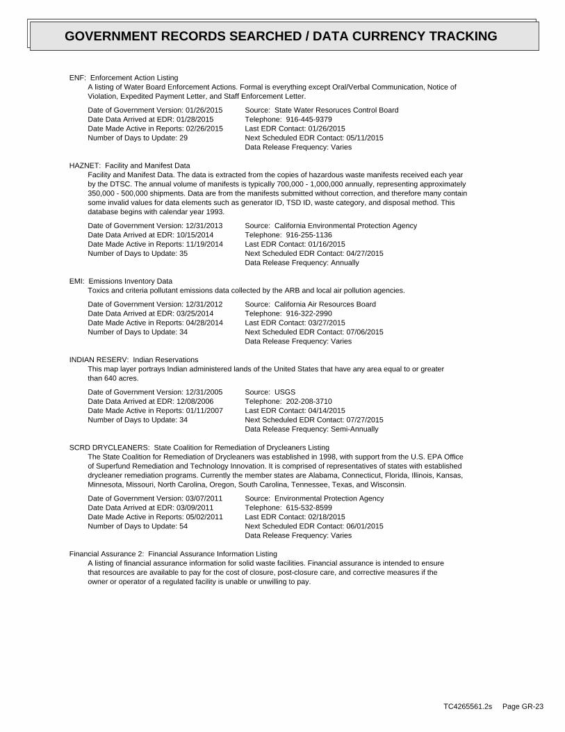
ENF: Enforcement Action ListingA listing of Water Board Enforcement Actions. Formal is everything except Oral/Verbal Communication, Notice ofViolation, Expedited Payment Letter, and Staff Enforcement Letter.
Date of Government Version: 01/26/2015Date Data Arrived at EDR: 01/28/2015Date Made Active in Reports: 02/26/2015Number of Days to Update: 29
Source: State Water Resoruces Control BoardTelephone: 916-445-9379Last EDR Contact: 01/26/2015Next Scheduled EDR Contact: 05/11/2015Data Release Frequency: Varies
HAZNET: Facility and Manifest DataFacility and Manifest Data. The data is extracted from the copies of hazardous waste manifests received each yearby the DTSC. The annual volume of manifests is typically 700,000 - 1,000,000 annually, representing approximately350,000 - 500,000 shipments. Data are from the manifests submitted without correction, and therefore many containsome invalid values for data elements such as generator ID, TSD ID, waste category, and disposal method. Thisdatabase begins with calendar year 1993.
Date of Government Version: 12/31/2013Date Data Arrived at EDR: 10/15/2014Date Made Active in Reports: 11/19/2014Number of Days to Update: 35
Source: California Environmental Protection AgencyTelephone: 916-255-1136Last EDR Contact: 01/16/2015Next Scheduled EDR Contact: 04/27/2015Data Release Frequency: Annually
EMI: Emissions Inventory DataToxics and criteria pollutant emissions data collected by the ARB and local air pollution agencies.
Date of Government Version: 12/31/2012Date Data Arrived at EDR: 03/25/2014Date Made Active in Reports: 04/28/2014Number of Days to Update: 34
Source: California Air Resources BoardTelephone: 916-322-2990Last EDR Contact: 03/27/2015Next Scheduled EDR Contact: 07/06/2015Data Release Frequency: Varies
INDIAN RESERV: Indian ReservationsThis map layer portrays Indian administered lands of the United States that have any area equal to or greaterthan 640 acres.
Date of Government Version: 12/31/2005Date Data Arrived at EDR: 12/08/2006Date Made Active in Reports: 01/11/2007Number of Days to Update: 34
Source: USGSTelephone: 202-208-3710Last EDR Contact: 04/14/2015Next Scheduled EDR Contact: 07/27/2015Data Release Frequency: Semi-Annually
SCRD DRYCLEANERS: State Coalition for Remediation of Drycleaners ListingThe State Coalition for Remediation of Drycleaners was established in 1998, with support from the U.S. EPA Officeof Superfund Remediation and Technology Innovation. It is comprised of representatives of states with establisheddrycleaner remediation programs. Currently the member states are Alabama, Connecticut, Florida, Illinois, Kansas,Minnesota, Missouri, North Carolina, Oregon, South Carolina, Tennessee, Texas, and Wisconsin.
Date of Government Version: 03/07/2011Date Data Arrived at EDR: 03/09/2011Date Made Active in Reports: 05/02/2011Number of Days to Update: 54
Source: Environmental Protection AgencyTelephone: 615-532-8599Last EDR Contact: 02/18/2015Next Scheduled EDR Contact: 06/01/2015Data Release Frequency: Varies
Financial Assurance 2: Financial Assurance Information ListingA listing of financial assurance information for solid waste facilities. Financial assurance is intended to ensurethat resources are available to pay for the cost of closure, post-closure care, and corrective measures if theowner or operator of a regulated facility is unable or unwilling to pay.
TC4265561.2s Page GR-23
GOVERNMENT RECORDS SEARCHED / DATA CURRENCY TRACKING
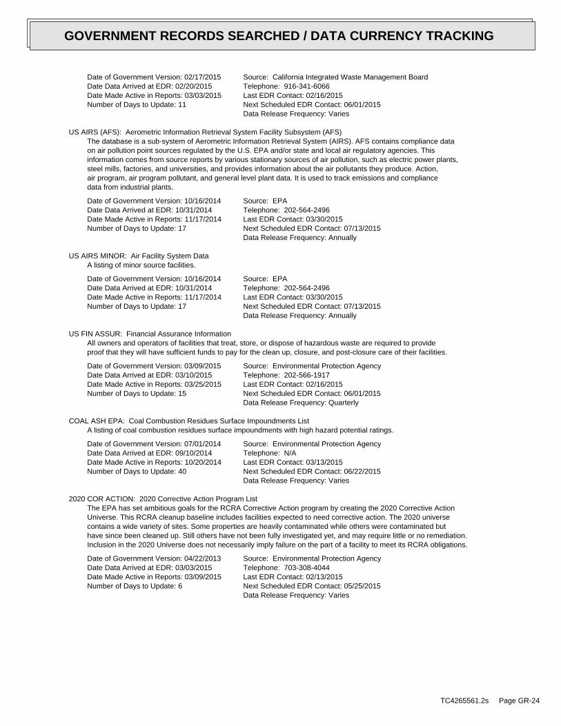
Date of Government Version: 02/17/2015Date Data Arrived at EDR: 02/20/2015Date Made Active in Reports: 03/03/2015Number of Days to Update: 11
Source: California Integrated Waste Management BoardTelephone: 916-341-6066Last EDR Contact: 02/16/2015Next Scheduled EDR Contact: 06/01/2015Data Release Frequency: Varies
US AIRS (AFS): Aerometric Information Retrieval System Facility Subsystem (AFS)The database is a sub-system of Aerometric Information Retrieval System (AIRS). AFS contains compliance dataon air pollution point sources regulated by the U.S. EPA and/or state and local air regulatory agencies. Thisinformation comes from source reports by various stationary sources of air pollution, such as electric power plants,steel mills, factories, and universities, and provides information about the air pollutants they produce. Action,air program, air program pollutant, and general level plant data. It is used to track emissions and compliancedata from industrial plants.
Date of Government Version: 10/16/2014Date Data Arrived at EDR: 10/31/2014Date Made Active in Reports: 11/17/2014Number of Days to Update: 17
Source: EPATelephone: 202-564-2496Last EDR Contact: 03/30/2015Next Scheduled EDR Contact: 07/13/2015Data Release Frequency: Annually
US AIRS MINOR: Air Facility System DataA listing of minor source facilities.
Date of Government Version: 10/16/2014Date Data Arrived at EDR: 10/31/2014Date Made Active in Reports: 11/17/2014Number of Days to Update: 17
Source: EPATelephone: 202-564-2496Last EDR Contact: 03/30/2015Next Scheduled EDR Contact: 07/13/2015Data Release Frequency: Annually
US FIN ASSUR: Financial Assurance InformationAll owners and operators of facilities that treat, store, or dispose of hazardous waste are required to provideproof that they will have sufficient funds to pay for the clean up, closure, and post-closure care of their facilities.
Date of Government Version: 03/09/2015Date Data Arrived at EDR: 03/10/2015Date Made Active in Reports: 03/25/2015Number of Days to Update: 15
Source: Environmental Protection AgencyTelephone: 202-566-1917Last EDR Contact: 02/16/2015Next Scheduled EDR Contact: 06/01/2015Data Release Frequency: Quarterly
COAL ASH EPA: Coal Combustion Residues Surface Impoundments ListA listing of coal combustion residues surface impoundments with high hazard potential ratings.
Date of Government Version: 07/01/2014Date Data Arrived at EDR: 09/10/2014Date Made Active in Reports: 10/20/2014Number of Days to Update: 40
Source: Environmental Protection AgencyTelephone: N/ALast EDR Contact: 03/13/2015Next Scheduled EDR Contact: 06/22/2015Data Release Frequency: Varies
2020 COR ACTION: 2020 Corrective Action Program ListThe EPA has set ambitious goals for the RCRA Corrective Action program by creating the 2020 Corrective ActionUniverse. This RCRA cleanup baseline includes facilities expected to need corrective action. The 2020 universecontains a wide variety of sites. Some properties are heavily contaminated while others were contaminated buthave since been cleaned up. Still others have not been fully investigated yet, and may require little or no remediation.Inclusion in the 2020 Universe does not necessarily imply failure on the part of a facility to meet its RCRA obligations.
Date of Government Version: 04/22/2013Date Data Arrived at EDR: 03/03/2015Date Made Active in Reports: 03/09/2015Number of Days to Update: 6
Source: Environmental Protection AgencyTelephone: 703-308-4044Last EDR Contact: 02/13/2015Next Scheduled EDR Contact: 05/25/2015Data Release Frequency: Varies
TC4265561.2s Page GR-24
GOVERNMENT RECORDS SEARCHED / DATA CURRENCY TRACKING

FEDLAND: Federal and Indian LandsFederally and Indian administrated lands of the United States. Lands included are administrated by: Army Corpsof Engineers, Bureau of Reclamation, National Wild and Scenic River, National Wildlife Refuge, Public Domain Land,Wilderness, Wilderness Study Area, Wildlife Management Area, Bureau of Indian Affairs, Bureau of Land Management,Department of Justice, Forest Service, Fish and Wildlife Service, National Park Service.
Date of Government Version: 12/31/2005Date Data Arrived at EDR: 02/06/2006Date Made Active in Reports: 01/11/2007Number of Days to Update: 339
Source: U.S. Geological SurveyTelephone: 888-275-8747Last EDR Contact: 04/14/2015Next Scheduled EDR Contact: 07/27/2015Data Release Frequency: N/A
PRP: Potentially Responsible PartiesA listing of verified Potentially Responsible Parties
Date of Government Version: 10/25/2013Date Data Arrived at EDR: 10/17/2014Date Made Active in Reports: 10/20/2014Number of Days to Update: 3
Source: EPATelephone: 202-564-6023Last EDR Contact: 02/13/2015Next Scheduled EDR Contact: 05/25/2015Data Release Frequency: Quarterly
LEAD SMELTER 2: Lead Smelter SitesA list of several hundred sites in the U.S. where secondary lead smelting was done from 1931and 1964. These sitesmay pose a threat to public health through ingestion or inhalation of contaminated soil or dust
Date of Government Version: 04/05/2001Date Data Arrived at EDR: 10/27/2010Date Made Active in Reports: 12/02/2010Number of Days to Update: 36
Source: American Journal of Public HealthTelephone: 703-305-6451Last EDR Contact: 12/02/2009Next Scheduled EDR Contact: N/AData Release Frequency: No Update Planned
LEAD SMELTER 1: Lead Smelter SitesA listing of former lead smelter site locations.
Date of Government Version: 11/25/2014Date Data Arrived at EDR: 11/26/2014Date Made Active in Reports: 01/29/2015Number of Days to Update: 64
Source: Environmental Protection AgencyTelephone: 703-603-8787Last EDR Contact: 04/10/2015Next Scheduled EDR Contact: 07/20/2015Data Release Frequency: Varies
EPA WATCH LIST: EPA WATCH LISTEPA maintains a "Watch List" to facilitate dialogue between EPA, state and local environmental agencies on enforcementmatters relating to facilities with alleged violations identified as either significant or high priority. Beingon the Watch List does not mean that the facility has actually violated the law only that an investigation byEPA or a state or local environmental agency has led those organizations to allege that an unproven violationhas in fact occurred. Being on the Watch List does not represent a higher level of concern regarding the allegedviolations that were detected, but instead indicates cases requiring additional dialogue between EPA, state andlocal agencies - primarily because of the length of time the alleged violation has gone unaddressed or unresolved.
Date of Government Version: 08/30/2013Date Data Arrived at EDR: 03/21/2014Date Made Active in Reports: 06/17/2014Number of Days to Update: 88
Source: Environmental Protection AgencyTelephone: 617-520-3000Last EDR Contact: 02/09/2015Next Scheduled EDR Contact: 05/25/2015Data Release Frequency: Quarterly
PROC: Certified Processors DatabaseA listing of certified processors.
Date of Government Version: 03/16/2015Date Data Arrived at EDR: 03/18/2015Date Made Active in Reports: 03/24/2015Number of Days to Update: 6
Source: Department of ConservationTelephone: 916-323-3836Last EDR Contact: 03/18/2015Next Scheduled EDR Contact: 06/29/2015Data Release Frequency: Quarterly
TC4265561.2s Page GR-25
GOVERNMENT RECORDS SEARCHED / DATA CURRENCY TRACKING

Financial Assurance 1: Financial Assurance Information ListingFinancial Assurance information
Date of Government Version: 02/02/2015Date Data Arrived at EDR: 02/06/2015Date Made Active in Reports: 03/03/2015Number of Days to Update: 25
Source: Department of Toxic Substances ControlTelephone: 916-255-3628Last EDR Contact: 01/26/2015Next Scheduled EDR Contact: 05/11/2015Data Release Frequency: Varies
WDS: Waste Discharge SystemSites which have been issued waste discharge requirements.
Date of Government Version: 06/19/2007Date Data Arrived at EDR: 06/20/2007Date Made Active in Reports: 06/29/2007Number of Days to Update: 9
Source: State Water Resources Control BoardTelephone: 916-341-5227Last EDR Contact: 02/23/2015Next Scheduled EDR Contact: 06/08/2015Data Release Frequency: Quarterly
PCB TRANSFORMER: PCB Transformer Registration DatabaseThe database of PCB transformer registrations that includes all PCB registration submittals.
Date of Government Version: 02/01/2011Date Data Arrived at EDR: 10/19/2011Date Made Active in Reports: 01/10/2012Number of Days to Update: 83
Source: Environmental Protection AgencyTelephone: 202-566-0517Last EDR Contact: 01/30/2015Next Scheduled EDR Contact: 05/11/2015Data Release Frequency: Varies
HWP: EnviroStor Permitted Facilities ListingDetailed information on permitted hazardous waste facilities and corrective action ("cleanups") tracked in EnviroStor.
Date of Government Version: 02/23/2015Date Data Arrived at EDR: 02/24/2015Date Made Active in Reports: 03/03/2015Number of Days to Update: 7
Source: Department of Toxic Substances ControlTelephone: 916-323-3400Last EDR Contact: 02/24/2015Next Scheduled EDR Contact: 06/08/2015Data Release Frequency: Quarterly
HWT: Registered Hazardous Waste Transporter DatabaseA listing of hazardous waste transporters. In California, unless specifically exempted, it is unlawful for anyperson to transport hazardous wastes unless the person holds a valid registration issued by DTSC. A hazardouswaste transporter registration is valid for one year and is assigned a unique registration number.
Date of Government Version: 01/12/2015Date Data Arrived at EDR: 01/13/2015Date Made Active in Reports: 02/03/2015Number of Days to Update: 21
Source: Department of Toxic Substances ControlTelephone: 916-440-7145Last EDR Contact: 04/15/2015Next Scheduled EDR Contact: 07/27/2015Data Release Frequency: Quarterly
COAL ASH DOE: Steam-Electric Plant Operation DataA listing of power plants that store ash in surface ponds.
Date of Government Version: 12/31/2005Date Data Arrived at EDR: 08/07/2009Date Made Active in Reports: 10/22/2009Number of Days to Update: 76
Source: Department of EnergyTelephone: 202-586-8719Last EDR Contact: 04/15/2015Next Scheduled EDR Contact: 07/27/2015Data Release Frequency: Varies
MWMP: Medical Waste Management Program ListingThe Medical Waste Management Program (MWMP) ensures the proper handling and disposal of medical waste by permittingand inspecting medical waste Offsite Treatment Facilities (PDF) and Transfer Stations (PDF) throughout thestate. MWMP also oversees all Medical Waste Transporters.
TC4265561.2s Page GR-26
GOVERNMENT RECORDS SEARCHED / DATA CURRENCY TRACKING
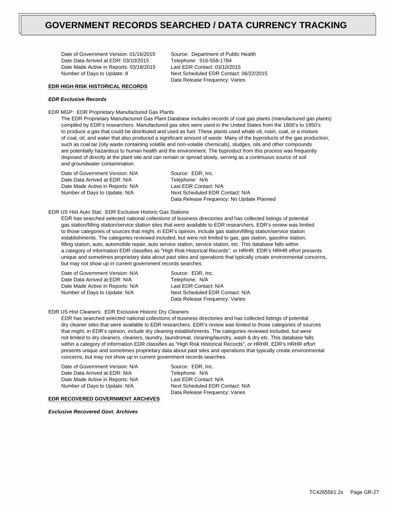
Date of Government Version: 01/16/2015Date Data Arrived at EDR: 03/10/2015Date Made Active in Reports: 03/18/2015Number of Days to Update: 8
Source: Department of Public HealthTelephone: 916-558-1784Last EDR Contact: 03/10/2015Next Scheduled EDR Contact: 06/22/2015Data Release Frequency: Varies
EDR HIGH RISK HISTORICAL RECORDS
EDR Exclusive Records
EDR MGP: EDR Proprietary Manufactured Gas PlantsThe EDR Proprietary Manufactured Gas Plant Database includes records of coal gas plants (manufactured gas plants)compiled by EDR’s researchers. Manufactured gas sites were used in the United States from the 1800’s to 1950’sto produce a gas that could be distributed and used as fuel. These plants used whale oil, rosin, coal, or a mixtureof coal, oil, and water that also produced a significant amount of waste. Many of the byproducts of the gas production,such as coal tar (oily waste containing volatile and non-volatile chemicals), sludges, oils and other compoundsare potentially hazardous to human health and the environment. The byproduct from this process was frequentlydisposed of directly at the plant site and can remain or spread slowly, serving as a continuous source of soiland groundwater contamination.
Date of Government Version: N/ADate Data Arrived at EDR: N/ADate Made Active in Reports: N/ANumber of Days to Update: N/A
Source: EDR, Inc.Telephone: N/ALast EDR Contact: N/ANext Scheduled EDR Contact: N/AData Release Frequency: No Update Planned
EDR US Hist Auto Stat: EDR Exclusive Historic Gas StationsEDR has searched selected national collections of business directories and has collected listings of potentialgas station/filling station/service station sites that were available to EDR researchers. EDR’s review was limitedto those categories of sources that might, in EDR’s opinion, include gas station/filling station/service stationestablishments. The categories reviewed included, but were not limited to gas, gas station, gasoline station,filling station, auto, automobile repair, auto service station, service station, etc. This database falls withina category of information EDR classifies as "High Risk Historical Records", or HRHR. EDR’s HRHR effort presentsunique and sometimes proprietary data about past sites and operations that typically create environmental concerns,but may not show up in current government records searches.
Date of Government Version: N/ADate Data Arrived at EDR: N/ADate Made Active in Reports: N/ANumber of Days to Update: N/A
Source: EDR, Inc.Telephone: N/ALast EDR Contact: N/ANext Scheduled EDR Contact: N/AData Release Frequency: Varies
EDR US Hist Cleaners: EDR Exclusive Historic Dry CleanersEDR has searched selected national collections of business directories and has collected listings of potentialdry cleaner sites that were available to EDR researchers. EDR’s review was limited to those categories of sourcesthat might, in EDR’s opinion, include dry cleaning establishments. The categories reviewed included, but werenot limited to dry cleaners, cleaners, laundry, laundromat, cleaning/laundry, wash & dry etc. This database fallswithin a category of information EDR classifies as "High Risk Historical Records", or HRHR. EDR’s HRHR effortpresents unique and sometimes proprietary data about past sites and operations that typically create environmentalconcerns, but may not show up in current government records searches.
Date of Government Version: N/ADate Data Arrived at EDR: N/ADate Made Active in Reports: N/ANumber of Days to Update: N/A
Source: EDR, Inc.Telephone: N/ALast EDR Contact: N/ANext Scheduled EDR Contact: N/AData Release Frequency: Varies
EDR RECOVERED GOVERNMENT ARCHIVES
Exclusive Recovered Govt. Archives
TC4265561.2s Page GR-27
GOVERNMENT RECORDS SEARCHED / DATA CURRENCY TRACKING
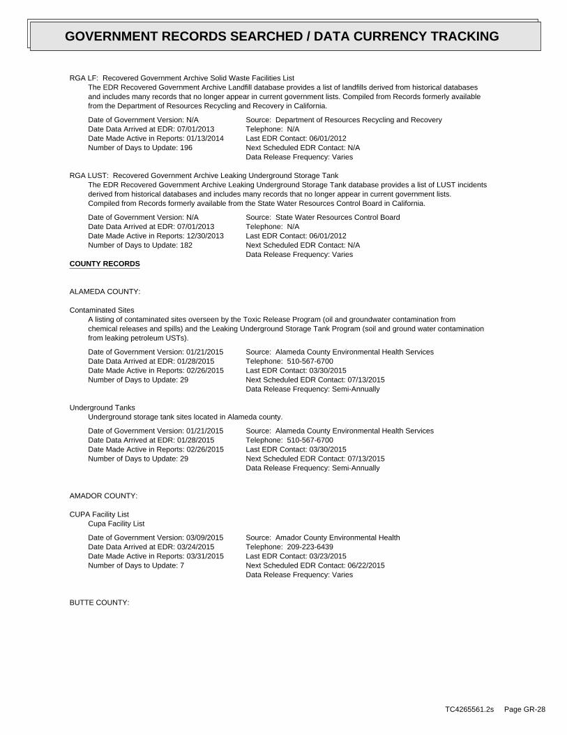
RGA LF: Recovered Government Archive Solid Waste Facilities ListThe EDR Recovered Government Archive Landfill database provides a list of landfills derived from historical databasesand includes many records that no longer appear in current government lists. Compiled from Records formerly availablefrom the Department of Resources Recycling and Recovery in California.
Date of Government Version: N/ADate Data Arrived at EDR: 07/01/2013Date Made Active in Reports: 01/13/2014Number of Days to Update: 196
Source: Department of Resources Recycling and RecoveryTelephone: N/ALast EDR Contact: 06/01/2012Next Scheduled EDR Contact: N/AData Release Frequency: Varies
RGA LUST: Recovered Government Archive Leaking Underground Storage TankThe EDR Recovered Government Archive Leaking Underground Storage Tank database provides a list of LUST incidentsderived from historical databases and includes many records that no longer appear in current government lists.Compiled from Records formerly available from the State Water Resources Control Board in California.
Date of Government Version: N/ADate Data Arrived at EDR: 07/01/2013Date Made Active in Reports: 12/30/2013Number of Days to Update: 182
Source: State Water Resources Control BoardTelephone: N/ALast EDR Contact: 06/01/2012Next Scheduled EDR Contact: N/AData Release Frequency: Varies
COUNTY RECORDS
ALAMEDA COUNTY:
Contaminated SitesA listing of contaminated sites overseen by the Toxic Release Program (oil and groundwater contamination fromchemical releases and spills) and the Leaking Underground Storage Tank Program (soil and ground water contaminationfrom leaking petroleum USTs).
Date of Government Version: 01/21/2015Date Data Arrived at EDR: 01/28/2015Date Made Active in Reports: 02/26/2015Number of Days to Update: 29
Source: Alameda County Environmental Health ServicesTelephone: 510-567-6700Last EDR Contact: 03/30/2015Next Scheduled EDR Contact: 07/13/2015Data Release Frequency: Semi-Annually
Underground TanksUnderground storage tank sites located in Alameda county.
Date of Government Version: 01/21/2015Date Data Arrived at EDR: 01/28/2015Date Made Active in Reports: 02/26/2015Number of Days to Update: 29
Source: Alameda County Environmental Health ServicesTelephone: 510-567-6700Last EDR Contact: 03/30/2015Next Scheduled EDR Contact: 07/13/2015Data Release Frequency: Semi-Annually
AMADOR COUNTY:
CUPA Facility ListCupa Facility List
Date of Government Version: 03/09/2015Date Data Arrived at EDR: 03/24/2015Date Made Active in Reports: 03/31/2015Number of Days to Update: 7
Source: Amador County Environmental HealthTelephone: 209-223-6439Last EDR Contact: 03/23/2015Next Scheduled EDR Contact: 06/22/2015Data Release Frequency: Varies
BUTTE COUNTY:
TC4265561.2s Page GR-28
GOVERNMENT RECORDS SEARCHED / DATA CURRENCY TRACKING
CUPA Facility ListingCupa facility list.
Date of Government Version: 11/20/2014Date Data Arrived at EDR: 11/24/2014Date Made Active in Reports: 01/07/2015Number of Days to Update: 44
Source: Public Health DepartmentTelephone: 530-538-7149Last EDR Contact: 04/14/2015Next Scheduled EDR Contact: 04/27/2015Data Release Frequency: No Update Planned
CALVERAS COUNTY:
CUPA Facility ListingCupa Facility Listing
Date of Government Version: 03/03/2015Date Data Arrived at EDR: 03/05/2015Date Made Active in Reports: 03/10/2015Number of Days to Update: 5
Source: Calveras County Environmental HealthTelephone: 209-754-6399Last EDR Contact: 03/30/2015Next Scheduled EDR Contact: 07/13/2015Data Release Frequency: Quarterly
COLUSA COUNTY:
CUPA Facility ListCupa facility list.
Date of Government Version: 06/11/2014Date Data Arrived at EDR: 06/13/2014Date Made Active in Reports: 07/07/2014Number of Days to Update: 24
Source: Health & Human ServicesTelephone: 530-458-0396Last EDR Contact: 02/09/2015Next Scheduled EDR Contact: 05/25/2015Data Release Frequency: Varies
CONTRA COSTA COUNTY:
Site ListList includes sites from the underground tank, hazardous waste generator and business plan/2185 programs.
Date of Government Version: 02/23/2015Date Data Arrived at EDR: 02/25/2015Date Made Active in Reports: 03/04/2015Number of Days to Update: 7
Source: Contra Costa Health Services DepartmentTelephone: 925-646-2286Last EDR Contact: 02/02/2015Next Scheduled EDR Contact: 05/18/2015Data Release Frequency: Semi-Annually
DEL NORTE COUNTY:
CUPA Facility ListCupa Facility list
Date of Government Version: 02/23/2015Date Data Arrived at EDR: 02/25/2015Date Made Active in Reports: 03/03/2015Number of Days to Update: 6
Source: Del Norte County Environmental Health DivisionTelephone: 707-465-0426Last EDR Contact: 02/16/2015Next Scheduled EDR Contact: 05/18/2015Data Release Frequency: Varies
EL DORADO COUNTY:
TC4265561.2s Page GR-29
GOVERNMENT RECORDS SEARCHED / DATA CURRENCY TRACKING

CUPA Facility ListCUPA facility list.
Date of Government Version: 02/24/2015Date Data Arrived at EDR: 02/25/2015Date Made Active in Reports: 03/03/2015Number of Days to Update: 6
Source: El Dorado County Environmental Management DepartmentTelephone: 530-621-6623Last EDR Contact: 02/02/2015Next Scheduled EDR Contact: 05/18/2015Data Release Frequency: Varies
FRESNO COUNTY:
CUPA Resources ListCertified Unified Program Agency. CUPA’s are responsible for implementing a unified hazardous materials and hazardouswaste management regulatory program. The agency provides oversight of businesses that deal with hazardous materials,operate underground storage tanks or aboveground storage tanks.
Date of Government Version: 12/31/2014Date Data Arrived at EDR: 01/16/2015Date Made Active in Reports: 02/05/2015Number of Days to Update: 20
Source: Dept. of Community HealthTelephone: 559-445-3271Last EDR Contact: 04/06/2015Next Scheduled EDR Contact: 07/20/2015Data Release Frequency: Semi-Annually
HUMBOLDT COUNTY:
CUPA Facility ListCUPA facility list.
Date of Government Version: 03/11/2015Date Data Arrived at EDR: 03/13/2015Date Made Active in Reports: 03/24/2015Number of Days to Update: 11
Source: Humboldt County Environmental HealthTelephone: N/ALast EDR Contact: 02/23/2015Next Scheduled EDR Contact: 06/08/2015Data Release Frequency: Varies
IMPERIAL COUNTY:
CUPA Facility ListCupa facility list.
Date of Government Version: 02/10/2015Date Data Arrived at EDR: 02/12/2015Date Made Active in Reports: 03/03/2015Number of Days to Update: 19
Source: San Diego Border Field OfficeTelephone: 760-339-2777Last EDR Contact: 02/09/2015Next Scheduled EDR Contact: 05/11/2015Data Release Frequency: Varies
INYO COUNTY:
CUPA Facility ListCupa facility list.
Date of Government Version: 09/10/2013Date Data Arrived at EDR: 09/11/2013Date Made Active in Reports: 10/14/2013Number of Days to Update: 33
Source: Inyo County Environmental Health ServicesTelephone: 760-878-0238Last EDR Contact: 02/23/2015Next Scheduled EDR Contact: 06/08/2015Data Release Frequency: Varies
KERN COUNTY:
TC4265561.2s Page GR-30
GOVERNMENT RECORDS SEARCHED / DATA CURRENCY TRACKING
Underground Storage Tank Sites & Tank ListingKern County Sites and Tanks Listing.
Date of Government Version: 07/22/2014Date Data Arrived at EDR: 11/12/2014Date Made Active in Reports: 12/19/2014Number of Days to Update: 37
Source: Kern County Environment Health Services DepartmentTelephone: 661-862-8700Last EDR Contact: 02/23/2015Next Scheduled EDR Contact: 05/25/2015Data Release Frequency: Quarterly
KINGS COUNTY:
CUPA Facility ListA listing of sites included in the county’s Certified Unified Program Agency database. California’s Secretaryfor Environmental Protection established the unified hazardous materials and hazardous waste regulatory programas required by chapter 6.11 of the California Health and Safety Code. The Unified Program consolidates the administration,permits, inspections, and enforcement activities.
Date of Government Version: 11/21/2014Date Data Arrived at EDR: 11/25/2014Date Made Active in Reports: 12/30/2014Number of Days to Update: 35
Source: Kings County Department of Public HealthTelephone: 559-584-1411Last EDR Contact: 04/10/2015Next Scheduled EDR Contact: 06/08/2015Data Release Frequency: Varies
LAKE COUNTY:
CUPA Facility ListCupa facility list
Date of Government Version: 01/20/2015Date Data Arrived at EDR: 01/21/2015Date Made Active in Reports: 02/05/2015Number of Days to Update: 15
Source: Lake County Environmental HealthTelephone: 707-263-1164Last EDR Contact: 01/19/2015Next Scheduled EDR Contact: 05/04/2015Data Release Frequency: Varies
LOS ANGELES COUNTY:
San Gabriel Valley Areas of ConcernSan Gabriel Valley areas where VOC contamination is at or above the MCL as designated by region 9 EPA office.
Date of Government Version: 03/30/2009Date Data Arrived at EDR: 03/31/2009Date Made Active in Reports: 10/23/2009Number of Days to Update: 206
Source: EPA Region 9Telephone: 415-972-3178Last EDR Contact: 03/23/2015Next Scheduled EDR Contact: 07/06/2015Data Release Frequency: No Update Planned
HMS: Street Number ListIndustrial Waste and Underground Storage Tank Sites.
Date of Government Version: 11/24/2014Date Data Arrived at EDR: 01/30/2015Date Made Active in Reports: 03/04/2015Number of Days to Update: 33
Source: Department of Public WorksTelephone: 626-458-3517Last EDR Contact: 04/13/2015Next Scheduled EDR Contact: 07/27/2015Data Release Frequency: Semi-Annually
List of Solid Waste FacilitiesSolid Waste Facilities in Los Angeles County.
TC4265561.2s Page GR-31
GOVERNMENT RECORDS SEARCHED / DATA CURRENCY TRACKING

Date of Government Version: 01/19/2015Date Data Arrived at EDR: 01/20/2015Date Made Active in Reports: 02/05/2015Number of Days to Update: 16
Source: La County Department of Public WorksTelephone: 818-458-5185Last EDR Contact: 01/20/2015Next Scheduled EDR Contact: 05/04/2015Data Release Frequency: Varies
City of Los Angeles LandfillsLandfills owned and maintained by the City of Los Angeles.
Date of Government Version: 03/05/2009Date Data Arrived at EDR: 03/10/2009Date Made Active in Reports: 04/08/2009Number of Days to Update: 29
Source: Engineering & Construction DivisionTelephone: 213-473-7869Last EDR Contact: 04/15/2015Next Scheduled EDR Contact: 08/03/2015Data Release Frequency: Varies
Site Mitigation ListIndustrial sites that have had some sort of spill or complaint.
Date of Government Version: 01/15/2015Date Data Arrived at EDR: 01/29/2015Date Made Active in Reports: 03/10/2015Number of Days to Update: 40
Source: Community Health ServicesTelephone: 323-890-7806Last EDR Contact: 01/19/2015Next Scheduled EDR Contact: 05/04/2015Data Release Frequency: Annually
City of El Segundo Underground Storage TankUnderground storage tank sites located in El Segundo city.
Date of Government Version: 03/30/2015Date Data Arrived at EDR: 04/02/2015Date Made Active in Reports: 04/13/2015Number of Days to Update: 11
Source: City of El Segundo Fire DepartmentTelephone: 310-524-2236Last EDR Contact: 03/06/2015Next Scheduled EDR Contact: 08/03/2015Data Release Frequency: Semi-Annually
City of Long Beach Underground Storage TankUnderground storage tank sites located in the city of Long Beach.
Date of Government Version: 01/29/2015Date Data Arrived at EDR: 02/13/2015Date Made Active in Reports: 02/26/2015Number of Days to Update: 13
Source: City of Long Beach Fire DepartmentTelephone: 562-570-2563Last EDR Contact: 01/26/2015Next Scheduled EDR Contact: 05/11/2015Data Release Frequency: Annually
City of Torrance Underground Storage TankUnderground storage tank sites located in the city of Torrance.
Date of Government Version: 01/08/2015Date Data Arrived at EDR: 01/15/2015Date Made Active in Reports: 01/27/2015Number of Days to Update: 12
Source: City of Torrance Fire DepartmentTelephone: 310-618-2973Last EDR Contact: 04/13/2015Next Scheduled EDR Contact: 07/27/2015Data Release Frequency: Semi-Annually
MADERA COUNTY:
CUPA Facility ListA listing of sites included in the county’s Certified Unified Program Agency database. California’s Secretaryfor Environmental Protection established the unified hazardous materials and hazardous waste regulatory programas required by chapter 6.11 of the California Health and Safety Code. The Unified Program consolidates the administration,permits, inspections, and enforcement activities.
TC4265561.2s Page GR-32
GOVERNMENT RECORDS SEARCHED / DATA CURRENCY TRACKING
Date of Government Version: 03/20/2015Date Data Arrived at EDR: 03/24/2015Date Made Active in Reports: 03/31/2015Number of Days to Update: 7
Source: Madera County Environmental HealthTelephone: 559-675-7823Last EDR Contact: 03/23/2015Next Scheduled EDR Contact: 06/08/2015Data Release Frequency: Varies
MARIN COUNTY:
Underground Storage Tank SitesCurrently permitted USTs in Marin County.
Date of Government Version: 10/08/2014Date Data Arrived at EDR: 10/22/2014Date Made Active in Reports: 12/15/2014Number of Days to Update: 54
Source: Public Works Department Waste ManagementTelephone: 415-499-6647Last EDR Contact: 04/15/2015Next Scheduled EDR Contact: 07/20/2015Data Release Frequency: Semi-Annually
MERCED COUNTY:
CUPA Facility ListCUPA facility list.
Date of Government Version: 02/23/2015Date Data Arrived at EDR: 02/24/2015Date Made Active in Reports: 03/03/2015Number of Days to Update: 7
Source: Merced County Environmental HealthTelephone: 209-381-1094Last EDR Contact: 02/23/2015Next Scheduled EDR Contact: 06/08/2015Data Release Frequency: Varies
MONO COUNTY:
CUPA Facility ListCUPA Facility List
Date of Government Version: 02/27/2015Date Data Arrived at EDR: 03/06/2015Date Made Active in Reports: 03/10/2015Number of Days to Update: 4
Source: Mono County Health DepartmentTelephone: 760-932-5580Last EDR Contact: 02/26/2015Next Scheduled EDR Contact: 06/15/2015Data Release Frequency: Varies
MONTEREY COUNTY:
CUPA Facility ListingCUPA Program listing from the Environmental Health Division.
Date of Government Version: 03/19/2015Date Data Arrived at EDR: 03/20/2015Date Made Active in Reports: 03/31/2015Number of Days to Update: 11
Source: Monterey County Health DepartmentTelephone: 831-796-1297Last EDR Contact: 02/23/2015Next Scheduled EDR Contact: 06/08/2015Data Release Frequency: Varies
NAPA COUNTY:
Sites With Reported ContaminationA listing of leaking underground storage tank sites located in Napa county.
TC4265561.2s Page GR-33
GOVERNMENT RECORDS SEARCHED / DATA CURRENCY TRACKING
Date of Government Version: 12/05/2011Date Data Arrived at EDR: 12/06/2011Date Made Active in Reports: 02/07/2012Number of Days to Update: 63
Source: Napa County Department of Environmental ManagementTelephone: 707-253-4269Last EDR Contact: 02/26/2015Next Scheduled EDR Contact: 06/15/2015Data Release Frequency: No Update Planned
Closed and Operating Underground Storage Tank SitesUnderground storage tank sites located in Napa county.
Date of Government Version: 01/15/2008Date Data Arrived at EDR: 01/16/2008Date Made Active in Reports: 02/08/2008Number of Days to Update: 23
Source: Napa County Department of Environmental ManagementTelephone: 707-253-4269Last EDR Contact: 02/26/2015Next Scheduled EDR Contact: 06/15/2015Data Release Frequency: No Update Planned
NEVADA COUNTY:
CUPA Facility ListCUPA facility list.
Date of Government Version: 02/12/2015Date Data Arrived at EDR: 02/13/2015Date Made Active in Reports: 03/03/2015Number of Days to Update: 18
Source: Community Development AgencyTelephone: 530-265-1467Last EDR Contact: 02/06/2015Next Scheduled EDR Contact: 05/18/2015Data Release Frequency: Varies
ORANGE COUNTY:
List of Industrial Site CleanupsPetroleum and non-petroleum spills.
Date of Government Version: 02/01/2015Date Data Arrived at EDR: 02/13/2015Date Made Active in Reports: 03/03/2015Number of Days to Update: 18
Source: Health Care AgencyTelephone: 714-834-3446Last EDR Contact: 02/09/2015Next Scheduled EDR Contact: 05/25/2015Data Release Frequency: Annually
List of Underground Storage Tank CleanupsOrange County Underground Storage Tank Cleanups (LUST).
Date of Government Version: 02/03/2015Date Data Arrived at EDR: 02/13/2015Date Made Active in Reports: 03/03/2015Number of Days to Update: 18
Source: Health Care AgencyTelephone: 714-834-3446Last EDR Contact: 02/09/2015Next Scheduled EDR Contact: 05/25/2015Data Release Frequency: Quarterly
List of Underground Storage Tank FacilitiesOrange County Underground Storage Tank Facilities (UST).
Date of Government Version: 02/01/2015Date Data Arrived at EDR: 02/13/2015Date Made Active in Reports: 02/26/2015Number of Days to Update: 13
Source: Health Care AgencyTelephone: 714-834-3446Last EDR Contact: 02/09/2015Next Scheduled EDR Contact: 05/25/2015Data Release Frequency: Quarterly
PLACER COUNTY:
TC4265561.2s Page GR-34
GOVERNMENT RECORDS SEARCHED / DATA CURRENCY TRACKING

Master List of FacilitiesList includes aboveground tanks, underground tanks and cleanup sites.
Date of Government Version: 03/10/2015Date Data Arrived at EDR: 03/12/2015Date Made Active in Reports: 03/18/2015Number of Days to Update: 6
Source: Placer County Health and Human ServicesTelephone: 530-745-2363Last EDR Contact: 03/09/2015Next Scheduled EDR Contact: 06/22/2015Data Release Frequency: Semi-Annually
RIVERSIDE COUNTY:
Listing of Underground Tank Cleanup SitesRiverside County Underground Storage Tank Cleanup Sites (LUST).
Date of Government Version: 01/28/2015Date Data Arrived at EDR: 01/29/2015Date Made Active in Reports: 03/03/2015Number of Days to Update: 33
Source: Department of Environmental HealthTelephone: 951-358-5055Last EDR Contact: 03/23/2015Next Scheduled EDR Contact: 07/06/2015Data Release Frequency: Quarterly
Underground Storage Tank Tank ListUnderground storage tank sites located in Riverside county.
Date of Government Version: 01/28/2015Date Data Arrived at EDR: 01/29/2015Date Made Active in Reports: 02/26/2015Number of Days to Update: 28
Source: Department of Environmental HealthTelephone: 951-358-5055Last EDR Contact: 03/23/2015Next Scheduled EDR Contact: 07/06/2015Data Release Frequency: Quarterly
SACRAMENTO COUNTY:
Toxic Site Clean-Up ListList of sites where unauthorized releases of potentially hazardous materials have occurred.
Date of Government Version: 11/03/2014Date Data Arrived at EDR: 01/07/2015Date Made Active in Reports: 02/03/2015Number of Days to Update: 27
Source: Sacramento County Environmental ManagementTelephone: 916-875-8406Last EDR Contact: 04/08/2015Next Scheduled EDR Contact: 07/20/2015Data Release Frequency: Quarterly
Master Hazardous Materials Facility ListAny business that has hazardous materials on site - hazardous material storage sites, underground storage tanks,waste generators.
Date of Government Version: 11/03/2014Date Data Arrived at EDR: 01/09/2015Date Made Active in Reports: 02/03/2015Number of Days to Update: 25
Source: Sacramento County Environmental ManagementTelephone: 916-875-8406Last EDR Contact: 04/08/2015Next Scheduled EDR Contact: 07/20/2015Data Release Frequency: Quarterly
SAN BERNARDINO COUNTY:
Hazardous Material PermitsThis listing includes underground storage tanks, medical waste handlers/generators, hazardous materials handlers,hazardous waste generators, and waste oil generators/handlers.
TC4265561.2s Page GR-35
GOVERNMENT RECORDS SEARCHED / DATA CURRENCY TRACKING
Date of Government Version: 03/02/2015Date Data Arrived at EDR: 03/03/2015Date Made Active in Reports: 03/10/2015Number of Days to Update: 7
Source: San Bernardino County Fire Department Hazardous Materials DivisionTelephone: 909-387-3041Last EDR Contact: 02/09/2015Next Scheduled EDR Contact: 05/25/2015Data Release Frequency: Quarterly
SAN DIEGO COUNTY:
Hazardous Materials Management Division DatabaseThe database includes: HE58 - This report contains the business name, site address, business phone number, establishment’H’ permit number, type of permit, and the business status. HE17 - In addition to providing the same informationprovided in the HE58 listing, HE17 provides inspection dates, violations received by the establishment, hazardouswaste generated, the quantity, method of storage, treatment/disposal of waste and the hauler, and informationon underground storage tanks. Unauthorized Release List - Includes a summary of environmental contamination casesin San Diego County (underground tank cases, non-tank cases, groundwater contamination, and soil contaminationare included.)
Date of Government Version: 09/23/2013Date Data Arrived at EDR: 09/24/2013Date Made Active in Reports: 10/17/2013Number of Days to Update: 23
Source: Hazardous Materials Management DivisionTelephone: 619-338-2268Last EDR Contact: 03/10/2015Next Scheduled EDR Contact: 06/22/2015Data Release Frequency: Quarterly
Solid Waste FacilitiesSan Diego County Solid Waste Facilities.
Date of Government Version: 10/31/2014Date Data Arrived at EDR: 11/21/2014Date Made Active in Reports: 12/29/2014Number of Days to Update: 38
Source: Department of Health ServicesTelephone: 619-338-2209Last EDR Contact: 01/26/2015Next Scheduled EDR Contact: 05/11/2015Data Release Frequency: Varies
Environmental Case ListingThe listing contains all underground tank release cases and projects pertaining to properties contaminated withhazardous substances that are actively under review by the Site Assessment and Mitigation Program.
Date of Government Version: 03/23/2010Date Data Arrived at EDR: 06/15/2010Date Made Active in Reports: 07/09/2010Number of Days to Update: 24
Source: San Diego County Department of Environmental HealthTelephone: 619-338-2371Last EDR Contact: 03/09/2015Next Scheduled EDR Contact: 06/22/2015Data Release Frequency: No Update Planned
SAN FRANCISCO COUNTY:
Local Oversite FacilitiesA listing of leaking underground storage tank sites located in San Francisco county.
Date of Government Version: 09/19/2008Date Data Arrived at EDR: 09/19/2008Date Made Active in Reports: 09/29/2008Number of Days to Update: 10
Source: Department Of Public Health San Francisco CountyTelephone: 415-252-3920Last EDR Contact: 02/09/2015Next Scheduled EDR Contact: 05/25/2015Data Release Frequency: Quarterly
Underground Storage Tank InformationUnderground storage tank sites located in San Francisco county.
Date of Government Version: 11/29/2010Date Data Arrived at EDR: 03/10/2011Date Made Active in Reports: 03/15/2011Number of Days to Update: 5
Source: Department of Public HealthTelephone: 415-252-3920Last EDR Contact: 02/09/2015Next Scheduled EDR Contact: 05/25/2015Data Release Frequency: Quarterly
SAN JOAQUIN COUNTY:
TC4265561.2s Page GR-36
GOVERNMENT RECORDS SEARCHED / DATA CURRENCY TRACKING
San Joaquin Co. USTA listing of underground storage tank locations in San Joaquin county.
Date of Government Version: 03/24/2015Date Data Arrived at EDR: 03/25/2015Date Made Active in Reports: 03/31/2015Number of Days to Update: 6
Source: Environmental Health DepartmentTelephone: N/ALast EDR Contact: 03/23/2015Next Scheduled EDR Contact: 07/06/2015Data Release Frequency: Semi-Annually
SAN LUIS OBISPO COUNTY:
CUPA Facility ListCupa Facility List.
Date of Government Version: 02/23/2015Date Data Arrived at EDR: 02/24/2015Date Made Active in Reports: 03/03/2015Number of Days to Update: 7
Source: San Luis Obispo County Public Health DepartmentTelephone: 805-781-5596Last EDR Contact: 02/23/2015Next Scheduled EDR Contact: 06/08/2015Data Release Frequency: Varies
SAN MATEO COUNTY:
Business InventoryList includes Hazardous Materials Business Plan, hazardous waste generators, and underground storage tanks.
Date of Government Version: 01/09/2015Date Data Arrived at EDR: 01/12/2015Date Made Active in Reports: 02/03/2015Number of Days to Update: 22
Source: San Mateo County Environmental Health Services DivisionTelephone: 650-363-1921Last EDR Contact: 03/16/2015Next Scheduled EDR Contact: 06/29/2015Data Release Frequency: Annually
Fuel Leak ListA listing of leaking underground storage tank sites located in San Mateo county.
Date of Government Version: 03/16/2015Date Data Arrived at EDR: 03/17/2015Date Made Active in Reports: 03/24/2015Number of Days to Update: 7
Source: San Mateo County Environmental Health Services DivisionTelephone: 650-363-1921Last EDR Contact: 03/13/2015Next Scheduled EDR Contact: 06/29/2015Data Release Frequency: Semi-Annually
SANTA BARBARA COUNTY:
CUPA Facility ListingCUPA Program Listing from the Environmental Health Services division.
Date of Government Version: 09/08/2011Date Data Arrived at EDR: 09/09/2011Date Made Active in Reports: 10/07/2011Number of Days to Update: 28
Source: Santa Barbara County Public Health DepartmentTelephone: 805-686-8167Last EDR Contact: 02/23/2015Next Scheduled EDR Contact: 06/08/2015Data Release Frequency: Varies
SANTA CLARA COUNTY:
Cupa Facility ListCupa facility list
TC4265561.2s Page GR-37
GOVERNMENT RECORDS SEARCHED / DATA CURRENCY TRACKING

Date of Government Version: 02/23/2015Date Data Arrived at EDR: 02/25/2015Date Made Active in Reports: 03/03/2015Number of Days to Update: 6
Source: Department of Environmental HealthTelephone: 408-918-1973Last EDR Contact: 02/23/2015Next Scheduled EDR Contact: 06/08/2015Data Release Frequency: Varies
HIST LUST - Fuel Leak Site Activity ReportA listing of open and closed leaking underground storage tanks. This listing is no longer updated by the county.Leaking underground storage tanks are now handled by the Department of Environmental Health.
Date of Government Version: 03/29/2005Date Data Arrived at EDR: 03/30/2005Date Made Active in Reports: 04/21/2005Number of Days to Update: 22
Source: Santa Clara Valley Water DistrictTelephone: 408-265-2600Last EDR Contact: 03/23/2009Next Scheduled EDR Contact: 06/22/2009Data Release Frequency: No Update Planned
LOP ListingA listing of leaking underground storage tanks located in Santa Clara county.
Date of Government Version: 03/03/2014Date Data Arrived at EDR: 03/05/2014Date Made Active in Reports: 03/18/2014Number of Days to Update: 13
Source: Department of Environmental HealthTelephone: 408-918-3417Last EDR Contact: 02/26/2015Next Scheduled EDR Contact: 06/15/2015Data Release Frequency: Annually
Hazardous Material FacilitiesHazardous material facilities, including underground storage tank sites.
Date of Government Version: 02/23/2015Date Data Arrived at EDR: 02/24/2015Date Made Active in Reports: 03/04/2015Number of Days to Update: 8
Source: City of San Jose Fire DepartmentTelephone: 408-535-7694Last EDR Contact: 02/23/2015Next Scheduled EDR Contact: 05/25/2015Data Release Frequency: Annually
SANTA CRUZ COUNTY:
CUPA Facility ListCUPA facility listing.
Date of Government Version: 11/24/2014Date Data Arrived at EDR: 11/25/2014Date Made Active in Reports: 12/31/2014Number of Days to Update: 36
Source: Santa Cruz County Environmental HealthTelephone: 831-464-2761Last EDR Contact: 02/23/2015Next Scheduled EDR Contact: 06/08/2015Data Release Frequency: Varies
SHASTA COUNTY:
CUPA Facility ListCupa Facility List.
Date of Government Version: 03/11/2015Date Data Arrived at EDR: 03/13/2015Date Made Active in Reports: 03/24/2015Number of Days to Update: 11
Source: Shasta County Department of Resource ManagementTelephone: 530-225-5789Last EDR Contact: 02/23/2015Next Scheduled EDR Contact: 06/08/2015Data Release Frequency: Varies
SOLANO COUNTY:
TC4265561.2s Page GR-38
GOVERNMENT RECORDS SEARCHED / DATA CURRENCY TRACKING
Leaking Underground Storage TanksA listing of leaking underground storage tank sites located in Solano county.
Date of Government Version: 03/13/2015Date Data Arrived at EDR: 03/19/2015Date Made Active in Reports: 03/24/2015Number of Days to Update: 5
Source: Solano County Department of Environmental ManagementTelephone: 707-784-6770Last EDR Contact: 03/13/2015Next Scheduled EDR Contact: 06/29/2015Data Release Frequency: Quarterly
Underground Storage TanksUnderground storage tank sites located in Solano county.
Date of Government Version: 03/13/2015Date Data Arrived at EDR: 03/20/2015Date Made Active in Reports: 03/31/2015Number of Days to Update: 11
Source: Solano County Department of Environmental ManagementTelephone: 707-784-6770Last EDR Contact: 03/13/2015Next Scheduled EDR Contact: 06/29/2015Data Release Frequency: Quarterly
SONOMA COUNTY:
Cupa Facility ListCupa Facility list
Date of Government Version: 03/31/2015Date Data Arrived at EDR: 04/02/2015Date Made Active in Reports: 04/10/2015Number of Days to Update: 8
Source: County of Sonoma Fire & Emergency Services DepartmentTelephone: 707-565-1174Last EDR Contact: 03/30/2015Next Scheduled EDR Contact: 07/13/2015Data Release Frequency: Varies
Leaking Underground Storage Tank SitesA listing of leaking underground storage tank sites located in Sonoma county.
Date of Government Version: 04/01/2015Date Data Arrived at EDR: 04/02/2015Date Made Active in Reports: 04/13/2015Number of Days to Update: 11
Source: Department of Health ServicesTelephone: 707-565-6565Last EDR Contact: 03/30/2015Next Scheduled EDR Contact: 07/13/2015Data Release Frequency: Quarterly
SUTTER COUNTY:
Underground Storage TanksUnderground storage tank sites located in Sutter county.
Date of Government Version: 03/09/2015Date Data Arrived at EDR: 03/10/2015Date Made Active in Reports: 03/18/2015Number of Days to Update: 8
Source: Sutter County Department of AgricultureTelephone: 530-822-7500Last EDR Contact: 03/09/2015Next Scheduled EDR Contact: 06/22/2015Data Release Frequency: Semi-Annually
TUOLUMNE COUNTY:
CUPA Facility ListCupa facility list
Date of Government Version: 01/30/2015Date Data Arrived at EDR: 02/03/2015Date Made Active in Reports: 02/27/2015Number of Days to Update: 24
Source: Divison of Environmental HealthTelephone: 209-533-5633Last EDR Contact: 01/26/2015Next Scheduled EDR Contact: 05/11/2015Data Release Frequency: Varies
VENTURA COUNTY:
TC4265561.2s Page GR-39
GOVERNMENT RECORDS SEARCHED / DATA CURRENCY TRACKING

Business Plan, Hazardous Waste Producers, and Operating Underground TanksThe BWT list indicates by site address whether the Environmental Health Division has Business Plan (B), WasteProducer (W), and/or Underground Tank (T) information.
Date of Government Version: 01/27/2015Date Data Arrived at EDR: 02/19/2015Date Made Active in Reports: 03/03/2015Number of Days to Update: 12
Source: Ventura County Environmental Health DivisionTelephone: 805-654-2813Last EDR Contact: 02/16/2015Next Scheduled EDR Contact: 06/01/2015Data Release Frequency: Quarterly
Inventory of Illegal Abandoned and Inactive SitesVentura County Inventory of Closed, Illegal Abandoned, and Inactive Sites.
Date of Government Version: 12/01/2011Date Data Arrived at EDR: 12/01/2011Date Made Active in Reports: 01/19/2012Number of Days to Update: 49
Source: Environmental Health DivisionTelephone: 805-654-2813Last EDR Contact: 04/02/2015Next Scheduled EDR Contact: 07/20/2015Data Release Frequency: Annually
Listing of Underground Tank Cleanup SitesVentura County Underground Storage Tank Cleanup Sites (LUST).
Date of Government Version: 05/29/2008Date Data Arrived at EDR: 06/24/2008Date Made Active in Reports: 07/31/2008Number of Days to Update: 37
Source: Environmental Health DivisionTelephone: 805-654-2813Last EDR Contact: 02/16/2015Next Scheduled EDR Contact: 06/01/2015Data Release Frequency: Quarterly
Medical Waste Program ListTo protect public health and safety and the environment from potential exposure to disease causing agents, theEnvironmental Health Division Medical Waste Program regulates the generation, handling, storage, treatment anddisposal of medical waste throughout the County.
Date of Government Version: 12/29/2014Date Data Arrived at EDR: 01/30/2015Date Made Active in Reports: 03/03/2015Number of Days to Update: 32
Source: Ventura County Resource Management AgencyTelephone: 805-654-2813Last EDR Contact: 01/26/2015Next Scheduled EDR Contact: 05/11/2015Data Release Frequency: Quarterly
Underground Tank Closed Sites ListVentura County Operating Underground Storage Tank Sites (UST)/Underground Tank Closed Sites List.
Date of Government Version: 02/27/2015Date Data Arrived at EDR: 03/18/2015Date Made Active in Reports: 03/26/2015Number of Days to Update: 8
Source: Environmental Health DivisionTelephone: 805-654-2813Last EDR Contact: 03/18/2015Next Scheduled EDR Contact: 06/29/2015Data Release Frequency: Quarterly
YOLO COUNTY:
Underground Storage Tank Comprehensive Facility ReportUnderground storage tank sites located in Yolo county.
Date of Government Version: 03/26/2015Date Data Arrived at EDR: 04/01/2015Date Made Active in Reports: 04/13/2015Number of Days to Update: 12
Source: Yolo County Department of HealthTelephone: 530-666-8646Last EDR Contact: 03/23/2015Next Scheduled EDR Contact: 07/06/2015Data Release Frequency: Annually
YUBA COUNTY:
TC4265561.2s Page GR-40
GOVERNMENT RECORDS SEARCHED / DATA CURRENCY TRACKING

CUPA Facility ListCUPA facility listing for Yuba County.
Date of Government Version: 02/17/2015Date Data Arrived at EDR: 02/19/2015Date Made Active in Reports: 03/03/2015Number of Days to Update: 12
Source: Yuba County Environmental Health DepartmentTelephone: 530-749-7523Last EDR Contact: 02/16/2015Next Scheduled EDR Contact: 05/18/2015Data Release Frequency: Varies
OTHER DATABASE(S)
Depending on the geographic area covered by this report, the data provided in these specialty databases may or may not becomplete. For example, the existence of wetlands information data in a specific report does not mean that all wetlands in thearea covered by the report are included. Moreover, the absence of any reported wetlands information does not necessarilymean that wetlands do not exist in the area covered by the report.
CT MANIFEST: Hazardous Waste Manifest DataFacility and manifest data. Manifest is a document that lists and tracks hazardous waste from the generator throughtransporters to a tsd facility.
Date of Government Version: 07/30/2013Date Data Arrived at EDR: 08/19/2013Date Made Active in Reports: 10/03/2013Number of Days to Update: 45
Source: Department of Energy & Environmental ProtectionTelephone: 860-424-3375Last EDR Contact: 11/17/2014Next Scheduled EDR Contact: 03/02/2015Data Release Frequency: No Update Planned
NJ MANIFEST: Manifest InformationHazardous waste manifest information.
Date of Government Version: 12/31/2011Date Data Arrived at EDR: 07/19/2012Date Made Active in Reports: 08/28/2012Number of Days to Update: 40
Source: Department of Environmental ProtectionTelephone: N/ALast EDR Contact: 04/14/2015Next Scheduled EDR Contact: 07/27/2015Data Release Frequency: Annually
NY MANIFEST: Facility and Manifest DataManifest is a document that lists and tracks hazardous waste from the generator through transporters to a TSDfacility.
Date of Government Version: 01/01/2015Date Data Arrived at EDR: 02/04/2015Date Made Active in Reports: 02/27/2015Number of Days to Update: 23
Source: Department of Environmental ConservationTelephone: 518-402-8651Last EDR Contact: 02/04/2015Next Scheduled EDR Contact: 05/18/2015Data Release Frequency: Annually
PA MANIFEST: Manifest InformationHazardous waste manifest information.
Date of Government Version: 12/31/2013Date Data Arrived at EDR: 07/21/2014Date Made Active in Reports: 08/25/2014Number of Days to Update: 35
Source: Department of Environmental ProtectionTelephone: 717-783-8990Last EDR Contact: 01/19/2015Next Scheduled EDR Contact: 05/04/2015Data Release Frequency: Annually
RI MANIFEST: Manifest informationHazardous waste manifest information
Date of Government Version: 12/31/2013Date Data Arrived at EDR: 07/15/2014Date Made Active in Reports: 08/13/2014Number of Days to Update: 29
Source: Department of Environmental ManagementTelephone: 401-222-2797Last EDR Contact: 02/23/2015Next Scheduled EDR Contact: 06/08/2015Data Release Frequency: Annually
TC4265561.2s Page GR-41
GOVERNMENT RECORDS SEARCHED / DATA CURRENCY TRACKING
WI MANIFEST: Manifest InformationHazardous waste manifest information.
Date of Government Version: 12/31/2014Date Data Arrived at EDR: 03/19/2015Date Made Active in Reports: 04/07/2015Number of Days to Update: 19
Source: Department of Natural ResourcesTelephone: N/ALast EDR Contact: 03/13/2015Next Scheduled EDR Contact: 06/29/2015Data Release Frequency: Annually
Oil/Gas Pipelines: This data was obtained by EDR from the USGS in 1994. It is referred to by USGS as GeoData Digital Line Graphsfrom 1:100,000-Scale Maps. It was extracted from the transportation category including some oil, but primarilygas pipelines.
Sensitive Receptors: There are individuals deemed sensitive receptors due to their fragile immune systems and special sensitivityto environmental discharges. These sensitive receptors typically include the elderly, the sick, and children. While the location of allsensitive receptors cannot be determined, EDR indicates those buildings and facilities - schools, daycares, hospitals, medical centers,and nursing homes - where individuals who are sensitive receptors are likely to be located.
AHA Hospitals:Source: American Hospital Association, Inc.Telephone: 312-280-5991The database includes a listing of hospitals based on the American Hospital Association’s annual survey of hospitals.
Medical Centers: Provider of Services ListingSource: Centers for Medicare & Medicaid ServicesTelephone: 410-786-3000A listing of hospitals with Medicare provider number, produced by Centers of Medicare & Medicaid Services,a federal agency within the U.S. Department of Health and Human Services.
Nursing HomesSource: National Institutes of HealthTelephone: 301-594-6248Information on Medicare and Medicaid certified nursing homes in the United States.
Public SchoolsSource: National Center for Education StatisticsTelephone: 202-502-7300The National Center for Education Statistics’ primary database on elementaryand secondary public education in the United States. It is a comprehensive, annual, national statisticaldatabase of all public elementary and secondary schools and school districts, which contains data that arecomparable across all states.
Private SchoolsSource: National Center for Education StatisticsTelephone: 202-502-7300The National Center for Education Statistics’ primary database on private school locations in the United States.
Daycare Centers: Licensed FacilitiesSource: Department of Social ServicesTelephone: 916-657-4041
Flood Zone Data: This data, available in select counties across the country, was obtained by EDR in 2003 & 2011 from the FederalEmergency Management Agency (FEMA). Data depicts 100-year and 500-year flood zones as defined by FEMA.
NWI: National Wetlands Inventory. This data, available in select counties across the country, was obtained by EDRin 2002, 2005 and 2010 from the U.S. Fish and Wildlife Service.
Scanned Digital USGS 7.5’ Topographic Map (DRG)Source: United States Geologic SurveyA digital raster graphic (DRG) is a scanned image of a U.S. Geological Survey topographic map. The map imagesare made by scanning published paper maps on high-resolution scanners. The raster imageis georeferenced and fit to the Universal Transverse Mercator (UTM) projection.
TC4265561.2s Page GR-42
GOVERNMENT RECORDS SEARCHED / DATA CURRENCY TRACKING
STREET AND ADDRESS INFORMATION
© 2010 Tele Atlas North America, Inc. All rights reserved. This material is proprietary and the subject of copyright protectionand other intellectual property rights owned by or licensed to Tele Atlas North America, Inc. The use of this material is subjectto the terms of a license agreement. You will be held liable for any unauthorized copying or disclosure of this material.
TC4265561.2s Page GR-43
GOVERNMENT RECORDS SEARCHED / DATA CURRENCY TRACKING
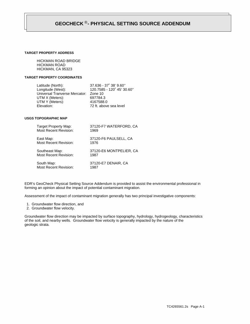
TC4265561.2s Page A-1
geologic strata.of the soil, and nearby wells. Groundwater flow velocity is generally impacted by the nature of theGroundwater flow direction may be impacted by surface topography, hydrology, hydrogeology, characteristics
2. Groundwater flow velocity. 1. Groundwater flow direction, and
Assessment of the impact of contaminant migration generally has two principal investigative components:
forming an opinion about the impact of potential contaminant migration.EDR’s GeoCheck Physical Setting Source Addendum is provided to assist the environmental professional in
1987Most Recent Revision:37120-E7 DENAIR, CASouth Map:
1987Most Recent Revision:37120-E6 MONTPELIER, CASoutheast Map:
1976Most Recent Revision:37120-F6 PAULSELL, CAEast Map:
1969Most Recent Revision:37120-F7 WATERFORD, CATarget Property Map:
USGS TOPOGRAPHIC MAP
72 ft. above sea levelElevation:4167588.0UTM Y (Meters): 697784.3UTM X (Meters): Zone 10Universal Tranverse Mercator: 120.7585 - 120˚ 45’ 30.60’’Longitude (West): 37.636 - 37˚ 38’ 9.60’’Latitude (North):
TARGET PROPERTY COORDINATES
HICKMAN, CA 95323HICKMAN ROADHICKMAN ROAD BRIDGE
TARGET PROPERTY ADDRESS
®GEOCHECK - PHYSICAL SETTING SOURCE ADDENDUM®

TC4265561.2s Page A-2
should be field verified.on a relative (not an absolute) basis. Relative elevation information between sites of close proximitySource: Topography has been determined from the USGS 7.5’ Digital Elevation Model and should be evaluated
SURROUNDING TOPOGRAPHY: ELEVATION PROFILES
Ele
vatio
n (f
t)E
leva
tion
(ft)
TP
TP0 1/2 1 Miles
✩Target Property Elevation: 72 ft.
North South
West East
172
170
169
169
170
172
171
133
148
72
173
172
172
172
172
172
171
170
166162
164
165
167
167
167
167
172
92
72
73
77 76
77 77
91
97
101
105
General EastGeneral Topographic Gradient:TARGET PROPERTY TOPOGRAPHY
should contamination exist on the target property, what downgradient sites might be impacted.assist the environmental professional in forming an opinion about the impact of nearby contaminated properties or,Surface topography may be indicative of the direction of surficial groundwater flow. This information can be used toTOPOGRAPHIC INFORMATION
collected on nearby properties, and regional groundwater flow information (from deep aquifers).sources of information, such as surface topographic information, hydrologic information, hydrogeologic datausing site-specific well data. If such data is not reasonably ascertainable, it may be necessary to rely on otherGroundwater flow direction for a particular site is best determined by a qualified environmental professionalGROUNDWATER FLOW DIRECTION INFORMATION
®GEOCHECK - PHYSICAL SETTING SOURCE SUMMARY®
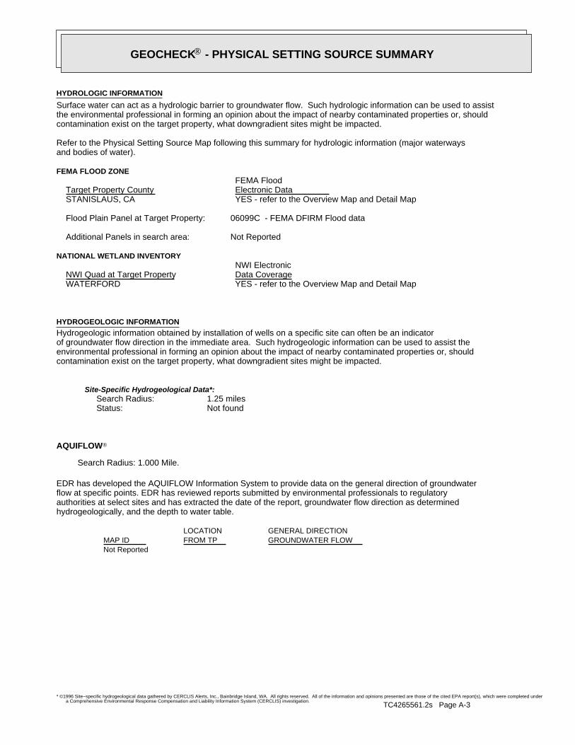
TC4265561.2s Page A-3
Not Reported
GENERAL DIRECTIONLOCATIONGROUNDWATER FLOWFROM TPMAP ID
hydrogeologically, and the depth to water table.authorities at select sites and has extracted the date of the report, groundwater flow direction as determinedflow at specific points. EDR has reviewed reports submitted by environmental professionals to regulatoryEDR has developed the AQUIFLOW Information System to provide data on the general direction of groundwater
AQUIFLOW®
Search Radius: 1.000 Mile.
Not found Status:1.25 miles Search Radius:
Site-Specific Hydrogeological Data*:
* ©1996 Site−specific hydrogeological data gathered by CERCLIS Alerts, Inc., Bainbridge Island, WA. All rights reserved. All of the information and opinions presented are those of the cited EPA report(s), which were completed undera Comprehensive Environmental Response Compensation and Liability Information System (CERCLIS) investigation.
contamination exist on the target property, what downgradient sites might be impacted.environmental professional in forming an opinion about the impact of nearby contaminated properties or, shouldof groundwater flow direction in the immediate area. Such hydrogeologic information can be used to assist theHydrogeologic information obtained by installation of wells on a specific site can often be an indicatorHYDROGEOLOGIC INFORMATION
YES - refer to the Overview Map and Detail MapWATERFORD
NATIONAL WETLAND INVENTORYNWI ElectronicData CoverageNWI Quad at Target Property
Not ReportedAdditional Panels in search area:
06099C - FEMA DFIRM Flood dataFlood Plain Panel at Target Property:
YES - refer to the Overview Map and Detail MapSTANISLAUS, CA
FEMA FLOOD ZONEFEMA FloodElectronic DataTarget Property County
and bodies of water).Refer to the Physical Setting Source Map following this summary for hydrologic information (major waterways
contamination exist on the target property, what downgradient sites might be impacted.the environmental professional in forming an opinion about the impact of nearby contaminated properties or, shouldSurface water can act as a hydrologic barrier to groundwater flow. Such hydrologic information can be used to assistHYDROLOGIC INFORMATION
®GEOCHECK - PHYSICAL SETTING SOURCE SUMMARY®

TC4265561.2s Page A-4
Map, USGS Digital Data Series DDS - 11 (1994).of the Conterminous U.S. at 1:2,500,000 Scale - a digital representation of the 1974 P.B. King and H.M. BeikmanGeologic Age and Rock Stratigraphic Unit Source: P.G. Schruben, R.E. Arndt and W.J. Bawiec, Geology
ROCK STRATIGRAPHIC UNIT GEOLOGIC AGE IDENTIFICATION
Stratifed SequenceCategory:CenozoicEra:QuaternarySystem:QuaternarySeries:QCode: (decoded above as Era, System & Series)
at which contaminant migration may be occurring.Geologic information can be used by the environmental professional in forming an opinion about the relative speedGEOLOGIC INFORMATION IN GENERAL AREA OF TARGET PROPERTY
move more quickly through sandy-gravelly types of soils than silty-clayey types of soils.characteristics data collected on nearby properties and regional soil information. In general, contaminant plumesto rely on other sources of information, including geologic age identification, rock stratigraphic unit and soilusing site specific geologic and soil strata data. If such data are not reasonably ascertainable, it may be necessaryGroundwater flow velocity information for a particular site is best determined by a qualified environmental professionalGROUNDWATER FLOW VELOCITY INFORMATION
®GEOCHECK - PHYSICAL SETTING SOURCE SUMMARY®
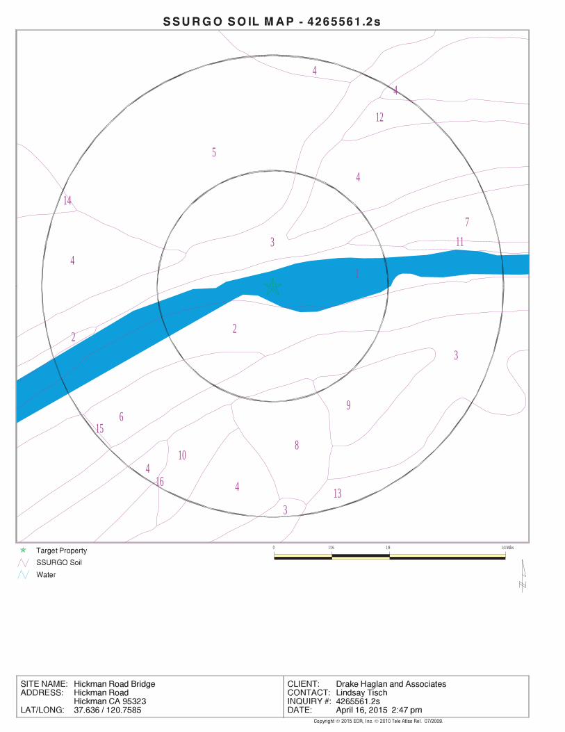
EDR Inc.EDR Inc.EDR Inc.EDR Inc.EDR Inc.EDR Inc.EDR Inc.EDR Inc.EDR Inc.EDR Inc.EDR Inc.EDR Inc.EDR Inc.EDR Inc.EDR Inc.EDR Inc.EDR Inc.EDR Inc.EDR Inc.EDR Inc.EDR Inc.EDR Inc.EDR Inc.EDR Inc.EDR Inc.EDR Inc.EDR Inc.EDR Inc.EDR Inc.EDR Inc.EDR Inc.EDR Inc.EDR Inc.EDR Inc.EDR Inc.EDR Inc.EDR Inc.EDR Inc.EDR Inc.EDR Inc.
4
5
3
4
12
4
14
7
4
11
1
2
32
96
8
13
10
15
44
16
3
0 1/16 1/8 1/4 Miles

TC4265561.2s Page A-6
> 0 inchesDepth to Watertable Min:
> 0 inchesDepth to Bedrock Min:
Not ReportedCorrosion Potential - Uncoated Steel:
Hydric Status: All hydric
Excessively drainedSoil Drainage Class:
water table, or are shallow to an impervious layer.Class D - Very slow infiltration rates. Soils are clayey, have a highHydrologic Group:
gravelly sandSoil Surface Texture:
RiverwashSoil Component Name:
Soil Map ID: 2
No Layer Information available.
> 0 inchesDepth to Watertable Min:
> 0 inchesDepth to Bedrock Min:
Not ReportedCorrosion Potential - Uncoated Steel:
Hydric Status: Not hydricSoil Drainage Class:
Not reportedHydrologic Group:Soil Surface Texture:
WaterSoil Component Name:
Soil Map ID: 1
in a landscape. The following information is based on Soil Conservation Service SSURGO data.for privately owned lands in the United States. A soil map in a soil survey is a representation of soil patternsSurvey (NCSS) and is responsible for collecting, storing, maintaining and distributing soil survey informationThe U.S. Department of Agriculture’s (USDA) Soil Conservation Service (SCS) leads the National Cooperative Soil
DOMINANT SOIL COMPOSITION IN GENERAL AREA OF TARGET PROPERTY
®GEOCHECK - PHYSICAL SETTING SOURCE SUMMARY®
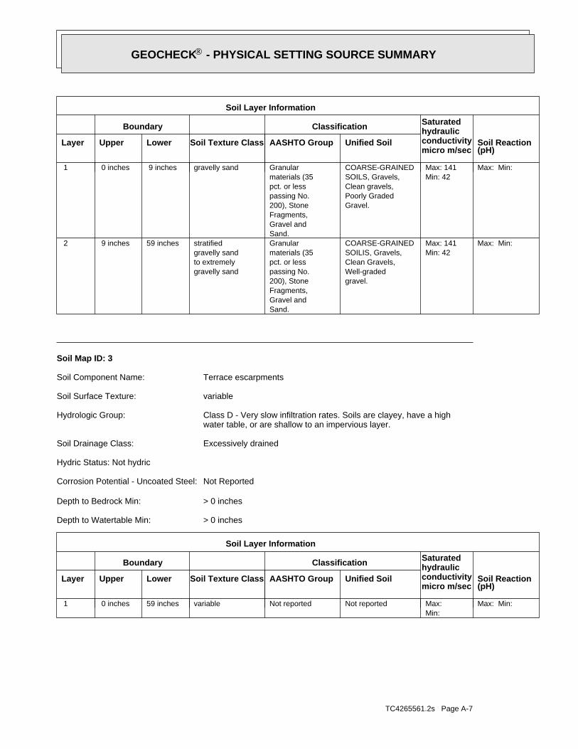
TC4265561.2s Page A-7
Max: Min: Min: Max: Not reportedNot reportedvariable59 inches 0 inches 1
Soil Layer Information
Boundary Classification Saturatedhydraulicconductivitymicro m/sec
Layer Upper Lower Soil Texture Class AASHTO Group Unified Soil Soil Reaction(pH)
> 0 inchesDepth to Watertable Min:
> 0 inchesDepth to Bedrock Min:
Not ReportedCorrosion Potential - Uncoated Steel:
Hydric Status: Not hydric
Excessively drainedSoil Drainage Class:
water table, or are shallow to an impervious layer.Class D - Very slow infiltration rates. Soils are clayey, have a highHydrologic Group:
variableSoil Surface Texture:
Terrace escarpmentsSoil Component Name:
Soil Map ID: 3
Max: Min: Min: 42Max: 141
gravel.Well-gradedClean Gravels,SOILIS, Gravels,COARSE-GRAINED
Sand.Gravel andFragments,200), Stonepassing No.pct. or lessmaterials (35Granular
gravelly sandto extremelygravelly sandstratified59 inches 9 inches 2
Max: Min: Min: 42Max: 141
Gravel.Poorly GradedClean gravels,SOILS, Gravels,COARSE-GRAINED
Sand.Gravel andFragments,200), Stonepassing No.pct. or lessmaterials (35Granulargravelly sand 9 inches 0 inches 1
Soil Layer Information
Boundary Classification Saturatedhydraulicconductivitymicro m/sec
Layer Upper Lower Soil Texture Class AASHTO Group Unified Soil Soil Reaction(pH)
®GEOCHECK - PHYSICAL SETTING SOURCE SUMMARY®
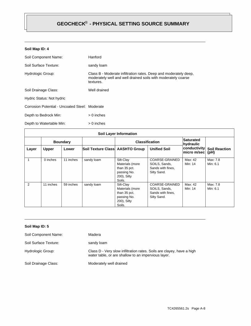
TC4265561.2s Page A-8
Moderately well drainedSoil Drainage Class:
water table, or are shallow to an impervious layer.Class D - Very slow infiltration rates. Soils are clayey, have a highHydrologic Group:
sandy loamSoil Surface Texture:
MaderaSoil Component Name:
Soil Map ID: 5
Min: 6.1Max: 7.8
Min: 14Max: 42
Silty Sand.Sands with fines,SOILS, Sands,COARSE-GRAINED
Soils.200), Siltypassing No.than 35 pct.Materials (moreSilt-Claysandy loam59 inches11 inches 2
Min: 6.1Max: 7.8
Min: 14Max: 42
Silty Sand.Sands with fines,SOILS, Sands,COARSE-GRAINED
Soils.200), Siltypassing No.than 35 pct.Materials (moreSilt-Claysandy loam11 inches 0 inches 1
Soil Layer Information
Boundary Classification Saturatedhydraulicconductivitymicro m/sec
Layer Upper Lower Soil Texture Class AASHTO Group Unified Soil Soil Reaction(pH)
> 0 inchesDepth to Watertable Min:
> 0 inchesDepth to Bedrock Min:
ModerateCorrosion Potential - Uncoated Steel:
Hydric Status: Not hydric
Well drainedSoil Drainage Class:
textures.moderately well and well drained soils with moderately coarseClass B - Moderate infiltration rates. Deep and moderately deep,Hydrologic Group:
sandy loamSoil Surface Texture:
HanfordSoil Component Name:
Soil Map ID: 4
®GEOCHECK - PHYSICAL SETTING SOURCE SUMMARY®
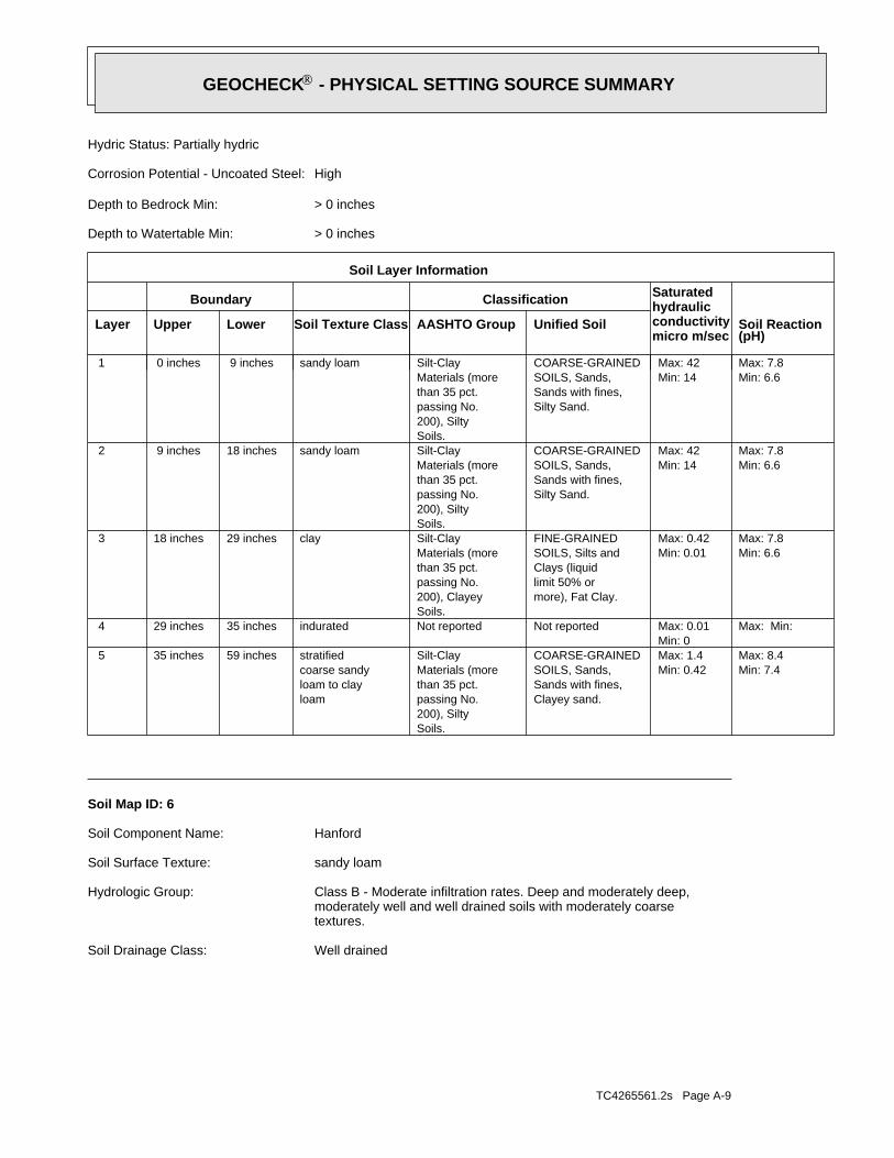
TC4265561.2s Page A-9
Well drainedSoil Drainage Class:
textures.moderately well and well drained soils with moderately coarseClass B - Moderate infiltration rates. Deep and moderately deep,Hydrologic Group:
sandy loamSoil Surface Texture:
HanfordSoil Component Name:
Soil Map ID: 6
Min: 7.4Max: 8.4
Min: 0.42Max: 1.4
Clayey sand.Sands with fines,SOILS, Sands,COARSE-GRAINED
Soils.200), Siltypassing No.than 35 pct.Materials (moreSilt-Clay
loamloam to claycoarse sandystratified59 inches35 inches 5
Max: Min: Min: 0Max: 0.01 Not reportedNot reportedindurated35 inches29 inches 4
Min: 6.6Max: 7.8
Min: 0.01Max: 0.42
more), Fat Clay.limit 50% orClays (liquidSOILS, Silts andFINE-GRAINED
Soils.200), Clayeypassing No.than 35 pct.Materials (moreSilt-Clayclay29 inches18 inches 3
Min: 6.6Max: 7.8
Min: 14Max: 42
Silty Sand.Sands with fines,SOILS, Sands,COARSE-GRAINED
Soils.200), Siltypassing No.than 35 pct.Materials (moreSilt-Claysandy loam18 inches 9 inches 2
Min: 6.6Max: 7.8
Min: 14Max: 42
Silty Sand.Sands with fines,SOILS, Sands,COARSE-GRAINED
Soils.200), Siltypassing No.than 35 pct.Materials (moreSilt-Claysandy loam 9 inches 0 inches 1
Soil Layer Information
Boundary Classification Saturatedhydraulicconductivitymicro m/sec
Layer Upper Lower Soil Texture Class AASHTO Group Unified Soil Soil Reaction(pH)
> 0 inchesDepth to Watertable Min:
> 0 inchesDepth to Bedrock Min:
HighCorrosion Potential - Uncoated Steel:
Hydric Status: Partially hydric
®GEOCHECK - PHYSICAL SETTING SOURCE SUMMARY®
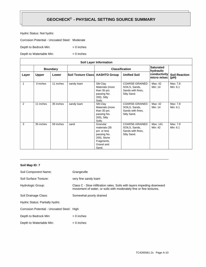
TC4265561.2s Page A-10
> 0 inchesDepth to Watertable Min:
> 0 inchesDepth to Bedrock Min:
HighCorrosion Potential - Uncoated Steel:
Hydric Status: Partially hydric
Somewhat poorly drainedSoil Drainage Class:
movement of water, or soils with moderately fine or fine textures.Class C - Slow infiltration rates. Soils with layers impeding downwardHydrologic Group:
very fine sandy loamSoil Surface Texture:
GrangevilleSoil Component Name:
Soil Map ID: 7
Min: 6.1Max: 7.8
Min: 42Max: 141
Silty Sand.Sands with fines,SOILS, Sands,COARSE-GRAINED
Sand.Gravel andFragments,200), Stonepassing No.pct. or lessmaterials (35Granularsand59 inches35 inches 3
Min: 6.1Max: 7.8
Min: 14Max: 42
Silty Sand.Sands with fines,SOILS, Sands,COARSE-GRAINED
Soils.200), Siltypassing No.than 35 pct.Materials (moreSilt-Claysandy loam35 inches11 inches 2
Min: 6.1Max: 7.8
Min: 14Max: 42
Silty Sand.Sands with fines,SOILS, Sands,COARSE-GRAINED
Soils.200), Siltypassing No.than 35 pct.Materials (moreSilt-Claysandy loam11 inches 0 inches 1
Soil Layer Information
Boundary Classification Saturatedhydraulicconductivitymicro m/sec
Layer Upper Lower Soil Texture Class AASHTO Group Unified Soil Soil Reaction(pH)
> 0 inchesDepth to Watertable Min:
> 0 inchesDepth to Bedrock Min:
ModerateCorrosion Potential - Uncoated Steel:
Hydric Status: Not hydric
®GEOCHECK - PHYSICAL SETTING SOURCE SUMMARY®
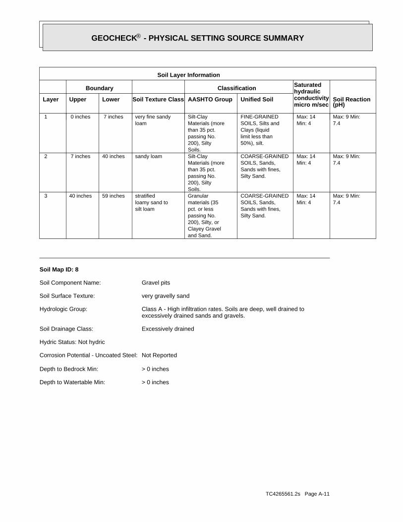
TC4265561.2s Page A-11
> 0 inchesDepth to Watertable Min:
> 0 inchesDepth to Bedrock Min:
Not ReportedCorrosion Potential - Uncoated Steel:
Hydric Status: Not hydric
Excessively drainedSoil Drainage Class:
excessively drained sands and gravels.Class A - High infiltration rates. Soils are deep, well drained toHydrologic Group:
very gravelly sandSoil Surface Texture:
Gravel pitsSoil Component Name:
Soil Map ID: 8
7.4Max: 9 Min:
Min: 4Max: 14
Silty Sand.Sands with fines,SOILS, Sands,COARSE-GRAINED
and Sand.Clayey Gravel200), Silty, orpassing No.pct. or lessmaterials (35Granular
silt loamloamy sand tostratified59 inches40 inches 3
7.4Max: 9 Min:
Min: 4Max: 14
Silty Sand.Sands with fines,SOILS, Sands,COARSE-GRAINED
Soils.200), Siltypassing No.than 35 pct.Materials (moreSilt-Claysandy loam40 inches 7 inches 2
7.4Max: 9 Min:
Min: 4Max: 14
50%), silt.limit less thanClays (liquidSOILS, Silts andFINE-GRAINED
Soils.200), Siltypassing No.than 35 pct.Materials (moreSilt-Clay
loamvery fine sandy 7 inches 0 inches 1
Soil Layer Information
Boundary Classification Saturatedhydraulicconductivitymicro m/sec
Layer Upper Lower Soil Texture Class AASHTO Group Unified Soil Soil Reaction(pH)
®GEOCHECK - PHYSICAL SETTING SOURCE SUMMARY®
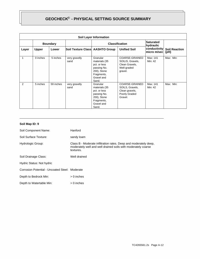
TC4265561.2s Page A-12
> 0 inchesDepth to Watertable Min:
> 0 inchesDepth to Bedrock Min:
ModerateCorrosion Potential - Uncoated Steel:
Hydric Status: Not hydric
Well drainedSoil Drainage Class:
textures.moderately well and well drained soils with moderately coarseClass B - Moderate infiltration rates. Deep and moderately deep,Hydrologic Group:
sandy loamSoil Surface Texture:
HanfordSoil Component Name:
Soil Map ID: 9
Max: Min: Min: 42Max: 141
Gravel.Poorly GradedClean gravels,SOILS, Gravels,COARSE-GRAINED
Sand.Gravel andFragments,200), Stonepassing No.pct. or lessmaterials (35Granular
sandvery gravelly59 inches 5 inches 2
Max: Min: Min: 42Max: 141
gravel.Well-gradedClean Gravels,SOILIS, Gravels,COARSE-GRAINED
Sand.Gravel andFragments,200), Stonepassing No.pct. or lessmaterials (35Granular
sandvery gravelly 5 inches 0 inches 1
Soil Layer Information
Boundary Classification Saturatedhydraulicconductivitymicro m/sec
Layer Upper Lower Soil Texture Class AASHTO Group Unified Soil Soil Reaction(pH)
®GEOCHECK - PHYSICAL SETTING SOURCE SUMMARY®

TC4265561.2s Page A-13
Min: 6.1Max: 7.3
Min: 42Max: 141
Silty Sand.Sands with fines,SOILS, Sands,COARSE-GRAINED
Sand.Gravel andFragments,200), Stonepassing No.pct. or lessmaterials (35Granularloamy sand 9 inches 0 inches 1
Soil Layer Information
Boundary Classification Saturatedhydraulicconductivitymicro m/sec
Layer Upper Lower Soil Texture Class AASHTO Group Unified Soil Soil Reaction(pH)
> 0 inchesDepth to Watertable Min:
> 0 inchesDepth to Bedrock Min:
ModerateCorrosion Potential - Uncoated Steel:
Hydric Status: Not hydric
Somewhat excessively drainedSoil Drainage Class:
excessively drained sands and gravels.Class A - High infiltration rates. Soils are deep, well drained toHydrologic Group:
loamy sandSoil Surface Texture:
TujungaSoil Component Name:
Soil Map ID: 10
Min: 6.1Max: 7.8
Min: 14Max: 42
Silty Sand.Sands with fines,SOILS, Sands,COARSE-GRAINED
Soils.200), Siltypassing No.than 35 pct.Materials (moreSilt-Claysandy loam59 inches11 inches 2
Min: 6.1Max: 7.8
Min: 14Max: 42
Silty Sand.Sands with fines,SOILS, Sands,COARSE-GRAINED
Soils.200), Siltypassing No.than 35 pct.Materials (moreSilt-Claysandy loam11 inches 0 inches 1
Soil Layer Information
Boundary Classification Saturatedhydraulicconductivitymicro m/sec
Layer Upper Lower Soil Texture Class AASHTO Group Unified Soil Soil Reaction(pH)
®GEOCHECK - PHYSICAL SETTING SOURCE SUMMARY®

TC4265561.2s Page A-14
Min: 7.4Max: 8.4
Min: 14Max: 42
Silty Sand.Sands with fines,SOILS, Sands,COARSE-GRAINED
and Sand.Clayey Gravel200), Silty, orpassing No.pct. or lessmaterials (35Granular
silt loamloamy sand tostratified59 inches40 inches 2
Min: 6.6Max: 8.4
Min: 14Max: 42
Silty Sand.Sands with fines,SOILS, Sands,COARSE-GRAINED
Soils.200), Siltypassing No.than 35 pct.Materials (moreSilt-Claysandy loam40 inches 7 inches 1
Soil Layer Information
Boundary Classification Saturatedhydraulicconductivitymicro m/sec
Layer Upper Lower Soil Texture Class AASHTO Group Unified Soil Soil Reaction(pH)
> 0 inchesDepth to Watertable Min:
> 0 inchesDepth to Bedrock Min:
HighCorrosion Potential - Uncoated Steel:
Hydric Status: Partially hydric
Somewhat poorly drainedSoil Drainage Class:
movement of water, or soils with moderately fine or fine textures.Class C - Slow infiltration rates. Soils with layers impeding downwardHydrologic Group:
sandy loamSoil Surface Texture:
GrangevilleSoil Component Name:
Soil Map ID: 11
Min: 6.1Max: 7.8
Min: 42Max: 141
Silty Sand.Sands with fines,SOILS, Sands,COARSE-GRAINED
Sand.Gravel andFragments,200), Stonepassing No.pct. or lessmaterials (35Granularloamy sand59 inches 9 inches 2
Soil Layer Information
Boundary Classification Saturatedhydraulicconductivitymicro m/sec
Layer Upper Lower Soil Texture Class AASHTO Group Unified Soil Soil Reaction(pH)
®GEOCHECK - PHYSICAL SETTING SOURCE SUMMARY®
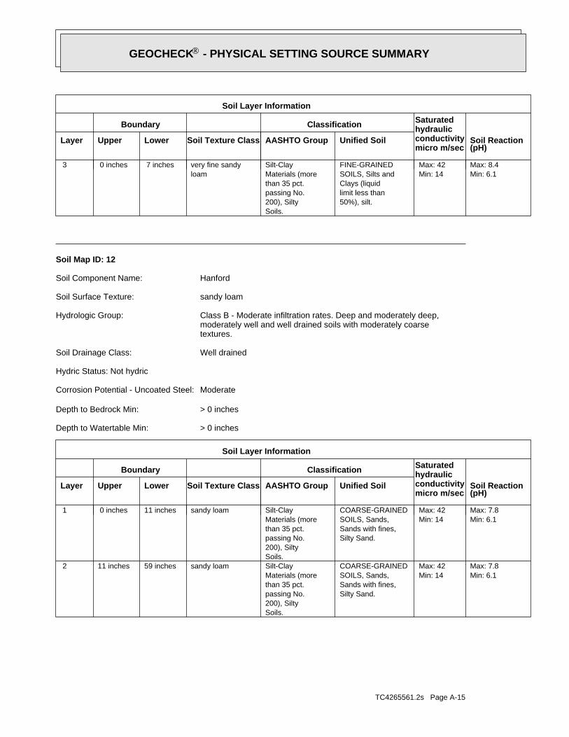
TC4265561.2s Page A-15
Min: 6.1Max: 7.8
Min: 14Max: 42
Silty Sand.Sands with fines,SOILS, Sands,COARSE-GRAINED
Soils.200), Siltypassing No.than 35 pct.Materials (moreSilt-Claysandy loam59 inches11 inches 2
Min: 6.1Max: 7.8
Min: 14Max: 42
Silty Sand.Sands with fines,SOILS, Sands,COARSE-GRAINED
Soils.200), Siltypassing No.than 35 pct.Materials (moreSilt-Claysandy loam11 inches 0 inches 1
Soil Layer Information
Boundary Classification Saturatedhydraulicconductivitymicro m/sec
Layer Upper Lower Soil Texture Class AASHTO Group Unified Soil Soil Reaction(pH)
> 0 inchesDepth to Watertable Min:
> 0 inchesDepth to Bedrock Min:
ModerateCorrosion Potential - Uncoated Steel:
Hydric Status: Not hydric
Well drainedSoil Drainage Class:
textures.moderately well and well drained soils with moderately coarseClass B - Moderate infiltration rates. Deep and moderately deep,Hydrologic Group:
sandy loamSoil Surface Texture:
HanfordSoil Component Name:
Soil Map ID: 12
Min: 6.1Max: 8.4
Min: 14Max: 42
50%), silt.limit less thanClays (liquidSOILS, Silts andFINE-GRAINED
Soils.200), Siltypassing No.than 35 pct.Materials (moreSilt-Clay
loamvery fine sandy 7 inches 0 inches 3
Soil Layer Information
Boundary Classification Saturatedhydraulicconductivitymicro m/sec
Layer Upper Lower Soil Texture Class AASHTO Group Unified Soil Soil Reaction(pH)
®GEOCHECK - PHYSICAL SETTING SOURCE SUMMARY®

TC4265561.2s Page A-16
Min: 7.4Max: 7.8
Min: 0.42Max: 1.4
Silty Sand.Sands with fines,SOILS, Sands,COARSE-GRAINEDClayey sand.Sands with fines,SOILS, Sands,COARSE-GRAINED
and Sand.Clayey Gravel200), Silty, orpassing No.pct. or lessmaterials (35Granular
sandy clay loamsandy loam tostratified59 inches48 inches 4
Max: Min: Min: 0Max: 0.01 Not reportedNot reportedindurated48 inches24 inches 3
Min: 5.6Max: 7.3
Min: 0.01Max: 0.42
50%), Lean Claylimit less thanClays (liquidSOILS, Silts andFINE-GRAINED
Soils.200), Clayeypassing No.than 35 pct.Materials (moreSilt-Clayclay loam24 inches12 inches 2
Min: 5.6Max: 6.5
Min: 4Max: 14
Silty Sand.Sands with fines,SOILS, Sands,COARSE-GRAINED
Soils.200), Siltypassing No.than 35 pct.Materials (moreSilt-Claysandy loam12 inches 0 inches 1
Soil Layer Information
Boundary Classification Saturatedhydraulicconductivitymicro m/sec
Layer Upper Lower Soil Texture Class AASHTO Group Unified Soil Soil Reaction(pH)
> 0 inchesDepth to Watertable Min:
> 0 inchesDepth to Bedrock Min:
HighCorrosion Potential - Uncoated Steel:
Hydric Status: Partially hydric
Moderately well drainedSoil Drainage Class:
water table, or are shallow to an impervious layer.Class D - Very slow infiltration rates. Soils are clayey, have a highHydrologic Group:
sandy loamSoil Surface Texture:
San JoaquinSoil Component Name:
Soil Map ID: 13
®GEOCHECK - PHYSICAL SETTING SOURCE SUMMARY®

TC4265561.2s Page A-17
Soil Drainage Class:
textures.moderately well and well drained soils with moderately coarseClass B - Moderate infiltration rates. Deep and moderately deep,Hydrologic Group:
sandy loamSoil Surface Texture:
Miscellaneous waterSoil Component Name:
Soil Map ID: 15
Max: Min: Min: 0Max: 0.01 Not reportedNot reportedcemented59 inches40 inches 3
Min: 6.5Max: 7.8
Min: 14Max: 42
Silty Sand.Sands with fines,SOILS, Sands,COARSE-GRAINED
Soils.200), Siltypassing No.than 35 pct.Materials (moreSilt-Claysandy loam40 inches20 inches 2
Min: 6.5Max: 7.8
Min: 14Max: 42
Silty Sand.Sands with fines,SOILS, Sands,COARSE-GRAINED
Soils.200), Siltypassing No.than 35 pct.Materials (moreSilt-Claysandy loam20 inches 0 inches 1
Soil Layer Information
Boundary Classification Saturatedhydraulicconductivitymicro m/sec
Layer Upper Lower Soil Texture Class AASHTO Group Unified Soil Soil Reaction(pH)
> 0 inchesDepth to Watertable Min:
> 0 inchesDepth to Bedrock Min:
HighCorrosion Potential - Uncoated Steel:
Hydric Status: Not hydric
Well drainedSoil Drainage Class:
textures.moderately well and well drained soils with moderately coarseClass B - Moderate infiltration rates. Deep and moderately deep,Hydrologic Group:
sandy loamSoil Surface Texture:
GreenfieldSoil Component Name:
Soil Map ID: 14
®GEOCHECK - PHYSICAL SETTING SOURCE SUMMARY®

TC4265561.2s Page A-18
Max: Min: Min: 0.01Max: 0.42 Not reportedNot reported
bedrockweathered35 inches31 inches 3
Min: 6.1Max: 7.3
Min: 4Max: 14
Silty Sand.Sands with fines,SOILS, Sands,COARSE-GRAINED
Soils.200), Siltypassing No.than 35 pct.Materials (moreSilt-Claysandy loam31 inches 7 inches 2
Min: 6.1Max: 7.3
Min: 14Max: 42
Silty Sand.Sands with fines,SOILS, Sands,COARSE-GRAINED
Soils.200), Siltypassing No.than 35 pct.Materials (moreSilt-Claysandy loam 7 inches 0 inches 1
Soil Layer Information
Boundary Classification Saturatedhydraulicconductivitymicro m/sec
Layer Upper Lower Soil Texture Class AASHTO Group Unified Soil Soil Reaction(pH)
> 0 inchesDepth to Watertable Min:
> 0 inchesDepth to Bedrock Min:
ModerateCorrosion Potential - Uncoated Steel:
Hydric Status: Not hydric
Well drainedSoil Drainage Class:
movement of water, or soils with moderately fine or fine textures.Class C - Slow infiltration rates. Soils with layers impeding downwardHydrologic Group:
sandy loamSoil Surface Texture:
WhitneySoil Component Name:
Soil Map ID: 16
No Layer Information available.
> 0 inchesDepth to Watertable Min:
> 0 inchesDepth to Bedrock Min:
Not ReportedCorrosion Potential - Uncoated Steel:
Hydric Status: Not hydric
®GEOCHECK - PHYSICAL SETTING SOURCE SUMMARY®

TC4265561.2s Page A-19
1/8 - 1/4 Mile ENECAOG9A000206831 1
STATE OIL/GAS WELL INFORMATION
LOCATIONFROM TPWELL IDMAP ID
OTHER STATE DATABASE INFORMATION
1/2 - 1 Mile West20918 171/2 - 1 Mile NECADW50000029750 161/2 - 1 Mile NNW20919 B151/2 - 1 Mile NNWCADW50000029768 B121/2 - 1 Mile ENE3851 A91/2 - 1 Mile ENECADW50000029725 A71/4 - 1/2 Mile ENE3852 41/4 - 1/2 Mile ESE3853 3
STATE DATABASE WELL INFORMATION
LOCATIONFROM TPWELL IDMAP ID
Note: PWS System location is not always the same as well location.
1/4 - 1/2 Mile NNWCA5000387 2
FEDERAL FRDS PUBLIC WATER SUPPLY SYSTEM INFORMATION
LOCATIONFROM TPWELL IDMAP ID
1/2 - 1 Mile SEUSGS40000184228 191/2 - 1 Mile SSEUSGS40000184189 181/2 - 1 Mile NNWUSGS40000184438 B141/2 - 1 Mile ENEUSGS40000184365 131/2 - 1 Mile SWUSGS40000184239 111/2 - 1 Mile EastUSGS40000184306 101/2 - 1 Mile NNWUSGS40000184378 81/2 - 1 Mile EastUSGS40000184308 61/4 - 1/2 Mile NNEUSGS40000184370 51/4 - 1/2 Mile ENEUSGS40000184314 1
FEDERAL USGS WELL INFORMATION
LOCATIONFROM TPWELL IDMAP ID
1.000State DatabaseNearest PWS within 1 mileFederal FRDS PWS1.000Federal USGS
WELL SEARCH DISTANCE INFORMATION
SEARCH DISTANCE (miles)DATABASE
opinion about the impact of contaminant migration on nearby drinking water wells.professional in assessing sources that may impact ground water flow direction, and in forming anEDR Local/Regional Water Agency records provide water well information to assist the environmental
LOCAL / REGIONAL WATER AGENCY RECORDS
®GEOCHECK - PHYSICAL SETTING SOURCE SUMMARY®

TC4265561.2s Page A-20
1/2 - 1 Mile ESECAOG9A000206812 61/4 - 1/2 Mile EastCAOG9A000206827 A51/4 - 1/2 Mile EastCAOG9A000206830 A41/4 - 1/2 Mile EastCAOG9A000206828 A31/4 - 1/2 Mile EastCAOG9A000206829 A2
STATE OIL/GAS WELL INFORMATION
LOCATIONFROM TPWELL IDMAP ID
®GEOCHECK - PHYSICAL SETTING SOURCE SUMMARY®
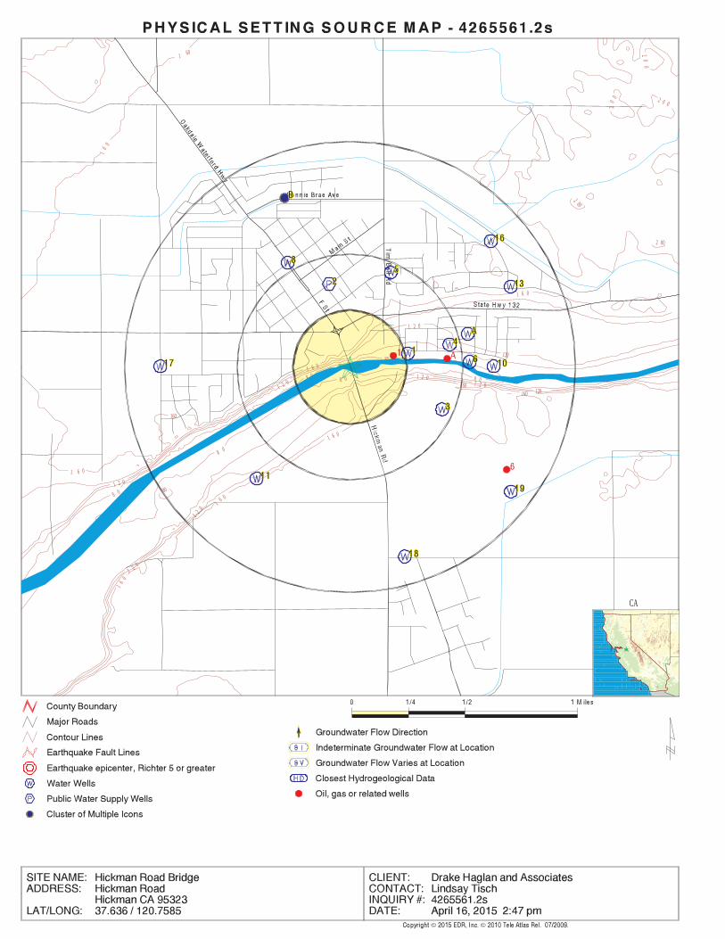
EDR Inc.EDR Inc.EDR Inc.EDR Inc.EDR Inc.EDR Inc.EDR Inc.EDR Inc.EDR Inc.EDR Inc.EDR Inc.EDR Inc.EDR Inc.EDR Inc.EDR Inc.EDR Inc.EDR Inc.EDR Inc.EDR Inc.EDR Inc.EDR Inc.EDR Inc.EDR Inc.EDR Inc.EDR Inc.EDR Inc.EDR Inc.EDR Inc.EDR Inc.EDR Inc.EDR Inc.EDR Inc.EDR Inc.EDR Inc.EDR Inc.EDR Inc.EDR Inc.EDR Inc.EDR Inc.EDR Inc.
1 60
16
0
1 6 0
160
1 6 0
801 2 0
1 2 0
1 2 0
8 0
8 0
80
8 0
8 0
80
1 2 0
1 2 0
1 6 0
1 6 0
20
0
20
0 2 0 0
2 00
2 00
1 6 0
8 0
120
1201 2 0
160160
1 2 0
16
0
CA
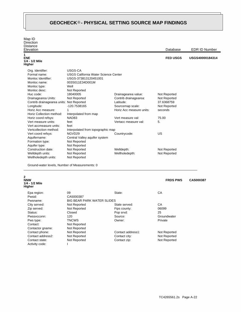
TC4265561.2s Page A-22
IActivity code:Not ReportedContact zip:Not ReportedContact state:Not ReportedContact city:Not ReportedContact address2:Not ReportedContact address1:Not ReportedContact phone:
Not ReportedContactor gname:Not ReportedContact:
PrivateOwner:TNCWSPws type:GroundwaterSource:120Pwssvcconn:25Pop srvd:ClosedStatus:06099Fips county:Not ReportedZip served:CAState served:Not ReportedCity served:
BIG BEAR PARK WATER SLIDESPwsname:CA5000387Pwsid:
CAState:09Epa region:
2NNW1/4 - 1/2 MileHigher
CA5000387FRDS PWS
Ground-water levels, Number of Measurements: 0
Not ReportedWellholedepth units:Not ReportedWellholedepth:Not ReportedWelldepth units:Not ReportedWelldepth:Not ReportedConstruction date:
Not ReportedAquifer type:Not ReportedFormation type:Central Valley aquifer systemAquifername:
USCountrycode:NGVD29Vert coord refsys:Interpolated from topographic mapVertcollection method:feetVert accmeasure units:
5.Vertacc measure val:feetVert measure units:75.00Vert measure val:NAD83Horiz coord refsys:
Interpolated from mapHoriz Collection method:secondsHoriz Acc measure units:1Horiz Acc measure:Not ReportedSourcemap scale:-120.7538165Longitude:37.6368759Latitude:Not ReportedContrib drainagearea units:Not ReportedContrib drainagearea:Not ReportedDrainagearea Units:Not ReportedDrainagearea value:18040005Huc code:
Not ReportedMonloc desc:WellMonloc type:003S011E34D001MMonloc name:USGS-373813120451001Monloc Identifier:USGS California Water Science CenterFormal name:USGS-CAOrg. Identifier:
1ENE1/4 - 1/2 MileHigher
USGS40000184314FED USGS
Map IDDirectionDistanceElevation EDR ID NumberDatabase
®GEOCHECK - PHYSICAL SETTING SOURCE MAP FINDINGS®
TC4265561.2s Page A-23
0Violmeasur:State Compliance AchievedEnf action:
4/4/2000 0:00:00Enfdate:4/4/2000 0:00:00Complperen:7/1/1993 0:00:00Complperbe:Initial Tap Sampling for Pb and CuViol. Type:
LEAD & COPPER RULEContaminant:95V0001Vioid:NCPwstypecod:25Retpopsrvd:
BIG BEAR PARK WATER SLIDESPwsname:CA5000387Pwsid:03/31/2009Truedate:
ENFORCEMENT INFORMATION:
Violations information not reported.
00000025Population:UntreatedTreatment Class:Not ReportedCity Served:
120 45 33Facility Longitude:37 38 29Facility Latitude:
WATERFORD, CA 9538613400 YOSEMITE BOULEVARDROBERT BEARDONSystem Owner/Responsible PartyAddressee / Facility:
WATERFORD, CA 9538613400 YOSEMITE BLVROBERT BEARDONBIG BEAR PARKPWS Name:
Not ReportedDate Deactivated:7706Date Initiated:CA5000387PWS ID:
04/04/2000Cmpedt:07/01/1993Cmpbdt:0State mcl:Not ReportedUnitmeasur:0Violmeasur:
LCRRule name:350Rule code:Initial Tap Sampling for Pb and CuViol name:51Viol code:Lead and Copper RuleContamnm:5000Contamcd:
1993Viol fy:CAState:FOrig cd:95V0001Violoation id:
Violations Information:
ResolvingEnf act cat:St Compliance achievedEnf act detail:04/04/2000Enf act date:2000Enf fy:FOrig cd:95V0001Violation id:
Enforcement Information:
Not ReportedZipserv:CAStateserv:StanislausCntyserv:Not ReportedCityserv:Not ReportedPhone:Not ReportedZip:Not ReportedState:Not ReportedCity:
Not ReportedAdd2:Not ReportedAdd1:25Popserved:
GWPrimsrccd:TNCWSPwstypcd:BIG BEAR PARK WATER SLIDESName:
Location Information:
®GEOCHECK - PHYSICAL SETTING SOURCE MAP FINDINGS®

TC4265561.2s Page A-24
WELL 272 - RAWSource Name:1 Mile (One Minute)Precision:373800.0 1204500.0Source Lat/Long:Active RawWell Status:Well/GroundwaterWater Type:WELL/AMBNT/MUN/INTAKE/SUPPLYStation Type:10District Number:StanislausCounty:5010026001FRDS Number:PTAUser ID:03S/11E-34N01 MPrime Station Code:
Water System Information:
3ESE1/4 - 1/2 MileHigher
3853CA WELLS
Modesto, CA 95358Suite CAddress 2:3800 Cornucopia wayAddress:
2095256795Phone:Wanda SerrosContact:25Population:BIG BEAR PARK WATER SLIDESName:
CONTACT INFORMATION:
State Compliance AchievedEnf. Action:04/04/00Enforcement Date:95V0001Violation ID:07/01/93 - 04/04/00Compliance Period:LEAD & COPPER RULEContaminant:Initial Tap Sampling for Pb and CuViolation Type:BIG BEAR PARK WATER SLIDESSystem Name:
State Compliance AchievedEnf. Action:4/4/2000 0:00:00Enforcement Date:95V0001Violation ID:7/1/1993 0:00:00 - 4/4/2000 0:00:00Compliance Period:LEAD & COPPER RULEContaminant:Initial Tap Sampling for Pb and CuViolation Type:BIG BEAR PARK WATER SLIDESSystem Name:
Not ReportedEnf. Action:Not ReportedEnforcement Date:95V0001Violation ID:1993-07-01 - 2015-12-31Compliance Period:LEAD & COPPER RULEContaminant:Initial Tap Sampling for Pb and CuViolation Type:BEARDEN FAMILYSystem Name:
State Compliance AchievedEnf. Action:2000-04-04Enforcement Date:95V0001Violation ID:1993-07-01 - 2000-04-04Compliance Period:LEAD & COPPER RULEContaminant:Initial Tap Sampling for Pb and CuViolation Type:BEARDEN FAMILYSystem Name:
State Compliance AchievedEnf. Action:2000-04-04Enforcement Date:95V0001Violation ID:1993-07-01 - 2000-04-04Compliance Period:LEAD & COPPER RULEContaminant:Initial Tap Sampling for Pb and CuViolation Type:BIG BEAR PARKSystem Name:
ENFORCEMENT INFORMATION:
®GEOCHECK - PHYSICAL SETTING SOURCE MAP FINDINGS®

TC4265561.2s Page A-25
CHROMIUM, HEXAVALENTChemical:. 8.4 UG/LFindings:18-SEP-14Sample Collected:
NITRATE (AS NO3)Chemical:. 34.8 MG/LFindings:19-MAR-14Sample Collected:
NITRATE (AS NO3)Chemical:28.3 MG/LFindings:20-MAR-13Sample Collected:
SPECIFIC CONDUCTANCEChemical:350. USFindings:17-OCT-12Sample Collected:
AGGRSSIVE INDEX (CORROSIVITY)Chemical:12.Findings:07-MAR-12Sample Collected:
LANGELIER INDEX @ 60 CChemical:0.15Findings:07-MAR-12Sample Collected:
TOTAL DISSOLVED SOLIDSChemical:280. MG/LFindings:07-MAR-12Sample Collected:
CHLORIDEChemical:7.7 MG/LFindings:07-MAR-12Sample Collected:
POTASSIUMChemical:5.5 MG/LFindings:07-MAR-12Sample Collected:
SODIUMChemical:50. MG/LFindings:07-MAR-12Sample Collected:
MAGNESIUMChemical:11. MG/LFindings:07-MAR-12Sample Collected:
CALCIUMChemical:19. MG/LFindings:07-MAR-12Sample Collected:
HARDNESS (TOTAL) AS CACO3Chemical:94. MG/LFindings:07-MAR-12Sample Collected:
BICARBONATE ALKALINITYChemical:190. MG/LFindings:07-MAR-12Sample Collected:
ALKALINITY (TOTAL) AS CACO3Chemical:160. MG/LFindings:07-MAR-12Sample Collected:
PH, LABORATORYChemical:8.2Findings:07-MAR-12Sample Collected:
SPECIFIC CONDUCTANCEChemical:410. USFindings:07-MAR-12Sample Collected:
NITRATE (AS NO3)Chemical:26.8 MG/LFindings:07-MAR-12Sample Collected:
NITRATE (AS NO3)Chemical:30.5 MG/LFindings:02-MAR-11Sample Collected:
HICKMANArea Served:160Connections:536Pop Served:
MODESTO, CA 95353P O BOX 3250
Organization That Operates System:City of Modesto, DE HickmanSystem Name:5010026System Number:
®GEOCHECK - PHYSICAL SETTING SOURCE MAP FINDINGS®

TC4265561.2s Page A-26
6East1/2 - 1 MileHigher
USGS40000184308FED USGS
Ground-water levels, Number of Measurements: 0
ftWellholedepth units:250Wellholedepth:ftWelldepth units:133Welldepth:19490101Construction date:
Not ReportedAquifer type:Not ReportedFormation type:Central Valley aquifer systemAquifername:
USCountrycode:NGVD29Vert coord refsys:Interpolated from topographic mapVertcollection method:feetVert accmeasure units:
2.5Vertacc measure val:feetVert measure units:172.00Vert measure val:NAD83Horiz coord refsys:
Global positioning system (GPS), uncorrectedHoriz Collection method:secondsHoriz Acc measure units:.5Horiz Acc measure:24000Sourcemap scale:-120.7551944Longitude:37.6420833Latitude:Not ReportedContrib drainagearea units:Not ReportedContrib drainagearea:Not ReportedDrainagearea Units:Not ReportedDrainagearea value:18040005Huc code:
Not ReportedMonloc desc:WellMonloc type:003S011E27M001MMonloc name:USGS-373831120451601Monloc Identifier:USGS California Water Science CenterFormal name:USGS-CAOrg. Identifier:
5NNE1/4 - 1/2 MileHigher
USGS40000184370FED USGS
Not ReportedArea Served:Unknown, Small SystemConnections:Unknown, Small SystemPop Served:
Not ReportedOrganization That Operates System:
BIG BEAR PARKSystem Name:5000387System Number:SOUTH WELLSource Name:
1,000 Feet (10 Seconds)Precision:373815.0 1204458.0Source Lat/Long:Active RawWell Status:Well/GroundwaterWater Type:WELL/AMBNT/MUN/INTAKEStation Type:80District Number:StanislausCounty:5000387002FRDS Number:50CUser ID:03S/11E-34C06 MPrime Station Code:
Water System Information:
4ENE1/4 - 1/2 MileHigher
3852CA WELLS
Map IDDirectionDistanceElevation EDR ID NumberDatabase
®GEOCHECK - PHYSICAL SETTING SOURCE MAP FINDINGS®
TC4265561.2s Page A-27
24000Sourcemap scale:-120.763539Longitude:37.642709Latitude:Not ReportedContrib drainagearea units:Not ReportedContrib drainagearea:Not ReportedDrainagearea Units:Not ReportedDrainagearea value:18040005Huc code:
Not ReportedMonloc desc:WellMonloc type:003S011E28K001MMonloc name:USGS-373834120454501Monloc Identifier:USGS California Water Science CenterFormal name:USGS-CAOrg. Identifier:
8NNW1/2 - 1 MileHigher
USGS40000184378FED USGS
CADW50000029725Site id:South Central Region OfficeOrg unit n:ModestoBasin desc:5-22.02Basin cd:
50County id:UnknownCasgem s 1:Not ReportedLocal well:03S11E34C003MCasgem sta:376380N1207491W001Site code:
120.7491Longitude :37.638Latitude :
A7ENE1/2 - 1 MileHigher
CADW50000029725CA WELLS
Ground-water levels, Number of Measurements: 0
Not ReportedWellholedepth units:Not ReportedWellholedepth:Not ReportedWelldepth units:Not ReportedWelldepth:Not ReportedConstruction date:
Not ReportedAquifer type:Alluvium of the Sierra NevadaFormation type:Central Valley aquifer systemAquifername:
USCountrycode:NGVD29Vert coord refsys:Interpolated from topographic mapVertcollection method:feetVert accmeasure units:
5.Vertacc measure val:feetVert measure units:78.00Vert measure val:NAD83Horiz coord refsys:
Interpolated from mapHoriz Collection method:secondsHoriz Acc measure units:1Horiz Acc measure:Not ReportedSourcemap scale:-120.7488163Longitude:37.6363204Latitude:Not ReportedContrib drainagearea units:Not ReportedContrib drainagearea:Not ReportedDrainagearea Units:Not ReportedDrainagearea value:18040005Huc code:
Not ReportedMonloc desc:WellMonloc type:003S011E34C001MMonloc name:USGS-373811120445201Monloc Identifier:USGS California Water Science CenterFormal name:USGS-CAOrg. Identifier:
®GEOCHECK - PHYSICAL SETTING SOURCE MAP FINDINGS®

TC4265561.2s Page A-28
Alluvium of the Sierra NevadaFormation type:Central Valley aquifer systemAquifername:
USCountrycode:NGVD29Vert coord refsys:Interpolated from topographic mapVertcollection method:feetVert accmeasure units:
5.Vertacc measure val:feetVert measure units:90.00Vert measure val:NAD83Horiz coord refsys:
Interpolated from mapHoriz Collection method:secondsHoriz Acc measure units:1Horiz Acc measure:Not ReportedSourcemap scale:-120.7468718Longitude:37.6360426Latitude:Not ReportedContrib drainagearea units:Not ReportedContrib drainagearea:Not ReportedDrainagearea Units:Not ReportedDrainagearea value:18040005Huc code:
Not ReportedMonloc desc:WellMonloc type:003S011E34C002MMonloc name:USGS-373810120444501Monloc Identifier:USGS California Water Science CenterFormal name:USGS-CAOrg. Identifier:
10East1/2 - 1 MileHigher
USGS40000184306FED USGS
Not ReportedArea Served:Unknown, Small SystemConnections:Unknown, Small SystemPop Served:
Not ReportedOrganization That Operates System:
BIG BEAR PARKSystem Name:5000387System Number:OLD NORTH WELLSource Name:
1,000 Feet (10 Seconds)Precision:373818.0 1204452.0Source Lat/Long:Active RawWell Status:Well/GroundwaterWater Type:WELL/AMBNT/MUN/INTAKEStation Type:80District Number:StanislausCounty:5000387001FRDS Number:50CUser ID:03S/11E-34C05 MPrime Station Code:
Water System Information:
A9ENE1/2 - 1 MileHigher
3851CA WELLS
Ground-water levels, Number of Measurements: 0
ftWellholedepth units:295Wellholedepth:ftWelldepth units:290Welldepth:19450514Construction date:
Not ReportedAquifer type:Not ReportedFormation type:Central Valley aquifer systemAquifername:
USCountrycode:NGVD29Vert coord refsys:Interpolated from topographic mapVertcollection method:feetVert accmeasure units:
2.5Vertacc measure val:feetVert measure units:165.00Vert measure val:NAD83Horiz coord refsys:
Interpolated from mapHoriz Collection method:secondsHoriz Acc measure units:1Horiz Acc measure:
®GEOCHECK - PHYSICAL SETTING SOURCE MAP FINDINGS®

TC4265561.2s Page A-29
13ENE1/2 - 1 MileHigher
USGS40000184365FED USGS
CADW50000029768Site id:South Central Region OfficeOrg unit n:ModestoBasin desc:5-22.02Basin cd:
50County id:UnknownCasgem s 1:225Local well:03S11E28G001MCasgem sta:376466N1207632W001Site code:
120.7632Longitude :37.6466Latitude :
B12NNW1/2 - 1 MileHigher
CADW50000029768CA WELLS
Ground-water levels, Number of Measurements: 0
Not ReportedWellholedepth units:Not ReportedWellholedepth:ftWelldepth units:210Welldepth:19690101Construction date:
Not ReportedAquifer type:Not ReportedFormation type:Central Valley aquifer systemAquifername:
USCountrycode:NGVD29Vert coord refsys:Interpolated from topographic mapVertcollection method:feetVert accmeasure units:
5.Vertacc measure val:feetVert measure units:164.00Vert measure val:NAD83Horiz coord refsys:
Interpolated from mapHoriz Collection method:secondsHoriz Acc measure units:1Horiz Acc measure:Not ReportedSourcemap scale:-120.7660389Longitude:37.6288205Latitude:Not ReportedContrib drainagearea units:Not ReportedContrib drainagearea:Not ReportedDrainagearea Units:Not ReportedDrainagearea value:18040005Huc code:
Not ReportedMonloc desc:WellMonloc type:003S011E33L001MMonloc name:USGS-373744120455401Monloc Identifier:USGS California Water Science CenterFormal name:USGS-CAOrg. Identifier:
11SW1/2 - 1 MileHigher
USGS40000184239FED USGS
Ground-water levels, Number of Measurements: 0
Not ReportedWellholedepth units:Not ReportedWellholedepth:Not ReportedWelldepth units:Not ReportedWelldepth:Not ReportedConstruction date:
Not ReportedAquifer type:
®GEOCHECK - PHYSICAL SETTING SOURCE MAP FINDINGS®
TC4265561.2s Page A-30
Ground-water levels, Number of Measurements: 0
Not ReportedWellholedepth units:Not ReportedWellholedepth:ftWelldepth units:235Welldepth:19600101Construction date:
Not ReportedAquifer type:Not ReportedFormation type:Central Valley aquifer systemAquifername:
USCountrycode:NGVD29Vert coord refsys:Interpolated from topographic mapVertcollection method:feetVert accmeasure units:
5.Vertacc measure val:feetVert measure units:160.00Vert measure val:NAD83Horiz coord refsys:
Interpolated from mapHoriz Collection method:secondsHoriz Acc measure units:1Horiz Acc measure:Not ReportedSourcemap scale:-120.7638169Longitude:37.6468756Latitude:Not ReportedContrib drainagearea units:Not ReportedContrib drainagearea:Not ReportedDrainagearea Units:Not ReportedDrainagearea value:18040005Huc code:
Not ReportedMonloc desc:WellMonloc type:003S011E28G001MMonloc name:USGS-373849120454601Monloc Identifier:USGS California Water Science CenterFormal name:USGS-CAOrg. Identifier:
B14NNW1/2 - 1 MileHigher
USGS40000184438FED USGS
Ground-water levels, Number of Measurements: 0
ftWellholedepth units:300Wellholedepth:ftWelldepth units:300Welldepth:19650101Construction date:
Not ReportedAquifer type:Not ReportedFormation type:Central Valley aquifer systemAquifername:
USCountrycode:NGVD29Vert coord refsys:Interpolated from topographic mapVertcollection method:feetVert accmeasure units:
2.5Vertacc measure val:feetVert measure units:172.00Vert measure val:NAD83Horiz coord refsys:
Global positioning system (GPS), uncorrectedHoriz Collection method:secondsHoriz Acc measure units:.5Horiz Acc measure:24000Sourcemap scale:-120.7455Longitude:37.6411667Latitude:Not ReportedContrib drainagearea units:Not ReportedContrib drainagearea:Not ReportedDrainagearea Units:Not ReportedDrainagearea value:18040005Huc code:
Not ReportedMonloc desc:WellMonloc type:003S011E27L001MMonloc name:USGS-373828120444001Monloc Identifier:USGS California Water Science CenterFormal name:USGS-CAOrg. Identifier:
®GEOCHECK - PHYSICAL SETTING SOURCE MAP FINDINGS®
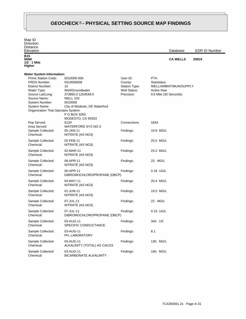
TC4265561.2s Page A-31
BICARBONATE ALKALINITYChemical:160. MG/LFindings:03-AUG-11Sample Collected:
ALKALINITY (TOTAL) AS CACO3Chemical:130. MG/LFindings:03-AUG-11Sample Collected:
PH, LABORATORYChemical:8.1Findings:03-AUG-11Sample Collected:
SPECIFIC CONDUCTANCEChemical:340. USFindings:03-AUG-11Sample Collected:
DIBROMOCHLOROPROPANE (DBCP)Chemical:0.19 UG/LFindings:07-JUL-11Sample Collected:
NITRATE (AS NO3)Chemical:22. MG/LFindings:07-JUL-11Sample Collected:
NITRATE (AS NO3)Chemical:19.5 MG/LFindings:01-JUN-11Sample Collected:
NITRATE (AS NO3)Chemical:20.4 MG/LFindings:04-MAY-11Sample Collected:
DIBROMOCHLOROPROPANE (DBCP)Chemical:0.18 UG/LFindings:06-APR-11Sample Collected:
NITRATE (AS NO3)Chemical:23. MG/LFindings:06-APR-11Sample Collected:
NITRATE (AS NO3)Chemical:23.2 MG/LFindings:02-MAR-11Sample Collected:
NITRATE (AS NO3)Chemical:25.5 MG/LFindings:02-FEB-11Sample Collected:
NITRATE (AS NO3)Chemical:19.9 MG/LFindings:05-JAN-11Sample Collected:
WATERFORD SYS NO 3Area Served:1843Connections:6129Pop Served:
MODESTO, CA 95353P O BOX 3250
Organization That Operates System:City of Modesto, DE WaterfordSystem Name:5010006System Number:WELL 103Source Name:
0.5 Mile (30 Seconds)Precision:373850.0 1204548.0Source Lat/Long:Active RawWell Status:Well/GroundwaterWater Type:WELL/AMBNT/MUN/SUPPLYStation Type:10District Number:StanislausCounty:5010006006FRDS Number:PTAUser ID:5010006-006Prime Station Code:
Water System Information:
B15NNW1/2 - 1 MileHigher
20919CA WELLS
Map IDDirectionDistanceElevation EDR ID NumberDatabase
®GEOCHECK - PHYSICAL SETTING SOURCE MAP FINDINGS®
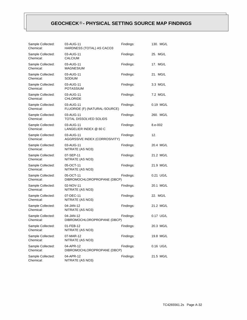
TC4265561.2s Page A-32
NITRATE (AS NO3)Chemical:21.5 MG/LFindings:04-APR-12Sample Collected:
DIBROMOCHLOROPROPANE (DBCP)Chemical:0.16 UG/LFindings:04-APR-12Sample Collected:
NITRATE (AS NO3)Chemical:19.8 MG/LFindings:07-MAR-12Sample Collected:
NITRATE (AS NO3)Chemical:20.3 MG/LFindings:01-FEB-12Sample Collected:
DIBROMOCHLOROPROPANE (DBCP)Chemical:0.17 UG/LFindings:04-JAN-12Sample Collected:
NITRATE (AS NO3)Chemical:21.2 MG/LFindings:04-JAN-12Sample Collected:
NITRATE (AS NO3)Chemical:22. MG/LFindings:07-DEC-11Sample Collected:
NITRATE (AS NO3)Chemical:20.1 MG/LFindings:02-NOV-11Sample Collected:
DIBROMOCHLOROPROPANE (DBCP)Chemical:0.21 UG/LFindings:05-OCT-11Sample Collected:
NITRATE (AS NO3)Chemical:21.9 MG/LFindings:05-OCT-11Sample Collected:
NITRATE (AS NO3)Chemical:21.2 MG/LFindings:07-SEP-11Sample Collected:
NITRATE (AS NO3)Chemical:20.4 MG/LFindings:03-AUG-11Sample Collected:
AGGRSSIVE INDEX (CORROSIVITY)Chemical:12.Findings:03-AUG-11Sample Collected:
LANGELIER INDEX @ 60 CChemical:8.e-002Findings:03-AUG-11Sample Collected:
TOTAL DISSOLVED SOLIDSChemical:260. MG/LFindings:03-AUG-11Sample Collected:
FLUORIDE (F) (NATURAL-SOURCE)Chemical:0.19 MG/LFindings:03-AUG-11Sample Collected:
CHLORIDEChemical:7.2 MG/LFindings:03-AUG-11Sample Collected:
POTASSIUMChemical:3.3 MG/LFindings:03-AUG-11Sample Collected:
SODIUMChemical:21. MG/LFindings:03-AUG-11Sample Collected:
MAGNESIUMChemical:17. MG/LFindings:03-AUG-11Sample Collected:
CALCIUMChemical:25. MG/LFindings:03-AUG-11Sample Collected:
HARDNESS (TOTAL) AS CACO3Chemical:130. MG/LFindings:03-AUG-11Sample Collected:
®GEOCHECK - PHYSICAL SETTING SOURCE MAP FINDINGS®
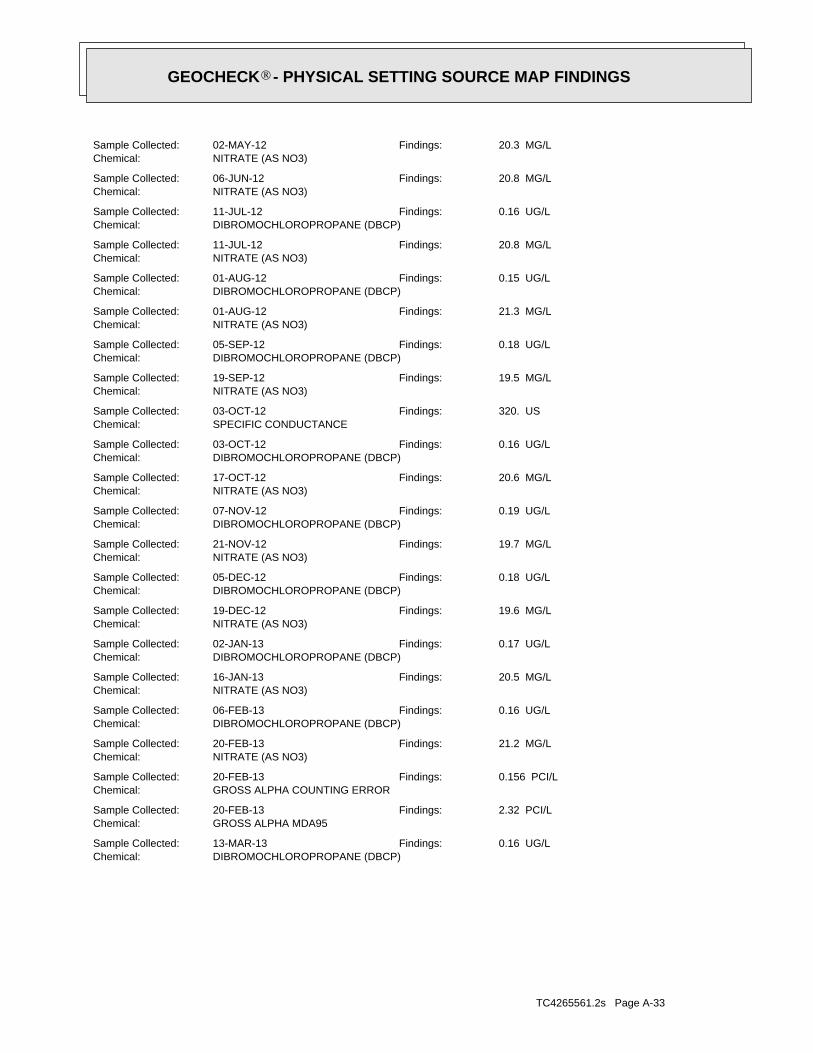
TC4265561.2s Page A-33
DIBROMOCHLOROPROPANE (DBCP)Chemical:0.16 UG/LFindings:13-MAR-13Sample Collected:
GROSS ALPHA MDA95Chemical:2.32 PCI/LFindings:20-FEB-13Sample Collected:
GROSS ALPHA COUNTING ERRORChemical:0.156 PCI/LFindings:20-FEB-13Sample Collected:
NITRATE (AS NO3)Chemical:21.2 MG/LFindings:20-FEB-13Sample Collected:
DIBROMOCHLOROPROPANE (DBCP)Chemical:0.16 UG/LFindings:06-FEB-13Sample Collected:
NITRATE (AS NO3)Chemical:20.5 MG/LFindings:16-JAN-13Sample Collected:
DIBROMOCHLOROPROPANE (DBCP)Chemical:0.17 UG/LFindings:02-JAN-13Sample Collected:
NITRATE (AS NO3)Chemical:19.6 MG/LFindings:19-DEC-12Sample Collected:
DIBROMOCHLOROPROPANE (DBCP)Chemical:0.18 UG/LFindings:05-DEC-12Sample Collected:
NITRATE (AS NO3)Chemical:19.7 MG/LFindings:21-NOV-12Sample Collected:
DIBROMOCHLOROPROPANE (DBCP)Chemical:0.19 UG/LFindings:07-NOV-12Sample Collected:
NITRATE (AS NO3)Chemical:20.6 MG/LFindings:17-OCT-12Sample Collected:
DIBROMOCHLOROPROPANE (DBCP)Chemical:0.16 UG/LFindings:03-OCT-12Sample Collected:
SPECIFIC CONDUCTANCEChemical:320. USFindings:03-OCT-12Sample Collected:
NITRATE (AS NO3)Chemical:19.5 MG/LFindings:19-SEP-12Sample Collected:
DIBROMOCHLOROPROPANE (DBCP)Chemical:0.18 UG/LFindings:05-SEP-12Sample Collected:
NITRATE (AS NO3)Chemical:21.3 MG/LFindings:01-AUG-12Sample Collected:
DIBROMOCHLOROPROPANE (DBCP)Chemical:0.15 UG/LFindings:01-AUG-12Sample Collected:
NITRATE (AS NO3)Chemical:20.8 MG/LFindings:11-JUL-12Sample Collected:
DIBROMOCHLOROPROPANE (DBCP)Chemical:0.16 UG/LFindings:11-JUL-12Sample Collected:
NITRATE (AS NO3)Chemical:20.8 MG/LFindings:06-JUN-12Sample Collected:
NITRATE (AS NO3)Chemical:20.3 MG/LFindings:02-MAY-12Sample Collected:
®GEOCHECK - PHYSICAL SETTING SOURCE MAP FINDINGS®
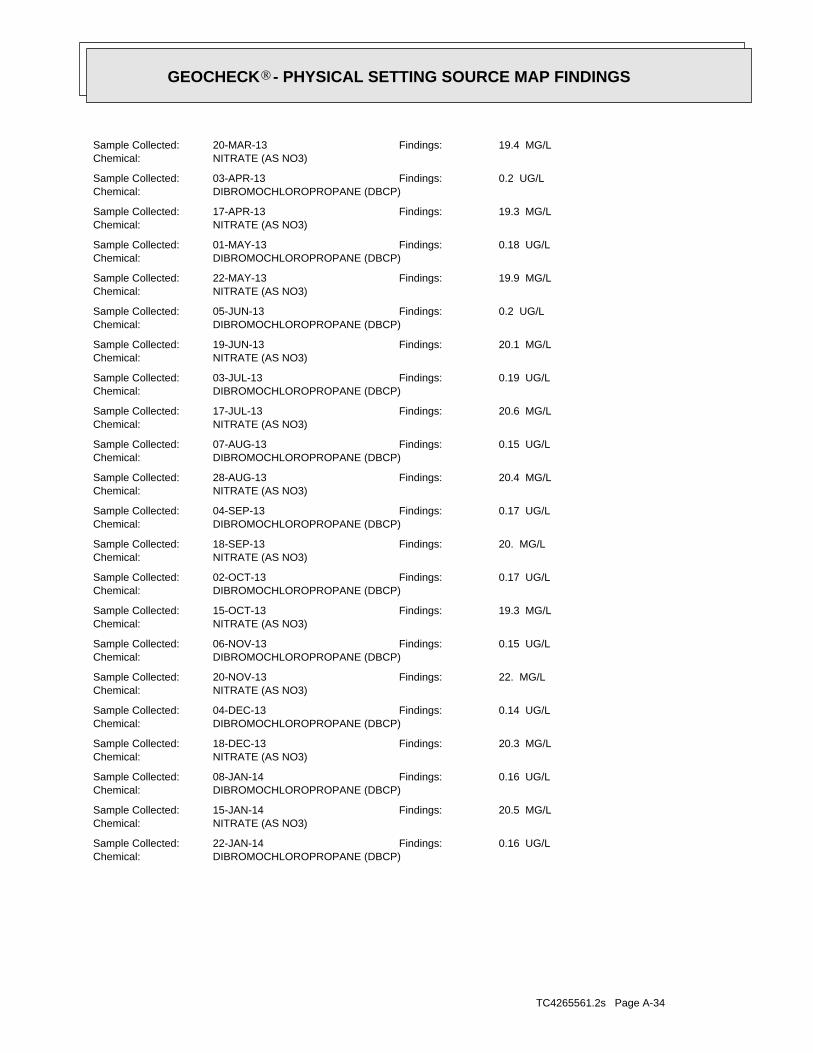
TC4265561.2s Page A-34
DIBROMOCHLOROPROPANE (DBCP)Chemical:0.16 UG/LFindings:22-JAN-14Sample Collected:
NITRATE (AS NO3)Chemical:20.5 MG/LFindings:15-JAN-14Sample Collected:
DIBROMOCHLOROPROPANE (DBCP)Chemical:0.16 UG/LFindings:08-JAN-14Sample Collected:
NITRATE (AS NO3)Chemical:20.3 MG/LFindings:18-DEC-13Sample Collected:
DIBROMOCHLOROPROPANE (DBCP)Chemical:0.14 UG/LFindings:04-DEC-13Sample Collected:
NITRATE (AS NO3)Chemical:22. MG/LFindings:20-NOV-13Sample Collected:
DIBROMOCHLOROPROPANE (DBCP)Chemical:0.15 UG/LFindings:06-NOV-13Sample Collected:
NITRATE (AS NO3)Chemical:19.3 MG/LFindings:15-OCT-13Sample Collected:
DIBROMOCHLOROPROPANE (DBCP)Chemical:0.17 UG/LFindings:02-OCT-13Sample Collected:
NITRATE (AS NO3)Chemical:20. MG/LFindings:18-SEP-13Sample Collected:
DIBROMOCHLOROPROPANE (DBCP)Chemical:0.17 UG/LFindings:04-SEP-13Sample Collected:
NITRATE (AS NO3)Chemical:20.4 MG/LFindings:28-AUG-13Sample Collected:
DIBROMOCHLOROPROPANE (DBCP)Chemical:0.15 UG/LFindings:07-AUG-13Sample Collected:
NITRATE (AS NO3)Chemical:20.6 MG/LFindings:17-JUL-13Sample Collected:
DIBROMOCHLOROPROPANE (DBCP)Chemical:0.19 UG/LFindings:03-JUL-13Sample Collected:
NITRATE (AS NO3)Chemical:20.1 MG/LFindings:19-JUN-13Sample Collected:
DIBROMOCHLOROPROPANE (DBCP)Chemical:0.2 UG/LFindings:05-JUN-13Sample Collected:
NITRATE (AS NO3)Chemical:19.9 MG/LFindings:22-MAY-13Sample Collected:
DIBROMOCHLOROPROPANE (DBCP)Chemical:0.18 UG/LFindings:01-MAY-13Sample Collected:
NITRATE (AS NO3)Chemical:19.3 MG/LFindings:17-APR-13Sample Collected:
DIBROMOCHLOROPROPANE (DBCP)Chemical:0.2 UG/LFindings:03-APR-13Sample Collected:
NITRATE (AS NO3)Chemical:19.4 MG/LFindings:20-MAR-13Sample Collected:
®GEOCHECK - PHYSICAL SETTING SOURCE MAP FINDINGS®
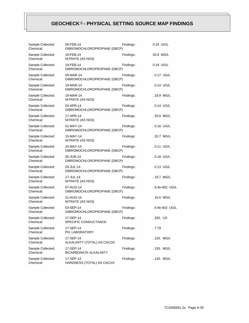
TC4265561.2s Page A-35
HARDNESS (TOTAL) AS CACO3Chemical:. 120. MG/LFindings:17-SEP-14Sample Collected:
BICARBONATE ALKALINITYChemical:. 150. MG/LFindings:17-SEP-14Sample Collected:
ALKALINITY (TOTAL) AS CACO3Chemical:. 120. MG/LFindings:17-SEP-14Sample Collected:
PH, LABORATORYChemical:. 7.79Findings:17-SEP-14Sample Collected:
SPECIFIC CONDUCTANCEChemical:. 320. USFindings:17-SEP-14Sample Collected:
DIBROMOCHLOROPROPANE (DBCP)Chemical:. 6.9e-002 UG/LFindings:03-SEP-14Sample Collected:
NITRATE (AS NO3)Chemical:. 16.6 MG/LFindings:21-AUG-14Sample Collected:
DIBROMOCHLOROPROPANE (DBCP)Chemical:. 8.4e-002 UG/LFindings:07-AUG-14Sample Collected:
NITRATE (AS NO3)Chemical:. 19.7 MG/LFindings:17-JUL-14Sample Collected:
DIBROMOCHLOROPROPANE (DBCP)Chemical:. 0.13 UG/LFindings:03-JUL-14Sample Collected:
DIBROMOCHLOROPROPANE (DBCP)Chemical:. 0.18 UG/LFindings:05-JUN-14Sample Collected:
DIBROMOCHLOROPROPANE (DBCP)Chemical:. 0.11 UG/LFindings:15-MAY-14Sample Collected:
NITRATE (AS NO3)Chemical:. 20.7 MG/LFindings:15-MAY-14Sample Collected:
DIBROMOCHLOROPROPANE (DBCP)Chemical:. 0.16 UG/LFindings:01-MAY-14Sample Collected:
NITRATE (AS NO3)Chemical:. 20.6 MG/LFindings:17-APR-14Sample Collected:
DIBROMOCHLOROPROPANE (DBCP)Chemical:. 0.14 UG/LFindings:03-APR-14Sample Collected:
NITRATE (AS NO3)Chemical:. 19.9 MG/LFindings:19-MAR-14Sample Collected:
DIBROMOCHLOROPROPANE (DBCP)Chemical:. 0.14 UG/LFindings:19-MAR-14Sample Collected:
DIBROMOCHLOROPROPANE (DBCP)Chemical:. 0.17 UG/LFindings:05-MAR-14Sample Collected:
DIBROMOCHLOROPROPANE (DBCP)Chemical:0.19 UG/LFindings:19-FEB-14Sample Collected:
NITRATE (AS NO3)Chemical:20.8 MG/LFindings:19-FEB-14Sample Collected:
DIBROMOCHLOROPROPANE (DBCP)Chemical:0.19 UG/LFindings:05-FEB-14Sample Collected:
®GEOCHECK - PHYSICAL SETTING SOURCE MAP FINDINGS®

TC4265561.2s Page A-36
17West1/2 - 1 MileHigher
20918CA WELLS
CADW50000029750Site id:South Central Region OfficeOrg unit n:ModestoBasin desc:5-22.02Basin cd:
50County id:UnknownCasgem s 1:229Local well:03S11E27L002MCasgem sta:376441N1207471W001Site code:
120.7471Longitude :37.6441Latitude :
16NE1/2 - 1 MileHigher
CADW50000029750CA WELLS
DIBROMOCHLOROPROPANE (DBCP)Chemical:. 0.12 UG/LFindings:03-DEC-14Sample Collected:
NITRATE (AS NO3)Chemical:. 17.7 MG/LFindings:21-NOV-14Sample Collected:
DIBROMOCHLOROPROPANE (DBCP)Chemical:. 0.1 UG/LFindings:05-NOV-14Sample Collected:
NITRATE (AS NO3)Chemical:. 21.4 MG/LFindings:15-OCT-14Sample Collected:
DIBROMOCHLOROPROPANE (DBCP)Chemical:. 7.1e-002 UG/LFindings:01-OCT-14Sample Collected:
CHROMIUM, HEXAVALENTChemical:. 3.8 UG/LFindings:18-SEP-14Sample Collected:
NITRATE (AS NO3)Chemical:. 18.1 MG/LFindings:17-SEP-14Sample Collected:
AGGRSSIVE INDEX (CORROSIVITY)Chemical:. 11.63Findings:17-SEP-14Sample Collected:
TOTAL DISSOLVED SOLIDSChemical:. 230. MG/LFindings:17-SEP-14Sample Collected:
ARSENICChemical:. 2.5 UG/LFindings:17-SEP-14Sample Collected:
FLUORIDE (F) (NATURAL-SOURCE)Chemical:. 0.18 MG/LFindings:17-SEP-14Sample Collected:
CHLORIDEChemical:. 9. MG/LFindings:17-SEP-14Sample Collected:
POTASSIUMChemical:. 3.5 MG/LFindings:17-SEP-14Sample Collected:
SODIUMChemical:. 21. MG/LFindings:17-SEP-14Sample Collected:
MAGNESIUMChemical:. 16. MG/LFindings:17-SEP-14Sample Collected:
CALCIUMChemical:. 22. MG/LFindings:17-SEP-14Sample Collected:
®GEOCHECK - PHYSICAL SETTING SOURCE MAP FINDINGS®
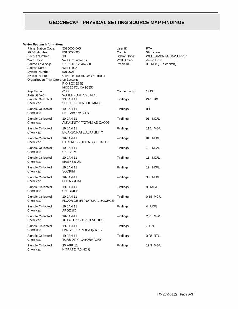
TC4265561.2s Page A-37
NITRATE (AS NO3)Chemical:13.3 MG/LFindings:20-APR-11Sample Collected:
TURBIDITY, LABORATORYChemical:0.28 NTUFindings:19-JAN-11Sample Collected:
LANGELIER INDEX @ 60 CChemical:- 0.29Findings:19-JAN-11Sample Collected:
TOTAL DISSOLVED SOLIDSChemical:200. MG/LFindings:19-JAN-11Sample Collected:
ARSENICChemical:4. UG/LFindings:19-JAN-11Sample Collected:
FLUORIDE (F) (NATURAL-SOURCE)Chemical:0.18 MG/LFindings:19-JAN-11Sample Collected:
CHLORIDEChemical:8. MG/LFindings:19-JAN-11Sample Collected:
POTASSIUMChemical:3.3 MG/LFindings:19-JAN-11Sample Collected:
SODIUMChemical:18. MG/LFindings:19-JAN-11Sample Collected:
MAGNESIUMChemical:11. MG/LFindings:19-JAN-11Sample Collected:
CALCIUMChemical:15. MG/LFindings:19-JAN-11Sample Collected:
HARDNESS (TOTAL) AS CACO3Chemical:81. MG/LFindings:19-JAN-11Sample Collected:
BICARBONATE ALKALINITYChemical:110. MG/LFindings:19-JAN-11Sample Collected:
ALKALINITY (TOTAL) AS CACO3Chemical:91. MG/LFindings:19-JAN-11Sample Collected:
PH, LABORATORYChemical:8.1Findings:19-JAN-11Sample Collected:
SPECIFIC CONDUCTANCEChemical:240. USFindings:19-JAN-11Sample Collected:
WATERFORD SYS NO 3Area Served:1843Connections:6129Pop Served:
MODESTO, CA 95353P O BOX 3250
Organization That Operates System:City of Modesto, DE WaterfordSystem Name:5010006System Number:WELL 102Source Name:
0.5 Mile (30 Seconds)Precision:373810.0 1204622.0Source Lat/Long:Active RawWell Status:Well/GroundwaterWater Type:WELL/AMBNT/MUN/SUPPLYStation Type:10District Number:StanislausCounty:5010006005FRDS Number:PTAUser ID:5010006-005Prime Station Code:
Water System Information:
®GEOCHECK - PHYSICAL SETTING SOURCE MAP FINDINGS®

TC4265561.2s Page A-38
18SSE1/2 - 1 MileHigher
USGS40000184189FED USGS
CHROMIUM, HEXAVALENTChemical:. 2. UG/LFindings:18-SEP-14Sample Collected:
NITRATE (AS NO3)Chemical:. 8.73 MG/LFindings:17-APR-14Sample Collected:
AGGRSSIVE INDEX (CORROSIVITY)Chemical:11.4Findings:15-JAN-14Sample Collected:
TOTAL DISSOLVED SOLIDSChemical:210. MG/LFindings:15-JAN-14Sample Collected:
ARSENICChemical:4. UG/LFindings:15-JAN-14Sample Collected:
CHLORIDEChemical:7.6 MG/LFindings:15-JAN-14Sample Collected:
POTASSIUMChemical:3.5 MG/LFindings:15-JAN-14Sample Collected:
SODIUMChemical:17. MG/LFindings:15-JAN-14Sample Collected:
MAGNESIUMChemical:11. MG/LFindings:15-JAN-14Sample Collected:
CALCIUMChemical:17. MG/LFindings:15-JAN-14Sample Collected:
HARDNESS (TOTAL) AS CACO3Chemical:89. MG/LFindings:15-JAN-14Sample Collected:
BICARBONATE ALKALINITYChemical:120. MG/LFindings:15-JAN-14Sample Collected:
ALKALINITY (TOTAL) AS CACO3Chemical:98. MG/LFindings:15-JAN-14Sample Collected:
PH, LABORATORYChemical:7.78Findings:15-JAN-14Sample Collected:
SPECIFIC CONDUCTANCEChemical:250. USFindings:15-JAN-14Sample Collected:
NITRATE (AS NO3)Chemical:10.4 MG/LFindings:17-APR-13Sample Collected:
GROSS ALPHA MDA95Chemical:2.32 PCI/LFindings:20-FEB-13Sample Collected:
GROSS ALPHA COUNTING ERRORChemical:0.291 PCI/LFindings:20-FEB-13Sample Collected:
SPECIFIC CONDUCTANCEChemical:230. USFindings:17-OCT-12Sample Collected:
NITRATE (AS NO3)Chemical:12.4 MG/LFindings:18-APR-12Sample Collected:
®GEOCHECK - PHYSICAL SETTING SOURCE MAP FINDINGS®
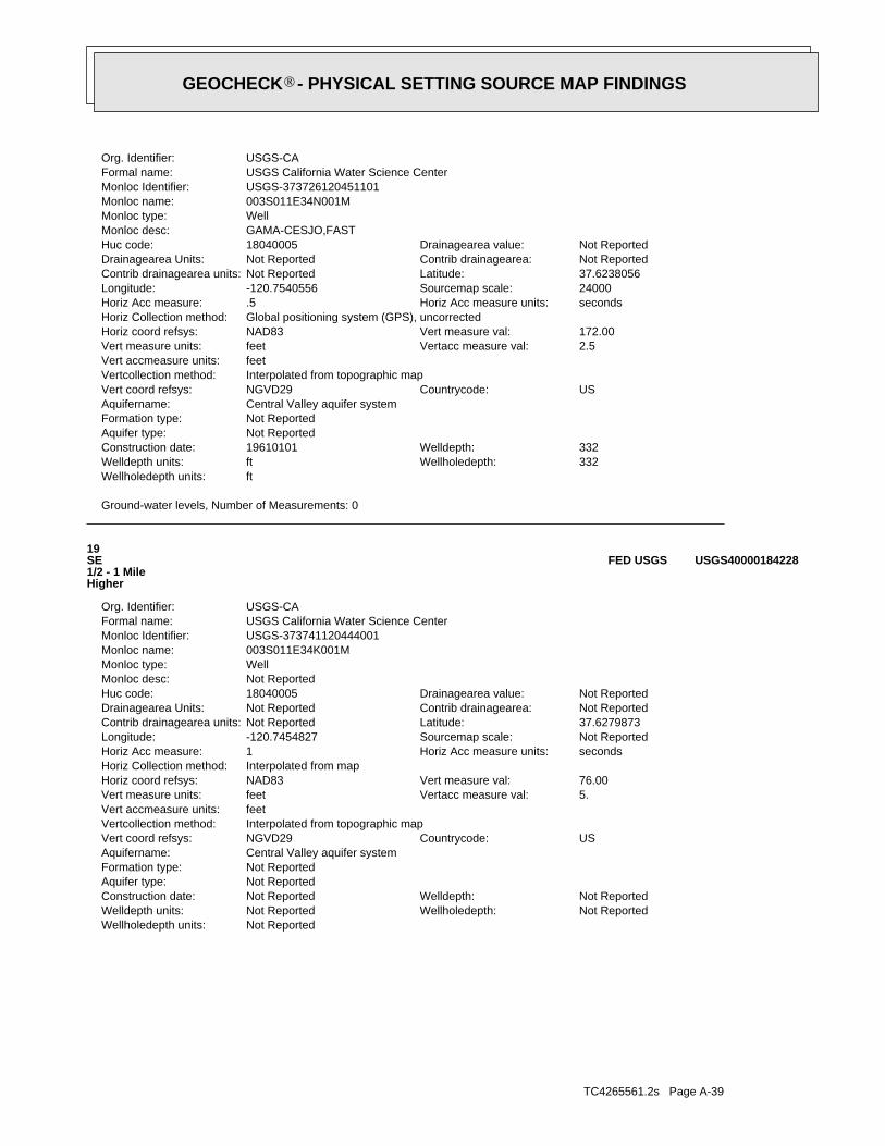
TC4265561.2s Page A-39
Not ReportedWellholedepth units:Not ReportedWellholedepth:Not ReportedWelldepth units:Not ReportedWelldepth:Not ReportedConstruction date:
Not ReportedAquifer type:Not ReportedFormation type:Central Valley aquifer systemAquifername:
USCountrycode:NGVD29Vert coord refsys:Interpolated from topographic mapVertcollection method:feetVert accmeasure units:
5.Vertacc measure val:feetVert measure units:76.00Vert measure val:NAD83Horiz coord refsys:
Interpolated from mapHoriz Collection method:secondsHoriz Acc measure units:1Horiz Acc measure:Not ReportedSourcemap scale:-120.7454827Longitude:37.6279873Latitude:Not ReportedContrib drainagearea units:Not ReportedContrib drainagearea:Not ReportedDrainagearea Units:Not ReportedDrainagearea value:18040005Huc code:
Not ReportedMonloc desc:WellMonloc type:003S011E34K001MMonloc name:USGS-373741120444001Monloc Identifier:USGS California Water Science CenterFormal name:USGS-CAOrg. Identifier:
19SE1/2 - 1 MileHigher
USGS40000184228FED USGS
Ground-water levels, Number of Measurements: 0
ftWellholedepth units:332Wellholedepth:ftWelldepth units:332Welldepth:19610101Construction date:
Not ReportedAquifer type:Not ReportedFormation type:Central Valley aquifer systemAquifername:
USCountrycode:NGVD29Vert coord refsys:Interpolated from topographic mapVertcollection method:feetVert accmeasure units:
2.5Vertacc measure val:feetVert measure units:172.00Vert measure val:NAD83Horiz coord refsys:
Global positioning system (GPS), uncorrectedHoriz Collection method:secondsHoriz Acc measure units:.5Horiz Acc measure:24000Sourcemap scale:-120.7540556Longitude:37.6238056Latitude:Not ReportedContrib drainagearea units:Not ReportedContrib drainagearea:Not ReportedDrainagearea Units:Not ReportedDrainagearea value:18040005Huc code:
GAMA-CESJO,FASTMonloc desc:WellMonloc type:003S011E34N001MMonloc name:USGS-373726120451101Monloc Identifier:USGS California Water Science CenterFormal name:USGS-CAOrg. Identifier:
®GEOCHECK - PHYSICAL SETTING SOURCE MAP FINDINGS®
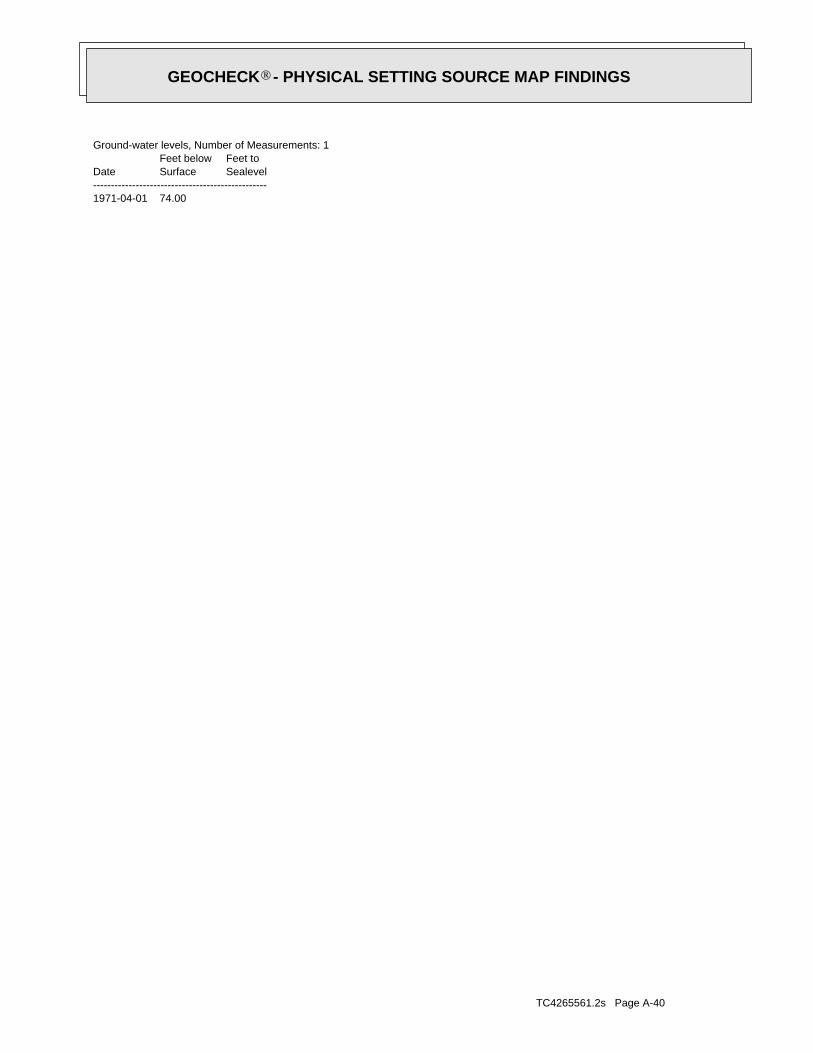
TC4265561.2s Page A-40
1971-04-01 74.00
DateFeet belowSurface
Feet toSealevel
-------------------------------------------------
Ground-water levels, Number of Measurements: 1
®GEOCHECK - PHYSICAL SETTING SOURCE MAP FINDINGS®
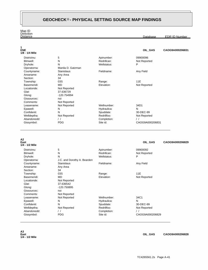
TC4265561.2s Page A-41
A3East1/4 - 1/2 Mile
CAOG9A000206828OIL_GAS
CAOG9A000206829Site id:PDGGissymbol:/ /Completion:/ /Abandonedd:Not ReportedRedrillfoo:Not ReportedWelldeptha:30-DEC-99Spuddate:NConfidenti:NHydraulica:NEpawell:34C1Wellnumber:Not ReportedLeasename:
Not ReportedComments:noiGissourcec:-120.750895Glong:37.636542Glat:Not ReportedLocationde:
Not ReportedElevation:MDBasemeridi:11ERange:03STownship:
34Section:Any AreaAreaname:
Any FieldFieldname:StanislausCountyname:J.C. and Dorothy A. BeardenOperatorna:
PWellstatus:NDryhole:Not ReportedRedrillcan:NBlmwell:09900092Apinumber:5Districtnu:
A2East1/4 - 1/2 Mile
CAOG9A000206829OIL_GAS
CAOG9A000206831Site id:PDGGissymbol:/ /Completion:/ /Abandonedd:Not ReportedRedrillfoo:Not ReportedWelldeptha:30-DEC-99Spuddate:NConfidenti:NHydraulica:NEpawell:34D1Wellnumber:Not ReportedLeasename:
Not ReportedComments:noiGissourcec:-120.754994Glong:37.636729Glat:Not ReportedLocationde:
Not ReportedElevation:MDBasemeridi:11ERange:03STownship:
34Section:Any AreaAreaname:
Any FieldFieldname:StanislausCountyname:Manila D. GatzmanOperatorna:
PWellstatus:NDryhole:Not ReportedRedrillcan:NBlmwell:09900096Apinumber:5Districtnu:
1ENE1/8 - 1/4 Mile
CAOG9A000206831OIL_GAS
Map IDDirectionDistance EDR ID NumberDatabase
®GEOCHECK - PHYSICAL SETTING SOURCE MAP FINDINGS®
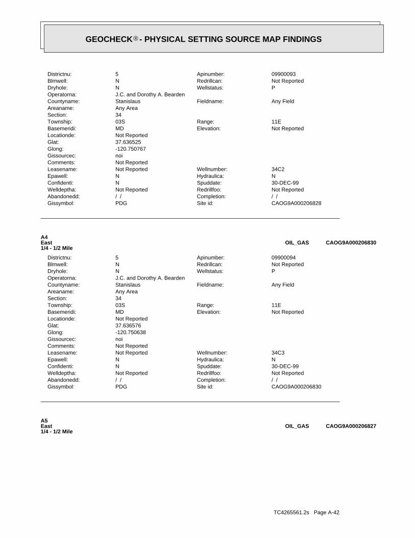
TC4265561.2s Page A-42
A5East1/4 - 1/2 Mile
CAOG9A000206827OIL_GAS
CAOG9A000206830Site id:PDGGissymbol:/ /Completion:/ /Abandonedd:Not ReportedRedrillfoo:Not ReportedWelldeptha:30-DEC-99Spuddate:NConfidenti:NHydraulica:NEpawell:34C3Wellnumber:Not ReportedLeasename:
Not ReportedComments:noiGissourcec:-120.750638Glong:37.636576Glat:Not ReportedLocationde:
Not ReportedElevation:MDBasemeridi:11ERange:03STownship:
34Section:Any AreaAreaname:
Any FieldFieldname:StanislausCountyname:J.C. and Dorothy A. BeardenOperatorna:
PWellstatus:NDryhole:Not ReportedRedrillcan:NBlmwell:09900094Apinumber:5Districtnu:
A4East1/4 - 1/2 Mile
CAOG9A000206830OIL_GAS
CAOG9A000206828Site id:PDGGissymbol:/ /Completion:/ /Abandonedd:Not ReportedRedrillfoo:Not ReportedWelldeptha:30-DEC-99Spuddate:NConfidenti:NHydraulica:NEpawell:34C2Wellnumber:Not ReportedLeasename:
Not ReportedComments:noiGissourcec:-120.750767Glong:37.636525Glat:Not ReportedLocationde:
Not ReportedElevation:MDBasemeridi:11ERange:03STownship:
34Section:Any AreaAreaname:
Any FieldFieldname:StanislausCountyname:J.C. and Dorothy A. BeardenOperatorna:
PWellstatus:NDryhole:Not ReportedRedrillcan:NBlmwell:09900093Apinumber:5Districtnu:
®GEOCHECK - PHYSICAL SETTING SOURCE MAP FINDINGS®

TC4265561.2s Page A-43
CAOG9A000206812Site id:PDHGissymbol:/ /Completion:/ /Abandonedd:Not ReportedRedrillfoo:Not ReportedWelldeptha:30-DEC-99Spuddate:NConfidenti:NHydraulica:NEpawell:34-56XWellnumber:Meikle-NomecoLeasename:
Not ReportedComments:hudGissourcec:-120.745829Glong:37.629405Glat:Fr SW cor 1973 Nly 2704 ElyLocationde:
Not ReportedElevation:MDBasemeridi:11ERange:03STownship:
34Section:Any AreaAreaname:
Any FieldFieldname:StanislausCountyname:Argo Petroleum Corp.Operatorna:
PWellstatus:YDryhole:Not ReportedRedrillcan:NBlmwell:09920038Apinumber:5Districtnu:
6ESE1/2 - 1 Mile
CAOG9A000206812OIL_GAS
CAOG9A000206827Site id:ADGGissymbol:/ /Completion:/ /Abandonedd:Not ReportedRedrillfoo:Not ReportedWelldeptha:30-DEC-99Spuddate:NConfidenti:NHydraulica:NEpawell:34C4Wellnumber:Not ReportedLeasename:
Not ReportedComments:noiGissourcec:-120.750273Glong:37.636508Glat:Not ReportedLocationde:
Not ReportedElevation:MDBasemeridi:11ERange:03STownship:
34Section:Any AreaAreaname:
Any FieldFieldname:StanislausCountyname:J.C. and Dorothy A. BeardenOperatorna:
IWellstatus:NDryhole:Not ReportedRedrillcan:NBlmwell:09900095Apinumber:5Districtnu:
®GEOCHECK - PHYSICAL SETTING SOURCE MAP FINDINGS®
TC4265561.2s Page A-44
0%0%100%2.250 pCi/LBasementNot ReportedNot ReportedNot ReportedNot ReportedLiving Area - 2nd Floor0%8%92%1.725 pCi/LLiving Area - 1st Floor
% >20 pCi/L% 4-20 pCi/L% <4 pCi/LAverage ActivityArea
Number of sites tested: 12
Federal Area Radon Information for STANISLAUS COUNTY, CA
: Zone 3 indoor average level < 2 pCi/L. : Zone 2 indoor average level >= 2 pCi/L and <= 4 pCi/L. Note: Zone 1 indoor average level > 4 pCi/L.
Federal EPA Radon Zone for STANISLAUS County: 3
0295323
______________________> 4 pCi/LNum TestsZipcode
Radon Test Results
State Database: CA Radon
AREA RADON INFORMATION
®GEOCHECK - PHYSICAL SETTING SOURCE MAP FINDINGSRADON
®
TOPOGRAPHIC INFORMATION
USGS 7.5’ Digital Elevation Model (DEM)Source: United States Geologic SurveyEDR acquired the USGS 7.5’ Digital Elevation Model in 2002 and updated it in 2006. The 7.5 minute DEM correspondsto the USGS 1:24,000- and 1:25,000-scale topographic quadrangle maps. The DEM provides elevation datawith consistent elevation units and projection.
Scanned Digital USGS 7.5’ Topographic Map (DRG)Source: United States Geologic SurveyA digital raster graphic (DRG) is a scanned image of a U.S. Geological Survey topographic map. The map imagesare made by scanning published paper maps on high-resolution scanners. The raster imageis georeferenced and fit to the Universal Transverse Mercator (UTM) projection.
HYDROLOGIC INFORMATION
Flood Zone Data: This data, available in select counties across the country, was obtained by EDR in 2003 & 2011 from the FederalEmergency Management Agency (FEMA). Data depicts 100-year and 500-year flood zones as defined by FEMA.
NWI: National Wetlands Inventory. This data, available in select counties across the country, was obtained by EDRin 2002, 2005 and 2010 from the U.S. Fish and Wildlife Service.
HYDROGEOLOGIC INFORMATION
AQUIFLOW Information SystemR
Source: EDR proprietary database of groundwater flow informationEDR has developed the AQUIFLOW Information System (AIS) to provide data on the general direction of groundwater
flow at specific points. EDR has reviewed reports submitted to regulatory authorities at select sites and hasextracted the date of the report, hydrogeologically determined groundwater flow direction and depth to water tableinformation.
GEOLOGIC INFORMATION
Geologic Age and Rock Stratigraphic UnitSource: P.G. Schruben, R.E. Arndt and W.J. Bawiec, Geology of the Conterminous U.S. at 1:2,500,000 Scale - A digitalrepresentation of the 1974 P.B. King and H.M. Beikman Map, USGS Digital Data Series DDS - 11 (1994).
STATSGO: State Soil Geographic DatabaseSource: Department of Agriculture, Natural Resources Conservation ServicesThe U.S. Department of Agriculture’s (USDA) Natural Resources Conservation Service (NRCS) leads the nationalConservation Soil Survey (NCSS) and is responsible for collecting, storing, maintaining and distributing soilsurvey information for privately owned lands in the United States. A soil map in a soil survey is a representationof soil patterns in a landscape. Soil maps for STATSGO are compiled by generalizing more detailed (SSURGO)soil survey maps.
SSURGO: Soil Survey Geographic DatabaseSource: Department of Agriculture, Natural Resources Conservation Services (NRCS)Telephone: 800-672-5559SSURGO is the most detailed level of mapping done by the Natural Resources Conservation Services, mappingscales generally range from 1:12,000 to 1:63,360. Field mapping methods using national standards are used toconstruct the soil maps in the Soil Survey Geographic (SSURGO) database. SSURGO digitizing duplicates theoriginal soil survey maps. This level of mapping is designed for use by landowners, townships and countynatural resource planning and management.
TC4265561.2s Page PSGR-1
PHYSICAL SETTING SOURCE RECORDS SEARCHED
LOCAL / REGIONAL WATER AGENCY RECORDS
FEDERAL WATER WELLS
PWS: Public Water SystemsSource: EPA/Office of Drinking WaterTelephone: 202-564-3750Public Water System data from the Federal Reporting Data System. A PWS is any water system which provides water to at
least 25 people for at least 60 days annually. PWSs provide water from wells, rivers and other sources.
PWS ENF: Public Water Systems Violation and Enforcement DataSource: EPA/Office of Drinking WaterTelephone: 202-564-3750Violation and Enforcement data for Public Water Systems from the Safe Drinking Water Information System (SDWIS) after
August 1995. Prior to August 1995, the data came from the Federal Reporting Data System (FRDS).
USGS Water Wells: USGS National Water Inventory System (NWIS)This database contains descriptive information on sites where the USGS collects or has collected data on surfacewater and/or groundwater. The groundwater data includes information on wells, springs, and other sources of groundwater.
OTHER STATE DATABASE INFORMATION
RADON
State Database: CA RadonSource: Department of Health ServicesTelephone: 916-324-2208Radon Database for California
Area Radon InformationSource: USGSTelephone: 703-356-4020The National Radon Database has been developed by the U.S. Environmental Protection Agency(USEPA) and is a compilation of the EPA/State Residential Radon Survey and the National Residential Radon Survey.The study covers the years 1986 - 1992. Where necessary data has been supplemented by information collected atprivate sources such as universities and research institutions.
EPA Radon ZonesSource: EPATelephone: 703-356-4020Sections 307 & 309 of IRAA directed EPA to list and identify areas of U.S. with the potential for elevated indoorradon levels.
OTHER
Airport Landing Facilities: Private and public use landing facilitiesSource: Federal Aviation Administration, 800-457-6656
Epicenters: World earthquake epicenters, Richter 5 or greaterSource: Department of Commerce, National Oceanic and Atmospheric Administration
California Earthquake Fault Lines: The fault lines displayed on EDR’s Topographic map are digitized quaternary fault lines,prepared in 1975 by the United State Geological Survey. Additional information (also from 1975) regarding activity at specific faultlines comes from California’s Preliminary Fault Activity Map prepared by the California Division of Mines and Geology.
TC4265561.2s Page PSGR-2
PHYSICAL SETTING SOURCE RECORDS SEARCHED
STREET AND ADDRESS INFORMATION
© 2010 Tele Atlas North America, Inc. All rights reserved. This material is proprietary and the subject of copyright protectionand other intellectual property rights owned by or licensed to Tele Atlas North America, Inc. The use of this material is subjectto the terms of a license agreement. You will be held liable for any unauthorized copying or disclosure of this material.
TC4265561.2s Page PSGR-3
PHYSICAL SETTING SOURCE RECORDS SEARCHED
Appendix B
USGS 7.5 MINUTE TOPOGRAPHIC QUAD MAPS
EDR Historical Topographic Map Report
Hickman Road Bridge
Hickman Road
Hickman, CA 95323
Inquiry Number: 4265561.4
April 15, 2015
EDR Historical Topographic Map Report
Environmental Data Resources, Inc.s (EDR) Historical Topographic Map Report is designed to assist professionals inevaluating potential liability on a target property resulting from past activities. EDRs Historical Topographic Map Reportincludes a search of a collection of public and private color historical topographic maps, dating back to the early 1900s.
Thank you for your business.Please contact EDR at 1-800-352-0050
with any questions or comments.
Disclaimer - Copyright and Trademark Notice
This Report contains certain information obtained from a variety of public and other sources reasonably available to Environmental Data Resources, Inc.It cannot be concluded from this Report that coverage information for the target and surrounding properties does not exist from other sources. NOWARRANTY EXPRESSED OR IMPLIED, IS MADE WHATSOEVER IN CONNECTION WITH THIS REPORT. ENVIRONMENTAL DATARESOURCES, INC. SPECIFICALLY DISCLAIMS THE MAKING OF ANY SUCH WARRANTIES, INCLUDING WITHOUT LIMITATION,MERCHANTABILITY OR FITNESS FOR A PARTICULAR USE OR PURPOSE. ALL RISK IS ASSUMED BY THE USER. IN NO EVENT SHALLENVIRONMENTAL DATA RESOURCES, INC. BE LIABLE TO ANYONE, WHETHER ARISING OUT OF ERRORS OR OMISSIONS, NEGLIGENCE,ACCIDENT OR ANY OTHER CAUSE, FOR ANY LOSS OF DAMAGE, INCLUDING, WITHOUT LIMITATION, SPECIAL, INCIDENTAL,CONSEQUENTIAL, OR EXEMPLARY DAMAGES. ANY LIABILITY ON THE PART OF ENVIRONMENTAL DATA RESOURCES, INC. IS STRICTLYLIMITED TO A REFUND OF THE AMOUNT PAID FOR THIS REPORT. Purchaser accepts this Report AS IS. Any analyses, estimates, ratings,environmental risk levels or risk codes provided in this Report are provided for illustrative purposes only, and are not intended to provide, nor should theybe interpreted as providing any facts regarding, or prediction or forecast of, any environmental risk for any property. Only a Phase I Environmental SiteAssessment performed by an environmental professional can provide information regarding the environmental risk for any property. Additionally, theinformation provided in this Report is not to be construed as legal advice.
Copyright 2015 by Environmental Data Resources, Inc. All rights reserved. Reproduction in any media or format, in whole or in part, of any report or mapof Environmental Data Resources, Inc., or its affiliates, is prohibited without prior written permission.
EDR and its logos (including Sanborn and Sanborn Map) are trademarks of Environmental Data Resources, Inc. or its affiliates. All other trademarksused herein are the property of their respective owners.

Historical Topographic Map
→
NTARGET QUADTARGET QUADNAME: WATERFORDMAP YEAR: 1916
SERIES: 7.5SCALE: 1:31680
SITE NAME: Hickman Road Bridge ADDRESS: Hickman Road
Hickman, CA 95323LAT/LONG: 37.636 / -120.7585
CLIENT: Drake Haglan and AssociatesCONTACT: Lindsay TischINQUIRY#: 4265561.4RESEARCH DATE: 04/15/2015

Historical Topographic Map
→
NTARGET QUADTARGET QUADNAME: MODESTO EASTMAP YEAR: 1941
SERIES: 15SCALE: 1:50000
SITE NAME: Hickman Road Bridge ADDRESS: Hickman Road
Hickman, CA 95323LAT/LONG: 37.636 / -120.7585
CLIENT: Drake Haglan and AssociatesCONTACT: Lindsay TischINQUIRY#: 4265561.4RESEARCH DATE: 04/15/2015
Historical Topographic Map
→
NTARGET QUADTARGET QUADNAME: WATERFORDMAP YEAR: 1953
SERIES: 7.5SCALE: 1:24000
SITE NAME: Hickman Road Bridge ADDRESS: Hickman Road
Hickman, CA 95323LAT/LONG: 37.636 / -120.7585
CLIENT: Drake Haglan and AssociatesCONTACT: Lindsay TischINQUIRY#: 4265561.4RESEARCH DATE: 04/15/2015
Historical Topographic Map
→
NTARGET QUADTARGET QUADNAME: WATERFORDMAP YEAR: 1969
SERIES: 7.5SCALE: 1:24000
SITE NAME: Hickman Road Bridge ADDRESS: Hickman Road
Hickman, CA 95323LAT/LONG: 37.636 / -120.7585
CLIENT: Drake Haglan and AssociatesCONTACT: Lindsay TischINQUIRY#: 4265561.4RESEARCH DATE: 04/15/2015
Appendix C
Sanborn Map Report
Certified Sanborn® Map Report
Hickman Road Bridge
Hickman Road
Hickman, CA 95323
Inquiry Number: 4265561.3
April 15, 2015
Certified Sanborn® Map Report 4/15/15
Site Name:Hickman Road BridgeHickman RoadHickman, CA 95323
Client Name:Drake Haglan and Associates11060 White Rock Road, SuiteRancho Cordova, CA 95670
Contact: Lindsay TischEDR Inquiry # 4265561.3
The Sanborn Library has been searched by EDR and maps covering the target property location as provided by DrakeHaglan and Associates were identified for the years listed below. The Sanborn Library is the largest, most completecollection of fire insurance maps. The collection includes maps from Sanborn, Bromley, Perris & Browne, Hopkins,Barlow, and others. Only Environmental Data Resources Inc. (EDR) is authorized to grant rights for commercialreproduction of maps by the Sanborn Library LLC, the copyright holder for the collection. Results can be authenticatedby visiting www.edrnet.com/sanborn.
The Sanborn Library is continually enhanced with newly identified map archives. This report accesses all maps in thecollection as of the day this report was generated.
Certified Sanborn Results:
Site Name: Hickman Road BridgeAddress: Hickman RoadCity, State, Zip: Hickman, CA 95323Cross Street:P.O. # NAProject: Hickman Rd Bridge ReplacementCertification # A79F-4D20-9E51
Library of Congress
University Publications of America
EDR Private Collection
The Sanborn Library LLC Since 1866™
The Sanborn Library includes more than 1.2 millionfire insurance maps from Sanborn, Bromley, Perris &Browne, Hopkins, Barlow and others which trackhistorical property usage in approximately 12,000American cities and towns. Collections searched:
Sanborn® Library search resultsCertification # A79F-4D20-9E51
UNMAPPED PROPERTYThis report certifies that the complete holdings of the SanbornLibrary, LLC collection have been searched based on clientsupplied target property information, and fire insurance mapscovering the target property were not found.
Limited Permission To Make CopiesDrake Haglan and Associates (the client) is permitted to make up to FIVE photocopies of this Sanborn Map transmittal and each fire insurancemap accompanying this report solely for the limited use of its customer. No one other than the client is authorized to make copies. Upon requestmade directly to an EDR Account Executive, the client may be permitted to make a limited number of additional photocopies. This permission isconditioned upon compliance by the client, its customer and their agents with EDR's copyright policy; a copy of which is available upon request.
Disclaimer - Copyright and Trademark noticeThis Report contains certain information obtained from a variety of public and other sources reasonably available to Environmental Data Resources, Inc. It cannot beconcluded from this Report that coverage information for the target and surrounding properties does not exist from other sources. NO WARRANTY EXPRESSED ORIMPLIED, IS MADE WHATSOEVER IN CONNECTION WITH THIS REPORT. ENVIRONMENTAL DATA RESOURCES, INC. SPECIFICALLY DISCLAIMS THEMAKING OF ANY SUCH WARRANTIES, INCLUDING WITHOUT LIMITATION, MERCHANTABILITY OR FITNESS FOR A PARTICULAR USE OR PURPOSE. ALLRISK IS ASSUMED BY THE USER. IN NO EVENT SHALL ENVIRONMENTAL DATA RESOURCES, INC. BE LIABLE TO ANYONE, WHETHER ARISING OUT OFERRORS OR OMISSIONS, NEGLIGENCE, ACCIDENT OR ANY OTHER CAUSE, FOR ANY LOSS OF DAMAGE, INCLUDING, WITHOUT LIMITATION, SPECIAL,INCIDENTAL CONSEQUENTIAL, OR EXEMPLARY DAMAGES. ANY LIABILITY ON THE PART OF ENVIRONMENTAL DATA RESOURCES, INC. IS STRICTLYLIMITED TO A REFUND OF THE AMOUNT PAID FOR THIS REPORT. Purchaser accepts this Report "AS IS". Any analyses, estimates, ratings, environmental risklevels or risk codes provided in this Report are provided for illustrative purposes only, and are not intended to provide, nor should they be interpreted as providingany facts regarding, or prediction or forecast of, any environmental risk for any property. Only a Phase I Environmental Site Assessment performed by anenvironmental professional can provide information regarding the environmental risk for any property. Additionally, the information provided in this Report is not to beconstrued as legal advice.
Copyright 2015 by Environmental Data Resources, Inc. All rights reserved. Reproduction in any media or format, in whole or in part, of any report or map ofEnvironmental Data Resources, Inc., or its affiliates, is prohibited without prior written permission.
EDR and its logos (including Sanborn and Sanborn Map) are trademarks of Environmental Data Resources, Inc. or its affiliates. All other trademarks used herein arethe property of their respective owners.
4265561 - 3 page 2

Appendix D
Site Photographs
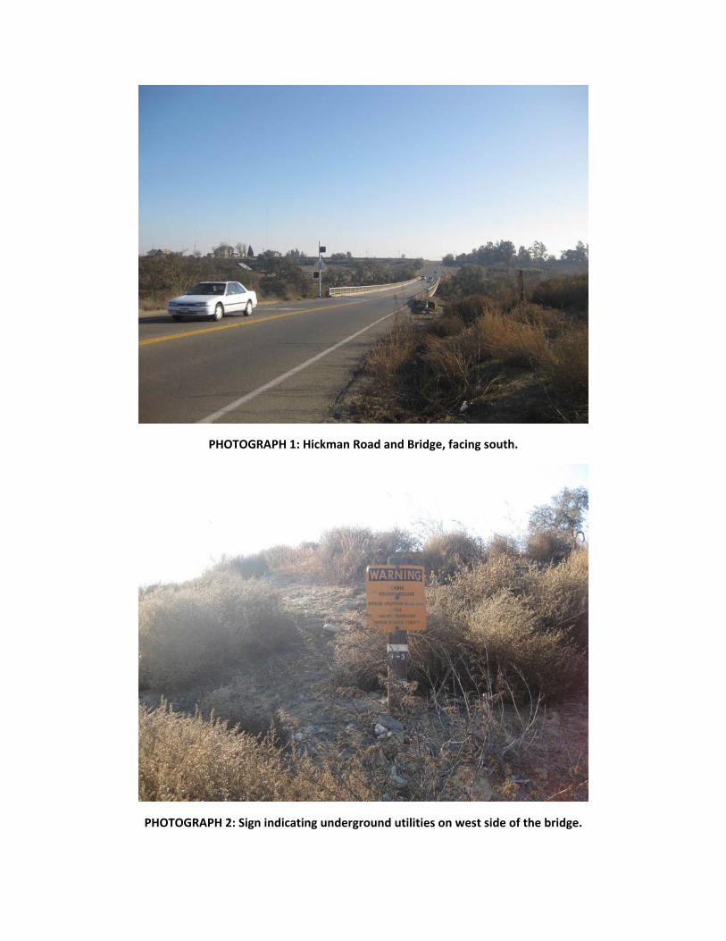
PHOTOGRAPH 1: Hickman Road and Bridge, facing south.
PHOTOGRAPH 2: Sign indicating underground utilities on west side of the bridge.
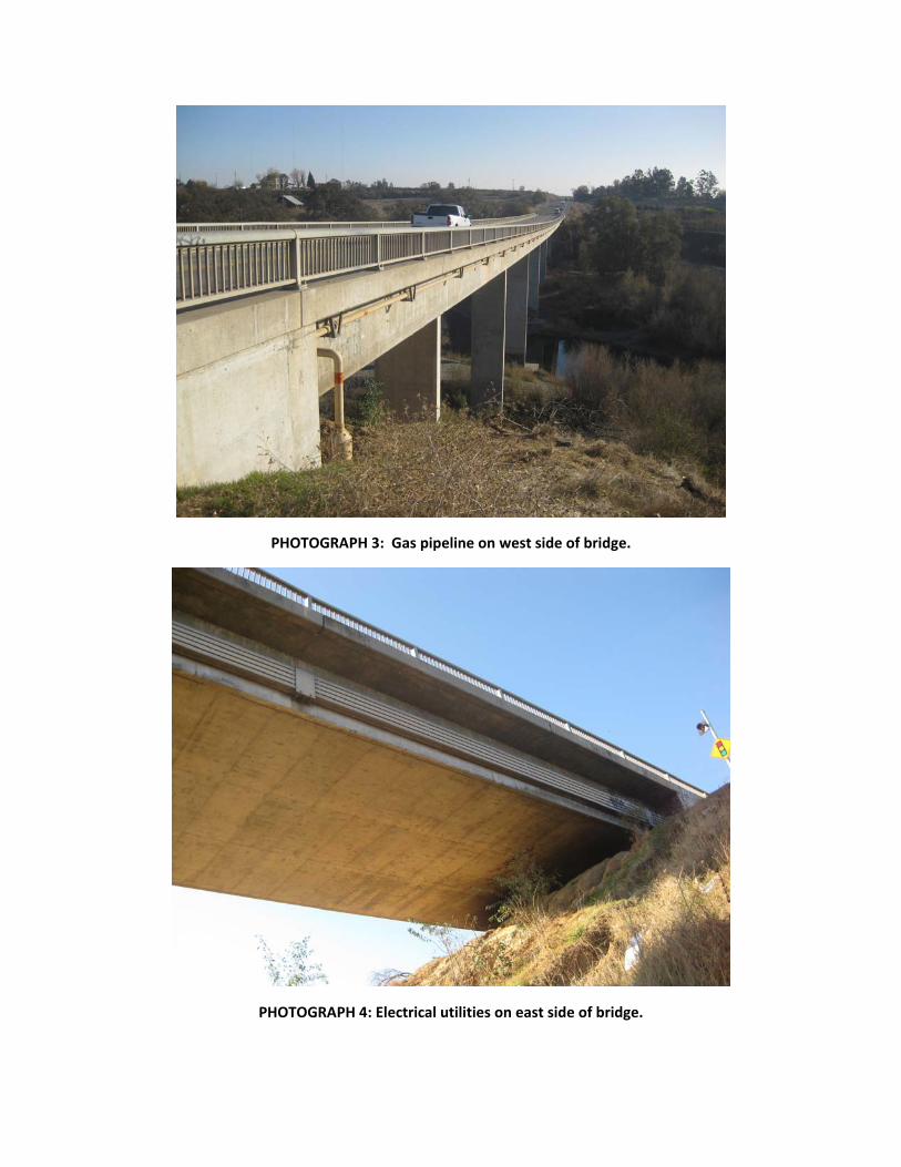
PHOTOGRAPH 3: Gas pipeline on west side of bridge.
PHOTOGRAPH 4: Electrical utilities on east side of bridge.
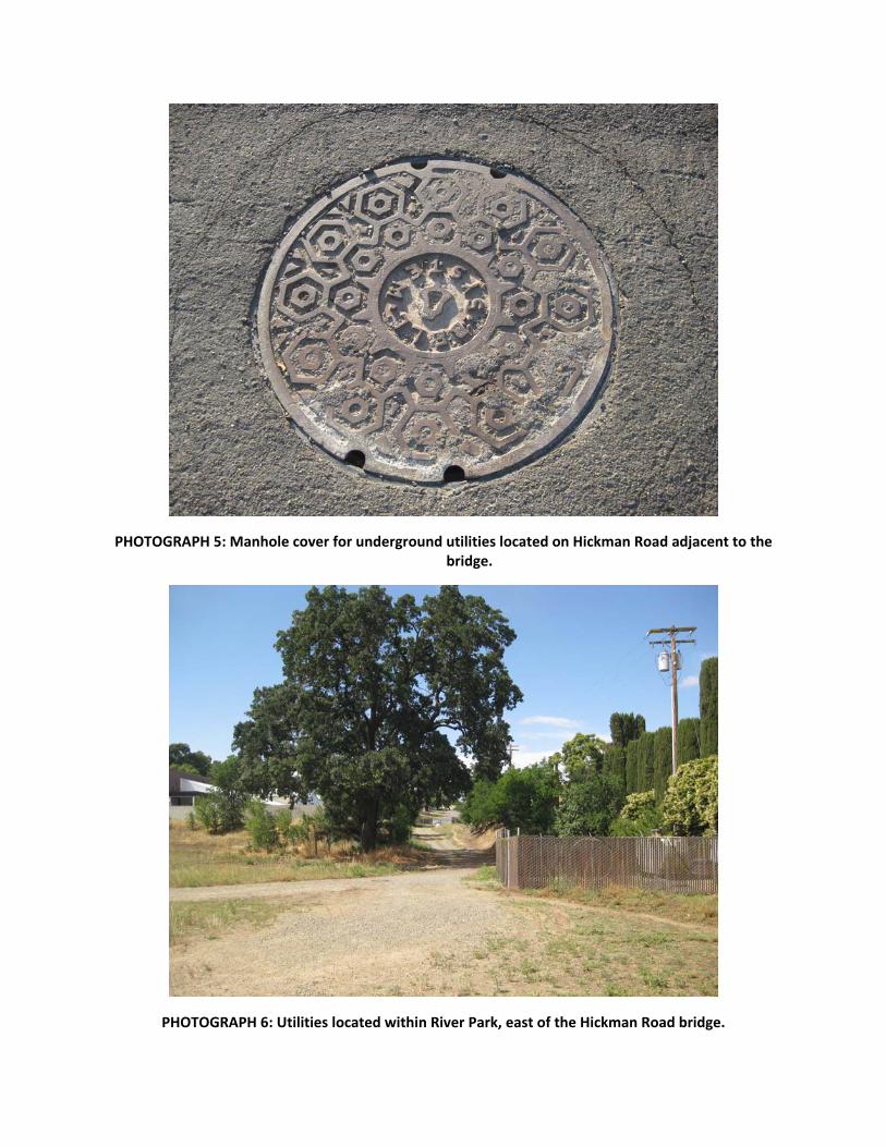
PHOTOGRAPH 5: Manhole cover for underground utilities located on Hickman Road adjacent to the bridge.
PHOTOGRAPH 6: Utilities located within River Park, east of the Hickman Road bridge.
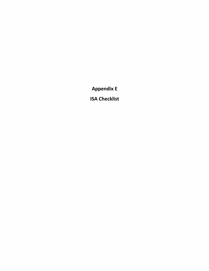
Appendix E
ISA Checklist