haringey local plan draft development …...5 0. introduction local plan 0.1. management policies...
TRANSCRIPT

1
Haringey Local Plan
Draft Development Management Policies Consultation
Document
March 2013
www.haringey.gov.uk

1
OREWORD We have big ambitions for the future of Haringey. As a Council we want to want to promote economic growth, bring high quality new homes and regenerate our borough. In delivering these ambitions we are committed to securing higher quality design and delivering our ambitions for carbon
reduction. Delivering regeneration and economic development in Haringey means getting the right planning policies in place to support development and champion quality. Following the adoption of the Local Plan: Strategic Policies in March 2013, we are now developing the more detailed planning policies that support the Local Plan this consultation is an important part of this process. Throughout this process, we are working to make sure that our planning policies and process are as straightforward as possible reducing bureaucracy for applicants and making planning more accessible to residents. Central to our planning policies is the Development Management Policies Document. This document is a real workhorse of our
planning policies - used every day to make decisions on planning applications. The Development Management policies help determine many of the fundamental and often most visible aspects of development- whether it be how high a new building can be, what a shop front should look like or how much green space a regeneration scheme should have. The Development Management Policies will therefore help to shape the future of Haringey s high streets, housing, business land and open space. That is why I am very keen to hear the views and ideas of residents, community organisations, businesses, investors and developers. Please let us know your thoughts on how we can strengthen the Development Management Policies, whether these are the right ones to deliver a strong future for Haringey and how we can set out them out in a simple and accessible way. We look forward to hearing from you and working with you. Councillor Alan Strickland Cabinet Member for Economic Development.
F

2
Draft Development Management Policies: Consultation Information
We would welcome your response on the draft Development Management Policies Document. It would really help us if you can:
Tell us which policies you agree with and any approaches that you think should be changed or improved;
Rout after each policy area; and
Let us know if there are ways we can make the next
version of this document easier to understand or use. Anecdotal evidence and good ideas from residents and local community members is always valuable but we would especially welcome any evidence, research or studies you can provide to support your comments. For developers and their agents it is our expectation that specific and detailed evidence will be supplied to support your comments. We need to communicate complex planning requirements clearly but want to avoid needless duplication or jargon that does nothing to improve development quality or decisions. We also want to avoid making the DMP overly complicated and have only set out policy responses to the most critical local land use policy issues. Please have this in mind when making comments. We welcome your thoughts on how to get this balance right. Finally, please note the DMP needs to be in line with the Mayor of
ic
Policies de anything that does not support these plans. You can comment online at: www.haringey.gov.uk/developmentmanagement
write to us you can email us at [email protected] or by post to: Place and Sustainability Directorate Planning Policy Team 6th Floor, River Park House 225 High Road N22 8HQ The Council will take your views and update this plan into a final draft version of the Development Management Policies Document which will be published along with further details of the results of this consultation and how we have used your responses to create the plan. Once we make any updates we will then submit the document to the Secretary of State for Communities and Local Government and it will be examined by an Independent Inspector. Consultation closes on Friday 10 th May 2013, Please contact the Planning Policy Team for more information or update on the preparation of the DMP on 020 8489 1479 or [email protected]

How does this consultation work?
Below is an example of how this consultation document is structured. It is hoped that this will guide you in responding to the content included in this document.
DMPX: The Name of Each Policy
For each policy, the London Plan, and Local Plan Strategic Policies provisions relating to this Policy will be set out. It is important to note that if policy guidance is included in these documents, that this should not be repeated in this document. For further information on what the London Plan or Local Plan says, simply follow the links provided.
The aim of the policy will be included in red boxes like this.
your responses to. The text here supports the policy in the purple box in terms of how it will be implemented. We welcome suggestions on additions/changes to this part of all of the proposed policies.
Consultation Questions are in green boxes after each policy. a and b will be there for each policy, but some policies may have additional questions which you may wish to answer.
a. Have we identified all the issues in relation to Infrastructure
Buildings? b. Do you agree on how we are going to address them? c. Additional questions as required
How each policy can achieve its aim will be in purple boxes like this.
Further information will be set out in blue Fact Boxes
The content of these boxes are the main content we are seeking
3

4
Contents
0. Introduction ....................................................................................... 5
1. Getting the right development in the right place ................................. 7
DMP1 Employment and Business Uses .............................................8
DMP2 Retail and Town Centres ..................................................... 11
DMP3 Meeting Housing Needs ...................................................... 14
DMP4 Balancing Housing Tenure ................................................... 16
DMP5 Managing Houses in Multiple Occupation .......................... 18
DMP6 Managing Housing Conversions .......................................... 21
2. Delivering the best design ................................................................ 23
DMP7 Good Design and Quality of Life .......................................... 24
DMP8 Sustainable Development and Climate Change .................. 27
DMP9 Waste, Demolition and Construction .................................. 29
DMP10 Energy and Carbon Reduction ........................................... 31
DMP11 Heritage and Conservation ............................................... 33
DMP12 Environmental Protection ................................................. 36
DMP13 Tall & Large buildings ........................................................ 39
DMP14 Basement Development .................................................... 41
DMP15 Shopfronts and On-Street Dining ...................................... 43
DMP16 Advertisements ..................................................................46
3. Enhancing our borough’s infrastructure ............................................ 48
DMP17 Parking and Transport Impacts ..........................................49
DMP18 Managing Provision of Community Infrastructure (including health,
education, leisure & other community facilities) ...........................51
DMP19 Managing the Quality of Community Facilities ..................54
DMP20 Jobs and Employment ........................................................56
DMP21 Open Space ........................................................................57
DMP22 Nature Conservation ..........................................................59
DMP23 Water Management and Flood Risk...................................62
4. Implementation, Monitoring and Review .......................................... 65
5. How to make a planning application ................................................. 67
APPENDICES ............................................................................................ 68
Appendix 1: Requirements for Planning Applications ................................ 68
Appendix 2: Glossary ............................................................................... 79

5
0. Introduction
Local Plan
0.1. Management Policies Development Plan Document (the DMP). Once adopted it will form part of the Local Plan for Haringey. At this stage it is just a draft for public consultation and views but once adopted it will be a key document for deciding on planning applications received by Haringey Council.
0.2. The overall spatial development plan for the borough is provided in the Local Plan Strategic Policies Document. This document sets out more detailed planning policy requirements for new development proposals in Haringey and shows how the overall
Policies (formerly Core Strategy) will be applied to individual sites through setting out requirements for developments in Haringey. Like the Local Plan Strategic Policies Document, the role of the DMP is to encourage growth and deliver sustainable development in Haringey in a way that reflects the vision and aspirations of local communities.
0.3. The policies in the DMP have to conform with national policies, the London Plan and the Local Plan Strategic Policies document; be informed by evidence, and be able to be applied effectively. They are also subject to a sustainability appraisal and an equalities impact assessment.

6
Three Steps to Planning Permission
0.4 and changing population, the Council needs to make the best use of the
The service wants to work with the community and developers to make sure that we achieve this.
0.5 This document sets out the planning policy approaches we are considering contains 23 policy approaches which are organised around three central considerations - to determine planning applications. Where there is more than one option for these policies that is being considered these have also been included for information and comment.
0.6 The first section is concerned with directing development to
appropriate locations and ensuring a balance between land uses and in the case of housing, the types of accommodation that should be provided.
0.7 The second group of policies set out design requirements
incorporating environmental sustainability standards. The content and requirements in these policies is to some extent pre-determined by design and sustainability standards identified nationally and in the London Plan Local Plan Strategic Polices document.
0.8 The final group of policies address the need to mitigate any
impacts of development on valuable infrastructure and identify the circumstances in which applicants will be required to provide additional infrastructure. This includes social community facilities such as schools; public realm improvements; energy and utilities infrastructure; open space and a range of other types of infrastructure.
0.9 Section four at the end of this DMP provides further guidance on how the Council will implement these policies. Section five provides further information on the planning application process including sources of further information and support.
Planning Proposal
Planning Permission
3
Enhance our boroughs's infrastructure
Policies DMP X- X highlight infrastructure requirements and
mitigation measures
2
Deliver the best design Policies DMP X- X includes
requirements for the sustainable design of buildings.
1
Get the right type of development in the right place
Policies DMP 1 - 6 outline where and when different types of
development wil be supported

7
1. Getting the right development in the right place
The first step to developing in Haringey is to ensure that development proposed is appropriate to the location and maintains the mix and diversity of land uses that are necessary to deliver the vision set out in the Local Plan: Strategic Policies document. Planning applicants should ask themselves whether their development: is in line with the strategic objectives set out in
the Local Plan: Strategic Policies and the London Plan?
is appropriate to the location in terms of the type and intensity of the use and its impact existing surrounding uses?
has incorporated measures to ensure it doesn’t have a significant adverse impact on local people or infrastructure?
Policies in this section need to be complied with to ensure that the right type of development is delivered in the right place in Haringey.
8
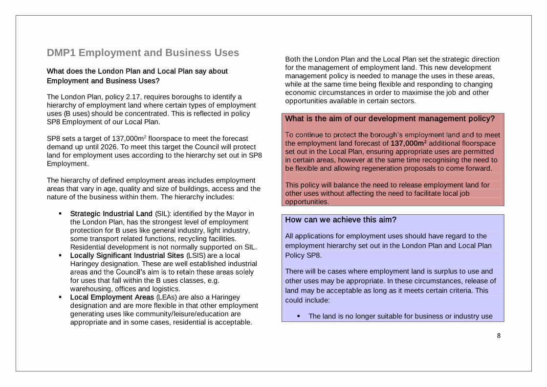
DMP1 Employment and Business Uses
What does the London Plan and Local Plan say about
Employment and Business Uses?
The London Plan, policy 2.17, requires boroughs to identify a hierarchy of employment land where certain types of employment uses (B uses) should be concentrated. This is reflected in policy SP8 Employment of our Local Plan. SP8 sets a target of 137,000m2 floorspace to meet the forecast demand up until 2026. To meet this target the Council will protect land for employment uses according to the hierarchy set out in SP8 Employment. The hierarchy of defined employment areas includes employment areas that vary in age, quality and size of buildings, access and the nature of the business within them. The hierarchy includes:
Strategic Industrial Land (SIL): identified by the Mayor in the London Plan, has the strongest level of employment protection for B uses like general industry, light industry, some transport related functions, recycling facilities. Residential development is not normally supported on SIL.
Locally Significant Industrial Sites (LSIS) are a local Haringey designation. These are well established industrial
for uses that fall within the B uses classes, e.g. warehousing, offices and logistics.
Local Employment Areas (LEAs) are also a Haringey designation and are more flexible in that other employment generating uses like community/leisure/education are appropriate and in some cases, residential is acceptable.
Both the London Plan and the Local Plan set the strategic direction for the management of employment land. This new development management policy is needed to manage the uses in these areas, while at the same time being flexible and responding to changing economic circumstances in order to maximise the job and other opportunities available in certain sectors.
What is the aim of our development management policy?
to meet the employment land forecast of 137,000m2 additional floorspace set out in the Local Plan, ensuring appropriate uses are permitted in certain areas, however at the same time recognising the need to be flexible and allowing regeneration proposals to come forward. This policy will balance the need to release employment land for other uses without affecting the need to facilitate local job opportunities.
How can we achieve this aim?
All applications for employment uses should have regard to the
employment hierarchy set out in the London Plan and Local Plan
Policy SP8.
There will be cases where employment land is surplus to use and
other uses may be appropriate. In these circumstances, release of
land may be acceptable as long as it meets certain criteria. This
could include:
The land is no longer suitable for business or industry use

9
on environmental, amenity and transport grounds in the
short, medium and long term;
There is well documented evidence of an unsuccessful
marketing/advertisement campaign over a period of 18
months;
the redevelopment or reuse of all of the employment
generating land and premises would result in the retention
of some permanent jobs as well as demonstrable wider
regeneration benefits to the community
We could require that changes from outside the B use classes in
LSIS and Local Employment Areas:
Relocate any existing businesses to suitable premises in the
locality; or
Provide appropriate employment elsewhere within the
borough; or
Make a financial contribution towards industrial land
regeneration projects, employment training schemes, job
brokerage services or business support initiatives.
Furthermore, for all development where there is a loss of
employment uses we could request the developer to explore the
provision and/or integration of alternative employment uses, such
as a creative and cultural business or providing a space for small,
medium or micro businesses.
-residential uses that generate employment. Understandably there is significant pressure for other land uses in the borough, particularly housing. Balancing the need for these uses can be difficult. Therefore, we need policies to support the
facilitate local job opportunities. With the changing nature of the economy, there may be an opportunity to use some industrial or employment land more efficiently, either through reconfiguration of land parcels or sites, allowing intensification of land by introducing other uses with the employment, or even releasing some of this land. This is possible on our Local Employment Areas. On a local level however, without careful management we could lose valuable employment land and miss out on opportunities that would allow us to provide jobs and homes for local people.
In order to ensure we properly assess any release of employment land to other uses, it is important to ask developers to demonstrate that the particular building or piece of land is no longer suitable for employment uses. The type of evidence we would be looking for in terms of marketing for all applications are details of commercial agents used, adverts in publications, conditions of any lease and terms offered to the present or last occupants if applicable.
The government has indicated that it will permit a change of use of offices to housing without planning permission from 2013 to 2016. This will have implications for an outer London borough like Haringey as new residential uses being permitted in employment areas may sterilise the employment use permanently.

10
The economy is changing. However, a loss of floorspace does not necessarily mean a loss of jobs. We need to think about policy solutions that will retain and increase jobs in Haringey. We also want to promote more flexible work spaces to support start up business and smaller and medium size enterprises. This is a particular important type of provision in the Creative Industries Sector where the borough is
If we did not have these policies there is a danger that we would continue to lose employment land and therefore job opportunities for local people.
We also need to make provision for employments opportunities related to new development in the borough. Policy DMP 21 sets out our approach to this.
Consultation Questions:
a. Have we identified all the issues in relation to Employment and
Business Uses?
b. Do you agree with linking new employment opportunities with
local job creation?
c. proposals to allow a change of use from offices to housing
without planning permission and what does it mean for the
future of our employment areas?

11
DMP2 Retail and Town Centres
What does the London Plan and Local Plan say about Town
Centres?
London Plan Policies 2.15, inten how the network of centres should be managed. The Plan also strongly supports a wide range of uses to enhance the vitality and viability of town centres across London.
Local Plan SP10 Town Centres reflects the London Plan approach by setting out a hierarchy of town centres for the
wide range of uses should be directed to these centres. SP10 also identifies the retail growth to meet the required additional 13,800m2 comparison goods floorspace and an additional 10,000m2 convenience goods floorspace by 2016. Haringey has six main town centres. Wood Green is one of 11 Metropolitan Town Centres in London. There are also five District Centres at Bruce Grove/Tottenham High Road, Crouch End, Green Lanes, Muswell Hill and West Green Road/Seven Sisters. Tottenham Hale is the boroughs out of town centre Retail Park. There are also a further 38 Local Shopping Centres.
What is the aim of our development management policy?
To reinforce the role and nature of our town centres and set out
what would be appropriate in terms of the balance of shops and
other town centre uses so everyone has access to a full range and
quality of goods and services.
How can we achieve this aim?
New retail and food and drink development should be located in
Shopping Centres.
Other uses such as leisure and community can also be located in
these centres if appropriate to the scale of the centre.
We will seek a % of certain town uses e.g. shops (use class A1) to
ensure that the shops and services that local residents would
expect to see in town centres are protected.
To promote vitality and diversity, we will seek to limit the number of
non-retail units. We could do this for those uses that, in
concentrations, could cause some negative impacts on the area
e.g. the operation of hot food take aways.
In District Centres, we will ask that uses such as banks/estate
agents/betting shops and other financial uses (A2) are limited to
25% of units in town centres.
Where planning permission is required for betting shops, we will
only allow such uses betting shops where there are fewer than
three operational betting shops in the Centre. We will not support
any new uses.
We will consider limiting the number of hot food take aways where
there is an over concentration in close proximity to schools.
If a unit has been vacant for more than six months, planning

12
permission could be granted temporary permission for an
alternative use if this does not harm the vitality of the centre or
operation of the units within the centre.
Retail uses will generally not be permitted outside of our District
Town Centres, in line with the National Planning Policy Framework
(NPPF). Small scale local shops may be appropriate as part of
major redevelopment proposals.
Our town centres face considerable challenges in the face of changing consumer behaviour; new forms of -
and car based out of centre retail and leisure development. Shops should be the main use in Metropolitan, District and Local Shopping Centres and should serve a wide range of shopping needs. Because of this, we need to make sure that we retain a minimum proportion of shops in our Metropolitan and District Centres and restrict the overall number and concentration of other uses. This will mean that if an application for a change of use from a shop to another use which would fall below this minimum percentage or lead to a cluster of non shop uses, then the application would be refused. Food and drink premises and drinking establishments, where well managed can contribute to creating a vibrant evening economy, particularly in our Metropolitan and District Centres. Services such as banks, opticians and leisure and community uses as well as uses like mini cab offices - also have a role in our Metropolitan Town and District Centres. But these uses are only appropriate where they complement the shopping use and contribute to the
vitality of the centre. One element that can distract from this is the presence of blank facades (that is the absence of a window display and activity street) - especially during the day. This can contribute to inactivity at street level and detract from the experience, and ultimately the sustainability of the centre [pedestrian flow information from Draft Haringey Retail Study, 2012]. This would mean that uses located in centres would need to incorporate a window display and should be an active and lively frontage to the street. Without some management and careful monitoring of our centres we might also see - of uses such as betting shops/payday loan shops and take aways in one location, which may result in anti-social behaviour and have other unwelcome impacts such as litter, noise and the promotion of unhealthy lifestyles. High levels of uses such as estate agents, betting shops/payday loan shops (A2 financial and professional services) can reduce the variety of shops on offer and the experience of our centres. The clustering of betting shops overall in close proximity can dominate centres visually and serve a smaller segment of the community than many alternative town and local centre uses. A change of use from a shop to a betting shop would require planning permission from the Council. When determining planning applications for this change of use, the Council will take into account the concentration of existing betting shops in town centres, particularly District and Local Centres. However, such a policy would still be limited in it impacts as currently national regulations identify Betting shops as A2 Financial and Professional Use. The effect of this is that a bank can become a betting shop without the need for planning permission as both

13
are in the same use class and the Council has no control. Restaurants, drinking establishments and takeaways can all become Financial and Professional Uses without the need for planning permission but the only exercise the Council could control in these circumstances is to withdraw these rights through a legal tool called an Article 4 Direction. The concern with using this is that it is a blunt tool and the additional bureaucracy may outweigh its effectiveness for example a bar would need permission to convert to a post office. The saturation of takeaways in some centres and an assessment of a possible link with childhood obesity has also been the subject of recent research1. The Council has much clearer planning control in this instance as a change of use to a takeaway requires planning permission. However, we could seek to limit the number of hot food takeaways where there is a significant concentration within close proximity to each other (suggested 400 metres) and to schools. Finally, the Council wants to leave some room for manoeuvre and flexibility. There is room for innovative uses of town centre that improve the experience of them and contribute to local employment. This is particularly important in centres with a high vacancy rate.
Consultation Questions:
a. Have we identified all the issues in relation to Retail and Town
Centres?
1 Draft Initial Findings, Health evidence base for the emerging policy concerning retail provision, NHS Haringey & LB Haringey, May 2012
b. Do you agree on how we are going to address issues in
relation to retail and town centres?
c. What other uses should we encourage in our Metropolitan and
District Centres?
d. How should we encourage a variety of uses in centres so that
there is activity out of normal working hours?

14
DMP3 Meeting Housing Needs
What does the London Plan and Local Plan say about housing
need?
London Plan Policies 3.8, 3.9, 3.14 and 7.2 set out the need to provide
a range of housing types, sizes
housing need and to ensure balanced communities; protect existing
housing; and ensure that housing is inclusive and accessible.
Local Plan Policy SP
approach to ensuring that the right amount, and the right type, of
diverse population. Meeting the diverse housing needs in Haringey is a
priority for the Council. This includes affordable, well designed and
accessible housing. Our annual housing target has now risen from 680
homes a year in the Unitary Development Plan to 820 homes a year in
the Local Plan.
What is the aim of our development management policy?
To ensure we meet and exceed our housing target of 820 units per year
(2011- 2021) in Local Plan Policy SP2 through a balance of residential
accommodation types across the borough, including housing for older
people and vulnerable people student accommodation and other forms
of specialist housing. We aim to protect existing accommodation and
support new provision in appropriate locations.
How will we achieve this aim?
Applications for new housing must comply with London Plan polices in
relation to meeting housing need and resisting loss of existing housing;
and s
identified growth areas and the local requirements for meeting housing
need. We will specifically direct new housing to growth areas and other
areas where it is appropriate to promote urban regeneration.
We will require development to provide a mix of dwelling types and
sizes to meet local housing requirement, including housing for families,
single person households and older people, as identified in the
Housing SPD (2008).
We will protect existing specialist and supported housing, including
hostels, sheltered housing and care homes, where we know there is a
need and there is no detrimental impact on the amenity of residents in
the area.
We will only permit new hostels and specialist needs accommodation if
they meet a local need; they do not result in a loss of residential
premises; are not within 400m of a similar use; meet appropriate design
standards; the scale and intensity of use is appropriate to the size of
the building; would not harm the character or appearance of the
surrounding area; and are located close to public transport and relevant
services.
We will ensure that proposals for student accommodation are designed
appropriately for its intended use, while being capable of conversion to
self contained units if required. New build student accommodation
and
Local Plan target of 820 new self-contained homes per year.
We want to ensure that all developments contribute to balanced
communities through a mix of dwelling types, sizes and tenures to meet
local housing need.
Haringey has a high demand for all housing types as set out in the
. This will be provided

15
through new development, but we also recognise the importance of
protecting existing housing against changes to other uses, especially
given the limited development sites and a slow construction industry
due to the economic recession.
When applications for new housing are submitted we will assess them
against the relevant development plan policies and supporting
guidance in relation to providing good quality housing in the right
ting
housing.
Applications for new development which do not provide the required
housing mix or result in a loss of housing will not be supported.
There are many different types of specialist and supported housing and
accommodation for different vulnerable groups in Haringey including
hostels, sheltered housing, residential care and nursing homes,
We aim to
protect this type of housing and support new applications to meet a
range of special housing needs, such as those of the homeless,
disabled and the elderly of our community.
Applications for specialist housing must incorporate at least minimum
space and design standards to ensure high quality accommodation
which meet the specific needs of the residents. It is important to ensure
that specialist housing meets a local need and does not have any
negative impacts on surrounding neighbourhoods through over
concentration or through poor management of the properties.
We want to be able to and ensure
that meeting the needs of students will not compromise the ability to
provide housing for our local community. The policy requirements set
out above will prevent the loss of sites that are more appropriate for
family and affordable homes, though are not too restrictive to lose out
on the economic benefits of accommodating students and the
additional benefits they can bring to an area. The requirements will
ensure that student housing is located in areas which can appropriately
serve the needs of students and do not give rise to adverse impacts for
existing residents, with pressure being placed on local services, as well
as amenity impacts such as noise and congestion. Student
accommodation should meet minimum space and design standards to
meet the requirements of its intended residents, and to allow
conversion to single dwelling units if required in the future.
Consultation Questions:
a. Have we identified all the issues in relation to meting future housing need?
b. Are there any areas where it would be appropriate to promote additional housing in response to new regeneration challenges?
c. Do you agree on how we are going to address issues in relation to meeting future housing needs?

16
DMP4 Balancing Housing Tenure
What does the Local Plan and London Plan say about housing
tenure?
London Plan Policies 3.9, 3.10, 3.11, 3.12, 3.13 and 3.14 set out the
need for a more balanced mix of tenures, targets for affordable housing
and how to achieve them and the need to protect existing affordable
Local Plan Policy SP2 Housing sets out the
Coun
type, of housing is provided in the right places to meet the needs of
needs across the borough and create mixed and balanced
communities.
What is the aim of our development management policy?
To meet and exceed our housing target of 820 units per year (2011
2021) and our borough target for affordable housing targets of
50% on large sites and 20% on smaller sites.
We aim to provide a range of private and affordable housing types
across Haringey, and enable regeneration which helps create
mixed and balanced communities. Of our affordable housing
provision we will aim to deliver 70% social rented and 30%
affordable rent or sale.
How will we achieve this aim?
Applications for new housing must meet the requirements set out
in London Plan policies in relation to affordable housing thresholds;
protection of existing housing, including affordable housing; and
provision of a balance of housing tenures.
2 Housing in
relation to affordable housing targets, on-site and off-site provision,
and housing design.
We will aim to maximise the delivery of affordable housing in line
with Local Plan SP2 and require 20% affordable housing on
developments of between 5 and 9 units.
We will negotiate the amount and type of affordable housing
depending on viability, the location, scheme details and site
characteristics.
When calculating new market housing for affordable housing
purposes, we will include additional dwellings created by
conversions and subdivisions, and the residential aspect of live-
work units.
We will consider estate regeneration and other sources of supply
such as long term vacant properties to meet our affordable housing
target.
Haringey is socially and economically polarised with high levels of
deprivation in eastern parts of the borough and relative affluence in the
west. Social rented accommodation is heavily concentrated in the east
while there is very little provision in the west. The Council is committed
to redressing the balance by focusing the development of affordable
housing in the west, while promoting greater levels of market provision
in the east.
We will negotiate different proportions of social rented and affordable
rented housing having regard to the existing proportions of these types
of housing in an area, the overall amount of affordable housing
proposed, the suitability of the site and location for family housing,
individual site costs and other planning requirements.

17
We will resist applications which result in an over concentration of one
type of tenure creating pockets of deprivation or lack of housing choice.
Local evidence supports the need to balance the tenure and reduce the
socio-economic problems associated with high concentrations of social
rented housing, such as worklessness, poor educational attainment
levels, and crime and anti social behaviour. It is both important and
appropriate that the Council uses current local and regional policy to
promote higher proportions of affordable rent and sale housing in the
east of the borough.
In line with Local Plan SP2 and in addition to our overall borough target
of 50% affordable housing on site with 10 units or more, we will ask
that 20% affordable housing is provided on sites with less than 10
housing units to maximise affordable housing across the borough. The
absence of such a requirement may encourage developers with windfall
sites to adjust their proposals to fall below the ten unit level.
Sites capable of delivering 5 - 9 units will be required to provide one to
two on-site affordable units, or where on-site provision is not feasible, a
financial contribution in lieu will be required to spend in areas with low
existing provision of affordable housing.
The Council will negotiate different proportions of affordable rented and
intermediate housing with regard to the existing proportion of
affordable housing in an area; the overall amount of affordable housing
proposed; the suitability of the site and location for family housing;
individual site costs; the availability of public subsidy; and other
relevant planning requirements.
In applications proposing redevelopment of existing homes there must
not be a loss of housing and in particular, no loss of family and
affordable homes. Where there is an increase in the amount of housing,
for example, any future estate renewal projects, we will require any
existing affordable housing to be replaced as well as requiring the
appropriate level and tenures of additional affordable housing.
In trying to deliver all of this, particularly given the current economic
climate, we recognise the task will be challenging, however, we want to
make the most of each opportunity to make Haringey a better place to
live.
Consultation Questions:
a. Have we identified all the issues in relation to housing tenure in
Haringey?
b. Do you agree on how we are going to address the issues in
relation to housing tenure in Haringey?

18
DMP5 Managing Houses in Multiple
Occupation
What does the London Plan and Local Plan say about Houses
in Multiple Occupation (HMOs)?
London Plan Policies 3.5, 3.8, 3.9, 7.1 and 7.2 set out minimum
space and design standards for all housing; the requirement to
meet a diverse housing need; and standards to ensure safe and
SP2
Housing and SP11 Design set
ensuring that the right amount, and the right type, of housing is
Houses in Multiple Occupation are recognised as meeting a
specific need in Haringey, especially for low income residents.
What is the aim of our development management policy?
This policy aims to ensure Houses in Multiple Occupation are
excellent quality homes, contribute to a mixed and balanced
community, and do not have any negative environmental or social
impacts on their neighbours.
How can we achieve this aim?
Applications for large HMOs (more than 6 unrelated people) and
small HMOs (3 - 6 unrelated people) in an Article 4 Direction area,
must comply with London Plan polices and guidance in relation to
design quality and space standards; inclusive and accessible
environments; and balanced communities; as well as the design
standards as set out in the Local Plan SP11 Design. Guidance
documents include the draft London Housing Design Guide and
Additionally, applications for HMOs will be assessed against
relevant development plan policies in relation to waste storage,
recycling and parking.
HMOs will be required to
standards. This sets minimum standards for heating, washing
facilities and WCs, kitchens, fire precautions and room sizes.
We will only grant planning permission for HMOs where the original
property is more than two storeys and has a floor area of more
than 120sqm.
HMOs play a role in meeting a particular housing need, especially
for low income residents and young people. In many cases this
type of accommodation is of poor quality; and there may be too
many located in certain areas, which has adverse impacts on its
neighbourhood. This affects the residents who live in the HMOs as
well as residents in nearby properties.
In response to the many problems associated with poor quality
HMOs in the borough, especially in the east, an Article 4 Direction
(A4D) is due to come into force by the end of 2013. The A4D will
remove permitted development rights for conversion to small
HMOs (3-6 unrelated people) in the eastern wards of the borough,
please see figure 1 for the extent of the area. The A4D will require

19
those who wish to change a single dwelling unit (C4 use class) into
a small HMO (C3 use class), to apply for planning permission.
These applications will be assessed against relevant planning
policies and must meet design and space standards.
In addition, we aim to manage HMOs across the whole borough in
order to minimise their impact on local services and facilities;
reduce the loss of family housing; and ensure that they meet
minimum design and space standards and provide high quality
accommodation.
Proposed HMOs should be in line with relevant development plan
policies and
London Housing Design Guide.
When assessing applications for HMOs we will consider the
location of the proposed HMO; the existing number of HMOs on
the street; the existing use of the property; and the size of the
property.
We will also carefully consider the location of features such as
waste and recycling storage, and car and cycle parking to protect
the character of the area.
Applications which do not meet the relevant requirements and
standards will not be supported.
Figure 1 Article 4 Direction Area for managing small HMOs

20
We will strive for consistency between planning decisions,
enforcement, and licensing schemes to ensure high quality
accommodation in HMOs, manage the rate of change of use to
HMOs, and will allow for the possibility of returning converted
properties to single family dwellings.
We are continuing to pursue a holistic multi-agency approach to
improve private sector housing involving the police, the fire brigade
planning, enforcement, council tax and housing benefit functions.
We have
for HMOs centred on Harringay ward requiring the licensing of
smaller HMOs and some conversions. A further scheme for five
wards in Tottenham was consulted on between September and
November 2012.
A Council wide approach to the private rented sector will ensure
that new HMOs will provide good quality accommodation, will
reduce the activities of rogue landlords and enable frontline
services to focus their efforts on problems areas rather than
spreading efforts to thinly. Proposed planning policies will aim to
implement good quality standards and will enable a multi-agency
approach.
Consultation Questions:
a. Have we identified all the issues in relation to Housing in
Multiple Occupation?
b. Does our policy show sufficient recognition to the role that
HMOs can play in the borough?
c. Do you agree on how we are going to address issues in
relation to houses in multiple occupancy?

21
DMP6 Managing Housing Conversions
What does the London Plan and Local Plan say about housing
conversions?
London Plan Policies 3.5, 3.8, 3.9, 7.1 and 7.2 set out minimum space
and design standards for all housing; the requirement to meet a diverse
housing need; and standards to ensure safe and accessible housing
across Lon Policy SP2 Housing sets out the
type, of housing, is provided in the right places to meet the needs of
rse population. Conversions play a role in meeting
is accessible and inclusive.
What is the aim of our development management policy?
To ensure that we meet and exceed our target of 820 homes per year
(2011 2021) through a mix of housing in terms of type, size and
tenure, which is of high quality and meets space and design standards,
and contributes to a sustainable community.
How can we achieve this aim?
Applications for housing conversions will be assessed against the
relevant London Plan and Local Plan policies and supporting guidance
in relation to density; housing design and space standards; waste
storage and recycling; cycle and car parking; amenity; and balanced
communities.
In addition, applications will be assessed against relevant development
management policies in relation to waste storage, recycling and
parking.
We will only permit the conversion of a single dwelling house with an
existing floor area of more than120sqm and at least five habitable
rooms.
We will expect that the conversion of properties into self contained flats
to be carried out within the existing building without the need for any
extensions.
We will require all house conversions to provide a mix of units as set
out in the Housing SPD, to meet local need.
We will expect house conversions, where appropriate, to provide
external amenity space which is appropriate to the needs of the future
occupants.
We could introduce a conversion management area (CMA) parallel with
the Article 4 Direction area, as set out in DMP5. Applications for house
conversions in the CMA will only be permitted if they deliver family
housing (at least 3 bedrooms) and meet our housing space standards.
We will apply a blanket ban on all flat conversions to prevent
continuous sub-division of units and to ensure no additional adverse
Conversions differ from Houses in Multiple Occupation (HMOS), in that
they provide self-contained units, i.e. homes with their own bathroom
and kitchen, whereas HMOs are homes where residents share such
facilities.
Like HMOs, conversions play an important role in meeting a specific
housing need in Haringey and contributing to our increased housing
target. However, in response to an over concentration of conversions in

22
certain areas in the borough, we need to manage the number and type
of conversions in the borough in order to control their impact on local
services and facilities, the loss of family housing, and to ensure that
they provide high quality accommodation and meet space standards.
When determining applications for house conversions we will carry out
a general assessment of the character of the existing properties, with
particular focus on unit size, and review the local environment impacts
associated with high levels of conversions.
We will expect house conversions to demonstrate that they will not have a harmful impact on the character and amenities of the surrounding area, are easily accessible by public transport, cycling and walking and meet the relevant housing standards for conversions. House conversions will be required to meet high quality design
standards to provide good quality accommodation and to allow for the
potential to convert properties back to single dwelling units.
Conversions should provide a mix of dwelling types and sizes to meet
local housing requirements, including families with children, single
person households and older people.
Applications for house conversions which do not meet the policy
requirements; would result in an over concentration of conversions; or
would have an adverse impact on the surrounding neighbourhood will
not be permitted.
Extensions which create a whole new flat or flats, or new habitable
room or rooms will not be acceptable. Extensions should only be
designed to improve otherwise sub-standard facilities of an existing flat.
In order to control the number of conversions across the borough and
to encourage mixed communities we will introduce a conversion
management area (CMA) which will mirror the Article 4 Direction area
based on the evidence which shows a high concentration of converted
houses and adverse impacts on the neighbourhood. In this CMA, house
conversions will not be permitted unless they deliver family housing (at
least 3 bedrooms) and meet our housing space standards.
There is currently a rapid rate of flat conversions in the borough which
results in continuous carving up of buildings, and which prevents the
potential to reverse conversions back to family homes. We aim to
manage this trend more effectively by applying a blanket ban on flat
conversions in some areas only.
Consultation Questions:
a. Have we identified all the issues in relation to housing
conversions?
b. Do you agree on how we are going to address issues in relation to
housing conversions?
c. Do you agree that the Conversion Management Area reflects the
area proposed under the Article 4 Direction?

23
2. Delivering the best design
How an environment is built, looks and functions can have a significant impact, either positive or negative, on people’s quality of life. This affects not only the environment itself but also the image of a locality, which can affect the economy of an area. Design is about how places work and should contribute positively to making places better for people. Planning applicants should ask themselves whether their proposed development is: of high quality design?
environmentally sustainable?
functional and inclusive providing a good
experience for occupiers and users of the development and other residents affected by it?
Policies in this section need to be complied with to ensure that the answer to these questions is a resounding yes and the best design is delivered.

24
DMP7 Good Design and Quality of Life
What does the Local Plan and London Plan say about promoting a
good quality of life?
The London Plan places an important emphasis on the quality of life of
against new development causing significant harm to the amenity of
neighbouring buildings, and for enhancing the amenity and vitality of
the surrounding streets, and local residents access to open space.
sets out the need for high quality
design to be adopted in new development.
What is the aim of our development management policy?
This policy aims to ensure new development protects the amenity of
neighbouring residents and uses, as well as current, and future users of
the site.
We need to make sure that new development fits in with its surroundings and does not detrimentally affect views of areas/buildings of excellence or particular historic value. It also needs to make the public space such as pavements and open areas look good, feel safe and accessible to everyone. How can we achieve this aim?
Development proposals should meet standards regarding issues like
the impact of the development on visual privacy and overlooking, loss
of sunlight and daylight, noise and air pollution, sense of enclosure, any
effects on microclimate
We will ask that development proposals demonstrate that there is good
standard of on-site amenity (Living Conditions) for surrounding uses, by
ensuring that the standards set out in the London Housing Design
Guide, and the latest version of the Haringey Housing SPD are met.
Where proposals are considered acceptable in principle, conditions
may be attached relating to the hours of operation and the nature of the
activities in order to mitigate any significant adverse environmental or
amenity impacts on surrounding communities.
We will ask that the character of the development site and the surrounding area/street scene be taken into account in the design of schemes. New development should address the locality in a positive way. Access and the mobility needs of pedestrians, cyclists and people with mobility difficulties (including wheelchair users and carers with pushchairs) should also be taken into account. Thoughtful design is particular key in sensitive areas such as where there is an impact on heritage assets such as Conservation Areas and adjacent to Metropolitan Open Land. Development should consider the impact of development on, and
ensuring that it does not detract from, the locally identified views.
density of development and population is likely to increase. As a result, Haringey residents will have to live and work in closer proximity to each
need to be carefully managed.
New development should complement the existing pattern of development in the borough and seek to ensure that the quality of life for those that live or work in Haringey is protected. As such, the

25
be considered alongside the amenity of future users of the development itself.
The potential direct impacts of new development could affect all of our senses, including cutting off light to adjoining properties, eroding privacy, and creating noise and other pollutants.
As space is limited in an urban borough such as Haringey, higher densities also mean that space is at a premium for users of new development. Living space, access to sunlight, storage space, and access to the street are examples of the quality of life issues that need to be managed when deciding whether a proposed development should go ahead.
While protecting local it is important also to give certainty to developers on what may and may not be granted planning permission. The clearest way to achieve both of these aims is to refer to agreed standards when assessing planning applications. At present these standards include:
Interim London Housing Design Guide (2011)
Haringey Housing SPD (2008)
BRE Rights to light
The quality of life issues that these standards protect include:
Ensuring minimum floorspaces
Provision of private and communal amenity space
Minimising sound and light pollution
Preventing overlooking from other properties
Provision of dual aspect, including orientation of the aspect
Protection of floor to ceiling heights
Provision of storage space
Maintaining accessibility to the street
The Government has proposed a relaxation of the current planning regulations with regard to house extensions; however, it is important
be necessary to ensure that any potential loss of daylight and sunlight is considered in the design process alongside the issues of overlooking and privacy.
If we did not have design requirements, we might see the introduction of features or design elements of new developments which do not fit in with their surroundings. For example, without thinking about what, who and where schemes are being developed, we might see the bplaces becoming disconnected, the scale of development being out of proportion, public realm being poor quality and cluttered, areas becoming unsafe and inaccessible. We want to support good design that is appropriate for that area. We want the design to be sustainable, to improve the quality of the existing environment, to reinforce a sense of place and to promote civic pride. Building materials should not differ between private and affordable units within a development. New development in the borough needs to complement the existing pattern of development in Haringey. Future development in the borough should not make the quality of life worse for those living, visiting and working in Haringey. As part of the design, we would expect that all developments meet the highest standards of access for wheelchair users. Design that is inclusive creates an environment where everyone can physically access and benefit from the full range of opportunities available to members of society. We consider that people deserve a safe environment in which they can live and move around without fearing that they might be a victim of

26
Good design of buildings and how those buildings work with the area around them affects how people feel about an area, as well as the opportunity for disorderly or criminal behaviour. Public art helps to create a sense of place, and may come forward both in new developments, and over the lifetime of a building. Public art could be secured as part of a planning application. Scenic areas can make a positive contribution to a community, preserving its unique charm, building civic pride and attracting positive growth to an area. In rapid change, vistas and views could be lost. Identifying and protecting local views and vistas is an important part of improvement and regeneration of an area. The view from Alexandra Palace to St Paul s Cathedral is a protected strategic view. There could also be local views and vistas of scenery and exempla buildings that could be considered worth protecting as views and vistas could sometimes be detrimentally affected by new development. We want to identify local views within the borough that should be protected and where possible enhanced. This could include views, vistas, panoramas and views of landmarks.
Some possible local views that could be considered for protection are: Along the Lee Valley; of Archway bridge; Highgate Bowl; Highgate High Street and Highgate Hill; West Highgate (Bishops Wood/ North Hill Area); Shepherds Hill- particularly St James church spire; Highgate Ridge; Hornsey Church Tower; High Cross area; Bruce Castle Park; Tottenham Green and the Parkland Walk.
Consultation Questions:
a. Have we identified all the issues in relation to the principles of good
design and quality of life?
b. Do you agree on how we are going to address the issues in relation
to good design and quality of life?
c. Which local views set out in the proposed planning policy do you
think we should be protecting?
d. Should public art in the borough be formally protected?
FACT BOX: Haringey Design Awards. The awards are a key part of the commitment by Haringey to promote, encourage and foster thoughtful and exciting design for new buildings or extensions to buildings. Previous winners include the new Haringey Heartlands School winner of best green design and best new or improved place. Haringey Design Panel. Is an independent panel that reviews some major planning applications at pre-application stage and comments on their design proposals. These comments then feed back into the planning application before it is submitted to Haringey.
The panel is made up of people who have an interest in architecture and design. Haringey is supported in its work on design excellence by Design for London, a team in the Greater London Authority who provide expert advice on good design on major development schemes; they help steer developments and collaborate to influence how places change. We also get support from Urban Design for London who aim to create and maintain well-
by offering: staff training; advice; information on latest policies and publications; practitioner networks; and design surgeries on big applications. Haringey also refer to CABE and CABE publications whose work places design at the heart of creating value by stimulating innovation in business and public services, improving the built environment and tackling complex social issues

27
DMP8 Sustainable Development and Climate
Change
What does the London Plan and Local Plan say about Sustainable
Development and Climate Change?
The London Plan, in particular Policy 5.3, seeks to contribute to the
of 60% (below 1990 levels) by 2025.
sets out the requirement from the
National Planning Policy Framework (NPPF) for
ch is reflected throughout the Local
Plan policies. Further detail on how to make development more
sustainable is set out in Local Plan policies SP4 Working Towards a
Low Carbon Haringey and SP11 Design, which set out the general
requirements for sustainable design and climate change.
What is the aim of our development management policy?
This policy will require developers to submit a sustainability statement
to make sure that all major and minor development in the borough is
as sustainable as possible.
This means that proposals will need to demonstrate how the issues of
sustainability and climate change have been incorporated into the
proposed design, construction and operation of a scheme.
How can this policy achieve its aim?
The aim of this policy will be achieved through compliance with London
Plan polices and guidance in relation to sustainable design and
construction and climate change adaptation and mitigation. It will also
be achieved through the carbon emission and energy efficiency
standards as set out in the Local Plan SP4 Working towards a Low
Carbon Haringey and the design principles set out in SP11 Design for
sustainable design and construction.
A sustainability statement will need to be submitted with all planning
the requirements for sustainable development and climate change
have been integrated within the proposals.
In order to assess how the requirements for sustainable development
and climate change are delivered within the borough, it is important for
development to demonstrate how social, economic and environmental
factors have been incorporated into the proposed design, construction
and operation of a scheme. All planning applications (except
householder applications) should, therefore, include a sustainability
statement. The statement should set out clearly how the issues
concerning sustainable development and climate change have been
addressed and integrated within the proposals.
The changes in climate are also likely to result in hotter drier summers
and wetter milder winters with more intense rainfall. Development
needs to be designed to adapt to any changes in climate, so that it
remains comfortable for users over its lifetime and to avoid making
local climatic conditions worse.
Consultation Questions:
a. Have we identified all the issues in relation to Sustainable
Development and Climate Change?
b. Do you agree with our policy approach to Sustainable
Development and Climate Change?

28
FACT BOX:
Householder Development
Householder developments are defined as those within the curtilage of a house (or a single flat) which require an application for planning permission and are not a change of use.
Included are: extensions, conservatories, loft conversions, dormer windows, alterations, garages, car ports or outbuildings, swimming pools, walls, fences, domestic vehicular accesses including footway crossovers, porches, balconies/terraces and satellite dishes.
Excluded are: applications relating to any work to two or more flats, applications to change the number of dwellings (flat conversions, building a separate house in the garden), changes of use to part or all of the property to non-residential (including business) uses, anything outside the garden of the property (including stables if in a separate paddock).

29
DMP9 Waste, Demolition and Construction
What does the London Plan and Local Plan say about Demolition and Construction?
for the recycling/reuse of 95% of construction, excavation and demolition of waste by 2020 6 Waste and Recycling supports this position and sustainable waste management including: the management of waste and waste sites; reducing the amount of waste created; and increasing recycling rates. The Local Plan supports the London Plan Policies on Waste and the M , including the target for the recycling/reuse of 95% of. Policies 5.16-5.18 are of particular relevance to this policy.
What is the aim of our development management policy?
The policy also seeks to make sure that all development in the borough is designed to reduce the amount of raw materials used during the demolition, construction and operation of a scheme in order to meet the waste management targets.
How can this policy achieve its aim?
All planning applications will be assessed against relevant development management policies in relation to sustainable development and climate change, energy and carbon, water management, pollution, and flood risk.
Existing buildings should be conserved rather than demolished where feasible and sustainable. Development will be required to justify the demolition of buildings on site.
Development should follow the Demolition Protocol (or similar waste
auditing tool) to encourage greater reuse of materials and sustainable waste management.
All development will need to provide adequate waste storage including space for recyclables and for composting biodegradable matter.
The type and source of materials in buildings has a major impact on
sustainability. The production and use of building materials consumes
large quantities of energy and resources and generates waste. The
choice of materials used has important implications for the
environment. It is therefore necessary to encourage the selection of
materials that will minimise negative environmental impacts and the
consumption of non-renewable resources.
By considering the whole-life cycle of materials the environmental
impacts of development can be greatly reduced. The whole life cycle
assessment means that the consequences and impacts of using
materials must be considered from the point at which they are mined or
harvested, through to processing and manufacture, including
transportation, installation, use, reuse/recycling and eventual disposal.
Existing buildings are an important resource and should be conserved
rather than demolished where feasible or where they make a positive
contribution to the streetscape or the appearance of a building. Where
development involves the demolition of existing structures, a Demolition
Waste Audit should be undertaken using established methodologies
such as the Demolition Protocol or the BRE SMARTWaste strategy.
Such tools provide a framework for decision making, which emphasise
the need to reuse, then recycle and landfill as a last resort. The use of a
framework can also provide an integrated approach to the development
of Site waste Management Plans (SWMPs) with indicative targets and
approaches to deliver major benefits to clients.

30
Dedicated areas for waste storage (including recycling) also need to be
provided within the site. The provision of adequate waste storage will
targets. Including space for composting biodegradable matter will also
help to reduce the amount of waste going to incineration or landfill.
The NLWP is currently being prepared in partnership with seven North
London Boroughs. The NLWP will identify suitable locations for waste
management facilities to meet the London Plan apportionment of 1.9m
tonnes and the Haringey apportionment of 237,000 tonnes. The
Counc
management sites. New waste management facilities will be required
to take into account and minimise pollution and nuisance issues as set
out in DM12 Environmental Protection.
Consultation Questions:
a. Have we identified all the issues in relation to Waste, Demolition
and Construction?
b. Do you agree that a requirement to follow the Demolition Protocol
(or similar waste auditing tool) should be introduced?
c. Do you agree that the justification of the demolition of a building
should be included in a planning application?
FACT BOX:
Demolition Protocol:
The Institute of Civil Engineers (ICE) and Chartered Institute of Waste Management (CIWM) Protocol provides methods to assess and recover demolition material as well as specify recovered (recycled & reclaimed) material in the new build. The detailed documents can be found on the following websites: http://www.ice.org.uk http://www.envirocentre.co.uk BRE SMARTWaste: This is a web-based tool developed by the Building Research Establishment (BRE) to help the construction industry prepare, implement and review Site Waste Management Plans (SWMPs) in full compliance with the Site Waste Management Plan Regulations 2008. http://www.smartwaste.co.uk
WRAP: The Waste and Resources Action Programme (WRAP) is a not for profit company backed by the Government to help individuals, businesses and local authorities reduce waste, recycle more, make better use of resources and help tackle climate change. WRAP has produced numerous publications and tools to help minimise waste in the construction process including a SWMP toolkit.
Waste minimisation publications can be accessed from the WRAP
website at www.wrap.org.uk. WRAP also provide further information
on sustainable aggregates at www.aggregain.org.uk
Further information on the selection of materials can be found in
Green Guide to
Specification at www.bre.co.uk
The Site Waste Management Plan Regulations 2008 can be viewed at -http://www.legislation.gov.uk/uksi/2008/314/regulation/5/made

31
DMP10 Energy and Carbon Reduction
What does the London Plan and Local Plan say about Energy and
Carbon Reduction?
The London Plan sets targets for zero carbon residential buildings from
2016 and zero carbon non-domestic buildings from 2019. This is
Working towards a Low
Carbon Haringey, which h to energy
standards and carbon reduction targets, including the use of renewable
energy sources and establishing decentralised energy networks.
As set out in the Local Plan, this policy will require new development to
achieve a reduction in predicted carbon dioxide emissions of 20% from
on site renewable energy regeneration (where viable), which can include
connections to local sources of decentralised renewable energy.
What is the aim of our development management policy?
This policy seeks to make sure that all development in the borough is
designed to improve the energy efficiency of buildings (new and
existing) and reduce carbon emissions in the borough. Haringey also
needs to meet the carbon reduction target of 40% by 2020, as set out
in Haringe
The policy adds specific requirements for retrofitting in order to address
the large proportion of carbon dioxide emissions from the existing
building stock.
How can this policy achieve its aim?
The aim of this policy will be achieved through compliance with London
Plan polices and guidance in relation to climate change, as well as the
carbon emission and energy efficiency standards as set out in the Local
Plan SP 4 Working towards a Low Carbon Haringey and SP11 Design.
In addition, all planning applications will be assessed against relevant
development management policies in relation to sustainable
development and climate change.
Existing buildings that are subject to change of use or refurbishment
will be required to show a reduction in their carbon footprint by
retrofitting energy efficiency measures. Major residential refurbishment
BREEAM Domestic Refurbishment scheme.
Reducing energy use in buildings and working towards a low carbon
borough is considered to be one of the key challenges facing Haringey.
Scenarios Study 2007 found that the
use of fossil fuel based energy in domestic buildings is responsible for
almost 50% of CO2 emissions in the borough. The existing building
stock also represents a large proportion of carbon emissions in
Haringey, which needs to be tackled.
reduction targets are being met, all major development will need to
prepare an energy statement as required in the London Plan. The
statement will need to be submitted with the planning application and
set out clearly the energy and carbon reduction strategy for the site and
It is also necessary to plan for new and emerging sources of energy
including on-site generation of heat, electricity, renewable applications
or connection to decentralised energy networks. Decentralised energy
networks are being introduced or extended within the borough and new

32
development should be designed so that it does not prevent the future
connection to such networks.
In order to deal with the inefficiencies in existing buildings, the Building
Research Establishment Environmental Assessment Method (BREEAM)
Refurbishment scheme is a solution, which would also reduce carbon
emissions. The BREEAM Domestic Refurbishment scheme is a new
initiative used to assess the environmental life cycle impacts of
refurbishment projects including existing dwellings undergoing
refurbishment, extensions, domestic conversions and change of use
projects. A scheme for non-domestic refurbishments is yet to be
released but major schemes may use BREEAM 2008 or 2011 until the
launch of BREEAM Non-domestic refurbishment.
Further Options
In addition to the policies put forward above there are further options,
which could be considered in order to strengthen the requirements for
energy and carbon reduction. The further policy options include:
The Introduction of a Carbon Offset Fund
There may be circumstances where it will not be possible for
2 targets through on-site
renewable energy provision. We are therefore considering the
introduction of a Carbon Offset fund, where a payment or investment in
an alternative allowable solution would be made to the Council. The
fund would compensate for the shortfall in carbon emissions through a
levy, which would be set at a cost per tonne of carbon. The fund would
fulfil two main objectives:
Provide an alternative means for developments to meet their
carbon reduction targets when on-site solutions are not viable;
Provide a source of funding for other 40:20 carbon reduction
initiatives, for example: decentralised energy networks, low
carbon infrastructure or energy efficient retrofit.
Further work will be necessary to establish whether such a fund would
be a viable proposition for the borough and to ensure it would not
discourage developers from incorporating on-site renewable energy
measures into proposals.
Energy assessments for residential buildings
Another option is the need for existing residential buildings to have an
energy assessment when an extension is proposed, to see if low cost
energy efficiency improvements can be made to the existing property.
The 2010 Building Regulations do not require improvements to the
existing dwelling when it is extended. The inclusion of a policy to
encourage such improvements would be used to address this issue
and help to reduce additional energy requirements.
Solid wall insulation
The reduction of carbon emissions in existing buildings could also be
addressed by retrofitting solid wall insulation. Any proposed policy
would need to be considered within the context of current permitted
development rights for rear extensions. The introduction of policy
would still require applications to be made in respect of external wall
insulation but will give the Council the opportunity to ensure
appropriate design and detailing, in addition to sympathetic material
selection. This option could help to remove uncertainty regarding the
approach to applications for external wall insulation while retaining
control to ensure aesthetic quality.

33
Consultation Questions:
a. Have we identified all the issues in relation to Energy and Carbon
Reduction?
b. Do you agree that a policy should require a minimum of BREEAM
xcellent for Major Domestic Refurbishment projects?
c. Do you agree that off-site provision for renewable energy or an
off-set payment (should a carbon offset fund be a viable option)
be used where on-site provision is not feasible?
d. Do you agree that requiring an energy assessment for residential
buildings that propose an extension is an appropriate way of
improving the energy efficiency of existing residential buildings?
e. Do you agree that the retrofitting of solid wall insulation should be
considered?
Fact Box:
All new residential development must meet a minimum of Code for
Sustainable Homes Level 4 and reduce CO2 emissions by:
- 25% improvement on Building Regulations 2010 up to 2013
- 40% improvement from 2013-2016
- Be zero carbon (Code Level 6) by 2016.
All new non-residential development must meet at least BREEAM
2 emissions by:
- 25% improvement on Building Regulations 2010 up to 2013
- 40% improvement from 2013-2016
- As per building regulations from 2016-2019
- Be zero carbon from 2019.
Code for Sustainable Homes (The Code) The Code for Sustainable Homes is the national standard for the sustainable design and construction of new home, which aims to
reduce carbon emissions and promote higher standards of sustainable design above the current minimum standards set out by the building regulations. The Code uses a 1 to 6 star system to rate the overall sustainability performance of a new home against the above categories, with 6 stars being the most sustainable. Mandatory minimum standards for energy and water use are set at each level. The Code for Sustainable Homes technical guide sets out the requirements of the latest version of the code, and how a code assessment is reached.
Building Research Establishment Environmental Assessment
Method (BREEAM)
A BREEAM assessment is a voluntary assessment method for new non-residential buildings, which is run by the Building Research Establishment. The assessment uses recognised measures of performance, which are set against established benchmarks, to evaluate measures used represent a broad range of categories and criteria from energy to ecology. A pre-assessment report provides a useful tool when developing initial designs, showing where improvements are needed to get the required rating. Buildings are rated on a scale of Pass, Good, Very Good, Excellent and Outstanding. Further information can be found at htttp:// www.bre.org
DMP11 Heritage and Conservation

34
What does the London Plan and the Local Plan say about Heritage and Conservation? London Plan Policies state that development should identify, value, conserve, restore, re-use and incorporate heritage assets. It also requires that sites of archaeological importance are protected.
SP12 Conservation identifies the 29 Conservation Areas, and highlights the other identified
heritage assets within Haringey, giving the historical context of the borough, confirming the importance of strategic and local buildings, historic parks and structures of historical importance.
What is the aim of our development management policy?
This policy will ensure that any new proposals or development do not have a negative impact on the built heritage and historic environment of the borough, but at the same time manage growth particularly in a context of improvement and regeneration. How can this policy achieve its aim? Development that harms the heritage of the borough will not be permitted. There is a presumption in favour of the retention of buildings that enhance the Conservation Area. Development proposals should set out how they preserve or enhance
including listed and locally listed buildings, their setting and their significance as key elements of developing a sense of place Sometimes significant changes to heritage buildings, spaces and features may occasionally be necessary and beneficial. The policy will consider any proposals in the context of such things as; the contribution being made to the existing character or appearance of the
area; the wider benefits of the proposed use; the potential for enhancement of architectural or historic interest; and the contribution to the local economy. It is also important to set out criteria to ensure that changes to built heritage can deliver energy efficiencies and make heritage assets fit for contemporary use, all the while not compromising the intrinsic qualities of the building/asset itself. In addition to these criteria, we would require that any proposals for development in Conservation Areas should demonstrate how it preserves and enhances the character of the conservation area. Furthermore, for proposals in/adjacent to Areas of Archaeological Importance, an Archaeological Assessment would also need to be produced. The heritage and historic spaces, structures and buildings of Haringey need to be protected and maintained for existing and future
sense of place and identity. We recognise that the heritage of an area is a key factor in helping to bring forward urban regeneration and promoting civic pride. We will protect buildings in Haringey that are statutorily listed for their historic or architectural interest. The listed buildings and their setting are recognised as an asset to the built environment of Haringey. Often the best use of a listed building is the use the building was originally designed for. However, with care and thoughtful design, historic buildings can be adapted and people can still enjoy them and their original character in appropriate settings. Where a change of use is proposed, which affects the special character of a listed building; it will need to be fully justified. Buildings of local interest in Haringey often play a crucial role in anchoring local visual and historic identity as well as acting as a

35
significant focus for encouraging urban vitality. We attach a special importance to the protection of locally listed buildings. We will use our planning powers to ensure that wherever possible the special character of such buildings is protected and enhanced even though buildings on the local list are not subject to the statutory protection given to those selected by the Secretary of State. We want to ensure that in determining planning applications the significance of the Conservation Area, historic building heritage and setting are fully considered. The history of the borough indicates that there is considerable likelihood that archaeological remains will be found in certain parts of the borough. There are areas of Areas of Archaeological Importance within Haringey; the boundaries are on the Local Plan: Policies Map.
educational, recreational and tourist resource. We will promote the conservation, protection or enhancement of archaeological sites and their presentation to the public. We also will encourage suitable design of the use of the land and the management to safeguard archaeological sites. The most important archaeological remains and their settings should be permanently preserved (if necessary for public access and display).
Consultation Questions:
a. Have we identified all the issues in relation to heritage and
conservation?
b. Do you agree on how we are going to address the issues in relation
to heritage and conservation?
c. What criteria should we use to ensure that changes to built heritage
can deliver energy efficiencies and make heritage assets fit for
contemporary use?
Fact Box Listing Buildings English Heritage is responsible for the process of national designation of structures of historic importance our heritage assets. This is to ensure that they are passed onto future generations for their enjoyment. For further information pease visit: http://www.english-heritage.org.uk/caring/listing/ Local Views The need to protect a local view will be considered in relation to minimising visual impact of development on heritage assets, whilst recognising regeneration needs in the borough. Refer to DMP13 Tall & large buildings for more information.

36
DMP12 Environmental Protection
What does the London Plan and Local Plan say about
Environmental Protection?
London Plan Policies set out how boroughs should respond to climate
change, reduce noise pollution and improve air quality.
Haringey and SP14 Health and Well-Being stress the importance of
and for the future.
What is the aim of our development management policy?
This policy seeks to make sure that all development in the borough is
designed to include appropriate environmental protection and to
provide further guidance on the control and prevention of pollution,
resulting from all stages of development. Assessments are therefore
needed on the issues set out below in line with national and local
guidance.
How can this policy achieve its aim?
All planning applications will be assessed against relevant development
management policies in relation to sustainable development and
climate change; waste, demolition and construction; amenity; open
space; nature conservation; and water management and flood risk.
Proposals will need to demonstrate that there is no significant adverse impact in relation to: Air quality Contaminated land Groundwater and water courses
Hazardous substances Light pollution Noise and vibration
(England and Wales) Regulations 2011and any subsequent amendments, a full Environmental Impact Assessment will be required.
Pollution of the air, watercourses and soil as well as from light and
noise can affect human health, safety and the environment and is
therefore a major planning consideration. The Council will only allow
schemes that consider, mitigate and prevent environmental effects
appropriately during all stages of development. Where proposals are
considered acceptable in principle, conditions may be attached in
relation to the land decontamination; the hours of operation; and the
nature of the activities, in order to mitigate any adverse environmental
effects.
Air Quality
The whole of the borough has been declared an Air Quality
Management Area (AQMA) for the pollutants of concern; nitrogen
dioxide (NOX) and particulate matter (PM10). The dominant sources of
air pollution in Haringey are road transport, domestic boilers, CHP and
biomass. Anticipated climate change is also expected to worsen air
pollution as a result of hotter drier summer weather.
All major development proposals must include an Air Quality Impact
Assessment, which identifies suitable mitigation measures to improve
air quality. New development which includes proposals for biomass
boilers must also include an emissions assessment. An Emissions
Statement to accompany proposals with a biomass boiler must be able
to demonstrate NOX and PM10 emissions achievable under normal

37
operating conditions are capable of meeting set emission standards as
determined by the Mayor.
Contaminated Land
Development on potentially contaminated land will not be supported
unless it can be demonstrated that the risks associated with potential
contamination have been suitably addressed. All land previously used
for industrial, utility or commercial uses in the borough will be regarded
as potentially contaminated.
Development proposals on potentially contaminated land will be
required to follow a risk management approach including:
a desk top study to identify potential contamination and risks to
identified receptors
a site investigation in the form of a quantitative risk assessment.
Where contamination is present, with the possibility of significant harm
to identified receptors, a remediation strategy will be needed. All
remediation works will need to be fully implemented and evidence
provided in a verification report to the satisfaction of the Council.
Groundwater and Water Courses
Haringey is underlain by London Clay, beneath which lies the Chalk
Aquifer, which is the major aquifer of the London Basin. There are a
number of ground water abstraction points within Haringey, which
require protection from existing and potential new sources of pollution
in order to maintain the quality of the groundwater. Development will
not be permitted where there is an unacceptable risk of pollution of
groundwater within Source Protection Zones 1 and 2, as defined by the
Environment Agency - Ground Water Protection Policy and Practice
(GP3).
Using soakaways or other infiltration methods on contaminated land
carries groundwater pollution risks and may not work in areas with a
high water table. Where the intention is to dispose to a soakaway, these
should be shown to work through an appropriate assessment.
(See also DM 24: Water Management and Flood Risk).
Hazardous Substances
These substances are considered to be toxic, harmful or corrosive, and
any proposed new development or the intensification of existing uses
must be assessed.
Light Pollution
Artificial light from premises can have a detrimental impact on the
quality of the local environment.
Light pollution (distinct from light nuisance) is caused by unwanted
artificial light and occurs when poorly designed light fixtures project
light where it is not intended or reflect light upwards into the night sky.
Light pollution can also result in energy wastage, which can contribute
to climate change and high running costs, as well as having an adverse
impact and wildlife.
Applicants will be encouraged to submit details of lighting schemes,
including lighting scatter diagrams as part of the planning application to
demonstrate that the proposed scheme is appropriate for its purpose
and setting.
Noise and Vibration
Noise can have a significant effect on the environment and on the
quality of life enjoyed by individuals and communities. Dense mixed
use urban areas have higher concentrations of noise arising from a
variety of different sources. Noise generating development should
contain noise through appropriate sound insulation and other noise
reducing technologies such as the positioning of buildings and using
landscape as noise barriers.
A noise assessment will be required if the proposed development is
either a noise-sensitive development (such as housing, a school or a

38
hospital) or is an activity with the potential to generate noise. All
development adjacent to railways will require a vibration assessment.
Mechanical ventilation should be designed to ensure no noise nuisance
is caused to occupiers of other properties and that noise disturbance
does not affect the property in which ventilation is situated. As a guide
developers should aim to ensure that noise from plant does not
increase the background noise in the area. Development should have
regard to the noise standards in Appendix 1.
Environmental Impact Assessment
Certain types of development, which are likely to have significant
environmental effects owing to factors such as its nature, size or
location will require Environmental Impact Assessment (EIA). All
applications subject to EIA must be accompanied by an Environmental
Statement.
The Environmental Statement must describe the likely significant effects
of the development on the environment and any proposed mitigation
measures.
Consultation Questions:
a. Have we identified all the issues in relation to Environmental
Protection?
b. Do you agree with our policy approach to dealing with the issues in
relation to Environmental Protection?

39
DMP13 Tall & Large buildings
What does the London Plan and Local Plan say about tall buildings? The London Plan requires boroughs to identify areas appropriate or areas inappropriate for tall or large buildings. The criteria for assessing tall and large buildings are included in the London Plan.
Design states that tall buildings will be assessed against certain criteria for siting and design. In Haringey, we have said that buildings over 9 storeys, have a significant impact on the skyline are substantially taller than their neighbours or are to be considered tall or large.
What is the aim of our development management policy?
This policy aims to set out the criteria for siting tall and large buildings and to identify the locations where they would be considered acceptable, and locations where they would not be acceptable. How can this policy achieve its aim? In addition to the two locations already identified appropriate for tall buildings (Haringey Heartlands and Tottenham Hale) the policy will identify whether other areas in the borough may be suitable for tall buildings.
Applications for the design of tall buildings will be assessed against the criteria set out in the London Plan. Proposals for redevelopment or refurbishment of existing tall buildings will be required to make a positive contribution to the townscape. If we did not have this policy we could find that the tall buildings being proposed end up having limited architectural quality which does not
suit or complement the character of the area. Without this policy we may also find that tall buildings would be built in more locations all over the borough. Haringey is mainly low-rise (2-3 storey) residential suburban development across the borough and 3-4 storey development in its Town Centres. Wood Green Town Centre has been identified as already having buildings which are considered tall, new development at Tottenham Hale also makes this location suitable. To inform this policy approach, we will commission an Urban Characterisation Study to assess the character of the borough and examine the case for tall and large buildings. Tall and large buildings can positively contribute to the feel and look, and how we use an area. They can help mark the location of Town Centres and major traffic nodes, close vistas of long straight roads and define landscape features. However, large and tall buildings can be intrusive on both the immediate and the wider area, by altering the established skyline, by adversely affecting attractive local views, heritage assets and their settings, buildings of townscape importance and important landmarks. It is important that we very carefully plan and guide the design and context of the buildings so that they are of the highest standard and to make sure that we relieve any environmental and socio-economic impacts. Either way, tall buildings have the potential to have a significant impact on their surrounding area either positive, in terms of
Given its overall suburban character, a lot of Haringey is particularly sensitive to the potential adverse impact of high buildings on its character and townscape qualities. Tall buildings should step up from surrounding lower heights rather than suddenly have comparably taller buildings. The significance of Heritage Assets, particularly the Conservation Areas and Historic Parks, and in all cases their setting,

40
must in particular be identified, analysed and assessed against the impact of tall and large buildings. In Tottenham, an investment in public housing will lead to estates being renewed with more housing options and better public realm. The renewal work and the assessment of suitable locations for tall/large buildings will take account of each other, Buildings of this scale must be developed using the highest standards of sustainable design and construction. Such proposals for tall and large buildings must also consider safety, overbearing effects on the street, the levels of daylight, amenity and microclimate, as well as other issues such as ecology, air movement, shadowing and shading. Amenity provision for residents in terms of open space and private amenity space must be addressed within the development. Balconies should be usable and of a practical depth.
Consultation Questions:
a. Have we identified all the issues in relation to tall/large
buildings?
b. Do you agree on how we are going to address the issues in
relation to tall/large buildings?
c. What areas in the borough do you think are suitable for tall
buildings? What areas may not be suitable for tall buildings?

41
DMP14 Basement Development
What does the London Plan and Local Plan say about basement
development?
London Plan Policies 5.12, 7.4, 7.6 set out the requirements of flood risk management and the need for positive design of development.
Local Plan Policies SP2 Housing and SP11 Design set out ring that the right type of housing is
provided in the right places to meet the needs . It is important that development contributes positively to the surrounding neighbourhoods and does not cause long lasting adverse impacts.
What is the aim of our development management policy?
To ensure basement development provides high quality design in
the right locations which has no adverse impacts on the property
itself and neighbouring properties, and does not result in over
development.
How can we achieve this aim?
Applications for basement development must comply with London
Plan and Local Plan policies. Applications should also be in line
with guidan
Development Guidance Note.
We will require basement developments to meet criteria such as the following:
Maintain the structural stability of neighbouring properties;
Ensure no adverse affects drainage and run-off or cause other damage to the water environment;
Avoid leading to the loss of open space or trees of townscape or amenity value;
Provide satisfactory landscaping, including adequate soil depth; and
Avoid harm to the appearance or setting of the property or the established character of the surrounding area.
We will resist basement development which includes habitable rooms and other sensitive uses in areas prone to flooding.
We will seek to minimise the disruption caused by basement development and will require Construction Management Plans to be submitted with applications.
When considering applications for basement extensions we will expect that effective measures will be taken during excavation, demolitions and construction works to ensure that structural damage is not caused to the subject building and any nearby properties.
In recent years there has been an increased amount of basement development in the borough. Although basement developments can
that this is done in such a way that does not cause harm to the amenity of neighbours, affect the stability of buildings, harm any protected trees, cause drainage or flooding problems, or damage the character of areas or the natural environment. Not all basement developments require submission of a planning application as they fall under permitted development rights. However, specific property types such as those listed below do require planning permission to be submitted;
Flats, apartments and maisonettes planning to extend underground;

42
Basement conversion (for e.g. converting a basement to a dwelling), this may be classed as a "change of use"; and
Light wells. Ground conditions in Haringey vary from sandy clay in the Highgate area through to the more common brown clay in Muswell Hill and Crouch End, with gravel in clay as you move towards Tottenham. These ground conditions may influence the affect basement development will have on geology and as a result the Council may require more research and supporting information with planning applications.
Consultation Questions:
a. Have we identified all the issues in relation to basement
development in Haringey?
b. Should we only allow basement development in certain parts of
the borough?
c. Do you agree on how we are going to address the issues in
relation to basement development in Haringey?

43
DMP15 Shopfronts and On-Street Dining
What does the London Plan and Local Plan say about shopfronts? London Plan Policies 4.8, 4.9, 7.2 and 7.4 state that development schemes should improve the quality of the street environment and through this, improve the experience of the borough for residents and visitors.
SP11 Design sets out the Council s approach to ensuring that all new development should enhance and
that are high quality, attractive, sustainable, safe and easy to use. This links closely with SP10 on Town Centres and SP12 on Conservation, where improving the viability of shopping areas and conserving
What is the aim of our development management policy?
We need additional policies to continue to maintain and improve the appearance of shopfronts, signs and security grills in shopping areas. How can this policy achieve its aim?
To maintain and improve the appearance and viability of shopping centres, proposals for shopfronts, signage and security shutters should respect the character and appearance of the area.
Planning applications will have to make sure that the designs:
Are of a high quality while being sensitive to its visual
appearance on the building on which it is to be sited and the surrounding street scene, especially in the case of listed buildings and conservation areas;
signage in the vicinity;
Are appropriate and relevant to a business /premises; Retain existing traditional framework and surrounds; Reflect existing traditional or classical designs in frontage where
original framework still exist; Reflect neighbouring shops in terms of fascia lines, stall riser
heights, materials and other architectural features; Reflect current access and safety requirements.
New shop fronts should be contained within the width of the building and should not extend over two or more original plot widths considering subdivision for a single large shop.
distinctive
Edwardian shopping parades where shops still retain original features of the original shops. We want to keep the original shopfronts and enhance the detail of them in order to maintain the appearance and viability of these areas. We also want to encourage replacement shopfronts to be of a good design. Shop fascia and any signage will require separate advertisement consent as well as planning permission. Well designed shopfronts respect the character of the area, the age and design of the shop. At the same time, we want to encourage vibrant and active shopping areas. Generally, the replacement of original traditional shop fronts by one in a more contemporary style can be detrimental to the appearance of a shopping area. There may also be cases where it will be desirable for a new shopfront to be built in a traditional style for example, where a shopfront in a traditional parade has been accidentally destroyed by fire or other cause.
) still survives, repairing the framework to its original appearance is preferable. The design of a new shopfront to be fitted into this framework should include the features and characteristics of a traditional shopfront. Some of these are shown in Figure 2 below.

44
Figure 2:
The design of a new shop front within a modern building should reflect the design of the building of which it is a part of and should also take account of the appearance of the best of neighbouring buildings and shop fronts in terms of the details of the design in terms of materials and architectural features. The imitation of historical styles is rarely appropriate and should not be attempted. The Council is not likely to support proposals that reinforce poor nearby shopfront design. In shopping centres outside Wood Green Metropolitan shopping centre,, new shopfronts should be contained within the width of the building they occupy and should not extend over two or more original plot widths. However, the sub-division of a new shopfront for a single large shop may be acceptable if sensibly designed.
The design of the shopfront should mean that the shop is accessible to disabled people and suppliers to/from the shop. Blinds, Canopies and Security Fittings should be of good design. We think that solid metal shutters are poor in design and so they are to be the last security resort and will only be considered in exceptional circumstances. Necessary, but unsightly items such as burglar and fire alarms should never cover architectural details or features and should be mounted in inconspicuous positions. This is all to maintain and improve the appearance and so viability of a shopping area Generally, the use of pavement seating is not practical as most public footpaths in Haringey are not wide enough or else pavement dining would cause problems with neighbouring residents in terms of noise, light or smell. However, there may be places in Haringey where there is enough space and where such an activity could operate effectively. The use of public pavements would also need Council approval.

45
Consultation questions:
a. Have we identified all the issues in relation to shopfronts?
b. Do you agree on how we are going to address issues in relation to
shopfronts?

46
DMP16 Advertisements
What does the London Plan and Local Plan say about advertisements? The London Plan states that development schemes should improve the quality of the street environment and through this, improve the experience of the borough for residents and visitors. Plan Policy SP11 Design sets out the design approach to development in Haringey. Advertisements that are well constructed and designed promote high quality, sustainable design aiming to conserve the boroughs rich and diverse heritage.
What is the aim of our development management policy?
To deliver the vision set out in the Local Plan Strategic Policies and provide further guidance to SP11, we need additional policy to ensure that proposals for advertisements are of high quality and do not have an adverse impact on the appearance of the building or the surrounding area, especially in the case of listed buildings and conservation areas. How can we address these issues?
We need to ensure that proposals for advertisements (including hoardings, illumination of hoardings, illuminated fascia signs, free-standing display panels, and estate agent boards) do not cause a public safety hazard, contribute clutter or a loss of amenity, We will ask that schemes submitted for advertisement consent should meet ALL of the following criteria:
be of a high quality and sensitive to its visual appearance on the building on which it is to be sited and the surrounding street scene, especially in the case of listed buildings and conservation areas;
not contribute to an unsightly proliferation or clutter of
signage in the vicinity; not cause a hazard to pedestrians or road users; be sited so as not to cause visual intrusion by virtue of light
pollution into adjoining residential properties; and where appropriate, be constructed of materials and finishes
which discourage both graffiti and flyposting. The display of most advertisements requires consent in accordance with the Town and Country Planning (Control of Advertisement) Regulations 2007. The Regulations state that decisions have to be made having regard to their impact on amenity and public safety. Development plan policy by itself is only a material consideration. Nonetheless, the Council wishes to set out guidance on how it interprets these two key issues locally. Amenity The Council is seeking to restrict the number of advertisements and signs to a level appropriate to the character of the area. There is a danger that flank wall displays can distort the scale and architectural unity of buildings especially when they are located above ground floor height. Where they are entitled to grant permission, advertisements should not be displayed without the permission of the owner of the site or any others with an interest in the site. Badly designed, very bright or inappropriately sited signs can seriously detract from the visual quality of a street or area. Attention must therefore be paid to designing signs that are in scale and character with the surrounding streetscape. Public safety We will need to be convinced that new adverts do not cause a public safety concern due to their potential to distract road users or other safety concerns due to inappropriate locations. Large signs will not generally be supported where they create areas where muggers could hide. We will consult Highways colleagues on most hoardings and

47
Transport for London on advertisements that could affect their road network.
Consultation Questions:
a. Have we identified all the issues in relation to this policy?
b. Do you agree on how we are going to address the issues in
relation to this policy?

48
3. Enhancing our borough’s infrastructure
Developments need to consider their impacts on the
social and environmental infrastructure that
supports Haringey’s communities such as schools,
transport infrastructure and parks. Most
development will be required to contribute towards
infrastructure to support development in Haringey.
Planning applicants should consider whether the
proposed development:
could have any extra demands on the quality, quantity or access to the borough’s infrastructure and identify ways of mitigating or planning for extra demand on this infrastructure;
provides opportunities to increase or improve quality of infrastructure.
Policies in this section need to be complied with to
ensure that valuable assets that support
communities in Haringey are retained and improved.

49
DMP17 Parking and Transport Impacts
What does the London Plan and the Local Plan say about Parking and Transport Impacts? The London Plan policies 6.1 and 6.2 sets out the strategic approach to integrating transport and development for improving sustainable transport ; enhancing transport capacity and connectivity; promoting non-car use and giving maximum parking standards. Local Plan Policy SP7 Transport sets out the Coun
as well as local and strategic access to London, employment areas and local services. The context and priorities for transport improvements and projects is also provided by Haringey Local Implementation Plan (LIP).
What is the aim of our development management policy?
This policy aims to make sure that all sections of the community, particularly the disadvantaged who are less likely to have a car available, have access to the widest possible range of employment, housing, shopping, recreations, medical, cultural and social facilities. How can this policy achieve its aim? The Council will require development to demonstrate it has no unacceptable impacts on the existing and proposed future transport network.
The Council will require new development to be located and designed
to encourage travel by public transport, cycling and walking.
The Council will strongly encourage the provision of new car club bays as an alternative to on-site car parking. We aim to have 150 car club
bays by 2013/14.
Development proposals will be assessed against the car parking and cycling standards. standards will not normally be permitted. For larger developments the parking requirement will be assessed on an individual basis as part of the Transport Assessment or Statement The Council will only support parking in front gardens where there is a minimum of 50% of the area being retained as soft landscape. The Council will not support the provision of a crossover or access where the implementation is likely to result in a reduction in pedestrian or highway safety, of on-street parking capacity or create visual damage to the street scene If we did not have a policy requiring the consideration of our transport infrastructure capacity, we might see developments come forward which would put too much pressure on how we move around, within, as well as to and from the borough. This is especially relevant in a place like Haringey given the scale of growth and where an increasing population needs access to jobs and essential services.
oads suffer from high levels of traffic congestion over much of the working day. We aim to reduce the traffic levels in the borough to improve environmental standards, particularly air quality. Too many journeys within and into the borough are by single occupancy vehicles for example. The Council sees a role for travel plans in reducing car based work journeys. The purpose of a travel plan is to reduce the level of car usage and to promote sustainable methods of transport. Guidance on the content of a travel plan is provided below. The submission of a travel plan will be required to support planning applications above a threshold. The thresholds for various land use categories are set out in Appendix 1 below. In addition, the Council

50
would require the submission of a travel plan for development proposals which are likely to have a significant transport impact or where a development is located in a sensitive area. Applications for parking in front gardens will have to ensure development does not result in an increase in flooding by considering the use of SUDS. In Conservation Areas, it is particularly important that the design preserves the character and appearance of the surrounding area. Current permitted development allows a maximum of 5 sqm of impermeable paving. The Council will require permeable paving above 5 sqm. Whilst cycle storage and parking are encouraged, care must be taken over the design of storage visible from the public highway, particular in Conservation Areas. Cycle storage units within front gardens require planning permission and will also be required to be of a high quality design. Storage units should benefit from appropriate placement within the garden and screening to minimise the impact on the street scene.
Consultation Questions:
a. Have we identified all the issues in relation to transport?
b. Do you agree on how we are going to address the issues in relation
to transport?

51
DMP18 Managing Provision of Community
Infrastructure (including health, education,
leisure & other community facilities)
What does the London Plan and Local Plan say about the provision
of community infrastructure facilities?
The London Plan sets out the need for additional infrastructure to meet the needs of a growing population. Development proposals which meet local need, are accessible by sustainable transportation methods, are multifunctional and do not produce deficits in local provision will be supported.
Council will work with its partners to ensure the much needed infrastructure and community facilities and services are provided for
possible, enhanced. This will be based on the projects identified in the
The Local Plan identifies s106 agreements and the Community Infrastructure Levy as mechanisms for securing infrastructure contributions from new development.
y (CIL) Charging Schedule is currently being developed. As part of this process, the Council will set out the infrastructure projects that can be funded from CIL revenues. The Mayor of London already collects Mayoral CIL from developments across London for the Crossrail project. After the introduction of CIL, some infrastructure will continue to be required through the s106 process including site specific infrastructure requirements and other obligations. The interrelationship between s106 and the CIL, and how the s106 will be operated after April 2014 deadline will be guided by the most up to date national CIL/ regulations.
What is the aim of this development management policy?
This policy aims to ensure that new facilities to deliver
infrastructure to meet the needs of population are derived from
future development in the borough.
How can this policy achieve its aim?
Opportunities to enhance and fund strategic infrastructure will be sought through new development:
by CIL charging in line with the CouSchedule to fund new local infrastructure projects identified in the Infrastructure Delivery Plan;
through Section 106 agreements to maximise the effectiveness and exploit synergies between the development and projects identified in the Infrastructure Delivery Plan; and
The Council, will consider supporting the consolidation of
equal or enhanced provision can be provided to meet an identified need.
The population growth forecast in the borough over the Local Plan period suggests that new infrastructure will be needed to accommodate the needs of the increased population. These facilities include meeting growing health, education, and leisure needs, and where possible enhancing the standard of provision for local residents. The Infrastructure Delivery Plan sets out the infrastructure projects required to take forward these Local Plan requirements.
Significant development sites are likely to come forward over the next 15 years, particularly in growth areas such as Tottenham and Haringey Heartlands. Large development sites may provide opportunities for provision of on-site local facilities. Specific uses which can be

52
accommodated on these sites need to be identified, and infrastructure providers will need to identify areas in which they will be seeking sites.
At present Haringey Council and its infrastructure delivery partners face significant challenges in ensuring that land and finance are provided to meet the needs of a growing population. Finding and financing sites for new provision is a key issue.
The Community Infrastructure Levy (CIL) will help fund new Plan.
CIL is charged on a per square metre basis on most new developments, and can be spent on new infrastructure projects across the borough. The other way infrastructure can be generated from new development is by section 106 agreements generating local infrastructure improvements on or close to new developments.
in July September 2012. The Council intends to put into place a CIL charging schedule by April 2104. The Council has also identified infrastructure projects that can be funded by the CIL levy collected.
Section 106 agreements and CIL will co-exist under the new system and CIL replaces the s106 tariff, although s106 will continue to be used for over ten units of housing and anything that is site specific e.g. a new access road.
New developments within a designated distance of a combined heat and power or renewable energy network may be required to connect to it via s106 agreements and the site design should enable the connection to the most up-to-date telecommunications, energy, transport, and information infrastructure through its design.
S106 may also continue to be required for travel plans, town centre management measures, public art and employment and training options.
The CIL regulations already place restrictions on the continued use of s106 planning obligations, requiring them to be necessary to make the development acceptable in planning terms, directly related to the
development, and fairly and reasonably related in scale and kind to the development. From 1st April 2014 onwards, the scope for pooling infrastructure contributions via s106 agreements to fund infrastructure projects will be restricted to the revenue accruing from 5 sites. The interrelationship between s106 and the CIL, and how the s106 will be operated after April 2014 will be guided by the most up to date national CIL/ s106 regulations.
The physical, social and environmental infrastructure that can be progressed via CIL or s106 includes the following:
Education/ training facilities;
Health facilities;
Community halls/centres;
Leisure facilities;
Emergency Services, including drop in police stations; Highway and footway reinstatement and road improvements
Public realm improvements
Utilities infrastructure
Telecommunications infrastructure
Neighbourhood combined heat and power networks
Decentralised energy networks
Flood defences including local drainage improvements
Micro, small or affordable workspace or retail space; and
Construction placements and procurement from local firms (construction phase)
Critical to the decision making process on planning applications including the gain, loss, or transfer of infrastructure will be the local assessment of need in specific localities. Sites currently in community

53
use can come under increasing pressure for redevelopment, and the consolidation and modernisation of community facilities in accessible locations where multi-functional facilities can meet the needs of a range of users can be considered. This process, as well as the disposal of surplus or redundant assets will need to be managed to ensure that critical uses are not lost from the local area. Developments yielding efficiency improvements, consolidations, and disposals should be
rastructure Delivery Plan.
Consultation Questions:
a. Have we identified all the issues in relation to provision of
community infrastructure facilities?
b. Do you agree on how we are going to address the issues in
relation to provision of community infrastructure facilities?

54
DMP19 Managing the Quality of Community
Facilities
What does the London Plan and Local Plan say about managing
community infrastructure?
The London Plan sets out the need for boroughs to manage the provision of additional infrastructure to meet the needs of a growing population and sets design and access criteria for quality of community facilities.
Local Plan Policy SP11 states that the impacts of new development on local users should be managed to minimise negative effects. SP16 promotes the efficient use of community facilities and the provision of multi-purpose community facilities.
What is the aim of this development management policy?
This policy will ensure that new social, environmental and physical
infrastructure facilities are provided in a manner sympathetic to
local amenity and accessible to all users and support the wider Plan
objectives. Opportunities to improve infrastructure through
appropriate planning applications will be explored.
How can this policy achieve its aim?
The Council will develop a criteria on how and when it can support the construction, installation, renewal and alteration of community infrastructure taking account of national and local policy requirements, and needs- based on evidence.
Criteria may include exploring consolidation of facilities and possibility of creating efficiencies through sharing facilities.
New community facilities such as health or educational uses should protect the amenity of the surrounding area for existing users and ensure that there is no significant impact on the free flow of traffic and road safety. Certain community facilities may benefit from being located in locations which are accessible by public transport, and other sustainable travel options.
The potential environmental impacts of new infrastructure will be considered under national and local policies including the relevant DM DPD policies.
In order to accommodate future growth identified in the Local Plan, there is a need to provide sufficient infrastructure to ensure that quality of life does not fall behind growth.
New infrastructure proposals may have amenity impacts, during construction and their functional lifespan. The impacts caused by a piece of infrastructure must be managed and mitigated as far as possible, and balanced against the benefits to society it will generate once complete.
When a development is permitted in a location where new infrastructure is planned, the development will need to be compatible with the future network.
Certain development proposals may be strategically located such that they can aid the facilitation of potential infrastructure projects. Future connections to a wider network (for example a fibre optic or decentralised energy network) and safeguards (for example for a transport link) are examples of considerations that may materially affect the outcome of a planning application decision.
he Infrastructure Delivery Plan offers an opportunity to ensure that synergies between development and infrastructure planning are exploited. This will be achieved by the growth identified in the Local Plan being shared with local infrastructure

55
providers so that they are informed about what infrastructure needs to be provided in the future and what the regeneration and growth aspirations are for specific sites.
We will encourage new uses to locate in town centres and local centres as these locations are well served by public transport.
Potential environmental impacts of new infrastructure such a biomass boiler will be assessed against other relevant planning policy.
Consultation questions
a. Have we identified all the issues in relation to managing the quality
and location of community facilities ?
b. Do you agree on how we are going to address the issues in relation
to managing the quality and location of community facilities?

56
DMP20 Jobs and Employment
What does the London Plan and Local Plan say about Jobs and
Employment?
The London Plan supports increasing training opportunities for Londoners, and supports the principle of development proposals supporting local employment and skills.
SP9 Improving Skills and Training to support access to jobs and community cohesion and inclusion supports the principals of creating higher skilled workforce in Haringey, and acts to collect a financial contribution from schemes that produce a loss of employment floorspace.
What is the aim of our development management policy?
This policy will ensure that new local employment and skills
generation will be generated as a result of development.
How can this policy achieve its aim?
On larger development sites, the developer will be required to ensure opportunities for local contractors and labour during the construction of the development.
Developers will be required to set out how they will engage with local contractors/ subcontractors/ employees, how many trainees will be employed on site and how many weeks training will be provided per trainee.
Where possible, once construction has finished, new jobs and local employment resulting from the ongoing use of the building should be secured. The approved scheme will be secured in a s106 agreement. In circumstances where it is not possible to employ trainees on-site
the financial contribution should be paid.
Unemployment in Haringey is above the London and national average. New development in the Borough will create opportunities for jobs during the construction period, as well as after completion of the development. There is significant residential development identified in the Haringey Local Plan. The growth in housing in Haringey will lead to an increase in linked retail and service jobs to support the increased population. Additionally employment land is safeguarded to preserve employment opportunities. To maximise the number of local jobs provided as a result of future development, every effort will be made to secure jobs on development sites for local residents. These jobs will be sought during the construction phase, as well as throughout the active lifespan of the building.
It is a key principal of sustainable development to co-locate housing and employment, thereby creating efficient commuting patterns. This policy seeks to secure local employment opportunities for Haringey residents as a result of new development, both in the construction phase, and over the lifespan of the building.
Consultation Questions:
c. Have we identified all the issues in relation to jobs and
employment?
d. Do you agree on how we are going to address all the issues in
relation to jobs and employment?

57
DMP21 Open Space
What does the London Plan and Local Plan say about Open Space?
The London Plan sets out the policies for the provision and protection of open space in London.
) and designated open spaces. The Local Plan seeks to promote a network of high quality, accessible open spaces as areas for recreation, visual interest and biodiversity, whilst improving access to those areas deficient in public open space.
What is the aim of our development management policy?
This policy seeks to make sure that there is adequate provision of open space throughout the borough for a range of uses and to maintain its value and visual character.
How can this policy achieve its aim?
Development that is adjacent to Green Belt, Metropolitan Open Land, Significant Open Land or any other valuable open land will only be permitted if it maintains or enhances the value and visual character of the open land.
Development will not to be permitted on Significant Local Open Land (SLOL) unless it meets all of the following criteria:
It is ancillary to the use of the open space It is small in scale
character It is required to enhance activities associated with the
particular open nature and character of the land It provides a positive contribution to the setting and quality
of the open space.
The provision of public open space and facilities for sport and recreation underpins Such provision is considered important to in and to the promotion of sustainable communities. Where new development occurs it is important that sufficient open space, sport and recreation provision is made to make the proposals acceptable in land use planning terms. New development must ensure that adequate open space is provided on site for the type of development proposed to prevent any further increase in open space deficiency. It is important that open space is accessible to all those in the immediate locality and, in the cases of strategic open space, from a wider catchment area. Where development would further increase demand for open space then improved access should be secured before development is allowed.
Development close to any valuable open land boundary must be carefully designed in order that the open character of the land itself is not diminished. Land adjacent to open land forms part of the character and may affect the natural habitat of the open land. Significant Local Open Land may have one or more of the following values: recreational, biodiversity, amenity and landscape.
Consultation Questions: a. Have we identified all the issues in relation to Open Space? b. Do you agree with how we are going to address the issues in
relation to Open Space?

58
FACT BOX: Different types of open space:
Green Belt: Green Belt is an area of land which has been given special status to restrict inappropriate development.
Green Chain/Link: Linked green spaces composed of such elements as open land, footpaths, canals and rivers which provide public access, play valuable recreational, conservation, ecological and general amenity role. Green chains can also be Ecological Corridors.
Green Infrastructure: A network of connected, high quality, multi-functional open spaces, corridors and the links in between that provide multiple benefits for people and wildlife.
Metropolitan Open Land (MOL): Strategic open land within the urban area that contributes to the structure of London.
Open Space: All land in London that is predominately undeveloped other than by buildings or structures that are ancillary to the open space use. The definition covers the broad range of types of open space within London, whether in public or private ownership and whether public access is unrestricted, limited or restricted.
Public Realm: This is the space between and within buildings that is publicly accessible, including streets, squares, forecourts, parks and open spaces.

59
DMP22 Nature Conservation
What does the London Plan and Local Plan say about Nature
Conservation?
The London Plan includes in particular policies to promote urban
greening, biodiversity and access to nature and the protection of trees
and woodlands.
n Policies SP5 Water Management and Flooding,
SP11 Design, SP13 Open Space and Biodiversity and SP14 Health and
Well-Being seek to protect and improve sites of biodiversity and nature
conservation, including designated sites, private gardens and trees.
What is the aim of our development management policy?
This policy seeks to protect and enhance the diversity and richness
and fauna to provide a rich and varied
landscape and ecological foundation to Haringey. The policy also
aims to provide protection to existing trees and to improve the
contribution trees make to the local landscape character in both
the public and private realm.
How can this policy achieve its aim?
The aim of this policy will be achieved through compliance with
London Plan polices and guidance in relation climate change and
places and spaces, as well as the requirements set out in the Local
Plan policies SP 5 Water Management and flooding; SP11 Design;
SP13 Open Space and Biodiversity and SP14 Health and well-
being.
This policy will set out some criteria which will need to be met
should development on or adjacent to designated sites for nature
conservation come forward.
Tree planting will be required, particularly where proposals result in
the loss of existing trees. As a minimum, any replacement must be
of an equal amenity and ecological value and be approved by the
Council.
Stronger protection should be given to ancient woodland areas,
and recognition of the value of such woodland in terms of the
historical, cultural and biodiversity contribution to the borough.
The designated sites of ecological value and nature conservation
importance in the borough make a positive contribution to the diversity
a.
Biodiversity should be considered early in the design process. An
understanding of the site and its context will therefore be important in
order to identify measures to preserve and enhance biodiversity. The
Council will encourage applicants to consider the potential for
biodiversity within and close to buildings. Green or brown roofs and
green walls should be included in development proposals unless it can
be demonstrated that it is not appropriate as set out in SP13 of the
Local Plan.
Green corridors may comprise a variety of areas including railway lines
and waterways, in particular the River Lee and the Moselle Brook, but
could also be a chain of private gardens. The continuity of these
corridors is important in order to prevent fragmentation and any
reduction in their ecological value.

60
Development should be avoided on areas of ecological value or
importance for nature conservation (SINC) or local nature reserves
(LNR) unless there are exceptional circumstances. Where development
is considered appropriate, suitable mitigation and/or compensation
measures will need to be identified. Planning obligations will be used
where relevant to control the impact of development on protected and
priority species and their habitat. Monitoring of impacts may be
required and the submission of evidence to show that compensation
has been implemented successfully.
Developments, which affect sites of existing or potential nature
conservation value, should be accompanied by an appropriate
ecological impact assessment. The assessment will need to be carried
out sufficiently far in advance of submitting a planning application to
enable a full survey of flora and fauna throughout the year to be made.
Trees play a significant role in improving environmental conditions and
They
provide major benefits to biodiversity, providing nest sites to birds and
mammals as well as essential cover and food. Trees also have a high
value in urban landscape including benefits in terms of: visual amenity,
visual separation of locations, screening, the microclimate, air and
noise pollution.
The Council has a duty to ensure that adequate provision is made for
the preservation and planting of trees. Trees of particular significance
can be protected under a Tree Preservation Order and will need
planning consent to fell, lop or top. Trees in Conservation Areas are
also protected as well as ancient woodland for their cultural, historical
and biodiversity benefits.
Further information on the biodiversity hierarchy and measures that can
be included in development is set out in the Sustainable design and
Construction SPD 2013.
Consultation Questions:
a. Have we identified all the issues in relation to Nature
Conservation?
b. Do you agree with how we will address the issues in relation to
Nature Conservation?
FACT BOX:
Designated sites include:
Sites of Special Scientific Interest (SSSIs): SSSIs conserve and protect the best of our wildlife, geological and physiographical heritage for the benefit of present and future generations. SSSIs give legal protection to the best sites for wildlife and geology in England under the Wildlife and Countryside Act 1981 (as amended).
Statutory Local Nature Reserve (LNRs): Sites which offer special opportunities for people to see and learn about wildlife in natural surroundings. LNRs are a statutory designation made under the National Parks and Access to the Countryside Act 1949.
Sites of Importance for Nature Conservation (SINCs): SINCs are areas protected through the local planning process, which are designated for their high biodiversity value.
Ecological Corridor: Ecological Corridors are areas of green space running through built up areas that allow the movement of plants and animals to other areas and habitats.
Natura 2000: Natura 2000 is the name of the European Union-wide network of nature conservation sites established under the EC Habitats and Birds Directives. This network will comprise Special Areas of Conservation (SACs) and Special Protection Areas (SPAs). Marine

61
Natura 2000 sites contribute to our ecologically coherent network of Marine Protected Areas.
Special Protection Area: Classification under the Birds Directive to protect internationally valuable populations of eligible bird species. Sometimes distinguished as Inshore Marine SPAs and Terrestrial SPAs.
Special Areas of Conservation (SACs): Classification under the Directive of areas of value for species,
plants and habitats. Together with SPAs, SACs form part of the Natura 2000 system. Sometimes distinguished separately as Marine and Terrestrial SACs.
Sites of Community Importance (SCI): Sites which have been adopted by the EC, but not yet formally designated by governments of Member States are known as Sites of Community Importance (SCIs).
Ramsar Sites: Designation under the Ramsar Convention for wetlands of international importance.

62
DMP23 Water Management and Flood Risk
What does the Local Plan and London Plan say about Water
Management and Flood Risk?
The London Plan sets out the strategic framework for water
management and flood risk
Change, in particular the need for residential development to be
designed so that mains water consumption meets a target of 105 litres
or less per head per day.
Water Management and Flooding
fficiency and reducing flood
risk. The policy identifies the need to improve water quality, minimise
water use and take account of flood risk.
What is the aim of our development management policy?
The policy seeks to manage water and reduce flood risk by
locating new developments in appropriate places through sensitive
flood resilient design and construction, and by measures to reduce
surface water run-off.
How can this policy achieve its aim?
The aim of this policy will be achieved through compliance with London Plan polices and guidance in relation climate change, as well as the requirements set out in the Local Plan policies SP 5 Water Management and flooding; SP11 Design; SP13 Open Space and Biodiversity and SP14 Health and well-being.
In addition, all planning applications will be assessed against relevant development management policies in relation to sustainable development and climate change, design and water
management.
All development in a flood risk area will be required to carry out an assessment of flood risk on their proposals including:
The fluvial risk Attenuation of surface water The risk of future flooding Potential flood risk elsewhere Mitigation measures to address identified effects Evidence for Sequential and Exemption Tests to be applied,
where applicable.
Any development which is close to a river, whether culverted or not, should maintain an 8m buffer strip free of any permanent obstruction including fences. The Environment Agency is to be consulted on any scheme within a distance of 8 metres of the main river.
A site specific Flood Risk Assessment (FRA) is to be submitted for all planning applications in flood risk and critical drainage areas.
All built development should incorporate Sustainable Drainage
Development should aim to achieve greenfield run-off rates where practicable. Climate change is expected to increase the likelihood of flooding in
cause significant damage to businesses and livelihoods. New
development should therefore be located, designed, built and operated
in ways that reduce the risks from flooding as much as possible
Sources of flood risk in Haringey include:
River (Fluvial) Flooding - from heightened levels of water in
major watercourses into recognised floodplains

63
Surface Water (Pluvial) Flooding - from intense rainfall
overwhelming local drainage
Groundwater Flooding - where water levels in the soil or
underlying geology rise to the surface or to otherwise change
hydrology
Sewer Flooding - from drainage discharges, damage to sewers
or surface water overwhelming existing sewers causing the foul
water in them to flood.
Flood Risk Assessments
Flood Risk Assessments are required for development proposals for all
sites in Flood Risk Zones 2 and 3, and for sites for 1 hectare and over in
Flood Zone 1. The Flood Risk Assessment is to relate to fluvial flood
risk and surface water run-off, and address how this will be managed
and the run-off rate reduced.
Site specific Flood Risk Assessments (FRA) carried out by the
developer should identify the functional floodplain on a site. Applicants
should demonstrate through a site specific Flood Risk Assessment
(FRA), whether the proposed development will:
Increase the risk of current or future flooding
Add to flood risk elsewhere
Include mitigating measures to address the affects identified
Provide evidence within the application so that the Sequential
Test can be applied in order to assess whether the development
will be safe
Ensure that the development is safe and where possible reduce
flood risk
Where applicable, provide evidence within the application in
order to assess the Exception Test.
The Sequential Test aims to steer all developments towards areas of
lowest risk. Where new development is considered necessary in flood-
risk areas it must be made safe, without increasing flood risk elsewhere
and, where possible, reducing flood risk overall in accordance with the
guidance.
Surface Water Flooding
Surface water run-off is the excess water that flows off the land as a
result of rainfall, which is unable to filter through the soil. As a result of
an increase in the amount of hard surfaces resulting from development
and the likely impacts of climate change, the level of surface water run-
off is expected to increase placing increasing pressure on traditional
drainage systems.
The SFRA has identified surface water run-off as the greatest risk to the
borough with regard to flooding. The assessment has identified that
the situation will get worse with climate change and that policy should
address these risks. In order to ensure that there is sufficient future
capacity to manage flood risk, the SFRA suggests that development
should aim to achieve greenfield runoff rates in line with the London
Plan and advice from the Environment Agency. Surface water run-off
should be managed as close to its source as possible and in line with
In principle, all areas of the borough are considered to be at risk,
especially as climate change is expected to increase the intensity of
rain storms with greater quantities of rain predicted to fall more
frequently in a shorter time. Haringey is developing plans to address
this risk through the Flood Risk Management Plan and Surface Water
Management Plan.

64
Sustainable Drainage Systems (SuDS) seek to mimic natural drainage
systems and retain water on or near to the site when rain falls in
contrast to traditional drainage approaches, which tend to pipe water
off site as quickly as possible. SuDs offer significant advantages over
conventional piped drainage systems in reducing flood risk by reducing
the quantity of surface water run-off from a site and the speed at which
it reaches water courses, improving water quality and amenity.
The use of SuDS such as permeable paving or swales (a natural or
artificial marshy depression to manage runoff) increases the amount of
water that can soak into the ground, which can reduce surface water
run-off and subsidence caused by drying out soils (in hot weather). It
should be noted, however, that permeable surfaces may be less
effective in some parts of the borough owing to the underlying clay.
Groundwater
The Level 1 North London SFRA concluded that Haringey was not at
risk from groundwater or tidal flooding. The Drain London project
undertook further work to assess the increased potential of elevated
groundwater, which was produced as a series of maps (iPEG maps).
Consultation Questions:
a. Have we identified all the issues in relation to Water Management
and Flood Risk?
b. Do you agree with how we will address the issues in relation to
Water Management and Flood Risk?
FACT BOX:
The Drainage Hierarchy:
below:
1. Store rainwater for later use
2. Use infiltration techniques, such as porous surfaces in non-clay areas
3. Attenuate rainwater in ponds or open water features for gradual release
4. Attenuate rainwater by storing in tanks or sealed water features for gradual release
5. Discharge rainwater direct to a watercourse
6. Discharge rainwater to a surface water sewer/drain
7. Discharge rainwater to the combined sewer.
Front Gardens with Hardstanding: From October 2008 the permitted development rights that allow householders to pave their front garden with hardstanding without planning permission were changed in order to reduce the impact of this type of development on flooding and on the pollution of watercourses. Planning permission will not be needed if a new or replacement driveway of any size uses permeable (or porous) surfacing, such as gravel, permeable concrete block paving or porous asphalt, or if the rainwater is directed to a lawn or border to drain naturally. If the surface to be covered is more than five square metres, planning permission will be needed for laying traditional, impermeable driveways that do not provide for the water to run to a permeable area. For further information please see the Department for Communities and Local Government guidance note Guidance on the permeable surfacing of and Construction SPD 2013.

65
4. Implementation, Monitoring and
Review
4.1 Implementation
Planning conditions are used to enhance the quality of development and enable development to proceed that may otherwise have been refused. Imposing planning conditions, such as limiting the hours of operation or requiring matching materials to be used in construction, can help to ensure that development is carried out in Haringey in the way that the plan intended. Planning conditions will only be used where they meet the tests set out in circular 11/95. The Council will use planning conditions to regulate the form and use of development proposals that are approved
To aid the implementation of this Plan, the Council has produced supplementary planning guidance on specific policy areas, such as affordable housing and planning briefs and development frameworks for specific regeneration areas or sites. This guidance will provide clarity to people wanting to make a planning application and those responsible for making the decision. Making policies clearer will help to ensure that
Development frameworks and planning briefs for areas and individual sites in Haringey will set out the type and mix of development that the Council wishes to see. These action plans will also set out any requirements that would be asked for in planning conditions or obligations. This will ensure that areas/sites are developed in vision, policies of the plan and in a way that benefits the local community. Public consultation will be carried out on all action plans the Council produces.
Planning and licensing are separate functions, and an application for a license or amendment to an existing license does not generally require planning permission. When a planning permission is granted for a use that may create amenity considerations for neighbouring users, conditions may be attached to the decision notice restricting the operating hours of the new use.
4.2 Enforcement
To ensure that the policies of this plan are successfully implemented the Council will take appropriate enforcement action in the following instances:
where development or a change of use has taken place without the necessary planning permission;
where conditions/planning obligations have not been complied;
where other breaches of control have taken place; and where land has been allowed to fall into disrepair.
The Council will take enforcement action in the above cases in order to make sure the policies of the plan are implemented properly. If enforcement action is not taken then it may only serve to increase the amount of unlawful development taking place in Haringey and people may lose faith in the planning system. In addition it is unfair to those who have gone through the right procedure to get planning permission. Enforcement action may not be necessary in all cases. The Council has discretion to take action depending on whether the breach of control would unacceptably affect public amenity. The Council has an enforcement policy, which sets out the order of priority for enforcement action and the type of enforcement

66
action that will be taken by the Council in response to breaches of control. Under section 215 of the Town and Country Planning Act the Council has the power to serve a notice on private landowners. This notice requires the owner to clean up their land and restore it to an acceptable appearance in order to improve and maintain the local environment.
4.3 Review
The Council will monitor this plan by assessing progress towards targets such as the housing figure; monitoring the effectiveness of policies in the plan and producing an annual monitoring report. The Council will monitor development trends in the borough and changes in population and social and economic trends. The Council will also monitor new national and regional government advice and legislation. The plan needs to be monitored to indicate if the plan is achieving what it set out to achieve and to see if targets set out in the plan are being met. The results of monitoring will show which policies need to be maintained, changed or removed from the plan. This work will lead to either the whole plan or sections of the plan being updated. This work may also lead to action being taken to remedy failures to meet policies.

67
5. How to make a planning application
5.1 When the Council receives a planning application its
Development Management Officers will consider whether it complies with the Local Plan Strategic Policies and any relevant London Plan policies. Officers will then systematically assess whether the application meets each of the policies in this DMP. Based on this, an officer will make a recommendation on whether the planning application should be approved by the Council and whether any conditions should be attached to the permission. As part of this process the Council consults with neighbouring occupiers likely to be impacted by the application. The decision on whether to approve an application is taken by Planning Committee or in the case of more smaller and less complex schemes by Delegated Decibehalf.
5.2 Developers who want planning permission to develop in
Haringey must ensure their proposal complies with each of the
policies in this DMP (or make clear why the policy does not
apply to their proposals). The policies do not cross reference
other policies with this document and neither repeat the same
policy requirements in several different policies has been
avoided because all policies apply to each planning application.
5.3 Planning applications must clearly demonstrate compliance with
this DMP in order for the Council to assess proposals. The level
of information and evidence that will be required in support of
the application will depend on the size and complexity of the
scheme the Council does not expect the same level of
information from a housing extension compared to a major
mixed use development. But enough information is needed in
relation to each proposal to judge whether a proposal failure to
do so will mean the Council will not be able to determine a
planning application. Appendix 2 provides an indicative guide on
the level and type of information required by the Council.
Developers are also encouraged to discuss their proposals with
those likely to be impacted by the development.
5.4 For major schemes there may be requirements for on-site
infrastructure; non-site specific infrastructure requirements will
be mainly addressed through the Community Infrastructure Levy
(CIL). Planning obligations (secured through a Section 106
agreement) funding for site specific requirements or will be
required to mitigate the infrastructure impacts of new
development which are not covered by CIL. This may include
compensation for loss or harm associated with a development,
mitigation of impacts of a development, and other relevant
measures to make development acceptable in planning terms
5.5 The Council has prepared further guidance to support
developers in implementing policies effectively this is in the
form of supplementary planning documents prepared by the
Council. These can be fou

68
APPENDICES
Appendix 1: Requirements for Planning Applications
Policies Type of Development Statement Required Further Guidance
Minor Development Development with a floorspace of less than 1000m2
Residential development of less than ten units or of a site area below 0.5 hectares.
Design and Access
Sustainability
See individual sections below and Haringey Sustainable Design and Construction SPD 2013
Major Development ALL Major Schemes:
Development with a floorspace of 1000m2 or more, a site area of 1 hectare or more.
Residential developments (whether by conversion or new build), involving the creation of 10 or more units, or where number of units is not known, those with a site area of 0.5 hectares
Air Quality
Design and Access
Energy and Carbon
Transport
Travel Plan
Site Waste Management Plan
Sustainability
See individual sections below and Haringey Sustainable Design and Construction SPD 2013
Exceptions Householder applications (unless within a World Heritage Site, conservation areas or requiring listed building consent)
or
Applications for material change of use (unless it also involves operational development).
DESIGN AND ACCESS AND SUSTAINABILITY NOT REQUIRED
DESIGN AND ACCESS NOT REQUIRED
Guidance on information requirements and validation (DCLG, March 2010)

69
Policies Type of Development Statement Required Further Guidance
Additional Statements which may be required depending on the type of development:
Retail and Town Centres
SP1 Managing Growth
SP10 Town centres
DM1 Retail and Town Centres
Retail (Use Class A1) schemes of 2500 sq. m. or more (where required e.g. for out of town centre schemes.
Non-food retail (Use Class A1) schemes of 2000 sq. m. or more.
Food retail (Use Class A1) schemes of 1000 sq. m. or more.
Business (Use Class B1) of 1000 sq. m. or more.
School, higher, further education (Use Class D1) of 2000 sq. m. or more.
Retail Need and Impact Statements
Sequential tests where appropriate
Employment/ Commercial Uses
SP8 Employment
SP9 Improving skills and training
DM2 Employment/Commercial uses
ALL Major Schemes
Development with a floorspace of 1000m2 or more, a site area of 1 hectare or more.
Air Quality
Design and Access
Energy and Carbon
Transport
Travel Plan
Site Waste Management Plan
Sustainability
Retail Need & Impact Statements
Sequential test where appropriate

70
Policies Type of Development Statement Required Further Guidance
Additional Statements which may be required depending on the type of development:
Housing SP2 Housing
DM3 Managing Housing Conversions and HMOs
DM4 Providing Housing Choice
DM5 Balancing Housing Tenure
ALL Major Schemes
Residential developments (whether by conversion or new build), involving the creation of 10 or more units, or where number of units is not known, those with a site area of 0.5 hectares
Air Quality
Design and Access
Energy and Carbon
Transport
Site Waste Management Plan
Sustainability
London Housing Design Guide, 2010 http://www.london.gov.uk/who-runs-london/mayor/publications/housing/london-housing-design-guide
Also see guidance set out below
Design SP11 Design
DM6 Design
All development (except that identifed by Article 4C of Statutory Instrument 2010/567)
Design and Access
Landscape and Visual Impact
DCLG Guidance on Information Requirements and Validation, 2010 https://www.gov.uk/government/publications/planning-applications-information-requirements-and-validation
Design and Access Statements how to read, write and use them, CABE 2006
GLA London View Management Framework, 2012 http://www.london.gov.uk/priorities/planning/vision/supplementary-planning-guidance/view-management
Guidelines for Landscape & Visual Impact Assessment, Landscape Institute/IEMA

71
Policies Type of Development Statement Required Further Guidance
Additional Statements which may be required depending on the type of development:
Sustainable Development and Climate Change
SP0 Presumption in Favour of Sustainable Development
DM7 Sustainable Development
ALL new development or
change of use
Sustainability NPPF https://www.gov.uk/government/policies/making-the-planning-system-work-more-efficiently-and-effectively/supporting-pages/national-planning-policy-framework
Haringey Sustainable Design and Construction SPD 2013
Waste, Demolition and Construction
SP6 Waste and Recycling
DM8 Waste, Demolition and Construction
ALL construction projects with an estimated cost of greater than £300,000 excluding VAT.
More detailed reporting requirements are needed for projects exceeding £500,000
Site Waste Management Plan
Site Waste Management Plan Regulations 2008
http://www.legislation.gov.uk/uksi/2008/314/introduction/made
http://www.sitewastemanagementplan.com/
Haringey Sustainable Design and Construction SPD 2013
Demolition Protocol www.ice.org.uk
Waste minimisation WRAP www.wrap.org.uk
Sustainable aggregates www.aggregain.org.uk
BRE Green Guide to Specification www.bre.co.uk

72
Policies Type of Development Statement Required Further Guidance
Additional Statements which may be required depending on the type of development:
Energy and Carbon Reduction
SP4 Working towards a Low carbon Haringey
DM9 Energy and Carbon
All new residential development must meet a minimum of Code for Sustainable Homes Level 4 and reduce CO2 emissions by:
- 25% improvement on Building Regulations 2010 up to 2013
- 40% improvement from 2013-2016
- Be zero carbon (Code Level 6) by 2016.
All new non-residential development
and reduce CO2 emissions by:
- 25% improvement on Building Regulations 2010 up to 2013
- 40% improvement from 2013-2016 - As per building regulations from
2016-2019 - Be zero carbon from 2019.
Energy
Code/BREEAM pre-assessments
GLA guidance on the production of energy assessments
http://www.london.gov.uk/priorities/planning/strategic-planning-applications/pre-planning-application-meeting-service/energy-assessments
Code for Sustainable Homes http://www.planningportal.gov.uk/buildingregulations/greenerbuildings/sustainablehomes/
BRE http://www.bre.co.uk/

73
Policies Type of Development Statement Required Further Guidance
Additional Statements which may be required depending on the type of development:
Conservation and Regeneration
SP12 Conservation
DM11 Heritage
ANY scheme which involves building works within a site of archaeological importance, as shown on the Proposals Map.
Archaeological Assessment
ALL applications in a Conservation Area
Conservation Area Consent
Borough Map of Conservation Areas
Haringey Conservation Area Character appraisals
ALL applications for Listed Buildings Listed Buildings Consent
Design and Access Statement
There are three grades -Grade I, Grade II* or Grade II. Grade I and II* listed buildings are buildings of outstanding architectural or historic interest. Grade II listed buildings include the majority of listed buildings, representing a major element in the historic quality of Haringey.

74
Policies Type of Development Statement Required Further Guidance
Additional Statements which may be required depending on the type of development:
Environmental Protection
SP11 Design
SP4 Working Towards a Low Carbon Haringey
SP5 Water Management and Flooding
SP7 Transport
SP14 Health and Well-being
DM13 Environmental Protection
MAJOR urban development projects
Including the construction of residential developments, shopping centres, car parks, sports stadia, leisure centres and multiplex cinemas where the area of the development exceeds 0.5 hectare, and which are likely to have significant environmental effects
Environmental Statement (including all necessary assessments for major applications)
Environmental Impact Assessment Regulations 2011. http://www.legislation.gov.uk/uksi/2011/1824/made
Planning Circular 1999
EU Guidance: http://ec.europa.eu/environment/eia/home.htm
Any scheme likely to have an adverse impact on:
- air quality
- contaminated land
-noise and vibration
Air Quality
Contaminated Land desk top study, site risk assessment and remediation strategy ( if appropriate)
Noise and vibration
Haringey Air Quality Action Plan
Noise Standards
Tall and Large Buildings
SP11 Design
DM6 Design
DM14Tall & Large Buildings
All tall and large buildings over 9 storeys in height or larger than the threshold sizes set for referral to the Mayor
Design and Access
Sustainability
Microclimate
Visual Impact
Guidance on Tall Buildings 2007, English Heritage/ CABE

75
Policies Type of Development Statement Required Further Guidance
Additional Statements which may be required depending on the type of development:
Basement Development
DM15 Basement Development All developments in Haringey that propose a new basement development, or an extension to existing basement accommodation where planning permission is required. Permitted development rights mean that some basements will not require planning permission.
An assessment of the impact on
drainage, flooding, groundwater conditions and structural stability, where appropriate
Haringey guidance note on Basement Development 2012
Parking and Transport
DM18 Parking and Transport Impacts
ALL Major development
ALL development (minor transport impacts)
Non-food retail (Use Class A1) schemes of 2000 sq. m. or more.
Food retail (Use Class A1) schemes of 1000 sq. m. or more.
Business (Use Class B1) of 1000 sq. m. or more.
School, higher, further education (Use Class D1) of 2000 sq. m. or more.
Transport Assessment including the parking requirement
Transport Statement
Travel Plan
Local Implementation Plan

76
Policies Type of Development Statement Required Further Guidance
Additional Statements which may be required depending on the type of development:
Open Space SP13 Open Space and Biodiversity
DM22 Open Space
Any scheme affecting an ecologically designated area, as shown in Schedule xx.
Ecological Impact Haringey Open Space and Sports Assessment (2004 and update 2008)
Haringey Open Space and Recreational Standards SPD 2008
Haringey Open Space Strategy 2006
Nature Conservation SP13 Open Space and Biodiversity
DM23 Nature Conservation
Any scheme affecting an ecologically designated area, as shown in Schedule xx.
Ecological Impact
Haringey Biodiversity Action Plan 2009

77
Policies Type of Development Statement Required Further Guidance
Additional Statements which may be required depending on the type of development:
Water Management and Flood Risk
SP5 Water Management and Flood Risk
DM10 Water Management
DM25 Flood Risk
ALL applications within Flood Zone 2 and 3
Also any developments in Zone 1 over 1 ha. in size, (assessment will relate to fluvial flood risk and water surface run off).
ANY development which could increase the risk of flooding from surface water run-off and/or sewers.
Flood Risk Assessment (FRA)
Drainage Impact
Assessment
NPPF technical Guidance note on Flooding 2012 https://www.gov.uk/government/publications/national-planning-policy-framework-technical-guidance
Haringey Strategic Flood Risk Assessments: - Level 1(Mouchel, 2008) - Level 2 (JBA, 2013)
Haringey Core Strategy Sequential Test, 2011
Haringey Preliminary Flood Risk Assessment, 2011
Haringey Surface Water Management Plan, 2012
Environment Agency http://www.environment-agency.gov.uk/

78
ENVIRONMENTAL IMPACT ASSESSMENT
Act (EIA)
(England and Wales) Regulations 2011 and any subsequent amendments a full Environmental Impact Assessment will be required.
The Town and Country Planning (Environmental Impact Assessment) Regulations 2011 were brought into force on the 24 August 2011 to replace The Town and Country Planning (Environmental Impact Assessment) Regulations (1999) in England. Certain types of development, which are likely to have significant environmental effects owing to factors such as its nature, size or location will require Environmental Impact Assessment (EIA). The 2011 Regulations set out the types of development that are likely to need EIA as either Schedule 1 (mandatory) or Schedule 2 (discretionary) type developments. All applications subject to EIA must be accompanied by an Environmental Statement. In order to determine whether an Environmental Impact Assessment is necessary, the developer can request a Screening Opinion from the Council. A response should be made within 3 weeks of the request. Where it has been determined that EIA is needed advice on the content of the Environmental Statement can be sought by making a request to the Council for a formal Scoping Opinion. The Council should consult with the statutory consultation bodies and have a period of 5 weeks to respond to the request. An Environmental Statement (ES) is the document prepared by the developer containing the findings of the EIA and information used in the assessment. The ES is normally submitted with a planning application. The ES should describe the likely significant effects of the development on the environment and any proposed mitigation measures. The document will be circulated to the statutory consultation bodies and made available to the public for comment. The contents of the Environmental Statement, together with any comments, will be taken into account before a decision is made on the application.

79
Appendix 2: Glossary
Accessibility: Ability of people or goods and services to reach places and facilities.
Accessible Development: A building, facility etc. and its wider environment which can be reached and used, in particular by people with disabilities.
Accessible Transport: Transport services and vehicles designed and operated to be usable by people with disabilities and other transport disadvantaged people, with characteristics possibly including affordable fares, wheelchair user accessibility and each reach of trip end.
Affordable Rent: Rented housing let by registered providers of social housing to households who are eligible for social rented housing. Affordable Rent is not subject to the national rent regime but is subject to other rent controls that require a rent of no more than 80 per cent of the local market rent
Affordable Housing: Affordable housing includes social rented and intermediate housing provided to specific eligible households whose needs are not met by the market (See entry for intermediate and social rented for further details).
Amenity: A positive element or elements which contribute to the overall character or an area, for example open land, trees, historic buildings and the inter-relationship between all elements in the environment.
Annual Monitoring Report (AMR): The AMR is part of the Local Development Framework and reviews progress on the preparation of the
Area Action Plan (AAP): Development Plan Documents used to provide a planning framework for areas of change (e.g. major regeneration) and areas of conservation.
Area of Archaeological Importance: strictly applied.
Area for Intensification: These are areas which have significant potential for increases in residential, employment and other uses through development for regeneration of available sites and exploitation of potential for regeneration, through higher densities and more mixed and intensive use. These areas have good existing or planned public transport.
Area of Change: these are areas with considerable potential for growth, though on a lesser scale than growth areas. These areas are appropriately located to support growth and contain identified sites which are available and suitable for development.
Area of Opportunityemployment and housing, each typically more than 5,000 jobs and /or 2,500 homes, with a mixed and intensive use of land and assisted by good public transport accessibility.
Article 4 Direction: A power available under the 1995 General Development Order allowing the Council, in certain instances, to restrict permitted development rights.

80
Backland Development: Development of land-locked sites, such as rear gardens, private open space or old lock up garages, usually within predominately residential areas.
Biodiversity: Biodiversity encompasses the whole variety of life on earth (including on or under water) including all species of plants and animals and the variety of habitats within which they live. It also includes the genetic variation within each species.
Biodiversity Action Plan (BAP) Haringey: The Biodiversity Action Plan includes polices and actions that will contribute towards conserving, enriching and celebrating the wildlife in Haringey.
Blue Ribbon Network gside them.
Building Research Establishment Assessment Method (BREEAM): used to assess the environmental performance of new and existing buildings.
Brownfield Land: Previously developed land which is or has been occupied by a permanent structure.
Borough Roads: Roads for which the Borough is the Highway Authority.
Building Line: The line formed by frontages of buildings along a street.
Car Club: Schemes which facilitate vehicle sharing.
Central Activity Zone (CAZ): The CAZ is the area where planning policy recognises the importance of strategic finance, specialist retail, tourist and cultural uses and activities, as well as residential and more local functions.
Care in the Community: This enable people in need of care, whether because of old age, disability, illness or other reasons, to continue to live in their own homes or in homely settings within the community.
Census: A ten-yearly comprehensive nation-wide sample survey of population, housing and socio-economic data. The latest one was conducted in April 2001.
Cluster: Geographical concentration of interconnected companies, specialised supplies, service providers in related industries, and associated institutions (for example universities, standard agencies, and trade associations) in particular firms that compete but also co-operate.
Code for Sustainable Homes: The national standard for the sustainable design and construction of new homes.
Combined Heat and Power (CHP): The combined production of heat, usually in the form of steam, and power, usually in the form of electricity.
Community Facilities: older people and disabled people, as well as health facilities, facilities for emergency services, including police facilities, education facilities, libraries, community halls, criminal justice facilities meeting rooms, places of worship, public toilets, pubs and post offices.
Community Transport: A range of voluntary sector, non profit-making transport services designed to meet the needs of people who do not have access to private transport and for whom public transport is unsuitable.

81
Comparison Goods: Goods for which the purchase involves comparison by the customer and which while not being purchased frequently must nevertheless be stocked in a wide range of size, colours and fabrics, jewellery, furniture and goods normally sold at specialist shops and general stores.
Compulsory Purchase Order (CPO): An order which enables a statutory authority to purchase an area of land compulsory for an approved project.
Conservation Area: Area designated by the Council under the Town and Country Planning (Listed Buildings and Conservation Areas) Act 1990 as possessing special architectural or historic interest. The Council will seek to preserve and enhance the character and appearance of these areas.
Contaminated Land: Land which contains potentially harmful substances as a result of human activity or from natural causes may be regarded as contaminated land. Because substances in or on the land may be hazardous and likely to affect its proposed development, a quantitative risk based assessment is required to determine whether the proposed development should proceed and whether some form of remedial action is required.
Context: In urban design terms the character and setting of the immediate local area within which a building or site is situated or to be sited. The context will take into account any local distinctiveness of an area i.e. the particular positive features of a locality that contribute to its special character and sense of place and distinguishes one local area from another.
Convenience Goods: Good purchased on a regular basis which meet the day to day needs of local residents. They require minimum effort in selection and buying e.g. food, newspapers and other goods of a standardised type of which there is a wide sale.
Conversions: The sub-division of residential properties into self-contained flats or maisonettes.
Core Strategy: The Core Strategy is a Development Plan Document setting out the vision and key policies for the future development of the borough up to 2026.
Culture: A way of life including, but not limited to language , arts and science, thought, spiritual aactivity, social activity and interaction (the Roshan Cultural Heritage Institute).
Cultural Quarter: Area where a critical mass of cultural activities and related uses are emerging, usually in historic or interesting environment.
Decent Homes Standard: A Government standard for housing which requires both Councils and Registered Social Landlords (RSLs) to bring up their property standards to a defined minimum by 2010.
Density: The number of habitable rooms per hectare.
Development Management (formerly Development Control): These are the policies which are required to ensure that all development in the borough meet the spatial vision and objectives set out in the Core Strategy.
Development Plan Documents (DPD): Statutory planning documents that form part of the Local Development Framework including the Core Strategy, Development Management DPD and Sites Allocation DPD.

82
District Centre: District centres have traditionally provided convenience goods and services for more local communities and accessible by public transport, walking and cycling.
Ecological Corridor: Ecological Corridors are relative areas of green space running through built up areas that allow the movement of plants and animals to other areas and habitats.
Emergency Services: Includes Fire, Police and Ambulance services.
Environmental Assessment: A method or procedure for predicting the effects on the environment of a proposal, either for an individual project or a higher- -making.
Fluvial: Water in the Thames and other rivers.
Form: The layout (structure and urban grain), density, scale (height and massing), appearance (materials and details) and landscaping of development.
General Development Order (GDO): Identifies the certain types of usually minor development for which planning permission is not required and which therefore do not require a planning application to be submitted to the Council.
Greater London Authority (GLA): The GLA is a strategic citywide government for London. It is made up of a directly elected Mayor and a separately elected Assembly.
Green Belt: Green Belt is an area of land which has been given special status to restrict inappropriate development.
Green Chain/Link: Linked green spaces composed of such elements as open land, footpaths, canals and rivers which provide public access, play valuable recreational, conservation, ecological and general amenity role. Green chains can also be Ecological Corridors.
Green Industries: This business sector that produced goods or services, which compared to other more generally more commonly used goods and services, are less harmful to the environment.
Green Infrastructure: A network of connected, high quality, multi-functional open spaces, corridors and the links in between that provide multiple benefits for people and wildlife.
Green Roofs: Planting on roofs to provide climate change, amenity and recreational benefits.
Growth Area: Specific areas for new residential development to accommodate future population growth. In Haringey, there are two including Tottenham Hale, Opportunity Area, and Haringey Heartlands, Area of Intensification.
Gyratory: A road junction at which traffic enters a one-way system around a central island.
Health Impact Assessment (HIA): A process for ensuring that land use and planning decision making at all levels consider the potential impacts of decisions on health and health inequalities. It identifies actions that can enhance positive effects and reduce or eliminate negative effects.
Heritage Asset: This is a broad term introduced in the NPPF which includes statutorily listed buildings, locally listed buildings, conservation areas, as well as other designations including ancient monuments and registered parks and gardens.

83
Heritage Land: Heritage Land is open land of strategic importance to London of significance for its landscape, historical and nature conservation interest. The only Heritage land at the present time is Highgate Golf Course which forms part of the wider area of Hampstead Heath.
Highway Authority: An authority responsible for a highway, whether or not maintainable at public expenses.
Historic Parks and Gardens: Parks and gardens containing historic features dating from 1939 or earlier registered by English Heritage. These parks and gardens are graded I, II or II* in the same way as Listed Buildings. Only Alexandra Park and Finsbury Park are registered in Haringey.
Homes and Community Agency (HCA): HCA is the national housing and regeneration agency for England.
House in Multiple Occupation (HMO): Housing occupied by members of more than one household, such as student accommodation or bedsits.
Housing Association: see Registered Social Landlord
Housing Trajectory: Graph illustrating the supply of projected completion housing completions up to 2026.
Industrial Business Park (IBP): Strategic industrial locations that are particularly suitable for activities that need better quality surroundings including research and development, light industrial and higher value general industrial, some waste management, utility and transport functions, wholesale markets and some small scale distribution. They can be accommodated next to environmentally sensitive areas.
Intermediate Housing: Housing available at prices and rents above those of social rent but below market prices or rents.
Landscape: The character and appearance of land, including its shape, form, ecology, natural features, colours and elements and the way these elements combine.
Lifetime Home: Ordinary homes designed to provide accessible and convenient homes for a large segment of the population.
Listed Building: Locally listed buildings are those which satisfy one or more of the following criteria: historic interest, architectural interest or environmental significance. Statutory listed buildings are buildings of special architectural or historic interest, they are graded as I, II* or with grade I being the highest. English Heritage is responsible for designating buildings for statutory listing in England.
Local Development Documents (LDD): The collective term for Development Plan Documents, Supplementary Planning Documents (does not form part of the statutory development plan) and other documents including the Statement of Community Involvement.
Local Development Scheme (LDS): The LDS sets out the programme/timetable for preparing the LDD. It must be agreed with the Government Office for London and be reviewed every year.
Local Implementation Plan (LIP): Statutory transport plans produced by London boroughs bringing together transport proposals to implement
Local Nature Reserve (LNR): Sites which offer special opportunities for people to see and learn about wildlife in natural surroundings. LNRs are a statutory designation made under the National Parks and Access to the Countryside Act 1949.

84
Local Plans: The plan for the future development of the local area, drawn up by the local planning authority in consultation with the community. In law this is described as the development plan documents adopted under the Planning and Compulsory Purchase Act 2004. Current Core Strategies or other planning policies, which under the regulations would be considered to be development plan documents, form part of the Local Plan. The term includes old policies.
Local Shopping Centre: The level of shopping centre below District Centre level, providing services for local communities.
Local Strategic Partnership (LSP): A partnership of people that bring together organisations from the public, private, community and voluntary sector within a local authority area.
London Development Agency (LDA): Organisation acting on behalf of the Mayor, whose aim is to further the economic development and regeneration of London.
London Plan (The Spatial Development Strategy): TLondon.
Market Housing: Private housing for rent or for sale, where the price is set in the open market.
Metropolitan Open Land (MOL): Strategic open land within the urban area that contributes to the structure of London.
Metropolitan Town Centre: Metropolitan centres serve wide catchments areas and can cover several boroughs. Typically they contain at least 100,000sq.m of retail floorspace with a significant proportion of high-order comparison goods relative to convenience goods. These centres generally have very good accessibility and significant employment, leisure, service and civic functions.
Mixed tenure: A mix of social and private housing.
Mixed Use Development: Provision of a mix of complementary uses, such as residential, community and leisure uses on a site, within the same building or within a particular area.
National Planning Policy Framework (NPPF) ey are expected to be applied. The NPPF replaces 44 planning documents, primarily Planning Policy Statements (PPS) and Planning Policy Guidance (PPGs), which previously formed Government policy towards planning.
Neighbourhood and more local centres: Typically serve a localised catchment often most accessible by walking and cycling. They include local parades and small cluster of shops, mostly for convenience goods and other services.
Open Space: All land in London that is predominately undeveloped other than by buildings or structures that are ancillary to the open space use. The definition covers the broad range of types of open space within London, whether in public or private ownership and whether public access is unrestricted, limited or restricted.
Primary Care Trust (PCT): PCTs decide what health services a local community needs, and they are responsible for providing them.
Public Realm: This is the space between and within buildings that is publicly accessible, including streets, squares, forecourts, parks and open spaces.

85
Public Transport Accessibility Level (PTAL): Public Transport Accessibility Levels are a measure of the extent and ease of access to the public transport network.
Regeneration: The economic, social and environmental renewal and improvement of a rural or urban area.
Section 106 Agreements (S106)/Planning Obligations: These agreements confer planning obligations on persons with an interest in land in order to achieve the implementation of relevant planning policies as authorised by Section 106 of the Town and Country Planning Act 1990.
Secured by Design: The planning and design of street layouts, open space, and buildings so as to reduce the likelihood or fear of crime.
Sites Allocation Development Plan Document: This will form part oborough until 2026.
Sites of Importance for Nature Conservation (SINC): SINCs are areas protected through the planning process having been designated for their high biodiversity value.
Small and Medium Enterprises (SMEs): Small and Medium Enterprises (SMEs) comprise businesses with more than 11 but less than 250 staff.
Social Infrastructure: Facilities and services including health provision , early years provision , schools, colleges and universities, community, cultural, recreation and sports facilities, places of worship, policing and other criminal justice or community safety facilities, children and young
be exhaustive and other facilities can be included as social infrastructure.
Social Rented Housing: Rented housing owned and managed by local authorities or registered social landlords, or be provide by other bodies under equivalent rental agreements).
Spatial Vision: A statement of long term shared goals for the spatial structure of an area.
Statement of Community Involvement (SCI): and planning applications. It includes who should be involved and the methods to be used.
Strategic Environmental Assessment (SEA): Expression used by the European Union to describe environmental assessment as applied to policies, plans and programmes.
Strategic Housing Land Availability Assessment (SHLAA): An assessment of land availability for housing which informs the London Plan and borough local development documents, as set out in section 48 of the NPPF
Strategic Housing Market Assessment (SHMA): An assessment of housing need and demand which informs the London Plan and borough local development documents as set out in Planning Policy Statement 3: Housing (PPS3).
Strategic Industrial Location (SIL): These comprise Preferred Industrial Locations (PILs) and Industrial Business Parks and exist to ensure that London provides sufficient quality sites, in appropriate locations, to meet the needs of industrial and related sectors including logistics, waste management, utilities, wholesale markets and some transport functions.
Supplementary Planning Document (SPD): Provides supplementary information about the policies in DPDs. They do not form part of the development plan and are not subject to independent examination.

86
Supplementary Planning Guidance (SPG): Additional advice, provided by the Council on particular topic or policy areas and related to and expanding upon statutory policies.
Sustainability Appraisal (SA): This is a systematic and continuous assessment of the social, environmental and economic effects of strategies and policies contained in the DPDs, which complies with the EU Directive for Strategic Environmental Assessment.
Sustainable Urban Drainage Systems (SUDS): An alternative approach from the traditional ways of managing runoff from buildings and hardstanding. They can reduce the total amount, flow and rate of surface water that runs directly to rivers through stormwater systems.
Tall Buildings: The Council has adopted the definition of Tall and Large Buildings as those which are substantially taller than their neighbours, have a significant impact on the skyline, are of 10 storeys and over or are otherwise larger than the threshold sizes set for referral to the Mayor of London, as set out in the draft replacement London Plan policy 7.7
Tree Preservation Order (TPO): Made under the Town and Country Planning Act 1990 by the local planning authority to protect trees of importance for amenity, landscape and nature conservation.
Use Classes Order: The Town and Country Planning (Use Classes) Order 1987, as amended, lists 15 classes of use. A change of use within the same Class does not constitute development and thus does not require planning permission.
Unitary Development Plan (UDP): A UDP is a land use plan that seeks to make the most efficient and effective use of land in the public
View Corridor: Strategic important views designated in the London Views Management Framework.

Shqip
Français
Kurdî Kurmancî
Polski
Soomaali
Türkçe
Name: Tel: Address:
Email:
Please return to: Freepost RLXS-XZGT-UGRJ, Haringey Council, Translation and Interpretation Services, 8th Floor, River Park House, 225 High Road, London N22 8HQ
Haringey Council offers this translating and interpreting service to Haringey residents. We can translate this document into one language per resident ONLY.
Published by Haringey Council’sCommunications Unit 837.15 • 03/13
This is printed on recycled paper. When you have finished with it, please recycle.
Please tell us if you would like a copy of this document in another language that is not listed above or in any of the following formats, and send the form to the Freepost address below.
In large print On audio tape In Braille
In another language, please state: