hambleton local plan
TRANSCRIPT

Hambleton Local Plan Sustainability Appraisal Second Addendum to the SA Report
March, 2021

1
Revision History
Revision Revision date Details Name Position
v1.0 11th December 2020
Draft report for client review Ian McCluskey Associate Consultant
V1.1 22nd February
2021
Final Report for client review Ian McCluskey Associate Consultant
V1.2 4th March 2021 Final Report for Consultation Ian McCluskey Associate Consultant
Prepared for: Hambleton District Council
Prepared by:
AECOM Infrastructure & Environment UK Limited 4th Floor, Bridgewater House Whitworth Street Manchester M1 6LT United Kingdom T: +44 (161) 907 3500 aecom.com © 2020 AECOM Limited. All Rights Reserved. This document has been prepared by AECOM Limited (“AECOM”) in accordance with its contract with Hambleton District Council (the “Client”) and in accordance with generally accepted consultancy principles, the budget for fees and the terms of reference agreed between AECOM and the Client. Any information provided by third parties and referred to herein has not been checked or verified by AECOM, unless otherwise expressly stated in the document. AECOM shall have no liability to any third party that makes use of or relies upon this document.

2
Table of Contents
NON TECHNICAL SUMMARY ........................................................................................... 1
1. Introduction ......................................................................................................... 1
2. Further Information Requested by the Inspectors .............................................. 1
3. How have the council established the employment strategy? ........................... 2
4. Appraisal of reasonable alternatives alongside the Local Plan ......................... 16
5. Mitigation, enhancement and Monitoring ........................................................ 26
6. Other matters .................................................................................................... 26
7. Next Steps .......................................................................................................... 27
APPENDIX A: EMPLOYMENT SITE OPTIONS MAPPED
APPENDIX B: EMPLOYMENT SITE APPRAISAL SUMMARY MATRIX
APPENDIX C: LEEMING BAR – REASONABLE SITE OPTIONS

1
NON TECHNICAL SUMMARY
Introduction
This SA Addendum has been prepared to respond to a request from the Inspector relating to how the employment strategy for the Local Plan was established.
It also touches upon other issues that are related to the SA such as the reasons for establishing the figure associated with a higher growth figure for housing land.
Establishing the employment strategy
The strategy for the Plan was developed over several years and was supported by numerous evidence studies and a robust SA process. Key stages that influenced the strategy are as follows:
• Vision and objectives – This set the context within which the Plan would be developed.
• Spatial Strategy – The Council tested different ways development could be distributed across the district, and confirmed that a central corridor approach was appropriate.
• Site appraisals – Employment sites were considered in the lead up to consultations at the issues and options, preferred options and Publication stages of Plan development. Sites were appraised consistently through the SA.
• Separate technical studies established that certain sites were unreasonable in Leeming Bar, but these were included in the SA in an Addendum for completeness. Therefore, all site options have been considered at some point.
• Technical studies identify needs and which locations are most attractive and suitable in terms of different sectors of employment.
• Representations and discussions at Examination lead to the Council identifying one further reasonable alternative strategy with regards to employment growth. This was to reduce the scale of growth slightly from 77ha to 67ha. The only appropriate way to achieve this would be to scale back growth at Dalton and Leeming Bar.
• SA consultants AECOM appraised this additional strategic alternative, and this was taken into account by the Council.

2
Revisiting the reasonable alternatives
The Council identified that there was only one reasonable alternative that ought to be considered in the SA at this stage. This was to compare two levels of employment growth, both of which would fall within the level of recommended employment land needs identified in the Housing and Economic Development Needs Assessment.
The proposed approach is that set out in the Publication / Submission Plan (77ha spread over the sites proposed for allocation). The alternative is the same in all respects apart from the amount of employment growth being reduced on the sites at Leeming Bar and Dalton.
The appraisal found that the effects are very similar for both alternatives for all of the SA objectives. The main differences are that the preferred approach is more beneficial with regards to the economy, whilst the alternative is slightly better in terms of traffic reduction and amenity concerns. When considering the Plan ‘as a whole’ though, the effects are the same for both options.
Procedural matters
The scoping information and SA framework remains appropriate and was used as the basis for appraising the additional option.
No further mitigation or monitoring measures were considered necessary at this stage of the SA.
Other Issues
The Addendum also includes a short explanation as to how the figure of 406 dwellings per annum was established for the higher housing growth option. Briefly, this was based on past completion rates, but sense checked by looking at sites that could be added or capacities increased to raise the overall level of growth.

1
1. Introduction 1.1.1 During the Examination in Public of the Hambleton Local Plan, several queries and
uncertainties were raised during Hearing Session 1 (20th October, 2020) with
regards to the Sustainability Appraisal process and outputs.
1.1.2 The Inspectors requested that several matters be clarified, and that an SA Report
Addendum would be an appropriate mechanism for setting out the required
information. As such, the primary purpose of this report is to respond to the
Inspectors’ request and rectify any uncertainties associated with previous iterations
of the SA.
2. Further Information Requested by the
Inspectors
2.1 Background
2.1.1 The Inspectors requests for information that are covered in this Addendum are as
follows
• Prepare an addendum to the SA - explaining the level of employment land and distribution of land. This is to include the alternatives to the level and distribution noting where this was considered.
2.1.2 The following requests are dealt with by the Council in separate notes, but are of
relevance to SA, so are also touched upon in this addendum.
• Prepare a note that gives the rationale for 406 dwellings per year: This figure was established as a ‘higher growth scenario’, but the rationale for arriving at this figure was not made explicit in the SA Report or other supporting documentation.
• Prepare a chronology of the identification of the site LEB 3 and the alternatives considered: This is of relevance to the SA as LEB3 forms a key part of the employment strategy, and it is necessary to demonstrate how it is justified in light of reasonable alternatives.
• Prepare a statement as to how (where) the Local Plan complies with NPPF paragraph 149 (climate change)

2
3. How have the council established the
employment strategy?
3.1 Introduction
3.1.1 The Council commissioned Capita to prepare an Employment Topic Paper (February
2020: SD09) that sets out in detail the Councils approach to economic development
in the Local Plan.
3.1.2 This document ought to be referred to for detailed discussion of the approaches
taken.
3.1.3 The SA Report must set out outline reasons for the approaches taken with regards
to key plan issues, and of critical importance is the consideration of alternatives.
This section therefore focuses on how alternatives in relation to economic strategy
have been dealt with throughout the Plan making process.
3.2 The Plan Objectives
3.2.1 A key driver behind the economic strategy emanated from the Strategic Economic
Plan (2016): SD12.1), which identified the Leeming Bar Food Park (amongst other
opportunities) as a key component of the A1/A19 growth corridor. The Local
Economic Strategy for Hambleton 2014-2024 (SD10) built upon these principles and
strategic opportunities.
3.2.2 From the outset, the Plan sought to deliver these priorities and opportunities, and
set out a vision and supporting objectives / outputs. In particular, Objective vii was
of relevance and was included in the Preferred Options document (CD02):
Objective vii: To provide a sufficient quality and quantity of employment land for
business expansion and new businesses primarily in and around Northallerton,
Thirsk, Leeming Bar and Dalton to maximise the connection to the A1, A19 and East
Coast Mainline stations.
3.2.3 Reasonable alternatives must be considered in the context of the Plan objectives,
and therefore, those which would clearly fail to deliver these driving factors behind
the economic strategy of the Local Plan can be considered unreasonable. This
principle has been applied by the Council throughout.
3.2.4 There was therefore a clear direction from the outset that growth in Leeming Bar
was likely to be amongst the reasonable alternatives that need to be explored
through the plan.

3
3.3 Site appraisals
3.3.1 Reasonable site options for employment development have been tested in the SA
throughout the Plan-making process. This has helped to inform the distribution of
development in-line with the spatial strategy.
3.3.2 To aid in comparison, and consolidate the site appraisals that have been undertaken
throughout the SA process, the findings for all of the reasonable site options for
employment have been replicated in Appendix B to this Addendum. Appendix A
illustrates these sites geographically on a series of maps.
3.3.3 An additional four employment sites were submitted during the Regulation 19
Consultation, but all of these were discounted as unreasonable alternatives1.
3.3.4 The rationale for site selection is set out in the Site Selection Methodology and
Results Paper, 2019 (SD23). Outline Reasons are also included in the SA Report
(CD10) at Section 9.
3.3.5 The site appraisal process took place over a number of years, and was an iterative
process. When LEB3 emerged as a promising site opportunity for Leeming Bar,
several alternative sites were considered and evaluated by the Council (See the
Leeming Bar Sites Paper, 2017 (SD55) ), but were not included in the SA as
reasonable alternatives at that time.
3.3.6 At later stages of the Plan making process, the Council considered it sensible to
revisit the discounted sites in Leeming Bar (which were also strategic / large scale in
nature) to ensure that the full range of reasonable alternatives were tested through
the SA in a consistent manner.
3.3.7 The SA process did not change the Council’s original view that LEB3 was the best
site for allocation.
3.3.8 In terms of decision making, the sites were considered at several points in the plan-
making process. Those submitted in the original call for site (June 2015 – Feb2016)
were considered and sorted into preferred options for the Preferred Options
Consultation (October – Dec 2016).
3.3.9 Further sites that were put forward for consideration were dealt with in the same
way. Non preferred and preferred sites were sorted and then consulted upon at the
Alternative Sites Consultation (June 2017). The Leeming Bar sites were considered
by the Council prior to the alternative sites’ consultation (Cabinet, 11th April 2017),
but only LEB3 was included in the Consultation as a reasonable alternative.
1 The Council has prepared a separate document ‘Sustainability Appraisal Site Assessments Regulation 19 ‘Omission Sites’.

4
3.4 The overall spatial strategy
3.4.1 The primary evidence for supporting the employment strategy in the Local Plan
emanated from several important Plans and studies:
• The Economic Study (2014), the SEP, LEP and Council Corporate Plan: Which set out the key drivers, opportunities and ambitions for growth.
• The Employment Land Review (2016): Established employment land needs, which were used to inform the preferred approach.
• The Technical Options Assessment (2017): This is an appraisal of the options that was undertaken alongside the SA, taking account of a wider range of factors such as consultation feedback on each option, deliverability, Duty to Cooperate considerations and infrastructure.
• The HEDNA (2018): Established an updated assessment of employment land needs, which was used to inform the draft Plan strategy at Publication stage.
3.4.2 Employment growth and distribution was also considered in the context of the
overall spatial strategy for the Local Plan. The Council acknowledges the need to
plan for housing and employment in tandem, and as such set out to explore
different spatial approaches that could be taken to deliver growth. Each key stage
of the Plan-making process is summarised below with regards to how the
employment strategy was considered.
Issues and Options stage
3.4.3 Five spatial options were established that set out where growth would be located
(see section 7 of the Main SA Report (CD10)). The presumption was that a
combined approach to housing and employment would be involved, though this
was not made explicit in the issues and options paper (CD01). This being said, there
are implicit references throughout the issues and options paper suggesting that the
spatial strategy options were considered for both employment and housing
combined. For example:
3.4.4 Option 2 (Central Transport Corridors) mentions that it would involve a focus on
Dalton Industrial Estate and other well connected employment centres such as
Leeming Bar.
3.4.5 These five spatial strategy options were all tested through the SA and an emerging
strategy developed focusing on Option 2: central transport corridors and (to a lesser
extent) Option 4 (five towns and villages). These approaches supported several the
objectives of the Plan, and the hybrid approach was considered by the Council to be
the preferred approach to distribution for both housing and employment.
5
3.4.6 At this stage, the key evidence of development needs was established in the
Employment Land Review (2016) and the SHMA, and so the broad spatial options
were framed in this context. Only one level of growth was tested at this stage, in-
line with the recommended targets in these evidence documents.
Preferred options
3.4.7 At preferred options stage, the following strategy was proposed:
• 5,500 new homes of mixed type, size and tenure
• 41.69 hectares for industrial, warehousing and distribution purposes + 33ha existing allocations (a total of 74.69ha).
• 4,000 sqm (gross) of new comparison retail floorspace.
3.4.8 The distribution of growth was a hybrid of the initial 5 options, but influenced
mostly by Option 2 (Central Transport Corridors) and Option 4 (Five Towns and
Villages).
3.4.9 This preferred (hybrid) approach was appraised through the SA, giving the Council
an understanding of the sustainability effects that could arise as a result of the
overall spatial strategy (consisting of course of the employment strategy).
3.4.10 No further reasonable alternatives to employment growth or distribution were
identified at this stage.

6
Preferred Option to Publication Stage
3.4.11 Following the preferred options stage, the context for the Local Plan changed, with
an important factor being the publication of a HEDNA (SD08) in 2018. This set an
updated employment land target range of 66ha – 82ha and an updated objectively
assessed housing need figure of 315 dwellings per annum (dpa). There was also
additional information around the suitability of different sites, and how these could
fit within the spatial strategy.
3.4.12 At this stage, further appraisal work was commissioned, which focused mainly on
the spatial distribution of housing at different scales of growth. There was an
assumption that the employment distribution established at the preferred options
stage remained broadly appropriate (given that it had been informed by previous
appraisals, detailed site assessments and technical studies). Therefore, no specific
additional appraisal work was undertaken looking at fundamental changes to the
distribution of employment.
3.4.13 However, other factors emerged that led to the Council adjusting the employment
strategy before the draft Plan was published at Regulation 19 stage. Primarily, this
involved some decreases in growth at certain locations, and an increase elsewhere.
The broad strategy however, remained the same, seeking to locate growth in key
opportunity areas with good accessibility and with specific locational strengths
relating to key sectors.
3.4.14 The change in supply was from 74.34ha in 2016 (preferred options) to 77.61ha in
2019 (Publication Draft).
3.4.15 The table below (replicated from Figure 5 in the Employment Topic Paper),
demonstrates the changes to the strategy between 2016 and 2019. Overall, the
scale of growth is fairly similar and does not constitute a significant change to the
overall strategy. However, there are some changes to the growth allocated to
different employment areas. These are explained below.

7
3.4.16 Sowerby: The reduction reflects a planning permission on part of the site, which is
likely to be granted planning permission.
3.4.17 Easingwold: No change to the strategy is proposed. The site is proposed to meet
local growth.
3.4.18 Northallerton: There is a slight change in the total amount of land, but this
represents an existing site allocation.
3.4.19 Stokesley: A slightly increased amount of land is provided, which reflects the
attractiveness of this site for new and existing business growth. However, its mixed
use makes it less suitable for large scale distribution and manufacturing
3.4.20 Leeming Bar: This is a key location and a hub of food and drink manufacturing and a
driver of growth in the district. A larger site has been considered a better approach
as the Plan has progressed from Preferred Options to Publication Draft. In addition
to viability and attractiveness to larger business, this reflects the fact that the site
can benefit from amended access arrangements to the A1(M) created by the A684
bypass.

8
3.4.21 Dalton: Dalton Airfield is a natural location for industry that requires access to the
strategic road network. Expansion to the site was identified as a preferred option in
2016, and remains so in the Publication draft, with some adjustments to the
boundary. Growth at this location is supported by focused investment in a new
bridge over the Cod Beck.
3.4.22 No alternative scales of employment growth were explored at this stage other than
that proposed in the Publication Draft Plan (2019). The spatial options that were
tested focused primarily on housing growth, but an assumption was made that at
higher scales of growth the employment land delivered would be at the higher end
of the identified range, and at the lower scale it would be at the lower end of this
range. This was not set out explicitly in the main SA Report (CD10) though.
3.4.23 Three key issues emerge from this stage
1. Whether the overall scale of growth could be lower or higher than that proposed
in the Plan.
2. Whether there are alternative ways of distributing the growth amongst
settlements to achieve the objectives of the Plan.
3. Whether there are alternative ways of distributing growth within settlements
3.4.24 These are discussed individually below and then brought together to consider
whether any further reasonable alternatives exist at the current stage of plan
making that need to be included in the SA process.
3.5 Alternative scales of employment growth
3.5.1 Leading up to the Publication stage (Reg19), the Council considered it unnecessary
to test further explicit growth options for the employment strategy. This is because
the proposed target sat within the recommended range set out in the HEDNA of
66ha to 82ha (which is not significantly different from the lower to upper limits). A
‘mid-point’, with allowance for safeguarded land was considered to be appropriate
(77ha as proposed in the Submission Plan).
3.5.2 In terms of growth, the Council considered it to be unreasonable to plan for a level
that is above the range identified in the HEDNA. Therefore, testing higher
employment land scenarios is not considered to be necessary / reasonable. The
proposed approach is only 5ha short of the higher limit, and also makes an
allowance for 10ha of safeguarded land, which would allow for a continued supply
beyond the Plan period. There is no evidence to support an arbitrary higher growth
strategy with regards to employment land.
3.5.3 The Council considered a lower growth target to be unreasonable in the lead up to
Publication stage, but on reflection consider that it could be considered a
reasonable approach to take (albeit there are limited choices). This is discussed
further below, in the context of different options for distribution.

9
3.5.4 The lowest end of the employment forecasts set out within the HEDNA is 36.5ha.
However, this uses a labour demand based scenario to estimate future employment
land needs for all sectors. The HEDNA makes it clear that estimations of factory and
warehousing space are more robustly forecast by past trends. The HENDA also
makes it clear that:
‘given recent trends in the district, adopting an industrial land requirement from the
labour demand scenarios, which assumes negative manufacturing jobs growth,
could likely have a constraining effect on the district’s future industrial performance’
3.5.5 For these reasons, the Council considered this lower growth calculation to be
impropriate. As such, this was not appraised through the SA as a reasonable
alternative.
3.6 Alternative strategies for distributing employment land
3.6.1 The preferred approach was developed through a consideration of strategic options
and individual site options (as described above). This allowed for a comparison of
effects across different settlements in terms of both housing and employment
growth and distribution. Another key factor for identifying suitable employment
sites is the quality, availability and attractiveness of the sites and how they fit with
the Plan vision and objectives.
3.6.2 When determining the type of sites and amount of growth that would be
appropriate in different settlements, the Council was mindful of the spatial strategy
as well as the supply of sites and their characteristics.
3.6.3 Hambleton's strategic locations were determined through consideration of:
• Proximity to the strategic highway network (which affords strategic
connectivity),
• Sites that are capable of supporting the role of the market towns, in
particular Northallerton and Thirsk,
• Sites that are large in scale (over 8 to 10 hectares) which are capable of
offering greater occupier flexibility, and the potential for large scale
investment in line with the Councils economic priorities; and
• sites which are capable of accommodating the key employment sectors
associated with business uses, in particular food manufacturing, high value
manufacturing, construction, knowledge based economy, and bio economy.
10
3.6.4 A key part of the Plan strategy is to bring forward sites that are of a sufficient scale
and location to support inward investment in key growth sectors; specifically food
manufacturing. The Council considered that no such sites existed in Northallerton,
and so the approach of allocating additional strategic land in this location was
considered to be unreasonable. Indeed, only one other reasonable site existed, but
this was a small site (1.7ha) already in employment use, adjacent to the allocation
at West of Darlington Road.
3.6.5 Likewise, the Council considered that a greater level of additional employment
growth in the Thirsk sub area was an unreasonable approach to take, given that
substantial development was already in the pipeline at Sowerby Gateway and
Dalton (indeed, the largest allocation in the Plan is made at Dalton (24.57ha), with a
further 11.6ha at Sowerby). Furthermore, allocation of additional land in the Thirsk
Sub area could not take advantage of the existing employment uses at Leeming Bar
and would not be suitable to meet the LEP approach and Council aspirations which
specifically support the food manufacturing sectors as key drivers for growth.
3.6.6 Therefore, in terms of reasonable locations where additional strategic development
sites could be located, the Council deemed that only Leeming Bar was suitable. This
approach also ensured a balanced approach to employment land across the district,
which was consistent with the spatial strategy.
3.6.7 For the smaller employment site allocations in locations such as Stokesley and
Easingwold, the Council determined that an assessment of site options was
sufficient to influence decisions about which sites to allocate.
3.7 Alternative strategies for Leeming Bar
3.7.1 It was clear from an early stage that economic development that supported the
food manufacturing sector was seen as an important part of any preferred
approach. This principle was set out early in the Plan Vision and Outcomes,
through the Issues and Options and Preferred Options stages. Leeming Bar was
identified from the outset as an opportunity area to deliver such growth. After
discounting other potential locations as unreasonable (i.e. Northallerton, Thirsk and
Dalton), the Council established that Leeming Bar was the only reasonable
alternative.
3.7.2 However, the form (and scale) that this growth took in Leeming Bar has changed
over the course of plan making.
3.7.3 At issues and options stage, there was no defined strategy for growth or site
options in Leeming Bar, just that it should form an important part of the economic
strategy.
3.7.4 At preferred options stage, informed by individual site assessments and spatial
options work, the strategy for the Plan and in Leeming Bar was set out in greater
detail. The approach proposed at this stage was for the allocation of three
relatively small sites in a dispersed manner totalling approximately 8ha.

11
3.7.5 Following the preferred options consultation, it became apparent in the lead up to
the Alternative Sites Consultation (March, 2017) that a singular site option would
be a more appropriate approach. Firstly, the smaller site options were all
constrained to some extent, they would not have the potential to accommodate
large businesses that would be suited to the area and could bring strategic growth
opportunities, and there were also concerns that highways issues would make the
sites unviable.
3.7.6 A view emerged around the benefits of allocating one larger site, and the Council
considered a range of site options that could perform this function. Five sites were
identified and evaluated. Council officers at this stage considered that four sites did
not constitute reasonable alternatives with regards to the SA, and that the
evaluation undertaken (See SD55: Leeming Bar Sites Report 2017) was sufficient to
rule the sites out. The site found to be most suitable at this stage was included in
the Alternative Sites Consultation as a preferred site, and then subsequently
proposed for allocation in the Publication Draft (LEB3).
3.7.7 The rationale as to why the alternative sites were considered unreasonable in SA
terms was not set out in interim SA Reports. Upon reflection, the Council
determined that these sites were in fact reasonable alternatives, and so were
included in the SA process for completeness at a later stage (the findings were set
out in the first SA Addendum (LP05.1). For completeness, the site appraisal
proformas relating to these sites are replicated at Appendix C of this report.
3.7.8 The Site Appraisal Framework in the SA covers similar topics to the initial site
evaluation undertaken by the Council in 2017. Therefore, it was unsurprising that
the SA process did not change the Council’s original view that LEB3 was the best site
for allocation.
3.7.9 For clarity, the outline reasons that the alternative strategic sites at Leeming Bar
were discounted are summarised below (Sites Document SD55 sets out further
detail):
• Ownership issues and unknown availability.
• Potential for more prominent visual and landscape character effects.
3.7.10 The Plan making process up to this point established that Leeming Bar was a key
location for growth. Further exploration of the form of development identified that
one larger strategic site would be the best approach to achieving the economic
strategy.
3.7.11 The only choice that remains as a potential reasonable alternative is the amount of
growth that would be involved at the strategic site in Leeming Bar.
3.7.12 The proposed approach is for 20ha at LEB3. It is possible that a smaller c15ha site
could be allocated at LEB3 that would still be capable of attracting investment from
larger businesses.

12
3.7.13 These matters are discussed further below in the context of overall growth and how
a reduction in employment land could reasonably be delivered.
3.8 What are the reasonable alternatives for the employment strategy at
this stage?
3.8.1 As discussed above, the context within which reasonable alternatives have been
considered has changed throughout the plan making process.
3.8.2 Several representations considered that there were reasonable alternatives to
employment growth that had not been covered in the SA. Such issues were also
dealt with at Hearing Session 1. In response, the Council has reconsidered whether
there are reasonable alternatives for the employment strategy that need to be
appraised in the SA at this stage.
3.8.3 As discussed above, a full range of site assessments has been carried out (which has
informed the Plan), and so it is considered unnecessary to undertake further work
in this respect. Furthermore, a range of spatial options have been considered that
direct the overall approach to distribution.
3.8.4 The broad spatial strategy has already been identified, and supported by SA at the
Issues and Options, Preferred Options and Publication stages. This includes
appraisal of strategic spatial options and individual site options for both housing
and employment. Therefore, it is not considered necessary to revisit totally new
approaches to growth and distribution2.
3.8.5 In hindsight, it is possible that the lower end of the HEDNA recommended
employment land target (66ha) could be a reasonable alternative to the proposed
77ha in the Submission Plan. However, there is not a drastic difference between
these figures, and the Council considers that there are limited ways that lower
growth could be delivered (without affecting important aspects of the Plan
objectives and the spatial strategy). The various options the Council have
considered are discussed below; with rationale given as to why they are considered
to be reasonable or not.
2 This is considered unnecessary / unreasonable given that the options tested at issues and options stage explored the implications of employment and housing growth in combination in a number of different ways. This was built upon following the preferred options stage, and has also been informed by individual site appraisals.

13
1. Reduce economic growth / allocations in the other Market Towns:
Unreasonable
3.8.6 The majority of growth proposed in Northallerton, Thirsk, Easingwold and Stokesley
consist of existing allocations, or small extensions to exiting employment areas.
These provide an important element of the supply as they allow for continued
proportionate growth in accessible locations. They also conform with the spatial
strategy. It is therefore considered unreasonable to omit these sites to fulfil a lower
overall employment land target.
2. Reduce growth in Leeming Bar to 10ha or less: Unreasonable
3.8.7 The economies of scale and attractiveness of a larger site would be marginal at a
reduced scale of growth. There is already interest in at least 15ha of the site. The
use of several smaller sites to deliver a higher target have already been discounted
following the preferred options stage.
3. Reduce growth in Dalton by 10ha or more: Unreasonable
3.8.8 There is known demand from existing businesses and for inward investment in the
types of employment land and sectors that Dalton is considered a suitable location.
The scale of the businesses in this location mean that there are limited
opportunities for relocation. There has also been significant investment in a new
bridge and approach highways work (funded by Hambleton District Council the LEP
and existing businesses), which was predicated (in part) on future substantial
expansion of the employment areas.
4.Reduce growth in Leeming Bar and Dalton by 5ha each: Reasonable
3.8.9 This is reasonable, as it would still allow for growth of the scale to support
infrastructure improvements and to attract the right types of employment and
investment. The overall growth would still lie within the recommended target
range set out in the HEDNA, but would be at the bottom of the range.
3.8.10 Given that this has been identified as a reasonable alternative, it has been
appraised alongside the proposed Plan approach. This process and the outcomes
are explained in section 4 of this Addendum.

14
3.9 What are the reasons for selecting the preferred approach?
3.9.1 The preferred strategy for employment growth is set out principally in policies S2
and S3, which provide for 77.6ha, distributed according to the spatial strategy,
which promotes development at central transport corridors (A1/A19) with further
localised growth to support the market towns.
3.9.2 Policy EG1 provides further detail by setting out a list of allocated sites that are
important to meeting this growth
3.9.3 The growth strategy has been influenced by the HEDNA (2018), which provided a
minimum (64.3ha) and maximum (81.4ha) range of growth to support jobs growth.
The Councils proposed approach is to pursue strategic opportunities for
employment by providing responsive land for inward investment in specific sectors.
This has led to a figure towards the higher end of this range being proposed by the
Council. This should allow further choice in the market and reflect ambitions to
grow the local economy, particularly in the A1/A19 corridor.
3.9.4 The SA demonstrates that reducing the overall employment growth figure from
77.6ha to 67.6ha would not lead to significantly different effects arising on a site
specific basis, and limited changes in the outcomes from a district wide perspective.
Therefore, the Council consider that the benefits from taking a more proactive
approach to economic growth are justified
3.9.5 With regards to distribution, the strategy selected is considered appropriate for the
following reasons:
3.9.6 From a strategic perspective, the alternatives are limited, but those that have been
rejected are outlined below.
Greater dispersal of growth: This approach would not meet strategic objectives for
sectors identified for growth and would not provide opportunities for large scale
businesses to relocate or for inward investment.
Standalone new settlements with associated employment: A new settlement was
considered unreasonable unless it could be sufficiently large enough to justify a
new secondary school. There was considered to be insufficient residual housing
need to justify this approach, as well as development elsewhere (which was seen as
necessary). Providing employment land in an entirely new location without
supporting housing development is not considered appropriate.
Increased growth in the principal town of Northallerton: This could have potential
impacts on the local highway network, and would not respond to specific
opportunities and signals for growth in Leeming Bar and Dalton.
3.9.7 On a settlement-specific basis, site assessments have informed the choice of
allocations, alongside information about deliverability and viability. The site
selection paper describes the allocation process in greater detail.

15
3.9.8 The following list of documents provide important sources of evidence and / or
procedural summaries that were used to justify the employment strategy:
CD04 – Options Assessment Report and Appendix (Oct 2016): Provides an planning analysis of the five spatial options, which contributed to the selection of a preferred strategy of focusing growth along the Central Transport Corridors.
SD55 (Leeming Bar Sites Report 2017 – Sets out the reasons why a large site is preferred to dispersed growth at Leeming Bar, and why LEB3 is the most appropriate site option.
CD05 – Alternative Sites Consultation (April 2017): Sets out an assessment of a range of site options submitted for potential employment uses.
SD23 – Site Selection Methodology and Results (July 2019): Pulls together the site appraisals undertaken from the outset of the Plan making process ad provides rationale as to why sites have been selected or not.
SD11 (The Employment Topic Paper, Feb 2020): Brings together the evidence that has been prepared throughout the Plan-making process and provides a timeline of how the employment strategy has developed.
SD19 - The Spatial Distribution and Development Needs Topic Paper (March 2020): Brings together the evidence that has been prepared throughout the plan making process and provides a timeline as to how the overall spatial strategy has developed.
Suite of SA documents:
▪ Appraisal of broad development options at Issues and Options Stage, which influenced the overall approach to growth across the district for housing and employment (2016).
▪ Appraisal of site options for employment at several iterations of the SA process (2015-2020). All sites are drawn together in this Addendum for clarity (Appendix A)
▪ Appraisal of a preferred option, which involved a particular level of employment growth and set of site allocations (2016).
▪ Appraisal of the Employment Strategy set out in the Publication Draft Plan (2019)
▪ Appraisal of a reasonable alternative to the proposed employment strategy (December 2020).

16
4. Appraisal of reasonable alternatives
alongside the Local Plan
4.1 Background
4.1.1 As discussed in previous sections of this report, a spatial strategy for the Hambleton
Local Plan was established through testing of a range of spatial options and
individual sites options.
4.1.2 The rationale for selecting the approach to employment growth and distribution up
to the draft Plan stage has been clarified in this Addendum. Having reconsidered
whether further alternatives should have been tested, the Council has identified
one alternative to the employment strategy within the Publication Local Plan.
4.1.3 The alternatives established at earlier stages of plan making were done so in the
context of the evidence at that time, and it is considered unnecessary to return to
those stages to test fundamentally different approaches to growth and distribution
(of which there are not considered to be any).
4.1.4 At the latest stage of plan making, it is still considered most appropriate to look at
alternatives in the context of the latest evidence and in comparison to the proposed
Plan approach.
4.1.5 As described in Section 3.8 of this addendum, the Council considers that there is
only one reasonable alternative to the submitted Plan approach. This is to plan for
the lower end of the HEDNA forecasts for employment land (66ha), rather than the
proposed 77ha. The Council believes there is only one reasonable way to deliver
this approach without fundamentally affecting the spatial strategy.
4.1.6 This would be to reduce growth / the amount of allocated land at the strategic sites
in Leeming Bar and Dalton. The form that this would take has not been defined,
but there is an assumption it would mean a reduction in the developable areas,
rather than an increase in density.
4.1.7 To enable a fair and equal comparison as to the effects of this approach compared
to the proposed Plan strategy, this section replicates the appraisal findings for the
Plan, with a supplementary section for each SA Objective that discusses the
implications that lowering growth would have for each topic. For consistency, the
alternative approach is considered assuming that the level of housing growth and
all other supporting plan policies would be the same (except for site specific
policies, which would be amended accordingly). As such, this appraisal is a
comparison of two slightly different Local Plans ‘viewed as a whole’. The only
difference is the amount of employment growth overall.

17
4.2 Appraisal findings
Methods
4.2.1 This section replicates the appraisal summary for the Local Plan as set out in the
Main SA Report (CD10). The appraisal takes account of all of the policies in the
Plan, including the economic strategy.
4.2.2 To allow a consistent appraisal, the alternative approach of a lower amount of
employment growth is considered in the same context. The implications this would
have in terms of the SA effects is set out for each SA Objective.
Scoping
4.2.3 The scoping information and appraisals methodologies as set out in the Scoping
Report and Main SA Report remain valid.
Biodiversity
4.2.4 Overall, the Plan is predicted to have a potentially significant positive effect upon
biodiversity. Whilst land would be lost to development, this is broadly in areas with
low biodiversity value. Where effects are likely, there are a series of measures
proposed to avoid, mitigate and compensate, with the ultimate aim of achieving net
gain.
4.2.5 A number of supporting plan policies should help to achieve biodiversity net gain,
but these benefits would only likely be seen in the longer term (i.e. towards the end
of the Plan period).
4.2.6 There is uncertainty related to the significance of the positive effects, as the
application of measures to achieve net gain will need to be carefully considered and
monitored over time to ensure that they are effective. In particular, on site
measures which do not lead to enhancements and connections to the wider
network may not be effective.
4.2.7 The success of the Plan will therefore partly rely upon how the policies are applied
in practice.
4.2.8 It would be useful to map biodiversity enhancement opportunity areas to help
identify areas of potential improvement that can be enhanced through
development.
Reasonable alternative employment strategy (67ha)
The sites at Leeming Bar and Dalton are in relatively insensitive locations with regards to designated habitats. There may be some local value on the sites, but it is assumed these could be protected and enhanced.

18
A slightly lower level of growth would allow greater flexibility to avoid negative effects. However, the effects would not be significantly different at a scale of 15 or 20ha.
From a site specific and borough wide perspective, the effects of the lower employment growth alternative is therefore predicted to be broadly the same as the proposed Plan strategy.
SA Topic 2: Landscape
4.2.9 Neutral effects are predicted with regards to landscape. Though the spatial strategy
(including the allocation of sites for development) is recorded as generating
negative effects, these are only minor and could be mitigated through site specific
measures. There are a range of supporting plan policies that would be beneficial
with regards to landscape character and function, with particular benefits to be
achieved by linking to existing green infrastructure networks.
4.2.10 It is possible that landscape and townscape could be improved in some parts of the
district (e.g. Thirsk), but in others a minor negative effect could remain. On
balance, the effects are predicted to be neutral from a district-wide perspective.
Reasonable alternative employment strategy (67ha)
The site at Leeming Bar is relatively flat and offers long range views from Low Street over Aiskew Moor towards the North Yorkshire Moors. This is likely to have negative effects on landscape character. Even with a reduced scale of growth the residual effects would still be negative though, given that substantial development involving industrial units would still occur and be likely to affect views.
At Dalton, though the surrounding areas are relatively open and rural in nature, there are industrial areas close by and the site is also relatively well screened. The extent of negative effects on the landscape is therefore not considered likely to be significant at a higher scale of growth. Like the Leeming Bar site, a lower scale of growth would be likely to have less prominent effects, but not to a significant degree.
Overall, an approach that sees less employment growth would be less negative in respect of landscape. However, negative impacts would still occur in these locations and others, but the effects should be possible to mitigate in the main. The overall picture would remain similar, with some minor negatives and some positive effects.
The picture would be slightly improved in these specific locations, but not to a significant degree given that sizeable development would still occur.

19
SA Topic 3: Population and Human Health
4.2.11 The Plan is predicted to have significant positive effects upon population and
human health for a number of reasons. Most importantly, the spatial strategy will
deliver housing needs across the district in locations that are accessible (or can be
made accessible) to a range of services and employment opportunities. Likewise,
provision for new employment land is made in accessible locations.
4.2.12 Though some minor negative effects are noted with regards to impacts upon
amenity, there are a range of plan policies that should mitigate such effects and
generate benefits for many residents. For example, policies that require or
encourage the provision of social infrastructure such as schools, walking and cycling
links and public open space. Such facilities all contribute towards healthy lifestyles
and wellbeing. The Plan focus on the protection and enhancement of the
environment is also positive with regards to wellbeing.
4.2.13 There are also specific Plan policies that will help to address the needs of
disadvantaged and minority groups such as gypsies and travellers, elderly, and
disabled (for example through improved space and accessibility standards in
homes).
Reasonable alternative employment strategy (67ha)
There are potential negative effects on amenity that are associated with growth at Leeming Bar and (to a lesser extent) Dalton. Whilst lower levels of growth would help to mitigate this to an extent, there would still likely be negative effects arising due to industrial activity nearby. For these reasons, the alternative strategy would perform slightly better compared to the proposed strategy overall. In particular, it would help to provide a buffer between nearby residential development and industrial uses, which could be harder to achieve at higher scales of growth for each site.
Conversely, the proposed approach would provide more jobs, which are also recorded as having positive effects with regards to health and wellbeing. The overall effects are therefore likely to be broadly the same when considering the Plan as a whole and the variety of communities that would be affected both positively and negatively.
SA Topic 4: Environmental Protection
4.2.14 The Plan is predicted to have mixed effects with regards to environmental
protection. On one hand, there will be the loss of best and most versatile
agricultural land. This is irreversible and is not mitigated through other plan
policies. Therefore, minor negative effects are recorded.
20
4.2.15 In terms of water quality, the Plan is likely to have neutral effects as a result of the
spatial strategy.
4.2.16 A number of general plan policies are recorded as having minor positive effects, as
they relate to the protection and improvement of environmental factors. Despite
there being a wide range of relevant policies though, the effects are not predicted
to be significant in combination.
Reasonable alternative employment strategy (67ha)
The sites at Leeming Bar and Dalton would both involve the loss of best and most versatile agricultural land. These are negative effects, and have been recorded as such for the proposed plan approach. When considered cumulatively with all other allocations, minor negatives are predicted.
Reducing the scale of employment growth on these two sites will clearly lead to less land being affected in the plan period. However, if growth occurs at a lower level on these sites, it would still be likely to sterilise the use of agricultural land that remains. Therefore, the effects are broadly the same from a district-wide perspective. The only way to reduce the impacts of the plan would be to substitute these sites with brownfield land / non-agricultural land. However, no such sites exist, especially those which have the ability to support strategic employment opportunities and would fit with the spatial strategy.
SA Topic 5: Resources and Material Assets
4.2.17 Development typically leads to the generation of waste and the use of natural
resources. Therefore, planning to deliver homes and employment land could have
negative effects in this respect. However, development would be anticipated in the
absence of a Local Plan anyway, so the effects are not significant with regards to
waste.
4.2.18 With regards to resource efficiency, the requirement to deliver the optional water
standards would lead to improvements over the baseline position, which is a minor
positive effect.
4.2.19 With regards to energy efficiency and low carbon energy, the Plan does not make
any significant contributions towards accelerating the move towards a zero carbon
economy.
Reasonable alternative employment strategy (67ha)
The sites at Leeming Bar and Dalton could be delivered to support sustainable forms of resource use, regardless of their size. In this respect, the effects are not predicted to be different.
Clearly, an overall lower level of growth would lead to less wastes being generated and less materials being processed during both construction and operations. This is slightly less negative compared to the proposed approach, but would not change the overall conclusions.

21
SA Topic 6: Climatic Factors
4.2.20 The Plan is predicted to have minor positive effects with regards to flooding.
4.2.21 Though there are several site allocations within close proximity to flood zones 2/3
(and a small number of sites that include such areas), there are site specific policies
that stipulate how flood risk will need to be assessed and taken into account.
Alongside additional plan policies RM2 and RM3 in particular, any negative effects
ought to be dealt with adequately, and improvements achieved through the
application of SuDS and a requirement to achieve a net reduction in surface water
run-off.
4.2.22 There is also a focus on green infrastructure enhancement throughout the Plan,
which would have benefits with regards to ‘making space for water’. Such measures
are also positive in terms of wider resilience to climate change, as green
infrastructure can provide a cooling / shading function and better link habitat
corridors.
4.2.23 On balance, minor positive effects are predicted.
4.2.24 In terms of climate change mitigation, there are some minor benefits such as
encouragement of low emissions vehicles, and locating growth in accessible
locations. However, the impact on emissions due to changes in energy efficiency
and supply is unlikely to be significant given that the policies are broadly reflective
of national policy. Furthermore, whilst there are some positive inclusions in the Plan
regarding sustainable travel, there is unlikely to be a radical change in how people
move around the district (i.e. a car dominated network is likely to remain).
Therefore, neutral effects are predicted in this regard.
Reasonable alternative employment strategy (67ha)
The sites at Leeming Bar and Dalton are broadly within Flood Zone 1 and are therefore suitable with regards to flood risk. Their development at a lower scale of growth would put less pressure on drainage and wastewater networks, and would involve less modification of green space. However, it is presumed that the mitigation would be appropriate to the scale of growth involved, and so the extent of SuDS would be expected to reduce with a lower scale of growth.
The net effect of lower development in these two locations is therefore unlikely to be significantly different in terms of flooding regardless of growth. As a result, the overall effects for the district in terms of flooding are predicted to be the same.
In terms of climate change emissions, lower levels of economic activity would no doubt lead to less direct emissions. However, these could be increased in other locations instead (perhaps outside the district).
There would remain potential to design development to a high standard, and so in terms of climate change, whilst a lower scale of employment growth would be

22
slightly less damaging for Hambleton, it would not lead to a significantly different effect from a district wide perspective when considering the Plan ‘as a whole’.
If an outcome of reduced employment within Hambleton means that people commute further afield for similar higher quality jobs, then this could offset decreases in emissions somewhat by increasing emissions from transport. Overall, the picture is similar for both approaches.
SA Topic 7: Cultural Heritage
4.2.25 A minor negative effect is possible as development at some of the allocated sites
will alter the setting of designated heritage assets, as well as the character of the
settlement fringes. (which coincide with conservation area boundaries). Conversely,
there are opportunities for enhancement and site specific policies that state the
need for avoidance of negative effects, mitigation and enhancement.
4.2.26 There are a range of plan policies that will contribute to good quality developments,
and Policy E5 in particular should help to ensure that locally important features and
assets are protected. A proportionate heritage assessment will also be required for
all developments which should help to ensure that issues and opportunities are
explored fully. Consequently, there is also the potential for minor positive effects.
Reasonable alternative employment strategy (67ha)
The site at Leeming Bar is unlikely to have a different impact on cultural heritage should its scale be reduced. It is relatively insensitive, and growth of any scale would be likely to affect the form of the settlement, but not to the extent of generating significant effects.
The site at Dalton does not contain designated heritage assets, and is set within the context of open countryside and nearby industrial units. The effects upon heritage are therefore unlikely to be significant even at a higher scale of growth. Reducing the scale of growth is therefore unlikely to lead to a change in the outcomes for cultural heritage at this site.
Negative effects are unlikely to be significant, or to even occur at all at these sites.
Therefore, a reduction in the scale of growth will result in a broadly similar effect in these locations and for the Plan considered as a whole.

23
SA Topic 8: Housing
4.2.27 The Plan is predicted to have significant positive effects upon housing as it should
deliver the identified needs within the Plan period in the short, medium and long
term.
4.2.28 A range of site choice is provided across the district in accordance with an
appropriate settlement hierarchy. This should help to provide benefits for a range of
communities and address affordability issues across the district. It will also avoid
issues associated with deliverability that can occur when there is an over-reliance
on very large urban extensions to deliver the majority of supply.
4.2.29 Additional plan policies concerning housing seek to achieve a suitable mix of types,
tenures and sizes, with specific targets to address demand for bungalows, which will
help to address issues relating to an aging population.
4.2.30 There are also standards relating to the quality of homes that will make them more
attractive to buyers
Reasonable alternative employment strategy (67ha)
The sites at Leeming Bar and Dalton are not considered as suitable for housing compared to employment, and therefore a reduction in size would have no effects in terms of creating further potentially suitable housing supply.
A slightly lower provision of employment across the district might reduce demand for housing to accommodate a local workforce, but the overall effects of the Plan would still remain significantly positive, as housing needs would be met in full.
The effects of the alternative with regards to housing are therefore broadly the same as the proposed plan approach overall.
SA Topic 9: Economy and employment
4.2.31 the Plan is predicted to have significant positive effects upon the economy through
the provision of land for development that is suitable in both quantity and quality.
4.2.32 The Plan is supportive of both strategic growth opportunities and for smaller local
businesses, as well as encouraging the strengthening of rural economies.
4.2.33 The policies that support economic growth contribute further benefits by
protecting key employment areas and encouraging their enhancement. There is
also a focus upon regeneration in key centres such as Northallerton, which would
bring benefits in terms of retail and leisure.
24
Reasonable alternative employment strategy (67ha)
Reducing the overall level of employment land supply / allocations (especially at two important locations for strategic growth opportunities) could have some implications for economic growth in key sectors. Planning to meet a lower level of growth would be less likely to fully support the SEP and the vision of the Local Plan. That being said, there would still be some employment land provided in these locations.
The effects overall are still likely to be significantly positive, but there is an element of uncertainty introduced as a less proactive approach might not help meet economic aspirations. In this respect, the alternative performs less well compared to the proposed Plan.
SA Topic 10: Transportation
4.2.34 The Plan strategy directs the majority of growth to settlements that are accessible
in terms of jobs, services and public transport. Whilst this is positive, several of the
allocated sites are at the settlement fringes and it is probable that current patterns
of car use will continue (contributing to climate change and poor air quality).
4.2.35 Other elements of the Plan promote greater levels of walking and cycling,
improvements to public transport networks, and management of traffic.
4.2.36 The level of growth directed to the different settlements is predicted to have
broadly neutral effects with regards to congestion and air quality, and should there
be issues identified through transport modelling (which is required through site
specific policies), the measures would need to be secured prior to development to
ensure that effects are mitigated.
4.2.37 These factors ought to generate a minor positive effect in the longer term.
Reasonable alternative employment strategy (67ha)
A reduction in employment land at Dalton and Leeming Bar would likely mean that traffic to these areas is reduced (from business operations and employees).
At Leeming Bar, where levels of traffic are already high, this could help to alleviate pressures somewhat. However, the level of contributions towards infrastructure enhancement would likely be less too. At Dalton, a slight reduction in traffic would not be likely to have significant implications, but is nevertheless more positive. The Highways modelling work concluded that no mitigation would be required for employment development at Leeming Bar and Dalton due to Local Plan development.
Overall, the alternative approach is likely to be slightly more positive from a transport perspective. However, the effects would not be significant, and are therefore broadly the same from a whole plan perspective.

25
Summary
SA Topic 1 SA Topic 2 SA Topic 3
SA Topic 4
SA Topic 5
SA Topic 6 SA Topic 7 SA Topic 8 SA Topic 9 SA Topic 10
Overall effects
Biodiversity Fauna and
Flora Landscape
Population and Human
Health
Environment Protection
Resources and Material
Assets
Climatic Factors
Cultural Heritage
Housing Economy Transport
Submission Plan (77ha)
✓✓? - ✓✓ × / ✓ ✓ ✓ × / ✓? ✓✓ ✓✓ ✓
Submission Plan minus 10ha
✓✓? - ✓✓ × / ✓ ✓ ✓ × / ✓? ✓✓ ✓✓
? ✓
4.2.38 From a borough-wide perspective, the implications of a lower employment growth figure (when applied as lower levels of growth at two
strategic locations of Leeming Bar and Dalton) are limited. The main tangible difference relates to the performance against SA9, as there would
be more uncertainty about whether significant positive effects would arise.
4.2.39 Though the alternative approach is slightly more positive on a site specific level with regards to landscape, resources, environmental protection
and biodiversity, the effects are not significantly different to those if a higher level of growth is involved. Therefore, from a whole plan
perspective, the effects are broadly the same.

26
5. Mitigation, enhancement and Monitoring
5.1 Mitigation and enhancement
5.1.1 No further measures have been identified with regards to the additional work on
reasonable alternatives.
5.2 Monitoring
5.2.1 Monitoring measures are set out within the SA Report. There is no need to
propose additional monitoring measures as this note deals with procedural matters
and options appraisals.
6. Other matters
6.1 Establishing the higher growth level of 406 dwellings per annum
6.1.1 A range of reasonable alternatives were tested at the issues and options stage in
relation to the scale and distribution of growth. Following consultation on a
preferred option, the Council reconsidered what the reasonable alternatives might
be with regards to growth. As explained in Section 8 of the SA Report, 2019 (CD10),
it was considered reasonable to test a higher scale of growth. The figure
established in the SA Report is 406 dwellings per annum (8526 over the Plan
period). Queries have been raised as to how this figure was established, as this
was not explicit in the SA Report. As such the Council have prepared a separate
note dealing with this matter.
6.2 How does the SA consider climate change?
6.2.1 The Council is preparing a separate note to respond to the Inspectors request to
‘Prepare a statement as to how (where) the Local Plan complies with NPPF
paragraph 149 (climate change)’. The following bullet points summarise the role of
the SA (which is part of the Plan making process) with regards to climate change.
o Climate change is a key factor that is considered and addressed throughout the SA process.
o There are specific objectives in the appraisal framework
o Alternatives (strategic and sites) are appraised in relation to their performance regarding climate change
o The Plan ‘as a whole’ is appraised in relation to climate change issues
o Mitigation and enhancement measures are suggested to improve the performance of the plan with regards to climate change.

27
7. Next Steps
7.1.1 This SA Report Addendum will be made available for Consultation alongside a range
of other documents that the Council are preparing in response to the Inspectors
requests.
7.1.2 Stakeholders will be given the opportunity to provide comments on this SA
Addendum and the Council will review the employment strategy in light of
comments received and the information set out in this report.

28
APPENDIX A: EMPLOYMENT SITE OPTIONS MAPPED
The map images in this appendix show the spread of employment site options that have been considered throughout the plan making and SA process. These are the reasonable alternatives with regards to the SA. The first map is an overview of the entire Plan area, whilst the second set of maps show individual settlements in smaller scale detail. A summary of appraisal findings are presented in Appendix B.

29

30

31
APPENDIX B: EMPLOYMENT SITE APPRAISAL SUMMARY MATRIX
Ref Name
Bio
div
ersi
ty /
G
eod
iver
sity
Wat
er
Wal
kin
g an
d
Cyc
ling
Lan
d a
nd
So
il
Go
od
qu
alit
y b
uilt
en
viro
nm
ent
Air
Qu
alit
y an
d
Flo
od
ing
Nat
ion
al P
ark
/ A
ON
B
Acc
ess
to S
ervi
ces
His
tori
c En
viro
nm
ent
Ho
usi
ng
Emp
loym
ent
Eco
no
my
Ove
rall
Bedale / Leeming Bar
B/004/002 Land to the East of Ashlands Drive Leeming Bar North Yorkshire
A G A A A A G R A N G G A
B/004/010a Land North and West of 23 Low Street & OS Field 4365 Leases Road Leeming Bar
A G A A A A G R A N G G A
B/004/021 OS Field 3600 Leases Road Leeming Bar North Yorkshire
A G A A A G G R A N G G A
ALT/B/004/023 Land Adjacent to Electricity Substation/Vale of Mowbray, Leases Road, Leeming Bar
A G A A A G G R A N G G A
ALT/B/004/031 Land South of Roughley Corner Farm, North of Relief Road, Aiskew, Bedale, North Yorkshire
A G R A A G G R A N G G A
ALT/B/004/033 Land at Aiskew Moor, Adjacent to Wensleydale Railway, Leeming Bar, Bedale
A G R A A A G R A N G G A
ALT/B/004/033a Land at Aiskew Moor, Adjacent to Wensleydale Railway, Leeming Bar, Bedale,
A G A A A A G A A N G G A
ALT/B/004/034/E Land at Aiskew Grange Farm Back Lane Aiskew Bedale North Yorkshire DL8 1DX
A G R A R A G R R N G G R
ALT/B/004/035/E Land at Micklebrack Farm Aiskew North Yorkshire DL8 1DX
A G R A R A G R A N G G R
ALT/B/004/036/E Highways Agency Rear Of Former Thoroughway House Leeming Bar
A G A A R A G R A N G G R
ALT/B/127/005 Land To The East Of Council Depot Northallerton Road, Leeming Bar
A G R A A G G R A N G G A
ALT/B/127/011 Holmfield Farm Scruton North Yorkshire DL7 9LQ
A G R A A A G R A N G G A

32
Ref Name
Bio
div
ersi
ty /
G
eod
iver
sity
Wat
er
Wal
kin
g an
d
Cyc
ling
Lan
d a
nd
So
il
Go
od
qu
alit
y b
uilt
en
viro
nm
ent
Air
Qu
alit
y an
d
Flo
od
ing
Nat
ion
al P
ark
/ A
ON
B
Acc
ess
to S
ervi
ces
His
tori
c En
viro
nm
ent
Ho
usi
ng
Emp
loym
ent
Eco
no
my
Ove
rall
Easingwold Area
E/041/011 Millfield Surgery Millfield Lane Easingwold North Yorkshire YO61 3JR
A G A A A G G A R N G G A
E/041/013 Part OS Field 6000 York Road Easingwold North Yorkshire
A G R A A G G R A N G G R
E/041/030 Land West Of Shires Bridge Mill Easingwold North Yorkshire
A G R A A A G R A N G G R
Northallerton Area
N/110/016 Land off Standard Way Business Park Northallerton
A G A A G G G R A N G G A
N/110/020a Land North, South West, West and South East Of Moor Close and OS Field 8529
A G A A A A G R G N G G A
Stokesley Area
S/033/007 Five Houses Farm Crathorne North Yorkshire TS15 0AY
A G R A A G A R A N G G R
S/057/007 Land North West Of Creyke Nest Farm Stokesley North Yorkshire
A G A A G A A R A N G G A
S/057/007a Land North West Of Creyke Nest Farm Stokesley North Yorkshire
A G A A G A A R A N G G A
S/057/007b Land North West of Creyke Nest Farm and Broughton Bridge Farm, Stokesley
A G A A G R G R A N G G A
S/057/013 Broughton Bridge Farm Stokesley North Yorkshire TS9 5JQ
A G R A G R A R G N G G A
S/142/003a Land East Of Carolina Farm Stokesley North Yorkshire
A G R A R A A R A N G G R
SE1 part OS Field 6500 Stokesley North Yorkshire A G A A A R G R A N G G A

33
Ref Name
Bio
div
ersi
ty /
G
eod
iver
sity
Wat
er
Wal
kin
g an
d
Cyc
ling
Lan
d a
nd
So
il
Go
od
qu
alit
y b
uilt
en
viro
nm
ent
Air
Qu
alit
y an
d
Flo
od
ing
Nat
ion
al P
ark
/ A
ON
B
Acc
ess
to S
ervi
ces
His
tori
c En
viro
nm
ent
Ho
usi
ng
Emp
loym
ent
Eco
no
my
Ove
rall
Thirsk Area
T/009/006 Land off Sutton Road and York Road Thirsk A G A A A A G R A N G G A
T/126/003 Land at Skipton Old Airfield Sandhutton A G R A R R G R A N G G R
ALT/T/126/004 Land to the North of Disused Airfield, Bewteen R Swale and Sand Hutton
A G R A R R G R A N G G R
T/139/005b OS Field 0043 Milburn Lane Sowerby North Yorkshire
A G G A A A G R A N G G A
ALT/T/139/019 Land Adjacent to the York Road Roundabout/A170, Thirsk, North Yorkshire
A G A A R A A R A N G G R
T/163/001 Land South of John Smith & Sons Dalton A G R A G A G R A N G G R
T/163/002 OS Field 6717 Eldmire Lane Dalton North Yorkshire
A G R A G A G R A N G G R
T/163/002a OS Field 6717 Eldmire Lane Dalton North Yorkshire
A G R A G R G R A N G G R
T/163/003 Alanbrooke Business Park Station Road Topcliffe North Yorkshire YO7 3SE
A G R A G A G R G N G G R
T/163/004 Plot 1 Dalton Old Airfield Industrial Estate Dalton North Yorkshire
A G R A G A A R G N G G R

34
APPENDIX C: LEEMING BAR - REASONABLE SITE OPTIONS

1
Site Appraisal Framework
The Sustainability Appraisal is a process for considering how much a plan will contribute to the different
environmental, social and economic factors that contribute to quality of life within the district. Sustainability
is about making sure that the decisions taken now will help to ensure that the quality of life improves, not
just in the short term, but for future generations too. The Sustainability Appraisal sets out the most suitable
sites for the Hambleton Local Plan to ensure the best level of sustainability for the future.
The Site Appraisal Framework is intended to objectively screen and assess each site against the 14
Sustainability Appraisal Objectives. The framework takes into account a wide range of environmental,
social and economic factors to guide choices over site selection allocations in the Hambleton District
Council’s Local Plan.
The tables below set out each Sustainability Appraisal Objective which includes their supporting prompt questions. For each prompt question a range of options for appraisal commentaries have been provided. These commentaries have been used to help assess each site. The final column of each table concludes the overall sustainability from the range of commentaries for the Sustainability Appraisal Objectives as a whole.
Abbreviations & Acronyms
AONB Area of Outstanding Natural BeautyGI Green Infrastructure NE Natural England NYCC North Yorkshire County Council PROW Public Right of Way SSSI Site of Special Scientific Interest SINC Site of Nature Conservation Interest

2
SA Objective 1: To protect and enhance biodiversity and geodiversity.
Prompt questions Source of information
Publication Prompt Commentary Publication Objective Commentary
1a) Would the development impact on nationally and internationally protected sites (SSSI, SINCs) in close proximity to the site? (500m buffer)
Specialist –
Yes, wholly or partly within a SSSI, SINC and harm cannot be mitigated
designation.
Yes, adjacent to a/ or within the buffer zone (as identified by NE for SSSI) but there is scope to mitigate.
No, outside the buffer zone and no harm is likely.
1b) Does the site have any biodiversity issues?
Specialist - NYCC Ecology
comments
Yes, potential harm to biodiversity cannot be mitiagated.
Yes, but the harm to biodiversity can be mitigated.
No, there will be no harm to existing biodiversity or there are opportunities to improve biodiversity.
This site is in a sensitive
will be required.
1c) Would the development impact on a local nature reserve? (500m Buffer)
GIS data – within 500m
LNR
Yes and the harm cannot be mitigated.
Yes, in or adjacent to but harm can be mitigated
No
1d) Are there any Tree Preservation Orders (TPO’s) on the site?
GIS data
Yes, and harm cannot be mitigated.
Yes, on site or adjacent to but harm can be mitigated
and geodiversity.
No.
1e) Is the development within, or does it impact on, a mineral safeguarding area?
Specialist GIS data - NYCC
NYCC: Yes, entirely within safeguarded area
NYCC: Yes, entirely within safeguarded area
NYCC: No not within safeguarded area

3
SA Objective 2: To protect and enhance water and reduce water consumption.
Prompt questions Source of information
Publication PromptCommentary
Publication Objective Commentary
2a) Is the site within a source protection zone 1, 2 or 3?
GIS data
Yes, Zone 1 and employment/General Industry/Petrol Filling Stations is proposed.
This site will have an adverse impact.
Yes, Zone 1, 2 or 3 if Housing or Zone 2 or 3 if Employment.
adverse impacts.
No.The site is not located within a source
protection zone.

4
SA Objective 3: To protect and improve air quality and minimise traffic congestion by providing a
transport network which encourages the use of public transport, cycling and walking.
Prompt questions Source of information
Publication PromptCommentary
Publication Objective Commentary
3a) Are there links to footpaths and cycle routes?
GIS data – PROW/Cycleways
No or poor links with little or no prospect of improved connectivity or
creation of new routes/footpaths.
routes and the public transport network.
No, but potential for new links to both footpaths and cycle routes/or PROW.
Yes, already well connected or very little off site works required to connect
to the existing network.
3b) Does the site have good connectivity to public transport?
GIS data – distances to bus stops and train
stations
Bus Stop
No, over 1201m.
Right of Way (PROW).
Between 401 and 1200m.
Yes, less than 400m.
Train Station
No, 1201m.
existing network.
Between 401 - 1200m.
Yes, less than 400m.
Note the name of the station.
Stations served and frequency of service can be
checked.

5
SA Objective 4: To protect and enhance soils and the most efficient use of land through optimising
opportunities for the re-use of existing buildings or brownfield land.
Prompt questions Source of information
Publication PromptCommentary
Publication Objective Commentary
4a) Will the development re-use brownfield land?
Council’s Brownfield Register
No, 0-25% is previously developed land
efficient use of land
26%-75% is previously developed land
Yes, 76-100 % is previously developed land
4b) Is the site potentially subject to contamination or other ground condition issues?
GIS data
Yes, contamination issues unlikely to be resolved through development.
and enhancement measures to come
forward. Further assessment will be
required
Yes, but can be dealt with during development.
No.
4c) Would there be loss of best and most versatile agricultural land?
GIS data
Yes, loss of grade 1 or 2 land.
development
Yes, loss of 3a and 3b, 4, 5 grade land.
No, previously developed land/ non-agricultural.
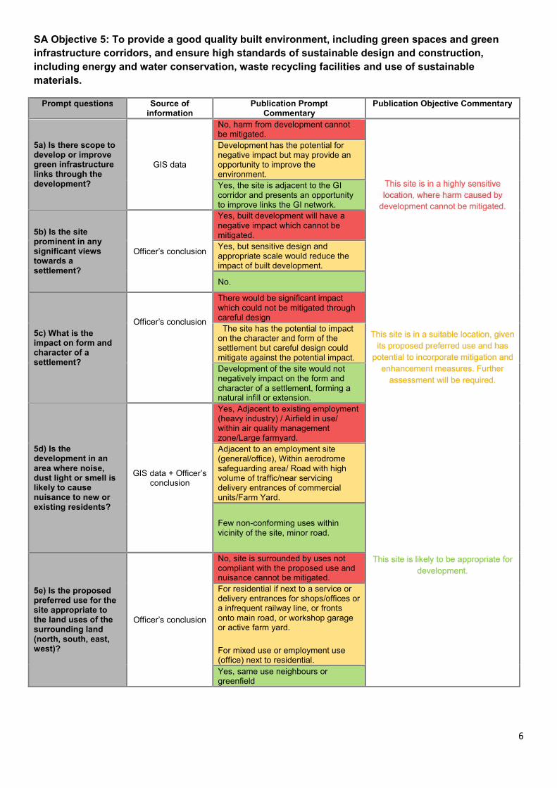
6
SA Objective 5: To provide a good quality built environment, including green spaces and green
infrastructure corridors, and ensure high standards of sustainable design and construction,
including energy and water conservation, waste recycling facilities and use of sustainable
materials.
Prompt questions Source of information
Publication PromptCommentary
Publication Objective Commentary
5a) Is there scope to develop or improve green infrastructure links through the development?
GIS data
No, harm from development cannot be mitigated.
development cannot be mitigated.
Development has the potential for negative impact but may provide an opportunity to improve the environment.
Yes, the site is adjacent to the GI corridor and presents an opportunity to improve links the GI network.
5b) Is the site prominent in any significant views towards a settlement?
Officer’s conclusion
Yes, built development will have a negative impact which cannot be mitigated.
Yes, but sensitive design and appropriate scale would reduce the impact of built development.
No.
enhancement measures. Further
assessment will be required.
5c) What is the impact on form and character of a settlement?
Officer’s conclusion
There would be significant impact which could not be mitigated through careful design
The site has the potential to impact on the character and form of the settlement but careful design could mitigate against the potential impact.
Development of the site would not negatively impact on the form and character of a settlement, forming a natural infill or extension.
5d) Is the development in an area where noise, dust light or smell is likely to cause nuisance to new or existing residents?
GIS data + Officer’s conclusion
Yes, Adjacent to existing employment (heavy industry) / Airfield in use/ within air quality management zone/Large farmyard.
Adjacent to an employment site (general/office), Within aerodrome safeguarding area/ Road with high volume of traffic/near servicing delivery entrances of commercial units/Farm Yard.
development.
Few non-conforming uses within vicinity of the site, minor road.
5e) Is the proposed preferred use for the site appropriate to the land uses of the surrounding land (north, south, east, west)?
Officer’s conclusion
No, site is surrounded by uses not compliant with the proposed use and nuisance cannot be mitigated.
For residential if next to a service or delivery entrances for shops/offices or a infrequent railway line, or fronts onto main road, or workshop garage or active farm yard.
For mixed use or employment use (office) next to residential.
Yes, same use neighbours or greenfield

7
SA Objective 6: To reduce level of waste produced and ensure opportunities for re-use locally are
maximised.
6a) Will the development contain individual / communal site waste facilities / infrastructure?
n/a This objective is no longer relevant.
Policy E2 – Amenity.

8
SA Objective 7: To help address climate change and reduce the risk of flooding.
Prompt questions Source of information
Publication PromptCommentary
Publication Objective Commentary
7a) Will the development promote low and zero carbon technologies and renewable sources
Officer’s conclusion
This prompt question is not applicable at a site level. All development proposals will be subject to the policy RM7: Renewables and Low Carbon Energy in the local plan.
which mitigation cannot negate.
7b) Will the development have an adverse effect on air quality in the area?
GIS data
Hambleton District only has one formally designated Air Quality Management Area and this area partially covers Bedale Market Town. This proposed site does not fall within this designation.
7c) Is part of the site or whole site in Flood Zone 3 or 2 or at risk from Surface Water Flooding?
GIS data
Yes, extremely significant (more than 40% of site within any event)
A significant part of the site at risk from surface water flooding (significant is 10% or more of site with 1in30 or 1in100 year event or 20% within 1in1000 year event) or where site is over 1Ha and any part of the site is within an area of surface water flooding
Site does not fall within a flood zone and has minimal or no risk of surface water flooding
This site is in a less vulnerable location.
elsewhere. Further assessment will be
required.
7d) Will development increase the risk of flooding?
Officer’s conclusion
Yes, whole or part of site is within flood zone 3 or there is a history of surface water flooding.
Yes, all new development could be considered to lead to an increase in the risk of flooding due to materials used but situation could be managed through mitigation.
No, site is within flood zone 1 or there is no history of surface water flooding on or near the site.
7e) Can any increase in risk of flooding be mitigated?
Officer’s conclusion
No
increase this risk.
Potential to mitigate will be dependent on scale and type of development, the physical terrain and site location, a flood risk assessment would be required.
Yes
Not applicable.
(Where the response is green above)

9
SA Objective 8: To maintain and enhance the quality and character of the landscape and protect the
special qualities of the AONB’s and National Park.
Prompt questions Source of information
Publication PromptCommentary
Publication Objective Commentary
8a) Does the site have a negative impact on the setting of the National Park or AONB?
GIS data & Specialist –
Natural England comments
Yes
plan.
Potential impact
Natural England.
No setting of a national park or AONB

10
SA Objective 9: To ensure all groups of the population have access to adequate leisure facilities,
recreational activities, health services, education and training opportunities and to ensure health
and well-being improves.
Prompt questions Source of information
Publication PromptCommentary
Publication Objective Commentary
9a) Does the site have good connectivity to the following services and facilities?
GIS data + Officer’s
conclusion
Town Centres
Further than 1601m – Most villages
and training opportunities.
Between 801 and 1600m
Less than 800m
Industrial Estates / Business Parks
Further than 1601m
801-1600m amber
less than 800m
Primary school
Further than 1200m
Between 401m and 1200m
Less than 400m
Secondary school
Further than 1600m
The site has limited
and training opportunities.
Between 801m and 1600m.
Less than 800m within a Service Centre or for villages served by NYCC secondary school transport route.
Doctors
Further than 1200m
Between 401- 800m
Less than 400m
Convenien-ce store
Further than 800m
Between 401- 800m
Less than 400m
Village Hall
Further 1.126 km (over 15 minutes walk time)
Between 751m and 1125m (within 15 minutes walk time).
Less than 750m (10 mins walk time)
Children's Play Area
Further than 1.125 km (over 15 minutes walk time)
Between 751m and 1125m (within 15 minutes walk time).
Less than 750m (10 mins walk time)
Active Recreation Area
Further than 1.126 km (over 15 minutes walk time)
opportunities.
Between 751m and 1.125 km (within 15 minutes walk time)
Less than 750m (10 mins walk time)
Youth Provision
Further than 1126m (over 15 minutes walk time).
Between 751m and 1125m (within 15 minutes walk time).
Less 750m (10 mins walk time)
Outdoor Sports
Further than 1126m (over 15 minutes walk time).
Between 751m and 1125m (within 15 minutes walk time).
Less than 750m (10 mins walk time)

11
Objective 10: To preserve and where feasible enhance the historic environment and improve
understanding of local cultural heritage.
Prompt questions Source of information
Publication PromptCommentary
Publication Objective Commentary
10a) Is the development in a Conservation Area?
GIS data
Yes, entirely or partly
sensitive location where
assets.
Adjacent to a conservation area or within the buffer zone
No
10b) Would development affect the character and appearance of the Conservation Area?
Specialist – Historic England
Yes.
There is scope to mitigate against any impact through careful design.
No impact on the setting and or Significance of a listed building/ Development will enhance ore better reveal elements which contribute to the significance of the heritage asset.
10c) Would development affect the setting and/or significance of a Listed Building?
GIS data & Specialist –
Historic England
Yes, impact could not be mitigated through the design of the development.
The site has potential to affect the setting or significance but impact could be mitigated against through good design.
No impact on the setting and or Significance of a listed building/ Development will enhance ore better reveal elements which contribute to the significance of the heritage asset.
This site is in a sensitive
Further assessment will
be required.
10d) Will the development of the site affect non-designated heritage assets?
Specialist – Historic England
Yes, impact could not be mitigated through the design of the development.
The site has potential to affect non-designated heritage assets but impact could be mitigated against through good design.
No impact on the asset or development will enhance or better reveal elements which contribute to the significance of the heritage asset.
10e) Would the development affect an important non-designated archaeological site?
GIS data & HDC
Conservation officer
Yes, a significant impact that cannot be mitigated against.
Potential for impact but scope to mitigate through careful sitting and design.
No impact or development will enhance ore better reveal elements which contribute to the significance of the heritage asset.
10f) Will the development of the site affect a Registered Historic Park and Garden or Registered Battlefield?
GIS data & Specialist –
Historic England
Yes, a significant impact that cannot be mitigated against.
Potential for impact within the 300m buffer zone but scope to mitigate through careful sitting and design.
This site has the
assets.
No impact on the asset or development will enhance or better reveal elements which contribute to the significance of the heritage asset.
10g) Will development of the site affect the setting of an elevated conservation area?
GIS data & HDC
Conservation officer
Yes, a significant impact that cannot be mitigated against.
Potential for impact but scope to mitigate.
No impact on any elevated conservation area or development will enhance or better reveal elements which contribute to the significance of the heritage asset.
10h) Would development affect the setting of a Scheduled Ancient Monument?
Specialist – Historic England
Yes, site is on site of Scheduled Ancient Monument or area which is identifed as high potential for remains.
Unknown potential or likelihood of archaeological remains.
No, site is outside of buffer of scheduled ancient monument or has been previously investigated with no results.

12
SA Objective 11: To provide a mix of housing types and tenures in order to ensure all local people
have the opportunity meet their housing needs.
Prompt questions Source of information
Publication PromptCommentary
Publication Objective Commentary
11a) Will the development make provision of sufficient market housing of a size and type that meets local housing needs, including older people?
Officer’s conclusion
All sites that are put forward for residential development will be expected to meet policies on size type and tenure.
subject to Local Plan policies. Not applicable, the site is only being considered for employment purposes.
11b) Will the development provide affordable housing for those who cannot afford to buy or rent on open market? Is this supported by a viability appraisal?
Officer’s conclusion
No, the site is under the current thresholds for affordable housing provision
purposes.
Yes, all sites above the current threshold will be assumed to meet policies on affordable housing.
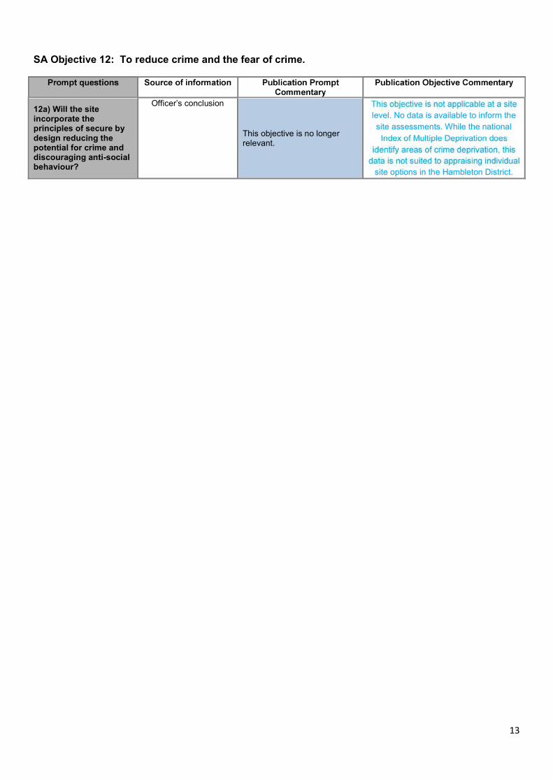
13
SA Objective 12: To reduce crime and the fear of crime.
12a) Will the site incorporate the principles of secure by design reducing the potential for crime and discouraging anti-social behaviour?
Officer’s conclusion
This objective is no longer relevant.
level. No data is available to inform the
site assessments. While the national
site options in the Hambleton District.

14
SA Objective 13: To provide a range of good quality employment opportunities.
Prompt questions Source of information
Publication PromptCommentary
Publication Objective Commentary
13a) Is there potential for direct jobs to be created as a result of development?
Officer’s conclusion
Limited mixed use sites Site has limited potential.
Positive contribution, large employment site or large mixed use site. employment opportunities.
Not applicable - the site is only being considered for residential development residential development.
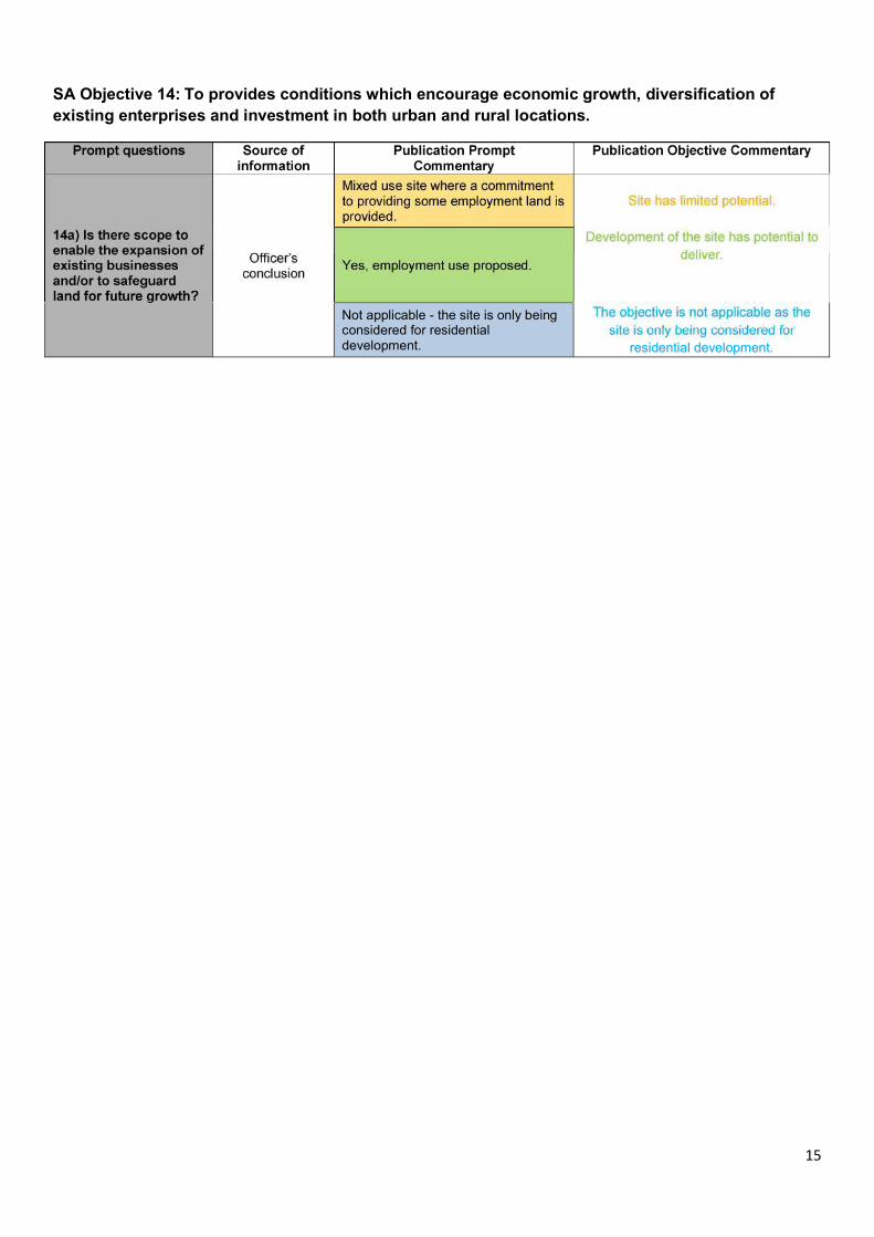
15
SA Objective 14: To provides conditions which encourage economic growth, diversification of
existing enterprises and investment in both urban and rural locations.
Not applicable - the site is only being considered for residential development. residential development.

B/004/010a Land North and West of 23 Low Street & OS Field 4365
Leases Road Leeming Bar North Yorkshire
Context: This is a greenfield site. The site is bounded by a caravan site to the south, Leases
Road to the west, Low Street and site ref B/004/005 to the east. There is a green strip,
then the A684 to the north of the site.
Site Area (Ha):
Sustainability Appraisal Assessment
Sustainability
Assessment
Objective
Decision Aiding Prompt
Prompt
Score Commentary
Objective
Score
1. To protect and
enhance
biodiversity and
geodiversity.
1a) Would the development
impact on nationally and
internationally protected sites
(SSSI, SINCs) in close proximity to
the site?
Green This site is in a sensitive
location, however
mitigation and
enhancement measures
maybe appropriate.
Further assessment will
be required.
Amber
1b) Does the site have any
biodiversity issues?
Amber
1c) Would the development
impact on a local nature
reserve?
Green
1d) Are there any Tree
Preservation Orders on the site?
Green
1e) Is the development within,
or does it impact on, a mineral
safeguarding area?
Red
2. To protect and
enhance water
and reduce
water
consumption
2a) Is the site within a source
protection zone 1, 2 or 3?
Green The site is not located
within a source
protection zone.
Green
3. To minimise
traffic congestion
by encouraging
the use of public
transport, cycling
and walking.
3a) Are there links to footpaths
and cycle routes?
Amber Limited links to either
footpaths, cycle routes
and/or the public
transport network, with
the potential to connect
to an network.
Amber
3b) Does the site have
good connectivity to
public transport?
Bus
Stop
Amber
Train
Station
4. To protect and
enhance soils
and the most
efficient use of
land through
optimising
opportunities for
the reuse of
existing buildings
4a) Will the development reuse
brownfield land?
Red This site has potential
with mitigation and
enhancement measures
to come forward.
Further assessment will
be required.
Amber
4b) Is the site potentially subject
to contamination or other
ground condition issues?
Green
4c) Would there be loss of best
and most versatile agricultural
land?
Red

or brownfield
land
5. To provide a
good quality
built
environment,
including green
spaces and green
infrastructure
corridors, and
ensure high
standards of
sustainable
design and
construction,
including energy
and water
conservation,
waste recycling
facilities and use
of sustainable
materials.
5a) Is there scope to develop or
improve green infrastructure
links through the development?
Amber This site is in a suitable
location, given its
proposed preferred use
and has potential to
incorporate mitigation
and enhancement
measures. Further
assessment will be
required.
Amber
5b) Is the site prominent in any
significant views towards a
settlement?
Amber
5c) What is the impact on form
and character of a settlement?
Amber
5d) Is the development in an
area where noise, dust light or
smell is likely to cause nuisance
to new or existing residents?
Green
5e) Is the proposed preferred
use for the site appropriate to
the land uses of the surrounding
land?
Green
6. To reduce
level of waste
produced and
ensure
opportunities for
reuse locally are
maximised
6a) Will the development
contain individual / communal
site waste facilities /
infrastructure?
Neutral This objective is not
applicable at a site level.
All development can
achieve this objective
through meeting the
requirements set out in
the Local Plan Part 1:
Spatial Strategy and
Development Policies
section, including Policy
E2 – Amenity.
Neutral
7. To protect and
improve air
quality, reduce
climate change
and reduce the
risk of flooding.
7a) Will the development
promote low and zero carbon
technologies and renewable
sources?
Neutral This site is a less
vulnerable location.
Given its proposed
preferred use the site
has potential to
incorporate mitigation
to reduce the risk of
flooding on site or
elsewhere. Further
assessment will be
required.
Amber
7b) Will the development have
an adverse effect on air quality
in the area?
Neutral
7c) Is part of the site or whole
site in Flood Zone 3 or 2 or at risk
from Surface Water Flooding?
Amber
7d) Will development increase
the risk of flooding?
Amber
7e) Can any increase in risk of
flooding be mitigated?
Amber
8. To maintain
and enhance the
quality and
character of the
8a) Does the site have a negative
impact on the setting of the
National Park or AONB?
Green The site will not have an
impact on the setting of
a national park or
AONB.
Green

landscape and
protect the
special qualities
of the AONB’s
and National
Park.
9. To ensure all
groups of the
population have
access to
adequate leisure
facilities,
recreational
activities, health
services,
education and
training
opportunities
and to ensure
health and well
being improves
9a) Does the site
have good
connectivity to
the following
services and
facilities?
Town Centre Red
3705.03
No, the site has poor
access to adequate
leisure facilites,
recreational activities,
health services,
education and training
opportunities.
Red
Industrial
Estate/
Business
Park
Green
750.05
Primary
School
Amber
948.45
Secondary
School
Red
4165.1
Doctors Red
4116.25
Convenience
Store
Red
2107.83
Village Hall Red
2257.94
Play Area Amber
908.24
Recreation
Area
Amber
786.99
Youth
Provision
Amber
905.88
Outdoor
Sport
Red
3654.4
10. To preserve
and where
feasible enhance
the historic
environment and
improve
understanding of
local cultural
heritage.
10 a) Is the development in a
conservation area?
Green This site is in a sensitive
location, however
mitigation measures
maybe appropriate.
Further assessment will
be required.
Amber
10 b) Would development affect
the character and appearance of
the conservation area?
Green
10 c) Would development affect
the setting and/or significance of
a listed building?
Green
10d) Will the development of the
site affect nondesignated
heritage assets?
Green
10e) Would the development
affect an important non
designated archaeological site?
Amber
10f) Will the development of the
site affect a Registered Historic
Park and Garden or Registered
Battlefield?
Green
10g) Will development of the
site affect the setting of an
elevated conservation area?
Green

10h) Would development affect
the setting of a Scheduled
Ancient Monument?
Green
11. To provide a
mix of housing
types and
tenures in order
to ensure all
local people
have the
opportunity
meet their
housing needs.
11a) Will the development make
provision of sufficient market
housing of a size and type that
meets local housing needs,
including older people?
Neutral The objective is not
applicable as the site is
only being considered
for employment
purposes.
Neutral
11b) Will the development
provide affordable housing for
those who cannot afford to buy
or rent on open market? Is this
supported by a viability
appraisal?
Neutral
12. To reduce
crime and the
fear of crime.
12a) Will the site incorporate the
principles of secure by design
reducing the potential for crime
and discouraging antisocial
behaviour?
Neutral This objective is not
applicable at a site level.
No data is available to
inform the site
assessments. While the
Index of Multiple
Deprivation does
identify areas of crime
deprivation, this data is
not suited to appraising
individual site options in
the Hambleton district.
Neutral
13. To provide a
range of good
quality
employment
opportunities.
13a) Is there potential for direct
jobs to be created as a result of
development?
Green The development of the
site has potential to
deliver a range of good
quality employment
opportunities.
Green
14. To provides
conditions which
encourage
economic
growth,
diversification of
existing
enterprises and
investment in
both urban and
rural locations
14a) Is there scope to enable the
expansion of existing businesses
and/or to safeguard land for
future growth?
Green Development of the site
has potential to deliver.
Green
Summary of Sustainability Appraisal:

A greenfield site adjacent to the Bedale relief road on the northern approach to Leeming Bar. The site
performs poorly against objective 9 and 5 in terms of distance from services and its impact on the
settlement pattern as the site would extend employment development into the countryside beyond
Leases Road.

ALT/B/004/0
34/E
Land at Aiskew Grange Farm Back Lane Aiskew Bedale
North Yorkshire DL8 1DX
Context: This is a greenfield site with the Aiskew Roman Villa scheduled monument in the
south western quarter of the site. The site is bounded by the Bedale relief road
curving from the northern tip to western point of the site. To the east is the A6055
and A1(M), and Back Lane to the South. Beyond the A1(M) are the employment uses
at Leeming Bar, and to the north site ref ALT/B/004/036/E (agricultural) and south site
ref ALT/B/004/035/E (agricultural).
Site Area (Ha): 36.25
Sustainability Appraisal Assessment
Sustainability
Assessment
Objective
Decision Aiding Prompt
Prompt
Score Commentary
Objective
Score
1. To protect and
enhance
biodiversity and
geodiversity.
1a) Would the development
impact on nationally and
internationally protected sites
(SSSI, SINCs) in close proximity to
the site?
Green This site is in a sensitive
location, however
mitigation and
enhancement measures
maybe appropriate.
Further assessment will
be required.
Amber
1b) Does the site have any
biodiversity issues?
Amber
1c) Would the development
impact on a local nature
reserve?
Green
1d) Are there any Tree
Preservation Orders on the site?
Green
1e) Is the development within,
or does it impact on, a mineral
safeguarding area?
Red
2. To protect and
enhance water
and reduce
water
consumption
2a) Is the site within a source
protection zone 1, 2 or 3?
Green The site is not located
within a source
protection zone.
Green
3. To minimise
traffic congestion
by encouraging
the use of public
transport, cycling
and walking.
3a) Are there links to footpaths
and cycle routes?
Amber Poor or no links to
footpaths, cycle routes
and the public transport
network.
Red
3b) Does the site have
good connectivity to
public transport?
Bus
Stop
Amber
Train
Station
4. To protect and
enhance soils
and the most
efficient use of
land through
4a) Will the development reuse
brownfield land?
Red This site has potential
with mitigation and
enhancement measures
to come forward.
Further assessment will
Amber
4b) Is the site potentially subject
to contamination or other
ground condition issues?
Green

optimising
opportunities for
the reuse of
existing buildings
or brownfield
land
4c) Would there be loss of best
and most versatile agricultural
land?
Amber be required.
5. To provide a
good quality
built
environment,
including green
spaces and green
infrastructure
corridors, and
ensure high
standards of
sustainable
design and
construction,
including energy
and water
conservation,
waste recycling
facilities and use
of sustainable
materials.
5a) Is there scope to develop or
improve green infrastructure
links through the development?
Amber This site is in a highly
sensitive location,
where harm caused by
development cannot be
mitigated.
Red
5b) Is the site prominent in any
significant views towards a
settlement?
Red
5c) What is the impact on form
and character of a settlement?
Red
5d) Is the development in an
area where noise, dust light or
smell is likely to cause nuisance
to new or existing residents?
Amber
5e) Is the proposed preferred
use for the site appropriate to
the land uses of the surrounding
land?
Amber
6. To reduce
level of waste
produced and
ensure
opportunities for
reuse locally are
maximised
6a) Will the development
contain individual / communal
site waste facilities /
infrastructure?
Neutral This objective is not
applicable at a site level.
All development can
achieve this objective
through meeting the
requirements set out in
the Local Plan Part 1:
Spatial Strategy and
Development Policies
section, including Policy
E2 – Amenity.
Neutral
7. To protect and
improve air
quality, reduce
climate change
and reduce the
risk of flooding.
7a) Will the development
promote low and zero carbon
technologies and renewable
sources?
Neutral This site is a less
vulnerable location.
Given its proposed
preferred use the site
has potential to
incorporate mitigation
to reduce the risk of
flooding on site or
elsewhere. Further
assessment will be
required.
Amber
7b) Will the development have
an adverse effect on air quality
in the area?
Neutral
7c) Is part of the site or whole
site in Flood Zone 3 or 2 or at risk
from Surface Water Flooding?
Amber
7d) Will development increase
the risk of flooding?
Amber
7e) Can any increase in risk of
flooding be mitigated?
Amber
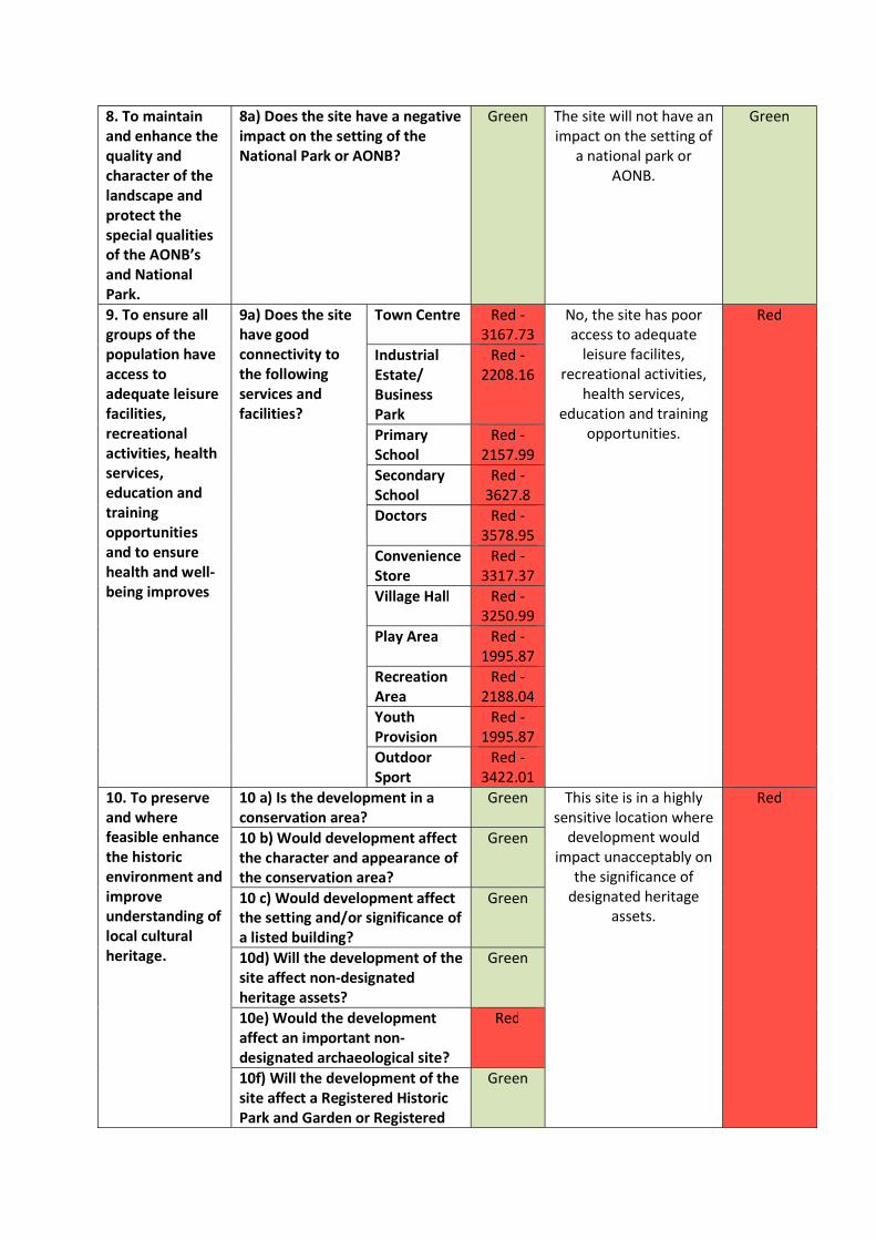
8. To maintain
and enhance the
quality and
character of the
landscape and
protect the
special qualities
of the AONB’s
and National
Park.
8a) Does the site have a negative
impact on the setting of the
National Park or AONB?
Green The site will not have an
impact on the setting of
a national park or
AONB.
Green
9. To ensure all
groups of the
population have
access to
adequate leisure
facilities,
recreational
activities, health
services,
education and
training
opportunities
and to ensure
health and well
being improves
9a) Does the site
have good
connectivity to
the following
services and
facilities?
Town Centre Red
3167.73
No, the site has poor
access to adequate
leisure facilites,
recreational activities,
health services,
education and training
opportunities.
Red
Industrial
Estate/
Business
Park
Red
2208.16
Primary
School
Red
2157.99
Secondary
School
Red
3627.8
Doctors Red
3578.95
Convenience
Store
Red
3317.37
Village Hall Red
3250.99
Play Area Red
1995.87
Recreation
Area
Red
2188.04
Youth
Provision
Red
1995.87
Outdoor
Sport
Red
3422.01
10. To preserve
and where
feasible enhance
the historic
environment and
improve
understanding of
local cultural
heritage.
10 a) Is the development in a
conservation area?
Green This site is in a highly
sensitive location where
development would
impact unacceptably on
the significance of
designated heritage
assets.
Red
10 b) Would development affect
the character and appearance of
the conservation area?
Green
10 c) Would development affect
the setting and/or significance of
a listed building?
Green
10d) Will the development of the
site affect nondesignated
heritage assets?
Green
10e) Would the development
affect an important non
designated archaeological site?
Red
10f) Will the development of the
site affect a Registered Historic
Park and Garden or Registered
Green

Battlefield?
10g) Will development of the
site affect the setting of an
elevated conservation area?
Green
10h) Would development affect
the setting of a Scheduled
Ancient Monument?
Amber
11. To provide a
mix of housing
types and
tenures in order
to ensure all
local people
have the
opportunity
meet their
housing needs.
11a) Will the development make
provision of sufficient market
housing of a size and type that
meets local housing needs,
including older people?
Neutral The objective is not
applicable as the site is
only being considered
for employment
purposes.
Neutral
11b) Will the development
provide affordable housing for
those who cannot afford to buy
or rent on open market? Is this
supported by a viability
appraisal?
Neutral
12. To reduce
crime and the
fear of crime.
12a) Will the site incorporate the
principles of secure by design
reducing the potential for crime
and discouraging antisocial
behaviour?
Neutral This objective is not
applicable at a site level.
No data is available to
inform the site
assessments. While the
Index of Multiple
Deprivation does
identify areas of crime
deprivation, this data is
not suited to appraising
individual site options in
the Hambleton district.
Neutral
13. To provide a
range of good
quality
employment
opportunities.
13a) Is there potential for direct
jobs to be created as a result of
development?
Green Development of the site
has potential to deliver
a range of good quality
employment
opportunities.
Green
14. To provides
conditions which
encourage
economic
growth,
diversification of
existing
enterprises and
investment in
both urban and
rural locations
14a) Is there scope to enable the
expansion of existing businesses
and/or to safeguard land for
future growth?
Green Development of the site
has potential to deliver.
Green
Summary of Sustainability Appraisal:

A significant greenfield site which contains a nationally important schedule monument, to the west of
Leeming Bar, across the A1(M). Due to its seperation from existing development its performs poorly
against objective three and nine, access to sustainable forms of transport and services. The site is
disconnected from the existing settlement so would have an unacceptable impact on the settlement form
and as such performs poorly against objective five.

ALT/B/004/0
35/E
Land at Micklebrack Farm Aiskew North Yorkshire DL8
1DX
Context: This is a greenfield site with an agricultural unit in the northern portion. To the north
west is site ref ALT/B/004/034/E . The site is bounded by Back Land from the northern
point to the western point, and the A6055 and A1(M) runs along to eastern boundary.
To the south east is the Wesleydale Railway track and sites ref B/004/004 and
B/004/018.
Site Area (Ha): 20.96
Sustainability Appraisal Assessment
Sustainability
Assessment
Objective
Decision Aiding Prompt
Prompt
Score Commentary
Objective
Score
1. To protect and
enhance
biodiversity and
geodiversity.
1a) Would the development
impact on nationally and
internationally protected sites
(SSSI, SINCs) in close proximity to
the site?
Green This site is in a sensitive
location, however
mitigation and
enhancement measures
maybe appropriate.
Further assessment will
be required.
Amber
1b) Does the site have any
biodiversity issues?
Amber
1c) Would the development
impact on a local nature
reserve?
Green
1d) Are there any Tree
Preservation Orders on the site?
Green
1e) Is the development within,
or does it impact on, a mineral
safeguarding area?
Red
2. To protect and
enhance water
and reduce
water
consumption
2a) Is the site within a source
protection zone 1, 2 or 3?
Green The site is not located
within a source
protection zone.
Green
3. To minimise
traffic congestion
by encouraging
the use of public
transport, cycling
and walking.
3a) Are there links to footpaths
and cycle routes?
Amber Poor or no links to
footpaths, cycle routes
and the public transport
network.
Red
3b) Does the site have
good connectivity to
public transport?
Bus
Stop
Red
Train
Station
4. To protect and
enhance soils
and the most
efficient use of
land through
optimising
opportunities for
4a) Will the development reuse
brownfield land?
Red This site has potential
with mitigation and
enhancement measures
to come forward.
Further assessment will
be required.
Amber
4b) Is the site potentially subject
to contamination or other
ground condition issues?
Green
4c) Would there be loss of best Amber

the reuse of
existing buildings
or brownfield
land
and most versatile agricultural
land?
5. To provide a
good quality
built
environment,
including green
spaces and green
infrastructure
corridors, and
ensure high
standards of
sustainable
design and
construction,
including energy
and water
conservation,
waste recycling
facilities and use
of sustainable
materials.
5a) Is there scope to develop or
improve green infrastructure
links through the development?
Amber This site is in a highly
sensitive location,
where harm caused by
development cannot be
mitigated.
Red
5b) Is the site prominent in any
significant views towards a
settlement?
Red
5c) What is the impact on form
and character of a settlement?
Red
5d) Is the development in an
area where noise, dust light or
smell is likely to cause nuisance
to new or existing residents?
Amber
5e) Is the proposed preferred
use for the site appropriate to
the land uses of the surrounding
land?
Amber
6. To reduce
level of waste
produced and
ensure
opportunities for
reuse locally are
maximised
6a) Will the development
contain individual / communal
site waste facilities /
infrastructure?
Neutral This objective is not
applicable at a site level.
All development can
achieve this objective
through meeting the
requirements set out in
the Local Plan Part 1:
Spatial Strategy and
Development Policies
section, including Policy
E2 – Amenity.
Neutral
7. To protect and
improve air
quality, reduce
climate change
and reduce the
risk of flooding.
7a) Will the development
promote low and zero carbon
technologies and renewable
sources?
Neutral This site is a less
vulnerable location.
Given its proposed
preferred use the site
has potential to
incorporate mitigation
to reduce the risk of
flooding on site or
elsewhere. Further
assessment will be
required.
Amber
7b) Will the development have
an adverse effect on air quality
in the area?
Neutral
7c) Is part of the site or whole
site in Flood Zone 3 or 2 or at risk
from Surface Water Flooding?
Amber
7d) Will development increase
the risk of flooding?
Amber
7e) Can any increase in risk of
flooding be mitigated?
Amber
8. To maintain
and enhance the
8a) Does the site have a negative
impact on the setting of the
Green The site will not have an
impact on the setting of
Green

quality and
character of the
landscape and
protect the
special qualities
of the AONB’s
and National
Park.
National Park or AONB? a national park or
AONB.
9. To ensure all
groups of the
population have
access to
adequate leisure
facilities,
recreational
activities, health
services,
education and
training
opportunities
and to ensure
health and well
being improves
9a) Does the site
have good
connectivity to
the following
services and
facilities?
Town Centre Red
2520.85
No, the site has poor
access to adequate
leisure facilites,
recreational activities,
health services,
education and training
opportunities.
Red
Industrial
Estate/
Business
Park
Red
2342.02
Primary
School
Red
2323.86
Secondary
School
Red
2980.93
Doctors Red
2932.08
Convenience
Store
Red
3483.24
Village Hall Red
2604.12
Play Area Red
2055.36
Recreation
Area
Red
1541.17
Youth
Provision
Red
2055.36
Outdoor
Sport
Red
2775.13
10. To preserve
and where
feasible enhance
the historic
environment and
improve
understanding of
local cultural
heritage.
10 a) Is the development in a
conservation area?
Green This site has the
potential to preserve
the historic
environment, and it is
unlikely that the
development of this site
will affect any
designated or non
designated heritage
assets.
Amber
10 b) Would development affect
the character and appearance of
the conservation area?
Green
10 c) Would development affect
the setting and/or significance of
a listed building?
Green
10d) Will the development of the
site affect nondesignated
heritage assets?
Green
10e) Would the development
affect an important non
designated archaeological site?
Amber
10f) Will the development of the
site affect a Registered Historic
Park and Garden or Registered
Battlefield?
Green
10g) Will development of the Green

site affect the setting of an
elevated conservation area?
10h) Would development affect
the setting of a Scheduled
Ancient Monument?
Green
11. To provide a
mix of housing
types and
tenures in order
to ensure all
local people
have the
opportunity
meet their
housing needs.
11a) Will the development make
provision of sufficient market
housing of a size and type that
meets local housing needs,
including older people?
Neutral The objective is not
applicable as the site is
only being considered
for employment
purposes.
Neutral
11b) Will the development
provide affordable housing for
those who cannot afford to buy
or rent on open market? Is this
supported by a viability
appraisal?
Neutral
12. To reduce
crime and the
fear of crime.
12a) Will the site incorporate the
principles of secure by design
reducing the potential for crime
and discouraging antisocial
behaviour?
Neutral This objective is not
applicable at a site level.
No data is available to
inform the site
assessments. While the
Index of Multiple
Deprivation does
identify areas of crime
deprivation, this data is
not suited to appraising
individual site options in
the Hambleton district.
Neutral
13. To provide a
range of good
quality
employment
opportunities.
13a) Is there potential for direct
jobs to be created as a result of
development?
Green Development of the site
has potential to deliver
a range of good quality
employment
opportunities.
Green
14. To provides
conditions which
encourage
economic
growth,
diversification of
existing
enterprises and
investment in
both urban and
rural locations
14a) Is there scope to enable the
expansion of existing businesses
and/or to safeguard land for
future growth?
Green Development of the site
has potential to deliver.
Green
Summary of Sustainability Appraisal:

A significant greenfield site to the west of Leeming Bar, across the A1(M). Due to its seperation from
existing development its performs poorly against objective three and nine, access to sustainable forms of
transport and services. The site is disconnected from the existing settlement so would have an
unacceptable impact on the settlement form and as such performs poorly against objective five.

ALT/B/004/0
36/E
Highways Agency Rear Of Former Thoroughway House
Leeming Bar North Yorkshire DL8 1DU
Context: This is a greenfield site with a a dwelling in the eastern part. To the south of the site is
the Bedale relief road and to the east is Back Lane. The site cuts round a disused
quarry in the north east. To the west is agricultural land.
Site Area (Ha): 10.75
Sustainability Appraisal Assessment
Sustainability
Assessment
Objective
Decision Aiding Prompt
Prompt
Score Commentary
Objective
Score
1. To protect and
enhance
biodiversity and
geodiversity.
1a) Would the development
impact on nationally and
internationally protected sites
(SSSI, SINCs) in close proximity to
the site?
Green This site is in a sensitive
location, however
mitigation and
enhancement measures
maybe appropriate.
Further assessment will
be required.
Amber
1b) Does the site have any
biodiversity issues?
Amber
1c) Would the development
impact on a local nature
reserve?
Green
1d) Are there any Tree
Preservation Orders on the site?
Green
1e) Is the development within,
or does it impact on, a mineral
safeguarding area?
Red
2. To protect and
enhance water
and reduce
water
consumption
2a) Is the site within a source
protection zone 1, 2 or 3?
Green The site is not located
within a source
protection zone.
Green
3. To minimise
traffic congestion
by encouraging
the use of public
transport, cycling
and walking.
3a) Are there links to footpaths
and cycle routes?
Amber Limited links to either
footpaths, cycle routes
and/or the public
transport network, with
the potential to connect
to an network.
Amber
3b) Does the site have
good connectivity to
public transport?
Bus
Stop
Red
Train
Station
4. To protect and
enhance soils
and the most
efficient use of
land through
optimising
opportunities for
the reuse of
existing buildings
4a) Will the development reuse
brownfield land?
Green This site has potential
with mitigation and
enhancement measures
to come forward.
Further assessment will
be required.
Amber
4b) Is the site potentially subject
to contamination or other
ground condition issues?
Green
4c) Would there be loss of best
and most versatile agricultural
land?
Amber

or brownfield
land
5. To provide a
good quality
built
environment,
including green
spaces and green
infrastructure
corridors, and
ensure high
standards of
sustainable
design and
construction,
including energy
and water
conservation,
waste recycling
facilities and use
of sustainable
materials.
5a) Is there scope to develop or
improve green infrastructure
links through the development?
Amber This site is in a highly
sensitive location,
where harm caused by
development cannot be
mitigated.
Red
5b) Is the site prominent in any
significant views towards a
settlement?
Red
5c) What is the impact on form
and character of a settlement?
Red
5d) Is the development in an
area where noise, dust light or
smell is likely to cause nuisance
to new or existing residents?
Amber
5e) Is the proposed preferred
use for the site appropriate to
the land uses of the surrounding
land?
Amber
6. To reduce
level of waste
produced and
ensure
opportunities for
reuse locally are
maximised
6a) Will the development
contain individual / communal
site waste facilities /
infrastructure?
Neutral This objective is not
applicable at a site level.
All development can
achieve this objective
through meeting the
requirements set out in
the Local Plan Part 1:
Spatial Strategy and
Development Policies
section, including Policy
E2 – Amenity.
Neutral
7. To protect and
improve air
quality, reduce
climate change
and reduce the
risk of flooding.
7a) Will the development
promote low and zero carbon
technologies and renewable
sources?
Neutral This site is a less
vulnerable location.
Given its proposed
preferred use the site
has potential to
incorporate mitigation
to reduce the risk of
flooding on site or
elsewhere. Further
assessment will be
required.
Amber
7b) Will the development have
an adverse effect on air quality
in the area?
Neutral
7c) Is part of the site or whole
site in Flood Zone 3 or 2 or at risk
from Surface Water Flooding?
Amber
7d) Will development increase
the risk of flooding?
Amber
7e) Can any increase in risk of
flooding be mitigated?
Amber
8. To maintain
and enhance the
quality and
character of the
8a) Does the site have a negative
impact on the setting of the
National Park or AONB?
Green The site will not have an
impact on the setting of
a national park or
AONB.
Green

landscape and
protect the
special qualities
of the AONB’s
and National
Park.
9. To ensure all
groups of the
population have
access to
adequate leisure
facilities,
recreational
activities, health
services,
education and
training
opportunities
and to ensure
health and well
being improves
9a) Does the site
have good
connectivity to
the following
services and
facilities?
Town Centre Red
3455.89
No, the site has poor
access to adequate
leisure facilites,
recreational activities,
health services,
education and training
opportunities.
Red
Industrial
Estate/
Business
Park
Red
1614.6
Primary
School
Red
1812.99
Secondary
School
Red
3949.4
Doctors Red
3900.55
Convenience
Store
Red
2972.38
Village Hall Red
3122.49
Play Area Red
1770.43
Recreation
Area
Red
1651.54
Youth
Provision
Red
1770.43
Outdoor
Sport
Red
3371.03
10. To preserve
and where
feasible enhance
the historic
environment and
improve
understanding of
local cultural
heritage.
10 a) Is the development in a
conservation area?
Green This site has the
potential to preserve
the historic
environment, and it is
unlikely that the
development of this site
will affect any
designated or non
designated heritage
assets.
Amber
10 b) Would development affect
the character and appearance of
the conservation area?
Green
10 c) Would development affect
the setting and/or significance of
a listed building?
Green
10d) Will the development of the
site affect nondesignated
heritage assets?
Green
10e) Would the development
affect an important non
designated archaeological site?
Amber
10f) Will the development of the
site affect a Registered Historic
Park and Garden or Registered
Battlefield?
Green
10g) Will development of the
site affect the setting of an
elevated conservation area?
Green

10h) Would development affect
the setting of a Scheduled
Ancient Monument?
Green
11. To provide a
mix of housing
types and
tenures in order
to ensure all
local people
have the
opportunity
meet their
housing needs.
11a) Will the development make
provision of sufficient market
housing of a size and type that
meets local housing needs,
including older people?
Neutral The objective is not
applicable as the site is
only being considered
for employment
purposes.
Neutral
11b) Will the development
provide affordable housing for
those who cannot afford to buy
or rent on open market? Is this
supported by a viability
appraisal?
Neutral
12. To reduce
crime and the
fear of crime.
12a) Will the site incorporate the
principles of secure by design
reducing the potential for crime
and discouraging antisocial
behaviour?
Neutral This objective is not
applicable at a site level.
No data is available to
inform the site
assessments. While the
Index of Multiple
Deprivation does
identify areas of crime
deprivation, this data is
not suited to appraising
individual site options in
the Hambleton district.
Neutral
13. To provide a
range of good
quality
employment
opportunities.
13a) Is there potential for direct
jobs to be created as a result of
development?
Green Development of the site
has potential to deliver
a range of good quality
employment
opportunities.
Green
14. To provides
conditions which
encourage
economic
growth,
diversification of
existing
enterprises and
investment in
both urban and
rural locations
14a) Is there scope to enable the
expansion of existing businesses
and/or to safeguard land for
future growth?
Green Development of the site
has potential to deliver.
Green
Summary of Sustainability Appraisal:

A significant greenfield site to the north west of Leeming Bar, across the A1(M). Due to its seperation from
existing development its performs poorly against objective three and nine, access to sustainable forms of
transport and services. The site is disconnected from the existing settlement so would have an
unacceptable impact on the settlement form and as such performs poorly against objective five.

ALT/B/127/0
11
Holmfield Farm Scruton North Yorkshire DL7 9LQ
Context: This is a greenfield site. The site is a triangular shape, with the eastern tip pointing
towards Morton On Swale and the A684. The north is bounded by the A684, and the
south by Northallerton Road. To the west is site ref B/127/005. The surrounding land
is agricultural land.
Site Area (Ha): 5.17
Sustainability Appraisal Assessment
Sustainability
Assessment
Objective
Decision Aiding Prompt
Prompt
Score Commentary
Objective
Score
1. To protect and
enhance
biodiversity and
geodiversity.
1a) Would the development
impact on nationally and
internationally protected sites
(SSSI, SINCs) in close proximity to
the site?
Green This site is in a sensitive
location, however
mitigation and
enhancement measures
maybe appropriate.
Further assessment will
be required.
Amber
1b) Does the site have any
biodiversity issues?
Amber
1c) Would the development
impact on a local nature
reserve?
Green
1d) Are there any Tree
Preservation Orders on the site?
Green
1e) Is the development within,
or does it impact on, a mineral
safeguarding area?
Red
2. To protect and
enhance water
and reduce
water
consumption
2a) Is the site within a source
protection zone 1, 2 or 3?
Green The site is not located
within a source
protection zone.
Green
3. To minimise
traffic congestion
by encouraging
the use of public
transport, cycling
and walking.
3a) Are there links to footpaths
and cycle routes?
Amber Poor or no links to
footpaths, cycle routes
and the public transport
network.
Red
3b) Does the site have
good connectivity to
public transport?
Bus
Stop
Red
Train
Station
4. To protect and
enhance soils
and the most
efficient use of
land through
optimising
opportunities for
the reuse of
4a) Will the development reuse
brownfield land?
Red This site has potential
with mitigation and
enhancement measures
to come forward.
Further assessment will
be required.
Amber
4b) Is the site potentially subject
to contamination or other
ground condition issues?
Green
4c) Would there be loss of best
and most versatile agricultural
Red

existing buildings
or brownfield
land
land?
5. To provide a
good quality
built
environment,
including green
spaces and green
infrastructure
corridors, and
ensure high
standards of
sustainable
design and
construction,
including energy
and water
conservation,
waste recycling
facilities and use
of sustainable
materials.
5a) Is there scope to develop or
improve green infrastructure
links through the development?
Amber This site is in a suitable
location, given its
proposed preferred use
and has potential to
incorporate mitigation
and enhancement
measures. Further
assessment will be
required.
Amber
5b) Is the site prominent in any
significant views towards a
settlement?
Amber
5c) What is the impact on form
and character of a settlement?
Red
5d) Is the development in an
area where noise, dust light or
smell is likely to cause nuisance
to new or existing residents?
Amber
5e) Is the proposed preferred
use for the site appropriate to
the land uses of the surrounding
land?
Amber
6. To reduce
level of waste
produced and
ensure
opportunities for
reuse locally are
maximised
6a) Will the development
contain individual / communal
site waste facilities /
infrastructure?
Neutral This objective is not
applicable at a site level.
All development can
achieve this objective
through meeting the
requirements set out in
the Local Plan Part 1:
Spatial Strategy and
Development Policies
section, including Policy
E2 – Amenity.
Neutral
7. To protect and
improve air
quality, reduce
climate change
and reduce the
risk of flooding.
7a) Will the development
promote low and zero carbon
technologies and renewable
sources?
Neutral This site is a less
vulnerable location.
Given its proposed
preferred use the site
has potential to
incorporate mitigation
to reduce the risk of
flooding on site or
elsewhere. Further
assessment will be
required.
Amber
7b) Will the development have
an adverse effect on air quality
in the area?
Neutral
7c) Is part of the site or whole
site in Flood Zone 3 or 2 or at risk
from Surface Water Flooding?
Amber
7d) Will development increase
the risk of flooding?
Amber
7e) Can any increase in risk of
flooding be mitigated?
Amber
8. To maintain
and enhance the
quality and
8a) Does the site have a negative
impact on the setting of the
National Park or AONB?
Green The site will not have an
impact on the setting of
a national park or
Green

character of the
landscape and
protect the
special qualities
of the AONB’s
and National
Park.
AONB.
9. To ensure all
groups of the
population have
access to
adequate leisure
facilities,
recreational
activities, health
services,
education and
training
opportunities
and to ensure
health and well
being improves
9a) Does the site
have good
connectivity to
the following
services and
facilities?
Town Centre Red
4196.9
No, the site has poor
access to adequate
leisure facilites,
recreational activities,
health services,
education and training
opportunities.
Red
Industrial
Estate/
Business
Park
Amber
1296.27
Primary
School
Red
1430.15
Secondary
School
Red
4656.97
Doctors Red
4608.12
Convenience
Store
Red
1877.78
Village Hall Red
2027.89
Play Area Red
1397.75
Recreation
Area
Red
1752.37
Youth
Provision
Red
1397.75
Outdoor
Sport
Red
2594.52
10. To preserve
and where
feasible enhance
the historic
environment and
improve
understanding of
local cultural
heritage.
10 a) Is the development in a
conservation area?
Green This site is in a sensitive
location, however
mitigation measures
maybe appropriate.
Further assessment will
be required.
Amber
10 b) Would development affect
the character and appearance of
the conservation area?
Green
10 c) Would development affect
the setting and/or significance of
a listed building?
Green
10d) Will the development of the
site affect nondesignated
heritage assets?
Green
10e) Would the development
affect an important non
designated archaeological site?
Amber
10f) Will the development of the
site affect a Registered Historic
Park and Garden or Registered
Battlefield?
Green
10g) Will development of the
site affect the setting of an
Green

elevated conservation area?
10h) Would development affect
the setting of a Scheduled
Ancient Monument?
Green
11. To provide a
mix of housing
types and
tenures in order
to ensure all
local people
have the
opportunity
meet their
housing needs.
11a) Will the development make
provision of sufficient market
housing of a size and type that
meets local housing needs,
including older people?
Neutral The objective is not
applicable as the site is
only being considered
for employment
purposes.
Neutral
11b) Will the development
provide affordable housing for
those who cannot afford to buy
or rent on open market? Is this
supported by a viability
appraisal?
Neutral
12. To reduce
crime and the
fear of crime.
12a) Will the site incorporate the
principles of secure by design
reducing the potential for crime
and discouraging antisocial
behaviour?
Neutral This objective is not
applicable at a site level.
No data is available to
inform the site
assessments. While the
Index of Multiple
Deprivation does
identify areas of crime
deprivation, this data is
not suited to appraising
individual site options in
the Hambleton district.
Neutral
13. To provide a
range of good
quality
employment
opportunities.
13a) Is there potential for direct
jobs to be created as a result of
development?
Green Development of the site
has potential to deliver
a range of good quality
employment
opportunities.
Green
14. To provides
conditions which
encourage
economic
growth,
diversification of
existing
enterprises and
investment in
both urban and
rural locations
14a) Is there scope to enable the
expansion of existing businesses
and/or to safeguard land for
future growth?
Green Development of the site
has potential to deliver.
Green
Summary of Sustainability Appraisal:

A greenfield site to the north east of Leeming Bar. Due to it's edge of settlement location the site performs
poorly against objective three and nine, access to sustainable forms of transport and services. However,
the site is proposed for employment and is large which will allow for mitigation through improved
transport connections. On its own the site would perform poorly against objective five, as it would have a
significant impact on the built form of Leeming Bar. The only mitigation would be to bring forward
adjacent employment sites which would lesson the impact.
The site performs adequately against the sustainability objectives but there are some issues that need
addressing.

B/004/010a
ALT/B/127/011/EALT/B/004/036/E
ALT/B/004/034/E
ALT/B/004/035/E
Leeming Bar SitesCivic Centre, Stone Cross, Northallerton DL6 2UU
Telephone: 01609 779 977 Fax: 01609 767228
[© Crown copyright [and database rights] 2020 OS 100018555 1:7,400
LegendSite Boundary

35
aecom.com