habs hl-461 - lcweb2.loc.govlcweb2.loc.gov/master/pnp/habshaer/hi/hi0700/hi0726/data/hi0726... ·...
TRANSCRIPT

U.S. NAVAL BASE, PEARL HARBOR, LOCOMOTIVE BUILDING (U.S. Naval Base, Pearl Harbor, Naval Shipyard, Facility No. 97) Lower Tank Farm, near intersection of Sixth Street & South Avenue Pearl Harbor Honolulu hdvvaii
PHOTOGRAPHS
WRITTEN HISTORICAL AND DESCRIPTIVE DATA
HISTORIC AMERICAN BUILDINGS SURVEY PACIFIC GREAT BASIN SUPPORT OFFICE
Natiol"al P9!°!<. Ser!ice U.S. Department of the Interior
1111 Jackson Street Oakland, CA 94607
HABS Hl-461 Hl-461
t-lA'3S i1 l 4"r I fl t -- b.
Location:
Significance:
Description:
HISTORIC AMERICAN BUILDINGS SURVEY
U.S. NAVAL BASE, PEARL HARBOR, LOCOMOTIVE BUILDING (U.S. Naval Base, Pearl Harbor, Naval Shipyard}
{Facility No. 97)
Lower Tank Farm Near Intersection of Sixth Street & South Avenue Pearl Harbor Naval Base City and County of Honolulu, Hawaii
HABS No. Hl-461
This building falls within the UTM coordinates of the Pearl Harbor, Naval Shipyard as defined in the location section of the overview report HABS No. Hl-483. This building's UTM coordinates are: 04.607320.2361030.
Facility 97 was demolished under the former 1979 MOA. Photo documentation was the only mitigation required prior to demolition. Facility 97 was demolished to construct a similar sized metal storage building, Facility 1910, for management and storage of hazardous waste.
Facility 97 was located within the Pearl Harbor National Historic Landmark. It was associated with early base development at Pearl Harbor and the use of railroads within the base and with the coaling stations. Also, it was a good example of a high bay industrial building for storage of locomotive engines, converted to one of the many functions to serve wartime efforts during World War II. It had a distinctive type of utilitarian warehouse architecture common to industrial buildings of the early 1900s.
Facility No. 97 is a corrugated metal-clad single-story structure with a rectangular floor plan and minimal detailing. The building is set on reinforced concrete footings with a concrete slab. It has a steel frame construction; is five bays long (each 20'-0") and one bay wide. The footprint of the building measures 101 '-9'" x 38'-3". At the ridgeline, the building stands approximately 28' high. The height of the building from the floor to the bottom of the trusses is 19' and the overall floor area is 3,892 square feet. The steel columns are bolted to the concrete footings. The primary exterior material of the walls is corrugated metal.
The pitched (6 in 12) gable roof with overhanging eaves is framed with steel trusses that are supported by knee braces. Corrugated metal roofing is attached to purlins, which sit on the exposed steel trusses. The overhanging eaves extend 3' beyond the corrugated metal walls. The roof monitor measures approximately 1 O' x 60' and sits centrally on the roof ridge, equidistant from both ends of the building in the longitudinal direction. The height to the ridge of the

U.S. NAVAL BASE, PEARL HARBOR, LOCOMOTIVE BUILDING (U.S. Naval Base, Pearl Harbor, Naval Shipyard)
(Facility No. 97) HABS No. Hl-461 (Page 2)
roof monitor measures about 32'. Both sides of the roof monitor are lined with wood louvers.
Originally, the building was a very simple shed-type structure with an appearance that corresponded to the needs of storing locomotives. According to the photos, the building was longer, 9 or 10 bays in length, and the roof was a simple gable roof without a clerestory ridge. The north end had a large central opening measuring approximately 15' wide and 20' high, with double sliding doors. The sliding doors were hung from a metal rail, which was attached to a wood header that spanned the length of the fa~ade. This header was bolted to the supports and the metal siding on the exterior side of the wall, so that the door could slide clear of the exterior wall. The north end of the structure had a unique set of large double sliding doors constructed of wood framing with 1 x 4 tongue-and-groove wood boards, oriented diagonally at a 45-degree angle. The sliding doors were constructed the full size of the end elevation to allow access of a large locomotive and to allow dissipation of heat.
As the building's function changed, modifications were made to its interior and exterior, as outlined in the Historical Context Section of this report. The major architectural modifications are described below:
A roof monitor was added to the structure after its original construction, most probably when the building was shortened sometime between the years of 1930 and 1942.
Fenestration was added in 1943 when the building was converted to radar training facility classroom use. There are only two types of openings. The first type is the one-over-one wood double-hung windows that are paired at each bay on the side elevations, except where the doors interject, and are singled at one of the end elevations where a standard sized door is hung. There are wood-louvered openings in a continuous band along most of the length of one side elevation. When the building was redesignated as a Radiological Training Facility in 1951, all of the double-hung windows were boarded up from the outside, and the louvered openings were boarded up from the inside.
Also, when the building was converted in 1950-1951, the north end door opening was partially infilled and a smaller sliding door installed inside the frame of the original door. At the south end elevation, there is a single standard door and two windows. Later, a large opening was made on the east side, which was of similar dimensions to that at the north end. Like the north end doors, the double wooden doors slide outboard of the exterior walls. A concrete ramp descends at a gradual slope to ground level approximately 15' out from the wall. The west side had a single flush entry door inserted at about midlength.

Historical Context:
U.S. NAVAL BASE, PEARL HARBOR, LOCOMOTIVE BUILDING (U.S. Naval Base, Pearl Harbor, Naval Shipyard)
(Facility No. 97) HABS No. Hl-461 (Page 3)
According to the Property Record Card, Facility 97 was built as an Electronics Storage Building in 1943. However, historical records show that this structure was actually in existence since the early development of the Base. The existence of a structure with the shape and orientation of Facility 97 is depicted in a photo taken on April 4, 1912 (Bishop Museum 1912). Furthermore, on a map showing developments of the base as of 1929, the building, labeled as "Fae. 111 Shed for locomotives + locomotive engines", continues to be shown at the exact spot (U.S. Navy Yard, Pearl Harbor, T.H. Fourteenth Naval District 1929). The facility appears to have been sited at an angle to allow for the adjacent turn-around loop. Later, on a map dated 1932, it shows the same building renamed as "Fae. 97" (U.S. Navy Yard, Pearl Harbor, T.H. Fourteenth Naval District 1932). Also, a WWII contract report states: "Project 1145 was decreased by the deletion of the Radar School. This work - remodeling Navy Yard building No. 97- was left for accomplishment by Seabees" (Contractors Pacific Naval Air Bases n.d.: A-891). Facility 97 was in existence before World War II, and most likely, was the same building as photographed in 1912. It is likely that when the function of the building was changed in 1943, a new property record card was made, and the old card removed or lost. Original drawings for this facility were prepared by the U. S. Navy's Fourteenth Naval District, Public Works Department.
When the building was first constructed, the facility was used as a Locomotive Shed (Bishop Museum 1912). A 1920 map (U.S. Naval Station, Pearl Harbor, T.H.) of the installation shows a main rail line leading out of this building down First Street (later renamed Sixth Street and now called Lake Erie Street) and along Drydock No. 1, with spur lines turning up next to all of the early Shipyard buildings, and connecting rail lines along two of the perpendicular avenues. The coaling basin, under construction, is visible in the background of the photo. The trains and rail system were critical transportation elements in the construction and operation of the station in the early decades of the twentieth century.
The 1912 photo shows the building was originally much longer and the roof was a simple gable roof without a ventilation monitor. The building's original length was 9 or 10 bays, but its size was reduced sometime between the years of 1930 and 1942. This is also the period when the monitor was added to the roof ridge. Due to lack of complete records, what transpired between the 1930s and the 1940s cannot be fully ascertained. It is almost certain that it kept its original function until 1943, when the building was converted to serve wartime efforts during World War II. According to veterans, Facility 97 was used early in the war as the primary radar training center. By 1943 it was remodeled and a separate building, Facility 176, was constructed for the main radar school, adjacent to Facility 97, which was converted to classrooms. Facility 176 was demolished prior to 1951. 1943 drawings at NAVFAC EDF Pacific plan files are entitled

Sources:
U.S. NAVAL BASE, PEARL HARBOR, LOCOMOTIVE BUILDING (U.S. Naval Base, Pearl Harbor, Naval Shipyard)
(Facility No. 97) HABS No. Hl-461 (Page 4)
"Locomotive Shed Bldg. 97, Modifications for Radar School Classrooms." A larger locomotive roundhouse and shop building (Facility 58, see HAER No. Hl-6) was constructed as Facility 97's replacement in 1943, in a more central location in the Shipyard.
The 1943 Radar School Classroom Building remodeling project included the construction of a wood-framed second floor, modification of the exterior walls, and construction of several new interior walls for a total cost of $30,640 (Property Record Card). The design was very straightforward. The new plan had four classrooms, a small office, and a restroom on the ground floor, and another four classrooms on the second floor. The interior was lined with canec panels above a tongue-and-groove (T & G) wainscot. (Drawing nos. l-N04-587, lN04-588, and 1-N04-591 ).
After the war, in 1948, the building was redesignated as an Equipment Repair Shop (Property Record Card), but the architectural features of the building were not touched.
In 1951, the building was redesignated again as a Radiological Decontamination Training Facility (Property Record card and drawing no. l-N04-1100). Work began on November 20, 1950 and was completed on March 21, 1951, at a cost of $2,456.18. But before that project was complete, the work was placed under a new contract number (Project #4014) and the scope was changed. The new work began December 31, 1950 and was completed June 14, 1951 at a cost of $16,007.82. When the building was redesignated, several modifications had to be made to accommodate its new function. First, all of the openings had to be boarded up. This meant removing the existing trim of the windows and all of the interior paneling of canec and T & G, and recladding the walls with Y4" transite panels, calcium silicate panels commonly known by the trade name Transite HT. The ceiling structure was also strengthened and transite attached to over half of the building. All of the interior walls and the second floor built for the Radar Classroom building were removed and new concrete block interior partition walls were built. Additional new construction included: a new shower room, a monitor room, and a drying room. At this time, all exterior cladding was replaced and new smaller sliding doors were built.
Until 1962, the structure was used as a General Warehouse and Supply facility. In order to be used as an efficient storage facility, most of the interior walls were removed. However, the exterior walls were not affected. It appears as though the building was used in this state all the way up to its demolition. The building was demolished in 2000.
The drawings for Facility 97 are on digitally scanned images or microfilm at Pacific Division, Naval Facilities Engineering Command (NAVFAC EFD Pacific) Plan Files. The drawings for Facility 97 are
U.S. NAVAL BASE, PEARL HARBOR, LOCOMOTIVE BUILDING (U.S. Naval Base, Pearl Harbor, Naval Shipyard)
(Facility No. 97) HABS No. Hl-461 (Page 5)
specifically numbered 1-N4-587, l-N4-588, l-N4-591, l-N4-1096, l-N4-1097, and l-N04-1098.
A copy of the 1943 Property Record Card for Facility 97 was obtained from the Naval Shipyard Facilities files.
A historic photo dated Nov. 6, 1922 of Facility 97 was found at the National Archives Photo Collection (RG71 CA, Box 160D)
Bishop Museum 1912 Photo entitled "Newly constructed buildings at Pearl
Harbor Naval Base, Hawaii, April 4, 1912." Negative number CP 121, 663.
Bureau of Yards and Docks 1921 Activities of the Bureau of Yards and Docks, Navy
Department, World War 1917-1918, Washington: Government Printing Office.
Commander, Navy Region Hawaii 2000 Pearl Harbor Naval Complex, Cultural Resources
Management Plan, Pearl Harbor, HI.
Commander, Navy Region Hawaii 2002 Integrated Cultural Resources Management Plan, Pearl
Harbor Naval Complex, Pearl Harbor, HI.
Contractors Pacific Naval Air Bases n.d. Technical Report and Project History, Contracts NOy-
3550 and NOy-4173, Chapter XXIX- Navy Yard, Pearl Harbor. Microfilm of report at Pacific Division Naval Facilities Engineering Command Library.
HABS/HAER Documents var. dates For those resources on the Navy database at the time the
CRMP (Contract No. NB62742-93-D-0502) was prepared, the HABS/HAER numbers assigned have been included in the electronic database as an additional field, as noted in Appendices: Pearl Harbor Naval Complex Cultural Resources Management Plan, 1998, p. A-6.
Kroll, John, Arizona Memorial Museum Association 1998 Telephone interview on September 22, 1998 with Ann
Yoklavich, architectural historian of Mason Architects, Inc.
Pearl Harbor Naval Shipyard 1992 Historic Preservation Documentation Program,
photocopied document dated 15DEC92 including Appendix B Historic Inventory.
U.S. Naval Station, Pearl Harbor, T.H. 1920 Map of Station, showing Improvements to June 30, 1920,
(A-71 ). Microfilm print provided by Jeffrey Dodge, Pacific Division Naval Facilities Engineering Command.
Project Information:
U.S. NAVAL BASE, PEARL HARBOR, LOCOMOTIVE BUILDING (U.S. Naval Base, Pearl Harbor, Naval Shipyard)
(Facility No. 97) HABS No. Hl-461 (Page 6)
U.S. Navy Yard, Pearl Harbor, T.H. Fourteenth Naval District
1929 Map of the Yard and Adjacent Units showing developments to June 30, 1929, (A-152)." Plan showing location of improvements recommended in annual estimates for 1932.
1933 "Project No. 284. Navy Yard Pearl Harbor, T.H. Storm Drainage ... March 1933." Map held at U.S. National Archives. Record Group 71, Bureau of Yards and Docks. Copy Courtesy of Earth Tech.
1942 "Navy Yard, Pearl Harbor, T.H. Fourteenth Naval District, Showing Conditions on June 30, 1942." Map held at National Archives, San Bruno. Record Group 181, Fourteenth Naval District, District Staff Headquarters, Selected Publications [formerly classified], Inspection Trip, Box 1.
1951 "A Map of Pearl Harbor, T.H. Fourteenth Naval District, showing Conditions on June 30, 1951." U.S. Government Printing Office: Pearl Harbor, Oahu, T.H.
Photo documentation and recordation of this facility by the Navy has been done in anticipation of future alterations or potential demolition of the structure. Photo documentation of historic facilities by the Navy assists in expediting planned undertakings by having the documentation prepared prior to taking actions. Also, photo documentation assists the Navy in gaining more information about its historic facilities to assist in making proactive management decisions. This project is being supervised by Jeffrey Dodge A.I.A., Historic Preservation Specialist at the Pacific Division, Naval Facilities Engineering Command (NAVFAC EFD Pacific). The photographic documentation was undertaken by David Franzen, photographer. Lorraine M. Palumbo, Ph.D. Architectural Historian, of Mason Architects, Inc. prepared the written documentation. The field work and research was conducted for this report between July 2001 and December 2001.
Shipyard Map
U.S. NAVAL BASE, PEARL HARBOR, LOCOMOTIVE BUILDING {U.S. Naval Base, Pearl Harbor, Naval Shipyard)
{Facility No. 97) HABS No. Hl-461 {Page 7)
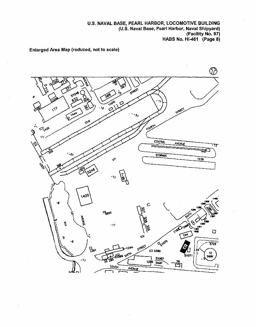
U.S. NAVAL BASE, PEARL HARBOR, LOCOMOTIVE BUILDING (U.S. Naval Base, Pearl Harbor, Naval Shipyard)
(Facility No. 97) HASS No. Hl-461 (Page 8)
Enlarged Area Map (reduced, not to scale)
c CENTRAL
c .,, ~
_____ ]
U.S. NAVAL BASE, PEARL HARBOR, LOCOMOTIVE BUILDING (U.S. Naval Base, Pearl Harbor, Naval Shipyard)
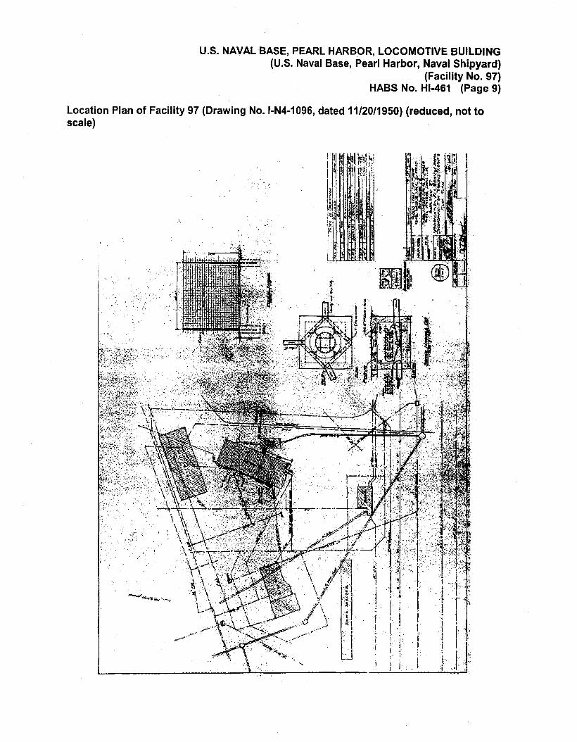
(Facility No. 97) HABS No. Hl-461 (Page 9)
Location Plan of Facility 97 (Drawing No. 1-N4-1096, dated 11/20/1950) (reduced, not to scale)
. -:·,
i I . ; •. · 1 • I
I . ~ •· .. , .. i .. , ,'. l .1 J. '
j 1: .... 1 • . . J . " i I ' J . 1·.· . '· i '. ·:

U.S. NAVAL BASE, PEARL HARBOR, LOCOMOTIVE BUILDING (U.S. Naval Base, Pearl Harbor, Naval Shipyard)
(Facility No. 97) HABS No. Hl-461 (Page 10)
Facility 97 - Modifications for Radar School Classrooms (Drawing No. 1-N4-587, dated 4/23/1943) (reduced, not to scale)
I r .I
·~
"" ... l\. .. ~.
{ ~· \; ~ ')
·--
--.......... ,_,..,.,.
~ ~
' tf.'. 1), ~i
·t .. ·.
~ ... ':i ' ..
.....
'
U.S. NAVAL BASE, PEARL HARBOR, LOCOMOTIVE BUILDING (U.S. Naval Base, Pearl Harbor, Naval Shipyard)
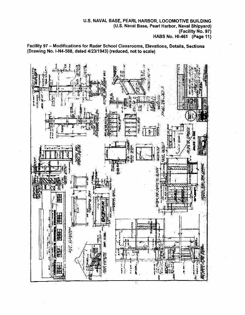
(Facility No. 97) HABS No. Hl-461 (Page 11}
Facility 97 - Modifications for Radar School Classrooms, Elevations, Details, Sections (Drawing No. 1-N4-588, dated 4/23/1943) (reduced, not to scale}

U.S. NAVAL BASE, PEARL HARBOR, LOCOMOTIVE BUILDING (U.S. Naval Base, Pearl Harbor, Naval Shipyard)
(Facility No. 97) HASS No. Hl-461 (Page 12)
Facility 97 - Modifications for Radiological Decontamination Training Facilities, Plans and Sections (Drawing No. 1-N4-1097, dated 11/20/1950) (reduced, not to scale)
l
l I
·~~-t' 'H l ~
;.
'------------------,----------------.
( ··{ ' . ~· « . '·
\