green belts, green wedges or disputed ground
TRANSCRIPT

GREEN BELTS, GREEN WEDGES
OR DISPUTED GROUND
John Ginivan
Department of Planning and Community Development
State Government of Victoria
Melbourne Australia
Greenbelts: Local Solutions for Global Challenges Conference
Toronto Canada March 2011
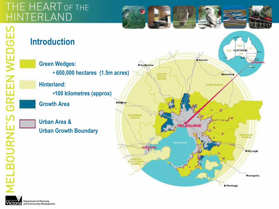
Green Wedges:
• 600,000 hectares (1.5m acres)
Hinterland:
•100 kilometres (approx)
Growth Area
Urban Area &
Urban Growth Boundary
Introduction
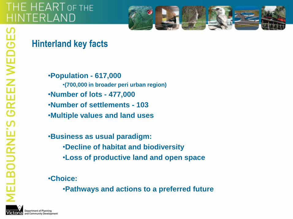
•Population - 617,000•(700,000 in broader peri urban region)
•Number of lots - 477,000
•Number of settlements - 103
•Multiple values and land uses
•Business as usual paradigm:
•Decline of habitat and biodiversity
•Loss of productive land and open space
•Choice:
•Pathways and actions to a preferred future
Hinterland key facts
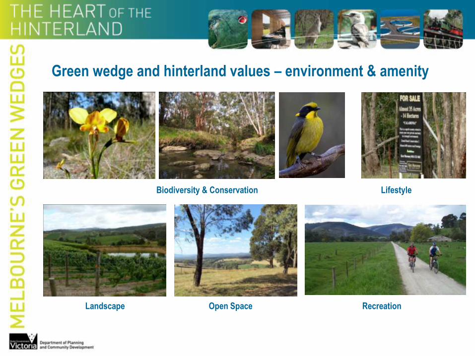
Green wedge and hinterland values – environment & amenity
RecreationLandscape Open Space
Biodiversity & Conservation Lifestyle

Green wedge and hinterland values - economic
Agriculture & Food Security Tourism
Protected Catchments Sensitive Land UsesViticulture
Buffers

Melbourne planning - early years
1837
•Melbourne was officially settled
•Surveyor Robert Hoddle’s street grid plan
•Parks and gardens were provided for
•Constraints were recognised
1929 - Landmark report
Plan of General Development
Addressed:
•transport and traffic congestion
•distribution of recreational open space
•haphazard intermingling of land uses
Proposed:
•planning and land-use zoning scheme – business, residential & industrial uses
•recreational scheme – open space, playgrounds, parks and ‘parkway drives’

Melbourne planning – mid 20thC
Proposed Major Park System
for Melbourne and Metropolis
1944
Note:
Permanent Agricultural Belt
(proposed - not official policy)

Melbourne planning – mid 20thC
Sprawling low density urban development
• perception of ‘boundless land’
• increased affluence - gardens, large lots
• rapid increase in car use & mobility
Social consequences
•poor services
•disadvantage
•haphazard planning
Under threat
•productive rural and agricultural lands
•landscapes and open space
•wildlife habitat and natural resources

Melbourne planning – 1954
•1st comprehensive Metropolitan Planning Scheme
•central locations - housing, transport, employment & community activity
•rural zones surrounding the urban area to reduce sprawl
•development corridors and ‘wedges’ of non urban land

Melbourne planning – 1968
Urban growth corridor / green wedge pattern of development
was officially adopted as planning policy in 1968
To:
•provide relief from continuous building development
•preserve countryside near to established populations
•protect areas of high natural amenity
•protect primary production including orchards and market gardens
•protect mineral deposits, resources and other rural activities
•provide locations for major public utility installations and large institutions
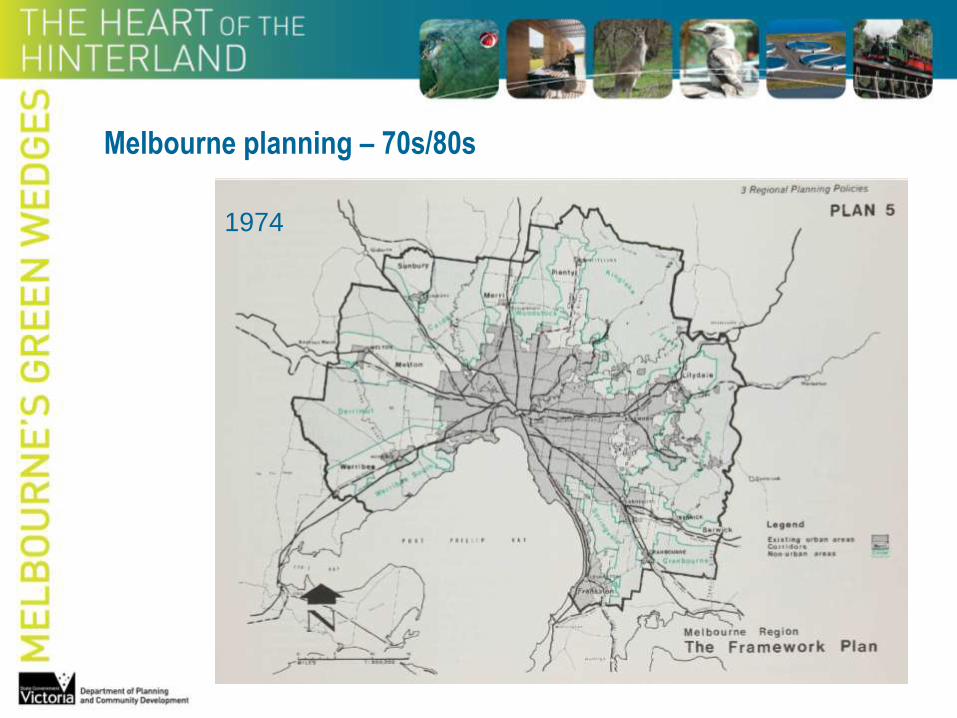
Melbourne planning – 70s/80s
1974

Melbourne’s Development
Urban settlement
1851 to 2004

Melbourne planning – recent years
1990s
•‘New format’ planning schemes – performance based
•4000 hectares of rural land ‘lost’ to residential development
2002
Melbourne 2030 – Planning for sustainable growth:
•30 year plan to manage growth and change
•Urban growth boundary established
•12 green wedges designated
•Legislation and planning controls to protect green wedge land


2002 - Proposed boundaries and green wedges

2005 - final alignment of boundaries2010 - urban growth boundary moved
NorthWest

Issues & Opportunities - 1
Population growth
•Melbourne = 1 million by 2020 – not 2030 as predicted
•Higher average annual growth rates in hinterland:
- Peri-urban = 1.8% / Victoria = 0.9% / Regional Vic = 0.8%
Agriculture
•Food security, climate change, peak oil, food miles
•Retention of large properties is critical
•Land use planning affects farming
Environment
•Loss of native vegetation and habitat
•Decline in biodiversity and viable species populations
•Loss of ecosystem services
•Carbon offsets, Bush Broker schemes
Golden Sun Moth

Issues & Opportunities - 2
Water
•Last decade:
•El Nino weather pattern – lower rainfall / higher temperatures
•Few rivers in good or excellent condition
•Water situation likely to worsen under climate change (5 – 45% reduction in runoff)
•Recent extreme flood events in Victoria
Social
•Commuting:
•42% work outside local area / 28% commute to Melbourne
•Lifestyle – rural living and maintaining a close connection with nature
•Diversity of hinterland towns – heritage values & character
•Connected settlements – internet broadband technology
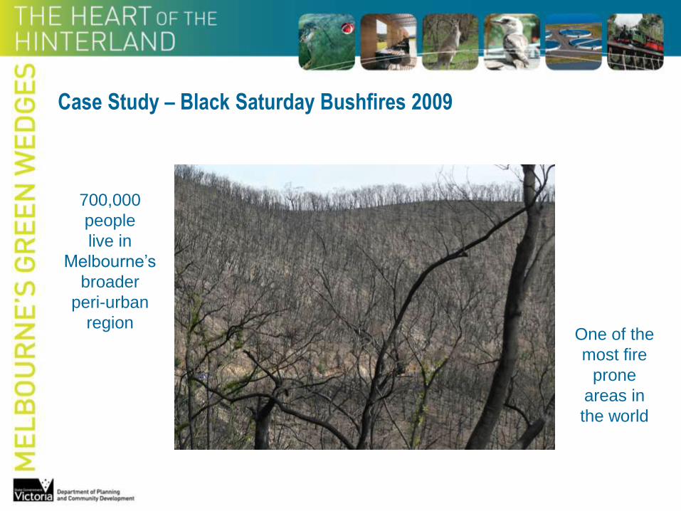
Case Study – Black Saturday Bushfires 2009
700,000
people
live in
Melbourne’s
broader
peri-urban
regionOne of the
most fire
prone
areas in
the world

Case Study – Black Saturday Bushfires 2009
450,000 hectares burnt
350,000 hectares in hinterland areas
173 lives lost 414 people injured 7562 people displaced

Wallan
Seymour
Dwelling permits
(aqua & orange dots)
1997-2007
Case Study
Shire of Mitchell
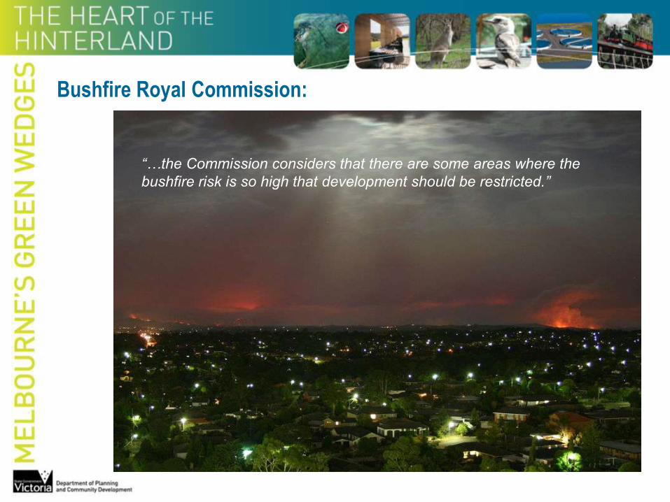
Bushfire Royal Commission:
“…the Commission considers that there are some areas where the
bushfire risk is so high that development should be restricted.”

Lessons
Green Wedges and Hinterland provide:
•Opportunities for greater resilience
•Capacity for improved sustainability
•Enhanced liveability
•Climate change adaptation

The Agenda
Integrated planning:
•Metropolitan Melbourne
•Green Wedges
•Hinterland
•Regional Victoria

Regional Planning & Partnerships
Community
•landcare groups
•community groups
•business
Objective:
Integrationand
Implementation
•8 Regional Strategic Plans
•8 Regional Land Use Plans
•AU$17.2 million
Government
•Local
•State
•National
Institutions
•research & data
•consequences of business as usual
•policy options – underway
P A R T N E R S H I P S
I M P L E M E N T A T I O N

State
Transport
Policies
State Climate
Change
Policies
State
Planning
Policy
Framework
Regional
Strategic
Plan
State
Biodiversity
Policies
Metropolitan
Planning
Policy
Spatial Policy
& Strategies –
Coastal,
Periurban,
Murray River
etc
Sustainable
Water/
Energy
Strategies
Emerging State Policies
TRANSLATION
+
INTEGRATION
regional settlement framework
RLUP
Priority
Actions
Partnerships
for Delivery
Planning Scheme
Amendments –
SPPF, LPPF & MSS
FundingIndicative
Infrastructure Plan
Other
Local Government Policy
IMPLEMENTATION

Conclusion
A city in isolation of its hinterland is not sustainable
www.dpcd.vic.gov.au [email protected]