great basin may - august, 2015 fire potential outlook gina mcguire shelby law nanette hosenfeld gbcc...
TRANSCRIPT

Great Basin May - August, 2015
Fire Potential Outlook
Gina McGuireShelby Law
Nanette HosenfeldGBCC Predictive Services
Meteorologists

Contents
• Recent Weather• May - August Weather/Fire Potential Forecast

Recent Weather TrendApril Temperature
Departure from AverageApril PrecipitationPercent of Average

Recent Weather TrendWater Year Precipitation Percent of
Average Current Snowpack
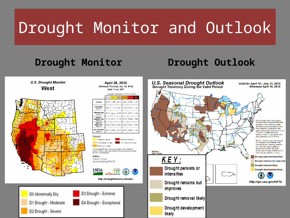
Drought Monitor Drought Outlook
Drought Monitor and Outlook

Recent Weather Trend Summary• Average temperatures over the last 30 days have dropped closer to
normal due to a few storm systems bringing cooler weather to the GB. However, high temperatures on average have still remained above normal.
• Precipitation over the last 30 days increased to near to up to 125-150% of normal over parts of the AZ Strip, eastern UT, western/northwest NV.
• The snowpack continued to decline to 0-15% over the Sierra and Nevada, and 20-35% over ID/UT, and to 50-65% in western WY.
• Extreme to exceptional drought continues over the western half of NV and CA with moderate-severe drought over much of the rest of the GB. The drought has expanded over southern ID/northern UT with some small areas now seeing extreme drought.
• The drought conditions are expected to persist through the end of July 2015 across most of NV and southern UT, but may improve somewhat over northeast NV, central/northern UT into southern ID/WY.

Fuels
• Green-up continues across the GB, and started early in 2015. Lower elevations of southern NV and parts of southern UT are curing and will transition through May and mid-higher elevations.
• Despite the earlier start to green-up, the curing of the fine fuels over the northern ½ of the GB may still occur on time (mid-June) considering the transition to a more showery pattern through May.
• Spring rains will likely bring more grass growth to the northern ½ of the GB than in recent years, but will be variable. Carryover still exists from 2014.
• The higher elevations are still extremely dry after another very poor year for snowpack, especially over the western half of the GB.

Fuels Continued
• Live fuel moisture sampling began in April showing very low 1000-hr and sagebrush fuel moisture in most areas.
• Heavier dead fuel moisture very low, near or at record lows.
• Fine fuel growth, continuity and loading variable across the landscape, but still relatively short and not above normal in most areas (exceptions may be parts of northeast NV and areas of the GB that see another cheat grass growth after May rains).
• Carryover is moderate due to low winter precipitation/snowpack.

Current Fire Danger
Fuel Moisture
Fuel Loading
Recent Weather Trends
Low Fire Potential in all areasdue to cold winter temperaturesand periodic winter precipitation.

Temperature Precipitation
CPC 8 – 14 day Climate Outlooks

Temperature Precipitation
Long Term CPC Climate Outlooks
June - August June – August

March and April Fire Potential Outlook• Normal large fire potential (little to no large
fire activity) through April/May, and maybe into June in some areas.
• The weather pattern is shifting at the beginning of April to a more active pattern (more frequent low pressure troughs moving through the GB bringing cooler temperatures, wind and precipitation) and this should keep a lid on significant fire potential in most areas through April and May.
• There is still a potential of significant larger fires during strong wind events after prolonged periods of drier weather at times during April and May, but these concerns would be of shorter duration.
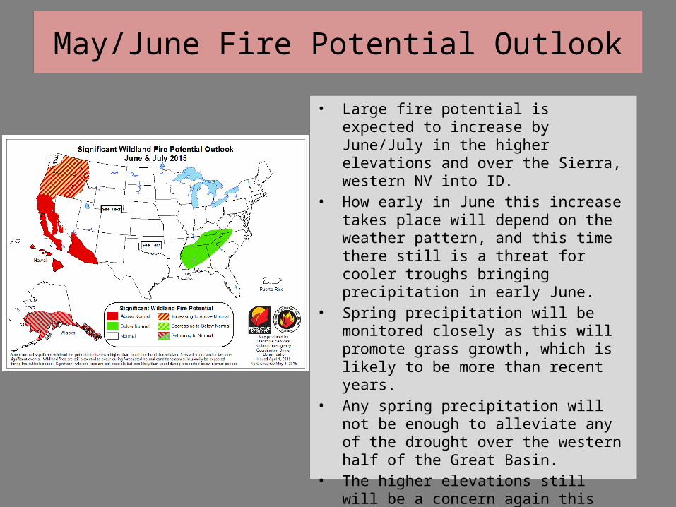
May/June Fire Potential Outlook• Large fire potential is expected to increase by
June/July in the higher elevations and over the Sierra, western NV into ID.
• How early in June this increase takes place will depend on the weather pattern, and this time there still is a threat for cooler troughs bringing precipitation in early June.
• Spring precipitation will be monitored closely as this will promote grass growth, which is likely to be more than recent years.
• Any spring precipitation will not be enough to alleviate any of the drought over the western half of the Great Basin.
• The higher elevations still will be a concern again this year due to drought and very low winter snowpack again.

Zoomed in Great Basin Outlook
June July – August

The End
Send Questions/CommentsTo
Gina McGuire, Shelby Law, or Nanette Hosenfeld - [email protected]
[email protected]@blm.gov