gm symposium 2016: nate wood, research geographer, usgs
TRANSCRIPT
Nathan Wood, PhDNina Abdollahian
Jamie JonesWestern Geographic Science CenterU.S. Department of the Interior
U.S. Geological Survey
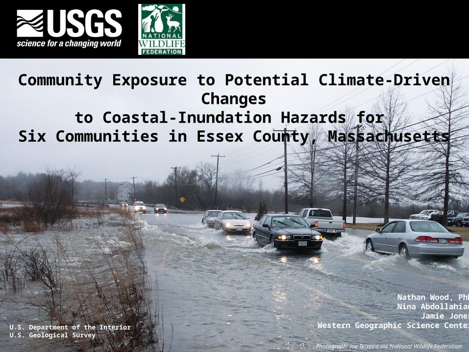
Community Exposure to Potential Climate-Driven Changesto Coastal-Inundation Hazards for
Six Communities in Essex County, Massachusetts
Photograph: Joe Teixeira via National Wildlife Federation
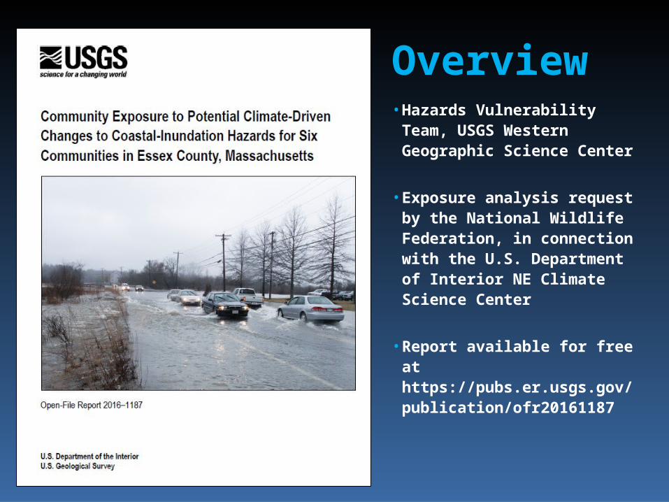
Overview• Hazards Vulnerability Team,
USGS Western Geographic Science Center
• Exposure analysis request by the National Wildlife Federation, in connection with the U.S. Department of Interior NE Climate Science Center
• Report available for free at https://pubs.er.usgs.gov/ publication/ofr20161187
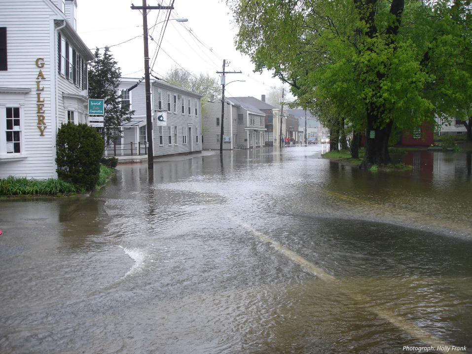
Photograph: Holly Frank

Source: IPCC AR5, 2013, Fig. 13.27http://www.realclimate.org/index.php/archives/2013/11/sea-level-rise-what-the-experts-expect/
http://www.cityofboston.gov/climate/sealevelriseboston.asp
Source: NOAA
Sea level rise – historic and predictionsGlobal Boston Harbor


SalisburyNewburyportNewbury
EssexIpswichRowley
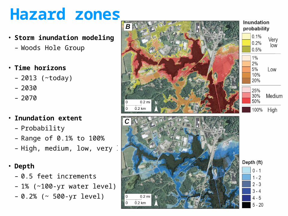
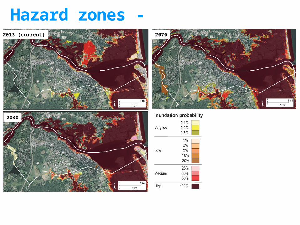
• Storm inundation modeling– Woods Hole Group
• Time horizons– 2013 (~today)– 2030– 2070
• Inundation extent– Probability– Range of 0.1% to 100%– High, medium, low, very low
• Depth– 0.5 feet increments– 1% (~100-yr water level)– 0.2% (~ 500-yr level)
Hazard zones

Hazard zones - Salisbury2013 (current) 2030
2070
Hazard zones - Newburyport2013 (current)
2030
2070

Hazard zones - Newbury2013 (current)
2030
2070

Hazard zones - Rowley2013 (current)
2030
2070
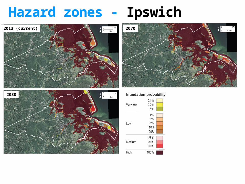
Hazard zones - Ipswich2013 (current)
2030
2070

Hazard zones - Essex2013 (current) 2030 2070

Development
2006 National Land Cover Database
Amount of developed land in
hazard zones
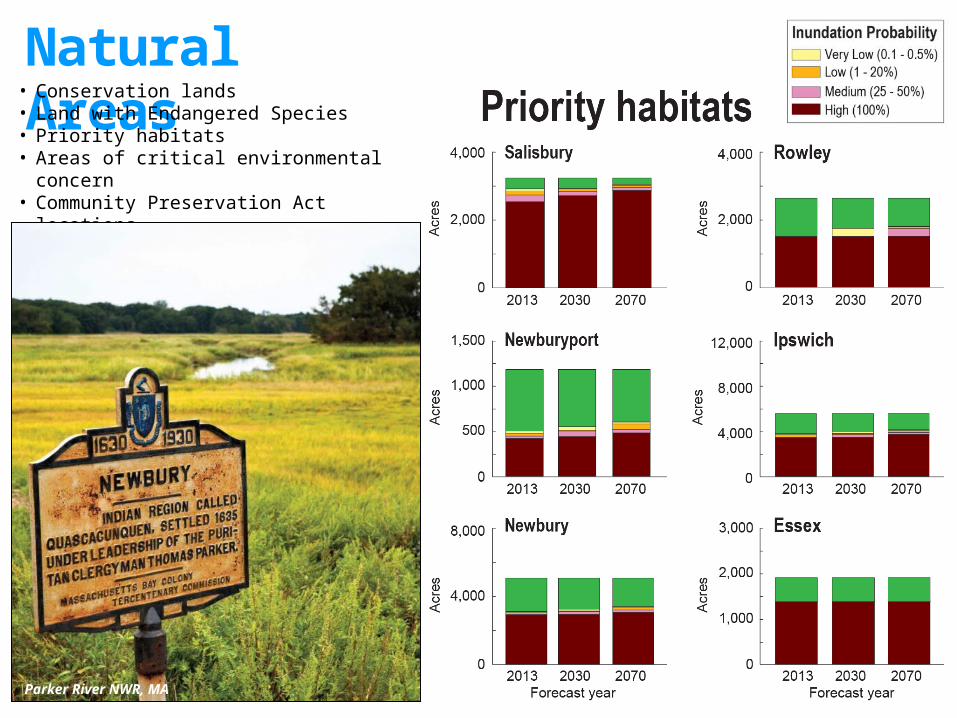
Natural Areas• Conservation lands• Land with Endangered Species• Priority habitats• Areas of critical environmental concern• Community Preservation Act locations• Various state data sources (MassGIS)
Parker River NWR, MA
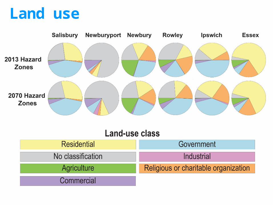
Land use

Residents
Residents
• 2013 Census block level data• Address points – parcels and businesses
Number of residents in
hazard zones
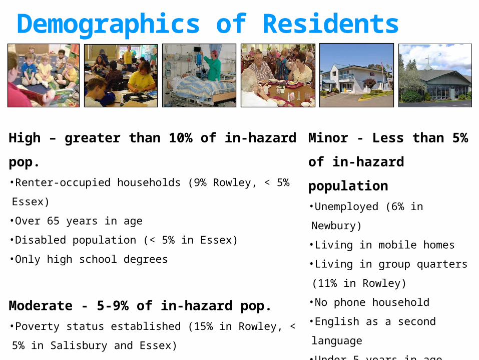
Demographics of Residents
High – greater than 10% of in-hazard pop.•Renter-occupied households (9% Rowley, < 5% Essex)
•Over 65 years in age
•Disabled population (< 5% in Essex)
•Only high school degrees
Moderate - 5-9% of in-hazard pop.•Poverty status established (15% in Rowley, < 5% in Salisbury
and Essex)
Minor - Less than 5% of
in-hazard population•Unemployed (6% in Newbury)
•Living in mobile homes
•Living in group quarters (11% in
Rowley)
•No phone household
•English as a second language
•Under 5 years in age
•Residents with no vehicle

Businesses in hazard zones
Photograph: Joe Teixeira via National Wildlife Federation

Economic assets
Data from 2012 Infogroup Employer Database
Number of employees in hazard zones

Economic assets Amount of parcel value ($, millions) in hazard zones
Photograph: Ipswich River Watershed Association

Economic assets Amount of building replacement value ($,
millions) in hazard zones
Photograph: National Wildlife Federation

Critical facilities and infrastructure in hazard zones
Photograph: Joe Teixeira via National Wildlife Federation

Areas of concern - Salisbury
Depth data at 1% probability for by 2070

Areas of concern - Newburyport
Depth data at 1% probability by 2070
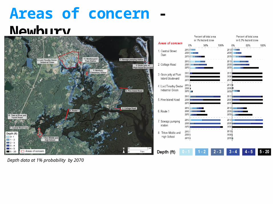
Areas of concern - Newbury
Depth data at 1% probability by 2070

Areas of concern - Rowley
Depth data at 1% probability by 2070
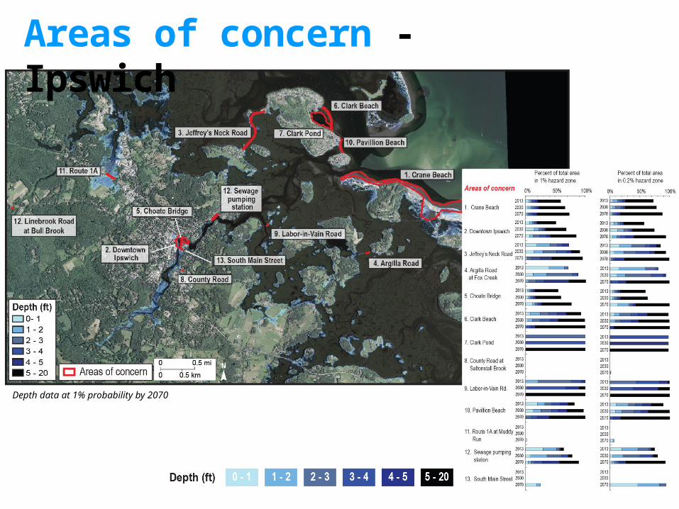
Areas of concern - Ipswich
Depth data at 1% probability by 2070

Areas of concern - Essex
Depth data at 1% probability by 2070
For more information• Report (free for download)
• USGS Open-File Report 2016-1187• https://pubs.er.usgs.gov/publication/ofr20161187
• Contact me - Nathan Wood, [email protected]• USGS vulnerability research - http://geography.wr.usgs.gov/science/vulnerability
Thank You
Photograph: National Wildlife Federation