glacial landforms. continental glaciers striations erosion of soil
TRANSCRIPT

Glacial Landforms
Continental Glaciers

Striations
Erosion of soil

Roches Moutonnees
or sheepback

• Weslemkoon Lake, Ontario
• Roche Moutonnee By The Lake
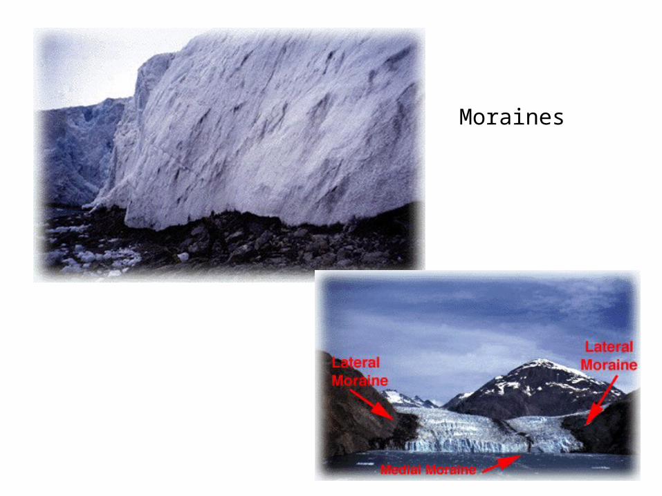
Moraines


Glacier Flow
Terminal Moraine
Material carried in the glacier like a conveyor belt is piled up in front of the ice sheet to form a moraine.
The larger the moraine the longer the glacier is stationary, ie., in a state of mass balance.
This material is till and is largely unsorted (ie., it is all mixed up with different sizes).
Terminal moraines mark the maximum extent of ice advance.

Glacier Flow
Terminal moraine
If the climate changes and becomes warmer, the glacier will retreat and eventually achieve a new state of mass balance.

Glacier Flow
Terminal moraine
If the climate changes and becomes warmer, the glacier will retreat and eventually achieve a new state of mass balance.
Note that even though the glacier is retreating, it is still flowing forward.
It is just being ablated (melted) faster than it flows.

Glacier Flow
When the new state of mass balance is reached, a new moraine is created, called a recessional moraine.
For the skiers: Horseshoe Valley and Mt. St. Louis-Moonstone are on a recessional moraine.
Terminal moraine
Recessional Moraine


Sometimes two lobes of glacial ice come together and a moraine forms between them
This happened north of Lake Ontario when there was a pause and short re-advance of the ice age during the last retreat – the ice lobe left in what would eventually become Lake Ontario grew north (and east and west and south) and met the main sheet moving south – they met just north of Toronto - the Oak Ridges Moraine – called interlobate moraine

Remnant ice sheet or chunk.
“future” Lake Ontario basin
Main ice sheet to the north
The ice sheets in retreat … there is a pause ...

Main ice sheet to the north
“future” Lake Ontario basin
…. and then a re-advance of the ice for a period of time

Main ice sheet to the north
“future” Lake Ontario basin
…. and then a re-advance of the ice for a period of time
Oak Ridges - Interlobate Moraine

Lake Ontario
Oak Ridges - Interlobate Moraine
Toronto Kingston


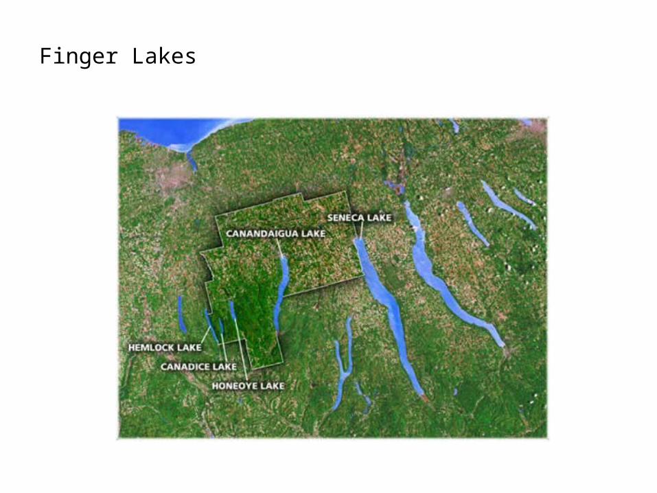
Finger Lakes

Drumlins are egg-shaped hills oriented to the direction of ice movement – usually in clusters or field – about 200/300 in S. Ontario near Peterborough.
Direction of ice movement
200 - 1000 m
30-100 m
Steep face indicates direction ice came from.

Drumlin


http://www.sfu.ca/~tabrenna/students/tim/tim.htm

http://www.virtualsk.com/maps/ecoregions_3.html
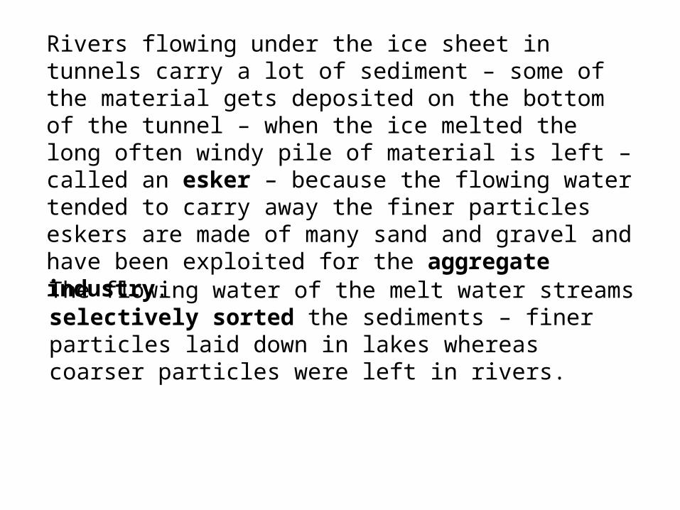
Rivers flowing under the ice sheet in tunnels carry a lot of sediment – some of the material gets deposited on the bottom of the tunnel – when the ice melted the long often windy pile of material is left – called an esker – because the flowing water tended to carry away the finer particles eskers are made of many sand and gravel and have been exploited for the aggregate industry.
The flowing water of the melt water streams selectively sorted the sediments – finer particles laid down in lakes whereas coarser particles were left in rivers.


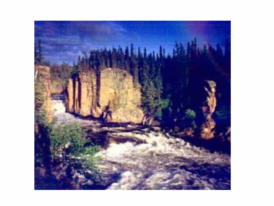
http://www.homepage.montana.edu/~geol445/hyperglac/meltwater1/ESKERS.htm


Erratics

Spillway with a Mistfit stream


Glacial Ponding
When the ice sheets started to melt about 15,000 years ago, huge amounts of water poured off the ice and large lakes were created in front of the sheets – huge quantities of sediment were deposited in these lakes (called glacial ponds) – today they are large flat areas and have fertile soils – called lake plains – eg., Great Lakes Lowlands; southern Manitoba (Lake Aggasiz) and part of the Niagara Fruit Belt.

Glacial Ponding
Sediments get depositedWeight of ice depresses the land
As the ice begins to melt, meltwater collects in front of the ice.This is called glacial ponding

Glacial Ponding
Sediments
The ice age ends and the ice sheets retreat.

Glacial Ponding
Sediments
The ice age ends and the ice sheets retreat.

SedimentsWhen ice retreats, land rebounds
Glacial ponding drains away

SedimentsWhen ice retreats, land rebounds
Sediments remain behind and make for excellent soil.Called lake plains.

In some areas the ocean flooded inland quite a way during the period of ice retreat because the land was depressed from the weight of the ice – also created fertile areas, eg., St. Lawrence River valley lowlands – sand bars, etc. left behind.

Deranged Drainage
Pattern

Alpine Glaciers

Cirque
Arete
Tarn
Col
Horn

Cirques, Aretes, U-shaped valley, Horns


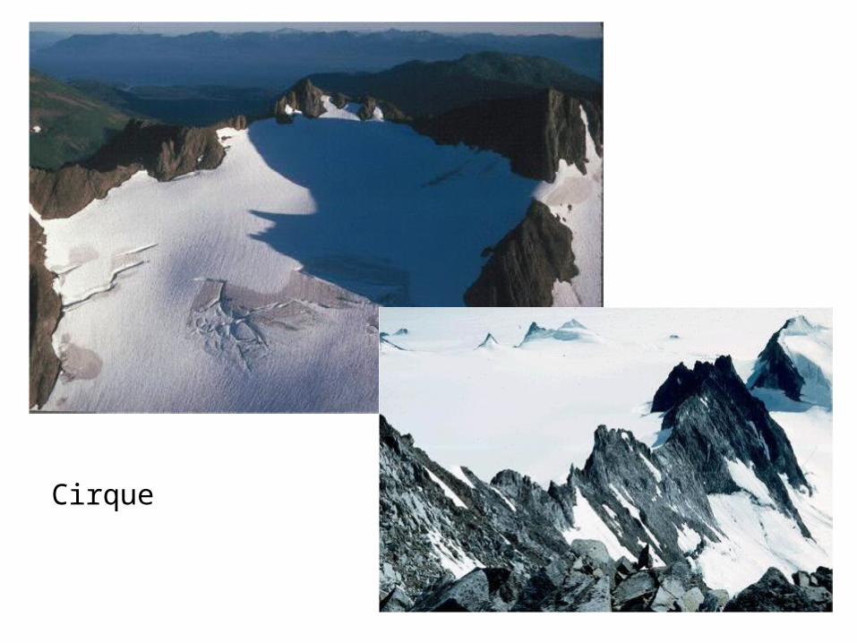
Cirque

Arete

Col
Horn
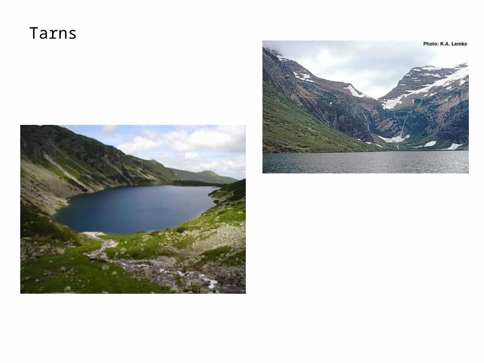
Tarns
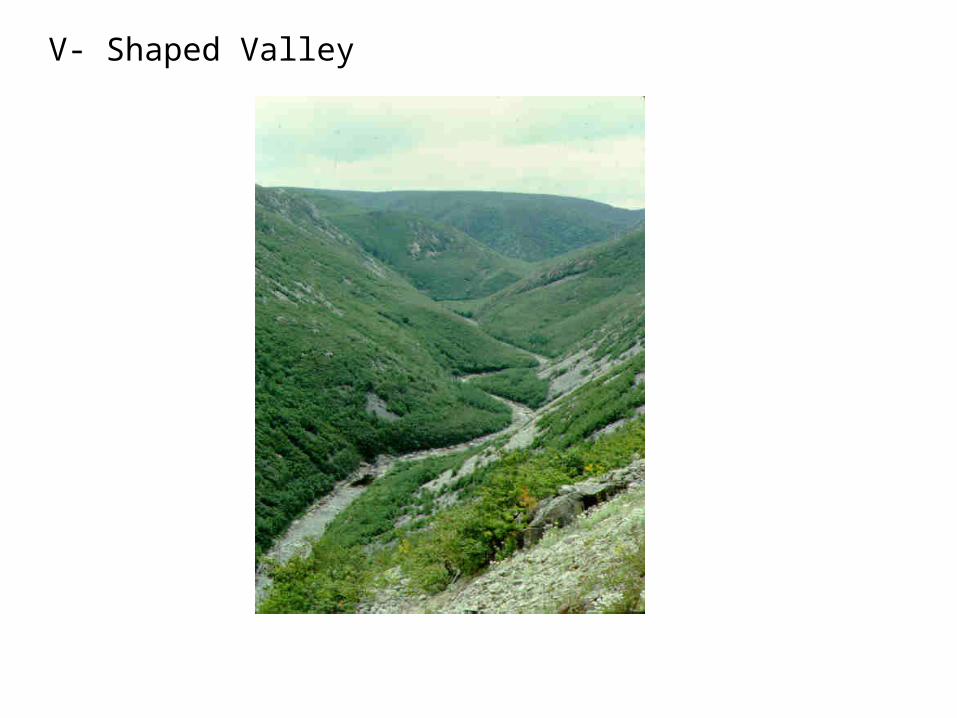
V- Shaped Valley

U-Shaped
Valley


This is a Fjord!
The formation of a Hanging Valley.


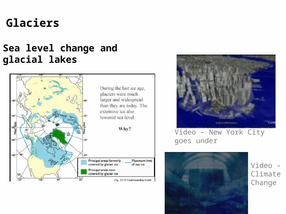
Glaciers
Sea level change and glacial lakes
Video – New York City goes under
Video – Climate Change

Glaciers
Take the quiz and see how much you know about glaciers
Video – Geography Glacier Quiz
The End!