gis data management lesson 12: arcgis server...
TRANSCRIPT
GEOG482/582 / My Course / University of Washington
GEOG 482 / 582 : GIS Data Management
Lesson 12: ArcGIS Server Capabilities
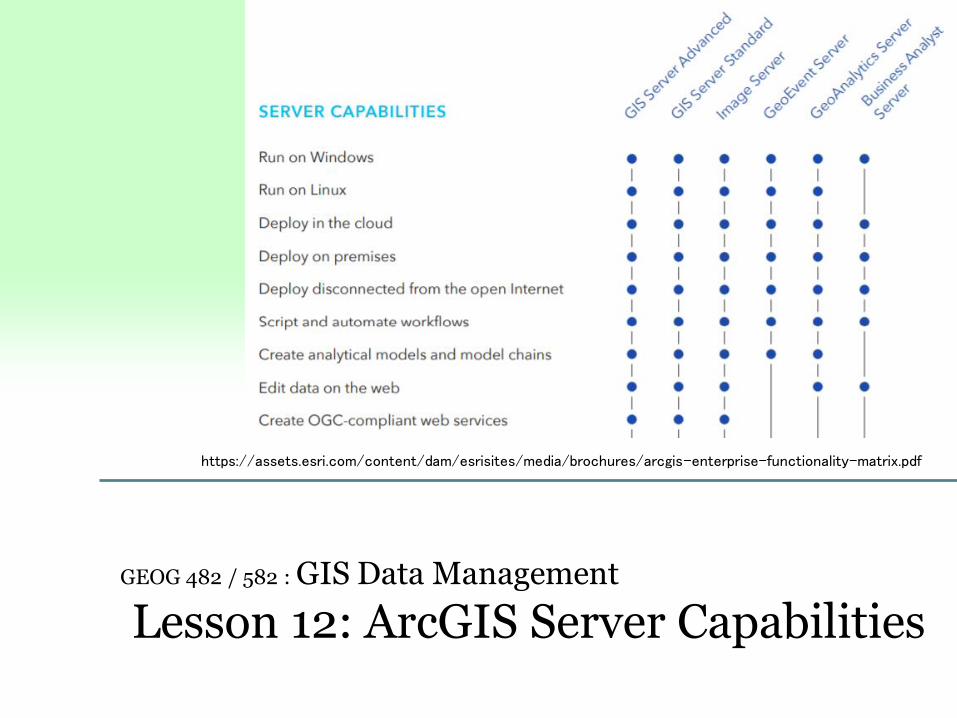
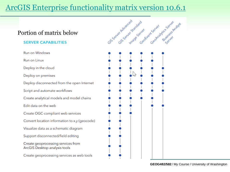
https://assets.esri.com/content/dam/esrisites/media/brochures/arcgis-enterprise-functionality-matrix.pdf
GEOG482/582 / My Course / University of Washington
Overview
Learning Objective Questions:
1. What are the ArcGIS Server Services?
2. How is ArcGIS Server packaged?
3. What are three types of geodatabase management platforms?
4. What are limitations of ArcGIS database environments?
5. What is versioning and why is it important for GIS data
management?
6. What is archiving and why is it important for GIS data
management?
7. How does versioning relate to archiving?
8. What is replication and why is it important for GIS data
management?
Lesson Preview
Learning objective questions act as the lesson outline.
Questions beg answers.

GEOG482/582 / My Course / University of Washington
Enterprise ArcGIS Services1. What are the ArcGIS Server Services?
ArcGIS Server (currently known as ArcGIS Enterprise) services
are many of the same capabilities provided in ArcGIS Desktop
& Pro, but deployed over a WAN, including the Internet.
ArcGIS Server services are useful for Workgroup, Enterprise GIS,
and Consortium GIS; that is, when multiuser systems are an
advantage for GIS data processing.
ArcGIS Server services provide capabilities as diverse as working
with geodatabases, geoprocessing analysis, data
entry/update/display for mobile, and web maps plus more
Key termsArcGIS Server
GEOG482/582 / My Course / University of Washington
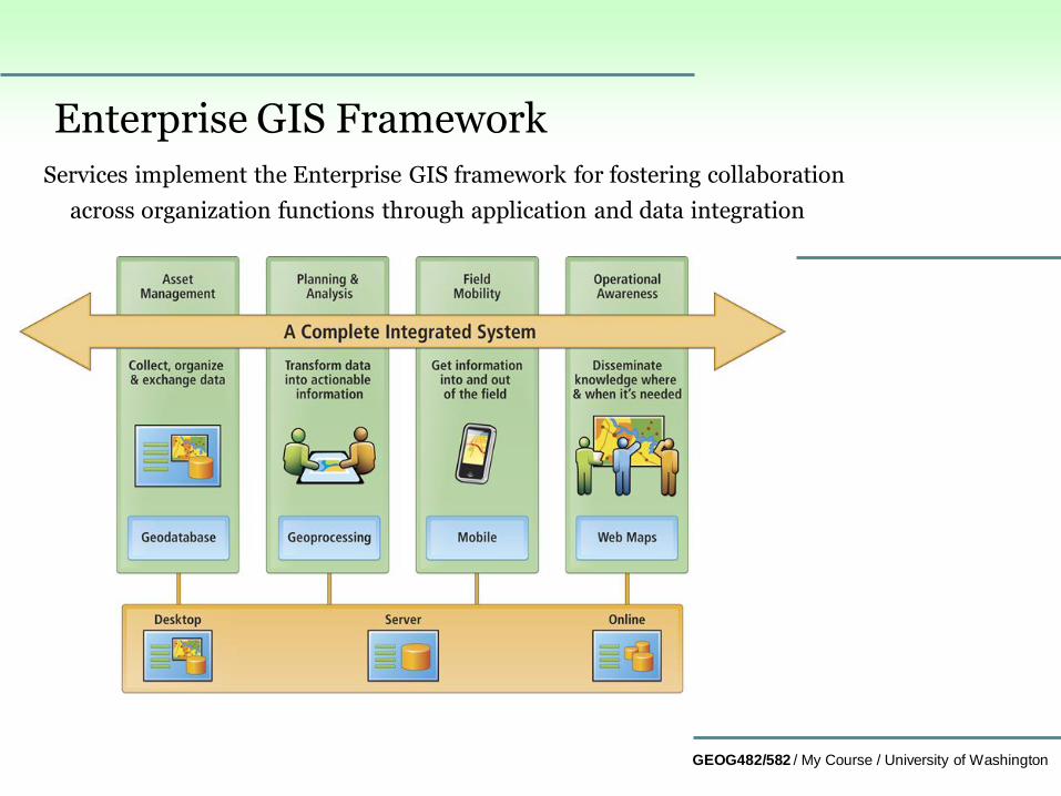
Enterprise GIS FrameworkServices implement the Enterprise GIS framework for fostering collaboration
across organization functions through application and data integration
GEOG482/582 / My Course / University of Washington
ArcGIS Server support for enterprise GIS
Publish Web maps tailored to an audience, strengthening
business and resource decisions with real-time geointelligence.
Geographically enable IT investments, shrinking data and
application redundancy, optimizing system configurations, and
consolidating enterprise systems.
Centrally manage geospatial data, providing better data security
and integrity for information assets.
Simplify access to large volumes of imagery resources,
significantly reducing storage costs and data processing overhead.
Extend GIS technology to mobile workforce, increasing the
accuracy and value of field data collection projects and asset
monitoring, as well as resource and event management.

GEOG482/582 / My Course / University of Washington
Users supported by ArcGIS Server
GIS professionals manage and distribute GIS content and
geoprocessing models to mobile and information workers
Database administrators work with centralized, scalable storage;
and deliver capabilities to Web, desktop, and mobile users.
Application developers use application programming interfaces
(APIs) to build and deploy Web mapping applications.
IT administrators streamline business processes, increase
efficiency, automate tasks, and manage GIS Web services.
Information workers access data, improve workflows and
customer service, and generate reports and analytic maps.
Mobile workers view and navigate mobile maps; monitor the
location of assets; and collect, edit, and update GIS data.
Web citizens explore government data as well as contribute their
own maps; share comments, photos, and other information; and
participate publically in local, regional, and global decision
making.
GEOG482/582 / My Course / University of Washington
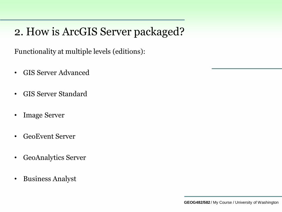
2. How is ArcGIS Server packaged?
Functionality at multiple levels (editions):
• GIS Server Advanced
• GIS Server Standard
• Image Server
• GeoEvent Server
• GeoAnalytics Server
• Business Analyst
GEOG482/582 / My Course / University of Washington
ArcGIS Enterprise functionality matrix version 10.6.1
Portion of matrix below
GEOG482/582 / My Course / University of Washington
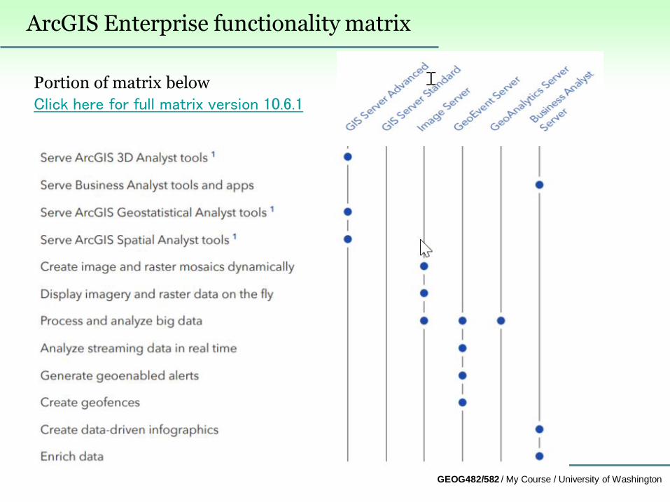
ArcGIS Enterprise functionality matrix
Portion of matrix below
Click here for full matrix version 10.6.1
GEOG482/582 / My Course / University of Washington
Scoping Enterprise Data Management3. What are three types of geodatabase management platforms?
• Personal GDB – collection of tables managed in MS Access
Jet Engine
• File GDB – collection of files managed in a file folder
• Enterprise (ArcSDE) GDB - collection of tables managed
in a relational database management system for multi-user
access
For a comparison of the three, see the table at
http://help.arcgis.com/en/arcgisdesktop/10.0/help/index.html
#/Types_of_geodatabases/003n00000007000000/

GEOG482/582 / My Course / University of Washington
Three database environments exist because…
Different organizations have different database needs…
Personal GDB : Mircosoft Access
• MS Access Jet Engine available as an embedded technology at
no/little cost
• uses Windows operating system, workstation personal users
File GDB : Windows file management system
• ArcGIS software uses Windows operating system folders
• Do not require DBMS software support
Enterprise GDB - IBM Informix, IBM DB2, Oracle, MS SQL
Server, PostgreSQL
• Database management technology provided by third party
software organization
GEOG482/582 / My Course / University of Washington
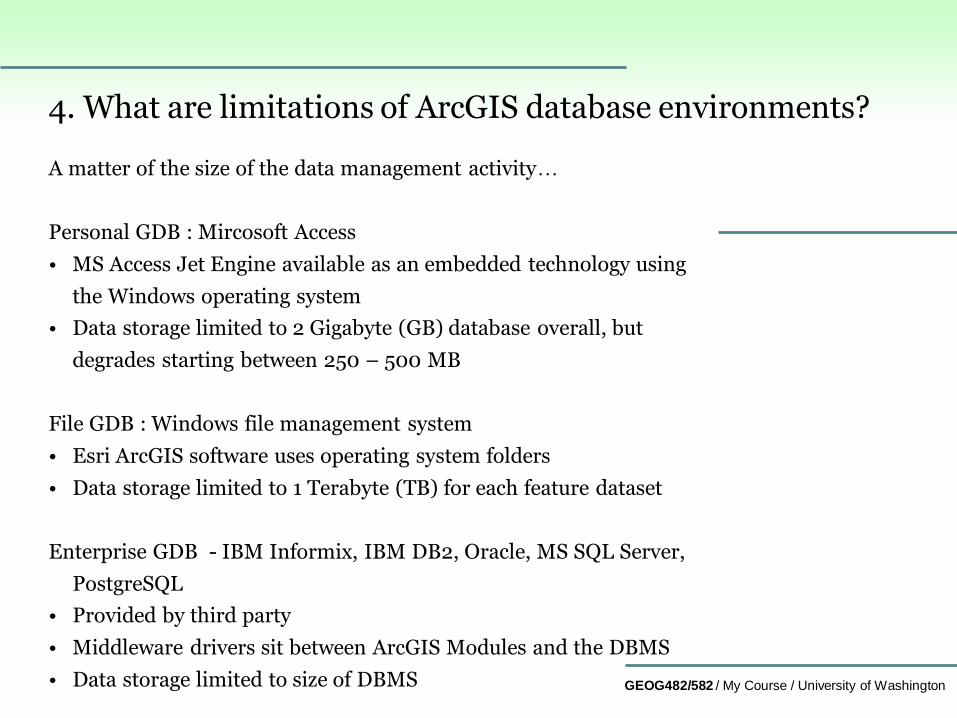
4. What are limitations of ArcGIS database environments?
A matter of the size of the data management activity…
Personal GDB : Mircosoft Access
• MS Access Jet Engine available as an embedded technology using
the Windows operating system
• Data storage limited to 2 Gigabyte (GB) database overall, but
degrades starting between 250 – 500 MB
File GDB : Windows file management system
• Esri ArcGIS software uses operating system folders
• Data storage limited to 1 Terabyte (TB) for each feature dataset
Enterprise GDB - IBM Informix, IBM DB2, Oracle, MS SQL Server,
PostgreSQL
• Provided by third party
• Middleware drivers sit between ArcGIS Modules and the DBMS
• Data storage limited to size of DBMS

GEOG482/582 / My Course / University of Washington
5. What is versioning and why is it important for GIS data management?
• Versioning allows multiple users to edit the same data in an Enterprise
geodatabase without applying locks or duplicating data.
• Users always access an Enterprise geodatabase through a version.
• Every Enterprise geodatabase has a default version called DEFAULT
• Versioning is always enabled for the geodatabase. It is a fundamental
part of how ArcGIS operates and does not need to be installed or
configured independently.
Above comes from…versioning help…
http://help.arcgis.com/en/arcgisdesktop/10.0/help/index.html#/A_quic
k_tour_of_versioning/00270000000r000000/
Additional insight about versioning available (highly recommended) at..
http://www.esri.com/news/arcuser/0110/versioning101.html

GEOG482/582 / My Course / University of Washington
How do versions and versioned edits work?
A geodatabase can have many versions.
• DEFAULT version is the root version and, therefore, the ancestor of all
other versions.
Creating other versions
• Create a version by creating children or branches from any existing
version.
• Create the first version by making a child version of the DEFAULT
version.
• When the new version is created, it is identical to the DEFAULT version.
Over time, the versions will diverge as changes are made to the DEFAULT
version and to the new version.

GEOG482/582 / My Course / University of Washington
6. What is archiving and why is it important for GIS data management?
• Geodatabase archiving introduces a historical version in
addition to the existing transactional (default or child)
version.
• Users connect to either a transactional version or a historical
version. A transactional version allows users to edit the data.
• A historical version (archive) represents the data at a specific
moment in time and provides a read-only representation of
the geodatabase; a snapshot of the geodatabase.
• One can connect to a historical version using an existing
historical marker or a specified moment. A historical marker
is a named moment in time that you create, for example,
"Completion of Subdivision 158" referencing the date 2:13 PM
July 11, 2018.
• Above comes from…geodatabase archiving help...
http://help.arcgis.com/en/arcgisdesktop/10.0/help/index.html
#/Geodatabase_archiving/002700000045000000/
Key termsArchiving

GEOG482/582 / My Course / University of Washington
More on archiving…
• Archiving supports all geodatabase data model constructs; e.g.,
feature classes, feature datasets, tables, relationship classes,
networks, topologies, and terrains.
• Archiving requires the data to be registered as versioned. Once
archiving is enabled, all changes saved or posted to the DEFAULT
version are maintained in the corresponding archive class.
• The archive class is a complete copy of the archive enabled class
plus all the edits saved or posted to the DEFAULT version.
Tools
• History Viewer tool allows users to quickly navigate to specific
time for displaying how the data appeared.
• Adding the archive class directly to ArcMap allows users to
perform queries to explore how the data has evolved over time,
e.g., edits occurring between Jan 18, 2018, and July 1, 2018.
GEOG482/582 / My Course / University of Washington
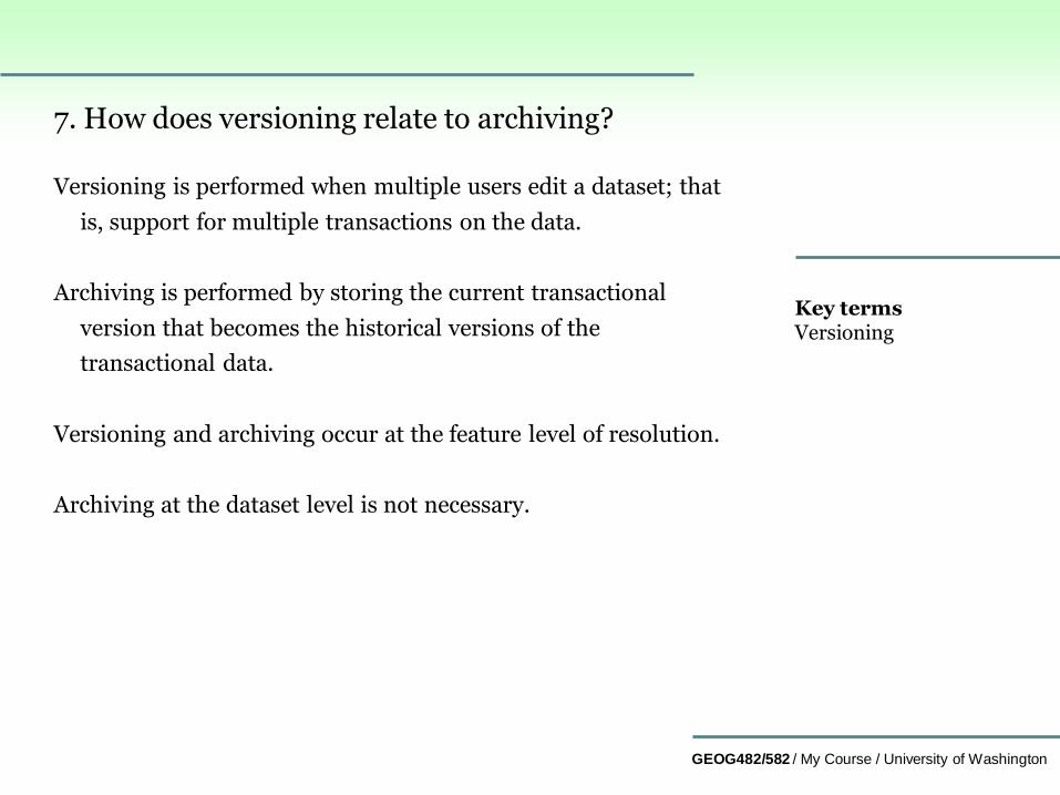
7. How does versioning relate to archiving?
Versioning is performed when multiple users edit a dataset; that
is, support for multiple transactions on the data.
Archiving is performed by storing the current transactional
version that becomes the historical versions of the
transactional data.
Versioning and archiving occur at the feature level of resolution.
Archiving at the dataset level is not necessary.
Key termsVersioning

GEOG482/582 / My Course / University of Washington
8. What is replication and why is it important for GIS data management?
• Geodatabase replication is designed to support many different
systems where you need to distribute data among multiple
locations (users); a copy of data is at other locations to
improve user access performance.
• Data is distributed as a means to improve data availability and
performance by alleviating server contention and slow
network access to a central server.
• Data distribution can help an organization balance the load on
its geodatabases between users performing edits and those
accessing it for reading operations.
• Above comes from…geodatabase replication help...
http://help.arcgis.com/en/arcgisdesktop/10.0/help/index.html
#/Working_with_geodatabase_replication/002700000022000
000/
Key termsreplication
GEOG482/582 / My Course / University of Washington
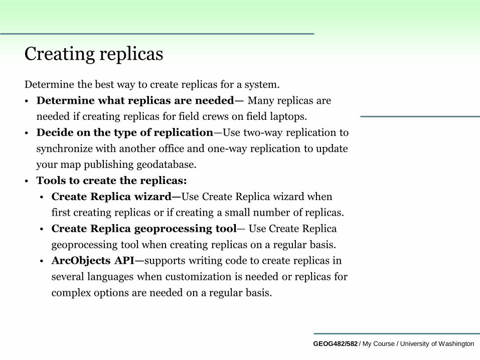
Creating replicas
Determine the best way to create replicas for a system.
• Determine what replicas are needed— Many replicas are
needed if creating replicas for field crews on field laptops.
• Decide on the type of replication—Use two-way replication to
synchronize with another office and one-way replication to update
your map publishing geodatabase.
• Tools to create the replicas:
• Create Replica wizard—Use Create Replica wizard when
first creating replicas or if creating a small number of replicas.
• Create Replica geoprocessing tool— Use Create Replica
geoprocessing tool when creating replicas on a regular basis.
• ArcObjects API—supports writing code to create replicas in
several languages when customization is needed or replicas for
complex options are needed on a regular basis.
GEOG482/582 / My Course / University of Washington
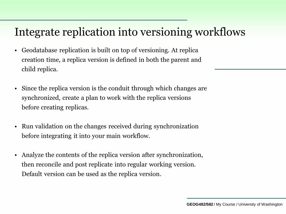
Integrate replication into versioning workflows
• Geodatabase replication is built on top of versioning. At replica
creation time, a replica version is defined in both the parent and
child replica.
• Since the replica version is the conduit through which changes are
synchronized, create a plan to work with the replica versions
before creating replicas.
• Run validation on the changes received during synchronization
before integrating it into your main workflow.
• Analyze the contents of the replica version after synchronization,
then reconcile and post replicate into regular working version.
Default version can be used as the replica version.
GEOG482/582 / My Course / University of Washington
Plan the replica - define the data to replicate • Geodatabase replication allows you to replicate some or all of the
datasets in your Enterprise geodatabase.
• Define the features or rows to replicate using filters and
relationship classes. Filters are applied first, then relationship
classes are used to append additional features and rows.
• Consider future needs when defining the data to replicate.
• Two-way and one-way replicas are created once and synchronized
many times.
• Over time, needs may change to require a larger replica area.
• To maintain data integrity, additional rules apply when replicating
complex data types such as geometric networks and topologies.
GEOG482/582 / My Course / University of Washington
Summary
In this lesson, you learned about…
1. ArcGIS (Enterprise) Server Services
2. ArcGIS Server packaging
3. Three types of geodatabase management platforms
4. Limitations of ArcGIS database environments
5. Versioning and why it is important for GIS data management
6. Archiving and why it is important for GIS data management
7. Versioning in relation to archiving
8. Replication and why it is important for GIS data management
GEOG482/582 / My Course / University of Washington
Contact me at [email protected] if you have questions or comments about this lesson.
GEOG 482/582: GIS Data Management
END Lesson 12: ArcGIS Server Capabilities