geotechnical data management of the new doha...
TRANSCRIPT

Geotechnical data management for mega reclamation projects
and an update on Geotechnical data interchange
Engineers Australia Singapore Group Geotechnical Evening 12 January 2012
Phil Wade, Managing Director Datgel Asia – Singapore, and Datgel – Australia
Asia-Pacific reseller of Bentley Systems' gINT Software
Copyright © 2012 Datgel Pty Ltd
Overview of Talk
Geotechnical Data Management for Mega Reclamation Projects
• New Doha International Airport
• Ras Laffan Port Expansion
• Khalifa Port
• Ruwais Refinery Expansion
• Geotechnical Data Management Systems best practice
Geotechnical Data Interchange
• AGS Format around the world
• DIGGS
• SGF
• GEF
Copyright © 2012 Datgel Pty Ltd
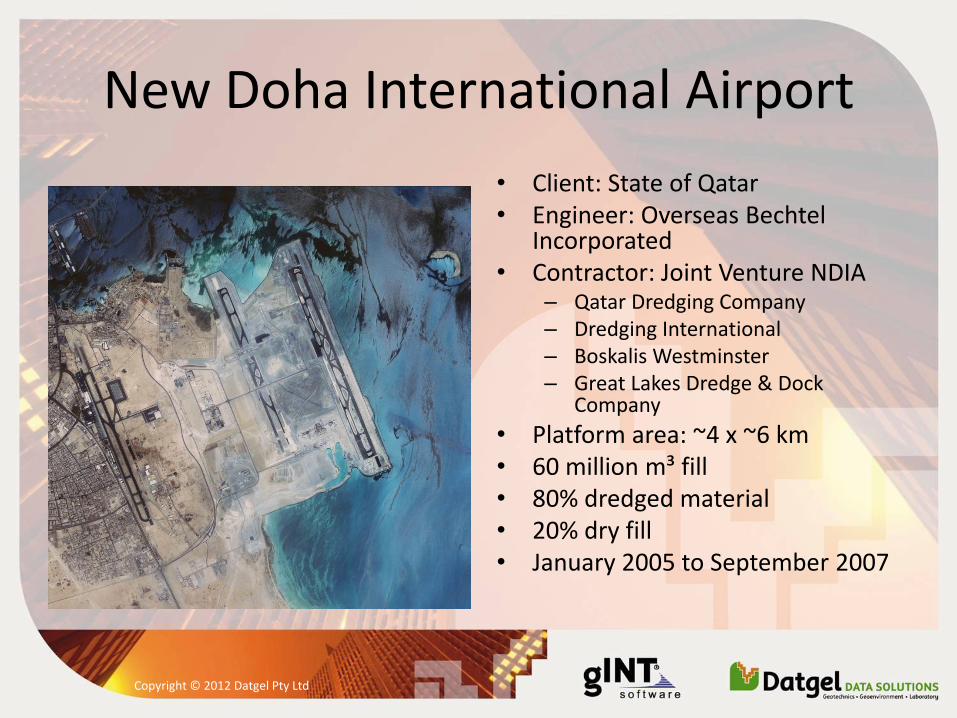
New Doha International Airport
• Client: State of Qatar • Engineer: Overseas Bechtel
Incorporated • Contractor: Joint Venture NDIA
– Qatar Dredging Company – Dredging International – Boskalis Westminster – Great Lakes Dredge & Dock
Company
• Platform area: ~4 x ~6 km
• 60 million m³ fill • 80% dredged material • 20% dry fill • January 2005 to September 2007
Copyright © 2012 Datgel Pty Ltd
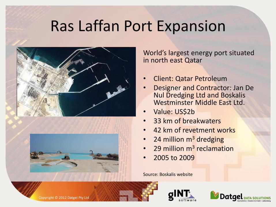
Ras Laffan Port Expansion
World’s largest energy port situated in north east Qatar • Client: Qatar Petroleum • Designer and Contractor: Jan De
Nul Dredging Ltd and Boskalis Westminster Middle East Ltd.
• Value: US$2b • 33 km of breakwaters • 42 km of revetment works • 24 million m3 dredging • 29 million m3 reclamation • 2005 to 2009
Source: Boskalis website
Copyright © 2012 Datgel Pty Ltd
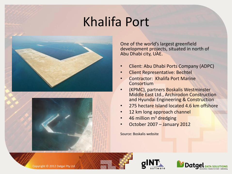
Khalifa Port
One of the world’s largest greenfield development projects, situated in north of Abu Dhabi city, UAE. • Client: Abu Dhabi Ports Company (ADPC) • Client Representative: Bechtel • Contractor: Khalifa Port Marine
Consortium • (KPMC), partners Boskalis Westminster
Middle East Ltd., Archirodon Construction and Hyundai Engineering & Construction
• 275 hectare Island located 4.6 km offshore • 12 km long approach channel • 46 million m3 dredging • October 2007 – January 2012
Source: Boskalis website
Copyright © 2012 Datgel Pty Ltd
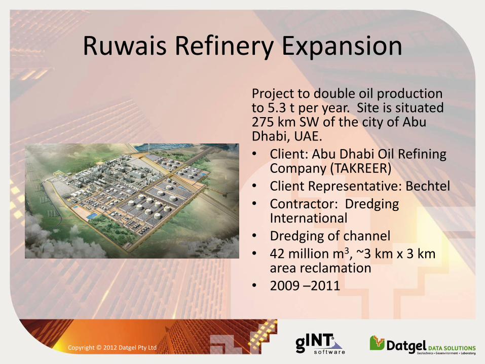
Ruwais Refinery Expansion
Project to double oil production to 5.3 t per year. Site is situated 275 km SW of the city of Abu Dhabi, UAE. • Client: Abu Dhabi Oil Refining
Company (TAKREER) • Client Representative: Bechtel • Contractor: Dredging
International • Dredging of channel • 42 million m3, ~3 km x 3 km
area reclamation • 2009 –2011
Copyright © 2012 Datgel Pty Ltd
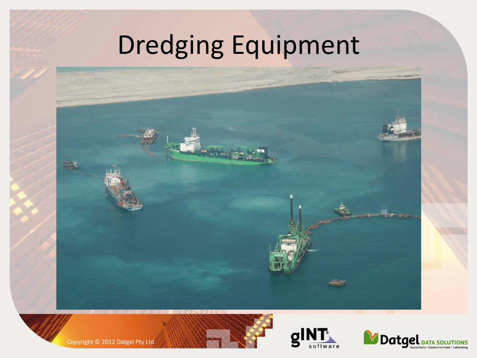
Dredging Equipment
Copyright © 2012 Datgel Pty Ltd
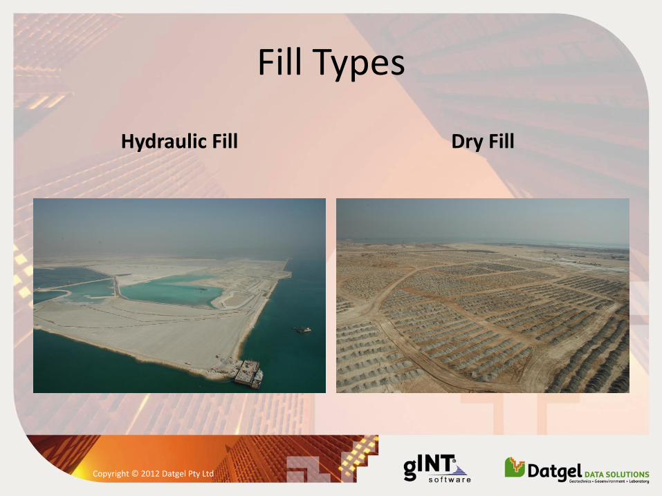
Fill Types
Hydraulic Fill Dry Fill
Copyright © 2012 Datgel Pty Ltd
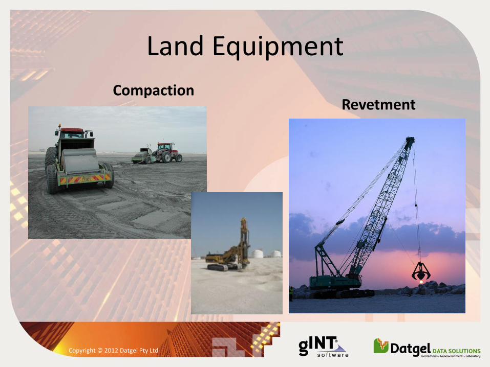
Land Equipment
Compaction Revetment
Copyright © 2012 Datgel Pty Ltd
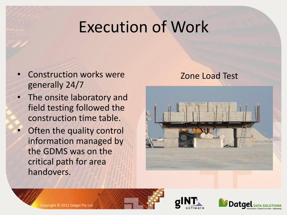
Execution of Work
• Construction works were generally 24/7
• The onsite laboratory and field testing followed the construction time table.
• Often the quality control information managed by the GDMS was on the critical path for area handovers.
Zone Load Test
Copyright © 2012 Datgel Pty Ltd
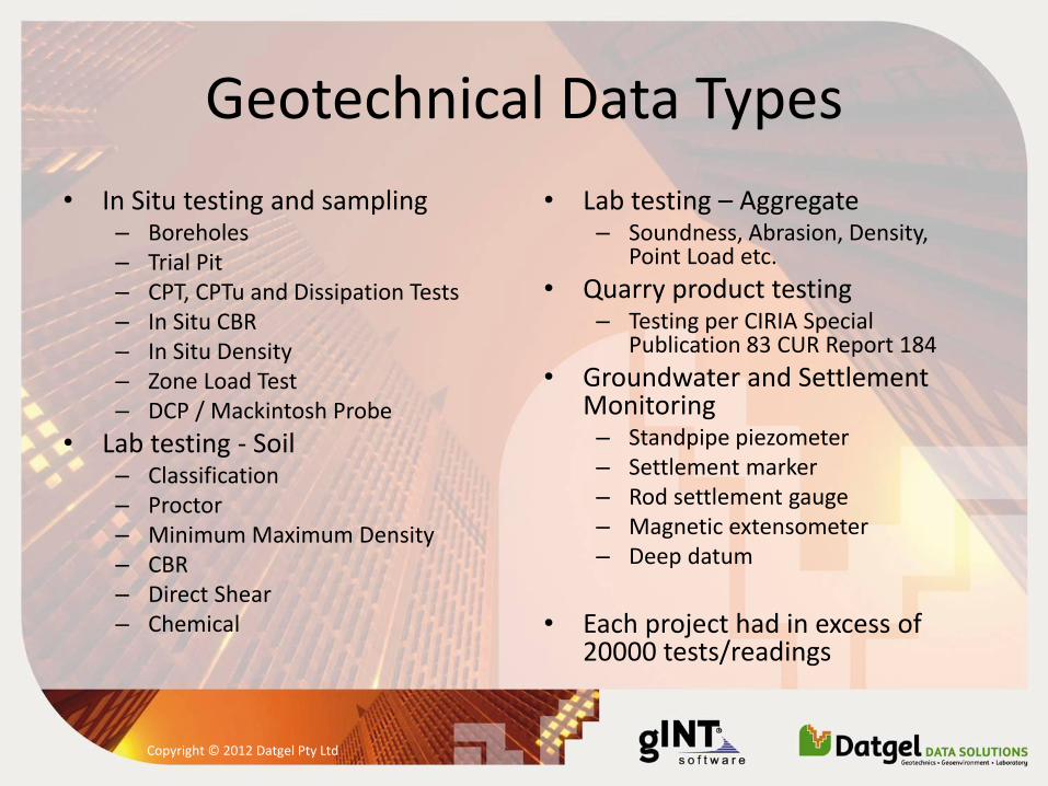
Geotechnical Data Types
• In Situ testing and sampling – Boreholes – Trial Pit – CPT, CPTu and Dissipation Tests – In Situ CBR – In Situ Density – Zone Load Test – DCP / Mackintosh Probe
• Lab testing - Soil – Classification – Proctor – Minimum Maximum Density – CBR – Direct Shear – Chemical
• Lab testing – Aggregate – Soundness, Abrasion, Density,
Point Load etc.
• Quarry product testing – Testing per CIRIA Special
Publication 83 CUR Report 184
• Groundwater and Settlement Monitoring – Standpipe piezometer – Settlement marker – Rod settlement gauge – Magnetic extensometer – Deep datum
• Each project had in excess of
20000 tests/readings
Copyright © 2012 Datgel Pty Ltd
Geotechnical Data Management System (GDMS) Philosophy
• Store all of geotechnical data types, and calculate or manipulate the test parameters based on the raw data, metadata and calibration data.
• The advantages of this type of system are: – All data is stored in one central relational database, making it
easier to find and use data – Data is entered only once which minimises the risk of
transcription errors – Negates the need to import data calculated by a second
software application (e.g. Excel) – It gives more confidence in the correctness of the calculations,
as opposed to numerous individual spreadsheet files.
Copyright © 2012 Datgel Pty Ltd
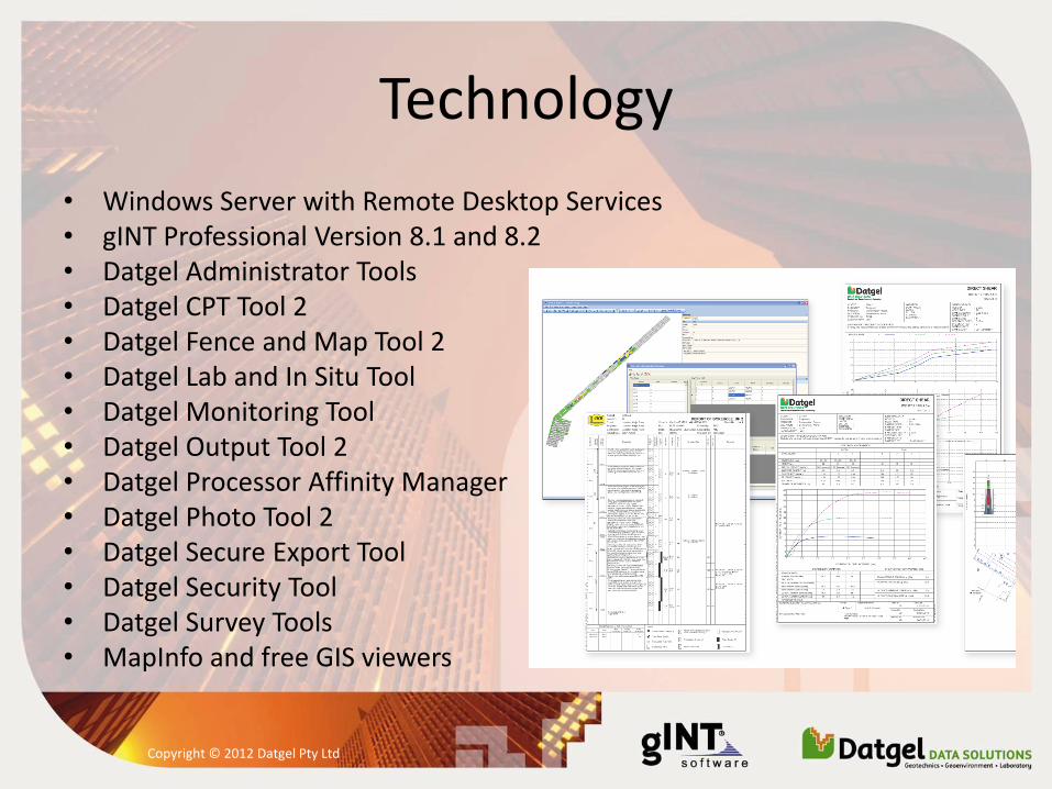
Technology
• Windows Server with Remote Desktop Services • gINT Professional Version 8.1 and 8.2 • Datgel Administrator Tools • Datgel CPT Tool 2 • Datgel Fence and Map Tool 2 • Datgel Lab and In Situ Tool • Datgel Monitoring Tool • Datgel Output Tool 2 • Datgel Processor Affinity Manager • Datgel Photo Tool 2 • Datgel Secure Export Tool • Datgel Security Tool • Datgel Survey Tools • MapInfo and free GIS viewers
Copyright © 2012 Datgel Pty Ltd
Implementation and Support
• Development and support done on site and in Sydney.
• NDIA included Leeke Associates (UK) and gINT Software (USA).
• A lead analyst programmer with geotechnical knowledge on site improved the quality and speed of the system delivery – this was integral to the success of the software project.
• The first project required site time of around 3 months over 3 years, the most recent project required one site visit of 3 weeks.
• Addition of new product features in gINT and Datgel applications.
• Custom programming in VB.NET and C#.
• Support provided using phone, email, Skype, Webex which allowed us to remote control the site computers.
Copyright © 2012 Datgel Pty Ltd
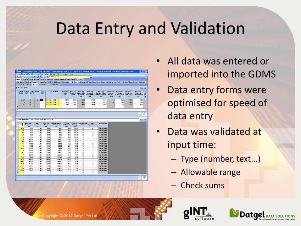
Data Entry and Validation
• All data was entered or imported into the GDMS
• Data entry forms were optimised for speed of data entry
• Data was validated at input time:
– Type (number, text...)
– Allowable range
– Check sums
Copyright © 2012 Datgel Pty Ltd
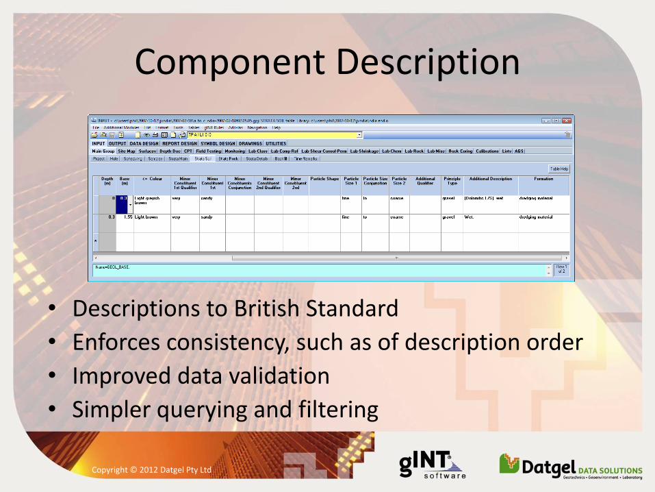
Component Description
• Descriptions to British Standard
• Enforces consistency, such as of description order
• Improved data validation
• Simpler querying and filtering
Copyright © 2012 Datgel Pty Ltd
Specification Checks
• Automatically checked result requirement for a fill type
• Result acceptability visible to the user in the database
• Result acceptability printed on report
Copyright © 2012 Datgel Pty Ltd
Data Security and Approval
• The system ensured unapproved data was not provided electronically to the Engineer
• Restricted edit access to the data once it was approved
• Each PointID and test was assigned a status
• Each user was assigned to a user group with differing access rights
• Time saving tools were implemented to assist in approving data
Copyright © 2012 Datgel Pty Ltd
Surface and Original Ground Elevation Calculation
• When reviewing CPT results it was critical to know if the material was natural or fill.
• Initially this was done by referring to paper maps, however many thousands of CPTs were planned.
• The GDMS automated this task by importing the survey surface data, and automatically interpolating the original elevation for each CPT location.
Copyright © 2012 Datgel Pty Ltd
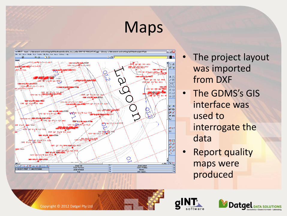
Maps
• The project layout was imported from DXF
• The GDMS’s GIS interface was used to interrogate the data
• Report quality maps were produced
Copyright © 2012 Datgel Pty Ltd
• Fence diagrams – Used to interpret data below sensitive structures
• Automatic lab descriptions – Lab samples were automatically described to
British Standard using the GDMS (based on PSD and Atterberg results)
• Custom Data Import Functions – CPT data directly from the CPT manufacturer’s
format
– Zone load test data logger files
– Excel
Copyright © 2012 Datgel Pty Ltd
Standard Reporting
• The GDMS produced all the standard reports for the geotechnical in situ, lab and monitoring data... >100 reports
• Filtering at output time allowed users to print data in certain areas, date ranges, geology types and/or results ranges
• Scripting of output runs were used for repetitive tasks and periodic reporting, such as monthly monitoring reports
Copyright © 2012 Datgel Pty Ltd
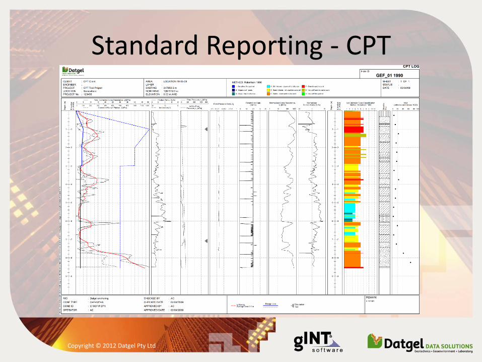
Standard Reporting - CPT
Copyright © 2012 Datgel Pty Ltd
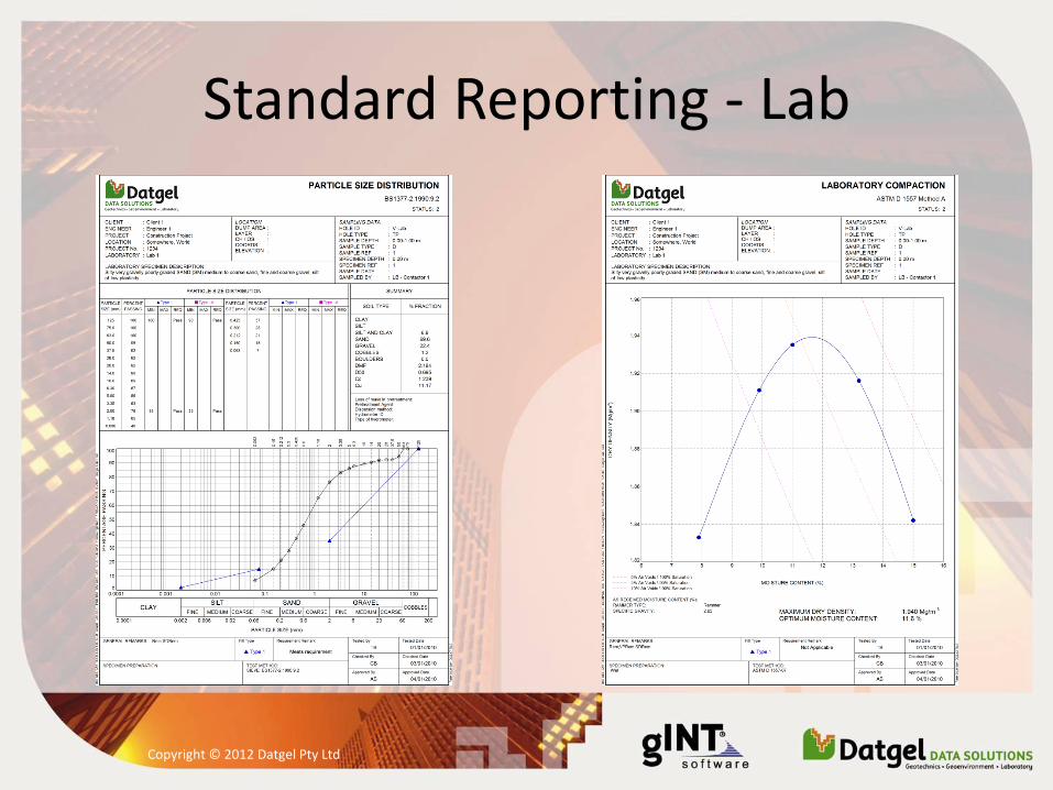
Standard Reporting - Lab
Copyright © 2012 Datgel Pty Ltd
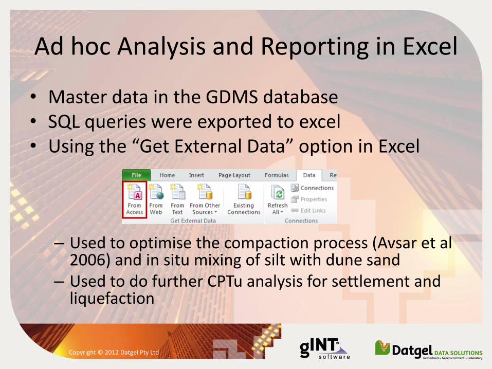
Ad hoc Analysis and Reporting in Excel
• Master data in the GDMS database • SQL queries were exported to excel • Using the “Get External Data” option in Excel
– Used to optimise the compaction process (Avsar et al
2006) and in situ mixing of silt with dune sand – Used to do further CPTu analysis for settlement and
liquefaction
Copyright © 2012 Datgel Pty Ltd
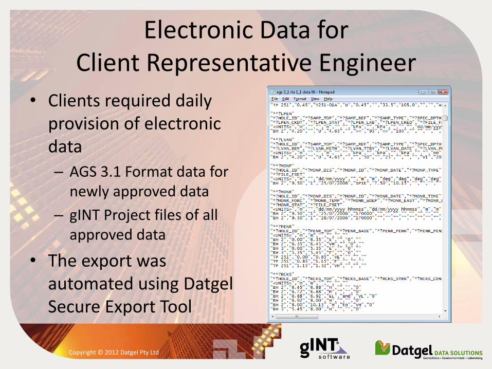
Electronic Data for Client Representative Engineer
• Clients required daily provision of electronic data
– AGS 3.1 Format data for newly approved data
– gINT Project files of all approved data
• The export was automated using Datgel Secure Export Tool
Copyright © 2012 Datgel Pty Ltd
Conclusions
• Enter data once and use it in many ways
• Managing, calculate, report and transfer geotechnical data from one system
• An efficient data management system will require less geotechnical engineers
• Our solution turned data into information for the contractor and client users.
• The efficient system allowed the contractor's geotechnical department to keep up with reporting for more than 4 million m³ per month of fill.
Copyright © 2012 Datgel Pty Ltd
Update on Geotechnical Data Interchange
• AGS Format is the most common geotechnical data interchange standard in use internationally. Developed in the UK by The Association of Geotechnical and Geoenvironmental Specialists.
• GEF, Geotechnical Exchange Format, developed in The Netherlands is used in Benelux for borehole data, and used world wide of CPT data.
• SGF, Swedish Geotechnical Format, is used in Sweden to interchange a range of in situ and lab testing data. Internationally it is used to interchange CPT data.
• DIGGS, Data Interchange for Geotechnical and GeoEnvironmental Specialists. XML and GML based standard, still under development and has not been used.
Copyright © 2012 Datgel Pty Ltd
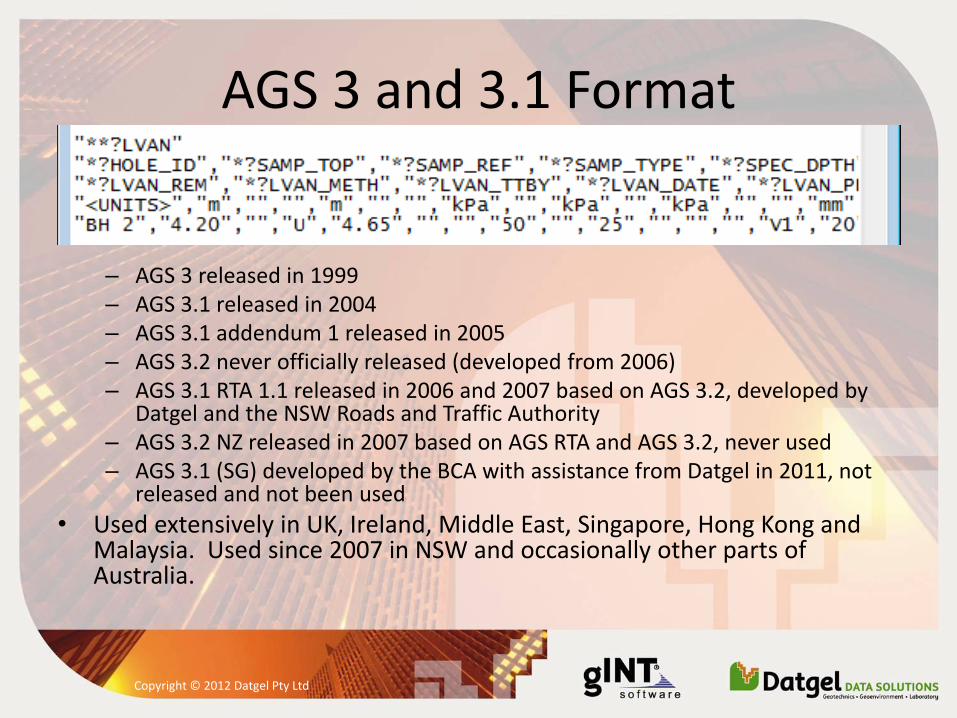
AGS 3 and 3.1 Format
– AGS 3 released in 1999 – AGS 3.1 released in 2004 – AGS 3.1 addendum 1 released in 2005 – AGS 3.2 never officially released (developed from 2006) – AGS 3.1 RTA 1.1 released in 2006 and 2007 based on AGS 3.2, developed by
Datgel and the NSW Roads and Traffic Authority – AGS 3.2 NZ released in 2007 based on AGS RTA and AGS 3.2, never used – AGS 3.1 (SG) developed by the BCA with assistance from Datgel in 2011, not
released and not been used
• Used extensively in UK, Ireland, Middle East, Singapore, Hong Kong and Malaysia. Used since 2007 in NSW and occasionally other parts of Australia.
Copyright © 2012 Datgel Pty Ltd
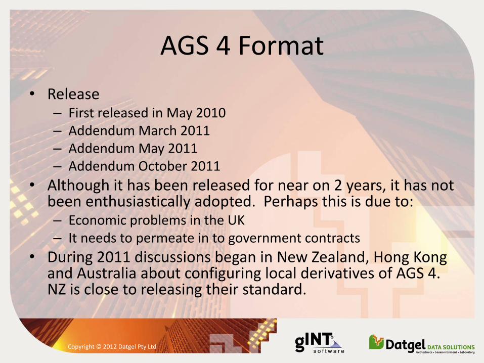
AGS 4 Format
• Release – First released in May 2010 – Addendum March 2011 – Addendum May 2011 – Addendum October 2011
• Although it has been released for near on 2 years, it has not been enthusiastically adopted. Perhaps this is due to: – Economic problems in the UK – It needs to permeate in to government contracts
• During 2011 discussions began in New Zealand, Hong Kong and Australia about configuring local derivatives of AGS 4. NZ is close to releasing their standard.
Copyright © 2012 Datgel Pty Ltd
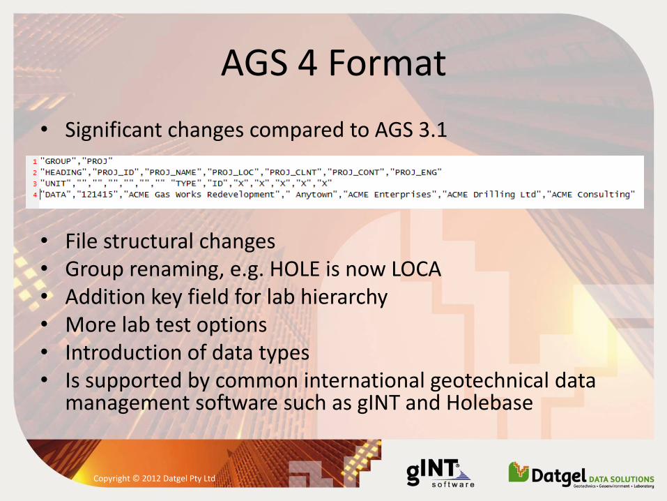
AGS 4 Format
• Significant changes compared to AGS 3.1
• File structural changes • Group renaming, e.g. HOLE is now LOCA • Addition key field for lab hierarchy • More lab test options • Introduction of data types • Is supported by common international geotechnical data
management software such as gINT and Holebase
Copyright © 2012 Datgel Pty Ltd
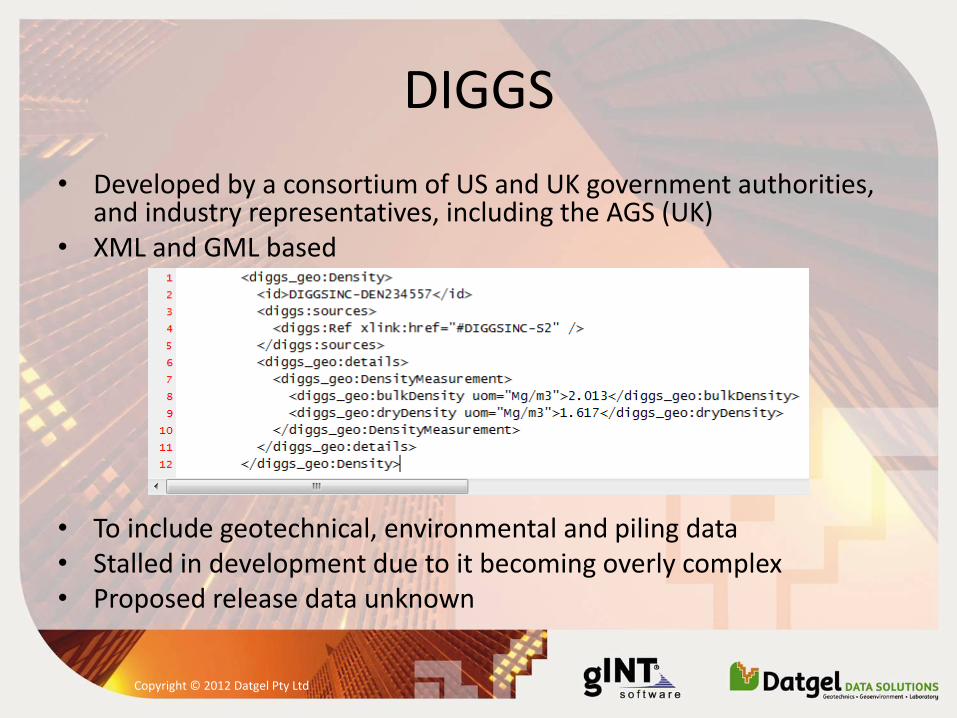
DIGGS
• Developed by a consortium of US and UK government authorities, and industry representatives, including the AGS (UK)
• XML and GML based
• To include geotechnical, environmental and piling data • Stalled in development due to it becoming overly complex • Proposed release data unknown
Copyright © 2012 Datgel Pty Ltd
Conclusions
• DIGGS maybe an option in the future, but is not in a usable form now
• AGS 4 is the best published interchange standard available
• AGS 3.1 (SG) has been designed for Singapore practice, and will satisfy existing requirements
Copyright © 2012 Datgel Pty Ltd