geotagging+ar
TRANSCRIPT
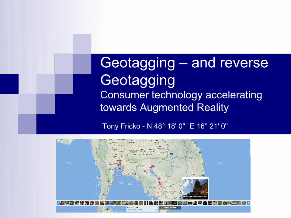
Geotagging – and reverse GeotaggingConsumer technology accelerating towards Augmented Reality
Tony Fricko - N 48° 18' 0'' E 16° 21' 0''
Geotagging & AR - Tony Fricko 2July 28th 2010
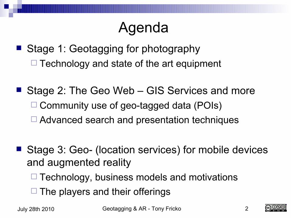
Agenda Stage 1: Geotagging for photography
Technology and state of the art equipment
Stage 2: The Geo Web – GIS Services and more Community use of geo-tagged data (POIs) Advanced search and presentation techniques
Stage 3: Geo- (location services) for mobile devices and augmented reality Technology, business models and motivations The players and their offerings
Geotagging & AR - Tony Fricko 3July 28th 2010
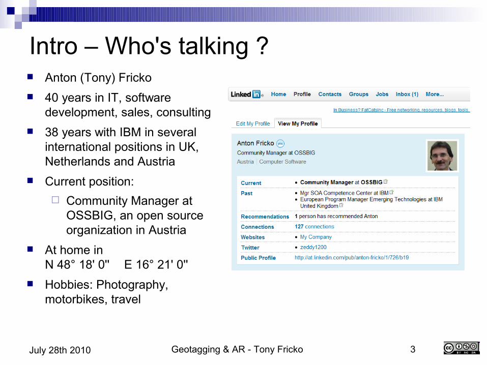
Intro – Who's talking ? Anton (Tony) Fricko 40 years in IT, software
development, sales, consulting 38 years with IBM in several
international positions in UK, Netherlands and Austria
Current position: Community Manager at
OSSBIG, an open source organization in Austria
At home inN 48° 18' 0'' E 16° 21' 0''
Hobbies: Photography, motorbikes, travel

Geotagging & AR - Tony Fricko 4July 28th 2010
Stage 1 – Geotagging for photographers
What we need:Digital Camera equipmentGPS TrackerSynchronisation toolsVisualisation (map services)
Geotagging & AR - Tony Fricko 5July 28th 2010
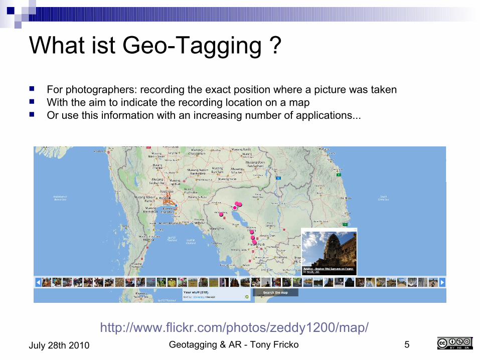
What ist Geo-Tagging ? For photographers: recording the exact position where a picture was taken With the aim to indicate the recording location on a map Or use this information with an increasing number of applications...
http://www.flickr.com/photos/zeddy1200/map/
Geotagging & AR - Tony Fricko 6July 28th 2010
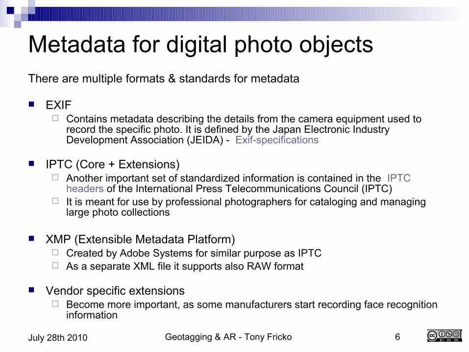
Metadata for digital photo objectsThere are multiple formats & standards for metadata
EXIF
Contains metadata describing the details from the camera equipment used to record the specific photo. It is defined by the Japan Electronic Industry Development Association (JEIDA) - Exif-specifications
IPTC (Core + Extensions) Another important set of standardized information is contained in the IPTC
headers of the International Press Telecommunications Council (IPTC) It is meant for use by professional photographers for cataloging and managing
large photo collections
XMP (Extensible Metadata Platform) Created by Adobe Systems for similar purpose as IPTC As a separate XML file it supports also RAW format
Vendor specific extensions Become more important, as some manufacturers start recording face recognition
information
Geotagging & AR - Tony Fricko 7July 28th 2010
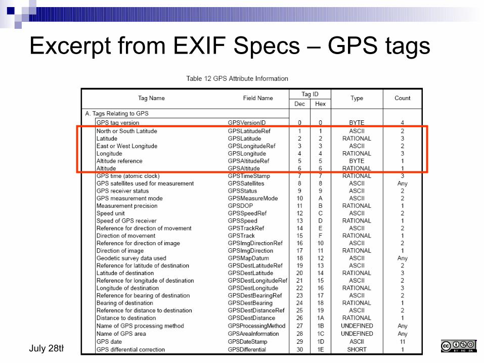
Excerpt from EXIF Specs – GPS tags
Geotagging & AR - Tony Fricko 8July 28th 2010
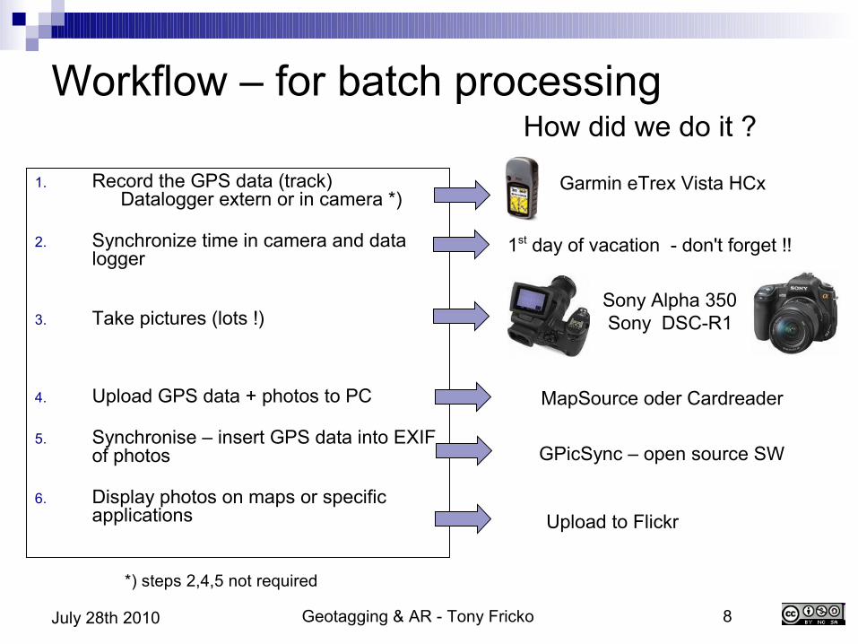
Workflow – for batch processing
1. Record the GPS data (track)Datalogger extern or in camera *)
2. Synchronize time in camera and data logger
3. Take pictures (lots !)
4. Upload GPS data + photos to PC
5. Synchronise – insert GPS data into EXIF of photos
6. Display photos on maps or specific applications
*) steps 2,4,5 not required
How did we do it ?
Garmin eTrex Vista HCx
1st day of vacation - don't forget !!
Sony Alpha 350 Sony DSC-R1
MapSource oder Cardreader
GPicSync – open source SW
Upload to Flickr
Geotagging & AR - Tony Fricko 9July 28th 2010
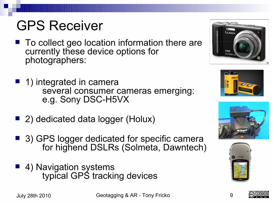
GPS Receiver To collect geo location information there are
currently these device options for photographers:
1) integrated in cameraseveral consumer cameras emerging:e.g. Sony DSC-H5VX
2) dedicated data logger (Holux)
3) GPS logger dedicated for specific camerafor highend DSLRs (Solmeta, Dawntech)
4) Navigation systemstypical GPS tracking devices
Geotagging & AR - Tony Fricko 10July 28th 2010
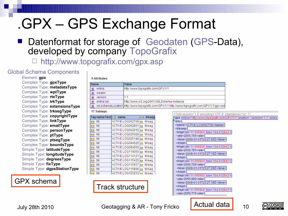
.GPX – GPS Exchange Format Datenformat for storage of Geodaten (GPS-Data),
developed by company TopoGrafix http://www.topografix.com/gpx.asp
Global Schema Components Element: gpx Complex Type: gpxType Complex Type: metadataType Complex Type: wptType Complex Type: rteType Complex Type: trkType Complex Type: extensionsType Complex Type: trksegType Complex Type: copyrightType Complex Type: linkType Complex Type: emailType Complex Type: personType Complex Type: ptType Complex Type: ptsegType Complex Type: boundsType Simple Type: latitudeType Simple Type: longitudeType Simple Type: degreesType Simple Type: fixType Simple Type: dgpsStationType
GPX schemaTrack structure
Actual data
Geotagging & AR - Tony Fricko 11July 28th 2010
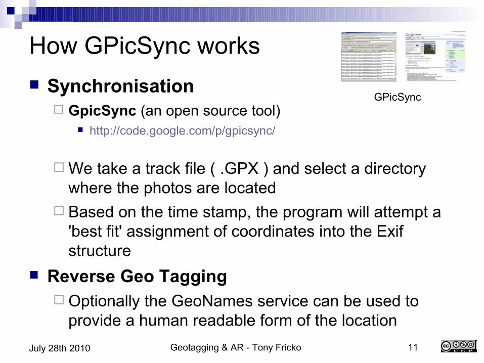
How GPicSync works Synchronisation
GpicSync (an open source tool) http://code.google.com/p/gpicsync/
We take a track file ( .GPX ) and select a directory where the photos are located
Based on the time stamp, the program will attempt a 'best fit' assignment of coordinates into the Exif structure
Reverse Geo Tagging Optionally the GeoNames service can be used to
provide a human readable form of the location
GPicSync
Geotagging & AR - Tony Fricko 12July 28th 2010
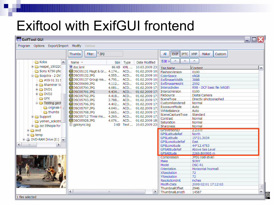
Exiftool with ExifGUI frontend
Geotagging & AR - Tony Fricko 13July 28th 2010
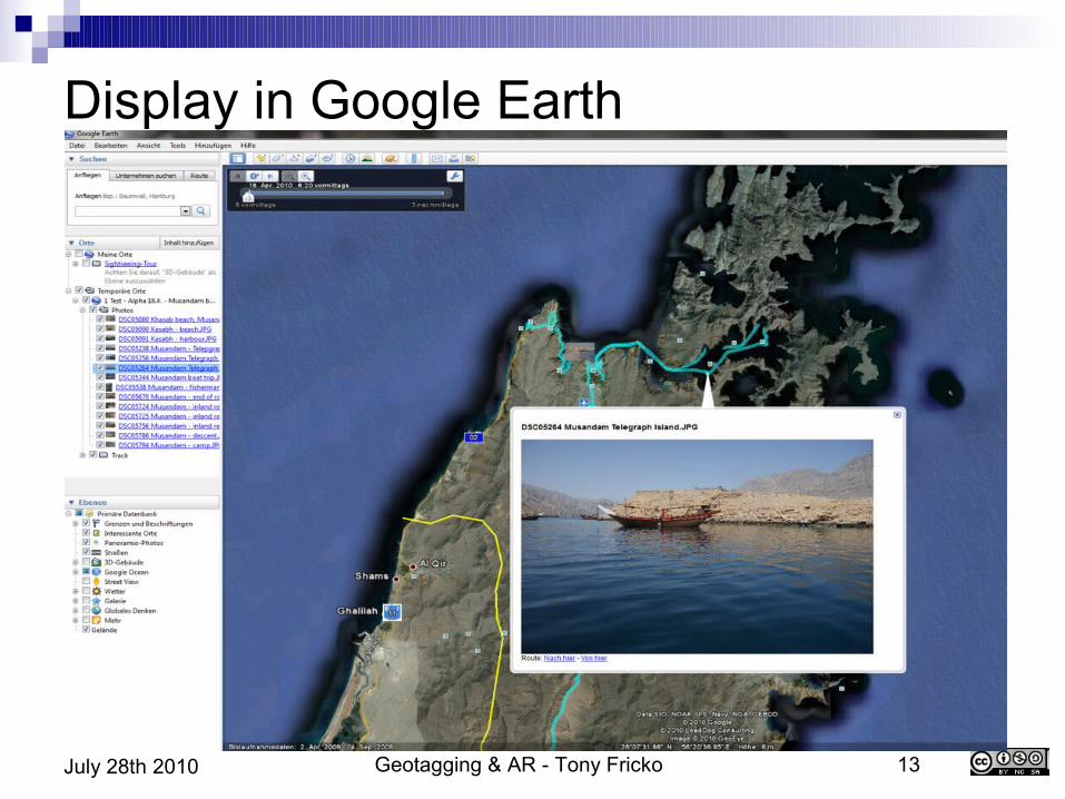
Display in Google Earth

Geotagging & AR - Tony Fricko 14July 28th 2010
Reverse Geo-Tagging GeoNames
A geographical database that contains more than 8 mill entries
Provides multiple web services interfaces (XML, JSON, etc) to search and convert coordinates into placenames
e.g. N 48° 18' 0''E 16° 21' 0'' into Langenzersdorf, Austria
http://www.geonames.org
Geotagging & AR - Tony Fricko 15July 28th 2010
Stage 2 – maps and layers - GeoWeb
So far we looked at geo-tagging photos and placed them on multiple map sources as featured objects
We now dive a bit deeper into how these geo-tagged objects are managed and what technology is used for mapping.
The big buildung blocks are: Base map + Geo-tagged objects (features) + Layering technology (for aggregation) + Browser for visualisation
Geotagging & AR - Tony Fricko 16July 28th 2010
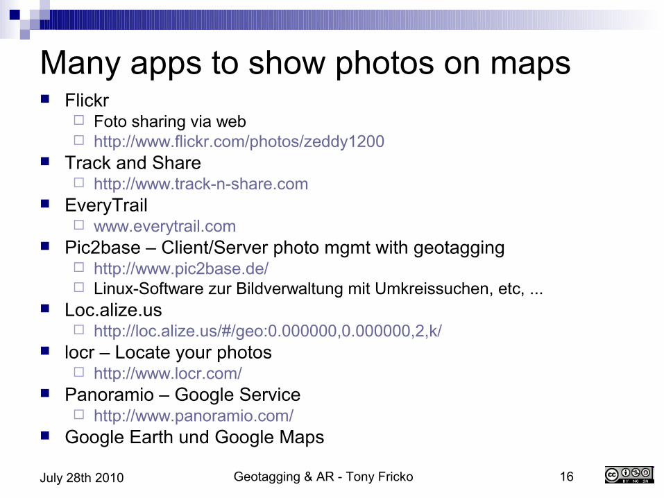
Many apps to show photos on maps Flickr
Foto sharing via web http://www.flickr.com/photos/zeddy1200
Track and Share http://www.track-n-share.com
EveryTrail www.everytrail.com
Pic2base – Client/Server photo mgmt with geotagging http://www.pic2base.de/ Linux-Software zur Bildverwaltung mit Umkreissuchen, etc, ...
Loc.alize.us http://loc.alize.us/#/geo:0.000000,0.000000,2,k/
locr – Locate your photos http://www.locr.com/
Panoramio – Google Service http://www.panoramio.com/
Google Earth und Google Maps
Geotagging & AR - Tony Fricko 17July 28th 2010
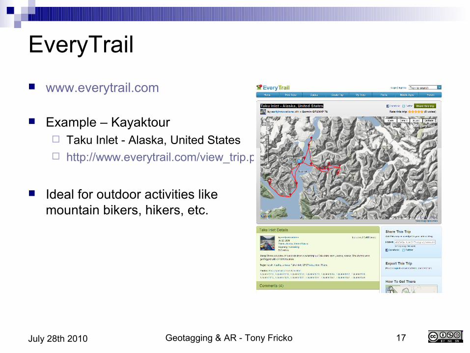
EveryTrail www.everytrail.com
Example – Kayaktour Taku Inlet - Alaska, United States http://www.everytrail.com/view_trip.php?trip_id=47048
Ideal for outdoor activities like mountain bikers, hikers, etc.
Geotagging & AR - Tony Fricko 18July 28th 2010
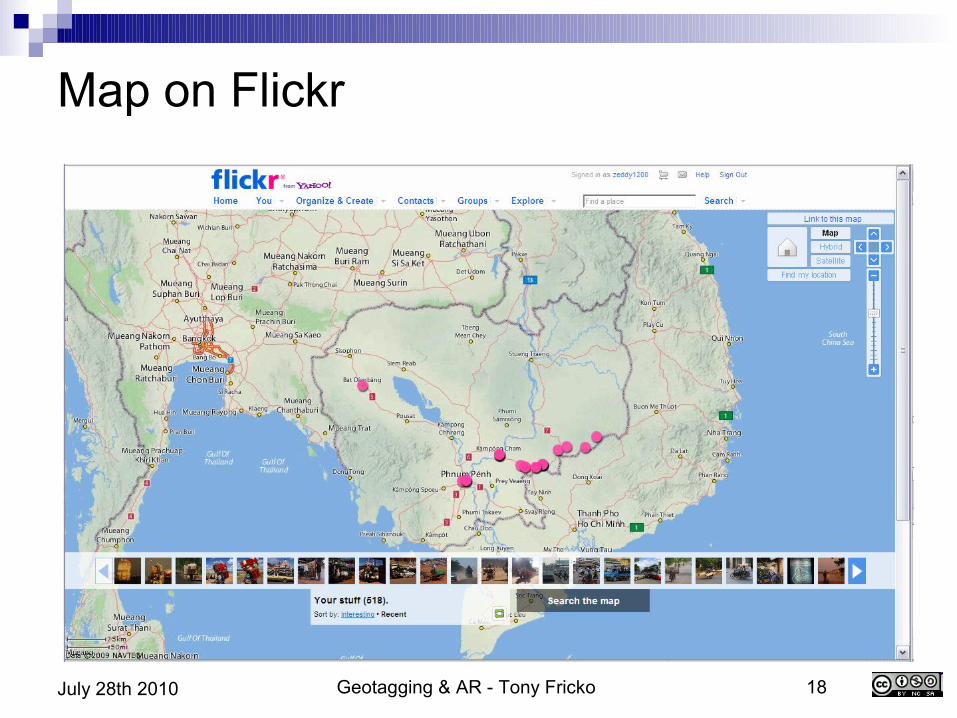
Map on Flickr
Geotagging & AR - Tony Fricko 19July 28th 2010
Search for photos by location CDWinder – Media DB for Windows CDFinder – Media DB for Mac
Can search for photos within a predefined range ( xx miles ) http://www.cdfinder.de/de/de/de/geotagging.html
Useful e.g. when multiple visits to a city, e.g. Quito
Integration in GIS DB UK decided to open the maps of Ordonance Survey http://openspace.ordnancesurvey.co.uk/openspace/
And more personalized services: Face recognition + location combined !
Geotagging & AR - Tony Fricko 20July 28th 2010
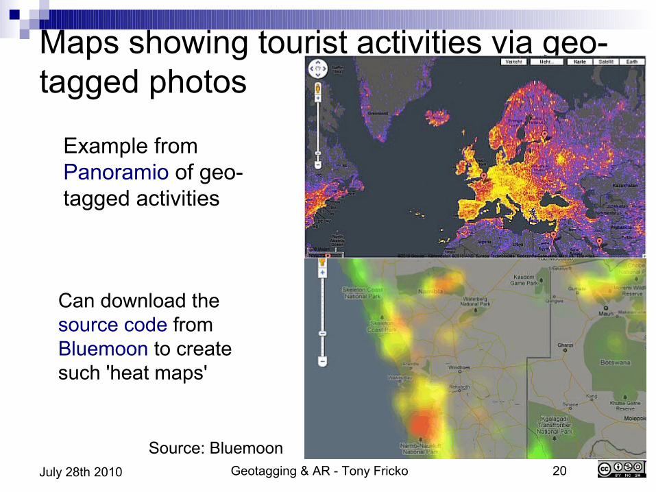
Maps showing tourist activities via geo-tagged photos
Example from Panoramio of geo-tagged activities
Can download the source code from Bluemoon to create such 'heat maps'
Source: Bluemoon
Geotagging & AR - Tony Fricko 21July 28th 2010
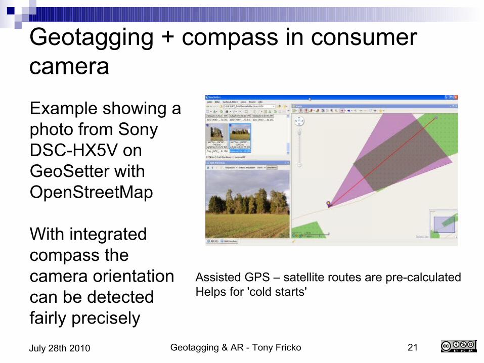
Geotagging + compass in consumer cameraExample showing a photo from Sony DSC-HX5V on GeoSetter with OpenStreetMap
With integrated compass the camera orientation can be detected fairly precisely
Assisted GPS – satellite routes are pre-calculatedHelps for 'cold starts'
Geotagging & AR - Tony Fricko 22July 28th 2010
Wikipedia and related crowd sourcing efforts Wikipedia
Wiki Projects Geography WikiProject Geographical coordinates
Collection of a series of projects to correlate knowledge (articles) with a geo reference
One result is the offer of Web services to respond to queries like: Give me all articles in the vicinity of 0.5km given the
current location coordinates (long/lat) Wikipedia Geocoding Web Service

Geotagging & AR - Tony Fricko 23July 28th 2010
GeoHack Map Services
Krasnoyarsk Hydroelectric Dam
●A great example for global and local services
●All maps can be displayed by a single click
Source: Wikipedia
Geotagging & AR - Tony Fricko 24July 28th 2010
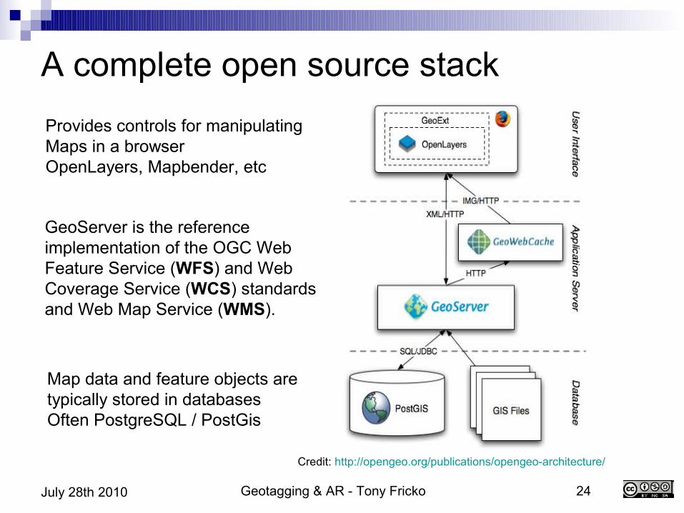
Credit: http://opengeo.org/publications/opengeo-architecture/
A complete open source stackProvides controls for manipulatingMaps in a browserOpenLayers, Mapbender, etc
GeoServer is the reference implementation of the OGC Web Feature Service (WFS) and Web Coverage Service (WCS) standards and Web Map Service (WMS).
Map data and feature objects aretypically stored in databasesOften PostgreSQL / PostGis
Geotagging & AR - Tony Fricko 25July 28th 2010
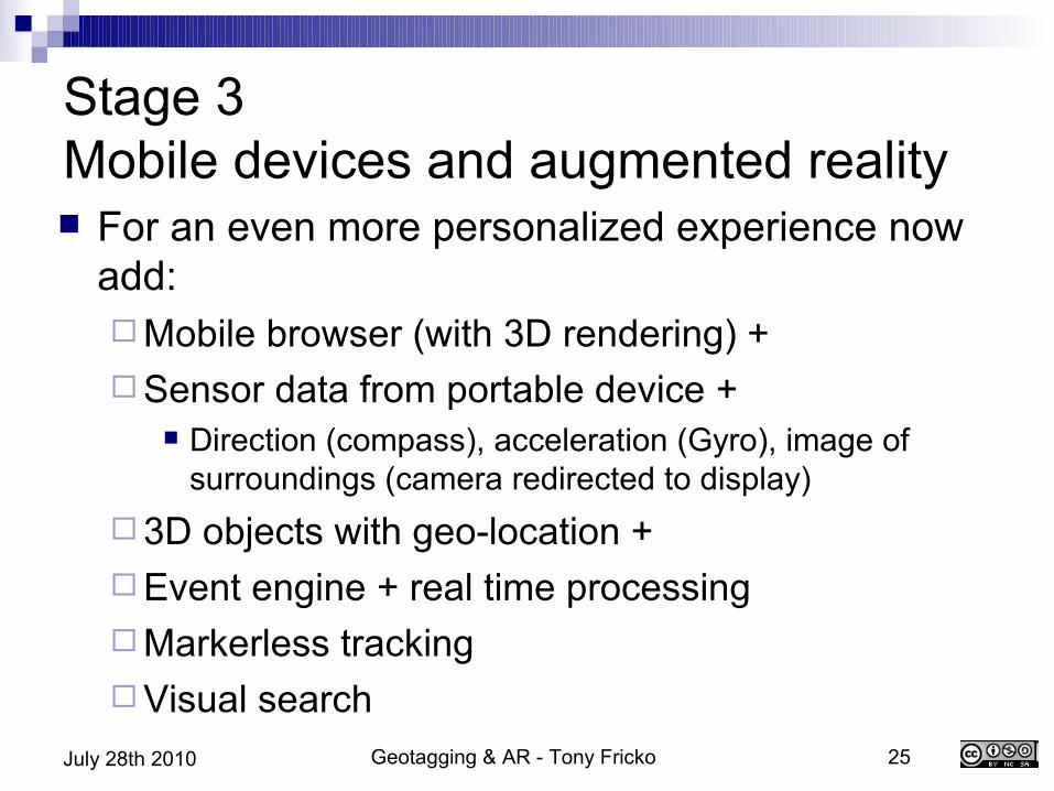
Stage 3Mobile devices and augmented reality For an even more personalized experience now
add:Mobile browser (with 3D rendering) +Sensor data from portable device +
Direction (compass), acceleration (Gyro), image of surroundings (camera redirected to display)
3D objects with geo-location +Event engine + real time processingMarkerless trackingVisual search
Geotagging & AR - Tony Fricko 26July 28th 2010
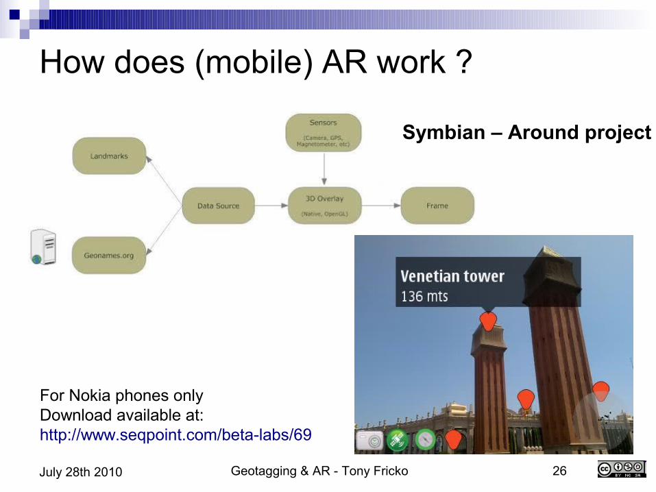
How does (mobile) AR work ?
For Nokia phones onlyDownload available at:http://www.seqpoint.com/beta-labs/69
Symbian – Around project
Geotagging & AR - Tony Fricko 27July 28th 2010
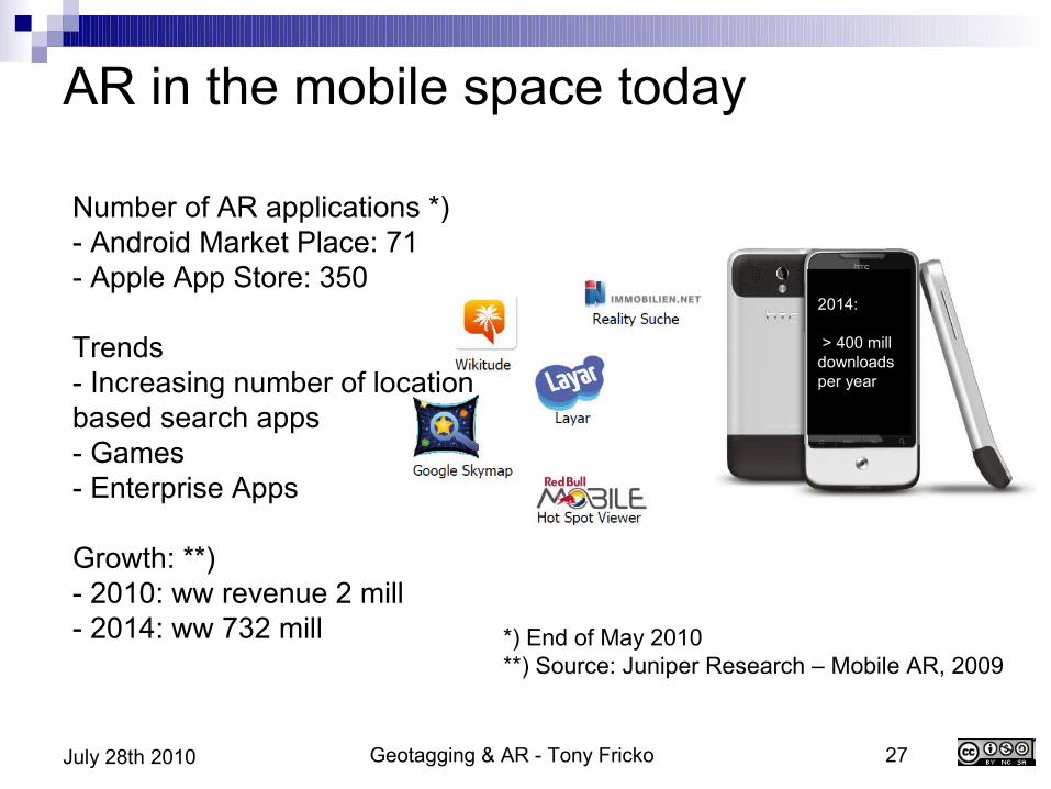
AR in the mobile space today
*) End of May 2010**) Source: Juniper Research – Mobile AR, 2009
Number of AR applications *)- Android Market Place: 71- Apple App Store: 350
Trends- Increasing number of location based search apps- Games- Enterprise Apps
Growth: **)- 2010: ww revenue 2 mill- 2014: ww 732 mill
2014:
> 400 mill downloadsper year
Geotagging & AR - Tony Fricko 28July 28th 2010
The players (and some examples..) Research projects / open source efforts
Frauenhofer Institut NavIT
Commercial startups / technology providers Wikitude Layar
Integrators / marketing industry Fjord Hoppala
Telecom / carrieres Qualcomm investment in AR lab in Vienna Telefonica, Telekom Austria, many others
Geotagging & AR - Tony Fricko 29July 28th 2010
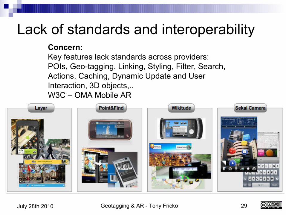
Lack of standards and interoperability Concern:Key features lack standards across providers:POIs, Geo-tagging, Linking, Styling, Filter, Search, Actions, Caching, Dynamic Update and User Interaction, 3D objects,..W3C – OMA Mobile AR
Geotagging & AR - Tony Fricko 30July 28th 2010
Layar – augmented reality browser..and business model Layar – a Dutch startup Extensive developer support
Open platform, everyboday can create Community generated content
Screened and hosted and owned by Layar > 1.500 contributors, 300 layers worldwide
Broad device support iPhone (store), Symbian, Android
Business Model Premium placement 'Branded' Browser
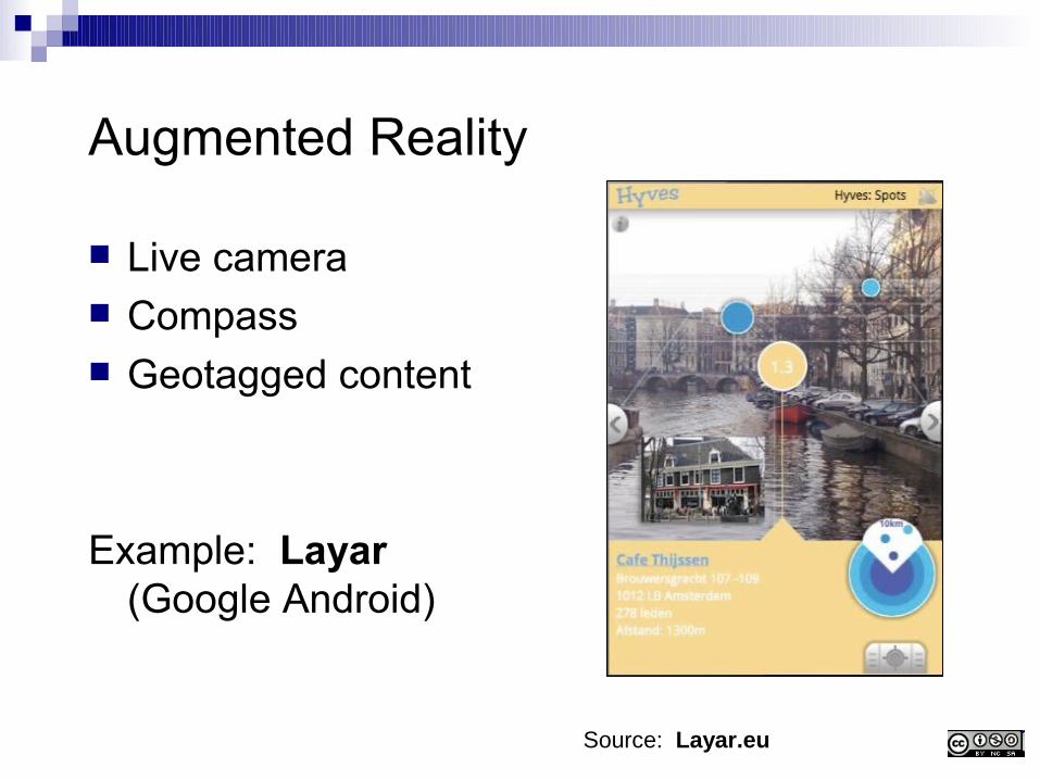
Augmented Reality
Live camera Compass Geotagged content
Example: Layar (Google Android)
Source: Layar.eu
Geotagging & AR - Tony Fricko 32July 28th 2010
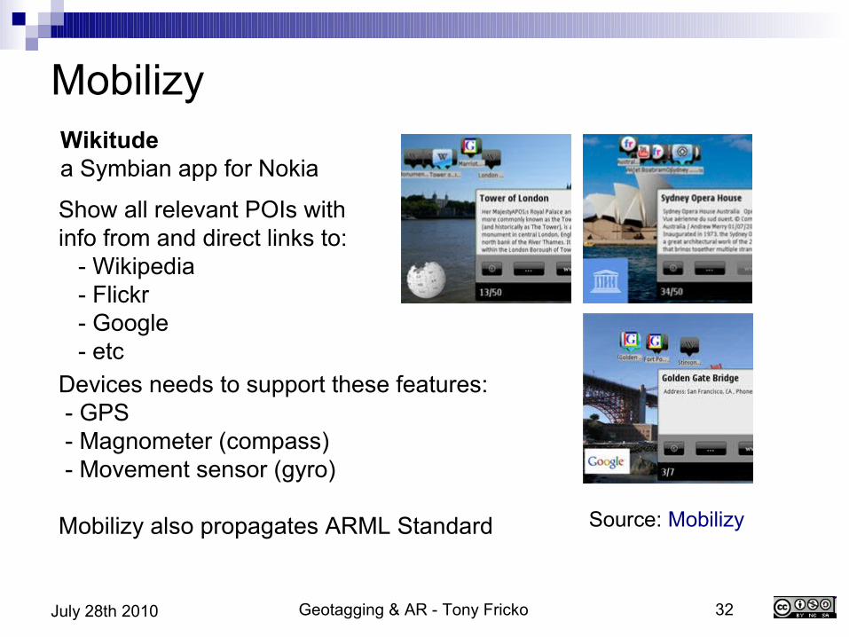
Mobilizy
Devices needs to support these features: - GPS - Magnometer (compass) - Movement sensor (gyro)
Mobilizy also propagates ARML Standard
Show all relevant POIs with info from and direct links to: - Wikipedia - Flickr - Google - etc
Source: Mobilizy
Wikitudea Symbian app for Nokia
Geotagging & AR - Tony Fricko 33July 28th 2010
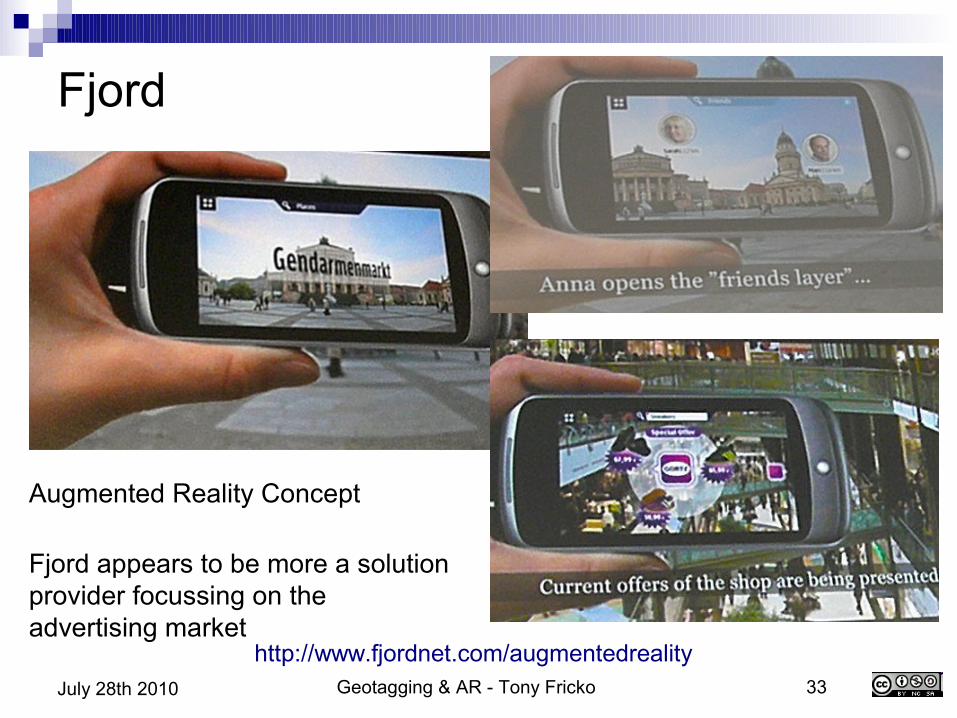
Fjord
Augmented Reality Concept
Fjord appears to be more a solution provider focussing on the advertising market
http://www.fjordnet.com/augmentedreality

Geotagging & AR - Tony Fricko 34July 28th 2010
Outlook and business potential AR will provide multi million Dollar business on mobile
devices... Windsor Holden from Juniper Research predicts 730 mill Dlr
business for mobile advertising and marketing in the AR space by 2014 with 350 mill handsets enabled
Ice breakers will be location based searches on mobiles AR supported advertising
Odds: Unclear legal situation Device proliferation and lack of standards (may make the
development cost too high or create functional islands) 1st European AR conference: Berlin, April 2010 Mobile AR Summit 2010 @ MWC, Barcelona Feb 2010 ARE 2010, US June 2010
Geotagging & AR - Tony Fricko 35July 28th 2010
Summary – Consumer driven development based on geotagging Photography
Consumer cameras with increased functionality re geo-tagging More applications to exploit, incl. Face recognition and social network
apps Mapping
Data representation and analysis often easier to consume in geographical context
Geo-tagged material and freely available maps on the increase Mobile applications
The next big battle ground (search/find, marketing, games, social networks)
High-end device manufacturers and telecoms looking for killer apps and new revenue sources
Consumer driven by 'desirability' and convenience
Geotagging & AR - Tony Fricko 36July 28th 2010
This is a shortened version of some more comprehensive material, which will be published on Slideshare after the GeoWeb 2010 Conference