geospatial capabilities for homeland security · office of the chief information officer 11/08/2013...
TRANSCRIPT
Office of the Chief Information Officer 11/08/2013 1
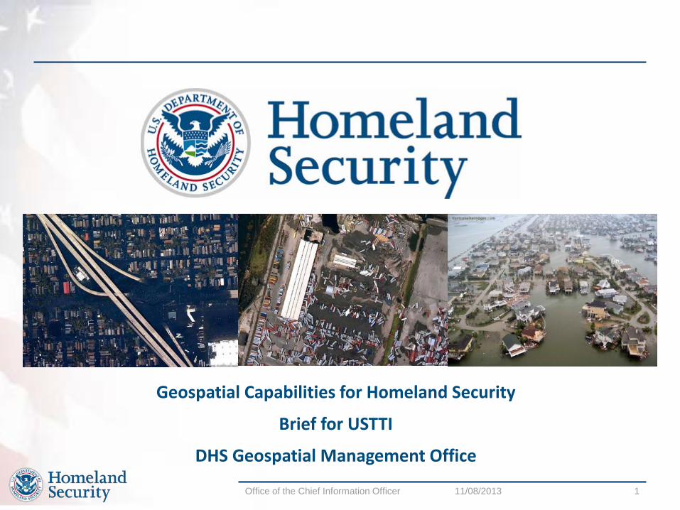
Geospatial Capabilities for Homeland Security
Brief for USTTI
DHS Geospatial Management Office

Office of the Chief Information Officer 11/08/2013 2
Agenda
• GMO Overview • GMO Activities • Real World Use Cases • Questions

Office of the Chief Information Officer 11/08/2013 3
Geospatial Management Office (GMO) : Overview Authorities
• Established by the Intelligence Reform and Terrorism Prevention act of 2004 TITLE
VII, Subtitle B, Section 8201, HOMELAND SECURITY GEOSPATIAL INFORMATION • Implemented through DHS Management Directive 4030 Structure • Reports to the DHS Chief Information Officer • Internal & external governance
• Open Geospatial Consortium • Federal Geographic Data Committee • INCITS L3 • Internal DHS Executive Steering Committees
• Liaisons with • DHS Science and Technology • Program Manager for Information Sharing Environment • National Protection and Programs Directorate • National Geospatial-Intelligence Agency

Office of the Chief Information Officer 11/08/2013 4
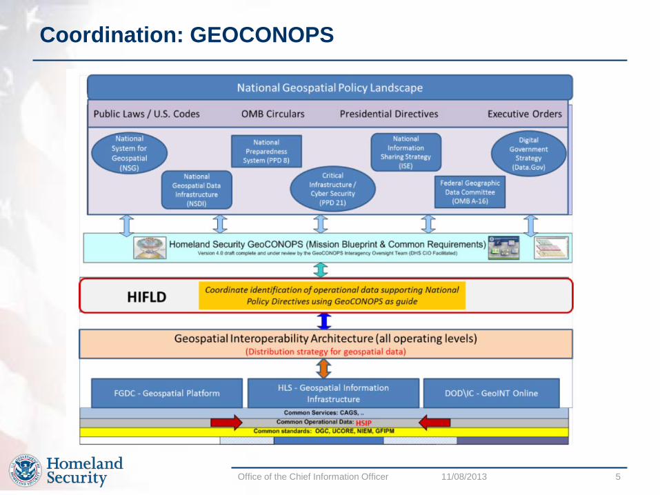
Activities to support Homeland Security Area Description Outcomes Coordination Work with all mission partners to
establish trusted / authoritative sources of geospatial data, assure interoperability, provide best practices, and mission coordination
• Homeland Security Geospatial Concept of Operations developed • Incorporated under PPD-8 National Preparedness framework • Supports Section 515 of the Homeland Security Act
• Developing DHS unclassified capability on the Federal GeoPlatform • Working with the National System for Geospatial Intelligence, the
Federal Geographic Data Committee and the White House Information Sharing Environment Office to define the architecture for CUI / SBU geospatial information sharing
Geospatial Data Provisioning
Provide access to common operating data and event / mission data to homeland security partners
• Developed agreed-on set of common operating data (COD) • Homeland Security Infrastructure Protection Gold data set • 450+ layers of information
• Divested or consolidated other data investments to avoid costs of over $10M per year since 2007
• Ongoing development of standards-based shared data services with mission partners
• Incident Imagery service (May, 2012)
Shared Geospatial Infrastructure
Establish shared geospatial infrastructure that can be leveraged by homeland security mission partners
• DHS Geospatial Information Infrastructure established • Data services (top ten services have been called 3 million times
in FY2012!!) • Geoanalytics • Visualization tools • Re-use of Homeland Security Information Network Identity and
Access Management controls
Geospatial Software Provisioning
Establish enterprise license agreements for geospatial software to support rapid deployment for incident response and reduce costs
• Agreements in place with ESRI, Google, MS Bing Maps • Over $30M in savings over GSA schedule since 2006
Office of the Chief Information Officer 11/08/2013 5
Coordination: GEOCONOPS

Office of the Chief Information Officer 11/08/2013 6
Coordination: GeoCONOPS
Office of the Chief Information Officer 11/08/2013 7
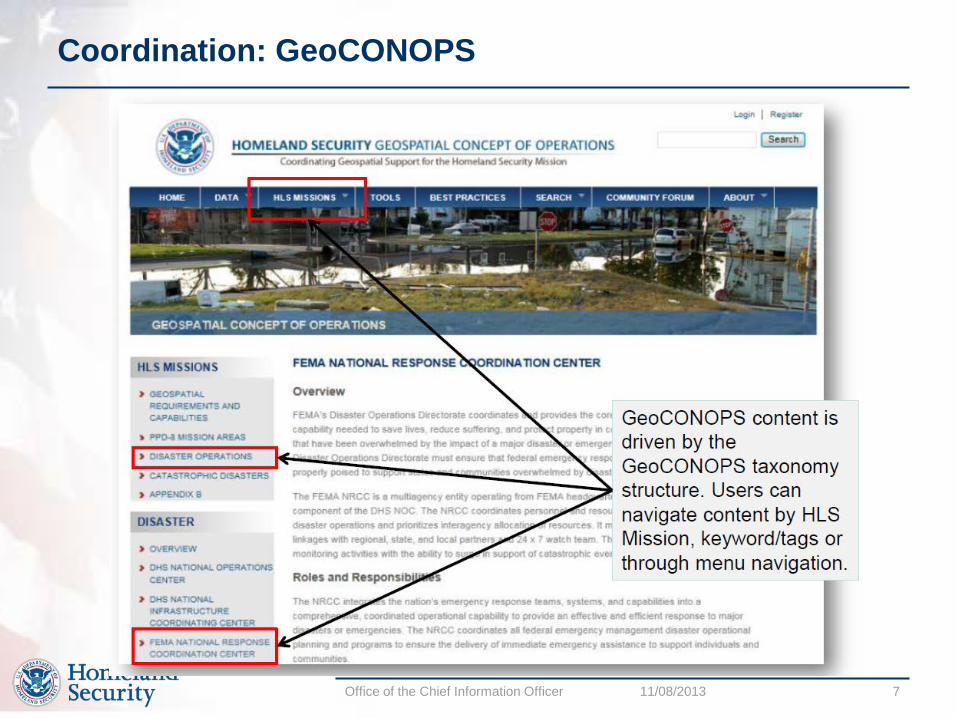
Coordination: GeoCONOPS
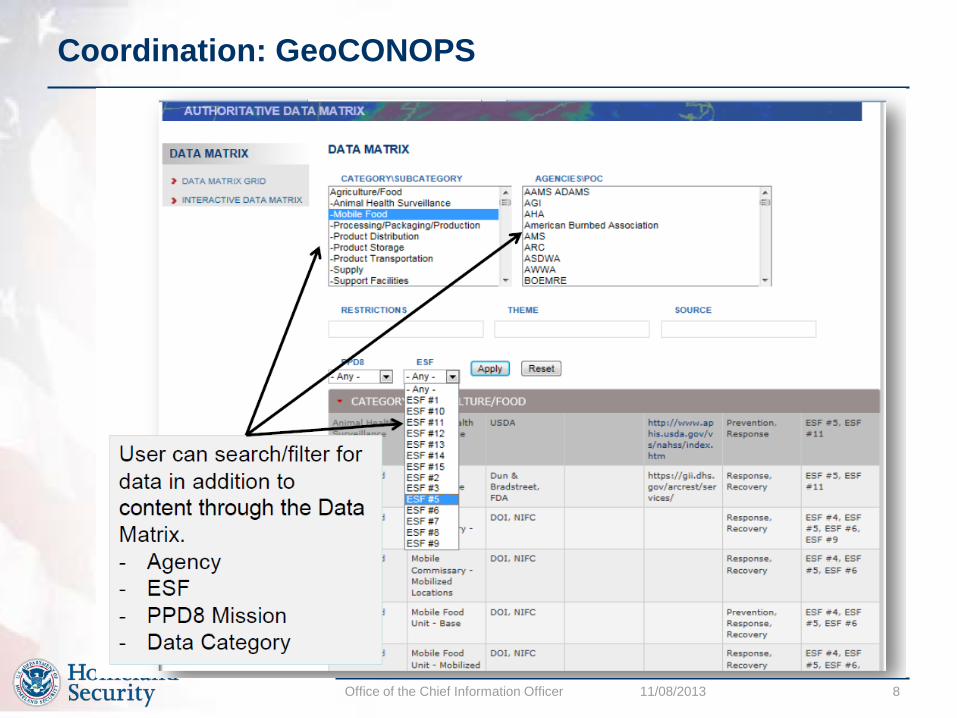
Office of the Chief Information Officer 11/08/2013 8
Coordination: GeoCONOPS
Office of the Chief Information Officer 11/08/2013 9
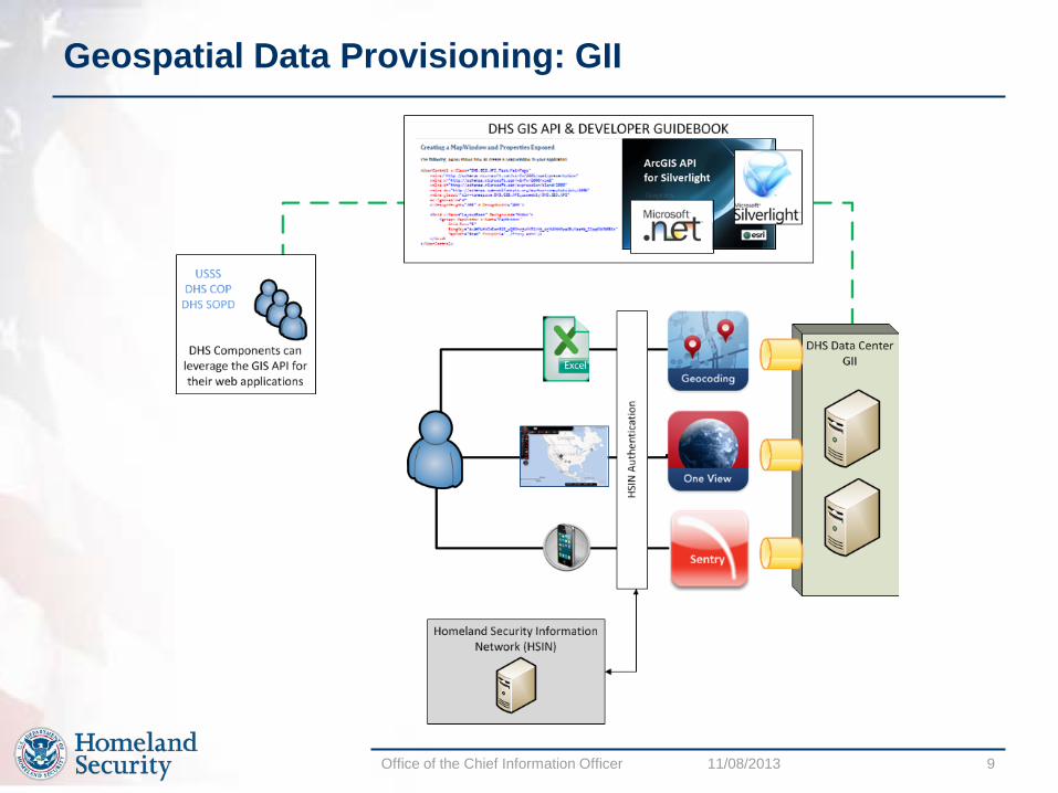
Geospatial Data Provisioning: GII

Office of the Chief Information Officer 11/08/2013 10
Geospatial Data Provisioning: GII

Office of the Chief Information Officer 11/08/2013 11
Geospatial Data Provisioning: GII

Office of the Chief Information Officer 11/08/2013 12
Shared Geospatial Infrastructure: Delivery Architecture
Key Points: The GII is physically located in the DHS Data Centers Accessible through the HSIN identity service Provides viewing tools, data and analytical services Supports the DHS COP and HSIN Supports User Defined Operating Pictures (UDOP) across the Homeland Security Enterprise
Office of the Chief Information Officer 11/08/2013 13
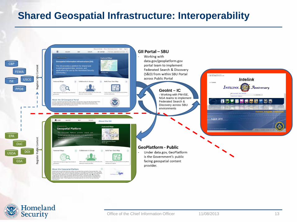
Shared Geospatial Infrastructure: Interoperability
Geospatial Information Infrastructure (GII) The GII provides a platform for shared and trusted geospatial data, services, and applications for use by the Homeland Security community.)
About the GII
GeoInt – IC - Working with PM-ISE, NGA teams to implement Federated Search & Discovery across SBU environments

Office of the Chief Information Officer 11/08/2013 14
Shared Geospatial Infrastructure: GII and APIs
Office of the Chief Information Officer 11/08/2013 15
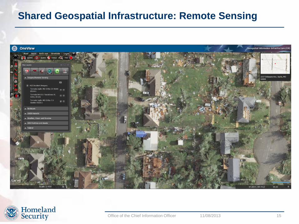
Shared Geospatial Infrastructure: Remote Sensing

Office of the Chief Information Officer 11/08/2013 16
Software Provisioning: ESRI ArcGIS, Google Earth

Office of the Chief Information Officer 11/08/2013 17
Real World Use Cases: Situational Awareness
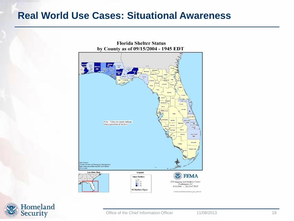
Office of the Chief Information Officer 11/08/2013 18
Real World Use Cases: Situational Awareness
Office of the Chief Information Officer 11/08/2013 19
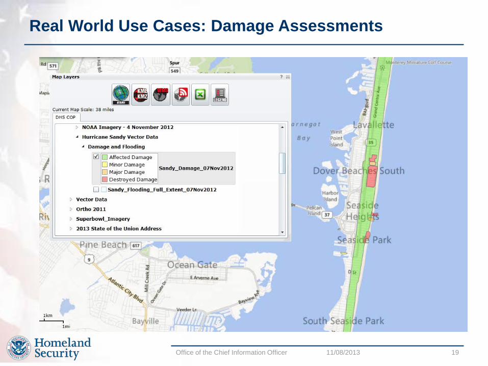
Real World Use Cases: Damage Assessments

Office of the Chief Information Officer 11/08/2013 20
Real World Use Cases: Disaster Response

Office of the Chief Information Officer 11/08/2013 21
Real World Use Cases: Disaster Response
Office of the Chief Information Officer 11/08/2013 22
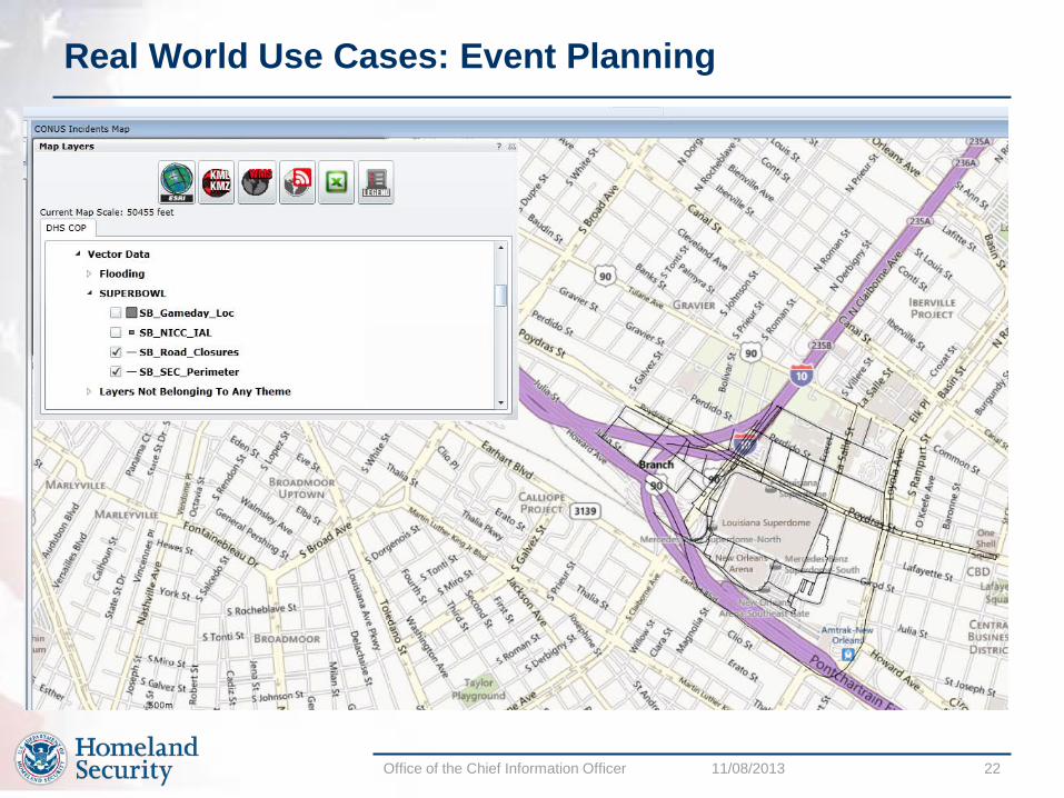
Real World Use Cases: Event Planning

Office of the Chief Information Officer 11/08/2013 23
Real World Use Cases: Event Planning

Office of the Chief Information Officer 11/08/2013 24
Summary
• GIS is essential to Emergency Management business, functions, and missions from response and recovery to mitigation and preparedness.
• GIS is the cornerstone of situational awareness. • GIS provides the foundation for disaster modeling. • GIS technology is critical to locating, sizing, and understanding an emergency and/or disaster • GIS provides the capability to evaluate the consequences of a disaster.
• Geospatial capabilities enhance situational aware and enable core missions • To ensure the right data are available • To ensure the right tools are used • To ensure the right information is communicated, consistently
Shelter Management
Proximity Analysis