geosar radar mapping - latornell.ca · 7 geosar data products orthorectified radar imagery (ori)...
TRANSCRIPT
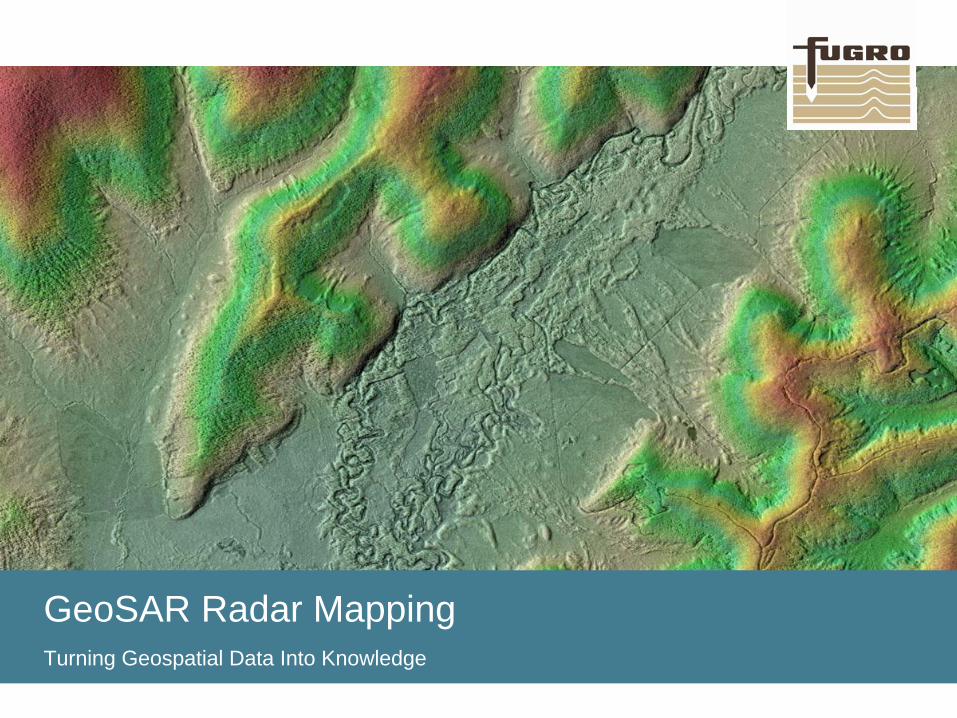
GeoSAR Radar MappingTurning Geospatial Data Into Knowledge
www.fugro.com2
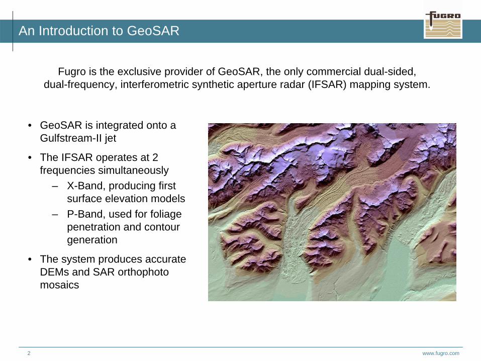
An Introduction to GeoSAR
Fugro is the exclusive provider of GeoSAR, the only commercial dual-sided,dual-frequency, interferometric synthetic aperture radar (IFSAR) mapping system.
• GeoSAR is integrated onto a Gulfstream-II jet
• The IFSAR operates at 2 frequencies simultaneously
– X-Band, producing first surface elevation models
– P-Band, used for foliage penetration and contour generation
• The system produces accurate DEMs and SAR orthophoto mosaics
www.fugro.com3
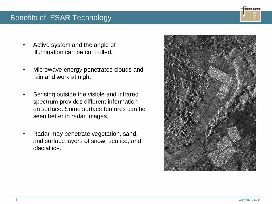
• Active system and the angle of illumination can be controlled.
• Microwave energy penetrates clouds and rain and work at night.
• Sensing outside the visible and infrared spectrum provides different information on surface. Some surface features can be seen better in radar images.
• Radar may penetrate vegetation, sand, and surface layers of snow, sea ice, and glacial ice.
Benefits of IFSAR Technology
www.fugro.com4
Benefits of the GeoSAR System
• GeoSAR platform– Only radar platform collecting 2 radar frequencies and LiDAR– Eight radars (4 x-band, 4 p-band, acquiring simultaneously)– Collection on both sides of aircraft (more data acquired)
• Simultaneous X and P radar band acquisition – More data for solution (better geometric solutions)– Less voids (data gaps due to difficult terrain)– Reduced acquisition risk (no missing data)– More thematic information, hence broader range of applications
• Multiple look data– All points on ground imaged multiple times (viewed between 4 to 8 times)– Images are more complete viewed from both sides (better radiometrics)
• Integrated LiDAR profiler– Additional independent ground control – Strengthens vertical solution
• Single-pass IFSAR avoids problems of repeat pass IFSAR– temporal decorrelation (wind movement of vegetation, different moisture, between passes)– atmospheric distortion introducing height errors (wavelength independent)– extremely difficult motion compensation and calibration issues
• Collects at 12,000 m– Therefore there are no issues in hostile areas– Other commercial systems fly within 5000-9,000 m
www.fugro.com5
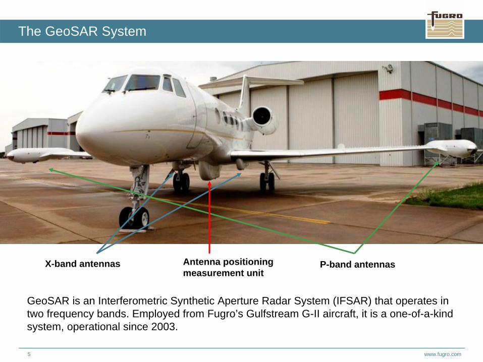
The GeoSAR System
GeoSAR is an Interferometric Synthetic Aperture Radar System (IFSAR) that operates in two frequency bands. Employed from Fugro’s Gulfstream G-II aircraft, it is a one-of-a-kind system, operational since 2003.
X-band antennas Antenna positioning measurement unit
P-band antennas
www.fugro.com6
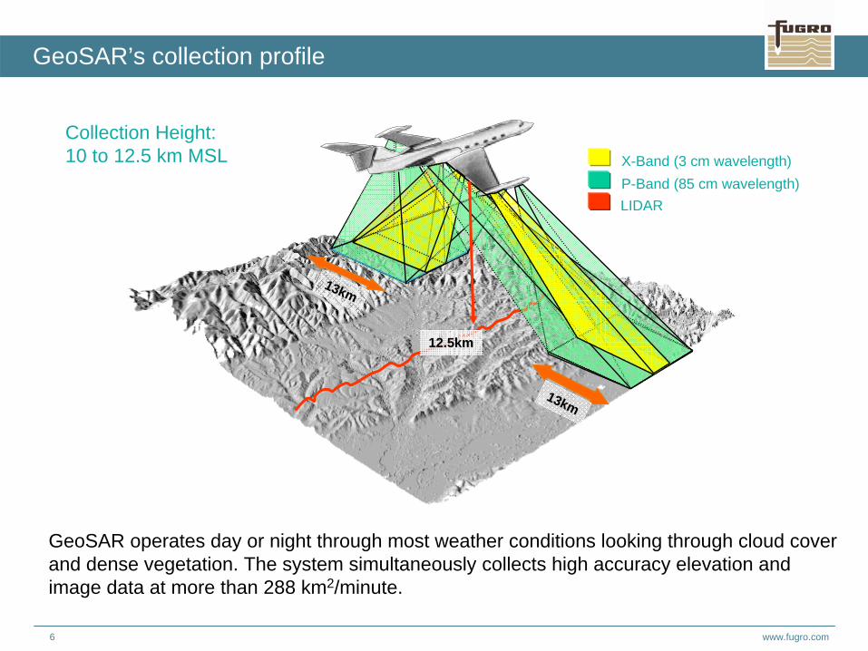
GeoSAR’s collection profile
P-Band (85 cm wavelength)X-Band (3 cm wavelength)
LIDAR
Collection Height:10 to 12.5 km MSL
13km13km
13km13km
12.5km12.5km
GeoSAR operates day or night through most weather conditions looking through cloud cover and dense vegetation. The system simultaneously collects high accuracy elevation and image data at more than 288 km2/minute.
www.fugro.com7
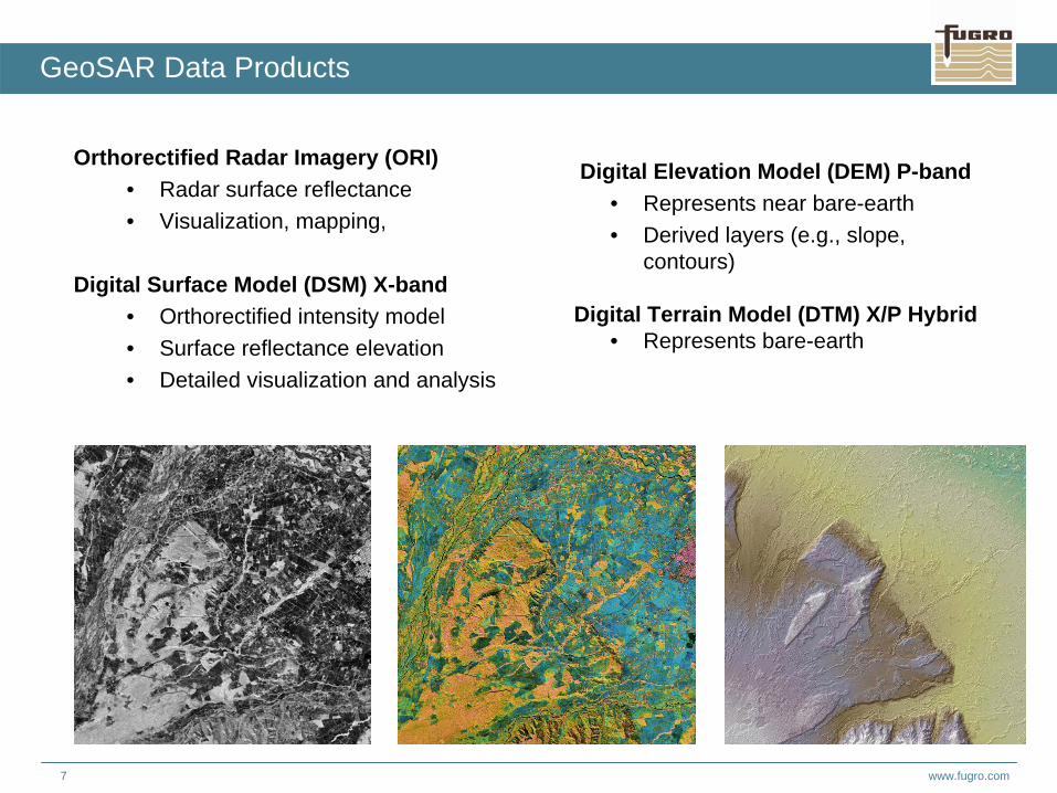
GeoSAR Data Products
Orthorectified Radar Imagery (ORI)• Radar surface reflectance• Visualization, mapping,
Digital Surface Model (DSM) X-band• Orthorectified intensity model• Surface reflectance elevation• Detailed visualization and analysis
Digital Elevation Model (DEM) P-band• Represents near bare-earth • Derived layers (e.g., slope,
contours)
Digital Terrain Model (DTM) X/P Hybrid• Represents bare-earth
www.fugro.com8
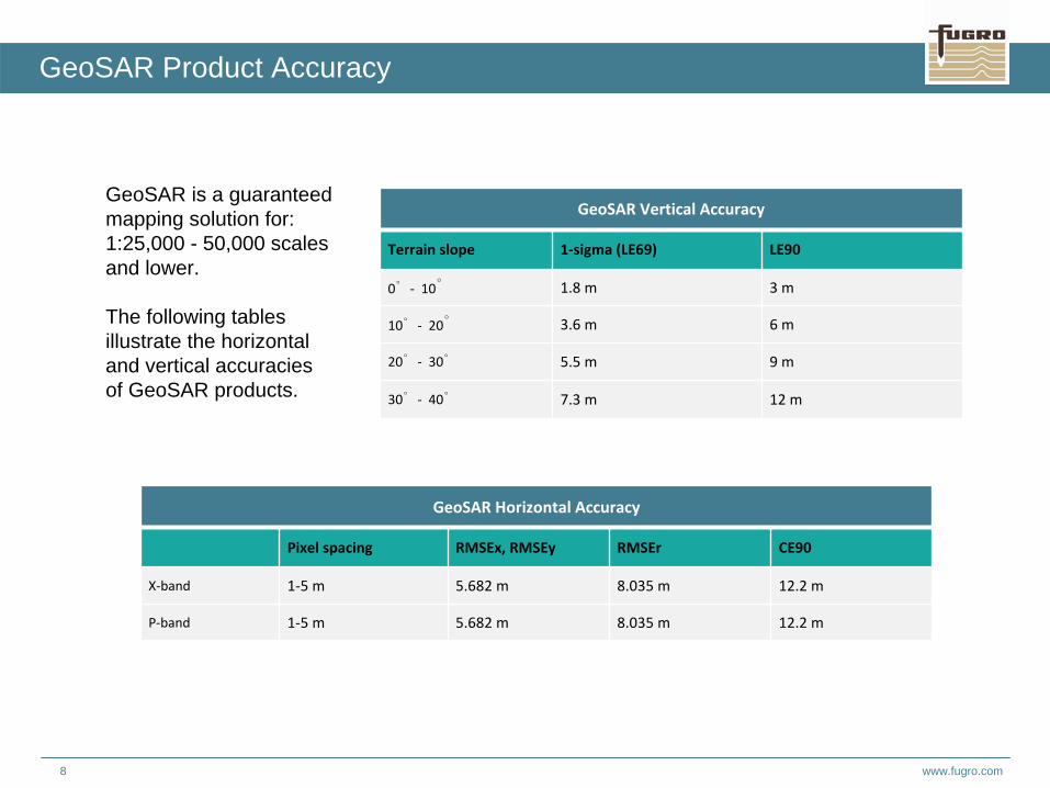
GeoSAR is a guaranteed mapping solution for: 1:25,000 - 50,000 scales and lower.
The following tables illustrate the horizontal and vertical accuracies of GeoSAR products.
GeoSAR Vertical Accuracy
Terrain slope 1‐sigma (LE69) LE90
0°‐ 10° 1.8 m 3 m
10°‐ 20° 3.6 m 6 m
20°‐ 30° 5.5 m 9 m
30°‐ 40° 7.3 m 12 m
GeoSAR Horizontal Accuracy
Pixel spacing RMSEx, RMSEy RMSEr CE90
X‐band 1‐5 m 5.682 m 8.035 m 12.2 m
P‐band 1‐5 m 5.682 m 8.035 m 12.2 m
GeoSAR Product Accuracy
www.fugro.com9
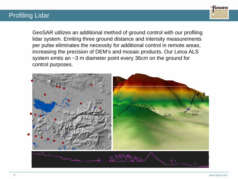
Profiling Lidar
GeoSAR utilizes an additional method of ground control with our profiling lidar system. Emiting three ground distance and intensity measurements per pulse eliminates the necessity for additional control in remote areas, increasing the precision of DEM’s and mosaic products. Our Leica ALS system emits an ~3 m diameter point every 36cm on the ground forcontrol purposes.
x, y, zGCP
x, y, zGCP
www.fugro.com10
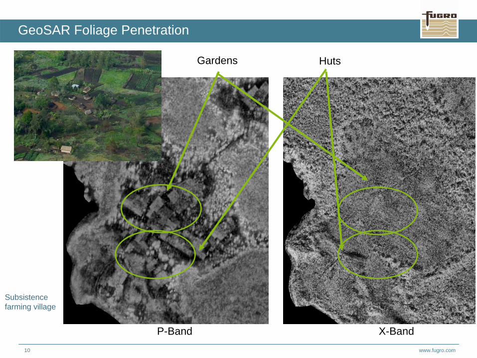
GeoSAR Foliage Penetration
P-Band X-Band
Gardens Huts
Subsistence farming village
www.fugro.com11
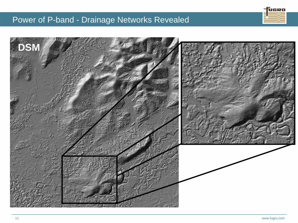
Power of P-band - Drainage Networks Revealed
DSM
www.fugro.com12
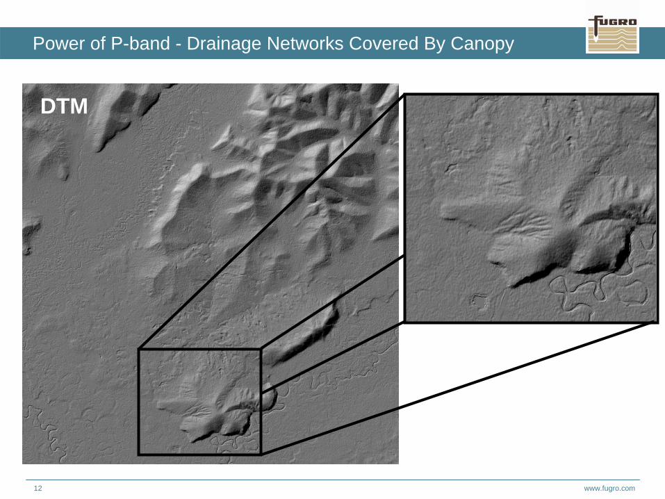
Power of P-band - Drainage Networks Covered By Canopy
DTM
www.fugro.com13
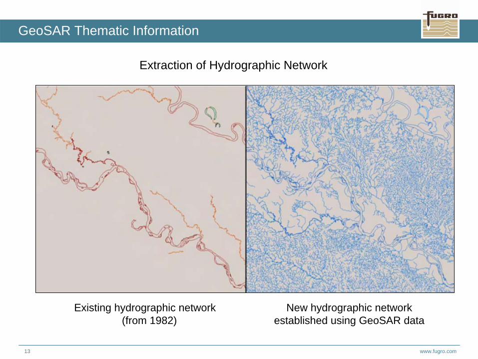
GeoSAR Thematic Information
Extraction of Hydrographic Network
Existing hydrographic network (from 1982)
New hydrographic networkestablished using GeoSAR data
www.fugro.com14
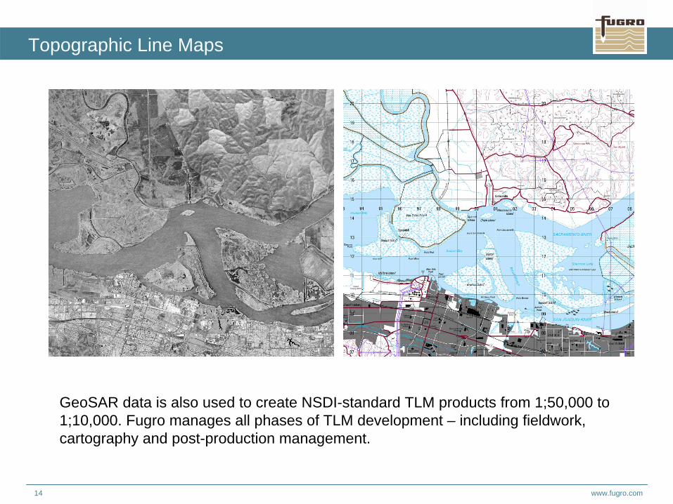
Topographic Line Maps
GeoSAR data is also used to create NSDI-standard TLM products from 1;50,000 to 1;10,000. Fugro manages all phases of TLM development – including fieldwork, cartography and post-production management.
www.fugro.com15
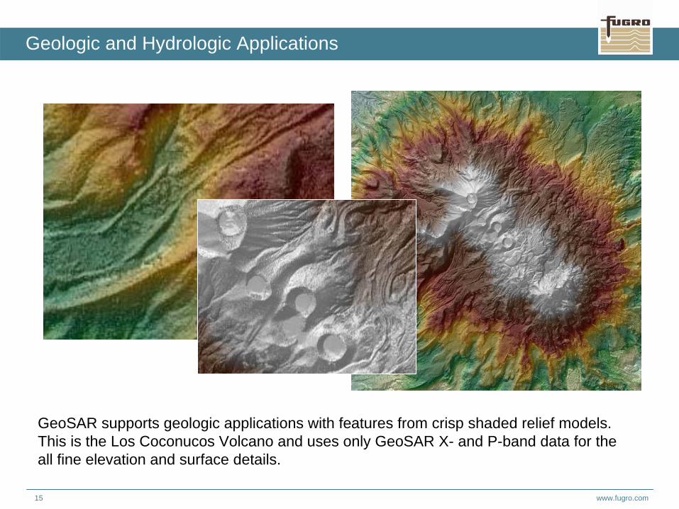
Geologic and Hydrologic Applications
GeoSAR supports geologic applications with features from crisp shaded relief models. This is the Los Coconucos Volcano and uses only GeoSAR X- and P-band data for the all fine elevation and surface details.
www.fugro.com16
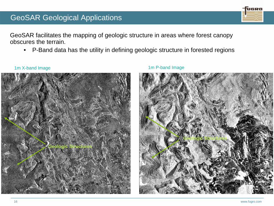
GeoSAR Geological Applications
GeoSAR facilitates the mapping of geologic structure in areas where forest canopy obscures the terrain.
• P-Band data has the utility in defining geologic structure in forested regions
1m P-band Image
Geologic Structures
Geologic Structures
1m X-band Image
www.fugro.com17
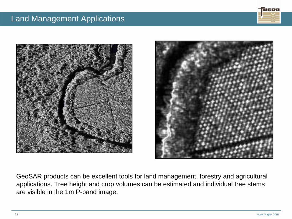
Land Management Applications
GeoSAR products can be excellent tools for land management, forestry and agricultural applications. Tree height and crop volumes can be estimated and individual tree stems are visible in the 1m P-band image.
www.fugro.com18
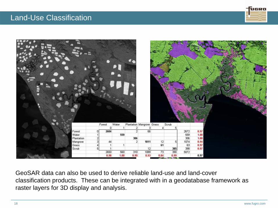
Land-Use Classification
GeoSAR data can also be used to derive reliable land-use and land-cover classification products. These can be integrated with in a geodatabase framework as raster layers for 3D display and analysis.
www.fugro.com19
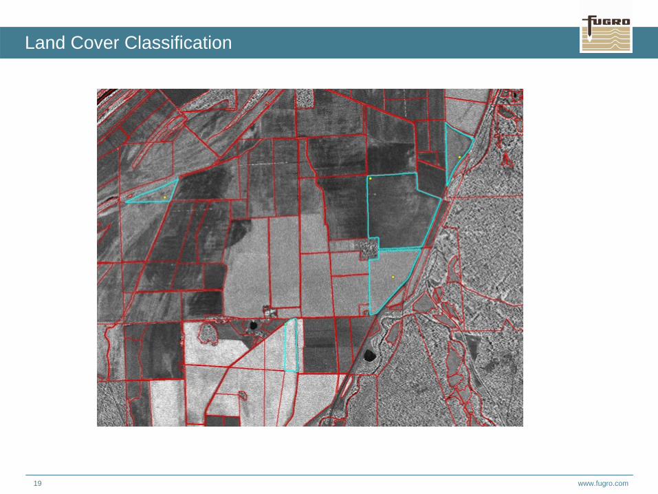
Land Cover Classification
www.fugro.com20
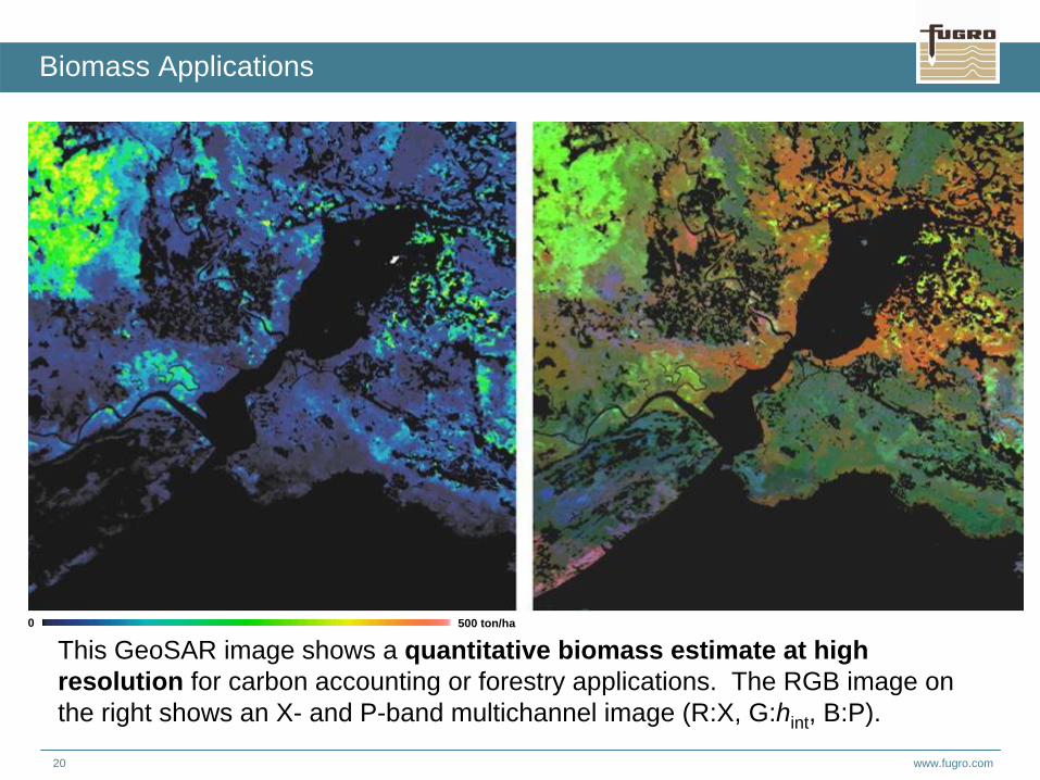
Biomass Applications
500 ton/ha0
This GeoSAR image shows a quantitative biomass estimate at high resolution for carbon accounting or forestry applications. The RGB image on the right shows an X- and P-band multichannel image (R:X, G:hint, B:P).
www.fugro.com21
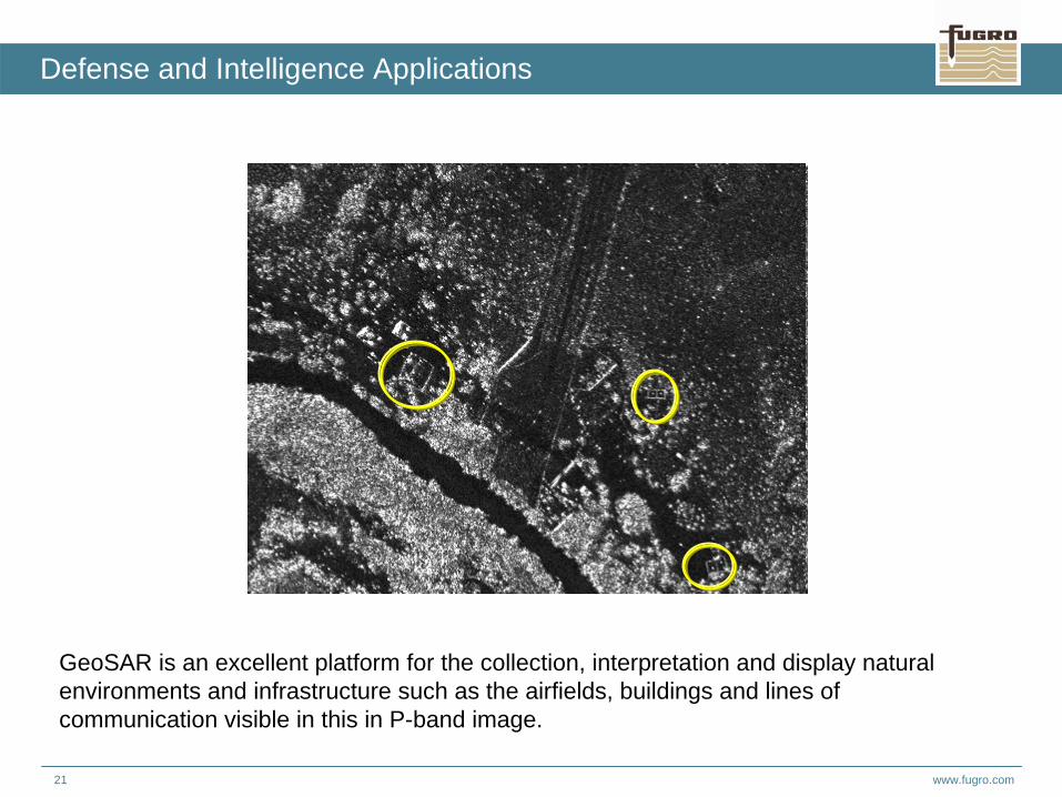
Defense and Intelligence Applications
GeoSAR is an excellent platform for the collection, interpretation and display natural environments and infrastructure such as the airfields, buildings and lines of communication visible in this in P-band image.

www.fugro.com22
Height Differences in Meters
Initial X-P Subtraction Map
X-band minus P-band Petermann Glacier
www.fugro.com23
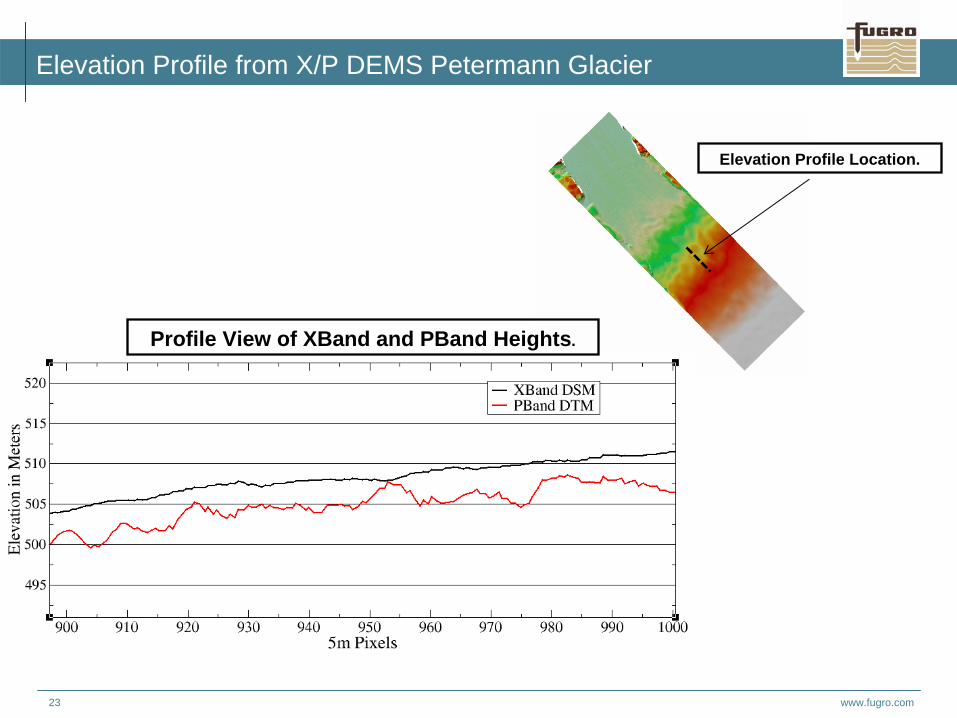
Elevation Profile from X/P DEMS Petermann Glacier
Elevation Profile Location.
Profile View of XBand and PBand Heights.
www.fugro.com24
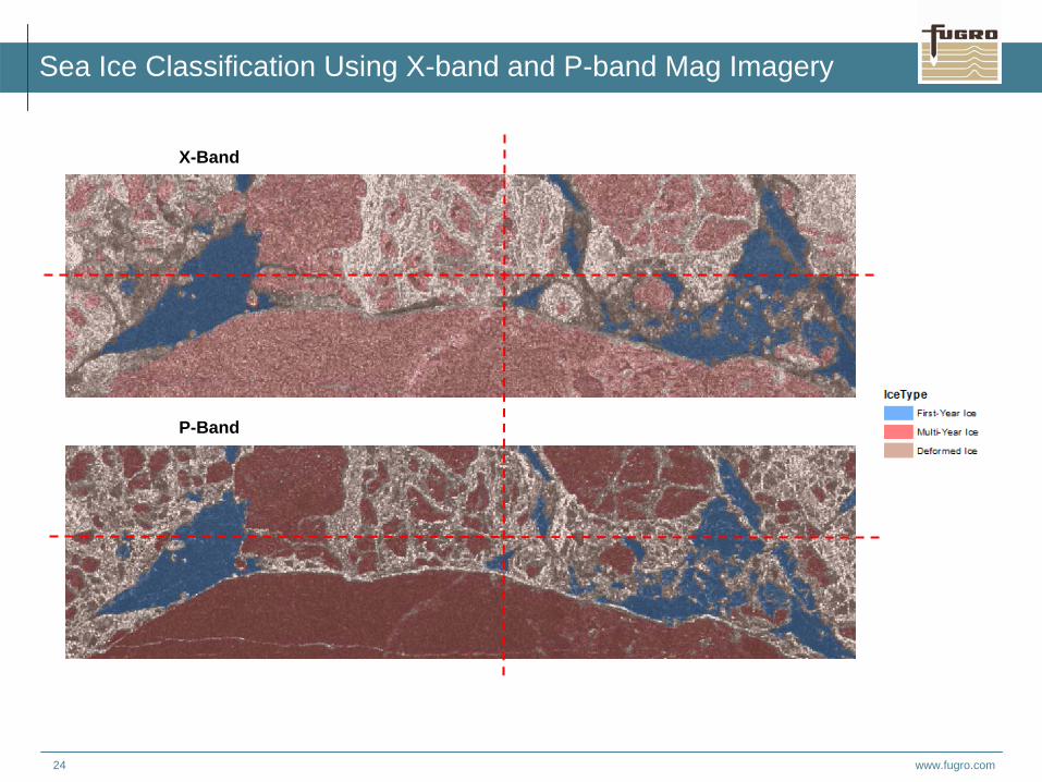
Sea Ice Classification Using X-band and P-band Mag Imagery
X-Band
P-Band
www.fugro.com25
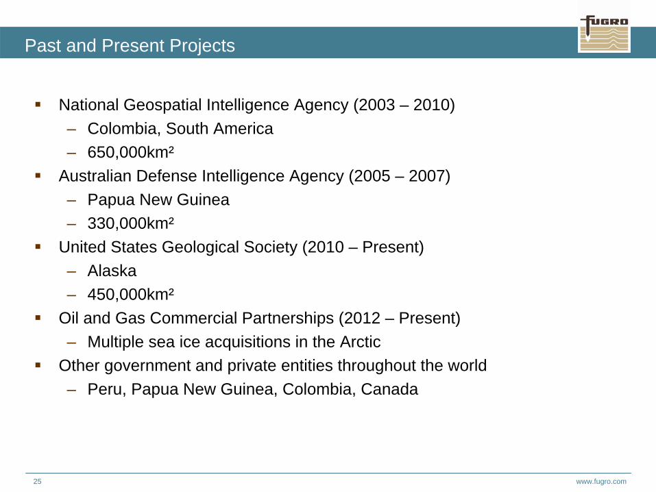
Past and Present Projects
National Geospatial Intelligence Agency (2003 – 2010)– Colombia, South America – 650,000km²
Australian Defense Intelligence Agency (2005 – 2007)– Papua New Guinea– 330,000km²
United States Geological Society (2010 – Present)– Alaska– 450,000km²
Oil and Gas Commercial Partnerships (2012 – Present)– Multiple sea ice acquisitions in the Arctic
Other government and private entities throughout the world– Peru, Papua New Guinea, Colombia, Canada