geology of the canyon table of contents -...
TRANSCRIPT

Geology of the Canyon Table of Contents
Geologic History of the Earth ................................................................................ 1
Canyon Carver I .....................................................................................................11
Canyon Carver II ....................................................................................................13
Canyon-Carving Force: River ...............................................................................15
Investigate the Rocks of Sinks Canyon State Park .........................................19
Geology of Sinks Canyon .....................................................................................21
Geology of Sinks Canyon II ..................................................................................25
Wyoming State Parks, Historic Sites and Trails

1
BEFOR
E VISITD
UR
ING
VISITAFTER
VISIT
Geologic History of the Earth
Activity to be completed: before trip to Sinks Canyon State Park
Essential Question:How can we better understand the geological history of Sinks Canyon State Park by knowing geological eras?
Goal:Students will understand geological timeframes.
Standards:
K-4th Grade:SC.4.1.4 Properties of Earth Materials: Students investigate water, air, rocks, and soils to compare basic properties of earth materials.
5th-8th Grade:SC.8.1.8 The Structure of the Earth System: Students examine the structure of the Earth, identifying layers of the Earth, considering plate movement and its effect, and recognizing landforms resulting from constructive and destructive forces.
SC.8.1.9 The Earth’s History: Students systematize the Earth’s history in terms of geologic evidence, comparing past and present Earth processes and identifying catastrophic events and fossil evidence.
Websites:http://www.enchantedlearning.com/subjects/Geologictime.html
http://www.cotf.edu/ete/modules/msese/earthsysflr/geotime.html
http://faculty.clintoncc.suny.edu/faculty/michael.gregory/files/bio%20102/Bio%20102%20lectures/History%20of%20Life/history.htm
Vocabulary:Era, geologic history, crust, mantle, core, continental activity
Materials: “Geologic History of the Earth” at http://www.english-online.at/science/geologic-history-of-the-earth/geologic-eras-of-the-earths-history.htm large paper for students to make a chart or timeline
Activity Procedure:1. Either as a class or in pairs, students
read, “Geologic History of the Earth.”2. Ask students to read for these main
ideas which they will turn into a detailed timeline:a. Name of Era or time period
Geologic History of the Earth 1 of 9 Wyoming State Parks, Historic Sites and Trails
2 3
b. When each era or time period occurredc. Life forms present during each era or
time periodd. Continental activity during era or time
periode. Other significant facts about era or
time period3. Ask students to develop a chart or timeline
to present the information from the reading visually (example follows).
Writing Activity:Note taking based on content of reading; encourage students to pull out main points and state those in clear, concise language
Assessment:Students’ chart or timeline with information specified and complete ideas for each point.
Follow-up Activity:Students illustrate their chart or timeline with representations of what era or time period may have looked like.
Geologic History of the Earth continued ...
Wyoming State Parks, Historic Sites and Trails Geologic History of the Earth 2 of 9
2 3
Geologic History of the Earth
http://www.english-online.at/science/geologic-history-of-the-earth/geologic-eras-of-the-earths-history.htm
Geologists are scientists who study the structure of rocks and the history of the earth. By looking at
and examining layers of rocks and the fossils they contain they are able to tell us what the earth looked
like at a certain time in history and what kind of plants and animals lived at that time.
Scientists think that the earth was probably formed at the same time as the rest of our solar system,
about 4.6 billion years ago. The solar system may have begun as a cloud of dust, from which the sun
and the planets evolved. Small particles crashed into each other to create bigger objects, which then
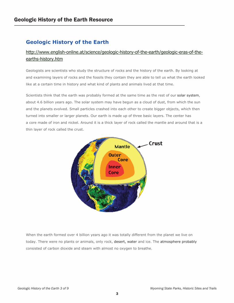
turned into smaller or larger planets. Our earth is made up of three basic layers. The center has
a core made of iron and nickel. Around it is a thick layer of rock called the mantle and around that is a
thin layer of rock called the crust.
When the earth formed over 4 billion years ago it was totally different from the planet we live on
today. There were no plants or animals, only rock, desert, water and ice. The atmosphere probably
consisted of carbon dioxide and steam with almost no oxygen to breathe.
Geologic History of the Earth Resource
Geologic History of the Earth 3 of 9 Wyoming State Parks, Historic Sites and Trails

4 5
The Precambrian Time
The oldest period of the earth’s history lasted from the beginnings four and a half billion years ago to
about 600 million years ago. At first simple forms of one-celled life developed in the oceans. Later on
bacteria and algae evolved. Towards the middle of the Precambrian, about 2 billion years ago,
more complex organisms, sponge-like creatures and soft-bodied animals lived in the seas. During this
time there was no life on land because there was not enough oxygen to breathe.
As the Precambrian came to an end the oceans were full of life. Plants
started absorbing the carbon dioxide from the atmosphere and turned it into oxygen. Early continents
formed, but they looked quite different than they do today.
Geologic History of the Earth Resource
Wyoming State Parks, Historic Sites and Trails Geologic History of the Earth 4 of 9

4 5
The Paleozoic Era
The Paleozoic Era lasted from about 600 million to about 240 million years ago. Geologists divide this
era into six periods. From the earliest to the latest these are the Cambrian, Ordovician, Silurian,
Devonian, Carboniferous and the Permian.
Although most animals and plants still lived in the oceans, life started to develop on land and by the
end of this era there was life in both the sea and on land. The earliest living things on land were
simple plants and mosses, the first creatures to appear on land were animals that looked like spiders,
scorpions and insects.
The middle of the era was dominated by all sorts of fish and invertebrates. Early amphibians, animals
that could live on land and in the water, appeared. During the Carboniferous period the
first reptiles evolved and insects grew to an enormous size.
The end of the era was the time of big forests and swamps. The earth got hot and wet. Plants and big
trees died and were buried in sediments.
Over millions of years they turned into gigantic coal deposits which we find in the eastern United
States, Europe, Russia and China.
During the Paleozoic era the land masses were constantly moving and by the end of the era they
joined together to become a single continent called Pangaea. As these land masses collided several
mountain chains, like the Appalachian and Ural Mountains emerged.
Geologic History of the Earth Resource
Geologic History of the Earth 5 of 9 Wyoming State Parks, Historic Sites and Trails

6 7
The Mesozoic Era
The Mesozoic era lasted from about 240 million to about 65 million years ago. At the end of the
Paleozoic about 90 % of all living creatures on earth died out. We don’t really know what caused this to
happen but many scientists think that our climate started to change dramatically. Maybe a big
volcanic eruption thrust gas into the earth’s atmosphere or maybe a large asteroid hit the earth
and dust blocked out sunlight for many years.
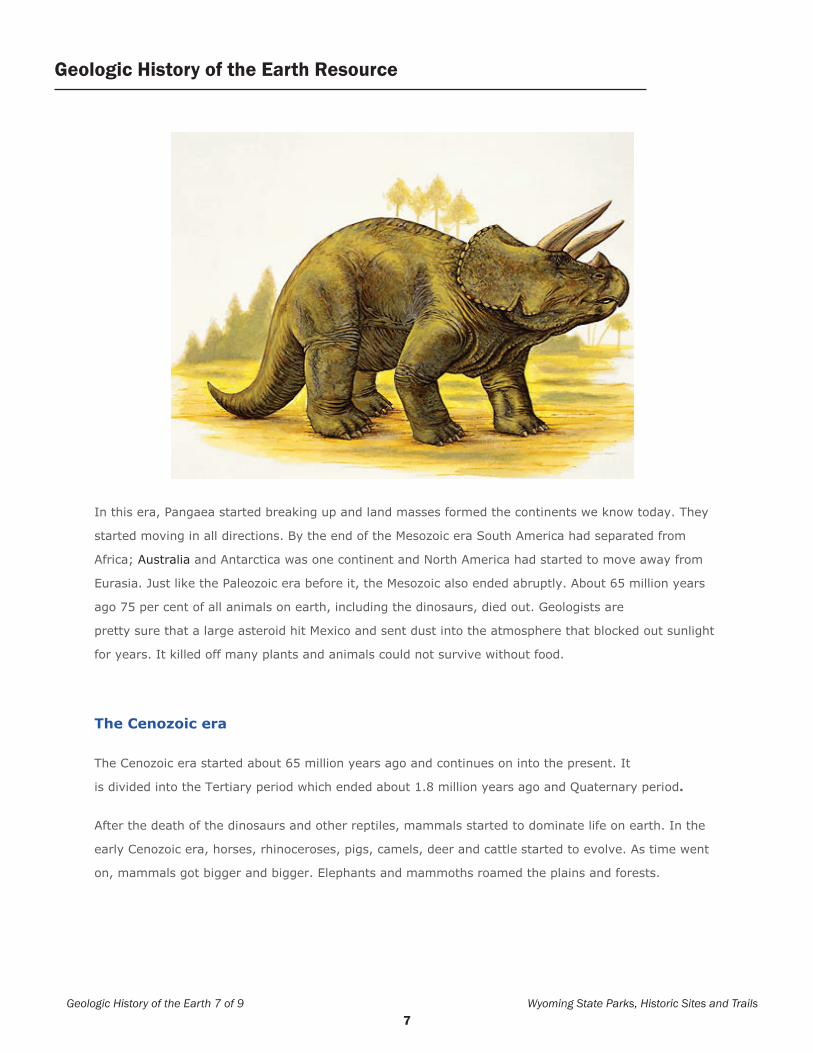
The Mesozoic era is often called the age of dinosaurs because they dominated the earth’s
land masses. Reptiles were the most powerful and fearsome creatures of that time. The archaeopteryx
was a flying reptile, probably the first bird on earth. Some dinosaurs, like the Tyrannosaurus Rex,
were meat eating predators; others only ate plants and leaves. The 30 meter long brontosaurus was
the largest land animal that ever lived. During the Mesozoic era the first mammals also appeared on
earth but they were very small and could not match the size and greatness of dinosaurs.
Geologic History of the Earth Resource
Wyoming State Parks, Historic Sites and Trails Geologic History of the Earth 6 of 9
6 7
In this era, Pangaea started breaking up and land masses formed the continents we know today. They
started moving in all directions. By the end of the Mesozoic era South America had separated from
Africa; Australia and Antarctica was one continent and North America had started to move away from
Eurasia. Just like the Paleozoic era before it, the Mesozoic also ended abruptly. About 65 million years
ago 75 per cent of all animals on earth, including the dinosaurs, died out. Geologists are
pretty sure that a large asteroid hit Mexico and sent dust into the atmosphere that blocked out sunlight
for years. It killed off many plants and animals could not survive without food.
The Cenozoic era
The Cenozoic era started about 65 million years ago and continues on into the present. It
is divided into the Tertiary period which ended about 1.8 million years ago and Quaternary period.
After the death of the dinosaurs and other reptiles, mammals started to dominate life on earth. In the
early Cenozoic era, horses, rhinoceroses, pigs, camels, deer and cattle started to evolve. As time went
on, mammals got bigger and bigger. Elephants and mammoths roamed the plains and forests.
Geologic History of the Earth 7 of 9 Wyoming State Parks, Historic Sites and Trails
Geologic History of the Earth Resource
8 9
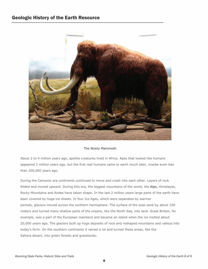
The Wooly Mammoth
About 2 to 4 million years ago, apelike creatures lived in Africa. Apes that looked like humans
appeared 2 million years ago, but the first real humans came to earth much later, maybe even less
than 200,000 years ago.
During the Cenozoic era continents continued to move and crash into each other. Layers of rock
folded and moved upward. During this era, the biggest mountains of the world, the Alps, Himalayas,
Rocky Mountains and Andes have taken shape. In the last 2 million years large parts of the earth have
been covered by huge ice sheets. In four Ice Ages, which were separated by warmer
periods, glaciers moved across the northern hemisphere. The surface of the seas sank by about 100
meters and turned many shallow parts of the oceans, like the North Sea, into land. Great Britain, for
example, was a part of the European mainland and became an island when the ice melted about
20,000 years ago. The glaciers built up huge deposits of rock and reshaped mountains and valleys into
today’s form. On the southern continents it rained a lot and turned these areas, like the
Sahara desert, into green forests and grasslands.
Wyoming State Parks, Historic Sites and Trails Geologic History of the Earth 8 of 9
Geologic History of the Earth Resource

8 9
Name of Era or Time Period
Number of Years Ago Life Forms Present Continental Activity Other Significant Facts
Precambrian
Archean Era
Proteroic Era
4.5 billion to 600 million years ago
-Simple, one-celled life in the ocean
-Then, bacteria and algae
-Then, sponges and soft-bodied sea animal
-End of era: sea plants which absorb CO2 and release O2
Early continents formed
CO2 and steam in atmosphere, no O2
Paleozoic Era 600 million to 240 million years ago
-Animals and plants mostly found in the ocean; life starts to develop on land
-Then, life in both sea and land; on land- simple plants and mosses, spiders, scorpions, insect-like creatures
-Early amphibian and first reptiles
-Continents moving to form Pangaea
-Mountain-building as a result of continental collisions
6 Periods
1. Cambrain
2. Orodovician
3. Silurian
4. Denovian
5. Carboniferous
6. Permian
-Earth got hot and wet during last period
-Large die-off of life at end of era
Mesozoic Era 240 million to 65 million years ago
-90% of all living creatures had died off at end of previous era
-Earth dominated by dinosaurs, both plant and meat-eating
-first mammals appear
Pangaea breaks-up to form present-day continents
Large die-off of life at end of era
Cenozoic Era 65 million years ago and continuing to present
-mammals dominate
-apes that look like humans present 2 million years ago
-Continents moving, much mountain-building
4 ice ages
Geologic History of the Earth Timeline
Geologic History of the Earth 9 of 9 Wyoming State Parks, Historic Sites and Trails

10 11

10 11
BEFOR
E VISITD
UR
ING
VISITAFTER
VISIT
Canyon Carver IActivity to be completed: before trip to Sinks Canyon State Park
Essential Question:How do rivers and glaciers form canyons?
Goals:Students will describe the canyon-carving ability of water and ice after observing a scale model demonstrating each.
Standards:
K-4th Grade:SC.4.1.4 Properties of Earth Materials: Students investigate water, air, rocks, and soils to compare basic properties of earth materials.
5th-8th Grade:SC.8.1.8 The Structure of the Earth System: Students examine the structure of the Earth, identifying layers of the Earth, considering plate movement and its effect, and recognizing landforms resulting from constructive and destructive forces.
SC.8.1.9 The Earth’s History: Students systematize the Earth’s history in terms of geologic evidence, comparing past and present Earth processes and identifying catastrophic events and fossil evidence.
Lesson Overview:Students will demonstrate the process of erosion (transportation of sediment by water or wearing away of earth’s surface by forces of water, glaciers, winds, or waves) using a milk carton and plastic bottle.
GoalStudents will learn the basics of erosional processes and how they create a landscape of river canyons such as the Grand Canyon.
Materials • 1.9-L milk carton • 2.0-L (water) bottle • sediment (sand or potting soil) • ruler • scissors • source of water • garden trowel
Canyon Carver I 1 of 2 Wyoming State Parks, Historic Sites and Trails

12 13
Vocabulary: Sediment, glacier, erosion, weathering
Background Students often know that rivers such as the Colorado River can be muddy. But they may not know that some of the sediment (sand, silt, and clay) that makes the river muddy comes from the riverbed itself and is a result of the river’s cutting or carving action. The canyon, and all of the formations within it, resulted directly from weathering and erosion in various forms. The Grand Canyon is one of the world’s greatest examples of arid land erosion through layers of stratified rock.
Procedure Preparation:
1. Use scissors to cut out the side panel of the empty milk carton under the spout, leaving the spout intact.
2. (You may wish to continue this activity outside; don’t forget all the necessary materials.) Lay the carton on its side with the cut out panel facing up. Fill the container about half full with the sediment, and smooth the surface.
Demonstration:3. To simulate the gravitational change of
a flowing river, set one end of the carton approximately 1-cm higher than the other end, using something to prop it up such as a rock or piece of bark. Be sure the lower end of the carton is the one with the spout.
4. Ask students to make predictions about what might happen when water is added. Place the mouth of the bottle containing water on the higher end and slowly pour
Canyon Carver I continued ...
Wyoming State Parks, Historic Sites and Trails Canyon Carver I 2 of 2
the water out. The water should flow steadily down and out the spout end. Remember, the water flow will be directly affected by your sediment choice and degree of its saturation.
5. Continue repeating steps 2-4, but raise the elevated end a cm or two at a time. What happens as the elevated end gets higher, or the grade of the river becomes steeper? Why? (The water or river is flowing faster as grade increases.) Discuss the various depths and formations created.
6. At each stage of the experiment, ask students to draw what occurs.
Before adding water
At 1 cm elevation
At 2 cm elevation

12 13
BEFOR
E VISITD
UR
ING
VISITAFTER
VISIT
Canyon Carver IIActivity to be completed: before trip to Sinks Canyon State Park
Essential Question:How are glacial canyons formed?
Goal:Students will learn the basics of erosional processes and how they form the landscape of glacial canyons, such as Sinks Canyon.
Standards:
K-4th Grade:SC.4.1.4 Properties of Earth Materials: Students investigate water, air, rocks, and soils to compare basic properties of earth materials.
5th-8th Grade:SC.8.1.8 The Structure of the Earth System: Students examine the structure of the Earth, identifying layers of the Earth, considering plate movement and its effect, and recognizing landforms resulting from constructive and destructive forces.
SC.8.1.9 The Earth’s History: Students systematize the Earth’s history in terms of geologic evidence, comparing past and present Earth processes and identifying catastrophic events and fossil evidence.
Materials • long (at least 24 inches) plastic container at
least 6 inches deep. • 2.0-L bottle containing water • sediment (sand with small gravel) • freezer• scissors • source of water • garden trowel
Vocabulary: Sediment, erosion, lateral moraine, terminal moraine, glacier
Procedure:Preparation
1. Before students arrive, fill and freeze 2-liter plastic container half full of water, lying horizontally. Leave frozen until just before students arrive, then cut away plastic container.
2. Fill long, plastic container with sand gravel mix. Elevate one end.
Demonstration:3. Ask students to make predictions about
what might happen when ice block is added and as it melts. Place ice block on elevated end of container with sand/gravel mix. Let gravity slide the ice block downhill, simulating a glacier as it inches downhill. Lateral and terminal moraines
Canyon Carver II 1 of 2 Wyoming State Parks, Historic Sites and Trails
14 15
should be created as the ice moves through the sand/gravel mix. It’s best if a hole is drilled in the lower end of the plastic container of sand and gravel so that melted ice can drain out. Throughout the day, students should check on the progress of the glacier as it melts. What effect does the glacier have on the “land surface?”
4. Ask students to draw what occurs and label lateral and terminal moraines.
5. Ask students to write a paragraph explaining the difference between what happened with the water and ice experiments and similarities (and differences) to how rivers and glaciers erode canyons.
Wyoming State Parks, Historic Sites and Trails Canyon Carver II 2 of 2
Canyon Carver II continued ...

14 15
BEFOR
E VISITD
UR
ING
VISITAFTER
VISIT
Canyon-Carving Force: RiverActivity to be completed: before trip to Sinks Canyon State Park
Essential Question:What forces have formed the Grand Canyon?
Goals:Students will describe how canyons can be formed by rivers, using the Grand Canyon as an example.
Standards:
K-4th Grade Science:SC.4.1.4 Properties of Earth Materials: Students investigate water, air, rocks, and soils to compare basic properties of earth materials.
5th-8th Grade Science:SC.8.1.8 The Structure of the Earth System: Students examine the structure of the Earth, identifying layers of the Earth, considering plate movement and its effect, and recognizing landforms resulting from constructive and destructive forces.
SC.8.1.9 The Earth’s History: Students systematize the Earth’s history in terms of geologic evidence, comparing past and present Earth processes and identifying catastrophic events and fossil evidence.
Materials: Computers with Internet access, Canyon-carving Force: River worksheet, students’ removable storage device to store all work and bookmarks. Vocabulary: Erosion, geology, sedimentary, igneous, metamorphic, land forms
Website: http://www.kaibab.org/geology/gc_geol.htm
Procedure: 1. Students will complete the previous
knowledge section of the Canyon-carving Force: River worksheet independently.
2. Working in pairs, students log-on and go to www.kaibab.org/geology/gc-geol.htm, and cooperatively complete the Canyon-carving Force: River worksheet with information from the website. Each student is responsible for recording his/her own notes and answers and each student should take a turn navigating the web-site.
Evaluation: The worksheet will include a student self-assessment. Information gathered from this field trip can be included on a Geology Unit test.
Canyon-Carving Force: River 1 of 3 Wyoming State Parks, Historic Sites and Trails
16 17
Students may give a short five minute presentation demonstrating what they have learned. Casual observation by the instructor will determine whether the students are on task.
Follow-up Activity: Students may make a PowerPoint or other type of media presentation on the topic or related topics and present it to the class. Some students may wish to go to the Sinks Canyon and make a photographic or video account of their expedition then, compare their photos to what they learned about the Grand Canyon from their web investigation.
River-formed Canyon continued ...
Wyoming State Parks, Historic Sites and Trails Canyon-Carving Force: River 2 of 3
16 17
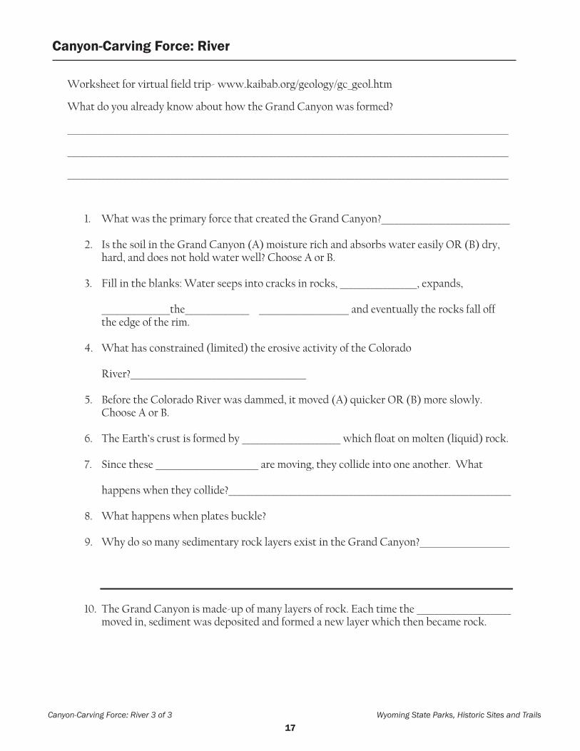
Canyon-carving Force: River
Worksheet for virtual field trip- www.kaibab.org/geology/gc_geol.htm
What do you already know about how the Grand Canyon was formed?
_______________________________________________________________________________________________________
_______________________________________________________________________________________________________
_______________________________________________________________________________________________________
1. What was the primary force that created the Grand Canyon?______________________________
2. Is the soil in the Grand Canyon (A) moisture rich and absorbs water easily OR (B) dry, hard, and does not hold water well? Choose A or B.
3. Fill in the blanks: Water seeps into cracks in rocks, __________________, expands, ________________the_______________ _____________________ and eventually the rocks fall off the edge of the rim.
4. What has constrained (limited) the erosive activity of the Colorado River?_________________________________________
5. Before the Colorado River was dammed, it moved (A) quicker OR (B) more slowly. Choose A or B.
6. The Earth’s crust is formed by _______________________ which float on molten (liquid) rock.
7. Since these ________________________ are moving, they collide into one another. What happens when they collide?__________________________________________________________________
8. What happens when plates buckle?
9. Why do so many sedimentary rock layers exist in the Grand Canyon?_____________________
10. The Grand Canyon is made-up of many layers of rock. Each time the ______________________ moved in, sediment was deposited and formed a new layer which then became rock.
Canyon-Carving Force: River 3 of 3 Wyoming State Parks, Historic Sites and Trails
Canyon-Carving Force: River

18 19

18 19
BEFOR
E VISITD
UR
ING
VISITAFTER
VISIT
Investigate the Rocks of Sinks Canyon State ParkActivity to be completed: during trip to Sinks Canyon State Park with State Parks Staff
Essential Question:What rocks are found at Sinks Canyon State Park?
Goals:Students will identify and classify rocks found in Sinks Canyon State Park.
Standards:
K-4th Grade:Properties of Earth Materials: Students investigate water, air, rocks, and soils to compare basic properties of earth materials.
5th-8th Grade:The Structure of the Earth System: Students examine the structure of the Earth, identifying layers of the Earth, considering plate movement and its effect, and recognizing landforms resulting from constructive and destructive forces.
The Earth’s History: Students systematize the Earth’s history in terms of geologic evidence, comparing past and present Earth processes and identifying catastrophic events and fossil evidence.
Materials:Student journals, pencils, photos of examples of different rock types (available from the visitors’ center)
Vocabulary: Geology, rock cycle, igneous, sedimentary, metamorphic
Activity Procedure:1. Drive to the Sinks Canyon State Park
Visitors’ Center where you may choose to meet a staff member.
2. Students observe examples of the rocks located in front of the Visitors’ Center, noting the characteristics of each rock.
3. Students compare photos with the actual rock and read the description on each corresponding card.
4. Students then visit various locations in the park to find as many of these examples of rock as possible.
5. If students have cameras, take photos of each example of rock to create a PowerPoint presentation or similar project to display their collection of rock images.
Investigate the Rocks of Sinks Canyon State Park 1 of 1 Wyoming State Parks, Historic Sites and Trails
20 21
Wyo
min
g St
ate
Park
s, H
isto
ric S
ites
and
Trai
ls
Jour
nal A
ctiv
ity
Inve
stig
ate
the
Roc
ks o
f Sin
ks C
anyo
n
Nam
e an
d de
scrib
e th
e di
ffere
nt ty
pes
of ro
cks
outs
ide
of th
e
Sink
s Ca
nyon
Sta
te P
ark
Visi
tors
’ Cen
ter a
nd th
ose
that
you
fo
und
on a
hik
e at
Sin
ks C
anyo
n.________________________________________________________
________________________________________________________
________________________________________________________
________________________________________________________
________________________________________________________
________________________________________________________
________________________________________________________
________________________________________________________
________________________________________________________
________________________________________________________
________________________________________________________
________________________________________________________
________________________________________________________
________________________________________________________
________________________________________________________
________________________________________________________
________________________________________________________
________________________________________________________
________________________________________________________
________________________________________________________
________________________________________________________
________________________________________________________
________________________________________________________
________________________________________________________

20 21
BEFOR
E VISITD
UR
ING
VISITAFTER
VISIT
Geology of Sinks CanyonActivity to be completed: during trip to Sinks Canyon State Park with State Park Staff
Essential Question:What makes the geology of Sinks Canyon unique?
Goals:Students will identify the geological forces that created the canyon.Students will identify the unique features of the canyon.
Standards:
K-4th Grade:Properties of Earth Materials: Students investigate water, air, rocks, and soils to compare basic properties of earth materials.
5th-8th Grade:The Structure of the Earth System: Students examine the structure of the Earth, identifying layers of the Earth, considering plate movement and its effect, and recognizing landforms resulting from constructive and destructive forces.
The Earth’s History: Students systematize the Earth’s history in terms of geologic evidence, comparing past and present Earth processes and identifying catastrophic events and fossil evidence.
Materials:Student journals, pencils.Optional: camera to take photos of geologic features.
Vocabulary:Glacier, sedimentary, igneous, metamorphic, glacial moraine, sinks, rise, limestone, feldspar, quartz, hornblende, intrusive, extrusive, minerals, Ten Sleep sandstone, Laramide Uplift, desert varnish, cirque, Madison limestone.
Activity Procedure #1:1. Drive to the Sinks Canyon State Park
Visitors’ Center where you may meet a SCSP staff member (please arrange for this prior to your field trip.)
2. Staff will share the geological history of Sinks Canyon.
3. The group will walk to the Sinks and Rise.4. Students take notes and draw the features
they observed.
Activity Procedure #2:1. Hike the Nature Trail (accessible from the
Popo Agie Campground) to an elevated area where a cross-section of the canyon is visible.
2. In their student journals, students draw the cross-section and describe its shape.
Geology 1 of 2 Wyoming State Parks, Historic Sites and Trails

22 23
3. On their drawings, students label geological features, for example glacial moraine, glacier erratic, etc.
4. Students describe how the canyon was formed based on the shape of their drawings.
Writing Activities:1. (Before visit) Students write a prediction
of how the canyon was formed and what unique features they may discover on the field trip.
2. (During) Students will write notes as the Sinks Canyon State Park staff member discusses geologic features in the canyon.
3. (After) Students write a reflection and include three new things they learned on the field trip.
Assessment:1. Students write a reflection about what they
learned. 2. Geology I Have activity (located after the
Geology of Sinks Canyon II activity) can be used as a review and assessment.
Extension of activity:1. Ask the students to compare the geology
of where they live to that of Sinks Canyon State Park by completing a Venn diagram.
Geology of Sinks Canyon continued ...
Wyoming State Parks, Historic Sites and Trails Geology 2 of 2
Sinks Canyon State Park
Student’s Hometown
Sim
ilarit
ies
22 23
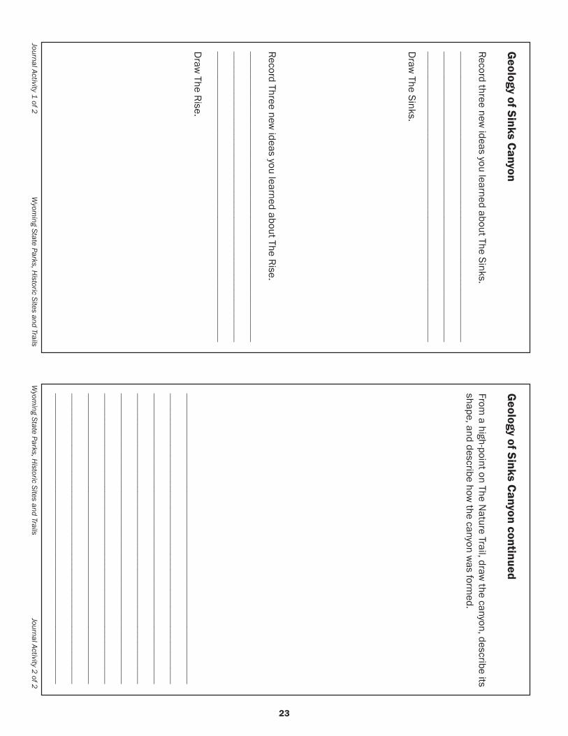
Journal Activity 1 of 2 W
yoming State Parks, H
istoric Sites and Trails
Geology of Sinks Canyon
Record three new ideas you learned about The Sinks.
________________________________________________________________________________________________________________________________________________________________________
Draw
The Sinks.
Record Three new ideas you learned about The Rise.
________________________________________________________________________________________________________________________________________________________________________
Draw
The Rise.
Wyom
ing State Parks, Historic Sites and Trails
Journal Activity 2 of 2
Geology of Sinks Canyon continued
From a high-point on The N
ature Trail, draw the canyon, describe its
shape, and describe how the canyon w
as formed.
________________________________________________________________________________________________________________________________________________________________________________________________________________________________________________________________________________________________________________________________________________________________________________________________________________________________________________________________________________________________________________________

24 25

24 25
BEFOR
E VISITD
UR
ING
VISITAFTER
VISIT
Geology of Sinks Canyon IIActivity to be completed: after trip to Sinks Canyon State Park
Essential Question:What makes the geology of Sinks Canyon unique?
Goals:Students will identify the geological forces that created the canyon.Students will identify the unique features of the canyon.
Standards:
K-4th Grade:Properties of Earth Materials:Students investigate water, air, rocks, and soils to compare basic properties of earth materials.
5th-8th Grade:The Structure of the Earth System: Students examine the structure of the Earth, identifying layers of the Earth, considering plate movement and its effect, and recognizing landforms resulting from constructive and destructive forces.
The Earth’s History: Students systematize the Earth’s history in terms of geologic evidence, comparing past and present Earth processes and identifying catastrophic events and fossil evidence.
Materials:Student journals, pencils, Geology “I Have” cardsOptional: camera to take photos of geologic features.
Vocabulary:Glacier, sedimentary, igneous, metamorphic, glacial moraine, sinks, rise, limestone, feldspar, quartz, hornblende, intrusive, extrusive, minerals, Ten Sleep sandstone, Laramide Uplift, desert varnish, cirque, Madison limestone.
Activity Procedure (may be done on the return trip or after returning to school):1. Use the “Geology ‘I Have’” cards master
to create a set of cards to distribute to students.
2. Distribute the cards to students3. Students proceed through the questions
until all are answered correctly. Ask any student to begin with his/her question. When the student with the card containing the correct answer to that question answers, he/she then asks the question on his/her card and so on until all students have asked a question.
Geology II 1 of 4 Wyoming State Parks, Historic Sites and Trails
26 27
Writing Activities:1. Students write a prediction of how the area
where they live was formed.2. Students will write notes as they research
the geology of their home area3. Students write a reflection, create a poster
or multi-media presentation comparing both geologic locations- Sinks Canyon and their home.
Assessment:1. Student reflection about what they learned can
be used as an assessment tool.
Extension of activity:1. Have the students compare the geology of
where they live to Sinks Canyon State Park by completing a Venn diagram.
2. Ask a local geologist to come and talk to the class about local landforms and geology.
Geology of Sinks Canyon II continued ...
Wyoming State Parks, Historic Sites and Trails Geology II 2 of 4
26 27
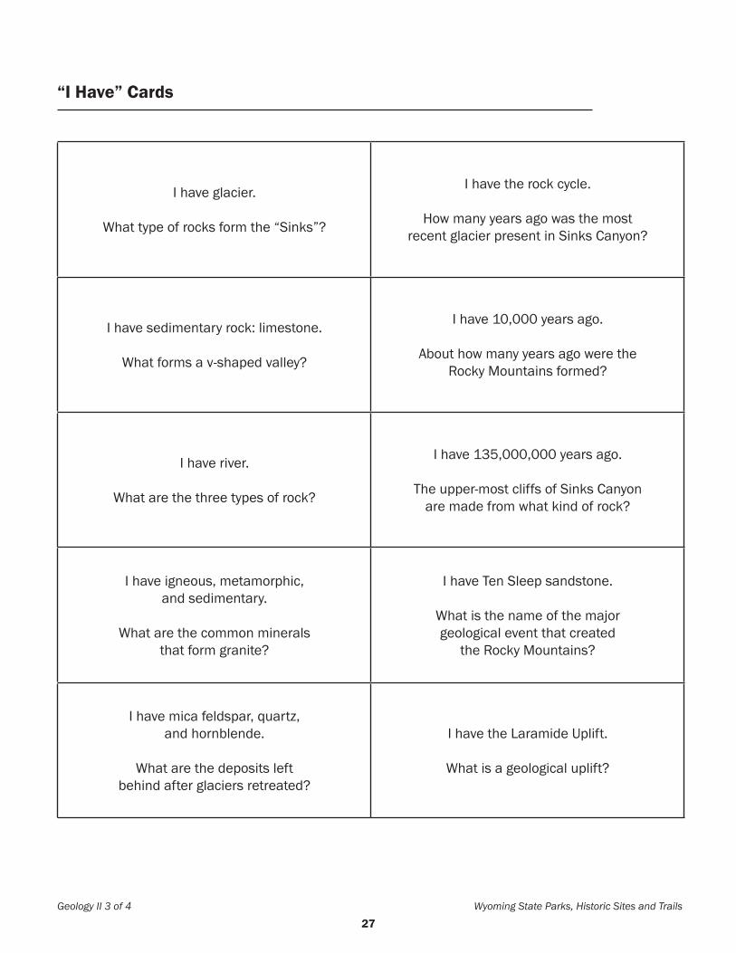
I have glacier.
What type of rocks form the “Sinks”?
I have the rock cycle.
How many years ago was the most recent glacier present in Sinks Canyon?
I have sedimentary rock: limestone.
What forms a v-shaped valley?
I have 10,000 years ago.
About how many years ago were the Rocky Mountains formed?
I have river.
What are the three types of rock?
I have 135,000,000 years ago.
The upper-most cliffs of Sinks Canyon are made from what kind of rock?
I have igneous, metamorphic,and sedimentary.
What are the common mineralsthat form granite?
I have Ten Sleep sandstone.
What is the name of the majorgeological event that created
the Rocky Mountains?
I have mica feldspar, quartz,and hornblende.
What are the deposits leftbehind after glaciers retreated?
I have the Laramide Uplift.
What is a geological uplift?
Geology II 3 of 4 Wyoming State Parks, Historic Sites and Trails
“I Have” Cards

28
“I Have” Cards
Wyoming State Parks, Historic Sites and Trails Geology II 4 of 4
I have moraines.
What is the type of igneous rock that cools beneath the surface of the Earth?
I have upward movement of the Earth’s crust.
What is a force that shaped Sinks Canyon?
I have intrusive igneous rock.
What are particles that make up rocks called?
I have the ice age or glaciers.
What is the name of large granite boulders carried from higher locations in the
mountains by glaciers and deposited on lower surfaces of a different material?
I have minerals.
What is the type of igneous rock that cools on the surface of the Earth?
I have glacial erratics.
What caused the red and black streaking on the high Ten Sleep sandstone cliff faces?
I have extrusive igneous rock.
What is the process during which rock can change from one form to another?
I have oxides of iron and magnesium called “desert varnish.”
What are steep-walled bowlsat the head of glacial valleys?
I have Madison Limestone.
What caused the u-shaped valley to form?
I have cirques?
What geological formation are the “Sinks” and “Rise” located?