geological setup and structure -...
TRANSCRIPT

Chapter- 4
GEOLOGICAL SETUP AND
STRUCTURE

33
4.1 REGIONAL AND LOCAL GEOLOGY
The Jammu and Kashmir State contains one of the finest developments of the
stratigraphic succession right from the Archean to recent, holding a complete
sequence of marine Paleozoics, Mesozoics and Cenozoics. A rich fossiliferous
geological record is seen in the hills and mountains surrounding the beautiful valley
of Kashmir in easily accessible localities. The stratigraphic sequence of the geological
formations with general lithology of Kashmir region is given in table 4.1. The
geological map of the Kashmir region is shown in fig.4.1 The lithological description
and areal extent of the different formations are given below:
Precambrians- Salkhala formation
In Kashmir the Precambrian rocks are called Salkhala formation (Wadia,
1931). It is considered as the oldest metasedimentary unit of Northern Himalaya,
representing the basement complex, constitutes carbonaceous slates, pyritous
graphitic phyllite and schist, associated with carbonaceous grey or white limestone,
marble, calcareous slate and calcareous schist. It also comprises chloritic, talcosic and
sericitic phyllites and schists, garentiferous schists and flagy quartzite. Wadia (1931)
observed that severe deformation and high grade metamorphism are additional
characteristics of Salkhala formation. The rocks of this formation are intimately
associated with granites and gneisses. The gneiss intruded in the Salkhala formation
has been designated as Central Himalayan Gneiss (Stoliczka, 1866; Mc Mohan, 1882;
Middlemiss 1890). These gneisses are acid, felspathic biotite, granite gneisses and are
porphyritic. There are also dolerites, amphibolites, pyroxenites within the formation.
The outcrops of these oldest rocks are found around the northwestern extremity of the
Kashmir valley and portions of the Pir Panjal range.

M
Table 4,1 The stratigraphic sequence of geological formations of Kashmir region (GSI-1989)
Geological
Quaternary
l.Sniy
Neogene
23 my
Paleogene
65my
Mesozoic
243my
Paleozoic
57()my
2S(K)mv
Archean
Time Scale
Holocene
Pleistocene
Miocene
Oligocene
Eocene
Paleocene
Cretaceous
Jurasisic
Triassic
Permian
Carboniferous
Devonian
Silurian
Ordovician
Cambrian
Proterozoic
Group and formation
River terraces and alluvium
KarewaGp. NaguniFm.
Hirpur Fm.
-
Numulitics
-
Wumuh Fm.
WiiGp.
Wuyan Fm
KhrewFm
Khunamuh Fm.
Zew'an Fm.
MamalFm.
Panjal Volcanics
Nishatbagh Fm.
Agglomeratic Slate
Fenestella Shale
Syringothyris Lst.
AishmuqamFm.
Muth Fm.
Margan Fm.
Karihul Fm.
Lolab Fm.
Dogra Fm.
Salkhala Fm.
Not yet recognized
General lithology
unconsolidated
pebble,boulder,sand and clay
Silt, clay, pebble
-
lime stone and shale(marine facies)
grey to purple shale, carbonaceous
shale+coal bed (continental facies)
-
sand stone, shale, limestone.
limestone, dolomite, shale.sand stone.
dark grey shale.
predominently volcanics with shale and
silt stone, plant bearing beds.
Quartzite.conglomerate, diamictite.
slate.
limestone, silt stone, shale, variegated
silt stone, quartzite, silty and calcare
ous shale, limestone, quartzite with
marine fossils.
Greenish grey sand stone, quartzite.
grey and dark grey silt stone + 1st.
1st, dolomite, with stromatolite, dark
grey shale/slate with quartzite
slate.phyllite, quartzite, grey shale.
siltstone, lst,+gypsum.

Fig. 4.1. Geological map of Kashmir valley (Source: Raza 1978)

36
Dogra slate
These rocks consist essentially of a thick series of phyllitic, black and green
coloured, flaggy or massive cleavage slate, interbedded with green, chloritoised,
amygdaloidal trap, a product of contemporaneous volcanic action, were designated as
the dogra slates by Wadia (1928). The slates show incipient foliation, the original
bedding planes rarely distinguishable as bands of different colours have largely been
obliterated by the superinduced cleavage planes. The lenticular quartz veins are
common. The Salkhalas are overlain by Dogra slates in the western flanks of Pir
Panjal range and north western parts of the Kashmir valley with unconformable or
thrust contact except in the syntaxial zone where it is gradational. However, the
relationship of the Dogra slates with the lower horizons of the Cambrian sequence is
obscure (Pascoe, 1959).
Paleozoic
In the extra peninsular region a continuous marine sedimentary succession
covering almost all the geological sequence of Paleozoic is widely developed from
Kashmir to Bhutan. There are some volcanic episodes and a few non-marine deposits
associated with this enormous succession. The fossiliferous marine sedimentaries of
the Himalayas are considered to represent the Tethyn zone'. The Kashmir Himalayas
is one of the classic areas exhibiting continuous Paleozoic succession with enormous
fossil wealth.
The geological, paleontological and petrological observations have been
recorded by many workers. However, the authentic geological account was given by
Godwin Austen (1866) and Verchere (1866-67), who were the first to introduce
Paleozoic stratigraphy. Lydekker (1883) produced first geological map of Kashmir
and made the first systematic study of the stratigraphy. The detailed study and
systematic mapping was carried out by Middlemiss (1909, 1910, 1911). He gave a

37
detailed account of stratigraphy of sourthern part of the Valley (Anantnag district).
His classification is still followed with some modifications from time to time.
Middlemiss divided the stratigraphic sequence into two divisions, by making the
Agglomeratic slate and Panjal Volcanics as a convenient series for division. The two
divisions are: Div. A, below the Panjal Volcanics and Div. B, above the Panjal
Volcanics. Wadia (1934) mapped northern part of Kashmir valley including the Fir
Panjal. The stratigraphy of SE Kashmir after Middlemiss (1910, 1911) and Wadia
(1934) is shown in table 4.2.
Table 4.2. Stratigraphy of SE Kashmir after Middlemiss (1910, 1911) and
Wadia (1934).
Age
Triassic
Permian
Upper
Carboniferous
Middle
Carboniferous
Low er
Carboniferous
Devonian
Ordovician
Middlemiss (1910-11) Wadia (1934)
Div. B.(Above the Panjal Volcanics)
(11) Upper Trias
(lO)Muschelkhel
(9) Lower Trias
(8) Zewan formation
(7) Gangamopteris beds
Panjal Volcanic flows
Agglomeratic Slate
Zewan formation
lower Gondwana beds
Panjal Traps
Agglomeratic Slate
Div. A. (below the Panjal Volcanics)
(6) Fenestella Shale
(5) Passage beds
(4) Syringothyris Lst
(3) Muth quartzites
Fenestella Shale
Syringothyris Lst
Muth quartzites

38
Silurian
(2) Upper Silurian
(1) Lower silurian
«& (?) Cambrian
fossiliferous slate.
quartzose greywacke etc.
Obscurely fossiliferous
slates, greywackes etc.
The other workers, who modified the above classification either by giving
some local names to some of the formations or by adding some more litho units,
include Gupta (1966-73), Shah (1972), Pal (1977). Shah (1972) divided cambro-
silurian group of Anantnag district into 3 lithological units which are :
Margan Shale
Lihinwan Sandstone
Chhatargul Mudstone
Gopender Kumar et of/,(1981) however, divided lower Paleozoic into following units:
Margan Shale
Karihul formation
Khaiyar formation
Stratigraphically, the lower Paleozoic of Kashmir is not well understood
because bulk of the sediments are mostly unfossiliferous and varying degree of
matamorphism has made lithostratigraphic correlation difficult. However, the upper
Paleozoic is well understood because persistent faunal horizons. The upper Paleozoic
have been described under more or less same litho units by all the workers.
Chhatargul Mudstone
This formation represents the oldest unit in Anantang district (Shah, 1972). It
consists of a homogenous succession of fine grained pyritiferous mudstone and slate
of varying shades from pale to dark blue. The siU content increases towards top and

39
the formation grades into Lihinwan Sandstone. Good Sections are also found in
Naubug and near Khaiyar in Hapatnar valley.
Lihinwan Sandstone
It consists of a heterogeneous succession of greywacke, banded sandstone and
sandy phyllite, with varying sandstone and shale ratio. The typical section is seen
around Lithinwan and near Naubug. The rocks show greater degree of metamorphism
to NW and comprise sandy phyllite with copper mineralisation.
Margan Shale
It is exposed throughout the area and is the only formation containing
determinable fossils. It comprises essentially shale, which is occasionally calcareous
and sandy. The Margan Shale is siliceous towards the base and becomes sandy
towards the top. Complete sections are seen below Margan pass. The important
taxonomic groups of fossisls include brachiopods, trilobites, corals, crinoids and
bryozoans.
Muth Quartzites
The Silurian rocks on both the flanks of Liddar anticline are overlain by a
thick succession of snow white to greenish grey, pinkish orthoquartzite of Devonian
age, known as Muthquartzites. It forms a conspicuous topographical feature by
making prominent cliffs and precipices. The formation consists of hard quartzite
which is generally massive and of granular texture and at places with ferruginous
spots. It also contains layers of siliceous limestone and agrillaceous matters. The
maximum thickness recorded is 317m. It shows wide development in Baramula,
Kupwara and Anantnag districts.
Aishmuqam Formation
This formation is a passage bed between Muthquartzites and Syringothyris
Limestones (Gopinder Kumar et al. 1981) and consists of quartzite with varying

40
colour from white, grey, purple to blotchy At places the formation is pebbly and
gritty with shale and sandstone partings. Fragmentary plant impressions are found in
the upper part. The rnaximum thickness is 150m near Wazur in the northern limb and
60m near Diuth in the southern limb of Liddar valley anticline.
In the Liddar valley anticline Muthquartzites are overlain by a series of
limestone strata called the Syringothyris Limestone. At Aishmuqam Syringothyris
Limestone is underlain by Aishmuqam formation. The lime stone is also exposed at
Kotsu, Ichhnar and Liwur. The formation yields fossils principally of Brachiopod
class. Syringothyris cuspidatae is a characteristic fossil of the strata from which the
formation derived its name. Middlemiss (1910) suggested lower Carboniferous age
for this formation because of its similarity to the Lipak series of Spiti.
Passage beds
The Syringothyris Limestone is overlain by a considerable thickness of
unfossiliferous rocks. The rocks consist of quartz, sandstone, and shale (Middlemiss,
1910). Petrologically they might be linked with Fenestella Shale above rather than
limestone below.
Fenestella Shale
The passage beds of Middlemiss were included in Fenestella Shale by a
number of workers. The Syringothyris Limestone is conformably overlain by an
enormous thickness (> 609m) of quartzites with intervening layer of generally dark
shales sometime slightly calcareous. It is in the lower part that these shales become
principally developed and are fossiliferous whilst towards the middle, the shale
becomes less conspicuous and without fossils Towards the upper Umit where the
formation pass into Agglomeratic Slate there recurs another fossil bearing horizon.
Fossil Fenestella gave rise the name to this formation. The other fossils are Spirifer,
Productus, Pecteu etc. The fossil Fenestella possess individual characteristics of its

41
own (Diener, 1915) bearing no relation to lower or upper Carboniferous. For this
reason this formation is placed between lower and upper Carboniferous. Although
the most characteristic sections are found on the banks of the Liddar river and at
Lehindajjar, the formation with fossils is also well marked in the valley head between
SW spurs of Liwapatur station and Krapri, near Buru, and at the head of Kirram
valley.
Agglomeratic Slate
The Agglomeratic Slates are pyroclastic slates, conglomerates, and
agglomeratic products. They contain pieces of quartzite, slate, porphyry, granite etc.,
irregularly dispersed in a fine grained greywake like matrix. These are generally
unfossiliferous but well preserved fossils have been obtained in Golabgarh Pass. The
presence of Fenestella and Protoretepora and their conformable upward passage into
the basal Gondwana conglomerate suggest upper Carboniferous age to these rocks.
Panjal Traps
Agglomeratic Slates are overlain by a thick series of bedded andesitic and
basaltic traps. They are distinctly bedded and massive. Amygdaloidal and compact
bands are both common. The lavas are non-porphyritic. The primary constituents are
plagioclase and augite in a fine grained semicrystalline ground mass. The
ferromagnesium minerals have been chloritized and / or epidotized to give the traps a
green colour. The intertrappean beds are also known within the Panjal Traps but
fossils are rare. However, some reported fossils fi"om limestone intertrappean do not
indicate any definite age. The Panjal Trap is extensively developed in Kashmir
valley. The estimated thickness is between 1800 and 2500 m.
Gangamopteris Beds (Lower Gondwana)
In many parts of Kashmir, the Panjal Traps are directly overlain by a series of
beds of cherts, siliceous and calcereous shales, thin bedded limestone, flaggy siliceous

42
beds of quartzite with a band of rock known as Novaculite. These beds contain fossil
impressions of ferns like Gangamopteris and Glossopteris with skeletons of
labyrinthodonts and fishes. Wadia (1928, 1934) calls the plant beds as lower
Gondwana with both Gangamopteris and Glassopteris flora. The localities where the
horizons are found are NE slope of Pir Panjal at Banihal pass, at Golbargash pass,
near Gulmarg and at Marhom. The age of Gangamopteris beds is upper Carboniferous
to lower Permian.
Zewan Formation
In Zewan, which is a type locality in Vihi district, the Gangamopteris beds are
overlain by a series of marine fossiliferous calcareous shale and crystalline limestone.
The name 'Zewan formation' has been applied to the entire succession from
Gangamopteris beds to lower Triassic beds. The lower part of the Zewan formation is
argillaceous but the upper part is calcareous. The lower part of the shale contains the
abundance of fossil Protoretepora. Over the top of the series there lie thin bands of
hard limestone and shales bearing Pseudomonotis, Danubites and other ammonites.
Some outcrops are also seen in Liddar valley, Pir Panjal and upper Sind.
Mesozoic
The Paleozoic formation are conformably overlain by Mesozoic formation in
the whole of the Himalayas, particularly in Kashmir and Spiti. Because of marked
difference in fauna between Paleozoic and Mesozoic the boundary between these can
be easily delineated. Cephalopods, which are abundant in the Mesozoic take the place
of Brachipod fauna which are abundant in Paleozoic. Of the three epochs of the
Mesozoic era, only Triassic is well developed in the Kashmir region.
Triassic
The Triassic of Kashmir consists mostly of a thick series of compact blue
limestone, agrillaceous limestone and dolomitic limestone and covers a large area of

43
Kashmir A superb development of limestone and dolomites of this system is
exhibited in a series of picturesque escarpments and cliffs forming the best part of the
scenery north of the river Jhelum. Numerous springs of fresh water issue from the
cliffs and prominences of these limestones at the southern end of the Valley
(Anantang district) aind form the sources of Jhelum. Middlemiss (1910) divided the
Triassic horizons of Kashmir into 3-broad units (table 4.3).
Table 4.3. Triassic horizons of Kashmir (after Middlemiss ,1910).
Upper Trias
(> 500m)
Unfossiliferous massive limestone.
Spiriferina stracheyi and S. Hauri zones.
Lamellibranch beds.
Ptychites horizon; Sandy shales with calcareous layers.
Ceratite beds;Sandy shales with calcareous layers.
Rhynchonella Trinodosibeds;Sandy shales with calcareous
layers.
Muschalkhalk
(About 274m ) Gymnites and ceratite beds;Sandy shales with calcareous layers,
lower nodular limestones and shales,
interbedded thin limestone, shales and sandy limestone.
Lower Trias
(over 91 m)
Hungarite shales.
Meekoceras limestone and shales.
Opheceras limestone.
Lower Triassic
All the three zones of lower Triassics, the Otoceras, Ophiceras ad Meekoceras
are developed in Vihi district of Kashmir. These are well exposed in the Sind and
Liddar valley Good sections have been found near Pastana and Lam (Tral).
44
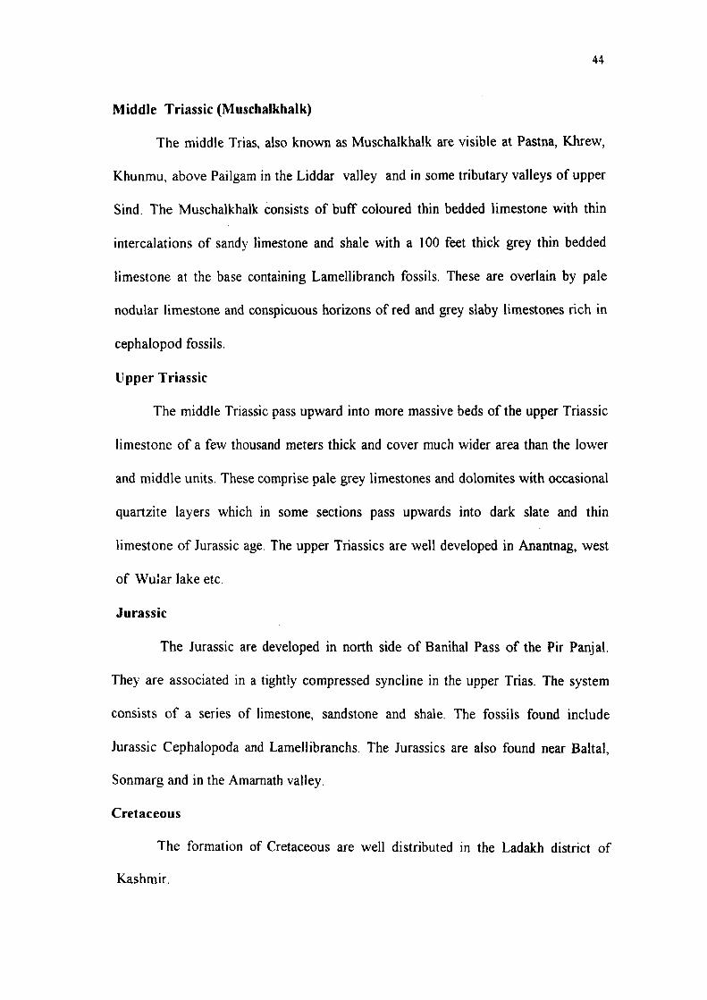
Middle Triassic (Muschalkhalk)
The middle Trias, also known as Muschalkhalk are visible at Pastna, Khrew,
Khunmu, above Pailgam in the Liddar valley and in some tributary valleys of upper
Sind. The Muschalkhalk consists of buff coloured thin bedded limestone v ith thin
intercalations of sandy limestone and shale with a 100 feet thick grey thin bedded
limestone at the base containing Lamellibranch fossils. These are overlain by pale
nodular limestone and conspicuous horizons of red and grey slaby limestones rich in
cephalopod fossils.
Upper Triassic
The middle Triassic pass upward into more massive beds of the upper Triassic
limestone of a few thousand meters thick and cover much wider area than the lower
and middle units. These comprise pale grey limestones and dolomites with occasional
quartzite layers which in some sections pass upwards into dark slate and thin
limestone of Jurassic age. The upper Triassics are well developed in Anantnag, west
of Wular lake etc.
Jurassic
The Jurassic are developed in north side of Banihal Pass of the Pir Panjal.
They are associated in a tightly compressed syncline in the upper Trias. The system
consists of a series of limestone, sandstone and shale. The fossils found include
Jurassic Cephalopoda and Lamellibranchs. The Jurassics are also found near Baltal,
Sonmarg and in the Amarnath valley.
Cretaceous
The formation of Cretaceous are well distributed in the Ladakh district of
Kashmir.

45
Tertiary
In Kashmir region only the Eocene and Murees are present. The Eocene
comprising dense Jaspery quartzites replacing limestone, carbonaceous and pyritous
shale, grey calcareous shale and fossiliferous limestone and unfossiliferous red,purple
and green shales with sandstone bands are found overlying the Triassic limestone in
the Uri area. The Tertiaries are not found in Anantnag so far.
The Murees of Punch area of Jammu are continued to the Uri area of
Kashmir, where they have faulted contact with the underlying numulitic limestone.
Quaternar}' (Karewa Group)
Godwin Austen (1864) was the first to take interest in the detailed geology of
the Karewa deposits. Drew (1875), Lydekker (1878), Middlemiss (1911, 1924), de
Terra and Paterson (1939), Wadia (1914) and Bhatt (1975) are the other workers who
had worked on the Karewa deposits.
During the Pleistocene period Kashmir had witnessed four major glaciation
which were separated by the inter glacial periods of humid and temperate climate. Of
these interglacial periods, the first one synchronised with the appearance of a wide
spread lake, which occupied every bit of the present day Kashmir valley. The non-
deposition during glacial phases and active deposifion during the interglacial phases is
preserved in these deposits. These alternations were simultaneous with the
intermittent uplift of western Himalayas, which resuhed in a thick pile of deposition
in the lake unless it was drained off at Baramulla, through which Jhelum flows at
present. The deposits thus formed occupy nearly half of the area of present day
Kashmir and presently range in aUitude fi-om 1600m in the Jhelum to over 3350m on
the slopes of Pir Panjal They are known as Karewa deposits. The term Karewa is of
Kashmiri origin. It means flat-topped hillock. The stratigraphy of the Karewa beds is
shown in fig. 4.2.

Fig. 4.2Map showing Karewa deposits
UJ
UJ
o
o
k
UJ
0.
10
I.
to
0
0)
0 -J
i 0.
GRAVELS
LOESSIC BED
MAIN GLACIATION — ELEVATION OF
PIR PANJAL
?••!..•/ 9 E LIGNITE ZONE
: \ ^ I LIGNITE ZONE
1000 m.
EARLY PLEISTOCENE ELEPHANT
LOCAL GRAVEL FANS
11" + + + + + + + + ml
"il + m« lilt i\\\ +
500 m.
0 m.

47
Karewa Group have been divided into lower and upper Karewas.
Lower Karewas (Hirpur Formation): The lower Karewas are mostly argillaceous,
light grey, sandy, dark grey clays, coarse to fine grained greenish sands but have the
gravel beds at the base containing most of the lignite of the Karewas and yield a
number of fossils of Equs, Elephus, Bos, Sus, Rhinoceras, cervus, Felis, fish and bird
bones and several leaf impressions. According to Wadia (1941) the basal lower
Karewas are preglacial in origin and their top portions even represent the debris of
second Ice advance. The original thickness of lower Karewas is estimated to be about
1675m.
Upper Karewas (Nagum Formation): Nagum formation are separated fi'om the
Hirpur formation by an unconfirmity representing an erosional interval. According to
Wadia (1941) about 600m of the lower Karewas were eroded from the crest of the
anticlinal folds. The upper Karewas are mostly arenaceous and comprise mainly of
the continental and lacustrine deposits consisting of the gravel facies, the lacustrine
facies and the loess facies are characterized by absence of lignite and by rare fossil
content. The Nagum formation starts with gravel facies which according to deTerra
represents second glacial and interglacial stage. The lacustrine facies comprise the
pale, yellow laminated marls and silts with medium to coarse grained calc grits and
varved clays. The lacustrine facies is overlain by the loess facies, which comprise
brown granular loams occuring as cappings over the river tarraces. The thickness of
upper Karewas in full is 610m. The general lithostratigraphy of Karewa group in
Kashmir valley is shown in table 4.4. (Bhatt, 1989).

48
Table 4.4. The general lithostratigraphy of Karewa group in Kashmir valley
Formation
Alluvium
(Holocene)
Dilpur (Upper
Pleistocene)
Nagum Fm.
(Middle
Pleistocene)
Member Lithology Thickness (m)
Hirpur
formation
(Pliocene to
lower
Pleistocene)
Shupiyan/
Ranipur/
Kninaus.
Methowain
Pre -Karewas
Rembiara
Dubjan
Sand and silt
Continental loess and reworked loess
Yellow silt, grey clay, calcareous layers and
sand with, conglomerates in the marginal
areas (Terrestrial, braided stream and lake
delta environment)
Unconformity - -
Grey clay, silt, lignitic mud, sand and
conglomerate (Lake deha environments with
braided stream as sub-environment)
Conglomerate (alluvial fan and braided
stream environment)
Grey clay, silt, lignitic mud, lignite and green
sand (Lake delta environment)
Unconformity
Mostly Paleozoic and Triassic basement
20-50
40-135
400
200
600
Recent to sub recent
The valley of Kashmir is an alluvium filled basin a large part of which is of
recent formation deposited by the river Jhelum and the adjoining nalas of the Kashmir
valley These deposits include alluvial tracts, flood plains, river terraces, and talus and
scree fans.

49
4.2 REGIONAL STRUCTURE
Wadia (1931) structurally divided the Kashmir region in to the following three
sharply defined tectonic units (fig. 4.3).
(1) The foreland
(2) The autochthonous folded beh
(3) The nappe zone
The rocks of the autochthonous belt are thrust over the rocks of the foreland
along the Murree thrust, and rocks of the Nappe Zone thrust over the rocks of the
autochthonous beh along the Panjal thrust.
The Foreland has the shape of a triangle which tapers down from a broad base
of several hundred miles in Jammu-Chakwal sections to less than 16 km north of
Muzzaffarabad due to the effects of thrusts resulting into syntaxis. The Foreland is
almost wholly submerged under middle Tertiary deposits. These rocks of the foreland
belonging to the Murree and Siwalik formations are thrown into several successive
waves giv'ing rise to parallel anticlines and synclines, with their fold axes following
the main line of the syntaxial bend. This parallelism of the fold trends on the Foreland
with the main axis of the Himalayan chain may be ascribed to the push of the
mountain arcs from the NE and NW (Varadan,1977). The Main Boundary Fauh,
another important structural feature of the Foreland marks the northern limit of the
Siwalik deposits against the faulted Murrees. The Main Boundary fault (MBT) is 200
km in length with a general trend WNW - ESE.The autochthonous Fold beh
intervenes between the Foreland Murrees and the crystalline schists of the Nappe zone
and occurs in the form of a thin strip of tightly folded vertically disposed strata or
recumbent folds, varying from a few meters to 7 km in width. The rocks of this belt
belong to the Himalayan geosyncline and are of the Carboniferous- Eocene age. The
cores of the recumbent anticlines are formed by the older Carboniferous- Triassic

c o '51
o
a
T3 CO
a m
iZ
U ^
A3nVA SnON
39NV>1 NVAVIVWIH i V i M O ^
isnaHi bvvisNvz
0 . Q.
< z
2 I
<
39NVb IVfNVd
iSnWHi IVfNVd
i s n i j H i
10 QNviabOd evfNnd
33banw
51
rocks while the flanks of the syndines are formed by the Eocene. The
sedimentary basin of Kashmir lies in a tectonic depression characterized by normal
open anticlines and synclines with the strongly ahered crystallines as the basement
and forms a part of the nappe zone, which is supposed to have travelled far along an
almost horizontal thrust. The rocks of the Nappe zone cover a vast extent of the area,
consist mostly of the Salkhalas and Dogra slates. However, on the Kashmir flank of
the Pir Panjal a series of deposits ranging in age from Cambrian to Triassic are well
developed.
4.3. LOCAL STRUCTURE
A section across the Liddar valley anticline is shown in fig. 4.4. On the eastern
side of the Liddar river the uninterrupted beds broadly strike NW- SE and dip at 35"
to 45" towards NE, In the SE part of the Liddar river the beds strike WNW- ESE and
dip up to 60° towards NNE. On the western side of the Liddar river the beds show a
considerable swerving in strike in NE- SW and even ENE- WSW direction. In the SW
part of Liddar river the beds dip south westerly.
The variation in the strike direction indicates anticlinal structure with a gentle
plunge towards NW (Kaul, 1982). This anticline is known as Liddar valley anticline.
The river Liddar has a straight course in NNE- SSW direction, is controlled by a
major fauh roughly trending NNE- SSW. (Middlemiss, 1910). The fault is of pre-
Panjal Trap age (Kaul, 1982). Several cross fauUs trending N80° E-S80°W, and
N80 W- S80 E are also found in the area. The joints noticed in the area are few cm to
several meters in length. Some joints continue for a length of over 25m. The average
disposition of the joints is in NW- SE and NE- SW with steep to vertical dips. The
prominent set of joints trending N50° E- S 50''W is nearly perpendicular to the fold
axis, where as another set is more or less parallel to the fold axis.

c ea > .
(LI
> •o T3
(LI
(/: VI O u CC
C o u u Vi Vi Vi O
CO
iZ
53
4.4. LITHOLOGICAL AND STRUCTURAL CONTROLS FOR ANANTNAG
SPRINGS
Most of the springs sampled and studied are hosted by Triassic Limestone.
There are, however, springs issuing out from the alluvium/ overburden, but field
geological characteristics suggest that these springs too have their reservoirs in the
limestone. In addition, there are springs confined to the zones occupied by Karewas. It
appears, therefore, that as for reservoir conditions are concerned, some of the springs
are fed undoubtedly by limestone-hosted reservoir. Karstic conditions in limestones
mostly have enhanced their tendency to form reservoirs. However, Karewa hosted
springs may possibly have their reservoirs within the Panjal Volcanics. This inference
is based on two considerations. First, the lithology of Karewas precludes the
possibility of hosting a reservoir capable of providing perennial supply of
groundwater to the springs, and secondly, as mentioned in a later chapter (chapter-6),
relatively high Mg content in Karewa-hosted springs gives clues to the existence of
the reservoir in Panjal rocks.
Joints and fractures, obviously, provide the most significant structural control
for the very existence of the springs in Anantnag area. These planes establish a
hydrological continuity between the recharge zones at higher altitudes and the
discharge sites at the valley floor. They act as conduits for the migration of
groundwater and determine the point of springs emergence.