geological map of the western sØrland - … · geological map of the western sØrland 3 financial...
TRANSCRIPT

NORSK GEOLOGISK TIDSSKRIFT 25
Ms. rec. Nov. 1944.
GEOLOGICAL MAP OF THE WESTERN SØRLAND
BY
ToM. F. W. BARTH
With l geo!. map, 2 plates, and 7 figures in the text.
The area covered by the map is limited to the north by 58° 40' N latitude, in the east by longitude 8° l O' E Greenwich. In south and west it is bounded by the North Sea. The area corresponds to the western part of the region which in Norway is known as the ''Sørland".
The pubHshed data that have 'been incorporated in the present map have been taken from the following sources:
l) Tlh. Kjerulf og T. Dahl!: Geologisk Kart over Det Søndenfjeldske Norge, 1858-1865. This is merely a reconnaissance map in the scale l: 400 000 on which rather few details are shown. 2) C. F. Kolderup: Die Labradorfelse des westlichen Norwegens I-. Bergens Museums Aarbog 1896, No. 5; 3): Fjeldbygningen inden rektangelkartet Egersunds omraade -. Norges Geo!. Undersøk. No. 71, 1914; 4): The anorthosites of Westen Norway-. Rep't. 16. Internat. Geo l. Congress, Washington 1933, p. 289. In these papers Kolderup has published some field observations on the anorthosite-charnockite petrographic province in the west. But detailed mapping is given only in No. 3 dealing wirh the extreme western parts (country around Egersund). 5) Arne Bugge: Trekk av Sørlandets geomorfologi -. Norsk Geogr. Tidsskr. 7, 98, 1939. This survey stops at the extreme eastern end of the present map; same features of the country around KrisHansand is shown.
Special geological and mineralogical details have been collected
from the following pa pers: 6) Olaf Holtedahl: The submarine relief off the Norwegian
coast --. Norske Vid.-Akad., Oslo 1940; 7) J. H. L. Vogt: Norske ertsforekomster V. Titanjernforekomstene i noritfeltet ved EkersundSoggendal -.Kristiania 1887; 8) Steinar Foslie: Syd-Norges gmber og malmforekomster -. Norges Geo!. Undersøk. No. 126, 1925; 9) Olaf Andersen: Feltspat Il, forekomster i fylkene Buskerud og
Norsk geol. tidsskr. 25.

2 TOM. F. W. BARTH
Telemark, i flere herreder i Aust-Agder og i Hidra i Vest-Agder -. Norges Geo!. Undersøk. No. 128b, 1931; 10) Olge J. Adamson: The granite pegmatites of Hitterø, Southwestern Norway -. Geo!. For. Forh. Stockholm, 64, 97, 1942.
Various cartographic data have previously been published by me in the following papers:
11) Tom. F. W. Barth: Zur Genese der Pegmatite im Urgebirge I, Die Geologie und Petrographie der granitischen Pegmatite im siidlichsten Norwegen -. Neues Jahrb. f. Min. etc., B. Bd 58, Abt. A, 385, 1928. 12): Zur Genesis der PegmaNte im Urgehirge Il, Ein syntektischer Gesteinskomplex aus dem siidlichsten Norwegen -. Chemie der Erde, 4, 95, 1928; 13) : Feltspat Ill, forekomster i Iveland og Vegusdal i Aust-Agder og i flere herreder i Vest-Agder,-. Norges Geo!. Undersøk. No. 128b, 1931; 14) : The large pre.-Cambrian intrusive bodies in the southern part of Norway -. Rep't. 16. Internat. Geo l. Congress, Washington 1933, p. 297; 15) : Geomorphology of Vest-Agder Fiord-Land -. · Norsk Geogr. Tidsskr. 7, 34, 1939;
16) : Lamprofyrer av to forskjellige aldre i kystmigmatiten vest for Kristiansand -. Norsk Geo!. Tidsskr. 23, 175, 1943.
Furthermore I have made use of the field observations of Robert Major on the quartz-monzonite area W of Farsund ( University exam pa per 1940), and of Olge J. Adamson on the rock complex in the island of Hidra ( University exam paper 1940) .
I have spent sev·eral weeks in the field together with Dr. Robert Balk (professor at Mt. Holyoke College, Mass. U. S. A.) to whom I am particularly indepted for constructive discussions and for his teaching me the principles, problems, and met<hods of study of the structural patterns of igneous rocks. I also want to acknowlege my grateful remembrance of the pleasant and stimulating days in the field together with Dr. Arne Bugge ( Norges Geologiske Undersøkelse), Dr. Harald Bjørlykke: (Norges Tekniske Høgskole), cand. reaL Anders Kvale (Bergens Museum), Dr. Otto MelJiis ( the University of Riga), and Dr. A. C. Waters (Stanford University, Calif. U. S. A.).
My own field investiga tions extend over several years: In 1930
and 1932, as a member of the Geophyskal Laboratory of Washington,
D. C., I stayed in the field for several months mainly studying the contact phenomena of the anorthosites and congeneNc rocks. I want to express my thanks to Dr. A. L. Day for tihe positive interest he took in my activities, and I take great pl�easure in acknowledging the

GEOLOGICAL MAP OF THE WESTERN SØRLAND 3
financial support for the field work extended to me from the Geophysical Laboratory through its former director, Dr. A. L. Day.
For eight consecutive summers ( 1936-1943) I have for shorter or longer periods worked in the field under the auspices of Norges Geologiske Undersøkelse. During this period I have nearly completed the geologi ca) mapping of the following 1 O "rectangle" map sheers in the sea le l : l 00 000: Evje, parts of Kristiansand, Oksø, Bjelland, Audnedal, Mandal, two still unnamed sheets between Bjelland and Egersund, Flekkefjord, Loshavn. I hope to be able to publis:h some of these maps as soon as the conditions in this country become more favorable and more normal. As a "summary" of these detailed field investigations I offer for publication the present map in the scale l : 300 000. For the pleasant co-operation with Norges Geologiske Undersøkelse and for defraying the full cost of the field work connected with the survey of these map sheets I want to express my hearty thanks to the director of the Survey, Dr. Carl Bugge.
The Rocks.
The map represents a part of the great pre-Cambrian shield of Southern Norway. Crystalline schists are dominating, but a rock province of anorthositic-charnockiNc composition occurring in the western parts of the mapped area was generally believed to be truly igneous. All measurements pertaining to strike and dip have been stated in terms of degrees of the decimal system: l 00° = right angle.
Mixed Gneisses constitute the oldest rock formation representing a heterogeneous migmatic-anatectic rock complex in which the composition of the constituent rock types ranges from amphibolitic to granitic. The general trend of the strike of the gneisses is northsouth with steep westerly dips. The amphibolites are present as hands, zones, and streaks in a granitic matrix, or else as larger bodies of irregular shape (nickeliferous "gabbro" at Evje-Iveland).
Some of the more characteristlic gneiss types: Regular banded
gneisses with straight layers of amphibolite extending over long
distances, Photos 3 and 7; in other parts the amphibolitc rna y be pulled out to narrow sheets that have floated in the granitic migma and eventually congealed as phantastically twisted and folded " rheolitcs", Photo 8; again in other parts the amphibolite forms lenses
4 TOM. F. W. BARTH
or irregularly elongated bodies, Photo 5; true agmatites ( = breccialike structures) of amphibolite and granitic gneiss also occur ( Photo 2)
strikingly similar to the agmatites described by Sederholm from migmatites in Southern Finland.
Through potash metasomatism the amphibolites develop into biotite gneisses, Photo 4; under certain conditions they in turn change
into augengneisses -+ granitic gneisses -+ gneiss granites -+ pegmatites, apparently in accordance with the scheme described by me in 1928 (reference No. 12) .
The foHowing summary statements represent my ideas on the genes1is of the mixed gneisses: They developed at a deep level of the earth's crust during a pre-Cambrian orogenesis. Following Eskola and
others I regard the granitic ichors or magmas as the "sweat" secreted by the crust during an orogeny. Thus is explained the dominant occurrence of rocks of granitic character.
At the contact of these granites a oontinuous transition into the adjacent gneisses is frequently encountered, see Fig. 1. In other places granite and gneiss are so intimately mixed that it requires a map on a very large scale to separate them. All tihe different types ,of gneisses have been formed through a metasomatic action of the granitic magma. Only anatectic processes, it seems to me, would be able to produce such gneisses and migmatites.
The granitic magma, which consequently was, at !east partially, a palingenic magma, can thus be pictured as a pore Iiquid being formed in the interstioes of the mineral grains of a pre-Cambrian rock complex as it was folded down deeply enough to suffer a differential re-fusion. Being lighter tihan the rock in whose por·es it is first enclosed
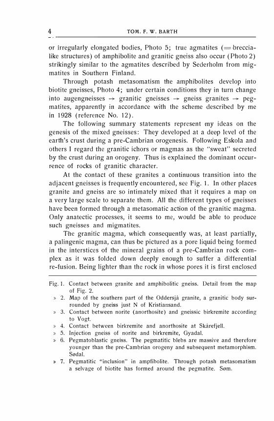
Fig. l. Contact between granite and amphibolitic gneiss. Detail from the map
of Fig. 2. » 2. Map of the southern part of the Oddersjå granite, a granitic body sur
rounded by gneiss just N of Kristiansand.
» 3. Contact between norite (anorthosite) and gneissic birkremite according
to Vogt. » 4. Contact between birkremite and anorthosite at Skårefjell.
» 5. lnjection gneiss of norite and birkremite, Gyadal.
» 6. Pegmatoblastic gneiss. The pegmatitic blebs are massive and therefore
younger than the pre-Cambrian orogeny and subsequent metamorphism.
Sødal.
» 7. Pegmatitic "inclusion" in ampfibolite. Through potash metasomatism
a selvage of biotite has formed around the pegmatite. Søm.

li l
'
' G;:anit� '
GEOLOGICAL MAP OF THE WESTERN SØRLAND
l t1eter
2?�m·•. l,:"' 6 l , ........ . ... l ,�i\\; 'l l (\"l•,'lo. -= l)�·. l}� :i:'•; �:�:tJ� 'l • l .'''""�
l ... ... i ,/. l l l l {���.�_!'! \ �, .. :\�_. '· "c•
' > ��t:' l ;����· ' Figs. l-7.
5

6 TOM. F. W. BARTH
this melt tends to rise, and at first it soaks through the overlying rock masses, and in acoordance with the law of mass action alters them metasomatically. As can be shown from chemical, mineralogical, and geological analyses, every volume unit of the adjacent gneiss has been influenced, indeed, severely altered by the granitic magma. AHhougih the magma itself was passive it can thus be set in motion by orogenetic or gravitative forces. It may be squeezed ou•t in some places, and will seek its way along shearing planes or other planes of small resistance. It may move shorter or langer distances. There may be formed veined gneisses or other kinds of migmatite ( Photos 4 and 8). Or the magma may concentrate into large basins giving rise to bodies of pure granite. An example of these large bodies is shown in the map of tlhe Oddersjå
granite, Fig. 2. It is composed of pure granite, and displays a more or less pronounced linear parallelism which looks similar to what have been termed flow lines by H. Cloos and his school. But if they were common flow lines they Should show a marked increase towards the selvages, where also pl a ty parallelism, or foliation, should appear; and obstacles in the direction of the flow, like bends in the border, or inclusions, should cause the flow lines to wind around in back eddies. But no such phenomena can be observed. Quite ·the contrary, as seen from Fig. 2, it is a striking fact that the "flow lines" continue in their normal direction (alm ost due nortih) straight out to the border of the granite, even if the border obliquely cuts the direction of the "flow lines". This contact is shown in great detail on Fig. l. These facts make it defini•tely impossible to account for the linear parallelism by magmatic flowage.
That, however, these lines indicate directions in which the magma was deformed prior to its compl,ete solidification is seen from the lower left hand sketch of Fig. 2 proving the pre-pegmatitic age of the texture. This indicates, therefore, that there has not been any metamorphism after the solidification of the granite, and that the linear paraHelism was caused during the crystallization of the granite by the same orogenetic forces that deformed the gneisses.
My contention regarding the mode of emplacement of these granites is thus that the granitic magma, which started as a palingenic pore liquid in the deeply down-folded pre-Cambrian rocks, partly soaking through the adjacent rocks, partly following planes of small
resistance, would slowly concentrate in larger basins, crystallize in situ, and simurJtaneously develop a linear texture. Where the pore liquid

GEOLOGICAL MAP OF THE WESTERN SØRLAND 7
was unable to concentrate in Iarger basins it congealed in "puddles", "blebs" or "drops" that had soaked through the surrounding gneissesthese are the innumerable small pegmatjte bodies which have such a wide distribution in the mixed gneisses. See Figs. 6 and 7. It is impossible to mark the pegmatites on the map, but all feldspar quarries are shown.
At the conclusion of �he pre-Cambrian orogeny the complex of mixed gneisses had received its present character.
Anorthosite ( Andesinic) - Farsundite (Hornblende-Bearing Quartz
Monzonite) - Birkr'emite (Hypersthene Granite-Gneiss).
These rocks are probably younger than the mixed gneisses and exhibit a more "igneous" texture; but oertain facies types of them may be just as "gneissic" as the mixed gneisses. By Kolderup 2) , 3) , 4) they were regarded as derivatives of a common magma. However, I have not been able to proc!Juce any clear evidence in favour of this view. The contact phenomena between �hese members among themselves and between them and the adjacent mixed gneisses are
interesting but have so far failed to give a clue to the problem of interrelation or genesis.
The contact anorthosite- birkremite is usually conformable; foliated anorthosite of the border zones ( induding noritic facies) is in contact with birkremite exhibiting parallel foliation. See Fig. 5. In many places the transition is gradual giving rise to migmatite-like border zones composed of foliated, alternating layers of various rock types, such as: anorthosite, norite, mangerite, birkremite, amphibolite, and even other types of gneisses. Vogt 7) found a contact supposed to prove the younger age of the anorthosite. See Fig. 3. A similar border phenomenon has been observed by me on the west side of Skårefjell. See Fig. 4. However, in my opinion we have in these places no primary contacts: At Skårefjell the anorthosite exhibits a typica:I block structure, and "blocks" of anorfhosite occur alongside wi�h "blocks" of gneissic birkremite. The anorthosite is part! y massive, partly intensely crushed. Just west of t'he crushed rocks an anorthosite crops out showing distinct foliation pointing directly into the gneissic birkremite whioh, therefore, must be separated from the anorthosite by a thrust plane. My conclusion is that the primary contact betwE'en anorthosite and hirkrernite is always conformable.

8 TOM. F. W. BARTH
The contact between b irkremite and farsund i te is always
very elusive, being effected over longer distances by a graclual increase
in hornblende on the cost of hypersthene.
The contact b i rkremit e- mixed gneiss is, as far as I have
seen, always transitional and undeterminable.
The contact farsund ite- mixed gneiss may take on two
different aspects: It is typical for farsundite to be come strongly
foliated towards the borclers, and the foliation is always parallel to
the border walls. Also the foliation of the adjacent gneisses are usually
swung into the plane of the border walls. The contact is in such
places quite sharp. In other places the transition farsundite-mixed
gneisses is similar to the transition between granite and gneiss shown
in Fig. 1. This type of transition is found, as indicated by the map,
at the end of the long offshoots which exten�d , two northwards, and
one southward, from the main body of farsundite.
In my opinion farsundite and birkremite represent closely related
derivatives of deepseated magma that some time after the conclusion
of t'he pre-Cambrian orogeny rose from a deep center in the neigh
borhood of Farsund-Lista, and by metasomtic alteration, brecciation,
disintegration, and assimilation invaded the country gneisses; thus
forming with them "injection gneisses" and migmatites. The relations of anorthosite are still uncertain. Even the mag
matic mocle of origin may be questioned . The following observations are hard to accept for an igneous rock: 1) Giant crystals of andesine that in places attain a length of 110 cm (3Yz feet) . 2) Homogeneous and undeformed crystals of "porphyric" andesine in a foliated or quite gneissouse groundmass. 3) Folds in anorthosite t'hat is entirely surrouncled by massive anorthosite. See Photo 6.
Faults, Thrust Zones, Friction Breccias.
Arne Bugge has ,demonstrated the existence of a mighty friction breccia extending for 350 kilometers from the Oslo region in NE to Kristiansand in SW. The trace of the sou�hwestern part of this breccia zone is indicatecl on the present map. Sub-parallel thrust zones have been shown to exist farther north and west. The alleged "volcano"
in Greipstad (K. O. Bjørlykke: "Remnants of a Volcano in Southwestern Norway", Norsk Geo!. Tidsskr. 7, pp. 271-279, 1924) is

GEOLOGICAL MAP OF THE WESTERN SØRLAND 9
merely a part of one of these zones. Thus this part of the preCambrian sihield has cracked up in long segments which again are cut
crosswise by a system of faults running athwart. There is no striking difference in the rock types encountered on opposite sides of the thrust zones; this indicates that the thrusts, although representing first order dislocations, do not separate geological formations of very different character.
According to Holtedahl 6) the land masses are bounded by a system of submarine fault lines testifying to tihe epeirogenic rise of the country in Cainozoic time.
Mineralogisk Institutt, Oslo, November l 944.
Trykt juni l 945.

Photo l. » 2. » 3. » 4. » 5.
Plate I.
Pegmatite dikes intrusive into amphibolitic gneiss, Herø, Søgne. A,gmatite. Nodeviksholmen, Søgne. Banded gneiss, Brennåsen, Greipstad. Striped biotite gneiss. Brennåsen, Greipstad. An "egg" of amphibolite embedded in granitic gneiss l x 2 meters across. Herø, Søgne.
Plate I I.
Photo 6. Fold in anorthosite. Bottenvann, Ana Sira. >>. 7. Banded gneiss. Udvår, Try. » 8. Rheolitic gneiss. Selskjær, Try.

Tom. F. W. Barth: Geological Map of the Western Sør! and. Pl. I.
Norsk geol. tidsskr. 25.

Tom. F. W. Barth: Geological Map of the Western Sørland. Pl. Il.
Norsk geo!. tidsskr. 25.

� l
0
El!] "
����
l?uth Smit del.
• \ l
•
-
/
.Oia/Jases
Birkremite
Farsund/te
No rite
llnorthosite
/1asslve gabbros
Gran/te <l) �
Gneissous granite <l)
<l) ·-
�
Gran/tie gneiss c: Q)
4ugen gneiss '1:::1 � )(
llmphibollte (E�je} -
�
llmphibolite
Mixed gneiss
'
l l
l
Mines, Quarries and O re Deposits
Ø' 1/menite, Magnetite l
• Pyrrhotite
fi' Pgrite
""· Chalcopgrite
<D Moly/Jdite
a !1anganese
D Stiver
X Feid spar
c Limestone
/BO/ 1/ertical dip = 100°
Fault on /ond --- Inlerred fault zone
.lnf'erred su/Jmarine
THE WESTERN PART OF SØRLANDET
s.w. NORWAY
Sca/e /:300000 o 5 JO 15
!aults
T.F:W.B. 1944 EMIL MOESTUE AlS