geographic information system (gis) and earth observation
TRANSCRIPT
MINISTRY OF WATER, SANITATION KENYA WATER INSTITUTE, AND IRRIGATION (KEWI)
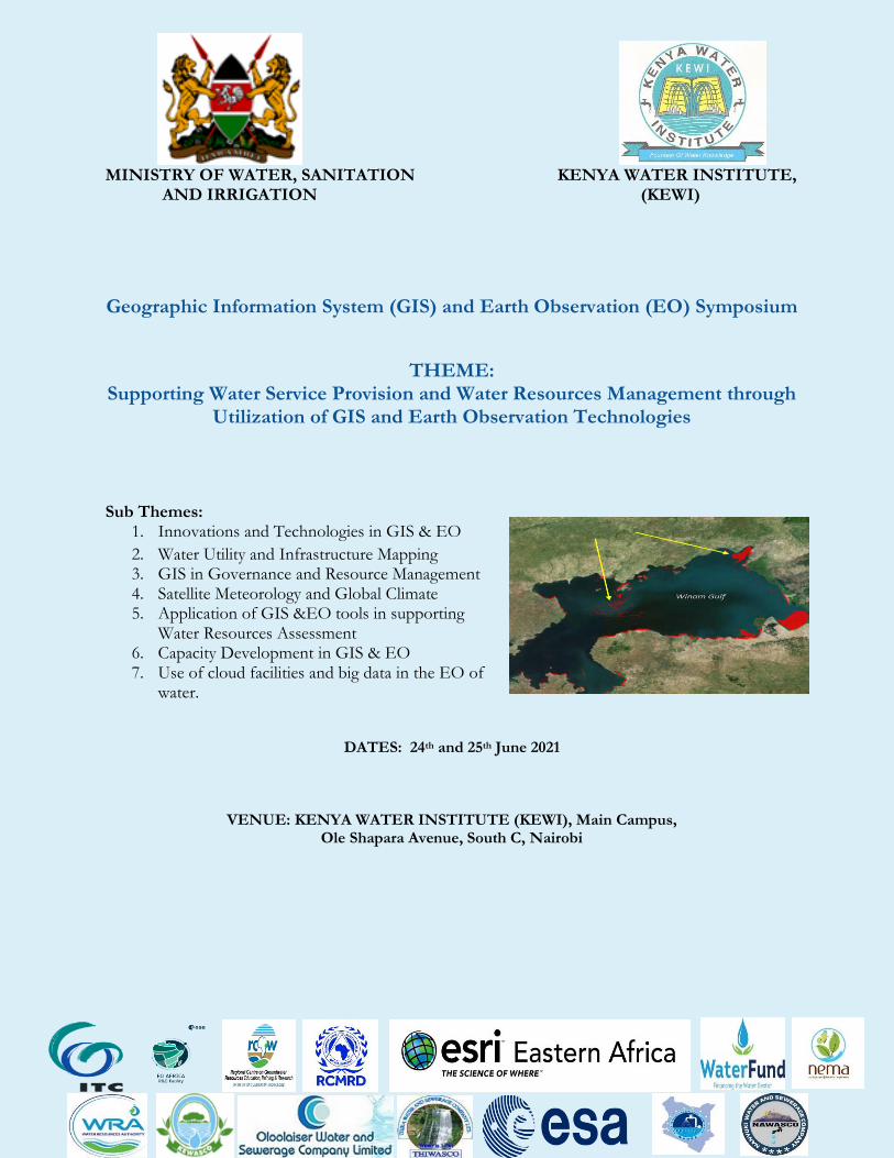
Geographic Information System (GIS) and Earth Observation (EO) Symposium
THEME: Supporting Water Service Provision and Water Resources Management through
Utilization of GIS and Earth Observation Technologies
Sub Themes: 1. Innovations and Technologies in GIS & EO
2. Water Utility and Infrastructure Mapping 3. GIS in Governance and Resource Management 4. Satellite Meteorology and Global Climate 5. Application of GIS &EO tools in supporting
Water Resources Assessment 6. Capacity Development in GIS & EO 7. Use of cloud facilities and big data in the EO of
water.
DATES: 24th and 25th June 2021
VENUE: KENYA WATER INSTITUTE (KEWI), Main Campus, Ole Shapara Avenue, South C, Nairobi
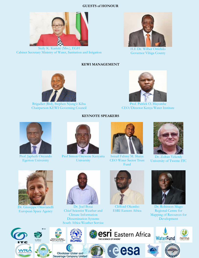
GUESTS of HONOUR
Sicily K. Kariuki (Mrs.), EGH
Cabinet Secretary Ministry of Water, Sanitation and Irrigation
H.E Dr. Wilber Ottichilo Governor Vihiga County
KEWI MANAGEMENT
Brigadier (Rtd), Stephen Njung’e Kihu Chairperson KEWI Governing Council
Prof. Patrick O. Hayombe
CEO/Director Kenya Water Institute
KEYNOTE SPEAKERS
Prof. Japheth Onyando
Egerton University
Prof Simon Onywere Kenyatta
University
Ismail Fahmy M. Shaiye CEO Water Sector Trust
Fund
Dr. Zoltan Vekerdy
University of Twente ITC
Dr. Giuseppe Ottavianelli European Space Agency
Dr. Joel Botai
Chief Scientist Weather and Climate Information
Dissemination Systems South Africa Weather Service
Clifford Okembo
ESRI Eastern Africa
Dr. Robinson Mugo Regional Centre for
Mapping of Resources for Development
OTHER KEYNOTE SPEAKERS
1. Major Andrew Nyawade 2. Dr. Patrick Chege Kariuki
3. Dr. Mark K Boit 4. Prof. Faith Njoki Karanja (MISK), LS(K)
5. Dr Betty Alosa Mulianga 6. Eric Nyadimo
7. Dr Joshua Cheboiwo
SYMPOSIUM PROGRAMME
Day 1: Thursday, June 24 2021 Facilitator Venue
8.30-9.00 am Arrival and Registration
Ms. Caroline Kibui
WRC Upper
9.00- 9.30am
Official Opening Welcome Address: Prof. Patrick O. Hayombe, PhD
Director/CEO Kenya Water Institute
Brig (Rtd) Stephen Njung’eKihu, EBS, Chairperson, Kenya Water Institute Governing Council
Prof. Patrick O. Hayombe, PhD Director/CEO Kenya Water
Institute
WRC Upper Rappoteurs: 1. Wayne Mark 2. Ruphin Naya 3. Vivian Akoth
Opening Remarks: Irrigation Secretary: Aboud Moeva
Water Secretary: Eng. S.A.O. Alima
Principal Secretary: Mr. Joseph W. Irungu, CBS
Chief Administrative Secretary: Dr. Andrew K. Tuimur, CBS
Governor, Vihiga County: H.E Dr. Wilber Otichillo
Cabinet Secretary: Sicily K Kariuki (Mrs) EGH
9.30-10.30am
Panel discussion 1 1. Dr. Giuseppe Ottavianelli –Head of the Applications Section in the Science, Applications and Climate Department. The ESA EO Africa initiative
2. Arno van Lieshout- Course Coordinator WREM / Lecturer, Faculty of Geo-Information Science and Earth Observation, University of Twente EO Africa Research and Development Facility:The way forward to strengthen the EO cooperation between Africa and Europe
3. Dr Joel Botai - Chief Weather and Climate Information Dissemination Systems – South Africa Weather Service
Moderator: Mr. Eric Wamiti
WRC Upper
Rappoteurs: 1. Wayne Mark 2. Ruphin Naya 3. Vivian Akoth
10.30-11.00 am Health Break
11.00-12.00pm
Panel discussion 2 1. H.E Dr. Wilber Otichillo – Governor, Vihiga County
Moderator: WRC Upper Rappoteurs:
2. Ismail Fahmy M. Shaiye- Chief Executive Officer (CEO) Water Sector Trust Fund
3. Clifford Okembo – Chief Executive, ESRI East Africa
4. Dr. Robinson Mugo -Regional Centre for Mapping of Resources for Development
5. Prof. Patrick O. Hayombe, PhD, Kenya Water Institute
Mr. Kennedy Riaga
1. Wayne Mark 2. Ruphin Naya 3. Vivian Akoth
12.00-1.00pm
Panel discussion 3 1. Prof. Onywere, Simon Mang’erere (PhD), Director, Capacity Development and Consultancy Services, Kenyatta University
2. Mr. Charles Mwangi/Major Andrew Nyawade – Kenya Space Agency
The use of GIS and Earth Observation technologies at KSA
3. Prof. Japheth O. Onyando, PHD, PE, MIEK – Egerton University
4. Dr. Patrick Chege Kariuki – Chairman Department of GIS South Eastern Kenya University (SEKU)
Moderator: Mr. Elkana Kaburi
WRC Upper
Rappoteurs: 1. Wayne Mark 2. Ruphin Naya 3. Vivian Akoth
1.00-2.00pm Lunch break
WRC Restaurant
2.00-4.00pm
Paper presentations Subtheme 1: Innovations and Technologies in GIS & EO
Topics and Presenters 1. Adopting new trends and approaches in the
management of Non-Revenue Water - Eric Nyadimo
2. Reservoir suitability mapping using analytical hierarchy process and GIS in Kirehe District - SylionMuramira
3. Near-Real-Time Bio-Optical Water Quality Assessment Using Landsat OLI and Sentinel MSI for Case II Waters - Herbert Kipchumba
4. Supporting water resources assessment - David Mwangi
5. Water Quality Monitoring and Reporting System - Collins Oduor
6. Topography and drainage - Grace Gakenia 7. Application of GIS and remote sensing in Oceans
and water resource management - Mill Bosire 8. Supporting Water Service Provision and Water
Resources Management through Utilization of GIS and EO technologies - John Maina
9. Flood assessment using EO technology Kenya – Rose Waswa
10. Upande Value Proposition Deck- Shatora Sharon
Subtheme Chairs: 1. Mr. Henry
Kobia 2. Mr. Peter
Nawiri
WRC Upper
Rappoteurs: 1. Wayne Mark 2. Ruphin Naya 3. Vivian Akoth

Paper Presentations
Subtheme 6: Capacity
Development in GIS & EO
Topics and Presenters 1. GIS and Earth Observation Training: Existing
and Emerging Challenges - Okota Grace Lorna 2. Competency-Based Training and Technical
Capacity Development in GIS/EO- A case of Laikipia University, Kenya - John Maina
3. Approaches for Capacity Building in GIS and Remote Sensing Technologies in Kenya - Auka Vincent
4. Kobo Toolbox: An open-source Mobile GIS tool for water access points collection, mapping and planning or not - Samuel Ouma
Subtheme Chairs: 1. Mr. Leonard
Makokha
WRC Upper
Rappoteurs: 1. Wayne Mark 2. Ruphin Naya 3. Vivian Akoth
Paper Presentations Subtheme 3: GIS in Governance and Resource Management
Topics and Presenters 1. A GIS-based approach to delineating the areas of
a lake that are suitable for cage fish culture - Aura Christopher
2. Use of GIS technologies in data management and flood monitoring by the Water Resources Authority (WRA) - Kennedy Ochieng
3. GIS Based Flood Vulnerability and Flood Risk Mapping (Case Study of the Lower Nzoia River Basin) - George Chilli
4. GIS and Earth Observation Technologies for Water Resources Mapping in Kenyan Rangelands-The Critical Micro-Level - Lapezoh O. Abisai
5. Erosion Risk Mapping for Sub Basins in Nzoia Watershed, Kenya - Ngessa Reuben
6. Multi-Criteria based watershed prioritization for soil and water conservation planning in Gotu watershed, Awash River basin, Ethiopia - Tesfaye Wasihun
7. GIS based Multi criteria Analysis in Mapping potential for Irrigated Agriculture – Muema Victor
8. Mapping Small Water Bodies from the Landsat Image Collection Using Google Earth Engine- James Wanjohi Nyaga
9. Role of GIS in Planning, Management and Development of Water Resources- Chepng’etich Karen
10. GIS Analysis of Solid Waste Management System and Design of an Engineered Sanitary Landfill for Nyeri Municipality’- Esther
11. GIS and Master Planning - Peterson Kinywa
Subtheme Chairs: 1. Mr. Jacob
Gitonga 2. Ms. Evelyn
Nyakundi
WRC Lower Rappoteurs: 1. Lilian Mutangili 2. Emily Nanjala 3. Morris Mathu

Paper Presentations Subtheme 7: Use of cloud facilities and big data in the EO of water
Topics and Presenters 1. EO Africa Innovation Lab: Design principles and
key features- Dr. S Grigin 2. NDWI change analysis of Likoni Ferry region of
Mombasa as a step towards addressing the increasing accident occurrences in the area - Hussein Adnan
3. Remote sensing for near-real time monitoring of floods - Pauline Wanjiku
4. Water Observations from Space (WOFS) – David Oongo
Subtheme Chair: Ms. Margaret Kasuki
WRC Lower Rappoteurs: 1. Lilian Mutangili 2. Emily Nanjala 3. Morris Mathu
4.30pm Health Break and Departure
Day 2: Friday, June 25 2021
8.30-9.00 am Arrival and registration Ms. Caroline Kibui
WRC Upper
9.00-10:00am
Panel discussion 4 1. Dr. Mark K Boit - (PhD, MISK, MEIK) – Dedan Kimathi University
2. Prof. Faith Njoki Karanja (MISK), LS(K), University of Nairobi Building Capacity for Resource Mapping in Kenya: Case Study Kenyan Universities.
3. Dr Betty Alosa Mulianga-Kenya Agricultural and Livestock Research Organization (KALRO) – Director Sugar Research Institute
4. Eric Nyadimo, MISK, Licensed Surveyor(K), Managing Director, Oakar Services Ltd
5. Dr Joshua Cheboiwo – Director , Kenya Forestry Research Institute
Mr. Kennedy Riaga
WRC Upper Rappoteurs: 1. Wayne Mark 2. Ruphin Naya 3. Vivian Akoth
10.00-10.30 am Health Break
10.30-1.00 pm
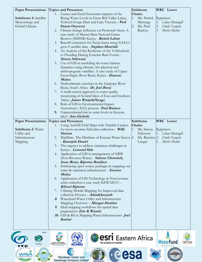
Paper Presentations Subtheme 4: Satellite Meteorology and Global Climate
Topics and Presenters 1. Causes and Social Economic impacts of the
Rising Water Levels in Great Rift Valley Lakes, Turkwel Gorge Dam and Lake Victoria – Prof Simon Onywere
2. Climate change Influence on Protected Areas; A case study of Maasai Mara National Game Reserve (MMNR) Kenya - Rotich Laban
3. Runoff estimation for Nzoia basin using NASA’s geos-5 satellite data - Stephen Mureithi
4. An Analysis of the Resilience of the Voltherbeek to Flooding During Extreme Rain Events - Simon Ndeweni
5. Use of GIS in modelling the water balance dynamics using climatic, bio-physical and anthropogenic variables. A case study of Upper EwasoNgiro River Basin, Kenya –Dancan Maina
6. Hydroclimatic extremes in the Limpopo River Basin, South Africa- Dr. Joel Botai
7. A multi-sensor approach to water quality monitoring of In-land lakes of East and Southern Africa- James WanjohiNyaga
8. Role of GIS in Environmental Impact Assessment ( EIA) process- Paul Rarieya
9. Unprecedented rise in water levels in Kenyan lakes’-Ann Gichuhi
Subtheme Chairs: 1. Mr. Patrick
Murunga 2. Mr. Paul
Rarieya
WRC Lower Rappoteurs: 1. Lilian Mutangili 2. Emily Nanjala 3. Morris Mathu
Paper Presentations Subtheme 2: Water Utility and Infrastructure Mapping
Topics and Presenters 1. Using ArcGIS Field Maps with Trimble Catalyst
for more accurate field data collection - Willy Simons
2. MajiData- The Database of Kenyan Water Sector - Karanjah Daniel
3. The urgency to address sanitation challenges in Kenya - Leonard Sida
4. Application of GIS in management of NRW (Non-Revenue Water) - Salome Cherotich, Isaac Rono, Kiprono Boniface
5. Embracing open-source packages in mapping out water & sanitation infrastructure - Erastus Maina
6. Application of GIS Technology in Non-revenue water reduction a case study KEWASCO – Kikwai Kiprono
7. Utilizing Mobile Mapping for Improved data collection Process – AfandiAsenath
8. Waterfund Water Utility and Infrastructure Mapping Overview – Mungai Ibrahim
9. Ideal mapping workflows for spatial data preparation- Eric K Wamiti
10. GIS & RS in Mapping Water Infrastructure- Joel Karimi
Subtheme Chairs: 1. Mr. Simon
Ndeweni 2. Ms. Beatrice
Langat
WRC Lower Rappoteurs: 1. Lilian Mutangili 2. Emily Nanjala 3. Morris Mathu
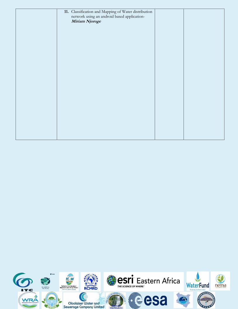
11. Classification and Mapping of Water distribution network using an android based application- Miriam Njoroge
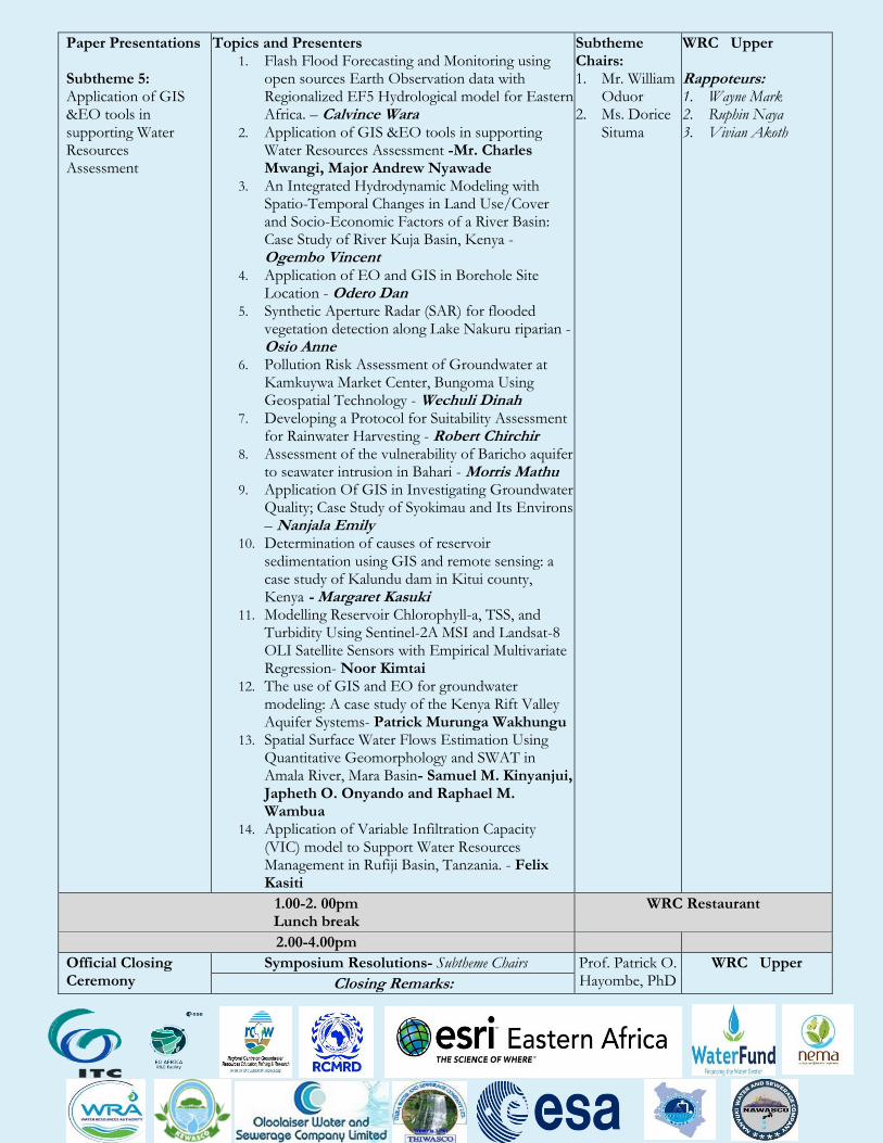
Paper Presentations Subtheme 5: Application of GIS &EO tools in supporting Water Resources Assessment
Topics and Presenters 1. Flash Flood Forecasting and Monitoring using
open sources Earth Observation data with Regionalized EF5 Hydrological model for Eastern Africa. – Calvince Wara
2. Application of GIS &EO tools in supporting Water Resources Assessment -Mr. Charles Mwangi, Major Andrew Nyawade
3. An Integrated Hydrodynamic Modeling with Spatio-Temporal Changes in Land Use/Cover and Socio-Economic Factors of a River Basin: Case Study of River Kuja Basin, Kenya - Ogembo Vincent
4. Application of EO and GIS in Borehole Site Location - Odero Dan
5. Synthetic Aperture Radar (SAR) for flooded vegetation detection along Lake Nakuru riparian - Osio Anne
6. Pollution Risk Assessment of Groundwater at Kamkuywa Market Center, Bungoma Using Geospatial Technology - Wechuli Dinah
7. Developing a Protocol for Suitability Assessment for Rainwater Harvesting - Robert Chirchir
8. Assessment of the vulnerability of Baricho aquifer to seawater intrusion in Bahari - Morris Mathu
9. Application Of GIS in Investigating Groundwater Quality; Case Study of Syokimau and Its Environs – Nanjala Emily
10. Determination of causes of reservoir sedimentation using GIS and remote sensing: a case study of Kalundu dam in Kitui county, Kenya - Margaret Kasuki
11. Modelling Reservoir Chlorophyll-a, TSS, and Turbidity Using Sentinel-2A MSI and Landsat-8 OLI Satellite Sensors with Empirical Multivariate Regression- Noor Kimtai
12. The use of GIS and EO for groundwater modeling: A case study of the Kenya Rift Valley Aquifer Systems- Patrick Murunga Wakhungu
13. Spatial Surface Water Flows Estimation Using Quantitative Geomorphology and SWAT in Amala River, Mara Basin- Samuel M. Kinyanjui, Japheth O. Onyando and Raphael M. Wambua
14. Application of Variable Infiltration Capacity (VIC) model to Support Water Resources Management in Rufiji Basin, Tanzania. - Felix Kasiti
Subtheme Chairs: 1. Mr. William
Oduor 2. Ms. Dorice
Situma
WRC Upper Rappoteurs: 1. Wayne Mark 2. Ruphin Naya 3. Vivian Akoth
1.00-2. 00pm Lunch break
WRC Restaurant
2.00-4.00pm
Official Closing Ceremony
Symposium Resolutions- Subtheme Chairs Prof. Patrick O. Hayombe, PhD
WRC Upper Closing Remarks:
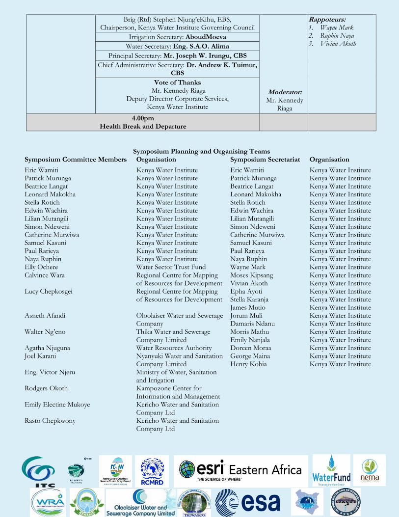
Brig (Rtd) Stephen Njung’eKihu, EBS, Chairperson, Kenya Water Institute Governing Council
Moderator: Mr. Kennedy
Riaga
Rappoteurs: 1. Wayne Mark 2. Ruphin Naya 3. Vivian Akoth
Irrigation Secretary: AboudMoeva
Water Secretary: Eng. S.A.O. Alima
Principal Secretary: Mr. Joseph W. Irungu, CBS
Chief Administrative Secretary: Dr. Andrew K. Tuimur, CBS
Vote of Thanks Mr. Kennedy Riaga
Deputy Director Corporate Services, Kenya Water Institute
4.00pm Health Break and Departure
Symposium Planning and Organising Teams Symposium Committee Members Organisation Symposium Secretariat Organisation
Eric Wamiti Patrick Murunga Beatrice Langat Leonard Makokha Stella Rotich Edwin Wachira Lilian Mutangili Simon Ndeweni Catherine Mutwiwa Samuel Kasuni Paul Rarieya Naya Ruphin Elly Ochere Calvince Wara Lucy Chepkosgei Asneth Afandi Walter Ng’eno Agatha Njuguna Joel Karani Eng. Victor Njeru Rodgers Okoth Emily Electine Mukoye Rasto Chepkwony
Kenya Water Institute Kenya Water Institute Kenya Water Institute Kenya Water Institute Kenya Water Institute Kenya Water Institute Kenya Water Institute Kenya Water Institute Kenya Water Institute Kenya Water Institute Kenya Water Institute Kenya Water Institute Water Sector Trust Fund Regional Centre for Mapping of Resources for Development Regional Centre for Mapping of Resources for Development Oloolaiser Water and Sewerage Company Thika Water and Sewerage Company Limited Water Resources Authority Nyanyuki Water and Sanitation Company Limited Ministry of Water, Sanitation and Irrigation Kampozone Center for Information and Management Kericho Water and Sanitation Company Ltd Kericho Water and Sanitation Company Ltd
Eric Wamiti Patrick Murunga Beatrice Langat Leonard Makokha Stella Rotich Edwin Wachira Lilian Mutangili Simon Ndeweni Catherine Mutwiwa Samuel Kasuni Paul Rarieya Naya Ruphin Wayne Mark Moses Kipsang Vivian Akoth Epha Ayoti Stella Karanja James Mutio Jorum Muli Damaris Ndanu Morris Mathu Emily Nanjala Doreen Moraa George Maina Henry Kobia
Kenya Water Institute Kenya Water Institute Kenya Water Institute Kenya Water Institute Kenya Water Institute Kenya Water Institute Kenya Water Institute Kenya Water Institute Kenya Water Institute Kenya Water Institute Kenya Water Institute Kenya Water Institute Kenya Water Institute Kenya Water Institute Kenya Water Institute Kenya Water Institute Kenya Water Institute Kenya Water Institute Kenya Water Institute Kenya Water Institute Kenya Water Institute Kenya Water Institute Kenya Water Institute Kenya Water Institute Kenya Water Institute
SHORT COURSE PROGRAMS
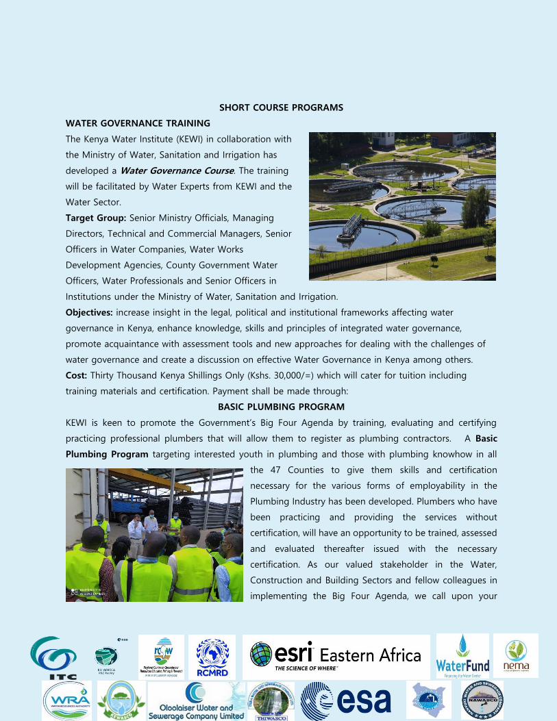
WATER GOVERNANCE TRAINING
The Kenya Water Institute (KEWI) in collaboration with
the Ministry of Water, Sanitation and Irrigation has
developed a Water Governance Course. The training
will be facilitated by Water Experts from KEWI and the
Water Sector.
Target Group: Senior Ministry Officials, Managing
Directors, Technical and Commercial Managers, Senior
Officers in Water Companies, Water Works
Development Agencies, County Government Water
Officers, Water Professionals and Senior Officers in
Institutions under the Ministry of Water, Sanitation and Irrigation.
Objectives: increase insight in the legal, political and institutional frameworks affecting water
governance in Kenya, enhance knowledge, skills and principles of integrated water governance,
promote acquaintance with assessment tools and new approaches for dealing with the challenges of
water governance and create a discussion on effective Water Governance in Kenya among others.
Cost: Thirty Thousand Kenya Shillings Only (Kshs. 30,000/=) which will cater for tuition including
training materials and certification. Payment shall be made through:
BASIC PLUMBING PROGRAM
KEWI is keen to promote the Government’s Big Four Agenda by training, evaluating and certifying
practicing professional plumbers that will allow them to register as plumbing contractors. A Basic
Plumbing Program targeting interested youth in plumbing and those with plumbing knowhow in all
the 47 Counties to give them skills and certification
necessary for the various forms of employability in the
Plumbing Industry has been developed. Plumbers who have
been practicing and providing the services without
certification, will have an opportunity to be trained, assessed
and evaluated thereafter issued with the necessary
certification. As our valued stakeholder in the Water,
Construction and Building Sectors and fellow colleagues in
implementing the Big Four Agenda, we call upon your
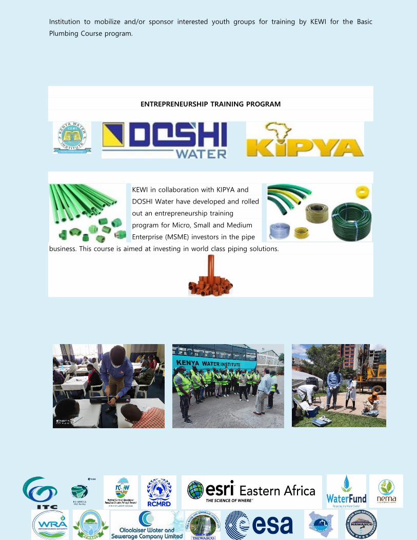
Institution to mobilize and/or sponsor interested youth groups for training by KEWI for the Basic
Plumbing Course program.
ENTREPRENEURSHIP TRAINING PROGRAM
KEWI in collaboration with KIPYA and
DOSHI Water have developed and rolled
out an entrepreneurship training
program for Micro, Small and Medium
Enterprise (MSME) investors in the pipe
business. This course is aimed at investing in world class piping solutions.

Chairperson, KEWI Governing Council with Management