geo l3 plateus_planes_0.2
TRANSCRIPT

Mountains
Plateaus
Plains
Landforms on earth
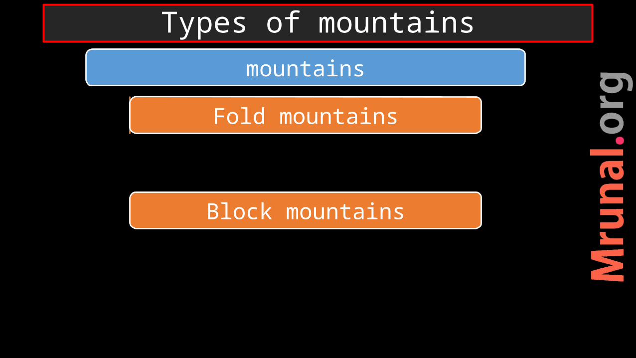
mountains
Fold mountains
Block mountains
Types of mountains

Fold mountains

Mountains created due to convergent boundaries of both
1) O-C (Rockies, Andes) 2) C-C (Himalayas, Alps)Compressive forces of platesYoungest mountains on earthTrue mountains
Fold mountains
Geomorph

1)Extensive mountain chain2) Great heights3) Formed along unstable parts of the earth4) Sedimentary deposits of marine origin (C-C)
Characteristics of Fold mountains

•Pull of descending limb of convection current •great pressure of compressive force exerted by the convection cells
Phases of mountain building
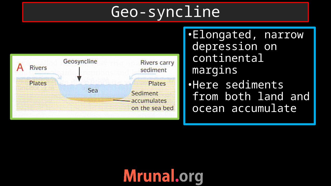
•Elongated, narrow depression on continental margins•Here sediments from both land and ocean accumulate
Geo-syncline

•Sediments from continental crusts of both plates + geo-syncline folded•Because of sediments of geo-syncline – marine origin
C-C collision

Fold mountains of the world

Pamir Knot

Hindu kush, Kirthar and Sulaiman Ranges
Sula
iman
ra
nge
Kirt
har r
ange

Mountains in Europe

1) Alaska range2) Southern Alps3) Dinaric Alps4) Atlas mountains5) Pyrenees6) Caucasus 7) Apennines8) Taurus 9) Elburz and Zagros
9) Hindukush10) Kirthar range11) Kunlun Shan12) Urals mountains13) Appalachian mountains14) Great Dividing Range
List of mountains to locate

understanding of the origin and evolution of earth’s crust.
At the time of the formation of the earth crust, first basaltic crust of ocean - breaking and melting - a lighter continental crust developed.
collide with one another = a larger land mass.
The joints = fold-mountains.
Importance of mountain building process

Urals Mountains

mountains
Fold mountains
Block mountains
Types of mountains

Block mountains formation
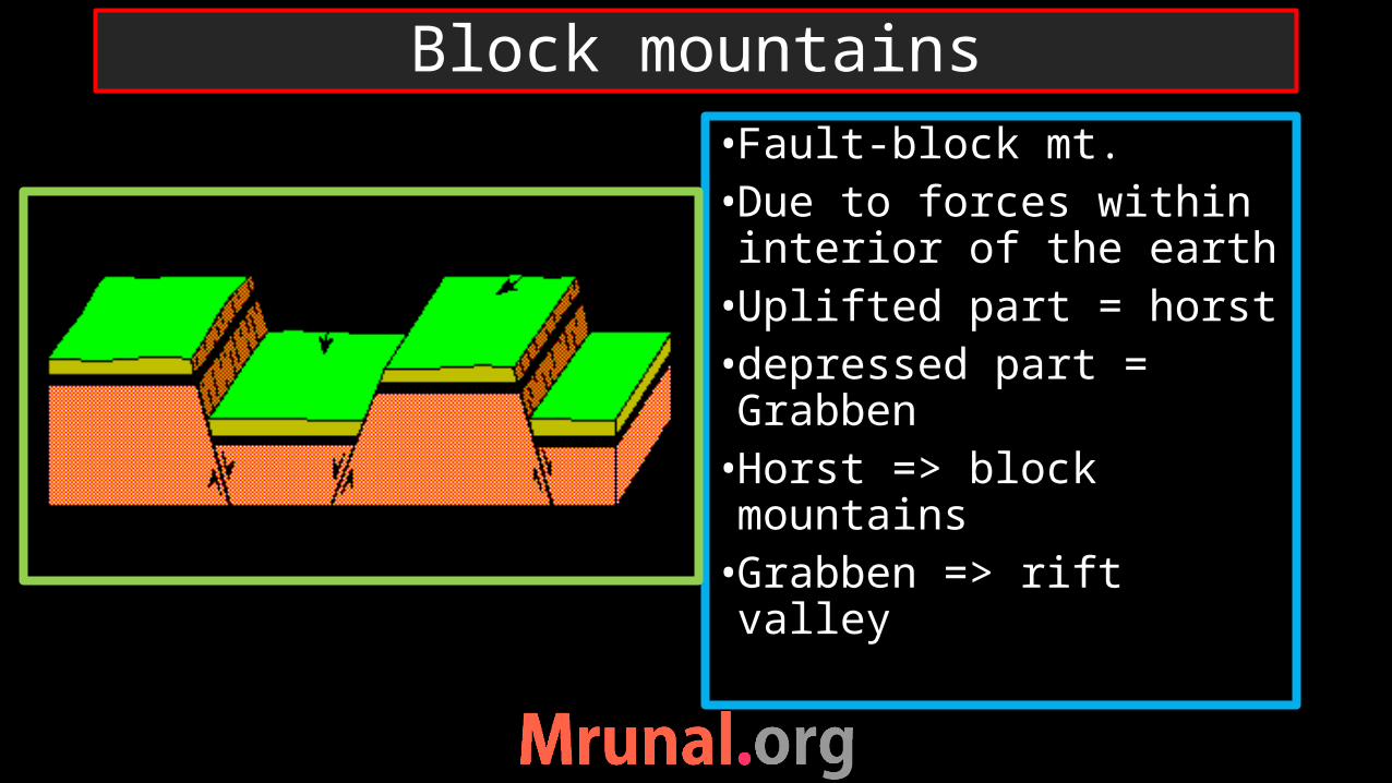
•Fault-block mt.•Due to forces within interior of the earth•Uplifted part = horst•depressed part = Grabben•Horst => block mountains•Grabben => rift valley
Block mountains

Phases of Divergent continental crust

African rift valley – block mountains

Europe India
Example of block mountains

Fold mountains
True mountainsCompressive force - folding
Due to collision of plates (C-C, O-C)
Folding of sedimentary rocks
Not true mountainsTensile force -faulting
Diverging plates (Conti)
Differential erosion of horst of fault – looks like mountains
Block mountains
comparison

Mountains
Plateaus
Plains
Landforms on earth
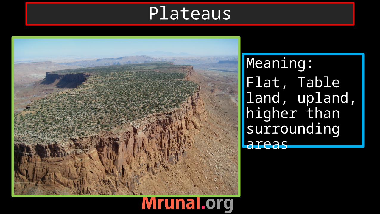
Meaning:Flat, Table land, upland, higher than surrounding areas
Plateaus

Raised land during mountains building process
Deposition from lavaDeposition from windEroded due to glaciers
Formation of Plateaus

Intermontane plateau
Bolivia plateauTibetan plateauColumbia plateauColorado plateauAnatolia Plateau (Turkey)
Deccan plateauKatanga plateauOzark plateau (USA)
Ethiopian highland
Continental plateau
Types of plateau

Glacial plateau
Grahwal plateauLaurentian plateau (Canada)
Columbia-snake plateau (USA)
Deccan PlateauShan plateau (Myanmar)
Lava plateau
Types of Plateau

Bolivia plateau Columbia- colorado

Ozark plateau Anatolia plateau

Loess plateau Laurentian plateau
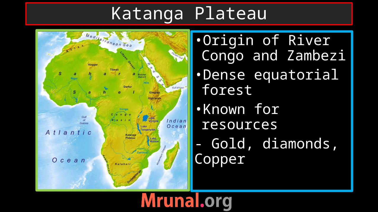
•Origin of River Congo and Zambezi •Dense equatorial forest•Known for resources- Gold, diamonds, Copper
Katanga Plateau

•Equatorial region•Dense rainforest•Known for gold reserve
Plateau of Mato Grasso, Brazil
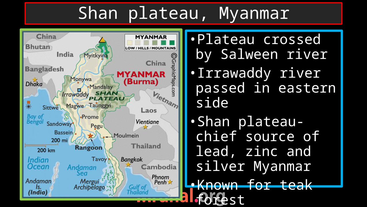
•Plateau crossed by Salween river• Irrawaddy river passed in eastern side•Shan plateau- chief source of lead, zinc and silver Myanmar•Known for teak forest
(Burmese Teak)
Shan plateau, Myanmar

“Roof of the world” – highest and largest plateau•Source of Indus, Brahmaputra, Salween, Mekong, Yangtse, Hwang He• Imp role in Indian monsoon
Tibetan plateau

•Granite•Less mobile, cannot move upward•Backbone of fold mountains
Batholith

Mountains
Plateaus
Plains
Landforms on earth

Plains
•Meaning•Flat areas with low heights•Best for human habitation•Most populated areas of the world – alluvial plains of rivers
•Depositional plains- Rivers- Sea (sub-merged coast)
•Erosional plains- Erosion of plateau
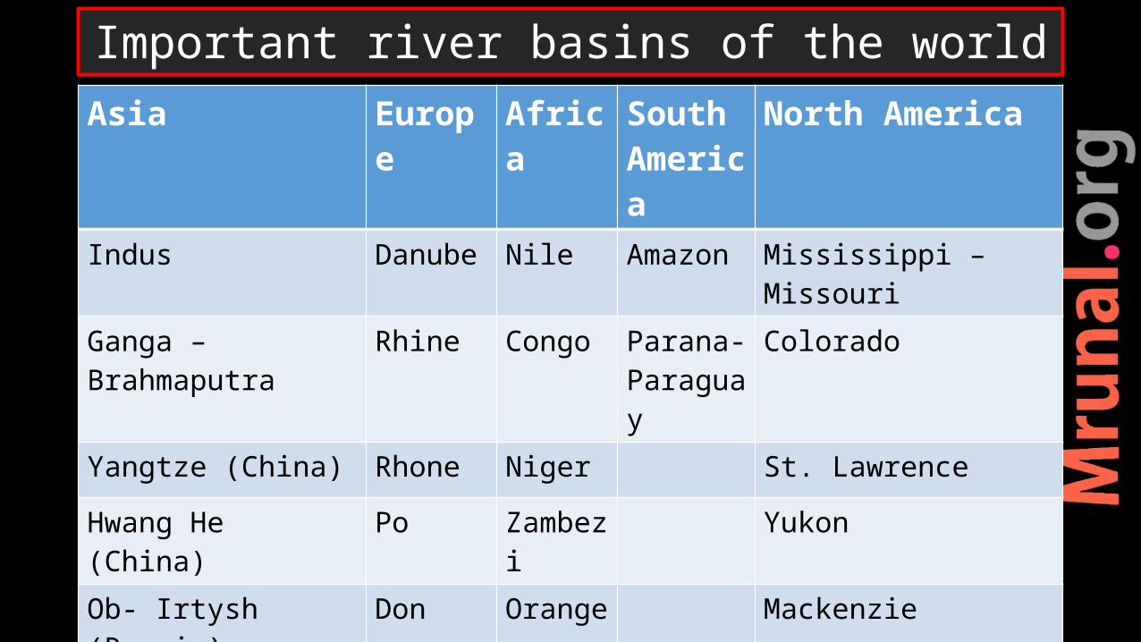
Asia Europe Africa South America
North America
Indus Danube Nile Amazon Mississippi – Missouri
Ganga –Brahmaputra Rhine Congo Parana- Paraguay
Colorado
Yangtze (China) Rhone Niger St. Lawrence
Hwang He (China) Po Zambezi Yukon
Ob- Irtysh (Russia) Don Orange Mackenzie
Mekong (SE Asia)
Euphrates - Tigris
Important river basins of the world
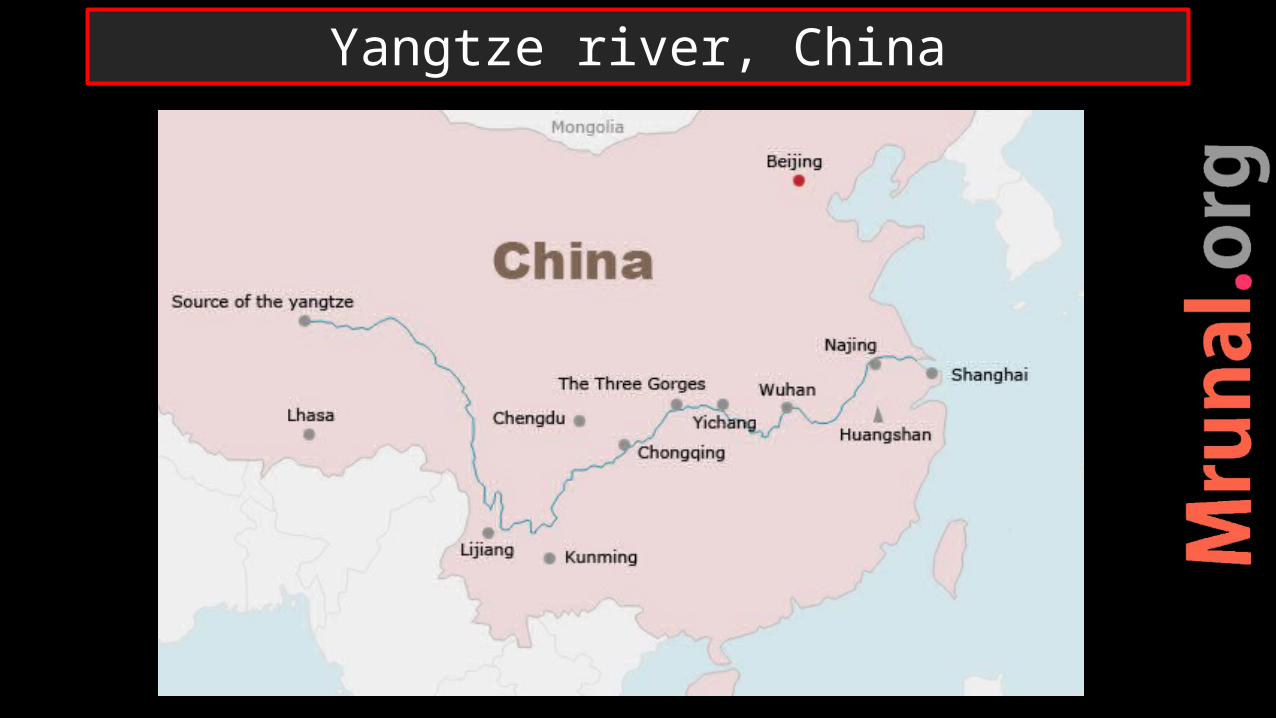
Yangtze river, China

Yangtze – 3th longest river in the worldNavigable river – 35% of China’s populationSichuan basin – rice cultivationShanghai – biggest port of China Wuhan – Iron and steelNanjing – textile, iron and steel Chengdu – oil and gasThree gorge damYun ho canal – connect Yangtze with Hwang He
Important locations
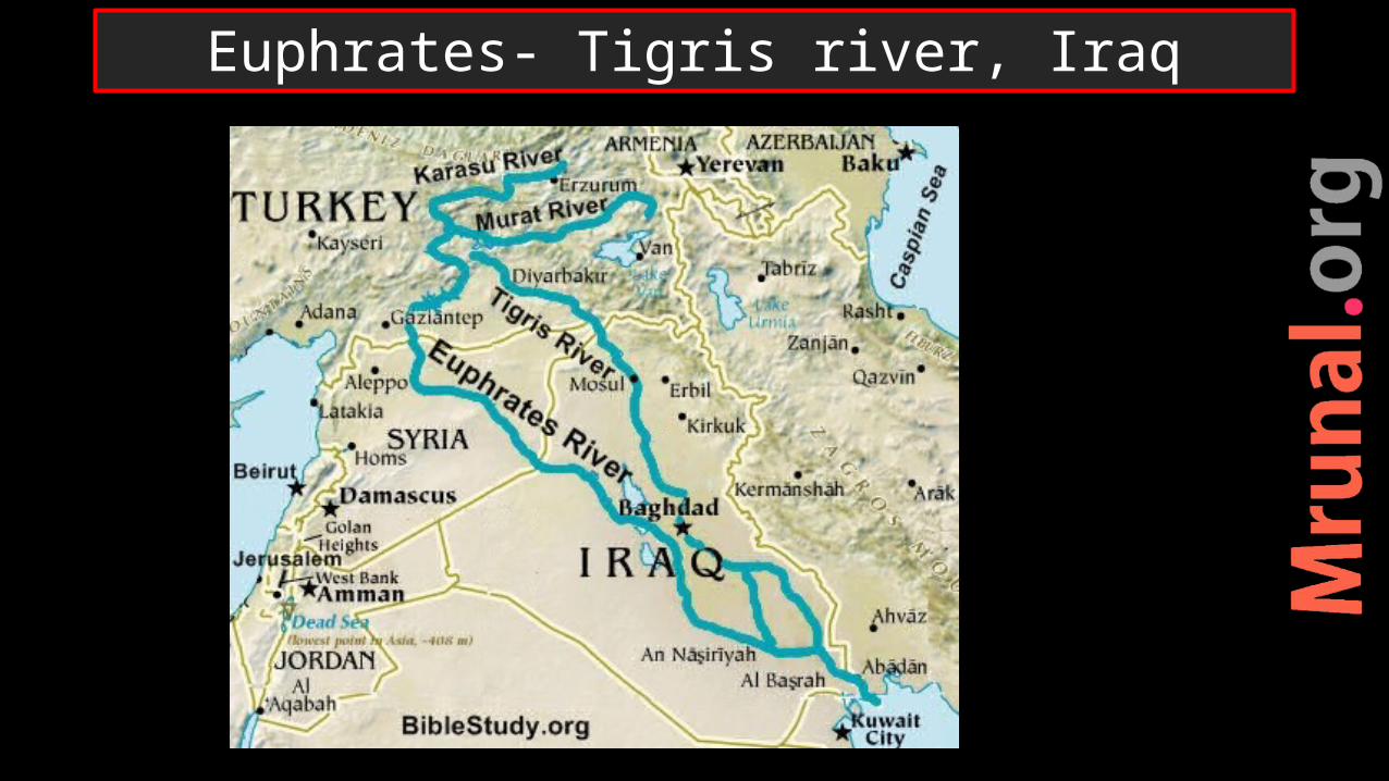
Euphrates- Tigris river, Iraq

Lake Van, Lake UrmiaImportant centers in Iraq:Baghdad, Mosul, Kirkuk, Al Basra
Locations near Euphrates-Tigris
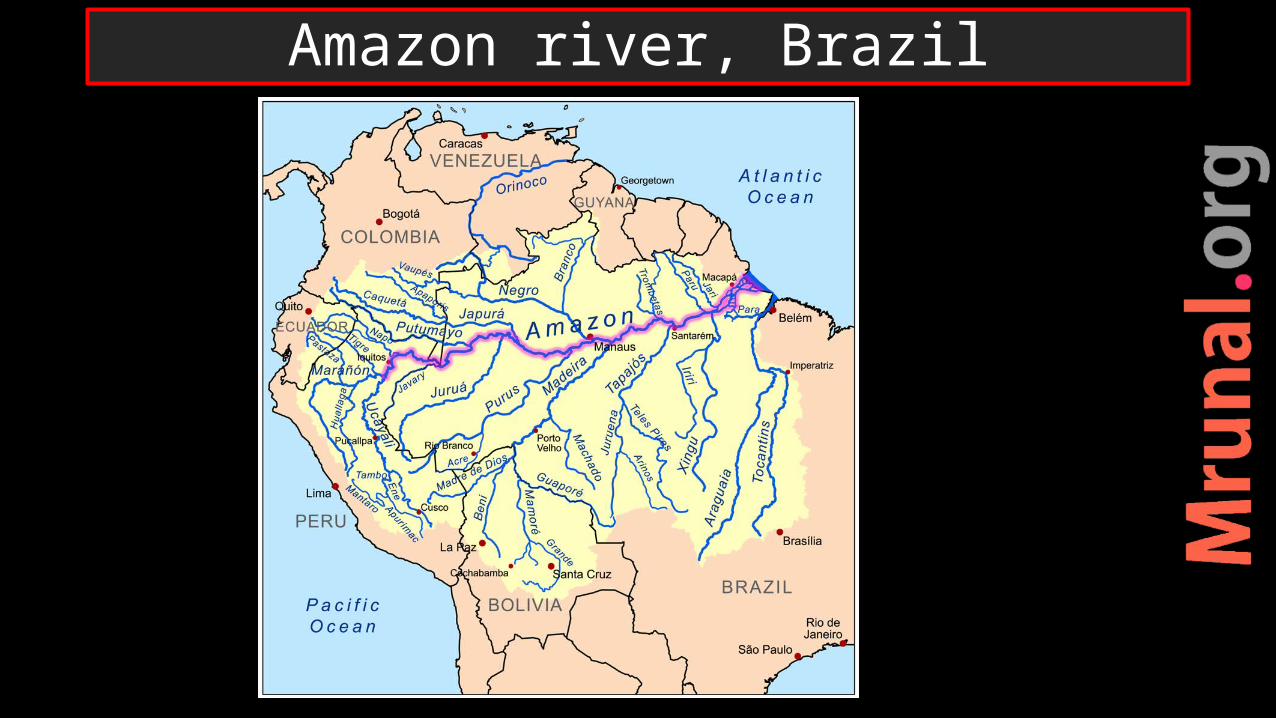
Amazon river, Brazil
Largest, 2nd longest river Selvas – equatorial rain forest Tin, rubber in Selvas Sertao – ranching regionPetroleum reserve at the mouthManaus – Iron ore, navigable plateau of Mato Grasso – gold reserve
Locations near Amazon river

Mississippi , USA
Temperate grasslands – PrairiesWheat, corn and cotton cultivationImportant cites: Kansas – agricultureSt. Pittsburg – iron and steelNew Orleans – port, ship building
Locations near Mississippi basin
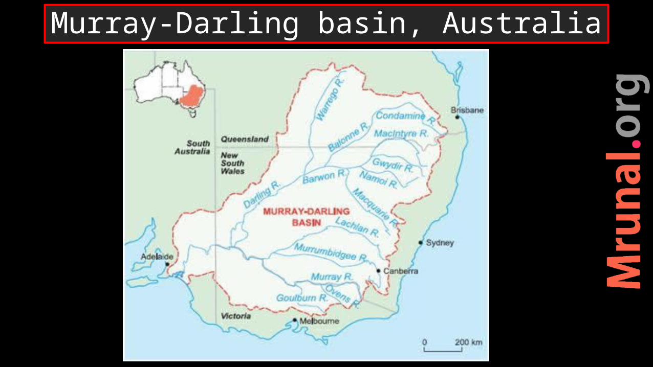
Murray-Darling basin, Australia

Temperate grassland – downsWheat cultivationSheep rearing ,Animal husbandryWool and dairy production
Location near Murray-darling basin

Landforms on earthMountains (fold and block)PlateausPlains

Natural Catastrophic events
volcanism
earthquake
Tsunami

complete sequence of processes of creation and movement of magma + creation of volcanic landforms
Volcanism is not randomReason associated with volcanism is also not random
Volcanism
Geomorpho
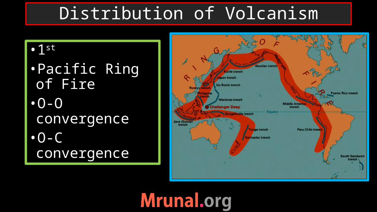
•1st
•Pacific Ring of Fire•O-O convergence•O-C convergence
Distribution of Volcanism

O-O : Volcanic arc O-C :Volcanic mountains
Plate movements
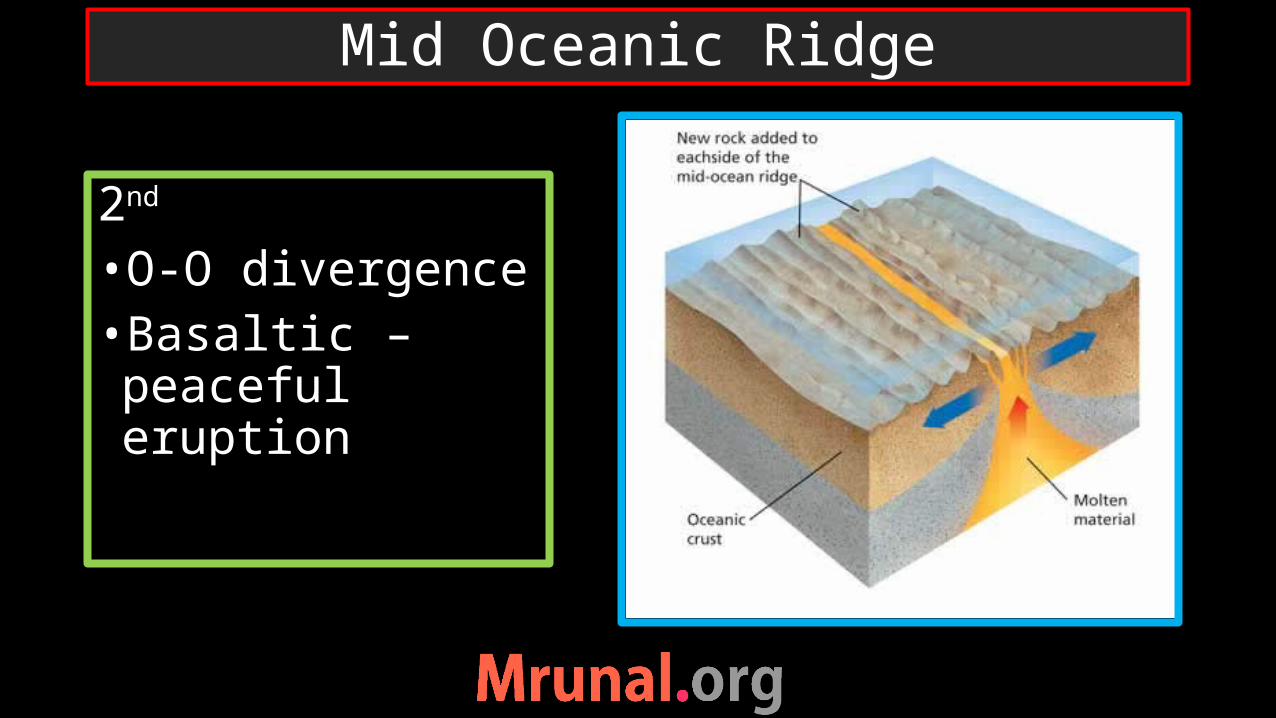
2nd •O-O divergence•Basaltic – peaceful eruption
Mid Oceanic Ridge
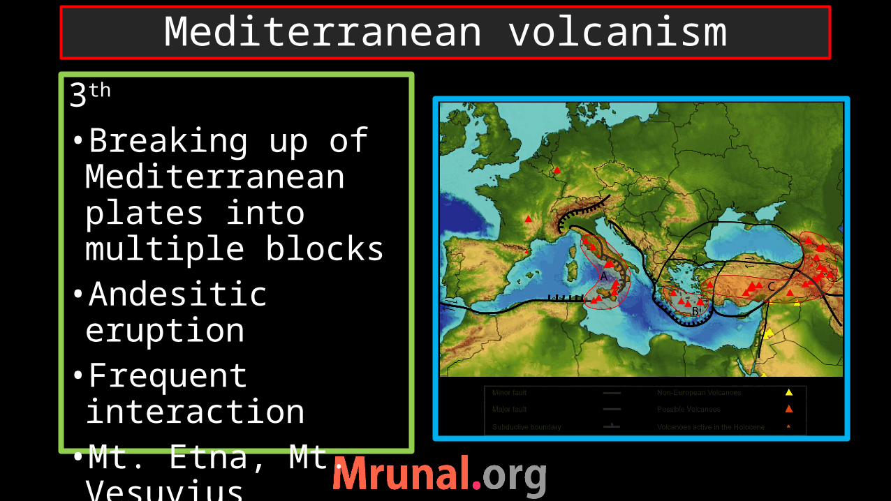
3th •Breaking up of Mediterranean plates into multiple blocks•Andesitic eruption•Frequent interaction•Mt. Etna, Mt. Vesuvius
Mediterranean volcanism

•Mediterranean sea is residual part of Tethys sea• Tethys sea was located between – Laurasia and Gondwana•Collision of Africa to Laurasia – breaking up of plates of Mediterranean sea
History of Mediterranean sea

•4th •Magma From deep interior -Basaltic•Fixed place - Plate movement – Island arc•Direction of plate•Hawaii, Reunion, Kurile, Aleutian
Hot Spot Volcanoes

Aleutian Islands

Basaltic eruption
Occur at mid-oceanic ridge and hot spot volcanism
Basalt highly fluid – mobile
Spread across easily
Quite eruption
Volcanic arcs, volcanic mountains
Andesite – less fluid – less mobile
Solidifies at short distance- intense pressure develop inside –explosive
Andesitic eruption
comparison

Basaltic eruption Andesitic eruption
comparison

Landforms
Extrusive
Volcanic plateau
Volcanic cones
Intrusive
Dykes etc.
Volcanic Landforms
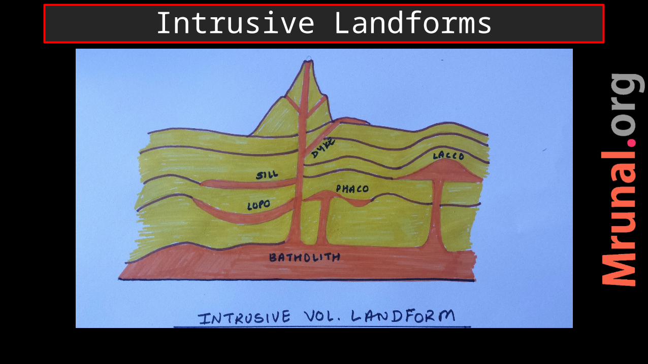
Intrusive Landforms
Intrusive LandformsIntrusion of Magma in sedimentary rocksSills (Horizontal)Dyke (Vertical)Laccolith – magma which could not come out
Lopolith – saucer-shapedPhacolith – shape like waves Batholith – intrusive granitic rock
Intrusive Volcanic Landforms

Extrusive
Volcanic Plateau
Volcanic cones
Shield volcano
Cinder vol.
Composite vol.
Extrusive volcanic Landforms

•Hot spot volcano on continental crust•Cracks on continental crust –Basaltic eruption•Spread across the land •Layer over layer•EX. Deccan lava trapps
Lava plateaus

• Indian plate passed over a hot spot near Reunion Island•Basaltic eruption•Layer over layers – looks like steps => Deccan lava traps•Soil – black soil ‘regur’
Indian Deccan trap

Spatial distribution of Lava Plateau

•Columbia-snake plateau, USA•Ozark plateau, USA•Parana-Patagonia, S. America•Adamawa plateau, Africa•Bie plateau, Africa•Katanga Plateau, Africa
Deccan plateau, India•Arabian plateau•Balkan plateau, Europe•Siberian plateau, Russia•Yunan Plateau, China•Shan plateau, Myanmar•Kimberly plateau, Australia
List of lava plateaus of the world

Extrusive
Volcanic Plateau
Volcanic cones
Shield volcano
Cinder vol.
Composite vol.
Extrusive volcanic Landforms
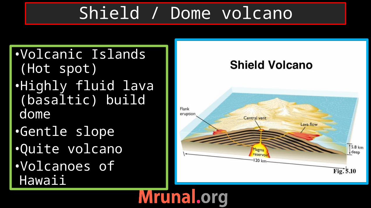
•Volcanic Islands (Hot spot)•Highly fluid lava (basaltic) build dome •Gentle slope•Quite volcano•Volcanoes of Hawaii
Shield / Dome volcano

•O-C collision – volcanic mountains•Less fluid lava (Andesitic) explode violently•Viscous lava solidifies at short distance
•Mt. Paricutin, Mexico
Cinder cones

Volcanic mountainsEach new eruption – new layers of ash or lava
Mt. Stromboli, Mt. Vesuvius, Mt. Fuji
Composite Cones

Shield/ dome Cinder Composite
Highly fluid Less fluid / highly viscous
Fluid + viscous
Silent flow Violent eruption Multiple and violent eruption
Gentle slope Steep slope Highest volcanoes
Small volcanoes Small volcanoes Large volcanoes
Types of Volcanic cones

•Geysers =fountains of Hot water•Ground water heated by shallow source of magma•Old faithful geyser, Yellow stone park, USA
Geysers
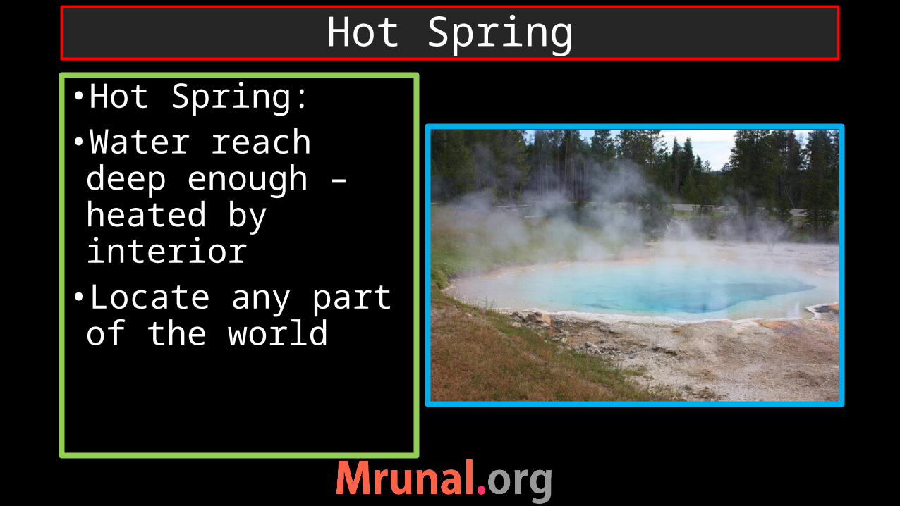
•Hot Spring: •Water reach deep enough – heated by interior •Locate any part of the world
Hot Spring

•Geyser – G/w heated by shallow magma source•Hot spring – g/w heated by either magma source or heated rocks•Geyser – chamber in interior – pressure – comes out like fountain•Hot –spring - quite
Difference between geyser and Hotspring

geyser
Geysers are rareHot water dissolved with silica accumulated on surface – gives different colours
USA, - Yellowstone park
Found anywhereThey gets different colors from heat-loving bacteria, like cyanobacteria
Medicinal valuesCan be helpful in harness geo-thermal energy
Hot spring
comparison
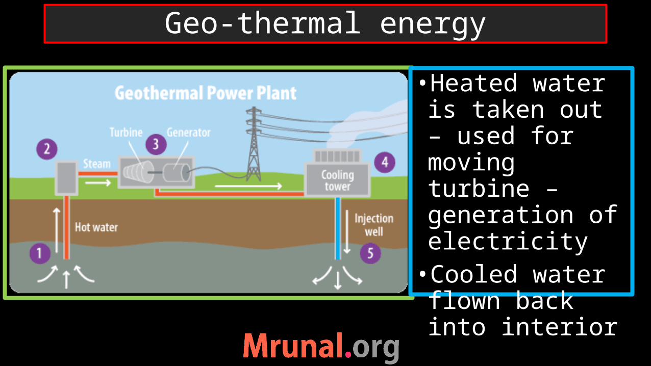
•Heated water is taken out – used for moving turbine – generation of electricity•Cooled water flown back into interior
Geo-thermal energy

Difficult to locate a good source of geothermal reservoir with current technology
Difficult to dig a deep well with hard and hot bedrock
Harmful gases can escape from the earth interior while exploration – GHG gases and dissolved toxic elements
Limitations of geo-thermal energy

volcanism
earthquake
Tsunami
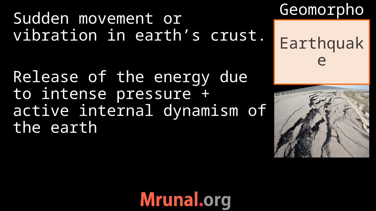
Sudden movement or vibration in earth’s crust.
Release of the energy due to intense pressure + active internal dynamism of the earth
Earthquake
Geomorpho

1) Shallow focus EQ2) Intermediate focus EQ3) Deep focus EQ
Shallow focus – destructive
Types of Earthquake

At Junction of 3 plates
Subduction of Pacific plate
Earthquakes in Japan

1st Collision of Plate boundariesO-O collisionO-C collisionC-C collision
Reasons behind EQ
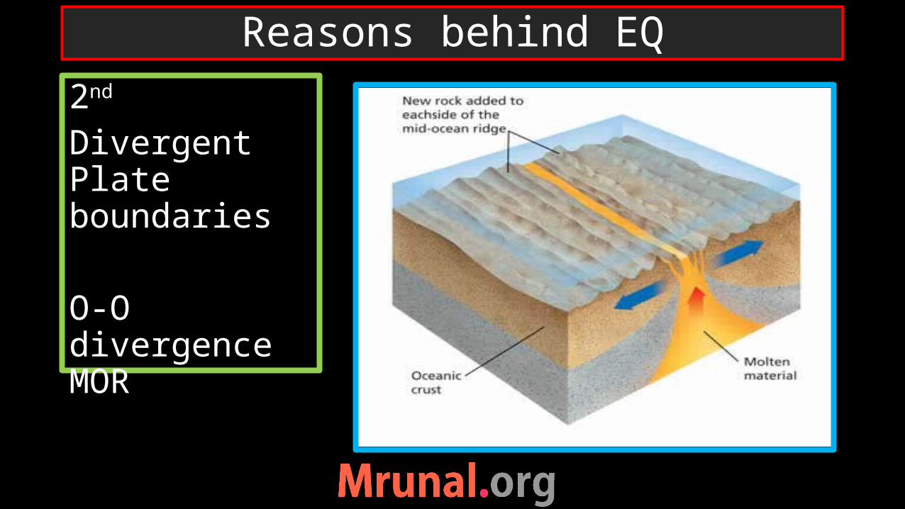
2nd
Divergent Plate boundaries
O-O divergence MOR
Reasons behind EQ

•3th•Transverse plate boundaries•Friction developed between two plates
Reasons behind EQ

4th Mediterranean sea regionNumerous small platesFrequent interactions
Reasons behind EQ

5th Craton = stable part of crustRe-emergence of old fractures
6th Human Induced 1) RIS2) mining3) Nuclear testing
Reasons behind EQ

volcanism
earthquake
Tsunami

Submarine EQSudden disturbances of underlying plates transmit the shock waves to surface waves
Tsunami
Geomorpho
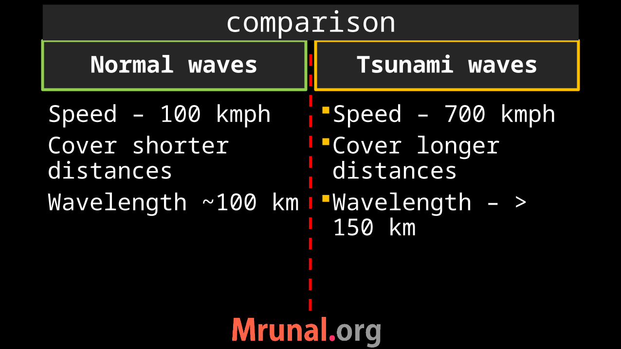
Normal waves
Speed – 100 kmphCover shorter distancesWavelength ~100 km
Speed – 700 kmphCover longer distances
Wavelength – > 150 km
Tsunami waves
comparison

•Distance between two crests of troughs = wavelength
•Waves of Tsunami are wider than normal waves of the ocean water
wavelength

•EQ on ocean crust – uplift the water upward•Tsunami wave generated•Vessels in the mid-sea cannot recongnise the tsunami waves•Sea water recede at the shore
Phase 1

•At coast – depth decrease – wavelength decreases – wave height increases•A huge wall of water – 10-12 floor high created•Enormous energy released at the shore
Phase 2

•Hit the coast• Tsunami- not a single wave but multiple waves •4th and 8th waves are the most dangerous•Time lapse between each waves – 15 to 50 minutes
Phase 3

Phases of tsunami

Tsunami Early warning system- gives warning in 10 minutes of submarine earthquake
Indian National centre for Ocean Information Sciences (INCOIS),Hyderabad
To capture Tsunami wave amplitude on 24x7 basis
real time sea-level sensors with bottom pressure recorders
HF radars for coastal currentsCoastal tide gauge stations
Indian preparedness against Tsunami

Catastrophic events on earthTheir reasons and distributionsVolcanismEQTsunami