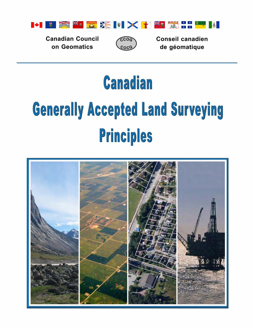
generally accepted land surveying principles v4
TRANSCRIPT
Canadian Council
on Geomatics
Conseil canadien
de géomatique
Generally Accepted Land Surveying
Principles
Canadian
Generally Accepted Land Surveying
Principles
Canadian
Principles to guide the development of LandSurveying governance models and legalboundary frameworks in Canada
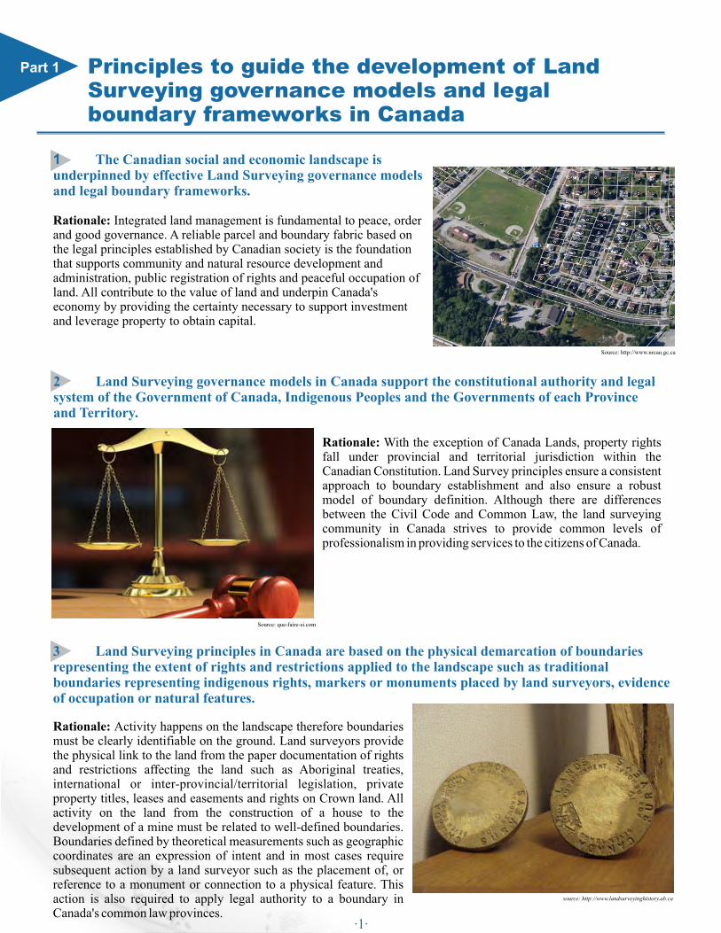
1 The Canadian social and economic landscape is underpinned by effective Land Surveying governance models and legal boundary frameworks. Rationale: Integrated land management is fundamental to peace, order and good governance. A reliable parcel and boundary fabric based on the legal principles established by Canadian society is the foundation that supports community and natural resource development and administration, public registration of rights and peaceful occupation of land. All contribute to the value of land and underpin Canada's economy by providing the certainty necessary to support investment and leverage property to obtain capital.
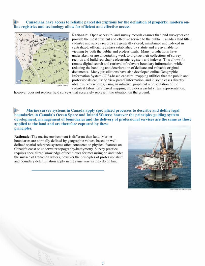
2 Land Surveying governance models in Canada support the constitutional authority and legal system of the Government of Canada, Indigenous Peoples and the Governments of each Province and Territory.
Rationale: With the exception of Canada Lands, property rights fall under provincial and territorial jurisdiction within the Canadian Constitution. Land Survey principles ensure a consistent approach to boundary establishment and also ensure a robust model of boundary definition. Although there are differences between the Civil Code and Common Law, the land surveying community in Canada strives to provide common levels of professionalism in providing services to the citizens of Canada.
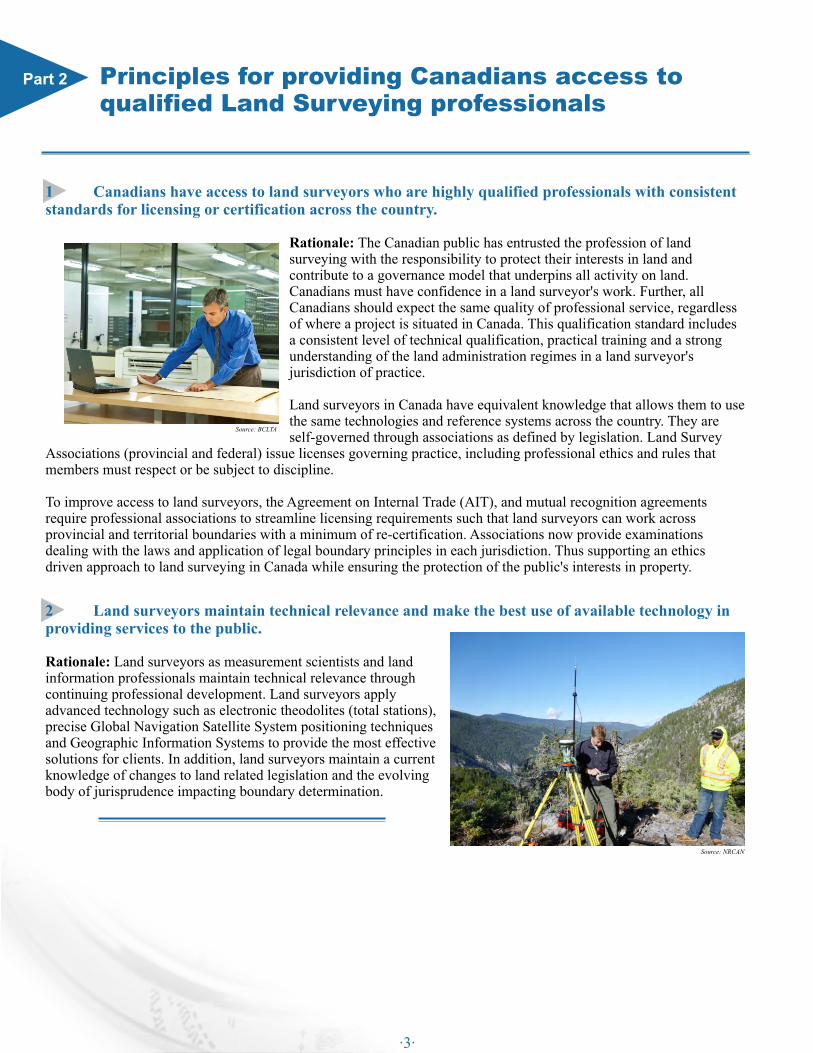
3 Land Surveying principles in Canada are based on the physical demarcation of boundaries representing the extent of rights and restrictions applied to the landscape such as traditional boundaries representing indigenous rights, markers or monuments placed by land surveyors, evidence of occupation or natural features.
Rationale: Activity happens on the landscape therefore boundaries must be clearly identifiable on the ground. Land surveyors provide the physical link to the land from the paper documentation of rights and restrictions affecting the land such as Aboriginal treaties, international or inter-provincial/territorial legislation, private property titles, leases and easements and rights on Crown land. All activity on the land from the construction of a house to the development of a mine must be related to well-defined boundaries. Boundaries defined by theoretical measurements such as geographic coordinates are an expression of intent and in most cases require subsequent action by a land surveyor such as the placement of, or reference to a monument or connection to a physical feature. This action is also required to apply legal authority to a boundary in Canada's common law provinces.
Part 1
source: http://www.landsurveyinghistory.ab.ca
Source: http://www.nrcan.gc.ca
Source: que-faire-si.com
·1·
4 Canadians have access to reliable parcel descriptions for the definition of property; modern on-line registries and technology allow for efficient and effective access.
Rationale: Open access to land survey records ensures that land surveyors can provide the most efficient and effective service to the public. Canada's land title, cadastre and survey records are generally stored, maintained and indexed in centralized, official registries established by statute and are available for viewing by both the public and professionals. Many jurisdictions have undertaken, or are undertaking work to digitize their collections of survey records and build searchable electronic registers and indexes. This allows for remote digital search and retrieval of relevant boundary information, while reducing the handling and deterioration of delicate and valuable original documents. Many jurisdictions have also developed online Geographic Information System (GIS)-based cadastral mapping utilities that the public and professionals can use to view parcel information, and in some cases directly obtain survey records, using an intuitive, graphical representation of the cadastral fabric. GIS based mapping provides a useful virtual representation,
however does not replace field surveys that accurately represent the situation on the ground.
5 Marine survey systems in Canada apply specialized processes to describe and define legal boundaries in Canada's Ocean Space and Inland Waters; however the principles guiding system development, management of boundaries and the delivery of professional services are the same as those applied to the land and are therefore captured by these principles.
Rationale: The marine environment is different than land. Marine boundaries are normally defined by geographic values, based on well-defined spatial reference systems often connected to physical features on Canada's coast or underwater topography/bathymetry. Survey practice requires specialized knowledge of techniques for measuring on and under the surface of Canadian waters, however the principles of professionalism and boundary determination apply in the same way as they do on land.
Source: http://www.hibernia.ca
Source: NRCAN
·2·
1 Canadians have access to land surveyors who are highly qualified professionals with consistent standards for licensing or certification across the country.
Rationale: The Canadian public has entrusted the profession of land surveying with the responsibility to protect their interests in land and contribute to a governance model that underpins all activity on land. Canadians must have confidence in a land surveyor's work. Further, all Canadians should expect the same quality of professional service, regardless of where a project is situated in Canada. This qualification standard includes a consistent level of technical qualification, practical training and a strong understanding of the land administration regimes in a land surveyor's jurisdiction of practice.
Land surveyors in Canada have equivalent knowledge that allows them to use the same technologies and reference systems across the country. They are self-governed through associations as defined by legislation. Land Survey
Associations (provincial and federal) issue licenses governing practice, including professional ethics and rules that members must respect or be subject to discipline.
To improve access to land surveyors, the Agreement on Internal Trade (AIT), and mutual recognition agreements require professional associations to streamline licensing requirements such that land surveyors can work across provincial and territorial boundaries with a minimum of re-certification. Associations now provide examinations dealing with the laws and application of legal boundary principles in each jurisdiction. Thus supporting an ethics driven approach to land surveying in Canada while ensuring the protection of the public's interests in property.
Principles for providing Canadians access toqualified Land Surveying professionals
2 Land surveyors maintain technical relevance and make the best use of available technology in providing services to the public.
Rationale: Land surveyors as measurement scientists and land information professionals maintain technical relevance through continuing professional development. Land surveyors apply advanced technology such as electronic theodolites (total stations), precise Global Navigation Satellite System positioning techniques and Geographic Information Systems to provide the most effective solutions for clients. In addition, land surveyors maintain a current knowledge of changes to land related legislation and the evolving body of jurisprudence impacting boundary determination.
Part 2
Source: NRCAN
Source: BCLTA
·3·
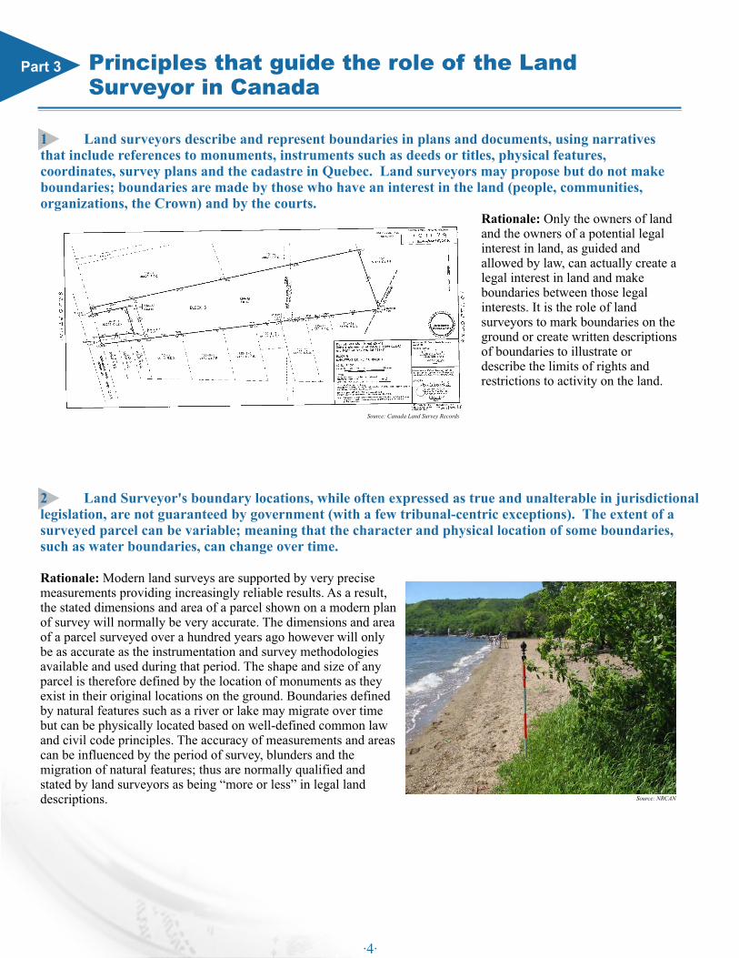
1 Land surveyors describe and represent boundaries in plans and documents, using narratives that include references to monuments, instruments such as deeds or titles, physical features, coordinates, survey plans and the cadastre in Quebec. Land surveyors may propose but do not make boundaries; boundaries are made by those who have an interest in the land (people, communities, organizations, the Crown) and by the courts.
Rationale: Only the owners of land and the owners of a potential legal interest in land, as guided and allowed by law, can actually create a legal interest in land and make boundaries between those legal interests. It is the role of land surveyors to mark boundaries on the ground or create written descriptions of boundaries to illustrate or describe the limits of rights and restrictions to activity on the land.
Principles that guide the role of the Land Surveyor in Canada
2 Land Surveyor's boundary locations, while often expressed as true and unalterable in jurisdictional legislation, are not guaranteed by government (with a few tribunal-centric exceptions). The extent of a surveyed parcel can be variable; meaning that the character and physical location of some boundaries, such as water boundaries, can change over time.
Rationale: Modern land surveys are supported by very precise measurements providing increasingly reliable results. As a result, the stated dimensions and area of a parcel shown on a modern plan of survey will normally be very accurate. The dimensions and area of a parcel surveyed over a hundred years ago however will only be as accurate as the instrumentation and survey methodologies available and used during that period. The shape and size of any parcel is therefore defined by the location of monuments as they exist in their original locations on the ground. Boundaries defined by natural features such as a river or lake may migrate over time but can be physically located based on well-defined common law and civil code principles. The accuracy of measurements and areas can be influenced by the period of survey, blunders and the migration of natural features; thus are normally qualified and stated by land surveyors as being “more or less” in legal land descriptions.
Part 3
Source: NRCAN
Source: Canada Land Survey Records
·4·
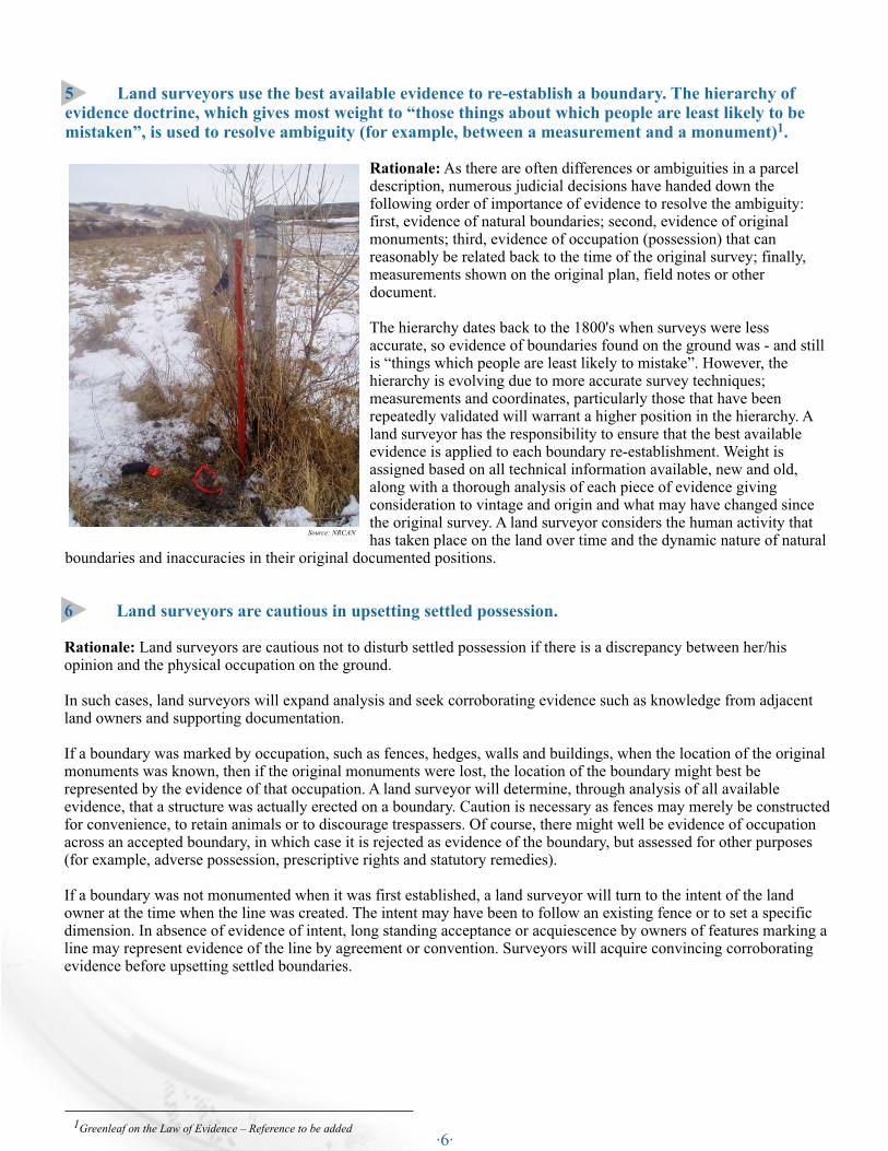
4 A land surveyor's opinion in re-establishing an existing boundary must withstand the scrutiny of fellow land surveyors, boundary tribunals and the courts.
Rationale: The land surveyor's work in re-establishing an existing boundary does not follow a fixed set of hard and fast rules. A thorough evaluation of each case and professional judgment are applied to all aspects of the task. Legislation, jurisprudence, civil codes, common law, policies, best practices and measurement tolerances guide the land surveyor's analysis of the available evidence. A land surveyor performing a boundary re-establishment is responsible for acquiring and analyzing all available survey evidence, occupation and title information which often includes verification of the original demarcation and subsequent re-establishments.
A review of documents, monuments, measurements, plans, imagery and other available evidence will sometimes provide conflicting results. A land surveyor uses professional judgment and expertise when applying legal principles and rendering an opinion to those with an interest in land regarding the re-established location of boundaries.
While jurisdictions may offer varying degrees of survey plan examination services prior to approving a plan for filing, it is the land surveyor who is ultimately responsible for the boundary opinion represented by their plan and survey. In undertaking boundary re-establishment, land surveyors have a responsibility to inform their clients and the public regarding the role of the profession, and what can and cannot be determined by a plan of survey. To provide the certainty essential to support secure land tenure, a land surveyor as the professional on the ground must apply legal principles and produce work to a standard of quality that can withstand the scrutiny of the courts.
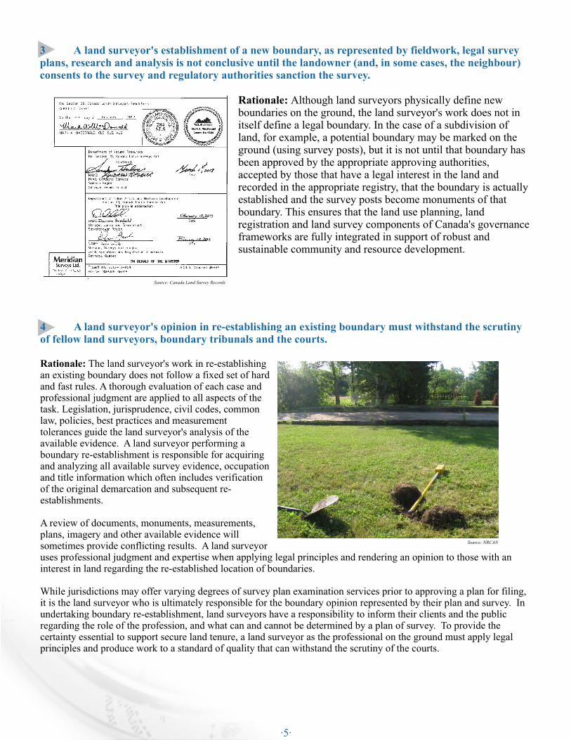
3 A land surveyor's establishment of a new boundary, as represented by fieldwork, legal survey plans, research and analysis is not conclusive until the landowner (and, in some cases, the neighbour) consents to the survey and regulatory authorities sanction the survey.
Rationale: Although land surveyors physically define new boundaries on the ground, the land surveyor's work does not in itself define a legal boundary. In the case of a subdivision of land, for example, a potential boundary may be marked on the ground (using survey posts), but it is not until that boundary has been approved by the appropriate approving authorities, accepted by those that have a legal interest in the land and recorded in the appropriate registry, that the boundary is actually established and the survey posts become monuments of that boundary. This ensures that the land use planning, land registration and land survey components of Canada's governance frameworks are fully integrated in support of robust and sustainable community and resource development.
Source: NRCAN
Source: Canada Land Survey Records
·5·
1 Greenleaf on the Law of Evidence – Reference to be added
5 Land surveyors use the best available evidence to re-establish a boundary. The hierarchy of evidence doctrine, which gives most weight to “those things about which people are least likely to be
1mistaken”, is used to resolve ambiguity (for example, between a measurement and a monument) .
Rationale: As there are often differences or ambiguities in a parcel description, numerous judicial decisions have handed down the following order of importance of evidence to resolve the ambiguity: first, evidence of natural boundaries; second, evidence of original monuments; third, evidence of occupation (possession) that can reasonably be related back to the time of the original survey; finally, measurements shown on the original plan, field notes or other document.
The hierarchy dates back to the 1800's when surveys were less accurate, so evidence of boundaries found on the ground was - and still is “things which people are least likely to mistake”. However, the hierarchy is evolving due to more accurate survey techniques; measurements and coordinates, particularly those that have been repeatedly validated will warrant a higher position in the hierarchy. A land surveyor has the responsibility to ensure that the best available evidence is applied to each boundary re-establishment. Weight is assigned based on all technical information available, new and old, along with a thorough analysis of each piece of evidence giving consideration to vintage and origin and what may have changed since the original survey. A land surveyor considers the human activity that has taken place on the land over time and the dynamic nature of natural
boundaries and inaccuracies in their original documented positions.
6 Land surveyors are cautious in upsetting settled possession.
Rationale: Land surveyors are cautious not to disturb settled possession if there is a discrepancy between her/his opinion and the physical occupation on the ground. In such cases, land surveyors will expand analysis and seek corroborating evidence such as knowledge from adjacent land owners and supporting documentation.
If a boundary was marked by occupation, such as fences, hedges, walls and buildings, when the location of the original monuments was known, then if the original monuments were lost, the location of the boundary might best be represented by the evidence of that occupation. A land surveyor will determine, through analysis of all available evidence, that a structure was actually erected on a boundary. Caution is necessary as fences may merely be constructed for convenience, to retain animals or to discourage trespassers. Of course, there might well be evidence of occupation across an accepted boundary, in which case it is rejected as evidence of the boundary, but assessed for other purposes (for example, adverse possession, prescriptive rights and statutory remedies).
If a boundary was not monumented when it was first established, a land surveyor will turn to the intent of the land owner at the time when the line was created. The intent may have been to follow an existing fence or to set a specific dimension. In absence of evidence of intent, long standing acceptance or acquiescence by owners of features marking a line may represent evidence of the line by agreement or convention. Surveyors will acquire convincing corroborating evidence before upsetting settled boundaries.
Source: NRCAN
·6·

7 Land surveyors manage precision and accuracy and carefully analyze errors of varying magnitude in conducting work that often involves assessing measurements made over a hundred years ago; Land surveyors do not perfect existing surveys or render adverse opinions, simply because they have conducted the new survey with more precise methods.
Rationale: Surveying equipment and technologies have advanced over time and surveys are now conducted to a very high degree of precision. Land surveyors are well versed in the measurement methodologies used throughout the history of Canada. In the process of re-constructing a boundary a retracement survey is not intended to be more precise; the intent is to follow in the footsteps of a previous land surveyor. Many descriptions are written with dimensions and directions that are approximate and often refer to delimiters that actually control the location of boundaries; (for example, extending 400 feet more or less to a brook). It is very possible that the distance to the brook may in fact be quite different than the dimension quoted in the deed; however the brook is in fact the boundary.
Depending on when a survey was conducted and the physical nature of the terrain, corner monuments established may appear to be displaced with
current technology, but often are very representative of the best expected results that could be obtained given the survey methods of the day. It is not the role of a land surveyor to establish boundaries where they should have been had they been surveyed using modern measurement technology, but to use sound judgment and survey practices to place the boundaries where they were originally established by competent authority.
8 Land surveyors as public officers, play a quasi-judicial role and are therefore impartial. They provide assistance independent of and uninfluenced by the interests of a client; avoid and reject the role of advocate; are unbiased; and abide by precepts of procedural fairness.
Rationale: Land surveys have a multi-generational impact. Surveys for one client have the potential to impact adjacent land owners and multiple land owners over time as subsequent transactions take place. All surveys are therefore prepared independently of the expectations or betterment of a client. Further, a land surveyor's work is based on the principles of an impartial evaluation of the best available evidence related to each case. Boundaries are re-established in their true, original and unalterable positions. In this way, the land surveyor, the profession and most importantly the survey itself are seen as truly objective and consequently are of the most value to the client, the public and future generations.
9 Land surveyors contribute data and play a leadership role in the development and maintenance of Canadian (federal, provincial, Aboriginal, territorial, municipal) Parcel Mapping data.
Rationale: Surveyors make the measurements that establish, update and maintain the property boundary framework draped over the Canadian landscape. Land surveyors provide the “eyes on the ground” to ensure that digital parcel data represents the actual occupation and activity on the landscape. The land surveyor is the professional that is closest to the source and best qualified to build an accurate virtual representation of the property fabric in Canada. Applying the land surveyor's expertise and professional approach continually improves the quality of parcel mapping data. The land surveyor also applies extensive geographic data integration expertise to support a large number of Geographic Information System applications from land use planning to natural resource management.
Source: NRCAN
Source: NRCAN
Source: dwellinatlanta.com
·7·