fundy in flux: challenges for science, policy and...
TRANSCRIPT

Fundy in Flux: Challenges for Science, Policy and Society
Proceedings of the 11th BoFEP Bay of Fundy Science Workshop,
Fredericton, New Brunswick, 9–11 June 2016
Editors
Marianne Janowicz, Blythe Chang, Sarah Chamberlain, Susan J. Rolston, and Peter G. Wells
BoFEP Technical Report No. 10
March 2017

2
This publication should be cited as: M. Janowicz, B. Chang, S. Chamberlain, S.J. Rolston and P.G. Wells (eds.). 2017. Fundy in Flux: Challenges for Science, Policy and Society. Proceedings of the 11th BoFEP Bay of Fundy Science Workshop, Fredericton, New Brunswick, 9–11 June 2016. Bay of Fundy Ecosystem Partnership Technical Report No. 10. Bay of Fundy Ecosystem Partnership, Tantallon, NS. 52 p. Photographs: Sarah Chamberlain, Jack Fife, Fundy Ocean Research Center for Energy (FORCE), Marianne Janowicz, Kimberly Robichaud-Leblanc, Susan Rolston, Peter G. Wells For further information, contact: Bay of Fundy Ecosystem Partnership Secretariat PO Box 3062 Tantallon, Nova Scotia, Canada B3Z 4G9 E-mail: [email protected] www.bofep.org © Bay of Fundy Ecosystem Partnership, 2017 ISBN 978-0-9783120-7-7

3
Table of Contents
Preface ........................................................................................................................................................... 4 Acknowledgements ........................................................................................................................................ 5 Workshop Organizers ..................................................................................................................................... 5 Core Sponsors of BoFEP ................................................................................................................................. 6 Workshop Program ........................................................................................................................................ 7 1. Reflections: An appreciation of Drs. Michael (Mick) Burt, UNB Fredericton and HMSC, and Mike
Brylinsky, ACER, regarding their contributions to BoFEP and Fundy Science ......................................... 8 2. Keynote Addresses ................................................................................................................................. 9 2.1 Warming, Ecosystem Change, and Fisheries in the Gulf of Maine: From Understanding to
Adaptation, Dr. Katherine Mills ......................................................................................................... 9 2.2 Reconstructing Past Human Use of Archaeological Landscapes in and Around the Bay of Fundy
Region, Brent D. Suttie ...................................................................................................................... 12 3. Special Sessions 3.1 Voices on the River ..................................................................................................................... 13 3.2 Towards a National Network for Ocean Observation ................................................................ 15 3.3 Putting the Ocean Health Index to Practice in the Bay of Fundy ................................................ 18 4. Contributed Paper Session Abstracts
4.1 Seabirds ................................................................................................................................. 20 4.2 Tidal Power and Renewable Resources ....................................................................................... 22 4.3 Coastal Monitoring ...................................................................................................................... 26 4.4 Mudflat Ecology .......................................................................................................................... 28 4.5 MPAs and Coastal Management ................................................................................................. 31 4.6 Aquatic Ecology ........................................................................................................................... 32 4.7 Geology ................................................................................................................................. 34 4.8 Building Better Governance for Sustainable Resources: Case Studies from Atlantic Canada .... 36 5. Poster Abstracts ................................................................................................................................. 40 6. Recollections of the 11th BoFEP Bay of Fundy Science Workshop, Marianne Janowicz .......................... 47 Author Index .................................................................................................................................................. 50 2018 Workshop Announcement .................................................................................................................... 52
4
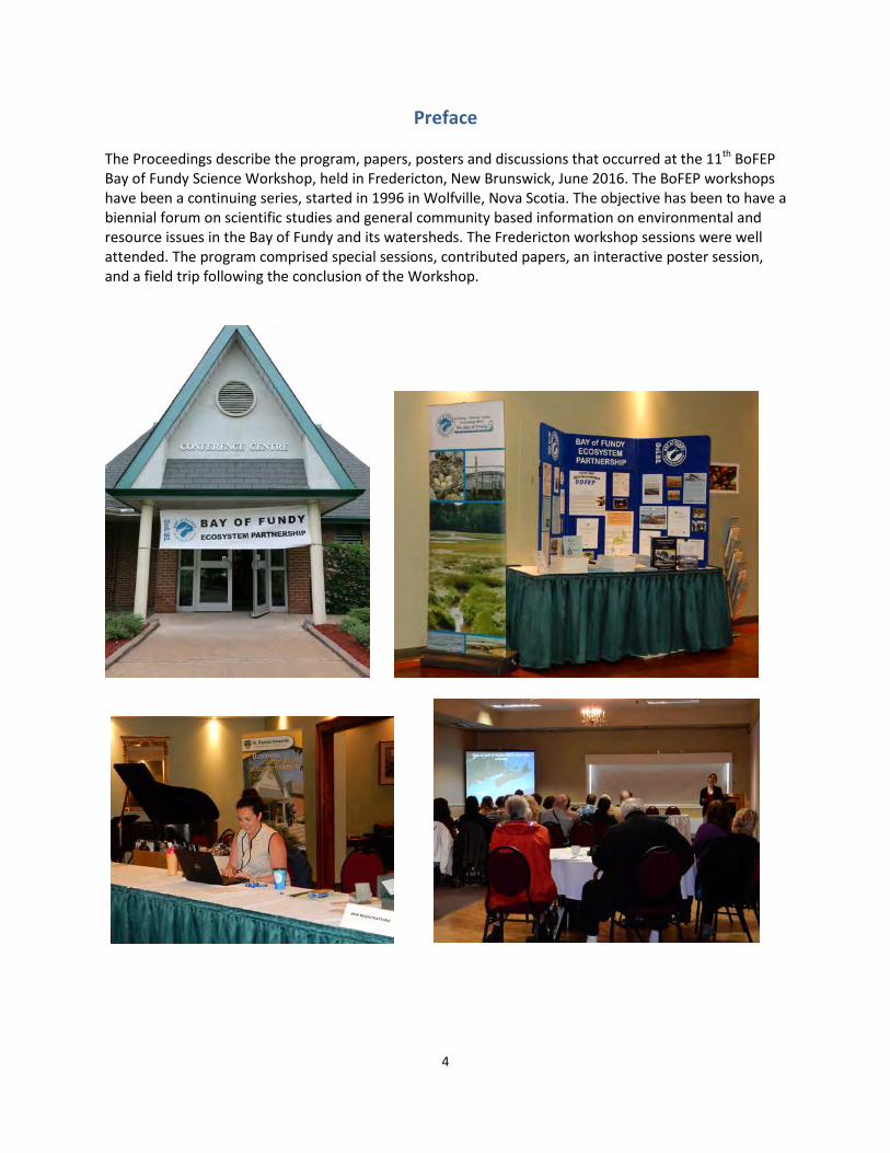
Preface The Proceedings describe the program, papers, posters and discussions that occurred at the 11th BoFEP Bay of Fundy Science Workshop, held in Fredericton, New Brunswick, June 2016. The BoFEP workshops have been a continuing series, started in 1996 in Wolfville, Nova Scotia. The objective has been to have a biennial forum on scientific studies and general community based information on environmental and resource issues in the Bay of Fundy and its watersheds. The Fredericton workshop sessions were well attended. The program comprised special sessions, contributed papers, an interactive poster session, and a field trip following the conclusion of the Workshop.

5
Acknowledgements
A special thank you to AMEC Foster Wheeler, Mountain Equipment Coop and the New Brunswick Department of Natural Resources for their support of the
11th BoFEP Bay of Fundy Science Workshop
Workshop Organizing Committee
Marianne Janowicz, Chair Sarah Chamberlain
Blythe Chang Jon Percy
Susan Rolston Peter Wells
Program Committee
Blythe Chang, Chair
Ken Adams Hugh Akagi
Jack Fife Marianne Janowicz
Joshua McNeely
Logistics Committee
Sarah Chamberlain, Chair Susan Rolston
Owen Washburn

6
Core Sponsors of BoFEP The core supporters, financial and/or in-kind, of BoFEP over the past 20 years have been the following:
• Environment Canada (now Environment and Climate Change Canada) o Conservation and Protection, Dartmouth, NS o Canadian Wildlife Service, Sackville, NB
• Fisheries and Oceans Canada o Bedford Institute of Oceanography o St. Andrews Biological Station
• Gulf of Maine Council on the Marine Environment, and its members • Acadia University - Acadia Centre for Estuarine Research, Wolfville, NS • Dalhousie University, Halifax, NS • SeaPen Communications, Granville Ferry, NS • Coastal Zone Canada Association
Many other groups (other universities, NGOs, private sector) have co-sponsored or supported in various ways the workshops and meetings of BoFEP over the years. All of the groups are greatly thanked for their long-term commitment and support. As well, many individual members of BoFEP, in various capacities through their working positions or as volunteers, have given generously of their time, skills, and personal resources to BoFEP activities, projects and administration; their contributions have been critical to the functioning and program output of the organization.

7
Workshop Program
Wednesday
8 June Thursday
9 June Friday
10 June Saturday 11 June
8:00
Registration Registration Field Trip
by Boat on the
Oromocto River
8:30 Opening & Keynote Presentation
Dr. Katherine Mills Ocean Health
Index
MPAs & Coastal
Management
10:00 Break Break
10:30 Ocean Observation
Network Seabirds
Aquatic Ecology
Geology
12:00 Lunch Lunch &
Special Presentation by Brent Suttie
1:30 Tidal Power &
Renewable Energy Coastal
Monitoring Building Better Governance for Sustainable Resources &
Workshop Closing
3:00
Break
3:30 Tidal Power & Renewable Energy
Mudflat Ecology 4:00
5:00 Poster Session
5:30
Reception 6:00
Meet for share-a-ride
to Special Event
6:30–
Voices on the River Special Event
Dinner on own
8
1. Reflections An appreciation of Drs. Michael (Mick) D. B. Burt, UNB Fredericton and Huntsman Marine Science Centre, and Mike Brylinsky, Acadia Centre for Estuarine Research
Peter G. Wells
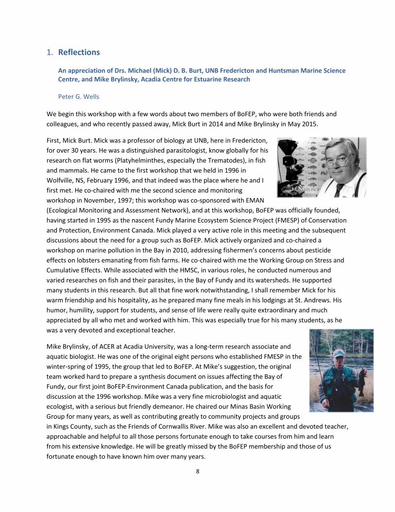
We begin this workshop with a few words about two members of BoFEP, who were both friends and colleagues, and who recently passed away, Mick Burt in 2014 and Mike Brylinsky in May 2015.
First, Mick Burt. Mick was a professor of biology at UNB, here in Fredericton, for over 30 years. He was a distinguished parasitologist, know globally for his research on flat worms (Platyhelminthes, especially the Trematodes), in fish and mammals. He came to the first workshop that we held in 1996 in Wolfville, NS, February 1996, and that indeed was the place where he and I first met. He co-chaired with me the second science and monitoring workshop in November, 1997; this workshop was co-sponsored with EMAN (Ecological Monitoring and Assessment Network), and at this workshop, BoFEP was officially founded, having started in 1995 as the nascent Fundy Marine Ecosystem Science Project (FMESP) of Conservation and Protection, Environment Canada. Mick played a very active role in this meeting and the subsequent discussions about the need for a group such as BoFEP. Mick actively organized and co-chaired a workshop on marine pollution in the Bay in 2010, addressing fishermen’s concerns about pesticide effects on lobsters emanating from fish farms. He co-chaired with me the Working Group on Stress and Cumulative Effects. While associated with the HMSC, in various roles, he conducted numerous and varied researches on fish and their parasites, in the Bay of Fundy and its watersheds. He supported many students in this research. But all that fine work notwithstanding, I shall remember Mick for his warm friendship and his hospitality, as he prepared many fine meals in his lodgings at St. Andrews. His humor, humility, support for students, and sense of life were really quite extraordinary and much appreciated by all who met and worked with him. This was especially true for his many students, as he was a very devoted and exceptional teacher.
Mike Brylinsky, of ACER at Acadia University, was a long-term research associate and aquatic biologist. He was one of the original eight persons who established FMESP in the winter-spring of 1995, the group that led to BoFEP. At Mike’s suggestion, the original team worked hard to prepare a synthesis document on issues affecting the Bay of Fundy, our first joint BoFEP-Environment Canada publication, and the basis for discussion at the 1996 workshop. Mike was a very fine microbiologist and aquatic ecologist, with a serious but friendly demeanor. He chaired our Minas Basin Working Group for many years, as well as contributing greatly to community projects and groups in Kings County, such as the Friends of Cornwallis River. Mike was also an excellent and devoted teacher, approachable and helpful to all those persons fortunate enough to take courses from him and learn from his extensive knowledge. He will be greatly missed by the BoFEP membership and those of us fortunate enough to have known him over many years.

9
2. Keynote Addresses 2.1 Warming, Ecosystem Change, and Fisheries in the Gulf of Maine: From Understanding to Adaptation Dr. Katherine Mills, Gulf of Maine Research Institute, Portland Maine Key Observations (Marianne Janowicz)
1) Management approaches are not always aligned with changes in the ecosystem. 2) There are economic and social implications of temperature changes – these include equity,
trade-offs, and community and food security. 3) Risk options – opportunities versus negative effects. Opportunities require flexibility in
management and this is difficult because policy is often removed from what is actually going on.
Extended Abstract Marine ecosystems and fisheries continually adjust to variability in environmental conditions, but rapid warming in the past decade has resulted in distinct changes in the Gulf of Maine - Bay of Fundy region. Tracing climate impacts through the physical, ecological, and social systems demonstrates interconnections and feedbacks and shows that climate impacts are already being felt by marine resource users and management systems.
Sea surface temperature (SST) has been steadily rising across the globe since the early 20th century. As global SSTs have climbed steadily, the Gulf of Maine has experienced more variability, but long-term warming trends in the region have been comparable to the global average (IPCC 2013). During a warm period in the 1940s and 50s, SSTs were at levels similar to those of recent warm years. A key difference though was that in the earlier time period, local waters were warm due to a northward Gulf Stream, but globally, waters were relatively cool. For the recent period spanning 2005-2014, exceptionally warm waters in the Gulf of Maine were part of a distinct pattern of warming throughout the world’s oceans. Since satellite records of SST began in 1982, the Gulf of Maine has warmed at a rate of 0.04° C / year, four times faster than the global average (Pershing et al. 2015). However, during the most recent decade from 2005 to 2014, SST in the region warmed more than four times the long-term rate at 0.18° C / year—a rate that was faster than that experienced in 99.9% of the global ocean (Pershing et al. 2015). This warming trend was also punctuated by the occurrence of a marine heat wave in 2012, during which SST anomalies were 1-3° C above the long-term average—on par with climate model projections for the end of the century (Mills et al. 2013).
Warming in the Gulf of Maine region has affected fish populations in a variety of ways. Shifts in productivity, distribution, and phenology have been linked to temperature for many species, and these temperature-driven changes impact fisheries. Gulf of Maine cod offers one example of stock productivity varying with temperature. Spawning stock biomass and age-1 recruitment of Gulf of Maine cod have been declining since 2010 (Palmer 2014). This decline in recruitment was not well captured by a stock-recruit relationship that was dependent solely on spawning stock biomass, but inclusion of

10
temperature in this relationship tracked the recent downturn in recruitment (Pershing et al. 2015). Further analyses indicated that failure to account for recent warming led to overly optimistic expectations for stock productivity, resulting in fishing quotas being set too high and making it unlikely that the stock could rebuild to static reference points on typical timelines (Pershing et al. 2015).
Many stocks of marine fish in the Gulf of Maine region have shifted their spatial distribution poleward and to deeper depths (Nye et al. 2009, Pinsky et al. 2013); in turn, fishing fleets that target these northward-moving species also follow the fish to new fishing locations (Mills et al. 2015). As one example, summer flounder experienced a northward shift in stock biomass from 1996-2014; in turn, the portion of catch of the species that is taken off of North Carolina and Virginia has declined between the late 1990s and early 2010s, while the proportion of catch has increased off of New Jersey and New York (Mills et al. 2015). Yet vessels that are now fishing for summer flounder in more northerly waters must land the catch in their home state because quota allocations were set decades ago based on historical fishing patterns (Hudson and Peros 2013). These types of regulations provide access to the species for vessels that have historically targeted it, but at greater costs due to increased travel distance; however, these regulations inhibit access by fishermen in more northerly areas as stocks more into new locations such as the Gulf of Maine (Hudson and Peros 2013).
In addition to spatial distribution shifts, changes in temporal distributions also affect marine organisms and fisheries. One example from the 2012 ocean heat wave demonstrates these connections through the American lobster fishery. During this event, ocean temperature anomalies in the Northwest Atlantic resulted in an annual cycle of temperatures that began warming three weeks ahead of normal (Mills et al. 2013). The Maine lobster fishery is closely tied to spring warming, as the high landings summer mode begins after lobsters migrate inshore, molt into harvestable size classes, and become more active, thus moving into and out of traps. During 2012, the Maine fishery began landing high volumes of lobster three to four weeks earlier than usual, overlapping with the Canadian fishing season and creating supplies that exceeded the transportation, storage, and processing capacities of the supply chain. This set of events resulted in a glut of product and a price collapse that affected both the U. S. and Canadian lobster fisheries (Mills et al. 2013). Changes in the phenology of events and seasonal cycles can also lead to ecological mis-matches between predators and prey (Richards 2012, Friedland et al. 2014).
While knowledge of temperature influences on fish populations and fisheries is increasing, there remains a substantial need to better understand how fishing industry participants, communities, and management systems can adapt and respond to climate-related changes. Those involved in fisheries at many levels are recognizing the need to anticipate vulnerabilities to climate variability and change and to identify adaptation options at temporal and spatial scales that are relevant to their decision-making processes. Providing scientific information to support multiple actors as they face decisions across a range of scales will be essential for enabling timely and effective adaptation to dynamic climate conditions. Key information needs entail (1) identifying both impacts and opportunities in the context of climate-driven ecosystem changes, (2) assessing vulnerability to projected changes and relative benefits of specific adaptation options, and (3) providing information tools, forecasts, and other products to support a range of decisions by varied users in a context of change and uncertainty.

11
References
Friedland KD, Leaf RT, Kane J, Tommasi D, Asch RG, Rebuck N, Ji R, Large S, Stock C, Saba VS (2015) Spring bloom dynamics and zooplankton biomass response on the US Northeast Continental Shelf 102: 47-61.
Hudson M, Peros J (2013) Preparing for emerging fisheries: an overview of mid-Atlantic stocks on the move. Gulf of Maine Research Institute, Portland, ME. <http://www.gmri.org/ sites/default/files/resource/preparing_for_emerging_fisheries_final.pdf>
IPCC (Intergovernmental Panel on Climate Change) (2013) Climate change 2013: The physical science basis. Working Group I contribution to the IPCC Fifth Assessment Report. Cambridge, United Kingdom: Cambridge University Press. www.ipcc.ch/report/ar5/wg1.
Mills KE, Hernandez CM, Young Morse R, Pershing AJ (2015) Final report to the Northeast Regional Ocean Council: Environmental Influences on Spatial Patterns of Commercial Fisheries in New England. Gulf of Maine Research Institute, Portland, ME.
Mills KE, Pershing AJ, Brown C, Chen Y, Chiang F, Holland D, Lehuta S, Nye J, Sun J, Thomas A, Wahle R (2013) Fisheries management in a changing climate: lessons from the 2012 ocean heat wave in the Northwest Atlantic. Oceanography 26(2): 191-195.
Nye JA, Link JS, Hare JA, Overholtz WJ (2009) Changing spatial distribution of fish stocks in relation to climate and population size on the Northeast United States continental shelf. Marine Ecology Progress Series 393: 111-129
Palmer MC (2014) 2014 Assessment update report of the Gulf of Maine Atlantic cod stock. US Dept. of Commerce, Northeast Fisheries Science Center Reference Document 14-14; 119 p. Available from: National Marine Fisheries Service,166 Water Street, Woods Hole, MA 02543-1026. CRD14-14
Pershing A, Alexander M, Hernandez C, Kerr L, Le Bris A., Mills KE, Nye J, Record N, Scannell H, Scott J, Sherwood G, Thomas A (2015) Slow adaptation in the face of rapid warming leads to collapse of the Gulf of Maine cod fishery. Science 350(6262): 809-812.
Pinsky ML, Worm B, Fogarty MJ, Sarmiento JL and Levin SA (2013) Marine taxa track local climate velocities. Science 341(6151): 1239-1242.
Richard AR (2012) Phenological shifts in hatch timing of northern shrimp Pandalus borealis. Marine Ecology Progress Series 456: 149-158.

12
2.2 Reconstructing Past Human Use of Archaeological Landscapes in and Around the Bay of Fundy Region Brent D. Suttie, Provincial Archaeologist and Director, Archaeology Branch, New Brunswick Department of Tourism, Heritage and Culture Since the end of the Wisconsinan Glaciation there have been profound changes in the landscape and sea-levels in an around the Bay of Fundy Region of Northeastern North America. Here I discuss some recent research which has demonstrated the effect that these changes have had on where people lived and what resources were available to them. The consideration of where people lived is particularly important for developing archaeological impact assessments prior to approving potential development projects. Three case studies are discussed, with particular reference to what they tell us about these past landscapes and how people responded to these profound changes over time.

13
3. Special Sessions 3.1 Voices on the River Joshua McNeely Convenors: Wendy Wetteland, President & Chief, New Brunswick Aboriginal Peoples Council Chris Brooks, Community Drum, St. Mary’s First Nation Amber Giles, Environmental Technicians, Maliseet Nation Conservation Council Ron Tremblay, Grand Chief, Wolastoq Grand Council Jason Harquail, Aboriginal Seafood Network, New Brunswick Aboriginal Peoples Council Joshua McNeely, IKANAWTIKET, Maritime Aboriginal Peoples Council Elders For the opening event, the New Brunswick Aboriginal Peoples Council led a discussion about Aboriginal Peoples’ worldview of water and river systems, titled “Voices on the River”. Participants gathered at the “Old Reserve” site on the Wolastoq (Saint John River) to receive a smudging and to share their stories and views. A prayer was given by Elder Alma Brooks who also shared stories about growing up on the Wolastoq and living on the cramped few acres of the reserve with about 100 other families, as well as the move up the hill to the much larger new reserve. Wolastoq Grand Chief Ron Tremblay expressed a deeper meaning about “conservation and sustainable use” by inviting participants to look through the Aboriginal lens of a long and hard fought history to have Aboriginal Rights and Treaty Rights acknowledge and respected by the settler government. Though many Aboriginal persons desire conservation and sustainable use of their traditional ancestral homelands, many also remember and still experience to this day discrimination, dispossession of lands, denial of birthright, and a lack of understanding by the public that the relationship with Aboriginal Peoples goes to the very core of Canada’s laws, policies, and postures, especially include those for the environment and biodiversity. Participants were encouraged to read the Report of the Royal Commission on Aboriginal Peoples (1996), UN Declaration on the Rights of Indigenous Peoples (2007), the Truth and Reconciliation report on Indian Residential Schools (2015), and the Supreme Court of Canada Tsilhqot’in Decision (2012) to begin to see through the Aboriginal lens, particularly when looking at recent announcements by the federal government to adopt UNDRIPs, to review environmental legislation, and to engage in a “nation-to-nation” relationship with Aboriginal Peoples. Other remarks and stories were shared by representatives of the New Brunswick Aboriginal Peoples Council, St. Mary’s First Nation, Maritime Aboriginal Peoples Council – IKANAWTIKET, Maliseet Nation Conservation Council, and Aboriginal Seafood Network, which highlighted some of the specific concerns and activities regarding the management of waterways and in situ natural biodiversity, where Aboriginal Peoples are included in discussions when it is convenient (e.g., species at risk) and shut-out or downplayed when it is not convenient (e.g., large natural resource development plans). Several others shared their personal views or those of their organization and some similarities of concern were noted. The session ended with a prayer and an offering to the Wolastaq for a productive conference and the resolve to continue in the face of change.

14
Elder Alma Brooks and Wolastoq Grand Chief Ron Tremblay

15
3.2 Towards a National Network for Ocean Observation Convenors: Lee T. Wilson¹ and Andrew Sherin² (1) School of Information Management, Dalhousie University, Halifax, NS ([email protected]); (2) Dalhousie University, Halifax, NS ([email protected]) Key Observations (Lee Wilson and Andy Sherin)
The success of CI00S (the Canadian Integrated Ocean Observing System) needs to be measured in at least two ways:
1) Having seamless access to ocean data, via a portal, and 2) Having its impact determined on a) social policy, and b) the number and strength of connections
between/amongst data providers and data users.
Presentation Overview The world’s oceans are a critical part of the Earth system. Sound knowledge and understanding of the oceans is essential for mitigating human impacts on the global environment and for promoting sustainable economic use of the marine environment, including: the safe and sustainable use of natural resources; the assessment of and adaptation to climate change; deep knowledge about complex and interconnected ecosystems; our understanding of the entire Earth system; and health and public safety. Knowledge and understanding, in turn, depends on access to accurate, rich, available, and integrated ocean data by end-users, including academic researchers, policy and decision-makers, and the general public. In Canada, ocean data is generated primarily by regional Ocean Observing Systems (OOS) operating in blue water and coastal areas. These regionally-focused activities, while strong individually, have not yet formed a strong national network, resulting in a fragmented ocean sciences sector. This “coordination gap” has made access to data by end-users difficult, with data and forecasts collected by various programs and agencies being scattered across a range of web-pages that can be difficult to find and hard to access – or not available at all. A careful re-examination of our data management practices, including how we share, access, and use data, is necessary to ensure we are leveraging Canada’s ocean data to best support scientific excellence, foster collaboration and innovation, and harness oceans data to inform decision-makers and other stakeholders. To that end, an Expert Forum on Ocean Data Management (November 18-19, 2015 in Montreal, Canada) was held to bring together national and international experts and stakeholders to present and evaluate international best practices in managing data from ocean observations, the current state of ocean data collected and managed in Canada, and goals and visions for the future of ocean data management in Canada. The vision that emerged from the discussion was of the formation of a Canadian Integrated Ocean Observing System (CIOOS): An integrated Ocean Observing System for Canada that would bring together and leverage existing Canadian and international ocean observation data/programs/projects to generate value-added data products on an open web-based platform that maximizes utility to end-users (e.g., government, science partners, industry, and the public). The proposed system would be comprised of several primarily regional/thematic Ocean Observing Systems already in operation across the country. Regional nodes would also have a mandate to engage smaller groups within their region, ranging from academic research projects and regional science networks to indigenous and local communities.

16
Data sharing within a community is challenging because of a coordination gap, the National Network for Ocean Observation will work to change that, building a community of practice to work on accreditation of data, respecting ownership, guidelines for citation of shared data. The idea is that the program will not be top down (i.e. groups will not be obliged to share data), but rather volunteer based. However, groups volunteering data will need to adhere to data quality standards.
Discussion (edited by Wells)
Q1: As an end user wanting to understand tuna, for example, migration, temperatures, threats and spawning areas in Mexico or the USA, not in the Canadian part of the North Atlantic, I’m wondering why this project is limited to this part of the Atlantic Ocean and not the ocean basin as a whole.
A: The concept is to have a full ocean system of global data, but Canada can’t create it for everyone. The idea is to start here, start small, and then work with other jurisdictions to expand.
Q1 (Follow up): Is there an international standard of data that we can easily tie into?
A: Yes. That’s the idea - to participate in global systems already in practice.
Q2: Most of the data presented here appears to be only quantitative in nature, but qualitative data can be very informative and even necessary for ocean management decisions. Will qualitative data be incorporated into the CIOOS (Canadian integrated Ocean Observation System)?
A: It’s hard to do that because qualitative data has so many more characteristics and layers to it than quantitative data. So at this point, no, we are not thinking about qualitative data.
Q2 (Follow up): The reason I raised this question was because I recall at CZC 2014 two years ago that one group had set up an interactive map of a local area and invited people to place labels on the map wherever they wanted that showed what they valued - a dock, for example, where someone’s grandfather taught them to fish, or a beach where they went every summer. For example, this kind of data could be layered with contaminants data so you could see where human activity and potentially dangerous toxic substances are overlapping and then make more informed management choices based on it.
Q3: Along the same vein, it is clear that this model works well for Ocean Tracking Network (OTN) Data, but OTN data are not the only kind of data that could be included in this shared network.
A: We are trying not to limit the data to ocean observation data. We need to look at the vision of this process and try to gather this feedback, such as we are doing here today, to operationalize the datasets in a way that will be useful to multiple end users.
Q4: Is CIOOS just for oceans? Or are freshwater systems like the Great Lakes included?
A: Great Lakes are a node that will be included.

17
Q5: Is it possible to incorporate traditional ecological knowledge or local ecological knowledge? This network will be data driven, but TEK/LEK is experiential. Is it possible to transcribe/translate that?
A: It would be interesting to include, certainly. The challenge is spending the time translating it into something that has not lost its meaning but can work with the data-centric components. It would also be hard to maintain. (Editor’s note – also see question 2).
Q6: Typically, most of the data collected now is collected by DFO. Those data are then kept by DFO, i.e. the federal government, and not necessarily shared with everyone. There will be feeders into this system that are more important than others (e.g. DFO, OTN). However, we have this culture of “my data are my data”. How do you overcome that?
A: Centralizing the data will help. Some groups, OTN for example, have embargos for 2 years on their data before it is then shared, so they have time to work with it before someone else can use it. It is possible to request a time extension. Another action that may help is to develop policies around encouraging sharing but protecting shared data. In most cases, someone is paying them to collect data (NSERC or another funding body), so data sharing arrangements could be built into the funding agreements.
Comment: There are ways of protecting data through copyrights, etc. For example, links can be made to publications that provided data; such links could help people/groups feel more secure in sharing their data in such an open way.
Comment: As a consultant, we “own” our data, but it goes to a public source. We are beginning to digitize our wetland data, for example, and people like to have access so as to ground truth the data, and have access to shape files for their own work. For example, the province (NB?) has benefited from us sharing the data. I also would like to point out that the government has lost a lot of its hardcopies when the libraries were gutted. The data are now gone, but it was still useful. Digitizing it and having it available through open access would have been nice.
Comment: Timescales are also important. Governments are not monitoring some “things” anymore, and those datasets have simply ended. Our baseline understanding of problems such as traditional chemical contamination is gone, in favor of obtaining more “fashionable” data such as on pharmaceuticals in the environment. There also should be parameters to ensure that the data are of a high quality and that data sets are long-term.
Q7: How do you measure success of such a program as CIOOS?
A: There are various metrics:
• Catalogue of the breadth of data. • Access/impact of data.
o How many people? Who are they? o Is this having an impaction on social policy?
• Optimize parameters at the outset so as to track the success measures. • Use good data architecture. • Ensue that the data/system is responsive to users.

18
3.3 Putting the Ocean Health Index to Practice in the Bay of Fundy Convenors: Rémi M. Daigle1,2 and Scott Kidd3 (1) ISMER, Université du Québec à Rimouski, Rimouski, QC ([email protected]); (2) Biological Sciences, Simon Fraser University, Burnaby, BC; (3) Quispamsis, NB ([email protected]) The Ocean Health Index (OHI) is a peer reviewed framework in use since 2012 to assess the ecological, social, and economic goals and assign a score to state of the world’s oceans. The OHI is now being used regionally with finer, more locally specific data in order to address local management concerns. BoFEP recently concluded a project where it tested the applicability of the OHI framework in the Bay of Fundy by assessing the Southwest New Brunswick Bay of Fundy Marine Resources Planning Area (MRPA). In this session we aim to: 1) Provide background on the OHI framework; 2) Discuss previous research on the OHI in Canada; 3) Detail the findings of BoFEP’s project; and 4) Discuss with attendees the future directions of the OHI to the entire Bay of Fundy, Gulf of Maine, or Atlantic Canada.
1) Talks were given by Julia Stewart Lowndes (National Center for Ecological Analysis and Synthesis, University of California, Santa Barbara), Rémi Daigle (University of Quebec –UQAR, Simon Fraser Univ., NCEAS), and Scott Kidd (UNBSJ, BoFEP).
2) Lowde’s talk: a. She has been associated with Conservation International’s OHI program for 3 years.
They have done 4 assessments and currently doing one for 2016. b. There is an OHI Toolbox and support – a training program; open source software;
visualization tools. These can be accessed at www.ohi-science.org . c. The training program allows one to develop a suitable OHI framework, then access the
OHI toolbox, then develop output. d. There are small scale OHI assessments being done in several countries – Brazil, Fiji, BC
Canada, US West Coast, Antarctic, and NE USA. There are also independent assessments – Canada 2013, Canada vol. 2, Columbia where OHI is part of ocean policy initiatives. Now there are more than 28 regions working on OHI on all the continents.
e. The biggest need is to persuade other groups to get involved. There is a need for leaders in other countries. There is going to be an eight nation workshop on OHI.
3) Daigle’s talk: a. He talked about the OHI Index in Canada – public perceptions of ocean derived benefits. b. For Canada, the OHI has 70 goals and subgoals. The objectives are to have an annual
OHI, with annual data improvements, goals that include “aboriginal needs”, and a web-based survey (of the public use of the OHI?).
c. The Canadian OHI is updating the iconic species goal/list, leading from the WWF list, and attempting to standardize between countries for this goal.
d. The aboriginal needs goal is unique to Canada and replaces the artisanal fisheries goal. e. One important question is “which OHI goals really matter to Canadians”? He did an
opinion survey. The priorities were clean water, food provision, coastal livelihoods and

19
carbon storage. But one of the challenges of dong such a survey is – how to remove investigator bias?
f. Various factors influenced the opinions of the importance of a particular goal. For example, food provision – the extent of eating seafood influenced the score; carbon storage – age of person influenced the score; political affiliation was also a factor.
g. The challenge is how to democratize the OHI – the OHI reports what is important to Canadians. It is shown to be a powerful tool, influential with the UN, the FAO, and with science communicators.
h. The Canadian project involves BC, the Atlantic Coast (Daigle as lead) and the pan Arctic (UK as lead). The Atlantic coast segment covers the Gulf of St. Lawrence, the Scotian Shelf, and Newfoundland and Labrador. Not Bay of Fundy/Gulf of Maine!
i. Questions – Q - who is supporting the Atlantic assessments? Answer - Daigle’s own research program. Q - How big was the sample size for the survey. Answer - >2000 people. Q – the OHI is a different approach to measuring ocean health – it is a social science index. Answer – yes, it gives a holistic view of the use of the oceans, and is a good tool for contributing to ocean management.
4) Kidd’s talk: a. He addressed the findings of the BoFEP OHI project. Refer to the major reports on the
BoFEP website. This project has had three phases; in the second phase, there were five OHI goals (fisheries, aquaculture, iconic spp, special places, biodiversity), specific to SW NB. He described phase 3 – what BoFEP has done to date.
b. Question – isn’t the OHI exercise itself as important as the result? A – yes, but with important caveats (?); Q – why is the total measure out of 100? A –standardization and need for comparison between OHI geographic areas, despite using different goals. Comment - sensitivity analysis is an important tool to apply here – which factors are the important ones? Which factors should policy and political folks concentrate on? Comment - the biodiversity goal – there is overwhelming importance placed on present status of species, which may be exaggerating the SBL problem (?). Reliance on iconic species may also be a mistake, due to population fluctuations and the need for reliable data sources. Some species populations simply are not stable – e.g. the common eider – numbers fluctuate naturally.

20
l-r: Atlantic puffin, Razorbill
4. Contributed Paper Session Abstracts & Key Observations 4.1 Seabirds Chair: Owen Washburn, Fredericton, NB Key Observations (Owen Washburn)
1) The session was interesting not only for the excellent research on seabird biology, but also for the observation that many of the results were found to be different from earlier understandings.
2) Some people noted that the research pointed to the need for coordinated research from different environmental sectors, e.g., seabirds and fish stock dynamics.
Accelerating Changes in the Seabird Community of Machias Seal Island Antony W. (Tony) Diamond Atlantic Laboratory for Avian Research, University of New Brunswick, Fredericton, NB ([email protected]) In 2006 I reported on the first 10 years of long-term research on the seabirds of the richest seabird colony in the Gulf of Maine and Bay of Fundy. In this update I summarise further changes in the subsequent ten years. 0-group herring (Clupea harengus) continue to figure only sporadically in the diet of Atlantic puffins (Fratercula arctica) and Arctic terns (Sterna paradisaea), but still predominate in the diet of razorbills (Alca torda). New species of fish in the diet include haddock (Melanogrammus aeglefinus) in 2013 and 2014; sandlance (Ammodytes sp.) predominated in 2015 for only the second year in the 21-year series of diet data. Puffins are nesting and fledging later than in the 1990s, and in poorer condition; sea surface temperature and rainfall have increased in June and July. Puffin numbers show early signs of decline, perhaps squeezed out of nesting habitat by increasing numbers of common murres (Uria aalge) and especially razorbills. The collapse of the tern colony in 2006 turns out to have been the direct result of the cessation (in 2000) of lethal control of predatory herring gulls (Larus marinus); restoration of limited lethal control in the last few years has brought back the Arctic terns, but at only about 10% of their former numbers. Recent GPS tracking of puffins and razorbills feeding chicks shows that they use mostly different marine areas, but the different demographic trajectories of the two species are as yet unexplained. Tagging is also beginning to show us where they spend the winter. The more years I study this colony, the less confidently can I explain or predict changes.

21
Atlantic Puffins and Razorbills May Be Using Several Strategies to Partition Resources on Machias Seal Island, NB Stephanie Symons and Tony Diamond Atlantic Laboratory for Avian Research, University of New Brunswick, Fredericton, NB ([email protected]) Seabirds are wide-ranging marine predators that are often used as indicators of marine food availability. They aggregate in large numbers during the breeding season making them easy to observe. The majority of seabird knowledge is collected from land-based observations at the birds’ breeding sites, yet little is known about time spent at sea. Machias Seal Island, NB, is a migratory bird sanctuary, home to several seabird species during the breeding season including the largest number of Atlantic Puffins (Fratercula arctica) and Razorbills (Alca torda) in the Gulf of Maine/Bay of Fundy. Puffins and Razorbills, belonging to the auk family, are long-lived, pursuit-diving, central-place foragers that feed on a similar diet. Relatively little is known about how these two species are partitioning resources in the Gulf of Maine/Bay of Fundy area. Generally, seabirds partition resources by foraging habitats, foraging depths, and/or interspecific differences in prey. Using a mix of GPS technology and long term data collected over the past 20 years, my thesis project aims to determine which of these strategies are being used by these seabirds in order for them to exist sympatrically during the breeding season. In addition, locating and describing foraging hotspots could serve as a valuable base for delineating marine protected areas in the Gulf of Maine and the Bay of Fundy. Colony Collapse in an Arctic Tern Metapopulation: Food, Weather, or Predation? Lauren Scopel and Tony Diamond Atlantic Laboratory for Avian Research, University of New Brunswick, Fredericton, NB ([email protected]) Seabirds are considered good bioindicators or sentinels of change to the marine environment, owing to seabirds' dependence on marine prey. Small, ground-nesting seabirds like the Arctic Tern (Sterna paradisaea) are some of the most sensitive to changes in their prey base, but terns are also sensitive to top-down population control via predation. Machias Seal Island (MSI) supported the largest colony of Arctic Terns in the Gulf of Maine-Bay of Fundy metapopulation for more than a century, but ~90% of the tern colony abandoned the colony in 2006. Although poor food, poor weather, and high predation by gulls were attributed as causes of the collapse of the colony, their individual contributions were unknown. We analyzed trends in Arctic Tern nesting success and number of chicks fledged on MSI over 12 years using logistic regression, focusing on predictors of food, weather, and predation. The relationship of food to nesting success is complex, and is moderated by weather. There was no support for a role of herring, a high-quality food, as a predictor of nest success on MSI. Inclement weather and predation had the strongest effects on nesting success; increased predation following a cessation in lethal predator control on MSI can be entirely attributed to the collapse of the tern colony. Our study indicates that tern breeding success serves as a poor indicator of bottom-up ecosystem changes when top-down control is strong. Poor breeding by terns does not necessarily indicate that conditions for other seabirds will be similar. Increasing predation by gulls does indicate that food stress may be occurring at higher trophic levels, and a more complete analysis of trophic relationships is warranted.

22
4.2 Tidal Power and Renewable Resources Chair: Anna Redden, Acadia Tidal Energy Institute, Acadia University, Wolfville, NS Key Observations (Anna Redden)
1) Successful tidal energy development will require: a. Greater attention to policy development (nationally and
internationally). b. Better assessment tools for the detection of environmental
effects, one end result being the reduction of uncertainty. c. Sharing of data and information via:
i. Data visualization tools (Tidal Energy Atlas). ii. Communication networks.
d. Greater trust among scientists, and government and industry proponents. 2) This is a multi-sector, nascent industry and many knowledge gaps need to be filled in the coming
years. 3) Thanks to all who organized this event. Had a great time.
Review and Analysis of Policies Pertaining to Tidal Power in Canada and the United States Emma Andrews Department of Anthropology, University of New Brunswick, Fredericton ([email protected]) Tidal energy demonstration project licences are granted to gather valuable data about the actual impacts of tidal devices on the environment and to further the development of the technology itself. There is interest in deploying tidal in-stream energy conversion (TISEC) devices in the Western Passage of the Bay of Fundy to trial new technological developments and monitor for impacts. Knowing that the deployment of TISEC devices in Western Passage is probable in the near future I conducted a gap analysis of the policies surrounding the installation of TISEC devices in Canada and the United States. I explored the policies of Canada and the United States at the federal level as well as the policies of the Province of New Brunswick and the State of Maine as the border of the Western Passage. I focused on jurisdiction, public participation and intervener status as well as transboundary environmental impact assessment policies. The analysis revealed the permitting process while rigorous in some aspects is less so in the area of public participation where vague references to methodology and language leave much open to the interpretation of government agencies. The absence of tidal power from transboundary legislation at national and international levels represents a massive gap that could have long lasting environmental and political impacts if not addressed.

23
Life in the Fast Lane: Assessing the Potential for Turbine-Marine Life Interactions in Minas Passage Anna M. Redden¹, Freya M. Keyser¹, Jeremy E. Broome¹, Peter Porschamp¹, Matthew Baker1, Kaycee Morrison1, Michael J.W. Stokesbury¹, Brian Sanderson1, Richard Karsten1, Jason Wood2, and Rod Bradford 3 (1) Acadia University, Wolfville, NS ([email protected]); (2) SMRU Consulting North America, Friday Harbour, WA; (3) Fisheries and Oceans Canada, Dartmouth, NS Tidal energy developments underway at the FORCE turbine test site in Minas Passage in 2016 will see the installation of two 16 m diameter OpenHydro instream tidal turbines, cabled to shore near Parrsboro, NS. Research on the potential risk of turbine – marine biota interactions conducted to date has evaluated the usefulness of both passive and active acoustic monitoring technologies. This has involved acoustic tracking of significant species, including those of high commercial value (American lobster) and those that have been designated by COSEWIC as endangered (Bay of Fundy Striped Bass and iBoF Atlantic Salmon) or threatened (Atlantic Sturgeon and American Eel). Tag transmission detections demonstrated that the FORCE test area forms part of the migratory corridor for both lobster and numerous fish species. Harbour porpoises, which follow the movements of Atlantic Herring, have been detected in and around the FORCE test site using a series of autonomous cetacean echolocation click detectors (C-PODs) and digital hydrophones. The biggest challenges faced in sensing both fishes and marine mammals in Minas Passage have been flow-induced noise effects on receiver and hydrophone detections when average water column current speed exceeds 1.5 m/s. Unexpectedly, our findings showed that Striped Bass (Morone saxatilis) move through the Minas Passage and the FORCE test area near year-round, including during winter when water temperatures are as low as 0°C. Striped Bass showed no diel vertical migration (DVM) at temperatures below 1°C; the degree of DVM observed increased as water temperature increased from 1°C to 6°C. Our data suggests that, during the winter months in Minas Passage, Striped Bass are relatively lethargic and potentially at greater risk of interaction with tidal turbines. WWF’s Habitat Friendly Renewable Energy Framework: Assessment and Application in the St. John River (NB) and the Bay of Fundy
Sarah Saunders1, Farid Sharifi2, and Simon J. Mitchell3 (1) Oceans Program, WWF Canada (saunders@wwfcanadaorg); (2) Science, Research and Innovation Team, WWF Canada ([email protected]); Freshwater Program, WWF Canada ([email protected]) The St. John River and Bay of Fundy has been identified as one of seven national priority areas by WWF Canada. This ecologically diverse and rich area is a working place, with numerous human uses including fishing, shipping, aquaculture and ecotourism, to name a few. Our focus SJR/BoF region is on protecting habitats and species and minimizing the impacts of human activities.
WWF’s global vision is a world powered by 100% renewable energy by 2050, in order to keep global warming below the 2°C threshold. Canada has some of the greatest renewable energy potential of any country on the planet, including from water, wind, solar, geothermal, and biomass. Since 2013 WWF Canada has been working to create a national assessment of these energy sources that incorporates

24
sustainability criteria for their development. WWF-Canada has made progress towards the goal of bringing new knowledge and tools to public forums and pivotal energy dialogues across the country by:
• Reviewing global best practices of mapping renewable energy potential and biodiversity values • Gathering all publicly available renewable energy data across Canada and evaluating their
quality and fitness for use • Proposing the “High Conservation Value” (HCV) Framework as a basis to assess the sustainability
of renewable energy resources and validating the framework through two rounds of external expert consultation sessions
• Piloting the application of the HCV analysis in the Saint John River and Bay of Fundy region
WWF proposes to explore the last two points in a presentation at the Bay of Fundy Ecosystem Partnership Science Workshop and use this as the basis for applying HCV Framework to in-stream tidal in the Bay of Fundy. WWF Canada believes that harnessing the power of the Bay of Fundy tides provides an opportunity to divest from fossil fuels and increase energy security, in addition to providing jobs and supporting coastal communities. And, if done correctly, these in-stream tidal developments can occur in a way that safeguards the marine environment.
In order to realize the potential of in-stream tidal energy, WWF-Canada is advocating for the ongoing testing and commercialization of tidal turbines, with conditions in place to ensure that development is habitat friendly. We are working with regulators to ensure appropriate marine renewable energy legislation is in place, communicating with the public about the potential risks and opportunities of tidal energy development, calling for appropriate site selection, and advocating for an adaptive, scaled, and precautionary approach to development. Supporting this nascent industry early-on can help to ensure that appropriate environmental considerations are thought of as projects are rolled out. Many of the negative environmental impacts of in-stream tidal energy can be mitigated by appropriately siting developments and avoiding areas of high conservation value. Using the HCV Framework to highlight potentially sensitive areas can help safeguard sensitive habitats and species.
This presentation will show initial mapping data which can be used to help energy stakeholders, scientists, industry and others to identify habitat-friendly renewable energy hot spots and will inform energy dialogues in the region. The Nova Scotia Tidal Energy Atlas: An Enabling Initiative for the Emerging Tidal Energy Industry Meghan Swanburg¹, Robert Covill², Joel Culina³, Thomas Roc¹, Richard Karsten¹, Anna M. Redden¹, and Elizabeth Nagel1 (1) Acadia Tidal Energy Institute, Wolfville, NS ([email protected]); (2) Tekmap Consulting, Halifax, NS ([email protected]); (3) Fundy Ocean Research Centre for Energy, Halifax, NS ([email protected]) The Acadia Tidal Energy Institute, in partnership with Atlantic Canada Opportunities Agency, Nova Scotia Department of Energy, Offshore Energy Research Association, Fundy Ocean Research Center for Energy and Tekmap Consulting, have developed The Nova Scotia Tidal Energy Atlas, an interactive web mapping application that makes tidal energy related spatial information readily accessible to the public

25
and provides online tools to allow users to interact with the data. The Nova Scotia Tidal Energy Atlas can be found at: http://tidalenergyatlas.acadiau.ca/. Tidal energy-related spatial data collected to date represents work conducted in various projects and regions within the Bay of Fundy. These studies support the developing industry through risk reduction and informed decision making. Much of the data available for the tidal energy industry in Nova Scotia is in the form of lengthy technical reports and large data sets housed by numerous institutions. Accessing information for technical analysis, business development and community engagement requires extensive exploration. To overcome this challenge, these otherwise disparate sets are being successfully combined, displayed and manipulated in an interactive web mapping application. A proof-of-concept was developed in the spring of 2014 with seed funding from OERA. Over the past year project team members have been bringing the tool to a level of readiness for government, industry and public use. The web map consolidates existing geospatial data of relevance to the tidal energy industry while remaining scalable, flexible and accessible – prudent features of a rapidly evolving industry. This presentation highlights the Nova Scotia Tidal Energy Atlas uses, abilities and features, the lessons learned and the opportunities this tool can provide in data sharing, collaboration, community engagement and business development. Communication in Tidal Power Networks Operating in the Bay of Fundy: The Important Role of Bridger Organizations Lee Wilson School of Information Management, Dalhousie University, Halifax, NS ([email protected]) Recent research has shown that the development of strong information-sharing networks is essential to the success of natural resource developments, particularly in highly active, and often hotly contested, coastal areas. Tidal power in the Bay of Fundy offers a source of clean, renewable energy, as well as a means to strengthen local economies. The capture and use of tidal forces may involve many stakeholders, e.g., industry both domestic and foreign; municipal, provincial, and federal governments; non-governmental organizations (NGOs); environmental groups; universities; and community groups, including First Nations communities. This paper will present the results of a mixed-methods case study that used participatory mapping, semi-structured interviews, and Social Network Analysis (SNA) to examine tidal power stakeholder communication networks. Interviews were conducted with representatives of 21 key tidal power stakeholder organizations across several sectors, providing communication data for over 200 organizations operating in the Bay of Fundy region of Nova Scotia. This research highlights the important role of boundary-spanning, i.e., the activity of “bridger” organizations, particularly from the NGO sector, in facilitating the transmission of information among diverse organizations. Research in several countries points to the value of intermediary, bridger organizations in promoting collaboration across complex, multi-sectoral networks. This paper will illustrate how bridgers operate, outline the activities of different bridger “types,” and describe the mechanisms used to connect organizations in multiple sectors. The implications of this research extend beyond tidal power into the core of integrated coastal and watershed governance where collaboration is vital for the development of resilient coastal areas. This paper will emphasize the importance of developing an understanding of

26
how, and indeed if, stakeholder organizations are communicating with each other through an exploration of enablers and barriers to information sharing. Significant gaps in the network will also be addressed and recommendations will be offered about how communication pathways and collaboration among organizations may be strengthened. 4.3 Coastal Monitoring Chair: Sarah Chamberlain, Dalhousie University, Halifax, NS Key Observations (Sarah Chamberlain)
1) Technology is king! All three presentations featured some element of technology, in many cases technology that was compatible with smartphones to allow citizen scientist groups, etc., to input monitoring data into a shared database.
2) Technical applications extend beyond citizen science and can/could be utilized in more traditional monitoring programs to capture spatial as well as temporal information.
ESIP (EcoSystem Indicator Partnership): Using your smartphone to monitor the Gulf of Maine Region Christine M. Tilburg1, Kathryn Parlee2, James S. Latimer3, and Heather Breeze4 (1) Gulf of Maine Council on the Marine Environment; (2) Environment and Climate Change Canada; (3) United States Environmental Protection Agency; (4) Fisheries and Oceans Canada, Dartmouth, NS ([email protected]) The Gulf of Maine Council’s EcoSystem Indicator Partnership (ESIP) was formed in 2006 to look at changes in the health of the Gulf of Maine ecosystem through the use of indicators. ESIP has identified and compiled monitoring information and indicator data for seven ecosystem themes: aquaculture, aquatic habitats, climate change, coastal development, contaminants, eutrophication and fisheries. To share information with those interested in ecosystem health, ESIP has relied on more traditional methods of outreach and engagement such as a website, fact sheets and presentations. ESIP recently embarked on a new approach to promote and encourage the use of existing ESIP data and to engage a broader audience in the collection of monitoring data. As part of this approach, ESIP recently released a new smartphone app aimed at citizen scientists: ICUC (“I See You See”). The app links to ESIP’s database of more than 14,000 monitoring sites. It allows users to map and find information on local monitoring activities within the Gulf of Maine from the palm of their hand. In addition, users can add to the collection of knowledge about ecosystem changes in their local area by uploading smartphone photos at specific ICUC locations into an online ESIP photo library. As the photo library grows, both in number of photos and number of locations, users will be able to observe environmental changes at each location over time via an associated web page on the ESIP website (http://www.gulfofmaine.org/2/esip-homepage/). Four photo monitoring sites have been set up to date within the Bay of Fundy watershed and ESIP is in the process of increasing this number. Users are also welcome to take photos at other Gulf of Maine sites and share what is important about them online.
Gulfwatch sampling

27
Going Mobile: Doing and Delivering USGS Coastal Change Science on Smartphones E. Robert Thieler1, Hilary F. Stockdon2, Emily A. Himmelstoss1, Heather Schreppel2, Nathaniel G. Plant2, Joseph W. Long2, Sara L. Zeigler1, Jordan S. Read3, Megan K. Hines3, Ivan Suftin3, Luke A. Winslow3, Jordan I. Walker3
(1) United States Geological Survey, Woods Hole, Massachusetts, USA ([email protected]); (2) United States Geological Survey, St. Petersburg, Florida, USA; (3) United States Geological Survey, Middleton, Wisconsin, USA Over one-third of visits to U.S. Government websites now come from mobile devices, and smartphones are ubiquitous in daily life. The U.S. Geological Survey (USGS) is responding to this changing environment by actively developing content and applications for mobile devices. This includes both data collection and information delivery using a variety of techniques that enable rapid development, leverage existing expertise across platforms, provide high usability, and engage stakeholders. Here we describe two projects that illustrate how USGS science can be advanced efficiently and effectively using smartphones. First, we developed a web portal to deliver coastal change hazard assessments and forecasts using responsive design principles so that critical information can be provided in a rich, fluid format on smartphones. This is particularly important during storm events, when mobile devices can be the preferred or even only means to obtain information due to power outages or other infrastructure failure. The USGS Coastal Change Hazards Portal synthesizes nearly two decades of research and provides tools to visualize coastal changes caused by major storms, chronic erosion, and sea-level rise. Data, assessments, and web-mapping services can be easily downloaded and integrated into user-specific analyses. We also deliver real-time forecasts of storm impacts using wave and surge modeling with detailed coastal elevation data to predict where dune erosion and overwash can be anticipated, and the likelihood of the beach and dune inundation by water. The portal provides this and other key information to community leaders and emergency planners to help identify where hazards pose the greatest risks to their communities, allowing them to develop specific plans of action. Second, we developed a smartphone application called iPlover to address common difficulties in collecting habitat information for the Federally-listed piping plover (Charadrius melodus) at nest sites on coastal beaches. This project engages a broad community of stakeholders along 1500 km of coast from North Carolina to Maine to address a shared problem in species and landscape management and increases collaboration and collective 'ownership' of the problem. Using agile software development approaches, the application was conceived, developed and deployed in just a few months following Hurricane Sandy in 2012. Within two years iPlover has provided robust, consistent data that informs highly skilled predictive habitat models. Methods used here to develop and deploy a distributed data collection system have broad applicability to interdisciplinary environmental monitoring, modeling and management. Using these two examples, we will present lessons learned and identify future directions that indicate what is required for mobile applications to succeed at all stages of development, implementation, and maintenance.

28
The Potential Role of Atlases in Knowledge Mobilization Regarding the Bay of Fundy Claudio Aporta Marine Affairs Program, Dalhousie University, Halifax, NS ([email protected]) This presentation will discuss some exploratory ideas regarding the development of atlases as data integration and knowledge mobilization tools, with a geographic focus on the Bay of Fundy. It will first explore the concept of atlas as proposed by Taylor in his book on cybercartography, emphasizing the need for participatory and interdisciplinary approaches, and for technical flexibility. It will then look at a number of examples of atlases based on indigenous knowledge and historical data in the Canadian Arctic. Finally, it will explore some ideas regarding the development of atlases in the Bay of Fundy, with goals that range from the integration and mobilization of scientific data, to the representation of indigenous knowledge and the use of crowd sourcing as part of a citizen science process. The main purpose of this presentation is to receive feedback, stimulate discussion, and generate potential partnerships. 4.4 Mudflat Ecology Chair: Tony Diamond, Atlantic Lab for Avian Research, University of New Brunswick, Fredericton, NB Key Observations (Tony Diamond)
1) Note that one paper was about rocky shores, not mudflats.
2) Changing methods of study make it very difficult to assess real degree of change in an ecosystem – this applies to determining species of alga (old method – morphology; new method – DNA analysis) as well as to assessing diet of sandpipers (old method – stomach contents; new method – stable isotopes and DNA analysis).
Movements and Duration of Stay of Semipalmated Sandpipers (Calidris pusilla) During Migratory Stopover in the Upper Bay of Fundy, Canada Sarah Neima1, Diana Hamilton1, Julie Paquet2, and Cheri Gratto-Trevor3
(1) Mount Allison University, Sackville, NB ([email protected]); (2) Atlantic Region, Canadian Wildlife Services, Environment and Climate Change Canada, Sackville, NB; (3) Prairie and Northern Wildlife Research Centre, Science and Technology, Environment and Climate Change Canada, Saskatoon, SK Semipalmated Sandpipers (Calidris pusilla) breed in the Arctic and overwinter in South America. On their fall migration route, the majority of the population stops in the upper Bay of Fundy, Canada, exploiting prey found in mudflats and building up fat reserves for their continuing migration. Population declines have been observed in this species across its range, and understanding movements and habitat use is critical for effective conservation. Using radiotelemetry, we studied movement patterns and duration of stay of Semipalmated Sandpipers within the Bay of Fundy. Additionally, as a member of the Motus

29
Wildlife Tracking system, a widely-distributed network of automated radio-telemetry towers, we were able to track sandpipers from their breeding grounds until their departure for South America, with some passing through the Bay of Fundy. Within the Bay of Fundy, we found at least three apparently distinct stopover populations, with limited mixing of individuals both within and between years. Duration of stay varied widely between individuals, but did not vary between stopover populations. Individuals captured later in the season stayed significantly less time than those captured earlier, suggesting there are time constraints at the end of the season. Overall, average duration of stay has increased by approximately one week from the historical estimate, which has serious implications for population estimates of sandpipers in this region. Finally, detections of sandpipers by other towers outside the Bay of Fundy indicate that sandpipers depart for South America via the Atlantic coast of Nova Scotia, and departure timing is related to specific atmospheric conditions. Composition and Quality of Diet, and Morphological Adaptations for Foraging in Semipalmated Sandpipers Migrating through the upper Bay of Fundy Diana J. Hamilton1, Sarah G. Neima2, and Jenna T. Quinn3
(1) Department of Biology, Mount Allison University, Sackville, NB. ([email protected]); (2) Department of Biology, Mount Allison University, Sackville, NB. ([email protected]); (3) rare Charitable Research Reserve, Cambridge, ON ([email protected]) Semipalmated Sandpipers that migrate through the upper Bay of Fundy depend on a rich food supply in the region to fuel their continued migration. Historically they were thought to feed primarily on the amphipod Corophium voultator, an animal rich in the n-3 polyunsaturated fatty acids (PUFAs) essential for migratory preparation. However, in recent years we have identified numerous other prey sources, including polychaete worms, ostracods, various terrestrial and freshwater organisms, and biofilm. This broad diet is beneficial in that it allows sandpipers to respond to a changing food base, but quality of prey, particularly fatty acid make up, is also important. Consumption of biofilm is particularly interesting in that it has been suggested as an important dietary component for several species of small-bodied sandpipers. However, for Semipalmated Sandpipers it was unclear whether they had morphological adaptations that would allow them to efficiently feed on biofilm. Using a scanning electron microscope, we examined details of the structure of sandpiper tongues. We found that, similar to related species, Semipalmated Sandpipers exhibited fine hairs that would facilitate collection of biofilm from the sediment. We also assessed fatty acid concentration and proportions in several common food items. We found that polychaetes are a high quality prey item that should adequately meet the needs of migrating sandpipers. Biofilm quality is more variable, with a higher proportion of n-3 PUFAs present in regions where biofilm is an important dietary component. This raises the possibility that sandpipers may vary consumption of biofilm based on quality. Historic Introduction and Limited Population Connectivity of the Ecosystem Engineers Corophium volutator and Hediste diversicolor in the Bay of Fundy Anthony L. Einfeldt1 and Jason A. Addison2
(1) University of New Brunswick, Fredericton, NB. ([email protected]); (2) University of New Brunswick, Fredericton, NB ([email protected])

30
A major challenge in managing and predicting ecological change is determining the scale at which populations are connected. Species distributed across the Atlantic but lacking long-distance dispersal ability are likely connected by human-mediated movement; either presently or historically. Recent introductions are often conspicuous, but historic introductions are more difficult to ascertain. In the Bay of Fundy, primary studies of biota lag behind the arrival of European explorers by over a century, biasing our assumptions of what is natural. On a smaller scale, discontinuity between habitat patches can impose barriers to movement for species with limited dispersal ability, influencing local recruitment and the exchange of genetic variation. Evaluating past and present connectivity is thus imperative to understanding how the Bay of Fundy has changed and predicting how resilient it might be to future changes. We investigated the biogeographic history and connectivity of two of the most abundant and ecologically important intertidal invertebrates in the Bay of Fundy, the amphipod Corophium volutator and the polychaete Hediste diversicolor. We examined genetic relationships between populations throughout their distributions by sequencing a reduced representation of both species’ genomes. We found that North American populations descend from more diverse European lineages, and have since become genetically distinct from European populations and each other. Our results show both species were introduced from Europe, and present movement between populations is limited at a remarkably small spatial scale. These findings provide vital context for interpreting community fluctuations in Fundy, and connect extensive research on adaptive evolution, toxicity response, and population dynamics in Europe to the Bay of Fundy ecosystem. Re-evaluating Green Algal Biodiversity in the Bay of Fundy: A Molecular and Morphological Assessment of Broadly Bladed Ulva spp (Chlorophyta) Kirby Morrill1 and Gary W. Saunders2
(1) Centre for Environmental & Molecular Algal Research, Biology, University of New Brunswick, Fredericton, NB ([email protected]); (2) Centre for Environmental & Molecular Algal Research, Biology, University of New Brunswick, Fredericton, NB ([email protected]) Genetic data for ulvalean specimens collected in the outer Bay of Fundy (New Brunswick, Canada) since 2005 indicate that previous floristic accounts of ulvalean diversity in the area underestimated total species richness. The Bay of Fundy ulvalean flora is therefore in need of reassessment. Using DNA barcoding to overcome the identification difficulties inherent in the simple morphologies of these algae, four species of Ulva with broadly bladed morphologies are recognized in contrast to the two previously reported species. Keeping biogeography in mind, rbcL and tufA data from the Bay of Fundy species were compared with data available on GenBank, and morphological examinations were completed for comparison to type descriptions to identify our four bladed Ulva species. While originally U. lactuca and U. rigida were the only reported species in our area, we now recognize U. fenestrata, U. gigantea, U. laetevirens, and U. procera.
Kirby Morrill was awarded the Best Student Paper Presentation at the 11th BoFEP Workshop

31
4.5 MPAs and Coastal Management Chair: Heather Breeze, Fisheries and Oceans Canada, Dartmouth, NS Key Observations (Heather Breeze)
1) Marine protected area network development is happening very quickly. There are opportunities for the public and coastal communities to influence the process.
2) Waste management – including the management of marine debris – is complex and involves many different government departments and organizations in the Bay of Fundy.
3) Question/challenge – how do we deal with coastal and ocean(s) management in a time of changing climate and shifting species?
Meeting Canada’s Commitment to the Aichi Targets: Marine Protected Area Network Development in the Scotian Shelf Bioregion – Progress to Date Penny Doherty, Glen Herbert, Marty King, Tanya Koropatnick, Gary Pardy, Maxine Westhead and Elise Will Fisheries and Oceans Canada, Bedford Institute of Oceanography, Dartmouth, NS The selection and designation of Marine Protected Areas (MPAs) in Canada has been somewhat ad hoc in the past, and progress towards the Aichi Target of 10% by 2020 (under the Convention on Biological Diversity) has been slow. Nationally, and in the Scotian Shelf Bioregion, Canada is at less than 1% marine protection. Given the new priority of the marine conservation agenda of Fisheries and Oceans Canada (DFO) (see mandate letter online: http://pm.gc.ca/eng/minister-fisheries-oceans-and-canadian-coast-guard-mandate-letter) to reach 5% marine protection by 2017 and 10% by 2020, more strategic thinking will be required moving forward. This includes real and practical application of marine science and knowledge (i.e., making marine science matter) as DFO undertakes a systematic and methodical approach to designing a representative and ecologically connected network of MPAs. DFO’s approach to finding a balance between protecting conservation priorities and avoiding areas of high economic use will be presented. We will show some key data layers that will inform network design and their rationale for inclusion (ecological and human use) and compare and contrast the different approaches being used between the coastal/Bay of Fundy area and the offshore area. Finally, a synopsis/review of the ongoing consultations with key stakeholder groups that are necessary for successful design and ultimate implementation of a network of MPAs will be presented. Preliminary Identification and Quantification of Coastline Marine Debris in the Southwest Fundy Region Reba McIver* Huntsman Marine Science Centre, St. Andrews, NB ([email protected]) * Presented by Peter Fenety Marine debris has become a subject of increasing interest, research, and concern globally. It is classified as any synthetic material that enters the marine environment, through intentional or accidental actions,
32
and does not decompose. Waste originating from both land and marine based activities are contributing macro- and micro-debris into the marine environment, where it subsequently sinks, washes up on shorelines near and further afield, or remains in buoyant flux in circulating ocean currents. Debris in the benthic, pelagic, and coastal marine ecosystem has a myriad of potential and realized negative impacts on marine life, ecosystem functions, and ecosystem services. Not surprisingly, In the Bay of Fundy marine debris has become an issue of concern, with accumulations of debris on coastlines continuing despite localized clean-up efforts. In August 2015 a multi-stakeholder committee and program to address the issue of Marine Debris in the southwest Bay of Fundy was established. As part of the objectives the program is developing a database that is collecting past beach clean-up, vessel survey, and derelict gear removal data from participating groups and organizations in the region. We propose to present the initial summary findings from the data accumulation and will discuss the dominant types of debris collected, including composition and potential sources. At the current time most of the data is from coastline surveys and our findings indicate that plastics comprise between 60-70% of debris collected: this is consistent with global records of marine debris surveys and removal efforts. Furthermore, we will present the geographic distribution of current clean-up efforts within the region, and highlight areas that are in potential need of further, or novel clean-up efforts. We thank all partners of the Marine Debris Steering Advisory Committee, and all groups who have contributed data thus far. 4.6 Aquatic Ecology Chair: Jack Fife, St. Andrews Biological Station, St. Andrews, NB Key Observations (Jack Fife, Don Killorn)
1) It is possible to quantify anthropogenic noise, which is increasing. 2) Striped bass have a major migration, from April to June, down the Shubenacadie River to the
sea. The fish have a 30 year life span. Canadian populations are much more genetically diverse than US populations. Saint John fish may be local (a different population). Some may overwinter in the Minas Basin. More work is required to establish lower lethal temperature.
3) Tracking and modelling spilled diluted bitumen (Dilbit) show that it could move from Saint John Harbour up the Bay to Chignecto Bay and in one case, into Minas Basin. There is only a 12 hour window of opportunity to collect spilled bitumen (Dilbit). It emulsifies and then sinks.
The Coastal Soundscape in the Outer Bay of Fundy Donald Killorn Eastern Charlotte Waterways ([email protected])
Background: Eastern Charlotte Waterways (ECW) is a non-profit environmental charity that was established in southwestern New Brunswick in 1993. In 2015, with the support of Environment Canada’s Gulf of Maine Initiative and the province of New Brunswick’s Environmental Trust Fund, ECW teamed with Dr. Jack Terhune of the University of New Brunswick to quantify, for the first time, the noise levels
33
in the coastal waters of the Outer Bay of Fundy. We believe an effective measurement of the noise pollution in the underwater habitat is required to enable an environmental management strategy that limits the stress on marine wildlife and ensures the environmental quality of the Outer Bay of Fundy. Approach: We purchased five autonomous underwater sound recorders (icListen HF, Ocean Sonics Ltd., Nova Scotia) and deployed them in the Quoddy region and south of Dipper Harbour. During the summer and fall of 2015 the recorders operated for two minutes every ten minutes, continuously, resulting in over 93,000 recordings. During the winter we have developed semiautomated analysis techniques, determined the 1/3 octave band levels of each recording from 20 Hz to 12,500 Hz, and summarized the data into percentile levels at each recording site. Findings: We found a large amount of temporal and spatial variation in noise levels throughout the Outer Bay of Fundy. The Passamaquoddy Bay region is the quietest and most dissimilar from the other recording locations. Head Harbour Passage is distinct because of greater tidal flows. The Wolves and Campobello Islands locations are influenced by the Grand Manan Ferries and, along with the Dipper Harbour site, are the locations that are directly exposed to the main lower Bay of Fundy. The differences between the Dipper Harbour and Wolves Islands noise levels suggest that variations in the noise level patterns along the coast are likely. Temporally we found that noise levels varied considerably on an hourly, daily and monthly scale, although trends were closely aligned with marine traffic schedules, fishing seasons, and weather events. Conclusion: The results suggest that there are significant differences in the noise patterns along the coastal regions of the Outer Bay of Fundy. It will be necessary to record at different locations along the coast to better describe the soundscape of the coastal habitat, however this preliminary data suggests that only during the absolute peak, is the Outer Bay of Fundy polluted with noise. Demographic Changes in Bay of Fundy Striped Bass: Apparent or Real? Rodney G. Bradford¹, Jeremy E. Broome1,2, Freya M. Keyser1,2, Anna M. Redden2, and Edmund Redfield3
(1) Fisheries and Oceans Canada, Dartmouth, NS; (2) Acadia University, Wolfville, NS ([email protected]); (3) Fort Folly First Nation, Dorchester, NB Results from recent monitoring and research activities focussed on Bay of Fundy Striped Bass (Morone saxatilis) have revealed seasonal distributions of certain life-history stages that are not consistent with the generally accepted portrayal of their population structure and demographic status. Specifically, the interannual appearance of age 0+ year old Striped Bass within the inner portions of the Petitcodiac River estuary suggest that spawning activity may not be limited to the Saint John (NB), Annapolis (NS) and Shubenacadie (NS) rivers which define the historical organization of spawning activity within the Bay. As well, documented occurrences of potentially large aggregations of Striped Bass in the Minas Passage during winter is not consistent with obligate winter residence in fresh-brackish water as a means of freeze avoidance, and as is the case for the other northern populations of Striped Bass. This presentation will discuss the implications of these recent findings in the context of the quality of the
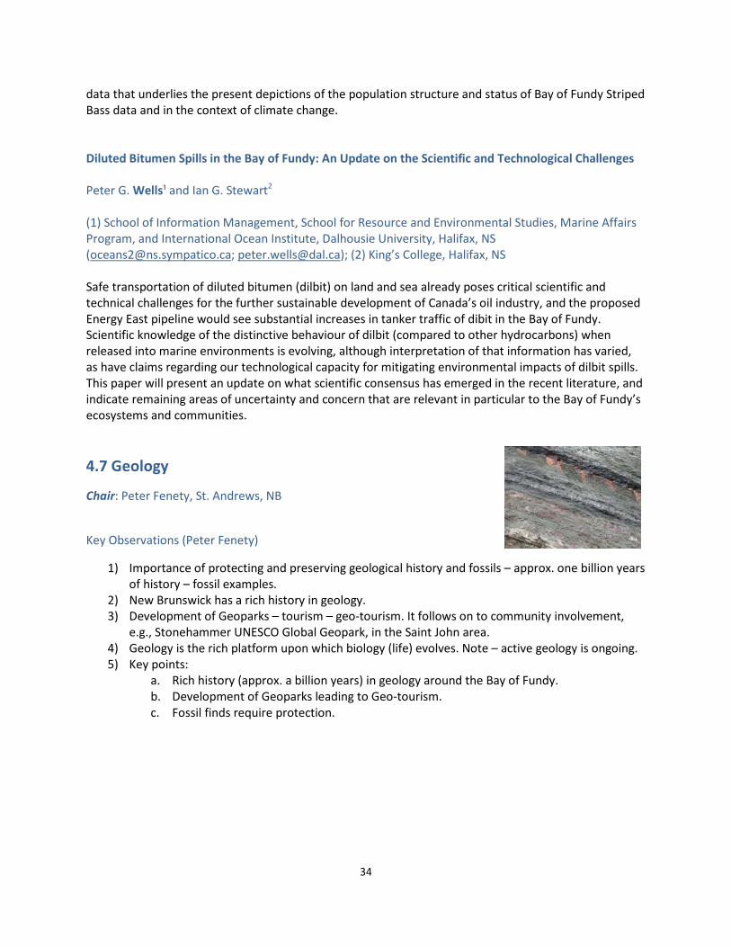
34
data that underlies the present depictions of the population structure and status of Bay of Fundy Striped Bass data and in the context of climate change. Diluted Bitumen Spills in the Bay of Fundy: An Update on the Scientific and Technological Challenges Peter G. Wells¹ and Ian G. Stewart2 (1) School of Information Management, School for Resource and Environmental Studies, Marine Affairs Program, and International Ocean Institute, Dalhousie University, Halifax, NS ([email protected]; [email protected]); (2) King’s College, Halifax, NS Safe transportation of diluted bitumen (dilbit) on land and sea already poses critical scientific and technical challenges for the further sustainable development of Canada’s oil industry, and the proposed Energy East pipeline would see substantial increases in tanker traffic of dibit in the Bay of Fundy. Scientific knowledge of the distinctive behaviour of dilbit (compared to other hydrocarbons) when released into marine environments is evolving, although interpretation of that information has varied, as have claims regarding our technological capacity for mitigating environmental impacts of dilbit spills. This paper will present an update on what scientific consensus has emerged in the recent literature, and indicate remaining areas of uncertainty and concern that are relevant in particular to the Bay of Fundy’s ecosystems and communities. 4.7 Geology
Chair: Peter Fenety, St. Andrews, NB
Key Observations (Peter Fenety)
1) Importance of protecting and preserving geological history and fossils – approx. one billion years of history – fossil examples.
2) New Brunswick has a rich history in geology. 3) Development of Geoparks – tourism – geo-tourism. It follows on to community involvement,
e.g., Stonehammer UNESCO Global Geopark, in the Saint John area. 4) Geology is the rich platform upon which biology (life) evolves. Note – active geology is ongoing. 5) Key points:
a. Rich history (approx. a billion years) in geology around the Bay of Fundy. b. Development of Geoparks leading to Geo-tourism. c. Fossil finds require protection.

35
An Update on the Fundy Rift Aspiring Geopark Tim Fedak1; John Calder2; Karen Dickinson3; and Eric Leighton3
(1) Fundy Geological Museum, Parrsboro, NS ([email protected]); (2) Nova Scotia Department of Natural Resources, Geoheritage Division, Halifax, NS; (3) Cumberland Geological Society, Parrsboro, NS The Global Geoparks Network has become a truly global entity, with Global Geoparks found in 35 countries, predominantly in Europe and Asia, and in 2015, Global Geoparks became an official program of UNESCO. In February 2016, Canada’s National Committee for Global Geoparks officially recognized the intent of the Cumberland Geological Society (CGS) to establish the Fundy Rift Aspiring Geopark. Geoparks are unlike Municipal, Provincial, Territorial and National parks that have legal boundaries and land use restrictions. Rather, a Global Geopark is a vehicle to recognize a region’s exceptional geological sites – its geoheritage – with strong emphasis on community-based economic development through geotourism (Global Geoparks Network, 2014). A requirement of an aspiring Global Geopark is that it be driven largely by the community. At present, Canada has two UNESCO Global Geoparks, Stonehammer in New Brunswick and Tumbler Ridge in British Columbia; several other sites across the country aspire to become Global Geoparks and are currently in preparation. In October 2015, the Cumberland Geological Society was informed of the Geopark program and potential in their area. The Self Evaluation tool of the Global Geoparks Network (2015) identified core strengths in the categories of Geology and Landscape, Interpretation and Education, Geotourism, and Economic Development. Contributing to this core strength are the dramatic exposures of geoheritage sites, existing Provincial Park facilities at Cape Chignecto and Five Islands, and the facilities and programs of the Fundy Geological Museum. The update will provide information about the proposed theme and potential connections between geological and cultural sites along the Parrsboro Shore. Reflections on the Collapse of Long Island Arch and Elephant Rock Tim Fedak1 and Kevin Snair2
(1) Fundy Geological Museum, Parrsboro, NS ([email protected]); (2) Hopewell Rocks Provincial Park, Hopewell Cape, NB ([email protected]) “The Bay of Fundy gets just a little bit bigger with every tide.” Don Reid, Joggins, NS There has been incredible public interest in coastal erosion in the Bay of Fundy with the loss of two internationally recognized coastal landmarks. In October 2015 the world’s attention was drawn to Five Islands (Nova Scotia) with the collapse of the iconic Long Island Arch. Then on March 14th 2016, Elephant Rock collapsed at Hopewell Rocks (New Brunswick). Both of these events generated rich media attention, and provide an opportunity to engage with the local and visiting public. By examining historical photographs and discussing comments from public meetings, we will explore opportunities for developing public education material related to coastal erosion issues and processes. There is an opportunity to use the rich media attention to draw attention to coastal erosion and cliff-

36
beach safety. We will present recent and archival video and photographs to provide a historical record of these two iconic landmarks. The coastal landscape of the Fundy Rift Basin is dominated by numerous geological faults related to the assembly and break-up of the supercontinent Pangaea 300-200 million years ago. The coastal erosion in the Bay of Fundy is impacted by the presence of these weak zones. Encouraging public education about coastal erosion has benefits to connections with the geological past and to provide knowledge about ongoing coastal processes. Palaeontology along the Bay Fundy Coast, New Brunswick, Canada Randall F. Miller Natural Science Department, New Brunswick Museum, Saint John, NB ([email protected]) New Brunswick’s fossil record extends back almost one billion years. The oldest fossils are stromatolites from Late Precambrian rocks found in Saint John, structures formed by cyanobacteria in shallow ocean waters. The fossil site described in 1890 is the first place in the world where Precambrian stromatolites were properly described in scientific literature. Moving forward through time the province’s fossil record includes representation from almost every geological period, and examples of most are found near the Bay of Fundy coast. Systematic geological exploration of the region dates to 1837 when Dr. Abraham Gesner began mapping the Fundy coast in his role as the first Provincial Geologist. During the last half of the 19th century the Natural History Society of New Brunswick discovered and described many of the fossil sites still being explored. Cambrian trilobites, Ordovician graptolites, Silurian and Devonian fish, Carboniferous plants, insects and tetrapod footprints, Permian-Triassic plants and Quaternary invertebrates and vertebrates comprise a very rich assemblage of the history of life. Stonehammer UNESCO Global Geopark, a 2500 sq km area centered on Saint John, includes many of the province’s scientifically and historically significant sites. Three of these have been added to the list of Provincial Heritage Places. The importance of our palaeontological record is officially recognized in the Heritage Conservation Act. It stipulates that any fossils discovered in the Province must not be destroyed or removed from sites where they are found, without the required permit.
4.8 Building Better Governance for Sustainable Resources: Case Studies from Atlantic Canada
Session Chair: Melanie G. Wiber, University of New Brunswick, Fredericton, NB Session Panel: Courtenay E. Parlee, Melanie G. Wiber, Allain J. Barnett, Robin Messenger, and Donna Curtis Department of Anthropology, University of New Brunswick, Fredericton, NB ([email protected], [email protected])

37
Sustainable development in Atlantic Canada requires integrating new economic activities that depend on the use of coastal resources without marginalizing older sectors. While many new development activities threaten the wellbeing of small-scale capture fisheries, it is also clear that long-established fisheries are not sufficient on their own to sustain communities. In reviewing case studies, this special session will demonstrate that innovative institutions have been developed to address these management and governance issues. However, power politics and bureaucratic resistance have thwarted sustainability efforts. One case study focuses on how long standing policies developed to ensure an independent and economically viable small-scale fishery sector have been undermined in a neo-liberal context of private ownership and control of fishing access rights. In a second case study, the use of community values to assess which activities are too risky and which are worth pursuing have come up against bureaucratic resistance to share power, resources and responsibility for governance and management of the marine environment. A third case study tracks the loss of benefits from the fisheries in Grand Manan, New Brunswick, benefits that have been distributed elsewhere. This research demonstrates that there are implications to the distribution of benefits for studying resilience and informing mitigation strategies. A fourth case study explores the management of risks posed by aquaculture to the lobster industry. Salmon aquaculture management in SWNB has progressed significantly since its beginnings. Our current state of knowledge on the impacts of aquaculture, and the various pathways through which impacts may occur is examined. This analysis allows us to consider how we are managing known and unknown risks. Key Observations (Peter G. Wells)
1) There were 4 talks and a lively discussion. 2) C. Parlee’s talk: She addressed the question of “how do you deal with diverse risks and values in
the marine environment”? She is examining the MAC (Marine Advisory Group) of SW NB, developing a community values criteria (CVC) map with four components – ecological, social, economic, and cultural. “The CVC could serve as the basis for discussions about activities to serve the basis of establishing a network of marine protected areas (MPAs)” for the Bay of Fundy.
3) R. Messenger – is exploring adaptive co-management related to the eastern NS lobster industry. 4) A. Barnett – is exploring anthropogenic risks, e.g. aquaculture, to the lobster fishery. Has
produced an interesting matrix of known impacts and unknown impacts, based on both lab and field data. The focus of concern is pesticides, referring back to the 2009 pesticide kill of lobsters in the vicinity of salmon cages. Comment – the focus may be on pesticides, but there are many other factors influencing lobsters (biology and population health) and the need to consider those factors, that vary and co-vary. Conclusions: the full story is not yet complete, there is a need for more analyses and fieldwork, and there are benefits to collaborating with industry.
5) D. Mallet – called for “the co-construction of knowledge”, the need to challenge centres of expertise, to consider knowledge inclusion (bringing science and local knowledge together), and to question “what is knowledge” and “the actions of knowledge” in attempting to understand what is happening with ovigerous (female) lobster populations in SW NB.
6) Discussion – it involved the panel members and 17 members of the audience who remained faithfully to the end of the formal workshop. Topics included: the silos between disciplines; the different aspects and views of values; and the fact that the various issues surrounding the lobster fishery require more communication between all the interested parties and players.

38
Assessing Anthropogenic Risk in the Marine Environment: How do we Measure the Impact of Aquaculture on Lobsters Allain Barnett and Melanie Wiber Department of Anthropology, University of New Brunswick, Fredericton, NB ([email protected]) Wiber et al. (2012) reported on commercial fishermen’s concerns about the impacts of aquaculture on commercial fish stocks in Southwest New Brunswick (SWNB), in the Bay of Fundy. While aquaculture only occupies 1.4% of the nearshore SWNB area, salmon aquaculture cage sites have significant overlap with important lobster habitat in Lobster Fishing Area (LFA) 36. Concerns intensified in 2009 when aquaculture sites deployed treatments for sea lice that killed lobsters. Assessing any potential aquaculture threat to lobster populations, however, presents us with a methodological challenge associated with examining cumulative effects, and understanding the spatial and temporal scale at which impacts might be prevalent. How do aquaculture practices and associated biological and chemical by-products interact with lobsters in nature? What risks do such by-products pose for adults and juvenile lobsters, and for the habitat on which they rely? In this paper, we will explore the complexities of our research methodology, the state and limitations of current knowledge, and our attempt to manage these complexities through a resilience lens.
A Clearer Understanding of Knowledge Co-Construction: A Case Study Analysis of a Joint Fishermen/Scientists Research Project on the Abundance of Ovigerous Female Lobsters (Homarus americanus) In Southwestern New Brunswick Donna G. Curtis Maillet
Interdisciplinary Studies, c/o Department of Anthropology, University of New Brunswick, Fredericton, NB ([email protected]) Improved management of the access and use of ocean and coastal resources requires well-informed risk analysis and democratic decision making processes inclusive of both experiential and scientific knowledge. The combining of stakeholders’ local ecological knowledge with scientific knowledge is especially significant with its potential for the co-construction of new knowledge sets. However, what is meant by knowledge and the role it plays in knowledge co-construction is not well understood. To examine how knowledge can be co-constructed, this paper presents a case study analysis of knowledge co-construction between fishermen and scientists participating in a three-year marine risk assessment study. The paper reports on the joint efforts of a group of fishermen and scientists working together to develop a research protocol for studying the abundance of ovigerous female lobsters (Homarus americanus) in the coastal waters of southwestern New Brunswick which are shared with a growing Atlantic salmon (Salmo salar) finfish aquaculture industry. This paper seeks to define what is meant by knowledge, to examine how different knowledge sets come together to contribute to knowledge co-construction and to identify what are the factors that facilitate or block the co-construction of knowledge?

39
Responding to Risk: A Case Study on Season Change Requests and the Role of Managing Institutions in Eastern Nova Scotia’s Lobster Industry Robin A. Messenger Department of Anthropology, University of New Brunswick , Fredericton, NB For decades the value of co-management in Canada’s fisheries, often in the broader context of achieving or maintaining sustainability, has been widely advocated in federal and provincial policies. Co-management is often conceptualized in terms of a formal power-sharing arrangement between a unified government and a homogenous community of resource users. The ability to respond to risk is supposedly enhanced through shared governance arrangements. In eastern Canada, this aspirational approach to management endorses the devolution of decision-making powers to resource users involved in democratic management/advisory boards. In Eastern Nova Scotia, however, the ability to maintain or develop new co-management institutions is challenged by issues of fair representation, transparency, trust, social capital and power dynamics between neighbouring communities. This became evident when a proposal to change the fishing season in response to market challenges was put to a vote. Adopting the notion of adaptive co-management, where the focus is on function, process, and the appreciation that social-ecological systems are complex, adaptive, and characterized by an inherent degree of uncertainty, my case study will critically assesses normative concepts of co-management such as power sharing, trust, and social learning. Risk Management through the Use of Community Values Criteria: Bridges and Barriers to Strengthening Governance Institutions Courtenay E. Parlee Department of Anthropology, University of New Brunswick, Fredericton, NB ([email protected], [email protected]) Today, a great deal of political decision-making involves managing risks and resolving conflict over values. Values are often implicit and unconscious and are taken as a given within a cultural context. Adaptive co-management as a form of Integrated Management is inherently value driven, and since values are not universal, they need to be made explicit. In Southwest New Brunswick, an innovative institution called the Southwest New Brunswick Marine Advisory Committee was developed. Through extensive consultations with the broader community, the MAC created a ‘Community Values Criteria’ which explicitly made people aware of what they value about the marine environment. The intention of the MAC was to use the CVC to assess which activities were too risky, and which were worth pursuing in the planning area. However, their pursuit of this objective has come up against bureaucratic resistance to share power, resources and responsibility for governance and management. Furthermore, the subjective ranking of the values has made the CVC difficult to apply. This presentation will explore the challenges of using the CVC as a tool to measure risk and will make recommendations on how to address those so as to improve institutions for sustainable resource development.

40
5. Poster Abstracts Population Dynamics of the Amphipod Corophium volutator on mudflats in the Bay of Fundy over a 16-Year Period Myriam A. Barbeau, Sophia C. Noël, Brittany V. Dixon and Travis G. Gerwing University of New Brunswick, Fredericton, NB ([email protected], [email protected], [email protected], [email protected]) The burrow-dwelling amphipod Corophium volutator is abundant on intertidal mudflats in the upper Bay of Fundy, Canada. It is a key species in the mudflat food web, and its burrow-related activities may stabilize mudflat sediments. Past studies examined variation in C. volutator density over the short-term, but not the long-term. We analyzed a C. volutator data set spanning 16 years (2000 to 2015) at four mudflats (Daniels Flats, Grande Anse, Minudie and Avonport), focusing on the overwintering generation (May and early June densities) and the summer generation (July densities). For this data set, sediment core samples were collected at random locations along two transects perpendicular to the low water line at the mudflats. C. volutator individuals were counted, measured and sexed to quantify total density, proportion juvenile, proportion female (a measure of sex ratio), and proportion of females that were ovigerous. Patterns in amphipod density varied greatly among populations (where a mudflat represents a population), with some mudflats being stable (e.g., Daniels Flats) from one year to the next, and others being highly variable. Population collapses and recoveries observed on three mudflats (Avonport, Minudie and Grande Anse) occurred in different years. Examination of the population structure showed faster dynamics following a warmer winter (2012, 2013). Recent work on connectivity between C. volutator populations suggested that mudflats may represent patches in a metapopulation. If this is the case, some mudflats may be source populations (e.g., the stable ones) while others may be sink populations. Such information would be useful for conservation or stewardship activities. Spec Community Patterns after 5 Years of Salt Marsh Restoration in the Upper Bay of Fundy Allen D. Beck1, Laura K. Boone1, Myriam A. Barbeau1, and Nic R. McLellan2 (1) University of New Brunswick, Fredericton, NB. ([email protected], [email protected], [email protected]); (2) Ducks Unlimited Canada (DUC), Amherst, NS. ([email protected]) Given the ecosystem services provided by salt marshes, there is increasing interest in restoring them. In 2009-2010, DUC and partners started one such restoration project in two adjacent farmland cells (impacted East and impacted West) in Aulac, NB. In October 2010, the dikes of these cells were breached, either with an engineered breach (with rock weir) or two smaller breaches to mimic a natural process. Emergent plant and invertebrate densities (those exposed to air at low tide) in the impacted sites (cells), as well as in two nearby established salt marshes (termed reference sites), were monitored yearly since summer 2010. Salt water cordgrass Spartina alterniflora (the primary bioengineer species of salt marshes) appeared 2 years after the breaching, and initially spread through rhizomes and then in years 4 and 5 mainly by production of seedlings. Freshwater cordgrass S. pectinata, present before the breaching, survived in a stressed state until year 5, when it disappeared from within the impacted sites. Salt marsh hay S. patens (the dominant grass in the high zone of marshes) and typical salt marsh invertebrates are just starting to colonize the impacted sites. Although still significantly different as of

41
this past year (2015, p = 0.035), the community structure in the impacted sites is approaching that of the reference sites. It is important to continue to study the ecological succession in large-scale salt marsh restoration projects in our climate, as most previous salt marsh restoration has been conducted in warmer geographic regions. Implications of Marine Protected Areas for Coastal Community Social-Ecological Wellbeing in Atlantic Canada Irene Brueckner-Irwin and Derek Armitage Environmental Change and Governance Group, University of Waterloo, School of Environment, Resources and Sustainability, Waterloo, ON ([email protected]; [email protected]) Expanding Canada’s network of marine protected areas (MPAs) will be necessary to achieve our target of protecting 10% of our marine and coastal areas by 2020. In order for MPAs to result in effective conservation outcomes, it is critical to understand how they influence the wellbeing of coastal communities. Indeed, MPAs create a range of social benefits and costs; however the social implications of MPAs in Atlantic Canada are poorly understood. The purpose of my research is to examine the relationship between MPAs and trade-offs in coastal community wellbeing. I aim to understand how stakeholders across cases perceive existing or anticipated changes in their wellbeing in relation to MPAs, and what explains these changes. I will apply a social-ecological wellbeing perspective which couples social wellbeing with ecological resilience. My research will involve an in-depth qualitative case study in the Bay of Fundy region, as well as a synthesis of regional MPA experiences in Atlantic Canada. Understanding perceptions of the impacts of MPAs on community wellbeing will reveal the acceptability, legitimacy, and levels of support given to MPA processes, which in turn can improve conservation outcomes. Additionally, this research may contribute insights on how to better design, implement, and manage existing and upcoming MPAs within the Bay of Fundy, in order to more adequately address social needs. Determining the overall use and influence of a long-term marine environmental monitoring program: A Case Study on Gulfwatch in Nova Scotia Sarah Chamberlain Dalhousie University, Halifax, NS ([email protected]) Chemical contamination of marine environments can pose numerous risks to both ecosystem and human health. Monitoring trends of chemical contaminants over time and space can provide managers and decision-makers the information necessary to make decisions to improve ecosystem health or to protect human health. However, information obtained through monitoring programs can only inform management and decision making if managers and decision-makers are aware of and are using the information. This study looked at a long-term biomonitoring program: Gulfwatch Contaminants Monitoring Program, a sub-committee of the Gulf of Maine Council on the Marine Environment. Gulfwatch uses blue mussels (Mytilus edulis) to monitor chemical contamination in the Gulf of Maine. The overall awareness and use of Gulfwatch information was examined through a cataloguing of all Gulfwatch-related publications, analysis of the Gulfwatch webpage, and interviews of potential users of

42
Gulfwatch information in Nova Scotia and Gulfwatch committee members. It was found that there was some awareness and very little use of Gulfwatch information in Nova Scotia. Reasons for the limited awareness and use were mostly linked to the lack of interest in chemical contamination in both the federal and provincial governments. Recommendations for implementing the methodology for other monitoring programs as well as for improving the use of long-term monitoring information are given. Development of Protocols to Test the Effects of Suspended Sediment on Tidal Flat Macrofauna of the Minas Basin in Mesocosm Experiments Eileen C. Haskett1 and Glenys Gibson2 (1) Acadia University, Wolfville, NS ([email protected]); (2) Acadia University, Wolfville, NS ([email protected])
The benthic macrofauna of the Minas Basin are highly dependent on sediment, which provides them with habitat and a source of nutrition. The dynamic tidal conditions of the Minas Basin continuously resuspend sediment, with potential impact on macrofauna diversity. Our objective is to develop the use of mesocosms to test for potential effects of changes in suspended sediment concentration (SSC) on tidal flat invertebrates. The mesocosms allow multi-week culture of cores of macrofauna under natural tidal sequences and experimental manipulation of sediment levels. In this pilot project, we compared the diversity of macrofauna from three assemblages (typifying species: Corophium volutator, Chaetozone setosa and Pygospio elegans) from field cores and cores maintained in the mesocosm benches for 2 or 4 weeks. Both macrofauna (abundance, diversity) and sediment characteristics (grain size, organic content, chlorophyll content) were monitored. We successfully developed protocols that gave good survivorship overall and allowed us to control levels of SSC. Preliminary results indicate that some changes in sediment characteristics (such as organic content) occurred and some species, such as Corophium, proved to be highly motile. These early results will inform subsequent experiments on the relationship between invertebrate assemblages and suspended sediment, with broader implications for understanding of the Bay of Fundy ecosystem. These species provide a critical link in the trophic web, as well as for understanding the potential effects of regionally important industries such as tidal power, hydroelectric power, and agriculture. Dynamics of the Saltwater Cordgrass Spartina alterniflora During Salt Marsh Restoration Meagan E. Hicks, Myriam A. Barbeau, Spencer D.S. Virgin, Tyler D. Trask, Lionel Hayter, and Dylan W. Schneider University of New Brunswick, Fredericton, NB ([email protected], [email protected], [email protected], [email protected], [email protected], [email protected]) The saltwater cordgrass, Spartina alterniflora, is the primary bioengineer species of salt marshes on the Atlantic coast of North America. In a salt marsh restoration project in the upper Bay of Fundy (Aulac, NB), we monitored S. alterniflora dynamics since the breaching of agricultural dikes in autumn 2010. S. alterniflora first appeared in the restoration sites in summer 2012, two years after the dikes had been breached, as small isolated patches. Throughout 2013 and onwards, we observed vigorous spreading of established patches by rhizomes (reflecting asexual reproduction). In 2014, we observed extensive

43
germination of seedlings throughout the restoration sites (reflecting spread by sexual reproduction). Finally, in summer 2015 (5 years post breach), we observed merging of patches with other patches and with areas of grown seedlings, leading to widespread coverage of the restoration sites by S. alterniflora. In 2015, seedlings grew throughout the summer and reached approximately half the plant height of 2-year old plants (40 vs. 87 cm tallest heights, respectively, measured in September), and did not flower. Two-year old plants flowered throughout August and September, and produced rhizomes and new shoots. They reached nearly the same height as older (> 3 yr) plants, which were similar to those along creeks in adjacent established salt marshes (102 cm, reflecting the tall form of S. alterniflora). With the continued increase in S. alterniflora stem density in the restoration sites, we expect to see the start of intraspecific competition, possibly leading to smaller plant heights, more flowering, and less seed germination.
Meagan Hicks was awarded the Best Student Poster at the 11th BoFEP Workshop
The Sustainability Challenge–Which Values Should Management Support? Courtenay E. Parlee Department of Anthropology, University of New Brunswick, Fredericton, NB ([email protected], [email protected]) The purpose of this poster is to draw attention to a local innovative institution for adaptive co-management called the Southwest New Brunswick Bay of Fundy Marine Advisory Committee (MAC). Between 2006 and 2008 the MAC held public consultations on a broad range of issues related to the marine environment. From these consultations they developed a sustainability framework referred to as

44
the ‘Community Values Criteria’ (CVC). The CVC has four categories (ecological, cultural, social and economic) and sixteen individual values against which any marine activity can be measured. Appropriate marine management requires trade-offs among diverse values, however selecting what is to be sustained is a society choice that can vary among individuals. To illustrate the challenges of using the CVC, and of managing for sustainability, this interactive poster invites participants to select one of four marine activities (Marine Debris, Offshore Oil and Gas, Marine Protected Area, Tidal Energy) and to prioritize values from the CVC on a scale of one to five. Influence of Avian Biovectors on Mercury Speciation in a Wetland Jocelyn Kickbush, Mark Mallory, John Murimboh, Jennie Rand, and Nelson J. O’Driscoll
Acadia University, Wolfville, NS ([email protected]) Mercury is a persistent and bioaccumulative chemical that is present in many remote environments due to its ability to be transported long distances in the atmosphere, and to be deposited far from the original source. Wetland ecosystems are important “hot spots” for mercury in eastern Canada, providing anoxic environmental conditions that promote the bacterial methylation of mercury. Methyl mercury is the most biologically available form of mercury and the form which biomagnifies in food webs. Seabird guano is a well-documented biovector for metals – including mercury – and nutrients, which may indirectly affect metal speciation. The site for this study, Big Meadow Bog (Brier Island, Nova Scotia, Canada) has a history of ditching in the 1950s, which changed hydrology significantly, resulting in colonization by 3000 pairs of herring gulls (Larus argentatus) in the 1980s. To quantify changes in mercury mobilization and speciation in response to this biovector, groundwater samples were collected from this site as well as a reference bog with similar geological and hydrological characteristics. The filtered samples were analyzed for total mercury, methyl mercury, and water chemistry (pH, conductivity, anions, cations, and dissolved organic and inorganic carbon). Preliminary results show significantly higher nutrients (nitrate, phosphate, and sulfate), total mercury, and methyl mercury concentration when compared to the reference bog that is minimally impacted by avian biovectors. This elevated availability of methyl mercury could potentially pose a threat to the local ecosystem and wildlife population due to methyl mercury’s toxicity. A Dilemma in Environmental Ethics: What is the Ecological Role of the ‘Nuisance’ Herring Gull in our Bay of Fundy? Katherine R. Shlepr1 and Antony W. Diamond2
(1) Atlantic Lab for Avian Research, University of New Brunswick, Fredericton, NB ([email protected]); (2) Atlantic Lab for Avian Research, University of New Brunswick, Fredericton, NB ([email protected]) For nearly a century, herring gulls (Larus argentatus) and great black-backed gulls (L. marinus) have been regarded as a public nuisance for their history of disrupting industrial operations, transmitting contaminants and disease over long distances, and depredating populations of eiders, terns and other species of conservation concern. The perception that gulls are overly abundant is a view still widely held, despite nest surveys that indicate the breeding population of both species has declined regionally by 30-50% since the 1980s. We acknowledge society’s continued desire to mitigate the impacts of large

45
congregations of gulls, but also suggest the need to more fully understand the causes of the gull decline and its consequences to both gulls and other marine species. With this in mind, we ran a pilot study in 2014 on Brier Island, NS, and then expanded the project to include Kent Island, NB and Witless Bay, NL in 2015, capturing gull foraging activity at the three largest colonies of herring gulls in Atlantic Canada. Our goal was to compare diet and foraging behaviour of gulls nesting at each of these sites using a combination of δ15N and δ13C isotope analysis (feathers and blood, n=125) and GPS loggers (n=38). Gulls at all sites were found to rely heavily on anthropogenic food sources (e.g., mink farms, seafood processing plants, salmon aquaculture pens), and were found to forage offshore only occasionally. Changes to industry practices may remove incentive for gulls to congregate near humans, in turn diminishing their reputation as a pest species. Effects of Coastal Managed Retreat on Mercury Biogeochemistry Tom Sizmur1, Adam Godfrey2 and Nelson J. O’Driscoll3
(1) University of Reading, Reading, Berkshire, UK ([email protected]); (2) Acadia University, Wolfville, NS ([email protected]); Acadia University, Wolfville, NS ([email protected]) We investigated the impact of managed retreat on mercury (Hg) biogeochemistry in the Bay of Fundy, which is subject to diffuse contamination with Hg. We visited Beaubassin Research Station on the Chignecto Isthmus between Nova Scotia and New Brunswick and collected sediment cores from an area of land that was due to be inundated with seawater after a failing dyke was intentionally breached. We returned two years later, re-sampled the dyke cell and also collected sediment cores from an adjacent mudflat and a salt marsh. We analysed the total mercury (THg) and methylmercury (MeHg) concentrations of the sediments in the cores. We discovered that the concentration of THg in the sediment doubled after the dyke was breached due to the deposition of fresh sediment that had a smaller particle size, and higher pH. The concentration of MeHg was 27% lower in the sediments after the dyke was breached. Because we found greater concentrations of THg and lower concentrations of MeHg after the sediments were inundated we can conclude that the reduction in MeHg was due to a low bioavailability of Hg to the sulphate reducing bacteria capable of methylating Hg. This may have occurred due to higher organic matter levels, greater sediment pH, and higher ionic strength. Overall we did not find any evidence to suggest that coastal managed retreat resulted in an elevated risk of Hg methylation during the first year after inundation. As the sediment becomes vegetated, increased activity of Hg-methylating bacteria may accelerate Hg-methylation rate.

46
Enablers and Barriers at the Science-Policy Interface: Case Studies on Scientific Information Use in Environmental Decision-Making Suzuette S. Soomai1 , Sarah Chamberlain1 , Bertrum H. MacDonald1 , James D. Ross1, Peter G. Wells2, Lee Wilson1
(1) School of Information Management, Dalhousie University, Halifax, NS ([email protected]; [email protected]; [email protected]; [email protected]; [email protected]); (2) School of Information Management, School for Resource and Environmental Studies, Marine Affairs Program, and International Ocean Institute, Dalhousie University, Halifax, NS ([email protected]; [email protected]) Understanding the apparent disconnect at the science-policy interface between the information and knowledge produced by scientists and that used by policy makers is essential if we are to effectively address global environmental problems. This poster describes the key enablers and barriers to the uptake of scientific information in decision-making, drawing on the results of case studies conducted by the Environmental Information Use and Influence research team at Dalhousie University of the information pathways – production, communication, and use – in national, regional, and international governmental organizations. Governmental information included state of the environment and resources reports, coastal atlases, and technical assessments – many of which are relevant to the Bay of Fundy – published in print and digital formats. The case studies utilized an array of methods including, citation analysis of references to published reports, semi-structured interviews of scientists and decision-makers (managers and policy advisors), direct observations at scientific and management meetings, analysis of organizational website statistics, content analysis of reports, and network analysis of the interaction of stakeholders in policy-making. The authority of organizations, related to their mandates, is a critical requirement for creating credible and relevant information for decision-making. Yet, awareness remains a major barrier to effective and widespread communication and use of this information in coastal and ocean management. Audiences vary from small groups to the interested public, i.e., persons with a known involvement in environmental management. Our research has found that particular individuals, groups, or organizations can bridge the science-policy “divide” to enhance communication between science and decision-making realms. Co-production of information broadens the scope of the available information for decision-making, thereby ensuring its legitimacy. Knowledge of such characteristics of the interface can have direct applications in the information pathways in decision-making in the Bay of Fundy region, resulting in substantial environmental and societal benefits.

47
6. Recollections of the 11th BoFEP Bay of Fundy Science Workshop
Marianne Janowicz As we began the 11th BoFEP Science Workshop, I asked session chairs to identify the key observations that could be drawn from the session. Out of this array of comments there were several points that are worth further thought and discussion. Kathleen Mills, in the opening plenary talk, noted that management approaches are not always aligned with changes in the ecosystem. Opportunities that present themselves, such a shift in water temperature that affects lobster movement, require flexibility in management. But this flexibility rarely can be utilized because the management approach is embedded in policy that has a rigidity that is often removed from what is actually going on. New technology is changing the way we do science. This point was made in the session on Mudflat Ecology, during one of the talks in the Aquatic Ecology session and in the session on Coastal Monitoring. Citizens or members of environmental groups can input data into shared data bases through their smart phones. New technological applications extend beyond citizen science and could be utilized in more traditional monitoring programs to capture spatial as well as data information. These technologies are also allowing us to quantify aspects of the marine ecosystem more than ever, such as anthropogenic noise and its impact on marine mammals or any aspect of marine life. There is another side to this new technology, however. Changing methods of study make it difficult to assess the real degree of change in a system. This is a theme that was echoed by marine scientists who have been working in the field for years—newer technologies do not have the same track record. In fact, some of the technologies are leading to changed protocols for monitoring where fewer variables are being used. The changed protocols in some instances mean that older data has to be reworked in order for it to be usable in a time series. So perhaps there is a cautionary tale here. As we embrace new technologies, we cannot forget that there is over 100 years of scientific information about the Bay of Fundy fisheries and ecosystem. We need to move forward utilizing that information, not neglecting to acknowledge its existence. Marine science is siloed. We are still focusing on specialties where we should be spending more effort on looking at connections, relationships, and dependencies. There is very little structured exchange of ideas and information from one branch of science to another. For instance, with seabirds, there is a need for a close link with researchers doing work on fish population dynamics in order to sort out and or predict diets of the birds and consequent nesting success. Breaking down the siloes will become increasingly important as we continue to experience climate shifts. Taking a multi-disciplinary approach, including the social sciences, to ecosystem change may be the only way we will be able to predict and understand the changes and effectively adapt.

48
Some of the discussion in the session on Tidal Power and Renewable Energy was about the fact that there are many knowledge gaps that need to be filled in order to detect environmental effects. Since the bulk of research on tidal energy is occurring in the Minas Basin, it is interesting to note that talks in other sessions referenced Minas Basin, increasing the strength of the argument that knowledge gaps need to be filled. The talk in Aquatic Biology about Striped Bass noted that there is a strong possibility that the Bay of Fundy Striped Bass winter in Minas Basin. In the same session, the talk on bitumen suggested that if the oil is released in Saint John Harbour, it could well end up in the Minas Basin within a fairly short period of time. Finally in the closing session, social scientists presented examples of emerging governance structures being tried out for management of the social, economic and environmental aspects of the Bay and insights into the barriers to their use. One barrier noted was government’s inability to relinquish power. Another is the need to improve ocean literacy so that the partners in co-management have the knowledge needed to effectively manage and govern. So, with the divergent workshop session topics, there are some common threads or at least connected pieces as take away messages. The first is that management requires flexibility to adapt to the changing ecosystem and environment, which is changing perhaps more rapidly than previously due to ocean temperature regimes. In order for us to understand what is happening in the ecological regime, we need to utilize a triage of researchers/experts, including social scientists, who have the capacity to interpret change. We have a long history of marine science on the Bay. We need to utilize that history as we move forward. Monitoring and research methods are going through a major shift due to technology which allows many people to input data. This could mean a more effective monitoring situation and a way to record change more quickly. But we need to be sure methods are compatible with tried and true methods otherwise long-term time series will be lost to us. Institutions of governance in the coastal/marine area need to change so that co-management, co-governance allows us all to have a part in shaping the future of the Bay of Fundy. Special thanks to the organizing committee, the session scribes, the session chairs, the guest speakers, the students who were our tech advisors, the researchers who brought their students to the Workshop, the presenters and the audience. Thank you also to our sponsors. We look forward in seeing you in two years for the 12th BoFEP Bay of Fundy Science Workshop where we can continue the discussion on the Bay and its future.

49
A special thank you to Robert Capozi, Climate Change Secretariat, Department of Environment and Local Government, Government of New Brunswick who organized the amazing boat tour of the
Oromocto River on Saturday, June 15

50
Author Index
Addison, Jason A., 29 Andrews, Emma, 22 Aporta, Claudio, 28 Armitage, Derek, 41 Baker, Matthew, 23 Barbeau, Myriam A., 40, 42 Barrett, Allain, 38 Beck, Allen D., 40 Boone, Laura K., 40 Bradford, Rod, 23, 33 Breeze, Heather, 26, 31 Broome, Jeremy, 23, 33 Brueckner-Irwin, Irene, 41 Calden, John, 35 Chamberlain, Sarah, 26, 41, 46 Covill, Robert, 24 Culina, Joel, 24 Curtis Maillet, Donna G., 38 Daigle, Rémi, 18 Diamond, Antony W. (Tony), 20, 21, 28, 44 Dickson, Karen, 35 Dixon, Brittany V., 40 Doherty, Penny, 31 Einfeldt, Anthony, 29 Fedak, Tim, 35 Fenety, Peter, 34 Fife, Jack, 32 Gerwing, Travis G., 40 Gibson, Glenys, 42 Godfrey, Adam, 45 Gratto-Trevor, Cheri, 28 Hamilton, Diana J., 28, 29 Haskett, Eileen C., 42 Hayter, Lionel, 42 Herbert, Glen, 31 Hicks, Meagan E., 42 Himmelstoss, Emily A., 27 Hines, Megan K., 27 Janowicz, Marianne, 47 Karsten, Richard, 23, 24 Keyser, Freya, 23, 33 Kickbush, Jocelyn, 44 Kidd, Scott, 18 Killorn, Donald, 32 King, Marty, 31
Koropatnick, Tanya, 31 Latimer, James, 26 Leighton, Eric, 35 Long, Joseph W., 27 MacDonald, Bertrum H., 46 Mallory, Mark, 44 McIver, Reba, 31 McLellan, Nic. R., 40 McNeely, Joshua, 13 Messenger, Robin A., 39 Miller, Randall F., 36 Mills, Katherine, 9 Mitchell, Simon J., 23 Morrill, Kirby, 30 Morrison, Kaycee, 23 Murimboh, John, 44 Nagel, Elizabeth, 24 Neima, Sarah, 28, 29 Noël , Sophia C., 40 O’Driscoll, Nelson J., 44, 45 Paquet, Julie, 28 Pardy, Gary, 31 Parlee, Courtenay E., 39, 43 Parlee, Kathryn, 26 Plant, Nathaniel G., 27 Porschamp, Peter, 23 Quinn, Jenna T., 29 Rand, Jennie, 44 Read, Jordan S., 27 Redden, Anna M., 21, 22, 24, 33 Redfield, Edmund, 33 Roc, Thomas, 24 Ross, James, 46 Sanderson, Brian, 23 Saunders, Gary W., 30 Saunders, Sarah, 23 Schneider, Dylan W., 42 Schreppel, Heather, 27 Scopel, Lauren, 21 Sharif, Farid, 23 Sherin, Andrew, 15 Shlepr, Katherine R., 44 Sizmur, Tom, 45 Snair, Kevin, 35 Soomai, Suzuette S., 46

51
Stewart Lowndes, Julia, 18 Stewart, Ian G., 34 Stockdon, Hilary F., 27 Stokesbury, Michael, 23 Suftin, Ivan, 27 Suttie, Brent D., 12 Swanbury, Meghan, 24 Symons, Stephanie, 21 Thieler, E. Robert, 27 Tilburg, Christine, 26 Trask, Tyler D., 42
Virgin, Spencer D.S., 42 Walker, Jordan I., 27 Washburn, Owen, 20 Wells, Peter G., 8, 34, 37, 46 Westhead, Maxine, 31 Wiber, Melanie, 38 Will, Elise, 31l Wilson, Lee, 15, 25, 46 Winslow, Luke A., 27 Wood, Jason, 23 Zeigler, Sara L., 27

52
The 12th BoFEP Bay of Fundy Science Workshop
“A Changing Fundy Environment: Emerging Issues, Challenges and Priorities”
Date: 9-12 May 2018
Location: Agricultural Campus, Dalhousie University,
Truro, Nova Scotia
Proposed Major Topics:
Climate change and the Gulf of Maine/Bay of Fundy Tidal power development
Mass mortality events The future of wild fisheries
Marine protected areas Recovery of the Petitcodiac estuary
Conservation of migratory shorebirds Plastics and chemical contaminants
Coastal communities – Issues of concern Invasive species
Ocean literacy and conmmunications Impact of run-off on the Bay of Fundy
Other topics for sessions are welcomed and encouraged
For up-to-date information
Visit the BoFEP Web site: www.bofep.org