forest stewardship plan · 4 1.0 interpretation 1.1 definitions “cfa” means community forest...
TRANSCRIPT
1
FOREST STEWARDSHIP PLAN
FSP #469
Term: 5 years (2013 – 2018)
Commencement Date: February 20, 2013
Amendment No. 1
Date: September 30, 2013
Lower North Thompson Community Forest Society
Community Forest Agreement K1Z
Southern Interior Region
Thompson Rivers District
Kamloops Timber Supply Area

2
Table of Contents
1.0 INTERPRETATION............................................................................................... 4
1.1 DEFINITIONS ..................................................................................................... 4
1.2 DEFINITIONS UNDER ENACTMENTS .......................................................... 4
2.0 ADMINISTRATION .............................................................................................. 5
2.1 SUBMISSION DATE .......................................................................................... 5
2.2 TERM AND COMMENCEMENT DATE .......................................................... 5
2.3 APPLICATION OF THIS FSP ............................................................................ 5
3.0 FOREST DEVELOPMENT UNITS ...................................................................... 5
3.1 ITEMS IDENTIFIED IN FDU’S ......................................................................... 5
4.0 OBJECTIVES, RESULTS, AND STRATEGIES .................................................. 6
4.1 KLRMP HLP OBJECTIVES NOT APPLICABLE TO THIS FSP ..................... 6
4.2 SOILS MANAGEMENT AND CONSERVATION OBJECTIVES................... 7
4.3 WATER OBJECTIVES ....................................................................................... 7
4.3.1 Domestic Water Resources .......................................................................... 7
4.3.2 Community Watersheds ............................................................................... 8
4.3.3 Riparian Management Objectives ................................................................ 9
4.4 BIODIVERSITY OBJECTIVES ....................................................................... 12
4.4.1 Landscape Level Biodiversity ..................................................................... 12
4.4.2 Stand Level Biodiversity............................................................................. 12
4.4.3 Ecosystem Management ............................................................................. 14
4.4.4 Biodiversity Emphasis Options................................................................... 15
4.5 RECREATION OBJECTIVES .......................................................................... 16
4.6 WILDLIFE OBJECTIVES ................................................................................ 16
4.6.1 KLRMP Wildlife Objective ........................................................................ 17
4.6.2 Moose .......................................................................................................... 18
4.6.3 “Interior” Western Screech Owl, Lewis’s Woodpecker, Badger, and
Western Rattlesnake, Flammulated Owl, Spotted Bat, Great Basin Spadefoot Toad,
and Williamson’s Sapsucker ..................................................................................... 19
4.7 VISUAL QUALITY OBJECTIVES .................................................................. 20
4.7.1 Visually Sensitive Areas Associated with this FSP .................................... 20
4.7.2 Areas Outside Visually Sensitive Areas Associated with this FSP ............ 21
4.8 CULTURAL HERITAGE RESOURCES ......................................................... 21

3
4.9 CULTURAL AND HERITAGE SITES ............................................................ 23
4.10 RANGE AND NOXIOUS WEED MEASURES ........................................... 24
4.10.1 Range Resources ......................................................................................... 24
4.10.2 Invasive Plants ......................................................................................... 25
5.0 STOCKING STANDARDS ................................................................................. 26
5.1 General Standards .............................................................................................. 26
6.0 SIGNATURES OF PREPARING FORESTER AND PERSON REQUIRED TO
PREPARE PLAN.............................................................................................................. 27
List of Tables
Table 1: Riparian Retention Strategies – Streams ........................................................... 10
Table 2: Riparian Retention Strategies – Wetlands ......................................................... 10
Table 3: Riparian Retention Strategies – Lakes ............................................................... 11
Table 4: Wildlife Related Objectives Applicable to this FSP .......................................... 17
Appendices
Appendix A: Stocking Standards
Appendix B: Supplemental Information to Support the Forest Stewardship Plan
Appendix C: FSP Map

4
1.0 INTERPRETATION
1.1 DEFINITIONS
“CFA” means Community Forest Agreement K1Z;
“Commencement Date” means the date that it is approved by the Minister or by
his/her delegate
“FDU” means the Forest Development Unit(s) identified under this FSP;
“FPPR” means the Forest and Planning and Practices Regulation;
“FRPA” means the Forest and Range Practices Act;
“FSP” means this Forest Stewardship Plan;
“Holder of this FSP” or “Holder” means the Lower North Thompson
Community Forest Society;
“Kamloops LRUP” means the Kamloops Forest District Lakes Local Resource
Use Plan - Lakeshore Management Guidelines, dated December 20, 2001;
“KLRMP” or “LRMP” means the Kamloops Land and Resource Management
Plan approved by government in 1995 and as amended from time to time;
“MFLNRO” means the Ministry of Forests, Lands, and Natural Resources
Operations;
“Primary Forest Activity” means one or more of the following:
a) timber harvesting;
b) silviculture treatments;
c) road construction, maintenance and deactivation.
1.2 DEFINITIONS UNDER ENACTMENTS
Unless otherwise expressly indicated, or indicated by context, terms used in this
FSP have the definition given them, as of the Submission Date, in Forest and Range
Practices Act and associated regulations and the Forest Act and the regulations under
them, as amended from time to time.

5
2.0 ADMINISTRATION
2.1 SUBMISSION DATE
The date of submission for approval is January 25, 2012.
2.2 TERM AND COMMENCEMENT DATE
The term of this FSP is five (5) years beginning on the Commencement Date.
2.3 APPLICATION OF THIS FSP
Subject to exceptions under FRPA, this FSP applies to:
Community Forest Agreement K1Z, held by the Lower North Thompson
Community Forest Society.
all new Cutting Permits and Road Permits issued under Community Forest
Agreement K1Z, and approved after the Commencement Date.
3.0 FOREST DEVELOPMENT UNITS
The following FDU’s are identified in this FSP:
Community Forest Agreement K1Z, including several buffers along the
east and west boundaries to facilitate future access requirements and the
potential need for salvage. This proposed FDU is shown on the FSP map
(Appendix C).
3.1 ITEMS IDENTIFIED IN FDU’S
The FSP map (Appendix C) identifies, where applicable, the locations of the
following items that were in effect four months prior to the submission date of this FSP:
Forest Development Units (new and existing);
Ungulate winter range area;
Wildlife habitat areas;
Fisheries sensitive watersheds;
Lakeshore management zones;

6
Scenic Areas;
L1 Lakes;
Community Watersheds;
Old growth management areas;
Areas where commercial timber harvesting is prohibited by an enactment;
Areas within all FDU’s that are subject to a Timber Sales Licence, a Cutting
Permit or a Road Permit (i.e. those areas that were in effect at the commencement
date of this FSP)
4.0 OBJECTIVES, RESULTS, AND STRATEGIES
4.1 KLRMP HLP OBJECTIVES NOT APPLICABLE TO THIS FSP
The following KLRMP Higher Level Plan (HLP) objectives identified in the
February 13, 2009 Order from the Minister of Agriculture and Lands are not applicable to
this FSP. These objectives refer to specific areas that are located outside the FDU(s) of
this Plan and/or have since been cancelled. As such, no results or strategies are proposed
for these objectives.
SOURCE GOVERNMENT OBJECTIVE
KLRMP HLP Sect. 2.1.12.1
February 13, 2009
Critical Deer Winter Range (CDWR) – Maintain or enhance forage
production and habitat requirements in CDWR
KLRMP HLP Sect. 2.1.12.1
February 13, 2009
CDWR – Disperse the timber harvest throughout the winter range and
spread it evenly over the rotation.
KLRMP HLP Sect. 2.1.12.1
February 13, 2009
CDWR – Maintain at least 25% of forested area in the thermal cover.
Link thermal cover units together with suitable travel corridors, especially
mature Douglas-fir vets on ridges.
KLRMP HLP Sect. 2.1.3
February 13, 2009
Cancelled March 5, 2013
Maintain old growth attributes within landscape units.
KLRMP HLP Order Sect. 2.2
February 13, 2009
Manage land within community growth boundary to meet the objectives
set out in approved community land use plans
KLRMP HLP Sect. 2.5.1
February 13, 2009
The overall objective of special resource management zones for habitat
and wildlife management areas is to: maintain or enhance identified
wildlife habitat areas.
KLRMP HLP Sect. 2.5.2
February 13, 2009
Maintain natural stand attributes in managed forests

7
KLRMP HLP Sect. 2.5.2
February 13, 2009
Maintain habitat for flammulated owls, for primary cavity nesters e.g.
Flickers and for Blue Grouse.
KLRMP HLP Sect. 2.5.2
February 13, 2009
Maintain or enhance forage production and habitat requirements in critical
deer winter range
KLRMP HLP Sect. 2.5.2
February 13, 2009
Maintain or enhance forage production and habitat requirements in critical
moose winter range
KLRMP HLP Sect. 2.6.1
February 13, 2009
Maintain viewscapes in recreation and tourism areas to a standard that
does not detract from the recreational enjoyment of other users.
KLRMP HLP Sect. 2.6.1
February 13, 2009
Road and trail construction, maintenance and deactivation and other
surface disturbances and construction will be undertaken in a manner that
meets the management objectives of each recreation and tourism zone, in
accordance with direction from an approved plan, local process, or
enhanced referral.
KLRMP HLP Sect. 2.6.1.4
February 13, 2009
Extractive uses are permitted providing they are consistent with the
objectives of the resource management zone.
4.2 SOILS MANAGEMENT AND CONSERVATION OBJECTIVES
SOURCE GOVERNMENT OBJECTIVE
FPPR Part 2,
Div. 1, Sect. 5
(November 29, 2011)
The objective set by government for soils is, without unduly reducing the supply of
timber from British Columbia's forests, to conserve the productivity and the hydrologic
function of soils.
Applicable Area:
All FDU’s
Result or Strategy:
Approach to Harvesting and Roads:
1. The Holder of this FSP will:
a) Comply with FPPR Section 35 (Soil Disturbance Limits) and within FPPR
Section 36 (Permanent Access Structure Limits).
4.3 WATER OBJECTIVES
4.3.1 Domestic Water Resources
SOURCE GOVERNMENT OBJECTIVE
KLRMP HLP
Sect. 2.1.2
(February 13, 2009)
Ensure implementation of a referral process to notify all potentially impacted water
licensees when development is proposed.
Applicable Area:
All FDU’s
Result or Strategy:
Approach to Harvesting and Roads:

8
1. The Holder of this FSP will:
a) During the development phase, contact water license holders to solicit
input into the planning process if it is determined that they may be
impacted by primary forest activities;
b) Complete assessments for all riparian features associated with harvesting
operations or road building activities;
c) When water is diverted for human consumption, notify the affected water
license holders when road construction or timber harvesting occurs within
a 100-meter radius upslope from their water license.
4.3.2 Community Watersheds
SOURCE GOVERNMENT OBJECTIVE
FPPR Part 2,
Div. 1, Sec. 8.2
(November 29, 2011)
The objective set by government for water being diverted for human consumption
through a licensed waterworks in a community watershed is to, without unduly
reducing the supply of timber from British Columbia’s forests, prevent the cumulative
hydrological effects of primary forest activities within the community watershed from
resulting in:
a. a material adverse impact upon the quantity of water or the timing of the flow of
the water from the waterworks, or
b. the water from the waterworks having a material adverse impact upon human
health that cannot be addressed by water treatment required under (i) an
enactment, or (ii) the license pertaining to the waterworks.
Definitions:
“Community Watershed Objective” means the objectives set by government for water in community
watersheds as described in Section 8.2 of the Forest Planning and Practices Regulation (January 31, 2004);
“Designated Community Watershed” means a community watershed
(a) that is continued under section 180 (e) of the Act, and
(b) for which a water quality objective has not been
(i) continued under section 181 of the Act, or
(ii) established under the Government Actions Regulation.
Applicable Area:
Designated Community Watershed areas
Result or Strategy:
There are no Designated Community Watershed areas within the FDUs of this FSP; no
results or strategies are proposed.

9
4.3.3 Riparian Management Objectives
SOURCE GOVERNMENT OBJECTIVE
FPPR Part 2 Div.
1, Sect. 8
(November 29, 2011)
The objective set by government for water, fish, wildlife and biodiversity within
riparian areas is, without unduly reducing the supply of timber from British
Columbia’s forests, to conserve, at the landscape level, the water quality, fish habitat,
wildlife habitat and biodiversity associated with those riparian areas.
Applicable Area:
All FDU’s
Result or Strategy:
Approach to Harvesting and Roads:
1. The Holder of this FSP will:
a) Comply with FPPR Sections 47 to 51 (inclusive), FPPR Sections 52(2),
and 53 that were effective on the Submission Date of this FSP.
b) Where primary forest operations occur within a Riparian Management
Area, comply with the retention strategies for streams, wetlands and lakes
as outlined in Tables 1, 2, and 3.
SOURCE GOVERNMENT OBJECTIVE
KLRMP HLP
Sect. 2.1.2.1
(February 13, 2009)
Manage riparian areas, including streams, wetlands and lakes in accordance with the
Forest Planning and Practices Regulation and the Kamloops and Clearwater District
Lakeshore Management Guidelines, or other applicable management tools or agency
agreements.
Applicable Area:
All FDU’s
Result or Strategy:
Approach to Harvesting and Roads:
1. The Holder of this FSP will:
a) Where operations occur within a Riparian/Lakeshore Management Area,
the Licensee will observe the established retention strategies for streams,
wetlands and lakes. These are outlined within Tables 1, 2, and 3 and
further described below.
b) Comply with FPPR Sections 47 to 51 (inclusive), FPPR Sections 52(2),
and 53 that were effective on the Submission Date of this FSP, and
c) Comply with the Kamloops Forest District Lakes Local Resource Use Plan
– Lakeshore Management Guidelines dated December 20, 2001.

10
Table 1: Riparian Retention Strategies – Streams
Streams % Basal Area Retention
General Objectives**
Riparian
Class*
Width
(m)
Riparian
Reserve
Zone (m)
Riparian
Management Zone
(m)
Riparian Management Zone
Low
Windthrow
Risk
Mod/High
Windthrow
Risk
S1 > 20 50 20 > 20 0 – 50
S2 >5 < 20 30 20 > 20 0 – 50
S3 > 1.5 < 5 20 20 > 20 0 – 50
S4 < 1.5 0 30 > 10 0 – 50
S5 > 3 0 30 0 – 30 0 – 30
S6 < 3 0 20 0 – 20 0 – 20
* Refer to definition of stream classifications found in FPPR Section 47.
** These are general objectives that represent a minimum target for % basal area retention within the
Riparian Management Zones (RMZ). Site-specific factors will be assessed to determine the
appropriate level of retention for a Riparian Feature. Site-specific factors include (but are not
limited to): the presence and need to protect the viability of Riparian Reserve Zones (RRZs),
windthrow risk, water quality, fish habitat protection, level of shading required, sediment filtering,
stream bank integrity, etc.
Table 2: Riparian Retention Strategies – Wetlands
Wetlands % Basal Area Retention
General Objectives**
Riparian
Class*
Area
(ha)
Riparian
Reserve
Zone (m)
Riparian
Management Zone
(m)
Riparian Management
Zone
W1 > 5 10 40 0 – 30
W2 > 1 & < 5 + 10 20 0 – 30
W3 (fish-
bearing)
> 1 & < 5 ++ 10 20 0 – 30

11
W3 > 1 & < 5 ++ 0 30 0 – 30
W4 > 0.25 & < 1 + 0 30 10 – 50
W5 Complex
Wetland++
10 40 10 – 50
* Refer to definition of wetland classifications found in FPPR Section 48.
** These are general objectives that represent a minimum target for % basal area retention within the Riparian
Management Zones (RMZ). Site-specific factors will be assessed to determine the appropriate level of
retention for a Riparian Feature. Site-specific factors include (but are not limited to): the presence and need
to protect the viability of Riparian Reserve Zones (RRZs), windthrow risk, water quality, fish habitat
protection, level of shading required, sediment filtering, stream bank integrity, etc.
+ Wetlands of this size within the following ecosystems: PP, IDFxh, xw, xm, and BG.
++ Wetlands of this size, outside of the following ecosystems: PP, IDFxh, xw, xm, and BG.
Table 3: Riparian Retention Strategies – Lakes
Lakes % Basal Area Retention
General Objectives**
Lake Class * Riparian
Reserve Zone
Width (m)
Riparian
Management Zone
Width (m)
Riparian Management
Zone
A 0 0 N/A
B 10 0 NA
C 10 20 > 10
D 0 30 > 10
E 0 30 > 10
* Refer to definition of lakes classifications found in the Kamloops LRUP.
** These are general objectives that represent a minimum target for % basal area retention within the Riparian
Management Zones (RMZ). Site-specific factors will be assessed to determine the appropriate level of
retention for a Riparian Feature. Site-specific factors include (but are not limited to): the presence and need
to protect the viability of Riparian Reserve Zones (RRZs), windthrow risk, water quality, fish habitat
protection, level of shading required, sediment filtering, stream bank integrity, etc.
Lakes of this size found outside of the following ecosystems: PP, IDFxh, xw, xm, and BG.

12
4.4 BIODIVERSITY OBJECTIVES
4.4.1 Landscape Level Biodiversity
SOURCE GOVERNMENT OBJECTIVE
FPPR Part 2,
Div. 1, Sect. 9
(November 29, 2011)
The objective set by government for wildlife and biodiversity at the landscape level is,
without unduly reducing the supply of timber from British Columbia’s forests and to
the extent practicable, to design areas on which timber harvesting is to be carried out
that resemble, both spatially and temporally, the patterns of natural disturbance that
occur within the landscape.
Applicable Area:
All FDU’s
Result or Strategy:
Approach to Harvesting and Roads:
1. a) The Holder of this FSP will comply with the requirements of FPPR
Sections 64 and 65.
4.4.2 Stand Level Biodiversity
SOURCE GOVERNMENT OBJECTIVE
FPPR Part 2,
Div. 1, Sect. 9.1
(November 29, 2011)
The objective set by government for wildlife and biodiversity at the stand level is,
without unduly reducing the supply of timber from British Columbia’s forests, to retain
wildlife trees.
Definitions:
“Mature Forest” means:
for pine leading stands, trees that are greater than or equal to 80 years of age.
for deciduous leading stands, trees that are greater than or equal to 60 years of age.
for coniferous leading stands, other than pine, trees that are greater than or equal to 100 years of
age.
“Wildlife Trees” means a means a tree or group of trees that: (a) provide wildlife habitat, and (b) assist in
the conservation of stand level biodiversity.
“Wildlife Tree Patches (WTP)” means an area occupied by a group of trees with special characteristics
that provide valuable habitat for the conservation and enhancement of wildlife.
Applicable Area:
All FDU’s
Result or Strategy:
Approach to Harvesting and Roads:
1. The Holder of this FSP will ensure the design for the cutblock conforms to the
following:

13
a) 80% of the cutblocks greater than 5 hectares, harvested during the 12-
month period (beginning on April 1 of any calendar year) will have one
or more Wildlife Trees and/or Wildlife Tree Patches associated with the
cutblock;
b) For each cutblock, the distance from a Wildlife Tree Patch, Wildlife
Tree, or area of Mature Forest, to another Wildlife Tree Patch, Wildlife
Tree, or area of Mature Forest will not exceed 500 meters.
c) For the purposes of Section 1a), a Wildlife Tree Patch may relate to more
than one cutblock if all of the cutblocks that relate to the Wildlife Tree
Patch collectively meet the applicable requirements of this section.
2.
The Holder of this FSP will not harvest timber from a Wildlife Tree Patch,
except under the following conditions:
a) The trees on the net area to be reforested (NAR) of the cutblock to which
the Wildlife Tree Patch relates have developed attributes that are
consistent with a mature forest.
b) Access to future harvest is severely limited by the Wildlife Tree Patch.
c) One or more of the circumstances or conditions specified in paragraph 3
are applicable to the Wildlife Tree Patch, or
d) A qualified registered professional has determined that the ecological
value of the Wildlife Tree Patch has been lost due to windfall, blowdown
or another disturbance and the areas where timber harvesting is
authorized or carried out are replaced with an equivalent or other suitable
Wildlife Tree Patch.
3.
The circumstances or conditions for the purposes of paragraph 2(c) are:
a) To remove one or more trees in order to ensure worker safety.
b) The condition of the stand within the Wildlife Tree Patch represents a
significant forest health risks to surrounding stands.

14
4.4.3 Ecosystem Management
SOURCE GOVERNMENT OBJECTIVE
Land Act Section
93.4, OGMA
Order for the
KLRMP area
(March 5, 2013)
a) Conserve biodiversity by retaining old forest values and attributes, or rare features
within the OGMAs across the landscape units over time.
b) Maintain all timber within OGMAs except as required to accommodate the
following purposes:
(a) to prevent the spread of insect infestations or diseases that pose a
significant threat to forested areas external to the OGMA;
(b) to address safety hazards associated with primary forest activities;
(c) to provide for guyline clearances and tailhold anchors;
(d) to address fuel management concerns and related safety hazards;
(e) to provide road access where no alternative practicable option for road
location exists; or
(f) to facilitate timber harvesting that will result in operationally practicable
cutblock boundaries.
c) Primary forest activities conducted for the purposes under Section 2 must:
(a) be conducted to the minimum extent necessary to accommodate the
purpose; and
(b) not exceed the lesser of two hectares or 10% of an individual OGMA
polygon per 20 year time period.
Definitions:
“Old Growth Management Areas” or “OGMAs” means the areas identified as old growth management
areas and mapped in Schedule 2 of the Ministerial Order under the Land Act establishing OGMAs for the
KLRMP area (March 5, 2013), as updated from time to time to reflect amendments completed through
previously enabled FSP results and/or strategies.
Applicable Area:
All FDU’s
Result or Strategy:
Approach to Harvesting and Roads:
1. Subject to Paragraph 2, the Holder of this FSP will:
a) Maintain all timber within OGMAs except as required to accommodate the
following purposes:
i. to prevent the spread of insect infestations or diseases that pose a
significant threat to forested areas external to the OGMA;
ii. to address safety hazards associated with primary forest activities;
iii. to provide for guyline clearances and tailhold anchors;
iv. to address fuel management concerns and related safety hazards;
v. to provide road access where no alternative practicable option for
road location exists; or
vi. to facilitate timber harvesting that will result in operationally
practicable cutblock boundaries.

15
b) Primary forest activities conducted for the purposes under Section 2 will:
i. be conducted to the minimum extent necessary to accommodate the
purpose; and
ii. not exceed the lesser of two hectares or 10% of an individual OGMA
polygon per 20 year time period.
2. Where the Holder of this FSP determines an OGMA must be relocated and/or
proposes Primary Forest Activities conducted for the purposes under
Section 1(a) that exceed the less of two hectares or 10% of an individual OGMA
polygon per 20 year time period, the Holder of this FSP will:
a) Submit for approval to the Statutory Decision Maker (SDM) an OGMA
amendment proposal as per the procedural requirements of the Kamloops
Forest District.
4.4.4 Biodiversity Emphasis Options
SOURCE GOVERNMENT OBJECTIVE
KLRMP HLP
Sect. 2.1.3.1
(February 13, 2009)
To conserve the diversity and abundance of native species and their habitats
throughout the Kamloops LRMP
Definitions:
N/A
Applicable Area:
All FDU’s
Result or Strategy:
The KLRMP Section 2.1.3.1 Biodiversity Emphasis Options Objective is addressed
through the results and strategies provided in the following sections of this FSP:
Section 4.3.3 – Riparian Management Objectives
Section 4.4.1 – Landscape Level Biodiversity
Section 4.4.2 – Stand Level Biodiversity
Section 4.4.3 – Ecosystem Management
Section 4.6 – Wildlife Objectives
Section 4.9.2 – Invasive Plants
No additional results or strategies are proposed for this objective.

16
4.5 RECREATION OBJECTIVES
SOURCE GOVERNMENT OBJECTIVE
FRPA Part 11,
Div. 2, Sect.
180/181
(November 29, 2011)
Grandparent Objective: Manage known recreation sites in accordance with
established objectives.
Applicable Area:
FRPA s.180 established recreation sites in the Kamloops Forest District portion of the FDUs.
Result or Strategy:
Although Recreation Sites and Trails have been legally established in the Kamloops
Forest District, no formal objectives (as required by FRPA Section 181) were established;
therefore, no Result or Strategy is required in this FSP.
SOURCE GOVERNMENT OBJECTIVE
KLRMP HLP
Sect. 2.1.5
(November 29, 2011)
Maintain a mosaic of angling opportunities with the recreational spectrum (i.e. walk-in
lakes, drive to lakes, trophy lakes).
Applicable Area:
All FDU’s
Result or Strategy:
Approach to Harvesting and Roads:
1. The Holder of this FSP will:
a) Avoid road development within Lakeshore Management Zones and
Riparian Management Zones associated with lakes; this will help
maintain existing levels of lake access within the Plan area.
2. If the Holder of this FSP conducts a Primary Forest Activity, the Holder will
implement the intent of the access management recommendations as outlined in
the Kamloops LRUP for identified Walk-In Lakes.
4.6 WILDLIFE OBJECTIVES
The following section outlines Results and Strategies for some specific species,
which have special significance and importance. The species and area-specific objectives
are from two sources:
FPPR Section 7(2) Notices
KLRMP Objectives

17
Table 4: Wildlife Related Objectives Applicable to this FSP
Species FRPA Kamloops
LRMP
Applicable Area for Results &
Strategies
Mule Deer No “Section 7 Notice” exists
No WHA’s designated.
LRMP HLP
Section 2.1.12.1 (February 13, 2009)
No Critical Deer Winter Range
(CDWR) is located within the
FDU(s) of this FSP; no results
and/or strategies are required.
Moose No “Section 7 Notice” exists
No WHA’s designated.
LRMP HLP
Section 2.1.12.2 (February 13, 2009)
Critical Moose Winter Range
(CMWR) as outlined in Figure
4, Kamloops LRMP
Mountain Goat “Section 7 Notice” exists
Mountain Goat Winter Range
designated.
LRMP HLP
Section 2.1.12 (February 13, 2009)
No Mountain Goat Winter
Range is located within the
FDU(s) of this FSP; no results
and/or strategies are required.
“Interior”
Western
Screech Owl
FPPR Section 7(2) Notice
WHA’s designated.
LRMP HLP
Section 2.1.12 (February 13, 2009)
Designated WHA’s; Figure 3,
General Resource Management
Zone
Western
Rattlesnake
FPPR Section 7(2) Notice
WHA’s designated.
LRMP HLP
Section 2.1.12 (February 13, 2009)
Designated WHA’s; Figure 3,
General Resource Management
Zone
Lewis’s
Woodpecker
FPPR Section 7(2) Notice
WHA’s designated.
LRMP HLP
Section 2.1.12 (February 13, 2009)
Designated WHA’s; Figure 3,
General Resource Management
Zone
Badger FPPR Section 7(2) Notice
WHA’s designated
LRMP HLP
Section 2.1.12 (February 13, 2009)
Designated WHA’s; Figure 3,
General Resource Management
Zone
Flammulated
Owl
No “Section 7 Notice” exists
No WHA designated.
LRMP HLP
Section 2.1.12 (February 13, 2009)
Figure 3, General Resource
Management Zone, Kamloops
LRMP
Spotted Bat No “Section 7 Notice” exists
No WHA’s designated.
LRMP HLP
Section 2.1.12 (February 13, 2009)
Figure 3, General Resource
Management Zone, Kamloops
LRMP
Williamson’s
Sapsucker
No “Section 7 Notice” exists
WHA’s designated.
Designated WHA’s;
Great Basin
Spadefoot
Toad
No “Section 7 Notice” exists
WHA’s designated.
Designated WHA’s;
4.6.1 KLRMP Wildlife Objective
SOURCE GOVERNMENT OBJECTIVE
KLRMP HLP
Sect. 2.1.12
(February 13, 2009)
Ensure habitat needs of all naturally occurring wildlife species are provided for.
Special attention will be paid to those red- and blue-listed species, as defined by BC
Environment, and species designated as regionally important (e.g. Mule Deer)
Definitions:
N/A
Applicable Area:
All FDU’s

18
Result or Strategy:
The KLRMP Section 2.1.12 Wildlife Objective is addressed through the results and
strategies provided in the following sections of this FSP:
Section 4.6.2 – Moose
Section 4.6.3 – Flammulated Owl and Spotted Bat
Section 4.6.4 – “Interior” Western Screech Owl, Lewis’s Woodpecker, Badger, and
Western Rattlesnake
No additional results or strategies are proposed for this objective.
4.6.2 Moose
The following objectives and associated results or strategies pertain to the Critical
Moose Winter Range (CMWR) areas as identified in the Kamloops LRMP Higher Level
Plan Order (February 13, 2009).
SOURCE GOVERNMENT OBJECTIVE
KLRMP HLP
Sect. 2.1.12.2
(February 13, 2009)
CMWR – Maintain thermal and visual cover for moose, and enhance browse
production.
KLRMP HLP
Sect. 2.1.12.2
(February 13, 2009)
CMWR – Maintain suitable forest cover attributes with respect to thermal cover and
forage production.
KLRMP HLP
Sect. 2.5.1
(February 13, 2009)
The overall objective of special resource management zones for habitat and wildlife
management areas is to maintain or enhance identified wildlife habitat areas.
Definitions:
“Extended Use Roads” means newly constructed and/or existing roads that are planned for more than two
years of use for forestry activities.
“Moose Forage” means palatable species of plants that are a food source for Moose. These plants include
rose, Saskatoon, Salix spp., Red-Osier Dogwood and deciduous species.
“Moose Habitat” means wetlands in Moose Winter Range that are either 200 meters in length or greater
than one hectare in size and that contain habitat features required by Moose as defined by a qualified
registered professional.
“Moose Winter Range” means areas identified in Figure 4 of the Kamloops Land and Resource
Management Plan (July, 1995) as critical moose winter range.
“Moose Management Units” means 200 meter buffers around Moose Habitat.

19
“Visual Screening” means vegetation and/or topography providing visual obstruction that makes it
difficult to see into adjacent areas from the roadbed.
Applicable Area:
Critical Moose Winter Range (CMWR) as outlined in Figure 4, KLRMP, and identified on the
FSP map in Appendix C
Result or Strategy:
Approach to Harvesting and Roads:
1. If the planned harvesting or road construction activity occurs within Moose
Winter Range, the Holder of this FSP will:
a) Within each Moose Management Unit, retain at least 67% of the forested
area equal to or greater than 20 years of age.
b) Where present, retain Visual Screening between Extended Use Roads and
Moose Management Units for those roads that are located within 100
meters of a Moose Management Unit. Where it is not practical to
maintain visual screening, any newly constructed roads will be
deactivated within four years of harvest completion.
c) Newly constructed roads that are not Extended Use Roads and that are
located within 100 meters of a Moose Management Unit will be
deactivated within four years of harvest completion.
d) Retain Moose Forage during silviculture activities (including brushing,
weeding and stand tending) unless retaining Moose Forage impedes the
ability of a stand to reach free growing status. This will be achieved by
retaining browse species (i.e. rose, Saskatoon, red-osier dogwood and
willow) and by retaining deciduous species.
4.6.3 “Interior” Western Screech Owl, Lewis’s Woodpecker, Badger, and Western
Rattlesnake, Flammulated Owl, Spotted Bat, Great Basin Spadefoot Toad, and
Williamson’s Sapsucker
SOURCE GOVERNMENT OBJECTIVE
There are presently no FPPR Section 7(2) Notices for these species. Wildlife Habitat
Area (WHA) designations have been made for Spotted Bat, “Interior” Western Screech
Owl, Lewis’s Woodpecker, Badger, Western Rattlesnake, Great Basin Spadefoot Toad,
and Williamson’s Sapsucker. All of these species are identified in the “Background

20
Information for Wildlife Habitat for Species at Risk Objectives Under the Kamloops
LRMP, in the Kamloops District”.
Applicable Area:
All FDU’s
Result or Strategy:
There are no designated WHA’s or known locations of these species within the FDUs of
this FSP.
If any of these species are located during fieldwork for block or road development, the
following strategy will be employed:
a) Qualified Registered Professional will be contacted for further guidance and an
appropriate management strategy will be developed.
b) the Holder of this FSP will contact the Ministry of Environment to inform them of
the location and details of the sighting
4.7 VISUAL QUALITY OBJECTIVES
4.7.1 Visually Sensitive Areas Associated with this FSP
SOURCE GOVERNMENT OBJECTIVE
FRPA
Section 180/181
(November 29, 2011)
Grandparent Objective: Known scenic areas with established VQO’s
KLRMP HLP
Section 2.1.14.1
(February 13, 2009)
The primary objective of management in Visually Sensitive Areas is to ensure that the
levels of visual quality expected by society are achieved on Crown land in keeping
with the concepts and principles of integrated resource management.
Definitions:
“Visually Sensitive Areas” means areas identified as of October, 1994, and presented in Figure 5 of the
KLRMP (1995);
“Visually Sensitive Class” means a visual sensitivity class established on or before October 24, 2002,
particulars of which are publicly available in the Land and Resource Data Warehouse maintained by the
minister responsible for the Land Act.
“Known Scenic Area” means an area of land established as a scenic area under the Forest Practices Code
of British Columbia Act on or before October 24, 2002 and continued as a scenic area under Section 180(c)
of the Act.
Applicable Area:
Known Scenic Areas with established VQO’s within all FDU’s
Visually Sensitive Areas within all FDU’s
Areas outside Visually Sensitive Areas with established VQO’s within all FDU’s

21
Result or Strategy:
Approach to Harvesting and Roads:
1. The Holder of this FSP will, to the extent practicable, ensure that the design of
the cutblock or road is consistent with the established Visual Quality Objectives.
4.7.2 Areas Outside Visually Sensitive Areas Associated with this FSP
SOURCE GOVERNMENT OBJECTIVE
KLRMP HLP
Section 2.1.14.1
(February 13, 2009)
Areas outside the identified visually sensitive areas within the Kamloops LRMP are
managed for landscape objectives as follows: alterations may dominate the
characteristic landscape but must borrow from natural line and form to such an extent
and on such a scale that they are comparable to natural occurrences.
Applicable Area:
Areas outside Visually Sensitive Areas and Known Scenic Areas within all FDU’s
Result or Strategy:
Approach to Harvesting and Roads:
1. When an area is outside an identified Visually Sensitive Area, the Holder of this
FSP will only carry out timber harvesting or road construction when the design
of the cutblock or road is consistent with mimicking naturally occurring
landscape characteristics with variability in openings (in size, shape and
distribution), by following natural boundaries, lines and forms such as ridgelines,
creeks, draws, rock outcrops or timber types etc. to ensure that naturally
appearing boundaries remain.
4.8 CULTURAL HERITAGE RESOURCES
SOURCE GOVERNMENT OBJECTIVE
FPPR Part 2, Div. 1,
Sect. 10
(November 29, 2011)
The objective set by government for cultural heritage resources is to conserve, or, if
necessary, protect cultural heritage resources that are:
a) the focus of a traditional use by an aboriginal people that is of continuing
importance to that people.
b) not regulated under the Heritage Conservation Act.
Definitions:
“Affected First Nation” means the First Nation in whose asserted traditional territory the area of Primary
Forest Activity lies, as identified by the maps and documents provided by government.
“Cultural Heritage Resource” means a cultural heritage resource to which the objective set by
government under section 10 of the FPPR pertains.
Applicable Area: All FDU’s

22
Result or Strategy:
Approach to Harvesting and Roads Information-Sharing:
1. The Holder of this FSP will:
a) Comply with all Service Agreements and Communications
Agreements developed for the purpose of this FSP between the
Licensee and a First Nation. This includes any unique referral
processes.
a) Subject to any unique referral processes under Paragraph 1(a), make
reasonable efforts to communicate to Affected First Nations proposed
areas of timber harvesting and road construction, including the
provision of a map and description of the proposed development for
review and comment.
b) If any site specific information is communicated to a Holder
concerning a Cultural Heritage Resource that is of traditional use and
continuing importance to the Affected First Nation and in or adjacent
to a proposed Cutblock or Road,
Evaluate the work to mitigate the direct impact of the road or
cutblock upon the affected Cultural Heritage Resource based
upon:
i. The relative value or importance of the affected
Cultural Heritage Resource to a traditional use by an
aboriginal people.
ii. The relative abundance or scarcity of the affected
Cultural Heritage Resource.
iii. The historical extent of the traditional use of the
affected Cultural Heritage Resource.
If necessary, the Holder of this FSP will modify the Primary
Forest Activity to ensure that the Cultural Heritage Resource
is conserved and communicate the outcomes to the Affected
First Nation that communicated the information.

23
2.
If a previously unidentified affected Cultural Heritage Resource is
encountered during a Primary Forest Activity, the activity will cease to the
extent necessary to protect the affected cultural heritage resource until the
process outlined in Section 1c) is carried out. If necessary, the Primary
Forest Activity will be modified to ensure that the Cultural Heritage
Resource is conserved; this information will be communicated to the
Affected First Nation.
4.9 CULTURAL AND HERITAGE SITES
SOURCE GOVERNMENT OBJECTIVE
KLRMP HLP
Sect. 2.1.16
(February 13, 2009)
Undertake archaeological assessments in all High and Medium Potential areas
identified in the Archaeological Overview Assessment.
Definitions:
“Archaeological Impact Assessment” means assessments initiated in response to proposed development
projects, which will disturb or alter the landscape; thereby, potentially endangering archaeological sites.
“Recommended Areas” means areas where an Archaeological Impact Assessment is recommended based
on ‘Guidelines for the Archaeological Overview Assessment (AOA) Process for the Forest Development
Planning in the Kamloops TSA (June 2010)’, as amended from time to time.
Applicable Area:
All FDU’s
Result or Strategy:
Approach to Harvesting and Roads:
1.
The Simpcw First Nation has completed an Archaeological Overview
Assessment (AOA) (February 23, 2010) over the CFA covered by this FSP.
For areas within the CFA, the Holder of this FSP will:
a) Comply with the results and recommendations of the Simpcw First
Nation AOA for the CFA (February 23, 2010).
b) Conduct Archaeological Impact Assessments for Recommended
Areas.
c) Implement recommendations where archaeological sites are found,
through measures such as establishing no harvest buffers, redesign of
cutblock boundaries, combining into WTP’s or riparian reserves.

24
2. For areas within the FDU of this FSP but outside the CFA, the Holder of this
FSP will:
a) Comply with the ‘Guidelines for the Archaeological Overview
Assessment (AOA) Process for the Forest Development Planning in
the Kamloops TSA (June 2010)’, as amended from time to time.
b) Conduct Archaeological Impact Assessments for Recommended
Areas.
c) Implement recommendations where archaeological sites are found,
through measures such as establishing no harvest buffers, redesign of
cutblock boundaries, combining into WTP’s or riparian reserves.
4.10 RANGE AND NOXIOUS WEED MEASURES
4.10.1 Range Resources
SOURCE GOVERNMENT OBJECTIVE
KLRMP HLP
Sect. 2.1.10
(February 13, 2009)
Minimize tree/grass/cattle conflicts through integrated management practices.
Applicable Area:
All FDU’s
Result or Strategy:
1.
Before the Holder of this FSP carries out or authorizes a Primary Forest Activity,
the Holder will:
a) On an annual basis or as required, inform the range tenure holder of the
planned activities within or adjacent to their range tenure, and
b) Where the range tenure holder indicates that conflict between timber and
range management may arise, develop and implement strategies, in
collaboration with the range tenure holder, to minimize such conflict
through integrated management practices.
c) Develop and implement strategies to protect any range improvements
(i.e. fences) located near Primary Forest Activities; any damage to range
improvements resulting from these activities will be repaired as soon as
practicable.
25
SOURCE GOVERNMENT OBJECTIVE
FPPR Part 2,
Div. 2, Sect. 18
(November 29, 2011)
A person who prepares a FSP must specify measures to mitigate the effect of removing
or rendering ineffective natural range barriers.
Applicable Area:
All FDU’s
Measures:
1.
Annually, based on information obtained from the MFLNRO, the Holder of this
FSP will update maps of occupied areas or areas adjacent to range tenures with
information pertinent to range management (range unit boundaries, natural
barriers).
2. Before the Holder of this FSP carries out or authorizes a Primary Forest Activity,
the Holder will:
a) On an annual basis or as required, inform the range tenure holder of the
planned activities within or adjacent to their range tenure.
b) Where the range tenure holder indicates that natural range barriers are
removed or rendered ineffective, work with the range tenure holder to
develop and implement a reasonable strategy for mitigation.
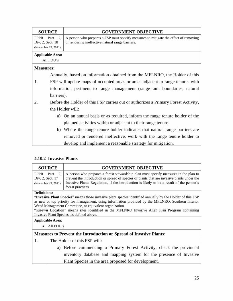
4.10.2 Invasive Plants
SOURCE GOVERNMENT OBJECTIVE
FPPR Part 2,
Div. 2, Sect. 17
(November 29, 2011)
A person who prepares a forest stewardship plan must specify measures in the plan to
prevent the introduction or spread of species of plants that are invasive plants under the
Invasive Plants Regulation, if the introduction is likely to be a result of the person’s
forest practices.
Definitions:
“Invasive Plant Species” means those invasive plant species identified annually by the Holder of this FSP
as new or top priority for management, using information provided by the MFLNRO, Southern Interior
Weed Management Committee, or equivalent organization.
“Known Location” means sites identified in the MFLNRO Invasive Alien Plan Program containing
Invasive Plant Species, as defined above.
Applicable Area:
All FDU’s
Measures to Prevent the Introduction or Spread of Invasive Plants:
1. The Holder of this FSP will:
a) Before commencing a Primary Forest Activity, check the provincial
inventory database and mapping system for the presence of Invasive
Plant Species in the area proposed for development.

26
b) When harvesting or road construction activities occur within 500 meters
of a Known Location and result in contiguous areas of disturbed soil that
are greater than 0.1 ha, the Holder of this FSP will ensure that within one
year of their completion, the portions of the area that are occupied by
ditch-lines, cut-slopes, fills and deactivated roads which are not
reforested (except for active running surface) are revegetated using:
- Seed or forage mixture that meets or exceeds Canada Common
Number 1 Forage Mixture as defined by the Canada Seeds Act
and Regulation, or
- Native forbs or shrubs
c) Advise logging truck drivers and heavy equipment operators when they
are operating within 500m of a Known Location, and require them to
inspect the undercarriage of their vehicle or equipment and remove
observed Invasive Plant Species when leaving or returning to a site.
d) Train field staff as required on the identification of Invasive Plant
Species.
e) Report previously unknown infestation sites to the MFLNRO within one
month of discovery where Invasive Plant Species are identified.
5.0 STOCKING STANDARDS
All stocking requirements are applicable across the entire FSP area (all FDU’s).
Legal Reference: FRPA Section 29(2), (July 26, 2007)
FPPR Section 16 and Section 44(1), (July 26, 2007)
Scale of Measurement: Cutblock
Map Reference: N/A
5.1 General Standards
Where the Holder of this FSP is required under FRPA to establish a free-growing
stand with respect to timber harvesting governed by this FSP, the Holder will do so in
accordance with the stocking standards in Appendix A.

27
6.0 SIGNATURES OF PREPARING FORESTER AND
PERSON REQUIRED TO PREPARE PLAN
Preparing Forester
“I certify that I have determined that this
work was performed to an acceptable
standard”
Mike Francis, RPF
Lower North Thompson Community
Forest Society
Signature of Person Required to Prepare
the Plan
Harley Wright, President
Lower North Thompson Community Forest
Society

Lower North Thompson Community Forest Society
APPENDIX A – STOCKING
STANDARDS
January 2012
Community Forest Agreement K1Z
Southern Interior Region
Thompson Rivers District
Kamloops Timber Supply Area

Lower North Thompson
Community Forest Society
Page 2 of 3
1.0 GENERAL DISCUSSION
Where possible, it is the intent of the Holder to utilize the established stocking standards. In
general, they will be based upon biogeoclimatic variant and site series. However, site-specific
conditions (i.e. aspect, elevation and management objectives) may modify them. The foundation
for stocking standards is described in the following discussion.
1.1 Minimum Inter-Tree Distance:
For the duration of this Forest Stewardship Plan, the Holder will use a minimum inter-tree
distance of 2.0 meters for the majority of sites. However, it may be reduced to 1.5 meters when
any of the following conditions exist and are identified in a Site Plan:
hygric and subhydric sites
xeric and very xeric sites
mechanically site prepped sites
areas with evidence of heavy cattle use (i.e. tracks, sign, salt blocks, past seedling
damage, heavy grazing, etc)
riparian areas with ≥20% residual component
sites where protected microsites are critical (shade, snow creep)
1.2 Crop Tree-Brush Ratio:
Biogeoclimatic
Zone
Crop Tree Height Above
Brush (%)
ESSF, IDF, MS, PP, BG 125
ICH, SBPS, SBS 150
1.3 Characteristics of Retained Trees:
Where trees are retained to form either an even-aged or uneven-aged stand following timber
harvesting the minimum characteristics of trees to be retained will be consistent with the
Silviculture Survey Procedures Manual (April 1, 2012)
1.4 Regeneration Delay:
The Holder will use a four year regeneration delay for areas utilizing an even-aged silviculture
system. Cutblocks relying upon natural regeneration will have a seven-year regeneration delay.
1.5 Damage Criteria:
The Holder will use damage criteria for Regeneration and Free Growing surveys specified in
Silviculture Survey Procedures Manual (April 1, 2012).
1.6 Maximum Density:
The Holder will use a maximum density of 25,000 countable stems per hectare for stands having
lodgepole pine as the leading species (> 80% by inventory). Maximum density for all other
leading species and mixed pine stands where pine component is less than 80% will be 10,000
countable stems per hectare.
Lower North Thompson
Community Forest Society
Page 3 of 3
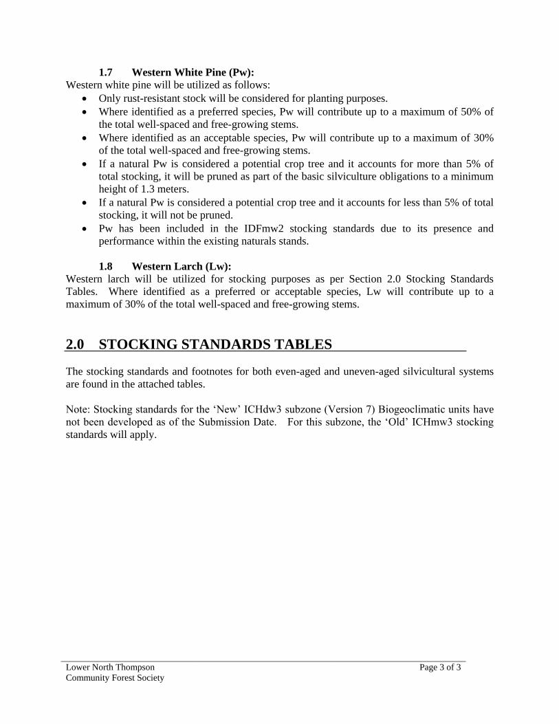
1.7 Western White Pine (Pw):
Western white pine will be utilized as follows:
Only rust-resistant stock will be considered for planting purposes.
Where identified as a preferred species, Pw will contribute up to a maximum of 50% of
the total well-spaced and free-growing stems.
Where identified as an acceptable species, Pw will contribute up to a maximum of 30%
of the total well-spaced and free-growing stems.
If a natural Pw is considered a potential crop tree and it accounts for more than 5% of
total stocking, it will be pruned as part of the basic silviculture obligations to a minimum
height of 1.3 meters.
If a natural Pw is considered a potential crop tree and it accounts for less than 5% of total
stocking, it will not be pruned.
Pw has been included in the IDFmw2 stocking standards due to its presence and
performance within the existing naturals stands.
1.8 Western Larch (Lw):
Western larch will be utilized for stocking purposes as per Section 2.0 Stocking Standards
Tables. Where identified as a preferred or acceptable species, Lw will contribute up to a
maximum of 30% of the total well-spaced and free-growing stems.
2.0 STOCKING STANDARDS TABLES
The stocking standards and footnotes for both even-aged and uneven-aged silvicultural systems
are found in the attached tables.
Note: Stocking standards for the ‘New’ ICHdw3 subzone (Version 7) Biogeoclimatic units have
not been developed as of the Submission Date. For this subzone, the ‘Old’ ICHmw3 stocking
standards will apply.

Lower North Thompson Community Forest Society - FSP #469Appendix A - Stocking Standards
Worksheets Included
Additional Reference Standards
For additional stocking standards information refer to Appendix A of the approved Forest Stewardship Plan.
The following worksheets are included with this workbook (see tabs at the bottom of the screen):
Introduction - introductory material and additional reference standardsStocking Standards - stocking standards applicable to this FSP
Dec 11/02 1 of 5

FSP #469 Stocking Standards
BGC Regeneration Guide Free Growing Guide
Classification Species Stocking(i) Regen Assessment Min. Height(ii)
Conifer Target MIN pa MIN p Delay Earliest Latest Species Ht
Zone/SZ Series Standards ID Preferred (p) Acceptable (a) (well-spaced/ha) (Max yrs) (yrs) (yrs) (m)
ICHmk2 01 1044346 Fd32
Pl Sx Bl10
Cw 1200 700 600 4 20 Pl, Lw 2.0
Lw32
Fd 1.4
Sx 0.8
Others 1.0
02 1044359 Fd Pl Bl10
Sx10
600 400 400 4 20 Pl 1.4
Fd 1.0
Others 0.8
03 1044360 Fd Pl Sx10,13
Bl10
1000 500 400 4 20 Pl 1.4
Fd 1.0
Others 0.8
04 1044361 Fd Pl Sx Bl10
Cw 1200 700 600 4 20 Pl, Lw 2.0
Lw32
Fd 1.4
Sx 0.8
Others 1.0
05 1044362 Fd32
Pl Sx Bl Cw32
1200 700 600 4 20 Pl, Lw 2.0
Lw32
Fd 1.4
Others 1.0
06 1044363 Pl1 Sx
1 Fd
1,32Bl
1 Cw
321000 500 400 4 20 Pl 1.4
Fd 1.0
Others 0.8
ICHmw3 01 1044364 Fd Sx10
Cw10
Pl51
Bl10
Hw 10
1200 700 600 4 20 Pl, Pw 2.0
(ICHdw3) Lw32
Pw31
Lw 2.0
Fd 1.4
Others 1.0
01-YC 1044365 Fd Cw10
Sx10
Bl10
Hw10
Pl51
1200 700 600 4 20 Pl, Pw 2.0
Lw32
Pw31
Lw 2.0
Fd 1.4
Others 1.0
02 1044366 Fd Pl Cw10
Pw31
Py23,32
1000 500 400 4 20 Pl, Pw 1.4
Fd 1.0
Others 0.8
03 1044367 Fd32
Pl Cw10
Pw31
Sx10
1000 500 400 4 20 Pl, Pw 1.4
Lw32
Bl10
Hw Lw 1.4
Fd 1.0
Others 0.8
04 1044368 Fd Pl51
Cw10
Bl Pw31
Sx10
1200 700 600 4 20 Pl, Pw 2.0
Lw32
Lw 2.0
Fd 1.4
Others 1.0
05 1044369 Fd Cw10
Sx10
Bl10
Pl51
1200 700 600 4 20 Pl, Pw 2.0
Lw32
Pw31
Lw 2.0
Fd 1.4
Others 1.0
06 1044370 Cw Fd Hw Sx Bl10
Pl51
1200 700 600 4 20 Pl, Pw 2.0
Lw Pw31
Lw 2.0
Fd 1.4
Others 1.0
07 1044371 Cw32
Sx Fd1,32
Bl Hw32
Pl51
Pw31
1200 700 600 4 20 Pl, Pw 2.0
Lw1,32
Lw 2.0
Fd 1.4
Others 1.0
08 1044372 Cw1,32
Hw1,32
Pl1,51
Bl1 Pw
311000 500 400 4 20 Pl 1.4
Sx1
Others 0.8
09 non-forested - - - - - - -
1,2 etc - see "Footnotes"
*Avoid logging
** Additional information or requirements may be contained in the text portion of the reference guide.
2 of 5
Dec 11/02

FSP #469 Stocking Standards
BGC Regeneration Guide Free Growing Guide
Classification Species Stocking(i) Regen Assessment Min. Height(ii)
Conifer Target MIN pa MIN p Delay Earliest Latest Species Ht
Zone/SZ Series Standards ID Preferred (p) Acceptable (a) (well-spaced/ha) (Max yrs) (yrs) (yrs) (m)
IDFmw2 01 1044373 Fd Pl Cw10
Sx10
Bl10
1200 700 600 4 20 Pl, Lw, Pw 1.6
Lw32
Pw31
Py23
Fd 1.0
Others 0.8
01-YC 1044374 Fd Pl Bl10
Cw10
Sx10
1200 700 600 4 20 Pl, Lw, Pw 1.6
Lw32
Pw31
Fd 1.0
Others 0.8
01-YS 1044375 Fd Pl Sx10
Bl10
Cw10
1200 700 600 4 20 Pl, Lw, Pw 1.6
Lw32
Pw31
Fd 1.0
Others 0.8
02 1044376 Fd27
Pl Py23
600 400 400 4 20 Pl 1.2
Fd 0.8
Py 0.6
03 1044377 Fd Pl Py Cw10
Sx10
Pw31
1000 500 400 4 20 Pl, Lw, Pw 1.6
Lw32
Fd 1.0
Others 0.8
04 1044378 Fd32
Sx Pl Cw32
Pw31
1200 700 600 4 20 Pl, Lw, Pw 1.6
Lw32
Fd 1.0
Others 0.8
05* 1044379 Sx1 Pl
1Bl
1 Cw
1,32 Pw
31400 200 200 4 20 Pl, Pw 1.2
Others 0.6
1,2 etc - see "Footnotes"
*Avoid logging
** Additional information or requirements may be contained in the text portion of the reference guide.
3 of 5
Dec 11/02

FSP #469 Stocking Standards
Uneven-aged Stocking Standards* -- Single-tree selection only
Target from Layer** Stocking*** Target from Layer** Stocking***
Table A standards Target pa MIN pa MIN p Table A standards Target pa MIN pa MIN p
(stems/ha) (stems/ha)
1200 1 600 300 250 800 1 300 150 150
ID 86000 (all layers) 2 800 400 300 ID 86003 (all layers) 2 400 200 200
3 1000 500 400 3 600 300 300
4 1200 700 600 4 800 400 400
1000 1 400 200 200 600 1 300 150 150
ID 86001 (all layers) 2 600 300 250 ID 86004 (all layers) 2 400 200 200
3 800 400 300 3 500 300 300
4 1000 500 400 4 600 400 400
900 1 400 200 200 400 1 200 100 100
ID 86002 (all layers) 2 500 300 250 ID 86005 (all layers) 2 300 125 125
3 700 400 300 3 300 150 150
4 900 500 400 4 400 200 200
MIN - minimum
**Stand Layer Definition
Layer 1 Mature trees >= 12.5 cm dbh
Layer 2 Pole trees 7.5 cm to 12.4 cm dbh
Layer 3 Sapling trees >= 1.3 m height to 7.4 cm dbh
Layer 4 Regeneration trees < 1.3 m height
(well-spaced/ha) (well-spaced/ha)
* Maximum regeneration delay is seven years. For a seven-year regeneration delay, the early free growing is 12 years and the late free growing is 15 years. Regeneration delay can be met immediately following harvest if the residual stand has no significant damage or pest problems and meets minimum stocking standards. If regeneration is achieved immediately following harvest, earliest free growing date is 12 months after completion of harvest and the latest date is 24 months after completion of harvest.
*** pa - preferred and acceptable species p - preferred species
Preferred and acceptable species and "Target from Table A standards' are as specified in Table A by biogeoclimatic ecosystem
4 of 5
Dec 11/02

FSP#469 - Appendix A: Stocking StandardsSpecies Footnotes
Footnote # Footnote
Conifer Tree Species 1 elevated microsites are preferred
"Bl" means subalpine fir; 10 restricted to northerly aspects
"Cw" means western red cedar; 23 restricted to trial use
"Fd" means Douglas-fir; 27 partial canopy cover required for successful establishment
"Hw" means western hemlock;
31 use of resistant stock mitigates risk of white pine blister rust.
Do not use non-resistant stock for reforestation. See BC
Journal of Ecosystems and Management 10(1): 97-100.
"Lw" means western larch; 32 limited by growing-season frosts
"Pl" means lodgepole pine; 51 restricted to areas with proven Pl performance
"Pw" means white pine;
"Py" means ponderosa pine;
"Sx" means hybrid spruce or interior spruce;
# Localized Footnotes
“Biogeoclimatic unit” or “BGC classification” means
the zone, subzone, variant and site series described in
the most recent field guide published by the Ministry of
Forests for the identiication and interpretation of
ecosystems, as applicable to a harvested area.
58 Southern Interior Forest Region - Fd limited to a max 50% of
preferred and acceptable well-spaced stems in the IDFmw and
all subzones of the ICH (except the ICHxw) due to root rot in
areas where stump removal has not been performed. See BC
Journal of Ecosystems and Management 9(2): 60-65.
“MIN or “Min” means minimum.
5 of 5
Dec 11/02