final uva internship presentation abby frazier, brendan mold, marc kavy, burton putrah, scott...
TRANSCRIPT

Final UVA Internship Final UVA Internship PresentationPresentation
Abby Frazier, Brendan Mold,
Marc Kavy, Burton Putrah,
Scott Gilbert & Michael Oldham
Spring 2008

OverviewOverview
• Over the course of the semester, we were able to complete the parcels from five towns: Bakersfield, Berkshire, Fairfield, Fletcher and Sheldon: 434 parcels total
• We were able to establish common problems and solutions while transferring these paper maps into a digital geodatabase

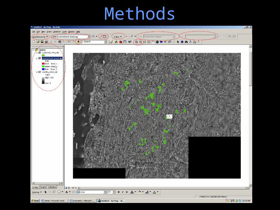
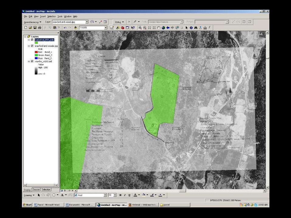
MethodsMethods
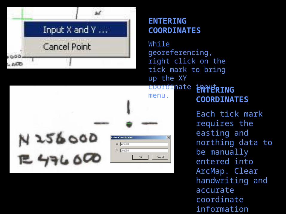
ENTERING COORDINATES
While georeferencing, right click on the tick mark to bring up the XY coordinate input menu.
ENTERING COORDINATES
Each tick mark requires the easting and northing data to be manually entered into ArcMap. Clear handwriting and accurate coordinate information helps eliminate error in this respect.
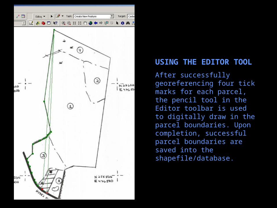
USING THE EDITOR TOOL
After successfully georeferencing four tick marks for each parcel, the pencil tool in the Editor toolbar is used to digitally draw in the parcel boundaries. Upon completion, successful parcel boundaries are saved into the shapefile/database.
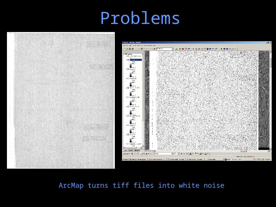
ProblemsProblems
ArcMap turns tiff files into white noise

Colored in orthophotos and multiple maps taped together…

All 4 east or north coordinates are the same, or barely any coordinates at all!Some also have no ground features to line up or even names on the map…
Also, any map with a false easting (East coordinate in the 100,000s) had to be adjusted with the figure of 347,599.695
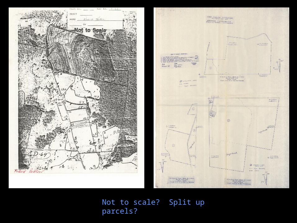
Not to scale? Split up parcels?
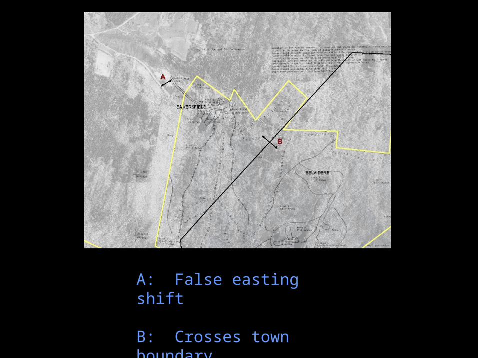
A: False easting shift
B: Crosses town boundary

Overlapping parcels
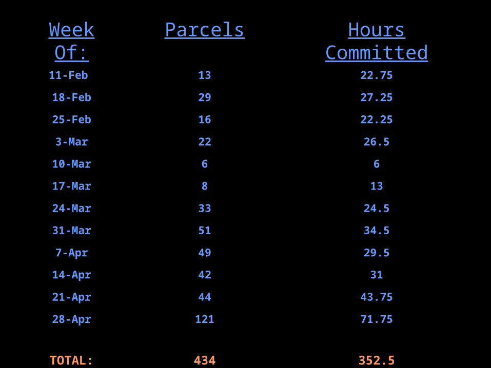
Week Of:Week Of: ParcelsParcels Hours CommittedHours Committed11-Feb 13 22.75
18-Feb 29 27.25
25-Feb 16 22.25
3-Mar 22 26.5
10-Mar 6 6
17-Mar 8 13
24-Mar 33 24.5
31-Mar 51 34.5
7-Apr 49 29.5
14-Apr 42 31
21-Apr 44 43.75
28-Apr 121 71.75
TOTAL: 434 352.5

Number of Parcels Completed vs. Number of Hours Committed
0
15
30
45
60
75
90
105
120
135
Week
1
Week
2
Week
3
Week
4
Week
5
Week
6
Week
7
Week
8
Week
9
Week
10
Week
11
Week
12
Parcels Completed
Hours Committed
EfficiencyEfficiency
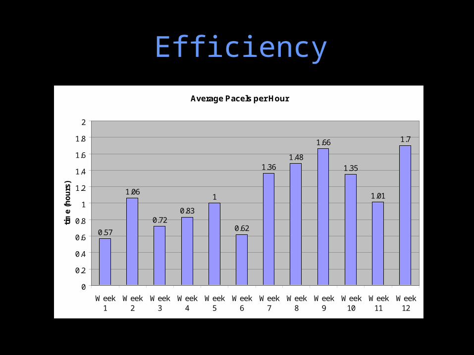
EfficiencyEfficiency
Average Pacels per Hour
0.57
1.06
0.720.83
1
0.62
1.361.48
1.66
1.35
1.01
1.7
0
0.2
0.4
0.6
0.8
1
1.2
1.4
1.6
1.8
2
Week1
Week2
Week3
Week4
Week5
Week6
Week7
Week8
Week9
Week10
Week11
Week12
tim
e (h
ou
rs)
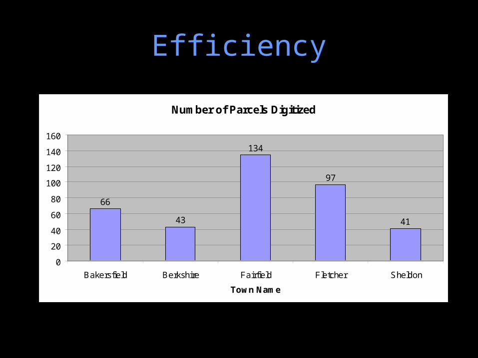
EfficiencyEfficiency
Number of Parcels Digitized
66
43
134
97
41
0
20
40
60
80
100
120
140
160
Bakersfield Berkshire Fairfield Fletcher Sheldon
Town Name
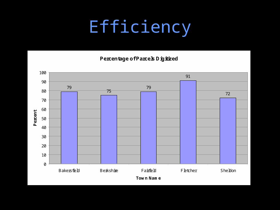
EfficiencyEfficiency
Percentage of Parcels Digitized
7975
79
91
72
0
10
20
30
40
50
60
70
80
90
100
Bakersfield Berkshire Fairfield Fletcher Sheldon
Town Name
Per
cen
t

RecommendationsRecommendations
• Establish a higher minimum standard for accepting maps– Only accept maps in NAD83– Make sure each map has at least 4 reference
coordinates (that make sense)– Consistency linking spatial and attribute data– High resolution scanning or digital copy

The Next Step…The Next Step…
• Reconciling the overlap issues using geodatabase topology– Collaborating with county forester to
determine actual boundaries