final environmental impact report - water.ca.gov simulation of natural flows in middle piru creek...
TRANSCRIPT

The Simulation of Natural Flows in Middle Piru Creek
FinalEnvironmental Impact Report
State Clearinghouse Number: 2004051123
January 2005
Prepared By:
AspenEnvironmental Group
Prepared for:
California Departmentof Water Resources

Final
Environmental Impact Report
for the
Simulation of Natural Flows in
Middle Piru Creek
State Clearinghouse No. 2004051123
Lead Agency:
California Department of Water Resources 1416 Ninth Street, Room 620
Sacramento, CA 95814
Prepared by:
Aspen Environmental Group 30423 Canwood Street, Suite 215
Agoura Hills, CA 91301
January 2005

CALIFORNIA DEPARTMENT OF WATER RESOURCES SIMULATION OF NATURAL FLOWS IN MIDDLE PIRU CREEK
FINAL ENVIRONMENTAL IMPACT REPORT
TABLE OF CONTENTS
PAGE
Final EIR i January 2005
EXECUTIVE SUMMARY.................................................................................................ES-1 FINAL ENVIRONMENTAL IMPACT REPORT 1. Organization of the Final Environmental Impact Report ................................................. 1 2. Purpose and Intended Uses of the Environmental Impact Report ...................................... 1 3. Scope of the Environmental Impact Report ................................................................. 2 3.1 Lead Agency and Other Agency Reviews and Approvals ......................................... 3 3.2 Environmental Review Process.......................................................................... 6 4. Organization of the Draft Environmental Impact Report................................................. 7 5. Availability of the Final Environmental Impact Report .................................................. 8 APPENDICES A. Comments on the DEIR and Responses to Comments
B. Mitigation Monitoring Plan C. Correlation Between the Contents of the Draft and Final Environmental Impact Reports and
the Contents of Exhibit E as Required by Title 18 of the Code of Federal Regulations Part 4.51(f)

EXECUTIVE SUMMARY
Final EIR ES-1 January 2005
This Final Environmental Impact Report (Final EIR) has been prepared to assess the environmental impacts associated with the proposed Simulation of Natural Flows in Middle Piru Creek Project (proposed project) and its alternatives. The primary objective of the proposed project is to avoid the “incidental take” of the federally endangered arroyo toad (Bufo californicus) due to water releases from Pyramid Dam into middle Piru Creek. The secondary objective is to continue using middle Piru Creek as a means of conveyance of up to 3,150 acre feet of State Water Project Table A1 water annually to United Water Conservation District. The California Department of Water Resources (CDWR) is acting as the Lead Agency under the California Environmental Quality Act (CEQA) for the proposed project’s environmental review. This Final EIR addresses potential environmental impacts associated with the proposed project and its alternatives, identifies mitigation measures to reduce adverse environmental impacts to a level of less than significant to the extent feasible, and discusses other CEQA-related considerations.
The project’s environmental review under CEQA was initiated on May 19, 2004 with the distribution of a Notice of Preparation (NOP) for a Draft EIR on the proposed project and its alternatives. The NOP, identifying the scope of environmental issues, was distributed to 63 organizations, interested parties, State, Federal, and local agencies, Native American interest groups, and the California State Clearinghouse. The Draft EIR was made available for public and agency review on November 8, 2004. The public and agency review period on the Draft EIR extended from November 8, 2004 through January 7, 2005; it was extended to 60 days, beyond the customary 30- to 45-day public review period mandated by CEQA, to accommodate the requirements of Title 18 of the Code of Federal Regulations Part 4.38(a)(7) (18 CFR 4.38(a)(7)) for public review of draft requests for amendment of a Federal Energy Regulatory Commission (FERC) license for hydropower facilities.
This document represents the Final EIR necessary for the CDWR to consider for approval of the proposed project. The Final EIR responds to all comments received; the Draft EIR is incorporated herein by reference. The Final EIR includes: the comments and responses to all comments that were submitted regarding the project’s Draft EIR (Appendix A); a Mitigation Monitoring Plan (Appendix B); and a technical appendix demonstrating how the proposed project’s CEQA documentation corresponds with Exhibit E of 18 CFR 4.51(f)) (Appendix C). No changes to the text, figures, tables, or appendices of the Draft EIR were necessary in response to comments received on the document.
Project Location. Piru Creek is located in northwestern Los Angeles County and eastern Ventura County, California. Middle Piru Creek is that portion of Piru Creek that is located downstream of Pyramid Dam and upstream of Lake Piru. Middle Piru Creek is approximately 18 miles long and flows roughly north to south. It crosses over the boundary between Los Angeles and Ventura Counties five times and drops in elevation from approximately 2,200 to 1,200 feet above sea level. Except for a few private inholdings, middle Piru Creek is surrounded by Angeles National Forest and Los Padres National Forest and primarily is used for recreational activities.
Project Description. The proposed project would consist of the implementation of water operations guidelines to simulate the natural hydrology of middle Piru Creek to the extent operationally feasible and consistent with safety considerations. Throughout the year stream releases from Pyramid Dam into middle Piru Creek would be similar to the natural inflows of water into Pyramid Lake as determined by CDWR’s model for natural inflow into Pyramid Lake. This model uses current daily stream flow data
1 “Table A” water refers to CDWR’s contractual obligation to deliver a certain number of acre-feet of State Water Project
water on an annual basis to the Ventura County Watershed Protection District (VCWPD) under their State Water Project long-term contract. The Table A amount does not assure delivery of that amount but rather provides the basis for proportional allocation of available supplies among all State Water Project contractors.

SIMULATION OF NATURAL FLOWS IN MIDDLE PIRU CREEK Executive Summary
January EIR ES-2 January 2005
from the gauging stations on upper Piru Creek (also known as Piru Creek below Buck Creek) and Cañada de los Alamos and adjusts it for additional inflows from several minor watersheds that drain into the lake but do not have gauging stations. Implementation of the proposed project would be as follows:
• Natural inflow to Pyramid Lake would be released into middle Piru Creek at a rate of up to approximately 18,000 cubic feet per second (cfs), which is the maximum safe designed release from Pyramid Dam. The exact maximum safe release depends on the lake surface water elevation at the time of the release.
• Storm releases into middle Piru Creek may be less than 18,000 cfs if they are deemed a threat to life, safety, or property at Pyramid Dam or downstream of the dam.
• CDWR may elect to appropriate inflow to Pyramid Lake above the safe release flows under the provisions of its existing water rights.
• Up to 3,150 acre feet of State Water Project Table A water may be delivered to United Water Conservation District (United) via middle Piru Creek between November 1st and the end of February of each water year. During this period, water deliveries may be made over a period of a few days, ramping flows up and down to simulate the hydrograph of a typical storm event, or they may be released more gradually over a longer period.
• Releases into middle Piru Creek may be increased by up to 50 cfs for short periods of time to exercise the Pyramid Dam radial gate and stream release valves, to test emergency power sources for operating State Water Project facilities, to conduct tests mandated by the FERC or other agencies, or to meet other short-term operational or maintenance requirements. Except for unscheduled events (such as equipment malfunctions) or emergencies, no such tests would be scheduled between March 15th and June 15th. Testing would also be avoided to the extent possible between June 16th and July 31st. Tests may be conducted at any time between August 1st and March 14th, provided that flows do not increase by more than 50 cfs above current base flows during the event and that the event does not last longer than 15 minutes. Scheduled tests requiring larger releases or lasting longer than 15 minutes would require prior notification to the United States Fish and Wildlife Service (USFWS), with further consultation as determined necessary by USFWS; unscheduled releases would require notification of USFWS no later than three business days after the event, again with further consultation as determined necessary by USFWS.
• The gauging station on upper Piru Creek (located north of Pyramid Lake) provides 24-hour averages; therefore instantaneous peak stream releases may be attenuated. Unlike a natural inflow hydrograph, which typically peaks sharply, the stream release hydrograph of middle Piru Creek may be attenuated.
• A multiplier is used to account for those portions of the Pyramid Lake watershed that are not tributaries of upper Piru Creek and Cañada de los Alamos upstream of their respective gauging stations. This may result in some deviations for individual storm events due to localized variations in storm water intensity.
• Due to operational constraints, the stream release hydrograph of middle Piru Creek would typically lag measured inflow by approximately one day. Occasionally, the delay may be longer.
• The valves at Pyramid Dam can be adjusted for release flows of less than three cfs; however, the precise measurement of release flows of less than three cfs may not be possible due to operational constraints of the dam’s gauging instrumentation. Natural inflow to Pyramid Lake would be released into middle Piru Creek at a rate of up to approximately 18,000 cfs, which is the maximum safe designed release from Pyramid Dam. The exact maximum safe release depends on the lake surface water elevation at the time of the release.
Implementation of the proposed project would result in greater volumes of water passing through middle Piru Creek during the “rainy season” (which typically extends from November through April). From May through October, generally considered the “dry season,” the volume and rate of flows into middle Piru Creek would diminish incrementally in response to progressively smaller volumes of natural surface water flows entering Pyramid Lake. During the dry season it is possible that at times there would be no surface water flow in middle Piru Creek.

SIMULATION OF NATURAL FLOWS IN MIDDLE PIRU CREEK Executive Summary
January EIR ES-3 January 2005
Project Alternatives. Five alternatives to the proposed project, including the “No Project” Alternative, are addressed in this Final EIR. These alternatives are summarized below:
• No Project Alternative. Under the No Project Alternative, the current temporary operations guidelines for releases of water from Pyramid Dam into middle Piru Creek would become the permanent operating guidelines. This alternative would consist of the following actions:
− From March 15th through April 1st CDWR would gradually ramp up stream releases, by approximately one cfs per day, to 25 cfs, with the exception of the natural storm release option described below.
− From April 1st through June 15th CDWR would keep stream releases constant at 25 cfs. The only exception for the period of March 15th through June 15th would be if natural storm events were to occur during this period, CDWR would have the option of releasing storm flows as they occur, simulating the natural hydrograph as much as possible, subject to specified operational and safety constraints.
− From June 16th through August 31st, CDWR would continue to keep stream releases constant at 25 cfs except for water deliveries to United or for the purpose of bullfrog control, as noted below.
− Water deliveries to United at Lake Piru may be made either during the period of June 16th through August 31st, provided that with the exception of natural storm flow releases, total stream releases do not exceed 35 cfs, or during the period of November 1st through February 28th.
− From September 1st through October 9th CDWR would gradually decrease stream releases back to five cfs.
− From October 10th through March 14th CDWR would maintain a minimum winter base flow of five cfs.
− CDWR would release all large storm events as they occur, regardless of the time of year. A large storm event is defined, for the purposes of the proposed project, as one that generates flows of 1,000 cfs or more on upper Piru Creek. The maximum stream release during a large storm event would be limited to the maximum controlled release that Pyramid Dam can safely accommodate, approximately 18,000 cfs; this maximum release could be further reduced as necessitated by other safety considerations.
− Water released into middle Piru Creek in excess of natural inflows into Pyramid Lake may be recovered from small to medium storm flows, defined as events in which flows on upper Piru Creek stay below 1,000 cfs. Water may be recouped from such small to medium natural storm flows at any time of year, including the arroyo toad breeding season (March 15th through June 15th), as long as flows between April 1 and August 31 do not fall below 25 cfs, with the exception of the bullfrog control measure below.
− If natural inflows into Pyramid Lake drop to very low levels after June 15th but before September 15th, CDWR may reduce stream releases to three cfs or less for a two-week period to help control the bullfrog population in middle Piru Creek.
− Short-term releases for testing and maintenance would be as under the proposed project.
• Reversion to FERC License 2426 Article 52 Flow Requirements. This alternative would change flows released from Pyramid Dam into middle Piru Creek back to those stipulated in Article 52 as amended by FERC Order 2426-010, issued November 11, 1982. This alternative would provide for winter base stream releases of five cfs (plus storm releases matching inflow into Pyramid Lake) from November 16th through April 30th. Between May 1st and November 15th, base stream releases into middle Piru Creek would be a minimum of ten cfs. However, the ten cfs stream release would be augmented with additional flows according to the following air temperature thresholds: (1) if, on any given day, the maximum air temperature in the project area is predicted to be between 86° Fahrenheit (°F) and 90°F, the minimum continuous flow is to be increased to 15 cfs between 10:00 a.m. and 6:00 p.m.; (2) if the maximum air temperature in the project area is predicted to range between 91°F and 95°F, the minimum continuous flow is to be increased to 20 cfs between 10:00 a.m. and 6:00 p.m.; and (3) if the maximum air temperature in the project area is predicted to be at or above 96°F, the minimum continuous flow is to be 25 cfs between 10:00 a.m. and 6:00 p.m.

SIMULATION OF NATURAL FLOWS IN MIDDLE PIRU CREEK Executive Summary
January EIR ES-4 January 2005
• Steady Low Summer Flows Alternative. This alternative would provide the same winter base and storm release flows as under the No Project Alternative. However, summer stream releases (May 1st through November 15th) into middle Piru Creek would be kept steady at five cfs or possibly ten cfs.
• Alternating Summer Flows Alternative. This alternative would consist of the No Project Alternative for a predetermined number of years (two or four years), followed by one year of simulated natural flows. Simulation of a natural flow regime would require the same operational assumptions as described for the proposed project. Under this alternative, flow regimes in middle Piru Creek would alternate over a three or five year cycle.
• No State Water Project Table A Annual Deliveries. This alternative would be identical to the proposed project except that there would be no deliveries of State Water Project Table A water to Lake Piru via middle Piru Creek.
Summary of Impacts and Mitigation Measures. The proposed project would result in potentially adverse impacts to water resources, biological resources, recreation, and cultural and paleontological resources. All identified impacts are considered either less than significant or can be mitigated to a level of less than significant. Table ES-1 summarizes the impacts associated with the proposed project and the mitigation measures proposed to reduce impacts to a level of less than significant, as warranted. The Mitigation Monitoring Plan presented in Appendix B and adopted by the CDWR would ensure effective implementation of the mitigation measures imposed by the proposed project.
The five project alternatives would impact the same resources as the proposed project (biological resources, water resources, cultural and paleontological resources and recreation). Out of all of the alternatives the proposed project is the only one that would meet both the primary and secondary project objectives. It would also have the greatest number of environmental benefits and is recommended as the environmentally preferred alternative because: (1) it would result in beneficial impacts for multiple sensitive wildlife species; (2) Alternatives 2 and 4 would result in significant adverse biological impacts; and (3) except for the No State Water Project Table A Annual Deliveries alternative, all other alternatives would result in continued incidental take of the arroyo toad and thus would not meet the primary objective of the project.
Issues of Public Concern/Known Controversy. A public scoping meeting regarding the proposed project was held on June 17, 2004 at the City Council Chambers in Santa Clarita, California. In addition, the public and affected agencies were notified of preparation of the proposed project’s EIR on May 19, 2004; the notification requested the submittal of project-related questions, concerns, and issues to be addressed in the project’s EIR by June 25, 2004. Concerns raised prior to release of the Draft EIR included potential impacts on the trout fishery, recreation, and water deliveries.
Comments received by mail and email during the public review period for the Draft EIR from November 8, 2004 to January 7, 2005 and made at the December 16, 2004 public meeting included concerns associated with endangered steelhead trout and southwestern pond turtle, historic water flows, State Water Project water deliveries, erosion and flooding, and public noticing of the proposed project’s CEQA process. These concerns were either addressed verbally at the public meeting or in written responses. Appendix A of this document contains the CDWR’s written responses to comments received on the Draft EIR and a transcript of the December 16, 2004 public meeting.
Issues to be Resolved. All issues raised during public and agency review of the proposed project’s Draft EIR are contained in Appendix A of this document; Appendix A additionally contains the CDWR’s responses to these issues. As of the publication date of this Final EIR, no issues regarding the proposed project’s implementation have been identified that would affect CDWR’s ability to make a decision on this document.

SIMULATION OF NATURAL FLOWS IN MIDDLE PIRU CREEK Executive Summary
Final EIR ES-5 January 2005
Table ES-1 Summary of Impacts and Mitigation for the Proposed Project Impact Impact Severity Mitigation Measure(s) Residual Impact
Biological Resources Impact B-1: The proposed project could result in the loss of or damage to non-sensit ive plants and wildlife. Less than signif icant None needed Less than signif icant Impact B-2: The proposed project could result in the loss of or damage to sensitive plants. Less than signif icant None needed Less than signif icant Impact B-3: The proposed project could result in the loss of or damage to sensitive natural communities. Less than signif icant None needed Less than signif icant Impact B-4: The proposed project could result in the loss of or damage to sensitive fauna. Less than signif icant None needed Less than signif icant
Water Resources Impact H-1: The proposed project could violate water quality standards or waste discharge requirements. No impact None needed No impact
Impact H-2: The proposed project could deplete groundwater supplies or interfere with groundwater recharge.
Less than signif icant None needed Less than signif icant
Impact H-3: The proposed project could alter the existing drainage pattern in a manner which would result in erosion.
Less than significant with
mitigation incorporated
Mitigation Measure H-3: Prevention of Erosion Damage to Infrastructure. The CDWR shall perform an engineering analysis to determine the potential for expected releases to damage Old Highway 99, the Old Highway 99 bridges, utilities, and other infrastructure in or adjacent to the channel. The engineering analysis shall be used as a basis for establishing procedures and guidelines for monitoring erosion at infrastructure during flood releases. CDWR shall monitor erosion at key potential infrastructure damage areas during large flow releases and temporarily curtail releases should the monitoring determine the infrastructure to be at risk. CDWR shall subsequently install engineered erosion protection to prevent erosion damage to the areas determined to be at risk.
Less than signif icant
Impact H-4: The proposed project could create off-site siltation. Less than signif icant None needed Less than signif icant
Impact H-5: The proposed project could increase the rate or amount of surface runoff in a manner which would result in flooding on- or off-site.
Less than signif icant None needed Less than signif icant
Impact H-6: The proposed project could create or contribute to runoff water which would exceed the capacity of existing or planned stormwater drainage systems.
No impact None needed No impact
Impact H-7: The proposed project could provide additional sources of polluted runoff or otherwise degrade water quality.
Less than significant. None needed Less than signif icant

SIMULATION OF NATURAL FLOWS IN MIDDLE PIRU CREEK Executive Summary
Final EIR ES-6 January 2005
Impact Impact Severity Mitigation Measure(s) Residual Impact Impact H-8: The proposed project could expose people or structures to a risk of loss, injury or death involving flooding, including flooding as a result of the failure of a dam.
Less than significant with
mitigation incorporated
Mitigation Measure H-8: Development of flood warning signage. The CDWR shall work with the USFS and landowners to develop a warning system and place signage warning the public of dangerously high flows in middle Piru Creek.
Less than signif icant
Cultural and Paleontological Resources Impact C-1: The proposed project could adversely affect prehistoric or historic resources in the project area.
Less than significant None needed Less than signif icant
Impact C-2: The proposed project could adversely affect paleontological resources in the project area.
Less than significant None needed Less than signif icant
Recreation Impact R-1: Altered Use of Piru Creek Recreational Facilities that Could Result in Their Physical Deterioration.
Less than significant None needed Less than signif icant
Impact R-2: Altered Use of Other Nearby Recreational Facilities that Could Result in Their Physical Deterioration.
Less than significant None needed Less than signif icant
Impact R-3: Altered Recreational Opportunities for Anglers.
Less than significant with
mitigation incorporated
Mitigation Measure R-3: Stock some or all of the additional 1,000 pounds of trout allotted in Piru Creek each year as determined appropriate by CDFG fisheries biologists. In addition to the 3,000 pounds of trout stocked annually in middle Piru Creek, some or all of the remaining 1,000 pounds of trout allotted may be stocked between the base of Pyramid Dam and the weir upstream of Frenchman’s Flat. Prior to the beginning of the stocking season, CDWR shall consult with CDFG fishery biologists to determine a suitable amount of trout, up to 1,000 pounds, to stock upstream of the weir to maintain a catch-and-release trout population.
Less than Significant
Impact R-4: Altered Opportunities for Rafters and Kayakers
Less than significant None needed Less than signif icant

FINAL ENVIRONMENTAL IMPACT REPORT
Final EIR 1 January 2005
1. ORGANIZATION OF THE FINAL ENVIRONMENTAL IMPACT REPORT
This Final Environmental Impact Report (Final EIR) is organized into five sections and three appendices, each addressing a separate aspect of the required content of a Final EIR as described in the California Environmental Quality Act (CEQA) and the CEQA Guidelines. To help the reader locate information of particular interest, a brief summary of the contents of each section of this document is provided. The following sections are contained in this Final EIR:
• Section 1. Organization of the Final Environmental Impact Report: This section provides an overview and guide to the sections and appendices of this Final EIR.
• Section 2. Purpose and Intended Uses of the Environmental Impact Report: This section contains a brief description of the proposed project, an overview of the purpose of this Final EIR, and a summary of how the Final EIR will be used by the CDWR as a decision-making tool.
• Section 3. Scope of the Environmental Impact Report: This section describes the scope of the proposed project’s Final EIR by presenting the resources and issues addressed in the document, in particular those that the proposed project has the potential to impact. This section also addresses the review and approval of the document by the Lead Agency and other agencies as well as the environmental review process.
• Section 4. Organization of the Draft Environmental Impact Report: This section provides a guide to the sections and appendices of the Draft EIR which is incorporated by reference into this document.
• Section 5. Availability of the Final Environmental Impact Report for Review: This section identifies the locations where the Final EIR is available for public review.
• Appendix A: Appendix A contains all the comments that were submitted regarding the project’s Draft EIR and responses to those comments; it also contains a transcript of the December 16, 2004 public hearing on the Draft EIR.
• Appendix B: This appendix consists of the Mitigation Monitoring Plan proposed to ensure the effective implementation of the mitigation imposed in the proposed project.
• Appendix C: This appendix shows how the proposed project’s CEQA documentation correlates with the required contents of Exhibit E as set forth in Title 18 of the Code of Federal Regulations Part 4.51(f) (18 CFR 4.51(f)).
No changes to the text, figures, tables, or appendices of the Draft EIR were made as a result of the comments.
2. PURPOSE AND INTENDED USES OF THE ENVIRONMENTAL IMPACT REPORT
This Final EIR has been prepared to evaluate the environmental impacts of the proposed Simulation of Natural Flows in Middle Piru Creek Project (“proposed project” or “project”). In addition to evaluating the impacts associated with the proposed project, this Final EIR evaluates feasible mitigation measures and project alternatives that would minimize or reduce project-related impacts. Piru Creek is located in northwestern Los Angeles County and eastern Ventura County, California. For the purposes of this document, middle Piru Creek is defined as that portion of Piru Creek that is located downstream of Pyramid Dam and upstream of Lake Piru; it is approximately 18 miles long and flows roughly north to south from Pyramid Dam to Lake Piru. Except for a few private inholdings, middle Piru Creek is surrounded by Angeles National Forest and Los Padres National Forest and primarily is used for recreational purposes.
The proposed project involves the simulation of natural flows in middle Piru Creek by altering the existing water flows released from Pyramid Dam. The primary objective of the proposed project is to

SIMULATION OF NATURAL FLOWS IN MIDDLE PIRU CREEK Final Environmental Impact Report
Final EIR 2 January 2005
revise the stream release schedule from Pyramid Dam to avoid the “incidental take” of the federally endangered arroyo toad (Bufo californicus) due to water releases into middle Piru Creek. The secondary objective is to continue using middle Piru Creek as a means of conveyance of up to 3,150 acre-feet of State Water Project Table A1 water annually to the United Water Conservation District. A detailed description of the proposed project is provided in Section 2 of the Draft EIR, which is incorporated by reference into this document.
This document is intended to serve as an informational document, as outlined in Section 15121(a) of the CEQA Guidelines, as follows:
An EIR is an informational document which will inform public agency decision makers and the public generally of the significant environmental effect of a project, identify possible ways to minimize the significant effects, and describe reasonable alternatives to the project. The public agency shall consider the information in the EIR along with other information which may be presented to the agency.
Furthermore, this Final EIR provides the primary source of environmental information for the Lead, Responsible, and Trustee Agencies to consider when exercising any permitting authority or approval power directly related to implementation of the proposed project.
EIRs not only identify significant or potentially significant environmental effects but also identify ways in which those impacts can be reduced to less-than-significant levels, whether through the imposition of mitigation measures or through specific alternatives. In a practical sense, EIRs function as a technique for fact-finding that allows a project proponent, concerned citizens, and agency staff to review and evaluate baseline conditions and potential project impacts through a process of full disclosure.
As the Lead Agency under CEQA, the California Department of Water Resources (CDWR) will decide whether or not to approve the proposed project. Implementation will also require amendment of the CDWR’s Federal Energy Regulatory Commission (FERC) license. The CDWR will consider the information in the project’s Final EIR along with other information before requesting a FERC license amendment. The conclusions of the project’s Final EIR regarding environmental impacts do not control the CDWR’s discretion to approve, deny, or modify the proposed project; instead they are presented as information intended to aid the decision-making process.
3. SCOPE OF THE ENVIRONMENTAL IMPACT REPORT
CEQA requires that an EIR be prepared when a Lead Agency determines that it can be fairly argued, based on substantial evidence, that a proposed project may have a significant effect on the environment (CEQA Sections 21080[d], 21082.2[d]). Based on this requirement and in consultation with appropriate State and Federal agencies with jurisdiction over resources affected by the proposed project, the CDWR determined that an EIR for the proposed project should be prepared. In making this determination four environmental resource/issue areas were identified that may be significantly impacted by the proposed project, including: biological resources; cultural and paleontological resources; recreation; and water resources. These four issues were noted as being the key environmental concerns in the proposed project’s Notice of Preparation (NOP), dated May 19, 2004. Following issuance of the NOP, a public scoping meeting was held on June 17, 2004 at the City Council Chambers in the City of Santa Clarita, 1 “Table A” water refers to CDWR’s contractual obligation to deliver a certain number of acre-feet of State Water Project
water on an annual basis to the Ventura County Watershed Protection District (VCWPD) under their State Water Project long-term contract. The Table A amount does not assure delivery of that amount but rather provides the basis for proportional allocation of available supplies among all State Water Project contractors.

SIMULATION OF NATURAL FLOWS IN MIDDLE PIRU CREEK Final Environmental Impact Report
Final EIR 3 January 2005
California to identify other resource- or issue-specific areas that may require detailed evaluation in the EIR. No resource or issue areas other than those noted above were identified at the public scoping meeting. Thus, the focus of the Draft EIR and this Final EIR is on the potential environmental effects of the proposed project on:
• Biological Resources • Recreation • Cultural and Paleontological Resources • Water Resources
In addition to addressing potentially significant environmental effects, CEQA requires that an EIR contain a statement that briefly explains the reasons why certain environmental effects associated with a proposed project have been determined not to be significant and thus not discussed in detail in the EIR (CEQA Section 21100(c)). In accordance with this CEQA requirement and Appendix G of the CEQA Guidelines, it has been determined that the proposed project would have either no impacts or less than significant impacts on the following resources or issues:
• Aesthetics • Mineral Resources • Agricultural Resources • Noise • Air Quality • Population and Housing • Ground Water, Geology and Soils • Public Services • Hazards and Hazardous Materials • Transportation and Traffic • Land Use and Planning • Utilities and Service Systems
The reasons why the impacts associated with these environmental resource/issue areas have been determined to be less than significant are addressed in Section 5 of the Draft EIR which is incorporated by reference to the Final EIR.
3.1 Lead Agency and Other Agency Reviews and Approvals
CEQA Agency Reviews
Under CEQA the Lead Agency is the California government agency that has the principal responsibility for carrying out or approving a proposed project and therefore has the principal responsibility for preparing all CEQA documents associated with that project. The CDWR is the Lead Agency under CEQA for the proposed project evaluated in this Final EIR. The Final EIR must be approved and certified as to its adequacy in complying with the requirements of CEQA by the CDWR before taking any action on the project.
A Responsible Agency under CEQA is a California governmental agency other than the Lead Agency that has a legal responsibility for carrying out or approving a project. A Responsible Agency must participate in the Lead Agency’s CEQA process, review the Lead Agency’s environmental review documents, and use the document when making a decision on the project. There are no State agencies acting as a Responsible Agency for the proposed project.
A Trustee Agency is a State agency that has jurisdiction over certain natural resources held in trust for the people of the State. A Trustee Agency is generally required to be notified of CEQA documents relevant to its jurisdiction, whether or not it has actual permitting approval or approval power over aspects of the project. Under CEQA the California Department of Fish and Game (CDFG) is the only State agency acting as a Trustee Agency for the proposed project.
The following agencies may have some interest in the proposed project and were sent copies of the proposed project’s Draft EIR:

SIMULATION OF NATURAL FLOWS IN MIDDLE PIRU CREEK Final Environmental Impact Report
Final EIR 4 January 2005
• Federal Energy Regulatory Commission • Native American Heritage Commission • U.S. Fish and Wildlife Service • California Department of Transportation • Angeles National Forest • State Water Resources Control Board • Los Padres National Forest • Regional Water Quality Control Board • U.S. Army Corps of Engineers • South Coast Air Quality Management District • National Park Service • Los Angeles Department of Water and Power • National Marine Fisheries Service • Los Angeles County • U.S. Environmental Protection Agency • Ventura County • California Department of Forestry • Ventura County Watershed Protection District • State Lands Commission • United Water Conservation District • California Department of Parks and
Recreation • Casitas Municipal Water District
Agencies and members of the public that commented on the Draft EIR were sent copies of the Final EIR ten days prior to the CDWR’s decision on the document. If the CDWR certifies the Final EIR and approves the proposed project, copies of the certified Final EIR and its Notice of Determination and CEQA findings will be submitted to the State Clearinghouse, Office of Planning and Research, for State agency distribution per the requirements of CEQA and the CEQA Guidelines.
Other Agency Reviews and Approvals
In addition to the proposed project’s CEQA review, the following federal and State approvals and permits were considered during preparation of this document:
• Federal Energy Regulatory Commission License. Through the Federal Power Act of 1935, as amended, and the Department of Energy Organization Act of 1977, as amended, the FERC is authorized to issue licenses for non-federal hydroelectric project works, including dams, reservoirs, and other works to develop and use power. Under this authority the FERC is responsible for licensing the hydropower facilities of the California Aqueduct (Aqueduct), which constitutes a major portion of the California State Water Project. The Aqueduct is a multi-purpose project designed for the conveyance of water, generation of hydroelectric power, and recreation. Portions of the Aqueduct, including Pyramid Dam, were licensed (approved) by the FERC on March 22, 1978 as FERC Project 2426. Articles 51 and 52 of the FERC license, as amended, address mitigation for the impacts of FERC Project 2426 on the trout fishery located between Pyramid Dam and Frenchman’s Flat. Implementation of the proposed project would require an amendment of Articles 51 and 52 of the FERC license for Project 2426 to alter the flow requirements for the creek’s trout fishery. The FERC license amendment is considered a federal discretionary action. The FERC will be the federal Lead Agency for the proposed project’s compliance with the National Environmental Policy Act (NEPA). The FERC has been kept informed by the CDWR throughout development of the proposed project and has also been notified of the proposed project’s environmental review through the project’s CEQA noticing process. Appendix C of this document shows how the proposed project’s CEQA documentation correlates with the required contents of Exhibit E as set forth in 18 CFR 4.51(f). Once this EIR is certified, CDWR plans to file an application for amendment of the FERC license.
• United States Department of Agriculture, Forest Service. A Memorandum of Understanding (MOU) was executed in 1969 between the United States Department of Agriculture, Forest Service (USFS) and the CDWR for the construction and operation of the Aqueduct on Angeles National Forest and Los Padres National Forest lands. The MOU applies to the project area and contains several provisions related to preserving, protecting, and enhancing resources, including recreation, fishing, and wildlife (Section VIII of the MOU). The Los Padres and Angeles National Forests have been involved in interagency discussions with the CDWR regarding the proposed project. As of the publication date of this Final EIR, neither the Los

SIMULATION OF NATURAL FLOWS IN MIDDLE PIRU CREEK Final Environmental Impact Report
Final EIR 5 January 2005
Padres National Forest nor the Angeles National Forest has indicated that implementation of the proposed project would require amendment of the MOU.
• United States Fish and Wildlife Service Consultation. Section 7 of the Federal Endangered Species Act (FESA) of 1973, as amended, requires that any federal action that may affect a species listed or proposed as threatened or endangered under the FESA, or the proposed or designated critical habitat for such species, must consult with the United States Fish and Wildlife Service (USFWS). As referenced above, a FERC license amendment would be required for the proposed project. In reviewing the license amendment application, the FERC will be required to make a determination as to whether the proposed project would have an impact on the arroyo toad, or any other species or critical habitat designated under FESA. If the FERC determines that no effects to listed species or critical habitat would occur, there would be no requirement to consult the USFWS. However, if the FERC determines that the proposed project may have an impact on the arroyo toad, and that the change in water flows within middle Piru Creek constitutes a federal action, FERC would be required to consult with the USFWS under Section 7 of the FESA. The purpose of the proposed project is to avoid the take of arroyo toad, thereby avoiding the need for a formal Section 7 consultation. (It is noted that the thresholds for “take” and “adverse effect” are very different. The threshold for needing to enter into a formal consultation [“adverse effect”] could be reached well before “take” occurs.) The USFWS has participated directly in the development of the proposed project, both at interagency meetings and independently with the CDWR. As of the publication date of this Final EIR, the USFWS has indicated that no adverse impacts to the arroyo toad would be anticipated to result from the proposed project and that several beneficial impacts to the species and its habitat could occur. Consequently, it is not anticipated that a formal Section 7 consultation with the USFWS would be required for the proposed project. The CDWR will continue to coordinate with the USFWS throughout the proposed project’s environmental review process regarding the applicability of a Section 7 consultation. If a Section 7 consultation is required, it is expected to be an informal consultation. An informal consultation would be appropriate if the FERC determined that the revised water release schedule may affect arroyo toad or another listed species but is not likely to adversely affect these listed species. A project is not likely to adversely affect a listed species if all of its effects are either completely beneficial, insignificant, or discountable.
• Regional Water Quality Control Board Water Quality Certification. Section 401 of the Clean Water Act grants each State the right to ensure that the State’s interests are protected on any federally permitted activity occurring in or adjacent to waters of the State. If a proposed project falls under the jurisdiction of a federal agency, or has the potential to impact waters of the State, the Regional Water Quality Control Board (RWQCB) verifies that project activities would comply with State water quality standards through a Water Quality Certification (WQC). The proposed project does require a federal action through its FERC license amendment process. However, the proposed project is not anticipated to alter the existing water quality or chemistry of middle Piru Creek. Through the project’s CEQA process the Los Angeles RWQCB has been notified of the proposed project and provided with the opportunity to comment on whether a WQC is considered necessary. In its comment letter on the Draft EIR (see Appendix A), the RWQCB did not indicate that a WQC would be required for the proposed project.
• California Department of Fish and Game Section 1602 Agreement. Pursuant to Sections 1600 et seq. of the California Fish and Game Code, the CDFG regulates all diversions, obstructions, or changes to the natural flow or bed, channel, or bank of any river, stream, or lake. Section 1602 of the California Fish and Game Code states that an entity may not substantially divert or obstruct the natural flow of, or substantially change or use any material from the bed, channel, or bank of, any river, stream, or lake without submitting a formal notification to the CDFG.
The proposed project does not constitute an obstruction or diversion of "natural flow," since the CDWR would adjust stream releases from Pyramid Dam into middle Piru Creek, to the extent operationally feasibly and consistent with safety considerations, to be equal to current natural inflow into Pyramid Lake. Whether or not the proposed project would substantially change the bed, channel, or bank of the creek, however, is less clear. The USFWS has informed CDWR that the proposed simulation of natural winter flow might result in the scouring of middle Piru Creek by high volumes of water during winter storms, resulting in the reduction of vegetation encroachment, redistribution of sediments, and the creation of sandbars (USFWS,

SIMULATION OF NATURAL FLOWS IN MIDDLE PIRU CREEK Final Environmental Impact Report
Final EIR 6 January 2005
2003). They conclude that the scouring action of heavy flow may be beneficial to the endangered arroyo toad, precisely because of changes it brings to the banks and bed of the creek. Riparian ecosystems are dynamic by nature. The scouring effects of winter storm flows are an integral part of local stream ecology and play a vital role in the maintenance of habitat for wildlife along the watercourse. The only "change" contemplated by CDWR in proposing the project is the restoration of those natural processes to the extent possible. It does not appear that restoring natural fluctuations in vegetation and the sediment redistribution essential to the formation of wildlife habitat was the sort of change contemplated by the Legislature when it drafted Section 1602 of the California Fish and Game Code. The proposed operations guidelines were developed in coordination with the CDFG and other agency stakeholders; through the project’s CEQA process, the CDFG was provided additional opportunity to comment on whether a Section 1602 agreement will be necessary. In its comment letter on the Draft EIR, the CDFG indicated that a Streambed Alteration Agreement pursuant to Section 1600 et seq. of the California Fish and Game Code would be required for the proposed project (see Appendix A). However, since receipt of the letter the CDWR has coordinated with the CDFG, and after further evaluation CDFG concluded that a Streambed Alternation Agreement will not be required (see Appendix A).
3.2 Environmental Review Process
This Final EIR has been prepared to meet all of the substantive and procedural requirements of CEQA (California Public Resources Code Section 21000 et seq.) and the CEQA Guidelines (California Code of Regulations, Title 14, Section 15000 et seq.). It also meets FERC requirements for providing specified stakeholders opportunity to review and comment on a draft application for license amendment. The CDWR is the Lead Agency for the proposed project, taking primary responsibility for conducting the CEQA environmental review and approving or denying the project. If the CDWR certifies this Final EIR and approves the proposed project, it would then submit a request for license amendment to the FERC. After receipt of the request for license amendment, the FERC would conduct its own environmental review in compliance with the NEPA.
After determining that an EIR should be prepared for the proposed project, the CDWR filed a NOP with the State Clearinghouse in the Office of Planning and Research on May 19, 2004. The NOP was also distributed to involved public agencies, Native American interest groups, and other interested parties for a 35-day public review period, which ended on June 25, 2004. The proposed project’s NOP and notification regarding its public scoping meeting were advertised on May 21, 2004 in the Los Angeles Times, The Signal, Antelope Valley Press, Bakersfield California and the Tehachapi News (May 26, 2004). In addition, notification was posted at Frenchman’s Flat and sent to local bait and fishing shops with a request for posting. The purpose of the NOP review period was to solicit comments on the scope and content of the environmental analysis to be included in the Draft EIR. In addition, a public scoping meeting to solicit comments on the content of the Draft EIR was held on June 17, 2004. Relevant comments received from agencies and interested parties that either responded to the NOP and/or participated in the scoping meeting were considered in preparation of the Draft EIR, as appropriate.
The Draft EIR was filed with the State Clearinghouse, Office of Planning and Research, and distributed to involved public agencies, Native American interest groups, private property owners adjacent to the creek, and other interested parties (see Appendix A of the Draft EIR). The document was additionally made available for review at six public repository sites including five public libraries and the Vista Del Lago Visitors Center (see Section 5, below, for the addresses of these sites). Newspaper advertisements regarding the Draft EIR, its corresponding Notice of Availability, and the Draft EIR’s December 16, 2004 public meeting began on November 8, 2004 in the Los Angeles Times and Ventura County Star.

SIMULATION OF NATURAL FLOWS IN MIDDLE PIRU CREEK Final Environmental Impact Report
Final EIR 7 January 2005
The advertisements were published for four consecutive weeks. This notification was also posted at Frenchman’s Flat and sent to local bait and fishing shops with a request for posting.
During the review period, from November 8, 2004 to January 7, 2005, agencies and the public could submit written comments on the Draft EIR to the CDWR contact person. In addition, a public meeting regarding the Draft EIR was held on December 16, 2004 at the City of Santa Clarita City Hall in Santa Clarita, California. Agencies, Native American interest groups, and other interested parties were given the opportunity to submit written comments and/or provide verbal comments on the Draft EIR at this meeting as well. Two members of the public and one representative from the Angeles National Forest provided verbal comments at the public meeting. Their comments were addressed at that time and are summarized in Appendix A of this document. Appendix A additionally contains a transcript of the December 16, 2004 public meeting. Eight comment letters were received during the public comment period. The comment letters and specific responses to these comments are included in Appendix A of this document, along with the above-referenced transcript. The Final EIR incorporates all the necessary changes to the Draft EIR based on these comments, although no changes to the project description or technical analyses contained in the Draft EIR were made as a result of comments.
If CDWR decides to carry out the proposed project, it must address in writing each significant impact identified in the Final EIR. These findings must either state that alterations have been made to the project to avoid or substantially reduce each significant impact, or that specific economic, legal, social, technological, or other considerations make mitigation of a significant impact infeasible.
When a Lead Agency makes the findings described above in conjunction with approving a project, a mitigation monitoring program (or plan) must be adopted to ensure that the measures needed to mitigate or avoid significant environmental impacts are implemented. Appendix B contains the Mitigation Monitoring Plan for the proposed project.
4. ORGANIZATION OF THE DRAFT ENVIRONMENTAL IMPACT REPORT
The Draft EIR is incorporated by reference into this Final EIR. A guide and summary of the sections of the Draft EIR are presented here. The Draft EIR was organized into ten sections, each addressing a separate aspect of the required content as described in the CEQA Guidelines. The following sections are contained in the Draft EIR:
• Executive Summary: The Draft EIR Executive Summary section contains an overview of the scope of the Draft EIR, as well as a summary of environmental impacts, proposed mitigation measures, level of significance after mitigation, and unavoidable significant impacts. Also in this section is a summary of project alternatives, areas of known controversy, and project-related issues to be resolved.
• Section 1. Introduction: This section provides an overview of the purpose and use of the proposed project’s Draft EIR, the scope of the Draft EIR, the environmental review process for the Draft EIR, the general format of the document, availability of the Draft EIR, and points of contact for submitting written comments on the Draft EIR. A glossary of terms and acronyms used in the Draft EIR is also provided in this section.
• Section 2. Project Description: This section outlines the project history and objectives and describes the project location.
• Section 3. Environmental Analysis: This section describes and evaluates the environmental issues addressed in detail in the Draft EIR, including the existing environmental setting and background, applicable environmental thresholds, environmental impacts (both short-term and long-term), policy considerations related to the particular environmental issue area under analysis, and proposed mitigation measures for minimizing adverse environmental impacts.

SIMULATION OF NATURAL FLOWS IN MIDDLE PIRU CREEK Final Environmental Impact Report
Final EIR 8 January 2005
• Section 4. Alternatives Analysis: This section analyzes feasible alternatives to the proposed project, including the No Project Alternative and four operational alternatives.
• Section 5. Issues Upon Which Impacts Would Be Less Than Significant or None: This section summarizes those environmental resources and issues upon which the proposed project would have less than significant impacts or no impacts.
• Section 6. Environmentally Preferred Alternative: This section provides a discussion of the environmentally superior, or preferred, alternative as required by CEQA Guidelines Section 15126.6(e)(2).
• Section 7. Other CEQA Considerations: This section provides a discussion of the proposed project’s growth-inducing impacts, cumulative impacts, irreversible environmental changes, and unavoidable significant impacts.
• Section 8. Environmental Impact Report Preparers, Contributors, and Reviewers: This section identifies all individuals responsible for the preparation and review of this document.
• Section 9. List of Agencies, Organizations and Persons Contacted: This section provides a listing of all agencies, organizations and persons contacted during the preparation of the Draft EIR.
• Section 10. References: This section identifies all references used and cited in the preparation of this report.
5. AVAILABILITY OF THE FINAL ENVIRONMENTAL IMPACT REPORT FOR REVIEW
The Final EIR has been prepared by the CDWR in accordance with CEQA, as amended, and State Guidelines for the implementation of CEQA. The CDWR has relied on Section 15084(d)(2) of the State CEQA Guidelines, which allows contracting with another entity, public or private, to prepare the Draft and Final EIRs. The CDWR has reviewed drafts of all portions of the Draft and Final EIRs and subjected them to its own review and analysis. The Draft and Final EIRs released for public review reflect the independent judgment of the CDWR. The Final EIR is available for public review at the following locations:
Newhall Public Library 23743 West Valencia Blvd. Valencia, CA 91355 (661) 259-0750
Blachard/Santa Paula Public Library 119 North 8th Street Santa Paula, CA 93060 (805) 525-3625
Valencia Public Library 23743 West Valencia Blvd. Valencia, CA 91355 (661) 259-8942
Camarillo Public Library 3100 Ponderosa Drive Camarillo CA 93010 (805) 482-1952
Canyon Country JoAnne Darcy Public Library 18601 Soledad Canyon Road Canyon Country, CA 91351 (661) 251-2720
Vista del Lago Visitors Center (at Pyramid Lake) 35800 Vista del Lago Gorman, CA 93243 (661) 294-0219

APPENDICES
A. COMMENTS ON THE DEIR AND RESPONSES TO COMMENTS
B. MITIGATION MONITORING PLAN
C. CORRELATION BETWEEN THE CONTENTS OF THE DRAFT AND FINAL ENVIRONMENTAL IMPACT REPORTS AND THE CONTENTS OF EXHIBIT E AS REQUIRED BY TITLE 18 OF THE CODE OF FEDERAL
REGULATIONS PART 4.51(F)

APPENDIX A.
COMMENTS ON THE DEIR AND RESPONSES TO COMMENTS
Comment Letters Responses to Comments Memorandum to John Kemp, California Department of Fish & Game Letter dated January 20, 2005, and Transcript of Public Scoping Meeting, December 16, 2004

COMMENT LETTERS

Comment Letter #1
1


Comment Letter #2
2
3

4


Comment Letter #3
5

5, cont.
6
7
8


Comment Letter #4
9

Comment Letter #5
11
10

14
13
12
11, cont.

19
16
15
14 cont.
18
17

19, cont.

Comment Letter #6
20
21

22

23
24
25

26
27
28
29

29, cont.
30

Comment Letter #7
31
32
33
34

35
36


Comment Letter #8


38
37
40
39

41
40, cont.

43
42
44

45
44, cont.
46

48
47
49

49, cont.
50


RESPONSES TO COMMENTS

APPENDIX A. RESPONSES TO COMMENTS
Responses to Comments A-1 January 2005
The proposed project’s Draft Environmental Impact Report (Draft EIR) was circulated for public and agency review from November 8, 2004 through January 7, 2005. During the review period written comments could be submitted in the form of a letter, facsimile (fax) or electronically (e-mail). The project was additionally discussed in a public meeting on December 16, 2004 at the City Council Chambers in the City of Santa Clarita, California. During the meeting the public and agency representatives were provided with the opportunity to comment on the Draft EIR. During the Draft EIR’s public and agency review period, written comments were received from eight parties. Table A-1 provides a listing of the commenting parties. During the proposed project’s public meeting on the Draft EIR comments and questions were raised by two members of the public and the U.S. Forest Service, Angeles National Forest. One public party provided written comments during his presentation, and these comments are included in this Appendix and noted in Table A-1. Questions raised by the U.S. Forest Service focused on public notification of the proposed project’s California Environmental Quality Act (CEQA) process; these questions were addressed at the meeting. Questions raised by the second public participant primarily focused on the presence of bullfrogs in middle Piru Creek, public noticing and distribution of the Draft EIR, and increased flood risks. These questions and comments were addressed at the meeting as well. A copy of the transcript of the December 16th meeting is provided at the end of this Appendix. Comment letters received on the Draft EIR are presented in the first section of this Appendix. Specific comments of each letter are indicated numerically in the right-hand margin of the letters. Responses to these comments are contained in the second section of this Appendix. The responses cross-reference the corresponding comment numbers of each letter.
Table A-1. Written Comments on the Draft EIR Commenter Comment Number(s)
California Department of Health Services Southern California Drinking Filed Operations Branch, Los Angeles Region
1
California Regional Water Quality Control Board, Los Angeles Region 2 – 4 California Department of Fish and Game South Coast Region
5 – 8
Ventura County Public Works Agency, Watershed Protection District 9 United Water Conservation District 10 – 19 California Trout 20 – 30 Mr. Joe Richey 31 – 36 United States Department of Commerce, National Oceanic and Atmospheric Administration National Marines Fisheries Service
37 - 50

Appendix A. Responses to Comments
Responses to Comments A-2 January 2005
California Department of Health Services Southern California Drinking Water Filed Operations Branch, Los Angeles Region November 14, 2004 1. In response to this comment, the California Department of Water Resources (CDWR) notified the CDWR’s operators of the Vista del Lago Visitors Center surface water treatment plant of the proposed project. A copy of the CDWR internal memorandum, dated December 14, 2004 is provided at the end of this Appendix. California Regional Water Quality Control Board Los Angeles Region January 6, 2005 2. The proposed project would not be a source of pollutants (please see Draft EIR Section 3.2.4). The proposed project does not include any new development, and it would not increase or otherwise modify existing sources and/or occurrences of pesticides, nitrogen, salts, or coliform. The only change associated with the proposed project is the timing of discharges into middle Piru Creek and Lake Piru. On an annual basis, the total discharged volume would remain unaffected. All project-related flows into middle Piru Creek would be delivered to and stored in Lake Piru, as is currently done. Santa Felicia Dam, the operation of which is not under the CDWR’s authority, is not part of the proposed project. Santa Felicia Dam regulates discharges from Lake Piru into lower Piru Creek, and ultimately, the Santa Clara River. Operation of Santa Felicia Dam would only be affected by the proposed project in high rain years, when inflow into Lake Piru might temporarily exceed the reservoir’s storage capacity. 3. As noted in response to Comment 2, above, the proposed project would not change flows into the Santa Clara River. Consequently, there would be no change is the assimilative capacity of the Santa Clara River for the constituents referenced above. 4. As noted in response to Comment 2, above, the proposed would not affect flows into the Santa Clara River; therefore, there would be no change in groundwater surface contributions to the Santa Clara River system. The requested estimates are not considered relevant to the technical scope of the Draft EIR. California Department of Fish and Game South Coast Region December 29, 2004 5. As identified in Draft EIR Section 3.1.4 (Environmental Impacts and Mitigation Measures for Biological Resources), current conditions at many locations on middle Piru Creek are not favorable for southwestern pond turtle. Artificially supported high current velocities, dense vegetation, and large numbers of aquatic predators have already produced conditions that likely affect the recruitment and survival of this species in these areas. Preliminary surveys conducted by CDWR biologists on middle Piru Creek in 2003 and 2004 between Frenchman’s Flat and Pyramid Dam in support of the Piru Creek Erosion Repairs Project Mitigated Negative Declaration (2003) indicated the area supports small numbers of older age class turtles. No juvenile turtles were found during these surveys, and no juvenile turtles have been found during repeated surveys conducted in the general area except for one juvenile pond turtle that was located in a shallow pool in an ephemeral tributary to middle Piru Creek.
Appendix A. Responses to Comments
Responses to Comments A-3 January 2005
The CDWR agrees that reduction in stream flow during dry summer months may lead to the formation of small pools and refugia for this species, which could increase the potential for disturbance by humans or predators. However, it should be noted that with the exception of the driest years, when little or no stream flow would occur, stream gauge data suggests that some flow into middle Piru Creek would probably continue throughout the summer. In the event that reduced inflow resulted in the drying of some sections of the creek, this would affect only a small section of middle Piru Creek (less than 4 miles of the 18 mile reach). In addition, only a small section of this area is subject to large numbers of summer visitors and of this small section, only a limited area is readily accessible to pedestrian travel due to the steep hillsides and rocky, boulder-dominated shoreline. Under the current summer conditions (augmented summer flows), the California Department of Fish and Game (CDFG) does not stock trout in the creek and few anglers have been recorded between Frenchman’s Flat and Pyramid Dam. In addition, while recreational users would probably focus their attention on the few remaining rocky pools containing summer water, most of these sites lie in sections that do not appear to contain southwestern pond turtles at this time. Likewise, Section 3.4 (Recreation) of the Draft EIR indicates that decreased summer flows would probably result in an overall decrease in the number of summer and fall visitors who use middle Piru Creek for water activities. Although some turtles could continue to be affected by human disturbance, the reduction in aquatic predators, increase in potential habitat, and restoration to natural stream conditions would not result in significant impacts and may ultimately provide beneficial impacts to this species. 6. Please see response to Comment 5. The CDWR believes that implementation of the proposed project may ultimately result in benefit to southwestern pond turtles in middle Piru Creek. However, the CDWR agrees that obtaining additional information regarding the population dynamics of this species might potentially provide useful scientific information that could lead to a better understanding of the species; therefore, the CDWR will continue to work with the CDFG to assess the feasibility and methodology of the studies recommended by the CDFG. 7. The primary objective of the proposed project is to avoid incidental take of the federally endangered arroyo toad as a result of water operations at Pyramid Dam. Simulation of natural flows in middle Piru Creek would achieve this objective by restoring natural stream dynamics, reworking sediments in the channel, and reducing populations of exotic aquatic predators. As noted in the Draft EIR Section 3.2 (Water Resources), simulation of natural flows on middle Piru Creek would probably result in increased sediment transport downstream of Pyramid Dam. However, this is an ongoing condition that currently occurs under the existing flow regime. It is estimated that to replace the sediment loss into middle Piru Creek, approximately 100,000 to 250,000 cubic yards of sediment would have to be imported into the creek below Pyramid Dam. This would require approximately 10,000 truck trips a year, with corresponding environmental impacts, and it would be difficult to ensure that the sediment was spread in a manner to facilitate the proper and timely transport to downstream reaches. Although simulating natural flows would have the potential to increase sediment loss in the uppermost portion of middle Piru Creek, arroyo toads are not known to occur in this area, and it is expected that sediment from adjoining tributaries would support suitable habitat further downstream for many years to come. In addition, current conditions associated with the existing flow regime do not provide favorable conditions for this species. As the proposed project is considered beneficial to the arroyo toads, sediment loss is currently ongoing under existing conditions, and it is speculative as to ascertain when/if the proposed project would result in future losses to this species; the CDWR does not believe that monitoring arroyo toad habitat is warranted at this time but is willing to continue discussions with
Appendix A. Responses to Comments
Responses to Comments A-4 January 2005
the regulatory agencies about the need and methodology for potential future periodic monitoring of special status species and their habitat along middle Piru Creek. 8. Following receipt of the CDFG’s comment letter on the proposed project’s Draft EIR, the CDWR initiated discussions with the CDFG to further discuss the need for a Streambed Alteration Agreement. In these discussions it was mutually agreed on that a Streambed Alteration Agreement would not be required. A follow-up letter regarding this agreement from the CDFG to CDWR, dated January 20, 2005, is included at the end of this Appendix. Ventura County Public Works Agency Watershed Protection District November 11, 2004 9. The CDWR does not own, operate, or maintain Lake Piru and recommends that the Ventura County Watershed Protection District (VCWPD) coordinate with the United Water Conservation District (United) regarding schedules or quantities of water releases from Lake Piru. United Water Conservation District January 6, 2005 10. The CDWR would like to clarify several statements made in the first paragraph of the United comment letter regarding CDWR’s operations related to the release of minimum flows as proposed by the CDFG and other agencies following the 1994 federal listing of the arroyo toad as endangered. United holds several State Water Regional Control Board (SWRCB) permits and licenses that grant United rights to all stormwater runoff in the Piru Creek watershed that can be put to beneficial use. The CDWR releases United’s stormwater runoff from the portion of the watershed above Pyramid Dam into middle Piru Creek. The water then flows into Lake Piru, which is owned and operated by United. Under conditions when Lake Piru is spilling and there is continuous surface flow from the spillway of Santa Felicia Dam (which forms Lake Piru) past the Freeman Diversion Dam to the Pacific Ocean, CDWR has appropriative water rights for up to 55,000 acre feet per year (afy) of storm runoff from the Piru Creek watershed. Current operations at Pyramid Lake are in conformance with the CDWR’s April 14, 1967 Agreement with United for the operation of Pyramid Dam, which governs the release of local water into Piru Creek. That agreement provides for the recovery of any over-release of local flows to Piru Creek from the next following storm flows. This allows CDWR to recover any release of water beyond natural flows that are made during the summer in order to comply with minimum fish flow requirements. This recovery of an over-release is distinct from CDWR appropriating local flows under its existing water rights. The CDWR cannot appropriate water from Piru Creek under its existing water rights until all downstream demands are met. CDWR has appropriated water from Piru Creek in only five of the past twenty-two years, all of which were very wet years when United was unable to put the additional flow to beneficial use. If averaged, CDWR appropriations from Piru Creek are less than 10,000 afy. 11. Comment noted. United’s use of water downstream from middle Piru Creek was not addressed because the proposed project is not anticipated to result in alteration of United’s operations. The proposed project is limited to the simulation of natural flow in middle Piru Creek from Pyramid Dam to Lake Piru and the delivery of currently contracted for State Water Project supplies to United. The total quantity of water released into middle Piru Creek from Pyramid Dam would not change in most years. The CDWR has historically appropriated water from Piru Creek only in wet years when Lake Piru is full and Freeman Diversion Dam is spilling. The increase in water released to Piru Creek at these times

Appendix A. Responses to Comments
Responses to Comments A-5 January 2005
would result in additional flows downstream of Santa Felicia Dam during high flow periods but would not alter United’s water supply operations. Therefore, a detailed description and analysis of the downstream uses of water released from Santa Felicia Dam is considered to be outside of the scope of this EIR. 12. At the June 23, 2003 meeting cited by United, the United States Fish and Wildlife Service (USFWS) agreed that late spring storm flows in May 2003 washed away arroyo toad eggs and tadpoles in middle Piru Creek. However, USFWS opined that, had CDWR matched stream releases after the storms to the receding limb of the hydrograph for natural inflows in Pyramid Lake, the adult toads that had retreated to higher ground may have returned to the creek as flows declined and may have resumed breeding. Instead, the sustained high flows may have prevented the toads from further breeding during the 2003 breeding season. Alternatively, USFWS opined, if the toads did lay additional eggs after the May 2003 storm, the eggs or tadpoles may have been stranded when stream releases dropped back down to 25 cubic feet per second (cfs) upon completion of water deliveries to United. Nancy Sandburg, a biological consultant to United, found evidence of reproductive success by arroyo toads on Agua Blanca Creek, a tributary to Piru Creek, after the May 2nd and 3rd 2003 storm. This supported USFWS’s conclusion that, had flows quickly been reduced to 25 cfs, the operations standard at that time, arroyo toads might have successfully reproduced in Piru Creek in 2003. As noted in its comment letter, United requested that flows be kept steady after the storm event for the purpose of water delivery. Therefore, based on its understanding at the time, erroneous in hindsight, that avoiding fluctuations in stream flows to the extent possible was of paramount importance during the arroyo toad breeding season, CDWR kept stream releases at a higher level after the May 2003 storm until water deliveries to United had been completed, rather than first dropping down to 25 cfs, then increasing flows again later in the season to deliver water. 13. The CDWR has a long term water supply contract with the VCWPD, which has a maximum Table A allocation of 20,000 acre feet of State Water Project water. VCWPD assigned administration of the agreement to Casitas Water District (CWD). Within VCWPD 5,000 acre feet (af) is assigned to CWD, 10,000 af to the City of San Buena Ventura and 5,000 af to United. Thus, United has a contractual right to receive up to 5,000 af of State Water Project water each year. 1,850 af of that amount is released to Port Hueneme through the VCWPD turnout at Castaic Lake. United received a total of 4,047 af of State Water Project water through middle Piru Creek in 2004, which was a combination of United’s Table A allocation of 3,150 af (5,000 af less 1,850 af released to Port Hueneme from Castaic Lake), of which the CDWR was able to deliver 2,047 af based on its allocation for the year, and United’s one-time purchase in 2004 of an additional 2,000 af from the VCWPD. The 2004 request from United did not include a request for a permanent increase in State Water Project deliveries. To date, the CDWR has not received such a request from VCWPD or United, and is unaware of any contract negotiations between the parties to secure an additional portion of VCWPD’s 20,000 af Table A amount. During the proposed project’s scoping period United suggested that the Draft EIR evaluate deliveries of up to 20,000 afy of State Water Project water to Lake Piru via middle Piru Creek. As referenced in the proposed project’s Notice of Preparation (NOP) and Draft EIR, the primary purpose of the proposed project is to avoid the incidental take of the arroyo toad due existing (“baseline”) operations of Pyramid Dam. An additional purpose of the proposed project is to maintain the current (“baseline”) delivery of up to 3,150 afy of State Water Project Table A water to United via middle Piru Creek (please see Draft EIR Section 2.2.2). The proposed project was developed and is being pursued by the CDWR to ensure compliance with the FESA. It is not intended to evaluate the entire range of potential future deliveries
Appendix A. Responses to Comments
Responses to Comments A-6 January 2005
of State Water Project water to United. United is not precluded from making future requests to increase State Water Project deliveries via middle Piru Creek; however, it will be responsible for evaluating the potential impacts of the increased deliveries consistent with CEQA. Incorporating United’s request into the proposed project would have required additional inter-agency discussion and concurrence prior to moving forward with preparation of the Draft EIR. The suggested modification also had the potential to trigger the need for re-circulation of the Draft EIR’s NOP and extension of the document’s scoping period. Such delays in the proposed project’s CEQA review process would have conflicted directly with the USFWS’s timeframes for FESA compliance. 14. The long-term water supply agreement between VCWPD and CDWR contemplates Castaic Dam, in Reach 30 of the California Aqueduct, as the primary point of delivery for VCWPD’s State Water Project water. Under Article 10 of that agreement, VCWPD may request additional points of delivery, subject to approval by CDWR, and shall pay all costs of the additional point of delivery. As discussed above, United, to CDWR’s knowledge, currently has a derivative contractual right to up to 5,000 afy of State Water Project water, 1,850 af of which is delivered to Port Hueneme at VCWPD’s turnout at Castaic Dam. If United or any other Ventura County water agency/purveyor were to formally propose a long-term yearly increase of up to 20,000 afy of State Water Project water deliveries by altering Pyramid Dam’s existing water operations, it is likely that any such increase would have potential environmental impacts and would require environmental analysis under CEQA. As noted above, analysis of the potential environmental impacts of more than 3,150 afy of State Water Project deliveries into middle Piru Creek are considered to be outside of the scope of the EIR prepared for the proposed project. Typically, if a State Water Project contractor requests a change in point of delivery or other operational change that benefits only one or two contractors and requires CEQA evaluation, the requesting contractor(s) act as lead agency for CEQA purposes and finance the analysis. The rationale is that the individual contractors are more familiar with the water needs in their area and the primary benefit of the proposed project accrues to them and not the State Water Project as a whole. It is necessary to work closely with CDWR to assure that analysis of the effects on the State Water Project as a whole are addressed in any environmental documentation prepared. On April 17, 2002, the CDWR provided a comment letter on the 2002 Draft Negative Declaration to United, which outlined the CDWR’s questions and concerns. One comment was that the CDWR was not requested to provide input into the Draft Negative Declaration during its preparation and that close coordination would have allowed a number of concerns related to State Water Project operations to be addressed prior to release of the Draft Negative Declaration. CDWR does not believe its actions with respect to the proposed project are inconsistent with previous actions taken with respect to United’s 2002 Piru Creek State Water Release Project. 15. An analysis of the potential beneficial and adverse impacts of increasing flows to allow additional State Water Project deliveries down Piru Creek is beyond the scope of this analysis for the reasons set forth in responses to Comments 13 and 14. Although it is possible that increasing winter releases into the creek to accommodate additional State Water Project water deliveries to United may provide some beneficial impacts to biological resources, as outlined in Draft EIR Section 7.3, increasing flows during the winter months to accommodate a 20,000 afy State Water Project water delivery to United would increase flood hazards and have adverse effects on overall channel degradation and erosion.

Appendix A. Responses to Comments
Responses to Comments A-7 January 2005
16. The intent of the discussions in Section 7.3 for Agricultural Resources and Population and Housing is to disclose to decision makers and the public that: (1) impacts to these resources could potentially occur; (2) their degree of significance cannot be fully identified within the context of this EIR; and (3) there would be opportunity to address and consider these impacts with greater certainty in a separate environmental review document specific to the increase if a formal request for the increase is made by United. Disclosure of such issues to decision makers and the public is a fundamental purpose of CEQA and considered appropriate for the purposes and use of this EIR (please see Public Resources Code, Division 13 [CEQA], Sections 21002 and 21002.1). The discussions in Section 7.3 for Agricultural Resources and Population and Housing both note that assessing potential impacts to these resources by increasing United’s State Water Project water deliveries to 20,000 afy are difficult to forecast, either individually or cumulatively, without knowledge of a specific implementation plan. Such a plan has not been formally proposed by United. The discussions in Section 7.3 also note that undue speculation regarding the assessment of impacts is discouraged under CEQA (CEQA Guidelines Section 14145). CDWR acknowledges that a detailed analysis of these impacts could require a regional evaluation of United’s existing and planned water uses, as well as regional evaluation of all other existing water sources, planned development projects, and existing and projected agricultural operations and production downstream of Lake Piru. Such an analysis is outside the scope of this EIR.
17. The first sentence on page 7-8 is focused on those projects listed in Table 7-1 that would not foster (induce) population growth or displace existing housing. It is not intended to infer that the Increased State Water Project Deliveries to United Project would displace housing. The first full paragraph of page 7-8 addresses potential impacts of the Increased State Water Project Deliveries to United Project and states that these impacts are focused on the potential to induce population growth. Per response to Comment 16, above, a comprehensive analysis of the potential impacts of the Increased State Water Project Deliveries to United Project on housing and population is beyond the scope of this EIR, and such an assessment would be highly speculative. 18. As noted in response to Comment 16, above, the impacts for Water Resources as they relate to the Increased State Water Project Deliveries to United Project are difficult to assess due to a lack of information. However, based upon the assumptions stated in this discussion, a quantitative analysis, to the extent possible, was conducted. The conclusion that impacts could be potentially significant is based upon the additional risk to humans that would occur under this project. As stated in the Draft EIR (Section 3.2.4) increases of 50 cfs or greater are considered to significantly increase flood hazard risks and this would occur if the Increased State Water Project Deliveries to United Project was implemented. In addition to the above, it is noted that under CEQA the discussion of cumulative impacts “need not provide as great detail as is provided for the effects attributable to the project alone” (CEQA Guidelines Section 15130 [b]). In the event that United or VCWPD do at some future time formally request increased water deliveries via Piru Creek, the lead agency would need to examine potential environmental impacts in much greater detail than is required in the cumulative impacts analysis presented in the proposed project’s Draft EIR. 19. The CDWR recognizes that State Water Project water deliveries to United via Castaic Creek would not be a preferred solution. The option of making deliveries to United via Castaic Creek was included because it (1) is a physically feasible alternative if deliveries could not be made via middle Piru Creek, and (2) could be a viable alternative if these deliveries were scheduled to occur during periods when water loss due to ground percolation is at a minimum. The intent of the Table 7-1

Appendix A. Responses to Comments
Responses to Comments A-8 January 2005
footnote is to document that this route of delivery is a potential alternative but that it is not assessed in Section 7.3 of the Draft EIR. California Trout January 5, 2005 20. Draft EIR Section 3.1 (Biological Resources) includes information pertaining to federally listed species known to occur in middle Piru Creek. Santa Felicia Dam has blocked access by anadromous species to and from the ocean since 1954. Consultation with the CDFG indicated that steelhead trout are not believed to be present in middle Piru Creek, and any steelhead trout trapped by construction of Santa Felicia Dam would have been genetically diluted long ago by rainbow trout planted by the CDFG in Piru Creek and Lake Piru. The National Oceanic and Atmospheric Administration National Marine Fisheries Service (NOAA-Fisheries) did not respond to the NOP or send a representative to the public scoping meeting held in Santa Clarita on June 17, 2004. NOAA-Fisheries’ December 10, 2004 proposed rule on critical habitat for steelhead trout characterizes Piru Creek upstream of Santa Felicia Dam as inaccessible and unoccupied habitat and seeks public comment on whether the area should be designated critical habitat. If it were determined that the species was present in middle Piru Creek or its tributaries, the restoration of natural flows, a condition in which this species evolved, would not be expected to result in adverse impacts to this species. It is conceivable that remnant populations of steelhead trout could occur in tributaries of Piru Creek such as Agua Blanca Creek. However, the proposed project would not affect flows in Piru Creek’s tributaries, and restoration of the natural flows in Piru Creek under which steelhead trout evolved would not be expected to result in adverse impacts to steelhead trout even if present. 21. The Draft EIR has met the requirements of CEQA Section 15003(d) by providing information regarding known sensitive species occurring in middle Piru Creek. Information known at the time the document was prepared did not indicate the presence of federally endangered species other than those identified in the Draft EIR. The information on steelhead trout presented in this and the NOAA-Fisheries comment letter on the Draft EIR does not change the conclusions reached in the Draft EIR. 22. The Draft EIR was prepared in accordance with the requirements of the FESA. NOAA-Fisheries was sent a copy of the NOP of a Draft EIR for the proposed Simulation of Natural Flows in Middle Piru Creek project and did not respond to it (please see Draft EIR Section 1.2.1 and page 3 of the CEQA distribution list found in Appendix A of the Draft EIR). The proposed ruling on critical habitat for the steelhead trout was not published until after the Draft EIR was released for public review. There appears to be some disagreement regarding the presence of steelhead trout upstream of Santa Felicia Dam between the information that CDWR received from CDFG and the NOAA-Fisheries proposed ruling. The public comment period on the proposed critical habitat designation continues until February 28, 2005, and NOAA-Fisheries will not issue a final rule until some time after that. In the event that middle Piru Creek is, at some future time, designated as critical habitat for steelhead trout, the CDWR and/or the Federal Energy Regulatory Commission (FERC) will consult and coordinate with NOAA-Fisheries and other agencies as appropriate. For additional information regarding this issue, please see the response to Comment 40. 23. Sections 3.2 (Biological Resources) and 3.2 (Water Resources) of the Draft EIR describe the historic conditions that once occurred in middle Piru Creek. It should be noted that steelhead trout evolved under dynamic natural stream conditions. Implementation of the proposed project would mimic

Appendix A. Responses to Comments
Responses to Comments A-9 January 2005
these natural conditions in middle Piru Creek to the extent operationally feasible and consistent with safety considerations. Implementation of the proposed project would simulate natural flows in middle Piru Creek, which would include periods of reduced flow occurring during late summer and fall and periods of intense but short flow resulting from large winter storms. Under natural pre-dam stream conditions, it is highly likely that in dry years sections of middle Piru Creek had no active stream flow for periods of one to three months at a time. It is likely that historic runs of steelhead trout sought thermal refuge in smaller tributaries or upstream sections of Piru Creek during these periods. Access to these tributaries would remain with implementation of the proposed project, with the exception of tributaries above Pyramid Lake which have been blocked by Pyramid Dam. Restoring natural stream flow conditions in middle Piru Creek would result in the reestablishment of the natural stream processes that are required for development of suitable habitat for native species, including the redistribution of spawning gravels in lower sections of middle Piru Creek. Restoring natural stream processes would not eliminate native food resources for trout and would reduce populations of exotic species known to prey on native fishes and amphibians. 24. Pursuant to CEQA and FERC’s consultation requirements for draft requests for license amendment, NOAA-Fisheries has been notified about the proposed project throughout the CEQA process. This is documented in Draft EIR Section 1.2.1 and on page 3 of the proposed project’s CEQA distribution list (please see Draft EIR Appendix A). Comments (and their respective responses) on the proposed project’s Draft EIR submitted by NOAA-Fisheries are presented in this Appendix. 25. Pyramid Dam was built in 1973, and from then through 1995 stream releases into middle Piru Creek were governed by Article 52 of the license for FERC Project No. 2426, which required substantial daily fluctuations in stream flows based on predicted air temperatures. From 1996 until March 2004, summer stream releases were kept steady at 25 cfs; since then, a slightly modified version of the 25 cfs regime, as approved by USFWS, has been in effect. To average stream release data across periods with such different flow regimes, both natural and managed, would not be scientifically valid. The six year period referred to in Comment 25 was used as the project baseline because this is the period during which current operation protocol of the Pyramid Dam has been in effect. Data for inflow into Pyramid Lake are presented for the same six-year period to provide a legitimate comparison of inflows and outflows under baseline conditions. Where appropriate and scientifically valid, the Draft EIR includes and analyses hydrologic data for longer periods of time. The current operation protocol is the legitimate basis of comparison and is consistent with the CEQA Guidelines (CEQA Guidelines Section 15126 [a]). A hydrologic analysis dating back to 1976, as requested in Comment 25, was in fact done but not presented in the Draft EIR for the above reasons. Had it been included, it would not have changed the conclusions of the impact analysis. According to this historic analysis, monthly flows into Pyramid Lake, adjusted for watershed area, for the period 1977 through 2002 are as shown in Table A-2.
Table A-2 Monthly Flows into Pyramid Lake, 1977 through 2002 Month Average Monthly Inflow (in cfs)
January 89 February 255 March 206 April 103 May 55
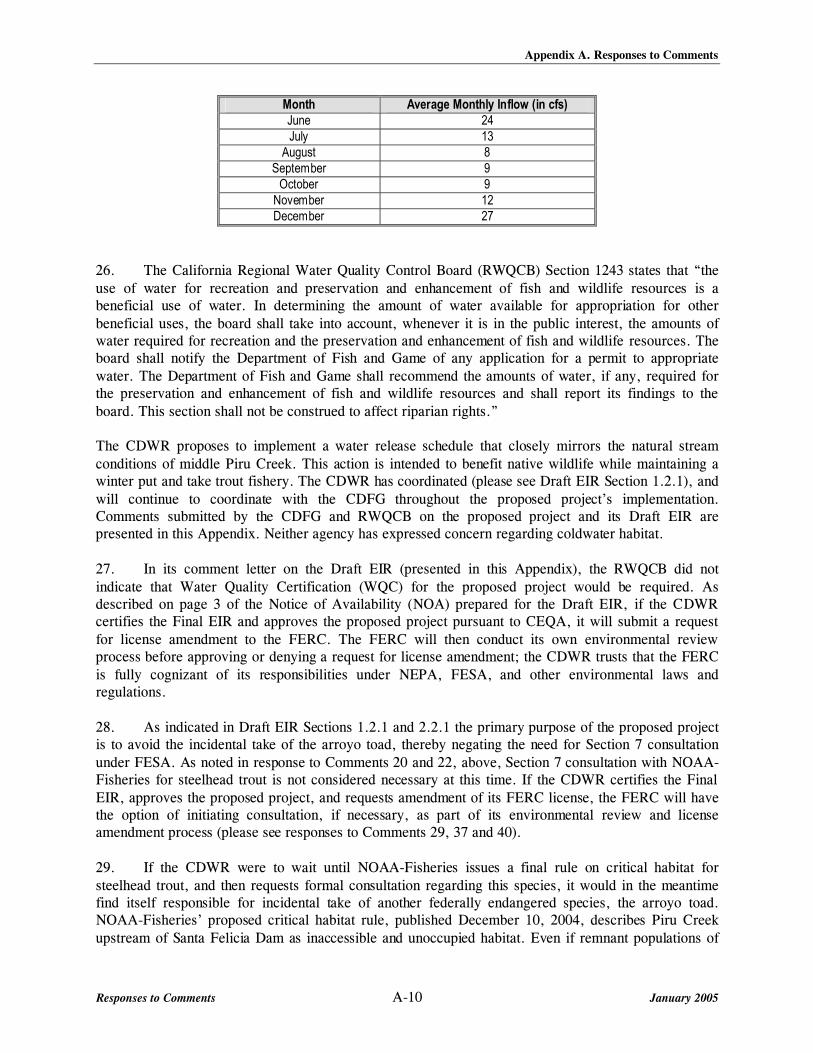
Appendix A. Responses to Comments
Responses to Comments A-10 January 2005
Month Average Monthly Inflow (in cfs) June 24 July 13
August 8 September 9
October 9 November 12 December 27
26. The California Regional Water Quality Control Board (RWQCB) Section 1243 states that “the use of water for recreation and preservation and enhancement of fish and wildlife resources is a beneficial use of water. In determining the amount of water available for appropriation for other beneficial uses, the board shall take into account, whenever it is in the public interest, the amounts of water required for recreation and the preservation and enhancement of fish and wildlife resources. The board shall notify the Department of Fish and Game of any application for a permit to appropriate water. The Department of Fish and Game shall recommend the amounts of water, if any, required for the preservation and enhancement of fish and wildlife resources and shall report its findings to the board. This section shall not be construed to affect riparian rights.” The CDWR proposes to implement a water release schedule that closely mirrors the natural stream conditions of middle Piru Creek. This action is intended to benefit native wildlife while maintaining a winter put and take trout fishery. The CDWR has coordinated (please see Draft EIR Section 1.2.1), and will continue to coordinate with the CDFG throughout the proposed project’s implementation. Comments submitted by the CDFG and RWQCB on the proposed project and its Draft EIR are presented in this Appendix. Neither agency has expressed concern regarding coldwater habitat. 27. In its comment letter on the Draft EIR (presented in this Appendix), the RWQCB did not indicate that Water Quality Certification (WQC) for the proposed project would be required. As described on page 3 of the Notice of Availability (NOA) prepared for the Draft EIR, if the CDWR certifies the Final EIR and approves the proposed project pursuant to CEQA, it will submit a request for license amendment to the FERC. The FERC will then conduct its own environmental review process before approving or denying a request for license amendment; the CDWR trusts that the FERC is fully cognizant of its responsibilities under NEPA, FESA, and other environmental laws and regulations. 28. As indicated in Draft EIR Sections 1.2.1 and 2.2.1 the primary purpose of the proposed project is to avoid the incidental take of the arroyo toad, thereby negating the need for Section 7 consultation under FESA. As noted in response to Comments 20 and 22, above, Section 7 consultation with NOAA-Fisheries for steelhead trout is not considered necessary at this time. If the CDWR certifies the Final EIR, approves the proposed project, and requests amendment of its FERC license, the FERC will have the option of initiating consultation, if necessary, as part of its environmental review and license amendment process (please see responses to Comments 29, 37 and 40). 29. If the CDWR were to wait until NOAA-Fisheries issues a final rule on critical habitat for steelhead trout, and then requests formal consultation regarding this species, it would in the meantime find itself responsible for incidental take of another federally endangered species, the arroyo toad. NOAA-Fisheries’ proposed critical habitat rule, published December 10, 2004, describes Piru Creek upstream of Santa Felicia Dam as inaccessible and unoccupied habitat. Even if remnant populations of

Appendix A. Responses to Comments
Responses to Comments A-11 January 2005
steelhead trout were present in tributaries of middle Piru Creek, such as Agua Blanca Creek, simulation of natural flows in the main stem of middle Piru Creek would not be expected to have an adverse effect on the fish in these tributaries. Should middle Piru Creek be designated as critical steelhead habitat, the FERC or CDWR will request consultation as appropriate at that time. 30. Please see responses to Comments 20 through 29, 40 and 48. Mr. Joe Richey December 16, 2004 Written Notes Submitted at Public Meeting on Draft EIR 31. The proposed project’s NOP and notification regarding its public scoping meeting were advertised on May 21, 2004 in the Los Angeles Times, The Signal, Antelope Valley Press, Bakersfield California and the Tehachapi News (May 26, 2004). In addition, notification was posted at Frenchman’s Flat and sent to local bait and fishing shops with a request for posting. Prior to release of the Draft EIR, private property owners adjacent to the creek were added to the proposed project’s CEQA distribution list (please see Appendix A of the Draft EIR). All private land owners with property adjacent to the creek were sent a copy of the proposed project’s NOA and the Draft EIR. Newspaper advertisements regarding the NOA, Draft EIR and December 16, 2004 public meeting began on November 8, 2004 in the Los Angeles Times and Ventura County Star. They were published for four consecutive weeks. This notification was also posted at Frenchman’s Flat and sent to local bait and fishing shops with a request for posting. 32. No formal contact with the property owner was made prior to or during the proposed project’s cultural resources surveys. The regulations for cultural resources investigations do not require contact with property owners unless a standing structure of potentially historic significance is directly within a proposed project’s Area Potentially Effected (APE). None of the private properties within the proposed project’s APE meet this criteria; therefore, contact prior to the surveys was limited to individuals and groups identified for Native American interests (please see Appendix B of the Draft EIR). 33. The road referenced on page 3-84 is a road indicated on the area’s U.S. Geological Survey (USGS) Quadrangle that parallels the creek and is blocked by a U.S. Forest Service gate. As the pedestrian surveys for cultural resources moved northward up the creek, traces of this road become progressively more difficult to discern and eventually could no longer be identified. The road referenced in the Draft EIR and the road referenced in Comment 33 are two different roads; the road referenced in this Draft EIR discussion is not the property owner’s access road crossing the creek. 34. The Draft EIR discussion quoted in this comment is specific to cultural resources; it is not directed toward potential impacts to the property owner’s existing access road due to high flows and erosion. Section 3.2.4 of the Draft EIR addresses the proposed project’s potential impacts due to increased flows and erosion and notes that these impacts could be potentially significant. Mitigation Measure H-3 is proposed to mitigate these impacts on existing infrastructure. As discussed with the property owner at the December 16, 2004 public meeting on the Draft EIR, high stream releases of Pyramid Dam similar to those proposed have occurred in years other than 1998. Although high stream flows could damage the property owner’s creek-crossing road, it is noted that tributaries of middle Piru Creek, over which the CDWR does not have any control, contribute roughly 30 percent of the inflow into Lake Piru. The proposed operations guidelines do stipulate that storm-

Appendix A. Responses to Comments
Responses to Comments A-12 January 2005
generated stream releases from Pyramid Dam into middle Piru Creek can be reduced if the full natural flow is deemed a threat to life, safety, or property downstream of the dam. 35. Plant and animal life on middle Piru Creek evolved under a variety of changing stream conditions. This included periods of intense rainfall, which resulted in large sections of the creek being scoured clean of vegetation and periods of drought where little if any flow occurred for several months at a time. Under pre-dam conditions middle Piru Creek supported a number of native fish species including a winter run of steelhead trout. It should be noted that native fishes and their prey items (insects, small crustaceans, and other fish) also evolved under changing natural stream conditions and the implementation of the proposed project would mimic the conditions under which these species evolved. Native riverine species also possess life history traits that enable individuals to survive and reproduce under a range of environmental variation. Invertebrates, including insects, would not be eliminated from middle Piru Creek under natural stream conditions since suitable habitat and refugia would continue to exist or even be enhanced at many locations in the watershed. Creel census surveys were conducted on middle Piru Creek between Frenchman’s Flat and the area below Pyramid Dam to document recreational fishing in the catch and release area above the concrete weir and in the put-and-take trout fishery stocked by the CDFG near Frenchman’s Flat. Angler surveys focused on this section of middle Piru Creek for a number of reasons including: the survey taker’s ability to interview a large percentage of the recreational anglers who fish middle Piru Creek; the fact that most anglers and hikers begin their activities from the parking area at Frenchman’s Flat; and the area’s close proximity to the catch and release area. Conducting creel census surveys above Lake Piru or in the back country sections of middle Piru Creek was not considered practical or feasible because of the small number of anglers that likely use these areas, their distance from the put-and-take trout fishery stocked by the CDFG, and restricted access. Due to the closure of Bluepoint Campground, located above (north of) Lake Piru, access to this section of the creek by recreational anglers is now restricted. Although recreational angling does occur in these areas (e.g. by hikers and people with private inholdings), the area probably supports only a limited number of anglers who either have access to the gate keys or are willing to hike the many miles into the backcountry. Information obtained during the creel census surveys did include anglers who hiked several miles downstream of Frenchman’s Flat seeking recreational opportunities. Anglers and hikers interviewed during the surveys noted that few if any other anglers were ever observed during hikes of middle Piru Creek. 36. As discussed in Section 2.2.1 of the Draft EIR, the proposed project was developed based on consultation of the USFWS and information provided by Dr. Sam Sweet from the University of California at Santa Barbara, who actively participated in the agency stakeholder meetings in which the proposed operations guidelines were developed. The simulation of natural flows is intended to restore natural stream dynamics to prevent the incidental “take” of arroyo toad, a federally endangered species, known to occur in sections of middle Piru Creek. In fact, it was the CDWR’s efforts to keep stream flows as steady as operationally feasible in the late spring of 2003, as discussed in the response to Comment 12 above, that precipitated the development of new proposed operations guidelines to prevent incidental take of the arroyo toad. Stream flow is one of several factors that affect the survival of the arroyo toad and other native species in and along middle Piru Creek. As discussed in Section 3.2 (Water Resources) of the Draft EIR, other factors include the timing of the stream flow, regular disturbance from winter storms, the distribution of sediments required for breeding, and the presence of exotic predators such as large mouth bass, bullfrogs, and red crayfish. Arroyo toads require slow moving water for breeding, placement of egg

Appendix A. Responses to Comments
Responses to Comments A-13 January 2005
masses, and rearing of juvenile toads. Under current stream conditions, augmented summer flows lead to the decline of suitable habitat for this species in many sections of middle Piru Creek. United States Department of Commerce National Oceanic and Atmospheric Administration National Marines Fisheries Service January 11, 2005 37. Please see response to Comment 28, above. Should the FERC determine that consultation regarding the steelhead trout or arroyo toad is warranted for the proposed project, it will coordinate with NOAA-Fisheries and USFWS, as appropriate, during its environmental review process prior to approving or denying the request for license amendment. 38. Water deliveries to Lake Piru via middle Piru Creek are discussed in Section 2.3 (Proposed Project) of the Draft EIR. Under the proposed project the CDWR intends to simulate natural flows along middle Piru Creek to the extent that is operationally feasible and consistent with safe operating procedures. The stream gauges upstream of Pyramid Lake record staff gauge readings every 15 minutes. These readings are first converted into instantaneous stream flows based on the cross-sectional profile of the stream at the gauge, then into 24-hour averages. The terms of the CDWR’s FERC license require CDWR to maintain these stream gauges and record data according to the standards of the USGS, which are based on collecting data at 15-minute intervals. CDWR then further refines the data by using a multiplier to account for natural inflow into Pyramid Lake from drainages without stream gauges. Furthermore, continuously matching outflow with natural inflow, or even adjusting outflow every 15 minutes, would not be operationally feasible and would require a system not currently in place at the Pyramid Dam facility. The facility consists of a remotely operated system that is not continuously adjusted. The CDWR normally adjusts stream releases into middle Piru Creek during daily operations; during storm events, outflow may be adjusted a few times over the course of a day. Matching the exact natural inflow at any given instant, or every 15 minutes, would require CDWR to maintain staff on a continuous basis at the control valves to regulate each change of inflow. 39. Pursuant to CEQA, the Draft EIR reflects “baseline” conditions as they existed at the time the NOP was published (May 19, 2004), which is many years after construction of Santa Felicia Dam. Construction of Santa Felicia Dam cut off access to and from the ocean by anadromous species and predates Pyramid Dam by almost two decades. The simulation of natural flows that would result from implementation of the proposed project is expected to benefit natural communities within middle Piru Creek, located between the Pyramid Dam and Lake Piru. The CDWR does not control the release of water from the Santa Felicia Dam and no changes to the existing release operations of this dam are proposed as part of the project. Therefore, implementation of the proposed project would not affect the Piru Creek downstream of Lake Piru or the Santa Clara River. 40. The Draft EIR Section 3.2 (Biological Resources) indicates that naturally breeding rainbow trout do occur in middle Piru Creek, and the CDWR has no issue with NOAA-Fisheries’ statement that historically, prior to construction of Santa Felicia Dam in 1954 and the Vern Freeman Diversion, Piru Creek supported runs of steelhead trout, including runs in the Piru Creek watershed upstream of Santa Felicia Dam. There appears to be some disagreement among subject matter experts on the continued presence of steelhead trout upstream of Santa Felicia Dam. As previously stated, the CDFG does not believe steelhead trout to be present in middle Piru Creek; and, although the comment letter states that remnant populations of the species may survive in middle Piru Creek or its tributaries, NOAA-Fisheries’ proposed rule on critical habitat describes Piru Creek upstream of Santa Felicia Dam as

Appendix A. Responses to Comments
Responses to Comments A-14 January 2005
inaccessible and unoccupied habitat. According to the proposed rule, an area currently lacking physical or biological features essential to the conservation of the species under consideration cannot be designated as critical habitat in the hope that the area may acquire the necessary features at some future time. However, current blocks to anadromy have been in place for over 50 years and based on information obtained from the CDFG and USFWS during the development of the Draft EIR, the CDWR did not believe that steelhead trout were present in middle Piru Creek. There will be an opportunity to consult and coordinate further with NOAA-Fisheries, the USFWS, and other agencies as necessary regarding any federally listed species or their critical habitat during the FERC license amendment process. It should also be noted that the CDFG has been planting 3,000 pounds of rainbow trout annually at Frenchman’s Flat (located downstream of Pyramid Dam and upstream of Santa Felicia Dam [Draft EIR Figure 2-2]) for many years. It appears highly probable that any steelhead trout trapped by construction of Santa Felicia Dam in the 1950s have interbred with hatchery-bred rainbow trout of a genetic strain not native to Piru Creek. Indeed, CDFG fishery biologists have advised the CDWR that the population of resident, naturally reproducing trout immediately downstream of Pyramid Dam is of hatchery origin. 41. Please see response to Comment 40. 42. Please see responses to Comments 40 and 44. 43. During development of the proposed project and preparation of the Draft EIR it was not believed that steelhead trout were present in middle Piru Creek, but that existing fish were of hatchery origin. The CDWR intends to amend the current operating license to reflect the simulation of natural flows as identified in the Draft EIR. Should the FERC conclude that consultation with the NOAA-Fisheries is warranted for the steelhead trout during its environmental review and license amendment processes, it will proceed with such consultation as warranted. 44. The CDWR agrees that implementation of the proposed project would result in beneficial impacts to native species on middle Piru Creek. Potential native stocks located in the tributaries to middle Piru Creek would not be negatively impacted by the proposed project because the simulation of natural flows along middle Piru Creek would not result in a change to those connecting tributaries. In fact, natural flows would be positive in that increased flow in middle Piru Creek would aid outmigration, if that becomes possible at some future time, or if trout currently migrate to Lake Piru from tributaries of middle Piru Creek. In addressing potential concerns regarding the delivery of State Water Project water, it is noted that this water would be delivered during the rainy season, outside the sensitive period for arroyo toads. This window of time for water deliveries was designed in close coordination with the USFWS. Furthermore, the USFWS recommends that water deliveries be made either in association with natural storm events or during a period when increased stream flows would mirror a natural event. In addition, by design the simulation of natural flows in middle Piru Creek would probably result in a decrease in non-native predators through increased winter storm flows and periodic disruption of creek flows during the dry summer. Regarding concerns about the introduction of non-native fish into middle Piru Creek due to implementation of the proposed project, creel census surveys conducted between Frenchman’s Flat and Pyramid Dam indicate that non-native fish, including large mouth bass, catfish, and bluegill, are already present in middle Piru Creek. In addition, reports from anglers interviewed during the creel

Appendix A. Responses to Comments
Responses to Comments A-15 January 2005
census surveys indicate that large mouth bass and other non-native game species can move upstream from Lake Piru during periods of high flow and are regularly observed above Lake Piru. Therefore, the presence of non-native fish in middle Piru Creek is an established fact and reflects the current “baseline” condition on the creek. The CDWR has also indicated that although it is possible that non-native fish can be introduced during testing or opening of the radial gate, which does not contain a fish screen, daily water releases flow through a cone valve system, and fish are not be expected to survive the passage. The installation of a fish screen at Pyramid Dam would constitute a major project that would require a major drawdown of Pyramid Lake. This action would significantly impact recreation, disrupt scheduled water deliveries and power operations, impact biological resources in middle Piru Creek and Pyramid Lake, and require environmental review beyond the scope of this EIR. Moreover, installation of a fish screen would be ineffective at keeping small, juvenile bass and other non-native species out of middle Piru Creek. It should also be noted that Pyramid Lake is a well established warm water fishery that has been in place for over 20 years. Any proposal to eliminate bass and other game fish introduced through the California Aqueduct would constitute a separate project requiring its own environmental review and approval, as well as amendment of the license for FERC Project No. 2426, which designates Pyramid Lake as a self-propagating warm water fishery. One component of the proposed project is the reduction of non-native species in middle Piru Creek. The simulation of natural flows would produce conditions that are not favorable to non-native species. Large winter storms would increase the potential to flush non-native fish downstream while sections of the creek may dry out during the late summer and fall months during periods of reduced rainfall. This would reduce populations of aquatic predators by desiccation and increased water temperatures. Although some non-native fishes would probably survive, the overall reduction in predator populations would probably provide benefits to native species on middle Piru Creek. 45. The only stream data available are the USGS data. As noted in the response to Comment 38 above, the terms of the CDWR’s FERC license require it to coordinate closely with USGS. Accordingly, the CDWR contract with the USGS to inspect and calibrate all gauges twice a year, to make maintenance recommendations to the CDWR, and to review its stream gauge data for accuracy. If the CDWR were to fail to implement the recommended maintenance or there were serious or on-going problems with the data submitted by the CDWR, the USGS would notify the FERC. Thus, there is an established mechanism for ensuring the accuracy of the data. Installation of additional, more precise, “real-time” gauges is not operationally feasible. Additionally, it is not clear what net benefit there would be from “real-time” recording of low flows. In reference to Draft EIR Figures 3.2-1 through 3.2-6, the gauges used in the analysis are described in Section 3.2.2 of the Draft EIR. Plot flows of daily flows (in reference to Figure 3.2-6) are not considered practical due to the large number of days during the period indicated. The intent of the graph is to show how summer flows have been altered by Pyramid Dam. This is accomplished by the existing figure. The information contained and format of Draft EIR Tables 3.2-1 and 3.2-4 is considered appropriate for the analysis. Changing this information to a graphic format would not alter the conclusions of the analysis and would not provide any net benefit to the content of the Draft EIR. 46. The purpose of the proposed project is to return the creek to its natural condition, to the extent feasible. Under the proposed project it is likely that some pools in the creek would dry up; however,

Appendix A. Responses to Comments
Responses to Comments A-16 January 2005
monitoring these conditions would not provide any net benefit as no action would be taken on monitoring observations. Additionally, CEQA does not require monitoring (mitigation) for project effects that are not considered significant; the potential drying up of pools would be a natural event and is not considered to be a significant impact. For the purposes of the Draft EIR mean daily inflows and outflows were used because gauge data for shorter periods of time were not available. Since inflow and outflow data were both daily means, the analysis is considered valid for a description of baseline conditions and the assessment of impacts. 47. Existing sediment transport in the creek is a function of Pyramid Dam, which is considered part of the proposed project area’s “existing conditions.” The proposed project would not significantly change these existing conditions and mitigation monitoring is therefore not considered necessary. It is noted, however, that CDWR has considered options for restoring sediment transport conditions below the Dam. Identified options would require the transport of large volumes of sediment by truck to the upper-most reaches of middle Piru Creek, all of which were considered to be impractical and would create additional impacts to the area, such as those associated with traffic and transportation, noise, air quality, and biological resources (please see response to Comment 7, above). 48. FERC License 2426 requires that a year-round trout fishery be maintained between Pyramid Dam and Frenchman’s Flat. The CDFG has maintained a put-and-take fishery at Frenchman’s Flat for over 20 years by stocking 3,000 pounds of rainbow trout per year; only the uppermost section of middle Piru Creek, from the concrete weir upstream of Frenchman’s Flat to the bridge immediately downstream of Pyramid Dam, is a designated catch and release area. The CDWR agrees that the introduction of hatchery raised fish can have an adverse impact on native species by competing for essential resources; however, passage by anadromous species from the ocean to middle Piru Creek was cut off almost two decades before Pyramid Dam was built. Moreover, the CDFG also stocks rainbow trout in Lake Piru. The CDWR has been advised by CDFG fisheries biologists that hatchery-raised fish would have interbred long ago with any steelhead trout trapped in middle Piru Creek by construction of Santa Felicia Dam. Thus, there seems to be substantial disagreement between subject matter experts on the genetic status of naturally reproducing trout in middle Piru Creek (please also see responses to Comments 22 and 40). Until this issue has been resolved, it seems premature to stock triploid fish especially since such a step would not undo whatever genetic introgression has already occurred. Notwithstanding the disagreement between subject matter experts, the CDWR intends to coordinate closely with affected agencies regarding this issue as needed in response to new information or changes in the regulatory setting. If this Final EIR is certified and the proposed project approved pursuant to CEQA, the CDWR would submit a request to the FERC to replace the license requirement for maintenance of a year-round trout fishery between Pyramid Dam and Frenchman’s Flat with a requirement for maintenance of a trout fishery as compatible with natural flows. To a certain extent, this is already the CDFG’s practice in that rainbow trout are typically only planted from November through May; under baseline conditions, only the latter part of this period has had supplemented summer flows, which were primarily intended to sustain the naturally reproducing fish in the catch and release area upstream of Frenchman’s Flat. In the event that access by anadromous fish to middle Piru Creek is restored at some future time, the proposed FERC license amendment stipulating that the trout fishery be compatible with natural flows would seem unlikely to cause any adverse effect on steelhead trout since this species evolved under such stream flow conditions.

Appendix A. Responses to Comments
Responses to Comments A-17 January 2005
49. Implementation of the proposed project would simulate natural flows along middle Piru Creek. The operations of Pyramid Dam would not alter the operations of Santa Felicia Dam or any other facility on the Santa Clara River watershed except when inflows into Lake Piru exceeded its storage capacity. Regarding the timing of flows commensurate with the life histories of native species, the simulation of natural flows on middle Piru Creek would be consistent with the life history characteristics of native species and would provide conditions that are more natural than those that exist under the current flow regime. Stream flow released into the Santa Clara River by Piru Creek would closely match natural conditions should water be released from the Santa Felicia Dam by United. Additional winter releases from the Santa Felicia Dam should benefit any remaining steelhead trout attempting to reach spawning areas downstream of Santa Felicia Dam. However, it should be noted that under natural flow simulation, the operations of Pyramid Dam would not be governed by flow downstream, unless there are issues of safety. Therefore, the CDWR does not believe the operations of United and CDWR are interdependent. 50. The CDWR has indicated that implementation of the proposed project would result in beneficial impacts to native species on middle Piru Creek and does not believe that additional studies or monitoring plans are warranted. The Mitigation Monitoring Plan in Appendix B addresses potentially adverse effects of the proposed project, how these impacts could be mitigated to a less than significant level, and how mitigation would be implemented and monitored.

MEMORANDUM TO JOHN KEMP, CALIFORNIA DEPARTMENT OF FISH & GAME
LETTER DATED JANUARY 20, 2005, AND TRANSCRIPT OF PUBLIC SCOPING MEETING
DECEMBER 16, 2004


APPENDIX B.
MITIGATION MONITORING PROGRAM

APPENDIX B. MITIGATION MONITORING PLAN
Final EIR B-1 January 2005
The California Department of Water Resources (CDWR) proposes implementation of modified water operations guidelines for Pyramid Dam to simulate the natural hydrology of middle Piru Creek to the extent operationally feasible and consistent with safety considerations. The primary objective of simulating the natural hydrological regime of middle Piru Creek is to avoid the incidental take (direct and indirect injury and mortality) of a federally endangered species, the arroyo toad (Bufo californicus) by State Water Project operations. A second objective of the proposed project is to allow State Water Project water deliveries to United Water Conservation District via middle Piru Creek to Lake Piru to continue at current levels.
The purpose of this Mitigation Monitoring Plan is to ensure effective implementation of the mitigation measures imposed by the CDWR. This plan includes:
• A brief description of the impact expected to occur from the proposed project
• The mitigation measure(s)
• The actions required to implement these measures
• Monitoring/Reporting requirements
• Timing of the implementation (Implementation Phase).

SIMULATION OF NATURAL FLOWS IN MIDDLE PIRU CREEK Appendix B. Mitigation Monitoring Program
Final EIR B-2 January 2005
Table B-1 Mitigation Monitoring Plan
Impact Mitigation Measures Monitoring/Reporting Requirement Implementation Phase/Action
Water Resources The proposed project could alter the existing drainage pattern in a manner which would result in erosion.
H-3: Prevention of Erosion Damage to Infrastructure. The CDWR shall perform an engineering analysis to determine the potential for expected releases to damage Old Highway 99, the Old Highway 99 bridges, utilities, and other infrastructure in or adjacent to the channel. The engineering analysis shall be used as a basis for establishing procedures and guidelines for monitoring erosion at infrastructure during flood releases. CDWR shall monitor erosion at key potential infrastructure damage areas during large flow releases and temporarily curtail releases should the monitoring determine the infrastructure to be at risk. CDWR shall subsequently install engineered erosion protection to prevent erosion damage to the areas determined to be at risk.
CDWR will ensure completion of an engineering analysis for infrastructure adjacent to the creek per Mitigation Measure H-3. CDWR will develop procedures and guidelines to monitor erosion based on the engineering analysis within the specified timeframes of the analysis. CDWR will monitor erosion at key areas during large flow releases. CDWR will install and maintain engineered erosion protection as needed in at risk areas. Engineered erosion protection will be monitored following large storm events, defined as storm events that generate flows of 1,000 cfs or more in upper Piru Creek, to determine whether erosion damage has occurred. If damage has occurred, CDWR will notify USFS and USFWS.
Following adoption of the proposed operations guidelines and issuance by FERC of a license amendment
The proposed project could expose people or structures to a risk of loss, injury or death involving flooding, including flooding as a result of the failure of a dam.
H-8: Development of flood warning signage. The CDWR shall work with the USFS and landowners to develop a warning system and place signage warning the public of dangerously high flows in middle Piru Creek.
CDWR will work with USFS to design and install flood warning signage. CDWR will inspect signage at least annually and repair or replace waning signs as needed. Monitoring results will be provided to the USFS.
Following adoption of the proposed operations guidelines and issuance by FERC of a license amendment
Recreation Altered Recreational Opportunities for Anglers.
R-3: Stock some or all of the additional 1,000 pounds of trout allotted in Piru Creek each year as determined appropriate by CDFG fisheries biologists. In addition to the 3,000 pounds of trout stocked annually in middle Piru Creek, some or all of the remaining 1,000 pounds of trout allotted may be stocked between the base of Pyramid Dam and the weir upstream of Frenchman’s Flat (the catch-and-release area). Prior to the beginning of the stocking season, CDWR shall consult with CDFG fishery biologists to determine a suitable amount of trout, up to 1,000 pounds, to stock upstream of the weir to maintain a catch-and-release trout population.
CDWR will contract with CDFG to stock the catch-and-release section of middle Piru Creek with up to 1,000 pounds and Frenchman’s Flat with 3,000 pounds of rainbow trout annually. Following each dry season, CDWR will consult with qualified CDFG fishery biologists to determine the appropriate amount of trout to be stocked during the rainy season. CDFG will stock the additional trout and provide stocking records to CDWR to verify the amount of additional trout stocked.
Following adoption of the proposed operations guidelines and issuance by FERC of a license amendment

APPENDIX C.
CORRELATION BETWEEN THE CONTENTS OF THE DRAFT AND FINAL ENVIRONMENTAL IMPACT REPORTS AND THE
CONTENTS OF EXHIBIT E AS REQUIRED BY TITLE 18 OF THE CODE OF FEDERAL REGULATIONS PART 4.51(F)

APPENDIX C. Correlation Between the Contents of the Draft and Final Environmental Impact Reports and the Contents of Exhibit E as Required by Title 18 of the Code of
Federal Regulations Part 4.51(f)
Final EIR C-1 January 2005
Under the Federal Power Act, the Federal Energy Regulatory Commission (FERC) is authorized to issue licenses for non-federal hydroelectric project works, including dams, reservoirs, and other works to develop and use power. Under this authority the FERC has issued a license for various portions of the hydropower facilities of the California Aqueduct (Aqueduct), which constitutes a major portion of the California State Water Project. Portions of the Aqueduct were licensed (approved) by the FERC on March 22, 1978 as FERC Project 2426. Articles 51 and 52 of the FERC license, as amended, address mitigation for the impacts of FERC Project 2426 on the trout fishery located between Pyramid Dam and Frenchman’s Flat.
If the Final Environmental Impact Report (Final EIR) for the proposed project is certified and the California Department of Water Resources (CDWR) approves the proposed project, CDWR’s next step would be to submit a request for license amendment to FERC. The certified Final EIR, which incorporates the Draft EIR by reference, would constitute the main supporting document for the request since these documents contain both a description of the proposed project and environmental documentation. The environmental documentation required for the requested license amendment must include submittal of the information required in Exhibit E of Title 18 of the Code of Federal Regulations Part 4.51 (f) (18 CFR 4.51 [f]).
Table C-1 provides the environmental documentation requirements of 18 CFR 4.51 (f). This Final EIR contains modifications to the Draft EIR’s Executive Summary and Section 1, responses to comments on the Draft EIR (Appendix A), the proposed project’s Mitigation Monitoring Plan (Appendix B), and this Appendix. The Draft EIR, which is incorporated into this Final EIR by reference, contains the proposed project’s technical analysis. Consequently, Table C-1 cross-references those sections of the Draft EIR and its related technical studies that contain the information needed to fulfill the requirements of 18 CFR 4.51 (f).

Appendix C. Compliance with Exhibit E
Final EIR C-2 January 2005
TABLE C-1 TITLE 18--CONSERVATION OF POWER AND WATER RESOURCES
CHAPTER I--FEDERAL ENERGY REGULATORY COMMISSION, DEPARTMENT OF ENERGY PART 4--LICENSES, PERMITS, EXEMPTIONS, AND DETERMINATION OF PROJECT COSTS
Subpart F--Application for License for Major Project--Existing Dam Exhibit E – Environmental Report
Exhibit E Requirements Description Corresponding Section(s) of the Draft Environmental Impact Report (DEIR) or Related Documents
18 CFR 4.51 (f) (1)
Project Description. The applicant must provide a general description of the environment of the project and its immediate vicinity. The descript ion must include general information concerning climate, topography, wetlands, vegetative cover, land development, population size and density, the presence of any floodplain and the occurrence of flood events in the vicinity of the project, and any other factors important to an understanding of the setting.
DEIR Section 2.1, Project Location; Section 3.1.2, Biological Resources Environmental Setting; Section 3.2.2, Water Resources Environmental Setting; Section 5.6, Land Use and Planning; Section 5.9, Population and Housing. Planning Level Riparian Delineation Report Section 2, Project Overview.
18 CFR 4.51 (f) (2)
Report on Water Quality and Use. The report must discuss the consumptive use of project waters and the impact of the project on water quality. The report must be prepared in consultation with the state and Federal agencies with responsibility for management of water quality in the affected stream or other body of water. Consultation must be documented by appending to the report a letter from each agency consulted that indicates the nature, extent, and results of the consultation.
DEIR Section 3.2.4, Water Resources Environmental Impacts and Mitigation Measures; Section 5.12, Utilities and Service Systems; Section 9, List of Agencies, Organizations, and Persons Contacted; Appendix A. Documentation Related to California Environmental Quality Act (CEQA): Noticing for RWQCB, USACE, and USEPA.
18 CFR 4.51 (f) (2) (i) A descript ion (including specif ied volume over time) of existing and proposed uses of project waters for irrigation, domestic water supply, steam-electric plant, industrial, and other consumptive purposes.
DEIR Section 3.2.4, Water Resources Environmental Impacts and Mitigation Measures and Section 5.12, Utilities and Service Systems.
18 CFR 4.51 (f) (2) (ii) A descript ion of existing water quality in the project impoundment and downstream water affected by the project and the applicable water quality standards and stream segment classifications;
DEIR Section 3.2.2, Water Resources Environmental Setting and Section 3.2.3, Water Resources Applicable Regulations and Signif icance Criteria.
18 CFR 4.51 (f) (2) (iii)
A descript ion of any minimum flow releases specifying the rate of flow in cubic feet per second (cfs) and duration, changes in the design of project works or in project operation, or other measures recommended by the agencies consulted for the purposes of protecting or improving water quality, including measures to minimize the short-term impacts on water quality of any proposed new development of project works (for any dredging or filling, refer to 40 CFR part 230 and 33 CFR 320.3(f) and 323.3(e));
DEIR Section 2.2, Project Background and Objectives; Section 3.2.2, Water Resources Environmental Setting; and Section 3.2.4, Water Resources Environmental Impacts and Mitigation Measures.
18 CFR 4.51 (f) (2) (iv)
A statement of the existing measures to be continued and new measures proposed by the applicant for the purpose of protecting or improving water quality, including an explanation of why the applicant has rejected any measures recommended by an agency and described under paragraph (f)(2)(iii) of this section;
DEIR Section 2.2, Project Background and Objectives; Section 3.2.2, Water Resources Environmental Setting; and Section 3.2.4, Water Resources Environmental Impacts and Mitigation Measures.
18 CFR 4.51 (f) (2) (v) A descript ion of the continuing impact on water quality of continued operation of the project and the incremental impact of proposed new development of project works or changes in project operation.
DEIR Section 3.2.4, Water Resources Environmental Impacts and Mitigation Measures and Section 4.1.2, No Project Alternative Water Resources.

Appendix C. Compliance with Exhibit E
Final EIR C-3 January 2005
Exhibit E Requirements Description Corresponding Section(s) of the Draft Environmental Impact Report (DEIR) or Related Documents
18 CFR 4.51 (f) (3)
Report on Fish, Wildlife and Botanical Resources. The report must discuss fish, wildlife, and botanical resources in the vicinity of the project and the impact of the project on those resources. The report must be prepared in consultation with any state agency with responsibility for fish, wildlife, and botanical resources, the U.S. Fish and Wildlife Service, the National Marine Fisheries Service (if the project may affect anadromous fish resources subject to that agency's jurisdiction), and any other state or Federal agency with managerial authority over any part of the project lands. Consultation must be documented by appending to the report a letter from each agency consulted that indicates the nature, extent, and results of the consultation.
DEIR Section 3.1, Biological Resources; Section 9, List of Agencies, Organizations, and Persons Contacted; Appendix A. CEQA Related Documentation: Noticing for USFWS, NMFS, CDFG, and USFS; Planning Level Riparian Delineation Report.
18 CFR 4.51 (f) (3) (i) A descript ion of the fish, wildlife, and botanical resources of the project and its vicinity, and of downstream areas affected by the project, including identification of any species listed as threatened or endangered by the U.S. Fish and Wildlife Service (See 50 CFR 17.11 and 17.12);
DEIR Section 3.1.2, Biological Resources Environmental Setting and Planning Level Riparian Delineation Report Section 2, Project Overview.
18 CFR 4.51 (f) (3) (ii)
A descript ion of any measures or facilities recommended by the agencies consulted for the mitigation of impacts on fish, wildlife, and botanical resources, or for the protection or improvement of those resources;
DEIR Section 3.1.3, Biological Resources Applicable Regulations and Signif icance Criteria; Section 3.1.4, Biological Resources Environmental Impacts and Mitigation Measures. Planning Level Riparian Delineation Report.
18 CFR 4.51 (f) (3) (iii)
A statement of any existing measures or facilities to be continued or maintained and any measures or facilit ies proposed by the applicant for the mitigation of impacts on fish, wildlife, and botanical resources, or for the protection or improvement of such resources, including an explanation of why the applicant has rejected any measures or facilit ies recommended by an agency and described under paragraph (f)(3)(ii) of this section;
DEIR Section 3.1, Biological Resources. Planning Level Riparian Delineation Report.
18 CFR 4.51 (f) (3) (iv) A descript ion of any anticipated continuing impact on fish, wildlife, and botanical resources of continued operation of the project, and the incremental impact of proposed new development of project works or changes in project operation; and,
DEIR Section 3.1.4, Biological Resources Environmental Impacts and Mitigation Measures; Section 4.1.1, No Project Alternative Biological Resources; Planning Level Riparian Delineation Report.
18 CFR 4.51 (f) (3) (v) The following materials and information regarding the measures and facilit ies identified under paragraph (f)(3)(iii) of this section:
18 CFR 4.51 (f) (3) (v) (A) Functional design drawings of any fish passage and collection facilities, indicating whether the facilities depicted are existing or proposed (these drawings must conform to the specifications of Sec. 4.39 regarding dimensions of full-sized prints, scale, and legibility);
Not applicable to this project.
18 CFR 4.51 (f) (3) (v) (B) A descript ion of operation and maintenance procedures for any existing or proposed measures or facilit ies;
DEIR Section 2, Project Descript ion.
18 CFR 4.51 (f) (3) (v) (C)
An implementation or construction schedule for any proposed measures or facilities, showing the intervals following issuance of a license when implementation of the measures or construction of the facilities would be commenced and completed;
If the CDWR approves and certifies the proposed project’s Environmental Impact Report, implementation would begin on March 15, 2005. No construction-related activities are required; implementation of the proposed project would be achieved through modification of operations of existing facilities.
18 CFR 4.51 (f) (3) (v) (D) An estimate of the costs of construction, operation, and maintenance, of any proposed facilities, and of implementation of any proposed measures, including a statement of the sources and extent of financing; and
Not applicable to this project. The proposed project would be implemented using exist ing facilities and staff.

Appendix C. Compliance with Exhibit E
Final EIR C-4 January 2005
Exhibit E Requirements Description Corresponding Section(s) of the Draft Environmental Impact Report (DEIR) or Related Documents
18 CFR 4.51 (f) (3) (v) (E)
A map or drawing that conforms to the size, scale, and legibility requirements of Sec. 4.39 showing by the use of shading, cross-hatching, or other symbols the identity and location of any measures or facilit ies, and indicating whether each measure or facility is existing or proposed (the map or drawings in this exhibit may be consolidated).
Not applicable to this project. DEIR Figures 2-2 and 2-3 in Section 2.1, Project Location, show general project location.
18 CFR 4.51 (f) (4)
Report on historical and archeological resources. The report must discuss the historical and archeological resources in the project area and the impact of the project on those resources. The report must be prepared in consultation with the State Historic Preservation Officer and the National Park Service. Consultation must be documented by appending to the report a letter from each agency consulted that indicates the nature, extent, and results of the consultation.
DEIR Section 3.3, Cultural and Paleontological Resources; Section 9, List of Agencies, Organizations, and Persons Contacted; Appendix A. CEQA Related Documentation (Noticing for State Historic Preservation Officer, National Park Service, and USFS); Appendix B. Native American Communications; and Cultural Resources Investigations and Paleontological Overview for the Simulation of Natural Flows in Middle Piru Creek Project, Los Angeles and Ventura Counties, California.
18 CFR 4.51 (f) (4) (i)
Identification of any sites either listed or determined to be eligible for inclusion in the National Register of Historic Places that are located in the project area, or that would be affected by operation of the project or by new development of project facilities (including facilities proposed in this exhibit);
DEIR Section 3.3.2, Cultural and Paleontological Resources Environmental Setting; Section 3.3.4, Cultural and Paleontological Resources Environmental Impacts and Mitigation Measures; and Cultural Resources Investigations and Paleontological Overview for the Simulation of Natural Flows in Middle Piru Creek Project, Los Angeles and Ventura Counties, California .
18 CFR 4.51 (f) (4) (ii)
A descript ion of any measures recommended by the agencies consulted for the purpose of locating, identifying, and salvaging historical or archaeological resources that would be affected by operation of the project, or by new development of project facilit ies (including facilities proposed in this exhibit), together with a statement of what measures the applicant proposes to implement and an explanation of why the applicant rejects any measures recommended by an agency.
DEIR Section 3.3.4, Cultural and Paleontological Resources Environmental Impacts and Mitigation Measures; and Cultural Resources Investigations and Paleontological Overview for the Simulation of Natural Flows in Middle Piru Creek Project, Los Angeles and Ventura Counties, California.
18 CFR 4.51 (f) (4) (iii) The following materials and information regarding the survey and salvage activities described under paragraph (f)(4)(ii) of this section:
18 CFR 4.51 (f) (4) (iii) (A)
A schedule for the activities, showing the intervals following issuance of a license when the activities would be commenced and completed; and
Agency reviews and approvals that may be required for the proposed project are addressed in DEIR Section 1.2.1 and FEIR Section 3.1. If the CDWR approves and certifies the proposed project’s Environmental Impact Report, implementation would begin on March 15, 2005.
18 CFR 4.51 (f) (4) (iii) (B) An estimate of the costs of the activities, including a statement of the sources and extent of financing.
Not applicable to this project. The proposed project would be implemented using exist ing facilities and staff.
18 CFR 4.51 (f) (5)
Report on Recreational Resources. The report must discuss existing and proposed recreational facilities and opportunit ies at the project. The report must be prepared in consultation with local, state, and regional recreation agencies and planning commissions, the National Park Service, and any other state or Federal agency with managerial authority over any part of the project lands. Consultation must be documented by appending to the report a letter from each agency consulted indicating the nature, extent, and results of the consultation.
DEIR Section 3.4, Recreation; Section 9, List of Agencies, Organizations, and Persons Contacted; and Appendix A, CEQA Related Documentation: Noticing for National Park Service, CDFG, and USFS.
18 CFR 4.51 (f) (5) (i) A descript ion of any existing recreational facilities at the project, indicating whether the facilities are available for public use;
DEIR Section 3.4.2, Recreation Environmental Setting.

Appendix C. Compliance with Exhibit E
Final EIR C-5 January 2005
Exhibit E Requirements Description Corresponding Section(s) of the Draft Environmental Impact Report (DEIR) or Related Documents
18 CFR 4.51 (f) (5) (ii) An estimate of existing and potential recreational use of the project area, in daytime and overnight visits;
DEIR Section 3.4.2, Recreation Environmental Setting and Appendix C. Monthly Summary Reports for Middle Piru Creek Creel Surveys. Use was not estimated in daytime and overnight visits in this document.
18 CFR 4.51 (f) (5) (iii)
A descript ion of any measures or facilities recommended by the agencies consulted for the purpose of creating, preserving, or enhancing recreational opportunit ies at the project and in its vicinity (including opportunities for the handicapped), and for the purpose of ensuring the safety of the public in its use of project lands and waters;
DEIR Section 3.2.4, Water Resources Environmental Impacts and Mitigation Measures; Section 3.4.3, Recreation Applicable Regulations and Significance Criteria and Section 3.4.4, Recreation Environmental Impacts and Mitigation Measures.
18 CFR 4.51 (f) (5) (iv)
A statement of the existing measures or facilit ies to be continued or maintained and the new measures or facilit ies proposed by the applicant for the purpose of creating, preserving, or enhancing recreational opportunities at the project and in its vicinity, and for the purpose of ensuring the safety of the public in its use of project lands and waters, including an explanation of why the applicant has rejected any measures or facilit ies recommended by an agency and described under paragraph (f)(5)(iii) of this section; and
DEIR Section 3.2.4, Water Resources Environmental Impacts and Mitigation Measures; Section 3.4.3, Recreation Applicable Regulations and Significance Criteria and Section 3.4.4, Recreation Environmental Impacts and Mitigation Measures.
18 CFR 4.51 (f) (5) (v) The following materials and information regarding the measures and facilit ies identified under paragraphs (f)(5) (i) and (iv) of this section:
18 CFR 4.51 (f) (5) (v) (A) Identification of the entities responsible for implementing, constructing, operating, or maintaining any existing or proposed measures or facilities;
DEIR Section 3.4.2, Recreation Environmental Setting.
18 CFR 4.51 (f) (5) (v) (B)
A schedule showing the intervals following issuance of a license at which implementation of the measures or construction of the facilities would be commenced and completed;
If the CDWR approves and certifies the proposed project’s Environmental Impact Report, implementation could begin on March 15, 2005. No construction-related activities are required; implementation of the proposed project would be achieved through modification of operations of existing facilities.
18 CFR 4.51 (f) (5) (v) (C) An estimate of the costs of construction, operation, and maintenance of any proposed facilities, including a statement of the sources and extent of financing;
DEIR Appendix A, CEQA Related Documentation.
18 CFR 4.51 (f) (5) (v) (D)
A map or drawing that conforms to the size, scale, and legibility requirements of Sec. 4.39 showing by the use of shading, cross-hatching, or other symbols the identity and location of any facilities, and indicating whether each facility is existing or proposed (the maps or drawings in this exhibit may be consolidated); and
Not applicable to this project. DEIR Figures 2-2 and 2-3 in Section 2.1, Project Location show general project location.
18 CFR 4.51 (f) (5) (vi)
A descript ion of any areas within or in the vicinity of the proposed project boundary that are included in, or have been designated for study for inclusion in, the National Wild and Scenic Rivers System, or that have been designated as wilderness area, recommended for such designation, or designated as a wilderness study area under the Wilderness Act.
DEIR Section 3.4.2, Recreation Environmental Setting.
18 CFR 4.51 (f) (6)
Report on Land Management and Aesthetics. The report must discuss the management of land within the proposed project boundary, including wetlands and floodplains, and the protection of the recreational and scenic values of the project. The report must be prepared following consultation with local and state zoning and land management authorities and any Federal or state agency with managerial authority over any part of the project lands. Consultation must be documented by appending to the report a letter from each agency consulted indicating the nature, extent, and results of the consultation.
DEIR Section 3.1.4, Biological Resources Environmental Impacts and Mitigation Measures; Section 3.4.4, Recreation Environmental Impacts and Mitigation Measures; Section 5.6, Land Use and Planning; Section 5.1, Aesthetics; Section 9, List of Agencies, Organizations, and Persons Contacted; Appendix A, CEQA Related Documentation: Noticing for USFS, CDFG, National Park Service, and USACE; Planning Level Riparian Delineation Report.

Appendix C. Compliance with Exhibit E
Final EIR C-6 January 2005
Exhibit E Requirements Description Corresponding Section(s) of the Draft Environmental Impact Report (DEIR) or Related Documents
18 CFR 4.51 (f) (6) (i) A descript ion of existing development and use of project lands and all other lands abutting the project impoundment;
DEIR Section 2, Project Descript ion and Section 5.6, Land Use and Planning.
18 CFR 4.51 (f) (6) (ii) A descript ion of the measures proposed by the applicant to ensure that any proposed project works, rights-of-way, access roads, and other topographic alterations blend, to the extent possible, with the surrounding environment; (see, e.g., 44 F.P.C. 1496, et seq.);
DEIR Section 5.1, Aesthetics.
18 CFR 4.51 (f) (6) (iii)
A descript ion of wetlands or floodplains within, or adjacent to, the project boundary, any short-term or long-term impacts of the project on those wetlands or floodplains, and any mitigative measures in the construction or operation of the project that minimize any adverse impacts on the wetlands or floodplains;
DEIR Section 3.1.2, Biological Resources Environmental Setting; Section 3.1.4, Biological Resources Environmental Impacts and Mitigation Measures. Planning Level Riparian Delineation Report.
18 CFR 4.51 (f) (6) (iv)
A statement, including an analysis of costs and other constraints, of the applicant's ability to provide a buffer zone around all or any part of the impoundment, for the purpose of ensuring public access to project lands and waters and protecting the recreational and aesthetic values of the impoundment and its shoreline;
Implementation of the proposed project would be achieved through modification to the operations of existing facilities and would not require the hiring of additional personnel; therefore, there would be no increase in the cost associated with operation of Pyramid Dam or Lake, or middle Piru Creek. No impoundments or other constraints on public access to water and recreational resources would occur and no impacts on visual resources would occur (DEIR Sections 3.1.4, 3.4.4 and 5.1).
18 CFR 4.51 (f) (6) (v) A descript ion of the applicant's policy, if any, with regard to permitting development of piers, docks, boat landings, bulkheads, and other shoreline facilities on project lands and waters; and
Not applicable to this project.
18 CFR 4.51 (f) (6) (vi) Maps or drawings that conform to the size, scale and legibility requirements of Sec. 4.39, or photographs, sufficient to show the location and nature of the measures proposed under paragraph (f)(6)(ii) of this section (maps or drawings in this exhibit may be consolidated).
Not applicable to this project.
18 CFR 4.51 (f) (7)
List of Literature. The report must include a list of all publications, reports, and other literature which were cited or otherwise utilized in the preparation of any part of the environmental report.
DEIR Section 10, References; Planning Level Riparian Delineation Report, Section 8, References; and Cultural Resources Investigations and Paleontological Overview for the Simulation of Natural Flows in Middle Piru Creek Project, Los Angeles and Ventura Counties, California, References Section.