fig/fao international seminar on “state and public land ... · state land identification ,...
TRANSCRIPT

1
State Land Distribution for the Poor: State Land Identification , Mapping,
Classification and Registration
FIG/FAO International Seminar on “State and Public Land Management ”
By Dr. Sareth BoramyDeputy General Director of Land Management and Urban Planning,
Director Land Allocation for Social and Economic Development (LASED) Project
Verona, Italy 9 to 10 September 2008

2
Presentation’s outline
1- Brief introduction about Cambodia
2- structure of the Sub-decree 118 on State Land Management
3- Mechanism for State Land Management
4- Procedures of the State Land Identification Mapping
Classification and Registration
5- Result of Registered State Private Land use for Land
Allocation for Social and Economic Development
(LASED) Project
3
Location: South-East Asia bordering with Thailand to the North and West, with Laos to the North, with Vietnam to the East and Siam Golf to the South-West
Territory: 181 035 Km
Population: About 14 Millions
Territorial Administration: - 4 Municipalities
- 20 Provinces
- 186 Districts
- 1632 Communes
Capital City: Phnom Penh
Official Language : Khmer
Religions: Buddhism Theravada about 90% of Population and other are Islam,Christian..
- Royal Decree: Legal Documents signed by the King
- Sub-Decree: Legal documents & Regulations signed by Prime Minister
- Prakas: Instructions ,guidelines and manuals signed by Minister
1- About The Kingdom of Cambodia
4
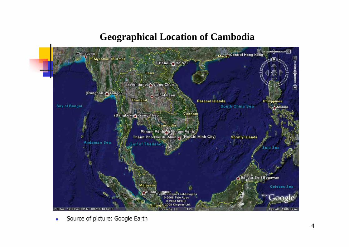
Geographical Location of Cambodia
� Source of picture: Google Earth

5
Cambodia
� Source of picture: Google Earth

6
2- Structure of State Land Management Sub-Decree 118
� State Land Management contains11 Chapters , 33 Articles
- The creation of State Land Management Sub-decree based on the approved in 2004 State Land Management Policy by Council for Land Policy
- State Land Management is a Multi- Sectors approach
- Regulation tool for effectively manage the state land
- By Land Law 2001 State Land has 2 types: State Public Land and State Private Land
� State Land Management Sub-Decree provides activities on:
- Identification Mapping Classification and Registration State Land
- Principle Procedure Mechanism and Institution to manage state land
- Types of State Land: Public State Land and Private State Land
- Duration for Manage State Land
- Planning and Distribution of State Private Land

7
� 3 General Principles for State Land Management:
- Royal Government of Cambodia owns all land that is not under royal property, individual property, individual possession or common property
- All State land should be registered in cadastral registration book
- State land can be distributed for Social Concessions , EconomicConcessions or other proposes only after legal registration .

8
� Public State Land
Public State Land is the State Land that is serving public interest as mentioned below:
1- Properties that created by nature are: Forests , Natural Lakes, Sea Shores, Water ways that allow ships or boats to cross, River banks , Mountains….
2- Property that is created for public use are: Airports, Railway Stations, Railways,
Roads, .. etc
3- Properties that created by nature for public use and improve by the state are:
parks , gardens, roads, tracks, walk ways, …etc
4- Environmental and wildlife protected areas (23 sites in Cambodia about 10 % of
territorial Cambodia) under Royal Degree5- Cultural heritage sites
6- Other land that have characteristic for public use
Types of State Land

9
� Private State Land
1- Not Public State Land
2- Property that is not under ownership or possession of individuals or common
property
3- Not Royal Property
4- Property that individuals or communities voluntarily give to the State
5- Property that can not be identified as legal possession or ownership
Types of State Land

10
4- State Land Identification mapping and classification
� General principle
- State land identification and mapping is a facilitation process with transparency and
participation from all concerned institutions , local authorities and local villagers
- State land identification and mapping needs to start from one village to another in
one commune
- All information related to the State land identification and mapping process is considered as initial data and only after cadastral registration it can be declared as official information.

11
� State land management committee at provincial level (PSLMC) chaired by provincial Governor. Members are: Director of technical departments of line ministries as Land Management Urban Planning , Cadaster and Construction, Agriculture, Forestry, Fishery, Environment, Public work , Cultural, Water resource, Mine and Industry, Rural development….
� District Working Group (DWG), chaired by District Governor and members are the chief technical office at district level, same as at the provincial level.
� Commune chief and village chief are the members of the District Working Group
� Secretariat for State land management committee at provincial level is the administration team to support PSLMC
� Core field team at provincial level to support District Working Group
� Ministry of Land Management , Urban Planning and Construction provides technical support and necessary material like maps and other materials in the process of identification , mapping and classification of state land
� State Land Management Committee at provincial level leads the process of state land identification, mapping and classification
� District Working Group implements the process of state land identification , mapping and classification
� Ministry of land Management, Urban Planning and Construction registers state land based on the classification done by PSLMC.
3- Mechanism of State land Management

12
4- Procedures of the State Land Identification, Mapping, Classification and Registration
Activities to identify mapping and classification by Disrtict Working Group
� Identify and document all evident information on the use and management of state land by government institutions, with the support from provincial and national levels for preparing the identification and mapping of state land in the communes and districts.
� facilitate government institutions that use and manage state land
� Identify approximate boundaries and types of state land that are been used and managed on map
� Public Display of the received information on state land
� Prepare report about the opinion from public to State land management committee at provincial level after public display

13
Identify and document all evident information :- Land Law, Forestry Law, State land management Sub-decree 118, Sub-decree
53 on Permanent classification forest, Prakas 42 of Ministry of Land Management Urban Planning and Construction on the Identification mapping and classification state land ..etc
- Ortho photo maps, Aero-photos (Department of land ), state immovable registration document (Department of Economic and Finance) , papers , transparent paper, colored pencils and makers, GPS, existing commune and village topography maps on scale 1: 100 000 and 1:2000, forms as annex in the sub-decrees.
Facilitate with institutions on the boundary use and manage state land- Provide all information of manage and use of the state land in commune to
members of District working group- Conduct meeting with all member and discus on the approximate boundary on
the use and manage state land from difference institution- Prepare presentation list of the meeting and report of the meeting about the
overlapping boundary of use or manage by deference institution , make on then map these overlapping boundary
- Field visit at the site if necessary for verify the map.- Meetings can be conduct several times for finding consensuses and agreed or
not agreed the boundary of the use or manage the state land by difference institutions
Activities to identify mapping and classification by Disrtict Working Group

14
Public display the initial state land map that had been prepare after meetings by District Working group: The aim of Public display is to provide information about the state land in commune and select claim from villages in the area that also using or possessing this land as they did not know this land belong to state .
- Put Information letter about the public display 30 days of the state land map at district office, technical offices in the district, commune office and other populated public places
- Put the state land map on the state land site and staffs for received claim from villages
- Staffs explain to villagers how to read the map and mark on map the areas that villages claim for use or possessing
- After public display prepare new map with claim from villager and detail report of each claim with clear name , approximately location on map, approximate number of hectare, type of use, document of evident, period of occupation and use this state land
- District working group prepare new map with all information from public display and detail report on claim and suggestion of classification this land as public State land or Private State land or part is Public State land and part is Private state land to State Land management committee at Provincial level to decide for final approval.
Activities to identify mapping and classification by Disrtict Working Group

15
After receiving all documents, maps and detail reports from District working Group , the State land management committee at provincial level starts to call all member for meeting and review the proposed from district working group. The meeting should take early and late then 30 days after receiving report. At the meeting of PSLM district governor present the map document related to the process of identification mapping and proposing for classification of state land. At the meeting chair by provincial governor and for discussion all member will find the solution and interest of using this state land for public use or can be classify to private state land that can be use for other purpose. The meeting will listening on:
- The main objective is to classify State land that suggested by DWG to Public State land or Private State Land or Part for Public State land and part for Private State land
- How many hectares and location on this map are under forest, fishery, mine..and other . The reports from DWG will verify and clarify by each technical department using specific regulation of own ministry for manage and use the state land
- Some time the team from PSLM need to check at the field for moreclarification and also some department need to ask the permission from their lines ministries on the type of state land that they are using or managing so PSLM conducts several meetings on the classification state land
- PSLM seeking consensus from all technical departments and if they are agreed then all members sing on the map and final sign for approval by Governor of province
Activities to classification by State Land Management Committee at provincial level

16
- After PSLM approve the state land management map, they need to send all report and map to Ministry of land management urban planning andconstruction for cadastral registration
- If PSLM can not find the consensus on the state land classification at Provincial level , they should send all report to Council for land policy (CLP). Council for land Policy chair by H.E Senior Minister, Minister of Land management urban planning and construction. Council of land policy has General Secretariat located in the ministry of land management urban planning and construction.
- If Council for land policy can not find the consensus then they send to Government for final decision.
Cadastral registration of state land: after state land had been classified then Ministry of land management urban planning and construction register this land by using more accurate survey equipment such as total station and highly accurate GPS. The cadastral registration of state land procedures are mention in the sub-decree 46 and 48 on systematic and sporadic land registration. State land that had been done cadastral registration can be use in Social land concession, economic land concession and other purposes.
Activities on classification by State Land Management Committee at provincial level

5- Result from the use of Registered State private Land for Land Allocation for Social and Economic Development (LASED) Project
Follow this sub-Decree on State land management 2 site in 2 provinces had been registered as state private land and use for Land allocation for Social and Economic development. Project aim to distribute state private land to poor landless and land poor families, who is need land for residential and agriculture purpose. Together with providing land LASED Project also support to those land recipients families basic rural development services, infrastructures, drinking water, Education, health service, Market opportunity, and supporting packaged in the first year.
Duration of LASED Project: 5 years, start from 2009 to 2013Development Partner for LASED Project: The World Bank and GTZImplementing agencies: Ministry of Land Management urban Planning and
Construction and Ministry of InteriorFirst site in Kratie province about 4000 hectares had been Title as state private land
owned by Governor of the Province representative for State and distribute this land for poor landless and land poor families in this area. (Picture 1)
Second site in Kompongcham province about 870 hectares (Picture 2)

Picture 1:Kratie province about 4000 hectares
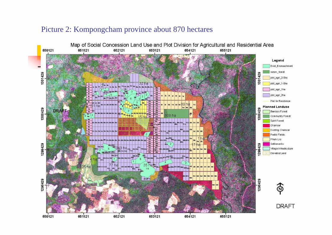
Picture 2: Kompongcham province about 870 hectares

THANK YOU FOR YOUR ATTENTION