field inspection report - blm.gov...field inspection report . dates of inspection june 25-27, 2013 ....
TRANSCRIPT

FEDERAL ENERGY REGULATORY COMMISSION FIELD INSPECTION REPORT
Dates of Inspection June 25-27, 2013 Project Ruby Pipeline, L.L.C.
Ruby Pipeline Project Wyoming, Utah, Nevada, and Oregon Docket No.: CP09-54-000 Authority: Section 7(c)
Personnel FERC Project Manager: Dave Swearingen
FERC Contractor: N/A FERC Contractor Staff: N/A Company Staff: Mike Bonar and Steve Bacon
Inspection Summary
3 Problem Area(s)
0 Noncompliance(s)
No Follow-Up Letter Required
No Refer to Enforcement
Introduction Construction of the Ruby Pipeline Project was from July 2010 to July 2011, with in-service being granted on July 27, 2011. Previous post-in-service restoration inspections were conducted in October 2011 and June 2012. The October 2011 and June 2012 air and ground inspections found that restoration and reclamation were proceeding satisfactorily, albeit very slowly in many places, resulting in much of the right-of-way being essentially bare. Overall, stability was good, though subsidence and sinkholes were evident in certain areas. Minor issues regarding trash, erosion, missing water bars, and weeds were noted.
1

2013 Inspection On June 25-26, 2013, I conducted an air inspection of the Ruby Pipeline Project. This inspection specifically targeted the state of right-of-way stability and restoration (e.g., status of seeding, revegetation, and presence of erosion). One June 27, I conducted a ground inspection of the Gladwill property (approximate milepost [MP] 578). This tract has been the subject of numerous construction and restoration complaints by the landowner. Ruby reports that certain issues and damage claims continue to be litigated and/or mediated. See section Gladwill Tract, below in the Nevada discussion. The air inspection was conducted via helicopter overflight of the entire route. All mileposts are approximate. Note that because of re-routes and variances, the mileposting for the “as built” pipeline varies up to 4 miles from previous designations, mostly in the western half of the project. Thus, certain ground features have somewhat different location designations compared to previous environmental analyses and inspection reports. Photos and descriptions are attached, as is a copy of the corrective action sheet for the inspection. A project site map is also attached. June 25: The inspection (helicopter) started at 9:20 AM. The morning was partly cloudy and mild, turning to sunny and warm in the afternoon. The inspection covered MPs 0-333 (Wyoming, Utah, and eastern Nevada). June 26: The inspection of the remaining part of the route, covering central/western Nevada and Oregon (MPs 333-680), was conducted via helicopter. The day was mostly sunny and hot, with fairly strong wind picking up in the afternoon. June 27: I conducted a ground inspection of the Gladwill property starting at 10:20 AM. The weather was sunny and warm. Ruby reported that Mrs. Gladwill had been contacted on a couple of occasions to inform her of my upcoming inspection and that she would meet us on the property. However, she apparently was called away for an emergency circumstance and was unable to participate in the inspection. The accompanying photo documentation shows examples of generally satisfactory right-of-way restoration, including rangeland, mountain passes and ridges, pasture and agricultural areas, wetlands, and waterbody crossings. Project-wide, agricultural and wetland areas looked very good. Waterbody crossings, including several that had been problematic during construction, looked good, with good revegetation and slope stability. Non-desirable vegetation, especially cheatgrass, was present on the right-of-way along portions of the route in Nevada; however, there was quite a bit less than seen in previous inspections (adjacent and nearby off-right-of-way land showed similar cheatgrass composition). Some of the Dyer’s woad identified as a Problem Area in the 2012
2

inspection was still present in Utah; but this too was much less prevalent this year. An early successional species, presumably yarrow, was seen sporadically in Utah. The main concern identified is the slow revegetation in many areas. This is considered a project-wide Problem Area (specific locations are discussed below). Aside from slow revegetation progress, the only other issues documented as Problem Areas were 1) a few isolated instances of subsidence and sinkholes seen at various locations over the length of the project, and 2) some downed and/or non-functional silt fence and erosion fabric that needed to be removed from the right-of-way. Photos and discussion of these Problem Areas are contained within the state-by-state inspection report, below. Wyoming The U.S. Bureau of Land Management (BLM) manages about 40 percent of the land crossed in Wyoming. The route is primarily open rangeland, with flat areas in the eastern portion (about MPs 0-30) trending towards hills and ridges in the west (MPs 30-47). The easternmost part of the route was essentially bare (photos 1-4), considered a Problem Area. Some patchy greening was present starting about MP 30 (photos 5-8). Ruby reported that two large sinkholes seen last year at MP 41.3 had been filled; however, subsidence is still an issue at this location (photo 9). There was little to no evidence that sagebrush plantings had resulted in reestablishing sagebrush on the right-of-way. Utah About 25 percent of the route in Utah crosses BLM land, mostly in the western portion of the state. The State of Utah owns a tract in the Bear River Valley as well as some of the land to the west. Much of the mountainous area is private land, with a small amount (about 1.2 miles) of U.S. Forest Service (USFS) land crossed as well. Bare areas were interspersed through much of the state, with the westernmost portion (MPs 197-232) exhibiting little to no greening, considered a Problem Area. The route through Utah crosses the widest variety of land use and terrain types. Wetlands, large waterbodies, mountains and canyons, agricultural land, and open rangeland are all traversed. The right-of-way showed good revegetation in some areas, particularly in the east and in the higher elevations (photos 10-13) but bare areas and patches were common in many areas, and predominant in the westernmost portion of the state (photos 14-25). Side slopes appeared stable (photos 26 and 27). An area reported for subsidence last year (MP 75.1) was still exhibiting a problem (photo 28). Some new areas of subsidence and sinkholes were noted as well at MPs 59 and 62 (not pictured) and MPs 149.5 and 157.9 (photos 29-30). The State property in the Bear River Valley looked good (photos 31-32) as did some of the nearby slopes (photos 33-35).
3

4
The nuisance weed Dyer’s woad was present at various locations on the right-of-way (photo 36), but not nearly as much as seen in the 2012 inspection. This species is also present in off right-of-way areas. Ruby reports that it is continuing eradication/control strategies, which appear to be mostly effective. Another species, tentatively identified as yarrow, was also noted (photos 37 and 38). This plant was not obviously present off right-of-way, but it is known as an early colonizer of disturbed areas. Ruby will monitor and consider eradication strategies if succession does not result in natural transition to other species. The Brigham City Bench (MPs 106-109; photos 39-41) and the nearby large wetland flat area (MPs 110-115; photos 42-45) looked good stability-wise, although portions still showed bare spots. Nevada A majority of the route in Nevada (over 67 percent) is managed by the BLM. The remainder is private land. Land use is generally open rangeland, much of it used for ranching. Some crop agriculture is present. The terrain gradually trends more towards hills and ridges as it progresses to the west. Photos 46-61 depict typical restoration and include examples of upland, wetland, and channel/waterbody crossings. The major Problem Area for Nevada was the lack of revegetation in many areas, especially Washoe County in the western portion of the state (photos 62-65). Cheatgrass was seen sporadically, especially between MPs 394-409 and certain specific locations west (photos 66-67). Several areas of sinkholes and subsidence were observed, especially in about a 4-mile stretch east of the Weiland Flat Compressor Station (between about MPs 329-333 [no photos]). There was little evidence that sagebrush plantings had resulted in reestablishing sagebrush on the right-of-way. The Gladwill tract is discussed below. It was one of the only tracts in Washoe County that showed any sort of revegetation that could be considered acceptable. The steep crossing at Twelve-Mile Creek was a major undertaking; the inspection confirmed that the slopes were stabilized and that restoration was proceeding satisfactorily (photos 68-70). There were some locations that still had silt fence present; for example, MP 320.5 (no photo) and various other waterbody or slope crossings. In some cases erosion control fabric and matting was strewn about or ripped. I instructed Ruby to assess each location and if the silt fence or fabric/matting was necessary, to reinforce it. If it was not necessary, then it should be considered debris and removed, as long as if doing so would not further compromise the stability of the location.

Gladwill Tract (approximate MP 578 in Washoe County, NV) Mrs. Gladwill has written numerous letters that are in the public record documenting various complaints on how the project was constructed and restored. Some of these issues are currently in either litigation or mediation. Among specific issues raised are the following:
• loss of topsoil • damage to a spring • too much heavy equipment using the right-of-way crossing her property • filter bags and debris left on and off right-of-way • gates left open, causing escape and harm of cattle and horses • improper recontouring of channels • inadequate revegetation • insufficient FERC inspection and monitoring
Damages and monetary compensation are outside the scope of this inspection and report. A check of the monitoring records (during construction) show over 100 FERC monitoring reports that cover the general area of the Gladwill tract, with about 10 or so that specifically mention the ongoing construction on the Gladwill property. The 2012 inspection, conducted from the air (helicopter overflight about 150-180 feet off the ground), did not note any obvious issues with restoration; thus, an on-the-ground component was added for this year’s inspection. The photos from the air (photos 71-73) show that the tract has been reseeded and that vegetation has progressed. The steep slope on the west side of the property is stable, with more revegetation seen on the upper portions. The Gladwill tract extends some ways into the flat area above the rim of the slope; this portion is stable but with little to no revegetation. The ground inspection allowed a closer look at the reseeding, where water channels cross the right-of-way, and other locations where recent additional restoration work has been done by Ruby. Photos 74-77 depict revegetation that appears successful. Certainly, the Gladwill property is the best-looking tract crossed by the project in all of Washoe County when it comes to revegetation. Photos 78 and 79 show bare patches where Ruby performed recent work fixing sinkholes and subsidence and retrieving old mats in an effort to address Mrs. Gladwill’s complaint. Photo 80 depicts a location where Ruby filled in a diagonal ditch that was channeling water down the right-of-way, leading to erosion. Ruby reports that Mrs. Gladwill was consulted and agreed this was a proper remedy.
5

Ruby states that it has brought in numerous trucks of topsoil in an effort to replace lost soil and fill in low spots. Ruby reports it will reseed these locations. This appears satisfactory. However, I have instructed Ruby to compare topsoil and compaction readings on and off right-of-way to ensure soil conditions are comparable to the surrounding area. Photos 81-84 show where channels have been recently reinforced with earthen berms. Ruby reports that project engineers designed the berms in consultation with Mrs. Gladwill for the purpose of ensuring proper drainage of water off the right-of-way. The berms appeared to be quite high, which may or may not be satisfactory to Mrs. Gladwill. There was no evidence of any remaining debris, mats, silt bags, etc. on or off the right-of-way, except for a small stack of mats/timbers Ruby left for the landowner upon her request (photo 85). Photo 86 shows debris recently collected by Ruby from the right-of-way. Despite what may have happened during construction (which did have its share of weather- and water-related challenges) the right-of-way across the Gladwill property at this time appears stable, with revegetation proceeding satisfactorily. Ruby should continue to ensure that any continuing soil, seeding, and stabilization issues are in compliance with FERC standards. Oregon About 20 percent of the route in Oregon crosses USFS land, with an additional 16 percent crossing land managed by the BLM and the U.S. Bureau of Reclamation. The remainder of the route crosses private land. Much of the terrain is forested, with the exception of the flat, wet areas near Goose Lake. Some open rangeland is present in the easternmost portion. Photos 87-104 depict typical restoration and include examples of rangeland, forest, ridges and slopes, wetlands, and waterbody crossings. Much of the right-of-way was left with rock and/or slash at the request of the various agencies. Ruby is attempting the seedling planting program in Oregon (which was also implemented in Wyoming, Utah, and Nevada using sagebrush), but is using bitterbrush and mountain mahogany rather than sagebrush. It is too early to tell whether or not this planting effort in Oregon will be successful. The Malin Lateral at the westernmost end of the route has been restored satisfactorily (photos 105 and 106).
6

Conclusions and Recommendations Right-of-way stability was satisfactory, with the exception of the instances of subsidence and the lack of revegetation noted above. Many areas of the right-of-way were essentially bare, especially in drier climates and at the tops of slopes in rugged terrain where little topsoil existed prior to construction. Much of this is related to precipitation patterns. Grazing pressures are also likely playing a role in the lack of vegetation. Ruby states that it will address the segments with subsidence and continue seeding, including eradication/control of the various weeds and other undesirable vegetation. Ruby will also continue to work with Mrs. Gladwill to address issues with her property, and will respond to the Problem Areas identified in this report in a follow-up report. No further follow-up inspections are recommended at this time.
7

1-3
Fig
ure 1
-1
Pro
ject Lo
cation
Map
1-2
1
-2
1-3

Photo documentation: Wyoming 1-4) Bare right-of-way in eastern Wyoming 1) MP 0
2) MP 6.1
9

3) MP 12.3; starting to see some revegetation
4) MP 19.6; with restored crossing of Little Muddy Creek
10

5-8) Western Wyoming exhibits more greening of ROW in higher elevations, though patchiness is common
5) MP 30.5
6) MP 37
11

7) MP 40; downslope is greener than ridge top
8) MP 47; greening is more uniform
12

9) MP 41.3; subsidence issues remain at this location
Photo documentation: Utah 10-13) Some areas in the eastern part of the state show good revegetation. 10) MP 50
13

11) MP 53
12) MP 66
14

13) MP 89
14-25) Some of the Utah route exhibited patchy revegetation or bare areas. The further West, the more chance for bare right-of-way. 14) MP 55.5; transition between irrigated agricultural area and bare right-of-way
15

15) MP 60.5
16) MP 85.2
16

17) MP 98.2
18) MP 99
17

19) MP 153.2
20) MP 158.2
18

21) MP 172.5; approaching the Wildcat Hills Compressor Station
22) MP 186
19

23) MP 194
24) MP 196
20

25) MP 231
26-27) Side slopes were stable; revegetation sporadic 26) MP 64
21

27) MP 88.5
28) MP 75.1; subsidence issue from 2012 persists
22

29-30) New subsidence issues documented 29) MP 149.5
30) MP 157.9
23

31-32) State of Utah property in the Bear River Valley 31) MP 92; Lime Kiln Spring
32) MP 92.5
24

33-35) Various slopes and waterbodies in the general area north of Brigham City 33) MP 93.5; La Plata Hill
34) MP 99.5
25

35) MP 105
36) MP 104; Dyer’s woad
26

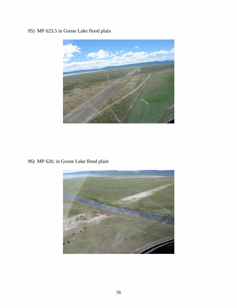
37-38) yarrow (?) 37) MP 104.5
38) MP 140.7
27

39-41) Brigham City Bench 39) MP 106
40) MP 107
28

41) MP 108
42-45) large wetland flat area west of the Bench 42) MP 109
29

43) MP 112.5
44) MP 113
30

45) MP 119
Photo documentation: Nevada 46-61) Typical examples of the right-of-way across Nevada 46) MP 234
31

47) MP 243; one of the few Nevada tracts in active agriculture
48) MP 248
32

49) MP 283.5; more revegetation here
50) MP 286.2
33

51) MP 303; Marys River
52) MP 313; grazing
34

53) MP 332; wetland
54) MP 334
35

55) MP 346.5
56) MP 409
36

57) MP 426
58) MP 465.3; little revegetation
37

59) MP 484.4; bare right-of-way around the Desert Valley Compressor Station
60) MP 494.5; transition from bare to green
38

61) MP 519.7; revegetation on ridgetop
62-65) lack of sufficient revegetation in Washoe County, NV 62) MP 534
39

63) MP 542
64) MP 547
40

65) MP 568.7; with a green patch
66-67) Cheatgrass is present in certain areas, both on and off right-of-way 66) MP 395.7
41

67) MP 444
68-70) MP 595; Twelve-Mile Creek; slopes remain stabilized 68)
42

69)
70)
43

71-86) Gladwill tract 71) vegetation prevalent across the flat part of the tract
72) lower slope stabilized; better revegetation on upper portion
44

73) flat portion above slope
74) lower slope stabilized; better revegetation on upper portion
45

75) seeded area revegetating
76) seeded area revegetating
46

77) seeded area revegetating
78) bare patch where recent work was done to repair subsidence and remove debris
47

79) recent repair of low spot/erosion area
80) recent fill in of ditch
48

81) channel and earthern berm 1
82) channel and earthern berm 2
49

83) channel and earthern berm 3
84) channel and earthern berm 4
50

85) Mats/timbers left at the request of the landowner
86) Debris collected by Ruby from the right-of-way
51

Photo documentation: Oregon 87-106) Typical examples of the right-of-way across Oregon 87) MP 597
88) MP 604
52

89) MP 607.7; Deep Creek
90) MP 608.5; USFS land
53

91) MP 613
92) MP 617
54

93) MP 620; agricultural area approaching Goose Lake
94) MP 621; Garrett Marsh
55
95) MP 623.5 in Goose Lake flood plain
96) MP 626; in Goose Lake flood plain
56

97) MP 634; exiting Goose Lake floodplain
98) MP 637.2; Oregon sunshine (desirable native)
57

99) MP 651; USFS land
100) MP 652.5; USFS land
58

101) MP 667; rock walls at creek crossing
102) MP 672.2; Lost River Reservoir
59

103) MP 673.5; rock walls on slope
104) MP 678.2; steep slope
60

105-106) Malin Lateral 105) Malin Lateral 1
106) Malin Lateral 2
61