farm for sales3.amazonaws.com/loa.data/inv/3461945/kuhn bayou...farm for sale in the arkansas river...
TRANSCRIPT
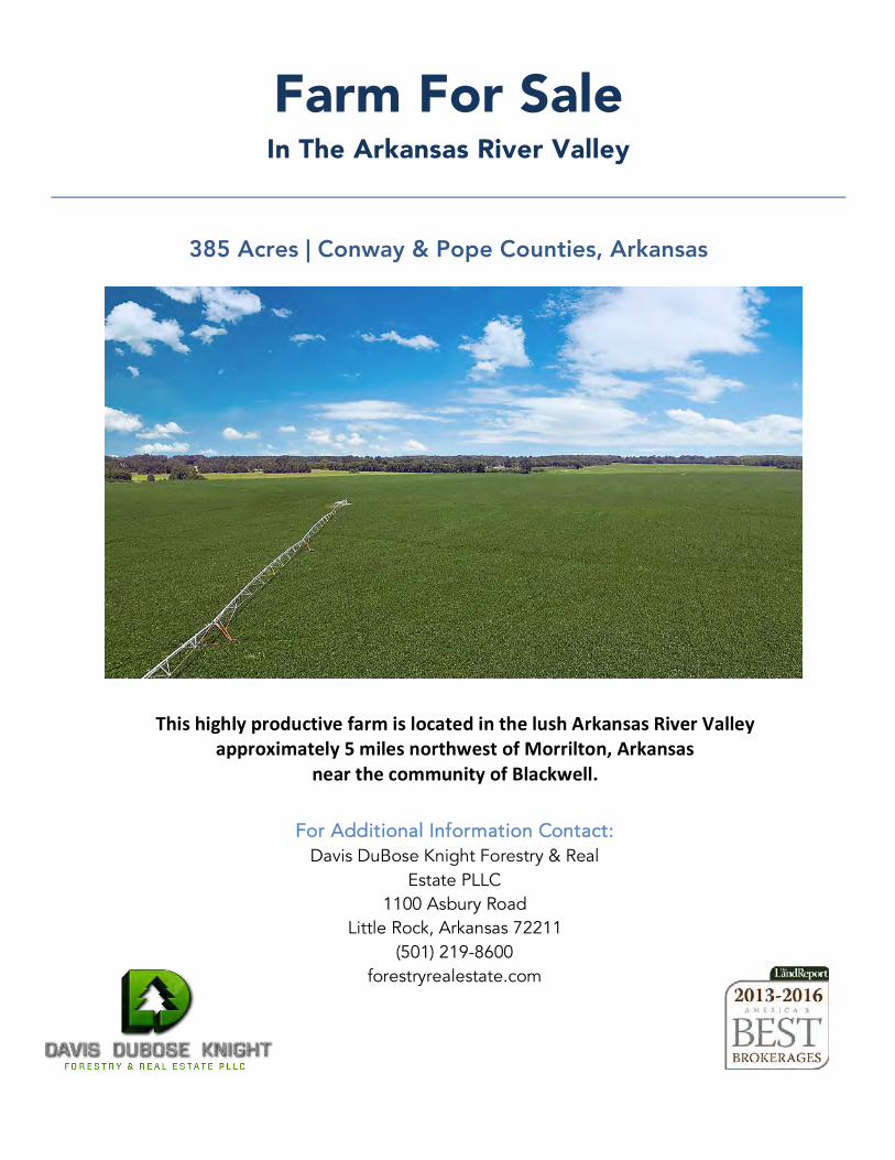
Farm For Sale In The Arkansas River Valley
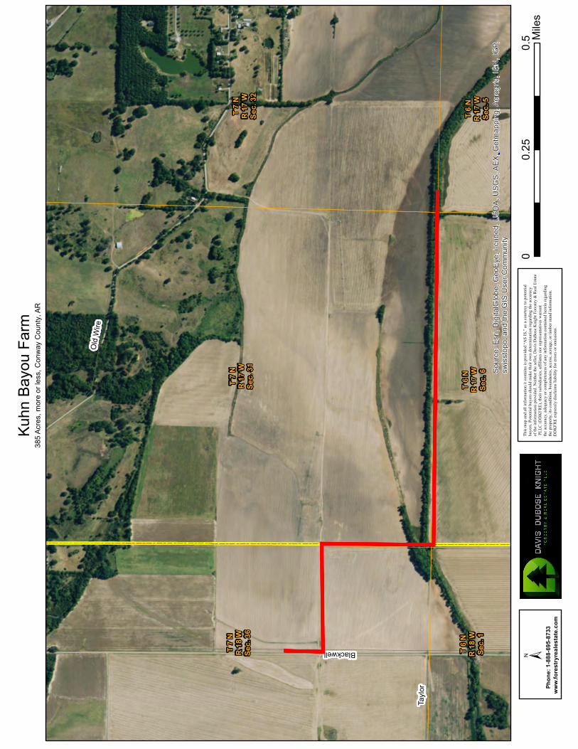
385 Acres | Conway & Pope Counties, Arkansas
For Additional Information Contact: Davis DuBose Knight Forestry & Real
Estate PLLC 1100 Asbury Road
Little Rock, Arkansas 72211 (501) 219-8600
forestryrealestate.com
ThishighlyproductivefarmislocatedinthelushArkansasRiverValleyapproximately5milesnorthwestofMorrilton,Arkansas
nearthecommunityofBlackwell.
2
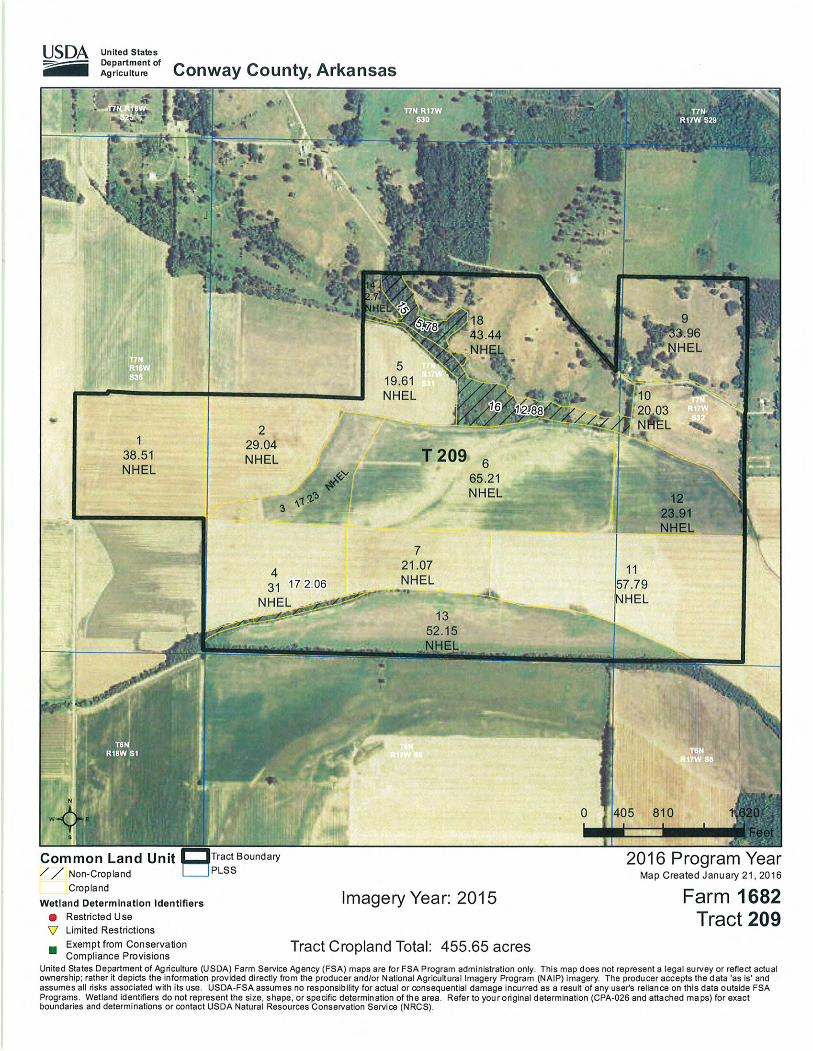
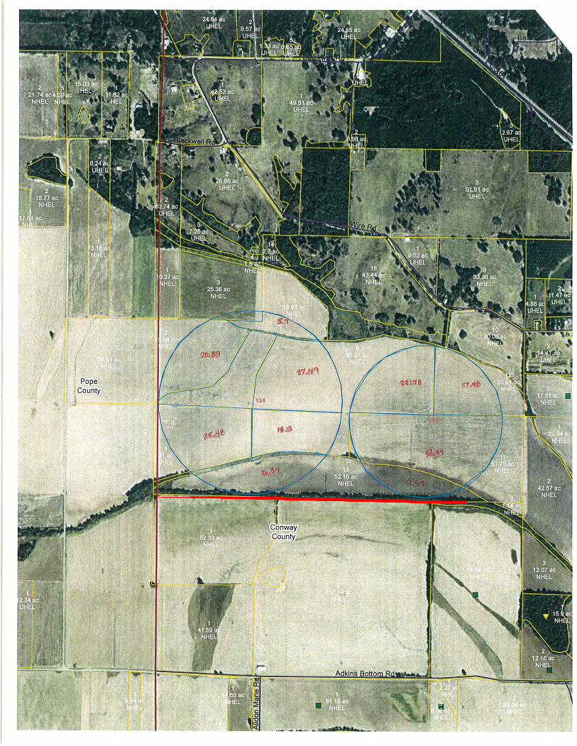
Kuhn Bayou Farm Summary
Summary: The Kuhn Bayou Farm is one contiguous parcel totaling 385 acres, more or less. This highly productive farm is located in the lush Arkansas River Valley approximately 5 miles northwest of Morrilton, Arkansas near the community of Blackwell. The property lies within the Point Remove Irrigation District, and Kuhn Bayou crosses the property along the southern boundary. Of the 355 tillable acres, approximately 283 acres are irrigated (243 acres with pivot and 40 acres furrow). The remaining acreage consists of 20 acres of pasture (partiallyfenced), 7 acres of timber, and 3 acres of roads and ditches.
Google Map https://goo.gl/9Hs07WLink:
Improvements: The irrigation system consists of two irrigation wells, two center pivots, and threepower units. The irrigation system is three years old. Two older barns are also located on the property.
Lease: Current lease is 75/25 crop share and runs through the 2023 crop year. Owner pays 25% of fertilizer, fungicide or insecticide costs as needed. Owner pays 25% of fuel costs associated with the center pivots only. Operator pays $16,930.20/year for two center pivots, two wells, and three power units. Owner retains ownership of pivots, wells and power units upon termination of lease.
The information provided herein is supplied as a courtesy to potential buyers and is in no way warranted or guaranteed. Neither the seller, Davis DuBose Knight Forestry & Real Estate PLLC (DDKFRE), their subsidiaries, affiliates nor representatives warrant the accuracy or completeness of the information contained herein. No representations or warranties are expressed or implied as to the property, its condition, boundaries, access, or acreage.
Mileage Chart:
Morrilton, AR………………..…7 Miles
Conway, AR…………………...27 Miles
Little Rock, AR…………….....58 Miles
Russellville, AR…………….…18 Miles
3
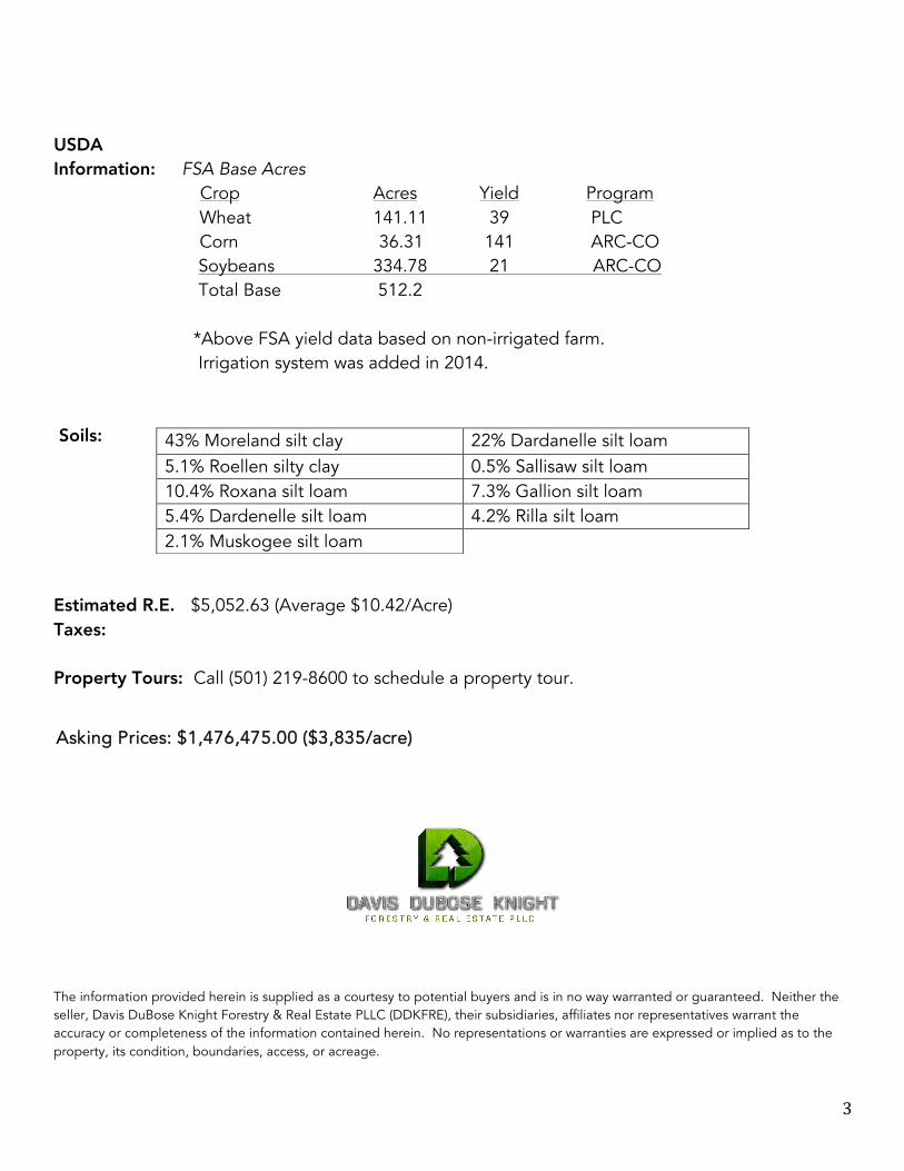
USDA Information: FSA Base Acres
Crop Acres Yield Program Wheat 141.11 39 PLC
Corn 36.31 141 ARC-CO Soybeans 334.78 21 ARC-CO Total Base 512.2 *Above FSA yield data based on non-irrigated farm. Irrigation system was added in 2014.
Soils: Estimated R.E. $5,052.63 (Average $10.42/Acre) Taxes: Property Tours: Call (501) 219-8600 to schedule a property tour.
The information provided herein is supplied as a courtesy to potential buyers and is in no way warranted or guaranteed. Neither the seller, Davis DuBose Knight Forestry & Real Estate PLLC (DDKFRE), their subsidiaries, affiliates nor representatives warrant the accuracy or completeness of the information contained herein. No representations or warranties are expressed or implied as to the property, its condition, boundaries, access, or acreage.
43% Moreland silt clay 22% Dardanelle silt loam 5.1% Roellen silty clay 0.5% Sallisaw silt loam 10.4% Roxana silt loam 7.3% Gallion silt loam 5.4% Dardenelle silt loam 4.2% Rilla silt loam 2.1% Muskogee silt loam
Asking Prices: $1,476,475.00 ($3,835/acre)
Little
Roc
k
Conw
ay
Cabo
t
Beeb
e
North
Littl
e Roc
k
Sher
wood
Jack
sonv
illeMa
umell
eSo
uth B
end
Vilon
ia
Atkin
s
Morri
lton
Ward
Holla
nd
Gree
nbrie
r
Lono
ke
Perry
ville
Oppe
lo
Mayfl
ower
Woos
ter
Menif
ee
Little
Roc
k Air F
orce
Bas
e
Enola
Austi
nAu
stin
Rose
Bud
Adon
a
Guy
Hous
ton
Twin
Grov
es
Perry
Bige
low
Plume
rville
Moun
t Vern
on
Four
che
Camm
ack V
illage
Guy
UV285
UV225
UV124
UV10
UV236
UV107
UV95 UV60
UV305
UV89UV30
0UV9
UV36
UV92
UV287
UV247
UV105
UV154
UV319
UV31
UV298
UV213
UV324
UV321
UV113
UV365
UV15
UV155
UV310
UV5
UV286
UV391
UV216
UV38
UV294
UV367
UV25 UV100
UV161
UV363
UV267
UV176
UV266
UV89
UV100
UV285
UV89
UV247
UV247
UV95
UV155
UV319
UV10
UV60
UV300
UV31
UV113
UV300
UV89UV31
9
UV324
UV287
UV324
UV287
UV113
UV365
£ ¤64
£ ¤70
£ ¤67
£ ¤65
£ ¤165
§̈ ¦40
§̈ ¦430
§̈ ¦30
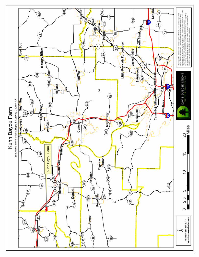
Kuhn
Bayo
u Farm
385 A
cres,
more
or les
s, Po
pe &
Conw
ay C
ounty
, AR
Kuhn
Bayo
u Farm
±ww
w.fo
restry
reale
state.
com
Phon
e: 1-8
88-69
5-873
3±
This
map a
nd al
l infor
matio
n it c
ontai
ns is
provid
ed “A
S IS,”
as a
court
esy to
poten
tial
buye
rs. Po
tentia
l buy
ers sh
ould
make
their
own d
eterm
inatio
n reg
arding
the a
ccurac
y of
the in
forma
tion p
rovide
d. Ne
ither
the se
ller, D
avis
DuBo
se Kn
ight F
orestr
y & Re
al Es
tate
PLLC
(DDK
FRE)
, their
subsi
diarie
s, affi
liates
nor r
epres
entat
ives w
arran
t the
accu
racy,
adeq
uacy
or co
mplet
eness
of an
y info
rmati
on co
ntaine
d here
in reg
arding
the
prop
erty,
its co
nditio
n, bo
unda
ries, a
ccess,
acrea
ge, o
r timb
er sta
nd in
forma
tion.
DDKF
RE ex
pressl
y disc
laims
liabil
ity fo
r erro
rs or
omiss
ions.
05
1015
202.5
Miles
2
T 7 N
R 17
WSe
c. 31
T 7 N
R 17
WSe
c. 32
T 7 N
R 18
WSe
c. 36
T 6 N
R 17
WSe
c. 6
T 6 N
R 18
WSe
c. 1
T 6 N
R 17
WSe
c. 5
Old W
ireBlackwell
Taylo
r
Sourc
e: Es
ri, Dig
italG
lobe,
GeoE
ye, i-
cube
d, US
DA, U
SGS,
AEX,
Getm
appin
g, Ae
rogrid
, IGN,
IGP,
swiss
topo,
and t
he G
IS U
ser C
ommu
nity
www.
fores
tryrea
lestat
e.com
Phon
e: 1-8
88-69
5-873
3
This
map a
nd al
l infor
matio
n it c
ontai
ns is
prov
ided “
AS IS
,” as
a cou
rtesy
to po
tentia
l bu
yers.
Poten
tial b
uyers
shou
ld ma
ke th
eir ow
n dete
rmina
tion r
egard
ing th
e accu
racy
of the
infor
matio
n prov
ided.
Neith
er the
selle
r, Dav
is Du
Bose
Knigh
t Fore
stry &
Real
Estat
e PL
LC (D
DKFR
E), th
eir su
bsidia
ries, a
ffilia
tes no
r rep
resen
tative
s warr
ant
the ac
curac
y, ad
equa
cy or
comp
leten
ess of
any i
nform
ation
conta
ined h
erein
regard
ing
the pr
opert
y, its
cond
ition,
boun
darie
s, acc
ess, a
creag
e, or
timbe
r stan
d info
rmati
on.
DDKF
RE ex
pressl
y disc
laims
liabil
ity fo
r erro
rs or
omiss
ions.
±
Kuhn
Bayo
u Farm
385 A
cres,
more
or les
s, Co
nway
Cou
nty, A
R
00.5
0.25
Miles

T 7 N
R 17
WSe
c. 31
T 7 N
R 17
WSe
c. 32
T 7 N
R 18
WSe
c. 36
T 6 N
R 17
WSe
c. 6
T 6 N
R 18
WSe
c. 1
T 6 N
R 17
WSe
c. 5
Old W
ireBlackwell
Taylo
r
Copy
right:
© 20
13 N
ation
al Ge
ograp
hic So
ciety,
i-cub
ed
www.
fores
tryrea
lestat
e.com
Phon
e: 1-8
88-69
5-873
3
This
map a
nd al
l infor
matio
n it c
ontai
ns is
prov
ided “
AS IS
,” as
a cou
rtesy
to po
tentia
l bu
yers.
Poten
tial b
uyers
shou
ld ma
ke th
eir ow
n dete
rmina
tion r
egard
ing th
e accu
racy
of the
infor
matio
n prov
ided.
Neith
er the
selle
r, Dav
is Du
Bose
Knigh
t Fore
stry &
Real
Estat
e PL
LC (D
DKFR
E), th
eir su
bsidia
ries, a
ffilia
tes no
r rep
resen
tative
s warr
ant
the ac
curac
y, ad
equa
cy or
comp
leten
ess of
any i
nform
ation
conta
ined h
erein
regard
ing
the pr
opert
y, its
cond
ition,
boun
darie
s, acc
ess, a
creag
e, or
timbe
r stan
d info
rmati
on.
DDKF
RE ex
pressl
y disc
laims
liabil
ity fo
r erro
rs or
omiss
ions.
±
Kuhn
Bayo
u Farm
385 A
cres,
more
or les
s, Co
nway
Cou
nty, A
R
00.5
0.25
Miles
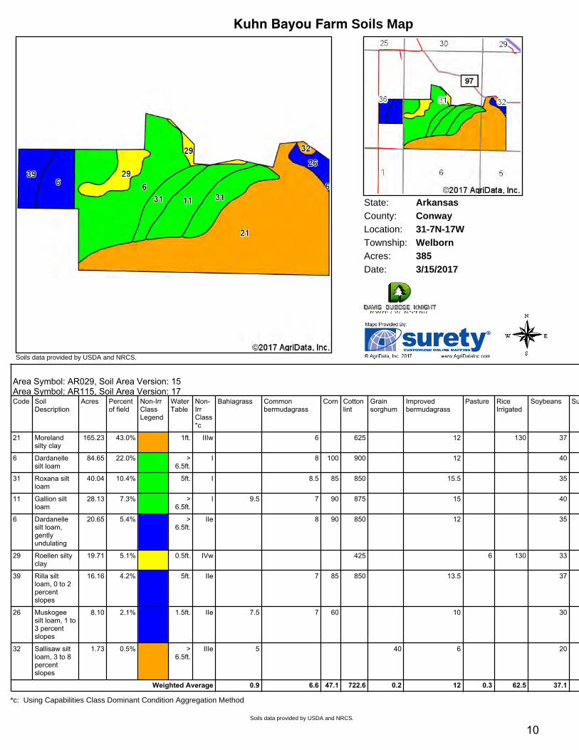
State: ArkansasConwayCounty:31-7N-17WLocation:
Township: WelbornAcres: 385Date: 3/15/2017
Soils data provided by USDA and NRCS.
Kuhn Bayou Farm Soils Map
Area Symbol: AR029, Soil Area Version: 15Area Symbol: AR115, Soil Area Version: 17Area Symbol: AR029, Soil Area Version: 15Area Symbol: AR115, Soil Area Version: 17Code Soil
DescriptionAcres Percent
of fieldNonIrrClassLegend
WaterTable
NonIrrClass*c
Bahiagrass Commonbermudagrass
Corn Cottonlint
Grainsorghum
Improvedbermudagrass
Pasture RiceIrrigated
Soybeans Sugarcane Tallfescue
Wheat
21 Morelandsilty clay
165.23 43.0% 1ft. IIIw 6 625 12 130 37 8.5
6 Dardanellesilt loam
84.65 22.0% >6.5ft.
I 8 100 900 12 40
31 Roxana siltloam
40.04 10.4% 5ft. I 8.5 85 850 15.5 35
11 Gallion siltloam
28.13 7.3% >6.5ft.
I 9.5 7 90 875 15 40 33
6 Dardanellesilt loam,gentlyundulating
20.65 5.4% >6.5ft.
IIe 8 90 850 12 35
29 Roellen siltyclay
19.71 5.1% 0.5ft. IVw 425 6 130 33
39 Rilla siltloam, 0 to 2percentslopes
16.16 4.2% 5ft. IIe 7 85 850 13.5 37
26 Muskogeesilt loam, 1 to3 percentslopes
8.10 2.1% 1.5ft. IIe 7.5 7 60 10 30 6.5 35
32 Sallisaw siltloam, 3 to 8percentslopes
1.73 0.5% >6.5ft.
IIIe 5 40 6 20 4.5 25
Weighted Average 0.9 6.6 47.1 722.6 0.2 12 0.3 62.5 37.1 2.4 3.8 0.9
*c: Using Capabilities Class Dominant Condition Aggregation Method
Soils data provided by USDA and NRCS.
10
11
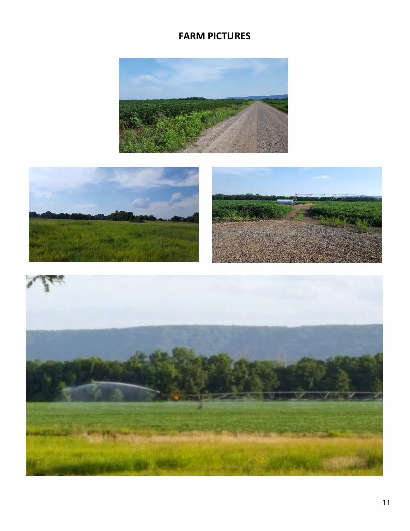
FARMPICTURES