ezsurvtm gnss post-processing software
TRANSCRIPT

1
EZSurvTM
GNSS Post-Processing SoftwareOctober 10th 2012
2012 - Training documents

2
What is EZSurv™?
•Designed to get the best accuracy out of a GNSS equipment in post-mission
• Translates raw GNSS observations (GPS&Glonass) into precisepositions (in static or kinematic mode, for all type of receivers)
•Used to deliver highly accurate positions for geodetic network
•Used as an offline RTK solutions
•Used as Quality Control tool for your RTK jobs

2. In Static mode: to perform sub-centimeter geodetic survey.
3. To perform QC on your RTK results.4. When a specific legislation requires post-mission positions.
1. In kinematic mode: to fill RTK failures
to secure centimeter accuracy when there is no RTKinfrastructure
to significantly improve single frequency receiveraccuracy (for GIS and/or survey).
Why do we need EZSurv™?

Is it complicated to use EZSurv?
• In the old days you needed a PhD to operate a Post-Processing Software
• Today, most of complexities (geodetic concepts) are well embedded intoEZSurv Post-Processing Software

What does EZSurv™ do ?
Static differential positioning
•When the remote data is a static file, EZSurv™computes 3 baseline components (static, rapid static)
So it could be used as abaseline processor
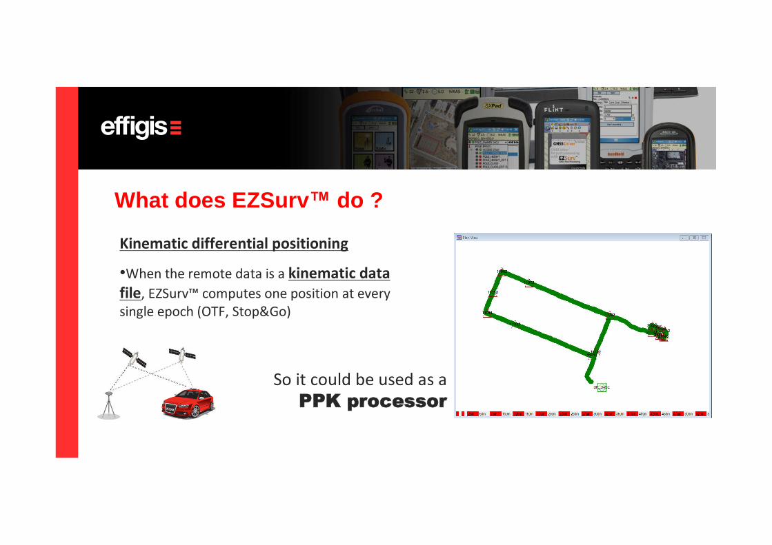
Kinematic differential positioning
•When the remote data is a kinematic datafile, EZSurv™computes one position at everysingle epoch (OTF, Stop&Go)
What does EZSurv™ do ?
So it could be used as aPPK processor
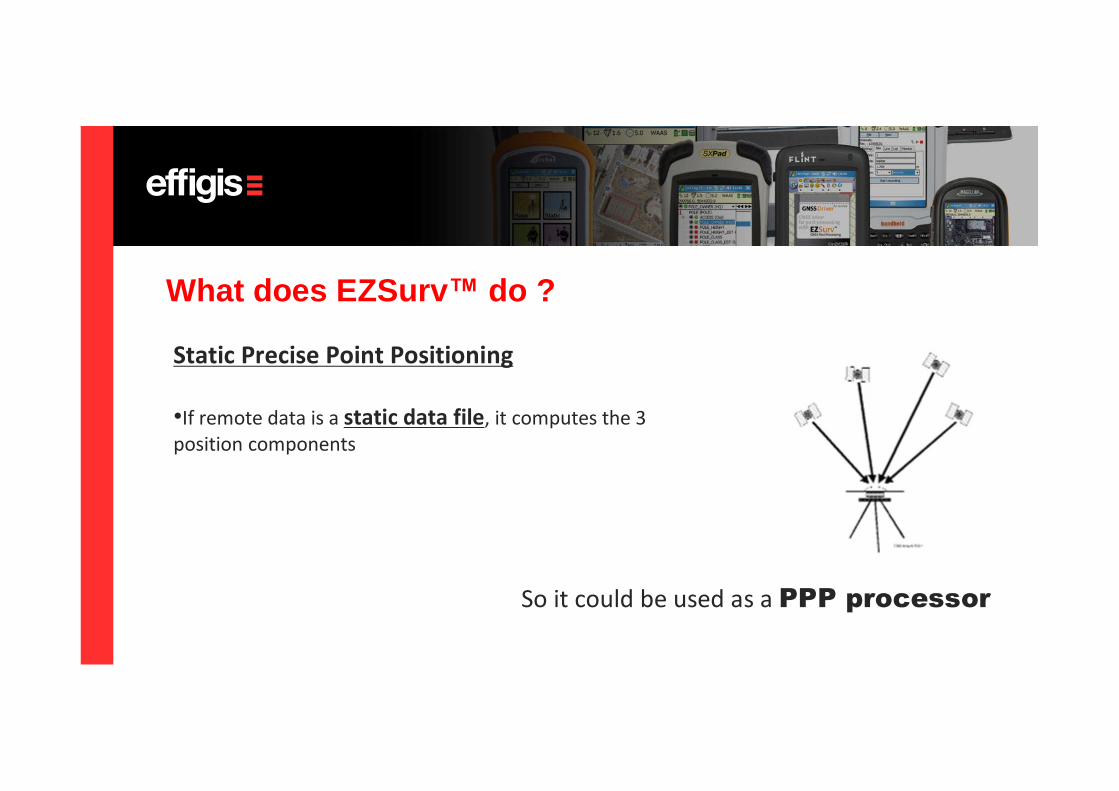
Static Precise Point Positioning
•If remote data is a static data file, it computes the 3position components
What does EZSurv™ do ?
So it could be used as a PPP processor

Kinematic Precise Point Positioning
•If remote data is a kinematic data file, it computes oneposition at every single epoch
What does EZSurv™ do ?
So it could be used as a PPP-K processor

It also has a Least-Squares adjustment module
What does EZSurv™ do ?

It also includes a external Plannermodule, that can be used to planyour survey, to analyze your rawdata as well as your final positionresults
What does EZSurv™ do ?

Coordinate Systems and Geoid Support
• EZSurv™has a mapping/Datum tool that can becustomized for your specific needs or can beupgraded by a simple Internet download.
• Many Geoid model aresupported (including theEGM 2008).
• We support *.GRD file soany Geoid file can beconverted an imported inEZSurv™
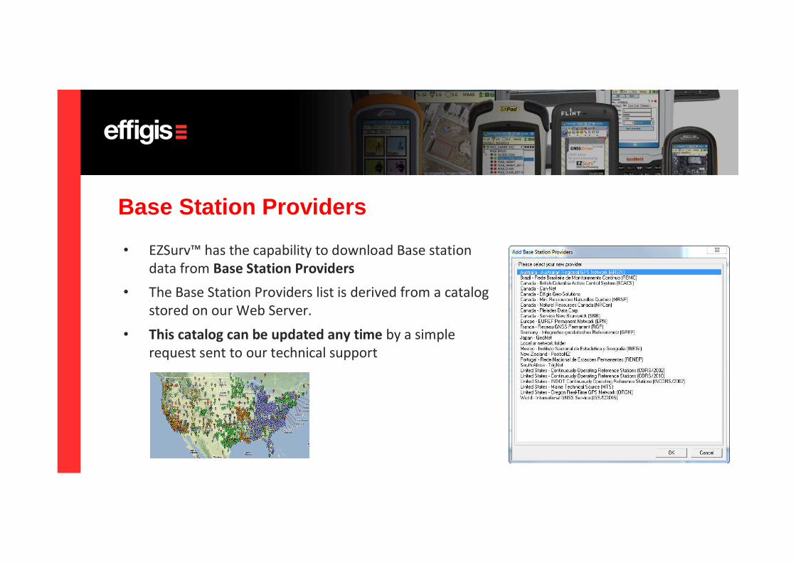
Base Station Providers
• EZSurv™has the capability to download Base stationdata from Base Station Providers
• The Base Station Providers list is derived from a catalogstored on our Web Server.
• This catalog can be updated any time by a simplerequest sent to our technical support

QA Tools
Many QA tools are available to assess GNSS results:•Loop closure tool•Graphical tools•RTK versus PP discrepancy analysis•Raw data quality analysis•Least-Squares adjustment•Customizable export for data analysis

Post-processing GNSS data is much more easier when PP software is compatible withIndustry standard data collection software. EZSurv™is compatible with the followingdata collection software:
• FieldGenius from MicroSurvey (Survey Software)• SurvCE from Carlson Software (Survey Software)• ArcPAD from ESRI (it requires a driver from OnPOZ (GIS
software)• EZField from OnPOZ Precision Positioning (Basic Survey
software)• EZTagCE from OnPOZ Precision Positioning (GIS Software)
Field Software compatibility

• EZSurv is fully compatible with PENTAX GNSS• Reads the native raw data files (along with S/N,
Antenna model and site information)
Receiver Compatibility

EZSurv Overview in Short• Easy to use PP software• GNSS Baseline Processor• GNSS PPK Processor (Offline RTK)• Precise Point Positioning Processor (for Static)• Precise Point Positioning Processor (for kinematic)• An Engine to search Base Station Providers DataBase• An Engine to search Precise Orbits/Clocks Providers DataBase• A Least-Squares adjustment module• A Coordinate System/Mapping/Datum Tool• A set of QA tools for your RTK job
Translated in English, French,Spanish and Portuguese