explore surrey- dormans park · 2016-10-18 · a 4.5 mile (7km) enjoyable walk from dormans...
TRANSCRIPT

A 4.5 mile (7km) enjoyable walk from Dormans Station.
The walk crosses Lingfield Park racecourse and golf course, passes through the Dormans Park estate and past the Cook’s Pond Viaduct. This walk is part of the Explore Surrey collection, published through a collaboration between iFootpath and Surrey County Council.
There are no pubs or shops along the route, but you can take an optional 10 minute detour to the village of Dormansland where there are public toilets, a shop and two pubs (The Royal Oak pub on the High Street and The Old House at Home pub on West Street). Ordnance Survey Map: Explorer 146 Dorking, Box Hill & Reigate (note: Dormansland village is covered on Explorer 147 Sevenoaks & Tonbridge). This walk follows public footpaths and bridleways which cross private and public land. Information is included for your interest, but please respect people’s privacy, keep dogs under control and remember the Countryside Code.
Getting there The walk starts from Dormans Rail Station. For help with planning your journey by public transport please visit http://journeys.travelsmartsurrey.info. The station does not have a car park and there is only limited parking along Dormans Station Road with restrictions Mon-Fri. For this reason, if you are coming by bus or car, you will need to adjust the walk to start and finish at St John’s Church on the High Street in Dormansland village. There is a bus stop directly outside the church and there is street parking available on the side roads (New Farthingdale, The Platt and Clinton Hill). Please park with respect for residents.
Approximate post code for St John’s Church is RH7 6RA. Grid reference for the station: TQ 397415.
Walk Sections Start to Mill Lane
The walk starts and finishes at Dormans Rail Station. (If you are starting the walk from the village of Dormansland, begin the walk by following the instructions written in brackets within Walk Section 2: Mill Lane to Golf Course Bridge.)
Standing on the road facing Dormans Station, take the footpath which runs immediately to the right of the building. This tarmac path leads you across the centre of a rough common. You will emerge out to a crossroads
D O R M A N S P A R K �1
1. The walk has a few steady gradients. 2. The paths are firm for the most part but the
unmade sections through woodland and the golf course can get very muddy so good stout boots are recommended.
3. You will need to negotiate some kissing gates and steps, but there are no stiles or livestock on route.
4. The walk crosses a golf course so please show respect for the golfers by allowing them to play their shots before you cross and watch closely for any stray flying golf balls.
7 km Circular 2 hours
Access Notes
© Copyright iFootpath part of OneToRemember LLP
Moderate Terrain
190515
Go 1
DORMANS PARK
Get the iFootpath App for a smarter walking experience. Hundreds of walking guides in the palm of your hand with live maps that show your progress as you walk. Say goodbye to wrong turns!
iFootpath.com

with a stone track, Mill Lane, with Nobles Green opposite. Alongside the bench at this crossroads you will see a stone marking this as a point on the Greenwich Meridian, zero degrees longitude.
(If you wish to take the detour to Dormansland village, follow the tarmac path ahead which leads you between fields and then between houses. The path widens to become a lane and swings right to pass Cherry Tree Cottage on the left. To reach The Old House at Home pub turn left here, otherwise keep straight ahead. At the T-junction alongside the Parish Room, turn right and you will emerge to the High Street alongside the church. Turn left to reach the bus stop, toilets, village shop and The Royal Oak pub).
For the main walk, turn left along Mill Lane.
Mill Lane to Golf Course Bridge
(Follow these directions if you are starting the walk at St John’s Church in Dormansland, otherwise skip to the next paragraph below. Standing facing the church, take the side road, The Platt, which runs to the left of the church. As you come to the Parish Room ahead, fork left and then keep straight ahead along this lane to pass Cherry Tree Cottage on the right. Bear left and then keep ahead to join the tarmac path between hedgerows. Follow this tarmac path between fields and then past Nobles Barn on the right. Immediately after this you will reach a crossroads with a stone track, Mill Lane. Alongside the bench at this crossroads you will see a stone marking this as a point on the Greenwich Meridian, zero degrees longitude. Turn right along Mill Lane and then follow the instructions below).
Follow this stone track lined with trees and hedgerows. The track narrows to lead you over the railway bridge. Immediately afterwards, ignore the path on the left, simply keep straight ahead on the wooded path leading you steadily downhill. Eventually the path emerges from the trees to cross a fairway within Lingfield Park golf course. Take particular care here, allowing golfers to play their shots before you proceed and
keeping your eyes peeled for stray golf balls. The path re-enters trees and then leads you down to a junction of paths. Walk diagonally left (at about 10 o'clock) to cross the bridge over the stream.
Golf Course Bridge to Racecourse Crossing
Keep ahead for just a few metres and then, immediately before the metal barn on the right, turn left onto the path with a hedge on the left. The path becomes a raised embankment path running alongside a golf fairway on the left. Continue until you reach a T-junction with a tarmac track at the side of Lingfield Park racecourse.
Turn left along the track. The grandstand of Lingfield Park racecourse can be seen behind you, with the chalk hills of the North Downs in the distance. Continue just until you reach the tee for the 17th hole on the left and a gap in the railings on the right.
The racecourse and club were established in 1890. It is said that in the early 1900s the people of Dormansland agreed not to use the footpath across the racecourse in return for discounted tickets to the races. This agreement continued for a number of years, until the course changed hands and the new owners said “No more free tickets”. On the following race day, a continuous chain of local people kept the footpath open, holding up the racing until the owners relented and gave them back their free tickets.
Racecourse Crossing to Blackberry Road Footpath
D O R M A N S P A R K �2© Copyright iFootpath part of OneToRemember LLP
1 2
2 3
3 4
Turn right here to cross the racecourse track. Immediately after the crossing, fork left across the grass, pass through the gap in the hedgerow and then keep left around the edge of the fairway. The path swings right and then forks left through a section of trees. You will see a bridge on the left. Do NOT cross this, instead, continue around the edge of the fairway with the stream running on the left.
Ignore the second bridge and, a few paces later, turn left keeping the stream on the left. Keep ahead, passing the third bridge on the left to reach a signed junction of paths. Fork right to join the path through a section of trees, with the road running on the left. As you emerge from the trees, turn left to reach the road (with the gate for Hill Rise opposite).
Cross over the road with care and take the small connecting road opposite. At the T-junction with Blackberry Road, turn right along the grass verge in front of houses. After 70m, cross over the road to turn left onto the signed public footpath.
Blackberry Road Footpath to Woodland Kissing Gate
Walk into the entrance driveway for The Stables and then fork immediately left through the side gate. Follow the stone footpath ahead and then, when the fence on the right ends, turn right along the grass bank (passing the property on the right). Go through the metal kissing gate and turn left then right along the tarmac lane.
Go through the gateway and then keep ahead on the wide grass track between fences. At the end of the grass track, go through the gateway ahead (or use the stile just to the right of the gate) and then turn left on the fenced track between fields. Within the boundary to your left are examples of neglected hazel coppice. Coppicing is an ancient woodland practice which involves the cutting of the stems down to the stumps or ‘bole’. The stems re-grow and the process is repeated every 7-25 years depending on the size of stems required. The wood was used in many ways including the manufacture of hurdles, cooking utensils, firewood and charcoal.
The path leads you down to a kissing gate at the edge of woodland.
Woodland Kissing Gate to Swissland Hill
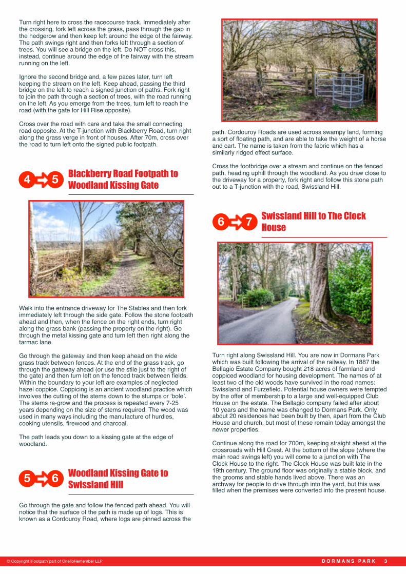
Go through the gate and follow the fenced path ahead. You will notice that the surface of the path is made up of logs. This is known as a Cordouroy Road, where logs are pinned across the
path. Cordouroy Roads are used across swampy land, forming a sort of floating path, and are able to take the weight of a horse and cart. The name is taken from the fabric which has a similarly ridged effect surface.
Cross the footbridge over a stream and continue on the fenced path, heading uphill through the woodland. As you draw close to the driveway for a property, fork right and follow this stone path out to a T-junction with the road, Swissland Hill.
Swissland Hill to The Clock House
Turn right along Swissland Hill. You are now in Dormans Park which was built following the arrival of the railway. In 1887 the Bellagio Estate Company bought 218 acres of farmland and coppiced woodland for housing development. The names of at least two of the old woods have survived in the road names: Swissland and Furzefield. Potential house owners were tempted by the offer of membership to a large and well-equipped Club House on the estate. The Bellagio company failed after about 10 years and the name was changed to Dormans Park. Only about 20 residences had been built by then, apart from the Club House and church, but most of these remain today amongst the newer properties.
Continue along the road for 700m, keeping straight ahead at the crossroads with Hill Crest. At the bottom of the slope (where the main road swings left) you will come to a junction with The Clock House to the right. The Clock House was built late in the 19th century. The ground floor was originally a stable block, and the grooms and stable hands lived above. There was an archway for people to drive through into the yard, but this was filled when the premises were converted into the present house.
D O R M A N S P A R K �3© Copyright iFootpath part of OneToRemember LLP
4 5
5 6
6 7

The Clock House to Woodland Crossroads
Continue straight ahead down the path which soon becomes a grass track. Cross the stream via the footbridge and keep ahead on the woodland path. The path leads you past a property on the left and the green wire gates for a former school on the right.
At the T-junction with the track, turn left. After 230m, as you draw level with The Cottage on the left, turn right down the track (signed as a public bridleway). Follow the path past houses and then continuing through a section of woodland. You will reach a signed crossroads within the woodland, with a property across to the left.
Woodland Crossroads to Cook's Pond Viaduct
Go straight ahead, crossing a small ford. The path swings right and leads you over a concrete bridge. Continue on the path for 0.6km, ignoring a path off to the right and then one off to the left. A few metres later, turn left onto the fenced path signed as part of the Greenwich Meridian Trail.
The path leads you over a wooden footbridge with great views of Cook’s Pond Viaduct and the Wilderness Lake on the right. The viaduct is made of latticed girders on brick piers, and is the largest structure on the Croydon to East Grinstead railway. The lake was drained temporarily whilst the piers were built.
Cook's Pond Viaduct to Railway Bridge
Keep ahead on the path which leads you over a couple of lake overflows. At the junction with the road, cross over and take the path which continues opposite. Keep straight ahead, climbing steadily, to emerge to a junction with a road alongside the railway bridge.
If you wish you can walk to the centre of the bridge to enjoy the views back along the rail line. From the bridge you can get a good idea of some of the work involved in the construction of the railway: a deep cutting, an embankment and the viaduct can be seen.
Railway Bridge to End
When you’ve finished with the view, return back to the path from which you emerged. Cross over the road and continue along the stone path ahead with the railway still on the right (still part of the Greenwich Meridian Trail). Continue over the brow of the hill and the path begins to descend steadily. Ignore the path off to the left, simply keep ahead alongside the railway. You will emerge, via a flight of steps, to reach the road opposite Dormans Station where the walk began.
(If you need to return to Dormansland village, follow the directions from the beginning of this walk.)
Dormans Station was originally called ‘Bellagio’ after the company that built Dormans Park a few years later, but this soon changed to its present name. The railway was built jointly by the London, Brighton & South Coast Railway and the South Eastern Railway Companies. Dormans Station opened on the same day that trains began to use the line on 10 March 1884.
D O R M A N S P A R K �4© Copyright iFootpath part of OneToRemember LLP
7 8
8 9
109
1110

D O R M A N S P A R K �5
Disclaimer
This walking route was walked and checked at the time of writing. We have taken care to make sure all our walks are safe for walkers of a reasonable level of experience and fitness. However, like all outdoor activities, walking carries a degree of risk and we accept no responsibility for any loss or damage to personal effects, personal accident, injury or public liability whilst following this walk. We cannot be held for responsible for any inaccuracies that result from changes to the routes that occur over time. Please let us know of any changes to the routes so that we can correct the information.
Walking SafetyFor your safety and comfort we recommend that you take the following with you on your walk: bottled water, snacks, a waterproof jacket, waterproof/sturdy boots, a woolly hat and fleece (in winter and cold weather), a fully-charged mobile phone, a whistle, a compass and an Ordnance Survey map of the area. Check the weather forecast before you leave, carry appropriate clothing and do not set out in fog or mist as these conditions can seriously affect your ability to navigate the route. Take particular care on cliff/mountain paths where steep drops can present a particular hazard. Some routes include sections along roads – take care to avoid any traffic at these points. Around farmland take care with children and dogs, particularly around machinery and livestock. If you are
This walk is part of the Explore Surrey collection, published through a collaboration between iFootpath and Surrey County Council.
Surrey is the ideal place to explore the outdoors on foot. Whether you're an adventurous walker or someone who prefers a short stroll, there's a walk to suit you.
If you would like to know more about Explore Surrey and find more walks please visit
www.surreycc.gov.uk/explore
© Copyright iFootpath part of OneToRemember LLP