executive summary - wordpress.com | executive summary july 2016 the houston-galveston area council...
TRANSCRIPT

JU LY 2 016
EXECUTIVE SUMMARY

Research Forest Drive at IH 45SH 105, Conroe, Texas

JULY 2016
PREPARED FOR MONTGOMERY COUNTY AND CONROEBY HOUSTON GALVESTON AREA COUNCIL
WITH ASSISTANCE FROM COBB FENDLEY AND ASSOCIATES THE LENTZ GROUP
DESIGN WORKSHOP, INC.HALFF ASSOCIATES
ALLIANCE ENGINEERINGSP ENGINEERING INC.

JULY 2016iv |
“Thank You - The project team would like to thank all the stakeholders and public officials that contributed their ideas and time throughout the development of this plan.”
L E A D A GE N C YHouston-Galveston Area Council (H-GAC)
H - G A C P R O J E C T M A N A GE R SCarlene Mullins, Transportation PlannerThomas Gray, Chief Transportation Planner
F U N D IN G PA R T N E R SMontgomery CountyCity of ConroeTexas Department of Transportation (TxDOT) – Houston District
C O N S U LTA N T T E A M : Cobb Fendley and Associates Halff AssociatesAlliance EngineeringSP Engineering Inc.The Lentz GroupDesign Workshop
S T E E R IN G C O M M I T T E E Jim Fredericks, Montgomery County Judge’s office John Holzwarth, Montgomery County Precinct 1Don Dean, Montgomery County Precinct 2Matt Beasley, Montgomery County Precinct 3Bill Smith, Montgomery County Precinct 4Mark Mooney P.E, Montgomery County Thomas Woolley, City of ConroeShawn Johnson, City of ConroeJohn Bleyl, Bleyl & AssociatesRichard Brown, TxDOT Montgomery CountyCatherine McCreight, TxDOT HoustonThomas Gray, H-GACCarlene Mullins, H-GACDavid Wurdlow, H-GAC
M O N T GO M E R Y C O U N T Y C O M M I S S I O N E R S C O U R T 2 0 15Hon. Craig Doyal, County Judge Hon. Mike Meador, Precinct 1 CommissionerHon. Charlie Riley, Precinct 2 CommissionerHon. James Noack, Precinct 3 CommissionerHon. Jim Clark, Precinct 4 Commissioner
C O N R O E C I T Y C O U N C I L 2 0 15Hon. Webb MelderHon. Marsha PorterHon. Seth M. Gibson, Councilman, Place 2Hon. Duke Coon, Councilman, Place3Hon. Guy Martin, Mayor Pro Tem, Place 4Hon. Gil Snider, Councilman, Place 5
ACKNOWLEDGEMENTS

MONTGOMERY THOROUGHFARE PLAN 2016 | v
H - G A C T R A N S P O R TAT I O N P O L I C Y C O U N C I L M E M B E R S 2 0 15Hon. Matt Sebesta, County Judge, Brazoria County Hon. Rusty Senac, County Commissioner, Pct. 4, Chambers CountyHon. David McCartney, Council Member, District 6, City of BaytownScott Taylor, Director of Public Works, City of ConroeHon. Ralph McMorris, Council Member, District 3, City of GalvestonHon. Stephen Costello, Council Member, At-Large 1, City of HoustonHon. Dwight Boykins, Council Member, District D, City of HoustonDale Rudick, P.E., Director, Public Works & Engineering, City of HoustonHon. Tim Paulissen, Mayor, City of League CityScott Elmer, P.E., Assistant City Manager, City of Missouri CityHon. Darrell Morrison, Council Member, District H, City of PasadenaHon. Tom Reid, Mayor, City of PearlandHon. Harish Jajoo, Council Member, District 4, City of Sugar LandDoug Kneupper, P.E., City Engineer, City of Texas CityHon. James Patterson, County Commissioner, Pct. 4, Fort Bend CountyHon. Kenneth Clark, County Commissioner, Pct. 4, Galveston CountyBert Keller, Chairman/GCD, Gulf Coast Rail DistrictHon. Ed Emmett, County Judge, Harris CountyHon. Steve Radack, County Commissioner, Pct. 3, Harris CountyJack Steele, Executive Director, H-GACHon. Eddie Lowery, County Commissioner, Pct. 3, Liberty CountyGilbert Garcia, METRO Chairman, METRO Hon. Charlie Riley, County Commissioner, Pct. 2, Montgomery CountyHon. Janiece Longoria, Commissioner/POH Chair, Port of Houston AuthorityQuincy Allen, P.E., District Engineer, TxDOT Houston DistrictTucker Ferguson, P.E., District Engineer, TxDOT Beaumont DistrictHon. John Amsler, County Commissioner, Pct. 1, Waller CountyHon. Robert A. Fry, Jr., Mayor, West University Place
This document was funded, in part, through
grants from the Federal Highway Administration,
Federal Transit Administration, U.S. Department
of Transportation, and Texas Department of
Transportation. The views and opinions of the
authors, expressed herein, do not necessarily
reflect those of the U. S. Department of
Transportation or the Texas Department of
Transportation.

vi | Executive Summary JULY 2016
Conroe, Texas

MONTGOMERY THOROUGHFARE PLAN 2016 Executive Summary | 1
EXECUTIVE SUMMARY
2 | Executive Summary JULY 2016
The Houston-Galveston Area Council (H-GAC) established a partnership with Montgomery County and the City of Conroe to update the Montgomery County Thoroughfare Plan. The intent of the 2016 Montgomery County Thoroughfare Plan (“MCTP”) is to provide the County with an updated planning tool that can be used to manage, guide and design a transportation network that improves connectivity, mitigates congestion and accommodates new development and growth throughout the County. The primary objective of the Thoroughfare Plan is to ensure the preservation of adequate rights-of-way on appropriate alignments of sufficient width to allow the orderly and efficient expansion and improvement of the roadway system to serve existing and future transportation needs.
PURPOSEThe Thoroughfare Plan designates a system of major roadways throughout the county intended to provide adequate access and travel mobility. It includes freeways, major and secondary arterials (high-capacity urban roads) and major collectors.
A THOROUGHFARE PL AN IS:• Long range (50+ years)• Identifies type and general location
of future roadways• Preserves transportation corridors
(i.e. right-of-way)• Guides future development• Promotes connectivity and design
uniformity• Requires, through the platting
approval process of cities and counties, appropriate dedication of rights-of-way and construction of identified thoroughfares by private land owners
A thoroughfare plan benefits the county by indicating where needed roadway right-of-way (ROW) should be preserved
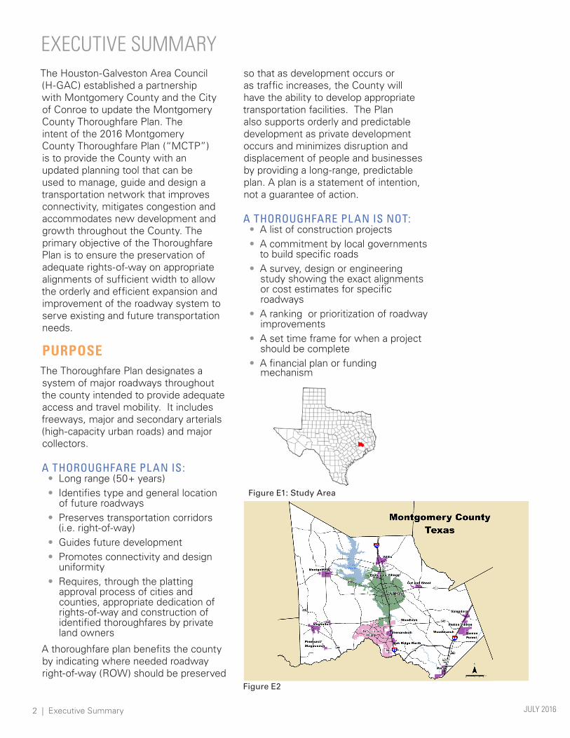
Figure E1: Study Area
Figure E2
so that as development occurs or as traffic increases, the County will have the ability to develop appropriate transportation facilities. The Plan also supports orderly and predictable development as private development occurs and minimizes disruption and displacement of people and businesses by providing a long-range, predictable plan. A plan is a statement of intention, not a guarantee of action.
A THOROUGHFARE PL AN IS NOT:• A list of construction projects• A commitment by local governments
to build specific roads• A survey, design or engineering
study showing the exact alignments or cost estimates for specific roadways
• A ranking or prioritization of roadway improvements
• A set time frame for when a project should be complete
• A financial plan or funding mechanism
EXECUTIVE SUMMARY

MONTGOMERY THOROUGHFARE PLAN 2016 Executive Summary | 3
VISION AND GUIDING PRINCIPLESThe overall goal of the MCTP is to develop a county-wide transportation plan that looks at the County holistically and accommodates the current and future mobility needs of people, goods and services traveling within and through the County.
The vision of the Montgomery County Thoroughfare Plan is to establish guidelines and policies to develop a safe, well-connected and efficient county-wide transportation system that provides adequate mobility for people, goods and services and promotes orderly growth and redevelopment throughout the county.
The vision is supported by the following guiding principles:
• Preserve adequate rights-of-way for future expansion and connectivity.
• Establish county-wide design standards that enhance the safety and movement of all county roadway users and aid the transition from rural to urban land uses.
• Institute policies and procedures to coordinate and optimize transportation investments in the county.
• Develop a well-connected transportation system to, from, and within local communities.
• Collaborate with the development community to ensure that roadway investments satisfy existing and future growth needs.
The Plan’s vision and guiding principles were referred to throughout the planning process to maintain the focus of the study.
AREA OVERVIEWMontgomery County is located in southeast Texas (Figure E1) and has a total area of 1,077 square miles.
According to the U.S. Census in 2014, there were 518,947 people living in the County. The City of Conroe, the county seat, is located in central Montgomery County and had an estimated 2014 population of 65,871. Other major cities include Magnolia, Montgomery, Shenandoah, Oak Ridge North and Willis (Figure E2). The largest community is The Woodlands Township.
Lake Conroe is a 21,000 acre lake, making it the largest body of water in the County. It is located in the northwest quadrant of the County. The San Jacinto River West Fork bisects the County from the northwest to the southeast and Spring Creek defines the County’s southern border. Over 22% of the County’s land area is located within a FEMA-defined floodway or 100-year flood plain. (Figure E3: Flood Plains and Forests)
Montgomery County is home to a national forest and a state forest. Sam Houston National Forest is located in northern Montgomery County and W. G. Jones State Forest is located on FM 1488 just west of IH 45.
Figure E3

4 | Executive Summary JULY 2016
POPULATIONAs the 13th-fastest growing county in the nation, Montgomery County is expected to experience an annual growth rate of 3.15% in the next 30 years (Figure E4). Much of this growth is expected to occur in the central and southern regions of the County (Figure E5).
EMPLOYMENTAs population increases in the County, employment centers and opportunities grow as well. Employment has grown at an annual rate of 5.77% since 1980 and it is estimated that it will continue to grow at an annual rate of 5.81% over the next 30 years (Figure E6). The densest concentrations of employment are, and are expected to be, located along the IH 45 corridor between the City of Conroe and The Woodlands.
Year
Thou
sand
s
01990 2000 2010 2020* 2030* 2040*
200
400
600
800
1,000
1,200
1,400
*Projection
Year
Thou
sand
s
01990 2000 2010 2020* 2030* 2040*
50
100
150
200
250
*Projection
Figure E6: Montgomery County Employment Growth
Figure E4: Montgomery County Population Growth
Figure E5: Population Projection Locations
MAJOR TRIP GENERATORSMontgomery County has hundreds of trip generators, but for this study the team looked at where the major trip generators or traffic generators were located (Figure E7). The major trip generators identified include large shopping areas, large recreational sites, major convention centers/entertainment venues and major employment centers. The largest employment center is located in The Woodlands. Along with numerous large employers, such as Anadarko, CB&I, etc., this area is also home to a major entertainment venue, several conference centers and a regional shopping mall. Two major trip generators are located outside of Montgomery County. These include the Texas Renaissance Festival in Grimes County and Springwoods Village in Harris County, which is home to Exxon Mobil and Southwestern Energy. Even though these sites are located outside Montgomery County they affect the traffic in Montgomery County.
New development is scattered throughout the County. However, there are numerous developments occurring along the Grand Parkway.
BARRIERSThere are many barriers to movement within Montgomery County, both natural and man-made (Figure E8). The natural barriers include the San Jacinto

MONTGOMERY THOROUGHFARE PLAN 2016 Executive Summary | 5
Figure E8
River, Spring Cypress Creek, Lake Creek, Peach Creek, Caney Creek, Sam Houston National Forest and W.G. Jones State Forest. Man-made barriers include, but are not limited to, expressways/toll roads, railroads, golf courses, cemeteries, and airports. Railroads, expressways/toll roads and floodplains can be crossed; however the construction cost dramatically increases when bridges are needed.
ROADWAY NETWORK DEMANDThe existing transportation network of the County was studied in order to evaluate the amount of congestion the major roadways are experiencing. For this study, ratios were calculated by using 2012 and 2013 Annual Daily Traffic counts (ADTs) collected by TxDOT, facility type and Highway Capacity Manual values including lane capacities, saturation flow rate, directional distribution, peak hour distribution and green time percentage.
Using the results from the volume to capacity (v/c) ratio calculations, a Congestion Map (Figure E9) was
Figure E9
created. The highest concentrations of congested roads in the County are located in The Woodlands. This is no surprise considering this area has the highest population density in the County and is one of the largest employment centers in the region.
PUBLIC INVOLVEMENTThe MCTP included various levels of public involvement ranging from focus groups to public meetings. This process
Figure E7

6 | Executive Summary JULY 2016
Figure E10

MONTGOMERY THOROUGHFARE PLAN 2016 Executive Summary | 7
led to more direct information on current and future needs, and development throughout the County. The MCTP team customized a robust public involvement program to receive input from the community leaders and residents of Montgomery County. The public involvement plan included two rounds of focus group meetings, multiple meetings with the steering committee and elected officials, as well as four public meetings.
2016 THOROUGHFARE PLAN Figure E10 shows the 2016 Montgomery County Thoroughfare Plan that was adopted by Commissioners Court on January 26, 2016. Water features, topography, the built environment and county boundaries were all considered during the analysis of the system. However, this analysis was performed at a high level. As the need for a particular roadway becomes apparent, more detailed studies will be necessary to refine alignments, investigate potential environmental impacts, and determine the ultimate design of the roadway (i.e.
cross sections, bridges, intersection geometries, and the like). Subdivision plats that include thoroughfares should be developed in collaboration with, and under the review of, the County and, where appropriate, municipal agencies.
FUNCTIONAL CLASSIFICATIONIn addition to defining a thoroughfare network, a classification was assigned to the each of the roadways. Functional classification is the process by which local and regional roadways are grouped into hierarchal categories according to the transportation objectives they are intended to provide. This process identifies the role each roadway serves in the context of the larger transportation system. Functional classifications for the plan were based on a variety of considerations, including whether the roadway is on the state system and the amount of traffic it currently or is expected to carry. Functional classifications are shown in Figure E11.
Figure E11

8 | Executive Summary JULY 2016
IMPLEMENTATIONThe MCTP represents a build-out of the County’s ultimate thoroughfare system and does not attempt to represent the need for or the timing of specific construction projects. This is a true long-range plan based on existing plans approved by local elected officials. This Plan should be used as a guide for local planning to support and promote orderly and planned growth. It should also be a starting point for needs-based arterial studies. This Plan may be used as a basis for city or county bond programs, regional land-use plans, economic development initiatives, and regional transportation plans.
The development of effective implementation policies will enable government officials, engineers, planners and local stakeholders to ensure that the vision and guiding principles of this plan are put into practice as development occurs within the County.
POLICYThe following Thoroughfare Plan Policies are intended to be complimentary to and coordinated with the Thoroughfare Plan Map. Both the policies and the Map are to be considered and interpreted within the context of the guiding principles. The following are recommended general policies that apply to the overall thoroughfare system and the general interpretation and application of this Thoroughfare Plan.
• COMPLETE STREETS: This is a type of street design meant to provide safe, accessible and convenient use by a variety of users including motorists, transit riders, pedestrians and cyclists.
• CONTEXT SENSITIVE SOLUTIONS: This is a collaborative approach that involves all stakeholders in developing a transportation facility that complements its physical setting and preserves
scenic, aesthetic and historic and environmental resources while maintaining safety and mobility.
• ACCESS MANAGEMENT: This is a set of techniques that state and local governments can use to control access to highways, major arterials and other roadways. These techniques include access spacing, driveway spacing, safe turning lanes, median treatments and right-of-way management.
POTENTIAL FUNDING OPTIONSThere are many development tools and strategies available to local jurisdictions to implement the MCTP. These items will be discussed with an emphasis on encouraging greater coordination of effort among local jurisdictions, private land developers and other area stakeholders. In addition to the federal and state funding available through the H-GAC Regional Transportation Plan (RTP)/ Transportation Improvement Plan (TIP) process, local jurisdictions and stakeholders can utilize existing funding mechanisms or collaborate to create new ones where appropriate.
The State of Texas provides an array of tools to help local and county governments encourage and maintain the economic vitality of their jurisdictions. Tools applicable to the County are described below.
TA X INCREMENT FINANCING (TA X CODE, CHAPTER 311) Tax Increment Financing is a tool that local governments can use to publicly finance needed structural improvements and enhanced infrastructure within a reinvestment zone. These improvements are usually undertaken to promote existing businesses and/or to attract new business to the area.

MONTGOMERY THOROUGHFARE PLAN 2016 Executive Summary | 9
LOCAL GOVERNMENT CODE CHAPTER 387 Local Government Code Chapter 387 allows counties to create County Assistance Districts that are funded by a portion of sales taxes. Any county may adopt this sales tax, in all or part of the county, if the new combined local sales tax rate would not exceed 2 percent at any location within the district.
CHAPTERS 380 (CITIES) AND 381 (COUNTIES) OF THE LOCAL GOVERNMENT CODE Chapters 380 and 381 of the local government code grant cities and counties broad discretion to make loans and grants of public funds or the provision of public services, at little or no cost, to promote all types of business development including industrial, commercial and retail projects.
PUBLIC IMPROVEMENT DISTRICTS (PID) (LOCAL GOVERNMENT CODE, CHAPTER 372) PIDs offer cities and counties a means for improving their infrastructure to promote economic growth in an area.
Other possible methods to fund future roadway projects include the following:
IMPACT FEESImpact fees impose a charge on new development to pay for the construction or expansion of off-site capital improvements that are necessitated by and benefit the new development. (Source: ImpactFees.com)
THOROUGHFARE FUNDA thoroughfare Fund is a designated funding source, created by a city or county, that would be used to fund all elements of a major or minor thoroughfare, including construction (travel lanes, sidewalks, bicycle lanes etc.), right-of-way acquisition and engineering costs. (Source: City of
Columbus Thoroughfare Plan, Columbus, IN, www.columbus.in.gov)
PARKING TA X A parking tax is a source that, at perhaps $5 per space, could be dedicated exclusively for roadway projects.
PRO-ACTIVE APPROACHES Pro-active approaches could help to move projects forward in H-GAC’s Transportation Improvement Program. Examples include:
• County and/or local jurisdictions acquiring right-of-way in advance
• Encourage landowners and developers to donate right-of-way
• County and/or local governments can fund feasibility and traffic studies, environmental studies and preliminary engineering and design
• County and/or local governments could pay the full cost of relocating utilities and pipelines and constructing drainage improvements
NEXT STEPSThe MCTP has been adopted and this study has been completed. However, there are still steps that need to be completed by the County in order for this plan to be successfully implemented. This includes the following actions.
• Updating the existing subdivision regulations
• Instituting policies and procedures to coordinate and optimize transportation investments in the county
• Collaborating with the development community to ensure that roadway investments satisfy existing and future growth needs
• Coordinate with Conroe, Houston and other cities to ensure their Thoroughfare Plans complement the MCTP
• Developing a process to amend the Thoroughfare Plan
• Updating the Thoroughfare Plan every 5 years
