executive summary draft checklist environmental...
TRANSCRIPT


EXECUTIVE SUMMARY
DRAFT CHECKLIST ENVIRONMENTAL ASSESSMENT for
MONTANA ROCKWORKS, LLC. OPERATING PERMIT APPLICATION
FOR MULTIPLE ROCK PRODUCT SITES IN FLATHEAD AND WHEATLAND COUNTIES
In July 2005, the Montana Department of Environmental Quality (DEQ) received an application from Montana Rockworks, LLC. (Montana Rockworks) for an operating permit to quarry and collect rock products found along outcrops, hilltops, and rangeland in Wheatland County and from talus slopes, boulder fields and outcrops in Flathead County. Montana Rockworks has asked to permit five sites over the life of the operating permit on up to 2,221 permit acres and to eventually disturb up to 860 acres over the 20-year permit life. With concurrent reclamation, Montana Rockworks commits to keep disturbed unreclaimed acreage to less than 200 acres at any one time during the life of the permit.
The current sites include:
1) The McGregor Lake Site #1 is 10 miles west of Marion, MT in Flathead County in Section 32, Township 26 North and Range 25 West. The land is owned by Moose Mountain Properties and leased by Montana Rockworks. Montana Rockworks proposes to permit 121 acres. Up to 60 acres could eventually be disturbed over the life of the permit.
2) The Moose Mountain Site #2 is 18 miles southwest of Marion, MT in Flathead County in Section 30, Township 26 North and Range 25 West. The land is owned by Moose Mountain Properties and leased by Montana Rockworks, Inc. Montana Rockworks proposes to permit 100 acres. Up to 50 acres could be disturbed over the life of the permit.
3) The Elk Mountain Site #3 is a permit area complex covering two private ranches in Wheatland County and three Sites I, II, and III. Montana Rockworks proposes to permit 1,000 acres on the Elk Mountain Site #3 of which 550 acres would eventually be disturbed.
Sites I and II: Site I is on the Duncan Colony Ranch and State of Montana Land which was leased from the Montana Department of Natural Resources and Conservation. Site II is on private land leased from the Duncan Colony Ranch. The sites on the ranch are 10 miles west of Harlowton, MT in Sections 5 and 18, Township 8 North and Range 14 East. Up to 100 acres would be disturbed and reclaimed over the life of the project on Sites I and II. Site I has been reclaimed and would not be disturbed in the future. The State lease on Site I has been cancelled. Site II would continue to be disturbed.
Site III: Montana Rockworks has a lease on the Mac White Ranch located one mile south of Two Dot in Section 35, Township 8 North, and Range
1

13 East. Up to 450 acres would be disturbed and reclaimed over the life of the project on Site III.
4) Montana Rockworks has a lease on the Sedgwick Ranch located six miles southeast of Two Dot in Section 3, Township 6 North, and Range 13 East. Montana Rockworks would permit 500 acres of which 100 acres would eventually be disturbed over the life of the permit on the Sedgwick Site #4. Less than five acres at any one time would be disturbed.
5) Site # 5 is on the Voss Ranch located two miles south/southeast of Two Dot in Section 1, Township 7 North, Range 13 East. Montana Rockworks would permit 500 acres of which 100 acres would eventually be disturbed over the life of the permit on the Voss Site #5. Less than five acres at any one time would be disturbed.
The Draft CEA analyzes the potential impacts of the Proposed Action as well as the potential impacts of two alternatives: 1) No Action (Denial of Proposed Action) and 2) Agency Modifications to the Proposed Action. The Draft CEA addresses issues and concerns raised during agency scoping. The operating permit application is available for review at the DEQ offices in Helena.
Important issues raised that are analyzed in the EA include the following.
Quarry and rock-collecting activities would remove rocks of varying geology exposed at each site. This is an unavoidable impact of the proposed operations. This is a direct and irreversible impact of the rock products industry. Up to 860 acres of rock covered land could be impacted over the life of the permit. Currently, the largest number of acres to be disturbed on any one site would be 450 acres on the Elk Mountain Site #3, Site III in Wheatland County.
Disturbance of native soils is an unavoidable impact from rock collecting activities. Soil is limited in the rock product sites in both counties. DEQ expects minimal offsite impacts to soils from these operations, even with a maximum of 200 acres disturbed and unreclaimed at any one time, because of their size, scattered locations, and rocky nature. Montana Rockworks is proposing up to 8,000 feet of new access road to develop the proposed five sites. Short stretches of new roads would be needed to access the Voss Site #5. These roads would not cross any stream. Montana Rockworks has proposed standard best management practices (BMPs) to limit offsite impacts from storm water, erosion and sediment. Some sediment production is an unavoidable impact of new road construction and maintenance activities over time.
Water quantity impacts would be minimal from the proposed operations. No water is proposed for use in the rock product sites except to control dust along roads or for drilling fluids if blasting is used on the sites. The rock products in the Flathead County area are weathered Belt Supergroup rocks and have no potential to leach metals and produce acid rock drainage. The rocks in Wheatland County are Eagle Sandstone and other rock types that also do not have the potential to produce pollutive drainage.
Groundwater impacts would be limited to impacts from nitrates if ammonium nitrate (ANFO) is used as a blasting agent or from fertilizers used to enhance revegetation success, from petroleum products resulting from accidental spills from equipment and
2

vehicle fuel tanks, hydraulic lines, etc., and from the use of herbicides to control noxious weeds.
Blasting is currently being used on the McGregor Lake Site #1. Surface water is only 140 feet away from the quarry site. Montana Rockworks has not proposed any groundwater monitoring.
Montana Rockworks has committed to noxious weed control on the proposed rock product sites. Montana Rockworks has approved noxious weed control plans for the counties where sites are currently operating. Noxious weeds would increase on the disturbed sites as in any disturbed area.
Minimal changes in overall air quality would result from the five sites currently proposed by Montana Rockworks. The rocky nature of the sites would limit dust impacts from the sites. Montana Rockworks has committed to use water trucks to control dust if necessary in the rock product sites. Montana Rockworks can impose controls for dust if needed along its privately owned roads.
The major dust impacts from most rock product sites would be fugitive dust from traffic on public access roads to the sites. This is a common problem with any development whether it is the rock product industry or subdivisions in rural Montana along gravel roads. No dust control is proposed on the public roads outside the sites. In Flathead County, logs could be hauled on the same roads at the same time if logging is occurring in the same general area
DEQ and Montana Rockworks have no control over dust management practices on other publicly owned roads. Montana Rockworks and its rock product operators have a right to use the public roads just like recreationists, local landowners and managers as long as they follow speed limits and observe seasonal road closures. Montana Rockworks has a road use permit to use the Flathead County sites.
Ranchers leasing rock product sites to Montana Rockworks in Wheatland County can require dust control as needed as part of their lease agreement with the company.
Vegetation on the sites in Flathead County is scattered because of the rock outcrops, talus slopes and boulder fields. Most of the area surrounding the sites has been logged in the past and the sites are regenerating forested stands of vegetation. Some isolated pockets of timber in the rocky areas have not been logged in the past. The limited tree and shrub dominated patches of vegetation on most rock product sites would be destroyed by rock picking activities.
In Wheatland County, the native plant communities that would be impacted are common in the sedimentary plains of Montana. Some of the future sites could be on dryland cropland where the native communities have been removed for agricultural production.
A search of the NRIS database found that there are no threatened and endangered plant species growing in the proposed sites. Disturbance of native plant communities in these rocky areas is an unavoidable impact of rock quarrying activities.
The proposed rock product sites would not impact important habitat for threatened and endangered wildlife species. Most of the surrounding areas around the outcrops,
3

boulder fields and talus slopes in Flathead County have been logged in the past. Threatened and endangered species such as the grizzly bear and gray wolf may occasionally pass through some of the areas. In Wheatland County, bald eagles would use the rock outcrops for hunting areas for small animals such as cottontail rabbits.
Other important wildlife species that would use the sites or travel through the rock product sites would be displaced around the quarrying activities. Wildlife habitat would be fragmented by the operations and new roads developed on the rock product sites. Most existing wildlife habitat would be destroyed or modified on the acres disturbed by the rock collecting activities.
Revegetation on acres resoiled after rock collecting activities cease would minimize some of the wildlife habitat impacts over time. Native plant species would be reduced and introduced plant species would be increased because of the disturbance and because of the introduced plant species mix proposed by Montana Rockworks for the Flathead County sites. The wildlife habitat on the sites would be modified permanently. This is an unavoidable impact of rock collecting activities on the proposed sites and use of introduced plant species in the reclamation plan.
The Wheatland County sites would be seeded to native species. The wildlife habitat on the sites would still be modified permanently. This is an unavoidable impact of rock collecting activities on the proposed sites and disturbance of the native plant communities. Loss of some native plant species in the wildlife habitat on the proposed rock product sites is an unavoidable impact of disturbance of the sites.
The quarries have the potential to impact cultural resources. The State Historic Preservation Office has been contacted and a search for cultural sites on the proposed disturbances in both counties has been conducted. Montana Rockworks has committed to protect any cultural resources found. The Moose Mountain site in Flathead County is the only site with archaeological and cultural sites near it. No direct impacts to important historic or archeological resources would occur if the proposed plan were implemented.
The proposed quarrying activities would disturb rock outcrops, talus slopes and boulder fields on Montana Rockworks, State of Montana, and leased private land, and remove vegetation including trees on the Flathead County sites. In Wheatland County, scattered rock on the rangeland as well as rock outcrops would be disturbed. In both counties, rock product operations would create disturbances that would result in a visual contrast with adjacent lands. The visual impacts from rock-collecting sites would be typical of activities that remove natural resources. This disturbed look is an unavoidable impact of rock quarrying activities in rock product locations visible from nearby roads and adjacent high elevation areas.
The McGregor Lake Site #1 and the Moose Mountain Site #2 are located in close proximity to the Thompson Chain of Lakes in Flathead County. The McGregor Lake Site #1 is 17 miles west of Marion and is approximately 11 miles east of the Lower Thompson Lake and 1 mile north of McGregor Lake. The quarry would not be visible from McGregor Lake and Highway 2.
The Moose Mountain Site #2 is 33 miles west of Kalispell and is approximately 14 miles southeast of the Lower Thompson Lake and 9 miles southwest of McGregor Lake. The quarry would not be seen from McGregor Lake and Highway 2.
4

Up to 8,000 feet of new access road would be developed to access the proposed rock product sites. These new access roads would be left at closure for future access purposes. The proposed plan would impact rock outcrops, boulder fields, talus slopes, and some cropland visible from other lands not owned by Montana Rockworks. The rock covered talus slopes and boulder fields would be disturbed in the process of sorting and loading rocks. The limited soil resources in the rocky areas would be disturbed. All these disturbances remove portions of the limited trees and other vegetation on the rock product sites. Other rocks not removed for commercial purposes would be disturbed and overturned revealing rock surfaces that have not weathered and are much more noticeable from a distance. As a result, the rock product sites would look disturbed and would be visible from various viewpoints, especially from higher elevations and rocky peaks.
Reclamation activities would minimize the visual contrast with adjacent lands as required by the Metal Mine Reclamation Act and would reduce those impacts to acceptable levels. The reclaimed areas would look disturbed for a long period of time. Some trees and shrubs would reestablish on the rocky sites in Flathead County over time. Rangeland vegetation would return on the Wheatland County sites.
The forested environment, natural broken landscape, and scattered locations of the two Flathead County rock product sites would lessen the impacts from any one area. The location of the Wheatland County sites on large private ranches would limit visibility of the disturbances.
Visual impacts are an unavoidable impact of allowing development of the five proposed rock collecting operations. Visual impacts are an unavoidable impact of quarrying rock outcrops, talus slopes and boulder fields in mountainous terrain in western Montana and outcrops in the sedimentary plains of eastern Montana.
The rocks would weather and surrounding stands of trees would regenerate eventually limiting visibility of the sites over time at the sites in Flathead County. Revegetation of the disturbed sites in Wheatland County would limit visual contrast with surrounding areas.
On the McGregor Lake Site #1 and Moose Mountain Site #2, Montana Rockworks proposes to subdivide the property when rock product operations end. This would reclaim the sites to another land use. The homes themselves and non-native landscaping around the homes would create a visual contrast that is an unavoidable impact if the subdivisions are approved.
Development of the sites would create noise, especially from use of heavy equipment handling and driving over solid rock surfaces and traffic along area roads. Most of the sites are away from homes and hours of operation would be limited. No sites would operate 24 hours a day. No sites would be operated in the dark with the aid of artificial lights. Montana Rockworks has committed to contact any landowners within 1,000 feet of the sites, if blasting were to be used.
The proposed project would produce full and part time seasonal jobs for Montana Rockworks’ employees developing and promoting these sites over the 20-year life of the permit.
5

The proposed project would add traffic along some public roads that would increase noise, dust, and increase maintenance of those roads. Use of roads during wet periods and during spring breakup could result in the need for increased road maintenance activities on Montana Rockworks land, on the Wheatland County ranchers’ lands, and on county and public roads used for site ingress and egress. Montana Rockworks has the right to use the roads. Montana Rockworks and the Wheatland County ranchers can control the use of their private roads during wet and spring breakup times by limiting the season of use. Public land managers can also limit the use of the roads in these times if impacts result.
DEQ has selected the Agency Modifications to the Proposed Action alternative as the preliminary preferred alternative. This is not a final decision. The preferred alternative could change in response to public comment on the Draft CEA, new information, or new analysis that might be needed in preparing the Final CEA. DEQ has selected this agency modified alternative to limit impacts to area resources and to protect public health and safety.
Three modifications to the Montana Rockworks Proposed Action have been identified to lessen potential impacts to water quality and noxious weeds in the future.
Modification 1. Some sites may use blasting in the traditional hard rock mining sense to create crushed landscape rock products or aggregates for road and home building needs. In these cases, the impacts from blasting to water quality would be increased. DEQ would review the location of rock product sites that propose the use of traditional blasting techniques. If the sites are near surface water, wetlands or private residences with water wells, Montana Rockworks would have to monitor the local homeowner’s well for nitrates, install shallow water monitoring wells, and sample the wells periodically for nitrates.
If nitrates were observed in any monitoring wells above baseline levels, DEQ and Montana Rockworks would review blasting operations and propose a solution to the problem. Blasting would cease on the site immediately. Montana Rockworks would have to apply for an amendment to the operating permit on the site and a groundwater quality protection plan would have to reviewed and approved before the site could resume blasting.
Montana Rockworks would have to install a shallow groundwater monitoring well at the McGregor Lake site.
Modification 2. Montana Rockworks would have to apply for a storm water permit from DEQ for the McGregor Lake Site #1 access road.
Modification 3. Montana Rockworks must report annual weed control activities including amount of acres sprayed, chemicals used, weeds sprayed, and maps of weed infestations.
Montana Rockworks expects that additional sites may eventually be permitted. Additional sites would be added over time as permit amendments or minor revisions. If the number of permitted acres eventually would exceed 2,221 acres, then Montana Rockworks would also have to apply for amendments and revisions to the operating
6

permit. Montana Rockworks feels that the operating permit has identified as many acres as possible that could be permitted over the 20-year permit life.
Copies of the application can be reviewed by the public at DEQ offices in Helena, MT. The Draft CEA is on the DEQ Website http://www.deq.state.mt.us/eis.htm. For information on the project, to obtain a CD or paper copy of the Draft CEA, and to submit comments on the proposal, please contact Herb Rolfes at [email protected] or call (406) 444-3841. Public comments concerning the adequacy and accuracy of the Draft CEA will be accepted until May 17, 2007. Written comments may be sent to the Montana Department of Environmental Quality, Environmental Management Bureau, PO Box 200901, Helena MT 59620-0901, attn: Herb Rolfes.
DEQ will review public comments on the Draft CEA and prepare a Final CEA. Since the Final CEA might only contain public comments and responses, and a list of changes to the Draft CEA, please keep the Draft CEA for future reference.
EMB/op/opapplications/montanarockworks/montanarockworkfolder/sexecsumm.doc
7

1
DRAFT CHECKLIST ENVIRONMENTAL ASSESSMENT
I. COMPANY NAME
Montana Rockworks LLP., 1107 Rose Crossing, Kalispell, MT 59901
II. PROJECT
Operating Permit Application for Rock Products Sites
III. LOCATION
Five operations in Flathead and Wheatland counties (See Figures 1-10 in Appendix A).
IV. COUNTIES
Flathead and Wheatland.
V. PROPERTY OWNERSHIP
[ ] Federal [X] State [X] Private
VI. TYPE AND PURPOSE OF ACTION
A. Background: The General Quarry Permit Process
Since the mid-1990’s, the Montana Department of Environmental Quality (DEQ) has seen an increase in the number of requests for rock product operations. Most of these operations have obtained Small Miner Exclusion Statements (SMES) because they are small operators that can maintain a maximum unreclaimed disturbance that does not exceed five acres at any one time. An operator can have such two sites under an SMES. Under a SMES, operators are excluded from the permitting, bonding and reclamation requirements of the Metal Mine Reclamation Act (MMRA). As sites become larger, some operators must apply for an operating permit because they can no longer keep their unreclaimed disturbance to less than five acres at any one time. If an operator needs more than two sites because they have developed markets for different rock products, then the operator must also apply for an operating permit.
The potential for environmental impacts is limited on these sites because they are in dry areas and the rock has no potential for producing water quality impacts. Many rock producers need to permit more than the maximum of two sites allowed under a SMES, but would not cause the level of environmental impacts that would potentially occur under a metal mining operating permit.
A General Quarry Permit permitting process was initiated in 1999 to regulate increasing numbers of quarries and rock product sites in Montana. The General Quarry Permit would permit these individual quarries and rock product sites if the operator could maintain a working disturbance of less than five acres disturbed and unreclaimed at any one time during the life of the operation.Total disturbance during the life of an individual operation could exceed five acres, but concurrent reclamation would be required to keep the unreclaimed disturbance to five acres or

2
less at each site.
A Programmatic Environmental Assessment (EA) for General Quarry Permits was prepared by DEQ. The Draft Programmatic EA was published by DEQ under the Montana Environmental Policy Act (MEPA) on October 26, 1999, and a Final Programmatic EA was issued on January 12, 2000, to cover these low impact rock product operations. Few public comments were received during the process and the General Quarry Permit process was approved. A Draft Supplemental Programmatic EA was completed by DEQ on February 1, 2004 and a Final Supplemental Programmatic EA was issued on March 30, 2004, which updated the 2000 EA (See Attachments 1 and 2). Few public comments were received on the General Quarry Permit process and it was approved.
A General Quarry Permit may be used to permit a quarry or rock product site if the following conditions are met:
� Total unreclaimed disturbed ground at any one time would not exceed five acres. Total disturbance during the life of an individual operation may exceed five acres, but concurrent reclamation would be required to keep the disturbance at any one time to five acres or less. If the total unreclaimed disturbed ground at any one time would be more than five acres, a supplemental EA would be needed.
� There would be no impact to any wetland, surface water or ground water. � There would be no water impounding structures constructed other than for storm water
control.� There would be no potential to produce any acid or other pollutive drainage from the
site.� There would be no impact to threatened or endangered plant and animal species. � There would be no impact to significant historic or archaeological features. � Sites may occur on federal, private, or state lands.
If sites do not meet the above listed criteria, a traditional operating permit under the MMRA must be requested and analyzed under MEPA.
B. History of the Montana Rockworks Operating Permit Application Process
Montana Rockworks LLP. (Montana Rockworks) has seen a dramatic increase in the demand for rock products. The rock is used for a variety of purposes and is shipped throughout the western U.S. Montana Rockworks began operations on two sites under SMESs and was not obliged to post a bond or reclaim the sites. On one of the sites, Montana Rockworks has not been able to limit the amount of land disturbed and unreclaimed at any time to less than five acres in accordance with SMES requirements. DEQ has been working with Montana Rockworks to bring the existing operations and all future operations under one operating permit.
Montana Rockworks has applied for a General Quarry Permit to comply with the MMRA. With this operating permit, Montana Rockworks would quarry and collect rock products found along outcrops, hilltops, and rangeland in Wheatland County and from talus slopes, boulder fields and outcrops in Flathead County. Montana Rockworks has asked to permit multiple sites over the life of the operating permit on up to 2,221 permit acres and to eventually disturb up to 860 acres during the 20-year permit life (See Table 1 in Appendix A). With concurrent reclamation, Montana

3
Rockworks commits to keep disturbed unreclaimed acreage to less than 200 acres at any one time during the life of the permit.
See the Site Baseline Descriptions at the end of Appendix A. The current sites include:
1) The McGregor Lake Site #1 is 17 miles west of Marion, MT in Flathead County in Section 32, Township 26 North and Range 25 West (Figures 1 and 2 in Appendix A). The land is owned by Moose Mountain Properties and leased by Montana Rockworks. Montana Rockworks proposes to permit 121 acres. Up to 60 acres could eventually be disturbed over the life of the permit.
2) The Moose Mountain Site #2 is 18 miles southwest of Marion, MT in Flathead County in Section 30, Township 26 North and Range 25 West (Figures 1, 3, and 4 in Appendix A). The land is owned by Moose Mountain Properties and leased by Montana Rockworks, Inc. Montana Rockworks proposes to permit 100 acres. Up to 50 acres could be disturbed over the life of the permit.
3) The Elk Mountain Site # 3 is a complex permit area covering four private ranches in Wheatland County (Table 1 and Figure 5 in Appendix A). Montana Rockworks proposes to permit 1,000 acres on the Elk Mountain Site #3 of which 550 acres would eventually be disturbed. The Elk Mountain Site #3 contains three rock product site areas. Site I is on the Duncan Colony Ranch and State of Montana land which was leased from the Montana Department of Natural Resources and Conservation. Site II is on private land leased from the Duncan Colony Ranch (Figure 6 in Appendix A). The sites on the ranch are 10 miles west of Harlowton, MT in Sections 5 and 18, Township 8 North and Range 14 East. Up to 100 acres would be disturbed and reclaimed over the life of the project on Sites I and II. Site I has been reclaimed and would not be disturbed in the future. The State lease on Site I has been cancelled. Site II would continue to be disturbed (Figure 6 in Appendix A).
Montana Rockworks has a lease for Site III on the Mac White Ranch located one mile south of Two Dot in Section 35, Township 8 North, and Range 13 East (Figure 7 in Appendix A). Up to 450 acres would be disturbed and reclaimed over the life of the project on Site III.
4) Montana Rockworks has a lease on the Sedgwick Ranch located six miles southeast of Two Dot in Section 3, Township 6 North, and Range 13 East (Figure 8 in Appendix A). Montana Rockworks would permit 500 acres of which 100 acres would eventually be disturbed over the life of the permit on the Sedgwick Site #4. Less than five acres at any one time would be disturbed.
5) Site # 5 is on the Voss Ranch located two miles south/southeast of Two Dot in Section 1, Township 7 North, Range 13 East (Figure 9 and 10 in Appendix A). Montana Rockworks would permit 500 acres of which 100 acres would eventually be disturbed over the life of the permit on the Voss Site #5. Less than five acres at any one time would be disturbed.
Montana Rockworks seeks to obtain an operating permit that would provide for regulation and bonding of current and future sites under the MMRA. Montana Rockworks began the operating permit process in 2004. After a draft review by DEQ, Montana Rockworks applied for an operating permit on July 5, 2005. At that time, DEQ started the operating permit review process. DEQ published legal notices in the county newspapers and issued a press release in July 2005

4
notifying the public of Montana Rockworks’ application. DEQ received only one public comment on the application. DEQ worked with Montana Rockworks to ensure that the operating permit would cover the largest number of sites possible to avoid piecemeal permitting. Montana Rockworks submitted a revised application on December 20, 2006. While the operating permit application was being reviewed and the environmental analysis process was being completed, DEQ allowed the sites to begin operations because they complied with General Quarry Permit conditions analyzed in the 2004 Supplemental Programmatic EA.
C. Type and Purpose of Action
Montana Rockworks proposes to cover the current and potential future rock product operations under one individual operating permit. All the rock product operations proposed comply with all of the requirements of the General Quarry Permit except that Sites #1, 2, and 3 would exceed the maximum five-acre disturbed and unreclaimed at any one time acreage limits sometime during the life of the operation. DEQ must complete an environmental assessment to analyze the impacts of the sites that exceed the five-acre limit. Another legal notice and press release were issued with this Draft Checklist Environmental Assessment (CEA) to solicit public comments on the revised application and Draft CEA.
This Draft CEA evaluates the potential impacts from the sites that would exceed the acreage limitations analyzed in the March 2004 Draft Supplemental Programmatic EA produced for General Quarry Permits (See Attachments 1 and 2). Although, the sites may exceed the five-acre unreclaimed disturbance limit, there would be no impacts other than size of the disturbance area over the impacts analyzed in the 2004 Programmatic EA. If any site proposed by Montana Rockworks does not comply with the other requirements of the General Quarry Permit, as listed above in Section VI.A, Montana Rockworks would have to apply for an amendment to the operating permit and DEQ would have to complete the application, review, and analysis process for that site to address the issue.
The locations and general characteristics of the sites are described in Table 1 and shown in Figures 1-10 in Appendix A. Individual Site Baseline Descriptions for the five sites addressed in this Draft CEA are included in Appendix A.
DEQ must decide whether to approve the Applicant’s Proposed Plan (See Section VII), Deny the Applicant’s Proposed Plan (the No-Action Alternative), or approve the Applicant’s Proposed Plan with Agency Modifications. This Draft CEA is tiered to the Supplemental Programmatic EA produced for General Quarry Permits in March 2004 (See Attachments 1 and 2).
Montana Rockworks proposes that this rock product operating permit last 20 years. During the life of the permit, Montana Rockworks predicts that the sites would total a maximum of 2,221 permitted acres. Within these permitted acres, Montana Rockworks anticipates a maximum of 860 acres would be actually disturbed by rock product operations over the life of the permit. With aggressive concurrent reclamation, the maximum unreclaimed disturbance at any one time would be less than 200 acres. The sites that exceed the five-acre unreclaimed disturbance limit could be permitted after this Draft CEA and a Final CEA are completed if approved by DEQ. Disturbed acres on sites that exceed the five-acre unreclaimed disturbance limit would be reclaimed as rock product operations end.
Montana Rockworks expects that additional sites may eventually be permitted. Additional sites

5
would be added over time as permit amendments or minor revisions, if the sites complied with the General Quarry Permit five-acre unreclaimed disturbance at any one time requirement. If new proposed sites exceed that requirement, DEQ would have to complete a supplemental environmental analysis to comply with MEPA. If the number of permitted acres eventually would exceed 2,221 acres, then Montana Rockworks would also have to apply for amendments and revisions to the operating permit. Montana Rockworks feels that the operating permit has identified as many acres as possible that could be permitted over the 20-year permit life.
All sites proposed to be added over the life of the permit would be reviewed for the required baseline information to ensure the sites comply with the other General Quarry Permit requirements. For operations that do not comply with any of the other General Quarry Permit requirements, Montana Rockworks would have to apply for amendments to the operating permit to address those issues.
New sites would be inspected by DEQ and would be bonded before being added to the operating permit. A notice of bond release for sites that are reclaimed over the life of the permit and ready for bond release would be published pursuant to MMRA requirements. The operating permit reclamation bond would be reviewed every five years as part of the MMRA required five-year bond review process.
DEQ would inspect each site annually to ensure that it continues to comply with the General Quarry Permit and Operating Permit requirements. Table 1, the Individual Site Maps (Figures 1-10), and the Site Baseline Description pages in Appendix A, as well as the bond for each site would be updated once a year in the annual report to DEQ to keep the permit current.
Operationally, Montana Rockworks would contact DEQ when a new operation is proposed for inclusion in the permit. DEQ would inspect the site, complete a site inspection and checklist environmental assessment form and ensure that the site meets the requirements of Montana Rockwork’s operating permit. In each annual report, Montana Rockworks would provide updated exhibits for the Operating Permit showing how many sites are active, acres that have been disturbed, and acres that have been reclaimed. The annual report would show which sites were added to the permit over the past year as revisions or amendments. The annual report would show which sites have been reclaimed and are ready to be removed from the permit. Bond release requests would be published to remove bond from disturbed acres that have been reclaimed per MMRA requirements. Bond amounts would be reviewed for each site annually.
VII. PROPOSED PLAN
A. Affected Environment
1. Land Ownership
Montana Rockworks leases the property for the two sites in Flathead County. Montana Rockworks leases the property in Wheatland County from four local ranches and leased land from the Montana Department of Natural Resources and Conservation Trust Land Division on the Elk Mountain Site #3, Site I. Site I has been reclaimed and the State lease has been cancelled.
2. Quarry Baseline Information

6
The five proposed sites and those to be added by revision or amendment during the life of the permit would be inspected and reviewed for baseline information to ensure the sites comply with the operating permit requirements. The operating permit would be updated with new individual site maps and narrative information in each annual report. DEQ would inspect all sites annually.
3. Location and Topography
Access to all sites would be by existing or new access roads. These access roads would remain unreclaimed for future land management purposes by Montana Rockworks or by the ranch. The main access route to each site is shown on the individual site maps (See Figures 1-10 in Appendix A).
Within each site there may be other temporary roads to access rock within the disturbance area. The temporary access roads would be recontoured and reclaimed upon completion of the rock product operations. The temporary roads would change over time and would be updated in the annual report. Table 1 summarizes the legal descriptions for the sites and the distance each site is located from the nearest town. The topography is generally moderate to steep on the rock product sites in Flathead County. The topography is gentle on the Wheatland County sites.
4. Present Land Use and Past Quarrying Disturbance
The primary past land use was timber production and management on the sites in Flathead County. The sites may have been used for limited livestock grazing and recreational opportunities like hunting. Some sites have been operating under a SMES or have been allowed to operate by DEQ if they complied with the General Quarry Permit requirements and they would be expanded under this operating permit. The Flathead County sites would be reclaimed to timber production and management, wildlife, livestock grazing, recreation and potential housing development uses. Montana Rockworks proposes to subdivide the McGregor Lake Site #1 and potentially the Moose Mountain Site #2 after completion of the rock product operations. Montana Rockworks would have to apply and receive permission to develop the property from Flathead County and DEQ.
The primary land use of the sites in Wheatland County is livestock grazing and some small grain production. There is some hunting on all of these lands. These sites would be reclaimed to native range to provide livestock grazing and wildlife habitat.
5. Water Wells
An onsite examination and a review of the Montana Department of Natural Resources and Conservation (DNRC) water well database has been performed to determine whether water wells are present on proposed rock product sites (http://nris.state.mt.us/interactive.html). No wells are within 1,000 feet of any proposed site. No water would be used at any sites except for dust control or rock drilling, if needed.
6. Water Table
The water table would not be intercepted by any quarry or rock-collecting activities.
7. Surface Water

7
For rock recovery under the operating permit, the rock must be obtained from a dry site. Surface waters would be 100 feet or more from the sites. No riparian areas or wetlands would be disturbed as a result of rock-collecting activities under the operating permit. Fisheries would not be affected and the probability for the occurrence of amphibians would be limited due to the distance from water.
Montana Rockworks would secure a storm water discharge permit for the McGregor Lake Site #1 access road and other quarries if needed.
8. Soil Material
Soil development may be highly variable but may be expected to be shallow or non-existent over rock on the two Flathead County sites. More soil is present in the Elk Mountain Site #3, Sedgwick Site #4 and Voss Site #5. In those instances when substantial site disturbance would be required, soils would be salvaged and stockpiled.
Long-term soil stockpiles would be revegetated with an interim seed mix to minimize dust, erosion and weed establishment on the Flathead County sites. The Elk Mountain Site #3, Sedgwick Site #4, and Voss Site #5 would be reseeded per land owner request. Refer to Section VII.C.3 below for more detail. Soil salvage would be done within the safe and practicable limits of the equipment being used.
9. Vegetation
The lands in Flathead County are leased by Montana Rockworks and have been forested and are managed for rock production and other subsequent development. The major forest types include Douglas fir, ponderosa pine, lodgepole pine, western larch, and Engelmann spruce. Other land types include lands dominated by grasses, shrubs, or rocky soils. Noxious weeds are present at most sites, typically invading along roads. Montana Rockworks has an approved noxious weed management plan from Flathead County to maintain and control weed populations.
The Elk Mountain Site #3, Sedgwick Site #4, and Voss Site #5 sites are crop land and livestock grazing land. The vegetation on the grazing land is dominated by native grasses. No noxious weeds are present on the quarry sites at this time. Montana Rockworks has an approved noxious weed management plan for Wheatland County to control weed populations.
Montana Rockworks queried the Montana Natural Heritage Program’s sensitive plant species database to locate federally endangered and threatened plant species and globally critically imperiled (G1) and globally imperiled (G2) plant species on the proposed sites. The G1 and G2 ranking describes plant species that are critically imperiled or imperiled because of extreme rarity or because of some factor(s) of their biology making them especially vulnerable to extinction. If a sensitive plant species is present, Montana Rockworks would discuss potential mitigation plans with the DEQ. No threatened and endangered or G1 or G2 sensitive plant species have been identified to date at any of the rock product sites.
Reclamation at quarry sites would include returning stockpiled native soil over disturbed areas to facilitate revegetation. Native soil would contain seed banks of native species and soil characteristics of the areas. Reclamation at rock product sites would include recontouring of the

8
disturbed areas including quarry development roads, returning stockpiled soil over non-rock covered areas to facilitate revegetation, and reseeding.
10. Wildlife
Rock-dominated habitats are abundant in Flathead County due to the mountainous terrain, geological history, and glaciation. Based on field visits, rock-dominated areas that have existing rock product sites or are planned for development into rock product sites do not represent unique habitat features compared to other surrounding rock features. The Elk Mountain Site #3, Sedgwick Site #4, and Voss Site #5 sites in Wheatland County are cropland and open rangeland with rock outcrops. The land would be reclaimed back to agricultural purposes.
Montana Rockworks queried the Montana Natural Heritage Program’s sensitive wildlife species database to locate federally endangered and threatened wildlife species and globally critically imperiled (G1) and globally imperiled (G2) wildlife species on company lands. If a sensitive species is present, Montana Rockworks would discuss potential mitigation plans with the DEQ.
Federally listed animal species near Montana Rockworks land ownership in Flathead County include the grizzly bear, Canada lynx, gray wolf, bald eagle, and bull trout. In the Elk Mountain Site #3, Sedgwick Site #4, and Voss Site #5 area, the federally listed animal species include the mountain plover and the bald eagle.
None of the federally listed threatened and endangered wildlife species is known to exist at any of the proposed quarry sites. Although some of these species like grizzly bears or Canada lynx may use areas with rock features, none of these federally listed species of concern are known to depend on specific rock habitats or are obligate users of this habitat type. No other quarry sites were found to contain any G1 for G2 wildlife species.
If a federally listed threatened and endangered species is located at a specific quarry site and would be impacted by the quarry operation and/or development, the General Quarry Permit would no longer apply. Development of the individual site would cease until an operating permit amendment could be applied for by the operator and a supplemental environmental analysis could be completed and mitigation measures developed as needed.
In Flathead County, Montana Rockworks would reclaim most areas to approximate adjacent similarly functioning rock habitats. Other areas would be developed into home sites or for recreational purposes. At the Elk Mountain Site #3, Sedgwick Site #4, and Voss Site #5, the land would be reclaimed back to the original pre quarry land use of farming and grazing land.
In addition, several mitigation measures would be implemented during rock product developmentthat will minimize the effects to wildlife using the area. These include:
� minimizing road building and landings at the site; � retaining large legacy wildlife trees, snags, and down logs at the site; � retaining soil for revegetation purposes during reclamation; � maintaining some exposed surface rock after reclamation as rocky habitat; � limiting total disturbed area by implementing concurrent reclamation of areas no
longer needed for site operation.

9
The Flathead County sites within the permit are mountainous and are generally not located within prime ungulate winter ranges. The sites within the permit are outside of mapped Montana Fish, Wildlife and Parks ungulate winter ranges. Activities at these small-scale, dispersed rock product sites are unlikely to impact ungulate winter ranges over the long-term. If a site is on a winter range and wildlife is impacted by operations, Montana Rockworks and DEQ would consider seasonal operating restrictions, if necessary.
Rock outcrops and talus slopes are widely distributed in Flathead County and sites within the permit are not the only rock features in the area surrounding the site; therefore impacts to wildlife using outcrops and talus within the permit would be limited. At the Elk Mountain Site #3, Sedgwick Site #4, and Voss Site #5 wildlife use is limited by agricultural operations. Large herds of mule deer, whitetail deer and antelope use the area south of Two Dot during the winter.
11. Geology
Rock quarried under this plan would consist of various rock types and mineralogies. The rock may be found at or near the surface, such as talus, or in-place such as bedded metasediments, sandstone, schist, shale, limestone, basalt, rhyolite, marble, etc. It may be covered by overburden or exposed as outcrops or scattered rock lying on the earth’s surface. The rock or resulting waste has no potential for causing acid rock drainage.
The rock being quarried in Flathead County is non-acid producing formations of the Belt Supergroup. The rock in Wheatland County is mostly Eagle Sandstone. Each site has been evaluated for visible sulfides, iron staining and other effects of chemical weathering on the rocks for the past and present potential for acid generation. If any rock observed appeared to be potentially problematic, it would be sampled for its potential to produce pollutive drainage. If rock were sampled at any site, the data would be provided in the individual site narrative sheets. Each new site under the plan would be evaluated in a similar fashion.
B OPERATING PLAN
1. Soil Material Handling
Montana Rockworks commits to have the operators salvage at least six inches of soil from soil covered areas if available and to salvage all soils and overburden from, and at least 10 feet ahead of, rock product and waste rock areas.
Montana Rockworks commits to have the operators handle soil and overburden separately and haul these materials to areas prepared for resoiling or stockpile them separately where they would not be disturbed, contaminated, or lost to erosion. Operators would shape and seed any soil or overburden stockpile that would remain undisturbed for more than one year.
In the case of reclamation to a use that would not require a vegetative cover, operators would concurrently reclaim all soil on site as the alternate reclamation plan is implemented.
2. Quarrying
A new quarry would be opened or an existing site reopened by removing vegetation, stripping and stockpiling soil for future reclamation use, and removing overburden or waste rock to access the

10
desired rock materials. Generally, the materials to be quarried are rock outcrops and talus slopes. Depending on the product being produced, rock may be removed by various methods from 1) hand picking, 2) drilling and blasting followed by excavation, 3) ripping with a bulldozer or excavator, or 4) drilling and sawing with diamond saws and splitting blocks. If blasting were to be used, Montana Rockworks would comply with provisions of Section 82-4-356, Montana Code Annotated, and Administrative Rules of Montana 17.24.157-159.
Rock may be sorted, stockpiled, and collected on sites, prior to removal. Occasionally, some splitting / breaking may be done and rock crushing or tumbling for decorative uses or for producing aggregates may occur. An air quality permit may be required for crushing operations and would be applied for on a site-specific basis. The materials are accessed by using existing roads or by building new access and quarry development roads with excavators or dozers. Soils if available, especially in the level facility areas, would be pushed into a pile and seeded until needed at closure for reclamation.
Operators would use a variety of heavy equipment to secure, quarry, sort and load materials. The material is sorted by size and loaded onto pallets, in bins or in trucks for shipment to staging areas. The materials are sorted by hand or using loaders/excavators or the materials may be sorted through a grizzly or similar device. At the staging areas, the pallets or bins are loaded onto trucks for shipment. Materials that do not meet the specifications for various rock products would be left at the site and used in the reclamation process at closure. See individual site maps on Figures 1-10 in Appendix A for specific details on proposed pit locations, and stockpile, roads and other facilities at each side.
3. Rock-Collecting Sites
A rock or stone collection site would be worked by laborers with hand bars and other hand tools, or with loaders, backhoes, or other similar equipment that would lift rock and stones from the ground surfaces, or from under thin soil layers, and stockpile or pallet them for removal. These kinds of operations would not generally cause continuous areas of disturbed soil nor create open pits or highwalls, but would only disturb the ground the rock had been removed from. In most rock collection sites, soil would not be salvaged, because site disturbance would be minimal, however, loss of soil by gully erosion of tracks or other careless activities would not be permitted.
Reclamation needs at rock collection sites would be evaluated on a site-specific basis. Reclamation may consist primarily of smoothing disrupted ground surfaces, replacing any soil that had been removed and stockpiled, seeding sites where rock has been removed, clearing rock from roads and trails to remain after quarrying, and grading excessive ruts on roads or fields that may have been caused by equipment.
4. Expected Starting Date of Operations
Montana Rockworks believes the operating permit application would be reviewed, analyzed and approved in 2007. Montana Rockworks anticipates the permit to be amended regularly as additional sites are identified and incorporated into the permit. DEQ and Montana Rockworks would review the operating permit annually as part of the annual report process. The operating permit would be completely reviewed every five years as part of the five-year bond review process.

11
5. Road Construction
The access roads and quarry development roads are shown on the individual site maps in Figures 1-10 in Appendix A. These quarry development roads would change over the life of the quarry and the site maps would be updated as needed.
Some roads may have the required Mine Safety and Health Administration (MSHA) berms during operations and would be seeded for weed control during operations. The berms would be reclaimed at closure. Upon completion of quarry activity, the access roads would remain as part of the transportation plan for private property management. Some spur roads may remain for post-quarrying use by the land owners.
6. Water Management and Protection
The operators would take appropriate measures to protect surface water and groundwater from impacts on quality and quantity that could be caused by rock collecting and reclamation activities. Best management practices for erosion and storm water controls would be utilized, including diversion of run-on water from undisturbed ground away from the rock collection or quarry site and collection of storm water from within the disturbed areas into ponds without discharge to surface waters. No water would be used at any site except for dust control, tumbling, or rock drilling. All activities on Montana Rockworks ownership comply with state and federal laws and regulations dealing with water quality and sediment control for storm water runoff. No storm water would leave the sites. If storm water could leave the site Montana Rockworks would obtain a storm water discharge permit.
Montana Rockworks would inspect and maintain all fuel storage tanks, parked or set onsite, to prevent spillage, immediately retrieve and properly dispose of any spilled fuel or contaminated materials, and report any spill that reaches state waters or that is greater than 25 gallons to DEQ. Montana Rockworks would require all contractors to maintain hazardous material spill kits on site.
Operators would keep all equipment, facilities, and disturbances at least 100 feet from typical high water marks of drainage ways, except at approved crossings.
7. Dust Management
With the exception of crushed aggregate sites, dust would not be anticipated to be a problem on the rock product sites. Generally, crushed aggregate projects include, as part of the project, dust control measures including air quality permits if needed. If dust control were needed on the sites, a water truck or other dust suppressant would be used, as needed.
8. Rock Stockpiles
The operators would consolidate excess materials into stockpiles in an accessible location near an access point or incorporate them into the reclamation plan.
9. Solid Waste Disposal
The operator would prohibit on site disposal of solid wastes unless an appropriate solid waste

12
management system license is obtained from DEQ.
10. Public Safety
In the majority of cases, the access roads to each site are closed to the public by a road closure gate. Montana Rockworks does not allow public access to their property. Creation of new highwalls at quarry sites could create a safety risk. In those cases where a hazardous feature such as a tall highwall exists, it may be necessary to sign or fence the area above the site. Montana Rockworks commits to mitigate these potentially hazardous areas during or at closure of operations in consultation with DEQ. Hazardous areas that require these measures would be listed on the individual site maps in Figures 1-10 in Appendix A.
11. Socio-economic Information
The quarrying and rock collecting activities are distributed across two counties. The quarry sites tend to be concentrated away from population centers and provide jobs near areas experiencing growth. The quarried rock satisfies the demand for decorative rock and building stone locally and nationally.
Montana Rockworks has to comply with MSHA part 46 regulations regarding noise, dust, and hours of operation. To limit traffic in the quarries Montana Rockworks provides company transportation for the employees. This limits the number of vehicles, noise, and dust impacts that may affect adjacent landowners. Montana Rockworks would work with the adjacent landowners to adjust operations to minimize impacts.
C. RECLAMATION PLAN
1. Post-quarry Land Use
When quarrying is complete on the Flathead County sites, the area would be reclaimed to rock habitat or development for home sites or recreational purposes. In these cases, main access roads would remain in place. Some spur roads used solely for rock removal may remain depending on the use. Most spur roads would be reclaimed. Depending on soil availability some areas would be soiled and seeded. The Elk Mountain Site #3, Sedgwick Site #4 and Voss Site #5 would be reclaimed back to cropland and rangeland.
2. Grading
If quarrying results in upslope raveling of scree or loose rock, that destabilized slope would be revegetated or otherwise stabilized. The quarry floor would be graded, covered with soil material and revegetated. All cut slopes and/or highwalls in unconsolidated materials within each permitted site would be graded and sloped to conform to the surrounding or adjacent topography. Other areas disturbed but not quarried would also be revegetated. Overburden and waste rock, if present, would be graded to conform to natural topography, against the quarry highwall or as a mound or slope. Coarse rock would not be revegetated but would remain as a rubble or scree feature. Overburden that could support vegetation, or rock that could be covered with salvaged soil, would be revegetated. Refer to the individual site maps, Figures 1-10 in Appendix A, for more detail. Any quarry that is below the level of the adjacent ground would be sloped to conform to the surrounding or adjacent topography during final site reclamation.

13
3. Ripping, Soil Material Replacement, and Revegetation
The operators would establish a vegetation cover capable of supporting the post-quarrying land use. Any compacted area would be ripped to a depth of 6 to 8 inches and grass seeded. Montana Rockworks would leave all access roads in place unless otherwise stated in the individual site plan.
Seeding would take place concurrently with resoiling efforts. Straw mulch or other agency approved mulch(es) may be used and would be considered on a site-specific basis. If available, stockpiled topsoil would be respread at a depth sufficient to cover the majority of the area. Resoiled sites in Flathead County would be broadcast seeded with the following introduced species seed mix:
Hard Fescue 15% Napier Orchardgrass 10% Timothy 15% Canada Bluegrass 15% Annual Ryegrass 20% Oahe Wheatgrass 5% Regar Bromegrass 5%
An application rate of 20 lbs of pure live grass seed/acre would be used. After one winter, a follow-up inspection would be made to make sure an adequate take has occurred. If necessary, a second application would be done.
The Elk Mountain Site #3, Sedgwick Site #4, and Voss Site #5 would be seeded with the following mostly native seed mixture:
Pounds per Acre Critana thickspike wheatgrass 40% 11 Secar bluebunch wheatgrass 20% 6 Lodorm green needlegrass 20% 5 Sandberg bluegrass 10% 0.5 Annual ryegrass 10% 2Total 100% 24.5 lbs/acre
Pure Live Seed
4. Weed Control
Montana Rockworks would ensure that all seed is noxious weed free and would control noxious weeds as specified in the respective county noxious weed district management plan.
5. Road Reclamation
Roads would be graded to blend with the natural contour. Road surfaces would be ripped, resoiled, and seeded. All access roads would be used for future development or recreational purposes and would remain unreclaimed and meet “BMP” standards (self-maintaining condition). Short spur roads, needed solely for rock removal, would be recontoured and reclaimed upon completion of quarry activity.

14
6. Site Protection and Management
Montana Rockworks would maintain adequate site protection on seeded areas for two complete growing seasons, or until reclamation is achieved, whichever is longer. Montana Rockworks commits to weed control, controlling erosion, repairing erosion rills and gullies and reseeding areas as necessary on the rock product sites.
7. Concurrent and Final Reclamation
Montana Rockworks would keep reclamation as concurrent with rock product operations as possible. Montana Rockworks would seed all soil stockpiles and road berms as they are constructed. For those sites that are inactive, the roads would be closed and any disturbed soil would be seeded in the interim period. Montana Rockworks would grade, resoil, and seed an area no longer needed for rock product related activities within one year of the cessation of such activities on that area. Montana Rockworks commits to reclaim all disturbances within two years of abandonment or completion of quarrying on a site as required by the MMRA. Montana Rockworks commits to complete final reclamation by the date given above or apply for approval to complete reclamation by a later date.
D. OTHER COMMITMENTS
1. Archaeological and Historical Resources
Montana Rockworks would provide appropriate protection for archaeological and historical resources found in the permit area on the various sites. If a significant site is found within the rock product area and could be impacted by the specific rock product operations, the General Quarry Permit would no longer apply. Development would cease until an application for an amendment to the operating permit could be submitted, an environmental analysis could be completed, and mitigations developed if possible. Montana Rockworks has notified the State Historic Preservation Office (SHPO) and requested a search for cultural sites on the proposed operations. The Moose Mountain Site #2 is the only site with archaeological sites known near it. Montana Rockworks would avoid the cultural sites.
If another cultural site is found, Montana Rockworks would commit to route operations around a site of discovery, promptly notify SHPO, and leave the site undisturbed until proper evaluation is made.
2. Personnel Informed
Montana Rockworks would inform all necessary site personnel, including subcontractors, of the commitments made herein.
VIII. DRAFT ENVIRONMENTAL ASSESSMENT
N = Not present or No Impact will occur. Y = Impacts may occur (explain under Potential Impacts).
N/A = Not Applicable

15
IMPACTS ON THE PHYSICAL ENVIRONMENT
RESOURCE [Y/N] POTENTIAL IMPACT AND MITIGATION MEASURES
1. GEOLOGY AND SOIL QUALITY, STABILITY AND MOISTURE: Are soils present which are fragile, erosive, susceptible to compaction, or unstable? Are there unusual or unstable geologic features? Are there special reclamation considerations?
[Y] The only geology and soil impact difference for the proposed sites from the Supplemental Programmatic EA for the General Quarry Permit (Attachments 1 and 2) is that more than five acres would be disturbed and left unreclaimed on the sites until closure.
Based on site inspections, DEQ has determined that the rock proposed for quarrying in both counties has no potential for acid rock drainage. If any acid producing rock would be encountered, Montana Rockworks would have to apply for an amendment to the operating permit for that site. DEQ would complete an environmental analysis and develop mitigations if possible.
The proposed quarrying activities would disturb rock outcrops, talus slopes and boulder fields on Montana Rockworks, State of Montana, and leased private land, and remove vegetation including trees on the Flathead County sites. In Wheatland County, scattered rock on the rangeland as well as rock outcrops would be disturbed. In both counties, rock product operations would create a disturbance that would result in a visual contrast with adjacent lands by exposing fresh rock surfaces that have not weathered.
Reclamation activities including regrading concurrently and at closure, resoiling areas that had soil before rock product operations started, and revegetating with forbs and grasses on soil-covered areas. Reclamation activities would minimize the visual contrast with adjacent lands as required by the MMRA and would reduce those impacts to acceptable levels. The reclaimed areas would look disturbed for a long period of time. Some trees and shrubs would reestablish on the rocky sites in Flathead County over time. Rangeland vegetation would return on the Wheatland County sites. This disturbed look is an unavoidable impact of rock quarrying activities in rock product locations visible from nearby roads and adjacent high elevation areas. For more discussion on visual impacts see Section VIII. 8 below.
On the McGregor Lake Site #1 and Moose Mountain Site #2, Montana Rockworks proposes to subdivide the property when rock product operations end. This would reclaim the sites to another land use. Landscaping activities by subsequent landowners would also help reclaim the sites

16
IMPACTS ON THE PHYSICAL ENVIRONMENT with vegetation and minimize the visual contrast with adjacent areas. The homes themselves and non-native landscaping around the homes would create a visual contrast that is an unavoidable impact if the subdivisions are approved.
Improper rock product activities could create unsafe conditions below rock outcrops and talus slopes on the two sites in Flathead County. MSHA regulates mine safety issues during operations. DEQ would determine the potential for rock raveling and slumping affecting adjacent properties and those owned by Montana Rockworks. DEQ would review reclamation plans for each site and incorporate some buttressing of slopes at closure to minimize sloughing as needed on a site-by-site basis including Montana Rockworks lands. Montana Rockworks has committed to work with DEQ to limit these impacts.
Quarry and rock-collecting activities would remove rocks of varying geology exposed at each site. This is an unavoidable impact of the proposed operations. This is a direct and irreversible impact of the rock products industry.
Up to 860 acres of rock covered land could be impacted over the life of the permit. Currently, the largest number of acres to be disturbed on any one site would be 450 on the Elk Mountain Site #3 in Wheatland County (See Table 1 in Appendix A).
Disturbance of native soils is an unavoidable impact from rock collecting activities. Soil is limited in the rock product sites in both counties. Soil, especially in staging areas, would be salvaged where feasible and placed in stockpiles to limit compaction and erosion. Montana Rockworks has committed to rip compacted areas at closure. The soil would be used to reclaim as much of the quarry and staging area as possible to facilitate future revegetation and to limit noxious weeds.
The predominant soils in Wheatland County that will be impacted are loams and stony loams. These soils are susceptible to wind erosion when exposed. During periods of drought, reclamation seedings may fail with some resulting loss of soil. Failed seedings would be reseeded until vegetation is successfully established.
DEQ expects minimal offsite impacts to soils from these

17
IMPACTS ON THE PHYSICAL ENVIRONMENT operations, even with a maximum of 200 acres disturbed and unreclaimed at any one time, because of their size, scattered locations, and rocky nature. Montana Rockworks has proposed standard best management practices (BMPs) to limit offsite impacts from storm water, erosion and sediment. BMPs have been shown to be over 90 per cent effective (DNRC 2004).
Cumulative Impacts: Even with the potential for 860 acres to be disturbed over the 20-year life, the permit sites would be scattered and not more than 200 acres would be disturbed and unreclaimed at any one time. DEQ has reviewed other operating permit applications in Flathead and other counties in northwest Montana. DEQ has approved an operating permit covering up to 93 sites that would disturb up to 3,545 acres of Plum Creek Timberlands over the 20-year life of the permit. The 93 sites are in five counties in western Montana. In addition, DEQ is working with rock product operators on private inholdings on the Flathead Indian Reservation trying to get them permitted.
Cumulatively, about 5,000 acres could be disturbed by rock picking operations in western Montana. This disturbance coupled with the population increase and continued development of private lands in Flathead County for subdivisions and private businesses would change the looks of areas near the rock product sites over the permit life. The Flathead County areas would change from historically logged and reforested areas with relatively undisturbed geology and soils. Some additional logging would also occur over 20 years. The area would change to a more suburban-looking forested fringe dotted with rock product industry disturbances, fresh road cuts for new housing developments, and new homes and businesses. This is an unavoidable impact of growth in western Montana without zoning to control private land use.
In Wheatland County, subdivisions have not been as common as in Flathead County. Cumulative impacts would result from rock products being collected on adjacent area ranches in Wheatland and Golden Valley counties. DEQ has previously permitted rock product operations in Wheatland and Golden Valley counties totaling 652 disturbed acres. In addition, one new operating permit and one new amendment have been applied for that would permit another 37 acres over the proposed operating permit lives. Cumulatively, this would create the loss of 689 acres of exposed rock on the

18
IMPACTS ON THE PHYSICAL ENVIRONMENT ranchlands. This is an unavoidable impact of permitting the ock product operations. r
2. WATER QUALITY, QUANTITY AND DISTRIBUTION: Are important surface or groundwater resources present? Is there potential for violation of ambient water quality standards, drinking water maximum contaminant levels, or degradation of water quality?
[Y] The rock product sites must meet certain parameters to qualify for the General Quarry Permit. There must not be any impact to any wetland, surface water or groundwater resource. All sites must be at least 100 feet from surface water. There must not be any water impounding structures constructed on site other than for storm water control. The water use on any site would be limited to dust control along site roads, rock tumbling, and drilling blast holes. The sites must not remove rock products from below the water table. There must not be any potential for the rock to produce any acid or other pollutive drainage from the site. The rock products in the Flathead County area are weathered Belt Supergroup rocks that have no potential to leach metals and produce acid rock drainage. The rocks in Wheatland County are Eagle Sandstone and other rock types that also do not have the potential to produce pollutive drainage.
Minimal water quality impacts would result even though some of the rocky sites would have more than five acres disturbed and unreclaimed at any one time during operations. Impacts would be the same as analyzed in the Supplemental Programmatic EA for the General Quarry Permit (Attachments 1 and 2). Groundwater impacts would be limited to impacts from nitrates if ammonium nitrate/fuel oil (ANFO) is used as a blasting agent or from fertilizers used to enhance revegetation success, from petroleum products resulting from accidental spills from equipment and vehicle fuel tanks, hydraulic lines, etc., and from the use of herbicides to control noxious weeds. Surface water impacts could occur from sediment production from traffic on access roads.
All sites would be permitted to use blasting as needed to remove rock products from rock outcrops. Blasting used in rock product operations is not the same as blasting used in typical hard rock mining operations. Blasting destroys the rock integrity and creates multiple fractures if excessive ANFO is used. This type of blasting would render the rock unusable for masonry and other building stone purposes. In the rock products industry, the rock is simply loosened by using minimal blasting. This also limits impacts from noise and overuse of ANFO.
Blasting is currently being used on the McGregor Lake Site

19
IMPACTS ON THE PHYSICAL ENVIRONMENT #1. Surface water is only 140 feet away from the quarry site. Montana Rockworks has not proposed any groundwater monitoring. DEQ would require Montana Rockworks to install a shallow groundwater monitoring well(s) based on a field review by DEQ hydrologists. If the sites are near surface water, wetlands or private residences with water wells, Montana Rockworks would have to monitor the local homeowners’ wells for nitrates, install shallow water monitoring wells and sample the wells periodically for nitrates (See Section VIII. 25, Modification 1).
No sites are currently crushing rock products. Some sites may use blasting in the traditional hard rock mining sense to create crushed landscape rock products or aggregates for road and home building needs in the future. In these cases, the potential impacts from blasting to water quality would be increased. DEQ would review the location of rock product sites that propose the use of traditional blasting techniques to produce rock products for crushing. If the sites are near surface water, wetlands or private residences with water wells, Montana Rockworks would have to monitor the local homeowners’ wells for nitrates, install shallow water monitoring wells and sample the wells periodically for nitrates (See Section VIII. 25, Modification 1).
No wells are located within 1,000 feet of any site. DEQ would require monitoring wells on the currently active Montana Rockworks McGregor Lake Site #1.
In the future, crushing could be proposed and monitoring wells might be needed. If nitrates were observed in any monitoring wells above baseline levels, DEQ and Montana Rockworks would review blasting operations and propose a solution to the problem. Blasting would cease on the site immediately. Montana Rockworks would have to apply for an amendment to the operating permit on the site and a groundwater quality protection plan would have to reviewed and approved before the site could resume blasting.
Impacts would be limited from fertilizer use if the operators applied fertilizers at recommended rates.
Petroleum product spills are largely avoidable but they may occur whenever equipment use is required and fuel must be delivered to remote areas. DEQ inspectors would look for areas on sites where petroleum spills have occurred. After review of the spill on a site-specific basis, the contaminated

20
IMPACTS ON THE PHYSICAL ENVIRONMENT materials would have to be removed to another disturbed area that could be regularly tilled during quarry operations. This land farming or tilling helps utilize natural bacteria to destroy the petroleum products over time. If this practice would not be feasible on site, the contaminated materials would have to be hauled to a licensed landfill.
If groundwater or a spring were exposed during operations, the quarry could no longer be covered by the General Quarry Permit. Montana Rockworks would be obligated to apply for an amendment to the operating permit for the site and supplemental review would be needed to control impacts to groundwater.
Bridges and culverts on new access roads would create some sediment impacts during construction and runoff from the subsoil and geologic materials used for road surfacing over time. Storm water runoff from access roads carrying sediment would be controlled with water quality BMPs (MSU Extension Service 2001). Montana Rockworks is proposing up to 8,000 feet of new access road to develop the proposed five sites. Short stretches of new roads would be needed to access the Voss Site #5. These roads would not cross any stream.
Montana Rockworks must comply with Streamside Management Zone (SMZ) requirements on any of its roads near streams whether roads are new or preexisting. If a road were proposed near a stream, Montana Rockworks would have to obtain a 310 Permit from the local County Conservation District and install a culvert to cross the stream.
Quarry development roads to access rock products would have limited sediment production potential because of the rocky soils in the area. These roads would be recontoured and reclaimed at closure.
Some sediment production is an unavoidable impact of new road construction and maintenance activities over time. DEQ would require special considerations to control sediment in drainages with bull trout and westslope cutthroat trout. No sites currently are in bull trout or westslope cutthroat drainages.
Montana Rockworks has committed to noxious weed control on the proposed rock product sites. Herbicides would be

21
IMPACTS ON THE PHYSICAL ENVIRONMENT used to control noxious weeds on the sites. Montana Rockworks has approved noxious weed control plans for the counties where sites are currently operating. If herbicides were applied properly and not in areas close to groundwater and surface water, impacts would be limited to acceptable levels. Montana Rockworks hires licensed weed control services on its private lands or the leased ranchlands or the ranchers would spray weeds on the rock product sites on their ranches.
Water quantity impacts would be minimal from the proposed operations. No water is proposed for use in the rock product sites except to control dust along roads or for drilling fluids if blasting is used on the sites.
Cumulative Impacts: Sediment production would increase in areas in Flathead County near the proposed rock product sites from increased traffic from the rock product sites and continued subdivision and road building activity on private lands in the area over the proposed 20-year permit life. Montana Rockworks uses sediment reduction practices called BMPs (MSU Extension Service 2001) on its private roads especially near streams that comply with standard forestry BMP requirements. BMPs have been shown to be over 90 per cent effective (DNRC 2004). Sediment production from the sites in Wheatland County would be controlled with BMPs as well.
Montana Rockworks has no control of sediment reduction practices on other roads not owned by Montana Rockworks used to access the sites and haul rock products once the operators leave Montana Rockworks lands.
Some petroleum-based product spills could occur from both the rock product sites as well as from equipment needed to construct new roads and housing in these areas over the years. The distance the rock product and home sites are from surface water and groundwater would limit impacts.
Nitrate impacts from blasting would be limited on most of the proposed rock product sites. Monitoring would be required in surface water or groundwater downgradient from the rock product sites, if DEQ believes there is a potential to contaminate water. If other developments such as subdivisions are also occurring in the drainages where rock product sites occur, such as in the Thompson Chain of Lakes area in Flathead County, then additional impacts to

22
IMPACTS ON THE PHYSICAL ENVIRONMENT water from septic tank drainfields and lawn fertilizers could occur. In these cases, DEQ would recommend that Montana Rockworks monitor water quality in area wells to document nitrate levels over time and try to identify the source of potential impacts from nitrates. If blasting use is limited, septic tanks are installed and used properly, and lawn fertilizers are used properly, nitrate problems would be limited to acceptable levels.
Herbicide use would continue in all lands in Montana trying to limit the spread of noxious weeds over the 20-year life of the permit. This is an unavoidable impact of trying to control existing and new populations of noxious weeds (See Section VIII.4 below). Impacts from use of herbicides on rock product sites would be limited by their distance from surface and groundwater and the lack of weeds on the rocky portions of the sites. Herbicide use in new subdivisions and along access roads in both counties would continue to increase the potential to impact water quality. The US Forest Service, the State of Montana and some other private landowners have started to use biological controls of noxious weeds.
Water quantity impacts from the rock sites would be limited to water used in water trucks to control dust on the sites if needed and to provide drilling fluids if blasting is proposed on the sites. In Flathead County, water would be used by local landowners to water around their homes to grow grass and other landscaped areas and provide a firebreak. Some water may be removed from the surrounding lakes to fill pumpers during general fire suppression activities in the surrounding forests. Water removal typically occurs using suction hoses from pumper trucks and from buckets used by helicopters. Water removal for fire suppression is considered essential to limit other impacts to the lakes after fires such as erosion and sediment production. All proposed sites would be dry and at least 100 feet from surface water. All excavations would be relatively shallow (les than 20 feet) and would not impact ground water.
In Wheatland County, the ranchers would continue to use water as needed to water livestock or produce crops.
3. AIR QUALITY: Will pollutants or particulate be produced? Is the project influenced by air quality regulations or zones (Class I
[Y] Minimal changes in overall air quality would result from the five sites currently proposed by Montana Rockworks. The rocky nature of the sites would limit dust impacts from the sites. Montana Rockworks has committed to use water trucks to control dust if necessary in the rock product

23
IMPACTS ON THE PHYSICAL ENVIRONMENT airshed)? sites. Montana Rockworks can impose controls for dust if
needed along its privately owned roads.
Some sites may have crushing operations in the future to produce crushed rock products. Crushing operations would be required to have individual air quality permits and to control dust to air quality standards in their permits.
The major dust impacts from most rock product sites would be fugitive dust from traffic on access roads to the sites. This is a common problem with any development whether it is the rock product industry or subdivisions in rural Montana along gravel roads. Snow cover along the access roads would be covered with dust along the public roads as is common throughout any area in Montana with gravel roads in the wintertime and especially in the spring as snow begins to melt. Vegetation along gravel roads in the summer also becomes covered with dust. This is an unavoidable impact of gravel roads in rural areas being used by vehicles.
No dust control is proposed on the public roads outside the sites. In Flathead County, logs could be hauled on the same roads at the same time if logging is occurring in the same general area. It is expected that each rock-product site would have 1-2 pickups per day while the site is used. The sites would be typically operated from April to December. While the sites are being worked, Montana Rockworks would expect the contractors to work an average of 8 hours per day, and five days per week unless a major contract needs to be filled. Trucks hauling rock products would be on the roads after they are loaded. Montana Rockworks predicts up to one truckload of rock products per day per site. Some times the sites would not be used at all for weeks depending on markets, etc.
DEQ has little control over dust off the sites once the traffic meets a public road. DEQ has met with local residents and operators in the past to try and get voluntary dust controls in place on public roads. DEQ would do this if a dust issue results again near a landowner along access roads to the rock product sites. DEQ would work with Montana Rockworks to develop traffic control plans to reduce speeds and use dust suppressants near residences along Montana Rockworks owned access roads.
DEQ and Montana Rockworks have no control over dust

24
IMPACTS ON THE PHYSICAL ENVIRONMENT management practices on other publicly owned roads. Montana Rockworks and its rock product operators have a right to use the public roads just like recreationists, local landowners and managers as long as it follows speed limits and observes seasonal road closures. Montana Rockworks has a US Forest Service Road Use Permit to use the Flathead County Sites.
Ranchers leasing rock product sites to Montana Rockworks in Wheatland County can require dust control as needed as part of their lease agreement with the company.
Cumulative Impacts: Road dust has always been an issue in rural areas across Montana on unpaved roads. Rock product activities would increase traffic and dust over the 20-year life of the permit. As subdivisions, other road building activities and recreation increase in Montana over the life of the permit, fugitive dust and dust issues would continue to increase. This is an unavoidable impact of growth in Montana. As traffic, dust, and sediment impacts increase, eventually some rural roads would be paved. This is a typical pattern observed in growth areas in rural areas across the western US.
4. VEGETATION COVER, QUANTITY AND QUALITY: Will vegetative communities be significantly impacted? Are any rare plants or cover types present?
[Y] Vegetation on the sites in Flathead County is scattered because of the rock outcrops, talus slopes and boulder fields. Most of the area surrounding the sites has been logged in the past and the sites are regenerating forested stands of vegetation. Some isolated pockets of timber in the rocky areas have not been logged in the past. Some large legacy trees exist on the proposed rock sites. The limited tree and shrub-dominated patches of vegetation on most rock product sites would be destroyed by rock picking activities.
In Wheatland County, the native plant communities that would be impacted are common in the sedimentary plains of Montana. Some of the future sites could be on dryland cropland where the native communities have been removed for agricultural production.
Plant communities are dominated by scattered native tree, shrub, forb and grass species. Introduced noxious weeds have been documented on the Flathead County sites as a result of past land management activities. Noxious weeds are present along most access roads and are spreading in the areas as in the rest of western Montana. In Wheatland

25
IMPACTS ON THE PHYSICAL ENVIRONMENT County, noxious weeds are not presently on the rock product sites, but are in nearby drainages.
A search of the NRIS database found that there are no threatened and endangered plant species growing in these areas. DEQ has no regulatory authority to limit impacts to sensitive plant species. DEQ encourages operating permit holders to limit impacts to these species if possible on private lands.
Disturbance of native plant communities in these rocky areas is an unavoidable impact of rock quarrying activities. The scattered nature of the sites would limit overall impacts to these vegetation communities. Montana Rockworks has proposed a grass and forb seed mix for the Flathead County sites that is made up entirely of introduced plant species. The MMRA does not require native plants in the seed mix. DEQ has encouraged Montana Rockworks to develop a native seed mix to limit impacts to native species. Montana Rockworks has proposed a seed mix for Wheatland County that is mostly native species.
Montana Rockworks has not proposed reseeding or planting trees in the Flathead County areas. The small size of the most of the rock product areas and the dominance of trees in the surrounding areas would increase the potential for native tree recolonization of the sites after closure.
Noxious weeds would increase on the disturbed sites as in any disturbed area. Montana Rockworks has committed to control weeds on the sites as part of regular operations. Montana Rockworks has noxious weed control plans which are approved by the local County Weed Control Districts.DEQ would monitor weed control activities during its inspections of the sites. DEQ would require Montana Rockworks to report annual weed control activities on each site.
Noxious weed control activities result in loss of native plant species especially forbs and young trees which are sprayed in the process of killing noxious weeds. On the rock product sites, weed control applicators could spot spray noxious weeds which would limit impacts to native plant species. Along roadsides where weed populations are thickest, most noxious weed control contractors do not spot spray. Loss of native plant species is an unavoidable impact of disturbance and weed control activities.

26
IMPACTS ON THE PHYSICAL ENVIRONMENT
Cumulative Impacts: The rock product industry would remove native vegetation-dominated communities on the rock collecting sites around rock outcrops and surrounding talus slopes and boulder fields. Noxious weeds would increase. Weed control would limit the spread of noxious weeds but would also remove some native forbs and small shrubs and trees sensitive to the weed control chemicals.
Growth in Montana around the rock product sites would continue to disturb the native plant dominated vegetation communities. Rural housing developments would open new roads in the process of building new homes on surrounding private lands. Reclamation of most road disturbance sites on private land would consist of no seeding at all or use of traditional seed mixes composed of introduced grass and forb species. Introduced tree, shrub forb and grass species would be planted around the new homes. Native plant landscaping could be used on some sites but the use is limited at this time. Wheatland County has not seen the same level of subdivision activity as Flathead County.
Surrounding public lands would become more and more important as refuges for native plant species dominated communities. US Forest Service management policies include the increasing use of native plants in seed mixes for disturbances on National Forest System lands. The State of Montana and Bureau of Land Management are increasing the use of native plants on the lands they manage.
5. TERRESTRIAL, AVIAN AND AQUATIC LIFE AND HABITATS: Is there substantial use of the area by important wildlife, birds or fish?
[Y] The proposed rock product sites would not impact important habitat for threatened and endangered wildlife species. Most of the surrounding areas around the outcrops, boulder fields and talus slopes in Flathead County have been logged in the past. Threatened and endangered species such as the grizzly bear and gray wolf may occasionally pass through some of the areas. In Wheatland County, bald eagles would use the rock outcrops for hunting areas for small animals such as cottontail rabbits.
Other important wildlife species that would use the sites or travel through the rock product sites would be displaced around the quarrying activities. Wildlife habitat would be fragmented by the operations and new roads developed on the rock product sites. Two stretches of new access road, totaling 8,000 feet would be developed by Montana Rockworks to access the two proposed sites in Flathead County. Short stretches of new roads would be needed to

27
IMPACTS ON THE PHYSICAL ENVIRONMENT access the Voss Site #5. Most existing wildlife habitat would be destroyed or modified on the acres disturbed by the rock collecting activities.
Some rock outcrops, boulder fields and talus slopes would remain on the disturbed sites. Regeneration of native trees and shrubs on the sites over time in Flathead County would limit some of the long-term wildlife habitat impacts. In Wheatland County, wildlife using the rock outcrops would return once the disturbance stops.
Revegetation on acres resoiled after rock collecting activities cease would minimize some of the wildlife habitat impacts over time. Native plant species would be reduced and introduced plant species would be increased because of the disturbance and because of the introduced plant species mix proposed by Montana Rockworks for the Flathead County sites.
The MMRA does not require the use of native plant species to reclaim these sites. The increase in introduced plant species as a result of the reseeding would favor some wildlife species over others that may have existed on the sites before rock collecting started. The wildlife habitat on the sites would be modified permanently. This is an unavoidable impact of rock collecting activities on the proposed sites and use of introduced plant species in the reclamation plan.
The Wheatland County site would be seeded to native species. The wildlife habitat on the sites would still be modified permanently. This is an unavoidable impact of rock collecting activities on the proposed sites and disturbance of the native plant communities.
Noxious weeds would increase in the disturbance areas as on and around all disturbed areas in Montana. Montana Rockworks has committed to control noxious weeds on the rock product sites. Noxious weed control activities limit native plant species as described in Section VIII.4 above. Loss of some native plant species in the wildlife habitat on the proposed rock product sites is an unavoidable impact of disturbance of the sites.
Cumulative Impacts: Continued development and growth in Montana would result in more loss of native plant species-dominated and relatively undisturbed blocks of wildlife

28
IMPACTS ON THE PHYSICAL ENVIRONMENT habitat over the 20-year life of the permit. Subdivision activity around the proposed rock product sites in Flathead County including road and home building also would change wildlife habitat and increase wildlife habitat fragmentation. US Forest Service lands and other public lands would become more and more important as refuges for native plant-dominated wildlife habitats that currently are not regulated by the MMRA for the rock product industry or subdivision laws for new housing developments.
In Wheatland County, multiple ranches are being disturbed to supply building stone. This would change wildlife habitat and increase wildlife habitat fragmentation. Public lands would become more and more important as refuges for native plant-dominated wildlife habitats that currently are not regulated by the MMRA for the rock product industry or other laws on agricultural lands.
6. UNIQUE, ENDANGERED, FRAGILE OR LIMITED ENVIRONMENTALRESOURCES: Are any federally listed threatened or endangered species or identified habitat present? Any wetlands? Species of special concern?
[N] No threatened and endangered wildlife or plant species and important habitats used by threatened and endangered species have been found in the proposed rock product sites. Bald eagles are seasonal migrants through the Wheatland County area, but do not remain, and are more closely associated with the Musselshell River valley than the uplands. As mentioned above, eagles may use the outcrops as perching sites.
There are some sensitive plant and animal species around the sites in Flathead and Wheatland counties but none that are classified as G1 or G2. DEQ has no regulatory authority to stop a rock product site from being developed because of a sensitive plant or animal species. Impacts to potential sensitive species are an unavoidable impact of the proposed rock-collecting activities.
If a spring or water table is encountered or a wetland has the potential to be disturbed during quarrying activities, operations would cease and an amendment to the operating permit would have to be obtained before operations could resume on that site.
Cumulative Impacts: Growth in Montana would continue to impact habitats used by threatened and endangered and sensitive wildlife and plant species. Lack of land use controls and regulations to limit development because of the presence of these species on private lands would result in

29
IMPACTS ON THE PHYSICAL ENVIRONMENT impacts. General Quarry Permit provisions limit development of a site with threatened and endangered species impacts. Montana Rockworks could apply for an amendment to the operating permit to disturb these areas on private lands.
The US Army Corps of Engineers (Corps) regulates activities that could impact wetlands on private, state and federal lands. The Corps would require wetland mitigation plans to limit impacts to wetlands on other private land developments.
7. HISTORICAL AND ARCHAEOLOGICAL SITES: Are any historical, archaeological or paleontological resources present?
[N] The quarries have the potential to impact cultural resources. SHPO has been contacted and a search for important sites on the proposed sites in both counties has been conducted. Montana Rockworks has committed to protect any cultural resources found. The Moose Mountain site in Flathead County is the only site with archaeological and cultural sites near it. No impacts to important historic or archaeological resources would occur if the proposed plan were implemented.
Cumulative Impacts: Growth in Montana would continue to impact archaeological and historical sites. Lack of land use controls and regulations to limit development because of the presence of these sites on private lands would result in impacts. General Quarry Permit provisions limit development of a site with important archaeological and historical site impacts. Montana Rockworks could apply for an amendment to the operating permit to disturb these areas
n private lands after mitigations have been implemented. o
8. AESTHETICS: Is the project on a prominent topographic feature? Will it be visible from populated or scenic areas? Will there be excessive noise or light?
[Y] The proposed rock collecting activities would create aesthetic impacts. The McGregor Lake Site #1 and the Moose Mountain Site #2 are located in close proximity to the Thompson Chain of Lakes in Flathead County.
The McGregor Lake Site #1 is 17 miles west of Marion and is approximately 11 miles east of the Lower Thompson Lake and 1 mile north of McGregor Lake. The quarry would not be visible from McGregor Lake and Highway 2.
The Moose Mountain Site #2 is 33 miles west of Kalispell and is approximately 14 miles southeast of the Lower Thompson Lake and 9 miles southwest of McGregor Lake. The quarry would not be seen from McGregor Lake and Highway 2.
The visual impacts from rock-collecting sites would be

30
IMPACTS ON THE PHYSICAL ENVIRONMENT typical of activities that remove natural resources. Up to 8,000 feet of new access road would be developed to access the proposed rock product sites. These new access roads would be left at closure for future use. All permanent Montana Rockworks access roads in the area would be maintained up to forestry BMP standards (MSU Extension Service 2001).
Quarry development roads would be needed inside the disturbance areas to remove the rock products. Recontouring at closure would reclaim these roads.
The proposed plan would impact rock outcrops, boulder fields, talus slopes, and some cropland visible from other lands not owned by Montana Rockworks. The rock-covered talus slopes and boulder fields would be disturbed in the process of sorting and loading rocks. The limited soil resources in the rocky areas would be disturbed. Deeper soils in level staging areas would be salvaged and stockpiled for reclamation. All these disturbances remove portions of the limited trees and other vegetation on the rock product sites. Other rocks not removed for commercial purposes would be disturbed and overturned revealing rock surfaces that have not weathered and are much more noticeable from a distance. As a result, the rock product sites would look disturbed and would be visible from various viewpoints, especially from higher elevations and rocky peaks.
The forested environment, natural broken landscape, and scattered locations of the two Flathead County rock product sites would lessen the impacts from any one area. The location of the Wheatland County sites on large private ranches would limit visibility of the disturbances.
Visual impacts are an unavoidable impact of allowing development of the five proposed rock collecting operations. Visual impacts are an unavoidable impact of quarrying rock outcrops, talus slopes and boulder fields in mountainous terrain and outcrops in the sedimentary plains of eastern Montana.
Reclamation would limit visual contrast of reclaimed quarries with adjacent lands to acceptable levels as required by the MMRA. Even with recontouring and revegetation of the sites after closure, the sites would look like they have been disturbed for a long time. The rocks would weather and surrounding stands of trees would regenerate eventually

31
IMPACTS ON THE PHYSICAL ENVIRONMENT limiting visibility of the sites over time at the sites in Flathead County. Revegetation of the disturbed sites in Wheatland County would limit visual contrast with surrounding areas.
Development of the sites would create noise, especially from use of heavy equipment driving over solid rock surfaces and traffic along area roads. Most of the sites are away from homes and hours of operation would be limited. No sites would operate 24 hours a day. No sites would be operated in the dark with the aid of artificial lights.
Blasting would be used as needed on the sites (See discussion in Section VIII.1). Montana Rockworks has committed to contact any landowners within 1,000 feet of the sites, prior to any blasting.
Cumulative Impacts: Logging on lands surrounding the sites in Flathead County would have a cumulative impact on visual resources in the area. The majority of the surrounding private lands and most of the US Forest Service and State of Montana lands have been logged sometime in the past. Trees on these areas have regenerated lessening visual impacts.
Other land developments in the Flathead County area surrounding the sites include road building to access residential developments and individual home sites. This is happening throughout western Montana. All these land developments impact the appearance of the forested environment in western Montana.
In Flathead County, logging would also add to noise and light impacts from the increased traffic along area roads. As new rural homes continue to develop in the area around the rock collecting sites, more noise and light impacts would result from traffic and security lights around the homes. Barking dogs are also potential problems adding to noise impacts.
All of the current and potential future quarry sites in both counties are in remote, rural areas. Activity would be visible from some county roads during operations, but the disturbance created would not be readily apparent in the absence of construction equipment. If applicable for each site, soil will be replaced after the rock has been removed and areas reseeded. The reclaimed rock product sites would not appear as the original outcrops in the area. This is an

32
IMPACTS ON THE PHYSICAL ENVIRONMENT unavoidable impact of rock production activities.
9. DEMANDS ON ENVIRONMENTALRESOURCES OF LAND, WATER, AIR OR ENERGY: Will the project use resources that are limited in the area? Are there other activities nearby that will affect the project?
[Y] The proposed project would impact rock resources but rock resources are common in western Montana and the sedimentary plains in Wheatland County. The proposed rock product sites would remove geologic rock materials from the sites as discussed above under Section VIII.1. This is an irreversible commitment of the resources.
Cumulative Impacts: Other rock product sites are being developed and proposed on private, State of Montana, Native American and federal lands in western Montana. Most sites are being developed under SMESs and are not regulated under the MMRA. DEQ currently has 13 SMESs in Flathead County and 7 SMESs in Wheatland County for rock product sites.
DEQ has approved an operating permit for Plum Creek Timberlands, Inc. in Kalispell, MT. Plum Creek proposes to disturb up to 3,545 acres over the next 20 years in five counties in western Montana including Flathead County. DEQ completed an environmental impact statement on the proposed project. DEQ will be evaluating the impacts of several sites operating on the private inholdings on the Flathead Indian Reservation. These other rock product sites would result in additional impacts to the rock resources around rock outcrops, talus slopes, and boulder fields in western Montana.
In Wheatland County, DEQ has approved an operating permit and amendments for E. S. Stone in Ryegate, MT. DEQ has approved an operating permit for Bozeman, Brick, Block, and Tile in Bozeman, MT and has published a Draft CEA for Northfork Stoneworks in Manhattan, MT. These operations would impact the rock resources in the sedimentary plains of Montana.
DEQ also regulates the sand and gravel industry in Montana. Currently, DEQ regulates 129 sand and gravel operations (117 in Flathead County and 12 in Wheatland County) in the two counties to be covered by the Montana Rockworks operating permit. These sand and gravel pits would result in additional disturbances in the surrounding areas. These projects would be isolated and require a minimum of energy resources.
10. IMPACTS ON OTHER ENVIRONMENTAL
[Y] No other activities in the Flathead County area would affect the rock product operations. Other rock product

33
IMPACTS ON THE PHYSICAL ENVIRONMENT RESOURCES: Are there other activities nearby that will affect the project?
and/or sand and gravel operations may occur on adjacent lands owned by other private individuals or managed by public agencies as discussed above under Section VIII.9. Other private landowners may have some timber sales over time on adjacent lands in Flathead County, but the rocky sites being quarried have limited timber resources. Other uses of the roads in rock product areas and along access roads such as new housing developments and recreation would produce cumulative impacts from dust, noise, traffic, etc. as discussed above under Section VIII.3. Private and public land managers can impose dust controls if needed.
Rock quarrying and other land development activities in the areas during dry periods could increase the risk of forest fires. Montana Rockworks can impose limitations on its rock product operations on its lands as do the US Forest Service and other public land management agencies to limit the risk of starting a fire.
In Wheatland County, the surrounding land use is livestock grazing and dryland farming. Some of the other ranchers have been marketing rock products as discussed in Section VIII.9. These activities would not affect the operations on Montana Rockworks’s leases.
Cumulative Impacts: Cumulatively, over the 20-year permit life there would be more developments in the areas surrounding some of the rock collecting sites, especially in Flathead County. This would be more common on those sites visible from major roads in the area. The spread of the suburban fringe around cities in western Montana has increased the complaints over developments such as gravel pits and metal mines near cities. These complaints include the visual impacts, concerns over water and air pollution, traffic, noise, risks to children at bus stops, etc. The lack of land use controls to limit development on private lands allows land developments for rock collecting activities as well as for housing developments. Conflicts over land uses are an unavoidable impact of land development in growth areas.
In Wheatland County, the major surrounding land uses are livestock grazing, dryland farming, and recreation and these would remain the traditional uses.
IMPACTS ON THE HUMAN POPULATION

34
IMPACTS ON THE HUMAN POPULATION 11. HUMAN HEALTH AND SAFETY: Will this project add to health and safety risks in the area?
[Y] Improper rock quarrying activities could create unsafe conditions below rock outcrops and talus slopes. MSHA regulates mine safety issues during operations. DEQ would inspect and review reclamation plans for each rock product and incorporate some buttressing of slopes at closure to minimize sloughing if needed.
Traffic on area roads would increase as a result of the rock collecting activities as discussed in Section VIII.3 above.
Cumulative Impacts: Health and safety risks from increased traffic on area roads would increase from the subdivision growth on adjacent private lands around the proposed rock product sites in Flathead County. Traffic accidents are largely avoidable, but careless and reckless driving would result in additional motor vehicle accidents on area roads over time. This would not be as much of a problem on the Wheatland County sites.
12. INDUSTRIAL, COMMERCIAL AND AGRICULTURAL ACTIVITIES AND PRODUCTION: Will the project add to or alter these activities?
[Y] The proposed project would supply rock products for the commercial and residential housing markets throughout the western US. This would influence commercial and industrial development. Agriculture would not be affected in Flathead County by Montana Rockworks’s proposed operations. Timber production would not be affected, as the rocky sites do not provide productive timber stands.
In Wheatland County over 750 acres of range land and cropland would be disturbed and reclaimed.
Cumulative Impacts: The rock product industry has grown steadily over the last 10 years as housing, commercial and industrial development have expanded with population increases in the western U.S. Rock product use would continue to grow as the western U.S population increases. Agriculture is directly affected by the rock product industry in areas such as Wheatland County. Rock product sites are being developed on and around agricultural operations to supplement farm and ranch incomes in that area. Agriculture is directly affected by the continued growth which is resulting in increased land values and subdivision of agricultural lands at increasing rates throughout western Montana around these growth areas. Impacts to agriculture are unavoidable around growth areas without land use controls to protect farmlands.
13. QUANTITY AND DISTRIBUTION OF
[Y] The proposed project would produce full and part time seasonal jobs for Montana Rockworks’s employees

35
IMPACTS ON THE HUMAN POPULATION EMPLOYMENT: Will the project create, move or eliminate jobs? If so, estimated number.
developing and promoting these sites over the 20-year life of the permit.
Cumulative Impacts: The rock products industry in Montana currently employs several hundred full and part-time employees throughout the state. These rock collecting jobs create additional jobs for truckers, rock masons, landscapers, etc. who are actively involved with the expanding housing, commercial, and industrial growth in the western U.S. This is happening in an area that traditionally had many logging related jobs in Flathead County and agriculture related jobs in Wheatland County. Logging is reduced in Flathead County and many of the rock collecting jobs would provide work for the unemployed loggers, equipment operators and truckers. Some agricultural jobs have also been lost to increased mechanization especially on croplands in Wheatland County. The rock product jobs would provide at least seasonal jobs for some of these workers.
These and other stone producing operations are large employers in Flathead and Wheatland counties, providing work for a segment of the population that is otherwise unemployed, or underemployed.
14. LOCAL AND STATE TAX BASE AND TAX REVENUES: Will the project create or eliminate tax revenue?
[Y] The proposed project would produce full and part time jobs as described in Section VIII.13 above and resultant revenue from income taxes. Montana Rockworks and the Wheatland County ranchers would profit from the rock products removed from their lands which would increase their taxes.
Cumulative Impacts: Other rock product sites would create additional jobs, profits, and income taxes for landowners and land managers selling the rock products.
15. DEMAND FOR GOVERNMENT SERVICES: Will substantial traffic be added to existing roads? Will other services (fire protection, police, schools, etc.) be needed?
[Y] The proposed project would add traffic along some public roads that would increase noise and dust, and increase maintenance of those roads. Montana Rockworks would work to limit impacts from traffic, noise, dust, etc.
Use of roads during wet periods and during spring breakup could result in the need for increased road maintenance activities on Montana Rockworks land, on the Wheatland County ranchers’ lands, and on county and public roads used for site ingress and egress. Montana Rockworks has the right to use public roads. Montana Rockworks and the

36
IMPACTS ON THE HUMAN POPULATION Wheatland County ranchers can control the use of their private roads during wet and spring breakup times by limiting the season of use. Public land managers can also limit the use of the roads in these times if impacts result.
Local fire protection services, police and schools should be able to absorb the people working on the rock product sites as most employees would be locals. Some immigrant workers would be expected to apply for these jobs and would look for housing in the surrounding cities and rural areas.
Cumulative Impacts: Cumulatively, over the 20-year life of the project, many changes would occur in these areas as growth is projected to increase in all areas of Montana, especially in Flathead County. Some roads may have to be widened, paved or rehabilitated in other ways around project sites that see increased growth from subdivision, recreation, and other activities.
Demand for fire protection services, police, and schools would also change over 20 years in some of these areas. This is an unavoidable impact of continued growth in Montana.
16. LOCALLY ADOPTED ENVIRONMENTAL PLANS AND GOALS: Are there State, County, City, USFS, BLM, Tribal, etc. zoning or management plans in effect?
[Y] Montana Rockworks’s operations in Flathead County are surrounded by US Forest Service lands, scattered tracts of State of Montana lands, and other private lands. The public management agencies have management plans in effect. Montana Rockworks would coordinate with these agencies if needed to limit impacts to area resources and the human environment. The ranches in Wheatland County are surrounded mostly by private lands with scattered pieces of State of Montana lands and Bureau of Land Management lands. Most of the roads are either private roads or county roads. Montana Rockworks would coordinate with the ranch owners to limit impacts to their lands. Montana Rockworks would have to coordinate with Wheatland County officials to limit impacts to county roads.
City and county land management plans are less common in the rural areas where the sites are located in both counties.
Cumulative Impacts: The US Forest Service and other federal and state agencies would see their management plans change over the years as growth increases in western Montana. Land use controls such as road closures and seasonal use restrictions to protect certain wildlife species

37
IMPACTS ON THE HUMAN POPULATION on federal and state lands would increase as growth continues in western Montana.
City and county land management plans would also increase o control growth related impacts in the areas. t
17. ACCESS TO AND QUALITY OF RECREATIONAL AND WILDERNESS ACTIVITIES: Are wilderness or recreational areas nearby or accessed through this tract? Is there recreational potential within the tract?
[N] Access through Montana Rockworks’s and the Wheatland County ranchlands would be controlled by gates. Montana Rockworks does not allow public hunting on its lands. There are no wilderness or major recreational areas on private land in these counties.
18. DENSITY AND DISTRIBUTION OF POPULATION AND HOUSING: Will the project add to the population and require additional housing?
[Y] The proposed project would supply rock products for the commercial and residential housing markets throughout the western U.S. Workers on these rock product operations are largely local residents already residing in the area.
Cumulative Impacts: Over the 20-year permit life, growth in Montana would continue. Some people moving to Montana would add to the growth in these areas and require new housing. This is an unavoidable impact of growth in Montana.
19. SOCIAL STRUCTURES AND MORES: Is some disruption of native or traditional lifestyles or communities possible?
[N] The traditional lifestyles in the areas surrounding the sites included seasonal logging and agricultural jobs. The rock products industry would provide some seasonal jobs for workers let go from these industries.
Cumulative Impacts: The work force would be largely local or drawn from neighboring counties. Some immigrant workers can be expected to apply for the jobs.
The royalty payments made to Wheatland County landowners would add to farm and ranch income.
20. CULTURAL UNIQUENESS AND DIVERSITY: Will the action cause a shift in some unique quality of the area?
[N] The permitting of the rock product sites by itself would not change the cultural uniqueness and diversity of Montana.
Cumulative Impacts: As discussed in Section VIII.19 above, The work force would be largely local or drawn from neighboring counties. Some immigrant workers can be expected to apply for the jobs.
21. PRIVATE PROPERTY [Y] Montana Rockworks and the Wheatland County ranchers
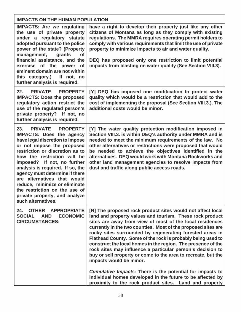
38
IMPACTS ON THE HUMAN POPULATION IMPACTS: Are we regulating the use of private property under a regulatory statute adopted pursuant to the police power of the state? (Property management, grants of financial assistance, and the exercise of the power of eminent domain are not within this category.) If not, no further analysis is required.
have a right to develop their property just like any other citizens of Montana as long as they comply with existing regulations. The MMRA requires operating permit holders to comply with various requirements that limit the use of private property to minimize impacts to air and water quality.
DEQ has proposed only one restriction to limit potential impacts from blasting on water quality (See Section VIII.3).
22. PRIVATE PROPERTY IMPACTS: Does the proposed regulatory action restrict the use of the regulated person’s private property? If not, no further analysis is required.
[Y] DEQ has imposed one modification to protect water quality which would be a restriction that would add to the cost of implementing the proposal (See Section VIII.3.). The additional costs would be minor.
23. PRIVATE PROPERTY IMPACTS: Does the agency have legal discretion to impose or not impose the proposed restriction or discretion as to how the restriction will be imposed? If not, no further analysis is required. If so, the agency must determine if there are alternatives that would reduce, minimize or eliminate the restriction on the use of private property, and analyze such alternatives.
[Y] The water quality protection modification imposed in Section VIII.3. is within DEQ’s authority under MMRA and is needed to meet the minimum requirements of the law. No other alternatives or restrictions were proposed that would be needed to achieve the objectives identified in the alternatives. DEQ would work with Montana Rockworks and other land management agencies to resolve impacts from dust and traffic along public access roads.
24. OTHER APPROPRIATE SOCIAL AND ECONOMIC CIRCUMSTANCES:
[N] The proposed rock product sites would not affect local land and property values and tourism. These rock product sites are away from view of most of the local residences currently in the two counties. Most of the proposed sites are rocky sites surrounded by regenerating forested areas in Flathead County. Some of the rock is probably being used to construct the local homes in the region. The presence of the rock sites may influence a particular person’s decision to buy or sell property or come to the area to recreate, but the impacts would be minor.
Cumulative Impacts: There is the potential for impacts to individual homes developed in the future to be affected by proximity to the rock product sites. Land and property

39
IMPACTS ON THE HUMAN POPULATION values would continue to grow as the demand for land in Montana grows. DEQ does not expect the quarries would influence tourism in the areas. The people that would see the rock product sites the most are recreationists using the private lands, adjacent US Forest Service, Bureau of Land Management, and State of Montana lands for hiking, hunting, etc.
25. Alternatives Considered:
NO ACTION, DENY THE APPLICANT’S PROPOSED PLAN: DEQ reviewed Montana Rockworks’ proposed operating and reclamation plans. If the Proposed Action were denied, then Montana Rockworks would have to cease existing operations that cannot comply with SMES requirements. DEQ has concluded that three of the five sites proposed meet the General Quarry Permit requirements except that the amount of land disturbed on the sites cannot be limited to less than five acres disturbed and unreclaimed at any one time.
APPROVE THE APPLICANT’S PROPOSED PLAN: Montana Rockworks has responded to almost all of DEQ’s concerns with the original application through the operating permit review process. Montana Rockworks has proposed subsequent changes that were used to develop this Draft EA. Montana Rockworks is expected to amend the permit with the addition of new sites over a 20-year permit life. Some of these sites would comply with restrictions analyzed in the Supplemental Programmatic EA for the General Quarry Permit completed in March 2004, except for the number of acres disturbed and unreclaimed at any one time. DEQ would review new sites as they are proposed for compliance with General Quarry Permit requirements. DEQ would then publish notice of proposed new sites as amendments or revisions to the operating permit per MMRA requirements. Another environmental analysis would be completed for each site that exceeds General Quarry Permit requirements as it is proposed. Montana Rockworks has attempted to propose a worst case scenario for permitting purposes to avoid the incremental permitting needed over time if too few acres are proposed now.
APPROVE THE APPLICANTS’S PROPOSED PLAN WITH AGENCY MODIFICATIONS: As mentioned above, Montana Rockworks has committed to requests made by DEQ during the operating permit review process. Three modifications to the Applicant’s Proposed Plan have been identified to lessen potential impacts to water quality in the future.
Modification 1. Some sites may use blasting to create crushed landscape rock products or aggregates for road and home building needs. Water quality from blasting could be affected. DEQ would review the location of rock product sites where blasting is proposed. If the sites are near surface water, wetlands or private residences with water wells, Montana Rockworks would have to monitor the local homeowner’s well for nitrates, install shallow water monitoring wells, and sample the wells periodically for nitrates.
If nitrates were observed in any monitoring wells above baseline levels, blasting would cease on the site immediately. Montana Rockworks would have to apply for an amendment to the operating permit on the site and a groundwater quality protection plan would have to reviewed and

40
approved by DEQ before blasting could be resumed.
Montana Rockworks would have to install a shallow groundwater monitoring well at the McGregor Lake site.
Modification 2. Montana Rockworks must apply for a storm water permit from DEQ for the McGregor Lake Site #1 access road.
A third modification would require Montana Rockworks to report annual weed control activities for each site in the annual report to DEQ.
Modification 3. Montana Rockworks must report annual weed control activities including amount of acres sprayed, chemicals used, weeds sprayed, and maps of weed infestations.
26. Public Involvement: DEQ published legal notices in the counties where quarries are proposed and issued a press release when the operating permit application was submitted in July 2005. No comments were received on the original permit application as a result of the public notices. DEQ received one telephone call from the U.S. Forest Service about the Flathead County sites during the process.
This Draft EA has been distributed to the mailing list developed for the General Quarry Permit and to all landowners adjacent to the proposed sites (See Table 2 in Appendix A). Extra copies of this Draft EA can be obtained from DEQ offices in Helena. This Draft EA has also been posted on the DEQ web page: http://www.deq.mt.gov/. For copies of the Draft EA or to submit comments, write or call the Montana Department of Environmental Quality c/o Herb Rolfes, P. O. Box 200901, Helena, MT 59620, telephone (406) 444-3841 or e-mail at [email protected]. Comments will be accepted for 30 days after the date of the signatures below.
27. Other Governmental Agencies with Jurisdiction: None US Forest Service, Bureau of Land Management, and State of Montana lands may be crossed for access to the rock product sites. Federal, County and State of Montana public roads would be used for access and hauling rock products from the quarries. Operators would have to comply with speed limits and other restrictions placed on use of these public roads across U.S. Forest Service, Bureau of Land Management, and State of Montana lands. County Weed Control Districts regulate noxious weed control activities.
28. Magnitude and Significance of Potential Impacts: There would be no significant impacts associated with this proposal. The various impacts have been discussed above in Section VIII.1-24. The major impacts are summarized here. Up to 860 acres of rocky areas in the mountains and foothills would be disturbed by quarrying, road development, and staging areas over the 20-year permit life. Impacts to rock outcrops and talus slopes, soils, vegetation and wildlife habitat as well as impacts to the human environment from dust and noise and to the aesthetics of the area are unavoidable impacts from allowing rock product operations. Reclamation would limit the visual impacts to acceptable levels as required by MMRA, but the sites would look disturbed for a long time.
Socio-economic benefits from the full and many part-time and seasonal jobs created by the proposed operations would result.

41
Most of the proposed sites exceed only one General Quarry Permit criterion and that is that the size of the area disturbed and unreclaimed cannot be kept to less than five acres. Montana Rockworks commits to keep the total area disturbed and unreclaimed at any one time to less than 200 acres.
29. Cumulative Impacts: As mentioned above, Montana Rockworks proposes to disturb up to 860 acres over the life of the operating permit. Physical, biological, visual and human environment impacts would result from these disturbances. The overall environmental impacts of these disturbances would be limited. The socio-economic impacts resulting from the quarries would benefit the economy of Flathead and Wheatland counties.
The rock products industry is the largest mining-related growth industry in Montana next to sand and gravel operations. Other rock quarrying operations on surrounding US Forest Service, State of Montana and private lands would add to the cumulative impacts of this operating permit. Currently, there are 20 SMESs for operating rock-collecting sites in the two counties affected by this proposed permit.
One operating permit that could cumulatively affect Montana Rockworks’s proposed operations covers Plum Creek’s sites in Flathead County. Plum Creek has permitted 93 sites in five western Montana counties, including Flathead County, and 3,545 acres would be disturbed over the 20-year permit life. In addition, other permit applications are being prepared for rock product operations on private inholdings on the Flathead Indian Reservation.
Cumulative impacts would result from rock products being collected on adjacent area ranches in Wheatland and Golden Valley counties. Currently, DEQ has permitted rock product operations in Wheatland and Golden Valley counties totaling 652 disturbed acres. In addition, one new operating permit and one new amendment have been applied for that would permit another 37 acres over the proposed operating permit lives.
U.S. Forest Service and private timber sales on adjacent lands could add to cumulative impacts in the drainages from sediment production, traffic, dust, and loss of native rock, soil and vegetation and increased visual impacts in Flathead County. Continued development of private property for subdivisions on Plum Creek as well as other private land would also add to the cumulative impacts to area resources from these quarries.
Building stone quarries and rock collecting sites are increasing throughout Montana. DEQ prepared a Final Supplemental Programmatic EA on these operations in March 2004. The operations that qualify must meet the provisions listed in Section VI.A.
The rock product sites proposed by Montana Rockworks meet all these requirements except the applicant cannot keep the disturbance to less than five acres disturbed and unreclaimed at any one time on three of the sites. Even though the current sites and some of the future sites may exceed five acres disturbed and unreclaimed at any one time, there would be no other impacts other than the size of the disturbance area over that analyzed in the March 2004 EA. This Checklist EA tiers to the 2004 EA. Reclamation would limit those impacts. DEQ would bond Montana Rockworks to reclaim acres disturbed by quarrying.
Many acres could be potentially disturbed by rock product operations throughout Montana as a result of the demand for building stone. The cumulative impacts from all these operations


ATTACHMENT 1

February 1, 2004
RE: Supplemental EA for General Quarry Permit
Dear Reader,
Attached is a copy of a supplemental programmatic Environmental Assessment (SEA) for a proposed general quarry permit for standardized plans of operations for small multiple-site quarry and rock collecting operations. The Montana Department of Environmental Quality (department) published a draft and final programmatic Environmental Assessment (EA) for a proposed general quarrypermit for standardized plans of operations for small multiple-site quarry and rock collecting operations on October 26, 1999 and January 12, 2000.
The department is herein proposing a revision of the language which refers to allowable disturbance under the general quarry permit, to comport with language found in the Metal Mine Reclamation Act (MMRA) regarding disturbance under the Small Miners Exclusion Statement (SMES). In addition, several changes have been made to improve precision and provide clarification. The draft SEA includes a draft application for operations qualifying for this proposed permit.
The General Quarry Permit was developed to address the need to regulate the expanding number of small quarries and rock collecting sites in Montana. Such sites traditionally have been regulated under a Small Miners Exclusion Statement (SMES). Many operators, however, have more than the maximum of two sites allowed under a SMES, but do not cause the level of environmental impacts appropriate for a full Operating Permit. The proposed language change wouldallow any individual small quarry to maintain a working disturbance of up to 5 acres. Total disturbance during the life of an individual operation could exceed 5 acres, but concurrent reclamation would be required to keep the disturbance at any one time to 5 acres or less. This language is consistent with that found in the MMRA with regard to mines that operate under the SMES.
The General Quarry Permit plan of operations would be accepted where there is no potential for impact to surface or groundwater, where the geochemicalchanges resulting from excavation of rock will not result in acid rock drainage, and where no water impounding structures other than for storm water control are constructed. In addition, the plan of operations would be accepted for sites where there are no cultural resources, wetlands, or threatened and endangered plant or animal species. Sites may occur on federal, private, or state lands.
1

A new supplemental information form would be used for these operations. This form provides an outline specifying information needed regarding the plan of operations, baseline conditions, the reclamation plan, and the applicants. If the department concludes that an application meets the criteria for this permit, no further Montana Environmental Policy Act analysis would be required.
The draft SEA discusses two alternatives: No-Action and the Agency Proposal.The Preferred Alternative in the draft SEA is the Agency Proposal.
A 30-day comment period on the draft SEA will begin on February 5, 2004 and end on March 5, 2004. Any comments, suggestions, or questions will be welcomeduring that period. Written comments may be sent to Patrick Plantenberg, Environmental Management Bureau, Permitting and Compliance Division, DEQ, P.O. Box 200901, Helena, MT 59620-0901. Letters must be postmarked by March 5, 2004. Comments can also be sent by e-mail to [email protected].
For more information on the draft SEA or to request a copy of the draft SEA call Patrick Plantenberg at (406) 444-4960 or Pete Strazdas at (406) 444-4962. The draft SEA is also available on the DEQ web page at http://www.deq.state.mt.us/ea.htm.
Sincerely,
Warren McCullough, Chief Environmental Management Bureau
Enclosure w/2 appendices
2

DEPARTMENT OF ENVIRONMENTAL QUALITY PERMITTING AND COMPLIANCE DIVISION
PROGRAMMATIC ANALYSISFOR
GENERAL QUARRY PERMITDRAFT SUPPLEMENTAL ENVIRONMENTAL ANALYSIS
Environmental Management Bureau - Hard Rock Program
APPLICATION FOR OPERATING PERMIT
Introduction
Name of Project:___________________ General Quarry Permit ____________
Type of Project:______________________Rock ____________________________
Location of Project(s):________________________Variable___________________
County:____________________________________Variable___________________
Description of Project (Summary of Proposed Action)
The department published draft and final programmatic Environmental Assessments (EAs) for a proposedgeneral quarry permit for standardized plans of operations for small multiple-site quarry and rock collectingoperations on October 26, 1999 and January 12, 2000. “Quarry” as used in this SEA may mean either a quarry ora rock collecting site. The department is herein proposing a revision of the language which refers to allowabledisturbance under the general quarry permit, to comport with language found in the Metal Mine Reclamation Act(MMRA) regarding disturbance under the Small Miners Exclusion Statement (SMES). In addition, several otherchanges have been made to improve precision and provide clarification. Additions to the SEA are shown in italics.Deletions are shown as strike outs.
The department is consolidating, in one programmatic review, an analysis of a proposed plan of operations for small multiple-site quarry and rock collecting operations. The General Quarry Permit was developed to address the need to regulate the expanding number of small quarries and rock collecting sites in Montana. Such sites traditionally have been regulated under a Small MinersExclusion Statement (SMES). Many operators, however, have more than the maximum of two sites allowed under a SMES, but do not cause the level of environmental impacts appropriate for a full Operating Permit. The proposed language change would allow any individual small quarry to maintain a working disturbance of up to 5 acres. Total disturbance during the life of an individualoperation could exceed 5 acres, but concurrent reclamation would be required to keep the disturbance at any one time to 5 acres or less. The plan of operationswould apply only to sites where each individual site would disturb no more than 5 acres, be accepted where there is no potential for impact to surface or groundwaters, where the geochemical changes resulting from excavation of rock do will not result in acid rock drainage, and where no water impounding structures other than for storm water control are constructed. In addition, the plan of operations would apply only to be accepted for sites where there are no
3

cultural resources, wetlands, or threatened and endangered plant or animal species. Such s Sites may occur on federal, private, or state lands.
A new supplemental information form would be used for in conjunction with these small quarryand rock collecting operations and is included in Appendix A. This form provides an outline specifying information needed regarding the plan of operations, baseline conditions, thereclamation plan, and information about the applicants. If this programmatic review is approvedand the department concludes that an application meets the criteria set out below, then no further Montana Environmental Policy Act ( MEPA) analysis would be required.
Each permit approved through this process may be modified by the department or the applicant in accordance with provisions of Section 82-4-337(3), MCA at any time that the above conditions are not met.
Purpose and Need
The department has proposed a standardized plan of operations for activities undertaken at certain sites by companies and individuals supplying rock for landscaping and construction.Demand for this type of rock is increasing. Thus, the department’s workload in this area is increasing. The department has developed this standardized plan to maximize the efficiency of permitting and the decision-making process for such companies and individuals.
These kinds of disturbances are have typically been covered under the SMESSmall Miner’s Exclusion Statement; the need by many applicants for more than two sites precludes this option. This documentation provides a categorical exclusion from the more detailed, standardized operating permit applicationprocess and environmental impact analysis currently required for sites noteligible for a SMES.
Pubic Involvement
The department published a notice to solicit public input in newspapers across the state. Onlytwo newspapers chose to publish the notice, the Mineral Independent of Superior, and theMeagher County News of White Sulphur Springs, both in April 1999. The department publishedthe notice for the supplemental environmental analysis in January 2004.
The department further solicited comments from 117 contractors, quarrymen, public agencies, elected officials, and citizens groups. Letters were mailed on May 10, 1999. The department received letters from two commentors in response. None of the comments weresubstantive.
Agency Roles and Responsibilities
The department is responsible for ensuring that activities proposed under the Metal Mine Reclamation Act MMRA are in compliance with the Act and with air and water regulations.Permits issued pursuant to these regulations do not confer any property rights to a permittee. In preparing the draft EA, the department solicited input from the Department of Natural Resourcesand Conservation and federal land managing agencies. No comments were received from these agencies. However, each applicant would be responsible for obtaining any special use permits or complying with agency-specific restrictions when if the proposed mine quarry was is located on state or federal lands.
Alternatives
4

Alternatives would be developed based on the complexity of the existing process and a desire to tailor the process to meet the specific needs of a group of permittees conducting activities on small areas with minimal impact and no potential for significant impacts. Public comment wassolicited to develop additional criteria for consideration as a part of the proposed action and to develop additional alternatives. No additional concerns were identified; therefore, there are no additional alternatives considered in this EA other than the No-Action Alternative required under MEPA.
No Action Alternative
Under the No-Action Alternative, the department would require each potential permittee to applyusing the standard operating permit application process. This existing process is minimallystandardized because of the large degree of variability between sites proposed for large industrial or even small metal mines. Thus it is difficult for the small operator who has minimal familiaritywith, and limited resources to commit to the permitting process and to secure an operatingpermit. Appendix B contains a copy of the existing application form. Supplemental material describing the environmental baseline, the operating plan, and the reclamation plan is typicallysubmitted in three-ring binders. The amount of supplemental information varies with the size andcomplexity of the site.
Proposed Plan of Operations Alternative
Under this alternative, the department would utilize a standardized, more structured process to work with the individuals and small firms proposing to collect landscaping rock or building stoneon a small-scale or intermittent basis. Appendix A contains the proposed form outlining and defining the supplemental information needed regarding the plan of operations, baselineconditions, the reclamation plan, and applicants, and would be appended to the existingApplication for Operating Permit form found in Appendix B. The proposed form condenses the information that typically fills three-ring binders under the existing standardized permitting process and would facilitate permitting multiple small quarry and rock collecting operations that meet the criteria described below.
This plan would apply to multiple sites that do not meet the criteria for a Small Miner’s ExclusionStatement because the same operator would disturb more than two sites. The General Quarry Permit was developed to address the need to regulate the expanding number of small quarries and rock collecting sites in Montana. Such sites traditionally have been regulated under a Small Miners Exclusion Statement (SMES). Many operators, however, have more than the maximum of two sites allowed under a SMES, but do not cause the level of environmental impacts appropriatefor a full Operating Permit. The proposed language change would allow any individual small quarry to maintain a working disturbance of up to 5 acres. Total disturbance during the life of an individual operation could exceed 5 acres, but concurrent reclamation would be required to keepthe disturbance at any one time to 5 acres or less. Individually, operators would not be allowed to have more than 5 acres at each site, Aaccess roads would not be counted against the allowable 5 acres under this permit if bonded for reclamation. Access roads would be bonded for reclamationif the landowner did not want the road left for uses after quarrying. The permitted sites are prohibited from being adjacent to each other so as to create a continuous disturbance orunreclaimed sites greater than 5 acres. This permit would cover two kinds of disturbances: quarrytype operations (at new or existing sites) and rock or stone collecting sites.
Quarry operations. A new quarry would be opened or an existing site reopened by removingvegetation, stripping and stockpiling soil for future reclamation use, and removing overburden or waste rock to access the desired rock materials. Depending on the product being produced, rock may be removed by drilling and blasting followed by excavation and hauling, ripping with a bulldozer or excavator followed by removal, or by drilling and sawing blocks with diamond sawsfollowed by removal. If blasting were to be used, the operator would comply with provisions of Ssection 82-4-356, MCA, and ARM 17.24.157-159.
5

Quarries would be reclaimed by scaling back highwalls, if necessary for stability and safety. If quarrying results in upslope raveling of scree or loose rock, that destabilized slope would be revegetated or otherwise stabilized. The quarry floor would be graded, covered with soil material and revegetated. If quarrying results in a pit below the level of adjacent ground, that pit would be backfilled to the level of adjacent ground with the remaining waste rock and/or graded to blend with the surrounding topography and revegetated using the cover material that is available.
Other areas disturbed but not mined quarried would also be revegetated. Overburden and wasterock, if present, would be graded to conform to natural topography, against the pit highwall or as a mound or slope. Coarse rock would not be revegetated but would remain as a rubble or scree feature. Overburden that could support vegetation, or rock that could be covered with salvagedsoil, would be revegetated.
Rock Collection Sites. A rock or stone collection site would be worked by workers with hand bars or other hand tools, or with loaders, backhoes, or other similar equipment that would lift rock and stones from the ground surface, or from under thin soil layers, and stockpile or pallet them for removal. These kinds of operations would generally occur on ridges or across rolling prairie and would not generally cause continuous areas of disturbed soil nor create open pits or highwalls,but would only disturb the ground from which the rock had been removed. In most rock collection sites, soil would not be salvaged, because site disturbance would be minimal, however,loss of soil by gully erosion of tracks or other careless activities would not be permitted.
Reclamation needs at rock collection sites would be evaluated on a site-specific basis. Reclamation may consist primarily of smoothing disrupted ground surfaces, replacing any topsoil that had been removed and stockpiled, seeding sites where rock has been removed, clearing rock from roads and trails to remain after mining, and grading excessive ruts on roads or fields thatmay have been caused by the operator.
General Requirements. There would be no permanent structures on site, unless these structuresconformed to the approved post mine land use after quarrying. Temporary camp/office trailers may be used. All equipment and buildings brought onto the site and trash would be removed at mine quarry closure.
Access would typically be from established trails or roads. However, if an access road wereproposed, it would typically be a relatively low grade, temporary road. The operator would need to have approval from the landowner or a special use permit from a government agency prior to constructing the road and all necessary measures would be taken to control erosion including using standard best management practices (BMPs) and revegetating all disturbed areas along theroad. Roads would be bonded for reclamation, unless required post mine by the landowner afterquarry closure.
Rock may be sorted, stockpiled, and collected on sites, prior to removal. Occasionally, somewood splitting/breaking may be done and rock crushing for decorative uses may occur. An air quality permit may be required for crushing operations and would be applied for on a site-specificbasis.
In those instances when substantial site disturbance would be required, soils would be salvagedand stockpiled. Long-term soil stockpiles would be revegetated with an interim seed mix to minimize dust and weed establishment. Best management practices for erosion and storm watercontrols would be utilized, including diversion of run-on water from undisturbed ground awayfrom the rock collection or quarry site and collection of storm water from within the disturbedareas into ponds without discharge to surface waters.
The proposed post-mining land use after quarrying would typically return the site to its prequarryingmining use, typically such as wildlife habitat, forest, or grazing land. Plant species used for revegetation would be compatible with and appropriate for the post-mining land use afterquarrying, and approved by the department. Any alternative post-mining land use after quarrying
6
proposed by the operator, such as a building site, may be appropriate if it is feasible, compatiblewith any local or regional zoning regulations, and consistent with the landowners’ long-term plansfor the site. Any land use changes outside these parameters would need to be evaluated in a separate EA.
Noxious weed control would be consistent with the County’s weed control plan. Liability for weedcontrol or eradication would be based on species identified in a site-specific prequarrying-miningweed inventory. Operators would be responsible to eradicate noxious weeds on ground that wasfree of noxious weeds prior to quarrying mining. Conversely, if the site was infested beforeoperations began, the operator would not be responsible for returning the land to a weed-freestate, but would be required to return the land to a condition no worse than what existed prior to operations and similar to that of surrounding lands. Operators may be required to establishcompetitive vegetation, if appropriate.
Bonding would be determined in accordance with the approved site-specific plan of operations asdefined in Section 82-4-338 MCA.
Affected Environment
The site conditions required for a plan to be approved under this operating permit are describedbelow.
Geology
Rock mined quarried under this plan would consist of various rock types and mineralogies. The rock may be found at or near the surface, such as talus, or in-place, such as bedded sandstone,shale, limestone, basalt, rhyolite, travertine, or marble. It may be covered by overburden, or exposed as outcrops or scattered rock laying on the earth’s surface. The rock or resulting wastewould have no potential for causing acid rock drainage. Sites with a potential for acid rock drainage would not be eligible for permitting under this SEA.
Hydrology
For rock recovery under a general quarry permit, the rock must be obtained from a dry site.Surface waters would must be 100 feet or more from the site and the water table would must notbe intercepted by any surface activities. Similarly, no riparian areas or wetlands would may bedisturbed as a result of rock quarrying under the general quarry permit.
Soils
Soil development may be highly variable but may be expected to be shallow over rock. Extent of soil development would not be a criterion of permit approval.
Biological Diversity
Vegetation on quarry sites consists of meadows, rangelands, forests, or agricultural crops,typically supporting an array of wildlife species including small and large mammals, reptiles, and birds. Sites supporting threatened and endangered or sensitive plant species would not be permittableed under this general permit. Some sites may contain a high concentration of andnoxious weeds plants prior to site disturbances. Due to the required distance from water, no fisheries would be present and the probability for the occurrence of any amphibians would be limited.
7

Land Use
Existing land uses would include mining quarrying, agriculture, recreation, and forestry. If anyhistoric or prehistoric cultural activities are known to have occurred at the proposed site, the site would not be permittableed under the general quarry permit. The site would not affect anyexisting transportation or utility corridors, or wilderness lands.
Social-Economic Conditions
Most rock collecting is done by individuals and small companies. The quarrying and rock collecting activities are distributed statewide. The operators tend to be concentrated nearpopulation centers and in areas experiencing growth, to satisfy the demand for decorative rock and building stone.
Impacts of the Proposed Project
8

N = Not present or No Impact will occur.
Y = Impacts may occur (explain under Potential Impacts).Include frequency, duration (long or short term) magnitude and context for any impactsidentified. Identify reasonable feasible mitigation measures where appropriate.
NA= Not applicable
IMPACTS ON THE PHYSICAL ENVIRONMENT
RESOURCE [Y/N] POTENTIAL IMPACTS AND MITIGATION MEASURES
1. GEOLOGY AND SOIL QUALITY,STABILITY AND MOISTURE: Are soils present which are fragile,erosive, susceptible to compaction,or unstable? Are there unusual or unstable geologic features? Arethere special reclamationconsiderations?
[Y] Removal of rock or building stone would irreversiblyremove the material from the site. A pit and/or highwallmay result from quarrying. Soils would be salvaged and replaced at sites proposed for substantial surfacedisturbance.Additional protective measures would be required on steepslopes and erodible soils to minimize erosion.
2. WATER QUALITY, QUANTITYAND DISTRIBUTION: Are importantsurface or groundwater resourcespresent? Is there potential for violation of ambient water qualitystandards, drinking water maximum contaminant levels, or degradationof water quality?
[N] The stipulated 100-foot distance from surface watersand prohibition of interception of water tables wouldprevent impacts to surface and ground waters.
3. AIR QUALITY: Will pollutants or particulate be produced? Is the project influenced by air qualityregulations or zones (Class I airshed)?
[N] There is some potential for dust created by crushingoperations that may need to be covered by an air qualitypermit.
4. VEGETATION COVER,QUANTITY AND QUALITY: Will vegetative communities be significantly impacted? Are anyrare plants or cover types present?
[Y] Vegetation could be impacted for the short-term byclearing and soil removal at some sites. This would be mitigated by replacing soil and revegetating the site at closure. The potential exists for increasing the spread ofnoxious weeds but would be minimized throughimplementation of a county approved noxious weed controlplan and aggressive control measures.
5. TERRESTRIAL, AVIAN ANDAQUATIC LIFE AND HABITATS: Is there substantial use of the area byimportant wildlife, birds or fish?
[Y] There is a potential for minor impacts to wildlife and birds at sites with greater surface disturbance, and whereheavy equipment or blasting would be used. This would bea short term and very local impact, and would be removedcease when quarrying or rock collecting mining ceasedends. Sites with critical habitats for threatened and orendangered species would not be permitted under this process.
9

IMPACTS ON THE PHYSICAL ENVIRONMENT
6. UNIQUE, ENDANGERED,FRAGILE OR LIMITED ENVIRONMENTAL RESOURCES:Are any federally listed threatened or and endangered species or identified habitat present? Anywetlands? Species of specialconcern?
[N] Sites with these features would not be permittedthrough this proposed permit process.
7. HISTORICAL ANDARCHAEOLOGICAL SITES: Are any historical, archaeological or paleontological resources present?
[N] Sites with these features would not be permittedthrough this proposed permit process.
8. AESTHETICS: Is the project on a prominent topographic feature?Will it be visible from populated or scenic areas? Will there be excessive noise or light?
[Y] Activities at existing quarries or development of newquarries may be visible from populated areas or from recreational sites, but the small size of these operationsand site reclamation concurrently and at closure wouldmitigate any long-term impacts to below the level ofsignificance.
9. DEMANDS ON ENVIRONMENTALRESOURCES OF LAND, WATER, AIR, OR ENERGY: Will the project use resources that are limited in the area? Are there other activitiesnearby that will affect the project?
[N]
10. IMPACTS ON OTHERENVIRONMENTAL RESOURCES:Are there other environmentalresources that would be affected bythe project?
[N]
IMPACTS ON THE HUMAN POPULATION
11. HUMAN HEALTH AND SAFETY:Will this project add to health and safety risks in the area?
[Y] Creation of new highwalls at quarry sites would create a safety risk. Fencing and posting of highwalls duringoperations and reclamation after mining would minimize the short- and long-term risks.
12. INDUSTRIAL, COMMERCIALAND AGRICULTURAL ACTIVITIESAND PRODUCTION: Will the project add to or alter these activities?
[Y] Development of new sites would result in the development of an industrial operation that could be noticeable in areas with few similar activities nearby.Reclamation of the sites after mining quarrying and rock collecting ceases would mitigate this impact. Expansion ofexisting quarries and sites would have less impact.
10

IMPACTS ON THE HUMAN POPULATION13. QUANTITY AND DISTRIBUTIONOF EMPLOYMENT: Will the project create, move or eliminate jobs? If so, estimated number.
[Y] The number of jobs created by these operations is highly variable, from one person per operation, to companies employing several tens of fulltime workers.
14. LOCAL AND STATE TAX BASE AND TAX REVENUES: Will the project create or eliminate tax revenue?
[Y] Addition to tax base would be insignificant substantialin some counties in Montana.
15. DEMAND FOR GOVERNMENTSERVICES: Will substantial traffic be added to existing roads? Will other services (fire, police, schools, etc.) be needed?
[Y] There may be some increase in traffic on roads to some sites, but the increase would not be substantial and wouldreturn to premine prequarry levels after the mine quarryclosed and the site was reclaimed.
16. LOCALLY ADOPTEDENVIRONMENTAL PLANS AND GOALS: Are there State, County,City, USFS, BLM, Tribal, etc. zoningor management plans in effect?
[Y] Special use permits and agency specific restrictionsmay be required on federal or state lands.
17. ACCESS TO AND QUALITY OF RECREATIONAL ANDWILDERNESS ACTIVITIES: Are wilderness or recreational areas nearby or accessed through this tract? Is there recreationalpotential within the tract?
[Y] Mining Quarrying could not occur within designatedwilderness areas, but development of new, or expansion of existing sites could affect recreational activities on and around the sites. The small size of each site and reclamation of potential sites at mine quarry closure wouldminimize this potential impact below the level of significance.
18. DENSITY AND DISTRIBUTIONOF POPULATION AND HOUSING:Will the project add to the population and require additionalhousing?
[N]
19. SOCIAL STRUCTURES AND MORES: Is some disruption of native or traditional lifestyles or communities possible?
[N]
20. CULTURAL UNIQUENESS AND DIVERSITY: Will the action cause a shift in some unique quality of the area? [N]
21. PRIVATE PROPERTY IMPACTS: Are we regulating the use of privateproperty under a regulatory statuteadopted pursuant to the police power of the state? (Property
[Y] This activity is regulated by the MMRA Montana Metal Mine Reclamation Act, Ssection 82-4-301 MCA, et seq. No permit conditions are proposed outside the scope of this statute.
11

IMPACTS ON THE HUMAN POPULATIONmanagement, grants of financialassistance, and the exercise of thepower of eminent domain are not within this category.) If not, no further analysis is required.
22. PRIVATE PROPERTY IMPACTS: Does the proposed regulatoryaction restrict the use of the regulated person’s privateproperty? If not, no further analysisis required.
[Y] The mitigations described above are necessary to comply with reclamation, water quality, and air quality lawsand regulations, and would vary to some degree from site to site, depending on conditions and type of operations.
23. PRIVATE PROPERTY IMPACTS: Does the agency have legaldiscretion to impose or not impose the proposed restriction ordiscretion as to how the restrictionwill be imposed? If not, no further analysis is required. If so, the agency must determine if there arealternatives that would reduce,minimize or eliminate the restrictionon the use of private property, and analyze such alternatives. The agency must disclose the potentialcosts of identified restrictions.
[N] The only discretion available to the agency would be in selecting mitigations appropriate for each site that wouldachieve the desired result of complying with the laws and regulations. The requirements imposed in the plan of operations are the minimum requirements necessary to comply with the Metal Mine Reclamation Act MMRA andrules.
24. OTHER APPROPRIATE SOCIAL AND ECONOMICCIRCUMSTANCES:
[N/A]
25. Description of and Impacts of Other Alternatives Considered:
No-Action: The No-Action alternative would leave the permitting requirements for smallquarrying and rock collection operations unchanged. Those operators who utilize more than the two sites allowable under the SMES would be obliged to submit more rigorousbaseline, operating, and reclamation plans. The department would be obliged to conductpublic scoping, prepare an environmental assessment, and solicit and respond to publiccomments for each site.
Approval with Modification: No modifications were proposed.
26. Summary of Magnitude and Significance of Potential Impacts: Impacts would be minimal. The General Quarry Permit was developed to address the need to regulate theexpanding number of small quarries and rock collecting sites in Montana. Such sites traditionally have been regulated under a Small Miners Exclusion Statement (SMES).Many operators, however, have more than the maximum of two sites allowed under a SMES, but do not cause the level of environmental impacts appropriate for a full Operating Permit. The proposed language change would allow any individual small quarry tomaintain a working disturbance of up to 5 acres. Total disturbance during the life of an individual operation could exceed 5 acres, but concurrent reclamation would be required
12
to keep the disturbance at any one time to 5 acres or less. Each permit would be no larger than 5 acres, which is the scale of disturbance determined in the MMRA to be non-significant. Further, there would be no impact to surface or groundwater, archeological or cultural resources, or rare threatened or and endangered plant or animal species. Eachsite would be reclaimed immediately following mine closure.
27. Cumulative Effects: Cumulative effects would depend on what other activities are ongoing in each of the quarry/rock collection areas. Operations under the general quarrypermit would provide minimal additional disturbance in any area. If cumulative effects from other activities in the area and a quarry or rock-picking site were identified, then thiscategorical exclusion would not apply.
28. Preferred Alternative: The department’s preferred alternative is to adopt thegeneral quarry permit as described in this supplemental environmental assessmentwithout modifications.
29. Recommendation for Further Environmental Analysis:
[ ] EIS [ ] More Detailed EA [ X ] No Further Analysis
Rationale for Recommendation: This permitting process for multiple small quarries or rock collection sites would be a more efficient and simpler way for applicants to apply forpermits and the agency to review them than the standard process that is currentlyrequired for multiple sites due to the small miner’s restrictions in the Montana Metal MinesReclamation Act MMRA. There would be minimal or no impacts to the existingenvironment during operation at sites approved under this general permit and there wouldbe no potential for acid rock drainage. No impacts of any kind would be allowed to affect surface or ground water, wetlands, archeological or cultural resources, or rare, threatened,or and endangered plant or animal species during operation, because the general quarrypermit would not be used in those instances. Soil would be salvaged and/or protected to prevent erosion and facilitate reclamation. Storm water controls would be required topreventing erosion and possible sedimentation of nearby streams outside the 100-footbuffer zone. Each site would be reclaimed concurrently and/or immediately following mineclosure.
30. SEA Checklist Prepared By:
Pete Strazdas Patrick PlantenbergSmall Miner Program Supervisor Operating Permit Section Supervisor
Approved By:
______________________________________________________________ WarrenMcCullough DateEnvironmental Management Bureau Chief
13

APPENDIX A
14

GENERAL QUARRYPLAN OF OPERATIONS
This Plan of Operations application form may be used to permit a rock or stone quarry or collection area if:
�� Any individual small quarry maintains a working disturbance of up to 5 acres. Total disturbance during the life of an individual operation could exceed 5 acres, but concurrent reclamation would be required to keep the disturbance at any one time to 5 acres or less. Access roads would not be included in the disturbed total, but the operator would submit a reclamation bond for roads that do not have an appropriate use after quarrying. Roads appropriate for the land use after quarrying and access or haulage roads which are required by a local, state, or federal agency having jurisdiction over that road would not have to be bonded;
�� There would be no impact to any wetland, surface or ground water;�� There would be no constructed impoundments or reservoirs used in
the operation; �� There would be no potential to produce any acid or other pollutive
drainage from the pit; �� There would be no impact to threatened and endangered species;
and�� There would be no impact to significant historic or archeological
features.
This form offers a simplified way to write a complete plan and must be submitted together with the Application for Operating Permit form and $500 application fee.
When using this form: 1) give a complete response to the information requested; 2) provide necessary additional information; and 3) write N/A if the request for information is not applicable.
Supplemental information can be found in the Plan of OperationsGuidelines and other Operating Permit packet materials. Please contact the department if you need additional information or assistance.
SECTION I - CORPORATE INFORMATION (All information requested in this part must be provided)
1. If the applicant is a corporation or other business entity, list the name and address of officers, directors, owners of 10% or more of any class of
15

voting stock, partners, and the like and its registered agent for service of process:
2. List the names and addresses of the owners of record and anypurchasers under contract for deed of the surface of the land within the permit area and the owners of record and any purchasers for deed of all land within one half mile of any part of the permit area:
3. List the names and addresses of the present owners of record and any purchasers under contracts for deed of all minerals in the land within the permit area:
4. Provide the source of the applicant’s legal right to quarry the mineral on the land affected by the permit:
5. Certify that the applicant is not currently in violation in this state of anylaw, rule, or regulation of this state or of the United States pertaining to air quality, water quality, or quarried land reclamation:
Or if the applicant is a partnership, corporation, or other business association,certify that any partners, officers, directors, owners of 10% or more of any class of voting stock, and business association members, are not correctly in violation in this state of any law, rule, or regulation of this state or of the United States pertaining to air quality, water quality, or quarried land reclamation:
SECTION II - PREQUARRY BASELINE
1. Location and Topography. Provide a map showing the location of the proposed quarry and describe the proposed access route. Include the specific area to be quarried and the boundaries of land that will be disturbed, sufficient topographic detail to show the topography of the site, the location and names of streams, roads, railroads, and utility lines on or immediately adjacent to the area, and the location of proposed access roads and conceptual spur roads to be built.Provide a general description of how to access the site using the Exhibits:
2. Present Land Use and Past Quarrying Disturbance. Describe the present land use and any past quarrying disturbance within and near the proposed permit area:
3. Water Wells. Give the location, total depth, and use of any water well in and within 1,000’ of the permit area:
16

4. Water Table. Give the estimated seasonal high and low table depths for the area to be quarried, and the maximum depth of quarrying. Specify whetherquarrying activities will intercept the water table at any time of the year. If the water table is close to the surface, please dig a test pit and document the presence or absence of evidence of seasonally high water tables:
5. Surface Water. Show the location on a map and provide a description, and use ofany surface water in and within 100 feet of the permit area. Specifically state howfar it is from the permit area to surface water. Specifically state whether there is any surface water within 100 feet of the quarry or the new access road. For all sites with surface water close to the site, the operator will describe additional BMP’s put in place to prevent impacts to surface water:
6. Soil Material. Provide a general description of the soil and overburden types and thickness in the area to be quarried. Provide a general description of the soil in the proposed disturbance areas. Provide an estimate of the total acreage of the disturbed area that will be salvaged and have soil replaced at closure:
7. Vegetation. Describe the dominant vegetation within the permit area and note the occurrence of any noxious weeds:
8. Wildlife. Describe any significant seasonal or year round use by wildlife in and within 1,000 feet of the permit area. Does the site have any habitat for threatened and endangered species?
9. Geology. Give a geologic description of the site and describe the potential for the rock to produce acid or other pollutive drainage. Specify whether there are any visible sulfides, iron staining or other effects of chemical weathering on the rocks. If so, then provide more information and sample the material and provide the results if necessary:
Quarry or Rock Picking Activities: Please provide information for each site on the products being removed from each site. Will the site be used for surface rock picking only? Will the site create a quarry pit that needs to be graded at closure?Will crushing be needed on the site? Will blasting be used on the site?
10. Additional Information. Describe any characteristics or circumstances unique to the site:
17

SECTION III - OPERATING PLAN
1. Soil Material Handling. Operator will:
a. Salvage at least 6" of soil from level facility areas, if available: (level facility areas include mineral stockpile, processing and staging area, except palleting areas receiving minimal disturbance):
b. Salvage all soil and overburden from, and at least 10' ahead of, quarry areas: (quarry areasinclude areas to be quarried as well as areas for waste rock disposal):
c. Handle soil and overburden separately and haul these materials to areas prepared for resoiling or stockpile them separately where they will not be disturbed, contaminated, or lost to erosion:
d. Shape and seed any soil or overburden stockpile that will remain undisturbed for more than 1 year:
e. In the case of reclamation to a use that will not require a vegetative cover, retain all soil on site in an accessible location until the alternate reclamation is assured:
2. Quarrying. Indicate the material to be quarried and describe the quarrying method, showinglocation of the proposed quarry, stockpiles, roads, and other facilities on a map:
3. Rock Collecting Sites. Indicate the material to be collected and describe the collecting method, showing location of the proposed collection area, soil or waste rock stockpiles, roads, and other facilities on a map:
4. Expected Starting Date of Operations.
5. Road Construction. Describe the types of access and quarry related roads to be built, and specify which if any road is to remain per landowner request after quarrying is completed, their intended use, and the condition in which they will be left:
6. Water Management. Describe 1) the source, quantity, use, and discharge of any surface water or groundwater to be used in the quarrying operation, and 2) any sediment control structure, water treatment system, drainage structure, or other water control system to be used:
18

7. Water Protection. Operator will:
a. Take appropriate measure to protect surface water and groundwater from deterioration of quality and quantity that could be caused by quarrying and reclamation activities:
b. Inspect and maintain all fuel storage tanks parked or set on site to prevent spillage,immediately retrieve and properly dispose of any spilled fuel or contaminated materials, andreport any spill that reaches state waters or that is greater than 25 gallons to the Department at 406-444-0379:
c. Keep all equipment, facilities, and disturbances at least 100 feet from typical high watermarks of drainage ways, except at approved crossings:
8. Dust Management. Describe any dust control measures to be used during site preparation, stripping, quarrying, processing, hauling, and reclamation:
9. Rock Stockpiles. Operator will consolidate excess rock products into stockpiles in an accessible location near an access point or incorporate them into the reclamation plan:
10. Waste Disposal. Operator will prohibit on site disposal of wastes unless an appropriatesolid waste management system license is obtained from the Department:
11. Public Safety. Describe provisions to secure hazardous features, such as highwalls, from public entry:
12. Socioeconomics. Describe the number of employees that the operation would require at least on a seasonal basis. Describe the number or truckloads from the quarry site per week or month:
SECTION IV - RECLAMATION PLAN
1. Land Use After Quarrying. State the land use of the permit area after quarrying. Structuresand roads must be removed and reclaimed unless they are appropriate for the land use after quarrying:
2. Grading. Describe the backfilling and grading plan, supported by sketch maps and drawingsif appropriate, including anticipated highwall, quarry floor, and waste rock dump slopes and contours, and any special reclamation features, water catchments, drainage ways, ponds, and any portion of the quarry to stay open. Describe grading of any quarries that are below the level of adjacent ground. Describe what steps will be taken to insure that the rock face will be stable and will not present a hazard to people or animals:
19

3. Ripping, Soil Material Replacement and Revegetation. Operator will establish a vegetative cover capable of supporting the land use after quarrying:
a. Describe the methods and depths of deep ripping road, stockpile, work, and other compacted areas.
b. Describe the methods and depths of soil replacement on level facility areas and of overburden and soil replacement on level quarry areas.
c. Describe the methods of seedbed preparation, including incorporation of soil amendments and mulch, if any.
d. Describe the methods, species and rates, and season of seeding or planting.
4. Weed Control. Operator will:
a. Ensure that all seed is weed free.
b. Control noxious weeds as specified in the respective weed district management plan.
c. Describe any planned weed control measures:
5. Road Reclamation. After road surface materials have been retrieved and properly handled, operator will downsize or completely reclaim quarry-related roads as follows:
a. Roads are to be graded to blend with the natural contour.
b. Roads surfaces are to be ripped, resoiled, and seeded.
6. Site Protection and Management. Operator will maintain adequate site protection on seeded areas for two complete growing seasons, or until reclamation is achieved, whichever is longer.
7. Concurrent and Final Reclamation. Operator will:
a. Keep reclamation as concurrent with quarrying operations as possible.
20

b. Grade, resoil, and seed or plant an area no longer needed for quarry-related activities within1 year of the cessation of such activities on that area.
c. Complete final reclamation by the date given below or apply for an amendment to complete reclamation by a later date.
d. Give a reasonable estimate of the month and year by which final reclamation will be completed:
SECTION V - OTHER
1. Archaeological and Historical Values: Operator will:
a. Provide appropriate protection for archaeological and historical values found in the permit area.
b. Route operations around a site of discovery, promptly notify the State Historic PreservationOffice (406-444-7715), and leave the site undisturbed until proper evaluation is made.
2. Personnel Informed. Operator will inform all necessary on site personnel, including subcontractors, of the commitments made herein.
3. Additional Information. Describe any other conditions that pertain to this permit that wouldalter the conditions or commitments above.
I certify that the statements and information given apply to the ____ _site, and that this plan will be followed unless modified by revision or amendment as provided for in 82-4-337, MCA.
________________________________________________________________Signature Date
Revised 02/01/04
21

APPENDIX B
22

APPLICATION FOR OPERATING PERMIT
State of Montana DEPARTMENT OF ENVIRONMENTAL QUALITY
Environmental Management BureauPO Box 200901
Helena, Montana 59620-0901Phone: (406) 444-4953
Pursuant to the Montana Metal Mine Reclamation Act (Title 82, Chapter 4, Part 3 MCA) INSTRUCTIONS: See Operating PermitRules and Regulations and General Quarry Plan of Operations
Following application submittal, the initial completeness review will be done within 60 days. Subsequent reviews will be completed within 30 days. If thisapplication is consistent with the General Quarry Supplemental EA, no furhter environmental analyses will be performed.
SIZE AND LEGAL DESCIPTION OF PERMITTED AREALocation:
Section T N Range E
S W
County
Miles Direction From Nearest Community
NAME AND ADDRESS OF OPERATOR (Corporation or other business entity: Give names and addresses of principal officers, partners,agents, etc.)
Telephone:
Minerals to be Mined Proposed Acreage to Proposed Acreage to Expected Dates of: be Permitted be Disturbed Starting Completion
In the following sections, refer to maps and photos. Use attachments if necessary. (Please contactDepartment on questions concerning application requirements.)
DESCRIBE ACCESS ROADS TO BE BUILT AND MANNER OF RECLAMATION UPON ABANDONMENT.
RECLAMATION PLAN FOR ACRES TO BE DISTURBED COVERED BY THIS APPLICATION FOR PERMIT.
DESCRIBE PLAN OF QUARRYING, PROVIDING FOR COMPLETION OF QUARRYING AND ASSOCIATED LANDDISTURBANCES.
Signature of Applicant
Title
Date
THIS APPLICATION MUST BE ACCOMPANIED BY:
1. Fee of $500.00. 2. Map showing: Permit Area; specific area to
be quarried; boundaries of land which willbe disturbed; topographic detail; location and names of all lakes, streams, roads,railroads, and utility lines on or immediately adjacent to the area;
FEERECEIVED
PERMIT ISSUED Application Returned(Statement Attached)
23

ATTACHMENT 2

March 30, 2004
Re: Responses to Comments on the Supplemental Programmatic Environmental Assessment and Approval of the Proposed General Quarry Permit
Dear Reader:
On February 1, 2004, the Montana Department of Environmental Quality (DEQ) published the Supplemental Programmatic Environmental Assessment (SEA) for the proposed General Quarry Permit for standardized plans of operations for multiple-site quarry and rock collecting operations. During the 30-day public comment period ending March 1, 2004, DEQ received seven comment letters, phone calls, and e-mails (Appendix C). DEQ’s responses to these comments are attached in Appendix D. None of the comments resulted in substantive changes to the SEA. Section V.1 of the General Quarry Plan of Operations in Appendix A of the SEA has been revised to address concerns from the State Historic Preservation Office:
“The Operator will contact the State Historic Preservation Office (SHPO) and request a file search for previously recorded archeological sites in thepermit area. Attach a copy of the SHPO response.”
This letter is being sent to the same people that received the SEA. If you would like another copy of the SEA, or if you have questions on the environmental assessment process, please contact Patrick Plantenberg, Operating Permit Section Supervisor, at DEQ, P. O. Box 200901, Helena, MT 59620, or call (406) 444-4960 or e-mail at [email protected], and one will be mailed to you.
Based on the analysis of potential environmental impacts and the lack of substantive comments received on the SEA, DEQ has determined that the Proposed Action as described in the SEA will not have any significant impacts on the human environment, and the preparation of an environmental impact statement is not required.
The SEA for the General Quarry Permit, the General Quarry Plan of Operations as modified by the SHPO comment listed above (Appendix A in the SEA), and the Application for Operating Permit form (Appendix B in the SEA) are hereby approved. This permitting process for multiple small quarries or rock collection sites would be more efficient than the standard process that is currently required

for multiple sites due to restrictions placed on small miners in the Montana Metal Mine Reclamation Act (MMRA). There would be minimal impacts to the environment during operation at sites approved under this General Quarry Permit, and there must be no potential for acid rock drainage. No impacts would be allowed to affect surface water or groundwater, wetlands, archeological or cultural resources, or threatened or endangered plant or animal species during operation. Soil would be salvaged and/or protected to prevent erosion and facilitate reclamation. Storm water controls would be required to prevent erosion and possible sedimentation of nearby streams outside the 100-foot buffer zone. Each site would be reclaimed immediately following quarry closure. Any sites that could not meet these criteria would have to be permitted through the standard operating permit application process.
As of the date of this letter applicants may apply for this permit for multiple small quarries or rock collection sites meeting the required criteria summarized above and described in the SEA. Applicants must complete the General Quarry Plan of Operations and Application for Operating Permit form attached to the SEA as Appendices A and B. The forms are available electronically on the DEQ web page as listed below. If you have any questions pertaining to the permitting process, please contact Pete Strazdas at (406) 444-4962, Ryan Harris at (406) 444-4330 or Patrick Plantenberg. The SEA is also available on the DEQ web page at http://www.deq.state.mt.us/ea.htm.
Sincerely,
Warren McCullough, Chief Environmental Management Bureau
2 Appendices
g:/p&c/mepa/ea/finalquarrysealtr.doc

APPENDIX C
COMMENT LETTERS


APPENDIX D
RESPONSES TO COMMENTSON THE PROGRAMMATIC SEA FOR THE
GENERAL QUARRY PERMIT
RESPONSE TO LYNNE DICKMAN’S COMMENT REGARDING THE DUPLICATIVE NATURE OF THIS PERMIT ON FEDERAL LANDS:
Under Montana law all small miners are required to apply for a Small Miners Exclusion Statement (SMES). Under the SMES they are limited to two sites of not more than 5 acres disturbed and unreclaimed at each site at any one time. The sites must be at least one mile apart. All hardrock mining operations that do not qualify for a SMES must have an operating permit. The law pertains to all operations on private and public (state, federal, or county) lands. Typically when operations occur on federal lands, a joint environmental assessment is conducted and the decision-makers make joint or separate decisions. For a proposed SMES operation, the state is not required to prepare a MEPA document because the SMES is not a state action. The federal agency requires a plan of operations and prepares the environmental assessment (EA).
Sites that would qualify under the General Quarry Permit would be evaluated by the state using the information supplied in the General Quarry Plan of Operations and Application for Operating Permit form included in the appendices of the SEA. Without the General Quarry Permit, the operators of proposed multiple small sites would be forced to go through the lengthy permitting process for a standard operating permit and incur greater costs and time delays in obtaining a permit. There is nothing in the new permit or supplemental information form that would preclude a federal agency from requiring a plan of operations and preparing an EA as is typically done for state-excluded small miners’ operations. In other words, the General Quarry Permit removes one layer of regulation for operations that would qualify. DEQ would review and approve operations that qualify under the General Quarry Permit contingent on approval from the federal agency. Finally, DEQ believes that General Quarry Permit is not duplicative as joint reviews are done now for all operations on federal lands that exceed the SMES limits.
In addition, the MMRA does not require regulation of common use pits and quarries on federal land in those instances when the responsible federal agency manages a pit or quarry for continuing occasional sales.

RESPONSE TO MARTIN HOLT’S COMMENTS ON IMPACTS OF ROCK PICKING ON MONTANA COUNTIES AND THE POTENTIAL FOR CULTURAL/AESTHETIC IMPACTS:
DEQ is aware of the varying level of impacts to various Montana counties from rock collecting activities across the state. For this reason, DEQ copied the County Commissioners in all 56 counties with a copy of the SEA. If rock picking continues to increase to the point that impacts became problematic in a particular county, and DEQ received many complaints, DEQ could reopen the analysis for a new operating permit application under cumulative impacts under MEPA and prepare a supplemental environmental assessment.
DEQ is also aware of the cultural/aesthetic impacts associated with quarrying and rock picking activities. A lot of decorative rock is being recovered in these operations and relocated to many parts of Montana as well as other states. The MMRA does not give DEQ authority to impose restrictions on a cultural or aesthetic basis. Impacts to significant Native American or historically significant sites on federal land would be mitigated under federal laws and regulations. DEQ does not have authority to require mitigations on private land, but would facilitate a compromise between the operator and SHPO. Based on a comment received from SHPO, DEQ has revised Section V.1 of the General Quarry Plan of Operations listed in Appendix A of the SEA to read:
“The Operator will contact the State Historic Preservation Office (SHPO) and request a file search for previously recorded archeological sites in the permit area. Attach a copy of the SHPO response.”
This will help address the cultural issue.

RESPONSE TO RALPH JACKSON’S COMMENTS ABOUT GOVERNMENTAL REGULATIONS AND THE IMPACTS ON QUARRYING IN MONTANA:
The Metal Mine Reclamation Act was passed in 1971 and has regulated mining on state, federal and private lands since that time. DEQ agrees that state and federal regulations and environmental laws are sometimes redundant. DEQ and the federal agencies have Memoranda of Understanding to limit the redundancy. The purpose of the General Quarry Permit is not to create more government, paperwork and redundancy. On the contrary, the purpose is to allow operations that meet the requirements listed in the General Quarry Permit Application to proceed without lengthy permitting and environmental review periods currently required. On federal lands, if the operation meets the requirements of the General Quarry Permit, DEQ would approve it contingent on approval from the federal agency.
The second purpose of the General Quarry Permit is to allow multiple sites, which is not presently allowed under the small miner’s exclusion statement.
DEQ considers soil salvage an important part of a quarry operation especially on the flat staging areas. DEQ does not agree that soil salvage is too expensive. I n fact, DEQ contends that soil must be removed as part of the overburden in any event. DEQ does not require salvage on the rock ribs. DEQ does not require soil to be separated from the rock as it is being quarried.
Scaling back highwalls would not be required on all sites. In an area as you described in your letter, DEQ would not require scaling back. However, DEQ cannot predetermine requirements on Forest Service lands. Your description of pushing the waste rock and dirt up against the highwall is what DEQ would require in almost all operations with a highwall.
Bonding will be required based on the estimated cost to the state to complete the reclamation. Bonds are based on construction estimates and include indirect costs such as mobilization, contract administration, etc.
DEQ does not get involved with royalties.
DEQ would require fencing quarry operations only if there is a public safety hazard. On private lands, the landowner or the quarry operator, as part of his lease agreement could control access. On federal lands, access and restrictions to public use would be controlled by the federal land management agency based on public safety issues. If the operator on federal lands wanted to control access for confidentiality issues, that would have to be worked out with the federal agency.

RESPONSE TO COMMENT FROM VALLEY COUNTY ROAD DEPARTMENT ABOUT APPLICABILITY OF SEA TO GRAVEL PITS:
The General Quarry Permit does not apply to gravel pits; the Open Cut Mining Act regulates them.
RESPONSE TO STATE HISTORIC PRESERVATION OFFICE COMMENT ON REWORDING SECTION V1. OF THE SEA ABOUT ARCHEOLOGICAL/HISTORIC SITES:
DEQ has revised the section V 1. of the General Quarry Plan of Operations in Appendix A of the SEA to say “The Operator will contact the State Historic Preservation Office (SHPO) and request a file search for previously recorded archeological sites in the permit area. Attach a copy of the SHPO response.”
RESPONSE TO ANONYMOUS CALL ON SEA ABOUT BONDING:
DEQ uses construction estimation techniques to calculate bonds on all operating permits and includes indirect costs to cover expenses such as mobilization and contract management. DEQ would use the same bonding method for these sites as it does for all operating permits in Montana.
RESPONSE TO PLUM CREEK COMMENT ON SENSITIVE PLANT SPECIES:
DEQ struck out the word sensitive in the SEA. That is one change made in the SEA from the 1999 Draft and 2000 Final Programmatic EA.

1
APPENDIX A
Table 1. Individual Site Data Summary
Figure 1. Flathead County Sites, McGregor Lake Site #1and Moose Mtn. Site #2
Figure 2. McGregor Lake Site #1
Figure 3. Access Route to Moose Mtn. Site #2
Figure 4. Moose Mtn. Site #2
Figure 5. Elk Mtn. Site #3, Site I, Site II, and Site III
Figure 6. Elk Mtn. Site #3, Site #II
Figure 7. Elk Mtn. Site #3, Site III
Figure 8. Sedgwick Site #4
Figure 9. Voss Site #5, South of Two Dot
Figure 10. Voss Site #5
McGregor Lake Site #1 Baseline Description
Moose Mountain Site #2 Baseline Description
Elk Mountain Site #3 Baseline Description
Sedgwick Site #4 Baseline Description
Voss Site #5 Baseline Description
Table 2. Adjacent Landowner Spreadsheet

MONTANA ROCKWORKS STATEWIDE OPERATING PERMIT TABLE 1 INDIVIDUAL SITE DATA SUMMARY
LOCATION
ON SECTION TWP RGE COUNTY MILESDIRECTIONFROM
NEARESTCOMMUNITY
CURRENTDISTURBEDACRES
RECLAIMEDACRES
UNRECLAIMEDACRES (INCLUDES STAGING AREA)
ESTIMATEDPERMITTEDDISTURBANCE
ESTIMATEDPERMITACRES
37 26N 25WFLATHEAD 17 WEST MARION 13.88 0 13.88 60 121
30 26N 25WFLATHEAD 25 SW MARION 0 N/A N/A 50 100
5 8N 14EWHEATLAND 10 WEST HARLOWTON 1 13.7 1 100 1,000
18 8N 14EWHEATLAND 10 WEST HARLOWTON 4.85 0 4.85
PERMITTEDWITHINABOVE
PERMITTEDWITHINABOVE
35 8N 13EWHEATLAND 1.25 S/SE TWO DOT 2 0 2 450
PERMITTEDWITHINABOVE
3 6N 13EWHEATLAND 6 SE TWO DOT 5 0 5 100 500
1 7N 13EWHEATLAND 2 S/SE TWO DOT 0 0 0 100 500
26.73 13.70 26.73 860.00 2,221.00


500 ftcom). Topo USA ®. Data copyright of content owner.
0° Magnetic Declination: 16.6°E


600 ftcom). Topo USA ®. Data copyright of content owner.
0° Magnetic Declination: 16.6°E

1 micom). Topo USA ®. Data copyright of content owner.
n: 0° Magnetic Declination: 14.0°E

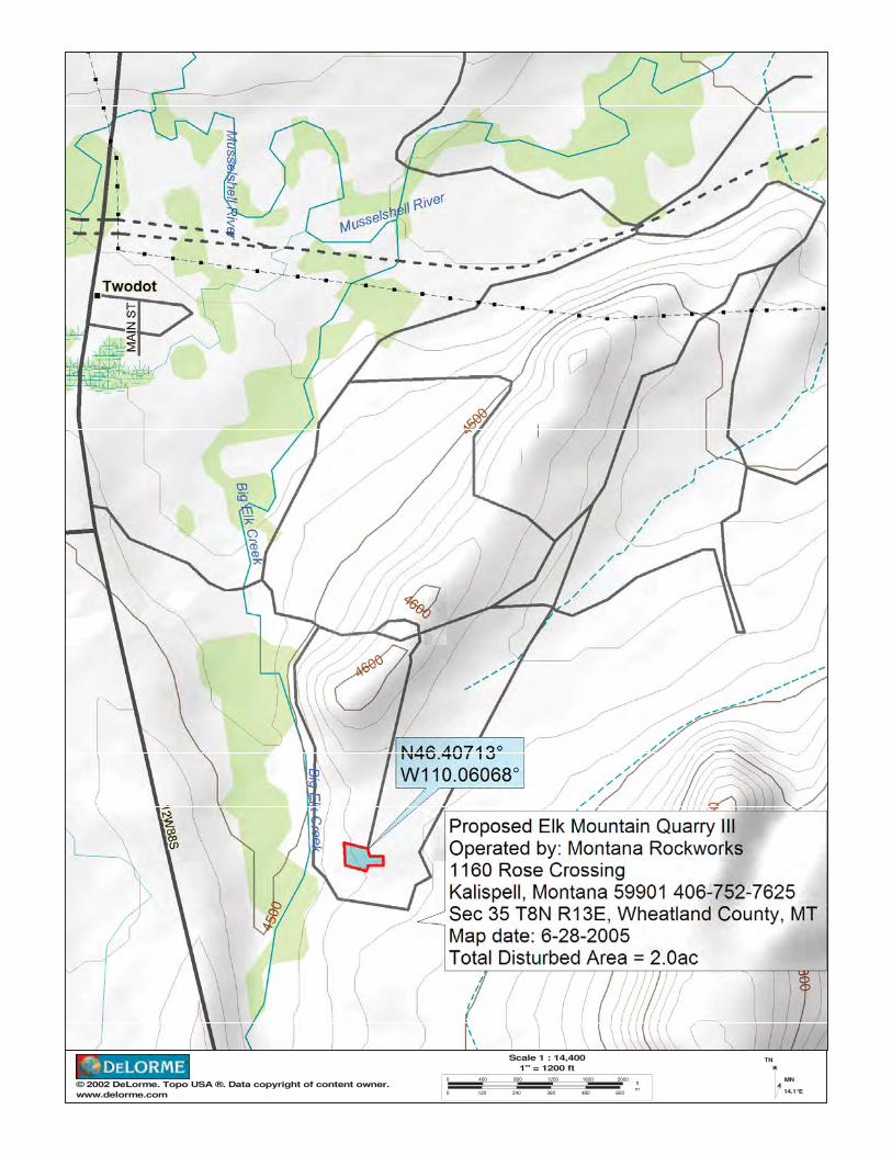
© 2002 DeLorme. Topo USA ®. Data copyright of content owner.www.delorme.com
Scale 1 : 14,4001" = 1200 ft
0 400 800 1200 1600 2000
0 120 240 360 480 600
ftm
TN
MN
14.1°E

600 ftcom). Topo USA ®. Data copyright of content owner.
0° Magnetic Declination: 14.0°E


1
MCGREGOR LAKE SITE #1 BASELINE DESCRIPTION Site Name: McGregor Lake Quarry
Legal Description: SE ¼ North West ½ Section 32 Township 26 North P.M.M. Flathead County. The general information presented in Table 2, for the McGregor Lake Quarry site, includes adjacent landowner information within ½ mile.
1. Location and Topography. Provide a map showing the location of the proposed quarry, the specific area to be quarried and the boundaries of land that will be disturbed, sufficient topographic detail to show the topography of the site, the location and names of streams, roads, railroads, and utility lines on or immediately adjacent to the area, and the location of proposed access roads to be built.
The general information presented in Table 2, for the McGregor Lake Quarry site, includes adjacent landowner information within ½ mile.
The attached Figures 1 and 2 provides the required detail of the quarry site. See also other regional maps for general access information.
2. Present Land Use and Past Quarrying Disturbance. Describe the present land use and any past quarrying disturbance within and near the proposed permit area:
See Section II.2 in the Montana Rockworks Plan of Operations. Total proposed area of disturbance is 19 acres within a five year period. Total disturbance over the life of the permit would be 60 acres.
3. Water Wells. Give the location, total depth, and use of any water well in and within 1000 feet of the permit area:
There are no water wells within 1,000 feet of the quarry site. The State web site for water wells has been checked for potential water wells (http://nris.state.mt.us/interactive.html).
4. Water Table. Give the estimated seasonal high and low table depths for the area to be quarried, and the maximum depth of the quarry:
The only sign of water is from snow melt in the spring or ponding after rainstorms. There are no visible signs of the water table. The quarry depth is planned to be approximately 20 feet in depth, depending on the available rock. Montana Rockworks commits to stay out of the water table per operating permit requirements.
5. Surface Water. Show the location on a map and provide a description, and use of any surface water in and within 1,000 feet of the permit area:
There is surface water in the permit area and within 140 feet of the quarry disturbance. Montana Rockworks commits to stay at least 100 feet away from the spring per operating requirements. Storm water can leave the site along the access road. Montana Rockworks is obtaining a storm water discharge permit.
1

2
6. Geology. Provide a general description of the rock type in the quarry area (from query on G.I.S.):
The general rock type is Belt, the parent material is Belt Rock. There is no evidence of sulfides in the rock.
2

3
MCGREGOR LAKE SITE BASE-LINE DESCRIPTION
7. Soil Material. Provide a general description of the soil and overburden types and thickness in the area to be quarried:
The quarry site is a talus slope with no surface soil. Shallow (2-4”) Gravelly Loam soils occur adjacent to the talus areas and are low productive soils. Any soil to be disturbed during the quarry activity will be stockpiled and set aside for future reclamation, as described in the general plan of operations.
8. Vegetation. Describe the dominant vegetation within the permit area and note the occurrence of any noxious weeds:
The area adjacent to the quarry site is mixed Douglas Fir, Western Larch forest type. There is little vegetation on the quarry site with the exception of an occasional Rocky Mountain Maple and Alder. Noxious weeds (spotted knapweed) exist on the access roads leading to the permit area and was existing prior to the quarry activity. Montana Rockworks commits to control noxious weeds along the roads and in the quarry area.
9. Wildlife. Describe any significant seasonal or year round use by wildlife in and within 1,000 feet of the permit area:
Throughout the year, there is intermittent use in adjacent timbered area, by deer, elk, black bear, bobcats, lynx, and moose. The quarry site does not contain any unique habitat features. No federally listed wildlife species or globally imperiled species are known to exist or frequent the quarry site. See attachment 2 in the Montana Rockworks Plan of Operations.
10. Quarry Activities.
10a. Product: Describe the type of product that will be removed from this site:
Decorative rock used for landscaping, retaining wall and masonry. Rip-rap, pit run and gravel may be used for road BMP upgrade and maintenance. Rock tumbler, splitter, crushers and blasting (fracture popping) may be used on the quarry site to help create the desired products.
10b. Reclamation: Describe reclamation plan for site:
The plan would be to reclaim some quarry development roads not needed for post quarry development purposes, and all areas where the quarrying activity was completed. The reclaiming would include activities such as recontouring slopes where needed, grass seeding on areas soiled, weed spraying, reshaping highwalls and pit areas where possible, as described in the general plan of operations. All access roads, which are needed for future development, would be left unreclaimed and BMPs maintained.
11. Additional Information. Describe any characteristics or circumstances
3

4
unique to the site:
No additional information.
4

5
MOOSE MOUNTAIN SITE #2 BASELINE DESCRIPTION Site Name: Moose Mountain Quarry
Legal Description: Section 30 T26N R25W
1. Location and Topography. Provide a map showing the location of the proposed quarry, the specific area to be quarried and the boundaries of land that will be disturbed, sufficient topographic detail to show the topography of the site, the location and names of streams, roads, railroads, and utility lines on or immediately adjacent to the area, and the location of proposed access roads to be built.
The general information presented in Table 2 for the Moose Mountain Quarry site, includes adjacent landowner information within ½ mile.
Figures 1, 3, and 4, the Moose Mountain site map provides the required detail of the quarry site. Se also other regional maps for general access information.
2. Present Land Use and Past Quarrying Disturbance. Describe the present land use and any past quarrying disturbance within and near the proposed permit area:
See Section II.2 in the Montana Rockworks Plan of Operations. There is no current quarry disturbance area at the site except some minimal exploration activities. The site has been strip logged, however no surface quarrying has been done. Total proposed area of disturbance is 1.83 acres in the first year, up to 5.75 acres over a ten year period. Total disturbance over the life of the permit would be 50 acres.
3. Water Wells. Give the location, total depth, and use of any water well in and within 1000 feet of the permit area:
There are no water wells within 1,000 feet of the quarry site. The State web site for water wells has been checked for potential water wells (http://nris.state.mt.us/interactive.html). See attachment 1 in the Montana Rockworks Plan of Operations.
4. Water Table. Give the estimated seasonal high and low table depths for the area to be quarried, and the maximum depth of the quarry:
The only sign of water is from snow melt in the spring or ponding after rainstorms. There are no visible signs of the water table. The quarry depth is planned to be approximately 20 feet in depth, depending on the available rock. Montana Rockworks commits to stay out of the water table per operating permit requirements.
5. Surface Water. Show the location on a map and provide a description, and use of any surface water in and within 1,000 feet of the permit area:
There is surface water in the permit area and within 140 feet of the quarry
5

6
disturbance. Montana Rockworks commits to stay at least 100 feet away from the spring per operating requirements.
6. Geology. Provide a general description of the rock type in the quarry area (from query on G.I.S.):
The general rock type is Belt, the parent material is Belt Rock. There is no evidence of sulfides in the rock.
6

7
MOOSE MOUNTAIN SITE BASE-LINE DESCRIPTION
7. Soil Material. Provide a general description of the soil and overburden types and thickness in the area to be quarried:
The quarry site is a talus slope with no surface soil. Shallow (2-4”) Gravelly Loam soils occur adjacent to the talus areas and are low productive soils. Any soil to be disturbed during the quarry activity will be stockpiled and set aside for future reclamation, as described in the general plan of operations.
8. Vegetation. Describe the dominant vegetation within the permit area and note the occurrence of any noxious weeds:
The area adjacent to the quarry site is mixed Douglas fir, Western Larch forest type. There is little vegetation on the quarry site with the exception of an occasional Rocky Mountain Maple and Alder. Noxious weeds (spotted knapweed) exist on the access roads leading to the permit area and was existing prior to the quarry activity. Montana Rockworks commits to control noxious weeds along the roads and in the quarry area.
9. Wildlife. Describe any significant seasonal or year round use by wildlife in and within 1,000 feet of the permit area:
Throughout the year, there is intermittent use in adjacent timbered area, by deer, elk, black bear, bobcats, lynx, and moose. The quarry site does not contain any unique habitat features. No federally listed wildlife species or globally imperiled species are known to exist or frequent the quarry site. See attachment 2 in the Montana Rockworks Plan of Operations.
10. Quarry Activities.
10a. Product: Describe the type of product that will be removed from this site:
Decorative rock used for landscaping, retaining wall and masonry. Rip-rap, pit run and gravel may be used for road BMP upgrade and maintenance. Rock tumbler, splitter, crushers and blasting (fracture popping) may be used on the quarry site to help create the desired products.
10b. Reclamation: Describe reclamation plan for site:
The plan would be to reclaim some quarry development roads not needed for post quarry development purposes, and all areas where the quarrying activity was completed. The reclamation would include activities such as recontouring slopes where needed, grass seeding on areas soiled, weed spraying, reshaping highwalls and pit areas where possible, as described in the general plan of operations. All access roads, which are needed for future development, would be left unreclaimed and BMPs maintained.
7

8
11. Additional Information. Describe any characteristics or circumstances unique to the site:
Moose Mountain has a cultural sites nearby. Montana Rockworks commits to keeping this cultural sites in tact, and undisturbed.
8

9
ELK MOUNTAIN SITE #3 BASELINE DESCRIPTION Site Name: Elk Mountain Quarry
Legal Description:
Elk Mountain Site #3, Site I S 5 T 8 N R 14 E Elk Mountain Site #3, Site II S 18 8 N R 14 E Elk Mountain Site #3, Site III S 35 8 N R 13 E
1. Location and Topography. Provide a map showing the location of the proposed quarry, the specific area to be quarried and the boundaries of land that will be disturbed, sufficient topographic detail to show the topography of the site, the location and names of streams, roads, railroads, and utility lines on or immediately adjacent to the area, and the location of proposed access roads to be built.
The general information presented in Table 2, for the Elk Mountain Quarry site, includes adjacent landowner information within ½ mile. Elk Mountain Site #3 Figures 5-7 provide the required detail of the quarry site. See also other regional maps for general access information.
2. Present Land Use and Past Quarrying Disturbance. Describe the present land use and any past quarrying disturbance within and near the proposed permit area:
Elk Mountain Site #3, Site I is located on state lands and private property. Elk Mountain Site #3, Sites II and III are leased properties. See Section II.2 in the Montana Rockworks Plan of Operations. Present and past use of the land is cropland and livestock grazing land. Present quarry disturbance in Elk Mountain Site #3, Site I has been reclaimed, and will be closed. Elk Mountain Site #3, Sites II and III are in the exploratory phase and have a 4.85 and 2 acre disturbance respectively. Projected disturbance in the first year is 7.85 acres on Elk Mountain Site 3, Site II, and eight acres for Site #3, Site III. Total disturbance over the life of the permit would be 550 acres.
3. Water Wells. Give the location, total depth, and use of any water well in and within 1000 feet of the permit area:
There are no water wells within 1,000 feet of the quarry site. The State web site for water wells has been checked for potential water wells (http://nris.state.mt.us/interactive.html). See attachment 1 in the Montana Rockworks Plan of Operations.
4. Water Table. Give the estimated seasonal high and low table depths for the area to be quarried, and the maximum depth of the quarry:
The only sign of water is from snow melt in the spring or ponding after rainstorms. There are no visible signs of the water table. The quarry depth is planned to be approximately 20 feet in depth, depending on the available rock. Montana Rockworks commits to stay out of the water table per operating permit requirements.
9

10
5. Surface Water. Show the location on a map and provide a description, and use of any surface water in and within 1,000 feet of the permit area:
There is no surface water in the permit area. Montana Rockworks commits to stay at least 100 feet away from the spring per operating requirements.
6. Geology. Provide a general description of the rock type in the quarry area (from query on G.I.S.):
The general rock type is sandstone and flagstone. There are no sulfides in the rock.
10

11
ELK MOUNTAIN SITE BASELINE DESCRIPTION
7. Soil Material. Provide a general description of the soil and overburden types and thickness in the area to be quarried:
The quarry site is flat farming ground with rolling hill outcroppings. This is grassland and productive farming soils. Any soil to be disturbed during the quarry activity will be stockpiled and set aside for future reclamation, as described in the general plan of operations.
8. Vegetation. Describe the dominant vegetation within the permit area and note the occurrence of any noxious weeds:
The area adjacent to the quarry site is cropland and native rangeland used for livestock grazing. There is little vegetation on the quarry site. The State web site for information http://nris.state.mt.us/interactive.htm searches show that no species of concern exists at this site. Noxious weeds are minimal. Leafy Spurge is present from farming equipment on the access roads prior to the quarry activity. Montana Rockworks commits to control noxious weeds along the roads and in the quarry area.
9. Wildlife. Describe any significant seasonal or year round use by wildlife in and within 1,000 feet of the permit area:
Throughout the year, there is intermittent use in adjacent grazing areas, by deer, elk, ferruginous hawk, and antelope. Because this is existing farming ground, the proposed quarry site does not contain any unique habitat features. The search attached in the Montana Rockworks Plan of Operations shows animal species of concern for this quarry site and in a ten mile buffer. There are three sensitive status species that are listed in the search area. However according to property owner and the species occurrences report these animals are not known to exist or frequent the quarry site. See attachment 2 in the Montana Rockworks Plan of Operations.
10. Quarry Activities.
10a. Product: Describe the type of product that will be removed from this site:
Decorative rock used for landscaping, retaining wall and masonry. Rip-rap, pit run and gravel may be used for road BMP upgrade and maintenance. Rock tumbler, splitter, crushers and blasting (fracture popping) may be used on the quarry site to help create the desired products.
10b. Reclamation: Describe reclamation plan for site:
The plan would be to reclaim some quarry development roads not needed for post quarry development purposes, and all areas where the quarrying activity
11

12
was completed. The reclamation would include activities such as recontouring slopes where needed, grass seeding on areas soiled, weed spraying, reshaping highwalls and pit areas where possible, as described in the general plan of operations. All access roads, which are needed for future development, would be left unreclaimed and BMPs maintained.
11. Additional Information. Describe any characteristics or circumstances unique to the site:
No additional information.
12

13
SEDGWICK SITE #4 BASELINE DESCRIPTION Site Name: Sedgwick Quarry
Legal Description: S 3 R7N 13E Wheatland County
1. Location and Topography. Provide a map showing the location of the proposed quarry, the specific area to be quarried and the boundaries of land that will be disturbed, sufficient topographic detail to show the topography of the site, the location and names of streams, roads, railroads, and utility lines on or immediately adjacent to the area, and the location of proposed access roads to be built.
The general information presented in Table 2, for the Sedgwick Quarry site, includes adjacent landowner information within ½ mile.
Figure 8, the Sedgwick site #4 map provides the required detail of the quarry site. Se also other regional maps for general access information.
2. Present Land Use and Past Quarrying Disturbance. Describe the present land use and any past quarrying disturbance within and near the proposed permit area:
The Sedgwick Site #4 is located on private property. Present and past use of the land is cropland and livestock grazing land. There has been past disturbance for a surface rock quarry. Up to 100 acres would be disturbed over the life of the permit.
3. Water Wells. Give the location, total depth, and use of any water well in and within 1000 feet of the permit area:
There are no water wells within 1,000 feet of the quarry site. The State web site for water wells has been checked for potential water wells (http://nris.state.mt.us/interactive.html). See attachment 1 in the Montana Rockworks Plan of Operations.
4. Water Table. Give the estimated seasonal high and low table depths for the area to be quarried, and the maximum depth of the quarry:
The only sign of water is from snow melt in the spring or ponding after rainstorms. There are no visible signs of the water table. The quarry depth is planned to be approximately 20 feet in depth, depending on the available rock. Montana Rockworks commits to stay out of the water table per operating permit requirements.
5. Surface Water. Show the location on a map and provide a description, and use of any surface water in and within 1,000 feet of the permit area:
There is no surface water in the permit area. Montana Rockworks commits to stay at least 100 feet away from the spring per operating requirements.
6. Geology. Provide a general description of the rock type in the quarry area (from query on G.I.S.):
13

14
The general rock type is sandstone and flagstone. There is no evidence of sulfides in the rock.
14

15
SEDGWICK SITE #4 BASE-LINE DESCRIPTION
7. Soil Material. Provide a general description of the soil and overburden types and thickness in the area to be quarried:
The quarry site is flat farming ground with rolling hill outcroppings. This is native grassland and productive farming soils. Any soil to be disturbed during the quarry activity will be stockpiled and set aside for future reclamation, as described in the general plan of operations.
8. Vegetation. Describe the dominant vegetation within the permit area and note the occurrence of any noxious weeds:
The area adjacent to the quarry site is farm ground and native grassland used for livestock grazing. There is little vegetation on the quarry site. The State web site for information http://nris.state.mt.us/interactive.htm searches show that no species of concern exists at this site. Noxious weeds are minimal. Leafy Spurge is present from farming equipment on the access roads prior to the quarry activity. Montana Rockworks commits to control noxious weeds along the roads and in the quarry area.
9. Wildlife. Describe any significant seasonal or year round use by wildlife in and within 1,000 feet of the permit area:
Throughout the year, there is intermittent use in adjacent grazing areas, by deer, elk, ferruginous hawk, and antelope. Because this is existing farming and range ground, the proposed quarry site does not contain any unique habitat features. The search attached shows animal species of concern for this quarry site and in a ten mile buffer. There are three sensitive status species that are listed in the search area. According to the property owner and the species occurrences report these animals are not known to exist or frequent the quarry site. See attachment 2 in the Montana Rockworks Plan of Operations.
10. Quarry Activities.
10a. Product: Describe the type of product that will be removed from this site:
Decorative rock used for landscaping, retaining wall and masonry. Rip-rap, pit run and gravel may be used for road BMP upgrade and maintenance. Rock tumbler, splitter, crushers and blasting (fracture popping) may be used on the quarry site to help create the desired products.
10b. Reclamation: Describe reclamation plan for site:
The plan would be to reclaim some quarry development roads not needed for post quarry development purposes, and all areas where the quarrying activity
15

16
was completed. The reclamation would include activities such as recontouring slopes where needed, grass seeding on areas soiled, weed spraying, reshaping highwalls and pit areas where possible, as described in the general plan of operations. All access roads, which are needed for future development, would be left unreclaimed and BMPs maintained.
11. Additional Information. Describe any characteristics or circumstances unique to the site:
No additional information.
16

17
VOSS SITE #5 BASELINE DESCRIPTION Site Name: Voss Quarry
Legal Description: S 1 R6N 13E Wheatland County
1. Location and Topography. Provide a map showing the location of the proposed quarry, the specific area to be quarried and the boundaries of land that will be disturbed, sufficient topographic detail to show the topography of the site, the location and names of streams, roads, railroads, and utility lines on or immediately adjacent to the area, and the location of proposed access roads to be built.
The general information presented in Table 2 for the Voss Ranch Quarry site, includes adjacent landowner information within ½ mile.
Figures 9 and 10 show the Voss Site #5 and provide the required detail of the quarry site. Se also other regional maps for general access information.
2. Present Land Use and Past Quarrying Disturbance. Describe the present land use and any past quarrying disturbance within and near the proposed permit area:
Voss Site #5 is located on private property. Present and past use of the land is cropland and livestock grazing land. There has been no disturbance for rock quarry to date.
3. Water Wells. Give the location, total depth, and use of any water well in and within 1000 feet of the permit area:
There are no water wells within 1,000 feet of the quarry site. The State web site for water wells has been checked for potential water wells (http://nris.state.mt.us/interactive.html). See attachment 1 in Montana Rockworks Plan of Operations.
4. Water Table. Give the estimated seasonal high and low table depths for the area to be quarried, and the maximum depth of the quarry:
The only sign of water is from snow melt in the spring or ponding after rainstorms. There are no visible signs of the water table. The quarry depth is planned to be approximately 20 feet in depth, depending on the available rock. Montana Rockworks commits to stay out of the water table per operating permit requirements.
5. Surface Water. Show the location on a map and provide a description, and use of any surface water in and within 1,000 feet of the permit area:
There is no surface water in the permit area. Montana Rockworks commits to stay at least 100 feet away from the spring per operating requirements.
6. Geology. Provide a general description of the rock type in the quarry area (from query on G.I.S.):
17

18
The general rock type is sandstone and flagstone. There is no evidence of sulfides in the rock.
18

19
VOSS SITE #5 BASELINE DESCRIPTION
7. Soil Material. Provide a general description of the soil and overburden types and thickness in the area to be quarried:
The quarry site is flat farming ground with rolling hill outcroppings. This is grassland and productive farming soils. Any soil to be disturbed during the quarry activity will be stockpiled and set aside for future reclamation, as described in the general plan of operations.
8. Vegetation. Describe the dominant vegetation within the permit area and note the occurrence of any noxious weeds:
The area adjacent to the quarry site is farm ground and native rangeland used for livestock grazing. There is little vegetation on the quarry site. The State web site for information http://nris.state.mt.us/interactive.htm searches show that no species of concern exists at this site. Noxious weeds are minimal. Leafy Spurge is present from farming equipment on the access roads prior to the quarry activity. Montana Rockworks commits to control noxious weeds along the roads and in the quarry area.
9. Wildlife. Describe any significant seasonal or year round use by wildlife in and within 1,000 feet of the permit area:
Throughout the year, there is intermittent use in adjacent grazing areas, by deer, elk, ferruginous hawk, and antelope. Because this is existing farming ground and native rangeland, the proposed quarry site does not contain any unique habitat features. The search attached shows animal species of concern for this quarry site and in a ten mile buffer. There are three sensitive status species that are listed in the search area. According to property owner and the species occurrences report these animals are not known to exist or frequent the quarry site. See attachment 2 in the Montana Rockworks Plan of Operations.
10. Quarry Activities. 10a. Product: Describe the type of product that will be removed from this site:
Decorative rock used for landscaping, retaining wall and masonry. Rip-rap, pit run and gravel may be used for road BMP upgrade and maintenance. Rock tumbler, splitter, crushers and blasting (fracture popping) may be used on the quarry site to help create the desired products.
10b. Reclamation: Describe reclamation plan for site:
The plan would be to reclaim some quarry development roads not needed for post quarry development purposes, and all areas where the quarrying activity was completed. The reclaiming would include activities such as recontouring
19

20
slopes where needed, grass seeding on areas soiled, weed spraying, reshaping highwalls and pit areas where possible, as described in the general plan of operations. All access roads, which are needed for future development, would be left unreclaimed and BMPs maintained.
11. Additional Information. Describe any characteristics or circumstances unique to the site:
No additional information.
20

y Sec Twp Rge Adjacent Landowner Name Legal Description Address Town State
d 32 27N 25W Montana Rockworks LLP TRAC 2A IN NE 4, SE4 PO Box 9473 Kalispell MT 59901
d 32 27N 25W Montana Rockworks LLP TRAC 2B IN NW 4, SE 4 PO Box 9473 Kalispell MT 59901
d 32 27N 25W Gladys & Grace JohnsonTRAC 2AA IN W1/2, NW 1/4,
NE1/84, SE1/44523 Shoreline Dr Apt L020 Springpark MN 55384
d 32 27N 25W Jay A Peat PPM 1762 Wema Way San Jose CA 95124
d 32 27N 25W Plum Creek Timerlands MPM PO Box 1990 Columbia Falls MT 59912
d 30 26N 25WMercord, Bradley & Corie; Carter, William & Cyndee TR 2 IN SE4NW4 1107 Rose Crossing Kalispell MT 59901
d 30 26N 25W Montana Rockworks LLP TR 2B IN NW4SE4 PO Box 9473 Kalispell MT 59901d 30 26N 25W Montana Rockworks LLP TR 2A IN NE4SE4 PO Box 9473 Kalispell MT 59901d 30 26N 25W Montana Rockworks LLP TR 2AA IN NW4NE4SE4 PO Box 9473 Kalispell MT 59901d 30 26N 25W Peat, Jay A & Peat, Steve TR 2C IN NE4SW4 1762 Wema Way San Jose CA 95124
d 30 26N 25W Plum Creek Timberlands LPTR 1 IN S2S2, S2NE4,
NW4SW4 PO Box 1990 Columbia Falls MT 59912d 30 26N 25W Plum Creek Timberlands LP ALL LESS RD PO Box 1990 Columbia Falls MT 59912d 30 26N 25W Plum Creek Timberlands LP TR 1 IN SW4, S2SE4 PO Box 1990 Columbia Falls MT 59912d 30 26N 25W Plum Creek Timberlands LP TR 2 IN E2,SW4,E2NW4,L3&4 PO Box 1990 Columbia Falls MT 59912d 30 26N 25W Plum Creek Timberlands LP N2N2, SW4NW4 PO Box 1990 Columbia Falls MT 59912
d 30 26N 25WSnook, Wilbur & Johnson, Gladys TR 2AAA IN E2NW4NE4SE4
4523 Shoreline Dr Apt L020 Springpark MN 55384
d 30 26N 25W US Forest ServiceAdjacent land to Forest Service
Road 16635 Box 429 Plains MT 59859
nd 35 8N 13E McFarland-White RanchNE4, NE4SW4, N2SE4, E2NW4 LESS 6.27 AC. Box 235 Two Dot MT 59085
nd McFarland-White RanchALL LESS 25.09 AC IN
W2SW4 Box 235 Two Dot MT 59085
nd 18 8N 14EDuncan Colony Ranch c/o Dave Waldner TRACT IN W2SW4 Hwy 12 Harlowton MT 59036
ndDuncan Colony Ranch c/o Dave Waldner W2W2 FRL., SE4SW4, S2SE4 Hwy 12 Harlowton MT 59036
nd 3 6N 13EState / Duncan Colony Ranch / White Ranch
Principal Meridian T6N, R13E, Section 10 Box 137 Two Dot MT 59085
nd 1 7N 13EState / Duncan Colony Ranch / White Ranch
Principal Meridian T7N, R13E, Section 1 Hwy 12 Two Dot MT 59085
Table 2. ADJACENT LANDOWNER SPREADSHEETPrivate Ownership within 1/2 mile of Montana Rockworks Quarry Sites
Adjacent Landowner Nameorks Landcription