excavations at a cropmark henge near bredon, worcestershire · excavations at a cropmark henge near...
TRANSCRIPT

Excavations at a Cropmark Henge near Bredon, WorcestershireBy DR JODIE P. LEWIS and DR DAVID MULLIN
AbstractExcavations at a cropmark, suspected to be a henge, at Bredon, Worcestershire, confirmed the status of the site and uncovered evidence for extensive reuse and remodelling in the Middle Bronze Age. This included the recutting of the henge ditch, the construction of a palisade and deposition of cremated human remains. The site was subsequently levelled, probably in the later Bronze Age/earlier Iron Age. Evidence was also recovered for the early use of Malvernian clay as a source of potting raw materials and Cornish gabbro tempered pottery was also identified.
This article places the reuse of the henge within its regional and national context and highlights the evidence for similar activities at other henge sites during the Middle and Later Bronze Age. It is suggested that this renewal of interest in old monuments was linked to the deposition of human remains.
IntroductionResearch excavations were undertaken at a cropmark, previously identified as a Neolithic henge, between 1st and 14th September 2004. The aim of the excavation was to clarify the nature of the cropmark and to recover evidence of its structure, date and, if possible, the contemporary environment. Fieldwalking was also carried out in an area around the cropmark in order to understand its setting and subsequent land-use.
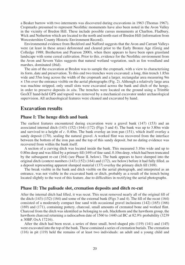
BackgroundThe cropmark is located in south-east Worcestershire, approximately 500m north of the village of Bredon at OS NGR SO 93003740 (Fig. 1). The site is located on the Fourth Terrace of the river Avon, the river itself lying c. 900m west. The Fourth Terrace is described as being formed of sands and gravels, with a high clay content (Barclay et al 1997, 122). The cropmark occupies part of a relatively flat plateau at approximately 35m AOD, the land eventually dropping to the Avon in the west and rising to Bredon Hill in the north and east.
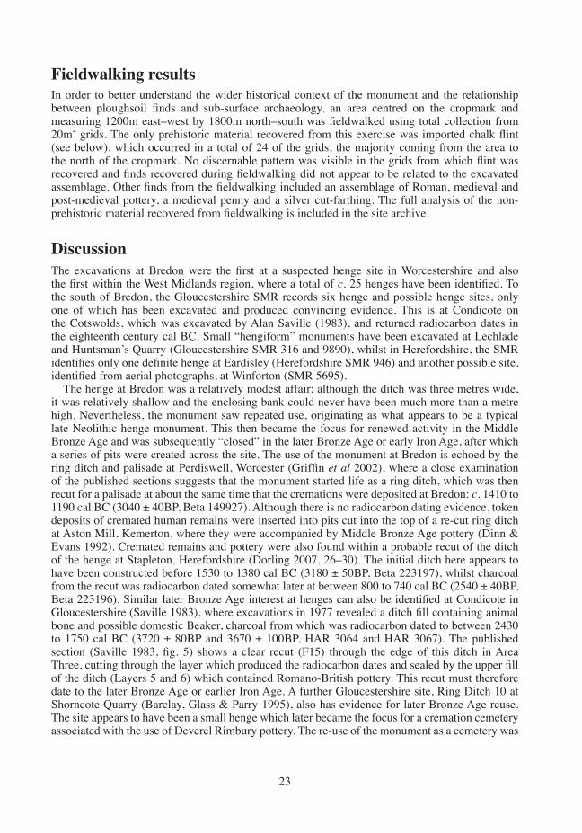
The cropmark is located in the middle of a large triangular field and takes the form of a circular ditch with a gap in the circuit to the south-east. From the aerial photographs, the total diameter of the site appears to be approximately 20m, the width of the ditch approximately 3m. The ditch terminals appear to be enlarged to possibly 4 to 5m wide. There are no indications of a bank from the aerial photograph, nor any clear (archaeological) internal features. The cropmark was first suggested to be a Neolithic henge monument by Mike Glyde of the Worcestershire Historic Environment and Archaeological Service (WHEAS hereafter, now Worcestershire Archives and Archaeology), who discovered it during aerial survey (Glyde 2003; Fig. 2). This interpretation was based on the physical form of the cropmark: the circular ditch with entrance gap; the width of the ditch; the enlarged ditch terminals and the diameter of the cropmark, all of which correspond with other known henges in southern England. Alternative interpretations included a Bronze Age ring ditch or the ditch of an Iron Age round house. Other cropmarks were also noted by Glyde in the same field as the cropmark henge. Approximately 10m north-west is a double ring ditch that may be of Bronze Age date, while approximately 80m north is a complex of rectangular and curvilinear enclosures, which may be of Roman date. To the south-west are linear cropmarks that
02_TWAS_25_Bredon Henge_017-036.indd 17 15/06/2016 11:01

18
Fig. 1 Location of excavations at Bredon, Worcestershire
02_TWAS_25_Bredon Henge_017-036.indd 18 15/06/2016 11:01

19
may represent an undated field system. The Worcestershire County Historic Environment Record Number for the henge, double ring ditch and enclosures is WSM32474.
Previous archaeological work has been undertaken in the environs of the henge at Bredon, in the valleys of the Carrant Brook and the river Avon. These areas have long been noted as being of great archaeological importance due to the density of cropmarks, some complexes extending continuously over several miles (Bond 1973). The Avon-Severn Research Committee co-ordinated a series of excavations in the Carrant, Avon and Severn Valleys in the 1960s and 1970s (Dinn and Evans 1992, 8) and subsequently most work has been developer-funded, largely in advance of quarrying. Important ‘salvage’ projects include work at Kemerton and Beckford, both to the east of Bredon. At Aston Mill, Kemerton, finds included Mesolithic flint, Late Neolithic pits and possible sub-rectangular structures, an Early Bronze Age ring ditch (with later cremations), Middle Iron Age pits and enclosures, Later Iron Age and early Roman ditches and an Anglo-Saxon grubenhaus (Dinn and Evans 1992). At Huntsman’s Quarry, Kemerton, finds included Upper Palaeolithic and Mesolithic flint, a Late Neolithic pit, a Beaker ring-ditch and pits and large amounts of Later Bronze Age archaeology including pits, postholes, water holes, trackways and ditches (Jackson and Napham 1998). At Beckford, excavations revealed Bronze Age activity, a large and important Middle Iron Age settlement and two Anglo-Saxon cemeteries. On the slopes of Bredon Hill itself,
Fig. 2 Aerial photograph of the site and trench location. (Original image: Copyright Mike Glyde)
02_TWAS_25_Bredon Henge_017-036.indd 19 15/06/2016 11:01
20
a Beaker barrow with two interments was discovered during excavations in 1963 (Thomas 1967). Cropmarks presumed to represent Neolithic monuments have also been noted in the Avon Valley in the vicinity of Bredon Hill. These include possible cursus monuments at Charlton, Fladbury, Wick and Netherton which are located to the north and north-east of Bredon Hill (information from Worcestershire County Historic Environment Record).
Environmental evidence from Beckford and Nafford suggests that the Avon and Carrant Valleys were (at least in these areas) deforested and cleared prior to the Early Bronze Age (Greig and Colledge 1988; Bretherton and Pearson 2000), when there appears to have been open grassland landscape with some cereal cultivation. Prior to this, evidence for the Neolithic environment from the Avon and Severn Vales suggests that natural wetland vegetation, such as fen woodland and marshes, dominated (ibid).
The aim of the excavation at Bredon was to sample the cropmark, with a view to characterising its form, date and preservation. To this end two trenches were excavated: a long, thin trench 1.85m wide and 55m long across the width of the cropmark and a larger, rectangular area measuring 9m × 15m over the entrance visible on the aerial photographs (Fig. 2). Although a relatively large area was machine stripped, only small slots were excavated across the bank and ditch of the henge, in order to preserve deposits in situ. The trenches were located on the ground using a Trimble GeoXT hand-held GPS and topsoil was removed by a mechanical excavator under archaeological supervision. All archaeological features were cleaned and excavated by hand.
Excavation resultsPhase I: The henge ditch and bankThe earliest features encountered during excavation were a gravel bank (147) (153) and an associated internal ditch (143) (152) (164) (172) (Figs 3 and 4). The bank was up to 3.80m wide and survived to a height of c. 0.40m. The bank overlay an iron pan (151), which itself overlay a sandy deposit (170), sealing the natural gravel. A worked flint was recovered from the interface between the bottom of the iron pan and the top of this sandy deposit, but no dating evidence was recovered from within the bank itself.
A section of a curving ditch was located inside the bank. This measured 3.10m wide and up to 0.80m deep and was filled by a primary fill (169) of fine sand, 0.10m deep, which had been truncated by the subsequent re-cut (164) (see Phase II, below). The bank appears to have slumped into the original ditch (context numbers (143) (152) (164) and (172), see below) before it had fully filled, as a deposit representing apparent slumped material (137) overlay the primary ditch fill (169).
The break visible in the bank and ditch visible on the aerial photograph, and interpreted as an entrance, was not visible in the excavated bank or ditch, probably as a result of the trench being located slightly to the west of this feature, due to difficulties in rectifying the aerial photographs.
Phase II: The palisade slot, cremation deposits and ditch re-cutAfter the internal ditch had filled, it was recut. This recut removed nearly all of the original fill of the ditch (143) (152) (164) and some of the external bank (Figs 3 and 4). The fill of the recut (164) consisted of a moderately compact fine sand with occasional gravel inclusions (142) (165) (166) (169) and (171), containing pottery, charcoal, small amounts of cremated bone and worked flint. Charcoal from the ditch was identified as belonging to ash, blackthorn and the hawthorn group, the hawthorn charcoal returning a radiocarbon date of 1560 to 1440 cal BC at 82.9% probability (3239 ± 30BP, OxA 17216).
After the ditch had been recut, a series of three small, bowl-shaped pits (119) (141) and (145) were excavated into the top of the bank. These contained a series of cremation burials. The cremation (116) in pit (119) held the remains of at least two individuals: an adult and a young child and
02_TWAS_25_Bredon Henge_017-036.indd 20 15/06/2016 11:01

21
Fig.
3
Plan
of t
he e
xcav
atio
n
02_TWAS_25_Bredon Henge_017-036.indd 21 15/06/2016 11:01

22
charcoal identified as alder. This charcoal returned a radiocarbon date of 1410 to 1260 BC at 95.4% probability (3058 ± 30BP, OxA 17215). Cremation (117) in pit (141) contained fragments of a single adult and a charred grain of sedge whilst cremation (144) in pit (145) also contained the remains of a single adult alongside single grains of free-threshing wheat, unidentifiable wheat and oat.
Probably contemporary with the deposition of the cremated bone within the pits, a narrow slot (154) (173) (175) was cut through the upstanding henge bank. This measured up to 0.80m wide and 0.50m deep but no finds were recovered from its fill. This fill (155) (174) (176) had a sandy component and was sealed by sand deposit (103) (146), belonging to Phase III (see below). The slot was flat bottomed and cut eccentrically to the henge bank, rather than along its crest. Although there was no stratigraphic relationship between the narrow slot and the cremation pits, and no finds from the slot itself, the slot respects the cremation pits and most probably belongs to the same phase: it is impossible to be certain if these features are contemporary but both were sealed by the Phase III infilling of the monument (see below). The narrowness of the slot, and its flat bottom, suggest that it was constructed to hold a palisade of split timbers, similar in form to that excavated at Perdiswell, Worcester (Griffin et al 2002).
Phase III: The infilling of the hengeAfter the henge ditch had filled and the palisade slot and cremation pits had been excavated, the centre of the henge was filled with a fine orange-brown sandy deposit (103). This lay immediately below the subsoil across the site and covered all features relating to Phases I to III. This deposit is interpreted as deliberate backfill material, as no sand was encountered outside the henge bank in the long east–west trench, although a thin, localised deposit of sand (146) lay against the outer edge of the bank. Flint artefacts were recovered from (103), but they are probably residual, as may be the small amount of cremated bone recovered from this deposit.
Phase IV: The pitsCut into the sand deposit (103) were a series of pits (105) (107) (109) (111) (113) and (140) (Fig. 3). These pits varied from 1.40–2.50m × 0.60–1.20m and survived up to 0.80m deep. One of these pits had a single re-cut (134) and pits (113) and (111) cut the ditch. No finds were recovered from any of these features, apart from a small amount of worked flint, probably residual and derived from (103). Charred grains of possibly free-threshing wheat and a small amount of cremated bone were recovered from the fill of (140). These features formed no regular pattern and do not appear to be related to any features visible on the aerial photographs of the site.
Phase V: Medieval cultivationTopsoil and subsoil were surprisingly deep for a site which has been extensively cultivated. In the western section of the trench, these deposits measured a total of 0.90m deep, probably representing a medieval ploughing headland. The depth of the ploughsoil in this area is responsible for the excellent preservation of the ditch and upstanding bank of the henge.
Fig. 4 West facing section of excavation
02_TWAS_25_Bredon Henge_017-036.indd 22 15/06/2016 11:01
23
Fieldwalking resultsIn order to better understand the wider historical context of the monument and the relationship between ploughsoil finds and sub-surface archaeology, an area centred on the cropmark and measuring 1200m east–west by 1800m north–south was fieldwalked using total collection from 20m2 grids. The only prehistoric material recovered from this exercise was imported chalk flint (see below), which occurred in a total of 24 of the grids, the majority coming from the area to the north of the cropmark. No discernable pattern was visible in the grids from which flint was recovered and finds recovered during fieldwalking did not appear to be related to the excavated assemblage. Other finds from the fieldwalking included an assemblage of Roman, medieval and post-medieval pottery, a medieval penny and a silver cut-farthing. The full analysis of the non-prehistoric material recovered from fieldwalking is included in the site archive.
DiscussionThe excavations at Bredon were the first at a suspected henge site in Worcestershire and also the first within the West Midlands region, where a total of c. 25 henges have been identified. To the south of Bredon, the Gloucestershire SMR records six henge and possible henge sites, only one of which has been excavated and produced convincing evidence. This is at Condicote on the Cotswolds, which was excavated by Alan Saville (1983), and returned radiocarbon dates in the eighteenth century cal BC. Small “hengiform” monuments have been excavated at Lechlade and Huntsman’s Quarry (Gloucestershire SMR 316 and 9890), whilst in Herefordshire, the SMR identifies only one definite henge at Eardisley (Herefordshire SMR 946) and another possible site, identified from aerial photographs, at Winforton (SMR 5695).
The henge at Bredon was a relatively modest affair: although the ditch was three metres wide, it was relatively shallow and the enclosing bank could never have been much more than a metre high. Nevertheless, the monument saw repeated use, originating as what appears to be a typical late Neolithic henge monument. This then became the focus for renewed activity in the Middle Bronze Age and was subsequently “closed” in the later Bronze Age or early Iron Age, after which a series of pits were created across the site. The use of the monument at Bredon is echoed by the ring ditch and palisade at Perdiswell, Worcester (Griffin et al 2002), where a close examination of the published sections suggests that the monument started life as a ring ditch, which was then recut for a palisade at about the same time that the cremations were deposited at Bredon: c. 1410 to 1190 cal BC (3040 ± 40BP, Beta 149927). Although there is no radiocarbon dating evidence, token deposits of cremated human remains were inserted into pits cut into the top of a re-cut ring ditch at Aston Mill, Kemerton, where they were accompanied by Middle Bronze Age pottery (Dinn & Evans 1992). Cremated remains and pottery were also found within a probable recut of the ditch of the henge at Stapleton, Herefordshire (Dorling 2007, 26–30). The initial ditch here appears to have been constructed before 1530 to 1380 cal BC (3180 ± 50BP, Beta 223197), whilst charcoal from the recut was radiocarbon dated somewhat later at between 800 to 740 cal BC (2540 ± 40BP, Beta 223196). Similar later Bronze Age interest at henges can also be identified at Condicote in Gloucestershire (Saville 1983), where excavations in 1977 revealed a ditch fill containing animal bone and possible domestic Beaker, charcoal from which was radiocarbon dated to between 2430 to 1750 cal BC (3720 ± 80BP and 3670 ± 100BP, HAR 3064 and HAR 3067). The published section (Saville 1983, fig. 5) shows a clear recut (F15) through the edge of this ditch in Area Three, cutting through the layer which produced the radiocarbon dates and sealed by the upper fill of the ditch (Layers 5 and 6) which contained Romano-British pottery. This recut must therefore date to the later Bronze Age or earlier Iron Age. A further Gloucestershire site, Ring Ditch 10 at Shorncote Quarry (Barclay, Glass & Parry 1995), also has evidence for later Bronze Age reuse. The site appears to have been a small henge which later became the focus for a cremation cemetery associated with the use of Deverel Rimbury pottery. The re-use of the monument as a cemetery was
02_TWAS_25_Bredon Henge_017-036.indd 23 15/06/2016 11:01

24
associated with the recutting of the internal ditch of the henge and the placing of three cremation deposits into these cuts in the upper fill of the primary ditch.
Further afield, at Reading Business Park, Berkshire (Brossler et al 2004), a cremation deposit was cut into the top fill of a small Neolithic hengiform monument in Area 3017. This cremation was dated to between 1700 to 1440 cal BC (3300 ± 57BP, NZA 9508), which is indistinguishable from the date obtained from context (171) at Bredon (3239 ± 30BP, OxA 17216). A ring ditch with an eccentric recut was also excavated at Stanstead, Essex (Framework Archaeology 2008, 58–63), where the waterlogged ditch contained charred timber which returned a radiocarbon date of 1690 to 1510 cal BC (3309 ± 30BP, NZA 23237), again very close to the date of the recut at Bredon. The cremated remains of at least four individuals were also recovered from this ditch fill and a radiocarbon date of 1440 to 1260 cal BC (3105 ± 35BP, NZA 20961) was obtained from a sloe stone from secondary fill of the ditch. The top of the ditch had a shallow recut, which contained cremated bone, burnt animal bone, pottery and flint, but was not dated. The stratigraphy, however, suggests that this feature belongs towards the end of the Middle Bronze Age.
The material outlined here suggests that, far from being abandoned in the later Neolithic, some henges were frequently reused and remodelled through the later Bronze Age and were the focus for the deposition of human remains. The cremated human remains at Bredon were incomplete, suggesting deposition of only token parts of the cremated body. These parts have an over-representation of phalanges, suggesting not only careful sifting of the pyre for bone, but potentially preferential deposition of feet and toe bones. This is also apparent at Stapleton, Herefordshire, where only the extremes of the body were represented (Dorling 2007, 26–30).
As well as re-use of existing monuments, there is emerging evidence that monuments continued to be constructed during the later Bronze Age. Unpublished excavations at Huntsmans Quarry, Gloucestershire (Patrick Foster Associates 2000) revealed evidence for the construction of two pennanular “hengiform” enclosures between 1290 to 890 cal BC (2860 ± 70BP, GU 4782; 2900 ± 60BP, GU 4745). These enclosures appear to have been contemporary and also contained cremated human remains. A henge at Pullyhour, Caithness, recently excavated by Richard Bradley (Bradley 2011, 118–141), returned a terminus post quem date for construction of 1620 to 1450 cal BC and evidence for remodelling c 1320 to 1120 cal BC. A recent summary of the material from Scottish henges by Bradley (2011) also points to the presence of human remains within these monuments, the re-use of older monuments and the continuing construction of small henges into at least the middle of the second millenium BC.
The re-use of the henge at Bredon, then, appears to fit within a wider pattern of exploitation of old monuments during the later Bronze Age. The nature of some of the finds is also of note. The charcoal found with the cremation in pit (119) consisted almost entirely of alder (Alnus glutinosa). Alder has notoriously poor burning qualities and it is an unusual choice for a cremation pyre, especially as ash (Fraxinus excelsior) charcoal was recovered from the ditch of the henge, indicating that it grew locally. Whilst alder has very poor burning properties, it makes excellent charcoal and was used extensively in the historic period for blacksmithing and gunpowder production. Dutton (1994, 280–281) has suggested that alder charcoal was being produced and used for fire-setting at the Bronze Age Great Orme copper mining site and it is generally accepted that charcoal would have been necessary for bronze smelting.
The bone in the pit had been effectively cremated at high pyre temperatures (see below), and, if the alder charcoal represents pyre material, as seems likely (McKinley 1994), the selection of this wood is unusual, particularly as no other species were present. This suggests several possibilities. The first is that other woods were present within the pyre but have not survived as charcoal, although their total absence makes this unlikely. The second is that the alder charcoal is not from the pyre site but was deliberately added and mixed with the cremated bone. In this case, the alder could represent a separate burnt structure or artefact. Another possibility is that the alder was part of the pyre structure with alder charcoal perhaps also being added to increase the burning temperature. If the latter is correct, then the selection of alder could have been expedient, the watery environment
02_TWAS_25_Bredon Henge_017-036.indd 24 15/06/2016 11:01

25
of the Avon Valley providing a plentiful source of this wood. It has been suggested, however, that the selection of wood for a pyre may have had a symbolic element (Thompson 1999 and Gale 1997 cited in Campbell 2007). Alder is the only deciduous tree to produce woody cones but, perhaps more strikingly, the tree exudes a red secretion when cut, leading to the notion that it bleeds. Its bark, twigs, leaves and catkins have all been used to produce dyes, ranging in colour from red, green and yellow to brown and black. Medicinally, alder decoctions are astringent and anti-inflammatory, and have been used for mouth and throat problems and in the treatment of wounds and burns and it is also a useful emetic. It is possible that there is a link between the real or perceived properties of this tree and its use as part of the Bronze Age funerary ritual, whether as pyre structure, fuel or artefact.
Whilst the finds assemblage from the excavations was relatively small, two of the pottery fabrics are particularly noteworthy. The fabric with inclusions of rock from the Malvern Hills forms part of a larger pattern of exploitation of this source in the later Bronze Age. Similar material has been recovered from a burnt mound at Sandy Lane, Cheltenham (Leah & Young 2001), and at later Bronze Age sites in Tewkesbury and Much Marcle (Leah & Young 2001, 69). Radiocarbon dates from these sites are very similar to those from Bredon and form part of a larger phenomenon of interest in rock for inclusion in pottery in the later Bronze Age across the UK (see Mullin, forthcoming). Also striking is the presence of Cornish gabbro-ware (fabric QtR1), manufactured from raw materials found on the Lizard peninsula, Cornwall. Pottery was made with this clay throughout the Neolithic and Bronze Age, Parker Pearson (1990) highlighting the renewed exploitation of the clay in Middle Bronze Age Trevisker Ware pottery. Although concentrated in south-west England, gabbroic pottery has been found in Dorset, Kent and France (Parker Pearson 1990) but the material from Bredon is the first from Worcestershire and the first from the wider Midlands region (Henrietta Quinnell, pers comm). Although the amounts recovered were modest, this was the second most abundant fabric at the site, after the Malvernian fabric. The identification of both of these fabrics emphasises the importance of petrological examination of sherd material, as macroscopic identification failed to be a reliable indicator of the fabric for the four sherds subjected to petrological analysis.
ConclusionThe limited excavations at the cropmark site at Bredon revealed an unexpectedly complex set of results that have added depth to our understanding of Neolithic and Bronze Age Worcestershire. Few monuments of this date survive as upstanding earthworks in the county and this in turn has meant there has been a general lack of research into monumentality. Developer-funded work has tended to reveal more pits than monuments, and whilst some of these are impressive and of national importance (such as the Late Neolithic pits from Clifton Quarry, Severn Stoke), Worcestershire is still seen as rather unrewarding for scholars of later prehistory. Whilst monuments may not be common, the research at Bredon henge has added to the growing body of work that shows that the Avon Valley, at least, was a significant locale for ritual and domestic life during the Neolithic and Bronze Ages. The site is also an important addition to the corpus of henges in Britain that evidence significant re-use and modification in later prehistory.
The Finds from the ExcavationThe prehistoric pottery by Emily EdwardsIntroductionThe pottery recovered during excavation of the monument at Bredon amounted to a total of 37 (270g) straight walled, plain body sherds (see Table 1). These sherds were difficult to date, having no diagnostic characteristics such as decoration or distinctive surface treatments, but were
02_TWAS_25_Bredon Henge_017-036.indd 25 15/06/2016 11:01

26
prehistoric. The assemblage was retrieved from three contexts (165, 166, 171), representing the recutting of the internal ditch of the henge.
MethodThe sherds were microscopically examined at ×20 magnification and recorded according to guidelines set out by the Prehistoric Ceramics Research Group (PCRG 1997). The data was recorded onto a Microsoft Excel spreadsheet which forms part of the archive. Petrology was undertaken to further clarify the fabrics of the pottery (see below).
Local geologyBredon is sited on the Fourth Terrace Gravels (Barclay et al 1997), which have a high clay content (grey fossiliferous mudstone with argillaceous and nodular limestones). Close by, at the Bredon Hill borehole Whittaker (1972) noted at 44.88 metres below the Lower Inferior Oolitic limestone, the upper parts of the Jusassic Lower Lias clays; these are pale to dark grey, locally micaceous, fossiliferous clays comprising silty mudstones and siltstones. These clays are also to be found within the valley below the hill.
FormAlthough the sherds from context (166) largely refitted to form the lower half of a straight-walled vessel, it was not possible to ascertain any original vessel forms.
Character of fabricsThe deposit from context (166) comprised ten sherds which were generally typical of later prehistoric pottery. The clay had been well prepared, containing well-sorted black clay pellets/grog
Table 1: Breakdown of the pottery assemblage
Context Count Weight (g) Fabric165 10 20 IND: indeterminate165 7 70 QtR1: Close, fine grained and well fired clay, 5–10% sub angular quartzite.
Rare metamorphic inclusions. 2% mica. Hackly fracture, poorly wedged. Wall thickness 9mm. Surface Treatment: Smoothed exterior and interior surfaces with inclusions mostly only visible in sectionPetrology: Cornish ‘gabbro’-tempered.
165 5 38 QtMd2: Close, fine grained and well fired clay containing 10% quartzite, 3% mudstone and 2% mica (quartzite up to 2mm in size). Inclusions visible on surface. Laminated, hackly, poorly wedged. Surface Treatment: exterior and interior smoothed with inclusions visible on both surfaces.Petrology: grog-tempered, with grog-in-grog.
165 3 26 AQtC1: Close, fine grained and well fired clay. Common sand, 2–3% mudstone, 2–3% calcareous inclusions and 10–20% sub angular quartzite. Laminated, hackly, poorly wedged. Petrology: grog-quartzite-igneous rock, ?local
166 10 132 AQG1: Close, fine grained, well prepared clay with a smooth fracture. 7–10% well sorted, black, sub rounded clay pellets/argillaceous rock fragments, 1mm, with diffuse edges. 10% elliptical and rounded voids. 1% quartz grains. Surface Treatment: internal trimming. Soapy texture.Petrology: igneous-?metamorphic rock tempered
171 1 2 D1: 10% sub rounded and linear voids, up to 1mm.Total 36 288
02_TWAS_25_Bredon Henge_017-036.indd 26 15/06/2016 11:01
27
inclusions. All sherds were smoothed, both externally and internally, with trimming marks on the internal faces of some. They were well fired, with slightly oxidised red-brown surfaces and a black core, characteristic of having been fired in a bonfire.
The fabrics from context (165) were manufactured from densely tempered, poorly prepared clay and contained a mixture of angular inclusions (see Table 1). The rock fragments were mostly quartzite grains, although some rare black and white inclusions were also noted. In order to determine the nature of these inclusions, sherds from the four main fabric groups (AQTC1, QTMD2, QTR1 and AQG1) were examined petrologically by Rob Ixer (see below) and the fabric descriptions added to Table 1.
DatingThe character of the fabrics from (165) are more consistent with those of Middle/Late Bronze Age or Iron Age assemblages from Kemerton (Jackson and Woodward forthcoming), Blackstone (Morris 1979) and Droitwich (Hurst and Rees 1992, 201), than with earlier fabrics such as Beaker, Collared Urn or Biconical Urn. Those from context (166): Fabric AQG1, are more difficult to place; they differ from local Early Bronze Age grog fabrics, such as Worcestershire Fabric Series 5.3.
Petrography of four pottery sherds from Bredon, Worcestershire by Dr R.A. IxerIntroductionInitially the exposed surfaces, cut surface and thin section of the sherds were investigated using a ×20 hand lens and the Geological Society of America rock-color chart. A standard thin section was then prepared from each of the sherds and investigated using routine, transmitted light petrography.
SummaryThe four sherds are from four separate pots and differ significantly from each other.
One sherd (QtR1) is highly unusual as it is a classical Cornish gabbro-ware, manufactured from the Lizard raw materials; it is a long-range import but of an unknown age. Pottery of this fabric type were produced during the Neolithic to Bronze Age with a gap in production until the Iron Age.
Two sherds, QtMd2 and AQtC1 are intentionally grogged. Based on this they may be Bronze Age and in the case of AQtC1 Early Bronze Age. AQtC1 has a number of similarities with Early Bronze Age pottery fabrics found in Herefordshire. These pots could be locally made.
One sherd AQG1, from context (166), is igneous tempered and may be locally made from Malvernian igneous rocks.
All three sherds from context (165) could be of Bronze Age date. The sherd from context (166) was not diagnostic enough to allow an age to be assigned.
Detailed descriptionsFabric. AQTC1 Context 165 ?EBAA grog-quartzite-igneous rock tempered pot.
SherdThe sherd has an outer, light brown (5YR 6/4 on the G.S.A. rock-color chart), but an inner mid grey (N5) surface. It is smooth to the touch and is sparsely tempered. The cut surface shows 6mm of mid grey (N5) fired clay with a 1mm thick, light brown (5YR 6/4) outer rim. Non-plastics are sparse and comprise angular, white, quartz up to 3mm in diameter, milky white ‘quartz’/rock fragments up to 1mm in diameter and black clasts plus rare white mica. The rock does not look crushed but natural.
02_TWAS_25_Bredon Henge_017-036.indd 27 15/06/2016 11:01

28
Thin section (The thin section is poorly made.)A moderate yellowish brown (10YR 5/4) colour. The pot has little fabric and poor cohesion. It is sparsely tempered with pale, rounded rock clasts up to 1mm in diameter and rare, thin 0.7mm long, green sediment. Large, up to 3mm in diameter, subrounded grog itself carrying 1mm diameter non-plastics is also present.
MicroscopicalIn thin section, a fairly clean clay carries a little fine-grained, angular quartz and rare white mica. Larger, single grains include pale green or brown amphibole, epidote, muscovite flakes, acid plagioclase and potassium feldspars including microcline and perthite. Rock clasts are infrequent and mainly comprise coarse-grained quartzite some showing later recrystallisation to fine-grained quartz mosaics; coarse-grained biotite-epidote, quartz-muscovite, altered feldspar-altered mafics and chert rock clasts are subordinate in amounts. Both twinned and untwinned feldspar have altered to epidote (probably zoisite/clinozoisite) with blue birefringent colours, or to fine-grained white mica, or to kaolinite.
Grogs with different firing colours are important components of the temper. Many are angular in shape and show different clay to non-clay ratios to each other and to the main paste (generally they are finer grained that the main paste); most comprise a dark, very clean clay with fine-grained quartz, or are a black grog with quartz; others carry quartzite or feldspar and quartz. One large grog clast carries grog inclusions (grog-in-grog). Rounded, small, darker fired, mudclasts are clean and uncommon. Limonite cutans and a little post-depositional gypsum are also present.
DiscussionThe pot fabric is unusual but has similarities with an Early Bronze Age collared urn from Bradbury Lines, Herefordshire (Ixer 2005 unpublished). The pot could be of local/regional manufacture if the igneous rocks are from the Malverns.
Fabric. QTMD2 Context 165A grog-tempered well made pot.
SherdThe sherd has an outer, light brown (5YR 6/4 on the G.S.A. rock-color chart), but an inner greyish orange (10Y 6/4) surface. It is very smooth to the touch. The cut surface shows a 6mm thick dark grey (N3) core with a 2mm thick, moderate reddish orange (10R 5/6), outer rim and a very thin light brown (5YR 6/4) inner rim. Non-plastics mainly comprise angular, mainly 1 – 2, but up to 4mm, diameter, dark, angular clasts with rare, pale quartz.
Thin section A 3mm thick, light brown (5YR 5/6) rim over a 6mm thick moderate brown core (5YR 4/4). The pot is evenly and quite densely tempered with angular to sub-rounded, black grog up to 2mm in diameter, brown grog up to 1mm in size and colourless quartz. Other grogs are present. The non-plastics have a restricted size range.
Microscopical In thin section the pot is densely tempered and is well made. A rather dirty clay carries fine-grained quartz and thin muscovite laths. Single mineral grains include quartz, potassium feldspar and zoned plagioclase. Very minor amounts of burned-out plant matter; rounded, fine-grained quartzite/sandstone; fine-grained chert and very rare, altered feldspathic rock are also present. Grogs with different firing colours dominate the temper and were deliberately added. Many are angular in shape and show different clay to non-clay ratios to each other and to the main paste; they
02_TWAS_25_Bredon Henge_017-036.indd 28 15/06/2016 11:01

29
include a dark, very clean clay that is very sparsely tempered, that may be mudstone rather than grog. However, some grog carries grog inclusions itself (grog-in-grog).
DiscussionThe amount of grog and the presence of grog-in-grog suggest that crushed pot(s) was added to natural clay. The pot could be local but the non-plastics provide no definitive provenance data. Solely based on the amount of grog and that the pot is well made, perhaps this is Bronze Age.
Fabric. QTR1 Context 165A ‘gabbro’-tempered pot.
SherdThe sherd has an outer, pale yellowish brown (10YR 6/2 on the G.S.A. rock-color chart), but an inner greyish black (N2) surface. It is moderately tempered and mafic-looking, black clasts and white ‘granitic’ clasts up to 5mm in diameter stand proud from the surfaces. The cut surface shows 4mm thick, black (N1) fired clay next to 3mm pale reddish brown (10R 5/4) clay to the outside. Non-plastics are quite monolithic with clasts of a coarse-grained, pale-coloured rock up to 5mm in diameter in an irregular distribution. A single 1mm long shell lies on the surface of the sherd.
Thin sectionA 3mm thick, dark yellowish orange (10YR 6/6) fired clay lies next to 5mm thick dark yellowish brown (10YR 4/2) fired clay. The pot is quite densely tempered with angular, rock clasts up to 6mm in length. The temper is monolithic and the non-plastics have a bimodal size range.
MicroscopicalIn thin section, a uniform, very clean clay, devoid of fine-grained white mica and quartz, carries angular, single grains of pale green and brown amphibole, altered plagioclase and epidote. Rock clasts mainly comprise coarse-grained pale green amphibole-altered feldspar and include plagioclase-epidote ± muscovite meta-igneous rocks. Rounded, small, very fine-grained, darker fired mudclasts are similar to the main clay matrix. Burned-out plant matter is rare.
Colourless to very pale green amphibole with low birefringence forms large, euhedral to subhedral crystals but brown, strongly pleochroic amphibole is also present. Trace amounts of sphene occur in larger amphibole crystals. Simply twinned or mainly untwinned feldspar is extensively altered to fine-grained epidote (probably zoisite/clinozoisite), to white mica or both. Multiple twinned, plagioclase has altered to a fine-grained epidote showing low birefringence and to white mica. Coarse-grained, white mica is rare and is always surrounded by epidote in association with coarse-grained amphibole and rare sphene. Epidote forms coarse-grained grains in the rock clasts or fine-grained grains replacing feldspar.
DiscussionThis pot was manufactured from the Lizard ‘gabbro’ and with Lizard clay. It compares very closely with classical gabbro material. This is clearly a non-regional import. Single occurrences of Gabbro ware are rarely recorded any distance from Cornwall.
Fabric. AQG1 Context 166An igneous-?metamorphic rock ?tempered pot.
SherdThe sherd has an outer, pale reddish brown (10R 6/4 on the G.S.A. rock-color chart), but an inner, dark grey (N3) surface. It is densely tempered and looks monolithic in its temper. The cut surface
02_TWAS_25_Bredon Henge_017-036.indd 29 15/06/2016 11:01

30
shows 8mm of medium dark grey (N4) fired clay with a 1mm thick paler reddish brown (10R 6/4) outer rim.
The non-plastics are angular with white to pink-white ‘quartz’ and have a wide range of sizes up to 4mm in diameter, although most are 1 – 2mm in size.
Thin section (The thin section is poorly made).An inner dark grey (N3) clay is associated with an outer light olive grey (5Y 6/1) clay. The pot is densely tempered but is polylithic with 3 – 5mm diameter, angular to rounded rock clasts comprising a medium-grained igneous rock. Other rocks are rare but include dark brown, mafic-rich ones. There is a wide size range.
MicroscopicalIn thin section a dark, dirty clay carries angular, igneous rock clasts that show a very wide size range.
The main paste carries small, white mica laths and angular quartz. Single grains, some of which are quite large, include strained quartz; green-brown, pleochroic amphibole; zoned, acid plagioclase with bent twin planes, alkali feldspars including microcline and microcline-perthite and muscovite flakes. Single feldspars are both unaltered or partially replaced by fine-grained white mica. The majority of the rock clasts are an acid to intermediate plutonic rock (granite/granodiorite) comprising quartz-plagioclase ± potassium feldspar (including microcline) ± muscovite ± amphibole ± cubic opaque mineral. The feldspar in these rocks has altered to fine-grained white mica and ?fine-grained epidote. A number of these clasts especially those comprising muscovite ± quartz ± biotite ± amphibole or those with serrated quartz mosaics may be tectonised or even metamorphic in origin. Coarse-grained, polycrystalline quartz clasts that show patches of fine-grained recrystallisation are metamorphic quartzites.
DiscussionThe wide size range shown by the non-plastics and could suggest that the pot is naturally tempered but equally a non-graded temper could have been added to an uncleaned/poorly cleaned clay. It has similarities with many granodiorite-tempered pots found in the East Midlands and many originating from Leicestershire. However, it is not exactly the same as the Leicestershire rocks and may have been manufactured using igneous rocks from the Malverns. No age is suggested.
The lithics by Dr David MullinA total of 29 worked flint objects were recovered from the excavation of the henge at Bredon. The majority of these finds (a total of 9) came from deposit (103) filling the henge and cut by later pits, from which small numbers of flints were also recovered. The majority of the flint from all contexts was waste material, dominated by flakes from late in the reduction sequence. Two notable exceptions to this are the fragment of a retouched object, possibly a flint knife, from pit fill (106), and a large, multi-platform core from the henge ditch (166). The latter was found in association with a rounded stone hammer, which fits some of the flake platforms on the core.
The cremated human bone by Christie CoxThe cremated human remains were assessed according to the current English Heritage Guidelines (Mays 2002) and the recommendations published by the British Association for Biological Anthropology and Osteoarchaeology and the Institute of Field Archaeologists (Brickley and McKinley 2004). The skeletal material was examined in order to determine the minimum number of individuals and where possible, age at death, biological sex, and pathological/dental health.
02_TWAS_25_Bredon Henge_017-036.indd 30 15/06/2016 11:01

31
A minimum number of five cremated individuals were recovered: context (116) contained the remains of two individuals, one of which was an adult and the other a very young infant (less than one year old). Contexts (117) and (144) contained the cremated remains of one adult individual each. Other cremated bone fragments were recovered in various contexts and some may have originated from contexts (116) (117) or (144) due to post-depositional disturbance. Only one of the various context samples (103) contained another individual as determined through a different age at death. It was not possible to determine biological sex on any of the cremated remains since the morphological characteristics needed for sex determination did not survive the cremation process and subsequent burial.
The majority of the cremated remains from Bredon ranged between light brownish-grey, yellowish-grey and light grey colouring. This indicates a pyre temperature of approximately 645–940ºC, whereby the deceased individuals were effectively cremated (Shipman et al 1984). The fragment sizes fell within normal ranges while the majority of the bone weights fell below expected averages, possibly suggesting selective deposition of remains collected from the pyre. This may also be borne out by the higher than average presence of cremated phalanges, reflecting careful bone collection for burial. McKinley (1997) asserts that 50% or less of the remaining bone after a cremation is recovered for burial and of that, only 30–50% may be identifiable as a particular bone fragment.
The macrofossil plant remains by Liz PearsonA total of 12 samples from 10 deposits were analysed for ecofactual remains relating to the environment or human activity on the site. Material was also recovered to enable radiocarbon dating of these deposits.
The environmental work conformed to standards set out by IFA (1999) and English Heritage (2002). Samples of 2 litre size or less were sieved using a 300μm sieve with the residue washed through a 1mm sieve. The larger samples were processed by flotation followed by wet sieving using a Siraf tank. The flots were collected on a 300μm sieve and the residue retained on a 1mm mesh. The residues were fully sorted by eye and the abundance of each category of environmental remains estimated. The flots were fully sorted using a low power MEIJI stereo light microscope and plant remains identified using modern reference collections and a seed identification manual (Beijerinck 1947). Nomenclature for the plant remains follows the New Flora of the British Isles, 2nd edition (Stace 2001).
During sorting of the flots a number of uncharred seeds were noted which are weeds of disturbed or cultivated ground, such as fat hen (Chenopodium album), goosefoot (Galium aparine) and vetch (Vicia sp), in association with occasional insect remains. As these are unlikely to have survived in the dry sandy soils for long, they are considered to be intrusive and not contemporary with the deposits selected for analysis. The charred remains alone are therefore reported on here.
Charred plant material was sparse in the samples (for a summary see Table 2) but single grains of free-threshing wheat (Triticum sp free-threshing), unidentifiable wheat (Triticum sp) and oat (Avena sp) were recovered from context (144). A single charred seed of sedge (Carex sp) in context (117)
Table 2: Charred plant remains from environmental samples
Latin name Family Common name Habitat 112 117 139 144Triticum sp (free-threshing) grain Gramineae free-threshing wheat F 6 1Triticum sp grain Gramineae wheat F 2 1Avena sp grain Gramineae oat AF 1Vicia sp Fabaceae vetch ABD 1Carex sp Cyperaceae sedge CDE 1
02_TWAS_25_Bredon Henge_017-036.indd 31 15/06/2016 11:01

32
may have been associated with a cereal crop grown in a field with wet, boggy areas, or with grassy material burnt on a fire. A small number of charcoal fragments were also recovered from context (116) (see the charcoal report, below). A small number of free-threshing wheat grains (Triticum sp free-threshing) and one vetch (Vicia sp) seed were recovered from context (112). Two wheat grains (Triticum sp) from context (139) were poorly preserved (popped and compressed), although the embryo of one of these was relatively steep, which is a characteristic of free-threshing wheat. No identifiable charred macrofossil remains were recovered from contexts (131) (165) (166) and (171), with the exception of a small number of charcoal fragments recovered from context 171 (see the charcoal report, below).
The assemblages from Bredon are similar in quantity to those recovered from a Bronze Age palisaded enclosure at Perdiswell in Worcester (Griffin et al 2002), and from a pit of late Neolithic/Beaker period at Huntsman Quarry, Kemerton (Pearson 2005). The material from Bredon is unusual, however, in that only free-threshing wheat (Triticum sp free-threshing) grain has been recovered. Emmer wheat is much more common in Neolithic assemblages (Fairburn 2000), the assemblage of wheat (Triticum sp) and barley (Hordeum vulgare) grains, emmer wheat chaff (Triticum dicoccum) and hazelnut shell (Corylus avellana) from Perdiswell being more representative of the expected pattern. Whether the remains from Bredon result from normal subsistence activities (processing cereal crops or burning crop waste on fires), or ritual activity is difficult to determine but the association with cremation burials or features nearby, tends to suggest a symbolic significance.
The charcoal by Rowena GaleCharcoal remains were sparse but included small amounts from cremation deposit (116) and the fill of ditch (171). The samples were poorly preserved and consisted of small fragments. These were prepared using standard methods (Gale and Cutler 2000). Anatomical structures were examined using incident light on a Nikon Labophot-2 compound microscope at magnifications up to ×400 and matched to prepared reference slides of modern wood. When possible, the maturity of the wood was assessed (ie heartwood/ sapwood).
Classification follows that of Flora Europaea (Tutin, Heywood et al 1964–1980). Group names are given when anatomical differences between related genera are too slight to allow secure identification to genus level, e.g., members of the Pomoideae (Crataegus, Malus, Pyrus and Sorbus). When a genus is represented by a single species in the British flora, it is named as the most likely origin of the wood, given the provenance and period but it should be noted that it is rarely possible to name individual species from wood features, and exotic species of trees and shrubs were introduced to Britain from an early period (Godwin 1956; Mitchell 1974).
The charcoal from cremation deposit (116) was degraded and friable. The sample consisted entirely of alder (Alnus glutinosa).The sample from ditch (171) was small and consisted mainly of ash (Fraxinus excelsior) sapwood. In addition, blackthorn (Prunus spinosa) and the hawthorn/Sorbus group (Pomoideae) were identified. Charcoal associated with cremation deposits such as (116) usually originates from pyre fuel scooped up with the remains of the bones. This sample, however, consisted entirely of alder (Alnus glutinosa), which, given the poor burning properties of alder wood (Porter 1992), seems an odd choice. All the more so, since ash (Fraxinus excelsior) clearly grew in the vicinity of the site (as shown by the ditch deposit 171) and would have provided a fast-burning high-energy heat source (Porter 1992). The absence of other species, however, may reflect the paucity of charcoal in this sample.
While evidently dumped or deposited from an activity requiring a heat source/ hearth, the origin of the charcoal in the ditch deposit (171) is unknown. The taxa identified included ash (Fraxinus excelsior) sapwood, blackthorn (Prunus spinosa) and the hawthorn/ Sorbus group (Pomoideae). Although the taxa identified provide some indication of the woodland cover in the region, it is probable that the environment supported a much wider range of trees and shrubs than those indicated by the small quantity of charcoal available from these contexts.
02_TWAS_25_Bredon Henge_017-036.indd 32 15/06/2016 11:01

33
The radiocarbon datesTwo samples were submitted to the University of Oxford Radiocarbon Accelerator Unit for AMS dating. The results are given below.OxA 17215 charcoal Alnus glutinosa (alder) context 116 3058 ± 30BPOxA 17216 charcoal Sorbus (hawthorn) context 171 3239 ± 30BP
These dates were calibrated using Oxcal (v.3.10) and the INTCAL04 dataset to:OxA 17215 1412 to 1260 BC (95.4% probability)OxA 17216 1561 to 1437 BC (82.9% probability) 1608 to 1570 BC (12.5% probability)
The Finds from FieldwalkingThe lithics by Dr David MullinA total of 52 struck flints were recovered from 29 grids, the majority being unretouched waste flakes. A small number of early pieces (including a broken-backed blade and three narrow blades) were recovered from across the area and a possible broken flint hammerstone was recovered from one grid. The majority of the flint finds were recovered from the area to the north of the cropmark, although no single grid yielded more than six flints.
Other finds by Historic Environment and Archaeology Service, Worcestershire County CouncilThe pottery assemblage retrieved from the fieldwalked area consisted of 97 sherds of pottery weighing 307g, together with fragments of roof tile, brick, clay pipes, glass and metalwork. A medieval penny and a silver cut-farthing were also recovered. The finds could be dated from the Roman period onwards and probably represent a manuring scatter, and, therefore, be indicative of arable cultivation, with any related settlement being situated some distance away. The medieval period is hardly represented at all and this suggests little intensive cultivation until the post-medieval and modern periods, when agricultural activity is indicated by a range of discarded material ploughed in over about the last 300 years.
AcknowledgementsThe excavation would not have been possible without the permission of Mr Adrian Darby, the landowner, who kindly gave permission for the excavation at the cropmark. The land was covered by a countryside stewardship agreement and DEFRA granted a derogation to carry out the excavation, for which they are thanked. Students from the University of Worcester carried out the work at the site as part of their summer training excavation and the University provided funding for post excavation analysis. The South Worcestershire Archaeological Group carried out the fieldwalking to their usual high standards. Staff at the Worcestershire Historic Environment and Archaeology Service provided crucial information about the site: Victoria Bryant supplied HER data, Jez Bretherton smoothed the way with DEFRA and Mike Glyde identified the cropmark and supplied aerial photographs, without which it would have been impossible to carry out work at the site.
BibliographyBarber, M., 2007. ‘The Blank Country? Neolithic enclosures and landscapes in the West Midlands’, in P.
Garwood (ed.) The Undiscovered Country. The earlier prehistory of the West Midlands. Oxford: Oxbow Books, 79–96
02_TWAS_25_Bredon Henge_017-036.indd 33 15/06/2016 11:01

34
Barclay, W., Ambrose, K., Chadwick, R. and Pharoah, T., 1997. Geology of the County around Worcester. Memoir for 1:50 000 Geological Sheet 199, London: HMSO
Barclay, A., Glass, H. and Parry, C., 1995. ‘Excavations of Neolithic and Bronze-Age Ring Ditches, Shorncote Quarry, Somerford Keynes, Gloucestershire’. Trans Bristol and Gloucestershire Archaeol Soc 113, 21–60
Beard, G.R., Cope, D.W., Jones, R.J.A., Palmer R.C. and Whitfield, W.A.D., 1986. Soils of the Worcester and the Malvern District (Sheet 150). Harpenden: Memoirs of the Soil Survey of Great Britain, England and Wales. Beijerinck, W., 1947. Zadenatlas der Nederlandsche Flora, Wagoningen
Benson, D. and Miles, D., 1974. The Upper Thames Valley: An Archaeological Survey of the river gravels. Oxford: Oxford Archaeological Unit Survey 2
Bond, J., 1973. Worcestershire in Prehistoric and Roman Times. Worcestershire County Museum Publication No. 6
Bradley, R., 2011. Stages and Screens. An investigation of four henge monuments in Northern and North-Eastern Scotland. Edinburgh: Society of Antiquaries of Scotland
Bretherton, J. and Pearson, L., 2000. Watching Brief at Gwen Finch Nature Reserve, Birlingham, Worcestershire. Archaeological Service, Worcestershire County Council, Project 1555, Report 893
Brickley, M. and McKinley, J. (eds), 2004. Guidance to Standards for Recording Human Skeletal Remains. Institute of Field Archaeologists/British Association of Biological Anthropology and Osteoarchaeology, University of Reading
Clay, P., n/d. An Archaeological Resource Assessment and Research Agenda for the Neolithic and Early-Middle Bronze Age of the East Midlands. http://www.le.ac.uk/ar/pdf_files/emidnba.pdf
Chapman, A., 1999. An Archaeological Resource Assessment of the Neolithic and Bronze Age in Northamptonshire. http://www.le.ac.uk/archaeology/pdf_files/14nhneba.pdf
Deeks, A., 2004. ‘The Pottery’, in A. Deeks Evaluation at Top Barn Farm, Holt, Worcestershire, Worcestershire Historic Environment and Archaeology Service Interim Report 1199
Dinn, J. and Evans, J., 1992. ‘Aston Mill Farm, Kemerton: excavation of a ring-ditch, middle Iron Age enclosures, and a grubenhaus’, Trans Worcestershire Archaeol Soc (3rd series) 12, 5–66
Dorling, P., 2007. The Lugg Valley, Herefordshire. Archaeology, Landscape Change and Conservation. Hereford: Herefordshire Studies in Archaeology 4
English Heritage, 2002. Environmental Archaeology: a guide to the theory and practice of methods, from sampling and recovery to post-excavation, Centre for Archaeology Guidelines
Evans, J., 1992. ‘The Pottery’, in J. Dinn and J. Evans ‘Aston Mill Farm, Kemerton: excavation of a ring-ditch, middle Iron Age enclosures, and a grubenhaus’, Trans Worcestershire Archaeol Soc (3rd series) 12, 5–66
Fairburn, A.S., 2000. ‘On the spread of crops across Neolithic Britain’, in A.S. Fairburn (ed.) Plants in Neolithic Britain and beyond, Neolithic Studies Group Seminar Papers, 5. Oxford: Oxbow Books, 107–123
Framework Archaeology, 2008. From Hunter Gatherers to Huntsmen. A history of the Stanstead landscape. Trowbridge: Framework Archaeology Monograph No. 2
Gale, R. and Cutler, D., 2000. Plants in Archaeology. Westbury and London: Royal Botanic Gardens, KewGlyde, M., 2003. Aerial Photograph: Cropmarks at Bredons Norton. Information to the Worcestershire County
Historic Environment RecordGodwin, H., 1956. The History of the British Flora. Cambridge: Cambridge University PressGreig, J.R.A. and Colledge, S., 1988. The prehistoric and early medieval waterlogged plant remains from
multi-period Beckford sites 5006 and 5007 (Worcestershire) and what they show of the surroundings then. English Heritage Ancient Monuments Laboratory Rep 54/88
Griffin, S., Jackson, R., Jones, L. and Pearson, L., 2000. Evaluation of Land at DERA, Malvern, Worcestershire. Historic Environment and Archaeology Service, Worcestershire County Council Report 859. Unpublished Typescript
Griffin, S., Dalwood, H., Hurst, D. and Pearson, E., 2002. ‘Excavations at Perdiswell Park and Ride, Droitwich Road, Worcester’. Trans Worcestershire Archaeol Soc (3rd Series) 18, 1–24
Humble, J., 1994. ‘Evaluation of Cotton Henge, Raunds’, Northamptonshire Archaeology 25, 177–179Hurst, J.D. and Rees, H., 1992. ‘Pottery Fabrics; a multi-period series for the County of Hereford and
Worcester’, in S.G. Woodiwiss (ed.) Iron Age and Roman Salt Production and the Medieval Town of Droitwich. CBA Research Report 81, 200–209
IFA, 1999. Standard and guidance for archaeological excavation. Institute of Field Archaeologists
02_TWAS_25_Bredon Henge_017-036.indd 34 15/06/2016 11:01

35
Jackson, R. and Naptham, M., 1998. ‘Interim Report on Salvage Recording of a Neolithic, Beaker and Bronze Age Settlement and Landscape at Huntsman’s Quarry, Kemerton’, 1994–96. Trans Worcestershire Archaeol Soc 16, 57–68
Jackson, R. and Woodward, A., forthcoming. ‘Prehistoric Pottery’, in R. Jackson forthcoming, Huntsmans Quarry, Kemerton, Worcestershire: Late Bronze Age settlement and landscape, Draft publication report (WHEAS report 1302), Historic Environment and Archaeology Service, Worcestershire County Council and English Heritage
Jennings, D., Muir, J., Palmer, S. and Smith, A., 2004. Thornhill Farm, Fairford, Gloucestershire: An Iron Age and Roman pastoral site in the Upper Thames Valley. Oxford: Thames Valley Monograph No 23. Oxford Archaeology
Lambrick, G., 1984. ‘Pitfalls and Possibilities in Iron Age pottery studies: experiences in the Upper Thames Valley’, in B. Cunliffe and G. Miles Aspects of the Iron Age in central southern Britain, Oxford: Oxford University Community Archaeological Monograph 2, 162–177
Leah, M. and Young, C., 2001. ‘A Bronze Age Burnt Mound at Sandy Lane, Charlton Kings, Gloucestershire: excavations in 1971’. Trans Bristol and Gloucestershire Archaeol Soc 119, 59–82
McKinley, J.I., 1994. ‘The Anglo-Saxon Cemetery at Spong Hill, North Elmham Part VIII: The Cremations’. East Anglian Archaeology Report 69, Norfolk
McKinley, J.I., 1997. ‘The cremated human bone from burial and cremation-related contexts’, in A.P. Fitzpatrick (ed.) Archaeological Excavations on the Route of the A27 Westhampnett Bypass, West Sussex, 1992. Salisbury: Wessex Archaeology Report 12, 55–73
Mitchell, A., 1974. A Field Guide to the Trees of Britain and Northern Europe. London: CollinsMorris, E.L., 1982. ‘Iron Age pottery from western Britain: another petrological study’, in L. Freestone,
C. and T. Potter (eds) Current Research in Ceramics: Thin Section Studies. London: British Museum Occasional Papers, 32.
Mullin, D. and Ixer, R., 2010. ‘Middle Bronze Age pottery from Perdiswell Park and Ride and DERA, Malvern, Worcestershire: new analysis and interpretation’. Trans Worcestershire Archaeol Soc 22, 59–63
Mullin, D., forthcoming. ‘Return to the source: the use of stone in pottery in later Bronze Age Britain’ Proceedings of the Bronze Age Forum, Belfast 2013
Patrick Foster Associates, 2000. Huntsmans Quarry (Phases 5–7). Excavations and Watching Briefs at Huntsmans Quarry, Naunton, Gloucestershire, 1994–1996. Typescript document held by Gloucestershire HER
PCRG, 1997. The Study of Later Prehistoric Pottery: Guidelines for analysis and publication. Oxford: Prehistoric Ceramics Research Group Occasional Paper 2
Pearson, E., 2005. ‘The plant macrofossils’, in R. Jackson Huntsman Quarry, Kemerton, Worcestershire: late Bronze Age settlement and landscape, Worcestershire County Council, Historic Environment and Archaeology Service 1302, 83–86
Porter, V., 1990. Small Woods and Hedgerows. London: Pelham BooksRay, K., 2002. The Neolithic in the West Midlands: An Overview: West Midlands Regional Research
Framework for Archaeology, Seminar 1: Earlier Prehistory: the Palaeolithic to the Early Bronze Age, http://www.arch-ant.bham.ac.uk/wmrrfa/seminars.htm
Ray, K., 2007. ‘The Neolithic in the West Midlands: an overview’, in P. Garwood (ed.) The Undiscovered Country. The earlier prehistory of the West Midlands. Oxford: Oxbow Books, 51–78
Robinson, M.A., 2000. ‘Further consideration of Neolithic charred cereals, fruits and nuts’, in A.S. Fairburn (ed.) Plants in Neolithic Britain and beyond, Neolithic Studies Group Seminar Papers 5, Oxford: Oxbow Books, 85–91
Shennan, S., 1981. ‘Settlement history in East Hampshire’, in S. Shennan and R. Schada-Hall (eds) The Archaeology of Hampshire from the Palaeolithic to the Industrial Revolution. Winchester: Hampshire Field Club Archaeological Society Monograph 1, 106–121
Shipman, P., Foster, G. and Schoeninger, M., 1984. ‘Burnt bones and teeth: an experimental study of color, morphology, crystal structure and shrinkage’. J Arch Sci 11, 307–325
Stace, C., 2001. New Flora of the British Isles (2nd Edition), Cambridge: Cambridge University PressThomas, N., 1967. ‘A Double Beaker Burial on Bredon Hill, Worcestershire’, Trans Proc Birmingham
Archaeol Soc 82, 58–76Tutin, T.G., Heywood, V.H., Burges, N.A. and Valentine, D.H., 1964–1980. Flora Europaea, 1–5. Cambridge:
Cambridge University Press
02_TWAS_25_Bredon Henge_017-036.indd 35 15/06/2016 11:01

36
Warwickshire Museum Field Services, 2003. Warwickshire Archaeology in 2002 Summary reports on fieldwork. Warwickshire County Council
Whittaker, A., 1972. Geology of Bredon Hill, Bulletin of the Geological Survey of Great Britain 42, 1–49Woodward, A., 2000. ‘The Pottery’, in R. Jackson and M. Napthan ‘Interim report on salvage recording of a
Neolithic/Beaker and Bronze Age settlement landscape at Huntsmans Quarry, Kemerton’ 1994–6, Trans Worcestershire Archaeol Soc (3rd Series) 16, 57–68
Woodward, A., 2003. Pots, Pits and Monuments. http://www.iaa.bham.ac.uk/research/fieldwork_research_themes/projects/wmrrfa/docs/Woodward%20txt.doc
02_TWAS_25_Bredon Henge_017-036.indd 36 15/06/2016 11:01