evaluating the presence of mixed use development by
TRANSCRIPT


EVALUATING THE PRESENCE OF MIXED USE DEVELOPMENT BY
USING VARIOUS TOOLS AT ‘‘BASHUPARA’’ AREA IN KHULNA,
BANGLADESH
Md. Nazmul Haque1*, Mahinur Rahman2 and Md. Raisul Islam3
1 Department of Urban and Regional Planning, Khulna University Engineering & Technology,
Khulna-9203, Bangladesh, [email protected] 2 Department of Urban and Regional Planning, Khulna University Engineering & Technology,
Khulna- 9203, Bangladesh, [email protected] 3 Department of Urban and Regional Planning, Khulna University Engineering & Technology,
Khulna-9203, Bangladesh, [email protected]
*Corresponding Author: Md. Nazmul Haque, [email protected]
ABSTRACT
The goal of this study is to evaluate the present condition of mixed use development at Bashupara area
in Khulna city. Mixed use offers opportunity of green developments that use environmentally efficient
materials and designs. For establishing the objective three core indices (i) Entropy Index (ii) Mixed Use
Index (iii) Herfindahl-Hirschman Index (HHI) are explored. This research relied on field based data
collection through the reconnaissance survey & field survey. GIS based secondary analysis help to
know the overall view of the site and the exiting condition of the land use. The findings of this study
suggest that, the value of Entropy Index is 0.28 that means the condition of mixed use is poor. On the
other hand the value of Mixed Use Index is 89:1:10 and the scale of measurement of Mixed Use Index
indicates that there is a little provision of mixed use in this area. At last the value of Herfindahl-
Hirschman Index is 7961 as it is very close to 10000 the result shows that the condition of mixed use in
Bashupara is very poor.
Keywords: Green development, Environment, Diversity.
INTRODUCTION
The objective of the research is to evaluate the mixed use development at Bashupara area in Khulna
city. Khulna is the third largest metropolitan city in Bangladesh and a Centre with intensive commercial
and industrial activities. Mixed-use development is a type of urban development that blends residential,
commercial, cultural, institutional, or industrial uses where those functions are physically and
functionally integrated and that provides pedestrian connections (Cervero, 1995)
The importance of mixed use development is increasing day by day as the city is expanding rapidly.
Different communities choose mixed use for different reasons. Some see it as an excellent way to
incorporate a mix of housing types on a small scale while enhancing traditional town character. Others
see it primarily as a vehicle for revitalizing struggling areas and spurring economic development
(Cervero, 1991). It promotes pedestrian & bicycle travel to reduce traffic problems, roadway
congestion, and air pollution (Badoe, D. A, Miller , 2000). It also promotes efficient use of land and
infrastructure to represents “Smart Growth” and increase revenues. It preserves and enhances traditional
village centers (Cervero, 1991). It encourages high quality design by providing greater flexibility
(Badoe, D. A, Miller , 2000). It may increase affordable housing opportunities for any social class of
people. Encourages economic investment (Cervero, 1995).
The findings of this study suggest that, the value of Entropy Index is 0.28 that means the condition of
mixed use is poor. On the other hand the value of Mixed Use Index is 89:1:10 and the scale of
measurement of Mixed Use Index indicates that there is a little provision of mixed use in this area. At
last the value of Herfindahl-Hirschman Index is 7961 as it is very close to 10000 the result shows that
the condition of mixed use in Bashupara is very poor. In this project the observation and calculation
1st International Conference on Research and Innovation in Civil Engineering (ICRICE 2018), 12 –13 January, 2018, Southern University Bangladesh (SUB), Chittagong, Bangladesh ISBN: 978-984-34-3576-7
258

about the mixed use potentiality helps to understand the development pattern and needs of development
for the area.
LITERATURE REVIEW
Mixed-use development is physically and functionally combined with residential, commercial,
administrative, institutional, industrial etc. uses providing enough pedestrian connections. This type of
urban development can be introduced as the form of a single building (skyscraper), complex of building,
a city block (governmental zoning regulations), or entire neighbourhoods by a private developer,
governmental agency (Joseph, Rabianski, herwood, 2007). Mixed-use development mainly divided into
two types i) Horizontal mixed-use development & ii) Vertical mixed-use development. Horizontal
mixed-use development takes place in the horizontal direction activating more land to be used. Main
Street residential, commercial, neighbourhood commercial zoning, office convenience are the scenario
of horizontal mixed-use development. Vertical mixed-use development takes place in to vertical
direction activating less land to be used. Urban residential, commercial, Hotel, residence, Shopping
mall conversion etc. are the scenario of vertical mixed-use development. (Herndon, Drummond, 2011).
Mixed-use development helps the developers or investors to get benefit by an adaptable building
product which, subject to the necessary planning and building requirements, contains flexibility to
change uses. Also increased security to tenants due to the nature of mixed use developments and the
complementary hours of operation. For example, activity created by ground level commercial use
creates passive surveillance for apartments above during the day and into the evening in some cases.
People get the choice of more affordable housing facility, employment, business and investment in
mixed-use development. It is more efficient use of public infrastructure. Mixed-use development
increase more efficient use of land and reduced car dependency by creating walk able neighbourhoods.
Also increased accessibility via transit. Both resulting in reduced transportation costs and traffic.
In mixed-use development, some design considerations are taken like there should be active mixed-use
centres with facilities such as housing, retail activities, and employment places. The walking distance
should be at a range of 400 metres. Safe road for crossing & footpath should be provided for the
pedestrian. The use of bicycle or cars should be reduced for ensuring safe environment. High amenity
open space and recreation areas should be provided for people’s recreation. Parking should be design
as not only provides secure parking but also make a good interaction between vehicles & pedestrian.
The amount of mixed use development present in an area is determined by using some indexes like
Entropy index, Mixed Use Index, Shanon Index, Herfindahl-Hirschman Index. Entropy index is the
most widely accepted and commonly used index for representing the land-use mix.
Entropy generally quantifies homogeneity of land use in a given area. Entropy is expressed as
Entropy Index =−A ∕ (ln (N)) (1)
Where area =
A= (b1/a)*ln(b1/a) + (b2/a)*ln(b2/a) + (b3/a)*ln(b3/a) + (b4/a)*ln(b4/a) + (b5/a)*ln(b5/a) +
(b6/a)*ln(b6/a)
a = total acre of land for all six land uses present in buffer
b1-b6 measure areas of land use for b1= Residential, b2= Commercial, b3= Educational, b4=
Recreational, b5= Amenities, b6= Transportation. And N= number of six land uses with area >
0 (Browna, et al., 2009).
According to Mixed Use Index, land uses are categorized into three types. In this Index mixed Use is
defined as the combination of Housing, Working and Amenities. Functional balance established among
the rudimentary uses. It is mainly described as MUI= Housing: Working: Amenities and if the value
is equally distributed then it is called totally mixed Use is available otherwise it is not (Browna, et al.,
2009).
Shanon Index is normalized using natural logarithm of the number land uses, its value lies between 0
and 1 where 0 represents homogenous land use, and one indicates the tract of land is equally distributed
across all land use types.
Shanon Index = -Σ Pj/J * ln (Pj/j) (2)
Where,
Pj = the proportion of total land area of jth land-use category found in the tract being analysed
J = total land uses considered in the study area (Manaugh & Kreider, 2013).
1st International Conference on Research and Innovation in Civil Engineering (ICRICE 2018), 12 –13 January, 2018, Southern University Bangladesh (SUB), Chittagong, Bangladesh ISBN: 978-984-34-3576-7
259

Herfindahl-Hirschman Index is basically based on the percentage of land use in the study area.
HHI = ∑ pj2 (3)
Where, pj = Percentage of individual land use.
If the value of HHI is closer to the 0 it indicates there exists mixed use and if it is closer to 10,000 it
indicates there remains no mixed use (Manaugh & Kreider, 2013).
A case study on Trends of Development in Dhanmondi was developed by A S M Mahbub-Un-Nabi and
Maqsud Hashem. Dhanmondi was planned and developed by the Public Works Department (PWD)
according to the order Dhaka No. 11413 requ.-9th December 1952 (A S M Mahbub-Un-Nabi). In 1984
about 28 percent of the houses in this area were used for non-residential purpose although the area was
planned as a residential area ((HBRI)).
METHODS AND MATERIALS
Study Area Khulna is the 3rd largest city of Bangladesh. The area of Khulna City Corporation is 14.30 square miles
and divided into 31 wards. The study area was selected thus a way that includes all classes of people.
The study area was Basupara (Figure 1) which is located in word no 25 and 26 and the area is 124.21
acres. The population of Basupara is 6380. More related information is described in Table 1. Table 1: Study area at a glance
Word 25 and 26
Total area 124.21 acres
population 6380 (Source :BBS 2001)
Population density 229.45 person/acre
Distance from Sonadanga 2.2 Kilometers
Maximum area coverage Residential land use
Methodology
The study area was selected through some study by reading the available reading materials in the
internet and talking to the people of Khulna. The study site was selected to evaluate the present
condition of mixed use development at Bashupara area. The study site was also selected based on the
requirement of the data for the analysis. A huge amount of report and other source was reviewed for
enhance knowledge about this topic. Base on this knowledge some criteria was established for
determining suitable location. Additionally, all factor is not be equally important. Important of each
factor determine by review various report and consult with local people. So that the influence of the
build-up area is too much than the others factors because it helps to evaluate the mixed use development
condition of the area.
This Study relied on field based data collection through the reconnaissance survey & field survey. The
preliminary survey helped to collect some initial information about the site such as: population density,
economic condition, land use pattern, history of the site etc. The field survey was done for gathering
the respected data for structure type, road pattern, existing land use etc of the project area. Different
BBS data
and also data from Banglapedia helped providing the secondary data about the site. Some map was
collected from various sources (KCC, LGED, and KDA).
1st International Conference on Research and Innovation in Civil Engineering (ICRICE 2018), 12 –13 January, 2018, Southern University Bangladesh (SUB), Chittagong, Bangladesh ISBN: 978-984-34-3576-7
260
The data was inputted in Microsoft Excel 2013, from the data the Entropy Index, Mixed Use Index and
Herfindahl-Hirschman Index was calculated. GIS based secondary analysis help to know the overall
view of the site and the exiting condition of the land use. It also helps to make maps for the study.
RESULTS AND DISCUSSIONS
In order to assume the mixed use of study area some indexes are used. Some scholars established
different tools for determining Mixed Use. Through analyzing the result it can be said that if there is
any mixed use development in study area or not.
Entropy Index Land use was divided into six categories. By the help of the equation in literature part, the entropy index
was calculated and showed in Table 2. Table 2: Entropy Calculation
In the Table 2 and Fig. 2, it is shown that the lion share of land is residential in the study area. Where a
low amount of commercial, educational and amenities, transportation is present. From this assumption
it is found that the entropy index is 0.287737914. We know that if the entropy index is closer to 0 then
there is no mixed use and on the other hand if the entropy index is closer to 1 then there is mixed use.
Here we can say that from this assumption there is no mixed use in the study area.
Category Area(acres)
Residential 33.26430756794
Commercial 1.68135507400
Education 1.28518788810
Recreation 0.04655339000
Amenities 0.90124360000
Transportation 0.26579780000
Total 37.44444532004
A= -0.51
Entropy Index =−A ∕ (ln (N));
= - (-0.515557132)/ln (6)
= 0.287737914
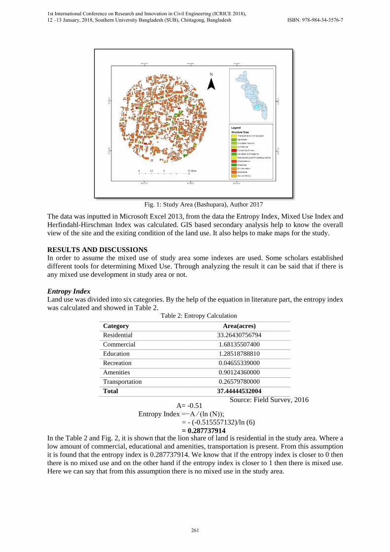
Fig. 1: Study Area (Bashupara), Author 2017
Source: Field Survey, 2016
1st International Conference on Research and Innovation in Civil Engineering (ICRICE 2018), 12 –13 January, 2018, Southern University Bangladesh (SUB), Chittagong, Bangladesh ISBN: 978-984-34-3576-7
261

Mixed Use Index
Land uses are categorized into housing, working and amenities. Table 3: Mixed Use Index Calculation
In the table 3, it is shown that the amount among the three categories, residential area has the maximum
share. Here the value of different categories land use is not equally distributed. So, there is no mixed
use in the study area.
Herfindahl-Hirschman Index It is basically based on the percentage of land use in the study area
HHI= (5)2 + 32 + 02 + 22 + 12 + 892
= 7961
As the score of HHI is very closer to 10,000 it can be easily said that the study area is not well mixed
with various uses. Table 4: Check List
Name of Index Limit Value Comment
Entropy 0-1 0.287737914 Poor
Mixed-Use No limit 89:1:10 Poor
Herfindahl-Hirschman 0-1000 7961 Poor
Source: Field Survey,
2016
From the analysis of the above index’s and Table 4, it is seen that the percentage of the residential type
of land use is more in comparison to the other type of uses. So it can easily say that the condition of
mixed use in study area is poor. The table shows the absence of mixed use in the given area.
CONCLUSION Mixed-use development is an integral part of most communities, creating unique places where people
can live, work, play and meet everyday shopping and lifestyle needs within a single neighborhood. The
primary issue in mixed-use developments is how to integrate both multiple uses and, typically, multiple
users. Clearly, the potential exists to realize sizeable long-term gains in transportation, housing,
infrastructure and design by pursuing mixed use as the new Pattern of development. In our research the
Residential , 89%
Commercial,
5%
Education ,
3%
Recreation,
0%
Amenities, 2% Transportation
, 1% Residential
Commercial
Education
Recreation
Amenities
Transportation
Category Area ( acres)
Housing 33.264308
Working 0.412011
Amenities 3.768121
Total 37.444440
Fig. 2: Land Use Pattern, Field survey, 2016
Source: Field Survey, 2016
1st International Conference on Research and Innovation in Civil Engineering (ICRICE 2018), 12 –13 January, 2018, Southern University Bangladesh (SUB), Chittagong, Bangladesh ISBN: 978-984-34-3576-7
262

observation and calculation about the mixed use potentiality helps to understand the development
pattern and needs. Mixed-use developments are becoming the favored means of development and re-
development. This kind of study gives knowledge about which involved with their use in each
component and be demanding that those components work together, both initially and into the future.
ACKNOWLEDGEMENT Special thanks to Md. Mokhlesur Rahman, Assistant professor and Tanmoy Chakraborty, Lecturer,
Department of Urban and Regional Planning, KUET for their cooperation and valuable comment on
this research.
REFERENCES
Adelaide City Council. (n.d.). Guide to Mixeduse Development.
(HBRI), H. a. (n.d.).
(n.d.). Colorado Springs Mixed Use Development Design Manual
A S M Mahbub-Un-Nabi, M. H. (n.d.). TFends of Development in Dhanmondi.
Joseph S. Rabianski, J. S. (2007). Mixed-Use Development: A Review of Professional Literature.
Joshua D. Herndon, D. W. (2011). Mixed-Use Development in Theory and Practice: Learning from
Atlanta’s Mixed Experiences.
Manaugh, K., & Kreider, T. (2013). What is mixed use? Presenting an interaction method for measuring
land use mix. JOURNAL OF TRANSPORT AND LAND USE.
Badoe, D. A. (n.d.). “Transportation-land-use interaction: Empirical findings in North America, and
their implications for modeling.” Transportation Research Part D: Transport and Environment 5(4):
235-263
Browna, B. B., Yamadab, I., Smitha, K. R., Zicka, C. D., Kowaleski-Jones, L., Fana, & X., a. J. (2009).
Mixed land use and walkability: Variations in land use measures and relationships with BMI,
overweight, and obesity. NIH Public Access.
Cervero, R. (1991). Land Uses and Travel at Suburban Activity Centers. Transportation Quarterly,
45(2), 479-491.
Cervero, R. (1995). Mixed Land-Uses and Commuting: Evidence from the American Housing Survey.
Transportation Research A, 30(5)
1st International Conference on Research and Innovation in Civil Engineering (ICRICE 2018), 12 –13 January, 2018, Southern University Bangladesh (SUB), Chittagong, Bangladesh ISBN: 978-984-34-3576-7
263