europe - hydropolitical vulnerability and resilience along international waters
DESCRIPTION
This report focuses on the challenges and the opportunities facing Europe a continent that enjoys relatively abundant water resources However, while European citizens only utilize around 20% of the available water supply, water is distributed unevenly across the Continent and there is a wide range in the average runoff across European basins. Meanwhile, several basins in Central Europe, from the Seine to the Dnieper, are showing lower runoff values, which may lead to rising water stress as populations climb.(Achim Steiner, United Nations Under-Secretary General Executive Director, United Nations Environment Programme)TRANSCRIPT


Copyright © 2009, United Nations Environment ProgrammeISBN: 978-92-807-3036-4 DEWA Job No. DEW/1184/NAThis publication is printed on chlorine and acid free paper from sustainable forests.This publication may be reproduced in whole or in part and in any form for educational or nonprofit purposes without specialpermission from the copyright holder, provided acknowledgment of the source is made. UNEP and the authors would appreciatereceiving a copy of any publication that uses this report as a source.No use of this publication may be made for resale or for any other commercial purpose whatsoever without prior permission inwriting from the United Nations Environment Programme.
United Nations Environment ProgrammePO Box 30552-00100, Nairobi, KenyaTel: +254 20 7624028Fax: +254 20 7623943/44E-mail: [email protected]: www.unep.org
United Nations Environment ProgrammeDivision of Early Warning and Assessment–North America47914 252nd Street, EROS Data Center, Sioux Falls, SD 57198-0001 USATel: 1-605-594-6117Fax: 1-605-594-6119E-mail: [email protected]: www.na.unep.net
www.unep.org
The “Hydropolitical Vulnerability and Resilience along International Waters” project, directed by Aaron T. Wolf and managedby Lynette de Silva, both of Oregon State University (OSU), USA, is a collaboration between the United Nations EnvironmentProgram – Division of Early Warning and Assessment, (UNEP-DEWA) and the Universities Partnership for TransboundaryWaters. The Partnership is an international consortium of water expertise, including institutes on five continents, seeking topromote a global water governance culture that incorporates peace, environmental protection, and human security <http://waterpartners.geo.orst.edu>.
Hydropolitical Resilience and Vulnerability along International Waters: Europe is the third of a five-part series of continentalreports. This volume was compiled in collaboration between UNEP-DEWA, OSU’s Transboundary Freshwater Dispute Database,and the University of Dundee, International Water Law Research Institute. “Hydropolitical Resilience and Vulnerability: SeriesIntroduction (Chapter 1)” was authored by Aaron T. Wolf, OSU Department of Geosciences. The following chapters wereauthored by Alistair Rieu-Clarke, University of Dundee, UNESCO Centre for Water Law, Policy and Science: “Challenges toEurope’s Water Resources” (Chapter 2), “The Evolution of Conflict and Cooperation over Europe’s Transboundary Waters”(Chapter 3), “Major Trends in Conflict and Cooperation” (Chapter 4), “Hydropolitical Vulnerability and Resilience Case Studies”(Chapter 5), and “Conclusion” (Chapter 6). Maps throughout the report and tables in the appendices were compiled by theTransboundary Freshwater Dispute Database (TFDD) Research Team (Department of Geosciences, OSU), which includesMarloes Bakker, Melissa Carper, Ryan Dey, Nathan Eidem, Barbara Geren, Samuel Littlefield, Erick Stemmerman, Yoshiko Sano,Kendra Hatcher, and Patrick MacQuarrie.
Transboundary Freshwater Dispute DatabaseDepartment of GeosciencesOregon State University104 Wilkinson HallCorvallis, OR 97331-5506, USATel: +1-541-737-2722Fax: +1-541-737-1200Web: www.transboundarywaters.orst.edu
DISCLAIMERThe views expressed in this publication are not necessarily those of the agencies cooperating in this project. The designationsemployed and the presentations do not imply the expression of any opinion whatsoever on the part of UNEP or cooperatingagencies concerning the legal status of any country, territory, city, or area of its authorities, or of the delineation of its frontiers orboundaries.Mention of a commercial company or product in this report does not imply endorsement by the United Nations EnvironmentProgramme. The use of information from this publication concerning proprietary products forpublicity or advertising is not permitted. Trademark names and symbols are used in aneditorial fashion with no intention of infringement on trademark or copyright laws.
We regret any errors or omissions that may have been unwittingly made.
Cover photo: Rower, Italy, by Keith Davis.
Title page photo: Danube River at Belgrade, Serbia, by Milan Vatovec.
Publication design and layout by Caryn M. Davis, Cascadia Editing,Philomath, Oregon; graphics technical assistance provided by Chris Smith,Corvallis, Oregon; and design consultation by Gretchen Bracher,Philomath, Oregon.
UNEP pr omotesenvironmentally sound pr actices
globally and in its own activities. Thisreport is printed on 100% recycled paper,
using vegetable-based inks and other eco-friendly practices. O ur distribution policy aims
to reduce UNEP’s carbon footprint.

ErratumThe name Macedonia as used in this document refers to
“The former Yugoslav Republic of Macedonia”.

v v v v v
PREFACE ...................................................................................................................................... xi
FOREWORD ................................................................................................................................. xiii
ACKNOWLEDGEMENTS ...................................................................................................................... xv
CHAPTER 1. HYDROPOLITICAL VULNERABILITY AND RESILIENCE: SERIES INTRODUCTION, BY AARON T. WOLF ..................1
1.1 Hydropolitical Vulnerability and Resilience.........................................................................11.2 Water and Security ..........................................................................................................5
1.2.1 International Waters................................................................................................ 5
1.2.1.1 Examining the Record ..................................................................................... 51.2.1.2 Tensions and Time Lags: Causes for Concern .................................................. 8
1.2.1.3 Institutional Capacity: The Heart of Conflict Management...............................11
1.2.2 Intranational Waters..............................................................................................121.3 Regional Instability: Political Dynamics of Loss of Irrigation Water .....................................14
CHAPTER 2. CHALLENGES TO EUROPE’S WATER RESOURCES, BY ALISTAIR RIEU-CLARKE ....................................... 172.1 Europe’s Water Resources ..............................................................................................172.2 Water Availability ..........................................................................................................19
2.3 Water Use ....................................................................................................................23
2.4 Water Quality Issues ......................................................................................................252.5 Climate Change ...........................................................................................................25
2.6 Conclusion ...................................................................................................................27
CHAPTER 3. THE EVOLUTION OF CONFLICT AND COOPERATION OVER EUROPE’S TRANSBOUNDARY WATERS,BY ALISTAIR RIEU-CLARKE ..................................................................................................................29
3.1 The Evolution of International Agreements Relating to Transboundary Waters .....................29
3.2 Regional Integration: the European Union and the United Nations Economic Commissionfor Europe ..........................................................................................................................30
3.2.1 The European Union (EU) .....................................................................................31
3.2.1.1 The Water Framework Directive (WFD)...........................................................32
3.2.2 The United Nations Economic ommission for Europe (UNECE) ................................33
3.2.2.1 The Helsinki Convention ..............................................................................34
3.3 Selected Conflicts Regarding Transboundary Water ..........................................................37
3.4 Conclusion ...................................................................................................................41
CONTENTS

vivivivivi
CHAPTER 4. MAJOR TRENDS IN CONFLICT AND COOPERATION, BY ALISTAIR RIEU-CLARKE ..................................... 43
4.1 Legal Scope: Surface Water to Drainage Basins ............................................................... 43
4.2 Substantive Water Rights and Obligations ....................................................................... 45
4.2.1 Equitable and Reasonable Utilisation of Transboundary Water .................................45
4.2.2 Sustainable Use and the Protection of Aquatic Ecosystems .......................................47
4.3 Procedural Rules and Mechanisms for Dispute Avoidance and Compliance ....................... 49
4.3.1 Exchange of Data and Information ........................................................................50
4.3.2 Notification of Planned Measures ..........................................................................51
4.3.3 Environmental Impact Assessment ..........................................................................52
4.3.4 Monitoring and Assessment ................................................................................... 53
4.3.5 Public Participation ...............................................................................................55
4.3.6 Compliance Strategy ............................................................................................ 56
4.4 Dispute Resolution......................................................................................................... 58
4.5 Institutional Arrangements ..............................................................................................60
4.6 Conclusion ...................................................................................................................62
CHAPTER 5. HYDROPOLITICAL VULNERABILITY AND RESILIENCE CASE STUDIES, BY ALISTAIR RIEU-CLARKE ...................... 655.1 The Dnieper (Dnipro) River Basin .................................................................................... 65
5.2 The Danube River Basin ................................................................................................. 70
5.3 The Narva River Basin ................................................................................................... 75
5.4 Conclusion ...................................................................................................................78
CHAPTER 6. CONCLUSION ............................................................................................................... 81
ATLAS OF HYDROPOLITICAL VULNERABILITY AND RESILIENCE ..........................................................................85
Biophysical Parameters ........................................................................................................ 86
Socioeconomic and Geopolitical Parameters ........................................................................89
Institutional Capacity ...........................................................................................................91
APPENDICES .................................................................................................................................95Appendix 1. International Freshwater Agreements, River Basin Organizations, and River BasinCommissions of Europe ....................................................................................................... 97Appendix 2. Notes on Basins .............................................................................................158
Appendix 3. Riparian Country Collaborations ...................................................................... 160
Appendix 4. Tenders for Large Projects ................................................................................ 169
REFERENCES ...............................................................................................................................171
INDEX OF BASIN NAMES .................................................................................................................177

vii vii vii vii vii
LISTS OF TABLES, FIGURES, MAPS, AND ACRONYMS
TABLES
Table 1.1 Selected examples of water-related disputes ........................................................ 6
Table 2.1 International river basins of Europe...................................................................20
FIGURES
Figure 1.1 International river basins of Europe..................................................................... 2
Figure 1.2 International river basins and countries, territories, and areas of Europe ................ 3
Figure 2.1 EU and UNECE membership countries ............................................................. 18Figure 2.2 Water exploitation index .................................................................................. 23
Figure 5.1 The Dnieper (Dnipro) River Basin ..................................................................... 66
Figure 5.2 The Danube River Basin .................................................................................. 71
Figure 5.3 The Narva River Basin ..................................................................................... 76
MAPS
Map 1 (A) Climate regions ................................................................................................... 86(B) Average annual runoff......................................................................................... 86
Map 2 (A) International aquifers ........................................................................................... 87
(B) Dam density with active and proposed tenders for large infrastructure ..................... 87
Map 3 (A) Climate change: temperature ............................................................................... 88(B) Climate change: precipitation .............................................................................. 88
Map 4 (A) Projected population density: 2025 ....................................................................... 89
(B) Projected water stress: 2025 ................................................................................ 89
Map 5 (A) Some socioeconomic indices: HDI, WPI, or GDP .................................................. 90
(B) Agricultural water use .......................................................................................... 90Map 6 (A) Water dependency ratio ....................................................................................... 91
(B) Percentage of basin under international freshwater treaty ....................................... 91
Map 7 (A) River basin organizations and commissions ........................................................... 92
(B) Votes on the UN Convention on International Watercourses ................................... 92
Map 8 (A) Institutional capacity and proposed Infrastructure ................................................... 93(B) Environmental sustainability index ........................................................................ 93
Map 9 Riparian country collaborations ........................................................................... 94

viiiviiiviiiviiiviii
ACRONYMS
GEF Global Environmental Fund
IHE International Hydrological Programme
IUCN International Union for the Conservation of Nature and Natural Resources
BBC British Broadcasting Corporation
EEA European Environment Agency
EPA Environmental Protection Agency
EU The European Union
GDP Gross Domestic Product
GEF Global Environment Facility
GIS Geographic Information System
HADCM3 Hadley Centre Coupled Model, version 3
HDI Human Development Index
ICPDR International Commission for the Protection of the Danube River
IHP International Hydrological Programme
IPPC International Panel on Climate Change
IWED International Water Event Database
IWLRI International Water Law Research Institute
IWRM Integrated Water and Resources Management
NGO Non-governmental organization
NOAA National Oceanic and Atmospheric Administration
OSU Oregon State University
PCCP Potential Conflict to Cooperation Potential
RBO River Basin Organizations
SAP Strategic Action Programme
TACIS Technical Assistance to the Commonwealth of Independent States
UN United Nations
UNDP United Nations Development Programme
UNECE United Nations Economic Commission for Europe
UNEP-DEWA United Nations Environment Program – Division of Early Warning and Assessment
UNESCO United Nations Educational, Scientific and Cultural Organization
UNWC United Nations Water Conference
USAID United States Agency for International Development
WFD Water Framework Directive
YILC Yearbook of the International Law Commission

ix ix ix ix ix ix ix ix ix ix
PREFACE
Within many international river basins including those in Europe, the demand for water fordomestic, industrial, and environmental purposes is growing annually. Thus nations sharingriver systems, lakes, and aquifers are becoming more vulnerable to tensions and conflicts,and climate change will, in many places, intensify these challenges. Monitoring, predicting,and pre-empting transboundary water conflicts, particularly in developing countries willbecome ever more central to future human and environmental security.
The good news is that, historically, nations across the world have often chosen cooperationover conflict when it comes to water—”hydro-diplomacy” and “hydrological cooperation”are now at the forefront of scientific enquiry so that the lessons learnt from the past canguide current and future policy-makers in water management decisions.
This report focuses on the challenges and the opportunities facing Europe—a continentthat enjoys relatively abundant water resources. On average, up to 3,200 m3 of water isavailable annually for every European inhabitant, of which only 660 m3 is being extracted.However, while European citizens only utilize around 20% of the available water supply,water is distributed unevenly across the Continent and there is a wide range in the averagerunoff across European basins. For instance, Cyprus and Malta have less than 160 mmannual runoff, and parts of Spain have less than 25 mm. In contrast, the highest annualrunoff rates are more than 1,700 mm in Bulgaria, Serbia, Montenegro, Croatia, and theNetherlands. Meanwhile, several basins in Central Europe, from the Seine to the Dnieper,are showing lower runoff values, which may lead to rising water stress as populations climb.
Major regional institutions like the European Union (EU) and the United NationsEconomic Commission for Europe (UNECE), often supported by the international community,are involved in influencing the hydropolitical situation of transboundary waters in Europe.The EU’s Water Framework Directive (WFD) and the 1992 Helsinki Convention under the UNEconomic Commission for Europe are key instruments that continue to shape improvedmanagement of transboundary water bodies.
Activities of the United Nations Environment Programme (UNEP) relating to freshwatercompliment these strategies by taking an ecosystem management approach set against thebackdrop of its work on climate change. UNEP’s activities are also guided by the MillenniumDevelopment Goals, the targets and timetable outlined in the 2002 World Summit onSustainable Development, and the work of UN-Water.

xxxxx
This report presents a comprehensive assessment of the hydropolitical vulnerabilities andresiliencies of Europe’s international waters, including detailed information on existing and forthcomingcooperative agreements. It aims to support informed policymaking and greater cooperation across thediverse social, political, and economic boundaries of the Continent at a time of a rapidly shiftingpolitical, economic, and environmental landscape.
ACHIM STEINER
United Nations Under-Secretary General
Executive Director, United Nations Environment Programme

xi xi xi xi xi
FOREWORD
The most influential regional legal frameworks for transboundary waters in Europe have been theUNECE Convention on the Protection and use of Transboundary Watercourses and International Lakesin Helsinki (the 1992 Helsinki Convention), implemented in 1996, and the EU Water FrameworkDirective (WFD), adopted in 2000. Both the Helsinki Convention and WFD seek to strengthencooperation, at both bilateral and multilateral levels, on the prevention, control and reduction oftransboundary pollution, sustainable water management, conservation of water resources, andenvironmental protection.
Central to the successful implementation and development of the Helsinki Convention is theregular gathering of the parties responsible for defining and reviewing the activities and policies underthe convention as well as sharing information on experience gained in negotiating and implementingbilateral and multilateral agreements on transboundary waters. Under the meeting of the parties, threeworking groups are charged with developing and implementing new policies, strategies andmethodologies for the protection of transboundary waters, as well as organizing workshops,conferences and training, and capacity-building events. In March 2000, the UNECE adoptedguidelines on sustainable flood prevention.
The Helsinki Convention is currently binding on 34 countries and the European Community andhas been highly influential in promoting cooperation over transboundary waters in Europe, particularlyin assisting countries in Eastern European, the Caucasus and Central Asia since the break-up of theformer Soviet Union. Many agreements relating to transboundary waters reflect the rules and principlescontained in the Convention.
It is in this context that I welcome the new publication, Hydropolitical Vulnerability and Resiliencealong International Waters: Europe. The close collaboration between the governments of Europeancountries, UN agencies and the international community continues to generate increased awareness ofthe vulnerabilities affecting the region’s shared water resources, as well as the resilience emerging fromcollective actions at the national, sub-regional, and regional levels to confront the challenges. Thispublication should inspire the continuing progress of intergovernmental dialogue and collective actionto halt and reverse the water challenges facing our world.
PETER GILRUTH
Director
Division of Early Warning and Assessment
United Nations Environment Programme

xiixiixiixiixii
This project, exemplary of the unifying force of transboundary waters, was built on the spirit ofincredible collaboration among researchers and staff at the United Nations Environment Programme,and two of the partners in the Universities Partnership for Transboundary Waters: the Oregon StateUniversity Department of Geosciences in the United States and the University of Dundee, UNESCOCentre for Water Law, Policy and Science, as well numerous other individuals from around the worldwho responded to our requests for data, information, and reviews.
First and foremost at UNEP, we would like to thank Achim Steiner, United Nations Under-SecretaryGeneral and UNEP Executive Director, Steve Lonergan and Peter Gilruth, the former and currentdirectors of UNEP’s Division of Early Warning and Assessment (DEWA), and Halifa Drammeh, SpecialAdviser to the Office of the Executive Director, for their consistent encouragement and supportthroughout this project. We would also like to acknowledge: Salif Diop, Senior Programme Officer andHead of DEWA’s Ecosystem Section, who provided vital professional oversight; Patrick M’mayi, DEWAProgramme Officer, who coordinated editorial contributions; Beth Ingraham, who provided guidanceon UNEP publication rules; Audrey Ringler, who provided cartographic input and advice; WinnieGaitho, who coordinated communication between partners; interns Martin Schaefer, Hanna Lindblomand Vinay Rajdev, who read early drafts and provided editorial support; and Arun Elhance, whoassisted with the preface. A special ‘thank you’ goes to those UNEP staff who provided data for thereport, particularly Johannes Akiwumi and Lal Kurukulasuriya.
We are especially grateful to Roger Admiral, Sandra Arbogast, Gary Badertscher, Keith Davis,Lynette de Silva, Richard Hermann, Michael Martin, Bryan Pendergrass, Emily Thomas, Jane McCauleyThomas, and Milan Vatovec, and to photographers from USAID and the Wikimedia Commons projectwho generously provided images used for this report. Finally, thanks go to Caryn M. Davis of CascadiaEditing for design and layout of the report.
At Oregon State University, we would like to thank Becci Anderson for her assistance withcartography, and Sam Littlefield for his late hours and attention to detail. Other members of theGeosciences team who contributed their time and expertise to the project include Todd Jarvis and ErickStemmerman. We gratefully acknowledge Steve W. Hostetler for furnishing manipulated HADCM3climate models. Special thanks to Melissa Carper for her willingness to jump in during the crunch andto Karen Logan, our departmental administrator, who helped to support the backbone of the projectthrough multiple contracts and budget oversight. Our gratitude goes to Eva Lieberherr and KristieMarsh for their attention to the written words in this report. A special thank you goes to De Stefano forproviding her generous assistance with proofreading and editing.
A big thank you to Marloes Bakker and Yoshiko Sano for their attention to detail and mastery ofthe multiple tables associated with this project; special thanks to Nathan Eidem and Patrick MacQuarriefor their cheerful willingness to handle any task, from research questions to data checking to creating
xii xii xii xii xii
ACKNOWLEDGEMENTS

xiii xiii xiii xiii xiii
maps; and our gratitude is extended to Kendra Hatcher for her gracious assistance in generatingadditional maps as needed. Finally, many thanks to our former colleague, Marcia F. Macomber, whowas instrumental in both spearheading and managing the “Hydropolitical Vulnerability and Resiliencealong International Waters” project.
This was an extraordinarily data-intensive project, which relied on the generosity of manyresearchers around the world who are committed to open distribution of their incredibly rich data sets,among them Charles Vörösmarty and Ellen Marie Douglas, from the Complex Systems ResearchCenter, Institute for the Study of Earth, Oceans and Space, University of New Hampshire, whogenerously provided their five-year-mean historical global runoff data.

xiv xiv xiv xiv xiv
PPPPPeople perched on stone parapet above Seine Rivereople perched on stone parapet above Seine Rivereople perched on stone parapet above Seine Rivereople perched on stone parapet above Seine Rivereople perched on stone parapet above Seine River, P, P, P, P, Paris, Faris, Faris, Faris, Faris, France.rance.rance.rance.rance.Photo credit: Jane McCauley Thomas.Photo credit: Jane McCauley Thomas.Photo credit: Jane McCauley Thomas.Photo credit: Jane McCauley Thomas.Photo credit: Jane McCauley Thomas.

Chapter 1. Series Introduction — 1Chapter 1. Series Introduction — 1Chapter 1. Series Introduction — 1Chapter 1. Series Introduction — 1Chapter 1. Series Introduction — 1
CHAPTER 1. HYDROPOLITICALVULNERABILITY AND RESILIENCE:SERIES INTRODUCTIONAaron T. Wolf
Water management is, by definition, conflict management. Postel (1999) describes the rootsof the problem: Water, unlike other scarce, consumable resources, is used to fuel all facetsof society, from biologies to economies to aesthetics and spiritual practice. Moreover, itfluctuates wildly in space and time, its management is usually fragmented, and it is oftensubject to vague, arcane, and/or contradictory legal principles. There is no such thing as
managing water for a single purpose—all water management is multi-objective and based on navigatingcompeting interests. Within a nation these interests include domestic users, agriculturalists, hydropowergenerators, recreators, and environmentalists—any two of which are regularly at odds—and thechances of finding mutually acceptable solutions drop exponentially as more stakeholders are involved.Add international boundaries, and the chances decrease exponentially yet again (Elhance, 1999).
Surface and groundwater that cross international boundaries present increased challenges toregional stability because hydrologic needs can often be overwhelmed by political considerations.While the potential for paralyzing disputes is especially high in these basins, history shows that watercan catalyze dialogue and cooperation, even between especially contentious riparians. There are263 rivers around the world that cross the boundaries of two or more nations, and untold number ofinternational groundwater aquifers. The catchment areas that contribute to these rivers compriseapproximately 47% of the land surface of the earth, include 40% of the world’s population, andcontribute almost 80% of freshwater flow (Wolf et al., 1999).
Within each international basin, allocations from environmental, domestic, and economic usersincrease annually, while the amount of freshwater in the world remains roughly the same as it has beenthroughout history. Given the scope of the problems and the resources available to address them,avoiding water conflict is vital. Conflict is expensive, disruptive, and interferes with efforts to relievehuman suffering, reduce environmental degradation, and achieve economic growth. Developing thecapacity to monitor, predict, and preempt transboundary water conflicts, particularly in developingcountries, is key to promoting human and environmental security in international river basins,regardless of the scale at which they occur.
1.1 HYDROPOLITICAL VULNERABILITY AND RESILIENCE
In general, concepts of “resilience” and “vulnerability” as related to water resources are often assessedwithin the framework of “sustainability,” (Blaikie et al., 1994), and relate to the ability of bio-physicalsystems to adapt to change (e.g., Gunderson and Pritchard, 2002). As the sustainability discourse hasbroadened to include human systems in recent years, so too has work been increasingly geared towardsidentifying indicators of resilience and vulnerability within this broader context (e.g., Bolte et al., 2004;Lonergan et al., 2000; Turner, 2003). In parallel, dialogue on “security” has migrated from traditionalissues of war and peace toward also beginning to incorporate the human-environment relationship inthe relatively new field of “environmental security ” (see UNEP, 2004; Vogel and O’Brien, 2004).

2 — Hydropolitical 2 — Hydropolitical 2 — Hydropolitical 2 — Hydropolitical 2 — Hydropolitical VVVVVulnerability and Rulnerability and Rulnerability and Rulnerability and Rulnerability and Resilienceesilienceesilienceesilienceesilience along International W along International W along International W along International W along International Waters: Europeaters: Europeaters: Europeaters: Europeaters: Europe
Figure 1.1 International river basins in Europe.

Chapter 1. Series Introduction — 3Chapter 1. Series Introduction — 3Chapter 1. Series Introduction — 3Chapter 1. Series Introduction — 3Chapter 1. Series Introduction — 3
Figure 1.2 International river basins and countries, territories, and areas of Europe.
4 — Hydropolitical V4 — Hydropolitical V4 — Hydropolitical V4 — Hydropolitical V4 — Hydropolitical Vulnerability and Rulnerability and Rulnerability and Rulnerability and Rulnerability and Resilience along International Wesilience along International Wesilience along International Wesilience along International Wesilience along International Waters: Europeaters: Europeaters: Europeaters: Europeaters: Europe
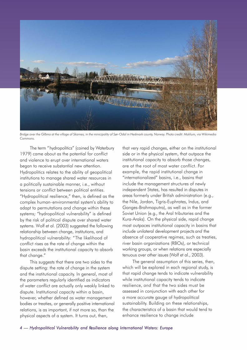
The term “hydropolitics” (coined by Waterbury1979) came about as the potential for conflictand violence to erupt over international watersbegan to receive substantial new attention.Hydropolitics relates to the ability of geopoliticalinstitutions to manage shared water resources ina politically sustainable manner, i.e., withouttensions or conflict between political entities.“Hydropolitical resilience,” then, is defined as thecomplex human-environmental system’s ability toadapt to permutations and change within thesesystems; “hydropolitical vulnerability” is definedby the risk of political dispute over shared watersystems. Wolf et al. (2003) suggested the followingrelationship between change, institutions, andhydropolitical vulnerability: “The likelihood ofconflict rises as the rate of change within thebasin exceeds the institutional capacity to absorbthat change.”
This suggests that there are two sides to thedispute setting: the rate of change in the systemand the institutional capacity. In general, most ofthe parameters regularly identified as indicatorsof water conflict are actually only weakly linked todispute. Institutional capacity within a basin,however, whether defined as water managementbodies or treaties, or generally positive internationalrelations, is as important, if not more so, than thephysical aspects of a system. It turns out, then,
that very rapid changes, either on the institutionalside or in the physical system, that outpace theinstitutional capacity to absorb those changes,are at the root of most water conflict. Forexample, the rapid institutional change in“internationalized” basins, i.e., basins thatinclude the management structures of newlyindependent States, has resulted in disputes inareas formerly under British administration (e.g.,the Nile, Jordan, Tigris-Euphrates, Indus, andGanges-Brahmaputra), as well as in the formerSoviet Union (e.g., the Aral tributaries and theKura-Araks). On the physical side, rapid changemost outpaces institutional capacity in basins thatinclude unilateral development projects and theabsence of cooperative regimes, such as treaties,river basin organizations (RBOs), or technicalworking groups, or when relations are especiallytenuous over other issues (Wolf et al., 2003).
The general assumption of this series, then,which will be explored in each regional study, isthat rapid change tends to indicate vulnerabilitywhile institutional capacity tends to indicateresilience, and that the two sides must beassessed in conjunction with each other fora more accurate gauge of hydropoliticalsustainability. Building on these relationships,the characteristics of a basin that would tend toenhance resilience to change include
Bridge over the Glåma at the village of Skarnes, in the minicipality of Sør-Odal in Hedmark county, Norway. Photo credit: Mahlum, via WikimediaCommons.

Chapter 1. Series Introduction — 5Chapter 1. Series Introduction — 5Chapter 1. Series Introduction — 5Chapter 1. Series Introduction — 5Chapter 1. Series Introduction — 5
• international agreements andinstitutions, such as RBOs
• a history of collaborative projects
• generally positive political relations
• higher levels of economicdevelopment
In contrast, facets that would tend towardsvulnerability would include
• rapid environmental change
• rapid population growth orasymmetric economic growth
• major unilateral developmentprojects
• the absence of institutionalcapacity
• generally hostile relations• natural climatic variability—
naturally variable rainfall patternswith frequent periods of floods anddrought.
1.2 WATER AND SECURITY
Water disputes revolve around one or more ofthree issues: quantity, quality, and timing. Thedynamics of those three issues play out verydifferently within various scales related to waterand security, whether internationally, intra-nationally, or regionally and indirectly. Eachsetting might be characterized as follows (forexamples, see Table 1.1):
1.1.1.1.1. International waters: very little violence, butlong processes from tension to cooperation,resulting in exacerbated political relations,inefficient water management, and ecosystemneglect; long, rich record of conflictresolution and development of resilientinstitutions; institutional capacity is at theheart of whether environmental stresseslead to conflict or cooperation.
2.2.2.2.2. Intranational waters (between sub-national political units, including states/provinces, ethnic/religious groups, and/oreconomic sectors): violence potential higherthan in international setting; rationale forinternational involvement more difficult,given greater issues of national sovereignty.
3.3.3.3.3. Regional instability (indirect)/politicaldynamics of loss of irrigation water: potential
for politically destabilizing processes ofmass migrations to cities and/or neighboringcountries when water supplies for broadlyirrigated regions are threatened due to adrop in quantity (including lowering ofgroundwater levels) or quality; issues ofpoverty alleviation and distribution ofwealth are tied directly to amelioration ofsecurity concerns.
1.2.1 International WatersWater is a unique and vital resource for whichthere is no substitute. It ignores politicalboundaries, fluctuates in both space and time,and has multiple and conflicting demands on itsuse—problems compounded in the internationalrealm by the fact that the international law thatgoverns it is poorly developed, contradictory,and unenforceable. It is no wonder, then, thatwater is perpetually suspect—not only as a causeof historic armed conflict, but as the resource thatwill bring combatants to the battlefield in the 21st
century. What is the likelihood that “the wars ofthe next century will be about water,” as somehave predicted?1
1.2.1.1 Examining the Record
In order to cut through the prevailing anecdotalapproach to the history of water conflicts,researchers at Oregon State University (OSU)undertook a three-year research project, whichattempted to compile a dataset of every reportedinteraction between two or more nations, whetherconflictive or cooperative, that involved water asa scarce and/or consumable resource or as aquantity to be managed—i.e., where water wasthe driver of the events,2 over the past 50 years(Wolf et al., 2003). The study documented a totalof 1,831 interactions, both conflictive andcooperative, between two or more nations overwater during the past 50 years, and found thefollowing:
1 World Bank vice-president Ismail Serageldin, quoted in the NewYork Times, 10 August 1995. His statement is probably most oftenquoted. For fear of water wars, see Joyce R. Starr, “Water Wars,”Foreign Policy (Spring 1991): 17–36; and John Bulloch and AdelDarwish, Water Wars: Coming Conflicts in the Middle East (London:Victor Gollancz, 1993).2 Excluded are events where water is incidental to the dispute, such asthose concerning fishing rights, access to ports, transportation, orriver boundaries. Also excluded are events where water is not thedriver, such as those where water is a tool, target, or victim of armedconflict.

6 — Hydropolitical V6 — Hydropolitical V6 — Hydropolitical V6 — Hydropolitical V6 — Hydropolitical Vulnerability and Rulnerability and Rulnerability and Rulnerability and Rulnerability and Resilience along International Wesilience along International Wesilience along International Wesilience along International Wesilience along International Waters: Europeaters: Europeaters: Europeaters: Europeaters: Europe
TABLE 1.1 SELECTED EXAMPLES OF WATER-RELATED DISPUTES.
QUANTITY
Cauvery RiverCauvery RiverCauvery RiverCauvery RiverCauvery River, South Asia, South Asia, South Asia, South Asia, South AsiaThe dispute on India’s Cauvery River sprang from the allocation of water betweenthe downstream state of Tamil Nadu, which had been using the river’s water forirrigation, and upstream Karnataka, which wanted to increase irrigated agriculture.The parties did not accept a tribunal’s adjudication of the water dispute, leading toviolence and death along the river.
Mekong Basin, Southeast AsiaMekong Basin, Southeast AsiaMekong Basin, Southeast AsiaMekong Basin, Southeast AsiaMekong Basin, Southeast Asia
Following construction of Thailand’s Pak Mun Dam, more than 25,000 people wereaffected by drastic reductions in upstream fisheries and other livelihood problems.Affected communities have struggled for reparations since the dam was completedin 1994.
OkavangoOkavangoOkavangoOkavangoOkavango-Makgadikgadi -Makgadikgadi -Makgadikgadi -Makgadikgadi -Makgadikgadi Basin, Southern ABasin, Southern ABasin, Southern ABasin, Southern ABasin, Southern Africafricafricafricafrica
In the Okavango-Makgadikgadi Basin, Botswana’s claims for water to sustain thedelta and its lucrative ecotourism industry contribute to a dispute with upstreamNamibia, which wants to pipe water from the Okavango River to supply its capitalcity with industrial and drinking water.
QUALITY
Rhine RiverRhine RiverRhine RiverRhine RiverRhine River, W, W, W, W, Western Europeestern Europeestern Europeestern Europeestern EuropeRotterdam’s harbor had to be dredged frequently to remove contaminated sludgedeposited by the Rhine River. The cost was enormous and consequently led tocontroversy over compensation and responsibility among Rhine users. While in thiscase negotiations led to a peaceful solution, in areas that lack the Rhine’s disputeresolution framework, siltation problems could lead to upstream/downstreamdisputes.
QUANTITY AND QUALITY
Incomati RiverIncomati RiverIncomati RiverIncomati RiverIncomati River, Southern A, Southern A, Southern A, Southern A, Southern Africafricafricafricafrica
Dams and water transfers in the South African area of the Incomati River basinreduced freshwater flows and increased salt levels in Mozambique’s Incomati estuary.This altered the estuary’s ecosystem and led to the disappearance of salt-intolerantplants and animals that are important for people’s livelihoods.
TIMING
Syr DarSyr DarSyr DarSyr DarSyr Dar’ya, Central Asia’ya, Central Asia’ya, Central Asia’ya, Central Asia’ya, Central AsiaRelations between Kazakhstan, Kyrgyzstan, and Uzbekistan—all riparians of theSyr Dar’ya, a major tributary of the disappearing Aral Sea—exemplify the problemscaused by water flow timing. Under the Soviet Union’s central management, springand summer irrigation in downstream Uzbekistan and Kazakhstan balancedupstream Kyrgyzstan’s use of hydropower to generate heat in the winter. But theparties are barely adhering to recent agreements that exchange upstream flows ofalternate heating sources (natural gas, coal, and fuel oil) for downstream irrigation,sporadically breaching the agreements.
Sources: Wolf et al., 2005; Jägerskog, 2003; Allan, 2001; Elhance, 1999; Bulloch and Darwish, 1993; Starr, 1991;Israeli- Jordanian peace treaty (www.israel-mfa.gov.il/mfa/go.asp?MFAH00pa0); Israeli-Palestinian interim agreement(www.mfa.gov.il/mfa/go.asp?MFAH00qd0#app-40, and www.nad-plo.org/fact/annex3.pdf).

Chapter 1. Series Introduction — 7Chapter 1. Series Introduction — 7Chapter 1. Series Introduction — 7Chapter 1. Series Introduction — 7Chapter 1. Series Introduction — 7
First, despite the potential for dispute ininternational basins, the record of acute conflictover international water resources is historicallyoverwhelmed by the record of cooperation. Thelast 50 years have seen only 37 acute disputes(those involving violence); of those, 30 werebetween Israel and one or another of itsneighbors, and the violence ended in 1970.Non-Mideast cases accounted for only five acuteevents, while, during the same period, 157treaties were negotiated and signed. In fact, theonly “water war” between nations on recordoccurred over 4,500 years ago between the city-states of Lagash and Umma in the Tigris-Euphrates basin (Wolf, 1998). The total numberof water-related events between nations of anymagnitude are likewise weighted towardscooperation: 507 conflict-related events, versus1,228 cooperative events, implying that violenceover water is neither strategically rational,hydrographically effective, nor economicallyviable.
Second, despite the occasional fiery rhetoricof politicians—perhaps aimed more often at their
own constituencies than at an enemy—mostactions taken over water are mild. Of all theevents, some 43% fell between mild verbalsupport and mild verbal hostility. If the next levelon either side—official verbal support and officialverbal hostility—is added in, the share of verbalevents reaches 62% of the total. Thus almost two-thirds of all events were only verbal and morethan two-thirds of those had no official sanction(Wolf, 1998).
Third, there were more issues of cooperationthan of conflict. The distribution of cooperativeevents covered a broad spectrum, including waterquantity, quality, economic development,hydropower, and joint management. In contrast,almost 90% of the conflict-laden events related toquantity and infrastructure. Furthermore, almostall extensive military acts (the most extreme casesof conflict) fell within these two categories (Wolf,1998).
Fourth, despite the lack of violence, wateracted as both an irritant and a unifier. As anirritant, water can make good relations bad andbad relations worse. Despite the complexity,
Schlossplatz (Palace Place), downtown Stuttgart in the state of Baden-Wuertemberg, in southwestern Germany. Photo credit: Gary Badertscher.

8 — Hydropolitical V8 — Hydropolitical V8 — Hydropolitical V8 — Hydropolitical V8 — Hydropolitical Vulnerability and Rulnerability and Rulnerability and Rulnerability and Rulnerability and Resilience along International Wesilience along International Wesilience along International Wesilience along International Wesilience along International Waters: Europeaters: Europeaters: Europeaters: Europeaters: Europe
however, international waters can act as a unifierin basins with relatively strong institutions.
This historical record suggests thatinternational water disputes do get resolved, evenamong enemies, and even as conflicts erupt overother issues. Some of the world’s most vociferousenemies have negotiated water agreements orare in the process of doing so, and theinstitutions they have created often prove to beresilient, even when relations are strained.
The Mekong Committee, for example,established by the governments of Cambodia,Laos, Thailand, and Viet Nam as an intergovern-mental agency in 1957, exchanged data andinformation on water resources developmentthroughout the Viet Nam War. Israel and Jordanhave held secret “picnic table” talks on managingthe Jordan River since the unsuccessful Johnstonnegotiations of 1953–1955, even though theywere technically at war from Israel’s independencein 1948 until the 1994 treaty. The Indus RiverCommission survived two major wars betweenIndia and Pakistan. And all 10 Nile Basin ripariancountries are currently involved in seniorgovernment-level negotiations to develop the basincooperatively, despite “water wars” rhetoricbetween upstream and downstream states.3
In Southern Africa, a number of river basinagreements were signed in the 1970s and 1980s,when the region was embroiled in a series oflocal wars. Although complex to negotiate, theagreements, once established, were one of therare arenas of peaceful cooperation betweencountries. Now that the wars in the area haveended, water cooperation is one of the foundationsfor regional cooperation (Turton, 2004). Somehave identified cooperation over water resourcesas a particularly fruitful entry point for buildingpeace; however, it is unclear what conditions arerequired for environmental cooperation to play amajor role (Conca and Dabelko, 2002).
1.2.1.2 Tensions and Time Lags:Causes for ConcernSo if there is little violence between nationsover their shared waters, what’s the problem?Is water actually a security concern at all? Infact, there are a number of issues where watercauses or exacerbates tensions, and it is worth
3 Mekong Committee from Ti Le-Huu and Lien Nguyen-Duc,Mekong Case Study, PCCP Series No. 10 (Paris, France: UNESCO-IHP 2003); Indus River Commission from Aaron T. Wolf, “Water andHuman Security, ” AVISO Bulletin, Global Environmental Changeand Human Security Project, Canada (June 1999); and Nile Basintalks from Alan Nicol, The Nile: Moving beyond Cooperation, PCCPSeries No. 16 (Paris, France: UNESCO-IHP 2003).
Miniature sailboats, Paris, France. Photo credit: Jane McCauley Thomas.

Chapter 1. Series Introduction — 9Chapter 1. Series Introduction — 9Chapter 1. Series Introduction — 9Chapter 1. Series Introduction — 9Chapter 1. Series Introduction — 9
understanding these processes to know bothhow complications arise and how they areeventually resolved.
The first complicating factor is the time lagbetween when nations first start to impinge oneach other’s water planning and when agreementsare finally, arduously, reached. A general patternhas emerged for international basins over time.Riparians of an international basin implementwater development projects unilaterally—first onwater within their own territory—in at tempts toavoid the political intricacies of the sharedresource. At some point, one of the riparians,generally the regional power, will implement aproject that impacts at least one of its neighbors.In the absence of relations or institutionsconducive to conflict resolution, the project canbecome a flashpoint, heightening tensions andregional instability, and requiring years or, morecommonly, decades, to resolve—the Indus treatytook 10 years of negotiations, the Ganges 30,and the Jordan 40—and, all the while, waterquality and quantity degrades to where the healthof dependent populations and ecosystems isdamaged or destroyed. This problem gets worse as
the dispute gains in intensity; one rarely hears talkabout the ecosystems of the lower Nile, the lowerJordan, or the tributaries of the Aral Sea—theyhave effectively been written off to the vagaries ofhuman intractability. During such periods of low-level tensions, threats and disputes rage acrossboundaries with relations as diverse as thosebetween Indians and Pakistanis and betweenAmericans and Canadians. Water was the lastand most contentious issue resolved innegotiations over a 1994 peace treaty betweenIsrael and Jordan, and was relegated to “finalstatus” negotiations—along with other of themost difficult issues such as Jerusalem andrefugees—between Israel and the Palestinians.
The timing of water flow is also important;thus, the operation of dams is also contested.For example, upstream users might release waterfrom reservoirs in the winter for hydropowerproduction, while downstream users might need itfor irrigation in the summer. In addition, waterquantity and water flow patterns are crucial tomaintaining freshwater ecosystems that dependon seasonal flooding. Freshwater ecosystemsperform a variety of ecological and economical
Excursion boat on the Elbe River, Hamburg, with container cranes in the background. The Port of Hamburg, located in northern Germany, is oneof the largest ports in Europe. Photo credit: Bryan Pendergrass.

10 — Hydropolitical V10 — Hydropolitical V10 — Hydropolitical V10 — Hydropolitical V10 — Hydropolitical Vulnerability and Rulnerability and Rulnerability and Rulnerability and Rulnerability and Resilience along International Wesilience along International Wesilience along International Wesilience along International Wesilience along International Waters: Europeaters: Europeaters: Europeaters: Europeaters: Europe
functions and often play an important role insustaining livelihoods, especially in developingcountries. As awareness of environmental issuesand the economic value of ecosystems increases,claims for the environment’s water requirementsare growing. For example, in the OkavangoBasin, Botswana’s claims for water to sustainthe Okavango Delta and its lucrative ecotourismindustry have contributed to a dispute withupstream Namibia, which wants to use someof the water passing through the Caprivi Stripon its way to the delta for irrigation.
Water quality problems include excessivelevels of salt, nutrients, or suspended solids. Saltintrusion can be caused by groundwater overuseor insufficient freshwater flows into estuaries. Forexample, dams in the South African part of theIncomati River basin reduced freshwater flowsinto the Incomati estuary in Mozambique and ledto increased salt levels. This altered the estuary’secosystem and led to the disappearance of salt-intolerant flora and fauna important for people’slivelihoods (the links between loss of livelihoodsand the threat of conflict are described below).The same exact situation exists on the borderbetween the United States and Mexico, where
high salinity problems have not only reducedagricultural productivity, but have severely alteredecosystems in the Colorado and Rio Granderivers and impacted marine flora and fauna inthe Gulfs of California and Mexico, where therespective rivers terminate.
Excessive amounts of nutrients or suspendedsolids can result from unsustainable agriculturalpractices, eventually leading to erosion. Nutrientsand suspended solids pose a threat to freshwaterecosystems and their use by downstreamriparians, as they can cause eutrophication andsiltation, respectively, which, in turn, can lead toloss of fishing grounds or arable land. Suspendedsolids can also cause the siltation of reservoirsand harbors: for example, Rotterdam’s harborhad to be dredged frequently to removecontaminated sludge deposited by the RhineRiver. The cost was enormous, and consequentlyled to conflict over compensation and responsibilityamong the river’s users. Although negotiationsled to a peaceful solution in this case, withoutsuch a framework for dispute resolution, siltationproblems can lead to upstream/downstreamdisputes such as those in the Lempa River basinin Central America (Lopez, 2004).
Rhine River near Burg Stahleck, a 12th- century castle near Bacharach in Rhineland-Palatinate, Germany. Photo credit: Bryan Pendergrass.

Chapter 1. Series Introduction — 11Chapter 1. Series Introduction — 11Chapter 1. Series Introduction — 11Chapter 1. Series Introduction — 11Chapter 1. Series Introduction — 11
1.2.1.3 Institutional Capacity:The Heart of Conflict Management
Most authors who write about hydropolitics,and especially those who explicitly address theissue of water conflicts, hold to the commonassumption that it is the scarcity of such acritical resource that drives people to conflict. Itfeels intuitive—the less there is of something,especially something as important as water, themore dearly it is held and the more likely peopleare to fight over it.
The three-year OSU study worked totease out just what the indicators of conflict are.A 100-layer Geographic Information System(GIS) was compiled—a spatial database of allthe parameters that might prove part of theconflict/cooperation story, including physical(e.g., runoff, droughts), socioeconomic (e.g.,GDP, rural/urban populations), and geopolitical(e,g., government type, votes on water-relatedUN resolutions) parameters. With this GIS inplace, a statistical snapshot was developed ofeach setting for each of the events over the last50 years of conflict or cooperation.
The results were surprising, and oftencounterintuitive. None of the physical parameters
were statistically significant—arid climates wereno more conflictive than humid climates, andinternational cooperation actually increasedduring droughts. In fact, when the numbers wererun, almost no single variable proved causal—democracies were as conflictive as autocracies,rich countries as poor countries, densely populatedcountries as sparsely populated ones, and largecountries the same as small countries.
It was close reflection of aridity that finallyput researchers on the right track: institutionalcapacity was the key. Naturally arid countrieswere cooperative: if one lives in a water-scarceenvironment, one develops institutional strategiesfor adapting to that environment. Once institutions—whether defined by formal treaties, informalworking groups, or generally warm relations—and their relationship to the physical environmentbecame the focus, researchers began to get aclear picture of the settings most conducive topolitical tensions in international waterways.
We found that the likelihood of conflictincreases significantly whenever two factorscome into play. The first is that some large orrapid change occurs in the basin’s physicalsetting—typically the construction of a dam, river
River Sava, Belgrade, Serbia. Photo credit: Milan Vatovec.

12 — Hydropolitical V12 — Hydropolitical V12 — Hydropolitical V12 — Hydropolitical V12 — Hydropolitical Vulnerability and Rulnerability and Rulnerability and Rulnerability and Rulnerability and Resilience along International Wesilience along International Wesilience along International Wesilience along International Wesilience along International Waters: Europeaters: Europeaters: Europeaters: Europeaters: Europe
diversion, or irrigation scheme—or in its politicalsetting, especially the breakup of a nation thatresults in new international rivers. The secondfactor is that existing institutions are unable toabsorb and effectively manage that change.This is typically the case when there is no treatyspelling out each nation’s rights andresponsibilities with regard to the shared river,nor any implicit agreements or cooperativearrangements. Even the existence of technicalworking groups can provide some capability tomanage contentious issues, as they have in theMiddle East.
The overarching lesson of the study is thatunilateral actions to construct a dam or riverdiversion in the absence of a treaty or institutionalmechanism that safeguards the interests of othercountries in the basin is highly destabilizing to aregion, often spurring decades of hostility beforecooperation is pursued. In other words, the redflag for water-related tension between countries isnot water stress per se, as it is within countries,but rather the unilateral exercise of domination ofan international river, usually by a regional power.
In the Jordan River Basin, for example,violence broke out in the mid-1960s over an “all-Arab” plan to divert the river’s headwaters (itselfa pre-emptive move to thwart Israel’s intention to
siphon water from the Sea of Galilee). Israel andSyria sporadically exchanged fire between March1965 and July 1966. Water-related tensions inthe basin persisted for decades and only recentlyhave begun to dissipate.
A similar sequence of events transpired inthe Nile basin, which is shared by 10 countries—of which Egypt is last in line. In the late 1950s,hostilities broke out between Egypt and Sudanover Egypt’s planned construction of the HighDam at Aswan. The signing of a treaty betweenthe two countries in 1959 defused tensionsbefore the dam was built. But no water-sharingagreement exists between Egypt and Ethiopia,where some 55% of the Nile’s flow originates,and a war of words has raged between these twonations for decades. As in the case of the Jordan,in recent years the Nile nations have begun towork cooperatively toward a solution thanks inpart to unofficial dialogues among scientists andtechnical specialists that have been held since theearly 1990s, and more recently a ministerial-level“Nile Basin Initiative” facilitated by the UnitedNations and the World Bank.
1.2.2 Intranational WatersThe second set of security issues occurs at thesub-national level. Much literature on trans-
Fish market, Brugge, Belgium. Photo credit: Sandra Arbogast.

Chapter 1. Series Introduction — 13Chapter 1. Series Introduction — 13Chapter 1. Series Introduction — 13Chapter 1. Series Introduction — 13Chapter 1. Series Introduction — 13
4 Giordano, M. A., and Wolf , A. T. 2003. Sharing waters: Post-Riointernational water management. Natural Resources Forum. 27:163-171.
boundary waters treats political entities ashomogeneous monoliths: “Canada feels . . .”or “Jordan wants. . . .” Analysts are only recentlyhighlighting the pitfalls of this approach, often byshowing how different subsets of actors relatevery different “meanings” to water. Rather thanbeing simply another environmental input, wateris regularly treated as a security issue, a gift ofnature, or a focal point for local society.Disputes, therefore, need to be understood asmore than “simply” over a quantity of a resource,but also over conflicting attitudes, meanings, andcontexts. Throughout the world, local water issuesrevolve around core values that often dateback generations. Irrigators, indigenouspopulations, and environmentalists, for example,can see water as tied to their very ways of life, andincreasingly threatened by newer uses for citiesand hydropower. Moreover, the local settingstrongly influences international dynamics andvice versa.
If there is a history of water-related violence,and there is, it is a history of incidents at thesub-national level, generally between tribes,water-use sectors, or states/provinces. In fact,the recent research at OSU suggests that, as thescale drops, the likelihood and intensity ofviolence rises.4 There are many examples of
internal water conflicts ranging from interstateviolence and death along the Cauvery River inIndia, to the USA, where California farmers blewup a pipeline meant for Los Angeles, to inter-tribal bloodshed between Maasai herdsmen andKikuyu farmers in Kenya. The inland, desert stateof Arizona in the USA even commissioned a navy(made up of one ferryboat) and sent its statemilitia to stop a dam and diversion on theColorado River in 1934.
Another contentious issue is water quality,which is also closely linked to water quantity.Decreasing water quality can render itinappropriate for some uses, thereby aggravatingits scarcity. In turn, decreasing water quantityconcentrates pollution, while excessive waterquantity, such as flooding, can lead tocontamination by sewage. Low water quality canpose serious threats to human and environmentalhealth. Water quality degradation is often asource of dispute between those who causedegradation and the groups affected by it. Aspollution increasingly impacts upon livelihoodsand the environment, water quality issues canlead to public protests.
Along the Golden Horn, an inlet of the Bosphorus Strait, Istanbul, Turkey. Photo credit: Lynette de Silva.

14 — Hydropolitical V14 — Hydropolitical V14 — Hydropolitical V14 — Hydropolitical V14 — Hydropolitical Vulnerability and Rulnerability and Rulnerability and Rulnerability and Rulnerability and Resilience along International Wesilience along International Wesilience along International Wesilience along International Wesilience along International Waters: Europeaters: Europeaters: Europeaters: Europeaters: Europe
One of the main causes of declining waterquality is pollution, e.g., through industrial anddomestic wastewater or agricultural pesticides. InTajikistan, for example, where environmentalstress has been linked to civil war (1992–1997),high levels of water pollution have beenidentified as one of the key environmental issuesthreatening human development and security.Water pollution from the tanning industry in thePalar Basin of the Indian state of Tamil Nadumakes the water within the basin unfit forirrigation and consumption. The pollutioncontributed to an acute drinking water crisis,which led to protests by the local community andactivist organizations, as well as to disputes andcourt cases between tanners and farmers (Cariuset al., 2003).
1.3 REGIONAL INSTABILITY:POLITICAL DYNAMICS OF LOSS
OF IRRIGATION WATER
As water quality degrades—or quantitydiminishes—over time, the effect on the stability
of a region can be unsettling. For example, for30 years the Gaza Strip was under Israelioccupation. Water quality deteriorated steadily,saltwater intrusion degraded local wells, andwater-related diseases took a rising toll on thepeople living there. In 1987, the intifada, orPalestinian uprising, broke out in the Gaza Strip,and quickly spread throughout the West Bank.Was water quality the cause? It would besimplistic to claim direct causality. Was it anirritant exacerbating an already tenuoussituation? Undoubtedly.
An examination of relations between Indiaand Bangladesh demonstrates that these internalinstabilities can be both caused and exacerbatedby international water disputes. In the 1960s,India built a barrage at Farakka, diverting aportion of the Ganges flow away from its courseinto Bangladesh, in an effort to flush silt awayfrom Calcutta’s seaport, some 100 miles to thesouth. In Bangladesh, the reduced upstream flowresulted in a number of adverse effects: degradedsurface and groundwater, impeded navigation,increased salinity, degraded fisheries, andendangered water supplies and public health.
Produce market, Italy. Photo credit: Keith Davis.

Chapter 1. Series Introduction — 15Chapter 1. Series Introduction — 15Chapter 1. Series Introduction — 15Chapter 1. Series Introduction — 15Chapter 1. Series Introduction — 15
Migration from affected areas further compoundedthe problem. Ironically, many of those displacedin Bangladesh have found refuge in India.
Two-thirds of the world’s water use is foragriculture so, when access to irrigation water isthreatened, one result can be movement of hugepopulations of out-of-work, disgruntled men fromthe country-side to the cities—an invariablerecipe for political instability. In pioneering work,Sandra Postel identified those countries that relyheavily on irrigation, and whose agriculturalwater supplies are threatened either by a declinein quality or quantity. The list coincides preciselywith regions of the world community’s currentsecurity concerns, where instability can haveprofound effects: India, China, Iran, Pakistan,Uzbekistan, Iraq, Bangladesh, and Egypt (Posteland Wolf, 2001).
Water management in many countries isalso characterized by overlapping and competingresponsibilities among government bodies.Disaggregated decision-making often producesdivergent management approaches that servecontradictory objectives and lead to competingclaims from different sectors. And such claims
are even more likely to contribute to disputes incountries where there is no formal system ofwater-use permits, or where enforcement andmonitoring are inadequate. Controversy alsooften arises when management decisions areformulated without sufficient participation bylocal communities and water users, thus failingto take into account local rights and practices.Protests are especially likely when the publicsuspects that water allocations are divertingpublic resources for private gain or when wateruse rights are assigned in a secretive and possiblycorrupt manner, as demonstrated by the violentconfrontations in 2000 following the privatizationof Cochabamba, Bolivia’s water utility (Postel andWolf, 2001).
Finally, there is the human security issue ofwater-related disease. It is estimated that between5 and 10 million people die each year fromwater-related diseases or inadequate sanitation.More than half the people in the world lackadequate sanitation. Eighty percent of disease inthe developing world is related to water (Gleick,1998). This is a crisis of epidemic proportions,and the threats to human security are self-evident.
Garbage and debris caught in branches along river, Italy. Photo credit: Keith Davis.

16 — Hydropolitical V16 — Hydropolitical V16 — Hydropolitical V16 — Hydropolitical V16 — Hydropolitical Vulnerability and Rulnerability and Rulnerability and Rulnerability and Rulnerability and Resilience along International Wesilience along International Wesilience along International Wesilience along International Wesilience along International Waters: Europeaters: Europeaters: Europeaters: Europeaters: Europe
WWWWWater faucet by riverater faucet by riverater faucet by riverater faucet by riverater faucet by river, Italy, Italy, Italy, Italy, Italy.....Photo credit: KPhoto credit: KPhoto credit: KPhoto credit: KPhoto credit: Keith Davis.eith Davis.eith Davis.eith Davis.eith Davis.

Chapter 2. Challenges to Europe’s Water Resources — 17Chapter 2. Challenges to Europe’s Water Resources — 17Chapter 2. Challenges to Europe’s Water Resources — 17Chapter 2. Challenges to Europe’s Water Resources — 17Chapter 2. Challenges to Europe’s Water Resources — 17
CHAPTER 2. CHALLENGES TO EUROPE’S WATERRESOURCESAlistair Rieu-Clarke
The hydrovulnerability of Europe is governed by the institutions created to resolve transboundarywater issues in a cooperative manner that attempts to prevent conflict. In fact, institutionalcapacity, be it water management bodies, treaties or generally positive international relations,is possibly more important than the physical environment for minimising hydropolitical vulner-ability and conflict on the one hand, and strengthening resilience and cooperation on the other
hand. In addition, the likelihood of conflict rises as the rate of change within a basin exceeds theinstitutional capacity to absorb that change; hence emphasising two key factors in hydropoliticalvulnerability and resilience: rate of change and institutional capacity. Therefore, the key question toaddress is whether or not the institutional capacity for the management of Europe’s transboundarywaters is sufficient to absorb likely changes and challenges facing the international waters in Europe.
The major regional institutions influencing the hydropolitical situation of transboundary waters inEurope are the European Union (EU) and the United Nations Economic Commission for Europe(UNECE). More specifically, the Water Framework Directive (WFD) under the EU and the 1992 HelsinkiConvention under the UNECE have played major roles in institutions governing transboundary waterresources in Europe because they have led to the adoption of drainage basin-wide approaches tomanaging transboundary waters in Europe.
Europe, in its broadest sense, encompasses the 27 EU Member States, as well as the remainingEastern European countries, the European Free Trade Area, and the Western Balkan countries (seeFigures 1.2 and 2.1). From a political conflict and cooperation stand-point, considerable change hasoccurred within Europe over the last century, including two World Wars (1914-1918 and 1939-1945),the emergence and subsequent dissolution of the Soviet Union, and the creation of the EU. The demiseof the Soviet Union and emergence of the newly independent states in the 1990s resulted in manynational basins becoming international; a significant number of water allocation and pollutionproblems that were previously national issues within the Soviet Union became transboundary in nature.Such a transition has given rise to a host of political, economic, and legal problems (Vinogradov, 1996).
In order to understand the hydrovulnerability issues in Europe, this paper provides a generaldescription of the transboundary water resource issues facing Europe. Furthermore, to develop anunderstanding of the demand for water resources within Europe, issues of water availability, waterextraction and use are depicted. Finally, issues that may have a negative impact on competing uses,water quality, and extreme hydrological events are assessed.
2.1 EUROPE’S WATER RESOURCES
There are 71 international river basins within Europe and approximately 89 international aquifers (seeFigure 1.1, Figure 1.2, and Map 2 (A)). A wide range of international basins exists within Europe, from

18 — Hydropolitical V18 — Hydropolitical V18 — Hydropolitical V18 — Hydropolitical V18 — Hydropolitical Vulnerability and Rulnerability and Rulnerability and Rulnerability and Rulnerability and Resilience along International Wesilience along International Wesilience along International Wesilience along International Wesilience along International Waters: Europeaters: Europeaters: Europeaters: Europeaters: Europe
large basins (e.g., theDanube) shared between 17countries, to 39 basins sharedbetween only two countries. Interms of size, basins vary fromthe 60 km2 (the Flurry basin inUnited Kingdom and NorthernIreland) to 1,554,900 km2
(the Volga basin shared byRussia, Kazakhstan, andBelarus).
Most European countriesare reliant on water resourcesthat originate outside theirterritory; in 16 Europeancountries, more than 90% ofthe country is located withinan international river basin.For example, while Germany,Greece, Luxembourg, andPortugal rely on neighboringcountries for 40% of theirwater resources, theNetherlands and the SlovakRepublic rely on 80%, andHungary relies on neighboringcountries for as much as 95%of its water resources (seeMap 6 (A)).
View of Great War Island (Veliko Ratno Ostrvo) at the confluence of the Danube and Sava rivers in Belgrade, Serbia. Photo credit: Milan Vatovec.
Figure 2.1 Map of EU and UNECE membership countries.

Chapter 2. Challenges to Europe’s Water Resources — 19Chapter 2. Challenges to Europe’s Water Resources — 19Chapter 2. Challenges to Europe’s Water Resources — 19Chapter 2. Challenges to Europe’s Water Resources — 19Chapter 2. Challenges to Europe’s Water Resources — 19
2.2 WATER AVAILABILITY
Europe enjoys relatively abundant waterresources. On average, up to 3,200 m3 of wateris available annually for every Europeaninhabitant, with only 660 m3 being extracted(EEA, 2009). However, while European citizensonly utilize around 20% of the available watersupply, water is distributed unevenly acrossEurope; a wide range in the average runoffamount exists across European basins (see Map1 (B)). For instance, Cyprus and Malta have lessthan 160 mm annual runoff, and parts of Spainreceive less than 25 mm. In contrast, the highestannual runoff rates are more than 1,700 mm(e.g., in Bulgaria, Serbia, Montenegro, Croatia,and the Netherlands; EEA, 2003a). Somecountries that usually have sufficient wateravailable may be water stressed at certain timesof the year or in certain years (UNEP, 2004).1
While water stress is not a severe problem inEurope because the continent is relatively wellwatered compared to Africa or the Middle East,several basins in Central Europe, from the Seineto the Dnieper, show lower runoff values, which,with increasing populations, may lead to more
The Rhône River with a low water level near Saint-Maurice, Switzerland. Photo credit: Dake, via Wikimedia Commons.
1 Levels of water stress are calculated on the basis of cubic meters ofwater available per person per year.2 Socioeconomic indicators show that there is a wide disparitybetween European countries, with Western European countriesgenerally enjoying higher rates of gross domestic product (GDP) percapita and human development rankings than other parts of Europe(UNECE 2003).
water stress (see Map 4(B)). While the latterbasins’ per capita availability puts theirpopulations closer to the critical threshold forwater stress, the figures do not account for spatialvariability or technological innovations such asdesalination or pumping of groundwater.2
Similarly, according to the EEA’s water exploitationindex eight European countries are water stressed(Germany, England and Wales, Italy, Malta,Belgium, Spain, Bulgaria, and Cyprus; see Figure2.2). While the majority of water abstraction inGermany, England and Wales, Bulgaria, andBelgium is for non-consumptive use, Italy, Spain,Cyprus, and Malta face significant pressuresgiven the high level of consumptive use vis-à-viswater availability).
Recent droughts throughout Europe havealso shown that water resource problems are notlimited to semiarid regions (UNEP, 2004).

20 — Hydropolitical V20 — Hydropolitical V20 — Hydropolitical V20 — Hydropolitical V20 — Hydropolitical Vulnerability and Rulnerability and Rulnerability and Rulnerability and Rulnerability and Resilience along International Wesilience along International Wesilience along International Wesilience along International Wesilience along International Waters: Europeaters: Europeaters: Europeaters: Europeaters: Europe
TABLE 2.1 INTERNATIONAL RIVER BASINS IN EUROPE
RIVER BASIN TOTAL AREA (KM2) AREA DIVISION (%)
Bann 5,600 United Kingdom 97.14
Ireland 2.86Barta 1,800 Latvia 60.87
Lithuania 37.71Bidasoa 500 Spain 89.33
France 10.67Castletown 400 United Kingdom 76.12
Ireland 23.88
Danube 790,100 Romania 28.97Hungary 11.74
Austria 10.30Serbia 9.41
Germany 7.46
Slovakia 5.75Bulgaria 5.22
Bosnia and Herzegovina 4.87Croatia 4.52
Ukraine 3.74
Czech Republic 2.59Slovenia 2.17
Moldova 1.76Montenegro 0.89
Switzerland 0.31Italy 0.16
Poland 0.08
Albania 0.03Daugava 58,700 Byelarus 48.14
Latvia 34.38Russia 16.11
Lithuania 1.38
Dnieper 516,300 Ukraine 57.97Byelarus 24.19
Russia 17.83Dniester 62,000 Ukraine 75.44
Moldova 24.52
Poland 0.05Don 425,600 Russia 87.23
Ukraine 12.76Douro/Duero 98,900 Spain 81.63
Portugal 18.37Ebro 85,800 Spain 99.36
Andorra 0.48
France 0.16Elancik 900 Russia 71.32
Ukraine 28.68Elbe 132,200 Germany 62.86
Czech Republic 36.02
Austria 0.54Poland 0.56
Enningsdalselva* NorwaySweden
Erne 4,800 Ireland 59.28
United Kingdom 40.72Fane 200 Ireland 96.46
United Kingdom 3.54Flurry 60 United Kingdom 73.77
Ireland 26.23Foyle 2,900 United Kingdom 67.30
Ireland 32.70
Garonne 55,800 France 98.83Spain 1.07
Andorra 0.08

Chapter 2. Challenges to Europe’s Water Resources — 21Chapter 2. Challenges to Europe’s Water Resources — 21Chapter 2. Challenges to Europe’s Water Resources — 21Chapter 2. Challenges to Europe’s Water Resources — 21Chapter 2. Challenges to Europe’s Water Resources — 21
Gauja 11,600 Latvia 90.42Estonia 9.58
Glama 43,000 Norway 99.00
Sweden 0.99Guadiana 67,900 Spain 80.82
Portugal 19.18Isonzo 3,000 Slovenia 59.48
Italy 40.09Jacobs 400 Norway 68.10
Russia 31.90
Kemi 55,700 Finland 94.52Russia 5.41
Norway 0.01Klaralven 51,000 Sweden 84.54
Norway 15.46
Kogilnik 6,100 Moldova 57.82Ukraine 42.18
Lake Prespa 9,000 Albania 88.17Macedonia 8.50
Greece 3.32Lava/Pregel 8,600 Russia 74.00
Poland 23.84
Lielupe 14,400 Latvia 66.76Lithuania 33.32
Lima 2,300 Spain 50.88Portugal 49.04
Maritsa 49,600 Bulgaria 66.49
Turkey 25.69Greece 7.55
Mino 15,100 Spain 96.18Portugal 3.70
Mius 2,800 Russia 69.82
Ukraine 30.07Naatamo 1,000 Norway 57.73
Finland 41.97Narva 53,000 Russia 53.20
Estonia 34.09Latvia 11.13
Byelarus 1.57
Neman 90,300 Byelarus 46.13Lithuania 43.97
Russia 5.30Poland 4.21
Latvia 0.36
Neretva 5,500 Bosnia and Herzegovina 95.98Croatia 3.47
Nestos 10,200 Bulgaria 53.63Greece 46.36
Oder/Odra 122,400 Poland 84.20
Czech Republic 8.38Germany 6.33
Slovakia 1.09Olanga 18,800 Russia 89.37
Finland 10.62Oulu 28,700 Finland 93.20
Russia 6.78
Parnu 5,800 Estonia 99.85Latvia 0.15
Pasvik 16,000 Finland 77.46Russia 16.15
Norway 6.39
Po 87,100 Italy 94.44Switzerland 4.92
France 0.54Austria 0.10
RIVER BASIN TOTAL AREA (KM2) AREA DIVISION (%)

22 — Hydropolitical V22 — Hydropolitical V22 — Hydropolitical V22 — Hydropolitical V22 — Hydropolitical Vulnerability and Rulnerability and Rulnerability and Rulnerability and Rulnerability and Resilience along International Wesilience along International Wesilience along International Wesilience along International Wesilience along International Waters: Europeaters: Europeaters: Europeaters: Europeaters: Europe
Prohladnaja 600 Russia 76.90Poland 23.10
Rezvaya 700 Turkey 74.66Bulgaria 25.34
Rhine 172,900 Germany 56.49Switzerland 14.05
France 13.34Belgium 8.03
Netherlands 5.75Luxembourg 1.46
Austria 0.76Liechtenstein 0.09
Italy 0.04Rhone 100,200 France 89.88
Switzerland 10.05Italy 0.05
Roia 600 France 67.39
Italy 30.45Salaca 2,100 Latvia 78.52
Estonia 5.70Sarata 1,800 Ukraine 63.90
Moldova 36.05Schelde 17,100 France 50.03
Belgium 49.28Netherlands 0.47
Seine 85,700 France 97.78Belgium 2.14
Luxembourg 0.08Struma 15,000 Bulgaria 57.66
Greece 25.88Macedonia 12.22
Serbia 4.19Tagus/Tejo 77,900 Spain 66.06
Portugal 33.50Tana 15,600 Norway 59.71
Finland 40.23Torne/Tornealven 37,300 Sweden 67.98
Finland 28.00Norway 4.03
Tuloma 25,800 Russia 91.85Finland 7.93
Vardar 32,400 Macedonia 62.83Serbia 25.22
Greece 11.94Velaka 700 Bulgaria 95.25
Turkey 3.74Venta 9,500 Latvia 65.15
Lithuania 34.72Vijose 7,200 Albania 64.83
Greece 34.66Vistula/Wista 194,000 Poland 87.45
Ukraine 6.55Byelarus 5.03
Slovakia 0.96Czech Republic 0.01
Volga 1,554,900 Russia 99.77Kazakhstan 0.14Byelarus 0.08
Vuoksa 62,700 Finland 86.48Russia 13.52
Wiedau 1,100 Denmark 86.23Germany 13.32
Yser 900 France 53.63
Belgium 46.37
*No information availableSource: Wolf et al., 1999.
RIVER BASIN TOTAL AREA (KM2) AREA DIVISION (%)

Chapter 2. Challenges to Europe’s Water Resources — 23Chapter 2. Challenges to Europe’s Water Resources — 23Chapter 2. Challenges to Europe’s Water Resources — 23Chapter 2. Challenges to Europe’s Water Resources — 23Chapter 2. Challenges to Europe’s Water Resources — 23
Moreover, desertification is an issue in parts ofEurope, including the Mediterranean basins andparts of Russia. In Spain and Portugal, forexample, almost one-third of the land is at risk ofdesertification and in the Kalmyk Republic of theRussian Federation almost 80% of the land isseverely affected by desertification (UNEP, 2004).
2.3 WATER USE
Both surface and groundwater provide importantsources of freshwater abstraction in Europeancountries; whilst desalination of seawatercomprises only a small percentage of the totalwater use (Krinner, 2000). The proportion ofwater consumed varies considerably (EEA, 2009).For instance, high temperatures and highevapotranspiration leads to higher average waterconsumption per hectare in southern Europeancountries. The amount of water used for irrigationin Italy and Spain, for example, is around tentimes that of central EU countries, with southernEuropean countries accounting for around 74%of the total irrigated area in Europe (UNEP,2004). While the total water extractions havedecreased in central European countries,
0% 10% 20% 30% 40% 50% 60% 70%
CyprusBulgaria
SpainBelgium
FYR, of MacedoniaItaly
England/WalesMalta
GermanyTurkeyPolandFrance
RomaniaCzech Republic
GreeceNetherlands
LithuaniaEstonia
HungarySwitzerland
AustriaDenmark
LuxembourgSlovenia
FinlandIreland
SwedenPortugalSlovakia
LatviaIcelandNorway
Total abstraction per year/Long term renewable resource
WEI-Latest Year
WEI-90
Figure 2.2 Water exploitation index (WEI). Total water abstraction per year as percentage of long-term freshwater resources in 1990 and 2002(Ver. 1.00) Data source: EEA-ETC/WTR based on data from Eurostat data tables: Renewable water resources (million m3/year), LTAA & annualwater abstraction by source and by sector (million m3/year) - Total freshwater abstraction (surface + groundwater). Accessed from http://themes.eea.europa.eu/IMS/ISpecs/ISpecification20041007131848/IAssessment1116497549252/view_content.
Water left running from outdoor faucets used for washing produce,Venice, Italy. Photo credit: Keith Davis.
24 — Hydropolitical V24 — Hydropolitical V24 — Hydropolitical V24 — Hydropolitical V24 — Hydropolitical Vulnerability and Rulnerability and Rulnerability and Rulnerability and Rulnerability and Resilience along International Wesilience along International Wesilience along International Wesilience along International Wesilience along International Waters: Europeaters: Europeaters: Europeaters: Europeaters: Europe
extractions in western European countries haveremained relatively stable over the last decade. Adecrease in agricultural and industrial activities inthe new EU member countries that is largely dueto economic restructuring in the 1990s, hasresulted in a 70% reduction in water extractionsfor agricultural and industrial uses and a 30%
reduction in municipal extraction (EEA, 2003).Furthermore, in a number of countries, thedroughts of recent years and a shift in managementstrategies have been responsible for downwardtrends in water extractions (Krinner, 2000).
In many Western European countries, urbanwater demand is a major consumer ofgroundwater, while in Eastern European andMediterranean countries it is less significant(Nixon, 2000). Over-extraction of groundwaterremains a problem in many areas of Europe;primarily due to municipal uses as well asagricultural and tourism-related uses. Particularlyon the Veneto and Emilia-Ramagna coasts, thePo delta, and Venice, Bolgne, and Ravenna (Italy)heavy use of groundwater resources has beenidentified as the source of subsidence and soilcompaction (UNEP, 2004). Another issue is thatlarge stretches of the Mediterranean coastline inItaly, Spain, and Turkey as well as countries alongthe Baltic and Black Sea coasts have beenaffected by saltwater intrusion (UNEP, 2004). Theover-exploitation of groundwater has also beendirectly linked to severe wetland losses, especiallyin the Mediterranean region.
Traditionally water quantity problems wereaddressed by increasing the storage capacitiesthrough reservoirs and water transfers. Extensivesystems of dams and resources can be found
Busy harbor, Venice, Italy. Photo credit: Keith Davis.
Tea at the Grand Bazaar, Istanbul, Turkey. Photo credit: L ynette de Silva.

Chapter 2. Challenges to Europe’s Water Resources — 25Chapter 2. Challenges to Europe’s Water Resources — 25Chapter 2. Challenges to Europe’s Water Resources — 25Chapter 2. Challenges to Europe’s Water Resources — 25Chapter 2. Challenges to Europe’s Water Resources — 25
throughout Europe’s international waters (seeMap 2(B)). However, the last decade has seen adiscernible shift in water management practicesin Europe, including the introduction of demandmanagement strategies, leakage reduction,increased water efficiency, recycling, metering,and increased water pricing (UNEP, 2002).Despite such a shift, an appropriate balancebetween supply and demand in many areasremains to be realised (Communication on WaterScarcity and Drought).
2.4 WATER QUALITY ISSUES
While on the whole, the quality of Europe’s waterhas improved over the last 15 years, certainproblems still exist. Furthermore, Europe’sgroundwater quality has generally not improvedsince the 1990s, with one-third of the ground-water resources exceeding nitrate drinking waterlimits (EEA, 2005).3 Rivers and lakes acrossEurope have been heavily modified for various
Snowfields, Dolomites, Italy. Photo credit: Keith Davis.
anthropogenic reasons, such as mitigatingfloods, navigation, and water extraction, as wellas domestic, agricultural, and industrial storagepurposes, which have a negative impact on waterquality and the aquatic environment (EEA, 2005).However, marked improvements in surface waterquality have been witnessed in some areas. Forexample, heavy pollution in many WesternEuropean rivers, such as the Rhine, has decreasedsignificantly in the last 25 years (UNEP, 2002). Suchwater quality issues place increasing pressure on
3 The most significant pollution of groundwater is from nitrates andpesticides. In addition, pollution of groundwater from othersubstances, such as hydrocarbons and heavy metals, specificallyfrom mining, industrial, and military activities has proved problem-atic, especially in Eastern Europe. Bulls by pond, Spain. Photo credit: Sandra Arbogast.

26 — Hydropolitical V26 — Hydropolitical V26 — Hydropolitical V26 — Hydropolitical V26 — Hydropolitical Vulnerability and Rulnerability and Rulnerability and Rulnerability and Rulnerability and Resilience along International Wesilience along International Wesilience along International Wesilience along International Wesilience along International Waters: Europeaters: Europeaters: Europeaters: Europeaters: Europe
Member States to be able to meet the objectivesof the WFD, discussed later in section 3.2.
2.5 CLIMATE CHANGE
Climate change and the lack of adequateadaptation strategies is perhaps the biggest threatto Europe’s water environment at present (EEA,2007; Flärke, et al, 2004; EEA, 2005). Thepotential effects of climate change on Europe’swater resources is expected to differ acrossEurope (UNEP, 2004; IPPC, 2007) (see Map 3 (A)and (B)). Northern European countries havealready experienced an increase of more than 9%in annual precipitation between 1946 and 1999.In contrast, decreases in precipitation have beenobserved in Southern and Central Europe (EEA,2003a). A 2007 IPPC report predicts that waterstress will increase over central and southernEurope from 19% to 35% by 2070. In aridcountries like Spain, climate change couldexacerbate land degradation on agriculturallandscapes. Moreover, a predicted temperatureincrease from 1oC to 3.5 oC could cause snow tomelt earlier, increasing winter runoff and reducingthe thawing process in spring and summer thatwill affect how international waters are utilised(Krinner, 2000). A rise in temperature in the lastfew decades has already led glaciers to shrink;alpine glaciers have lost more than 25% of theirvolume between 1975 and 2000 and it ispredicted that half of Europe’s alpine glacierscould disappear by 2025 (UNEP, 2004).
Many areas of Europe already experienceextreme floods and droughts. Since 1988, anestimated 700 fatalities have occurred due tofloods in Europe, around half a million peoplehave been displaced, and economic losses haveamounted to at least 25 billion euro (EEA,2003b). Flooding is the most common naturalhazard in Europe, with 188 flood events beingrecorded between 1980 and 2000 (UNEP, 2004).Areas particularly prone to flood events includethe Mediterranean coasts, the Netherlands,South-East United Kingdom, Northern Germancoastal plains, the Rhine, Seine, Po, and LoireValleys, coastal areas of Portugal, and alpinevalleys (Krinner, 1999). An example of extremerisk is the Rhine basin where more than 10
(From top) Visitors tour the Topkapi Palace on a rainy day in Istanbul,Turkey. Photo credit: Lynette de Silva. Summer rainstorm, Belgrade,Serbia. Photo credit: Milan Vatovec. Cyclist prepares to navigatestorm water runoff on a Paris street. Photo credit: Sandra Arbogast.

Chapter 2. Challenges to Europe’s Water Resources — 27Chapter 2. Challenges to Europe’s Water Resources — 27Chapter 2. Challenges to Europe’s Water Resources — 27Chapter 2. Challenges to Europe’s Water Resources — 27Chapter 2. Challenges to Europe’s Water Resources — 27
The aftermath of flooding in western Bulgaria when the Maritsa River burst its banks in August 2005, during a summer marked by torrential rains.Photo credit: CARE International, courtesy of USAID.
million people live in areas at risk of extremefloods; the potential damage from floods withinthis area is estimated at around 165 billion euro(EU, 2004b).
A marked increase in the frequency andmagnitude of flood events is largely due to twointerconnected reasons. The first reason is thehigher intensity of rainfall and rising sea level thatmay be a result of climate change that createsmore drastic floods. A second reason is thegrowing number of people and economic assetslocated in flood plains (EU, 2004a). It ispredicted that coastal flooding related toincreasing storminess and sea-level rise is likelyto threaten up to 1.6 million people acrossEurope annually (IPPC, 2007).
Droughts also pose a significant threatthroughout Europe, with more frequent andprolonged droughts occurring, as well as longerfire seasons, particularly in the Mediterraneanregion (IPPC, 2007).
2.6 CONCLUSION
This chapter highlighted Europe’s heavy relianceon transboundary waters. Increased demands forwater and inefficient practices throughout Europehave led to various water-related problems thathave the potential to lead to water conflictsbetween European countries. Common problemsinclude over-extraction of groundwater, pollution,soil erosion, landscape changes, and the loss ofnatural habitats. In addition, potential threats ofclimate change as well as changes in land-usepractices have increased the risk of harm fromextreme hydrological events such as flooding.The fact that the majority of river basins in Europeare transboundary means that many of thesecommon water-related problems are not limitedto national boundaries. For instance, the use offertilisers for agricultural needs upstream mayhave a detrimental effect on drinking watersupplies in a downstream country.

Rhine River from Burg Stahleck, Rhineland-PRhine River from Burg Stahleck, Rhineland-PRhine River from Burg Stahleck, Rhineland-PRhine River from Burg Stahleck, Rhineland-PRhine River from Burg Stahleck, Rhineland-Palatinate,alatinate,alatinate,alatinate,alatinate,GermanyGermanyGermanyGermanyGermany. Photo credit: Bryan P. Photo credit: Bryan P. Photo credit: Bryan P. Photo credit: Bryan P. Photo credit: Bryan Pendergrass.endergrass.endergrass.endergrass.endergrass.
28 — Hydropolitical V28 — Hydropolitical V28 — Hydropolitical V28 — Hydropolitical V28 — Hydropolitical Vulnerability and Rulnerability and Rulnerability and Rulnerability and Rulnerability and Resilience along International Wesilience along International Wesilience along International Wesilience along International Wesilience along International Waters: Europeaters: Europeaters: Europeaters: Europeaters: Europe

Chapter 3. The Evolution of Conflict and Cooperation over Europe’s Transboundary Waters — 29Chapter 3. The Evolution of Conflict and Cooperation over Europe’s Transboundary Waters — 29Chapter 3. The Evolution of Conflict and Cooperation over Europe’s Transboundary Waters — 29Chapter 3. The Evolution of Conflict and Cooperation over Europe’s Transboundary Waters — 29Chapter 3. The Evolution of Conflict and Cooperation over Europe’s Transboundary Waters — 29
CHAPTER 3. THE EVOLUTION OF CONFLICTAND COOPERATION OVER EUROPE’STRANSBOUNDARY WATERSAlistair Rieu-Clarke
This chapter discusses the evolution of conflicts and cooperation over Europe’s transboundarywaters – from the evolution of legal institutions dealing with transboundary waters to newerinstitutions that are shifting towards regional integration of transboundary water management.The primary institutions depicted are the EU’s Water Framework Directive and the UNECE’s1992 Helsinki Convention. Despite the history of institutions that promote cooperation,
conflicts regarding transboundary water resources occur in Europe.
3.1 THE EVOLUTION OF INTERNATIONAL AGREEMENTS RELATING TO
TRANSBOUNDARY WATERS
A long tradition of cooperation over transboundary waters exists in Europe. The main purpose ofmultilateral treaties created by European countries during the early nineteenth century was to ensurefreedom of navigation and equal treatment between riparian countries (YILC, 1972). The 1814 Treatyof Paris, the 1815 Final Act of Congress of Vienna, the 1831 Convention of Mainz, the 1856 Treaty ofParis, the 1857 Navigation of the Danube Act, the 1878 Treaty of Berlin, and the 1883 Treaty ofLondon all sought to promote the freedom of navigation throughout Europe’s transboundary waters(McCaffrey, 1993). The peace treaties signed following World War I represent a further level ofcooperation over European transboundary waters that extend beyond issues of navigation. Forexample, the 1919 Treaty of Versailles created priority uses between irrigation, fisheries, andnavigation. These early agreements tended to focus more on surface water rather than groundwater.Furthermore, they usually only addressed the main stem of a river; excluding tributaries andgroundwater (McCaffrey, 1993).
A number of these early agreements also included a provision for joint commissions. For instance,the 1895 convention between the Netherlands and Germany, concerning the Niers and the GuelderNiers canal (in the Rhine River basin), established an inspection commission to oversee theimplementation of the rights and obligations pursuant to the convention. Furthermore, the 1892 Treatyfor the regulation of the Rhine established the International Commission for the regulation of the RhineRiver. Similarly, the 1856 Treaty of Paris established a European Commission for the Danube River. In1922, the Frontier Agreement between Denmark and Germany was created, which established aFrontier Water Commission and a Supreme Frontier Water Commission; the former being responsiblefor examining and deciding all matters connected with the frontier waters, and the latter acting as acourt of final appeal. Furthermore, the 1927 agreement between Spain and Portugal on the RiverDouro established an international commission to implement the provisions of the agreement.
Numerous other agreements were adopted throughout the twentieth century in order to deal withissues such as hydropower production. Examples include the 1930 convention between France and

30 — Hydropolitical V30 — Hydropolitical V30 — Hydropolitical V30 — Hydropolitical V30 — Hydropolitical Vulnerability and Rulnerability and Rulnerability and Rulnerability and Rulnerability and Resilience along International Wesilience along International Wesilience along International Wesilience along International Wesilience along International Waters: Europeaters: Europeaters: Europeaters: Europeaters: Europe
Switzerland respecting the Chatelot Fallsconcession in the Rhone basin, the 1991agreement between Norway and Swedenconcerning the salmon and anadromous salmonfisheries in the Svinesund, the Iddefjord, and theRiver Enningsdals tributaries of the Glama Riverbasin, the 1950 convention between the formerSoviet Union and Hungary concerning measuresto prevent floods and to regulate the waterregime in the area of the frontier river Tisza (inthe Danube basin), and the 1951 agreementbetween Finland and Norway on the transfer fromthe course of the Neiden River to the course ofthe Gandvik River.
In recent decades a discernable shift awayfrom single purpose agreements towards the jointmanagement of international waters hasoccurred. In some cases joint commissions haveevolved into institutions dealing with a range ofjoint management issues. An example of such acommission is the Finish-Norwegian Commissionthat has taken a leading role in developingintegrated water resources management (IWRM)plans for all the basins shared between Finlandand Norway. The first IWRM plan (concerning theTana River basin) was published in 1990 andupdated during the end of the 1990s.
The development of internationalagreements throughout the last two centuries hasled to the development of a large body ofinternational agreements covering the majority ofinternational basins in Europe (see Map 6 (B)).However, in some basins, basin-wide agreementsbetween countries have not yet been established,which as noted in Chapter 1, potentiallyincreases their hydropolitical vulnerability.Notable examples include Daugava basinbetween Russia, Belarus and Latvia; the Nemanbasin, shared between Russia, Belarus, andLithuania; the Dniester basin between the Ukraineand Moldova; and the Dnieper basin betweenBelarus, Russia, and the Ukraine.
3.2 REGIONAL INTEGRATION:THE EUROPEAN UNION AND THE
UNITED NATIONS ECONOMIC
COMMISSION FOR EUROPE
The shift towards joint management oftransboundary waters (discussed above) is largelydue to the influence of regional organisations.Regional integration has played an extremely
Rhine River flowing through Düsseldorf, in North Rhine-Westphalia, Germany. Photo credit: Richard Hermann.

Chapter 3. The Evolution of Conflict and Cooperation over Europe’s Transboundary Waters — 31Chapter 3. The Evolution of Conflict and Cooperation over Europe’s Transboundary Waters — 31Chapter 3. The Evolution of Conflict and Cooperation over Europe’s Transboundary Waters — 31Chapter 3. The Evolution of Conflict and Cooperation over Europe’s Transboundary Waters — 31Chapter 3. The Evolution of Conflict and Cooperation over Europe’s Transboundary Waters — 31
significant role in shaping legal and institutionalframeworks for the management of trans-boundary waters in Europe. The most notableinstitutions within this sphere are the EU andUNECE, which have played a large role inleading to a shift towards joint management ofinternational waters.
3.2.1 The European Union (EU)
Given its broad remit and supranational status,the EU is unique as an international organisation.Inspired in the post World Water II era as ameans of promoting peace and securitythroughout Europe, the EU was first proposed bythe French Foreign Minister Robert Schuman inMay of 1950. Initially consisting of six countries(Belgium, Germany, France, Italy, Luxembourgand the Netherlands), the EU soon expanded toinclude Denmark, Ireland, and the UnitedKingdom in 1973, Greece in 1981, Spain, andPortugal in 1986, Austria, Finland, and Sweden in1995, Cyprus, the Czech Republic, Estonia,Hungary, Latvia, Lithuania, Malta, Poland,Slovakia, and Slovenia in 2004, and mostrecently Bulgaria and Romania in 2007 (seeFigure 2.1).
Cooperation between EU countries initiallyinvolved issues of trade and the economy;however, as the number of EU countries grew,matters such as citizen rights, freedom, securityand justice, employment, regional development,environmental protection, and internationaldevelopment became included. Five key EUinstitutions became responsible for thedevelopment, implementation, and enforcementof EU law and policy: the European Parliament(elected by the peoples of member countries), theCouncil of the European Union (representinggovernments of the member countries), theEuropean Commission (responsible for developinglaw and policy, and enforcement), the Court ofJustice (ensuring compliance with EU law) andthe Court of Auditors (controlling sound andlawful management of the EU budget).Furthermore, various types of EU laws exist, whichinclude regulations (binding in their entirety anddirectly applicable in all member countries),directives (binding but leave member countrieswith the discretion to decide how they will beimplemented), decisions (fully binding on those towhom they are addressed), and recommendationsand opinions (non-binding, declaratoryinstruments).
Snov River, a tributary of the Dnieper River, near Sedniv, Ukraine. Photo credit: Yuriy Tkach, courtesy of Wikimedia Commons.

32 — Hydropolitical V32 — Hydropolitical V32 — Hydropolitical V32 — Hydropolitical V32 — Hydropolitical Vulnerability and Rulnerability and Rulnerability and Rulnerability and Rulnerability and Resilience along International Wesilience along International Wesilience along International Wesilience along International Wesilience along International Waters: Europeaters: Europeaters: Europeaters: Europeaters: Europe
3.2.1.1 The Water FrameworkDirective (WFD)
Early EU policy adopted a sectoral approach,mainly focusing on setting water qualityobjectives for particular water uses, or limiting thedischarge of certain pollutants. Whileconsiderable cooperation throughout the EUmember countries occurred, the piecemealapproach to adopting water legislation meantthat by 1996, EU water law and policy sufferedfrom a lack of coherence and coordination.Therefore, in 1996 the EU Commission called forthe adoption of a framework directive designedto more efficiently and effectively implement EUwater law and policy. This led to a directiveestablishing a framework for community action inthe field of water policy: the Water FrameworkDirective (EU WFD) in 2000 (Chave, 2001).Marking an important shift from the piecemealapproach that existed in the 1970s, the main
objective of the EU WFD is to ensure the long-term sustainable use of all EU waters.Furthermore, the EU WFD attempts to provideboth the criteria for determining what constitutessustainable use, and the mechanisms fordetermining how the principle can beimplemented.
According to preliminary assessments in2005, a large part of Europe’s water bodies areat risk of failing to meet the ambitiousenvironmental objectives of good ecologicalstatus by 2015 (EU, 2005). The EU Commissionhas already launched infringement proceedingsagainst a number of member countries. However,most member countries have transposed the EUWFD into their national law, designated riverbasin districts, and employed competentauthorities (WFD, 2004). In addition to the EUWFD, the EU has been active in developing lawand policy on a number of water-related issues.For instance, a new directive on the protection of
The Europabrücke, or Europe’s bridge, above the Sill River (Danube basin) in the Wipp valley just south of Innsbruck, Austria. Photo credit:Richard Hilber, via Wikimedia Commons.

Chapter 3. The Evolution of Conflict and Cooperation over Europe’s Transboundary Waters — 33Chapter 3. The Evolution of Conflict and Cooperation over Europe’s Transboundary Waters — 33Chapter 3. The Evolution of Conflict and Cooperation over Europe’s Transboundary Waters — 33Chapter 3. The Evolution of Conflict and Cooperation over Europe’s Transboundary Waters — 33Chapter 3. The Evolution of Conflict and Cooperation over Europe’s Transboundary Waters — 33
groundwater from pollution that mandatesmember countries to monitor and assessgroundwater quality on the basis of commoncriteria and to identify and reverse trends ingroundwater pollution was adopted in 2006.Furthermore, 2007 saw the adoption of adirective on flood risk management, floodprevention, protection, and mitigation (EU,2005a). The next major evaluation of the WFDwill come in 2010, when the first River BasinManagement Plans, due in 2009, are reportedalongside the status of the water bodies. TheEuropean Commission and EEA will subsequentlypublish a major status report in 2012.
The EU also provides a number of fundingprogrammes that are relevant to internationalwaters. For example, Interreg III focuses onenhancing economic and social cohesion acrossborders. Furthermore, the Interreg Rhine MeuseActivities programme was funded through thisprogramme in order to increase safety and publicawareness of flood management issues andreduce future flood damage. Pursuant to theproject, the governments of Belgium, France,Germany, Luxembourg, the Netherlands, andSwitzerland developed a joint flood controlprogramme. Another environment related EUfunding programme is LIFE III, which contributesto the implementation of community legislationrelating to environmental protection. Under thisprogramme, the Integrated Management ofWetlands Initiative, aimed at the reclamation,conservation, and balanced use of wetlands, wasinitiated between Germany, Italy, and Poland.
Several further EU funding programmesfocussing on non-EU member countries are alsorelevant to transboundary projects. The first is thePhare programme that provides around 11 billioneuro for institutions of pre-accession countries tostrengthen public administrations and institutions,promote convergence with EU community law,and promote economic and social cohesion.Similarly, the Tacis programme (implementedfrom 2002 – 2004 by the EU and supported bythe UNECE) funds technical assistance in 12Eastern European countries, mainly focusing onenhancing the transition process in thesecountries. Finally, the Sixth Research andTechnological Development programme is the
main instrument for funding the EU’s researchon financing issues related to sustainabledevelopment, global change, and ecosystems.
3.2.2 The United NationsEconomic Commission forEurope (UNECE)
The UNECE was created in 1947 by the UNECEas one of five regional commissions of theUnited Nations. As the primary goal of theUNECE is to foster greater economic coop-eration among its member countries, it focuseson issues including economic analysis, theenvironment, human settlements, statistics,sustainable energy, trade, industry andenterprise development, timber, and transport.Activities of the UNECE include policy analysis,development of conventions, regulations andstandards, and technical assistance. There are55 member countries of the UNECE and 70international professional organizations; othernon-governmental organizations are alsoinvolved in the activities of the UNECE on an adhoc basis. The geographic scope of the UNECEis far reaching, encompassing the regions ofEurope, Central Asia, North America, and Israel.
Dragon fountain, Rome, Italy. Photo credit: Keith Davis.

34 — Hydropolitical V34 — Hydropolitical V34 — Hydropolitical V34 — Hydropolitical V34 — Hydropolitical Vulnerability and Rulnerability and Rulnerability and Rulnerability and Rulnerability and Resilience along International Wesilience along International Wesilience along International Wesilience along International Wesilience along International Waters: Europeaters: Europeaters: Europeaters: Europeaters: Europe
The UNECE first dealt with water relatedmatters in the late 1960s and early 1970s(Wouters, 2004). In contrast to the EU WFD,which deals with all waters of the EU, the UNECEfocuses solely on transboundary water resources.A number of non-binding policy documents weredeveloped by the UNECE throughout the 1980s,including the 1980 Declaration of Policy onPrevention and Control of Water Pollution, the1982 decision on International Cooperation onShared Water Resources, the 1984 Declaration ofPolicy on the Rational Use of Water, the 1986Decision on Cooperation in the Field ofTransboundary Waters, the 1989 Charter onGroundwater management, and the 1990 Code ofConduct on Accidental Pollution of TransboundaryWaters.
3.2.2.1 The Helsinki Convention
The promulgation of policy documents ontransboundary waters led to the adoption of theUNECE Convention on the Protection and Use ofTransboundary Watercourses and InternationalLakes in Helsinki in 1992 (1992 HelsinkiConvention). Implemented into action in 1996,this convention is perhaps the most influentialregional legal framework for transboundarywaters in Europe. While the focus of the 1992Helsinki Convention is more limited than the EUWFD, the UNECE has a wider influence withrespect to the number of contracting parties. As aframework agreement, the 1992 HelsinkiConvention has been strengthened by thedevelopment of supplementary protocols such asthe 1999 Protocol on Water and Health and the
2003 Protocol on Civil Liability andCompensation for Damage Caused by theTransboundary Effects of Industrial Accidents onTransboundary Waters. In addition, the 1992Helsinki Convention benefits from a widerenvironmental programme within the UNECE thathas seen the adoption of the 1992 Conventionon the Transboundary Effects of IndustrialAccidents, the 1991 Convention onEnvironmental Impact Assessment in aTransboundary Context, and the 1998Convention on Access to Information, PublicParticipation in Decision-Making and Access toJustice in Environmental Matters. Furthermore, the1992 Helsinki Convention seeks to strengthencooperation, bilateral and multilateral levels forthe prevention, control and reduction oftransboundary pollution, sustainable watermanagement, conservation of water resources,and environmental protection.
Central to the successful implementationand development of the 1992 HelsinkiConvention is the meeting of the parties, which isresponsible for defining and reviewing theactivities and policies under the convention aswell as sharing information on experience gainedin negotiating and implementing bilateral andmultilateral agreements concerningtransboundary waters. Under the meeting of theparties three working groups are charged withdeveloping and implementing new policies,strategies and methodologies to protecttransboundary waters, as well as organisingworkshops and conferences, training, andimplementing capacity-building events.1
In March of 2000, the UNECE adoptedguidelines on sustainable flood prevention(UNECE, 2000). Subsequently, a UNECE taskforce on flood prevention, protection andmitigation (led by Germany) has analysed theeffectiveness of the 2000 Flood Guidelines and
1 The working group on integrated water resources management hasdeveloped policy guidelines on sustainable flood management, inter-state water distribution, and public participation in water manage-ment. The working group on monitoring and assessment hasdeveloped three sets of guidelines for monitoring and assessingtransboundary rivers, groundwater and lakes, as well as adoptingpilot programmes to assist countries in the implementation of theguidelines. Finally, the working group on water and health isresponsible for the implementation of the 1999 protocol on waterand health.Fallen leaves in water. Hupisaaret Park, Oulu, Finland.

Chapter 3. The Evolution of Conflict and Cooperation over Europe’s Transboundary Waters — 35Chapter 3. The Evolution of Conflict and Cooperation over Europe’s Transboundary Waters — 35Chapter 3. The Evolution of Conflict and Cooperation over Europe’s Transboundary Waters — 35Chapter 3. The Evolution of Conflict and Cooperation over Europe’s Transboundary Waters — 35Chapter 3. The Evolution of Conflict and Cooperation over Europe’s Transboundary Waters — 35
proposed further activities, includingstrengthening legal arrangements at the nationaland international level; developing soft-lawinstruments; and enhancing capacitydevelopment in flood management activities(UNECE 2004). In parallel to the UNECE’sactivities relating to flood management,international basins particularly prone to floodevents, such as the Rhine, Oder, Meuse, Danube,Saar, Moselle, and Elbe, have started to takecoordinated measures at the basin level tomanage floods. For instance, in the Rhine basin,pursuant to the 1998 convention on theprotection of the Rhine, the contracting parties setthe goal of comprehensive flood prevention. Theparties adopted the Rhine action plan on floodsin January of 1998 that sought a 10% reductionin flood damage by 2005 and a 25% reductionby 2020. Between 1998 and 2020 an estimated12.3 billion euro is being spent by thecontracting parties on flood protection measures.A similar flood action plan has recently beenadopted for the Danube basin countries underthe auspices of the 1994 Danube Convention.The action plan, prepared by the InternationalCommission for the Protection of the DanubeRiver (ICPDR), sets out basic principles and
approaches to flood management, includingboth structural and non-structural measures(Danube, 2004).
In September 2000, the International WaterAssessment Centre was established to assist withthe implementation of the 1992 HelsinkiConvention. A legal board and advisory servicealso support the implementation of theconvention as they advise the bodies under theconvention on controversial legal issues andprovide legal, institutional, economic, financial,and technical support for the practical
Floating restaurants in the foreground, with excursion boats across the River Sava, Belgrade, Serbia. Photo credit: Milan Vatovec.
Tour boat prices, Brugge, Belgium. Photo credit: Sandra Arbogast.

36 — Hydropolitical V36 — Hydropolitical V36 — Hydropolitical V36 — Hydropolitical V36 — Hydropolitical Vulnerability and Rulnerability and Rulnerability and Rulnerability and Rulnerability and Resilience along International Wesilience along International Wesilience along International Wesilience along International Wesilience along International Waters: Europeaters: Europeaters: Europeaters: Europeaters: Europe
implementation of the convention. The centreprovides expertise on water-related monitoring,assessment, information technology and publicparticipation, and seeks to build a network of
leading European water institutions. Therefore,not only does the convention provide the legalframework by which to develop bilateral andmultilateral agreements, it also contains anorganizational framework that assists countries inthe negotiation, implementation, anddevelopment of agreements for cooperation overtheir transboundary waters.
The 1992 Helsinki Convention, currentlybinding 34 countries and the Europeancommunity, has been highly influential inpromoting cooperation over transboundarywaters in Europe; particularly in assisting EasternEuropean countries, the Caucasus and CentralAsia since the break-up of the former SovietUnion. Many agreements relating totransboundary waters reflect the rules andprinciples contained in the 1992 HelsinkiConvention, including the 1994 DanubeConvention, the 1994 Agreements on the Meuseand Scheldt (both components of the Rhine Riverbasin), the 1997 Estonia-Russia Agreement onTransboundary Waters, the 1998 RhineConvention, the 1998 Spain-Portugal BasinConvention, the 2001 Belarus-UkraineAgreement on Transboundary Waters and the2002 Sava Framework Agreement (sub-basin ofthe Danube), and the 2002 Agreement on the
Douro Valley near Régua, Portugal. Photo credit: Npolvo, viaWikimedia Commons.
Moldovan dried fruit and vegetable producers observe a Uniferax-Grup washing machine during a study tour. Photo credit: Rodion Gudim,CNFA, courtesy of USAID.

Chapter 3. The Evolution of Conflict and Cooperation over Europe’s Transboundary Waters — 37Chapter 3. The Evolution of Conflict and Cooperation over Europe’s Transboundary Waters — 37Chapter 3. The Evolution of Conflict and Cooperation over Europe’s Transboundary Waters — 37Chapter 3. The Evolution of Conflict and Cooperation over Europe’s Transboundary Waters — 37Chapter 3. The Evolution of Conflict and Cooperation over Europe’s Transboundary Waters — 37
Chu and Talias Rivers between Kazakhstan andKyrgyzstan (UNECE, 1993; UNECE 2003).
An example of the effectiveness of theUNECE is that in collaboration with theOrganisation for Security and Cooperation inEurope (OSCE), it supports a transboundaryproject on the Dniester River basin, which startedin 2004 for an initial 14-month period. Theproject aims to enhance regional cooperationbetween the Dniester riparian countries, Ukraineand Moldova, and draw international attention tothe problems of the basin. Part of the projectinvolves the preparation of a new agreement onthe management and sustainable use of thewaters of the Dniester basin as well as thedevelopment of joint methodologies for theassessment of water quality within the basin.
3.3 SELECTED CONFLICTS
REGARDING TRANSBOUNDARY
WATER
Despite a long tradition of developingcooperative arrangements over Europe’stransboundary waters, numerous transboundary
water conflicts between European countries haveoccurred. For example, during the early twentiethcentury, Belgium and the Netherlands contestedthe enlargement of certain canals and theconstruction of certain works on the River Meuse(in the Rhine basin). This dispute eventually hadto be settled in the Permanent Court ofInternational Justice. In 1929 this court alsoresolved a dispute concerning the River Oderbetween Germany, Denmark, France, UnitedKingdom, Sweden, former Czechoslovakia, andPoland. Interestingly, in reaching its opinion thecourt followed the “general principles ofinternational river law” and recognized the“community of interests” of riparian countries innavigable rivers. In addition, the early twentiethcentury witnessed a dispute between France andSpain over Lake Lanoux and the Carol River inthe Ebro basin. The dispute involved France’sproposal to utilize the Carol River in such a waythat caused the Spanish government to fear that itwould adversely affect their rights and interests(that were protected under the Treaty of Bayonneconcluded by the parties in 1866). Eventually, thedispute was resolved by an international arbitraltribunal. France was also involved in a dispute
Tejo/Tagus River seen from Portas do Sol park, Santarém, Portugal. Photo credit: Fulviusbsas, via Wikimedia Commons.

38 — Hydropolitical V38 — Hydropolitical V38 — Hydropolitical V38 — Hydropolitical V38 — Hydropolitical Vulnerability and Rulnerability and Rulnerability and Rulnerability and Rulnerability and Resilience along International Wesilience along International Wesilience along International Wesilience along International Wesilience along International Waters: Europeaters: Europeaters: Europeaters: Europeaters: Europe
with Italy over the River Roya in the 1930s whereFrance questioned Italy’s right to develop theRoya in light of a France-Italy Treaty in which Italyhad agreed not to interfere with the waters of theRoya in a way that would affect France.
More recently, during the 1990s, Portugalexpressed concern over Spain’s plans to divert anumber of shared transboundary waters—theMinho, Douro, Tagus, and Guadiana—forhydropower generation (IWED, 2005); a concernthat was aggravated by serious droughts withinthe Iberian Peninsula during the early 1990s.Portugal claimed that implementation of the
1993 Spanish water plan would result in a 13-17% decrease in water flow. Portugalmaintained that such a decrease would have ledto various problems including increasedpolluted wastewater, which was dischargeddirectly into the Douro, as well as negativeimpacts on Portuguese hydropower production.However, positive steps to build hydropoliticalresilience within Luso-Spanish waters were takenin 1998 with the adoption of the AlbufeiraConvention and joint Commission betweenSpain and Portugal concerning the protectionand sustainable use of their shared waters.2
Another example of a transboundary waterdispute occurred in the Varda River basin whereshared water resources have been the source ofconflict between Greece and Macedonia formany decades. Intensive irrigation, developmentof dams, and increased pollution resulted insignificant degradation of water quality in thisriver basin. As recently as 2002, the Greekgovernment protested about the absence ofnotification of Macedonia’s plans to revitalize
Dam area in Miranda do Douro (Portugal). Photo credit: Byj2000, courtesy of Wikimedia Commons.
Lion’s head fountain, Paris, France. Photo credit: Jane McCauleyThomas.
2 Agreement on the Cooperation for the Protection and SustainableUse of the Waters of the Spanish-Portuguese Hydrographic Basins,Albufeira, 30 Nov. 1998 (entered into force 17 January 2000).2009 United Nations Treaty Series.

Chapter 3. The Evolution of Conflict and Cooperation over Europe’s Transboundary Waters — 39Chapter 3. The Evolution of Conflict and Cooperation over Europe’s Transboundary Waters — 39Chapter 3. The Evolution of Conflict and Cooperation over Europe’s Transboundary Waters — 39Chapter 3. The Evolution of Conflict and Cooperation over Europe’s Transboundary Waters — 39Chapter 3. The Evolution of Conflict and Cooperation over Europe’s Transboundary Waters — 39
Lake Dorjran. Within the same region, a history ofconflict exists between Greece and Bulgariaregarding the Nestos Basin. Despite the adoptionof a basin-wide agreement in 1995, cross-borderpollution problems continue. In recent years,Greek citizens have repeatedly complained toBulgarian authorities about industrial anddomestic waste that has been dumped upstream,at the cost of downstream uses of the basin(Athens News Agency, 2004). Both countries haveagreed to engage in closer cooperation to stopthe pollution of the Nestos basin, especially giventhat Bulgaria recently became a part of the EUand it now has an obligation to meet theenvironmental obligations of EU law (AthensNews Agency, 2005).
The proposed construction of theGabcikovo-Nagymaros Dam System in theDanube River basin has been a major source oftension between Hungary and the SlovakRepublic. The two countries agreed to the cross-border system of dams in 1977 as a means ofsupplying much needed hydropower andregulation of flood events. A growingenvironmental movement forced the Hungariangovernment to suspend works on the dam systemin 1989, which in turn led former Czechoslovakia
to adopt a unilateral dam system. After protractednegotiations and third-party intervention by theEuropean Commission, the dispute was taken tothe International Court of Justice. In 1997, thecourt decided that Hungary had violatedinternational law by abandoning the 1977bilateral agreement; however, at the same time itfound that Slovakia was wrong in going aheadwith an alternative system. The countries werethen requested to reach a compromise solutionbased on the court’s decision. Despite patchytalks, no mutually agreeable decision has yetbeen reached.
Drava River, at Drávaszabolcs, Hungary. Photo credit: Spinsta, viaWikimedia Commons.
Hydroelectric power plant on the Sava River at Moste in Slovenia. Photo credit: Ziga Koselj, Slovenia, via Wikimedia Commons.

40 — Hydropolitical V40 — Hydropolitical V40 — Hydropolitical V40 — Hydropolitical V40 — Hydropolitical Vulnerability and Rulnerability and Rulnerability and Rulnerability and Rulnerability and Resilience along International Wesilience along International Wesilience along International Wesilience along International Wesilience along International Waters: Europeaters: Europeaters: Europeaters: Europeaters: Europe
Various other construction projects havecaused controversy within the Danube basin inrecent years. Following environmental protestsfrom 10,000 Croats and 5,000 Hungarians inNovember 2004, Croatian plans to build aHydroelectric Plan on the Drava River havereportedly been put on hold (Hungarian NewsAgency, 2005). Similarly, plans by the Ukraine tobuild the Bystre navigation canal have sparkedtension due to Romania’s claims that the canalwould have serious environmental consequenceson the Danube delta’s ecosystem (BBC, 2005).
Within Northern Europe, the Daugava basinhas been the source of tension between Belarus,Latvia, and Lithuania. Pollution from largeproduction facilities, including chemical industriesand oil refineries as well as intensive agriculturein Belarus and Lithuania, has had a detrimentaleffect on Latvia’s water supplies. However,positive steps to alleviate transboundary impactshave been taken with the adoption of a basin-wide agreement between Belarus, Latvia, andLithuania in 2003.
Accidental pollution has also proven to be asource of tension between European countriessharing international basins. For example, inNovember of 1986, a fire broke out at theSandoz chemical factory in Basel, Switzerland,causing major pollution in the Rhine River as anestimated 30 tons of highly toxic waste enteredthe water of the Rhine, which resulted in watersupplies being cut off as well as the loss of half amillion fish. The Sandoz spill was the impetusbehind the cleaning up of the Rhine basin in thelast 20 years.
Another example of accidental pollutionoccurred in Spain when a supporting wall of areservoir containing toxic wastes burst within theDoñana National Park causing 5,000,000 m3 oftoxic waste to enter the Agrio River, a tributary ofthe Guadiamar River. In 2000 a similar dambreak in Baia Mare in northwest Romaniaoccurred. The spill resulted in 100,000 m3 ofwater with high concentrations of cyanideentering the Sasar, Lapus, Somes, Tisza andDanube rivers before entering the Black Sea.
Park near the confluence of the Danube and Sava rivers at Belgrade, Serbia. Photo credit: Milan Vatovec.

Chapter 3. The Evolution of Conflict and Cooperation over Europe’s Transboundary Waters — 41Chapter 3. The Evolution of Conflict and Cooperation over Europe’s Transboundary Waters — 41Chapter 3. The Evolution of Conflict and Cooperation over Europe’s Transboundary Waters — 41Chapter 3. The Evolution of Conflict and Cooperation over Europe’s Transboundary Waters — 41Chapter 3. The Evolution of Conflict and Cooperation over Europe’s Transboundary Waters — 41
Stora Enso pulp and paper mill in Oulu, Finland, with an empty small harbor in the foreground. Photo credit: Estormiz, via Wikimedia Commons.
While numerous other examples of accidentalpollution exist in Europe, the latter accidenthighlighted the need to address the problems ofaccidental pollution across Europe. The UNECEsubsequently adopted a protocol to the 1992Helsinki Convention on the transboundaryeffects of industrial accidents. However,accidental pollution continues to be a majorconcern in Europe, particularly within the newlyindependent countries because a lack offinancial resources exacerbates the risk ofaccidents (UNECE, 2003).
3.4 CONCLUSION
This chapter highlighted a variety of conflictsthat have arisen over transboundary waters inEurope, and shows how institutional capacityhas evolved in response to such conflicts. Mostparts of Europe have experienced such conflictsthat have largely been as a result of contentious
unilateral actions by one transboundary basincountry. Furthermore, the fact that both qualitativeand quantitative characteristics are evident intransboundary disputes in Europe was illustrated.While a significant record of conflicts overtransboundary waters exists in Europe, a strongcommitment by European countries to developthe institutional capacity necessary to resolve isalso evident as international agreements relatingto European transboundary waters date backover 200 years. While earlier agreements tendedto focus on single uses, there has been a markedevolution towards the integrated management oftransboundary waters within treaty practice.Today, a large body of international agreementsrelating to Europe’s transboundary waters exists,which in itself is testament to the desire ofEuropean countries to develop the institutionalcapacity to accommodate economic, social, andenvironmental changes in a basin. The content ofsuch agreements will be examined in the nextchapter.

TTTTTourist fills a water bottle from a public fountain, Rourist fills a water bottle from a public fountain, Rourist fills a water bottle from a public fountain, Rourist fills a water bottle from a public fountain, Rourist fills a water bottle from a public fountain, Rome.ome.ome.ome.ome.Photo credit: KPhoto credit: KPhoto credit: KPhoto credit: KPhoto credit: Keith Davis.eith Davis.eith Davis.eith Davis.eith Davis.
42 — Hydropolitical V42 — Hydropolitical V42 — Hydropolitical V42 — Hydropolitical V42 — Hydropolitical Vulnerability and Rulnerability and Rulnerability and Rulnerability and Rulnerability and Resilience along International Wesilience along International Wesilience along International Wesilience along International Wesilience along International Waters: Europeaters: Europeaters: Europeaters: Europeaters: Europe

Chapter 4. Major Trends in Conflict and Cooperation — 43Chapter 4. Major Trends in Conflict and Cooperation — 43Chapter 4. Major Trends in Conflict and Cooperation — 43Chapter 4. Major Trends in Conflict and Cooperation — 43Chapter 4. Major Trends in Conflict and Cooperation — 43
CHAPTER 4. MAJOR TRENDS IN CONFLICT ANDCOOPERATIONAlistair Rieu-Clarke
The aim of this chapter is to assess the range of legal and institutional mechanisms that exist inEurope to monitor, predict, and pre-empt transboundary water conflicts. Trends in cooperativemechanisms related to European transboundary waters are identified using an analyticalframework in order to assess the legal scope, substantive water rights and obligations,procedural rules and mechanisms, dispute resolution mechanisms, and institutional
arrangements. This analytical framework recognises the fact that the existence of an agreementbetween countries over their transboundary waters is not in itself sufficient to ensure hydropoliticalresilience. The chapter makes the assumption that in order for a legal framework for transboundarywaters to be equitable and sustainable over the long-term, a set of key components must be present.This chapter assesses how these key components have been developed within the Europeantransboundary water context.
4.1 LEGAL SCOPE: SURFACE WATER TO DRAINAGE BASINS
The first section assesses how legal and institutional arrangements leading to cooperation overtransboundary waters in Europe have dealt with geographic scope. It is necessary to ensure thatinternational regimes regulate all countries’ activities that might have a significant adverse impact onthe interests of other countries sharing the same waters in order to promote hydropolitical resiliencebetween countries. Adopting a basin approach is largely recognised as the most appropriate method ofachieving such security (Wescoat, 1992). The most pertinent issues to consider are the inclusion of bothsurface and groundwater, the coverage of confined groundwater, and the accommodation for relevantlinkages between land and water.
In line with the increasing number of uses of Europe’s water resources, transboundary agreementshave generally broadened their geographic scope to include surface and groundwater, and in somecircumstances, the entire drainage basin. The 1992 Helsinki Convention defined “transboundarywaters” in Article 1 as, “any surface or groundwaters which mark, cross or are located on boundariesbetween two or more States; wherever transboundary waters flow directly into the sea.”
The main purpose of the 1992 Helsinki Convention is to require contracting parties to take allappropriate measures to prevent, control, and reduce any transboundary impact. Pursuant to theconvention, “transboundary impact” is defined as “any significant adverse effect on the environmentresulting from a change in the conditions of transboundary waters caused by a human activity, thephysical origin of which is situated wholly or in part within an area under the jurisdiction of a Party,within an area under the jurisdiction of another Party.” The way in which ‘transboundary impact’ isdefined under the 1992 Helsinki Convention implies a wide geographic scope; not only does theconvention cover transboundary surface water and groundwater but it also covers land-based activityaffecting the conditions of transboundary waters. Therefore, the convention would cover pollution fromagricultural practices, such as the use of pesticides and fertilisers that filter through the soil and into

44 — Hydropolitical V44 — Hydropolitical V44 — Hydropolitical V44 — Hydropolitical V44 — Hydropolitical Vulnerability and Rulnerability and Rulnerability and Rulnerability and Rulnerability and Resilience along International Wesilience along International Wesilience along International Wesilience along International Wesilience along International Waters: Europeaters: Europeaters: Europeaters: Europeaters: Europe
Vineyards on steep slopes above the Rhine River, Germany. Photo credit: Bryan Pendergrass.
surface and groundwater supplies. Similarly,deforestation that might affect the physicalcharacteristics of the watercourse downstream iscovered by the convention.
Aligned with the 1992 Helsinki Convention,the EU WFD also adopts a basin-wide approachwhereby the ‘river basin’ is actually defined inArticle 2 as “the area of land from which allsurface run-off flows through a sequence ofstreams, rivers, and possibly lakes, into the sea ata single river mouth, estuary or delta, as well asthe associated groundwater.” Pursuant of thisdirective, EU member countries must ensure thatinternational river basins are assigned to aninternational river basin district, and appropriateadministrative arrangements are implemented toensure that the rights and obligations of thedirective are upheld. The EU WFD is arguablyunique as an international agreement because itrequires member countries to, not only assignconnected surface and groundwater, but toidentify and assign groundwater that does not“fully follow a particular basin,” to the mostappropriate river basin district.
Due to the influence of the 1992 HelsinkiConvention and the EU WFD throughout Europe,many ‘ local’ transboundary agreements have
adopted a similar basin approach. For instance,at the bilateral level, the 1998 Luso-Spanish RiverBasin Convention covers all transboundarywaters between Portugal and Spain. At the basinlevel, Article 1 of the 2002 Sava FrameworkAgreement provides a definition of“transboundary impact” as “any adverse effect onthe river environment resulting from a change inthe water regime, caused by human activity andstretching out beyond an area under thejurisdiction of a Party, and which change mayaffect life and property, safety of facilities, and theaquatic ecosystem concerned.” It is worth notingthat the Sava Agreement places a lower impactthreshold on harm than the 1992 HelsinkiConvention by not requiring that the adverseeffect be significant.
The 1994 Agreements in the Rhine basin onthe Meuse and Scheldt rivers were also inspiredby the 1992 Helsinki Convention. Article 1 of theMeuse agreements defines not only the Meusebut also the Meuse River basin and the Meusedrainage area; the Meuse being defined as theriver and the Meuse River basin as the river and“the waterways and canals which directly orindirectly, run into it.” Furthermore, the Meusedrainage area is defined as “the area, the watersof which run into the Meuse or its tributaries.”

Chapter 4. Major Trends in Conflict and Cooperation — 45Chapter 4. Major Trends in Conflict and Cooperation — 45Chapter 4. Major Trends in Conflict and Cooperation — 45Chapter 4. Major Trends in Conflict and Cooperation — 45Chapter 4. Major Trends in Conflict and Cooperation — 45
The 1994 Danube Convention uses the term“catchment area” to describe the geographicalscope of the agreement, which covers “thehydrological river basin as far as it is shared bythe contracting Parties.” Finally, the 1998 RhineConvention is worth considering given its veryprecise definition of the geographic scope of theagreement in Articles 1 and 2. The scope of thisconvention is stipulated to cover the Rhine, thegroundwater interacting with the Rhine, theaquatic and terrestrial environments interactingwith the Rhine, and for the purposes of floodmanagement and pollution control, the entireRhine catchment area. The Rhine is defined inArticle 1 as “the outlet of Lake Untersee and inthe Netherlands the branches Bovenrijn, BijlandsKanaal, Pannerdensch Kanaal, Ijssel, Nederrijn,Lek, Waal, Boven-Merwede, Beneden-Merwede,Noord, Oude Maas, Nieuwe Maas and Scheurand the Nieuwe Waterweg as far as the base lineas defined in Article 5 in connection with Article11 of the UN Convention on the Law of the Sea,the Ketelmeer and the Ijsselmeer.”
In sum, a survey of European agreementsrelating to transboundary waters shows that acommon trend towards adopting a drainagebasin-wide approach to the joint management oftransboundary waters exists in Europe. Further-
more, the 1992 Helsinki Convention and the EUWFD have been instrumental in influencing thedevelopment of such an approach.
4.2 SUBSTANTIVE WATER
RIGHTS AND OBLIGATIONS
Generally speaking, substantive rules define therights and duties incumbent on the subjects ofinternational law. In the context of transboundarywaters such rules refer to the rights andobligations that exist to reconcile competinginterests between the users and uses oftransboundary waters; the most pertinentcompeting interests being water for domestic,industrial and agricultural purposes, humanhealth issues, hydropower production, floodmanagement, regulation, fisheries, navigation,and the protection of ecosystems.
4.2.1 Equitable and ReasonableUtilisation of TransboundaryWater
The substantive rule of equitable and reasonableuse is widely considered to be a rule of customaryinternational law and thus binding for allcountries (ICJ, 1997). Therefore, it can be
Mute swans in canal fed by Soestwetering stream, Salland, Overijssel, the Netherlands. Photo credit: Rhh, via Wikimedia Commons.

46 — Hydropolitical V46 — Hydropolitical V46 — Hydropolitical V46 — Hydropolitical V46 — Hydropolitical Vulnerability and Rulnerability and Rulnerability and Rulnerability and Rulnerability and Resilience along International Wesilience along International Wesilience along International Wesilience along International Wesilience along International Waters: Europeaters: Europeaters: Europeaters: Europeaters: Europe
maintained that European countries are under anobligation to ensure that they utilise theirinternational watercourses in an equitable andreasonable manner. The primary substantive rulesof international water law are contained in Part IIof the 1997 UN Watercourses Convention (1997UNWC). More specifically, Article 5 of thisconvention provides that “Watercourse Statesshall in their respective territories utilise aninternational watercourse in an equitable andreasonable manner” (UNWC, 1997). While theimplementation of equitable and reasonableutilisation will depend on the factors andcircumstances of a particular case, in reconcilingtheir competing interests, countries must take intoaccount all relevant factors and circumstances(IWLRI, 2005).
The rule of equitable and reasonableutilisation can be found in numerousinternational agreements relating to Europe’stransboundary waters. At the Europe-wide level,Article 2(1)(c) of the 1992 Helsinki Conventionmandates all contracting parties “to ensure thattransboundary waters are used in a reasonableand equitable way.” Similarly, at the basin level,Article 7(1) of the 2002 Sava Framework
Agreement provides that the parties shall beentitled to “a reasonable and equitable share ofthe beneficial uses of the Sava River Basin waterresources.”
Another important legal construct closelylinked to equitable and reasonable use oftransboundary waters is that of no significantharm. Article 7(1) of the 1997 UN WatercoursesConvention provides that “Watercourse Statesshall, in utilising an international watercourse intheir territories, take all appropriate measures, toprevent the causing of significant harm to otherwatercourse States” [emphasis added]. Thisobligation, considered to be reflective ofcustomary international law, is an obligation ofconduct rather than an end-result objective.Therefore, countries’ obligation is not to preventsignificant harm per se but rather to take allappropriate measures to prevent such harm. If,having taken all the appropriate measures,significant harm nevertheless results, a countrywill not necessarily have breached this obligation.The “appropriate” measures to be taken wouldappear to imply a minimum level of legal,administrative, and technical measures to preventsignificant harm. Such measures might include
The ancient Roman aqueduct of Segovia, Spain. Photo credit: Sandra Arbogast.

Chapter 4. Major Trends in Conflict and Cooperation — 47Chapter 4. Major Trends in Conflict and Cooperation — 47Chapter 4. Major Trends in Conflict and Cooperation — 47Chapter 4. Major Trends in Conflict and Cooperation — 47Chapter 4. Major Trends in Conflict and Cooperation — 47
setting emission limits, licensing and permits forwaste water discharges based on best availabletechnology, establishing water quantity andquality standards, and ensuring effectivemonitoring and assessment.
The duty to take all appropriate measures toprevent significant harm is supported bothexplicitly and implicitly in numerous Europeantransboundary water agreements. For example,Article 5 of the 2002 Sava Framework Agreementstipulates that the contracting parties shall “takeall appropriate measures to prevent causingsignificant harm to other Part[ies].” It can bemaintained that the notion of transboundaryimpact that is contained in various Europeanagreements complements the obligation of nosignificant harm, and perhaps even imposes ahigher standard on countries utilising theirtransboundary waters. As noted above, theregional 1992 Helsinki Convention placescontracting parties under an obligation to “takeall appropriate measures to prevent, control andreduce any transboundary impact.”1
4.2.2 Sustainable Use and theProtection of Aquatic EcosystemsThe previous sub-sections demonstrated thatunder treaties and customary law, Europeancountries are obligated to ensure that theirtransboundary waters are utilised in an equitableand reasonable manner. Furthermore, in manycases countries must take appropriate measuresto prevent, limit, and reduce transboundaryimpact. In addition, European countries mustadhere to certain rules designed to reconcilecompeting interests between countries. Aquestion that remains unanswered is whether ornot countries are also obligated to balance theireconomic and social uses with “silent users,”such as the aquatic environment.
Since the 1970s, a discernable shift towardsprotecting transboundary watercourse per se,
regardless of harm being caused by one countryor another, has occurred in Europe; most notablyfollowing the 1972 Stockholm Declaration on theHuman Environment as well as after the 1992 RioDeclaration on Environment and Development.This shift reflects the increased awareness of theneed to cooperate over environmental matters(UNEP, 2002). Increasingly, new rules are beingdeveloped that require greater cooperationbetween countries to ensure that not onlycompeting interests between countries arereconciled but also that economic and socialuses do not threaten the long-term viability ofinternational basins. At the regional level, the2000 EU WFD and the 1992 HelsinkiConvention serve as clear examples of this trend.The 2000 EU Water WFD sets out its purpose asincluding the promotion of sustainable water usebased on a long-term protection of availablewater resources. One of the main means ofprotecting the long-term viability of EU waterresources is to mandate that member countries
1The transboundary impact approach has been transposed into manybilateral and basin specific agreement in Europe, including the 1994Danube Convention, the 1998 Luso-Spanish Convention, the 2001Agreement between Belarus and Ukraine on the Common Use andProtection of Transboundary Waters and the 2002 Agreementbetween Belarus and Russia on Cooperation in the Field of Protectionand Rations Utilisation of Transboundary Water Resources.
Wetland restoration, Laguna de Nava, Spain. Photo credit: SandraArbogast.

48 — Hydropolitical V48 — Hydropolitical V48 — Hydropolitical V48 — Hydropolitical V48 — Hydropolitical Vulnerability and Rulnerability and Rulnerability and Rulnerability and Rulnerability and Resilience along International Wesilience along International Wesilience along International Wesilience along International Wesilience along International Waters: Europeaters: Europeaters: Europeaters: Europeaters: Europe
must achieve good water status with regards tosurface water and groundwater usage by 2015 atthe latest, subject to a number of exceptions;good water status is essentially defined as therate at which the resource is utilised at asustainable level (Rieu-Clarke, 2004).
Furthermore, the 2000 EU WFD and itssupporting legislation requires member countriesto adopt a combined approach to point anddiffuse sources of pollution whereby acombination of emission controls, emission limitvalues, and best environmental practices areadopted. In addition, member countries arerequired to ensure that by 2010 water pricingpolicies provide adequate incentives for users toutilize water resources efficiently, and that there isan “adequate contribution” of the different wateruses to the recovery of the costs of water servicestaking into account the polluter pays principle.
Following the 1992 Helsinki Convention,contracting parties are obligated to take allappropriate measures “to ensure thattransboundary waters are used with the aim ofecologically sound and rational watermanagement, conservation of water resourcesand environmental protection.” Moreover,contracting parties must take all appropriatemeasures “to ensure conservation and, wherenecessary, restoration of ecosystems.” Theconvention goes further to urge that “sustainablewater-resources management, including theapplication of the ecosystems approach, ispromoted.”
At the bilateral and basin level a number ofmore recent agreements recognise the need toprotect the long-term viability of transboundarywaters. Article 1 of the 1997 Russia-EstoniaAgreement sets the primary goal of theagreement as being the “organization ofcooperation between the Parties in the field ofprotection and sustainable use of transboundarywaters and their ecosystems.” The contractingparties are to “co-operate with the aim to provideecologically sustainable management of the useof water resources of transboundary waters andtheir preservation in the interests of thepopulation and sustainable development.” Morespecifically, the parties are obligated to:
• cooperate in the development ofnorms, methods of assessment, andclassification of water quality
• adopt the necessary measures toprevent and diminish discharge ofpolluting substances
• establish effective sewage treatmentplants and water saving productiontechnologies
• guarantee the maintenance ofhydrotechnological and waterprotection equipment
• desist from activities or inactivity thatmay cause deterioration oftransboundary water bodies and theirecosystems (among other requirements).
Under the 2002 Russia-Belarus Agreement,the involved parties agreed to refrain fromactions or inactions that might result in thedeterioration of hydrological and hydro-chemicalregimes of transboundary waters. Similarly, underthe 1998 Rhine Convention contracting partiesagree to pursue the goal of sustainabledevelopment of the Rhine River basin, which,under Article 3, includes “ensuring anecologically sound and rational management ofwater resources.” Following this obligation,contracting parties have agreed to the following:
• discharge of wastewater is subject toprior discharge consent
• the discharge of hazardoussubstances is gradually reduced
• regulations will, as far as possible,reduce the danger of pollution due to
Trio of basking turtles, pond in Paris, France. Photo credit: EmilyThomas and Michael Martin.

Chapter 4. Major Trends in Conflict and Cooperation — 49Chapter 4. Major Trends in Conflict and Cooperation — 49Chapter 4. Major Trends in Conflict and Cooperation — 49Chapter 4. Major Trends in Conflict and Cooperation — 49Chapter 4. Major Trends in Conflict and Cooperation — 49
incidents or accidents and emergencymeasures are taken
• technical intervention that is liable toconsiderably affect the Rhine ecosystemis subject to prior consent.
The 2002 Sava Framework Agreementadopts a similar goal of sustainable watermanagement under Article 2. Following the goalof sustainable water management contractingparties are obligated to ensure sufficient waterquality and quantity for the preservation,protection, and improvement of the aquaticenvironment. Interestingly, Article 1 of the 1998Luso-Spanish Agreement, which precedes theSava Agreement, goes one step further byproviding a definition of sustainable use asbeing, “the use that allows the presentgenerations to satisfy their needs withoutcompromising the possibility of future generationssatisfying their own needs.” Under Article 15 ofthe Luso-Spanish agreement, the parties mutuallyrecognise their right to the sustainable use of thewater resources in the Luso-Spanish river basins
and their “duty to protect them, as well as toapply, in their territory, measures for theprevention, elimination, mitigation and control oftransboundary impacts.”
4.3 PROCEDURAL RULES AND
MECHANISMS FOR DISPUTE
AVOIDANCE AND COMPLIANCE
Procedural rules and mechanisms provide themeans by which substantive rules areimplemented and changes in a transboundarywater regime are both recognised and reconciledwith existing uses. A range of procedural rulesand mechanisms relevant to transboundary waterresources exist in Europe. This section identifiesthe major trends in procedural rules andmechanisms throughout Europe, focusing on theexchange of information, prior notification, andconsultation of planned activities, environmentalimpact assessments, monitoring and reporting,public participation, and compliance strategies.
Tour boat on canal in Brugge, Belgium. Photo credit: Roger Admiral.

50 — Hydropolitical V50 — Hydropolitical V50 — Hydropolitical V50 — Hydropolitical V50 — Hydropolitical Vulnerability and Rulnerability and Rulnerability and Rulnerability and Rulnerability and Resilience along International Wesilience along International Wesilience along International Wesilience along International Wesilience along International Waters: Europeaters: Europeaters: Europeaters: Europeaters: Europe
4.3.1 Exchange of Data andInformation
An obligation for countries to exchange data andinformation relating to the conditions and use oftransboundary waters is evident in many legalagreements throughout Europe. Under Article 13of the 1992 Helsinki Convention riparian partiesmust exchange reasonable available data onmatters including:
• national regulations
• environmental conditions oftransboundary waters
• experience gained in the applicationand operation of best availabletechnology
• results of research and development
• emission and monitoring data
• measures taken and planned to betaken to prevent, control and reducetransboundary impact
• permits or regulations for wastewaterdischarges issued by the competentauthority or appropriate body.
The EU WFD also contains a number ofprovisions relating to the exchange of data andinformation between member countries. Inparticular, under Article 15 of this directive,member countries must send copies of their rivermanagement plans—as well as subsequentupdates and linked drought and floodmanagement plans—to the EuropeanCommission and any other member countriesconcerned. This is an obligation both on nationaland international river basin districts. Furthermore,the River Basin Management plan that should bepublished by 2009 will include a generaldescription of the river basin district, a summaryof the pressures and impacts of human activity onthe status of waters in the basin, a map ofmonitoring networks, an economic analysis ofwater use, a programme of measures adopted inorder to comply with EU water law and policy,and a summary the measures taken for publicinformation and consultation. At the bilaterallevel, Article 5 of the 1998 Luso-SpanishConvention requires countries to “proceed, on aregular and systematic basis … to the exchange
of available information on matters governed bythe convention and on data and recordspertaining to them.” Relevant informationincludes matters relating to the management ofthe waters of river basins and activities that maycause transboundary impacts. As this conventionrequires the parties to exchange such informationthrough a bi-lateral commission, it illustrates animportant coordinating role that can beundertaken by joint commissions.
A similar role is adopted by a differentcommission established under the auspices of the1994 Meuse Agreement among ripariancountries in this sub-basin of the Rhine. Amongthe tasks of the commission is the obligation todefine, collect, and evaluate data, as well asexchange information that each party mustprovide about its respective territory; this serves toidentify sources of pollution that may havesignificant impact on the quality of the Meuse.The commission must also exchange informationabout the policies of the contracting parties in thefield of water management, projects that aresubject to impact assessment, best availabletechnologies, and national and regional alertnetworks. Similarly, pursuant to the 2002 Russia-Belarus Agreement, contracting parties mustregularly exchange information on the state oftransboundary water resources and the sources oftheir pollution.
A number of agreements relating totransboundary waters require that information beexchanged when an imminent threat totransboundary waters exists. For example, the1992 Helsinki Convention requires riparianparties to, without delay, “inform each otherabout any critical situation that may havetransboundary impact.” In addition, riparianparties are obligated to set up, whereappropriate, coordinated or joint warning andalarm systems. For instance, in the 2002 Russia-Belarus Agreement the parties agreed to createjoint systems for communications, notifications,and signaling of emergency situations, andcooperate in the early assessment andforecasting of such situations. Such an approachis adopted in a large number of other Europeancountries with transboundary water, particularly intransboundary areas that are prone to flooding

Chapter 4. Major Trends in Conflict and Cooperation — 51Chapter 4. Major Trends in Conflict and Cooperation — 51Chapter 4. Major Trends in Conflict and Cooperation — 51Chapter 4. Major Trends in Conflict and Cooperation — 51Chapter 4. Major Trends in Conflict and Cooperation — 51
such as the Danube, the Rhine, the Elbe, and theOder river basins.
4.3.2 Notification of PlannedMeasures
Under customary international law, countriesmust give prior notification of planned measuresinfluencing a waterway that may have majornegative impacts on another country’s water; thisobligation finds expression in Article 12 of the1997 UN Watercourses Convention. Suchnotification must be accompanied by appropriatedata and information, including anyenvironmental impact assessment, in order for allthe notified countries to evaluate the possibleeffects of the planned measures. A similarapproach is adopted by Article 10(2)(h) in the1992 Helsinki Convention that requires countriesto exchange information on existing and planneduses of water and related installations that arelikely to cause transboundary impact. In addition,the 1992 Helsinki Convention mandates riparianparties to enter into consultations on the basis ofreciprocity, good faith, and good neighbourliness.
Numerous bilateral and basin specificagreements provide for notification of planned
measures as a proactive tool to prevent conflicts.Article 7 of the 2002 Russia-Belarus Agreementobligates a party to notify the other party of anyplanned measures likely to cause atransboundary impact as well as to provide allrelevant data and information. The notified partythen has a six month period to evaluate theplanned measures. The agreement also entailsthat the parties enter into consultations over theplanned measures upon the request of thenotified party. Similarly, under Article 8 of the1998 Luso-Spanish Basin Convention, a partyconsidering a project or activity that may causetransboundary impact must notify the other partyand provide all relevant data and information. Inaddition, this convention provides that a partyconsidering a project to cause or potentiallycause transboundary impact (and has not beennotified of the plans) the right to request thenecessary information from the other party inorder to evaluate the plans. Furthermore, thisconvention obliges countries to enter intoconsultations through a joint commissionestablished under the agreement when there issufficient evidence that a project or activity causesor may cause a transboundary impact. As thelatter agreement provides a forum through whichparties can hopefully resolve disputes at an early
Boaters on the Lahn River (Rhine basin), at Weilburg, in Hesse, Germany. Photo credit: Bryan Pendergrass.

52 — Hydropolitical V52 — Hydropolitical V52 — Hydropolitical V52 — Hydropolitical V52 — Hydropolitical Vulnerability and Rulnerability and Rulnerability and Rulnerability and Rulnerability and Resilience along International Wesilience along International Wesilience along International Wesilience along International Wesilience along International Waters: Europeaters: Europeaters: Europeaters: Europeaters: Europe
stage, it highlights a further important role of jointcommissions.
4.3.3 Environmental ImpactAssessment
The mandates of a number of internationalagreements relating to transboundary watersthroughout Europe to conduct environmentalimpact assessments is closely linked to the duty tonotify countries of planned measures. Forexample, Article 3(1) of the 1992 HelsinkiConvention provides that “to prevent, control andreduce transboundary impact, the Parties shalldevelop, adopt, implement and, as far aspossible, render compatible relevant legal,administrative, economic, financial and technicalmeasures, in order to ensure, inter alia , thatenvironmental impact assessment and othermeans of assessment are applied.” Thisconvention goes on to state that one of the tasksof transboundary basin commissions is “toparticipate in the implementation ofenvironmental impact assessments relating to
transboundary waters, in line with supranationaland international regulations or other proceduresfor evaluation and assessment of environmentaleffects.”
The most pertinent supranational andinternational regulations within the Europeancontext that relate to environmental impactassessments are the 1991 UNECE Convention onenvironmental impact assessment in thetransboundary context, and the amended 1985EU directive on the effects of certain public andprivate projects on the environment that has beensubsequently amended in 1997 and 2003. MostUNECE member countries have signed the 1991UNECE convention that requires them toestablish an environmental impact assessmentprior to a decision to authorise or undertakecertain activities that are likely to cause significantadverse transboundary impacts.2 While nationalenvironmental impact assessment procedureswere in place for many UNECE countries prior tothe implementation of the convention, thisregional instrument has made significant progress
Diversion dam on the Douro River near Palencia, Spain. Photo credit: Roger Admiral.

Chapter 4. Major Trends in Conflict and Cooperation — 53Chapter 4. Major Trends in Conflict and Cooperation — 53Chapter 4. Major Trends in Conflict and Cooperation — 53Chapter 4. Major Trends in Conflict and Cooperation — 53Chapter 4. Major Trends in Conflict and Cooperation — 53
in harmonising environmental impactassessments at the national and internationallevels. The 1991 UNECE Convention has recentlybeen supplemented by the 2003 protocol onstrategic assessment, which, once in force, willrequire contracting parties to evaluate theenvironmental consequences of official draftplans and programmes.
The 1985 EU directive on the effects ofcertain public and private projects on theenvironment obliges member countries to “adoptall measures necessary to ensure that beforeconsent is given, projects likely to have significanteffects on the environment … are made subjectto a requirement for development consent and anassessment with regard to their effects.”3
Following this directive, the environmental impactassessment shall identify, describe, and assess (inan appropriate manner) direct and indirect effectsof a project on human beings, fauna and flora,soil, water air, climate and the landscape, andmaterial assets as well as the cultural heritage. Asimilar approach was taken in the 1991 UNECEConvention and Protocol, where the EU adoptedthe Directive 2001/42/EC in June of 2001,which requires member countries to conductenvironmental assessments for certain plans andprogrammes.
Within the transboundary waters context anumber of agreements require the contractingparties to carry out environmental impactassessments. For example, Article 8(5)(f) of the1994 Danube Convention obligates thecontracting parties to ensure that “environmentalimpact assessment in line with supranational andinternational regulations or other procedures forevaluation and assessment of environmentaleffects are applied.” This convention links thelatter provision to the more detailed EU andUNECE legislation relating to environmentalimpact assessments. A further example is Article 6
of the 2002 Russia-Belarus Agreement wherebythe parties are similarly obligated to conductenvironmental impact assessments for plannedactivities that may cause transboundary impacts.
4.3.4 Monitoring andAssessment
The provision for monitoring and assessing theconditions of transboundary waters in general isclosely linked to the procedural requirementsoutlined above. Such a procedure is vital in orderto evaluate whether the substantive rules arebeing implemented, and if not, what additionalmeasures need to be undertaken. In manyEastern European and South-Eastern Europeancountries water monitoring networks are deficient.While relatively well established monitoringnetworks existed during the Soviet Era, the breakof the union and the resultant economicdifficulties have led to a degrading of monitoringinfrastructure (UNECE, 2003). Similar problemsexist in the Balkans where there has been a lackof public funds to maintain and operate existingnetworks following the ethnic conflicts in theregion.
The UNECE Helsinki Convention is aninstrumental legal framework for transboundarywater management in Europe; its significance isprimarily due to its unique approach to setting upregional monitoring guidelines that have had apositive impact within Central and EasternEurope. For instance, under Article 11 of the1992 Helsinki Convention, riparian parties arerequired to establish and implement jointprogrammes for monitoring the conditions oftransboundary waters, which should includefloods and ice drifts. In addition, the riparianparties are to agree upon pollution parametersand pollutants that be monitored in terms ofdischarges and concentration in transboundarywaters. Furthermore, the riparian parties mustcarry out joint or coordinated assessments of theconditions of the transboundary waters at regularintervals.
Despite its success, problems with theimplementation of the 1992 Helsinki Conventionoccurred in a number of basins throughout theUNECE. While some countries such as the Czech
2 The list of activities include thermal and nuclear power stations,construction of transport infrastructure, ports for inland-waterwaytraffic, waste disposal installations, large dams and reservoirs,groundwater extraction exceeding 10 million m3, pulp and papermanufacturing, major mining, and the deforestation of large areas.
3 A number of countries have failed to fully implement the require-ments of this directive into national legislation, including Germany,Ireland, the United Kingdom, and Spain.

54 — Hydropolitical V54 — Hydropolitical V54 — Hydropolitical V54 — Hydropolitical V54 — Hydropolitical Vulnerability and Rulnerability and Rulnerability and Rulnerability and Rulnerability and Resilience along International Wesilience along International Wesilience along International Wesilience along International Wesilience along International Waters: Europeaters: Europeaters: Europeaters: Europeaters: Europe
Republic, Hungary, Poland, Romania, andSlovakia had an established a practice ofcollecting and storing huge amounts of watermonitoring data, the countries did not translatethe data into useful, policy relevant information(UNECE 2003). Therefore, following theadoption of the 1992 Helsinki Convention, theUNECE developed guidelines for monitoring thequality of transboundary waters. These guidelineswere revised in 1999, and adopted by themeeting of the parties at the convention in March2000 (UNECE, 2000b). In 2000 and 2003respectively, the UNECE also supplemented theguidelines on transboundary rivers withadditional guidelines relating to transboundarygroundwater and lakes. However, as notedabove, in some Eastern European countries thereremains a general lack of monitoring of waterquality and quantity.
An example of a project that supports theimplementation of the 1992 Helsinki Convention,and more particularly the provisions relating tothe joint assessment of water quality, is the 2002–2004 EU Tacis Project (supported by the UNECE)that focused on the Pripyat, a major tributary ofthe Dnieper River. More specifically, the projectinvolved the monitoring of four international
rivers, the Kura (Turkey, Georgia, Azerbaijan andArmenia), the Seversky-Donetz (Ukraine, Russia),and the Tobol (Kazakhstan, Russia). Attention hadalso been paid to ensuring that the guidelines ofthis project were consistent with the 2000 EUWFD. Key objectives of the project includeddemonstrating the application of the UNECEguidelines on monitoring and assessment;promoting and assisting monitoring services inGeorgia, Armenia, Azerbaijan, Ukraine, Russia,Kazakhstan, and Belarus; evaluating andrecommending improvements to the guidelines;training managerial and technical staff onmodern systems for monitoring and assessingwater quality; and developing competent localexperts to produce draft river basin plans for thePripyat River.
Provisions related to monitoring are alsocontained in the 2000 EU WFD, wherein membercountries must establish programmes formonitoring the status of surface water andgroundwater within each river basin district. Themonitoring information required for both surfacewater and groundwater is contained in Article Vof the directive. EU member countries developeda common methodology for the monitoring of EUwaters (EU, 2004).
Port of Kiev, capital city of Ukraine, on the Dnieper River. Photo credit: Shliahov, via Wikimedia Commons.

Chapter 4. Major Trends in Conflict and Cooperation — 55Chapter 4. Major Trends in Conflict and Cooperation — 55Chapter 4. Major Trends in Conflict and Cooperation — 55Chapter 4. Major Trends in Conflict and Cooperation — 55Chapter 4. Major Trends in Conflict and Cooperation — 55
At the bilateral or basin level someagreements call for the establishment of jointmonitoring systems while others merely requirethe parties to engage in monitoring andexchanging of information. For example,according to Article 9 of the 1994 DanubeConvention, contracting parties are obligated toharmonise their monitoring and assessmentmethods and develop concerted or jointmonitoring systems. Following this obligation, theInternational Commission for the Protection of theDanube has developed the Trans-NationalMonitoring Network for the Danube (ICPDR,2005). In contrast, under the 1997 Estonia-RussiaAgreement contracting parties must only monitorthe state of transboundary waters, to predictpossible changes, and make such dataaccessible to both parties.
4.3.5 Public Participation
Public participation in the management oftransboundary waters provides an effectivemechanism for avoiding disputes by improvingthe quality and implementation of decisions andbuilding public awareness about issues related to
transboundary waters. In Western Europe demandfor water-related data is high, with various reportsbeing widely available to the public anddecision-makers (UNECE 2003). In EasternEurope demand for, and access to, informationrelating to water resources is still relatively low(UNECE, 2003). However, the introduction of anumber of regional instruments has improved thesituation. For instance, under Article 16(1) of the1992 Helsinki Convention, riparian parties arerequired to ensure that “information concerningthe conditions of the transboundary waters,measures taken or planned to be taken toprevent, control and reduce transboundaryimpact, and the effectives of those measure, ismade available to the public.” Furthermore, theUNECE has developed a guidance document onpublic participation (UNECE, 2000a). Similarly,the 1999 UNECE Protocol on Water and Healthrequires contracting parties to provide the publicwith a variety of information, including theestablishment of water management plans andprotection against water-related diseases. Inaddition to the above water-related agreements,the UNECE has also adopted the 1998 AarhusConvention that ensures the rights of access to
Water conservation display at natural resources interpretive center near Segovia, Spain. Photo credit: Sandra Arbogast.

56 — Hydropolitical V56 — Hydropolitical V56 — Hydropolitical V56 — Hydropolitical V56 — Hydropolitical Vulnerability and Rulnerability and Rulnerability and Rulnerability and Rulnerability and Resilience along International Wesilience along International Wesilience along International Wesilience along International Wesilience along International Waters: Europeaters: Europeaters: Europeaters: Europeaters: Europe
information, public participation in decision-making, and access to justice in environmentalmatters (UNECE, 1998).
Public participation is also encouragedunder Article 14 of the 2000 EU WFD, asmember countries must foster the activeinvolvement of all interested parties in theimplementation of this directive. More specifically,member countries must encourage publicparticipation in the production, review, andupdating of the river basin management plans. Inaddition, for each river basin district, membercountries are required to publish, make a time-table, and a work programme for the productionplan as well as a statement of consultationmeasures, an interim overview of the significantwater management issues, and the provision ofdraft copies of the river basin management plan(to be made available for comments to thepublic). The EU WFD is also supplemented bytwo EU directives; one relating to publicparticipation and access to justice, and the otherrelating to public access to environmentalinformation (EU 2003, EU 2003a). Bothdirectives seek to implement the provisions of the1998 UNECE Aarhus Convention.
Given the influence of regional agreementsat the bilateral and basin levels, an increasingnumber of agreements address publicparticipation. For instance, Article 14 of theDanube Convention requires that the contractingparties ensure that competent authorities makeinformation concerning the state or quality of theaquatic environment in the Danube basinavailable. In addition, the contracting parties areobligated to make periodic assessments of theDanube’s water quality and to provideinformation to the public (through appropriatepublications) regarding the progress made bytheir measures taken to implement the objectivesof the convention. Furthermore, following theconvention as well as the requirements of the EUWFD, the International Commission for theProtection of the Danube has adopted a strategyfor public participation in river basinmanagement planning (ICPDR, 2003).
Another example of public participation isArticle 9 of the 2002 Russia-Belarus Agreementthat requires the parties to ensure the right oflocal authorities and public to access informationand be able to participate in the decision-makingprocedures in matters related to the utilisationand protection of transboundary water resources.A similar provision can be found in Article 12 ofthe Estonia-Russia agreement that requires partiesto guarantee publicity of the discussion of issuescovered by the agreement and involve local self-government entities and the public in the decisionmaking process.
4.3.6 Compliance Strategy
A recent trend in international cooperativearrangements for transboundary waters is theintroduction of compliance strategies that focuson establishing a mechanism for verifyingwhether or not countries have implemented andcomplied with their treaty commitments. Inaddition, these strategies may adopt non-adversarial and non-judicial methods to assistcountries in complying with their internationalobligations. Therefore, a compliance strategyseeks to avoid traditional options such as treatysuspension or termination. Assigning liability andresponsibility may be ineffective given that thereWatching container cranes loading cargo, Rhine River at Dusseldorf,
Germany. Photo credit: Richard Hermann.

Chapter 4. Major Trends in Conflict and Cooperation — 57Chapter 4. Major Trends in Conflict and Cooperation — 57Chapter 4. Major Trends in Conflict and Cooperation — 57Chapter 4. Major Trends in Conflict and Cooperation — 57Chapter 4. Major Trends in Conflict and Cooperation — 57
might be justifiable reasons for non-compliance,such as ambiguity and indeterminacy of treatylanguage, or deficiencies in administrative,technical or economic infrastructure. Layingblame in such circumstances will not solve theissue and could prove counter-productive tolong-term cooperation. For instance, theGabcíkovo-Nagymaros Dam Dispute betweenHungary and Slovakia is a case in point. Work onthis system of dams commenced in 1978;however, due to intense criticism of the project inHungary, the Hungarian Government suspendedwork in 1989. To date, no mutually agreeablesolution has been sought despite various forms ofnegotiation, mediation, and a decision of theInternational Court of Justice in 1997.
At the regional level, the 1999 UNECEprotocol on water and health obligatescontracting parties to set targets and dates,review and assess progress as well as review thecompliance of the involved parties. This protocolgoes further by requesting the contracting parties
to establish “arrangements of a non-confrontational, non-judicial and consultativenature for reviewing compliance,” which shouldallow for appropriate public involvement.Therefore, the role of public participation inassessing compliance is recognised within theagreement.
Pursuant to the requirements of the aboveprotocol, the UNECE has drafted a compliancereview mechanism (UNECE, 2004). Themechanism proposes that a compliancecommittee made up of nine independent expertsmeet annually. The function of the committee willbe to review submissions of non-compliance fromcountries, the public, or the secretariat. Where acase of non-compliance is identified, variouspowers will be available to the committee,including providing financial and technicalassistance, issuing cautions and declarations ofnon-compliance, publicising cases of non-compliance, and suspending special rights andprivileges accorded to contracting parties under
Hydroelectric power plant on the Sava River, at the town of Moste, in Slovenia. Photo credit: Ziga Koselj, Slovenia, via Wikimedia Commons.

58 — Hydropolitical V58 — Hydropolitical V58 — Hydropolitical V58 — Hydropolitical V58 — Hydropolitical Vulnerability and Rulnerability and Rulnerability and Rulnerability and Rulnerability and Resilience along International Wesilience along International Wesilience along International Wesilience along International Wesilience along International Waters: Europeaters: Europeaters: Europeaters: Europeaters: Europe
the protocol. While the committee is in itsinfancy, it represents an important shift towardsdeveloping mechanisms that ensureinternational agreements are effectivelyimplemented.
At the basin level, only a few internationalwatercourse agreements contain provisionsrelating to compliance. An example is the 2002Sava Framework Agreement that, under Article21, requires parties to agree and establish amethodology for the permanent monitoring ofhow the agreement as well as related activitiesare being implemented. A stipulation of such acompliance mandate is providing stakeholdersand the general public with access to relevantinformation.
Several international agreements withinEurope make joint institutions responsible formonitoring the implementation of agreements.The 1998 Rhine Convention, for example,provides that contracting parties must regularlyreport to the Rhine Commission, “on legislative,regulatory or other measures taken with a viewto implementing the rules of the Conventionand the decisions of the Commission.”
Furthermore, the Rhine Commission has alsodefined water quality objectives with a jointmonitoring programme that provides the basisupon which periodic evaluations of water qualityare conducted (UNECE, 2003b). Likewise, the1994 Danube Convention obligates contractingparties to report to the International DanubeCommission on matters relating to theimplementation of the convention. However, todate, the assessment of the effectiveness ofmeasures taken pursuant to international basinagreements is relatively weak (UNECE, 2003).
4.4 DISPUTE RESOLUTION
In general, countries implement internationalagreements without serious problems arising. Ifthe range of mechanisms identified in theprevious sub-sections (i.e., the exchange ofinformation, monitoring and assessment, publicparticipation and compliance strategies) havebeen implemented at the basin level, thelikelihood of a dispute arising is minimised.However, a mechanism must be in place to dealwith the minority of cases where a legal disputeover the management of transboundary watersoccurs. Under international law, countries mustresolve disputes in a peaceful manner. Mostagreements relating to transboundary waters inEurope follow the UN Charter that requirescountries to initially resolve their disputes throughnegotiation and other diplomatic means(Vinogradov, 2003). For instance, according tothe 2002 Sava Framework Agreement a solutionto a dispute between two or more parties aboutthe interpretation or implementation of the agree-ment shall initially be sought by negotiation;failing negotiation, upon request of one of theparties, they may jointly seek mediation orconciliation from a third party, or they may referthe dispute to arbitrage. If, within six months fromsubmitting a request, the concerned parties areunable to resolve the dispute, then any party mayrequest an independent fact-finding expertcommittee to be established.
Similarly, under the 1992 HelsinkiConvention, the member countries havediscretion over which dispute resolution methodBiking along the Rhine River at Bacharach in the Mainz-Bingen district
in Rhineland-Palatinate, Germany. Photo credit: Bryan Pendergrass.

Chapter 4. Major Trends in Conflict and Cooperation — 59Chapter 4. Major Trends in Conflict and Cooperation — 59Chapter 4. Major Trends in Conflict and Cooperation — 59Chapter 4. Major Trends in Conflict and Cooperation — 59Chapter 4. Major Trends in Conflict and Cooperation — 59
they employ, including negotiations, “or anyother means of dispute settlement” acceptable tothem. However, arbitration and judicial settlementthrough the International Court of Justice areprovided for under this convention only if thecontracting parties consent to it.
Disputes arising pursuant to EU water laware decided by the European Court of Justice.The court has the power to settle legal disputesbetween member countries, EU institutions,businesses, and individuals. Both the EuropeanCommission and other member countries caninitiate proceedings against member countries forfailing to fulfil their obligations under EU waterlaw. If, after investigation the court finds amember country at fault, then that country isobligated to remedy the situation. There havebeen over 45 cases before the EU Court ofJustice due to the failure of various membercountries to fulfil the requirements of the EU WFDin the last 25 years. Most cases have beenlaunched by the EU Commission against a rangeof member countries, including Denmark,Germany, Greece, France, Ireland, Italy, Portugal,Spain, Sweden, and the Netherlands. The mostprevalent directives that have not been complied
with are the 1975 Drinking Water Directive, 1976Dangerous Substances Directive, 1976 BathingWater Directive, 1980 Directive of Water forHuman Consumption, 1991 Nitrates Directive,and 1991 Urban Wastewater Directive.
Besides the EU Court of Justice decisions, anumber of disputes concerning transboundarywater within Europe have been referred toarbitration by judicial settlement. The 1927Permanent Court of International Justice heard acase between Belgium and the Netherlands overthe diversion of the River Meuse and in 1929 thesame court heard a case between Germany,Denmark, France, Great Britain, Sweden, formerCzechoslovakia, and Poland concerning the RiverOder. In 1957 France and Spain took theirdispute over Lake Lanoux and the River Carol toan international arbitral tribunal. More recently,the International Court of Justice heard thedispute between Hungary and Slovakiaconcerning the Gabcikovo-Nagymaros Damsystem on the Danube. Another recent example isthe Permanent Court of Arbitration case betweenFrance and the Netherlands decided in March of2004 that concerned the interpretation andapplication of a protocol related to the 1976
Brewery, Brugge, Belgium. Photo credit: Sandra Arbogast.

60 — Hydropolitical V60 — Hydropolitical V60 — Hydropolitical V60 — Hydropolitical V60 — Hydropolitical Vulnerability and Rulnerability and Rulnerability and Rulnerability and Rulnerability and Resilience along International Wesilience along International Wesilience along International Wesilience along International Wesilience along International Waters: Europeaters: Europeaters: Europeaters: Europeaters: Europe
Convention on the protection against pollution bychlorides.
4.5 INSTITUTIONAL
ARRANGEMENTS
The above sections have shown that river basincommissions provide an important mechanism bywhich to ensure that the above substantive andprocedural rules are effectively implemented. Themain task of such commissions is to act as aforum whereby information can be gathered andassessed, basin-wide decisions made, and theengagement of all stakeholders can beaccommodated.
The tasks of joint commissions can varyconsiderably. A recent UNECE survey concludedthat many commissions performed tasks relatingto the prevention, control, and reduction ofpollution, including identifying pollution sources,inventories, and exchanges of information onpollution sources, establishing joint monitoringprogrammes, early warning and alarm systems aswell as emission limits on waste water (UNECE,2005). In the case of the Rhine Commission,water quality objectives have been defined,
regularly monitored, and water quality isevaluated against such objectives. Furtheremission measures are then adopted if waterquality objectives are unmet. The UNECE surveyalso highlights a number of other tasks beingundertaken in varying degrees by jointcommissions, including the cooperation andexchange of information on the best availabletechnology, the implementation of environmentalimpact assessment, and acting as a forum for theexchange of information between governments,municipalities, interest groups, and otherstakeholders.
The EU WFD requires member countries tocoordinate their activities over international riverbasins. Within the EU around 30% of river basindistricts are designated international, accountingfor approximately 66% of the total area of riverbasin districts (Nilsson, 2004); therefore,international river basin districts account for alarge percentage of EU waters. Where riverbasins are shared by member countries, noobligation exists requiring the assignment of acompetent authority for the entire river basin;however, member countries may do so if theywish. If member countries choose not to assign acompetent international authority to the river basin,
Pont de Pierre Bridge over the Garonne River at Bordeaux in southwest France. Photo credit: Roger Admiral.

Chapter 4. Major Trends in Conflict and Cooperation — 61Chapter 4. Major Trends in Conflict and Cooperation — 61Chapter 4. Major Trends in Conflict and Cooperation — 61Chapter 4. Major Trends in Conflict and Cooperation — 61Chapter 4. Major Trends in Conflict and Cooperation — 61
they are still obliged to ensure that the obligationsunder the EU WFD are at least coordinatedthroughout the entire river basin. To date,countries sharing the Danube, Rhine, Elbe, Torne,Oder, Schedlt, and Meuse (both of the latter in theRhine basin) have agreed that their internationalriver commission will develop joint river basinmanagement plans by 2009 (Nilsson, 2004).
Where river basins extend beyond theborders of the EU, there is no obligation to adopta river basin approach; however, coordinationwith non-member countries is encouraged. Theinfluence of the EU WFD can be illustrated by thecase of the Danube basin, where all the ripariancountries, not just EU member countries, haveagreed to implement the EU WFD as an effectivemechanism for cooperation in cleaning up theDanube and the Black Sea (Danube, 2001).
Interestingly, under Article 9, the 1992Helsinki Convention is the only regionaltransboundary water agreement that requirescontracting parties to establish joint bodies. Thetasks of such joint bodies include:
• the collection and compilation ofdata in order to identify pollution sourceslikely to cause transboundary impact
• elaboration of joint monitoring
programmes concerning water qualityand quantity
• drawing up inventories• exchanging information on pollutionsources• elaboration of emission limits forwastewater• evaluation of the effectiveness ofcontrol programmes• elaboration of joint water-qualityobjectives and criteria• development of concerned actionprogrammes for the reduction ofpollution loads from point and diffusesources• establishment of warning and alarmprocedures
• serving as a forum for the exchangeof information on existing and planneduses of water and related installationsthat are likely to cause transboundaryimpact• promotion of cooperation andexchange of information on the bestavailable technology• participation in the implementationof environmental impacts assessmentsrelating to the transboundary waters.
Barges and boats on the River Sava at Belgrade, Serbia. Photo credit: Milan Vatovec.

62 — Hydropolitical V62 — Hydropolitical V62 — Hydropolitical V62 — Hydropolitical V62 — Hydropolitical Vulnerability and Rulnerability and Rulnerability and Rulnerability and Rulnerability and Resilience along International Wesilience along International Wesilience along International Wesilience along International Wesilience along International Waters: Europeaters: Europeaters: Europeaters: Europeaters: Europe
A wide variety of joint commissions (Map 7(A) for transboundary waters exist throughoutEurope, including the commission for theDanube, Dnieper, Elbe, Meuse, and LakeConstance (Rhine), Lake Leman (Rhone), Oder,Rhine, Saar, Moselle, and Scheldt river basins.Several bilateral commissions have also been setup by countries in order to utilise and protectfrontier waters, which include the Finnish-Norwegian transbounday water commission, theFinnish-Russian joint commission on theutilisation of frontier waters, Estonian-Russianjoint commission on transboundary waters, andthe Luso-Spanish commission.
Many international agreements provide forsuch joint commissions and stipulate thecommission’s responsibilities. The InternationalCommission for the Protection of the RiverDanube (ICPRD), for instance, was set upfollowing the 1994 Danube Agreement. Broadlyspeaking, the ICPRD oversees the implementationof the convention and enhances cooperationbetween contracting parties. This commission
consists of delegations from each of thecontracting parties, with each party nominatingno more than five delegates including a headof delegation and a deputy. The chair of theinternational commission rotates annuallybetween the contracting parties.4
4.6 CONCLUSION
This chapter demonstrated that whileinternational agreements relating totransboundary waters have existed in Europesince before the nineteenth century, disputesbetween European countries do occuroccasionally. However, the chapter also showedthat Europe has developed a variety ofcooperative frameworks that promotecooperation between European countries anddevelop mechanisms for dispute avoidance.The analytical framework adopted for this
4 The next chapter provides further details on the ICPRD, as well asthe commissions established within the Dneiper and Narva Basins.
A cargo ship approaching the Vihreäsaari harbour in Oulu, Finland, while the Bay of Bothnia starts to freeze for the winter. Photo credit: Estormiz,via Wikimedia Commons.

Chapter 4. Major Trends in Conflict and Cooperation — 63Chapter 4. Major Trends in Conflict and Cooperation — 63Chapter 4. Major Trends in Conflict and Cooperation — 63Chapter 4. Major Trends in Conflict and Cooperation — 63Chapter 4. Major Trends in Conflict and Cooperation — 63
chapter elucidated that a survey of Europeanagreements relating to transboundary waterspoints to the fact that a common trend towardsadopting a drainage basin approach to thejoint management of transboundary watersexists in Europe; with the 1992 HelsinkiConvention and the EU WFD beinginstrumental in influencing the development ofsuch an approach.
With regard to substantive rules, thereappears to be a general trend amongstEuropean countries to ensure that their interestsin transboundary waters are reconciled in anequitable and reasonable manner; manytreaties recognise such an obligation, and evengo further by requiring countries to limittransboundary impact. The definition of‘transboundary impact’, as contained in the1992 Helsinki Convention would appear toplace countries under a relatively high standardwhen conducting economic and social activitiesthat may have a negative impact ontransboundary waters. Furthermore, thereappears to be an increasing movement toadopt rules that ensure that transboundarywaters are used in a sustainable manner andthat the aquatic and terrestrial environments areprotected. Such an approach is particularlyevident in the EU WFD and its requirement that,subject to limited exceptions, good water statusin all EU waters is achieved by 2015.
This chapter also revealed that a variety ofprocedural rules and mechanisms haveemerged within international agreements. Themore established of these rules andmechanisms include the duty to exchangeinformation, prior notification and consultation,and monitoring and assessment. The chapterhas also identified emerging trends such aspublic participation and compliance strategiesthat seek to ensure that internationalagreements are implemented in an effectiveand efficient manner. Central to the success ofthese measures is the establishment of jointcommissions for the management oftransboundary waters. Finally, an assessment ofpractices in Europe has shown that a variety ofsuch commissions exist.
Fountains: Paris, France (top), photo credit: Jame McCauley Thomas;Rome, Italy, photo credit: Keith Davis; and Belgrade, Serbia, photocredit: Milan Vatovec.

64 — Hydropolitical V64 — Hydropolitical V64 — Hydropolitical V64 — Hydropolitical V64 — Hydropolitical Vulnerability and Rulnerability and Rulnerability and Rulnerability and Rulnerability and Resilience along International Wesilience along International Wesilience along International Wesilience along International Wesilience along International Waters: Europeaters: Europeaters: Europeaters: Europeaters: Europe
Beacon above Sava RiverBeacon above Sava RiverBeacon above Sava RiverBeacon above Sava RiverBeacon above Sava River, Serbia., Serbia., Serbia., Serbia., Serbia.Photo credit: Milan VPhoto credit: Milan VPhoto credit: Milan VPhoto credit: Milan VPhoto credit: Milan Vatovec.atovec.atovec.atovec.atovec.

Chapter 5. Hydropolitical Vulnerability and Resilience Case Studies — 65Chapter 5. Hydropolitical Vulnerability and Resilience Case Studies — 65Chapter 5. Hydropolitical Vulnerability and Resilience Case Studies — 65Chapter 5. Hydropolitical Vulnerability and Resilience Case Studies — 65Chapter 5. Hydropolitical Vulnerability and Resilience Case Studies — 65
CHAPTER 5. HYDROPOLITICAL VULNERABILITYAND RESILIENCE CASE STUDIESAlistair Rieu-Clarke
Selected case studies representing instances of either hydropolitical vulnerability or resilience arediscussed below in order to depict the hydropolitical situation in Europe. The hydropoliticalvulnerability of the Dnieper, the Danube, and the Narva river basins is discussed below.
5.1 THE DNIEPER (DNIPRO) RIVER BASIN
The Dnieper River basin, or in Ukrainian, Dnipro, is the third largest in Europe (after the Volga and theDanube). Shared between the former Soviet Union countries of Belarus, Russia, and the Ukraine, 33million people live in the Dnieper basin. The total basin area is 516,300 km2 and the river spans 2,200km in length (see Figure 5.1). This river has a number of transboundary tributaries including theBerezina, Pripyat, Desna, Psel, Vorska, and the Inhulets. The transboundary importance of the river isincreased by the fact that the Dnieper empties into the Black Sea; therefore, upstream impacts withinthe basin affect those countries sharing the Black Sea, i.e., Bulgaria, Georgia, Romania, Russia, Turkey,and Ukraine. The Dnieper is particularly important for Belarus and the Ukraine because around 48% ofthe Ukraine and 56% of Belarus lie within the basin. Furthermore, both the countries capitals (Kiev,Ukraine, and Minsk, Belarus) are situated within the basin, as is Chernobyl, the site of the 1986 nuclearpower plant accident.
In large part due to a legacy of converting a traditionally agricultural region into a mainlyindustrial one, the Dnieper River has been heavily utilised (UNDP, 2003). Several major dams exist inthe basin and 300 hydroelectric plants. Approximately 1,677 km of the river is navigable year-round,except during two months when it is frozen; therefore, it represents a major shipping artery for EasternEurope.
The countries in the Dnieper basin are relatively poor in terms of GDP per capita, and rely heavilyon the water of the Dnieper to improve their economic situation. Major transboundary problems withinthe basin include intensively farmed areas with a history of over-fertilisation, excessive damming –including six major reservoirs on the main-stem of the river and over 500 smaller dams on thetributaries. Further problems include the draining of wetlands to provide more land for agriculture,large scale and extensive water extraction for agriculture and industry, poorly regulated deposits oftailings from mining complexes – including wastes from uranium mining – as well as industrialaccidents, frequent accidental spills of contaminated wastewater, and partial treatment of only 45% ofwaste waters (UNDP, 2003). In addition, unsustainable practices within the Dnieper basin have resultedin high concentrations of nutrients, biological oxygen demand (BOD), bacteria, heavy metals and toxicorganic contaminants leading to very poor water quality.
Despite such threats to the aquatic environment, parts of the Dnieper basin remain unique areasof natural beauty. Approximately 50% of Belarusian territory of the basin is forested; compared to 30%

66 — Hydropolitical V66 — Hydropolitical V66 — Hydropolitical V66 — Hydropolitical V66 — Hydropolitical Vulnerability and Rulnerability and Rulnerability and Rulnerability and Rulnerability and Resilience along International Wesilience along International Wesilience along International Wesilience along International Wesilience along International Waters: Europeaters: Europeaters: Europeaters: Europeaters: Europe
Figure 5.1 The Dnieper (Dnipro) River Basin.
in Russia and 17% inUkraine. Wetlandsaccount for around 36%of the basin, of whicharound 3% areprotected. Furthermore,35 nature reserves exist,of particular interest isthe Polessie region inBelarus, which isconsidered the onlyremaining floodplainforest within the basin(UNDP, 2003). However,human activities such asland drainage and theconstruction ofreservoirs mean thatthese areas continue tobe depleted; thus, thereis an urgent need toimprove theenvironmentalconditions of theresources.
In 1999, theDnipro BasinEnvironment Programme(implemented by theGlobal EnvironmentFacility ( GEF), and UNDevelopmentProgramme (UNDP)) ledto a significant shift in direction within the basin.The project is designed to develop a programmeof measures and implementation mechanisms topromote sustainable management in the Dnieperbasin. The project has been supported by anumber of other international organisations,including the UN Industrial DevelopmentOrganisation, the UN Environment Programme,the International Atomic Energy Agency, and theInternational Development Research Centre. Keyobjectives of the programme are to develop atransboundary management regime andcoordinating body, as well as to assist countriesin the formulation, review and endorsement of astrategic action programme (SAP), improve thefinancial, legal, and operational mechanisms for
pollution reduction and sustainable resourceuses. Further objectives include the formulation ofnational action plans, improving conservation ofbiodiversity in the basin, enhancingcommunication among stakeholders andencouraging public awareness and involvementas well as building capacity in order to implementthe SAP (UNDP, 1999).
To date, the project has undertaken atransboundary diagnostic analysis of the Dnieperbasin and developed the SAP. The diagnosticidentified a number of transboundary socio-economic and environmental issues, includingpollution from the Chernobyl disaster, toxicpesticides, herbicides, heavy metals as well asuntreated sewage dumped into the river on a

Chapter 5. Hydropolitical Vulnerability and Resilience Case Studies — 67Chapter 5. Hydropolitical Vulnerability and Resilience Case Studies — 67Chapter 5. Hydropolitical Vulnerability and Resilience Case Studies — 67Chapter 5. Hydropolitical Vulnerability and Resilience Case Studies — 67Chapter 5. Hydropolitical Vulnerability and Resilience Case Studies — 67
Belarus and Russia are parties to the 1998agreement on the main principles of cooperationin the field of rational use and protection of waterresources of the CIS member countries. The 1998agreement closely follows the rules and principlescontained in the 1992 Helsinki Convention, andrequires member countries to take measures tocooperate over the joint management oftransboundary waters and protect such watersagainst pollution and unsustainable use as well
Vop River (tributary of the Dnieper) at Yartsevo, Smolensk Oblast, Russia. Photo credit: Vityaz Red, via Wikimedia Commons.
daily basis. The analysis also identified theinstitutional, legal and policy issues that need tobe addressed, which include developing a basin-wide agreement and joint commission. Theproduction of the draft SAP was the result of aconsultative process involving basin countries, theinternational organisations involved in theDnieper basin as well as a wider stakeholderforum. The draft SAP includes a strategy forenvironmental rehabilitation of the Dnieper,proposed financing needs as well as existingfinancing arrangements, and a legal andinstitutional framework for the implementation ofthe SAP.
Adopting the appropriate legal andinstitutional framework will clearly be central topromoting the joint sustainable management ofthe Dnieper basin. Currently, the parties arealready taking part in a number of internationalagreements relevant to the Dnieper basin,including the 1992 Helsinki Convention alongwith subsequent protocols, the 1998 AarhusConvention on public participation, the 1992convention on the protection of the Black Seaagainst pollution, and protocol on protection ofthe Black Sea marine environment againstpollution from land based sources. Furthermore,
Yahotyn Cannery has increased income for both farmers and localresidents who now work at the cannery; it is expected to help increaseproduction and expand the market for Ukraine’s farmers. Photocredit: Lina Dotsenko, courtesy of USAID.

68 — Hydropolitical V68 — Hydropolitical V68 — Hydropolitical V68 — Hydropolitical V68 — Hydropolitical Vulnerability and Rulnerability and Rulnerability and Rulnerability and Rulnerability and Resilience along International Wesilience along International Wesilience along International Wesilience along International Wesilience along International Waters: Europeaters: Europeaters: Europeaters: Europeaters: Europe
as harmonise the relevant legal, administrative,and technical arrangements—including creatinga single system for monitoring transboundaryresources and preventing or mitigating theharmful effects of extreme conditions. Theagreement also mandates countries to designatecompetent authorities responsible for theimplementation of the agreement, and adoptbilateral and multilateral agreements asnecessary. Accordingly, in 2002, Russia andBelarus adopted an agreement in the field ofprotection and rational utilisation of
transboundary waters, with the objective to“coordinate cooperation of the parties.” Thisframework agreement requires countries to adoptmeasures to prevent, limit, and reducetransboundary impacts, such as conductingenvironmental impact assessments for plannedactivities, notifying each other of plannedmeasures, and entering into consultations ifnecessary. Furthermore, the framework requiresthat countries regularly monitor and exchangeinformation on the transboundary waterresources, provide local authorities and thepublic with access to information, develop andcoordinate activities in cases of emergencies,and establish a joint Russian-Belarusiancommission for the implementation of theagreement.
A similar agreement was adopted betweenBelarus and the Ukraine in 2002 on the commonuse and protection of transboundary waters. Inaddition, Russia and the Ukraine adopted anagreement on the cooperation of boundaryareas. However, to date these countries have notadopted a Dnieper basin-wide agreement,although a draft version exists. The adoption ofthe latter agreement will be crucial in order toharmonise the various regional and bilateral
View of Dnieper River at Kiev, capital of Ukraine. Photo credit: Shliahov, via Wikimedia Commons.
Reservoir behind Kachovská Dam, on the Dnipro River in southernUkraine. Photo credit: Mš, via Wikimedia Commons.

Chapter 5. Hydropolitical Vulnerability and Resilience Case Studies — 69Chapter 5. Hydropolitical Vulnerability and Resilience Case Studies — 69Chapter 5. Hydropolitical Vulnerability and Resilience Case Studies — 69Chapter 5. Hydropolitical Vulnerability and Resilience Case Studies — 69Chapter 5. Hydropolitical Vulnerability and Resilience Case Studies — 69
legal arrangements and promote the sustainablemanagement of the waters of the Dnieperagreement.
The poor environmental state of the basinas well as the problems related to the provisionof good quality drinking water supply and theconservation of the biological diversity of thelandscape are highlighted in the preamble of thedraft Dnieper agreement. The preamble alsorecognises that current local, national, andinternational level efforts are insufficient to ensurethe substantial improvement of the environmentalstate of the Dnieper basin, and that rehabilitationcan only be ensured through focused andcoordinated action at the international andnational level. Interestingly, despite the fact thatthe Dnieper countries are not EU membercountries, the preamble makes reference not onlyto the bilateral and multilateral agreements(mentioned above) but also to the guidingprinciples and approaches of the EU WFD.
If implemented, the Dnieper agreementwould require the basin countries to implementthe SAP for the Dnieper basin in order to achievesustainable natural use and environmentalconservation of the basin. The agreement would
also oblige countries to establish the adequatelegal and institutional framework for theinternational management of the basin, includinga sound legislative framework for multi- andbilateral cooperation, enhanced cooperation withinternational donor agencies in the field ofenvironmental rehabilitation of the Dnieper basin,and the provision of a sufficient framework toencourage and promote public participation indecision-making processes at the national andinternational level. Furthermore, the draftagreement would require countries to convene aconference with the involved parties as a supremebody responsible for managing the Dnieperbasin, and establish the International DnieperBasin Commission, assisted by a permanentsecretariat. A number of related organisationswould support the work of the commission, someof which already exist. For example, theInternational Dnieper Council currently acts as aconsultative body to ensure the effectiveimplementation of cooperative arrangementsfocused on the rehabilitation of the Dnieperbasin. Other institutions envisaged include theInternational Dnieper Basin Thematic Centres andthe International Forum of Non-GovernmentalOrganisation.
Dnieper Delta near the Black Sea, at Kherson, Ukraine. Photo credit: Uaquantum, via Wikimedia Commons.

70 — Hydropolitical V70 — Hydropolitical V70 — Hydropolitical V70 — Hydropolitical V70 — Hydropolitical Vulnerability and Rulnerability and Rulnerability and Rulnerability and Rulnerability and Resilience along International Wesilience along International Wesilience along International Wesilience along International Wesilience along International Waters: Europeaters: Europeaters: Europeaters: Europeaters: Europe
5.2 THE DANUBE RIVER BASIN
The Danube River basin, encompassing an areaof 790,100 km2, includes 300 tributaries andspans 2,870 km. Eighteen countries share thewaters of the Danube, which is more than in anyother basin in the world. The basin includes all ofHungary; almost all of Austria, Romania,Slovenia, Slovakia, Serbia, and Montenegro;significant areas of Bosnia and Herzegovina,Bulgaria, Croatia, the Czech Republic, andMoldova as well as part of Germany and theUkraine. In addition, Switzerland, Italy, Poland,Albania, and Macedonia share small areas of theDanube basin (less than 2,000 km2; see Figure5.2). The population of the Danube basin is 81million people.
Significant environmental, economic, political,and social diversity between the Danube basincountries exists. For instance, the Danube basinincludes high alpine zones, large plains, sanddunes, forested and marshy wetlands, and a
unique delta. Such diversity has led the DanubeRiver and its tributaries to become home to aunique mix of habitat and wildlife, with around2,000 vascular plants and more than 5,000animal species. The Danube is home to thelargest remaining floodplain area in CentralEurope, located as the confluence of the Danubeand Drava, which is an area of outstandingbiodiversity. The floodplain area is shared by
Danube River from the medieval fortress of Kalemegdan at Belgrade, Serbia. Photo credit: Milan Vatovec.
Danube basin wetlands, Serbia. Photo credit: Milan Vatovec.

Chapter 5. Hydropolitical Vulnerability and Resilience Case Studies — 71Chapter 5. Hydropolitical Vulnerability and Resilience Case Studies — 71Chapter 5. Hydropolitical Vulnerability and Resilience Case Studies — 71Chapter 5. Hydropolitical Vulnerability and Resilience Case Studies — 71Chapter 5. Hydropolitical Vulnerability and Resilience Case Studies — 71
Figure 5.2 The Danube River Basin.
Hungary, Croatia, Serbia, and Montenegro. TheDanube delta, where the Danube discharges intothe Black Sea, is a World Heritage site spanning60,000 hectares, two-thirds of which isseasonally submerged. The delta is Europe’slargest remaining natural wetland and one of thecontinent’s most valuable natural habitats.
While the Danube River has played animportant role for drinking water supply, industry,transport, energy, tourism, and recreation, themiddle and lower reaches of the basin areheavily utilised for agriculture. Industrial use,particularly for mining and energy generation,are especially important in economic terms asthey account for a significant share ofemployment and revenue for the countries of theDanube basin.
The heavy reliance on Danube watersthroughout the years has taken its toll on thisresource. Over 80% of the Danube has beenregulated, with over 700 dams and weirs alongits main tributaries. While representing a major
source of income for many people living in theDanube basin, agriculture has had a significanttransboundary impact on the waters of theDanube as inappropriate practices have led todegraded water quality and soil erosion,particularly due to pollutants such as fertilisersand pesticides. Furthermore, outdated industrialfacilities and inadequate pollution controltechnologies have caused degradation of the
Fruit stand at outdoor market, Belgrade, Serbia. Photo credit:Milan Vatovec.
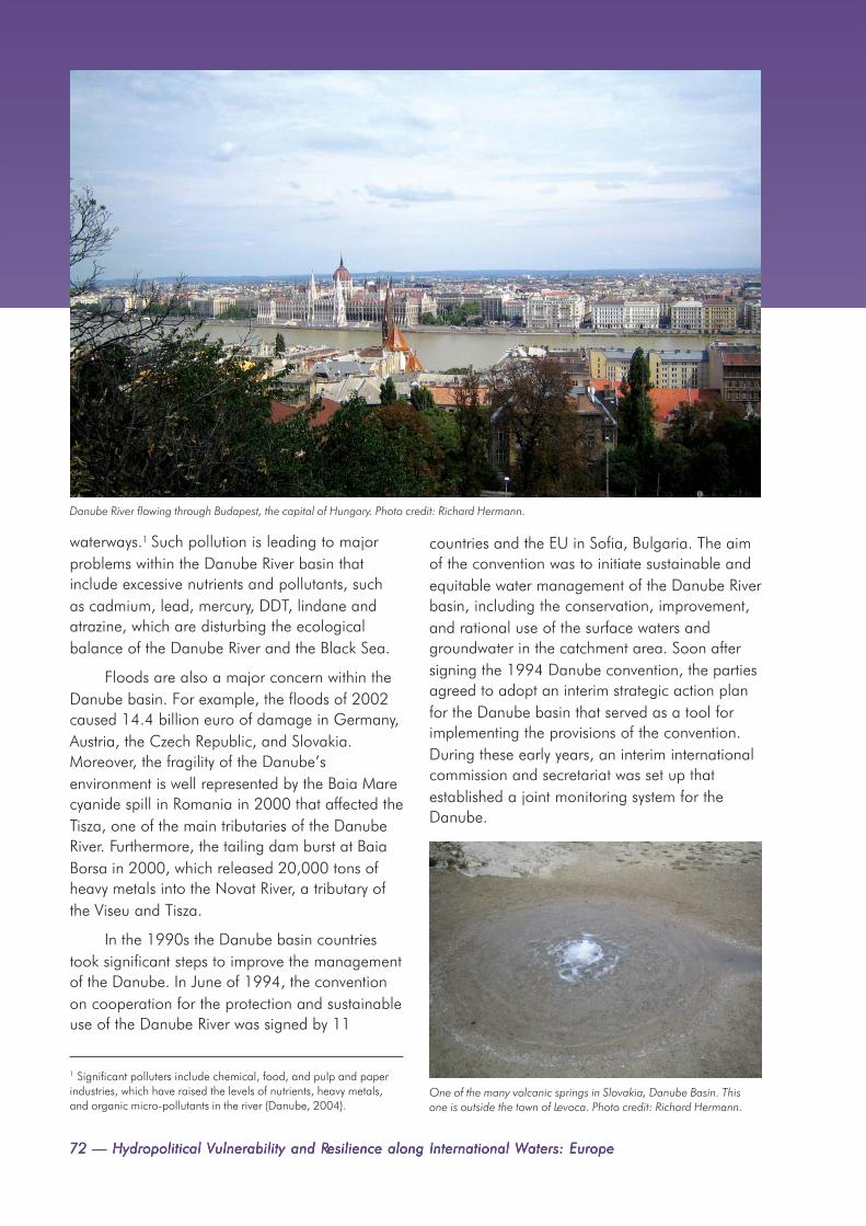
72 — Hydropolitical V72 — Hydropolitical V72 — Hydropolitical V72 — Hydropolitical V72 — Hydropolitical Vulnerability and Rulnerability and Rulnerability and Rulnerability and Rulnerability and Resilience along International Wesilience along International Wesilience along International Wesilience along International Wesilience along International Waters: Europeaters: Europeaters: Europeaters: Europeaters: Europe
Danube River flowing through Budapest, the capital of Hungary. Photo credit: Richard Hermann.
waterways.1 Such pollution is leading to majorproblems within the Danube River basin thatinclude excessive nutrients and pollutants, suchas cadmium, lead, mercury, DDT, lindane andatrazine, which are disturbing the ecologicalbalance of the Danube River and the Black Sea.
Floods are also a major concern within theDanube basin. For example, the floods of 2002caused 14.4 billion euro of damage in Germany,Austria, the Czech Republic, and Slovakia.Moreover, the fragility of the Danube’senvironment is well represented by the Baia Marecyanide spill in Romania in 2000 that affected theTisza, one of the main tributaries of the DanubeRiver. Furthermore, the tailing dam burst at BaiaBorsa in 2000, which released 20,000 tons ofheavy metals into the Novat River, a tributary ofthe Viseu and Tisza.
In the 1990s the Danube basin countriestook significant steps to improve the managementof the Danube. In June of 1994, the conventionon cooperation for the protection and sustainableuse of the Danube River was signed by 11
countries and the EU in Sofia, Bulgaria. The aimof the convention was to initiate sustainable andequitable water management of the Danube Riverbasin, including the conservation, improvement,and rational use of the surface waters andgroundwater in the catchment area. Soon aftersigning the 1994 Danube convention, the partiesagreed to adopt an interim strategic action planfor the Danube basin that served as a tool forimplementing the provisions of the convention.During these early years, an interim internationalcommission and secretariat was set up thatestablished a joint monitoring system for theDanube.
One of the many volcanic springs in Slovakia, Danube Basin. Thisone is outside the town of Levoca. Photo credit: Richard Hermann.
1 Significant polluters include chemical, food, and pulp and paperindustries, which have raised the levels of nutrients, heavy metals,and organic micro-pollutants in the river (Danube, 2004).

Chapter 5. Hydropolitical Vulnerability and Resilience Case Studies — 73Chapter 5. Hydropolitical Vulnerability and Resilience Case Studies — 73Chapter 5. Hydropolitical Vulnerability and Resilience Case Studies — 73Chapter 5. Hydropolitical Vulnerability and Resilience Case Studies — 73Chapter 5. Hydropolitical Vulnerability and Resilience Case Studies — 73
On October 22nd of 1998, the 1994Danube Convention entered into force and theInternational Commission for the Protection of theDanube River (ICPDR) was established. TheICPDR is the main decision-making bodyestablished under the convention. Thiscommission is responsible for the implementationof the convention, decision-making, management,and coordination of regional cooperation,approval of the budget and annual workprogramme, and the joint action programme.The ICPDR is supported by a secretariat, which isalso the focal point for information provisionabout the convention. In addition, a number ofexpert groups are set up under the conventionthat reflect its main thematic work areas thatinclude river basin management, ecology,emissions, monitoring laboratory and informationmanagement, accident prevention and control aswell as flood protection (Danube, 2005).
Since its inception, the ICPDR has proven tobe a useful mechanism in fulfilling the objectivesof the convention; it has accomplished thefollowing:
• a cooperative strategy for theestablishment of the Danube River BasinManagement Plan
• cooperated with stakeholder groupsto build a common understanding ofthe Danube
• identified and facilitated funding for45 projects addressing waste watertreatment plants
• set up a network of more than 75water quality monitoring stations
• developed an emission inventory forpollution originating frommunicipalities, industry and agriculture
• put into operation a basin-wideaccident emergency warning system
Danube River flowing through Novi Sad, Serbia. Photo credit: Milan Vatovec.
Young women on medieval fortress wall overlooking the Danube River,Belgrade, Serbia. Photo credit: Milan Vatovec.
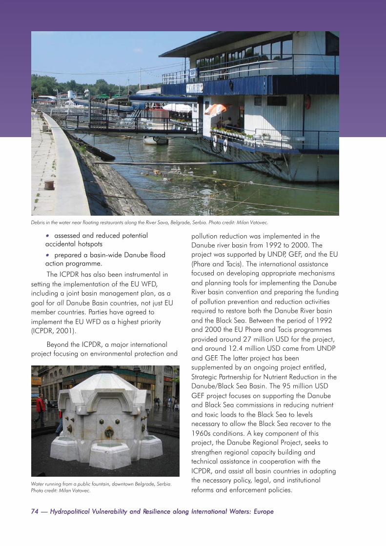
74 — Hydropolitical V74 — Hydropolitical V74 — Hydropolitical V74 — Hydropolitical V74 — Hydropolitical Vulnerability and Rulnerability and Rulnerability and Rulnerability and Rulnerability and Resilience along International Wesilience along International Wesilience along International Wesilience along International Wesilience along International Waters: Europeaters: Europeaters: Europeaters: Europeaters: Europe
• assessed and reduced potentialaccidental hotspots
• prepared a basin-wide Danube floodaction programme.
The ICPDR has also been instrumental insetting the implementation of the EU WFD,including a joint basin management plan, as agoal for all Danube Basin countries, not just EUmember countries. Parties have agreed toimplement the EU WFD as a highest priority(ICPDR, 2001).
Beyond the ICPDR, a major internationalproject focusing on environmental protection and
pollution reduction was implemented in theDanube river basin from 1992 to 2000. Theproject was supported by UNDP, GEF, and the EU(Phare and Tacis). The international assistancefocused on developing appropriate mechanismsand planning tools for implementing the DanubeRiver basin convention and preparing the fundingof pollution prevention and reduction activitiesrequired to restore both the Danube River basinand the Black Sea. Between the period of 1992and 2000 the EU Phare and Tacis programmesprovided around 27 million USD for the project,and around 12.4 million USD came from UNDPand GEF. The latter project has beensupplemented by an ongoing project entitled,Strategic Partnership for Nutrient Reduction in theDanube/Black Sea Basin. The 95 million USDGEF project focuses on supporting the Danubeand Black Sea commissions in reducing nutrientand toxic loads to the Black Sea to levelsnecessary to allow the Black Sea recover to the1960s conditions. A key component of thisproject, the Danube Regional Project, seeks tostrengthen regional capacity building andtechnical assistance in cooperation with theICPDR, and assist all basin countries in adoptingthe necessary policy, legal, and institutionalreforms and enforcement policies.
Water running from a public fountain, downtown Belgrade, Serbia.Photo credit: Milan Vatovec.
Debris in the water near floating restaurants along the River Sava, Belgrade, Serbia. Photo credit: Milan Vatovec.

Chapter 5. Hydropolitical Vulnerability and Resilience Case Studies — 75Chapter 5. Hydropolitical Vulnerability and Resilience Case Studies — 75Chapter 5. Hydropolitical Vulnerability and Resilience Case Studies — 75Chapter 5. Hydropolitical Vulnerability and Resilience Case Studies — 75Chapter 5. Hydropolitical Vulnerability and Resilience Case Studies — 75
5.3 THE NARVA RIVER BASIN
The Narva basin, shared between Estonia andRussia spans a total area of 53,000 km2, and is77 km long. The total population of the basin isaround one million, with only two large towns,
Pskov (Russia) and Tartu (Estonia) situated in thebasin; the majority of the inhabitants live in smallsettlements.
The basin contains Lake Peipsi, the fourthlargest and biggest transboundary lake in Europe(UNESCO, 2003; see Figure 5.3). A number of
wetlands ofinternationalsignificance are alsolocated in the basin.Both the Ramsar Sites ofEmajõe Suursoo(Estonia) andRemdovsky (Russia) arehome to a variety ofglobally endangeredplants and animalspecies, such as thecorncrake, lesser-spotted eagle and thewhile-tailed eagle.
Forestry andagriculture represent themain land use practiceswithin the basin;however, an agingpopulation and aShoreline of Lake Peipsi at Mustvee, Estonia. Photo credit: Mark A. Wilson (Department of Geology,
The College of Wooster), via Wikimedia Commons.
Bridge over the Narva River (Estonian-Russian border) between Narva and Ivangorod. Photo credit: Hannu, via Wikimedia Commons.

76 — Hydropolitical V76 — Hydropolitical V76 — Hydropolitical V76 — Hydropolitical V76 — Hydropolitical Vulnerability and Rulnerability and Rulnerability and Rulnerability and Rulnerability and Resilience along International Wesilience along International Wesilience along International Wesilience along International Wesilience along International Waters: Europeaters: Europeaters: Europeaters: Europeaters: Europe
departure of the youngergeneration to largetowns is resulting in adeclining economy.More than half thepeople in the basin donot earn enough tocover their cost of livingand a high rate ofunemployment exists.Environmental problemsare related to thenegative impacts offorestry and agriculture,including unsustainabledeforestation and non-point-source pollution. Ahigh nutrient content inthe basin’s river duringthe 1980s led to amajor problem ofeutrophication.However, with thedissolution of allcollective farms inEstonia and economicdepression in Russia inthe 1990s, the nutrientload of Lake Peipsi hasdecreased significantly.It is estimated thatnitrogen andphosphorus loads have Figure 5.3 The Narva River Basin.
decreased by 53% and 44% respectively. Themajority of the remaining phosphorus andnitrogen compounds enter Lake Peipsi from theEmajõgi River on the Estonian side and theVelikaya River on the Russian side. The Emajõgicarries biologically treated sewage from Pskov,while the Velikaya transports wastewater fromTartu, which was untreated until 1998. In additionto agricultural uses, Lake Peipsi is also heavilyrelied upon for commercial fishing, the maincommercial fish being lake smelt, perch, pike-perch, ruffe, roach, bream and pike; the annualcatch usually amounts to 7,000-8,000 tons.
Within the basin, industrial activities,particularly the oil-shale industry, also have amajor impact on the water resources. The
wastewaters and gaseous emissions, includingtoxic sulphur and nitrogen oxides from powerstates and pulverized oil shale affect the chemicalcomposition of the water in Lake Peipsi. Asignificant industrial user of the Narva basin isthe Baltic thermal power plant, which uses waterfor cooling purposes, with an average annualdemand of 470 million m3.
The Narva basin is a relatively new resourcein transboundary terms, as it became atransboundary waterway when Estonia separatedfrom the Soviet Union in 1991. However, asignificant amount of transboundary activitieshave been developed in this basin over the last15 years. For instance, on May 4th, 1994 a treatyabout the conservation of fish stocks in Lake

Chapter 5. Hydropolitical Vulnerability and Resilience Case Studies — 77Chapter 5. Hydropolitical Vulnerability and Resilience Case Studies — 77Chapter 5. Hydropolitical Vulnerability and Resilience Case Studies — 77Chapter 5. Hydropolitical Vulnerability and Resilience Case Studies — 77Chapter 5. Hydropolitical Vulnerability and Resilience Case Studies — 77
Peipsi was concluded between Estonia andRussia. Pursuant to the agreement anintergovernmental Estonian-Russian commissionon fisheries was established, with the aim tocoordinate management issues of fish stocks,coordinate research of the state of fish resources,establish a common fishing limit, regulate toolsand methods of fishing, set up prohibited periodsand areas, improve state of and increase theamount of living resources, resolve disputes andincidents relating to fishing activities.
The parties then adopted an agreement ofcooperation regarding the environment onJanuary 11th, 1996. This agreement was followedby another agreement about cooperationregarding the protection and sustainable use oftransboundary waters, which came into action onAugust 20th, 1997; an intergovernmentalcommission was established under the 1997agreement to coordinate its implementation(Estonia-Russia, 1997). Responsibilities of thecommission include the exchange of monitoringdata between the parties, defining priority areasand programmes of scientific study, agreeing oncommon indicators of water quality, facilitatingcooperation between various stakeholders(including governmental bodies, local
government, scientific and public interestorganisations), and encouraging stakeholderengagement in transboundary issues.
The latter commission is chaired by theEstonian secretary general of the ministry of the
Lake Peipsi harbor at Mustvee, Estonia. Photo credit: Mark A . Wilson(Department of Geology, The College of Wooster), via WikimediaCommons.
Waterfront club on the Emajõgi River in Tartu, Estonia. The river flows into Lake Peipus. Photo credit: HendrixEesti, via Wikimedia Commons.

78 — Hydropolitical V78 — Hydropolitical V78 — Hydropolitical V78 — Hydropolitical V78 — Hydropolitical Vulnerability and Rulnerability and Rulnerability and Rulnerability and Rulnerability and Resilience along International Wesilience along International Wesilience along International Wesilience along International Wesilience along International Waters: Europeaters: Europeaters: Europeaters: Europeaters: Europe
environment and the Russian first deputy ministerof natural resources. A number of joint workinggroups have also been established under theauspices of this commission covering issues ofwater protection, water management, monitoringand research, and cooperation with localauthorities, population, international, and non-governmental organisations.
In 1999 the commission adopted a decisionto start preparing a comprehensive basinmanagement programme in line with regionalcommitments contained in various agreementsincluding the 2000 EU WFD and the 1992Helsinki Convention. Preparation of the LakePeipsi Basin Management Programme started in2001. The project sought to substituteuncoordinated small-scale projects withcoordinated basin-wide projects, as well asprovide practical recommendations for thenutrient load reduction and prevention, promotesustainable conservation of habitats andecosystems within the region, strengthen capacityof all stakeholder groups and promote theirengagement in preparation of the programme,promote education and public awareness of the
programme and resulting issues (Peipsi, 2005).Information networks of non-governmentalorganizations (NGOs) and other communitygroups, such as the Peipsi Centre forTransboundary Cooperation (Peipsi, 2005a),have taken an increasingly significant role indeveloping and implementing the programme.Support for the Basin Management Programmehas come from the Global Environment Facility,the Estonian and Russian Governments, the EUTACIS Baltic Line 2000 programme, the EU 5th
RTD programme project MANTRA East, EU LifeProgramme in Estonia, MATRA programme fromthe Dutch government, US Baltic NGO fund, theSwedish EPA project on joint monitoring, andDanish infrastructure projects in Pskov.
5.4 CONCLUSION
This chapter discussed the hydropolitical situationin three European basins, the Dnieper, Danube,and the Narva. While steps toward basin-wideagreements have been taken in the Dnieper Riverbasin, no basin-wide agreements exist. This basinis largely comprised of economically poor
View of the Velikaya River and the city of Pskov, in western Russia, from the Pskov Kremlin. Photo credit: Sergei Rubliov, via Wikimedia Commons.

Chapter 5. Hydropolitical Vulnerability and Resilience Case Studies — 79Chapter 5. Hydropolitical Vulnerability and Resilience Case Studies — 79Chapter 5. Hydropolitical Vulnerability and Resilience Case Studies — 79Chapter 5. Hydropolitical Vulnerability and Resilience Case Studies — 79Chapter 5. Hydropolitical Vulnerability and Resilience Case Studies — 79
countries and faces major pollution problemsfrom anthropogenic activities that need to beaddressed; therefore, increased institutionalcapacity to address pollution and transboundaryproblems is needed in the Dnieper basin in orderto mitigate conflict. The Danube River basinencompasses diverse countries that haveengaged in heavy use of the water resources,which has led to water pollution. However, in thisbasin, significant steps have been taken to offsetpollution problems in the transboundary water;basin-wide approaches have been taken with aninternational commission (ICPDR) as well as aninternational project that functions to protect thewater resources as well as reduce the pollution ofthe Danube basin’s water resources. The third
basin discussed in this chapter, Narva River basin,faces water pollution from forestry andagricultural practices that have led toeutrophication, particularly in Lake Peipsi;industrial activities also have a negative impacton the basin’s water resources. While the Narvabasin is a relatively new transboundary basin,significant transboundary activities haveoccurred, i.e. an intergovernmental commissionbetween Estonia and Russia. In sum, the DnieperRiver basin is the most vulnerable of the threebasins discussed in this chapter because theheavy agricultural and industrial use as well astransboundary pollution may lead totransboundary conflicts as no basin-wideagreement has been implemented.
Narva hydroelectric station on the Narva River, Estonia, shining in sunlight with thunderclouds in the background. Photo credit:Hannu, via Wikimedia Commons.
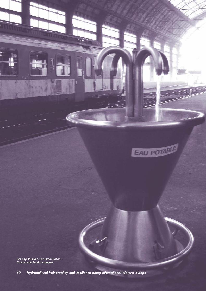
80 — Hydropolitical 80 — Hydropolitical 80 — Hydropolitical 80 — Hydropolitical 80 — Hydropolitical VVVVVulnerability and Rulnerability and Rulnerability and Rulnerability and Rulnerability and Resilienceesilienceesilienceesilienceesilience along International W along International W along International W along International W along International Waters: Europeaters: Europeaters: Europeaters: Europeaters: Europe80 — Hydropolitical V80 — Hydropolitical V80 — Hydropolitical V80 — Hydropolitical V80 — Hydropolitical Vulnerability and Rulnerability and Rulnerability and Rulnerability and Rulnerability and Resilience along International Wesilience along International Wesilience along International Wesilience along International Wesilience along International Waters: Europeaters: Europeaters: Europeaters: Europeaters: Europe
Drinking fountain, PDrinking fountain, PDrinking fountain, PDrinking fountain, PDrinking fountain, Paris train station.aris train station.aris train station.aris train station.aris train station.Photo credit: Sandra Arbogast.Photo credit: Sandra Arbogast.Photo credit: Sandra Arbogast.Photo credit: Sandra Arbogast.Photo credit: Sandra Arbogast.

Chapter 6. Conclusion — 81Chapter 6. Conclusion — 81Chapter 6. Conclusion — 81Chapter 6. Conclusion — 81Chapter 6. Conclusion — 81
CHAPTER 6. CONCLUSIONAlistair Rieu-Clarke
The introduction noted that institutional capacity, be it water management bodies, treaties, orgenerally positive international relations, is possibly more important than the physicalcharacteristics of river basins in minimising hydropolitical vulnerability and strengtheningresilience. In addition, it was noted that the likelihood of conflict rises as the rate of changewithin a basin exceeds the institutional capacity to absorb that change, thus emphasising two
key factors in hydropolitical vulnerability and resilience: rate of change and institutional capacity. Thekey question addressed in this paper is whether or not the institutional capacity for the management ofEurope’s transboundary waters is sufficient to absorb likely changes and challenges.
An answer to the above question firstly requires an analysis of the likely changes and challengesto Europe’s transboundary basins. Chapter two conducted such a study, and highlighted Europe’sheavy reliance on transboundary waters for its socioeconomic needs. Increased demands for water andinefficient practices throughout Europe have led to various water-related problems that have thepotential to lead to water conflicts between countries. Common problems include over-extraction,especially of groundwater, pollution, soil erosion, landscape changes, and the loss of natural habitats.Moreover, potential threats of climate change and changes in land-use practices have increased therisk of harm both from floods and droughts. The fact that the majority of basins within Europe aretransboundary means that many of these common water-related problems are not limited to nationalboundaries. For instance, the use of fertilisers for agricultural needs upstream may have a detrimentalimpact on drinking water supplies within a downstream country. Similarly, the draining of wetlands inone basin country may lead to an increase in the likelihood and severity of floods in another basincountry. Regional responses are therefore required.
The strong reliance on transboundary waters has inevitably led to tensions between Europeanbasin countries. Chapter three highlighted a variety of conflicts that have arisen over transboundarywaters in Europe. Most parts of Europe have experienced such conflicts, which have largely been aresult of contentious unilateral actions by one transboundary basin country. Examples include Spain’sobjection to France’s proposed development of the Ebro basin in the early twentieth century, orGreece’s recent opposition to Macedonian plans to utilise part of the Varda basin for agriculturalpurposes. Chapter three also illustrated the fact that both qualitative and quantitative characteristics areevident in transboundary disputes in Europe. For example, while Portugal claimed that Spain’s 1993National Water Plan would lead to at least a 13% reduction in the flow of transboundary waters, in theDaugava basin, pollution of the Daugava from large production facilities and intensive agriculture inBelarus and Lithuania has impacted Latvia’s water supply. In addition, chapter three noted thatinternational agreements relating to European transboundary waters date back over two centuries.
One aspect of cooperation that makes Europe unique is the significant role played by regionalagreements in the continuous evolution of basin-wide legal and institutional mechanisms for disputeavoidance. Both the UNECE and the EU have made a significant contribution to strengtheninginstitutional capacity for transboundary water resource management at the basin level, most notably

82 — Hydropolitical V82 — Hydropolitical V82 — Hydropolitical V82 — Hydropolitical V82 — Hydropolitical Vulnerability and Rulnerability and Rulnerability and Rulnerability and Rulnerability and Resilience along International Wesilience along International Wesilience along International Wesilience along International Wesilience along International Waters: Europeaters: Europeaters: Europeaters: Europeaters: Europe
strong institutional framework, has proven to be amajor influence in establishing and strengtheningtransboundary water resource managementthroughout Europe. Not only has the conventionassisted European countries in adopting basin-wide arrangements, such as the 1998 Rhineconvention, but through the meeting of theparties and related bodies, European countriesand other interested parties can assess wheregaps and weaknesses exist within the legalframework for the management of transboundarywaters in Europe, and act accordingly. TheUNECE has consequently expanded its remit intoareas such as flood management, water andhealth, civil liability, and compliance. Theflexibility of such a framework agreement leavesthe UNECE framework well placed to react tofuture challenges related to transboundarywaters. As a result, the convention provides auseful example of the potential role of suchframework agreements—most notably the 1997UN Watercourses Convention—in the regionalmanagement of transboundary waters.
While the EU encompasses fewer membercountries than the UNECE and covers both
within the relatively new ‘internationalised’ basinsof the former Soviet Union where legal andinstitutional frameworks have been established ina relatively short period.
More specifically, two institutions have hada significant impact on the hydropoliticalsituation of transboundary waters in Europe,namely the EU’s WFD and the 1992 HelsinkiConvention under UNECE. In less than 20 years,the 1992 Helsinki Convention, supported by a
The Shroud Bridge over the Daugava River in Riga, the capital ofLatvia. Photo credit: Philaweb, via Wikimedia Commons.
The Bidasoa River, Doneztebe-Santesteban, in Navarre, northern Spain. Photo credit: Jorab, via Wikimedia Commons.

Chapter 6. Conclusion — 83Chapter 6. Conclusion — 83Chapter 6. Conclusion — 83Chapter 6. Conclusion — 83Chapter 6. Conclusion — 83
national and transboundary waters, it has beenjust as influential in promoting cooperation overtransboundary waters in Europe. Through acombination of key principles, such as achievinggood water status in all EU waters by 2015, anddetailed procedural rules, such as the productionof river basin management plans, the EU WFD isset to bring about significant changes to the waywater is managed within Europe. Even beyondthe EU region, e.g., in the Dnieper basin, the EUWFD has influenced the negotiation of basin-wide legal agreements. Moreover, through itsinstitutional structure the EU is well placed toaddress pressing challenges within Europeanwater resource management, such as floodmanagement and the protection of groundwater.
Despite such positive trends in institutionalcapacity building within Europe, from an issue-based perspective, chapter four highlighted anumber of areas where the institutional capacityfor the management of transboundary waterscould be strengthened. On a positive note, treatylaw shows that European countries haveendorsed the substantive rule of equitable andreasonable utilisation, and also the duty to takeall appropriate measures to prevent, control andreduce transboundary impact. However,establishing the practical procedural rules andmechanisms that effectively and efficiently
implement the latter substantive rules has provedto be more problematic. The analysis in chapterfour showed that in certain areas such asmonitoring and assessment, public participation,and compliance, there were clear gaps withinexisting agreements. In addition, little work hasbeen done in assessing the effectiveness of suchagreements in accordance with their aims andobjectives as more emphasis has been placed onensuring compliance with internationalagreements. Measuring the effectiveness ofinternational agreements is strongly dependenton there being sufficient data of a suitablestandard to evaluate the key joint managementissues within the basin. Similarly publicparticipation and appropriate compliancestrategies can go a long way to ensuring thatbasin-agreements are both implemented andeffective. Useful guidance on how countries candevelop these aspects of water resourcemanagement can be found within the UNECEand EU framework. However, in many cases lackof financial resources and the absence ofcapacity development measures will be majorimpediments to strengthening basin agreements.This issue thus highlights the role thatinternational donors should take in developingbasin-wide agreements; a role that has beenclearly illustrated within the case studies and listof international projects.
Rudesheim, Rhine River, Germany. Photo credit: Sandra Arbogast.

84 — Hydropolitical V84 — Hydropolitical V84 — Hydropolitical V84 — Hydropolitical V84 — Hydropolitical Vulnerability and Rulnerability and Rulnerability and Rulnerability and Rulnerability and Resilience along International Wesilience along International Wesilience along International Wesilience along International Wesilience along International Waters: Europeaters: Europeaters: Europeaters: Europeaters: Europe
sharing the Dniester basin (Ukraine andMoldova), and the Dnieper basin (Belarus,Russia, and the Ukraine). Both the latter rivers areparticularly vulnerable to transboundary conflicts,largely as a result of heavy agricultural andindustrial use, coupled with transboundarypollution. While significant steps have been takento develop basin-wide agreements for both rivers,at present only a series of bilateral and draftagreements exist.
While a significant record of conflicts overtransboundary waters exists within Europe, astrong commitment by European countries todevelop the institutional capacity necessary toresolve—and ultimately avoid such conflicts inthe future—is evident. Of particular prevalence inthis regard is the interface between regional,basin-level and national governance structures.While earlier agreements tended to focus onsingle uses, a marked evolution towards theintegrated management of transboundary waterswithin treaty practice has occurred. Today, a largebody of international agreements relating toEurope’s transboundary waters exists, which initself is testament to the desire of Europeancountries to develop the institutional capacity toaccommodate economic, social, andenvironmental changes within transboundarybasins in order to offset hydro-vulnerability inEurope.
In addition to the above-mentioned issue-based gaps, the study has also highlighted anumber of basin specific examples where thecurrent institutional capacity may be incapable ofabsorbing changes within the basin. For example,despite transboundary pollution for largeproduction facilities and agriculture within theDaugava basin, no basin-wide agreement existsbetween Belarus, Latvia, and Lithuania; althougha positive sign can be seen in the commitment ofthe basin countries to adopt a river basinmanagement plan in accordance with theprovisions of the EU WFD. Similarly, no basin-wide agreements exist between the countries
Ugra River, tributary of the Oka River (Volga basin), in Smolensk and Kaluga Oblasts, Russia. Photo credit: Laim, via Wikimedia Commons.
The Ponte Vecchio, a medieval bridge over the Arno River, inFlorence, Italy. Photo credit: Keith Davis.

ATLAS OF HYDROPOLITICALVULNERABILITY AND RESILIENCE:EUROPE
WWWWWaiting for passengers, Brugge, Belgium. Photo credit: Raiting for passengers, Brugge, Belgium. Photo credit: Raiting for passengers, Brugge, Belgium. Photo credit: Raiting for passengers, Brugge, Belgium. Photo credit: Raiting for passengers, Brugge, Belgium. Photo credit: Roger Aoger Aoger Aoger Aoger A dmiral.dmiral.dmiral.dmiral.dmiral.
Atlas of Hydropolitical Vulnerability and Resilience — 85Atlas of Hydropolitical Vulnerability and Resilience — 85Atlas of Hydropolitical Vulnerability and Resilience — 85Atlas of Hydropolitical Vulnerability and Resilience — 85Atlas of Hydropolitical Vulnerability and Resilience — 85

86 — Hydropolitical V86 — Hydropolitical V86 — Hydropolitical V86 — Hydropolitical V86 — Hydropolitical Vulnerability and Rulnerability and Rulnerability and Rulnerability and Rulnerability and Resilience along International Wesilience along International Wesilience along International Wesilience along International Wesilience along International Waters: Europeaters: Europeaters: Europeaters: Europeaters: Europe
Map 1 (A) Climate RMap 1 (A) Climate RMap 1 (A) Climate RMap 1 (A) Climate RMap 1 (A) Climate Regions. egions. egions. egions. egions. Köeppen climate zones based on a 0.5 decimal degree grid by Leemans andCramer (1991) published by the International Institute for Applied Systems Analysis (IIASA). The Köeppen systemintegrates IIASA average monthly rainfall total and average monthly temperature, in most cases averaged from1961–1990, to yield five base climate types: tropical, dry, temperate, cold, and polar. Each primary type is dividedinto sub-classes based mainly on the distribution of rainfall and temperature throughout the year. Not all classesmay be represented at the continental level. (B) A (B) A (B) A (B) A (B) A verage Annual Rverage Annual Rverage Annual Rverage Annual Rverage Annual Runoffunoffunoffunoffunoff..... Fekete et al. (1999) produced compositerunoff fields by accessing GRDC discharge data, selecting significant global gauging stations, and geo-registeringthe discharge information to locations on a simulated topological network. This dataset was deemed accurate forpresentation with a 0.5 decimal degree grid. Summary statistics based on the runoff dataset, such as those used forprojected water stress (human indicators), may not be considered accurate for basins with an area less thanapproximately 25,000 km2.
BIOPHYSICAL PARAMETERS
B
A

Atlas of Hydropolitical Vulnerability and Resilience — 87Atlas of Hydropolitical Vulnerability and Resilience — 87Atlas of Hydropolitical Vulnerability and Resilience — 87Atlas of Hydropolitical Vulnerability and Resilience — 87Atlas of Hydropolitical Vulnerability and Resilience — 87
Map 2 (A) Groundwater AMap 2 (A) Groundwater AMap 2 (A) Groundwater AMap 2 (A) Groundwater AMap 2 (A) Groundwater A quifers.quifers.quifers.quifers.quifers. Adapted from a map developed by the World-wide HydrogeologicalMapping and Assessment Programme (WHYMAP), August 2004. The most important groundwater basins areshown in blue. The green color symbolizes hydrogeological environments of complex structure. Unmarkedregions are occupied by local and shallow aquifers in which relatively dense bedrock is exposed to the surface.Hatching has been applied in areas where “fossil” or non-renewable groundwater is stored. The boundaries ofthe various colored hydrogeologic regions are first order approximations using the best available information. (B)(B)(B)(B)(B)Dam Density with ADam Density with ADam Density with ADam Density with ADam Density with Active and Pctive and Pctive and Pctive and Pctive and Proposed Troposed Troposed Troposed Troposed Tenders for Lenders for Lenders for Lenders for Lenders for Large Infrastructure.arge Infrastructure.arge Infrastructure.arge Infrastructure.arge Infrastructure. Global Dams Data from: Ph.D.Associates Inc. 1998. DCW in ASCII version 3.0. 1998; Density Calculations from Fiske and Yoffee, 2001. Dataon tenders is taken from the International Rivers Network “Dams In The Pipeline of Financial Institutions”database, which includes new projects in the lending pipeline from the World Bank, the Asian DevelopmentBank, the A frican Development Bank and the Inter-American Development Bank, as well as links to ongoing andcompleted projects on the individual websites.
A
B

88 — Hydropolitical V88 — Hydropolitical V88 — Hydropolitical V88 — Hydropolitical V88 — Hydropolitical Vulnerability and Rulnerability and Rulnerability and Rulnerability and Rulnerability and Resilience along International Wesilience along International Wesilience along International Wesilience along International Wesilience along International Waters: Europeaters: Europeaters: Europeaters: Europeaters: Europe
Map 3 (A) Climate Change, TMap 3 (A) Climate Change, TMap 3 (A) Climate Change, TMap 3 (A) Climate Change, TMap 3 (A) Climate Change, Temperature. (B)emperature. (B)emperature. (B)emperature. (B)emperature. (B) Climate Change, PClimate Change, PClimate Change, PClimate Change, PClimate Change, Precipitation. recipitation. recipitation. recipitation. recipitation. Based on HADCM3 generalclimate model using the SRES B2 (moderate emissions, climate change, and technological advancement) emissionsscenario. HADCM3 is distributed as 2.5 x 3.5 decimal degree data, which could not be properly projected in a GISwithout square grid cells. Cell values were distributed to points at 2.5 x 3.5 decimal degree cell centroids, whichwere interpolated, using the inverse distance weighted method, at a resolution of 0.5 decimal degrees. Theinterpolated data used here should not be taken to exactly represent HADCM3 projections, but do provide areasonable cartographic representation of current HADCM3 climate change predictions.
A
B

Atlas of Hydropolitical Vulnerability and Resilience — 89Atlas of Hydropolitical Vulnerability and Resilience — 89Atlas of Hydropolitical Vulnerability and Resilience — 89Atlas of Hydropolitical Vulnerability and Resilience — 89Atlas of Hydropolitical Vulnerability and Resilience — 89
SOCIOECONOMIC AND GEOPOLITICAL PARAMETERS
Map 4 (A) PMap 4 (A) PMap 4 (A) PMap 4 (A) PMap 4 (A) Projected Projected Projected Projected Projected Population Density: 2025.opulation Density: 2025.opulation Density: 2025.opulation Density: 2025.opulation Density: 2025. The 2025 population dataset is published at a cell size of 0.5decimal degrees (DD), which places a size constraint for small basin analysis. The raster was resampled at 0.01DD to overcome the deficiency. This disregards some of the assumptions of the original 0.5 DD cell size, butaffords a tentative estimate of predicted population in small basins. Because small basins maintain less area, thereis less area to smooth out data errors. Therefore, some basins, especially those with a relatively small area (lessthan 25,000 km2), may have projected populations significantly lower or higher than they should be. (B) P(B) P(B) P(B) P(B) ProjectedrojectedrojectedrojectedrojectedWWWWWater Stress: 2025.ater Stress: 2025.ater Stress: 2025.ater Stress: 2025.ater Stress: 2025. Water stress is the amount of water available per capita. Water stress estimates do notaccount for spatial variability of water resources, nor for technological or other adaptations affecting how a givenpopulation manages water scarcity. The map’s calculation of water stress is based on renewable water supplydefined by discharge, and does not consider groundwater extraction. Falkenmark’s (1989) definition of waterstress, calculates water supply based on renewable surface and groundwater flows. According to Falkenmark, athreshold value of 1000 cubic meters per person per year indicates a general point at which water shortages beginto chronically hamper economic development and human health and well-being in moderately developed nations.
A
B

90 — Hydropolitical V90 — Hydropolitical V90 — Hydropolitical V90 — Hydropolitical V90 — Hydropolitical Vulnerability and Rulnerability and Rulnerability and Rulnerability and Rulnerability and Resilience along International Wesilience along International Wesilience along International Wesilience along International Wesilience along International Waters: Europeaters: Europeaters: Europeaters: Europeaters: Europe
Map 5 (A) Human Development Index. Map 5 (A) Human Development Index. Map 5 (A) Human Development Index. Map 5 (A) Human Development Index. Map 5 (A) Human Development Index. The human development index (HDI) is a composite index that measuresthe average achievements in a country in three basic dimensions of human development: a long and healthy life,as measured by life expectancy at birth; knowledge, as measured by the adult literacy rate and the combined grossenrolment ratio for primary, secondary and tertiary schools; and a decent standard of living, as measured by GDPper capita in purchasing power parity (PPP) US dollars. The formula to calculate the HDI, as well as specific data onthe indicators, can be found at http://hdr.undp.org/reports/global/2004/. (B) Agricultural W (B) Agricultural W (B) Agricultural W (B) Agricultural W (B) Agricultural Water Use.ater Use.ater Use.ater Use.ater Use. Agriculturalwater use is based on a model of irrigation water requirements developed for AQUASTAT by the FAO Land andWater Development and incorporates crop, reference, and actual evapotranspiration, crop coefficient, area underirrigation as percentage of the total area under analysis, and cropping intensity. Renewable water resourcesavailable for agricultural use are defined as the sum of internal renewable water resources and incoming floworiginating outside the country, taking into consideration the quantity of flows reserved to upstream and downstreamcountries through formal or informal agreements or treaties.
A
B

Atlas of Hydropolitical Vulnerability and Resilience — 91Atlas of Hydropolitical Vulnerability and Resilience — 91Atlas of Hydropolitical Vulnerability and Resilience — 91Atlas of Hydropolitical Vulnerability and Resilience — 91Atlas of Hydropolitical Vulnerability and Resilience — 91
Map 6 (A) WMap 6 (A) WMap 6 (A) WMap 6 (A) WMap 6 (A) Water Dependency Rater Dependency Rater Dependency Rater Dependency Rater Dependency Ratio.atio.atio.atio.atio. Water dependency ratio is calculated for AQUASTAT by the FAO Land andWater Development Division. It incorporates total country inflow and outflow of surface water and groundwaterafter accounting for flow submitted to and reserved by bilateral and multilateral treaties. (B) International(B) International(B) International(B) International(B) InternationalFFFFFreshwater Treshwater Treshwater Treshwater Treshwater Treaties Preaties Preaties Preaties Preaties Per Basin.er Basin.er Basin.er Basin.er Basin. Number of treaties per basin is the sum of all agreements (historical, present,general) which have been signed by States governing water resources in the basin, either with one another or aspart of a regional agreement, where the concern is water as a scarce or consumable resource, a quantity to bemanaged, or an ecosystem to be improved or maintained. Documents concerning navigation rights and tariffs,division of fishing rights, and delineation of rivers as borders or other territorial concerns are not included, unlessfreshwater as a resource is also mentioned in the document, or physical changes are being made that mayimpact the hydrology of the river system (e.g., dredging of river bed to improve navigation, straightening of ariver’s course.
INSTITUTIONAL CAPACITY
A
B

92 — Hydropolitical V92 — Hydropolitical V92 — Hydropolitical V92 — Hydropolitical V92 — Hydropolitical Vulnerability and Rulnerability and Rulnerability and Rulnerability and Rulnerability and Resilience along International Wesilience along International Wesilience along International Wesilience along International Wesilience along International Waters: Europeaters: Europeaters: Europeaters: Europeaters: Europe
Map 7 (A) River Basin Organizations and Commissions.Map 7 (A) River Basin Organizations and Commissions.Map 7 (A) River Basin Organizations and Commissions.Map 7 (A) River Basin Organizations and Commissions.Map 7 (A) River Basin Organizations and Commissions. Data for map was collected over a six month periodfrom July to December 2004, drawing from: a compilation by Johannes Akiwumi at UNEP’s Division ofEnvironmental Information and Assessment (Nairobi); and internet searches and email interviews withinternational waters practitioners and scholars. (See SECTION 4 Tables for sources). We define an RBO/RBC as“a bilateral or multilateral body composed of representatives of national governments acting in an officialcapacity, created for the purpose of dialogue and/or coordinated management of an international water body.”Presence of an RBO/RBC in an international river basin does not imply that all riparian countries are parties tothe institution. Zero values do not necessarily reflect an absence of an RBO/RBC. (B) V (B) V (B) V (B) V (B) Votes on the UNotes on the UNotes on the UNotes on the UNotes on the UNConvention on International WConvention on International WConvention on International WConvention on International WConvention on International Watercourses.atercourses.atercourses.atercourses.atercourses. Vote records presented are based on data from the originalconvention voting period, which was open from May 1997 until May 2000. However, though the conventionclosed in 2000, member states may choose to become party to the convention at any time.
A
B

Atlas of Hydropolitical Vulnerability and Resilience — 93Atlas of Hydropolitical Vulnerability and Resilience — 93Atlas of Hydropolitical Vulnerability and Resilience — 93Atlas of Hydropolitical Vulnerability and Resilience — 93Atlas of Hydropolitical Vulnerability and Resilience — 93
Map 8 (A) Institutional Capacity and PMap 8 (A) Institutional Capacity and PMap 8 (A) Institutional Capacity and PMap 8 (A) Institutional Capacity and PMap 8 (A) Institutional Capacity and Proposed Infrastructure. roposed Infrastructure. roposed Infrastructure. roposed Infrastructure. roposed Infrastructure. Treaties and River Basin Organizations andCommissions may serve to increase the hydropolitical resilience of a basin. This may be particularly important inbasins with tenders for large projects, which can alter river functions and displace local inhabitants. (B) (B) (B) (B) (B)Environmental Sustainability Index. Environmental Sustainability Index. Environmental Sustainability Index. Environmental Sustainability Index. Environmental Sustainability Index. The 2005 Environmental Sustainability Index (ESI) measures the ability of acountry to protect the environment over the next several decades. The ESI is an equally weighted average of 21indicators, grouped into categories such as environmental systems, reducers of environmental stresses, reducersof human vulnerability, societal and institutional capacity and global stewardship. These data are combined from76 separate data sets of natural resource endowments, pollution levels, environmental management efforts, etc.The ESI is useful for comparative analysis in identifying leading countries in environmental sustainability. The fullESI report is available at http://www.yale.edu/esi.
A
B

94 — Hydropolitical V94 — Hydropolitical V94 — Hydropolitical V94 — Hydropolitical V94 — Hydropolitical Vulnerability and Rulnerability and Rulnerability and Rulnerability and Rulnerability and Resilience along International Wesilience along International Wesilience along International Wesilience along International Wesilience along International Waters: Europeaters: Europeaters: Europeaters: Europeaters: Europe
Map 9 Riparian Country Collaborations.Map 9 Riparian Country Collaborations.Map 9 Riparian Country Collaborations.Map 9 Riparian Country Collaborations.Map 9 Riparian Country Collaborations. Riparian Country Collaborations are defined as projects, programs, orpartnerships with a river basin as a geographic focus, involving organizations or representatives (acting in an officialor non-official capacity) from two or more countries that share the international water body. Data for the map wascollected from internet searches, and compiled over a five -month period from July to December 2004. Due to theshort time period in which the study took place, the number of projects represented on the map may not accuratelyreflect the number of collaborations actually occurring. Detailed information about each riparian countrycollaboration (including participating countries; principal issue area; level of collaboration; dates of collaboration;and source from which the information was gathered) is compiled in Appendix 2.

APPENDICES
Stone fountain, Rome. Photo credit: Keith Davis.Stone fountain, Rome. Photo credit: Keith Davis.Stone fountain, Rome. Photo credit: Keith Davis.Stone fountain, Rome. Photo credit: Keith Davis.Stone fountain, Rome. Photo credit: Keith Davis.
Appendices — 95Appendices — 95Appendices — 95Appendices — 95Appendices — 95

96 — Hydropolitical V96 — Hydropolitical V96 — Hydropolitical V96 — Hydropolitical V96 — Hydropolitical Vulnerability and Rulnerability and Rulnerability and Rulnerability and Rulnerability and Resilience along International Wesilience along International Wesilience along International Wesilience along International Wesilience along International Waters: Europeaters: Europeaters: Europeaters: Europeaters: Europe

APPENDIX 1. INTERNATIONAL FRESHWATERAGREEMENTS, RIVER BASIN ORGANIZATIONS,AND RIVER BASIN COMMISSIONS OF EUROPE
Appendix 1. International Freshwater Agreements, Organizations, Commissions — 97Appendix 1. International Freshwater Agreements, Organizations, Commissions — 97Appendix 1. International Freshwater Agreements, Organizations, Commissions — 97Appendix 1. International Freshwater Agreements, Organizations, Commissions — 97Appendix 1. International Freshwater Agreements, Organizations, Commissions — 97
The treaties contained in this document were compiled as part of the Transboundary FreshwaterDispute Database (TFDD) project at Oregon State University in collaboration with the Food andAgriculture Organization (FAO) of the United Nations. The documents included are treaties or otherinternational agreements relating to international freshwater resources, where the concern is water asa scarce or consumable resource, a quantity to be managed, or an ecosystem to be improved ormaintained. Treaties concerning navigation rights and tariffs, division of fishing rights, and delineationof rivers as borders or other territorial concerns are not included, unless freshwater as a resource isalso mentioned in the document, or physical changes are being made to the river system that mightimpact the hydrology of the river system (e.g., dredging of river bed to improve navigation, straighteningof river course).
For ease of reference, the treaties are first categorized by continent, and then by international basin,as delineated in the TFDD Geographical Information System. The treaties listed under each internationalbasin either refer directly to that international basin, or a sub-basin thereof. In cases of multiple spellingsor names for the same river system of an international basin, a “ / ” separates the names (e.g., Asi/Orontes). Where the basin represents the confluence of a set of major rivers, a “ - ” is used to separatethe names of the different river systems (e.g., Ganges-Brahmaputra-Meghna).
It is important to note that the following database of treaties is, by its very nature, a work in constantprogress, and makes no claims to completeness. Those interested in updates should follow progress onthe relevant sites, such as the Transboundary Freshwater Dispute Database Project(http://www.transboundarywaters.orst.edu/).
The area of each basin and its riparian countries’ territorial share was calculated using a GIS at1km spatial resolution (Wolf et al. 1999). We recognize the limitations of the data sources and processby reporting the size of basins, not as raw data as is common with digital data, but by rounding the lastsignificant figure in basins 1–99 km2 and the last two significant figures in basins 100 km2 or larger. As aresult of rounding the area values, the numbers for areas within each basin do not necessarily add up tothe total area for that basin. The percentage areas were calculated based on raw data, and therefore donot reflect the rounding of the areas. An asterisk (*) following a TFDD basin’s name indicates notes inAppendix 2 regarding caveats associated with the derivation of the area values. The following is adescription of the terms used in the appendices.

98 — Hydropolitical V98 — Hydropolitical V98 — Hydropolitical V98 — Hydropolitical V98 — Hydropolitical Vulnerability and Rulnerability and Rulnerability and Rulnerability and Rulnerability and Resilience along International Wesilience along International Wesilience along International Wesilience along International Wesilience along International Waters: Europeaters: Europeaters: Europeaters: Europeaters: Europe
DESCRIPTION OF TERMSCommissionCommissionCommissionCommissionCommission—————A bilateral or multilateral body, composed of officials appointed by national governments to
participate in dialogue, discourse, and negotiations regarding the international water body for which it wascreated.
DateDateDateDateDate—The date usually indicates the date on which a treaty document was signed or a river basin commissionwas instituted. If such information was unavailable, the next choice was the date of entry into force, followed bythe date of ratification. For agreements consisting of a series of letters or notes written on different dates, thelatest date was used. Dates are represented in a month/day/year format.
Economic programEconomic programEconomic programEconomic programEconomic program—A bilateral or multilateral economic development project or program which aims toimprove investment/trade/economic activities among countries sharing an international water body.
Environmental programEnvironmental programEnvironmental programEnvironmental programEnvironmental program—A bilateral or multilateral project or program which aims to improve/protect/conservethe quality and habitat of aquatic systems associated with an international water body.
International initiativeInternational initiativeInternational initiativeInternational initiativeInternational initiative—A bilateral or multilateral body, composed of non-official actors who serve a Track 2function, bringing stakeholders together to dialogue and strategize about transboundary water issues. Interna-tional initiatives involve stakeholders from multiple countries who are mainly functioning to enhance dialogueand improve stakeholder participation, but do not necessarily implement their own projects, as they do nothave funding to do so.
LLLLLevel of collaboration—evel of collaboration—evel of collaboration—evel of collaboration—evel of collaboration—Indication of level of international water collaboration form: official or non-official.Official collaboration is acknowledged by the national government while non-official collaboration has nogovernmental involvement.
OrganizationOrganizationOrganizationOrganizationOrganization—A bilateral or multilateral body, composed of officials acting on behalf of their government(ministerial, technical or other) to conduct coordinated and/or informed management of the internationalwater body. An organization differs from a commission in that it involves the implementation of bilateral ormultilateral programs (information sharing, joint management, etc.).
PPPPParticipating countriesarticipating countriesarticipating countriesarticipating countriesarticipating countries—The countries that are party to the international water collaboration form.
PPPPPrincipal issuerincipal issuerincipal issuerincipal issuerincipal issue—————Issue area that international water collaboration form focuses on more than on other issues.
Riparian country collaborationsRiparian country collaborationsRiparian country collaborationsRiparian country collaborationsRiparian country collaborations—Projects, programs, or partnerships with a river basin as a geographic focus,involving organizations or representatives (acting in an official or non-official capacity) from two or morecountries that share the international water body.
SignatoriesSignatoriesSignatoriesSignatoriesSignatories—Signatories to the agreement. The formal country names as delineated in the actual treaty areused if that information is readily apparent; otherwise, common country names are listed instead.
Social / health programSocial / health programSocial / health programSocial / health programSocial / health program—A bilateral or multilateral social and/or health project or program which aims toimprove the social and/or health conditions of the people living in an international water body.
TTTTTreaty basinreaty basinreaty basinreaty basinreaty basin—Identifies the basin or sub-basins specifically mentioned in the document. If a document applies toall basins shared between the signatories, but no river or basin is mentioned specifically, the treaty basin islisted as “frontier or shared waters.” For frontier or shared waters, a treaty is listed under all the TFDD basinsshared between those signatories. A document may therefore appear listed under multiple basins.
TTTTTreaty or agreementreaty or agreementreaty or agreementreaty or agreementreaty or agreement—The full formal name of the document or best approximation thereof. The place ofsignature is often included as part of the agreement name. Agreement titles, regardless of the language of thesource document, are listed in English. Not all titles are official.
TTTTType of international water collaborationype of international water collaborationype of international water collaborationype of international water collaborationype of international water collaboration—Form of international water collaborations.

Appendix 1. International Freshwater Agreements, Organizations, Commissions — 99Appendix 1. International Freshwater Agreements, Organizations, Commissions — 99Appendix 1. International Freshwater Agreements, Organizations, Commissions — 99Appendix 1. International Freshwater Agreements, Organizations, Commissions — 99Appendix 1. International Freshwater Agreements, Organizations, Commissions — 99
TREATIES AND AGREEMENTS
TTTTTreaty of Delimitation Between Freaty of Delimitation Between Freaty of Delimitation Between Freaty of Delimitation Between Freaty of Delimitation Between France and Spain, signed at Bayonnerance and Spain, signed at Bayonnerance and Spain, signed at Bayonnerance and Spain, signed at Bayonnerance and Spain, signed at Bayonne
Treaty basin: Canal d’Angoustrine, Raour Date: May 26, 1866Signatories: France, Spain
BIDASOATotal area: 500 km2
Area of Basin in CountryCountries km2 %
Spain 500 89.33France 60 10.67
Canal with houses, Paris, France. Photo credit: Jane McCauley Thomas.

100 — Hydropolitical V100 — Hydropolitical V100 — Hydropolitical V100 — Hydropolitical V100 — Hydropolitical Vulnerability and Rulnerability and Rulnerability and Rulnerability and Rulnerability and Resilience along International Wesilience along International Wesilience along International Wesilience along International Wesilience along International Waters: Europeaters: Europeaters: Europeaters: Europeaters: Europe
DANUBE*Total area: 789,800 km2
Area of Basin in CountryCountries km2 %
Romania 229,000 28.99Hungary 92,700 11.74Austria 81,400 10.31Serbia 74,300 9.41Germany 59,000 7.47Slovakia 45,500 5.76Bulgaria 41,200 5.22Bosnia and Herzegovina 38,500 4.87Croatia 35,700 4.52Ukraine 29,500 3.74Czech Republic 20,400 2.58Slovenia 17,100 2.17Moldova 13,900 1.76Montenegro 7,000 0.89Switzerland 2,500 0.32Italy 1,300 0.16Poland 600 0.08Albania 200 0.03
TREATIES AND AGREEMENTS
TTTTTreaty between Areaty between Areaty between Areaty between Areaty between Austria and Bavaria Concerning the Rustria and Bavaria Concerning the Rustria and Bavaria Concerning the Rustria and Bavaria Concerning the Rustria and Bavaria Concerning the Regime of The Fegime of The Fegime of The Fegime of The Fegime of The Frontier Line and Other Trontier Line and Other Trontier Line and Other Trontier Line and Other Trontier Line and Other TerritorialerritorialerritorialerritorialerritorialRelations Between Bohemia and BavariaRelations Between Bohemia and BavariaRelations Between Bohemia and BavariaRelations Between Bohemia and BavariaRelations Between Bohemia and Bavaria
Treaty basin: Frontier or shared waters Date: June 24, 1862
Signatories: Austria, Bavaria
Convention Between the AConvention Between the AConvention Between the AConvention Between the AConvention Between the Austrian and Czechoslovak Rustrian and Czechoslovak Rustrian and Czechoslovak Rustrian and Czechoslovak Rustrian and Czechoslovak Republics Concerning the Delimitation of the Fepublics Concerning the Delimitation of the Fepublics Concerning the Delimitation of the Fepublics Concerning the Delimitation of the Fepublics Concerning the Delimitation of the FrontierrontierrontierrontierrontierBetween ABetween ABetween ABetween ABetween Austria and Czechoslovakia and Vustria and Czechoslovakia and Vustria and Czechoslovakia and Vustria and Czechoslovakia and Vustria and Czechoslovakia and Various Questions Connected Therewitharious Questions Connected Therewitharious Questions Connected Therewitharious Questions Connected Therewitharious Questions Connected Therewith
Treaty basin: Thaya Date: March 10, 1921
Signatories: Austria, Czechoslovakia
Convention instituting the definitive statute of the DanubeConvention instituting the definitive statute of the DanubeConvention instituting the definitive statute of the DanubeConvention instituting the definitive statute of the DanubeConvention instituting the definitive statute of the Danube
Treaty basin: Danube Date: July 23, 1921
Signatories: Belgium, France, Greece, Italy, Romania, Yugoslavia (Serb-Croat-Slovene state), Czechoslovakia,Germany, Austria, Bulgaria, Hungary.
TTTTTreaty between Germany and Preaty between Germany and Preaty between Germany and Preaty between Germany and Preaty between Germany and Poland for the Settlement of Foland for the Settlement of Foland for the Settlement of Foland for the Settlement of Foland for the Settlement of Frontier Questionsrontier Questionsrontier Questionsrontier Questionsrontier Questions
Treaty basin: Frontier or shared waters Date: January 27, 1926
Signatories: Germany, Poland
Agreement between PAgreement between PAgreement between PAgreement between PAgreement between Poland and the USSR concerning the regime on the Sovietoland and the USSR concerning the regime on the Sovietoland and the USSR concerning the regime on the Sovietoland and the USSR concerning the regime on the Sovietoland and the USSR concerning the regime on the Soviet-P-P-P-P-Polish State Folish State Folish State Folish State Folish State Frontierrontierrontierrontierrontier
Treaty basin: Frontier or shared waters Date: July 8, 1948
Signatories: Russia, Poland

Appendix 1. International Freshwater Agreements, Organizations, Commissions — 101Appendix 1. International Freshwater Agreements, Organizations, Commissions — 101Appendix 1. International Freshwater Agreements, Organizations, Commissions — 101Appendix 1. International Freshwater Agreements, Organizations, Commissions — 101Appendix 1. International Freshwater Agreements, Organizations, Commissions — 101
Convention regarding the regime of navigation on the DanubeConvention regarding the regime of navigation on the DanubeConvention regarding the regime of navigation on the DanubeConvention regarding the regime of navigation on the DanubeConvention regarding the regime of navigation on the Danube
Treaty basin: Danube Date: August 18, 1948
Signatories: USSR, Bulgaria, Hungary, Romania, Ukraine, Czechoslovakia, Yugoslavia
PPPPProtocol between the Frotocol between the Frotocol between the Frotocol between the Frotocol between the Federal Pederal Pederal Pederal Pederal People’s Reople’s Reople’s Reople’s Reople’s Republic of Yepublic of Yepublic of Yepublic of Yepublic of Yugoslavia and the Pugoslavia and the Pugoslavia and the Pugoslavia and the Pugoslavia and the People’s Reople’s Reople’s Reople’s Reople’s Republic of Republic of Republic of Republic of Republic of RomaniaomaniaomaniaomaniaomaniaGoverning crossing of the FGoverning crossing of the FGoverning crossing of the FGoverning crossing of the FGoverning crossing of the Frontier by officials of the water control servicesrontier by officials of the water control servicesrontier by officials of the water control servicesrontier by officials of the water control servicesrontier by officials of the water control services
Treaty basin: Danube Date: December 31, 1948
Signatories: Romania, Yugoslavia
TTTTTreaty between the Government of the Union of Soviet Socialist Rreaty between the Government of the Union of Soviet Socialist Rreaty between the Government of the Union of Soviet Socialist Rreaty between the Government of the Union of Soviet Socialist Rreaty between the Government of the Union of Soviet Socialist Republics and the Government of theepublics and the Government of theepublics and the Government of theepublics and the Government of theepublics and the Government of theRRRRRomanian Pomanian Pomanian Pomanian Pomanian People’s Reople’s Reople’s Reople’s Reople’s Republic Concerning the Republic Concerning the Republic Concerning the Republic Concerning the Republic Concerning the Regime of the Soviet -Regime of the Soviet -Regime of the Soviet -Regime of the Soviet -Regime of the Soviet -Romanian State Fomanian State Fomanian State Fomanian State Fomanian State Frontier and Frontier and Frontier and Frontier and Frontier and FinalinalinalinalinalPPPPProtocolrotocolrotocolrotocolrotocol
Treaty basin: Danube Date: November 25, 1949
Signatories: USSR, Romania
TTTTTreaty between the Government of the Union of Soviet Socialist Rreaty between the Government of the Union of Soviet Socialist Rreaty between the Government of the Union of Soviet Socialist Rreaty between the Government of the Union of Soviet Socialist Rreaty between the Government of the Union of Soviet Socialist Republics and the Government of theepublics and the Government of theepublics and the Government of theepublics and the Government of theepublics and the Government of theHungarian PHungarian PHungarian PHungarian PHungarian Peoples Reoples Reoples Reoples Reoples Republic concerning the regime of the Sovietepublic concerning the regime of the Sovietepublic concerning the regime of the Sovietepublic concerning the regime of the Sovietepublic concerning the regime of the Soviet-Hungarian state frontier and final-Hungarian state frontier and final-Hungarian state frontier and final-Hungarian state frontier and final-Hungarian state frontier and finalprotocolprotocolprotocolprotocolprotocol
Treaty basin: Danube Date: February 24, 1950
Signatories: USSR, Hungary
Convention between the [USSR] and [Hungary] concerning measures to prevent floods and to regulateConvention between the [USSR] and [Hungary] concerning measures to prevent floods and to regulateConvention between the [USSR] and [Hungary] concerning measures to prevent floods and to regulateConvention between the [USSR] and [Hungary] concerning measures to prevent floods and to regulateConvention between the [USSR] and [Hungary] concerning measures to prevent floods and to regulatethe water regime in the area of the Fthe water regime in the area of the Fthe water regime in the area of the Fthe water regime in the area of the Fthe water regime in the area of the Frontier River Trontier River Trontier River Trontier River Trontier River Tiszaiszaiszaiszaisza
Treaty basin: Tisza Date: June 9, 1950
Signatories: USSR, Hungary
Agreement between the AAgreement between the AAgreement between the AAgreement between the AAgreement between the Austrian Fustrian Fustrian Fustrian Fustrian Federal Government and the Bavarian State Government concerning theederal Government and the Bavarian State Government concerning theederal Government and the Bavarian State Government concerning theederal Government and the Bavarian State Government concerning theederal Government and the Bavarian State Government concerning thediversion of water in the Rissbach, Durrach and Wdiversion of water in the Rissbach, Durrach and Wdiversion of water in the Rissbach, Durrach and Wdiversion of water in the Rissbach, Durrach and Wdiversion of water in the Rissbach, Durrach and Walchen districtsalchen districtsalchen districtsalchen districtsalchen districts
Treaty basin: Isar, Rissbach, Durrach, Kesselbach, Blaserbach, DollmannbachDate: October 16, 1950
Signatories: Austria, Germany (GFR)
Agreement between [Austria] and [Germany] concerning the Österreichisch-Bayerische Kraftwerke AGAgreement between [Austria] and [Germany] concerning the Österreichisch-Bayerische Kraftwerke AGAgreement between [Austria] and [Germany] concerning the Österreichisch-Bayerische Kraftwerke AGAgreement between [Austria] and [Germany] concerning the Österreichisch-Bayerische Kraftwerke AGAgreement between [Austria] and [Germany] concerning the Österreichisch-Bayerische Kraftwerke AG
Treaty basin: Inn, Salzach Date: October 16, 1950
Signatories: Austria, Germany (GFR)
Agreement between the Government of the RAgreement between the Government of the RAgreement between the Government of the RAgreement between the Government of the RAgreement between the Government of the Republic of Aepublic of Aepublic of Aepublic of Aepublic of Austria and the Government of the Fustria and the Government of the Fustria and the Government of the Fustria and the Government of the Fustria and the Government of the FederalederalederalederalederalRRRRRepublic of Germany and of the free state of Bavaria concerning the Donaukraftwerkepublic of Germany and of the free state of Bavaria concerning the Donaukraftwerkepublic of Germany and of the free state of Bavaria concerning the Donaukraftwerkepublic of Germany and of the free state of Bavaria concerning the Donaukraftwerkepublic of Germany and of the free state of Bavaria concerning the Donaukraftwerk----- Jochenstein-Jochenstein-Jochenstein-Jochenstein-Jochenstein-Aktiengesellschaft (Danube PAktiengesellschaft (Danube PAktiengesellschaft (Danube PAktiengesellschaft (Danube PAktiengesellschaft (Danube Powerowerowerowerower-Plant and Jochenstein Joint-Plant and Jochenstein Joint-Plant and Jochenstein Joint-Plant and Jochenstein Joint-Plant and Jochenstein Joint-----Stoch Company)Stoch Company)Stoch Company)Stoch Company)Stoch Company)
Treaty basin: Danube Date: February 13, 1952
Signatories: Germany (GFR), Austria
Convention between the government of the Union of Soviet Socialist Republics and the Government of theConvention between the government of the Union of Soviet Socialist Republics and the Government of theConvention between the government of the Union of Soviet Socialist Republics and the Government of theConvention between the government of the Union of Soviet Socialist Republics and the Government of theConvention between the government of the Union of Soviet Socialist Republics and the Government of theRomanian people’s republics concerning measures to prevent floods and to regulate the waterRomanian people’s republics concerning measures to prevent floods and to regulate the waterRomanian people’s republics concerning measures to prevent floods and to regulate the waterRomanian people’s republics concerning measures to prevent floods and to regulate the waterRomanian people’s republics concerning measures to prevent floods and to regulate the waterregime of the river Pregime of the river Pregime of the river Pregime of the river Pregime of the river Prutrutrutrutrut
Treaty basin: Danube, Prut Date: December 25, 1952
Signatories: USSR, Romania
Agreement between [Czechoslovakia] and [Hungary] concerning the settlement of technical andAgreement between [Czechoslovakia] and [Hungary] concerning the settlement of technical andAgreement between [Czechoslovakia] and [Hungary] concerning the settlement of technical andAgreement between [Czechoslovakia] and [Hungary] concerning the settlement of technical andAgreement between [Czechoslovakia] and [Hungary] concerning the settlement of technical andeconomic questions relating to frontier watereconomic questions relating to frontier watereconomic questions relating to frontier watereconomic questions relating to frontier watereconomic questions relating to frontier water...............
Treaty basin: Danube, Tisza Date: April 16, 1954
Signatories: Hungary, Czechoslovakia
Convention between the Governments of [YConvention between the Governments of [YConvention between the Governments of [YConvention between the Governments of [YConvention between the Governments of [Yugoslavia] and [Augoslavia] and [Augoslavia] and [Augoslavia] and [Augoslavia] and [Austria] concerning water economy questionsustria] concerning water economy questionsustria] concerning water economy questionsustria] concerning water economy questionsustria] concerning water economy questionsrelating to the Dravarelating to the Dravarelating to the Dravarelating to the Dravarelating to the Drava
Treaty basin: Drava Date: May 25, 1954Signatories: Austria, Yugoslavia

102 — Hydropolitical V102 — Hydropolitical V102 — Hydropolitical V102 — Hydropolitical V102 — Hydropolitical Vulnerability and Rulnerability and Rulnerability and Rulnerability and Rulnerability and Resilience along International Wesilience along International Wesilience along International Wesilience along International Wesilience along International Waters: Europeaters: Europeaters: Europeaters: Europeaters: Europe
Agreement between [YAgreement between [YAgreement between [YAgreement between [YAgreement between [Yugoslavia] and [Augoslavia] and [Augoslavia] and [Augoslavia] and [Augoslavia] and [Austria] concerning water economy questions in respect of theustria] concerning water economy questions in respect of theustria] concerning water economy questions in respect of theustria] concerning water economy questions in respect of theustria] concerning water economy questions in respect of thefrontier sector of the Murafrontier sector of the Murafrontier sector of the Murafrontier sector of the Murafrontier sector of the Mura
Treaty basin: Mura Date: December 16, 1954
Signatories: Austria, Yugoslavia
Agreement between [YAgreement between [YAgreement between [YAgreement between [YAgreement between [Yugoslavia] and [Rugoslavia] and [Rugoslavia] and [Rugoslavia] and [Rugoslavia] and [Romania] concerning questions of water control on water controlomania] concerning questions of water control on water controlomania] concerning questions of water control on water controlomania] concerning questions of water control on water controlomania] concerning questions of water control on water controlsystems and watercourses on or intersected...systems and watercourses on or intersected...systems and watercourses on or intersected...systems and watercourses on or intersected...systems and watercourses on or intersected...
Treaty basin: Danube, Tisza Date: April 7, 1955
Signatories: Romania, Yugoslavia
Agreement between [YAgreement between [YAgreement between [YAgreement between [YAgreement between [Yugoslavia] and [Hungary] together with the statute of the Yugoslavia] and [Hungary] together with the statute of the Yugoslavia] and [Hungary] together with the statute of the Yugoslavia] and [Hungary] together with the statute of the Yugoslavia] and [Hungary] together with the statute of the Yugoslav-Hungarianugoslav-Hungarianugoslav-Hungarianugoslav-Hungarianugoslav-Hungarianwater economy commission.water economy commission.water economy commission.water economy commission.water economy commission.
Treaty basin: Mura, Drava, Maros, Tisa, Danube Date: August 8, 1955
Signatories: Hungary, Yugoslavia
TTTTTreaty between the Hungarian Preaty between the Hungarian Preaty between the Hungarian Preaty between the Hungarian Preaty between the Hungarian People’s Reople’s Reople’s Reople’s Reople’s Republic and the Republic and the Republic and the Republic and the Republic and the Republic of Aepublic of Aepublic of Aepublic of Aepublic of Austria concerning the regulation ofustria concerning the regulation ofustria concerning the regulation ofustria concerning the regulation ofustria concerning the regulation ofwater economy questionswater economy questionswater economy questionswater economy questionswater economy questions
Treaty basin: Danube Date: April 9, 1956
Signatories: Austria, Hungary
TTTTTreaty between [Czechoslovakia] and [Hungary] concerning the regime of state frontiers.reaty between [Czechoslovakia] and [Hungary] concerning the regime of state frontiers.reaty between [Czechoslovakia] and [Hungary] concerning the regime of state frontiers.reaty between [Czechoslovakia] and [Hungary] concerning the regime of state frontiers.reaty between [Czechoslovakia] and [Hungary] concerning the regime of state frontiers.
Treaty basin: Danube Date: October 13, 1956
Signatories: Czechoslovakia, Hungary
Agreement between the Government of the FAgreement between the Government of the FAgreement between the Government of the FAgreement between the Government of the FAgreement between the Government of the Federal Pederal Pederal Pederal Pederal People’s Reople’s Reople’s Reople’s Reople’s Republic of Yepublic of Yepublic of Yepublic of Yepublic of Yugoslavia and the Governmentugoslavia and the Governmentugoslavia and the Governmentugoslavia and the Governmentugoslavia and the Governmentof the Pof the Pof the Pof the Pof the People’s Reople’s Reople’s Reople’s Reople’s Republic of Albania concerning water economy questions, together with the statue ofepublic of Albania concerning water economy questions, together with the statue ofepublic of Albania concerning water economy questions, together with the statue ofepublic of Albania concerning water economy questions, together with the statue ofepublic of Albania concerning water economy questions, together with the statue ofthe Ythe Ythe Ythe Ythe Yugoslav-Albanian Wugoslav-Albanian Wugoslav-Albanian Wugoslav-Albanian Wugoslav-Albanian Water economic commission and with the protocol concerning fishing inater economic commission and with the protocol concerning fishing inater economic commission and with the protocol concerning fishing inater economic commission and with the protocol concerning fishing inater economic commission and with the protocol concerning fishing infrontier lakes and riversfrontier lakes and riversfrontier lakes and riversfrontier lakes and riversfrontier lakes and rivers
Treaty basin: Crni Drim, Beli Drim, Bojana, Lake Skadar Date: December 5, 1956
Signatories: Albania, Yugoslavia
Agreement concerning waterAgreement concerning waterAgreement concerning waterAgreement concerning waterAgreement concerning water-----economy questions between the government of the Feconomy questions between the government of the Feconomy questions between the government of the Feconomy questions between the government of the Feconomy questions between the government of the Federal Pederal Pederal Pederal Pederal People’seople’seople’seople’seople’sRRRRRepublic of Yepublic of Yepublic of Yepublic of Yepublic of Yugoslavia and the Government of the Pugoslavia and the Government of the Pugoslavia and the Government of the Pugoslavia and the Government of the Pugoslavia and the Government of the People’s Reople’s Reople’s Reople’s Reople’s Republic of Bulgariaepublic of Bulgariaepublic of Bulgariaepublic of Bulgariaepublic of Bulgaria
Treaty basin: Danube Date: April 4, 1958
Signatories: Yugoslavia, Bulgaria
Convention between the government of the socialist federal republic of YConvention between the government of the socialist federal republic of YConvention between the government of the socialist federal republic of YConvention between the government of the socialist federal republic of YConvention between the government of the socialist federal republic of Yugoslavia and the government ofugoslavia and the government ofugoslavia and the government ofugoslavia and the government ofugoslavia and the government ofthe Rthe Rthe Rthe Rthe Romanian Pomanian Pomanian Pomanian Pomanian People’s republic concerning compensation for damage caused by the construction ofeople’s republic concerning compensation for damage caused by the construction ofeople’s republic concerning compensation for damage caused by the construction ofeople’s republic concerning compensation for damage caused by the construction ofeople’s republic concerning compensation for damage caused by the construction ofthe Iron gates water power and navigation system on the River Danubethe Iron gates water power and navigation system on the River Danubethe Iron gates water power and navigation system on the River Danubethe Iron gates water power and navigation system on the River Danubethe Iron gates water power and navigation system on the River Danube
Treaty basin: Danube Date: November 30, 1963
Signatories: Romania, Yugoslavia
Agreement between the Socialist FAgreement between the Socialist FAgreement between the Socialist FAgreement between the Socialist FAgreement between the Socialist Federal Rederal Rederal Rederal Rederal Republic of Yepublic of Yepublic of Yepublic of Yepublic of Yugoslavia and the Rugoslavia and the Rugoslavia and the Rugoslavia and the Rugoslavia and the Romanian Pomanian Pomanian Pomanian Pomanian People’s Reople’s Reople’s Reople’s Reople’s Republicepublicepublicepublicepublicconcerning the construction and operation of the Iron Gates water power and Navigation system onconcerning the construction and operation of the Iron Gates water power and Navigation system onconcerning the construction and operation of the Iron Gates water power and Navigation system onconcerning the construction and operation of the Iron Gates water power and Navigation system onconcerning the construction and operation of the Iron Gates water power and Navigation system onthe River Danubethe River Danubethe River Danubethe River Danubethe River Danube
Treaty basin: Danube Date: November 30, 1963
Signatories: Romania, Yugoslavia
Convention between the Socialist FConvention between the Socialist FConvention between the Socialist FConvention between the Socialist FConvention between the Socialist Federal Rederal Rederal Rederal Rederal Republic of Yepublic of Yepublic of Yepublic of Yepublic of Yugoslavia and the Rugoslavia and the Rugoslavia and the Rugoslavia and the Rugoslavia and the Romanian Pomanian Pomanian Pomanian Pomanian People’s Reople’s Reople’s Reople’s Reople’s Republicepublicepublicepublicepublicconcerning compensation for damage caused by the construction of the Iron Gates water power andconcerning compensation for damage caused by the construction of the Iron Gates water power andconcerning compensation for damage caused by the construction of the Iron Gates water power andconcerning compensation for damage caused by the construction of the Iron Gates water power andconcerning compensation for damage caused by the construction of the Iron Gates water power andnavigation system on the River Danubenavigation system on the River Danubenavigation system on the River Danubenavigation system on the River Danubenavigation system on the River Danube
Treaty basin: Danube Date: November 30, 1963
Signatories: Romania, Yugoslavia
Convention between the Government of the Socialist FConvention between the Government of the Socialist FConvention between the Government of the Socialist FConvention between the Government of the Socialist FConvention between the Government of the Socialist Federal Rederal Rederal Rederal Rederal Republic of Yepublic of Yepublic of Yepublic of Yepublic of Yugoslavia and The Governmentugoslavia and The Governmentugoslavia and The Governmentugoslavia and The Governmentugoslavia and The Governmentof the Rof the Rof the Rof the Rof the Romanian Pomanian Pomanian Pomanian Pomanian People’s Reople’s Reople’s Reople’s Reople’s Republic concerning the preparation of designs for the construction of theepublic concerning the preparation of designs for the construction of theepublic concerning the preparation of designs for the construction of theepublic concerning the preparation of designs for the construction of theepublic concerning the preparation of designs for the construction of theIron Gates WIron Gates WIron Gates WIron Gates WIron Gates Water power and navigation system on the River Danubeater power and navigation system on the River Danubeater power and navigation system on the River Danubeater power and navigation system on the River Danubeater power and navigation system on the River Danube
Treaty basin: Danube Date: November 30, 1963Signatories: Romania, Yugoslavia

Convention between the Government of the Socialist FConvention between the Government of the Socialist FConvention between the Government of the Socialist FConvention between the Government of the Socialist FConvention between the Government of the Socialist Federal Rederal Rederal Rederal Rederal Republic of Yepublic of Yepublic of Yepublic of Yepublic of Yugoslavia and the Governmentugoslavia and the Governmentugoslavia and the Governmentugoslavia and the Governmentugoslavia and the Governmentof the Rof the Rof the Rof the Rof the Romanian Pomanian Pomanian Pomanian Pomanian People’s Reople’s Reople’s Reople’s Reople’s Republic concerning the execution of works for the Iron Gates water powerepublic concerning the execution of works for the Iron Gates water powerepublic concerning the execution of works for the Iron Gates water powerepublic concerning the execution of works for the Iron Gates water powerepublic concerning the execution of works for the Iron Gates water powerand navigation system on the River Danubeand navigation system on the River Danubeand navigation system on the River Danubeand navigation system on the River Danubeand navigation system on the River Danube
Treaty basin: Danube Date: November 30, 1963
Signatories: Romania, Yugoslavia
FFFFFinal Ainal Ainal Ainal Ainal Act, Agreement and other acts relating to the establishment and operation of the Iron Gates waterct, Agreement and other acts relating to the establishment and operation of the Iron Gates waterct, Agreement and other acts relating to the establishment and operation of the Iron Gates waterct, Agreement and other acts relating to the establishment and operation of the Iron Gates waterct, Agreement and other acts relating to the establishment and operation of the Iron Gates waterpower and navigation system on the River Danubepower and navigation system on the River Danubepower and navigation system on the River Danubepower and navigation system on the River Danubepower and navigation system on the River Danube
Treaty basin: Danube Date: November 30, 1963
Signatories: Romania, Yugoslavia
Convention between the Government of the Socialist FConvention between the Government of the Socialist FConvention between the Government of the Socialist FConvention between the Government of the Socialist FConvention between the Government of the Socialist Federal Rederal Rederal Rederal Rederal Republic of Yepublic of Yepublic of Yepublic of Yepublic of Yugoslavia and the Governmentugoslavia and the Governmentugoslavia and the Governmentugoslavia and the Governmentugoslavia and the Governmentof the Rof the Rof the Rof the Rof the Romanian Pomanian Pomanian Pomanian Pomanian People’s Reople’s Reople’s Reople’s Reople’s Republic Concerning the Determination of the Vepublic Concerning the Determination of the Vepublic Concerning the Determination of the Vepublic Concerning the Determination of the Vepublic Concerning the Determination of the Value of Investments andalue of Investments andalue of Investments andalue of Investments andalue of Investments andMutual AMutual AMutual AMutual AMutual Accounting in Connexion with the Construction of the Iron Gates Wccounting in Connexion with the Construction of the Iron Gates Wccounting in Connexion with the Construction of the Iron Gates Wccounting in Connexion with the Construction of the Iron Gates Wccounting in Connexion with the Construction of the Iron Gates Water Pater Pater Pater Pater Power and Navigationower and Navigationower and Navigationower and Navigationower and NavigationSystem on the River DanubeSystem on the River DanubeSystem on the River DanubeSystem on the River DanubeSystem on the River Danube
Treaty basin: Danube Date: November 30, 1963
Signatories: Romania, Yugoslavia
TTTTTreaty between the republic of Areaty between the republic of Areaty between the republic of Areaty between the republic of Areaty between the republic of Austria and the Czechoslovak socialist republic concerning the regulationustria and the Czechoslovak socialist republic concerning the regulationustria and the Czechoslovak socialist republic concerning the regulationustria and the Czechoslovak socialist republic concerning the regulationustria and the Czechoslovak socialist republic concerning the regulationof water management questions relating to frontier waters.of water management questions relating to frontier waters.of water management questions relating to frontier waters.of water management questions relating to frontier waters.of water management questions relating to frontier waters.
Treaty basin: Danube Date: December 7, 1967
Signatories: Austria, Czechoslovakia
Agreement between the government of the Czechoslovak socialist republic and the government of theAgreement between the government of the Czechoslovak socialist republic and the government of theAgreement between the government of the Czechoslovak socialist republic and the government of theAgreement between the government of the Czechoslovak socialist republic and the government of theAgreement between the government of the Czechoslovak socialist republic and the government of theHungarian people’s republic concerning the establishment of a river administration in the Rajka-Hungarian people’s republic concerning the establishment of a river administration in the Rajka-Hungarian people’s republic concerning the establishment of a river administration in the Rajka-Hungarian people’s republic concerning the establishment of a river administration in the Rajka-Hungarian people’s republic concerning the establishment of a river administration in the Rajka-Gönyü Sector of the DanubeGönyü Sector of the DanubeGönyü Sector of the DanubeGönyü Sector of the DanubeGönyü Sector of the Danube
Treaty basin: Danube Date: February 27, 1968
Signatories: Czechoslovakia, Hungary
Agreement between the government of the socialist republic of Romania and the government of the UnionAgreement between the government of the socialist republic of Romania and the government of the UnionAgreement between the government of the socialist republic of Romania and the government of the UnionAgreement between the government of the socialist republic of Romania and the government of the UnionAgreement between the government of the socialist republic of Romania and the government of the Unionof Soviet Socialist Republics on the joint construction of the Stinca-Costesti Hydraulic Engineeringof Soviet Socialist Republics on the joint construction of the Stinca-Costesti Hydraulic Engineeringof Soviet Socialist Republics on the joint construction of the Stinca-Costesti Hydraulic Engineeringof Soviet Socialist Republics on the joint construction of the Stinca-Costesti Hydraulic Engineeringof Soviet Socialist Republics on the joint construction of the Stinca-Costesti Hydraulic EngineeringScheme on the River PScheme on the River PScheme on the River PScheme on the River PScheme on the River Prut and the Establishment of the conditions for its operationrut and the Establishment of the conditions for its operationrut and the Establishment of the conditions for its operationrut and the Establishment of the conditions for its operationrut and the Establishment of the conditions for its operation
Treaty basin: Prut Date: December 16, 1971
Signatories: USSR and Romania
Agreement between The FAgreement between The FAgreement between The FAgreement between The FAgreement between The Federal Rederal Rederal Rederal Rederal Republic of Germany and the EEC, on the one hand, and , the Republic of Germany and the EEC, on the one hand, and , the Republic of Germany and the EEC, on the one hand, and , the Republic of Germany and the EEC, on the one hand, and , the Republic of Germany and the EEC, on the one hand, and , the Republicepublicepublicepublicepublicof Aof Aof Aof Aof Austria, on the otherustria, on the otherustria, on the otherustria, on the otherustria, on the other, on cooperation and management of water resources in the Danube Basin, on cooperation and management of water resources in the Danube Basin, on cooperation and management of water resources in the Danube Basin, on cooperation and management of water resources in the Danube Basin, on cooperation and management of water resources in the Danube Basin
Treaty basin: Danube Date: December 1, 1987
Signatories: Germany (GFR), Austria
Agreement on co-operation management of water resources in the Danube Basin, Regensburg 1987Agreement on co-operation management of water resources in the Danube Basin, Regensburg 1987Agreement on co-operation management of water resources in the Danube Basin, Regensburg 1987Agreement on co-operation management of water resources in the Danube Basin, Regensburg 1987Agreement on co-operation management of water resources in the Danube Basin, Regensburg 1987
Treaty basin: Danube Date: December 1, 1987
Signatories: Austria, Germany (GFR)
Agreement between the government of the republic of Croatia and the government of the republic ofAgreement between the government of the republic of Croatia and the government of the republic ofAgreement between the government of the republic of Croatia and the government of the republic ofAgreement between the government of the republic of Croatia and the government of the republic ofAgreement between the government of the republic of Croatia and the government of the republic ofHungary on water management relationsHungary on water management relationsHungary on water management relationsHungary on water management relationsHungary on water management relations
Treaty basin: Danube, Drava Date: June 10, 1994
Signatories: Croatia, Hungary
Convention on cooperation for the protection and sustainable use of the River DanubeConvention on cooperation for the protection and sustainable use of the River DanubeConvention on cooperation for the protection and sustainable use of the River DanubeConvention on cooperation for the protection and sustainable use of the River DanubeConvention on cooperation for the protection and sustainable use of the River Danube
Treaty basin: Danube Date: June 30, 1994
Signatories: Austria, Bulgaria, Croatia, Germany, Hungary, Republic of Moldova, Romania, Slovakia,Ukraine, European Union
Agreement between the government of the republic of Moldova and the government of Ukraine on theAgreement between the government of the republic of Moldova and the government of Ukraine on theAgreement between the government of the republic of Moldova and the government of Ukraine on theAgreement between the government of the republic of Moldova and the government of Ukraine on theAgreement between the government of the republic of Moldova and the government of Ukraine on thejoint use and protection of transboundary watersjoint use and protection of transboundary watersjoint use and protection of transboundary watersjoint use and protection of transboundary watersjoint use and protection of transboundary waters
Treaty basin: Dnestr, Danube, Kogilnik, Sarata Date: November 23, 1994Signatories: Moldova, Ukraine
Appendix 1. International Freshwater Agreements, Organizations, Commissions — 103Appendix 1. International Freshwater Agreements, Organizations, Commissions — 103Appendix 1. International Freshwater Agreements, Organizations, Commissions — 103Appendix 1. International Freshwater Agreements, Organizations, Commissions — 103Appendix 1. International Freshwater Agreements, Organizations, Commissions — 103

104 — Hydropolitical V104 — Hydropolitical V104 — Hydropolitical V104 — Hydropolitical V104 — Hydropolitical Vulnerability and Rulnerability and Rulnerability and Rulnerability and Rulnerability and Resilience along International Wesilience along International Wesilience along International Wesilience along International Wesilience along International Waters: Europeaters: Europeaters: Europeaters: Europeaters: Europe
Agreement between the government of Ukraine and the republic of PAgreement between the government of Ukraine and the republic of PAgreement between the government of Ukraine and the republic of PAgreement between the government of Ukraine and the republic of PAgreement between the government of Ukraine and the republic of Poland on cooperation in the field ofoland on cooperation in the field ofoland on cooperation in the field ofoland on cooperation in the field ofoland on cooperation in the field ofwater management in frontier waterswater management in frontier waterswater management in frontier waterswater management in frontier waterswater management in frontier waters
Treaty basin: Danube, Dniester, Vistula/Wista Date: October 10, 1996Signatories: Ukraine, Poland
Agreement between the government of Romania and the Government of Ukraine on cooperation in theAgreement between the government of Romania and the Government of Ukraine on cooperation in theAgreement between the government of Romania and the Government of Ukraine on cooperation in theAgreement between the government of Romania and the Government of Ukraine on cooperation in theAgreement between the government of Romania and the Government of Ukraine on cooperation in thefield of Tfield of Tfield of Tfield of Tfield of Transboundary water managementransboundary water managementransboundary water managementransboundary water managementransboundary water management
Treaty basin: Danube, Tisza, Prut, Siret Date: September 30, 1997
Signatories: Romania, Ukraine
RIVER BASIN ORGANIZATIONS AND COMMISSIONS
International Sava River Basin CommissionInternational Sava River Basin CommissionInternational Sava River Basin CommissionInternational Sava River Basin CommissionInternational Sava River Basin Commission
The Commission is responsible for the implementation of the agreements, which was ratified by all fourcountries by June 2004.
Treaty basin: Sava Date: June 1, 2004Bosnia and Herzegovina, Croatia, Slovenia and Serbia
Source: http://www.seerecon.org/infrastructure/sectors/environment/ri/sava.htm
Joint Commission for the TJoint Commission for the TJoint Commission for the TJoint Commission for the TJoint Commission for the Tisza. Fisza. Fisza. Fisza. Fisza. For the regulation of water supplyor the regulation of water supplyor the regulation of water supplyor the regulation of water supplyor the regulation of water supply
Treaty basin: Tisza Date: September 16, 2003
Signatories: Ukraine, SlovakiaSource: http://www.coe.int/T/E/Cultural_Co-operation/Environment/CEMAT/List_of_Conferences/DeclarationTisa.asp
Joint Commission established according to the agreement signed by both countries on October 10, 1996Joint Commission established according to the agreement signed by both countries on October 10, 1996Joint Commission established according to the agreement signed by both countries on October 10, 1996Joint Commission established according to the agreement signed by both countries on October 10, 1996Joint Commission established according to the agreement signed by both countries on October 10, 1996Treaty basin: Danube, Dniester, Vistula/Wista Date: October 10, 1996
Signatories: Ukraine, Poland
Source: http://www.unece.org/env/water/documents/transbwatcoopnis_fin_e.pdf
International Commission for the PInternational Commission for the PInternational Commission for the PInternational Commission for the PInternational Commission for the Protection of the River Danube (ICPDR)rotection of the River Danube (ICPDR)rotection of the River Danube (ICPDR)rotection of the River Danube (ICPDR)rotection of the River Danube (ICPDR)
The ICPDR is an international organization consisting of 13 cooperating states and European Union, imple-menting the Danube River Protection Convention. It is the institutional frame not only for pollution control andthe protection of water bodies but it sets also a common platform for sustainable use of ecological resourcesand coherent and integrated river basin management.
Treaty basin: Danube October 22, 1998
Signatories: Albania, Austria, Bosnia and Herzegovina, Bulgaria, Croatia, Czech Republic, Germany,Hungary, Italy, Moldova, Poland, Romania, Serbia and Montenegro, Slovakia, Slovenia, Switzerland, Ukraine
Source: http://www.icpdr.org/pls/danubis/danubis_db.dyn_navigator.show

Appendix 1. International Freshwater Agreements, Organizations, Commissions — 105Appendix 1. International Freshwater Agreements, Organizations, Commissions — 105Appendix 1. International Freshwater Agreements, Organizations, Commissions — 105Appendix 1. International Freshwater Agreements, Organizations, Commissions — 105Appendix 1. International Freshwater Agreements, Organizations, Commissions — 105
DAUGAVA*Total area: 58,700 km2
Area of Basin in CountryCountries km2 %
Byelarus 28,300 48.14Latvia 20,200 34.38Russia 9,500 16.11Lithuania 800 1.38
TREATIES AND AGREEMENTS
TTTTTreaty of Preaty of Preaty of Preaty of Preaty of Peace Between Leace Between Leace Between Leace Between Leace Between Latvia and Ratvia and Ratvia and Ratvia and Ratvia and Russiaussiaussiaussiaussia
Treaty basin: Frontier or shared waters Date: August 11, 1920
Signatories: Russia, Latvia
PPPPPeace Teace Teace Teace Teace Treaty between Lithuania and the Rreaty between Lithuania and the Rreaty between Lithuania and the Rreaty between Lithuania and the Rreaty between Lithuania and the Russian Socialist Fussian Socialist Fussian Socialist Fussian Socialist Fussian Socialist Federal Rederal Rederal Rederal Rederal Republic, and Pepublic, and Pepublic, and Pepublic, and Pepublic, and Protocolrotocolrotocolrotocolrotocol
Treaty basin: Frontier or shared waters Date: July 13, 1924
Signatories: Russia, Lithuania
Agreement between the ministry of natural resources and environmental protection of the republic ofAgreement between the ministry of natural resources and environmental protection of the republic ofAgreement between the ministry of natural resources and environmental protection of the republic ofAgreement between the ministry of natural resources and environmental protection of the republic ofAgreement between the ministry of natural resources and environmental protection of the republic ofBelarus and the environmental protection ministry of the republic of Lithuania on cooperation inBelarus and the environmental protection ministry of the republic of Lithuania on cooperation inBelarus and the environmental protection ministry of the republic of Lithuania on cooperation inBelarus and the environmental protection ministry of the republic of Lithuania on cooperation inBelarus and the environmental protection ministry of the republic of Lithuania on cooperation inthe field of environmental protectionthe field of environmental protectionthe field of environmental protectionthe field of environmental protectionthe field of environmental protection
Treaty basin: Neman, Daugava Date: April 14, 1995Signatories: Belarus, Lithuania
Draft agreement on water quality management of Zapadnaya Dvina/Daugava River basinDraft agreement on water quality management of Zapadnaya Dvina/Daugava River basinDraft agreement on water quality management of Zapadnaya Dvina/Daugava River basinDraft agreement on water quality management of Zapadnaya Dvina/Daugava River basinDraft agreement on water quality management of Zapadnaya Dvina/Daugava River basin
Treaty basin: Zapadnaya, Dvina, Daugava Date: November 12, 1997Signatories: Byelarus, Latvia, Russia
Agreement between Belarus and RAgreement between Belarus and RAgreement between Belarus and RAgreement between Belarus and RAgreement between Belarus and Russia on Cooperation in the Fussia on Cooperation in the Fussia on Cooperation in the Fussia on Cooperation in the Fussia on Cooperation in the Field of Pield of Pield of Pield of Pield of Protection and Rrotection and Rrotection and Rrotection and Rrotection and RationalationalationalationalationalUtilisation of TUtilisation of TUtilisation of TUtilisation of TUtilisation of Transboundary Wransboundary Wransboundary Wransboundary Wransboundary WatersatersatersatersatersTreaty basin: Daugava, Dnieper, Narva, Neman, Volga Date: May 24, 2002
Signatories: Belarus, Russia

106 — Hydropolitical V106 — Hydropolitical V106 — Hydropolitical V106 — Hydropolitical V106 — Hydropolitical Vulnerability and Rulnerability and Rulnerability and Rulnerability and Rulnerability and Resilience along International Wesilience along International Wesilience along International Wesilience along International Wesilience along International Waters: Europeaters: Europeaters: Europeaters: Europeaters: Europe
DNIEPERTotal area: 516,300 km2
Area of Basin in CountryCountries km2 %
Ukraine 299,300 57.97Byelarus 124,900 24.19Russia 92,100 17.83
TREATIES AND AGREEMENTS
Agreement between the government of the Russian federation and the government of UkraineAgreement between the government of the Russian federation and the government of UkraineAgreement between the government of the Russian federation and the government of UkraineAgreement between the government of the Russian federation and the government of UkraineAgreement between the government of the Russian federation and the government of Ukraineconcerning the joint use and protection of transboundary watersconcerning the joint use and protection of transboundary watersconcerning the joint use and protection of transboundary watersconcerning the joint use and protection of transboundary watersconcerning the joint use and protection of transboundary waters
Treaty basin: Desna, Seim, Seversky, Donets Date: October 19, 1992
Signatories: Russia, Ukraine
Agreement between Belarus and Ukraine on the Common Use and PAgreement between Belarus and Ukraine on the Common Use and PAgreement between Belarus and Ukraine on the Common Use and PAgreement between Belarus and Ukraine on the Common Use and PAgreement between Belarus and Ukraine on the Common Use and Protection of Trotection of Trotection of Trotection of Trotection of TransboundaryransboundaryransboundaryransboundaryransboundaryWWWWWatersatersatersatersaters
Treaty basin: Dnieper, Vistula/Wista Date: October 16, 2001
Signatories: Belarus, Ukraine
Agreement between Belarus and RAgreement between Belarus and RAgreement between Belarus and RAgreement between Belarus and RAgreement between Belarus and Russia on Cooperation in the Fussia on Cooperation in the Fussia on Cooperation in the Fussia on Cooperation in the Fussia on Cooperation in the Field of Pield of Pield of Pield of Pield of Protection and Rrotection and Rrotection and Rrotection and Rrotection and RationalationalationalationalationalUtilisation of TUtilisation of TUtilisation of TUtilisation of TUtilisation of Transboundary Wransboundary Wransboundary Wransboundary Wransboundary Watersatersatersatersaters
Treaty basin: Daugava, Dnieper, Narva, Neman, Volga Date: May 24, 2002Signatories: Belarus, Russia
RIVER BASIN ORGANIZATIONS AND COMMISSIONS
International Dnieper Basin CouncilInternational Dnieper Basin CouncilInternational Dnieper Basin CouncilInternational Dnieper Basin CouncilInternational Dnieper Basin Council
The Council is consultative in nature and functions as a coordinating body to ensure effective interna-tional cooperation focused on the environmental rehabilitation of the Dnieper basin. It plays an activerole in the development and implementation of both the regional Strategic Action Plan as well as thethree countries’ National Action Plans.
Treaty basin: Dnieper Date: 2003Signatories: Belarus, Russia and Ukraine
Source: http://www.grid.unep.ch/product/publication/freshwater_europe/dniepr.php

Appendix 1. International Freshwater Agreements, Organizations, Commissions — 107Appendix 1. International Freshwater Agreements, Organizations, Commissions — 107Appendix 1. International Freshwater Agreements, Organizations, Commissions — 107Appendix 1. International Freshwater Agreements, Organizations, Commissions — 107Appendix 1. International Freshwater Agreements, Organizations, Commissions — 107
DNIESTER*Total area: 62,000 km2
Area of Basin in CountryCountries km2 %
Ukraine 46,800 75.44Moldova 15,200 24.52Poland 30 0.05
TREATIES AND AGREEMENTS
TTTTTreaty of Preaty of Preaty of Preaty of Preaty of Peace between Peace between Peace between Peace between Peace between Poland, Roland, Roland, Roland, Roland, Russia (and Ukraine)ussia (and Ukraine)ussia (and Ukraine)ussia (and Ukraine)ussia (and Ukraine)
Treaty basin: Frontier or shared waters Date: March 18, 1921
Signatories: Poland, Russia
Agreement between the government of the republic of Moldova and the government of Ukraine on theAgreement between the government of the republic of Moldova and the government of Ukraine on theAgreement between the government of the republic of Moldova and the government of Ukraine on theAgreement between the government of the republic of Moldova and the government of Ukraine on theAgreement between the government of the republic of Moldova and the government of Ukraine on thejoint use and protection of transboundary watersjoint use and protection of transboundary watersjoint use and protection of transboundary watersjoint use and protection of transboundary watersjoint use and protection of transboundary waters
Treaty basin: Dnestr, Danube, Kogilnik, Sarata Date: November 23, 1994
Signatories: Moldova, Ukraine
Agreement between the government of Ukraine and the republic of PAgreement between the government of Ukraine and the republic of PAgreement between the government of Ukraine and the republic of PAgreement between the government of Ukraine and the republic of PAgreement between the government of Ukraine and the republic of Poland on cooperation in the field ofoland on cooperation in the field ofoland on cooperation in the field ofoland on cooperation in the field ofoland on cooperation in the field ofwater management in frontier waters.water management in frontier waters.water management in frontier waters.water management in frontier waters.water management in frontier waters.
Treaty basin: Danube, Dniester, Vistula/Wista Date: October 10, 1996Signatories: Ukraine, Poland
RIVER BASIN ORGANIZATIONS AND COMMISSIONS
Joint Commission established according to the agreement signed by both countries on October 10,Joint Commission established according to the agreement signed by both countries on October 10,Joint Commission established according to the agreement signed by both countries on October 10,Joint Commission established according to the agreement signed by both countries on October 10,Joint Commission established according to the agreement signed by both countries on October 10,19961996199619961996
Treaty basin: Danube, Dniester, Vistula/Wista Date: October 10, 1996
Signatories: Ukraine, Poland
Source: http://www.unece.org/env/water/documents/transbwatcoopnis_fin_e.pdf

108 — Hydropolitical V108 — Hydropolitical V108 — Hydropolitical V108 — Hydropolitical V108 — Hydropolitical Vulnerability and Rulnerability and Rulnerability and Rulnerability and Rulnerability and Resilience along International Wesilience along International Wesilience along International Wesilience along International Wesilience along International Waters: Europeaters: Europeaters: Europeaters: Europeaters: Europe
DONTotal area: 425,600 km2
Area of Basin in CountryCountries km2 %
Russia 371,200 87.23Ukraine 54,300 12.76
TREATIES AND AGREEMENTS
Agreement between the government of the Russian federation and the government of UkraineAgreement between the government of the Russian federation and the government of UkraineAgreement between the government of the Russian federation and the government of UkraineAgreement between the government of the Russian federation and the government of UkraineAgreement between the government of the Russian federation and the government of Ukraineconcerning the joint use and protection of transboundary watersconcerning the joint use and protection of transboundary watersconcerning the joint use and protection of transboundary watersconcerning the joint use and protection of transboundary watersconcerning the joint use and protection of transboundary waters
Treaty basins: Desna, Seim, Seversky, Donets Date: October 19, 1992
Signatories: Russia, Ukraine

Appendix 1. International Freshwater Agreements, Organizations, Commissions — 109Appendix 1. International Freshwater Agreements, Organizations, Commissions — 109Appendix 1. International Freshwater Agreements, Organizations, Commissions — 109Appendix 1. International Freshwater Agreements, Organizations, Commissions — 109Appendix 1. International Freshwater Agreements, Organizations, Commissions — 109
DOURO/DUEROTotal area: 98,900 km2
Area of Basin in Country
Countries km2 %
Spain 80,700 81.63Portugal 18,200 18.37
TREATIES AND AGREEMENTS
TTTTTreaty of limits between Preaty of limits between Preaty of limits between Preaty of limits between Preaty of limits between Portugal and Spainortugal and Spainortugal and Spainortugal and Spainortugal and Spain
Treaty basin: Minho, Douro, Tagus Date: September 29, 1864
Signatories: Spain, Portugal
RRRRRegulations annexed to the Boundary Tegulations annexed to the Boundary Tegulations annexed to the Boundary Tegulations annexed to the Boundary Tegulations annexed to the Boundary Treaty between Spain and Preaty between Spain and Preaty between Spain and Preaty between Spain and Preaty between Spain and Portugal of 29th Septemberortugal of 29th Septemberortugal of 29th Septemberortugal of 29th Septemberortugal of 29th September, 1864., 1864., 1864., 1864., 1864.Signed at Lisbon, November 4, 1866.Signed at Lisbon, November 4, 1866.Signed at Lisbon, November 4, 1866.Signed at Lisbon, November 4, 1866.Signed at Lisbon, November 4, 1866.
Treaty basin: Minho, Douro, Tagus Date: November 4, 1864
Signatories: Portugal, Spain
Convention between Spain and PConvention between Spain and PConvention between Spain and PConvention between Spain and PConvention between Spain and Portugal to regulate the hydroortugal to regulate the hydroortugal to regulate the hydroortugal to regulate the hydroortugal to regulate the hydro-----electric development of the internationalelectric development of the internationalelectric development of the internationalelectric development of the internationalelectric development of the internationalsection of the River Dourosection of the River Dourosection of the River Dourosection of the River Dourosection of the River Douro
Treaty basin: Douro, Huebra, Esla, Tormes Date: August 11, 1927Signatories: Spain, Portugal
Exchange of Notes Amending Article 14, PExchange of Notes Amending Article 14, PExchange of Notes Amending Article 14, PExchange of Notes Amending Article 14, PExchange of Notes Amending Article 14, Paragraph 2, of the Convention of 11 Aaragraph 2, of the Convention of 11 Aaragraph 2, of the Convention of 11 Aaragraph 2, of the Convention of 11 Aaragraph 2, of the Convention of 11 August 1927ugust 1927ugust 1927ugust 1927ugust 1927
Treaty basin: Douro Date: September 27, 1951Signatories: Portugal, Spain
Convenio entre España y PConvenio entre España y PConvenio entre España y PConvenio entre España y PConvenio entre España y Portugal para Rortugal para Rortugal para Rortugal para Rortugal para Regular el Aprovechamiento hydroelectrico de los tramosegular el Aprovechamiento hydroelectrico de los tramosegular el Aprovechamiento hydroelectrico de los tramosegular el Aprovechamiento hydroelectrico de los tramosegular el Aprovechamiento hydroelectrico de los tramosinternacionales de rio Duero y de sus afluentesinternacionales de rio Duero y de sus afluentesinternacionales de rio Duero y de sus afluentesinternacionales de rio Duero y de sus afluentesinternacionales de rio Duero y de sus afluentesTreaty basin: Douro Date: July 16, 1964
Signatories: Spain, Portugal
Convenção sobre Cooperação para a PConvenção sobre Cooperação para a PConvenção sobre Cooperação para a PConvenção sobre Cooperação para a PConvenção sobre Cooperação para a Protecção e o Aproveitamento Sustentável das Águas das Baciasrotecção e o Aproveitamento Sustentável das Águas das Baciasrotecção e o Aproveitamento Sustentável das Águas das Baciasrotecção e o Aproveitamento Sustentável das Águas das Baciasrotecção e o Aproveitamento Sustentável das Águas das BaciasHidrográficas LHidrográficas LHidrográficas LHidrográficas LHidrográficas Lusousousousouso-----espanholas and Aespanholas and Aespanholas and Aespanholas and Aespanholas and Additional Pdditional Pdditional Pdditional Pdditional Protocol and Annexesrotocol and Annexesrotocol and Annexesrotocol and Annexesrotocol and AnnexesTreaty basin: Lima, Minho, Douro (Duero), Tagus (Tejo), Guadiana Date: November 30, 1998
Signatories: Portugal, Spain

110 — Hydropolitical V110 — Hydropolitical V110 — Hydropolitical V110 — Hydropolitical V110 — Hydropolitical Vulnerability and Rulnerability and Rulnerability and Rulnerability and Rulnerability and Resilience along International Wesilience along International Wesilience along International Wesilience along International Wesilience along International Waters: Europeaters: Europeaters: Europeaters: Europeaters: Europe
EBROTotal area: 85,800 km2
Area of Basin in CountryCountries km2 %
Spain 85,200 99.36Andorra 400 0.48France 100 0.16
TREATIES AND AGREEMENTS
TTTTTreaty of Delimitation Between Freaty of Delimitation Between Freaty of Delimitation Between Freaty of Delimitation Between Freaty of Delimitation Between France and Spain, signed at Bayonnerance and Spain, signed at Bayonnerance and Spain, signed at Bayonnerance and Spain, signed at Bayonnerance and Spain, signed at Bayonne
Treaty basin: Canal d’Angoustrine, Raour Date: May 26, 1866
Signatories: France, Spain

Appendix 1. International Freshwater Agreements, Organizations, Commissions — 111Appendix 1. International Freshwater Agreements, Organizations, Commissions — 111Appendix 1. International Freshwater Agreements, Organizations, Commissions — 111Appendix 1. International Freshwater Agreements, Organizations, Commissions — 111Appendix 1. International Freshwater Agreements, Organizations, Commissions — 111
ELBETotal area: 132,200 km2
Area of Basin in CountryCountries km2 %
Germany 83,100 62.86Czech Republic 47,600 36.02Austria 700 0.54Poland 700 0.56
TREATIES AND AGREEMENTS
Convention instituting the statute of navigation of the ElbeConvention instituting the statute of navigation of the ElbeConvention instituting the statute of navigation of the ElbeConvention instituting the statute of navigation of the ElbeConvention instituting the statute of navigation of the Elbe
Treaty basin: Elbe Date: February 22, 1922
Signatories: Germany, Belgium, France, UK, Italy, Czechoslovakia
Agreement concerning the PAgreement concerning the PAgreement concerning the PAgreement concerning the PAgreement concerning the Posts of Secretaryosts of Secretaryosts of Secretaryosts of Secretaryosts of Secretary-----General and Assistant SecretaryGeneral and Assistant SecretaryGeneral and Assistant SecretaryGeneral and Assistant SecretaryGeneral and Assistant Secretary- General of the- General of the- General of the- General of the- General of theInternational Elbe CommissionInternational Elbe CommissionInternational Elbe CommissionInternational Elbe CommissionInternational Elbe Commission
Treaty basin: Elbe Date: February 22, 1922
Signatories: Germany, Chechoslovakia
Convention supplementary to the statute of navigation of the ElbeConvention supplementary to the statute of navigation of the ElbeConvention supplementary to the statute of navigation of the ElbeConvention supplementary to the statute of navigation of the ElbeConvention supplementary to the statute of navigation of the Elbe
Treaty basin: Elbe Date: January 27, 1923
Signatories: Germany, Belgium, France, Great Britain, Italy, Chechoslovakia
TTTTTreaty between Germany and Preaty between Germany and Preaty between Germany and Preaty between Germany and Preaty between Germany and Poland for the Settlement of Foland for the Settlement of Foland for the Settlement of Foland for the Settlement of Foland for the Settlement of Frontier Questionsrontier Questionsrontier Questionsrontier Questionsrontier Questions
Treaty basin: Frontier or shared waters Date: January 27, 1926Signatories: Germany, Poland
Convention between the FConvention between the FConvention between the FConvention between the FConvention between the Federal Rederal Rederal Rederal Rederal Republic of Germany and the Czech and Slovak Fepublic of Germany and the Czech and Slovak Fepublic of Germany and the Czech and Slovak Fepublic of Germany and the Czech and Slovak Fepublic of Germany and the Czech and Slovak Federative Rederative Rederative Rederative Rederative Republic andepublic andepublic andepublic andepublic andthe European Economic Community on the International Commission for the Pthe European Economic Community on the International Commission for the Pthe European Economic Community on the International Commission for the Pthe European Economic Community on the International Commission for the Pthe European Economic Community on the International Commission for the Protection of the Elberotection of the Elberotection of the Elberotection of the Elberotection of the ElbeTreaty basin: Elbe Date: October 8, 1990
Signatories: Germany, Slovak Federative republic
Convention on the International Commission for the PConvention on the International Commission for the PConvention on the International Commission for the PConvention on the International Commission for the PConvention on the International Commission for the Protection of the Elberotection of the Elberotection of the Elberotection of the Elberotection of the ElbeTreaty basin: Elbe Date: October 8, 1990
Signatories: Germany, Czech and Slovak Republic

112 — Hydropolitical V112 — Hydropolitical V112 — Hydropolitical V112 — Hydropolitical V112 — Hydropolitical Vulnerability and Rulnerability and Rulnerability and Rulnerability and Rulnerability and Resilience along International Wesilience along International Wesilience along International Wesilience along International Wesilience along International Waters: Europeaters: Europeaters: Europeaters: Europeaters: Europe
Abkommen zwischen dem Bundesministerium für Umwelt, Naturschutz und Reaktorsicherheit derAbkommen zwischen dem Bundesministerium für Umwelt, Naturschutz und Reaktorsicherheit derAbkommen zwischen dem Bundesministerium für Umwelt, Naturschutz und Reaktorsicherheit derAbkommen zwischen dem Bundesministerium für Umwelt, Naturschutz und Reaktorsicherheit derAbkommen zwischen dem Bundesministerium für Umwelt, Naturschutz und Reaktorsicherheit derBundesrepublik Deutschland und dem Ministerium für Umwelt der TBundesrepublik Deutschland und dem Ministerium für Umwelt der TBundesrepublik Deutschland und dem Ministerium für Umwelt der TBundesrepublik Deutschland und dem Ministerium für Umwelt der TBundesrepublik Deutschland und dem Ministerium für Umwelt der Tschechischen Rschechischen Rschechischen Rschechischen Rschechischen Republik über dieepublik über dieepublik über dieepublik über dieepublik über dieDurchführung des gemeinsamen Umweltschutzpilotprojekts “KDurchführung des gemeinsamen Umweltschutzpilotprojekts “KDurchführung des gemeinsamen Umweltschutzpilotprojekts “KDurchführung des gemeinsamen Umweltschutzpilotprojekts “KDurchführung des gemeinsamen Umweltschutzpilotprojekts “KommunaleommunaleommunaleommunaleommunaleAbwasserbehandlungsanlagen NordböhmenAbwasserbehandlungsanlagen NordböhmenAbwasserbehandlungsanlagen NordböhmenAbwasserbehandlungsanlagen NordböhmenAbwasserbehandlungsanlagen Nordböhmen
Treaty basin: Elbe Date: December 19, 1994
Signatories: Germany, Czech Republic
Gesetz zu dem VGesetz zu dem VGesetz zu dem VGesetz zu dem VGesetz zu dem Vertrag vom 12. Dezember 1995 zwischen der Bundesrepublik Deutschland und derertrag vom 12. Dezember 1995 zwischen der Bundesrepublik Deutschland und derertrag vom 12. Dezember 1995 zwischen der Bundesrepublik Deutschland und derertrag vom 12. Dezember 1995 zwischen der Bundesrepublik Deutschland und derertrag vom 12. Dezember 1995 zwischen der Bundesrepublik Deutschland und derTTTTTschechischen Rschechischen Rschechischen Rschechischen Rschechischen Republik über die Zusammenarbeit auf dem Gebiet der Wepublik über die Zusammenarbeit auf dem Gebiet der Wepublik über die Zusammenarbeit auf dem Gebiet der Wepublik über die Zusammenarbeit auf dem Gebiet der Wepublik über die Zusammenarbeit auf dem Gebiet der Wasserwirtschaft and denasserwirtschaft and denasserwirtschaft and denasserwirtschaft and denasserwirtschaft and denGrenzgewässernGrenzgewässernGrenzgewässernGrenzgewässernGrenzgewässern
Treaty basin: Elbe, Eger Date: December 12, 1995
Signatories: Germany, Czech Republic
RIVER BASIN ORGANIZATIONS AND COMMISSIONS
International Commission for the PInternational Commission for the PInternational Commission for the PInternational Commission for the PInternational Commission for the Protection of the Elbe (ICEP)rotection of the Elbe (ICEP)rotection of the Elbe (ICEP)rotection of the Elbe (ICEP)rotection of the Elbe (ICEP)
The contracting parties shall cooperate in the International Commission for the Protection of the Elbe toprevent the pollution of the Elbe and its drainage area.
Treaty basin: Elbe Date: 1990Signatories: Czech Republic, European Union, Germany
Source: http://rod.eionet.eu.int/show.jsv?id=182&mode=S and http://www.ikse.de/

Appendix 1. International Freshwater Agreements, Organizations, Commissions — 113Appendix 1. International Freshwater Agreements, Organizations, Commissions — 113Appendix 1. International Freshwater Agreements, Organizations, Commissions — 113Appendix 1. International Freshwater Agreements, Organizations, Commissions — 113Appendix 1. International Freshwater Agreements, Organizations, Commissions — 113
TREATIES AND AGREEMENTS
TTTTTraites et Conventions Concernant la Dissolution de Lraites et Conventions Concernant la Dissolution de Lraites et Conventions Concernant la Dissolution de Lraites et Conventions Concernant la Dissolution de Lraites et Conventions Concernant la Dissolution de L’Union Suedo’Union Suedo’Union Suedo’Union Suedo’Union Suedo-Norvegienne-Norvegienne-Norvegienne-Norvegienne-Norvegienne
Treaty basin: Frontier or shared waters Date: October 26, 1905Signatories: Norway, Sweden
Agreement concerning the salmon and seasalmon fisheries in the Svinesund, the Iddefjord, and the RiverAgreement concerning the salmon and seasalmon fisheries in the Svinesund, the Iddefjord, and the RiverAgreement concerning the salmon and seasalmon fisheries in the Svinesund, the Iddefjord, and the RiverAgreement concerning the salmon and seasalmon fisheries in the Svinesund, the Iddefjord, and the RiverAgreement concerning the salmon and seasalmon fisheries in the Svinesund, the Iddefjord, and the RiverEnningsdalsEnningsdalsEnningsdalsEnningsdalsEnningsdals
Treaty basin: Iddefjord, Svinesund, Enningsdals Date: December 5, 1991
Signatories: Norway, Sweden
ENNINGSDALSELVA*
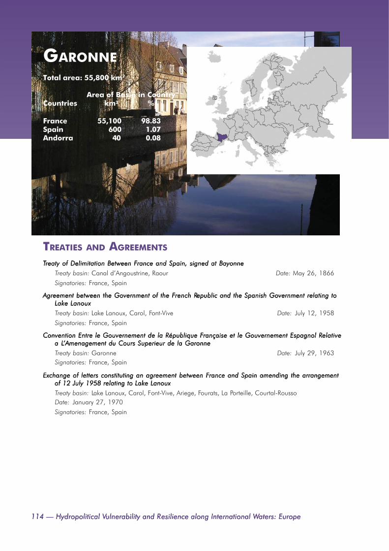
114 — Hydropolitical V114 — Hydropolitical V114 — Hydropolitical V114 — Hydropolitical V114 — Hydropolitical Vulnerability and Rulnerability and Rulnerability and Rulnerability and Rulnerability and Resilience along International Wesilience along International Wesilience along International Wesilience along International Wesilience along International Waters: Europeaters: Europeaters: Europeaters: Europeaters: Europe
GARONNETotal area: 55,800 km2
Area of Basin in CountryCountries km2 %
France 55,100 98.83Spain 600 1.07Andorra 40 0.08
TREATIES AND AGREEMENTS
TTTTTreaty of Delimitation Between Freaty of Delimitation Between Freaty of Delimitation Between Freaty of Delimitation Between Freaty of Delimitation Between France and Spain, signed at Bayonnerance and Spain, signed at Bayonnerance and Spain, signed at Bayonnerance and Spain, signed at Bayonnerance and Spain, signed at Bayonne
Treaty basin: Canal d’Angoustrine, Raour Date: May 26, 1866
Signatories: France, Spain
Agreement between the Government of the FAgreement between the Government of the FAgreement between the Government of the FAgreement between the Government of the FAgreement between the Government of the French Rrench Rrench Rrench Rrench Republic and the Spanish Government relating toepublic and the Spanish Government relating toepublic and the Spanish Government relating toepublic and the Spanish Government relating toepublic and the Spanish Government relating toLake LanouxLake LanouxLake LanouxLake LanouxLake Lanoux
Treaty basin: Lake Lanoux, Carol, Font-Vive Date: July 12, 1958
Signatories: France, Spain
Convention Entre le Gouvernement de la République FConvention Entre le Gouvernement de la République FConvention Entre le Gouvernement de la République FConvention Entre le Gouvernement de la République FConvention Entre le Gouvernement de la République Française et le Gouvernement Espagnol Rrançaise et le Gouvernement Espagnol Rrançaise et le Gouvernement Espagnol Rrançaise et le Gouvernement Espagnol Rrançaise et le Gouvernement Espagnol Relativeelativeelativeelativeelativea La La La La L’Amenagement du Cours Superieur de la Garonne’Amenagement du Cours Superieur de la Garonne’Amenagement du Cours Superieur de la Garonne’Amenagement du Cours Superieur de la Garonne’Amenagement du Cours Superieur de la Garonne
Treaty basin: Garonne Date: July 29, 1963Signatories: France, Spain
Exchange of letters constituting an agreement between FExchange of letters constituting an agreement between FExchange of letters constituting an agreement between FExchange of letters constituting an agreement between FExchange of letters constituting an agreement between France and Spain amending the arrangementrance and Spain amending the arrangementrance and Spain amending the arrangementrance and Spain amending the arrangementrance and Spain amending the arrangementof 12 July 1958 relating to Lake Lanouxof 12 July 1958 relating to Lake Lanouxof 12 July 1958 relating to Lake Lanouxof 12 July 1958 relating to Lake Lanouxof 12 July 1958 relating to Lake Lanoux
Treaty basin: Lake Lanoux, Carol, Font-Vive, Ariege, Fourats, La Porteille, Courtal-RoussoDate: January 27, 1970
Signatories: France, Spain

Appendix 1. International Freshwater Agreements, Organizations, Commissions — 115Appendix 1. International Freshwater Agreements, Organizations, Commissions — 115Appendix 1. International Freshwater Agreements, Organizations, Commissions — 115Appendix 1. International Freshwater Agreements, Organizations, Commissions — 115Appendix 1. International Freshwater Agreements, Organizations, Commissions — 115
GLAMATotal area: 43,000 km2
Area of Basin in CountryCountries km2 %
Norway 42,600 99.00Sweden 400 0.99
TREATIES AND AGREEMENTS
TTTTTraites et Conventions Concernant la Dissolution de Lraites et Conventions Concernant la Dissolution de Lraites et Conventions Concernant la Dissolution de Lraites et Conventions Concernant la Dissolution de Lraites et Conventions Concernant la Dissolution de L’Union Suedo’Union Suedo’Union Suedo’Union Suedo’Union Suedo-Norvegienne-Norvegienne-Norvegienne-Norvegienne-Norvegienne
Treaty basin: Frontier or shared waters Date: October 26, 1905Signatories: Norway, Sweden

116 — Hydropolitical V116 — Hydropolitical V116 — Hydropolitical V116 — Hydropolitical V116 — Hydropolitical Vulnerability and Rulnerability and Rulnerability and Rulnerability and Rulnerability and Resilience along International Wesilience along International Wesilience along International Wesilience along International Wesilience along International Waters: Europeaters: Europeaters: Europeaters: Europeaters: Europe
TREATIES AND AGREEMENTS
Convenio y PConvenio y PConvenio y PConvenio y PConvenio y Protocola Arotocola Arotocola Arotocola Arotocola Adicional Pdicional Pdicional Pdicional Pdicional Para Rara Rara Rara Rara Regular el Uso y aprovechamiento hidraulico de los tramosegular el Uso y aprovechamiento hidraulico de los tramosegular el Uso y aprovechamiento hidraulico de los tramosegular el Uso y aprovechamiento hidraulico de los tramosegular el Uso y aprovechamiento hidraulico de los tramosinternacionales de los rios Miño, Limia, Tinternacionales de los rios Miño, Limia, Tinternacionales de los rios Miño, Limia, Tinternacionales de los rios Miño, Limia, Tinternacionales de los rios Miño, Limia, Tajo...ajo...ajo...ajo...ajo...
Treaty basin: Miño, Guadiana Date: May 29, 1968
Signatories: Spain, Portugal
TTTTTreaty between Spain and Preaty between Spain and Preaty between Spain and Preaty between Spain and Preaty between Spain and Portugal relating to hydropower construction on the Miño river [Untitled]ortugal relating to hydropower construction on the Miño river [Untitled]ortugal relating to hydropower construction on the Miño river [Untitled]ortugal relating to hydropower construction on the Miño river [Untitled]ortugal relating to hydropower construction on the Miño river [Untitled]
Treaty basin: Miño Date: February 12, 1976
Signatories: Spain and Portugal
Convenção sobre Cooperação para a PConvenção sobre Cooperação para a PConvenção sobre Cooperação para a PConvenção sobre Cooperação para a PConvenção sobre Cooperação para a Protecção e o Aproveitamento Sustentável das Águas dasrotecção e o Aproveitamento Sustentável das Águas dasrotecção e o Aproveitamento Sustentável das Águas dasrotecção e o Aproveitamento Sustentável das Águas dasrotecção e o Aproveitamento Sustentável das Águas dasBacias Hidrográficas LBacias Hidrográficas LBacias Hidrográficas LBacias Hidrográficas LBacias Hidrográficas Lusousousousouso-----espanholas and Aespanholas and Aespanholas and Aespanholas and Aespanholas and Additional Pdditional Pdditional Pdditional Pdditional Protocol and Annexesrotocol and Annexesrotocol and Annexesrotocol and Annexesrotocol and Annexes
Treaty basin: Lima, Minho, Douro (Duero), Tagus (Tejo), Guadiana Date: November 30, 1998Signatories: Portugal, Spain
GUADIANATotal area: 67,900 km2
Area of Basin in CountryCountries km2 %
Spain 54,900 80.82Portugal 13,000 19.18

Appendix 1. International Freshwater Agreements, Organizations, Commissions — 117Appendix 1. International Freshwater Agreements, Organizations, Commissions — 117Appendix 1. International Freshwater Agreements, Organizations, Commissions — 117Appendix 1. International Freshwater Agreements, Organizations, Commissions — 117Appendix 1. International Freshwater Agreements, Organizations, Commissions — 117
ISONZOTotal area: 3,000 km2
Area of Basin in CountryCountries km2 %
Slovenia 1,800 59.48Italy 1,200 40.09
TREATIES AND AGREEMENTS
Accord Entre le Gouvernement de la Republique Italienne et le Gourvernement de la RepubliqueAccord Entre le Gouvernement de la Republique Italienne et le Gourvernement de la RepubliqueAccord Entre le Gouvernement de la Republique Italienne et le Gourvernement de la RepubliqueAccord Entre le Gouvernement de la Republique Italienne et le Gourvernement de la RepubliqueAccord Entre le Gouvernement de la Republique Italienne et le Gourvernement de la RepubliquePPPPPopulaire Fopulaire Fopulaire Fopulaire Fopulaire Federative de Yederative de Yederative de Yederative de Yederative de Yougoslavie Concernant Lougoslavie Concernant Lougoslavie Concernant Lougoslavie Concernant Lougoslavie Concernant L’Alimentation en Eau de la Commune de’Alimentation en Eau de la Commune de’Alimentation en Eau de la Commune de’Alimentation en Eau de la Commune de’Alimentation en Eau de la Commune deGorizia Conformement au PGorizia Conformement au PGorizia Conformement au PGorizia Conformement au PGorizia Conformement au Paragraphe 5 de Laragraphe 5 de Laragraphe 5 de Laragraphe 5 de Laragraphe 5 de L’Annexe V au T’Annexe V au T’Annexe V au T’Annexe V au T’Annexe V au Traite de Praite de Praite de Praite de Praite de Paix Aaix Aaix Aaix Aaix Avec Lvec Lvec Lvec Lvec L’Italie et Echange’Italie et Echange’Italie et Echange’Italie et Echange’Italie et Echangede Notesde Notesde Notesde Notesde Notes
Treaty basin: Mrzlek, Fontefredda Date: July 18, 1957
Signatories: Italy, Yugoslavia

118 — Hydropolitical V118 — Hydropolitical V118 — Hydropolitical V118 — Hydropolitical V118 — Hydropolitical Vulnerability and Rulnerability and Rulnerability and Rulnerability and Rulnerability and Resilience along International Wesilience along International Wesilience along International Wesilience along International Wesilience along International Waters: Europeaters: Europeaters: Europeaters: Europeaters: Europe
KEMITotal area: 55,700 km2
Area of Basin in CountryCountries km2 %
Finland 52,700 94.52Russia 3,000 5.41Norway 10 0.01
TREATIES AND AGREEMENTS
Convention between the RConvention between the RConvention between the RConvention between the RConvention between the Republic of Fepublic of Fepublic of Fepublic of Fepublic of Finland and the Rinland and the Rinland and the Rinland and the Rinland and the Russian Socialist Fussian Socialist Fussian Socialist Fussian Socialist Fussian Socialist Federal Soviet Rederal Soviet Rederal Soviet Rederal Soviet Rederal Soviet Republicepublicepublicepublicepublicconcerning the maintenance of river channels and the regulation of fishing on water coursesconcerning the maintenance of river channels and the regulation of fishing on water coursesconcerning the maintenance of river channels and the regulation of fishing on water coursesconcerning the maintenance of river channels and the regulation of fishing on water coursesconcerning the maintenance of river channels and the regulation of fishing on water coursesFFFFForming Porming Porming Porming Porming Part of the Fart of the Fart of the Fart of the Fart of the Frontier Between Frontier Between Frontier Between Frontier Between Frontier Between Finland and Rinland and Rinland and Rinland and Rinland and Russiaussiaussiaussiaussia
Treaty basin: Kutajoki, Kutalahti, Kuusamon-järvi, Lake Ladoga, Lake Tulenanjärvi, Lake Tuulijärvi,Lentiera, Lieksa, Luttojoki, Pääjärvi, Paanajärvi, Pistojoki, Pielisjärvi, Tuntsajoki, Tuntsajoki, Tuulijoki,Tulenmananjoki, Tuulomanjoki, Ulanganjoki, Yla-Kuittijärvi Date: October 28, 1922Signatories: Finland, Republic of; Russian Socialist Federal Soviet Republic
Agreement [Between FAgreement [Between FAgreement [Between FAgreement [Between FAgreement [Between Finland and the Union of Soviet Socialist Rinland and the Union of Soviet Socialist Rinland and the Union of Soviet Socialist Rinland and the Union of Soviet Socialist Rinland and the Union of Soviet Socialist Republics] Concerning Fepublics] Concerning Fepublics] Concerning Fepublics] Concerning Fepublics] Concerning FrontierrontierrontierrontierrontierWWWWWatercourses (with exchange of letters), Helsinkiatercourses (with exchange of letters), Helsinkiatercourses (with exchange of letters), Helsinkiatercourses (with exchange of letters), Helsinkiatercourses (with exchange of letters), Helsinki
Treaty basin: Frontier or shared waters Date: April 24, 1964Signatories: Finland, USSR
RIVER BASIN ORGANIZATIONS AND COMMISSIONS
FFFFFinnish-Norwegian Tinnish-Norwegian Tinnish-Norwegian Tinnish-Norwegian Tinnish-Norwegian Transboundary Wransboundary Wransboundary Wransboundary Wransboundary Water Commission.ater Commission.ater Commission.ater Commission.ater Commission.
The Commission acts as a body for cooperation and communication between the two states. Its aim is topreserve the transboundary watercourses and their unique natural conditions. It also safeguards theenvironmental interests of both states and the residents of the border region. The Commission has anadvisory role.
Treaty basin: Kemi, Naatamo, Olanga, Pasvik, Tana, Torne/Tornealven Date: 1980
Signatories: Finland, Norway
Source: http://www.ymparisto.fi/default.asp?node=9813&lan=en
FFFFFinnish-Rinnish-Rinnish-Rinnish-Rinnish-Russian Joint Commission on the Utilization of Fussian Joint Commission on the Utilization of Fussian Joint Commission on the Utilization of Fussian Joint Commission on the Utilization of Fussian Joint Commission on the Utilization of Frontier Wrontier Wrontier Wrontier Wrontier Watersatersatersatersaters
Geographical Scope: The lakes, rivers, and streams intersected by the frontier line or along which thefrontier line runs.
Treaty basin: Kemi, Olanga, Oulu, Pasvik, Tuloma, Vuoksa Date: 1964
Signatories: Finland, Russia
Source: http://www.inwent.org/ef-texte/vilnius/rep1199e.htm

Appendix 1. International Freshwater Agreements, Organizations, Commissions — 119Appendix 1. International Freshwater Agreements, Organizations, Commissions — 119Appendix 1. International Freshwater Agreements, Organizations, Commissions — 119Appendix 1. International Freshwater Agreements, Organizations, Commissions — 119Appendix 1. International Freshwater Agreements, Organizations, Commissions — 119
KLARALVENTotal area: 51,000 km2
Area of Basin in CountryCountries km2 %
Sweden 43,100 84.54Norway 7,900 15.46
TREATIES AND AGREEMENTS
TTTTTraites et Conventions Concernant la Dissolution de Lraites et Conventions Concernant la Dissolution de Lraites et Conventions Concernant la Dissolution de Lraites et Conventions Concernant la Dissolution de Lraites et Conventions Concernant la Dissolution de L’Union Suedo’Union Suedo’Union Suedo’Union Suedo’Union Suedo-Norvegienne-Norvegienne-Norvegienne-Norvegienne-Norvegienne
Treaty basin: Frontier or shared waters Date: October 26, 1905
Signatories: Norway, Sweden

120 — Hydropolitical V120 — Hydropolitical V120 — Hydropolitical V120 — Hydropolitical V120 — Hydropolitical Vulnerability and Rulnerability and Rulnerability and Rulnerability and Rulnerability and Resilience along International Wesilience along International Wesilience along International Wesilience along International Wesilience along International Waters: Europeaters: Europeaters: Europeaters: Europeaters: Europe
KOGILNIKTotal area: 6,100 km2
Area of Basin in CountryCountries km2 %
Moldova 3,600 57.82Ukraine 2,600 42.18
TREATIES AND AGREEMENTS
Agreement between the government of the republic of Moldova and the government of Ukraine onAgreement between the government of the republic of Moldova and the government of Ukraine onAgreement between the government of the republic of Moldova and the government of Ukraine onAgreement between the government of the republic of Moldova and the government of Ukraine onAgreement between the government of the republic of Moldova and the government of Ukraine onthe joint use and protection of transboundary watersthe joint use and protection of transboundary watersthe joint use and protection of transboundary watersthe joint use and protection of transboundary watersthe joint use and protection of transboundary waters
Treaty basin: Dnestr, Danube, Kogilnik, Sarata Date: November 23, 1994
Signatories: Moldova, Ukraine

Appendix 1. International Freshwater Agreements, Organizations, Commissions — 121Appendix 1. International Freshwater Agreements, Organizations, Commissions — 121Appendix 1. International Freshwater Agreements, Organizations, Commissions — 121Appendix 1. International Freshwater Agreements, Organizations, Commissions — 121Appendix 1. International Freshwater Agreements, Organizations, Commissions — 121
TREATIES AND AGREEMENTS
Exchange of Notes Between Greece and YExchange of Notes Between Greece and YExchange of Notes Between Greece and YExchange of Notes Between Greece and YExchange of Notes Between Greece and Yugoslaviaugoslaviaugoslaviaugoslaviaugoslavia
Treaty basin: Vardar, Dojran, Ljumnica, Sakuleva, Dragas, Pelagonia, Prespa Date: May 25, 1954
Signatories: Greece, Yugoslavia
AAAAAccord Entre Lccord Entre Lccord Entre Lccord Entre Lccord Entre Le Re Re Re Re Royaume de Grece et al Royaume de Grece et al Royaume de Grece et al Royaume de Grece et al Royaume de Grece et al Republique Pepublique Pepublique Pepublique Pepublique Populaire Fopulaire Fopulaire Fopulaire Fopulaire Federative de Yederative de Yederative de Yederative de Yederative de Yougoslavie Rougoslavie Rougoslavie Rougoslavie Rougoslavie Relatif auxelatif auxelatif auxelatif auxelatif auxQuestions de LQuestions de LQuestions de LQuestions de LQuestions de L’Hydroeconomie A’Hydroeconomie A’Hydroeconomie A’Hydroeconomie A’Hydroeconomie Avec Annexe Concernant Lvec Annexe Concernant Lvec Annexe Concernant Lvec Annexe Concernant Lvec Annexe Concernant Le Statut de la Commission Pe Statut de la Commission Pe Statut de la Commission Pe Statut de la Commission Pe Statut de la Commission PermanenteermanenteermanenteermanenteermanenteGrecoGrecoGrecoGrecoGreco-----YYYYYougoslave de Lougoslave de Lougoslave de Lougoslave de Lougoslave de L’Hydroeconomie et Echange de Notes, Signe a A’Hydroeconomie et Echange de Notes, Signe a A’Hydroeconomie et Echange de Notes, Signe a A’Hydroeconomie et Echange de Notes, Signe a A’Hydroeconomie et Echange de Notes, Signe a Athenesthenesthenesthenesthenes
Treaty basin: Vardar, Axios, Dojran, Ljumnica, Sakuleva, Dragas, Pelagonia, Prespa
Date: June 18, 1959Signatories: Greece, Yugoslavia
RIVER BASIN ORGANIZATIONS AND COMMISSIONS
Alliance for LAlliance for LAlliance for LAlliance for LAlliance for Lake Cooperation in Pake Cooperation in Pake Cooperation in Pake Cooperation in Pake Cooperation in Prespa and Ohrid.respa and Ohrid.respa and Ohrid.respa and Ohrid.respa and Ohrid.
Lake Ohrid is a subbasin of Lake Prespa. The alliance focuses on promoting and supporting the cross-border activities in the protection of the environment in the Region of Ohrid and Prespa Lakes aiming atsustainable development of the region. The approach includes development of cross border cooperationand co-ordination between the relevant states and above all local government and NGOs in order toensure the active participation of the local population.
Treaty basin: Lake Prespa, Lake Ohrid Date: January 15, 2000
Signatories: Albania, Macedonia
Source: http://allcoop.org.mk/ALLCOOP.html
LAKE PRESPATotal area: 9,000 km2
Area of Basin in CountryCountries km2 %
Albania 8,000 88.17Macedonia 800 8.5Greece 300 3.32

122 — Hydropolitical V122 — Hydropolitical V122 — Hydropolitical V122 — Hydropolitical V122 — Hydropolitical Vulnerability and Rulnerability and Rulnerability and Rulnerability and Rulnerability and Resilience along International Wesilience along International Wesilience along International Wesilience along International Wesilience along International Waters: Europeaters: Europeaters: Europeaters: Europeaters: Europe
LAVA/PREGELTotal area: 8,600 km2
Area of Basin in CountryCountries km2 %
Russia 6,300 74Poland 2,000 23.84
TREATIES AND AGREEMENTS
Agreement between PAgreement between PAgreement between PAgreement between PAgreement between Poland and the USSR concerning the regime on the Sovietoland and the USSR concerning the regime on the Sovietoland and the USSR concerning the regime on the Sovietoland and the USSR concerning the regime on the Sovietoland and the USSR concerning the regime on the Soviet-P-P-P-P-Polish State Folish State Folish State Folish State Folish State Frontierrontierrontierrontierrontier
Treaty basin: Frontier or shared waters Date: July 8, 1948
Signatories: Russia, Poland-

Appendix 1. International Freshwater Agreements, Organizations, Commissions — 123Appendix 1. International Freshwater Agreements, Organizations, Commissions — 123Appendix 1. International Freshwater Agreements, Organizations, Commissions — 123Appendix 1. International Freshwater Agreements, Organizations, Commissions — 123Appendix 1. International Freshwater Agreements, Organizations, Commissions — 123
TREATIES AND AGREEMENTS
Convenção sobre Cooperação para a PConvenção sobre Cooperação para a PConvenção sobre Cooperação para a PConvenção sobre Cooperação para a PConvenção sobre Cooperação para a Protecção e o Aproveitamento Sustentável das Águas dasrotecção e o Aproveitamento Sustentável das Águas dasrotecção e o Aproveitamento Sustentável das Águas dasrotecção e o Aproveitamento Sustentável das Águas dasrotecção e o Aproveitamento Sustentável das Águas dasBacias Hidrográficas LBacias Hidrográficas LBacias Hidrográficas LBacias Hidrográficas LBacias Hidrográficas Lusousousousouso-----espanholas and Aespanholas and Aespanholas and Aespanholas and Aespanholas and Additional Pdditional Pdditional Pdditional Pdditional Protocol and Annexesrotocol and Annexesrotocol and Annexesrotocol and Annexesrotocol and Annexes
Treaty basin: Lima, Minho, Douro (Duero), Tagus (Tejo), Guadiana Date: November 30, 1998
Signatories: Portugal, Spain
LIMATotal area: 2,300 km2
Area of Basin in CountryCountries km2 %
Spain 1,200 50.88Portugal 1,100 49.04

124 — Hydropolitical V124 — Hydropolitical V124 — Hydropolitical V124 — Hydropolitical V124 — Hydropolitical Vulnerability and Rulnerability and Rulnerability and Rulnerability and Rulnerability and Resilience along International Wesilience along International Wesilience along International Wesilience along International Wesilience along International Waters: Europeaters: Europeaters: Europeaters: Europeaters: Europe
MARITSATotal area: 49,600 km2
Area of Basin in CountryCountries km2 %
Bulgaria 33,000 66.49Turkey 12,800 25.69Greece 3,700 7.55
TREATIES AND AGREEMENTS
Agreement between the PAgreement between the PAgreement between the PAgreement between the PAgreement between the People’s Reople’s Reople’s Reople’s Reople’s Republic of Bulgaria and the Republic of Bulgaria and the Republic of Bulgaria and the Republic of Bulgaria and the Republic of Bulgaria and the Republic of Tepublic of Tepublic of Tepublic of Tepublic of Turkey concerningurkey concerningurkey concerningurkey concerningurkey concerningcooperation in the use of the waters of rivers flowing through the territory of both countriescooperation in the use of the waters of rivers flowing through the territory of both countriescooperation in the use of the waters of rivers flowing through the territory of both countriescooperation in the use of the waters of rivers flowing through the territory of both countriescooperation in the use of the waters of rivers flowing through the territory of both countries
Treaty basin: Maritsa, Marica, Tundzha, Veleka, Rezovska Date: October 23, 1968
Signatories: Turkey, Bulgaria

Appendix 1. International Freshwater Agreements, Organizations, Commissions — 125Appendix 1. International Freshwater Agreements, Organizations, Commissions — 125Appendix 1. International Freshwater Agreements, Organizations, Commissions — 125Appendix 1. International Freshwater Agreements, Organizations, Commissions — 125Appendix 1. International Freshwater Agreements, Organizations, Commissions — 125
TREATIES AND AGREEMENTS
TTTTTreaty of limits between Preaty of limits between Preaty of limits between Preaty of limits between Preaty of limits between Portugal and Spainortugal and Spainortugal and Spainortugal and Spainortugal and Spain
Treaty basin: Minho, Douro, Tagus Date: September 29, 1864
Signatories: Spain, Portugal
RRRRRegulations annexed to the Boundary Tegulations annexed to the Boundary Tegulations annexed to the Boundary Tegulations annexed to the Boundary Tegulations annexed to the Boundary Treaty between Spain and Preaty between Spain and Preaty between Spain and Preaty between Spain and Preaty between Spain and Portugal of 29th Septemberortugal of 29th Septemberortugal of 29th Septemberortugal of 29th Septemberortugal of 29th September, 1864., 1864., 1864., 1864., 1864.Signed at Lisbon, November 4, 1866.Signed at Lisbon, November 4, 1866.Signed at Lisbon, November 4, 1866.Signed at Lisbon, November 4, 1866.Signed at Lisbon, November 4, 1866.
Treaty basin: Minho, Douro, Tagus Date: November 4, 1864
Signatories: Portugal, Spain
Convenção sobre Cooperação para a PConvenção sobre Cooperação para a PConvenção sobre Cooperação para a PConvenção sobre Cooperação para a PConvenção sobre Cooperação para a Protecção e o Aproveitamento Sustentável das Águas dasrotecção e o Aproveitamento Sustentável das Águas dasrotecção e o Aproveitamento Sustentável das Águas dasrotecção e o Aproveitamento Sustentável das Águas dasrotecção e o Aproveitamento Sustentável das Águas dasBacias Hidrográficas LBacias Hidrográficas LBacias Hidrográficas LBacias Hidrográficas LBacias Hidrográficas Lusousousousouso-----espanholas and Aespanholas and Aespanholas and Aespanholas and Aespanholas and Additional Pdditional Pdditional Pdditional Pdditional Protocol and Annexesrotocol and Annexesrotocol and Annexesrotocol and Annexesrotocol and Annexes
Treaty basin: Lima, Minho, Douro (Duero), Tagus (Tejo), Guadiana Date: November 30, 1998Signatories: Portugal, Spain
MINHO/MIÑOTotal area: 15,100 km2
Area of Basin in CountryCountries km2 %
Spain 14,500 96.18Portugal 600 3.7

126 — Hydropolitical V126 — Hydropolitical V126 — Hydropolitical V126 — Hydropolitical V126 — Hydropolitical Vulnerability and Rulnerability and Rulnerability and Rulnerability and Rulnerability and Resilience along International Wesilience along International Wesilience along International Wesilience along International Wesilience along International Waters: Europeaters: Europeaters: Europeaters: Europeaters: Europe
NÄÄTÄMOTotal area: 1,000 km2
Area of Basin in CountryCountries km2 %
Norway 600 57.73Finland 400 41.97
TREATIES AND AGREEMENTS
Agreement between [FAgreement between [FAgreement between [FAgreement between [FAgreement between [Finland] and [Norway] on the transfer from the course of the Näätämo (Neiden)inland] and [Norway] on the transfer from the course of the Näätämo (Neiden)inland] and [Norway] on the transfer from the course of the Näätämo (Neiden)inland] and [Norway] on the transfer from the course of the Näätämo (Neiden)inland] and [Norway] on the transfer from the course of the Näätämo (Neiden)river to the course of the Gandvik River of water from the Garsjoen, Kjerringvatn andriver to the course of the Gandvik River of water from the Garsjoen, Kjerringvatn andriver to the course of the Gandvik River of water from the Garsjoen, Kjerringvatn andriver to the course of the Gandvik River of water from the Garsjoen, Kjerringvatn andriver to the course of the Gandvik River of water from the Garsjoen, Kjerringvatn andFFFFForstevannene lakesorstevannene lakesorstevannene lakesorstevannene lakesorstevannene lakes
Treaty basin: Näätämo, Gandvik Date: April 25, 1951
Signatories: Norway, Finland
RIVER BASIN ORGANIZATIONS AND COMMISSIONS
Estonian – REstonian – REstonian – REstonian – REstonian – Russian Joint Tussian Joint Tussian Joint Tussian Joint Tussian Joint Transboundary Wransboundary Wransboundary Wransboundary Wransboundary Water Commissionater Commissionater Commissionater Commissionater Commission
Treaty basin: Näätämo Date: 1997
Signatories: Estonia, RussiaSource: http://www.envir.ee/jc/eng
FFFFFinnish-Norwegian Tinnish-Norwegian Tinnish-Norwegian Tinnish-Norwegian Tinnish-Norwegian Transboundary Wransboundary Wransboundary Wransboundary Wransboundary Water Commissionater Commissionater Commissionater Commissionater Commission
The Commission acts as a body for cooperation and communication between the two states. Its aim is topreserve the transboundary watercourses and their unique natural conditions. It also safeguards theenvironmental interests of both states and the residents of the border region. The Commission has anadvisory role.
Treaty basin: Kemi, Näätämo, Olanga, Pasvik, Tana, Torne/Tornealven Date: 1980Signatories: Finland, Norway
Source: http://www.ymparisto.fi/default.asp?node=9813&lan=en

Appendix 1. International Freshwater Agreements, Organizations, Commissions — 127Appendix 1. International Freshwater Agreements, Organizations, Commissions — 127Appendix 1. International Freshwater Agreements, Organizations, Commissions — 127Appendix 1. International Freshwater Agreements, Organizations, Commissions — 127Appendix 1. International Freshwater Agreements, Organizations, Commissions — 127
NARVA*Total area: 53,000 km2
Area of Basin in CountryCountries km2 %
Russia 28,200 53.2Estonia 18,100 34.09Latvia 5,900 11.13Byelarus 800 1.57
TREATIES AND AGREEMENTS
TTTTTreaty of Preaty of Preaty of Preaty of Preaty of Peace Between Leace Between Leace Between Leace Between Leace Between Latvia and Ratvia and Ratvia and Ratvia and Ratvia and Russiaussiaussiaussiaussia
Treaty basin: Frontier or shared waters Date: August 11, 1920
Signatories: Russia, Latvia
TTTTTreaty between Estonia and Rreaty between Estonia and Rreaty between Estonia and Rreaty between Estonia and Rreaty between Estonia and Russia on the conservation of fish stocks in Lussia on the conservation of fish stocks in Lussia on the conservation of fish stocks in Lussia on the conservation of fish stocks in Lussia on the conservation of fish stocks in Lake Pake Pake Pake Pake Peipsieipsieipsieipsieipsi
Treaty basin: Lake Peipsi Date: 1994Signatories: Estonia, Russia
Agreement between the government of Estonia and the government of the Russian federation on theAgreement between the government of Estonia and the government of the Russian federation on theAgreement between the government of Estonia and the government of the Russian federation on theAgreement between the government of Estonia and the government of the Russian federation on theAgreement between the government of Estonia and the government of the Russian federation on theprotection and rational use of transboundary watersprotection and rational use of transboundary watersprotection and rational use of transboundary watersprotection and rational use of transboundary watersprotection and rational use of transboundary waters
Treaty basin: Narva, Lake Peipsi/Chudskoe Date: August 20, 1997
Signatories: Estonia, Russian Federation
Agreement between Belarus and RAgreement between Belarus and RAgreement between Belarus and RAgreement between Belarus and RAgreement between Belarus and Russia on Cooperation in the Fussia on Cooperation in the Fussia on Cooperation in the Fussia on Cooperation in the Fussia on Cooperation in the Field of Pield of Pield of Pield of Pield of Protection and Rrotection and Rrotection and Rrotection and Rrotection and RationalationalationalationalationalUtilisation of TUtilisation of TUtilisation of TUtilisation of TUtilisation of Transboundary Wransboundary Wransboundary Wransboundary Wransboundary Watersatersatersatersaters
Treaty basin: Daugava, Dnieper, Narva, Neman, Volga Date: May 24, 2002
Signatories: Belarus, Russia

128 — Hydropolitical V128 — Hydropolitical V128 — Hydropolitical V128 — Hydropolitical V128 — Hydropolitical Vulnerability and Rulnerability and Rulnerability and Rulnerability and Rulnerability and Resilience along International Wesilience along International Wesilience along International Wesilience along International Wesilience along International Waters: Europeaters: Europeaters: Europeaters: Europeaters: Europe
NEMAN*Total area: 90,300 km2
Area of Basin in Country
Countries km2 %
Byelarus 41,700 46.13Lithuania 39,700 43.97Russia 4,800 5.3Poland 3,800 4.21Latvia 300 0.36
TREATIES AND AGREEMENTS
TTTTTreaty of Preaty of Preaty of Preaty of Preaty of Peace Between Leace Between Leace Between Leace Between Leace Between Latvia and Ratvia and Ratvia and Ratvia and Ratvia and Russiaussiaussiaussiaussia
Treaty basin: Frontier or shared waters Date: August 11, 1920
Signatories: Russia, Latvia
PPPPPeace Teace Teace Teace Teace Treaty between Lithuania and the Rreaty between Lithuania and the Rreaty between Lithuania and the Rreaty between Lithuania and the Rreaty between Lithuania and the Russian Socialist Fussian Socialist Fussian Socialist Fussian Socialist Fussian Socialist Federal Rederal Rederal Rederal Rederal Republic, and Pepublic, and Pepublic, and Pepublic, and Pepublic, and Protocolrotocolrotocolrotocolrotocol
Treaty basin: Frontier or shared waters Date: July 13, 1924
Signatories: Russia, Lithuania
Convention between the German Reich and the Lithuanian Republic regarding the maintenance andConvention between the German Reich and the Lithuanian Republic regarding the maintenance andConvention between the German Reich and the Lithuanian Republic regarding the maintenance andConvention between the German Reich and the Lithuanian Republic regarding the maintenance andConvention between the German Reich and the Lithuanian Republic regarding the maintenance andadministration of the frontier waterwaysadministration of the frontier waterwaysadministration of the frontier waterwaysadministration of the frontier waterwaysadministration of the frontier waterways
Treaty basin: Memel, Kurische Haff Date: January 29, 1928
Signatories: Germany, Lithuania
Agreement between PAgreement between PAgreement between PAgreement between PAgreement between Poland and the USSR concerning the regime on the Sovietoland and the USSR concerning the regime on the Sovietoland and the USSR concerning the regime on the Sovietoland and the USSR concerning the regime on the Sovietoland and the USSR concerning the regime on the Soviet-P-P-P-P-Polish State Folish State Folish State Folish State Folish State Frontierrontierrontierrontierrontier
Treaty basin: Frontier or shared waters Date: July 8, 1948
Signatories: Russia, Poland
Agreement between the environmental protection ministry of the republic of Lithuania and the ministryAgreement between the environmental protection ministry of the republic of Lithuania and the ministryAgreement between the environmental protection ministry of the republic of Lithuania and the ministryAgreement between the environmental protection ministry of the republic of Lithuania and the ministryAgreement between the environmental protection ministry of the republic of Lithuania and the ministryof environmental protection, nature conservation and forestry of the republic Pof environmental protection, nature conservation and forestry of the republic Pof environmental protection, nature conservation and forestry of the republic Pof environmental protection, nature conservation and forestry of the republic Pof environmental protection, nature conservation and forestry of the republic Polandolandolandolandoland
Treaty basin: Siesupe, Selmenta, Lake Galadusis Date: March 31, 1994
Signatories: Lithuania, Poland
Agreement between the ministry of natural resources and environmental protection of the republic ofAgreement between the ministry of natural resources and environmental protection of the republic ofAgreement between the ministry of natural resources and environmental protection of the republic ofAgreement between the ministry of natural resources and environmental protection of the republic ofAgreement between the ministry of natural resources and environmental protection of the republic ofBelarus and the environmental protection ministry of the republic of Lithuania on cooperation inBelarus and the environmental protection ministry of the republic of Lithuania on cooperation inBelarus and the environmental protection ministry of the republic of Lithuania on cooperation inBelarus and the environmental protection ministry of the republic of Lithuania on cooperation inBelarus and the environmental protection ministry of the republic of Lithuania on cooperation inthe field of environmental protectionthe field of environmental protectionthe field of environmental protectionthe field of environmental protectionthe field of environmental protection
Treaty basin: Neman, Daugava Date: April 14, 1995
Signatories: Belarus, Lithuania
Agreement between Belarus and RAgreement between Belarus and RAgreement between Belarus and RAgreement between Belarus and RAgreement between Belarus and Russia on Cooperation in the Fussia on Cooperation in the Fussia on Cooperation in the Fussia on Cooperation in the Fussia on Cooperation in the Field of Pield of Pield of Pield of Pield of Protection and Rrotection and Rrotection and Rrotection and Rrotection and RationalationalationalationalationalUtilisation of TUtilisation of TUtilisation of TUtilisation of TUtilisation of Transboundary Wransboundary Wransboundary Wransboundary Wransboundary Watersatersatersatersaters
Treaty basin: Daugava, Dnieper, Narva, Neman, Volga Date: May 24, 2002Signatories: Belarus, Russia

Appendix 1. International Freshwater Agreements, Organizations, Commissions — 129Appendix 1. International Freshwater Agreements, Organizations, Commissions — 129Appendix 1. International Freshwater Agreements, Organizations, Commissions — 129Appendix 1. International Freshwater Agreements, Organizations, Commissions — 129Appendix 1. International Freshwater Agreements, Organizations, Commissions — 129
NESTOSTotal area: 10,200 km2
Area of Basin in CountryCountries km2 %
Bulgaria 5,500 53.63Greece 4,700 46.36
TREATIES AND AGREEMENTS
Minutes of the GreekMinutes of the GreekMinutes of the GreekMinutes of the GreekMinutes of the Greek-Bulgarian Committee for the use of waters of the Nestos river-Bulgarian Committee for the use of waters of the Nestos river-Bulgarian Committee for the use of waters of the Nestos river-Bulgarian Committee for the use of waters of the Nestos river-Bulgarian Committee for the use of waters of the Nestos river
Treaty basin: Nestos Date: March 16, 1988
Signatories: Bulgaria, Greece
Agreed minutes of the first meeting of the GreekAgreed minutes of the first meeting of the GreekAgreed minutes of the first meeting of the GreekAgreed minutes of the first meeting of the GreekAgreed minutes of the first meeting of the Greek-Bulgarian joint programming and follow-Bulgarian joint programming and follow-Bulgarian joint programming and follow-Bulgarian joint programming and follow-Bulgarian joint programming and follow-up-up-up-up-upCommitteeCommitteeCommitteeCommitteeCommittee
Treaty basin: Not specified Date: April 22, 1994
Signatories: Bulgaria, Greece
Agreement between the Government of Hellenic Republic and the Government of the Republic ofAgreement between the Government of Hellenic Republic and the Government of the Republic ofAgreement between the Government of Hellenic Republic and the Government of the Republic ofAgreement between the Government of Hellenic Republic and the Government of the Republic ofAgreement between the Government of Hellenic Republic and the Government of the Republic ofBulgaria for the use of the Nestos River watersBulgaria for the use of the Nestos River watersBulgaria for the use of the Nestos River watersBulgaria for the use of the Nestos River watersBulgaria for the use of the Nestos River waters
Treaty basin: Nestos Date: December 22, 1995
Signatories: Bulgaria, Greece

130 — Hydropolitical V130 — Hydropolitical V130 — Hydropolitical V130 — Hydropolitical V130 — Hydropolitical Vulnerability and Rulnerability and Rulnerability and Rulnerability and Rulnerability and Resilience along International Wesilience along International Wesilience along International Wesilience along International Wesilience along International Waters: Europeaters: Europeaters: Europeaters: Europeaters: Europe
ODER/ODRATotal area: 122,400 km2
Area of Basin in CountryCountries km2 %
Poland 103,100 84.2Czech Republic 10,300 8.38Germany 7,800 6.33Slovakia 1,300 1.09
TREATIES AND AGREEMENTS
Convention between the RConvention between the RConvention between the RConvention between the RConvention between the Republic of Fepublic of Fepublic of Fepublic of Fepublic of Finland and the Rinland and the Rinland and the Rinland and the Rinland and the Russian Socialist Fussian Socialist Fussian Socialist Fussian Socialist Fussian Socialist Federal Soviet Rederal Soviet Rederal Soviet Rederal Soviet Rederal Soviet Republicepublicepublicepublicepublicconcerning the maintenance of river channels and the regulation of fishing on water coursesconcerning the maintenance of river channels and the regulation of fishing on water coursesconcerning the maintenance of river channels and the regulation of fishing on water coursesconcerning the maintenance of river channels and the regulation of fishing on water coursesconcerning the maintenance of river channels and the regulation of fishing on water coursesFFFFForming Porming Porming Porming Porming Part of the Fart of the Fart of the Fart of the Fart of the Frontier Between Frontier Between Frontier Between Frontier Between Frontier Between Finland and Rinland and Rinland and Rinland and Rinland and Russiaussiaussiaussiaussia
Treaty basin: Tuulomanjoki, Luttojoki, Kutajoki,Tuntsajoki, Kutalahti, Tuntsajoki, Ulanganjoki, Pääjärvi,Paanajärvi, Pistojoki, Yla-Kuittijärvi, Kuusamon-järvi, Lieksa, Tuulijoki, Pielisjärvi, Lentiera, Lake Tuulijärvi,Tulenmananjoki, Lake Ladoga, Lake Tulenanjärvi Date: October 28, 1922Signatories: USSR, Finland
TTTTTreaty between Germany and Preaty between Germany and Preaty between Germany and Preaty between Germany and Preaty between Germany and Poland for the Settlement of Foland for the Settlement of Foland for the Settlement of Foland for the Settlement of Foland for the Settlement of Frontier Questionsrontier Questionsrontier Questionsrontier Questionsrontier Questions
Treaty basin: Frontier or shared waters Date: January 27, 1926Signatories: Germany, Poland
Agreement between the Government of the Czechoslovak RAgreement between the Government of the Czechoslovak RAgreement between the Government of the Czechoslovak RAgreement between the Government of the Czechoslovak RAgreement between the Government of the Czechoslovak Republic and the Government of the Pepublic and the Government of the Pepublic and the Government of the Pepublic and the Government of the Pepublic and the Government of the PolisholisholisholisholishPPPPPeople’s Reople’s Reople’s Reople’s Reople’s Republic concerning the use of water resources in frontier watersepublic concerning the use of water resources in frontier watersepublic concerning the use of water resources in frontier watersepublic concerning the use of water resources in frontier watersepublic concerning the use of water resources in frontier watersTreaty basin: Oder Date: March 21, 1958
Signatories: Czechoslovakia and Poland
Agreement between the federal republic of Germany and the republic of PAgreement between the federal republic of Germany and the republic of PAgreement between the federal republic of Germany and the republic of PAgreement between the federal republic of Germany and the republic of PAgreement between the federal republic of Germany and the republic of Poland on cooperation inoland on cooperation inoland on cooperation inoland on cooperation inoland on cooperation inthe field of water management at border watersthe field of water management at border watersthe field of water management at border watersthe field of water management at border watersthe field of water management at border watersTreaty basin: Oder Date: May 19, 1992
Signatories: Germany, Poland
RIVER BASIN ORGANIZATIONS AND COMMISSIONS
International Commission for the PInternational Commission for the PInternational Commission for the PInternational Commission for the PInternational Commission for the Protection of the Oder River against Protection of the Oder River against Protection of the Oder River against Protection of the Oder River against Protection of the Oder River against Pollution (ICPOAP)ollution (ICPOAP)ollution (ICPOAP)ollution (ICPOAP)ollution (ICPOAP)
The objectives of the ICPOAP are: 1. to prevent the pollution of the Oder and the Baltic Sea by contami-nants and to achieve a reduction in the pollution thereof; 2. to achieve the most natural aquatic andlittoral ecosystems possible with the corresponding species diversity; 3. to permit utilization of the Oder, inparticular the production of drinking water from bank filtrate and the use of its water and sediments inagriculture; 4. to provide for precautions against the risk of flood damage and achieve a sustainedreduction thereof; and 5. to coordinate implementation of the Water Framework Directive in the Oderriver basin.
Treaty basin: Oder/Odra Date: April 26, 1999Signatories: Poland, Czech Republic, Germany

Appendix 1. International Freshwater Agreements, Organizations, Commissions — 131Appendix 1. International Freshwater Agreements, Organizations, Commissions — 131Appendix 1. International Freshwater Agreements, Organizations, Commissions — 131Appendix 1. International Freshwater Agreements, Organizations, Commissions — 131Appendix 1. International Freshwater Agreements, Organizations, Commissions — 131
OLANGATotal area: 18,800 km2
Area of Basin in CountryCountries km2 %
Russia 16,800 89.37Finland 2,000 10.62
TREATIES AND AGREEMENTS
Agreement [Between FAgreement [Between FAgreement [Between FAgreement [Between FAgreement [Between Finland and the Union of Soviet Socialist Rinland and the Union of Soviet Socialist Rinland and the Union of Soviet Socialist Rinland and the Union of Soviet Socialist Rinland and the Union of Soviet Socialist Republics] Concerning Fepublics] Concerning Fepublics] Concerning Fepublics] Concerning Fepublics] Concerning FrontierrontierrontierrontierrontierWWWWWatercourses (with exchange of letters), Helsinkiatercourses (with exchange of letters), Helsinkiatercourses (with exchange of letters), Helsinkiatercourses (with exchange of letters), Helsinkiatercourses (with exchange of letters), Helsinki
Treaty basin: Frontier or shared waters Date: April 24, 1964
Signatories: Finland, Union of Soviet Socialist Republics
Convention between the RConvention between the RConvention between the RConvention between the RConvention between the Republic of Fepublic of Fepublic of Fepublic of Fepublic of Finland and the Rinland and the Rinland and the Rinland and the Rinland and the Russian Socialist Fussian Socialist Fussian Socialist Fussian Socialist Fussian Socialist Federal Soviet Rederal Soviet Rederal Soviet Rederal Soviet Rederal Soviet Republicepublicepublicepublicepublicconcerning the maintenance of river channels and the regulation of fishing on water coursesconcerning the maintenance of river channels and the regulation of fishing on water coursesconcerning the maintenance of river channels and the regulation of fishing on water coursesconcerning the maintenance of river channels and the regulation of fishing on water coursesconcerning the maintenance of river channels and the regulation of fishing on water coursesFFFFForming Porming Porming Porming Porming Part of the Fart of the Fart of the Fart of the Fart of the Frontier Between Frontier Between Frontier Between Frontier Between Frontier Between Finland and Rinland and Rinland and Rinland and Rinland and RussiaussiaussiaussiaussiaTreaty basin: Kutajoki, Kutalahti, Kuusamon-järvi, Lake Ladoga, Lake Tulenanjärvi, Lake Tuulijärvi,Lentiera, Lieksa, Luttojoki, Pääjärvi, Paanajärvi, Pistojoki, Pielisjärvi, Tuntsajoki, Tuntsajoki, Tuulijoki,Tulenmananjoki, Tuulomanjoki, Ulanganjoki, Yla-Kuittijärvi
Date: October 28, 1922
Signatories: Finland, Republic of; Russian Socialist Federal Soviet Republic
RIVER BASIN ORGANIZATIONS AND COMMISSIONS
FFFFFinnish-Norwegian Tinnish-Norwegian Tinnish-Norwegian Tinnish-Norwegian Tinnish-Norwegian Transboundary Wransboundary Wransboundary Wransboundary Wransboundary Water Commissionater Commissionater Commissionater Commissionater Commission
The Commission acts as a body for cooperation and communication between the two states. Its aim is topreserve the transboundary watercourses and their unique natural conditions. It also safeguards theenvironmental interests of both states and the residents of the border region. The Commission has anadvisory role.
Treaty basin: Kemi, Naatamo, Olanga, Pasvik, Tana, Torne/Tornealven Date: 1964Signatories: Finland, NorwaySource: http://www.inwent.org/ef-texte/vilnius/rep1199e.htm
FFFFFinnish-Rinnish-Rinnish-Rinnish-Rinnish-Russian Joint Commission on the Utilization of Fussian Joint Commission on the Utilization of Fussian Joint Commission on the Utilization of Fussian Joint Commission on the Utilization of Fussian Joint Commission on the Utilization of Frontier Wrontier Wrontier Wrontier Wrontier Watersatersatersatersaters
Geographical Scope: The lakes, rivers, and streams intersected by the frontier line or along which thefrontier line runs.
Treaty basin: Kemi, Olanga, Oulu, Pasvik, Tuloma, Vuoksa Date: 1964Signatories: Finland, Russia
Source: http://www.inwent.org/ef-texte/vilnius/rep1199e.htm

132 — Hydropolitical V132 — Hydropolitical V132 — Hydropolitical V132 — Hydropolitical V132 — Hydropolitical Vulnerability and Rulnerability and Rulnerability and Rulnerability and Rulnerability and Resilience along International Wesilience along International Wesilience along International Wesilience along International Wesilience along International Waters: Europeaters: Europeaters: Europeaters: Europeaters: Europe
OULUTotal area: 28,700 km2
Area of Basin in CountryCountries km2 %
Finland 26,700 93.2Russia 1,900 6.78
TREATIES AND AGREEMENTS
Agreement between FAgreement between FAgreement between FAgreement between FAgreement between Finland and the Union of Soviet Socialist Rinland and the Union of Soviet Socialist Rinland and the Union of Soviet Socialist Rinland and the Union of Soviet Socialist Rinland and the Union of Soviet Socialist Republics concerning frontierepublics concerning frontierepublics concerning frontierepublics concerning frontierepublics concerning frontierwatercourses (with exchange of letters), Helsinkiwatercourses (with exchange of letters), Helsinkiwatercourses (with exchange of letters), Helsinkiwatercourses (with exchange of letters), Helsinkiwatercourses (with exchange of letters), Helsinki
Treaty basin: Frontier or shared waters Date: April 24, 1964
Signatories: Finland, Union of Soviet Socialist Republics
RIVER BASIN ORGANIZATIONS AND COMMISSIONS
FFFFFinnish-Rinnish-Rinnish-Rinnish-Rinnish-Russian Joint Commission on the Utilization of Fussian Joint Commission on the Utilization of Fussian Joint Commission on the Utilization of Fussian Joint Commission on the Utilization of Fussian Joint Commission on the Utilization of Frontier Wrontier Wrontier Wrontier Wrontier Watersatersatersatersaters
Geographical Scope: The lakes, rivers, and streams intersected by the frontier line or along which the frontierline runs.
Treaty basin: Kemi, Olanga, Oulu, Pasvik, Tuloma, Vuoksa Date: 1964Signatories: Finland, Russia
Source: http://www.inwent.org/ef-texte/vilnius/rep1199e.htm

Appendix 1. International Freshwater Agreements, Organizations, Commissions — 133Appendix 1. International Freshwater Agreements, Organizations, Commissions — 133Appendix 1. International Freshwater Agreements, Organizations, Commissions — 133Appendix 1. International Freshwater Agreements, Organizations, Commissions — 133Appendix 1. International Freshwater Agreements, Organizations, Commissions — 133
PASVIKTotal area: 16,000 km2
Area of Basin in CountryCountries km2 %
Finland 12,400 77.46Russia 2,600 16.15Norway 1,000 6.39
TREATIES AND AGREEMENTS
Convention between the RConvention between the RConvention between the RConvention between the RConvention between the Republic of Fepublic of Fepublic of Fepublic of Fepublic of Finland and the Rinland and the Rinland and the Rinland and the Rinland and the Russian Socialist Fussian Socialist Fussian Socialist Fussian Socialist Fussian Socialist Federal Soviet Rederal Soviet Rederal Soviet Rederal Soviet Rederal Soviet Republicepublicepublicepublicepublicconcerning the maintenance of river channels and the regulation of fishing on water coursesconcerning the maintenance of river channels and the regulation of fishing on water coursesconcerning the maintenance of river channels and the regulation of fishing on water coursesconcerning the maintenance of river channels and the regulation of fishing on water coursesconcerning the maintenance of river channels and the regulation of fishing on water coursesFFFFForming Porming Porming Porming Porming Part of the Fart of the Fart of the Fart of the Fart of the Frontier Between Frontier Between Frontier Between Frontier Between Frontier Between Finland and Rinland and Rinland and Rinland and Rinland and Russiaussiaussiaussiaussia
Treaty basin: Tuulomanjoki, Luttojoki, Kutajoki,Tuntsajoki, Kutalahti, Tuntsajoki, Ulanganjoki, Pääjärvi,Paanajärvi, Pistojoki, Yla-Kuittijärvi, Kuusamon-järvi, Lieksa, Tuulijoki, Pielisjärvi, Lentiera, Lake Tuulijärvi,Tulenmananjoki, Lake Ladoga, Lake Tulenanjärvi, Date: October 28, 1922
Signatories: USSR, Finland
Convention between [Norway] and [FConvention between [Norway] and [FConvention between [Norway] and [FConvention between [Norway] and [FConvention between [Norway] and [Finland] concerning the international legal regime of the waters ofinland] concerning the international legal regime of the waters ofinland] concerning the international legal regime of the waters ofinland] concerning the international legal regime of the waters ofinland] concerning the international legal regime of the waters ofthe Pthe Pthe Pthe Pthe Pasvik (Pasvik (Pasvik (Pasvik (Pasvik (Paatsjoki) and the Jakobselv (Vaatsjoki) and the Jakobselv (Vaatsjoki) and the Jakobselv (Vaatsjoki) and the Jakobselv (Vaatsjoki) and the Jakobselv (Vuoremajoki)uoremajoki)uoremajoki)uoremajoki)uoremajoki)
Treaty basin: Paatsjoki, Vuoremajoki Date: February 14, 1925
Signatories: Finland, Norway
TTTTTreaty between the USSR and Freaty between the USSR and Freaty between the USSR and Freaty between the USSR and Freaty between the USSR and Finland on the transfer to the territory of the Soviet Union of part of theinland on the transfer to the territory of the Soviet Union of part of theinland on the transfer to the territory of the Soviet Union of part of theinland on the transfer to the territory of the Soviet Union of part of theinland on the transfer to the territory of the Soviet Union of part of thestate territory of Fstate territory of Fstate territory of Fstate territory of Fstate territory of Finland in the region of the Janiskoski Hydroelectric Pinland in the region of the Janiskoski Hydroelectric Pinland in the region of the Janiskoski Hydroelectric Pinland in the region of the Janiskoski Hydroelectric Pinland in the region of the Janiskoski Hydroelectric Power Station and theower Station and theower Station and theower Station and theower Station and theNiskakoski Control DamNiskakoski Control DamNiskakoski Control DamNiskakoski Control DamNiskakoski Control Dam
Treaty basin: Paatsjoki Date: February 3, 1947Signatories: USSR, Finland
Agreement between Norway and FAgreement between Norway and FAgreement between Norway and FAgreement between Norway and FAgreement between Norway and Finland concerning the construction and maintenance of a bridgeinland concerning the construction and maintenance of a bridgeinland concerning the construction and maintenance of a bridgeinland concerning the construction and maintenance of a bridgeinland concerning the construction and maintenance of a bridgeacross the Anarjokka (Inarijoki) Riveracross the Anarjokka (Inarijoki) Riveracross the Anarjokka (Inarijoki) Riveracross the Anarjokka (Inarijoki) Riveracross the Anarjokka (Inarijoki) River. Signed at Helsinki, on June 28, 1957. Signed at Helsinki, on June 28, 1957. Signed at Helsinki, on June 28, 1957. Signed at Helsinki, on June 28, 1957. Signed at Helsinki, on June 28, 1957Treaty basin: Anarjokka, Inarijoki Date: June 28, 1957
Signatories: Finland, Norway
Agreement between Norway and the Union of Soviet Socialist RAgreement between Norway and the Union of Soviet Socialist RAgreement between Norway and the Union of Soviet Socialist RAgreement between Norway and the Union of Soviet Socialist RAgreement between Norway and the Union of Soviet Socialist Republics on the Utilization of Wepublics on the Utilization of Wepublics on the Utilization of Wepublics on the Utilization of Wepublics on the Utilization of Waterateraterateraterpower on the Ppower on the Ppower on the Ppower on the Ppower on the Pasvik (Pasvik (Pasvik (Pasvik (Pasvik (Paatso) Riveraatso) Riveraatso) Riveraatso) Riveraatso) RiverTreaty basin: Pasvik Date: December 18, 1957
Signatories: USSR, Norway

134 — Hydropolitical V134 — Hydropolitical V134 — Hydropolitical V134 — Hydropolitical V134 — Hydropolitical Vulnerability and Rulnerability and Rulnerability and Rulnerability and Rulnerability and Resilience along International Wesilience along International Wesilience along International Wesilience along International Wesilience along International Waters: Europeaters: Europeaters: Europeaters: Europeaters: Europe
Agreement between the Government of the Union of Soviet Socialist Republics, the Government ofAgreement between the Government of the Union of Soviet Socialist Republics, the Government ofAgreement between the Government of the Union of Soviet Socialist Republics, the Government ofAgreement between the Government of the Union of Soviet Socialist Republics, the Government ofAgreement between the Government of the Union of Soviet Socialist Republics, the Government ofNorway and the Government of FNorway and the Government of FNorway and the Government of FNorway and the Government of FNorway and the Government of Finland concerning the regulation of Linland concerning the regulation of Linland concerning the regulation of Linland concerning the regulation of Linland concerning the regulation of Lake Inari by means of theake Inari by means of theake Inari by means of theake Inari by means of theake Inari by means of theKKKKKaitakoski hydroaitakoski hydroaitakoski hydroaitakoski hydroaitakoski hydro-----electric power station and dam and additional protocolelectric power station and dam and additional protocolelectric power station and dam and additional protocolelectric power station and dam and additional protocolelectric power station and dam and additional protocol
Treaty basin: Paatsjoki Date: April 29, 1959
Signatories: USSR, Finland, Norway
Agreement [Between FAgreement [Between FAgreement [Between FAgreement [Between FAgreement [Between Finland and the Union of Soviet Socialist Rinland and the Union of Soviet Socialist Rinland and the Union of Soviet Socialist Rinland and the Union of Soviet Socialist Rinland and the Union of Soviet Socialist Republics] Concerning Fepublics] Concerning Fepublics] Concerning Fepublics] Concerning Fepublics] Concerning FrontierrontierrontierrontierrontierWWWWWatercourses (with exchange of letters), Helsinkiatercourses (with exchange of letters), Helsinkiatercourses (with exchange of letters), Helsinkiatercourses (with exchange of letters), Helsinkiatercourses (with exchange of letters), Helsinki
Treaty basin: Frontier or shared waters Date: April 24, 1964
Signatories: Finland, USSR
RIVER BASIN ORGANIZATIONS AND COMMISSIONS
FFFFFinnish-Norwegian Tinnish-Norwegian Tinnish-Norwegian Tinnish-Norwegian Tinnish-Norwegian Transboundary Wransboundary Wransboundary Wransboundary Wransboundary Water Commissionater Commissionater Commissionater Commissionater Commission
The Commission acts as a body for cooperation and communication between the two states. Its aim is topreserve the transboundary watercourses and their unique natural conditions. It also safeguards the environ-mental interests of both states and the residents of the border region. The Commission has an advisory role.
Treaty basin: Kemi, Naatamo, Olanga, Pasvik, Tana, Torne/Tornealven Date: 1980
Signatories: Finland, NorwaySource: http://www.ymparisto.fi/default.asp?node=9813&lan=en
FFFFFinnish-Rinnish-Rinnish-Rinnish-Rinnish-Russian Joint Commission on the Utilization of Fussian Joint Commission on the Utilization of Fussian Joint Commission on the Utilization of Fussian Joint Commission on the Utilization of Fussian Joint Commission on the Utilization of Frontier Wrontier Wrontier Wrontier Wrontier WatersatersatersatersatersGeographical Scope: The lakes, rivers, and streams intersected by the frontier line or along which the frontierline runs.
Treaty basin: Kemi, Olanga, Oulu, Pasvik, Tuloma, Vuoksa Date: 1964
Signatories: Finland, Russia
Source: http://www.inwent.org/ef-texte/vilnius/rep1199e.htm

Appendix 1. International Freshwater Agreements, Organizations, Commissions — 135Appendix 1. International Freshwater Agreements, Organizations, Commissions — 135Appendix 1. International Freshwater Agreements, Organizations, Commissions — 135Appendix 1. International Freshwater Agreements, Organizations, Commissions — 135Appendix 1. International Freshwater Agreements, Organizations, Commissions — 135
POTotal area: 87,100 km2
Area of Basin in CountryCountries km2 %
Italy 82,200 94.44Switzerland 4,300 4.92France 500 0.54Austria 90 0.10
TREATIES AND AGREEMENTS
Convention Entre La Confederation Suisse et la Republique Italienne Concernant La Correction de laConvention Entre La Confederation Suisse et la Republique Italienne Concernant La Correction de laConvention Entre La Confederation Suisse et la Republique Italienne Concernant La Correction de laConvention Entre La Confederation Suisse et la Republique Italienne Concernant La Correction de laConvention Entre La Confederation Suisse et la Republique Italienne Concernant La Correction de laRoggia Molinara (Communes de Chiaso et de Come), Concluye a ChiassoRoggia Molinara (Communes de Chiaso et de Come), Concluye a ChiassoRoggia Molinara (Communes de Chiaso et de Come), Concluye a ChiassoRoggia Molinara (Communes de Chiaso et de Come), Concluye a ChiassoRoggia Molinara (Communes de Chiaso et de Come), Concluye a Chiasso
Treaty basin: Roggia Molinara Date: April 15, 1951
Signatories: Italy, Switzerland
AAAAAccord Pccord Pccord Pccord Pccord Provisoire et Echange de Notes entre Lrovisoire et Echange de Notes entre Lrovisoire et Echange de Notes entre Lrovisoire et Echange de Notes entre Lrovisoire et Echange de Notes entre La Fa Fa Fa Fa France et Lrance et Lrance et Lrance et Lrance et L’Italie R’Italie R’Italie R’Italie R’Italie Relative au Felative au Felative au Felative au Felative au Fonctionnement deonctionnement deonctionnement deonctionnement deonctionnement deLLLLL’Usine de Gran Scala’Usine de Gran Scala’Usine de Gran Scala’Usine de Gran Scala’Usine de Gran Scala
Treaty basin: Gran Scala, Lac du Mont-Cenis Date: January 12, 1955
Signatories: France, Italy
Convention Entre LConvention Entre LConvention Entre LConvention Entre LConvention Entre L’Italie et la Suisse au Sujet de la R’Italie et la Suisse au Sujet de la R’Italie et la Suisse au Sujet de la R’Italie et la Suisse au Sujet de la R’Italie et la Suisse au Sujet de la Regularisation du Legularisation du Legularisation du Legularisation du Legularisation du Lac de Lac de Lac de Lac de Lac de Lugano et Pugano et Pugano et Pugano et Pugano et ProtocolrotocolrotocolrotocolrotocolAdditionnelAdditionnelAdditionnelAdditionnelAdditionnel
Treaty basin: Lugano, Rochetta Date: September 17, 1955Signatories: Italy, Switzerland
Convention Entre la Confederation Suisse et la RConvention Entre la Confederation Suisse et la RConvention Entre la Confederation Suisse et la RConvention Entre la Confederation Suisse et la RConvention Entre la Confederation Suisse et la Republique Italienne au Sujet de Lepublique Italienne au Sujet de Lepublique Italienne au Sujet de Lepublique Italienne au Sujet de Lepublique Italienne au Sujet de L’Utilisation de la’Utilisation de la’Utilisation de la’Utilisation de la’Utilisation de laFFFFForce Hydraulique du Spol et Porce Hydraulique du Spol et Porce Hydraulique du Spol et Porce Hydraulique du Spol et Porce Hydraulique du Spol et Protocole Arotocole Arotocole Arotocole Arotocole Additionneldditionneldditionneldditionneldditionnel
Treaty basin: Spol Date: May 27, 1957Signatories: Italy, Swizterland
Echange de lettres du 15 juin 1970 entre LEchange de lettres du 15 juin 1970 entre LEchange de lettres du 15 juin 1970 entre LEchange de lettres du 15 juin 1970 entre LEchange de lettres du 15 juin 1970 entre La Suisse et La Suisse et La Suisse et La Suisse et La Suisse et L’Italie concernant les travaux d’Amenagement’Italie concernant les travaux d’Amenagement’Italie concernant les travaux d’Amenagement’Italie concernant les travaux d’Amenagement’Italie concernant les travaux d’Amenagementdu cours d’eau de la Breggia sur la frontiere Italo-Suissedu cours d’eau de la Breggia sur la frontiere Italo-Suissedu cours d’eau de la Breggia sur la frontiere Italo-Suissedu cours d’eau de la Breggia sur la frontiere Italo-Suissedu cours d’eau de la Breggia sur la frontiere Italo-SuisseTreaty basin: Breggia Date: June 15, 1970
Signatories: Italy, Switzerland
Convention Entre LConvention Entre LConvention Entre LConvention Entre LConvention Entre La Suisse et La Suisse et La Suisse et La Suisse et La Suisse et L’Italie R’Italie R’Italie R’Italie R’Italie Relative a Lelative a Lelative a Lelative a Lelative a L’Amenagement Hydraulique du T’Amenagement Hydraulique du T’Amenagement Hydraulique du T’Amenagement Hydraulique du T’Amenagement Hydraulique du Torrent Breggia a laorrent Breggia a laorrent Breggia a laorrent Breggia a laorrent Breggia a laFFFFFrontiere Italorontiere Italorontiere Italorontiere Italorontiere Italo-----Suisse, ASuisse, ASuisse, ASuisse, ASuisse, Avec Annexes, Bernevec Annexes, Bernevec Annexes, Bernevec Annexes, Bernevec Annexes, Berne
Treaty basin: Breggia Date: June 23, 1972
Signatories: Italy, Switzerland

136 — Hydropolitical V136 — Hydropolitical V136 — Hydropolitical V136 — Hydropolitical V136 — Hydropolitical Vulnerability and Rulnerability and Rulnerability and Rulnerability and Rulnerability and Resilience along International Wesilience along International Wesilience along International Wesilience along International Wesilience along International Waters: Europeaters: Europeaters: Europeaters: Europeaters: Europe
RHINE*Total area: 172,900 km2
Area of Basin in CountryCountries km2 %
Germany 97,700 56.49Switzerland 24,300 14.05France 23,100 13.34Belgium 13,900 8.03Netherlands 9,900 5.75Luxembourg 2,500 1.46Austria 1,300 0.76Liechtenstein 200 0.09Italy 70 0.04
TREATIES AND AGREEMENTS
PPPPProcesrocesrocesrocesroces-verbal of Delimitation between Belgium and F-verbal of Delimitation between Belgium and F-verbal of Delimitation between Belgium and F-verbal of Delimitation between Belgium and F-verbal of Delimitation between Belgium and France, signed at Prance, signed at Prance, signed at Prance, signed at Prance, signed at Pussemangeussemangeussemangeussemangeussemange
Treaty basin: Facquanont Date: July 20, 1910
Signatories: Belgium, France
TTTTTraite de Limites Entre Lraite de Limites Entre Lraite de Limites Entre Lraite de Limites Entre Lraite de Limites Entre La Fa Fa Fa Fa France et Lrance et Lrance et Lrance et Lrance et Les Pes Pes Pes Pes Pays Bas Conclu A Courtrayays Bas Conclu A Courtrayays Bas Conclu A Courtrayays Bas Conclu A Courtrayays Bas Conclu A Courtray
Treaty basin: Lys, Semoy, Meuse Date: March 28, 1820
Signatories: France, Netherlands
Convention entre les delegues des Etats riverains du lac de Constance: Bade, la Baviere, l’Autriche, laConvention entre les delegues des Etats riverains du lac de Constance: Bade, la Baviere, l’Autriche, laConvention entre les delegues des Etats riverains du lac de Constance: Bade, la Baviere, l’Autriche, laConvention entre les delegues des Etats riverains du lac de Constance: Bade, la Baviere, l’Autriche, laConvention entre les delegues des Etats riverains du lac de Constance: Bade, la Baviere, l’Autriche, laSuisse et le WSuisse et le WSuisse et le WSuisse et le WSuisse et le Wurtembergurtembergurtembergurtembergurtemberg, touchant la regularisation de l’ecoulement des eaux du lac de, touchant la regularisation de l’ecoulement des eaux du lac de, touchant la regularisation de l’ecoulement des eaux du lac de, touchant la regularisation de l’ecoulement des eaux du lac de, touchant la regularisation de l’ecoulement des eaux du lac deConstance pres ConstanceConstance pres ConstanceConstance pres ConstanceConstance pres ConstanceConstance pres Constance
Treaty basin: Lake Constance Date: August 31, 1857Signatories: Austria, Bade, Bavaria, Switzerland, Wurtemberg
TTTTTraite pour regler le regime des prises d’eau a la Meuse, suivi d’une note explicative, signe a la Hayeraite pour regler le regime des prises d’eau a la Meuse, suivi d’une note explicative, signe a la Hayeraite pour regler le regime des prises d’eau a la Meuse, suivi d’une note explicative, signe a la Hayeraite pour regler le regime des prises d’eau a la Meuse, suivi d’une note explicative, signe a la Hayeraite pour regler le regime des prises d’eau a la Meuse, suivi d’une note explicative, signe a la Haye
Treaty basin: Meuse Date: May 12, 1863Signatories: Belgium, Pays-Bas
Revised Convention Relating to the Navigation of the RhineRevised Convention Relating to the Navigation of the RhineRevised Convention Relating to the Navigation of the RhineRevised Convention Relating to the Navigation of the RhineRevised Convention Relating to the Navigation of the RhineTreaty basin: Rhine Date: October 17, 1868
Signatories: Belgium, Germany, France, Netherlands, Switzerland, United Kingdom of Great Britain andNorthern Ireland
Convention pour modifier l’article 6 du TConvention pour modifier l’article 6 du TConvention pour modifier l’article 6 du TConvention pour modifier l’article 6 du TConvention pour modifier l’article 6 du Traite du 12 mai 1863, reglant le regime des prises d’eau a laraite du 12 mai 1863, reglant le regime des prises d’eau a laraite du 12 mai 1863, reglant le regime des prises d’eau a laraite du 12 mai 1863, reglant le regime des prises d’eau a laraite du 12 mai 1863, reglant le regime des prises d’eau a laMeuse, suivie d’une DeclarationMeuse, suivie d’une DeclarationMeuse, suivie d’une DeclarationMeuse, suivie d’une DeclarationMeuse, suivie d’une DeclarationTreaty basin: Meuse, Dommel Date: January 11, 1873
Signatories: Belgium, Pays-Bas

Appendix 1. International Freshwater Agreements, Organizations, Commissions — 137Appendix 1. International Freshwater Agreements, Organizations, Commissions — 137Appendix 1. International Freshwater Agreements, Organizations, Commissions — 137Appendix 1. International Freshwater Agreements, Organizations, Commissions — 137Appendix 1. International Freshwater Agreements, Organizations, Commissions — 137
TTTTTraite entre la Suisse et l’Araite entre la Suisse et l’Araite entre la Suisse et l’Araite entre la Suisse et l’Araite entre la Suisse et l’Autricheutricheutricheutricheutriche-Hongrie pour le redressement du Rhin des l’embouchure de l’Ill jusqu-Hongrie pour le redressement du Rhin des l’embouchure de l’Ill jusqu-Hongrie pour le redressement du Rhin des l’embouchure de l’Ill jusqu-Hongrie pour le redressement du Rhin des l’embouchure de l’Ill jusqu-Hongrie pour le redressement du Rhin des l’embouchure de l’Ill jusqu’au’au’au’au’aulac de Constancelac de Constancelac de Constancelac de Constancelac de Constance
Treaty basin: Lake Constance, Rhine Date: December 30, 1892
Signatories: Austria-Hungary, Switzerland
TTTTTreaty for the Rreaty for the Rreaty for the Rreaty for the Rreaty for the Regulation of the Rhine; for the straightening of the Rhine from the mouth of the Ill until Legulation of the Rhine; for the straightening of the Rhine from the mouth of the Ill until Legulation of the Rhine; for the straightening of the Rhine from the mouth of the Ill until Legulation of the Rhine; for the straightening of the Rhine from the mouth of the Ill until Legulation of the Rhine; for the straightening of the Rhine from the mouth of the Ill until LakeakeakeakeakeConstanceConstanceConstanceConstanceConstance
Treaty basin: Rhine Date: December 30, 1892
Signatories: Austria-Hungary, Switzerland
TTTTTraite Entre la Confederation Suisse et la Rraite Entre la Confederation Suisse et la Rraite Entre la Confederation Suisse et la Rraite Entre la Confederation Suisse et la Rraite Entre la Confederation Suisse et la Republique Depublique Depublique Depublique Depublique D’A’A’A’A’Autriche pour le redressement du Rhin desutriche pour le redressement du Rhin desutriche pour le redressement du Rhin desutriche pour le redressement du Rhin desutriche pour le redressement du Rhin desl’embouchure de l’Ill jusqul’embouchure de l’Ill jusqul’embouchure de l’Ill jusqul’embouchure de l’Ill jusqul’embouchure de l’Ill jusqu’au lac de Constance’au lac de Constance’au lac de Constance’au lac de Constance’au lac de Constance
Treaty basin: Lake Constance Date: November 19, 1924
Signatories: Austria, Switzerland
Convention pour le reglement des rapports entre la Suisse et la FConvention pour le reglement des rapports entre la Suisse et la FConvention pour le reglement des rapports entre la Suisse et la FConvention pour le reglement des rapports entre la Suisse et la FConvention pour le reglement des rapports entre la Suisse et la France au sujet de certaines clauses durance au sujet de certaines clauses durance au sujet de certaines clauses durance au sujet de certaines clauses durance au sujet de certaines clauses duregime juridique de la future derivation de Kregime juridique de la future derivation de Kregime juridique de la future derivation de Kregime juridique de la future derivation de Kregime juridique de la future derivation de Kembsembsembsembsembs
Treaty basin: Kembs Date: August 28, 1930
Signatories: France, Switzerland
AAAAAccord Entre Lccord Entre Lccord Entre Lccord Entre Lccord Entre La Suisse et La Suisse et La Suisse et La Suisse et La Suisse et L’Italie au Sujet de L’Italie au Sujet de L’Italie au Sujet de L’Italie au Sujet de L’Italie au Sujet de La Concession de Fa Concession de Fa Concession de Fa Concession de Fa Concession de Forces Hydrauliques du Rorces Hydrauliques du Rorces Hydrauliques du Rorces Hydrauliques du Rorces Hydrauliques du Reno Di Leno Di Leno Di Leno Di Leno Di Lei, Aei, Aei, Aei, Aei, AvecvecvecvecvecPPPPProtocole Arotocole Arotocole Arotocole Arotocole Additionneldditionneldditionneldditionneldditionnel
Treaty basin: Reno di Lei, Averserrhein, Madriserrhein, Emetbach Date: June 18, 1949
Signatories: Italy, Switzerland
State TState TState TState TState Treaty concerning the construction of a hydroreaty concerning the construction of a hydroreaty concerning the construction of a hydroreaty concerning the construction of a hydroreaty concerning the construction of a hydro-----electric powerelectric powerelectric powerelectric powerelectric power-plant on the Sauer at R-plant on the Sauer at R-plant on the Sauer at R-plant on the Sauer at R-plant on the Sauer at Rosport/Rosport/Rosport/Rosport/Rosport/Ralingenalingenalingenalingenalingen
Treaty basin: Rhine Date: April 25, 1950
Signatories: Luxembourg, Germany (GFR)
TTTTTraite Entre la Confederation Suisse et la Rraite Entre la Confederation Suisse et la Rraite Entre la Confederation Suisse et la Rraite Entre la Confederation Suisse et la Rraite Entre la Confederation Suisse et la Republique Depublique Depublique Depublique Depublique D’A’A’A’A’Autriche Putriche Putriche Putriche Putriche Pour la Rour la Rour la Rour la Rour la Regularisation du Rhin deegularisation du Rhin deegularisation du Rhin deegularisation du Rhin deegularisation du Rhin deLLLLL’Embouchure de L’Embouchure de L’Embouchure de L’Embouchure de L’Embouchure de L’Ill A’Ill A’Ill A’Ill A’Ill Au Lu Lu Lu Lu Lac de Constanceac de Constanceac de Constanceac de Constanceac de Constance
Treaty basin: Lake Constance Date: April 10, 1954
Signatories: Austria, Switzerland
Convention Entre LConvention Entre LConvention Entre LConvention Entre LConvention Entre La République Fédérale Da République Fédérale Da République Fédérale Da République Fédérale Da République Fédérale D’allemagne et la République F’allemagne et la République F’allemagne et la République F’allemagne et la République F’allemagne et la République Française Sur Lrançaise Sur Lrançaise Sur Lrançaise Sur Lrançaise Sur L’Aménagement Du’Aménagement Du’Aménagement Du’Aménagement Du’Aménagement DuCours Supérieur Du Rhin Entre Bâle Et Strasbourg et PCours Supérieur Du Rhin Entre Bâle Et Strasbourg et PCours Supérieur Du Rhin Entre Bâle Et Strasbourg et PCours Supérieur Du Rhin Entre Bâle Et Strasbourg et PCours Supérieur Du Rhin Entre Bâle Et Strasbourg et Protocole Annexé À Lrotocole Annexé À Lrotocole Annexé À Lrotocole Annexé À Lrotocole Annexé À La Convention, Signée àa Convention, Signée àa Convention, Signée àa Convention, Signée àa Convention, Signée àLuxembourg Le 27 Octobre 1956Luxembourg Le 27 Octobre 1956Luxembourg Le 27 Octobre 1956Luxembourg Le 27 Octobre 1956Luxembourg Le 27 Octobre 1956
Treaty basin: Rhine Date: October 27, 1956
Signatories: France, Germany
TTTTTraité Entre la Rraité Entre la Rraité Entre la Rraité Entre la Rraité Entre la Republique Fepublique Fepublique Fepublique Fepublique Francaise et la Rrancaise et la Rrancaise et la Rrancaise et la Rrancaise et la Republique Fepublique Fepublique Fepublique Fepublique Federale Dederale Dederale Dederale Dederale D’Allemagne Sur le R’Allemagne Sur le R’Allemagne Sur le R’Allemagne Sur le R’Allemagne Sur le Reglement de laeglement de laeglement de laeglement de laeglement de laQuestion SarroiseQuestion SarroiseQuestion SarroiseQuestion SarroiseQuestion Sarroise
Treaty basin: Sarre Date: October 27, 1956
Signatories: France, Germany
State treaty between LState treaty between LState treaty between LState treaty between LState treaty between Luxembourg and Wuxembourg and Wuxembourg and Wuxembourg and Wuxembourg and West Germany concerning the construction of hydroelectric powerest Germany concerning the construction of hydroelectric powerest Germany concerning the construction of hydroelectric powerest Germany concerning the construction of hydroelectric powerest Germany concerning the construction of hydroelectric power-----installations on the Our ( with annexes)installations on the Our ( with annexes)installations on the Our ( with annexes)installations on the Our ( with annexes)installations on the Our ( with annexes)
Treaty basin: Our Date: July 10, 1958
Signatories: Luxembourg, Germany (GFR)
TTTTTreaty between the Kingdom of the Netherlands and the Freaty between the Kingdom of the Netherlands and the Freaty between the Kingdom of the Netherlands and the Freaty between the Kingdom of the Netherlands and the Freaty between the Kingdom of the Netherlands and the Federal Rederal Rederal Rederal Rederal Republic of Germany concerning theepublic of Germany concerning theepublic of Germany concerning theepublic of Germany concerning theepublic of Germany concerning thecourse of the common frontiercourse of the common frontiercourse of the common frontiercourse of the common frontiercourse of the common frontier, the boundary waters, real property situated near the frontier, the boundary waters, real property situated near the frontier, the boundary waters, real property situated near the frontier, the boundary waters, real property situated near the frontier, the boundary waters, real property situated near the frontier, traffic, traffic, traffic, traffic, trafficcrossing the frontier on land and via inland waters, and other frontier questionscrossing the frontier on land and via inland waters, and other frontier questionscrossing the frontier on land and via inland waters, and other frontier questionscrossing the frontier on land and via inland waters, and other frontier questionscrossing the frontier on land and via inland waters, and other frontier questions
Treaty basin: Frontier or shared waters Date: April 8, 1960
Signatories: Germany, Netherlands

138 — Hydropolitical V138 — Hydropolitical V138 — Hydropolitical V138 — Hydropolitical V138 — Hydropolitical Vulnerability and Rulnerability and Rulnerability and Rulnerability and Rulnerability and Resilience along International Wesilience along International Wesilience along International Wesilience along International Wesilience along International Waters: Europeaters: Europeaters: Europeaters: Europeaters: Europe
Exchange of notes constituting an agreement concerning the treaty of 12 May 1863 to regulate theExchange of notes constituting an agreement concerning the treaty of 12 May 1863 to regulate theExchange of notes constituting an agreement concerning the treaty of 12 May 1863 to regulate theExchange of notes constituting an agreement concerning the treaty of 12 May 1863 to regulate theExchange of notes constituting an agreement concerning the treaty of 12 May 1863 to regulate thediversion of water from the River Meuse and the convention of 11 January 1873 amending that treatydiversion of water from the River Meuse and the convention of 11 January 1873 amending that treatydiversion of water from the River Meuse and the convention of 11 January 1873 amending that treatydiversion of water from the River Meuse and the convention of 11 January 1873 amending that treatydiversion of water from the River Meuse and the convention of 11 January 1873 amending that treaty
Treaty basin: Meuse Date: February 24, 1961Signatories: Netherlands, Belgium
Agreement withdrawal of water from Lake ConstanceAgreement withdrawal of water from Lake ConstanceAgreement withdrawal of water from Lake ConstanceAgreement withdrawal of water from Lake ConstanceAgreement withdrawal of water from Lake Constance
Treaty basin: Rhine Date: April 30, 1966
Signatories: Germany (GFR), Austria, Switzerland
Convention between the FConvention between the FConvention between the FConvention between the FConvention between the French Rrench Rrench Rrench Rrench Republic and the Fepublic and the Fepublic and the Fepublic and the Fepublic and the Federal Rederal Rederal Rederal Rederal Republic of Germany concerning developmentepublic of Germany concerning developmentepublic of Germany concerning developmentepublic of Germany concerning developmentepublic of Germany concerning developmentof the Rhine between Strasbourg/Kof the Rhine between Strasbourg/Kof the Rhine between Strasbourg/Kof the Rhine between Strasbourg/Kof the Rhine between Strasbourg/Kehl and Lehl and Lehl and Lehl and Lehl and Lauterbourg/Neuburgweierauterbourg/Neuburgweierauterbourg/Neuburgweierauterbourg/Neuburgweierauterbourg/NeuburgweierTreaty basin: Rhine Date: July 4, 1969
Signatories: Germany (GFR) and France
Convention Entre LConvention Entre LConvention Entre LConvention Entre LConvention Entre La Ra Ra Ra Ra Republque Fepublque Fepublque Fepublque Fepublque Française Et Lrançaise Et Lrançaise Et Lrançaise Et Lrançaise Et La Ra Ra Ra Ra Republique Fepublique Fepublique Fepublique Fepublique Federale Dederale Dederale Dederale Dederale D’Allemagne A’Allemagne A’Allemagne A’Allemagne A’Allemagne Additionnelle A Ldditionnelle A Ldditionnelle A Ldditionnelle A Ldditionnelle A LaaaaaConvention Du 4 Juillet 1969 AConvention Du 4 Juillet 1969 AConvention Du 4 Juillet 1969 AConvention Du 4 Juillet 1969 AConvention Du 4 Juillet 1969 Au Sujet De Lu Sujet De Lu Sujet De Lu Sujet De Lu Sujet De L’Amenagement du Rhin Entre Strasbourg/K’Amenagement du Rhin Entre Strasbourg/K’Amenagement du Rhin Entre Strasbourg/K’Amenagement du Rhin Entre Strasbourg/K’Amenagement du Rhin Entre Strasbourg/Kehl etehl etehl etehl etehl etLLLLLauterbourg/Neuburgweierauterbourg/Neuburgweierauterbourg/Neuburgweierauterbourg/Neuburgweierauterbourg/Neuburgweier, Signée à Bonn L, Signée à Bonn L, Signée à Bonn L, Signée à Bonn L, Signée à Bonn Le 16 Juillet 1975e 16 Juillet 1975e 16 Juillet 1975e 16 Juillet 1975e 16 Juillet 1975Treaty basin: Rhine Date: July 16, 1975
Signatories: France, Germany
AAAAA ccord Entre Lccord Entre Lccord Entre Lccord Entre Lccord Entre Le Gouvernement de la Re Gouvernement de la Re Gouvernement de la Re Gouvernement de la Re Gouvernement de la Republique Fepublique Fepublique Fepublique Fepublique Federale Dederale Dederale Dederale Dederale D’Allemagne et le Gourvernement du Grand-’Allemagne et le Gourvernement du Grand-’Allemagne et le Gourvernement du Grand-’Allemagne et le Gourvernement du Grand-’Allemagne et le Gourvernement du Grand-Duche de LDuche de LDuche de LDuche de LDuche de Luxembourg Sur Luxembourg Sur Luxembourg Sur Luxembourg Sur Luxembourg Sur L’Entretien, L’Entretien, L’Entretien, L’Entretien, L’Entretien, Le Re Re Re Re Renouvellement et Lenouvellement et Lenouvellement et Lenouvellement et Lenouvellement et L’Exploitation de la P’Exploitation de la P’Exploitation de la P’Exploitation de la P’Exploitation de la Partie de la Moselleartie de la Moselleartie de la Moselleartie de la Moselleartie de la MoselleCommuen Aux Deux EtatsCommuen Aux Deux EtatsCommuen Aux Deux EtatsCommuen Aux Deux EtatsCommuen Aux Deux Etats
Treaty basin: Moselle Date: September 14, 1976
Signatories: Germany (GFR), Luxembourg
Convention on the PConvention on the PConvention on the PConvention on the PConvention on the Protection of the Rhine against chemical pollutionrotection of the Rhine against chemical pollutionrotection of the Rhine against chemical pollutionrotection of the Rhine against chemical pollutionrotection of the Rhine against chemical pollutionTreaty basin: Rhine Date: December 3, 1976
Signatories: Germany (GFR), France, Luxembourg, Netherlands, Switzerland, European Economic Commu-nity
Convention entre la Royaume de Belgique et le Grand-Duché de Luxembourg au Sujet des Eaux de laConvention entre la Royaume de Belgique et le Grand-Duché de Luxembourg au Sujet des Eaux de laConvention entre la Royaume de Belgique et le Grand-Duché de Luxembourg au Sujet des Eaux de laConvention entre la Royaume de Belgique et le Grand-Duché de Luxembourg au Sujet des Eaux de laConvention entre la Royaume de Belgique et le Grand-Duché de Luxembourg au Sujet des Eaux de laSûreSûreSûreSûreSûreTreaty basin: Sûre Date: May 17, 1980
Signatories: Belgium, Luxembourg
Convention Entre LConvention Entre LConvention Entre LConvention Entre LConvention Entre La Ra Ra Ra Ra Republque Fepublque Fepublque Fepublque Fepublque Française Et Lrançaise Et Lrançaise Et Lrançaise Et Lrançaise Et La Ra Ra Ra Ra Republique Fepublique Fepublique Fepublique Fepublique Federale Dederale Dederale Dederale Dederale D’Allemagne Modifiant et’Allemagne Modifiant et’Allemagne Modifiant et’Allemagne Modifiant et’Allemagne Modifiant etCompletant La Convention Additionelle Du 16 Juillet 1975 a la Convention du 4 Juillet 1969 Au SujetCompletant La Convention Additionelle Du 16 Juillet 1975 a la Convention du 4 Juillet 1969 Au SujetCompletant La Convention Additionelle Du 16 Juillet 1975 a la Convention du 4 Juillet 1969 Au SujetCompletant La Convention Additionelle Du 16 Juillet 1975 a la Convention du 4 Juillet 1969 Au SujetCompletant La Convention Additionelle Du 16 Juillet 1975 a la Convention du 4 Juillet 1969 Au SujetDe LDe LDe LDe LDe L’Amenagement du Rhin Entre Strasbourg/K’Amenagement du Rhin Entre Strasbourg/K’Amenagement du Rhin Entre Strasbourg/K’Amenagement du Rhin Entre Strasbourg/K’Amenagement du Rhin Entre Strasbourg/Kehl et Lehl et Lehl et Lehl et Lehl et Lauterbourg/Neuburgweierauterbourg/Neuburgweierauterbourg/Neuburgweierauterbourg/Neuburgweierauterbourg/Neuburgweier, Signée à Bonn L, Signée à Bonn L, Signée à Bonn L, Signée à Bonn L, Signée à Bonn Le 6e 6e 6e 6e 6Decembre 1982Decembre 1982Decembre 1982Decembre 1982Decembre 1982
Treaty basin: Rhine Date: December 6, 1982
Signatories: France, Germany
Convention entre le Gouvernement de la République FConvention entre le Gouvernement de la République FConvention entre le Gouvernement de la République FConvention entre le Gouvernement de la République FConvention entre le Gouvernement de la République Française et le Gouvernement du Grand-Duché derançaise et le Gouvernement du Grand-Duché derançaise et le Gouvernement du Grand-Duché derançaise et le Gouvernement du Grand-Duché derançaise et le Gouvernement du Grand-Duché deLuxembourg pour la Réalisation et l’Exploitation de Certaines Implantations Industrielles sur laLuxembourg pour la Réalisation et l’Exploitation de Certaines Implantations Industrielles sur laLuxembourg pour la Réalisation et l’Exploitation de Certaines Implantations Industrielles sur laLuxembourg pour la Réalisation et l’Exploitation de Certaines Implantations Industrielles sur laLuxembourg pour la Réalisation et l’Exploitation de Certaines Implantations Industrielles sur laMoselleMoselleMoselleMoselleMoselle
Treaty basin: Moselle Date: March 12, 1986
Signatories: France, Luxembourg
Exchange of Notes Constituting an Agreement Concerning the Execution of Improvement WExchange of Notes Constituting an Agreement Concerning the Execution of Improvement WExchange of Notes Constituting an Agreement Concerning the Execution of Improvement WExchange of Notes Constituting an Agreement Concerning the Execution of Improvement WExchange of Notes Constituting an Agreement Concerning the Execution of Improvement Works on theorks on theorks on theorks on theorks on theRiver Gander at Mondorff (FRiver Gander at Mondorff (FRiver Gander at Mondorff (FRiver Gander at Mondorff (FRiver Gander at Mondorff (France) and at Mondorf-lesrance) and at Mondorf-lesrance) and at Mondorf-lesrance) and at Mondorf-lesrance) and at Mondorf-les-Bains (L-Bains (L-Bains (L-Bains (L-Bains (Luxembourg). Puxembourg). Puxembourg). Puxembourg). Puxembourg). Paris, 3 and 23 Junearis, 3 and 23 Junearis, 3 and 23 Junearis, 3 and 23 Junearis, 3 and 23 June19861986198619861986
Treaty basin: Gander Date: June 23, 1986
Signatories: France, Luxembourg
Agreement Between the Government of the FAgreement Between the Government of the FAgreement Between the Government of the FAgreement Between the Government of the FAgreement Between the Government of the French Rrench Rrench Rrench Rrench Republic, the Government of the Fepublic, the Government of the Fepublic, the Government of the Fepublic, the Government of the Fepublic, the Government of the Federal Rederal Rederal Rederal Rederal Republic ofepublic ofepublic ofepublic ofepublic ofGermanyGermanyGermanyGermanyGermany, and the Government of the Grand Duchy of L, and the Government of the Grand Duchy of L, and the Government of the Grand Duchy of L, and the Government of the Grand Duchy of L, and the Government of the Grand Duchy of Luxembourg on Flood Wuxembourg on Flood Wuxembourg on Flood Wuxembourg on Flood Wuxembourg on Flood Warning for thearning for thearning for thearning for thearning for theCatchment Basin of the MoselleCatchment Basin of the MoselleCatchment Basin of the MoselleCatchment Basin of the MoselleCatchment Basin of the Moselle
Treaty basin: Moselle, Saar Date: October 1, 1987
Signatories: France, Germany, Luxembourg

Agreement between the government of the Land Badenwurttemberg and the Swiss federal councilAgreement between the government of the Land Badenwurttemberg and the Swiss federal councilAgreement between the government of the Land Badenwurttemberg and the Swiss federal councilAgreement between the government of the Land Badenwurttemberg and the Swiss federal councilAgreement between the government of the Land Badenwurttemberg and the Swiss federal councilconcerning the joint construction and operation of a monitoring and control station downstream ofconcerning the joint construction and operation of a monitoring and control station downstream ofconcerning the joint construction and operation of a monitoring and control station downstream ofconcerning the joint construction and operation of a monitoring and control station downstream ofconcerning the joint construction and operation of a monitoring and control station downstream ofBasel to monitor the water quality of the River RhineBasel to monitor the water quality of the River RhineBasel to monitor the water quality of the River RhineBasel to monitor the water quality of the River RhineBasel to monitor the water quality of the River Rhine
Treaty basin: Rhine Date: May 17, 1990Signatories: Germany, Switzerland
Supplementary protocol to the convention on the protection of the Rhine against pollution by ChloridesSupplementary protocol to the convention on the protection of the Rhine against pollution by ChloridesSupplementary protocol to the convention on the protection of the Rhine against pollution by ChloridesSupplementary protocol to the convention on the protection of the Rhine against pollution by ChloridesSupplementary protocol to the convention on the protection of the Rhine against pollution by Chlorides
Treaty basin: Rhine Date: September 25, 1991
Signatories: France, Germany, Luxembourg, Netherlands, Switzerland
Agreement between the federal republic of Germany and the republic of PAgreement between the federal republic of Germany and the republic of PAgreement between the federal republic of Germany and the republic of PAgreement between the federal republic of Germany and the republic of PAgreement between the federal republic of Germany and the republic of Poland on cooperation in theoland on cooperation in theoland on cooperation in theoland on cooperation in theoland on cooperation in thefield of water management at border watersfield of water management at border watersfield of water management at border watersfield of water management at border watersfield of water management at border waters
Treaty basin: Oder Date: May 19, 1992
Signatories: Germany, Poland
Agreement on the protection of the MeuseAgreement on the protection of the MeuseAgreement on the protection of the MeuseAgreement on the protection of the MeuseAgreement on the protection of the MeuseTreaty basin: Meuse Date: April 26, 1994
Signatories: France; Netherlands, the Brussels Capital Region, the Walloon Region, the Flemish Region
Convention on the PConvention on the PConvention on the PConvention on the PConvention on the Protection of the Rhinerotection of the Rhinerotection of the Rhinerotection of the Rhinerotection of the Rhine
Treaty basin: Rhine Date: January 22, 1998
Signatories: Germany, France, Luxembourg, Netherlands, Switzerland
RIVER BASIN ORGANIZATIONS AND COMMISSIONS
International Meuse Commission (IMC)International Meuse Commission (IMC)International Meuse Commission (IMC)International Meuse Commission (IMC)International Meuse Commission (IMC)
The Meuse is a subbasin of the Rhine. The IMC has as most important tasks: coordinating the obligations ofthe European framework directive water, giving recommendations to the parties for the prevention of hightides and fighting calamitous water pollution (warning - and alarm system). The Commission has an actionprogramme and meets one time per year. For the preparation the IMC has four permanent working partiesand some temporary project groups. Non-governmental organizations (NGOs) take part as an observer inmeetings of the Commission.Treaty basin: Meuse Date: 2002
Signatories: Germany, France, Luxembourg and the Netherlands
Source: http://www.cipm-icbm.be/default.asp
International Commission for the Hydrology of the Rhine Basin (CHR)International Commission for the Hydrology of the Rhine Basin (CHR)International Commission for the Hydrology of the Rhine Basin (CHR)International Commission for the Hydrology of the Rhine Basin (CHR)International Commission for the Hydrology of the Rhine Basin (CHR)An organization where the scientific institutes of the Rhine riparian states formulate joint hydrological mea-sures for sustainable development of the Rhine basin. Mission: 1) Expansion of the knowledge of the hydrol-ogy in the Rhine basin and 2) making a contribution to the solution of cross-border problems.
Treaty basin: Rhine Date: 1970Signatories: Switzerland, Austria, Germany, France, Luxembourg and the Netherlands
Source: http://www.chr-khr.org/
International commission for the protection of Lake Constance (IKGB)International commission for the protection of Lake Constance (IKGB)International commission for the protection of Lake Constance (IKGB)International commission for the protection of Lake Constance (IKGB)International commission for the protection of Lake Constance (IKGB)
Lake Constance is a subbasin of the Rhine.Treaty basin: Lake Constance Date: November 10, 1961
Signatories: Austria, Liechtenstein, Switzerland
Source: http://www.eda.admin.ch/sub_dipl/e/home/thema/scoop/comorg/comint.html
Common commission for the international regularization of the Rhine at its mouth at Ill on LakeCommon commission for the international regularization of the Rhine at its mouth at Ill on LakeCommon commission for the international regularization of the Rhine at its mouth at Ill on LakeCommon commission for the international regularization of the Rhine at its mouth at Ill on LakeCommon commission for the international regularization of the Rhine at its mouth at Ill on LakeConstanceConstanceConstanceConstanceConstanceObjectives:• To continue the work to regularize the Rhine at its mouth at Ill on Lake ConstanceSphere(s) ofactivity:• Continuing the work to regularize the Rhine;• Directing all matters of a technical, administrativeand financial nature;• Carrying out regular inspections of the works regulating the flow of the river.
Treaty basin: Rhine Date: July 22, 1955Signatories: Switzerland, Austria
Source: http://www.eda.admin.ch/sub_dipl/e/home/thema/scoop/comorg/comint/water.html

140 — Hydropolitical V140 — Hydropolitical V140 — Hydropolitical V140 — Hydropolitical V140 — Hydropolitical Vulnerability and Rulnerability and Rulnerability and Rulnerability and Rulnerability and Resilience along International Wesilience along International Wesilience along International Wesilience along International Wesilience along International Waters: Europeaters: Europeaters: Europeaters: Europeaters: Europe
International Commission for the PInternational Commission for the PInternational Commission for the PInternational Commission for the PInternational Commission for the Protection of the Rhine (formerly: International Commission for therotection of the Rhine (formerly: International Commission for therotection of the Rhine (formerly: International Commission for therotection of the Rhine (formerly: International Commission for therotection of the Rhine (formerly: International Commission for thePPPPProtection of the Rhine against Protection of the Rhine against Protection of the Rhine against Protection of the Rhine against Protection of the Rhine against Pollution) (ICPR)ollution) (ICPR)ollution) (ICPR)ollution) (ICPR)ollution) (ICPR)
Targets: 1. Sustainable development of the entire Rhine ecosystem 2. Guarantee the use of Rhine water fordrinking water production 3. Improvement of the sediment quality in order to enable the use or disposal ofdredged material without causing environmental harm. 4. Overall flood prevention and environmentallysound flood protection 5. Improvement of the North Sea quality in accordance with other measures aimed atthe protection of this marine area.
Treaty basin: Rhine Date: 1950
Signatories: European Union, France, Germany, Luxemburg, the Netherlands, Switzerland
Source: http://www.iksr.org/
Central Commission for Navigation on the Rhine (CCNR)Central Commission for Navigation on the Rhine (CCNR)Central Commission for Navigation on the Rhine (CCNR)Central Commission for Navigation on the Rhine (CCNR)Central Commission for Navigation on the Rhine (CCNR)
The Commission passes resolutions unanimously in line with its terms ofreference as follows:% proposalsconcerning the prosperity of navigation on the Rhine% adoption of technical and administrative regulations(and their amendments) concerning the safety of vessels% complaints arising from the application of theMannheim Convention.
Treaty basin: Rhine Date: 1815
Signatories: Belgium, Germany, France, Netherlands, Switzerland
Source: http://unesdoc.unesco.org/images/0013/001333/133303e.pdf

Appendix 1. International Freshwater Agreements, Organizations, Commissions — 141Appendix 1. International Freshwater Agreements, Organizations, Commissions — 141Appendix 1. International Freshwater Agreements, Organizations, Commissions — 141Appendix 1. International Freshwater Agreements, Organizations, Commissions — 141Appendix 1. International Freshwater Agreements, Organizations, Commissions — 141
RHONETotal area: 100,200 km2
Area of Basin in CountryCountries km2 %
France 90,100 89.88Switzerland 10,100 10.05Italy 50 0.05
TREATIES AND AGREEMENTS
Convention avec la France pour l’amenagement de la puissance hydraulique du Rhone entre l’usineprojetee de La Plaine et un point a determiner en amont du pont de Pougny-ChancyTreaty basin: Rhone Date: October 4, 1913
Signatories: France, Switzerland
Convention entre la Suisse et la FConvention entre la Suisse et la FConvention entre la Suisse et la FConvention entre la Suisse et la FConvention entre la Suisse et la France au sujet de la concession de la chute du Chatelotrance au sujet de la concession de la chute du Chatelotrance au sujet de la concession de la chute du Chatelotrance au sujet de la concession de la chute du Chatelotrance au sujet de la concession de la chute du ChatelotTreaty basin: Chatelot, Doubs Date: November 20, 1934
Signatories: France, Switzerland
TTTTTreaty of Preaty of Preaty of Preaty of Preaty of Peace with Italyeace with Italyeace with Italyeace with Italyeace with Italy, Signed at P, Signed at P, Signed at P, Signed at P, Signed at Paris, on 10 Faris, on 10 Faris, on 10 Faris, on 10 Faris, on 10 February 1947ebruary 1947ebruary 1947ebruary 1947ebruary 1947
Treaty basin: Lake of Mont Cenis Date: February 10, 1947
Signatories: Italy, France (primarily), and the Allied Powers
Convention entre la Suisse et la FConvention entre la Suisse et la FConvention entre la Suisse et la FConvention entre la Suisse et la FConvention entre la Suisse et la France concernant la correction de l’Hermancerance concernant la correction de l’Hermancerance concernant la correction de l’Hermancerance concernant la correction de l’Hermancerance concernant la correction de l’Hermance
Treaty basin: Hermance Date: December 3, 1959
Signatories: France, Switzerland
Convention entre la Suisse et la FConvention entre la Suisse et la FConvention entre la Suisse et la FConvention entre la Suisse et la FConvention entre la Suisse et la France concernant la correction du ruisseau <<Lrance concernant la correction du ruisseau <<Lrance concernant la correction du ruisseau <<Lrance concernant la correction du ruisseau <<Lrance concernant la correction du ruisseau <<Le Boiron>>e Boiron>>e Boiron>>e Boiron>>e Boiron>>
Treaty basin: Le Boiron Date: December 4, 1963
Signatories: France, Switzerland
Convention entre la Confederation suisse et la Republique francaise au sujet de l’amenagementConvention entre la Confederation suisse et la Republique francaise au sujet de l’amenagementConvention entre la Confederation suisse et la Republique francaise au sujet de l’amenagementConvention entre la Confederation suisse et la Republique francaise au sujet de l’amenagementConvention entre la Confederation suisse et la Republique francaise au sujet de l’amenagementhydroelectrique d’Emossonhydroelectrique d’Emossonhydroelectrique d’Emossonhydroelectrique d’Emossonhydroelectrique d’Emosson
Treaty basin: Emosson Date: August 24, 1967
Signatories: France, Switzerland
Convention Instituant le Conseil du Léman Lausanne, 19 Février 1987 et Échange de Lettres du 10Convention Instituant le Conseil du Léman Lausanne, 19 Février 1987 et Échange de Lettres du 10Convention Instituant le Conseil du Léman Lausanne, 19 Février 1987 et Échange de Lettres du 10Convention Instituant le Conseil du Léman Lausanne, 19 Février 1987 et Échange de Lettres du 10Convention Instituant le Conseil du Léman Lausanne, 19 Février 1987 et Échange de Lettres du 10Juin 1987Juin 1987Juin 1987Juin 1987Juin 1987
Treaty basin: Leman Date: June 10, 1987
Signatories: France and Switzerland

142 — Hydropolitical V142 — Hydropolitical V142 — Hydropolitical V142 — Hydropolitical V142 — Hydropolitical Vulnerability and Rulnerability and Rulnerability and Rulnerability and Rulnerability and Resilience along International Wesilience along International Wesilience along International Wesilience along International Wesilience along International Waters: Europeaters: Europeaters: Europeaters: Europeaters: Europe
RIVER BASIN ORGANIZATIONS AND COMMISSIONS
Mixed FMixed FMixed FMixed FMixed Francorancorancorancoranco-----Swiss Commission on fishing and the protection of the aquatic environment in the stretchesSwiss Commission on fishing and the protection of the aquatic environment in the stretchesSwiss Commission on fishing and the protection of the aquatic environment in the stretchesSwiss Commission on fishing and the protection of the aquatic environment in the stretchesSwiss Commission on fishing and the protection of the aquatic environment in the stretchesof the River Doubs which form the frontier between the two Statesof the River Doubs which form the frontier between the two Statesof the River Doubs which form the frontier between the two Statesof the River Doubs which form the frontier between the two Statesof the River Doubs which form the frontier between the two States
Objectives::::: Regulate questions concerning fishing and the protection of the aquatic environment in thestretches of the River Doubs which form the frontier.
Treaty basin: River Doubs Date: July 1, 1993
Signatories: Switzerland, France
Source: http://www.eda.admin.ch/sub_dipl/e/home/thema/scoop/comorg/comint/fishin.html
FFFFFrancorancorancorancoranco-----Swiss Consultative Commission on FSwiss Consultative Commission on FSwiss Consultative Commission on FSwiss Consultative Commission on FSwiss Consultative Commission on Fishing in Lishing in Lishing in Lishing in Lishing in Lake Genevaake Genevaake Genevaake Genevaake Geneva
Objectives::::: Harmonize the legal provisions between the two States governing fishing, and ensure the effectiveprotection of fish and their habitat.
Treaty basin: Lake Geneva Date: September 1, 1982
Signatories: Switzerland, FranceSource: http://www.eda.admin.ch/sub_dipl/e/home/thema/scoop/comorg/comint/fishin.html
Joint commission for the protection of Italian-Joint commission for the protection of Italian-Joint commission for the protection of Italian-Joint commission for the protection of Italian-Joint commission for the protection of Italian-Swiss waters against pollution (CIPSwiss waters against pollution (CIPSwiss waters against pollution (CIPSwiss waters against pollution (CIPSwiss waters against pollution (CIPAIS)AIS)AIS)AIS)AIS)Area(s) of activity: Examine all problems related to pollution and all other changes to the Swiss-Italianwaterways; Organize and ensure the necessary research to determine the origin, the nature of and the scaleof pollution, and to make use of the results of this research; Propose to the contracting governments measuresto take to treat existing pollution and to prevent all future pollution.
Treaty basin: Rhone Date: August 7, 1973
Signatories: Italy, Switzerland
Source: http://www.eda.admin.ch/sub_dipl/e/home/thema/scoop/comorg/comint.html
International commission for the protection of Lake Geneva (CIPEL)International commission for the protection of Lake Geneva (CIPEL)International commission for the protection of Lake Geneva (CIPEL)International commission for the protection of Lake Geneva (CIPEL)International commission for the protection of Lake Geneva (CIPEL)
Focus: Lake Geneva. Area(s) of activity: Organize and carry out the necessary research into determining thenature, the scale and the origin of pollution, and make use of the results of this research; Recommend to thecontracting governments measures to be taken to treat current pollution and to prevent all future pollution;Examine all other questions concerning pollution of the Lake.
Treaty basin: Lake Geneva Date: November 1, 1963
Signatories: Switzerland, France
Source: http://www.eda.admin.ch/sub_dipl/e/home/thema/scoop/comorg/comint.html
Swiss delegation for the regularization of Lake GenevaSwiss delegation for the regularization of Lake GenevaSwiss delegation for the regularization of Lake GenevaSwiss delegation for the regularization of Lake GenevaSwiss delegation for the regularization of Lake Geneva
Treaty basin: Lake Geneva Date: December 15, 1964
Signatories: Switzerland, France
Source: See http://www.bwg.admin.ch or http://www.eda.admin.ch/sub_dipl/e/home/thema/scoop/comorg/comint/water.html

Appendix 1. International Freshwater Agreements, Organizations, Commissions — 143Appendix 1. International Freshwater Agreements, Organizations, Commissions — 143Appendix 1. International Freshwater Agreements, Organizations, Commissions — 143Appendix 1. International Freshwater Agreements, Organizations, Commissions — 143Appendix 1. International Freshwater Agreements, Organizations, Commissions — 143
ROIA/ROYATotal area: 600 km2
Area of Basin in CountryCountries km2 %
France 400 67.39Italy 200 30.45
TREATIES AND AGREEMENTS
Convention Entre LConvention Entre LConvention Entre LConvention Entre LConvention Entre La Fa Fa Fa Fa France et Lrance et Lrance et Lrance et Lrance et L’Italie R’Italie R’Italie R’Italie R’Italie Relative a Lelative a Lelative a Lelative a Lelative a L’Utilisation des Eaux de la Riviere R’Utilisation des Eaux de la Riviere R’Utilisation des Eaux de la Riviere R’Utilisation des Eaux de la Riviere R’Utilisation des Eaux de la Riviere Roya et de Sesoya et de Sesoya et de Sesoya et de Sesoya et de SesAffluentsAffluentsAffluentsAffluentsAffluents
Treaty basin: Roya Date: December 17, 1914Signatories: France, Italy
FFFFFrancorancorancorancoranco-Italian convention concerning the supply of water to the Commune of Menton-Italian convention concerning the supply of water to the Commune of Menton-Italian convention concerning the supply of water to the Commune of Menton-Italian convention concerning the supply of water to the Commune of Menton-Italian convention concerning the supply of water to the Commune of Menton
Treaty basin: Roya Date: September 28, 1967Signatories: France, Italy

144 — Hydropolitical V144 — Hydropolitical V144 — Hydropolitical V144 — Hydropolitical V144 — Hydropolitical Vulnerability and Rulnerability and Rulnerability and Rulnerability and Rulnerability and Resilience along International Wesilience along International Wesilience along International Wesilience along International Wesilience along International Waters: Europeaters: Europeaters: Europeaters: Europeaters: Europe
SARATA*Total area: 1,800 km2
Area of Basin in CountryCountries km2 %
Ukraine 1,100 63.90Moldova 600 36.05
TREATIES AND AGREEMENTS
Agreement between the government of the republic of Moldova and the government of Ukraine onAgreement between the government of the republic of Moldova and the government of Ukraine onAgreement between the government of the republic of Moldova and the government of Ukraine onAgreement between the government of the republic of Moldova and the government of Ukraine onAgreement between the government of the republic of Moldova and the government of Ukraine onthe joint use and protection of transboundary watersthe joint use and protection of transboundary watersthe joint use and protection of transboundary watersthe joint use and protection of transboundary watersthe joint use and protection of transboundary waters
Treaty basin: Dnestr, Danube, Kogilnik, Sarata Date: November 23, 1994Signatories: Moldova, Ukraine

Appendix 1. International Freshwater Agreements, Organizations, Commissions — 145Appendix 1. International Freshwater Agreements, Organizations, Commissions — 145Appendix 1. International Freshwater Agreements, Organizations, Commissions — 145Appendix 1. International Freshwater Agreements, Organizations, Commissions — 145Appendix 1. International Freshwater Agreements, Organizations, Commissions — 145
SCHELDETotal area: 17,100 km2
Area of Basin in CountryCountries km2 %
France 8,600 50.03Belgium 8,400 49.28Netherlands 80 0.47
TREATIES AND AGREEMENTS
TTTTTraite de Limites Entre Lraite de Limites Entre Lraite de Limites Entre Lraite de Limites Entre Lraite de Limites Entre La Fa Fa Fa Fa France et Lrance et Lrance et Lrance et Lrance et Les Pes Pes Pes Pes Pays Bas Conclu A Courtrayays Bas Conclu A Courtrayays Bas Conclu A Courtrayays Bas Conclu A Courtrayays Bas Conclu A Courtray
Treaty basin: Lys, Semoy, Meuse Date: March 28, 1820
Signatories: France, Netherlands
Convention between the FConvention between the FConvention between the FConvention between the FConvention between the French republic and the Kingdom of Belgium concerning improvement of therench republic and the Kingdom of Belgium concerning improvement of therench republic and the Kingdom of Belgium concerning improvement of therench republic and the Kingdom of Belgium concerning improvement of therench republic and the Kingdom of Belgium concerning improvement of thecommon river Lcommon river Lcommon river Lcommon river Lcommon river Lys between Deulemont and Menin [alt. Menen]ys between Deulemont and Menin [alt. Menen]ys between Deulemont and Menin [alt. Menen]ys between Deulemont and Menin [alt. Menen]ys between Deulemont and Menin [alt. Menen]
Treaty basin: Lys, Leie Date: February 3, 1982
Signatories: France, Belgium
Agreement on the protection of the ScheldtAgreement on the protection of the ScheldtAgreement on the protection of the ScheldtAgreement on the protection of the ScheldtAgreement on the protection of the Scheldt
Treaty basin: Scheldt Date: April 26, 1994
Signatories: France, Netherlands, the Brussels capital region, the Wallon Region, the Flemish Region
RIVER BASIN ORGANIZATIONS AND COMMISSIONS
International commission for the protection of the Scheldt /Commission internationale pour la protectionInternational commission for the protection of the Scheldt /Commission internationale pour la protectionInternational commission for the protection of the Scheldt /Commission internationale pour la protectionInternational commission for the protection of the Scheldt /Commission internationale pour la protectionInternational commission for the protection of the Scheldt /Commission internationale pour la protectionde l’Escaut (CIPE) / Internationale commissie voor de bescherming van de Schelde (ICBS)de l’Escaut (CIPE) / Internationale commissie voor de bescherming van de Schelde (ICBS)de l’Escaut (CIPE) / Internationale commissie voor de bescherming van de Schelde (ICBS)de l’Escaut (CIPE) / Internationale commissie voor de bescherming van de Schelde (ICBS)de l’Escaut (CIPE) / Internationale commissie voor de bescherming van de Schelde (ICBS)International cooperation in order to protect the waters of the Scheldt riverInternational cooperation in order to protect the waters of the Scheldt riverInternational cooperation in order to protect the waters of the Scheldt riverInternational cooperation in order to protect the waters of the Scheldt riverInternational cooperation in order to protect the waters of the Scheldt river.....
Treaty basin: Schelde Date: 1995
Signatories: Belgium, France, Netherlands
Source: http://www.isc-cie.com/default.asp

146 — Hydropolitical V146 — Hydropolitical V146 — Hydropolitical V146 — Hydropolitical V146 — Hydropolitical Vulnerability and Rulnerability and Rulnerability and Rulnerability and Rulnerability and Resilience along International Wesilience along International Wesilience along International Wesilience along International Wesilience along International Waters: Europeaters: Europeaters: Europeaters: Europeaters: Europe
SEINETotal area: 85,700 km2
Area of Basin in CountryCountries km2 %
France 83,800 97.78Belgium 1,800 2.14Luxembourg 70 0.08
TREATIES AND AGREEMENTS
PPPPProtocol to establish a tripartite standing committee on polluted waters, signed at Brusselsrotocol to establish a tripartite standing committee on polluted waters, signed at Brusselsrotocol to establish a tripartite standing committee on polluted waters, signed at Brusselsrotocol to establish a tripartite standing committee on polluted waters, signed at Brusselsrotocol to establish a tripartite standing committee on polluted waters, signed at Brussels
Treaty basin: Lys, Haine, Espierre, Escaut/Scheldt Date: April 8, 1950
Signatories: Belgium, France, Luxembourg

Appendix 1. International Freshwater Agreements, Organizations, Commissions — 147Appendix 1. International Freshwater Agreements, Organizations, Commissions — 147Appendix 1. International Freshwater Agreements, Organizations, Commissions — 147Appendix 1. International Freshwater Agreements, Organizations, Commissions — 147Appendix 1. International Freshwater Agreements, Organizations, Commissions — 147
STRUMA*Total area: 15,000 km2
Area of Basin in CountryCountries km2 %
Bulgaria 8,700 58.39Greece 3,900 26.17Macedonia 1,700 11.41Serbia 600 4.03
TREATIES AND AGREEMENTS
Exchange of Notes Between Greece and YExchange of Notes Between Greece and YExchange of Notes Between Greece and YExchange of Notes Between Greece and YExchange of Notes Between Greece and Yugoslaviaugoslaviaugoslaviaugoslaviaugoslavia
Treaty basin: Vardar, Dojran, Ljumnica, Sakuleva, Dragas, Pelagonia, Prespa Date: May 25, 1954
Signatories: Greece, Yugoslavia
PPPPProcesrocesrocesrocesroces-----VVVVVerbal des Delegations de la Rerbal des Delegations de la Rerbal des Delegations de la Rerbal des Delegations de la Rerbal des Delegations de la Republique Pepublique Pepublique Pepublique Pepublique Populaire Fopulaire Fopulaire Fopulaire Fopulaire Federative de Yederative de Yederative de Yederative de Yederative de Yougoslavie de du Rougoslavie de du Rougoslavie de du Rougoslavie de du Rougoslavie de du Royaume deoyaume deoyaume deoyaume deoyaume deGrece, RGrece, RGrece, RGrece, RGrece, Reuniews du 23 Aeuniews du 23 Aeuniews du 23 Aeuniews du 23 Aeuniews du 23 Au 30 Mars 1956 Pu 30 Mars 1956 Pu 30 Mars 1956 Pu 30 Mars 1956 Pu 30 Mars 1956 Pour Lour Lour Lour Lour La Question Du Niveau des Eaux du La Question Du Niveau des Eaux du La Question Du Niveau des Eaux du La Question Du Niveau des Eaux du La Question Du Niveau des Eaux du Lac de Doiranac de Doiranac de Doiranac de Doiranac de Doiran
Treaty basin: Doiran Date: March 31, 1956
Signatories: Greece, Yugoslavia
PPPPProcesrocesrocesrocesroces-----VVVVVerbal de la Rerbal de la Rerbal de la Rerbal de la Rerbal de la Reunion des Delegations de la Reunion des Delegations de la Reunion des Delegations de la Reunion des Delegations de la Reunion des Delegations de la Republique Pepublique Pepublique Pepublique Pepublique Populaire Fopulaire Fopulaire Fopulaire Fopulaire Federative de Yederative de Yederative de Yederative de Yederative de Yougoslavie de duougoslavie de duougoslavie de duougoslavie de duougoslavie de duRoyaume de Grece Qui a Eu Lieu du 26 Aout au 1 Septembre 1957 a Stari Dojran pour Elaborer leRoyaume de Grece Qui a Eu Lieu du 26 Aout au 1 Septembre 1957 a Stari Dojran pour Elaborer leRoyaume de Grece Qui a Eu Lieu du 26 Aout au 1 Septembre 1957 a Stari Dojran pour Elaborer leRoyaume de Grece Qui a Eu Lieu du 26 Aout au 1 Septembre 1957 a Stari Dojran pour Elaborer leRoyaume de Grece Qui a Eu Lieu du 26 Aout au 1 Septembre 1957 a Stari Dojran pour Elaborer leMode et le Plan de Collaboration Concernant les Etudes Hydro-Economiques du Bassin D’EcoulementMode et le Plan de Collaboration Concernant les Etudes Hydro-Economiques du Bassin D’EcoulementMode et le Plan de Collaboration Concernant les Etudes Hydro-Economiques du Bassin D’EcoulementMode et le Plan de Collaboration Concernant les Etudes Hydro-Economiques du Bassin D’EcoulementMode et le Plan de Collaboration Concernant les Etudes Hydro-Economiques du Bassin D’Ecoulementdu Lac de Dojrandu Lac de Dojrandu Lac de Dojrandu Lac de Dojrandu Lac de Dojran
Treaty basin: Dojran Date: September 1, 1957Signatories: Greece, Yugoslavia
AAAAAccord Entre Lccord Entre Lccord Entre Lccord Entre Lccord Entre Le Re Re Re Re Royaume de Grece et al Royaume de Grece et al Royaume de Grece et al Royaume de Grece et al Royaume de Grece et al Republique Pepublique Pepublique Pepublique Pepublique Populaire Fopulaire Fopulaire Fopulaire Fopulaire Federative de Yederative de Yederative de Yederative de Yederative de Yougoslavie Rougoslavie Rougoslavie Rougoslavie Rougoslavie Relatif auxelatif auxelatif auxelatif auxelatif auxQuestions de LQuestions de LQuestions de LQuestions de LQuestions de L’Hydroeconomie A’Hydroeconomie A’Hydroeconomie A’Hydroeconomie A’Hydroeconomie Avec Annexe Concernant Lvec Annexe Concernant Lvec Annexe Concernant Lvec Annexe Concernant Lvec Annexe Concernant Le Statut de la Commission Pe Statut de la Commission Pe Statut de la Commission Pe Statut de la Commission Pe Statut de la Commission PermanenteermanenteermanenteermanenteermanenteGrecoGrecoGrecoGrecoGreco-----YYYYYougoslave de Lougoslave de Lougoslave de Lougoslave de Lougoslave de L’Hydroeconomie et Echange de Notes, Signe a A’Hydroeconomie et Echange de Notes, Signe a A’Hydroeconomie et Echange de Notes, Signe a A’Hydroeconomie et Echange de Notes, Signe a A’Hydroeconomie et Echange de Notes, Signe a AthenesthenesthenesthenesthenesTreaty basin: Vardar, Axios, Dojran, Ljumnica, Sakuleva, Dragas, Pelagonia, PrespaDate: June 18, 1959
Signatories: Greece, Yugoslavia

148 — Hydropolitical V148 — Hydropolitical V148 — Hydropolitical V148 — Hydropolitical V148 — Hydropolitical Vulnerability and Rulnerability and Rulnerability and Rulnerability and Rulnerability and Resilience along International Wesilience along International Wesilience along International Wesilience along International Wesilience along International Waters: Europeaters: Europeaters: Europeaters: Europeaters: Europe
TAJO/TEJOTotal area: 77,900 km2
Area of Basin in CountryCountries km2 %
Spain 51,400 66.06Portugal 26,100 33.50
TREATIES AND AGREEMENTS
TTTTTreaty of limits between Preaty of limits between Preaty of limits between Preaty of limits between Preaty of limits between Portugal and Spainortugal and Spainortugal and Spainortugal and Spainortugal and Spain
Treaty basin: Minho, Douro, Tagus Date: September 29, 1864
Signatories: Spain, Portugal
RRRRRegulations annexed to the Boundary Tegulations annexed to the Boundary Tegulations annexed to the Boundary Tegulations annexed to the Boundary Tegulations annexed to the Boundary Treaty between Spain and Preaty between Spain and Preaty between Spain and Preaty between Spain and Preaty between Spain and Portugal of 29th Septemberortugal of 29th Septemberortugal of 29th Septemberortugal of 29th Septemberortugal of 29th September, 1864., 1864., 1864., 1864., 1864.Signed at Lisbon, November 4, 1866.Signed at Lisbon, November 4, 1866.Signed at Lisbon, November 4, 1866.Signed at Lisbon, November 4, 1866.Signed at Lisbon, November 4, 1866.
Treaty basin: Minho, Douro, Tagus Date: November 4, 1864
Signatories: Portugal, Spain
Convenção sobre Cooperação para a PConvenção sobre Cooperação para a PConvenção sobre Cooperação para a PConvenção sobre Cooperação para a PConvenção sobre Cooperação para a Protecção e o Aproveitamento Sustentável das Águas dasrotecção e o Aproveitamento Sustentável das Águas dasrotecção e o Aproveitamento Sustentável das Águas dasrotecção e o Aproveitamento Sustentável das Águas dasrotecção e o Aproveitamento Sustentável das Águas dasBacias Hidrográficas LBacias Hidrográficas LBacias Hidrográficas LBacias Hidrográficas LBacias Hidrográficas Lusousousousouso-----espanholas and Aespanholas and Aespanholas and Aespanholas and Aespanholas and Additional Pdditional Pdditional Pdditional Pdditional Protocol and Annexesrotocol and Annexesrotocol and Annexesrotocol and Annexesrotocol and Annexes
Treaty basin: Lima, Minho, Douro (Duero), Tagus (Tejo), Guadiana Date: November 30, 1998Signatories: Portugal, Spain

Appendix 1. International Freshwater Agreements, Organizations, Commissions — 149Appendix 1. International Freshwater Agreements, Organizations, Commissions — 149Appendix 1. International Freshwater Agreements, Organizations, Commissions — 149Appendix 1. International Freshwater Agreements, Organizations, Commissions — 149Appendix 1. International Freshwater Agreements, Organizations, Commissions — 149
TANATotal area: 15,600 km2
Area of Basin in CountryCountries km2 %
Norway 9,300 59.71Finland 6,300 40.23
TREATIES AND AGREEMENTS
Agreement between Norway and FAgreement between Norway and FAgreement between Norway and FAgreement between Norway and FAgreement between Norway and Finland concerning the construction and maintenance of a bridgeinland concerning the construction and maintenance of a bridgeinland concerning the construction and maintenance of a bridgeinland concerning the construction and maintenance of a bridgeinland concerning the construction and maintenance of a bridgeacross the Anarjokka (Inarijoki) Riveracross the Anarjokka (Inarijoki) Riveracross the Anarjokka (Inarijoki) Riveracross the Anarjokka (Inarijoki) Riveracross the Anarjokka (Inarijoki) River. Signed at Helsinki, on June 28, 1957. Signed at Helsinki, on June 28, 1957. Signed at Helsinki, on June 28, 1957. Signed at Helsinki, on June 28, 1957. Signed at Helsinki, on June 28, 1957
Treaty basin: Anarjokka, Inarijoki Date: June 28, 1957
Signatories: Finland, Norway
RIVER BASIN ORGANIZATIONS AND COMMISSIONS
FFFFFinnish-Norwegian Tinnish-Norwegian Tinnish-Norwegian Tinnish-Norwegian Tinnish-Norwegian Transboundary Wransboundary Wransboundary Wransboundary Wransboundary Water Commissionater Commissionater Commissionater Commissionater Commission
The Commission acts as a body for cooperation and communication between the two states. Its aim is topreserve the transboundary watercourses and their unique natural conditions. It also safeguards theenvironmental interests of both states and the residents of the border region. The Commission has anadvisory role.
Treaty basin: Kemi, Naatamo, Olanga, Pasvik, Tana, Torne/Tornealven Date: 1980
Signatories: Finland, Norway
Source: http://www.ymparisto.fi/default.asp?node=9813&lan=en

150 — Hydropolitical V150 — Hydropolitical V150 — Hydropolitical V150 — Hydropolitical V150 — Hydropolitical Vulnerability and Rulnerability and Rulnerability and Rulnerability and Rulnerability and Resilience along International Wesilience along International Wesilience along International Wesilience along International Wesilience along International Waters: Europeaters: Europeaters: Europeaters: Europeaters: Europe
TORNE/TORNEALVENTotal area: 37,300 km2
Area of Basin in CountryCountries km2 %
Sweden 25,400 67.98Finland 10,400 28Norway 1,500 4.03
TREATIES AND AGREEMENTS
TTTTTraites et Conventions Concernant la Dissolution de Lraites et Conventions Concernant la Dissolution de Lraites et Conventions Concernant la Dissolution de Lraites et Conventions Concernant la Dissolution de Lraites et Conventions Concernant la Dissolution de L’Union Suedo’Union Suedo’Union Suedo’Union Suedo’Union Suedo-Norvegienne-Norvegienne-Norvegienne-Norvegienne-Norvegienne
Treaty basin: Frontier or shared waters Date: October 26, 1905
Signatories: Norway, Sweden
RIVER BASIN ORGANIZATIONS AND COMMISSIONS
FFFFFinnish-Norwegian Tinnish-Norwegian Tinnish-Norwegian Tinnish-Norwegian Tinnish-Norwegian Transboundary Wransboundary Wransboundary Wransboundary Wransboundary Water Commissionater Commissionater Commissionater Commissionater Commission
The Commission acts as a body for cooperation and communication between the two states. Its aim is topreserve the transboundary watercourses and their unique natural conditions. It also safeguards theenvironmental interests of both states and the residents of the border region. The Commission has anadvisory role.
Treaty basin: Kemi, Naatamo, Olanga, Pasvik, Tana, Torne/Tornealven Date: 1980
Signatories: Finland, Norway
Source: http://www.ymparisto.fi/default.asp?node=9813&lan=en

Appendix 1. International Freshwater Agreements, Organizations, Commissions — 151Appendix 1. International Freshwater Agreements, Organizations, Commissions — 151Appendix 1. International Freshwater Agreements, Organizations, Commissions — 151Appendix 1. International Freshwater Agreements, Organizations, Commissions — 151Appendix 1. International Freshwater Agreements, Organizations, Commissions — 151
TULOMATotal area: 25,800 km2
Area of Basin in CountryCountries km2 %
Russia 23,700 91.85Finland 2,000 7.93
TREATIES AND AGREEMENTS
Agreement [Between FAgreement [Between FAgreement [Between FAgreement [Between FAgreement [Between Finland and the Union of Soviet Socialist Rinland and the Union of Soviet Socialist Rinland and the Union of Soviet Socialist Rinland and the Union of Soviet Socialist Rinland and the Union of Soviet Socialist Republics] Concerning Fepublics] Concerning Fepublics] Concerning Fepublics] Concerning Fepublics] Concerning FrontierrontierrontierrontierrontierWWWWWatercourses (with exchange of letters), Helsinkiatercourses (with exchange of letters), Helsinkiatercourses (with exchange of letters), Helsinkiatercourses (with exchange of letters), Helsinkiatercourses (with exchange of letters), Helsinki
Treaty basin: Frontier or shared waters Date: April 24, 1964
Signatories: Finland, USSR
RIVER BASIN ORGANIZATIONS AND COMMISSIONS
FFFFFinnish-Rinnish-Rinnish-Rinnish-Rinnish-Russian Joint Commission on the Utilization of Fussian Joint Commission on the Utilization of Fussian Joint Commission on the Utilization of Fussian Joint Commission on the Utilization of Fussian Joint Commission on the Utilization of Frontier Wrontier Wrontier Wrontier Wrontier Watersatersatersatersaters
This cooperation provides an example of the benefits of sustained activities between two countries sharingcommon resources. Geographical Scope: The lakes, rivers, and streams intersected by the frontier line oralong which the frontier line runs.
Treaty basin: Oulu, Pasvik, Tuloma, Vuoksa Date: 1964
Signatories: Finland, RussiaSource: http://www.inwent.org/ef-texte/vilnius/rep1199e.htm

152 — Hydropolitical V152 — Hydropolitical V152 — Hydropolitical V152 — Hydropolitical V152 — Hydropolitical Vulnerability and Rulnerability and Rulnerability and Rulnerability and Rulnerability and Resilience along International Wesilience along International Wesilience along International Wesilience along International Wesilience along International Waters: Europeaters: Europeaters: Europeaters: Europeaters: Europe
VARDAR*Total area: 32,400 km2
Area of Basin in CountryCountries km2 %
Macedonia 20,500 63.43Serbia 7900 24.44Greece 3900 12.07Bulgaria 20 0.06
TREATIES AND AGREEMENTS
Exchange of Notes Between Greece and YExchange of Notes Between Greece and YExchange of Notes Between Greece and YExchange of Notes Between Greece and YExchange of Notes Between Greece and Yugoslaviaugoslaviaugoslaviaugoslaviaugoslavia
Treaty basin: Vardar, Dojran, Ljumnica, Sakuleva, Dragas, Pelagonia, Prespa Date: May 25, 1954
Signatories: Greece, Yugoslavia
AAAAAccord Entre Lccord Entre Lccord Entre Lccord Entre Lccord Entre Le Re Re Re Re Royaume de Grece et al Royaume de Grece et al Royaume de Grece et al Royaume de Grece et al Royaume de Grece et al Republique Pepublique Pepublique Pepublique Pepublique Populaire Fopulaire Fopulaire Fopulaire Fopulaire Federative de Yederative de Yederative de Yederative de Yederative de Yougoslavie Rougoslavie Rougoslavie Rougoslavie Rougoslavie Relatif auxelatif auxelatif auxelatif auxelatif auxQuestions de LQuestions de LQuestions de LQuestions de LQuestions de L’Hydroeconomie A’Hydroeconomie A’Hydroeconomie A’Hydroeconomie A’Hydroeconomie Avec Annexe Concernant Lvec Annexe Concernant Lvec Annexe Concernant Lvec Annexe Concernant Lvec Annexe Concernant Le Statut de la Commission Pe Statut de la Commission Pe Statut de la Commission Pe Statut de la Commission Pe Statut de la Commission PermanenteermanenteermanenteermanenteermanenteGrecoGrecoGrecoGrecoGreco-----YYYYYougoslave de Lougoslave de Lougoslave de Lougoslave de Lougoslave de L’Hydroeconomie et Echange de Notes, Signe a A’Hydroeconomie et Echange de Notes, Signe a A’Hydroeconomie et Echange de Notes, Signe a A’Hydroeconomie et Echange de Notes, Signe a A’Hydroeconomie et Echange de Notes, Signe a Athenesthenesthenesthenesthenes
Treaty basin: Vardar, Axios, Dojran, Ljumnica, Sakuleva, Dragas, Pelagonia, Prespa
Date: June 18, 1959Signatories: Greece, Yugoslavia

Appendix 1. International Freshwater Agreements, Organizations, Commissions — 153Appendix 1. International Freshwater Agreements, Organizations, Commissions — 153Appendix 1. International Freshwater Agreements, Organizations, Commissions — 153Appendix 1. International Freshwater Agreements, Organizations, Commissions — 153Appendix 1. International Freshwater Agreements, Organizations, Commissions — 153
VISTULA/WISTATotal area: 194,000 km2
Area of Basin in CountryCountries km2 %
Poland 169,700 87.45Ukraine 12,700 6.55Byelarus 9,800 5.03Slovakia 1,900 0.96Czech Republic 20 0.01
TREATIES AND AGREEMENTS
Agreement between PAgreement between PAgreement between PAgreement between PAgreement between Poland and the USSR concerning the regime on the Sovietoland and the USSR concerning the regime on the Sovietoland and the USSR concerning the regime on the Sovietoland and the USSR concerning the regime on the Sovietoland and the USSR concerning the regime on the Soviet-P-P-P-P-Polish State Folish State Folish State Folish State Folish State Frontierrontierrontierrontierrontier
Treaty basin: Vistula, San Date: May 27, 1871Signatories: Austria, Russia
A treaty regarding navigation and hydraulic works along the rivers Vistula and San [no title available]A treaty regarding navigation and hydraulic works along the rivers Vistula and San [no title available]A treaty regarding navigation and hydraulic works along the rivers Vistula and San [no title available]A treaty regarding navigation and hydraulic works along the rivers Vistula and San [no title available]A treaty regarding navigation and hydraulic works along the rivers Vistula and San [no title available]Treaty basin: Frontier or shared waters Date: July 8, 1948Signatories: Russia, Poland
Agreement between the Government of the PAgreement between the Government of the PAgreement between the Government of the PAgreement between the Government of the PAgreement between the Government of the Polish Polish Polish Polish Polish People’s Reople’s Reople’s Reople’s Reople’s Republic and the Government of the Unionepublic and the Government of the Unionepublic and the Government of the Unionepublic and the Government of the Unionepublic and the Government of the Unionof Soviet Socialist Republics concerning the use of water resources in frontier watersof Soviet Socialist Republics concerning the use of water resources in frontier watersof Soviet Socialist Republics concerning the use of water resources in frontier watersof Soviet Socialist Republics concerning the use of water resources in frontier watersof Soviet Socialist Republics concerning the use of water resources in frontier watersTreaty basin: Vistula Date: July 17, 1964Signatories: USSR, Poland
TTTTTreaty between the Czech Rreaty between the Czech Rreaty between the Czech Rreaty between the Czech Rreaty between the Czech Republic Government and the Slovak Republic Government and the Slovak Republic Government and the Slovak Republic Government and the Slovak Republic Government and the Slovak Republic government on mutualepublic government on mutualepublic government on mutualepublic government on mutualepublic government on mutualrelations and principles of cooperation in agriculture, food industryrelations and principles of cooperation in agriculture, food industryrelations and principles of cooperation in agriculture, food industryrelations and principles of cooperation in agriculture, food industryrelations and principles of cooperation in agriculture, food industry, forestry, forestry, forestry, forestry, forestry, and water economy, and water economy, and water economy, and water economy, and water economyunder the conditions of the customs unionunder the conditions of the customs unionunder the conditions of the customs unionunder the conditions of the customs unionunder the conditions of the customs unionTreaty basin: Vistula/Wista Date: November 23, 1992
Signatories: Czech Republic, Slovak Republic
Agreement between the government of Ukraine and the republic of PAgreement between the government of Ukraine and the republic of PAgreement between the government of Ukraine and the republic of PAgreement between the government of Ukraine and the republic of PAgreement between the government of Ukraine and the republic of Poland on cooperation in the fieldoland on cooperation in the fieldoland on cooperation in the fieldoland on cooperation in the fieldoland on cooperation in the fieldof water management in frontier waters.of water management in frontier waters.of water management in frontier waters.of water management in frontier waters.of water management in frontier waters.Treaty basin: Danube, Dniester, Vistula/Wista Date: October 10, 1996Signatories: Ukraine, Poland
\Agreement between Belarus and Ukraine on the Common Use and P\Agreement between Belarus and Ukraine on the Common Use and P\Agreement between Belarus and Ukraine on the Common Use and P\Agreement between Belarus and Ukraine on the Common Use and P\Agreement between Belarus and Ukraine on the Common Use and Protection of Trotection of Trotection of Trotection of Trotection of TransboundaryransboundaryransboundaryransboundaryransboundaryWWWWWatersatersatersatersaters
Treaty basin: Dnieper, Vistula/Wista Date: October 16, 2001
Signatories: Belarus, Ukraine
RIVER BASIN ORGANIZATIONS AND COMMISSIONS
Joint Commission established according to the agreement signed by both countries on October 10,Joint Commission established according to the agreement signed by both countries on October 10,Joint Commission established according to the agreement signed by both countries on October 10,Joint Commission established according to the agreement signed by both countries on October 10,Joint Commission established according to the agreement signed by both countries on October 10,1996.1996.1996.1996.1996.Treaty basin: Danube, Dniester, Vistula/Wista Date: October 10, 1996
Signatories: Ukraine, Poland
Source: http://www.unece.org/env/water/documents/transbwatcoopnis_fin_e.pdf
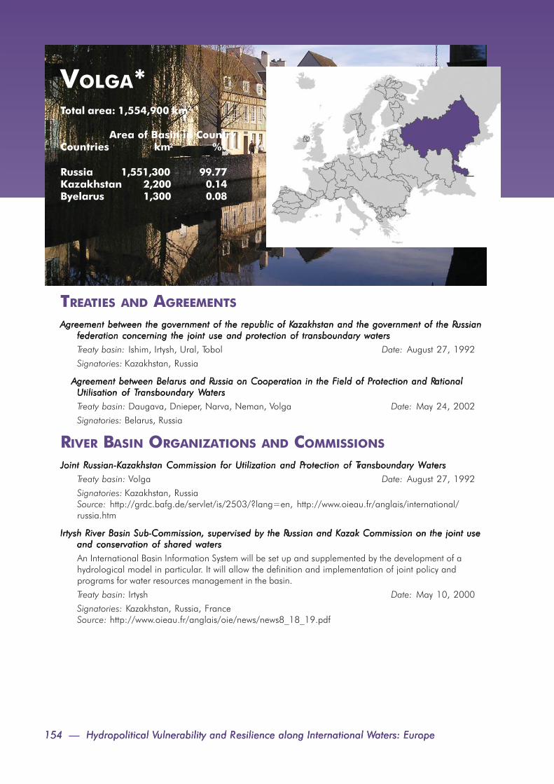
154 — Hydropolitical V154 — Hydropolitical V154 — Hydropolitical V154 — Hydropolitical V154 — Hydropolitical Vulnerability and Rulnerability and Rulnerability and Rulnerability and Rulnerability and Resilience along International Wesilience along International Wesilience along International Wesilience along International Wesilience along International Waters: Europeaters: Europeaters: Europeaters: Europeaters: Europe
VOLGA*Total area: 1,554,900 km2
Area of Basin in CountryCountries km2 %
Russia 1,551,300 99.77Kazakhstan 2,200 0.14Byelarus 1,300 0.08
TREATIES AND AGREEMENTS
Agreement between the government of the republic of KAgreement between the government of the republic of KAgreement between the government of the republic of KAgreement between the government of the republic of KAgreement between the government of the republic of Kazakhstan and the government of the Razakhstan and the government of the Razakhstan and the government of the Razakhstan and the government of the Razakhstan and the government of the Russianussianussianussianussianfederation concerning the joint use and protection of transboundary watersfederation concerning the joint use and protection of transboundary watersfederation concerning the joint use and protection of transboundary watersfederation concerning the joint use and protection of transboundary watersfederation concerning the joint use and protection of transboundary waters
Treaty basin: Ishim, Irtysh, Ural, Tobol Date: August 27, 1992
Signatories: Kazakhstan, Russia
Agreement between Belarus and RAgreement between Belarus and RAgreement between Belarus and RAgreement between Belarus and RAgreement between Belarus and Russia on Cooperation in the Fussia on Cooperation in the Fussia on Cooperation in the Fussia on Cooperation in the Fussia on Cooperation in the Field of Pield of Pield of Pield of Pield of Protection and Rrotection and Rrotection and Rrotection and Rrotection and RationalationalationalationalationalUtilisation of TUtilisation of TUtilisation of TUtilisation of TUtilisation of Transboundary Wransboundary Wransboundary Wransboundary Wransboundary Watersatersatersatersaters
Treaty basin: Daugava, Dnieper, Narva, Neman, Volga Date: May 24, 2002
Signatories: Belarus, Russia
RIVER BASIN ORGANIZATIONS AND COMMISSIONS
Joint RJoint RJoint RJoint RJoint Russian-Kussian-Kussian-Kussian-Kussian-Kazakhstan Commission for Utilization and Pazakhstan Commission for Utilization and Pazakhstan Commission for Utilization and Pazakhstan Commission for Utilization and Pazakhstan Commission for Utilization and Protection of Trotection of Trotection of Trotection of Trotection of Transboundary Wransboundary Wransboundary Wransboundary Wransboundary Watersatersatersatersaters
Treaty basin: Volga Date: August 27, 1992
Signatories: Kazakhstan, RussiaSource: http://grdc.bafg.de/servlet/is/2503/?lang=en, http://www.oieau.fr/anglais/international/russia.htm
Irtysh River Basin SubIrtysh River Basin SubIrtysh River Basin SubIrtysh River Basin SubIrtysh River Basin Sub-----Commission, supervised by the RCommission, supervised by the RCommission, supervised by the RCommission, supervised by the RCommission, supervised by the Russian and Kussian and Kussian and Kussian and Kussian and Kazak Commission on the joint useazak Commission on the joint useazak Commission on the joint useazak Commission on the joint useazak Commission on the joint useand conservation of shared watersand conservation of shared watersand conservation of shared watersand conservation of shared watersand conservation of shared waters
An International Basin Information System will be set up and supplemented by the development of ahydrological model in particular. It will allow the definition and implementation of joint policy andprograms for water resources management in the basin.
Treaty basin: Irtysh Date: May 10, 2000
Signatories: Kazakhstan, Russia, FranceSource: http://www.oieau.fr/anglais/oie/news/news8_18_19.pdf

Appendix 1. International Freshwater Agreements, Organizations, Commissions — 155Appendix 1. International Freshwater Agreements, Organizations, Commissions — 155Appendix 1. International Freshwater Agreements, Organizations, Commissions — 155Appendix 1. International Freshwater Agreements, Organizations, Commissions — 155Appendix 1. International Freshwater Agreements, Organizations, Commissions — 155
VUOKSATotal area: 62,700 km2
Area of Basin in CountryCountries km2 %
Finland 54,300 86.48Russia 8,500 13.52
TREATIES AND AGREEMENTS
Convention between the RConvention between the RConvention between the RConvention between the RConvention between the Republic of Fepublic of Fepublic of Fepublic of Fepublic of Finland and the Rinland and the Rinland and the Rinland and the Rinland and the Russian Socialist Fussian Socialist Fussian Socialist Fussian Socialist Fussian Socialist Federal Soviet Rederal Soviet Rederal Soviet Rederal Soviet Rederal Soviet Republic concerningepublic concerningepublic concerningepublic concerningepublic concerningthe maintenance of river channels and the regulation of fishing on water courses Fthe maintenance of river channels and the regulation of fishing on water courses Fthe maintenance of river channels and the regulation of fishing on water courses Fthe maintenance of river channels and the regulation of fishing on water courses Fthe maintenance of river channels and the regulation of fishing on water courses Forming Porming Porming Porming Porming Part of theart of theart of theart of theart of theFFFFFrontier Between Frontier Between Frontier Between Frontier Between Frontier Between Finland and Rinland and Rinland and Rinland and Rinland and Russiaussiaussiaussiaussia
Treaty basin: Tuulomanjoki, Luttojoki, Kutajoki,Tuntsajoki, Kutalahti, Tuntsajoki, Ulanganjoki, Pääjärvi,Paanajärvi, Pistojoki, Yla-Kuittijärvi, Kuusamon-järvi, Lieksa, Tuulijoki, Pielisjärvi, Lentiera, Lake Tuulijärvi,Tulenmananjoki, Lake Ladoga, Lake Tulenanjärvi, Date: October 28, 1922
Signatories: USSR, Finland
Agreement Agreement Agreement Agreement Agreement [Between F[Between F[Between F[Between F[Between Finland and the Union of Soviet Socialist Rinland and the Union of Soviet Socialist Rinland and the Union of Soviet Socialist Rinland and the Union of Soviet Socialist Rinland and the Union of Soviet Socialist Republics] Concerning Fepublics] Concerning Fepublics] Concerning Fepublics] Concerning Fepublics] Concerning FrontierrontierrontierrontierrontierWWWWWatercourses (with exchange of letters), Helsinkiatercourses (with exchange of letters), Helsinkiatercourses (with exchange of letters), Helsinkiatercourses (with exchange of letters), Helsinkiatercourses (with exchange of letters), Helsinki
Treaty basin: Frontier or shared waters Date: April 24, 1964
Signatories: Finland, USSR
Agreement between the Government of the RAgreement between the Government of the RAgreement between the Government of the RAgreement between the Government of the RAgreement between the Government of the Republic of Fepublic of Fepublic of Fepublic of Fepublic of Finland and the Government of the Union ofinland and the Government of the Union ofinland and the Government of the Union ofinland and the Government of the Union ofinland and the Government of the Union ofSoviet Socialist RSoviet Socialist RSoviet Socialist RSoviet Socialist RSoviet Socialist Republics concerning the production of electric power in the part of the Vepublics concerning the production of electric power in the part of the Vepublics concerning the production of electric power in the part of the Vepublics concerning the production of electric power in the part of the Vepublics concerning the production of electric power in the part of the Vuoksi riveruoksi riveruoksi riveruoksi riveruoksi riverbounded by the Imatra and Svetogorsk Hydroelectric Stationbounded by the Imatra and Svetogorsk Hydroelectric Stationbounded by the Imatra and Svetogorsk Hydroelectric Stationbounded by the Imatra and Svetogorsk Hydroelectric Stationbounded by the Imatra and Svetogorsk Hydroelectric Station
Treaty basin: Vuoksa Date: July 12, 1972Signatories: Russia, Finland
RIVER BASIN ORGANIZATIONS AND COMMISSIONS
Joint Commission for regulation of the rules for the lake Saimaa and the VJoint Commission for regulation of the rules for the lake Saimaa and the VJoint Commission for regulation of the rules for the lake Saimaa and the VJoint Commission for regulation of the rules for the lake Saimaa and the VJoint Commission for regulation of the rules for the lake Saimaa and the Vuoksa rivers (subbasins of theuoksa rivers (subbasins of theuoksa rivers (subbasins of theuoksa rivers (subbasins of theuoksa rivers (subbasins of theVVVVVuoksa Basin)uoksa Basin)uoksa Basin)uoksa Basin)uoksa Basin)Treaty basin: Vuoksa Date: October 26, 1989Signatories: Russia, FinlandSource: http://www.unece.org/env/water/documents/transbwatcoopnis_fin_e.pdf
FFFFFinnish-Rinnish-Rinnish-Rinnish-Rinnish-Russian Joint Commission on the Utilization of Fussian Joint Commission on the Utilization of Fussian Joint Commission on the Utilization of Fussian Joint Commission on the Utilization of Fussian Joint Commission on the Utilization of Frontier Wrontier Wrontier Wrontier Wrontier Watersatersatersatersaters
This cooperation provides an example of the benefits of sustained activities between two countries sharingcommon resources. Geographical Scope: The lakes, rivers, and streams intersected by the frontier line oralong which the frontier line runs. See http://
Treaty basin: Kemi, Olanga, Oulu, Pasvik, Tuloma, Vuoksa Date: 1964
Signatories: Finland, Russia
Source: www.inwent.org/ef-texte/vilnius/rep1199e.htm

156 — Hydropolitical V156 — Hydropolitical V156 — Hydropolitical V156 — Hydropolitical V156 — Hydropolitical Vulnerability and Rulnerability and Rulnerability and Rulnerability and Rulnerability and Resilience along International Wesilience along International Wesilience along International Wesilience along International Wesilience along International Waters: Europeaters: Europeaters: Europeaters: Europeaters: Europe
GENERAL
TREATIES AND AGREEMENTS
EU WEU WEU WEU WEU Water Fater Fater Fater Fater Framework Directiveramework Directiveramework Directiveramework Directiveramework Directive
The Directive establishes a framework for the Community action in the field of water policy. The EUWFDexpands the scope of water protection to all waters and sets a clear objectives that “good status” must beachieved for all European waters by 2015 and that sustainable water use is ensured throughout Europe.Members of the EU are bound to implement the Directive.
Treaty basin: Bann, Barta, Bidasoa, Castletown, Danube, Daugava, Dniester, Douro/Duero, Ebro, Elbe,Fane, Flurry, Garonne, Gauja, Glama, Guadiana, Isonzo, Kemi, Klaralven, Lake Prespa, Lava/Pregel,Lielupe, Lima, Maritsa, Mino, Naatamo, Narva, Neman, Nestos, Oder/Odra, Olanga, Oulu, Parnu,Pasvik, Po, Prohladnaja, Rhine, Rhone, Roia, Salaca, Schelde, Seine, Struma, Tagus/Tejo, Tana, Torne/Tornealven, Tuloma, Vardar, Venta, Vijose, Vistula/Wista, Vuoksa, Wiedau, YserDate: December 22, 2000
Signatories: Austria, Belgium, Cyprus, Czech Republic, Denmark, Estonia, Finland, France, Germany,Greece, Hungary, Ireland, Italy, Latvia, Lithuania, Luxembourg, Malta, the Netherlands, Poland, Portugal,Slovakia, Slovenia, Spain, Sweden, United Kingdom
UN/ECE protocol on water and health to the 1992 convention on the protection and use ofUN/ECE protocol on water and health to the 1992 convention on the protection and use ofUN/ECE protocol on water and health to the 1992 convention on the protection and use ofUN/ECE protocol on water and health to the 1992 convention on the protection and use ofUN/ECE protocol on water and health to the 1992 convention on the protection and use oftransboundary watercourses and international lakestransboundary watercourses and international lakestransboundary watercourses and international lakestransboundary watercourses and international lakestransboundary watercourses and international lakes
Treaty basin: Bann, Barta, Bidosoa, Castletown, Danube, Daugava, Dnieper, Dniester, Don, Douro/Duero, Drin, Ebro, Elancik, Elbe, Erne, Fane, Flurry, Foyle, Garonne, Gauja, Glama, Guadiana, Isonzo,Jacobs, Kemi, Klaralven, Kogilnik, Krka, Lake Prespa, Lava/Pregel, Lielupe, Lima, Maritsa, Mino, Mius,Naatamo, Narva, Neman, Neretva, Nestos, Oder/Odra, Olanga, Oulu, Parnu, Pasvik, Po, Prohladnaja,Rezvaya, Rhine, Rhone, Roia, Salaca, Sarata, Schelde, Seine, Struma, Tagus/Tejo, Tana, Torne/Tornealven, Tuloma, Vardar, Velaka, Venta, Vijose, Vistula/Wista, Volga, Vuoksa, Wiedau, Yser
Date: June 17, 1999
Signatories: Alabania, Armenia, Austria, Azerbaijan, Belarus, Belgium, Bulgaria, Croatia, Cyprus, CzechRepublic, Denmark, Estonia, Finland, France, Hungary, Germany, Greece, Ireland, Italy, Kazakhstan,Latvia, Lithuania, Luxembourg, Malta, the Netherlands, Norway, Poland, Portugal, Romania, Russia,Slovakia, Slovenia, Sweden, Republic of Moldova, Monaco, Slovenia, Spain, Sweden, Switzerland,United Kingdom

Appendix 1. International Freshwater Agreements, Organizations, Commissions — 157Appendix 1. International Freshwater Agreements, Organizations, Commissions — 157Appendix 1. International Freshwater Agreements, Organizations, Commissions — 157Appendix 1. International Freshwater Agreements, Organizations, Commissions — 157Appendix 1. International Freshwater Agreements, Organizations, Commissions — 157
Convention on environmental impact assessment in a transboundary context, EspooConvention on environmental impact assessment in a transboundary context, EspooConvention on environmental impact assessment in a transboundary context, EspooConvention on environmental impact assessment in a transboundary context, EspooConvention on environmental impact assessment in a transboundary context, Espoo
The Espoo (EIA) Convention sets out the obligations of Parties to assess the environmental impact of certainactivities at an early stage of planning. It also lays down the general obligation of States to notify and consulteach other on all major projects under consideration that are likely to have a significant adverse environmen-tal impact across borders.
Treaty basin: General Date: September 10, 1997
Signatories: Albania, Austria, Belarus, Belgium, Bulgaria, Canada, Czech Republic, Denmark, EuropeanCommunity, Finland, France, Germany, Greece, Hungary, Iceland, Ireland, Italy, Luxembourg, the Nether-lands, Norway, Poland, Portugal, Romania, Russian Federation, Slovakia, Spain, Sweden, Ukraine, UnitedKingdom of Great Britain and Northern Ireland, United States of America
Convention on the protection and use of transboundary watercourses and international lakes, HelsinkiniConvention on the protection and use of transboundary watercourses and international lakes, HelsinkiniConvention on the protection and use of transboundary watercourses and international lakes, HelsinkiniConvention on the protection and use of transboundary watercourses and international lakes, HelsinkiniConvention on the protection and use of transboundary watercourses and international lakes, Helsinkini
Treaty basin: Bann, Barta, Bidosoa, Castletown, Danube, Daugava, Dnieper, Dniester, Don, Douro/Duero,Drin, Ebro, Elancik, Elbe, Erne, Fane, Flurry, Foyle, Garonne, Gauja, Glama, Guadiana, Isonzo, Jacobs,Kemi, Klaralven, Kogilnik, Krka, Lake Prespa, Lava/Pregel, Lielupe, Lima, Maritsa, Mino, Mius, Naatamo,Narva, Neman, Neretva, Nestos, Oder/Odra, Olanga, Oulu, Parnu, Pasvik, Po, Prohladnaja, Rezvaya,Rhine, Rhone, Roia, Salaca, Sarata, Schelde, Seine, Struma, Tagus/Tejo, Tana, Torne/Tornealven, Tuloma,Vardar, Velaka, Venta, Vijose, Vistula/Wista, Volga, Vuoksa, Wiedau, Yser
Date: March 17, 1992
Signatories: Alabania, Armenia, Austria, Azerbaijan, Belarus, Belgium, Bulgaria, Croatia, Cyprus, CzechRepublic, Denmark, Estonia, Finland, France, Hungary, Germany, Greece, Ireland, Italy, Kazakhstan, Latvia,Lithuania, Luxembourg, Malta, the Netherlands, Norway, Poland, Portugal, Romania, Russia, Slovakia,Slovenia, Sweden, Republic of Moldova, Monaco, Slovenia, Spain, Sweden, Switzerland, United Kingdom
Convention on wetlands of international importance especially as waterfowl habitat (Ramsar) 1971 andConvention on wetlands of international importance especially as waterfowl habitat (Ramsar) 1971 andConvention on wetlands of international importance especially as waterfowl habitat (Ramsar) 1971 andConvention on wetlands of international importance especially as waterfowl habitat (Ramsar) 1971 andConvention on wetlands of international importance especially as waterfowl habitat (Ramsar) 1971 andPPPPProtocol 1972rotocol 1972rotocol 1972rotocol 1972rotocol 1972
The Convention on Wetlands is an intergovernmental treaty which provides the framework for national actionand international cooperation for the conservation and wise use of wetlands and their resources. There arepresently 146 Contracting Parties to the Convention, with 1436 wetland sites, totaling 125.1 million hect-ares, designated for inclusion in the Ramsar List of Wetlands of International Importance.
Treaty basin: General Date: February 02, 1971
Signatories: 145 parties signed. The European signatories are: Albania, Algeria, Austria, Belarus, Belgium,Bosnia and Herzegovina, Bulgaria, Croatia, Cyprus, Czech Republic, Denmark, Estonia, Finland, France,Georgia, Germany, Greece, Hungary, Iceland, Ireland, Israel, Italy, Latvia, Liechtenstein, Lithuania, Luxem-bourg, Malta, Monaco, Netherlands, Norway, Poland, Portugal, Republic of Moldova, Romania, RussianFederation, Serbia and Montenegro, Slovak Republic, Slovenia, Spain, Sweden, Switzerland, Ukraine, UnitedKingdom, Uzbekistan, former USSR
TTTTTreaty between Belgium, the Freaty between Belgium, the Freaty between Belgium, the Freaty between Belgium, the Freaty between Belgium, the Federal Rederal Rederal Rederal Rederal Republic of Germanyepublic of Germanyepublic of Germanyepublic of Germanyepublic of Germany, F, F, F, F, France, Italyrance, Italyrance, Italyrance, Italyrance, Italy, L, L, L, L, Luxembourg and theuxembourg and theuxembourg and theuxembourg and theuxembourg and theNetherlands instituting the European Community of the ANetherlands instituting the European Community of the ANetherlands instituting the European Community of the ANetherlands instituting the European Community of the ANetherlands instituting the European Community of the A tomic Energy (EURAtomic Energy (EURAtomic Energy (EURAtomic Energy (EURAtomic Energy (EURATTTTTOM)OM)OM)OM)OM)Euratom calls for support for nuclear power across the EU and is the only Treaty which supports the develop-ment of a particular energy source.
Treaty basin: General Date: March 25, 1957
Signatories: Belgium, Germany, France, Italy, Luxembourg, the Netherlands

158 — Hydropolitical V158 — Hydropolitical V158 — Hydropolitical V158 — Hydropolitical V158 — Hydropolitical Vulnerability and Rulnerability and Rulnerability and Rulnerability and Rulnerability and Resilience along International Wesilience along International Wesilience along International Wesilience along International Wesilience along International Waters: Europeaters: Europeaters: Europeaters: Europeaters: Europe
APPENDIX 2. NOTES ON BASINS
DANUBEDisputes are ongoing between Bosnia-Herzegovina and Serbia, over Serbian populated areas. According tothe Serbian Republic of Bosnia-Herzegovina (SRBH), the external boundaries are marked by the Una river inthe west, the Sava river in the north, the state boundary with the Federal Republic of Yugoslavia in the east,and Croatia and the Serbian Republic Krajina in the south (CIA World Factbook, 2007; IBRU, 1999).
Eastern Slavonia, which was held by Serbs during the ethnic conflict in the former Yugoslavia, was returned toCroatian control by the UN Transitional Administration for Eastern Slavonia on January 15, 1998 (CIA WorldFactbook, 2007).Under an International Court of Justice (ICJ) ruling, Hungary and Slovakia were to agree on the future of theGabcikovo Dam complex by March 1998. The dispute, however, has yet to be resolved. Completion of thedam system would alter the boundaries between Hungary and Slovakia established under the 1920 Treaty ofTrianon (CIA World Factbook, 2007; IBRU, 1999).
DAUGAVABorder problems between Byelarus and Lithuania in part lie in the fact that the new boundary is different fromthe old Soviet administrative division between the two republics. Areas of dispute include the land around theAdutiskis railway station and the Druskininkai resort claimed by Byelarus. Demarcation of the boundarybetween Byelarus and Lithuania is underway (CIA World Factbook, 2007; IBRU 1999).
The 1997 boundary agreement Lithuania and Russia remains to be ratified (CIA World Factbook, 2007).
DNIESTERRomania considers certain territories of Moldova and Ukraine-including Bessarabia (45,600 km2) andNorthern Bukovina-as historically part of Romania. This territory was incorporated into the former SovietUnion following the Molotov-Ribbentrop Pact in 1940 (CIA World Factbook, 2007; Columbia Gazetteer,1998).
ENNINGSDALSELVA
No basin area data was available.
NARVAThe December 1996 technical boundary agreement reached between Estonian and Russian negotiatorsremains to be ratified. Estonia claimed over 2,000 km2 of territory in the Narva and Pechory regions ofRussia-based on the boundary established under the 1920 Peace Treaty of Tartu (CIA World Factbook,2007).
Latvia claimed the Abrene/Pytalovo section of the border ceded by the Latvian Soviet Socialist Republic toRussia in 1944, based on the 1920 Treaty of Riga. A draft treaty delimiting the boundary between Latvia andRussia has not been signed. The Abrene/Pytalovo region is crossed by the Utroya River, a tributary of theVclikaya river (CIA World Factbook, 2007; Columbia Gazetteer, 1998).
NEMANBorder problems between Byelarus and Lithuania in part lie in the fact that the new boundary is different fromthe old Soviet administrative division between the two republics. Areas of dispute include the land around theAdutiskis railway station and the Druskininkai resort claimed by Byelarus. Demarcation of the boundarybetween Byelarus and Lithuania is underway (CIA World Factbook, 2007; IBRU 1999).
The 1997 boundary agreement Lithuania and Russia remains to be ratified (CIA World Factbook, 2007).
RHINEWhile the Meuse basin is topographically part of the Rhine basin, European nations treat it as a politicallyseparate basin (Huisman, de Jong, and Wieriks, 1998).
SARATARomania considers certain territories of Moldova and Ukraine-including Bessarabia (45,600 km2) andNorthern Bukovina-as historically part of Romania. This territory was incorporated into the former SovietUnion following the Molotov-Ribbentrop Pact in 1940 (CIA World Factbook, 2007; Columbia Gazetteer,1998).
STRUMAThe boundary commission formed by Serbia and Montenegro, and the Former Yugoslav Republic ofMacedonia in April 1996 to resolve differences in delineation of their mutual boundary has made noprogress so far (CIA World Factbook, 2007).
VARDARThe boundary commission formed by Serbia and Montenegro, and the Former Yugoslav Republic ofMacedonia in April 1996 to resolve differences in delineation of their mutual boundary has made noprogress so far (CIA World Factbook, 2007).
VOLGAThe boundaries of the Caspian Sea remain to be determined among Azerbaijan, Iran, Kazakhstan, Russia,and Turkmenistan (CIA World Factbook, 2007).
Appendix 2. Notes on Basins — 159Appendix 2. Notes on Basins — 159Appendix 2. Notes on Basins — 159Appendix 2. Notes on Basins — 159Appendix 2. Notes on Basins — 159

160 — Hydropolitical V160 — Hydropolitical V160 — Hydropolitical V160 — Hydropolitical V160 — Hydropolitical Vulnerability and Rulnerability and Rulnerability and Rulnerability and Rulnerability and Resilience along International Wesilience along International Wesilience along International Wesilience along International Wesilience along International Waters: Europeaters: Europeaters: Europeaters: Europeaters: Europe
APPENDIX 3. RIPARIAN COUNTRYCOLLABORATIONS
DANUBE
UNDP/GEF Danube regional project (DRP)UNDP/GEF Danube regional project (DRP)UNDP/GEF Danube regional project (DRP)UNDP/GEF Danube regional project (DRP)UNDP/GEF Danube regional project (DRP)
The DPR aims to reinforce regional cooperation of the Danube countries and support development of na-tional policies and legislation and the definition of priority actions for pollution control in order to ensurecommon approach to protection of international waters, sustainable management of natural resources andbiodiversity. The DPR is implementing 22 project components in total.
Participating countries: Bosnia and Herzegovina, Bulgaria, Croatia, Czech Republic, Hungary, Moldova,Romania, Slovakia, Slovenia, Serbia and Montenegro, Ukraine Date: 2001-2006
Level/Type of Collaboration: Official/Environmental program
Principal Issue: Water quality, joint managementSource: http://www.undp-drp.org/jart/projects/unodp/intro2.html
GEF IW project: Strategic PGEF IW project: Strategic PGEF IW project: Strategic PGEF IW project: Strategic PGEF IW project: Strategic Partnership for Nutrient Rartnership for Nutrient Rartnership for Nutrient Rartnership for Nutrient Rartnership for Nutrient Reduction in the Danube River and Black Sea - Weduction in the Danube River and Black Sea - Weduction in the Danube River and Black Sea - Weduction in the Danube River and Black Sea - Weduction in the Danube River and Black Sea - WorldorldorldorldorldBankBankBankBankBank-----GEF Nutrient RGEF Nutrient RGEF Nutrient RGEF Nutrient RGEF Nutrient Reduction Investment Feduction Investment Feduction Investment Feduction Investment Feduction Investment Fund: Tund: Tund: Tund: Tund: Tranche 3.ranche 3.ranche 3.ranche 3.ranche 3.The World Bank-GEF Investment Fund (IF) is the investment arm of the GEF Strategic Partnership on theBlack Sea/Danube Basin which also funds two regional projects, the Black Sea Ecosystem Recovery Projectfor the Black Sea littoral countries and the Danube Regional Project in the Danube Basin, both focusingmainly on capacity building activities.
Participating countries: Belarus, Bosnia-Herzegovina, Bulgaria, Croatia, Czech Republic, Georgia, Hungary,Moldova, Romania, Russia, Serbia and Montenegro, Slovak Republic, Slovenia, Turkey, Ukraine
Date: Approved in 2003
Level/Type of Collaboration: Official/Environmental program
Principal Issue: Water quality, joint management
Source: http://www.gefonline.org/projectDetails.cfm?projID=2044
GEF IW project: Danube/Black Sea Strategic PGEF IW project: Danube/Black Sea Strategic PGEF IW project: Danube/Black Sea Strategic PGEF IW project: Danube/Black Sea Strategic PGEF IW project: Danube/Black Sea Strategic Partnership - Nutrient Rartnership - Nutrient Rartnership - Nutrient Rartnership - Nutrient Rartnership - Nutrient Reduction Investment Feduction Investment Feduction Investment Feduction Investment Feduction Investment Fund: Tund: Tund: Tund: Tund: Tranche 2ranche 2ranche 2ranche 2ranche 2
The GEF World Bank Investment Fund (IF) is the investment arm of the GEF Strategic Partnership on the BlackSea/Danube Basin which also funds two regional projects, one in Black Sea littoral countries and one in theDanube Basin, focusing on capacity building activities.
Participating countries: Belarus, Bosnia-Herzegovina, Bulgaria, Croatia, Czech Republic, Georgia, Hungary,Moldova, Russia, Slovak Republic, Slovenia, Turkey, Ukraine, Romania Date: Approved in 2002
Level/Type of Collaboration: Official/Environmental programPrincipal Issue: Water quality, joint management
Source: See http://www.gefonline.org/projectDetails.cfm?projID=1661
GEF IW project: TGEF IW project: TGEF IW project: TGEF IW project: TGEF IW project: Transfer of Environmentallyransfer of Environmentallyransfer of Environmentallyransfer of Environmentallyransfer of Environmentally----- sound Tsound Tsound Tsound Tsound Technology (TEST) to Rechnology (TEST) to Rechnology (TEST) to Rechnology (TEST) to Rechnology (TEST) to Reduce Teduce Teduce Teduce Teduce Transboundary Pransboundary Pransboundary Pransboundary Pransboundary Pollutionollutionollutionollutionollutionin the Danube River Basinin the Danube River Basinin the Danube River Basinin the Danube River Basinin the Danube River BasinThe project’s objective is to build capacity in existing cleaner production institutions to apply the UNIDO testprocedure. The project will demonstrate ways to reduce pollution while remaining financially viable. Theproject includes the transfer of this technology to 20 pilot enterprises that are contributing to transboundarypollution, primarily nutrients, in the Danube River basin and Black Sea.

Appendix 3. Riparian Country Collaborations — 161Appendix 3. Riparian Country Collaborations — 161Appendix 3. Riparian Country Collaborations — 161Appendix 3. Riparian Country Collaborations — 161Appendix 3. Riparian Country Collaborations — 161
Participating countries: Bulgaria, Croatia, Hungary, Romania, Slovak RepublicLevel/Type of Collaboration:Official/Environmental program Date: 2000-2003
Principal Issue: Water quality, joint management
Source: http://www.gefonline.org/projectDetails.cfm?projID=867
GEF IW project: Danube/Black Sea Basin Strategic PGEF IW project: Danube/Black Sea Basin Strategic PGEF IW project: Danube/Black Sea Basin Strategic PGEF IW project: Danube/Black Sea Basin Strategic PGEF IW project: Danube/Black Sea Basin Strategic Partnership on Nutrient Rartnership on Nutrient Rartnership on Nutrient Rartnership on Nutrient Rartnership on Nutrient Reduction, Teduction, Teduction, Teduction, Teduction, Tranche Iranche Iranche Iranche Iranche I
This is Strategic Partnership consisting of capital investments, economic instruments, development andenforcement of environmental law and policy, strengthening of public participation, and monitoring of trendsand compliance for the countries of the Danube/Black Sea basin.
Participating countries: Bulgaria, Romania, Georgia, Turkey, Russia, Ukraine, Czech Republic, SlovakRepublic, Hungary, Slovenia, Croatia, Moldova, Bosnia-Herzegovina, Serbia and Montenegro
Date: 2001-2007
Level/Type of Collaboration: Official/Environmental program
Principal Issue: Water quality, joint management
Source: http://www.gefonline.org/projectDetails.cfm?projID=1014
GEF IW project: Strengthening the Implementation Capacities for Nutrient RGEF IW project: Strengthening the Implementation Capacities for Nutrient RGEF IW project: Strengthening the Implementation Capacities for Nutrient RGEF IW project: Strengthening the Implementation Capacities for Nutrient RGEF IW project: Strengthening the Implementation Capacities for Nutrient Reduction and Teduction and Teduction and Teduction and Teduction and TransboundaryransboundaryransboundaryransboundaryransboundaryCooperation in the Danube River Basin-Phase I PCooperation in the Danube River Basin-Phase I PCooperation in the Danube River Basin-Phase I PCooperation in the Danube River Basin-Phase I PCooperation in the Danube River Basin-Phase I Project Short Troject Short Troject Short Troject Short Troject Short Title: Danube Ritle: Danube Ritle: Danube Ritle: Danube Ritle: Danube Regional Pegional Pegional Pegional Pegional Project Phase 1roject Phase 1roject Phase 1roject Phase 1roject Phase 1
The overall objective of this project is to complement and support the activities of the Danube Commission(ICPDR).
Participating countries: Czech Republic, Slovak Republic, Hungary, Slovenia, Croatia, Bosnia-Herzegovina,Bulgaria, Romania, Moldova, Ukraine, Serbia and Montenegro Date: July 2001-July 2006Level/Type of Collaboration: Official/Environmental program
Principal Issue: Water quality, joint management
Source: http://www.gefonline.org/projectDetails.cfm?projID=1460
GEF IW project: Strengthening the Implementation Capacities for Nutrient RGEF IW project: Strengthening the Implementation Capacities for Nutrient RGEF IW project: Strengthening the Implementation Capacities for Nutrient RGEF IW project: Strengthening the Implementation Capacities for Nutrient RGEF IW project: Strengthening the Implementation Capacities for Nutrient Reduction and Teduction and Teduction and Teduction and Teduction and TransboundaryransboundaryransboundaryransboundaryransboundaryCooperation in the Danube River Basin (TCooperation in the Danube River Basin (TCooperation in the Danube River Basin (TCooperation in the Danube River Basin (TCooperation in the Danube River Basin (Tranche 2)ranche 2)ranche 2)ranche 2)ranche 2)
The overall objective of the Danube Regional Project is to complement the activities of the ICPDR required toprovide a regional approach and global significance to the development of national policies and legislationand the definition of priority actions for nutrient reduction and pollution control with particular attention toachieving sustainable transboundary ecological effects within the DRB and the Black Sea area. Taking intoaccount the basic orientations of the Danube/Black Sea Basin Programmatic Approach, the Danube Re-gional Project, in its Phases 1 and 2, shall facilitate implementation of the Danube River Protection Conven-tion in providing a framework for coordination, dissemination and replication of successful demonstration thatwill be developed through investment projects (World Bank-GEF Strategic Partnership, EBRD, EU programmesfor accession.
Participating countries: Czech Republic, Slovak Republic, Hungary, Slovenia, Croatia, Bosnia-Herzegovina,Serbia and Montenegro, Bulgaria, Romania, Moldova, Ukraine
Date: December 2003-November 2006
Level/Type of Collaboration: Official/Environmental program
Principal Issue: Water quality, joint management
Source: http://www.gefonline.org/projectDetails.cfm?projID=2042
GEF IW project: Building Environmental Citizenship to Support TGEF IW project: Building Environmental Citizenship to Support TGEF IW project: Building Environmental Citizenship to Support TGEF IW project: Building Environmental Citizenship to Support TGEF IW project: Building Environmental Citizenship to Support Transboundary Pransboundary Pransboundary Pransboundary Pransboundary Pollution Rollution Rollution Rollution Rollution Reduction in theeduction in theeduction in theeduction in theeduction in theDanube: A PDanube: A PDanube: A PDanube: A PDanube: A Pilot Pilot Pilot Pilot Pilot Projectrojectrojectrojectroject
The project will be designed to help countries operationalize information access and public participation in amanner that advances the goals of reducing toxics and nutrients discharges to the Danube River Basin.Participating countries: Hungary, Slovenia Date: February 2000-August 2001
Level/Type of Collaboration: Official/Environmental program
Principal Issue: Water quality, joint management
Source: http://www.gefonline.org/projectDetails.cfm?projID=806
WWF project: DanubeWWF project: DanubeWWF project: DanubeWWF project: DanubeWWF project: Danube-----Carpathian PCarpathian PCarpathian PCarpathian PCarpathian Programmerogrammerogrammerogrammerogramme
Program aims: to promote the conservation, restoration and sustainable management of nature for the benefitof both people and environment. The work is primarily focused on freshwater and forest resources in theDanube River Basin and Carpathian Mountains.

162 — Hydropolitical V162 — Hydropolitical V162 — Hydropolitical V162 — Hydropolitical V162 — Hydropolitical Vulnerability and Rulnerability and Rulnerability and Rulnerability and Rulnerability and Resilience along International Wesilience along International Wesilience along International Wesilience along International Wesilience along International Waters: Europeaters: Europeaters: Europeaters: Europeaters: Europe
Participating countries: Romania, Bulgaria, Hungary, Slovakia, Slovenia, Austria, the Czech Republic,Germany and Poland, Ukraine, the Republic of Moldova, Serbia & Montenegro, Croatia and Bosnia &Herzegovina Date: 1998
Level/Type of Collaboration: Non-official/Environmental program
Principal Issue: Water quality, joint management
Source: http://www.panda.org/about_wwf/where_we_work/europe/where/danube_carpathian/about_the_programme.cfm
Danube Environmental FDanube Environmental FDanube Environmental FDanube Environmental FDanube Environmental Forum (DEF)orum (DEF)orum (DEF)orum (DEF)orum (DEF)
The DEF is a network of environmental non-governmental organisations working on nature protection indifferent parts of the River Danube’s watershed area. The aim of this site is to make available to the public allinformation relating to the environment within the Danube’s catchment and to report on the activities of theDEF. The DEF was created as a Danube River Basin-wide platform of non-governmental, non-profit, politi-cally independent, environmental organisations, in order to establish a common approach for the environ-mental protection of the Danube river. Since 1999 the DEF has also had observer status with the ICPDR.
Participating countries: Austria, Bosnia and Herzegovina, Bulgaria, Croatia, Czech Republic, Germany,Hungary, Moldova, Romania, Serbia and Montenegro, Slovakia, Slovenia, Ukraine Date: 1999
Level/Type of Collaboration: Non-official/International initiative
Principal Issue: Water quality, other: research and education
Source: http://www.de-forum.org
DANUBE - TISZA SUBBASIN
WWF/DEF project: PWWF/DEF project: PWWF/DEF project: PWWF/DEF project: PWWF/DEF project: Public Information and Public Information and Public Information and Public Information and Public Information and Participation Participation Participation Participation Participation Programmerogrammerogrammerogrammerogramme
DEF national focal points in Romania, Yugoslavia and Bulgaria and partners in Hungary and Ukrainemanage public information and awareness activities at the national level. They provide and collect informa-tion from stakeholders in local communities and disseminate information on the Baia Mare Task Force withintheir countries.
Source: http://www.tisaforum.org.yu/defyu/engl/program-wwf.htm
Participating countries: Bulgaria, Hungary, Romania, Ukraine and Yugoslavia
Date: July 15, 2000-May 31, 2001
Level/Type of Collaboration: Non-official/Environmental program
Principal Issue: Joint management, other: research and education
RAMSAR cooperationRAMSAR cooperationRAMSAR cooperationRAMSAR cooperationRAMSAR cooperation
Joint designation of portions of the Tisza (Tisa) River as a transboundary Ramsar Wetland of InternationalImportance.
Participating countries: Hungary, Slovakia Date: December 4, 2004Level/Type of Collaboration: Non-official/Environmental program
Principal Issue: Water quality, joint management
Source: http://www.ramsar.org/wn/w.n.tisza_transboundary.htm
River Basin Management Plan for the TRiver Basin Management Plan for the TRiver Basin Management Plan for the TRiver Basin Management Plan for the TRiver Basin Management Plan for the Tisza river supporting sustainable development of the regionisza river supporting sustainable development of the regionisza river supporting sustainable development of the regionisza river supporting sustainable development of the regionisza river supporting sustainable development of the region
The countries agreed to cooperate more closely in the framework of the ICPDR in order to produce aTiszaRiver Basin Management Plan by 2009 aiming at the objectives set by the EU Water Framework Directive asimplemented through the Danube River Protection Convention and the ICPDR Flood action Programme andthereby complementing the efforts of the ICPDR, the bilateral co-ordination and the national level.
Participating countries: Hungary, Romania, Serbia and Montenegro, Slovakia Republic, and Ukraine
Date: 2004-2009
Level/Type of Collaboration: Official/Environmental program
Principal Issue: Water quality, water quantity, flood control/relief, joint management
Source: http://www.icpdr.org/pls/danubis/docs/folder/HOME/ICPDR/ICPDR_DOC_CENTRE/ICPDR_BASIC_DOCS/LEGAL_POLICY/FINAL+-+TISZA+-+MOU+-+SIGNATURE.PDF

Appendix 3. Riparian Country Collaborations — 163Appendix 3. Riparian Country Collaborations — 163Appendix 3. Riparian Country Collaborations — 163Appendix 3. Riparian Country Collaborations — 163Appendix 3. Riparian Country Collaborations — 163
DANUBE - SAVA SUBBASIN
Sava River Basin: Sustainable use, Management and protection of resources (SARIB)Sava River Basin: Sustainable use, Management and protection of resources (SARIB)Sava River Basin: Sustainable use, Management and protection of resources (SARIB)Sava River Basin: Sustainable use, Management and protection of resources (SARIB)Sava River Basin: Sustainable use, Management and protection of resources (SARIB)
The EU-funded STREP “SARIB” is a three year international research project between research institutes fromthe Balkan countries (Slovenia, Croatia, Bosnia and Herzegovina, Serbia and Montenegro), Italy, Austria andNorway. This multidisciplinary project was initiated August 2004 and aims to facilitate the development ofmethods, exchange of knowledge and establishment of a regional monitoring system for the Sava River.
Participating countries: Bosnia and Herzegovina, Croatia, Slovenia and Serbia Date: 2004-2007
Level/Type of Collaboration: Official/Environmental program
Principal Issue: Water quality, joint management
Source: http://www.niva.no/symfoni/infoportal/PUBLIKASJON.NSF/redirect?ReadForm&Url=http://www.niva.no/symfoni/infoportal/PUBLIKASJON.NSF/0/414277F65F146083C1256FD600297573?OpenDocument
DNIEPER
GEF IW project: PGEF IW project: PGEF IW project: PGEF IW project: PGEF IW project: Preparation of A Strategic Areparation of A Strategic Areparation of A Strategic Areparation of A Strategic Areparation of A Strategic Action Pction Pction Pction Pction Programme (SAP) for the Dnieper River Basin androgramme (SAP) for the Dnieper River Basin androgramme (SAP) for the Dnieper River Basin androgramme (SAP) for the Dnieper River Basin androgramme (SAP) for the Dnieper River Basin andDevelopment of SAP Implementation MechanismsDevelopment of SAP Implementation MechanismsDevelopment of SAP Implementation MechanismsDevelopment of SAP Implementation MechanismsDevelopment of SAP Implementation Mechanisms
The long-term objectives of the project are to remedy the serious environmental effects of pollution andhabitat degradation in the Dnieper River Basin, to ensure sustainable use of its resources, and to protectbiodiversity in the basin. This will be catalyzed through the development of both a regional Strategic ActionProgramme (SAP) as well as individual National Action Programmes (NAP) outlining country and donorcommitments to baseline and additional preventive and remedial actions on behalf of the basin.
Participating countries: Belarus, Russia, Ukraine Date: 1998-2001
Level/Type of Collaboration: Official/Environmental program
Principal Issue: Water quality, joint management
Source: http://www.gefonline.org/projectDetails.cfm?projID=460
UNDPUNDPUNDPUNDPUNDP-----GEF project: the Dnipro Basin Environment PGEF project: the Dnipro Basin Environment PGEF project: the Dnipro Basin Environment PGEF project: the Dnipro Basin Environment PGEF project: the Dnipro Basin Environment Programrogramrogramrogramrogram
The long-term objectives of the project are to remedy the serious environmental effects of pollution andhabitat degradation in the Dnipro River Basin, to ensure sustainable use of its resources, and to protectbiodiversity in the basin. The direct output will be the development of a Strategic Action Plan (SAP) to managethe river in cooperation with the other Dnipro nations, Russia and Belarus. The program’s overall objective isto remedy the serious environmental effects of pollution and habitat degradation and contribute to theprotection of its regional and global international waters. This project is part of the GEF Black Sea BasinStrategic Approach. Note: An interim phase leading to a second stage of the Program is expected commenceApril 1, 2005.
Participating countries: Belarus, Russia and Ukraine Date: September 1, 2000-March 31, 2005Level/Type of Collaboration: Official/Environmental program
Principal Issue: Water quality, joint management
Source: http://www.dnipro-gef.net/
DNIEPER - PIRPYAT SUBBASIN
TTTTTACIS project: PACIS project: PACIS project: PACIS project: PACIS project: Pilot Pilot Pilot Pilot Pilot Project on Troject on Troject on Troject on Troject on Transboundary Wransboundary Wransboundary Wransboundary Wransboundary Water Quality Monitoring and Assessment in Order toater Quality Monitoring and Assessment in Order toater Quality Monitoring and Assessment in Order toater Quality Monitoring and Assessment in Order toater Quality Monitoring and Assessment in Order toImplement PImplement PImplement PImplement PImplement Provisions of International Lrovisions of International Lrovisions of International Lrovisions of International Lrovisions of International Legal Regal Regal Regal Regal Regulationsegulationsegulationsegulationsegulations
This project, funded by the European Commission Tacis Inter-State 1999 Programme, is concerned with themonitoring of transboundary waters in four international rivers: the Kura, the Seversky-Donetz, the Tobol andthe Pripyat.
Participating countries: Ukraine, Belarus Date: 2002-2004
Level/Type of Collaboration: Official/Environmental programPrincipal Issue: Water quality, joint management
Source: http://www.jointrivers.org/eng/

164 — Hydropolitical V164 — Hydropolitical V164 — Hydropolitical V164 — Hydropolitical V164 — Hydropolitical Vulnerability and Rulnerability and Rulnerability and Rulnerability and Rulnerability and Resilience along International Wesilience along International Wesilience along International Wesilience along International Wesilience along International Waters: Europeaters: Europeaters: Europeaters: Europeaters: Europe
DNIESTER
OSCE / UNECE project: TOSCE / UNECE project: TOSCE / UNECE project: TOSCE / UNECE project: TOSCE / UNECE project: Transboundary Cooperation and Sustainable Management of the Dniester Riverransboundary Cooperation and Sustainable Management of the Dniester Riverransboundary Cooperation and Sustainable Management of the Dniester Riverransboundary Cooperation and Sustainable Management of the Dniester Riverransboundary Cooperation and Sustainable Management of the Dniester River
The project has been launched to enhance regional cooperation between the Dniester riparian states,Ukraine, and Moldova, including its Transdniestrian region. The project also aims to draw internationalattention to the problems in the river basin.
Participating countries: Moldova, Ukraine Date: May 2004-October 2005
Level/Type of Collaboration: Official/Environmental program
Principal Issue: Water quality, joint management
Source: http://www.dniester.org/
EcoEcoEcoEcoEco-----TIRAS project (in partnership with PTIRAS project (in partnership with PTIRAS project (in partnership with PTIRAS project (in partnership with PTIRAS project (in partnership with Polish and Ukrainian NGOs): the Dniesterolish and Ukrainian NGOs): the Dniesterolish and Ukrainian NGOs): the Dniesterolish and Ukrainian NGOs): the Dniesterolish and Ukrainian NGOs): the Dniester-----Odra project, a jointOdra project, a jointOdra project, a jointOdra project, a jointOdra project, a jointproject for Dniesterproject for Dniesterproject for Dniesterproject for Dniesterproject for Dniester
The project entailed a co-operation of NGOs, local and state authorities for the protection of large Europeanrivers, which had the aim to transfer know how of integrated transboundary river basin management from theOdra to the Dniester River.
Participating countries: Moldova, Poland, Ukraine Date: 2004Level/Type of Collaboration: Official/Environmental program
Principal Issue: Water quality, joint management
Source: http://www.eco-tiras.org/news.htm
EcoEcoEcoEcoEco-----TIRASTIRASTIRASTIRASTIRAS, the International Environmental Association of River K, the International Environmental Association of River K, the International Environmental Association of River K, the International Environmental Association of River K, the International Environmental Association of River Keeperseeperseeperseeperseepers
Created by environmental NGOs of the Dniester River basin, shared by Moldova and Ukraine, to help andadvice authorities and population to manage the river in sustainable way, using Integrated River BasinManagement Approach.
Participating countries: Moldova, Ukraine Date: October 10, 1999
Level/Type of Collaboration: Non-official/International initiative
Principal Issue: Water quality
Source: http://www.eco-tiras.org/news.htm
DON - SEVERSKY-DONETZ SUBBASIN
TTTTTACIS project: PACIS project: PACIS project: PACIS project: PACIS project: Pilot Pilot Pilot Pilot Pilot Project on Troject on Troject on Troject on Troject on Transboundary Wransboundary Wransboundary Wransboundary Wransboundary Water Quality Monitoring and Assessment in Order toater Quality Monitoring and Assessment in Order toater Quality Monitoring and Assessment in Order toater Quality Monitoring and Assessment in Order toater Quality Monitoring and Assessment in Order toImplement PImplement PImplement PImplement PImplement Provisions of International Lrovisions of International Lrovisions of International Lrovisions of International Lrovisions of International Legal Regal Regal Regal Regal Regulationsegulationsegulationsegulationsegulations
This project, funded by the European Commission Tacis Inter-State 1999 Programme, is concerned with themonitoring of transboundary waters in four international rivers: the Kura, the Seversky-Donetz, the Tobol andthe Pripyat.
Participating countries: Russia, Ukraine Date: 2002-2004
Level/Type of Collaboration: Official/Environmental program
Principal Issue: Water quality, joint management
Source: http://www.jointrivers.org/eng/
ELBE
EUEUEUEUEU-P-P-P-P-Project “Integrated Management of Wroject “Integrated Management of Wroject “Integrated Management of Wroject “Integrated Management of Wroject “Integrated Management of Wetlands” (WETLANDS)etlands” (WETLANDS)etlands” (WETLANDS)etlands” (WETLANDS)etlands” (WETLANDS)The goal of this project is the reclamation, the conservation, as well as the balanced, sustainable, andeconomic use of wetlands. The term wetlands is used in a broad sense, and includes lakes, banks andfloodplains of rivers, coastal waters, lagoons, and swamps.
Participating countries: Germany, Italy, Poland Date: 1998-2001
Level/Type of Collaboration: Official/Environmental program
Principal Issue: Water quality, joint management
Source: http://www.regione.emilia-romagna.it/wetlands/indexengl.htm

Appendix 3. Riparian Country Collaborations — 165Appendix 3. Riparian Country Collaborations — 165Appendix 3. Riparian Country Collaborations — 165Appendix 3. Riparian Country Collaborations — 165Appendix 3. Riparian Country Collaborations — 165
EUEUEUEUEU-P-P-P-P-Project “Integrated Management of Wroject “Integrated Management of Wroject “Integrated Management of Wroject “Integrated Management of Wroject “Integrated Management of Wetlands (followetlands (followetlands (followetlands (followetlands (follow-up) (WETLANDS II)-up) (WETLANDS II)-up) (WETLANDS II)-up) (WETLANDS II)-up) (WETLANDS II)
The main purpose of WETLANDS II is the improvement of the operative management of wetlands, throughcapacity building and pilot projects in the partners’ territories, always with the same objective to reach anintegrated management standard, that takes into account the protection of these natural areas as well as thepopulations’ right to live and develop near and with these wetlands.
Participating countries: Germany, Italy, Poland Date: 2003-2005
Level/Type of Collaboration: Official/Environmental program
Principal Issue: Water quality, joint management
Source: http://www.wetlandsmanagement.org/
LAKE PRESPA - LAKE OHRID SUBBASIN
GEF IW project: Lake Ohrid ManagementGEF IW project: Lake Ohrid ManagementGEF IW project: Lake Ohrid ManagementGEF IW project: Lake Ohrid ManagementGEF IW project: Lake Ohrid ManagementIn order to protect the natural resources of Lake Ohrid, like fisheries, and the economic activities associatedwith the Lake, like tourism, GEF funds will assist the two nations sharing this lake.
Participating countries: Albania, Macedonia Date: April 1997-April 2000
Level/Type of Collaboration: Official/Environmental program
Principal Issue: Water quality, joint management
Source: http://www.gefonline.org/projectDetails.cfm?projID=113
Institute for Sustainable Communities (ISC) project: Lake Ohrid LEAPSInstitute for Sustainable Communities (ISC) project: Lake Ohrid LEAPSInstitute for Sustainable Communities (ISC) project: Lake Ohrid LEAPSInstitute for Sustainable Communities (ISC) project: Lake Ohrid LEAPSInstitute for Sustainable Communities (ISC) project: Lake Ohrid LEAPS
ISC was able to secure support to strengthen natural resource management capacities in the three majorcommunities on the shores of Lake Ohrid: Struga and Ohrid in Macedonia and Pogradec in Albania. Byworking in one Albanian community and two Macedonian communities, all of which contribute to thedevelopment and protection of the Lake Ohrid watershed, ISC is helping to strengthen citizen participation inlocal problem solving, address pressing environmental problems, support the reduction of inter-ethnic tensionin the region, and develop a coordinated regional effort to protect a globally significant natural resource.
Participating countries: Albania, Macedonia Date: 1999-2001
Level/Type of Collaboration: Official/Environmental program
Principal Issue: Water quality, joint management
Source: http://www.iscvt.org/psalbania.html
Institute for Sustainable Communities (ISC) project: Lake Ohrid LEAPSInstitute for Sustainable Communities (ISC) project: Lake Ohrid LEAPSInstitute for Sustainable Communities (ISC) project: Lake Ohrid LEAPSInstitute for Sustainable Communities (ISC) project: Lake Ohrid LEAPSInstitute for Sustainable Communities (ISC) project: Lake Ohrid LEAPS
ISC was able to secure support to strengthen natural resource management capacities in the three majorcommunities on the shores of Lake Ohrid: Struga and Ohrid in Macedonia and Pogradec in Albania. Byworking in one Albanian community and two Macedonian communities, all of which contribute to thedevelopment and protection of the Lake Ohrid watershed, ISC is helping to strengthen citizen participation inlocal problem solving, address pressing environmental problems, support the reduction of inter-ethnic tensionin the region, and develop a coordinated regional effort to protect a globally significant natural resource.Participating countries: Albania, Macedonia Date: 1999-2001
Level/Type of Collaboration: Official/Environmental program
Principal Issue: Water quality, joint management
Source: http://www.iscvt.org/psalbania.html
GEF project: LGEF project: LGEF project: LGEF project: LGEF project: Lake Ohrid Conservation Pake Ohrid Conservation Pake Ohrid Conservation Pake Ohrid Conservation Pake Ohrid Conservation Project (Lroject (Lroject (Lroject (Lroject (LOCP)OCP)OCP)OCP)OCP)
The primary objective of the Project is to develop the basis for the joint management and protection of LakeOhrid by the Albanian and Macedonian Governments and people of two countries.
Participating countries: Albania, Macedonia Date: March 1999-March 2002
Level/Type of Collaboration: Official/Environmental program
Principal Issue: Water quality, joint management
Source: http://www.iwlearn.net/event/presentations/iwc2000/M_E/selfo.pdf

166 — Hydropolitical V166 — Hydropolitical V166 — Hydropolitical V166 — Hydropolitical V166 — Hydropolitical Vulnerability and Rulnerability and Rulnerability and Rulnerability and Rulnerability and Resilience along International Wesilience along International Wesilience along International Wesilience along International Wesilience along International Waters: Europeaters: Europeaters: Europeaters: Europeaters: Europe
GEF project: LGEF project: LGEF project: LGEF project: LGEF project: Lake Ohrid Conservation Pake Ohrid Conservation Pake Ohrid Conservation Pake Ohrid Conservation Pake Ohrid Conservation Project (Lroject (Lroject (Lroject (Lroject (LOCP)OCP)OCP)OCP)OCP)
The primary objective of the Project is to develop the basis for the joint management and protection of LakeOhrid by the Albanian and Macedonian Governments and people of two countries.
Participating countries: Albania, Macedonia Date: March 1999-March 2002
Level/Type of Collaboration: Official/Environmental program
Principal Issue: Water quality, joint management
Source: http://www.iwlearn.net/event/presentations/iwc2000/M_E/selfo.pdf
LIELUPE
PPPPProject: Lielupe River Basin Wroject: Lielupe River Basin Wroject: Lielupe River Basin Wroject: Lielupe River Basin Wroject: Lielupe River Basin Water Quality Monitoring and Managementater Quality Monitoring and Managementater Quality Monitoring and Managementater Quality Monitoring and Managementater Quality Monitoring and ManagementThe participants are: Environmental Protection Ministries of Latvia and Lithuania, four Regional Departments(Agencies); the Environmental Data Centre and ECAT from Latvia; the Joint Research Centre of EPM ofLithuania and the Environmental Research Institute of Sweden. One of the objectives is the development ofwater data bases using GIS. The information is to be used to analyze and assess the situation of the LielupeRiver Basin Water Quality Management. The information exchange capacities between countries and partici-pants are to be installed and the modern information technology is to be implemented.
Participating countries: Latvia, Lithuania Date: Data not available
Level/Type of Collaboration: Official/Environmental program
Principal Issue: Water quality, joint management
Source: http://www.ivl.se/en/business/monitoring/monitoring_of_water_quality.asp#
US EPUS EPUS EPUS EPUS EPA initiative: the Great LA initiative: the Great LA initiative: the Great LA initiative: the Great LA initiative: the Great Lakes/Baltic Sea Pakes/Baltic Sea Pakes/Baltic Sea Pakes/Baltic Sea Pakes/Baltic Sea Partnershipartnershipartnershipartnershipartnership
The objective of this partnership is to improve the water quality of the Great Lakes and the Baltic Sea bysharing information, expertise, and management approaches.
Participating countries: Latvia, Lithuania, Russia Date: 1999
Level/Type of Collaboration: Official/Environmental program
Principal Issue: Water quality, joint management
Source: http://www.greatlakesbalticseapartnership.org/
NARVA - LAKE PEIPSI (LAKE CHUDSKOE) SUBBASIN
Sida project: Environmental monitoring project on lake PSida project: Environmental monitoring project on lake PSida project: Environmental monitoring project on lake PSida project: Environmental monitoring project on lake PSida project: Environmental monitoring project on lake Peipsieipsieipsieipsieipsi
Goal of the project is to strengthen the capacity of regional environmental authorities in the Estonian-Russiantransboundary region for quality-assured environmental monitoring and for information exchange. The projectis also aimed at developing contacts between environmental experts on the two sides of the border, andestablishment of a network of environmental experts for co-operation in the Lake Peipsi and its catchmentarea.
Participating countries: Estonia, Russia Date: 1995-1999
Level/Type of Collaboration: Official/Environmental program
Principal Issue: Water quality, joint management
Source: http://www.ctc.ee/index.php?menu_id=245&lang_id=2
UNDP/GEF project Development and Implementation of the LUNDP/GEF project Development and Implementation of the LUNDP/GEF project Development and Implementation of the LUNDP/GEF project Development and Implementation of the LUNDP/GEF project Development and Implementation of the Lake Pake Pake Pake Pake Peipsi / Chudskoe Basin Managementeipsi / Chudskoe Basin Managementeipsi / Chudskoe Basin Managementeipsi / Chudskoe Basin Managementeipsi / Chudskoe Basin ManagementPPPPProgramrogramrogramrogramrogram
The overall objective of the Project is to develop and start implementation of a Lake Peipsi/Chudskoe BasinManagement Program including practical recommendations for the Lake Peipsi/Chudskoe nutrient loadreduction and prevention and the sustainable conservation of habitats and eco-systems in the cross-borderregion.
Participating countries: Estonia, Russia Date: January 2003-January 2007Level/Type of Collaboration: Official/Environmental program
Principal Issue: Water quality, joint management
Source: http://www.peipsi.org/gef/

GEF IW project: Development and Implementation of the LGEF IW project: Development and Implementation of the LGEF IW project: Development and Implementation of the LGEF IW project: Development and Implementation of the LGEF IW project: Development and Implementation of the Lake Pake Pake Pake Pake Peipsi/Chudskoe Basin Management Planeipsi/Chudskoe Basin Management Planeipsi/Chudskoe Basin Management Planeipsi/Chudskoe Basin Management Planeipsi/Chudskoe Basin Management Plan
Goal: to develop Lake Peipsi/Chudskoe Basin Management Program (further Management Program) inaccord to the Estonian Water Act, European Water Framework Directive, and Russian Water Code.
Participating countries: Estonia, Russia Date: Approval date January 9, 2002
Level/Type of Collaboration: Official/Environmental program
Principal Issue: Water quality, joint management
Source: http://www.gefonline.org/projectDetails.cfm?projID=1444
PPPPPeipsi Centre for Teipsi Centre for Teipsi Centre for Teipsi Centre for Teipsi Centre for Transboundary Cooperationransboundary Cooperationransboundary Cooperationransboundary Cooperationransboundary Cooperation
An international non-profit institute, which works to promote sustainable development and cross bordercooperation in the Lake Peipsi international water basin.
Participating countries: Estonia, Latvia, Russia Date: July 1, 1998
Level/Type of Collaboration: Non-official/International initiative
Principal Issue: Water qualitySource: http://www.ctc.ee/index.php?lang_id=2
RHINE
ICPR PICPR PICPR PICPR PICPR Project: Rhine Aroject: Rhine Aroject: Rhine Aroject: Rhine Aroject: Rhine Action Pction Pction Pction Pction Program (RAP)rogram (RAP)rogram (RAP)rogram (RAP)rogram (RAP)
The overall goal of the program is to improve water quality by meeting the following objectives, by the year2000: (1) To create conditions that can support the return of higher trophic level species such as Salmonsalar; (2) To protect the Rhine River as a source for drinking water; (3) To decrease the contamination ofsediments, suspended matter, and the biota due to toxic compounds; (4) To meet water quality standardsmandated in the North Sea Action Plan.
Participating countries: Austria, Germany, France, Luxembourg, Netherlands, Switzerland
Date: 1987-2000
Level/Type of Collaboration: Official/Environmental program
Principal Issue: Water quality, joint managementSource: http://www.ub.es/medame/rinaccio.html
ICPR project: PICPR project: PICPR project: PICPR project: PICPR project: Program 2020 on the sustainable development of the Rhinerogram 2020 on the sustainable development of the Rhinerogram 2020 on the sustainable development of the Rhinerogram 2020 on the sustainable development of the Rhinerogram 2020 on the sustainable development of the RhineThe program defines general Rhine protection targets forthe next 20 years and succeeds the Rhine ActionProgram. The focal points are the further improvement of the Rhine ecosystem, the improvement of floodprevention and protection and groundwater protection. The continued monitoring of the state of the Rhineand the further improvement of water quality remain essential.
Participating countries: Austria, Germany, France, Luxembourg, Netherlands, Switzerland
Date: 2000-2020
Level/Type of Collaboration: Official/Environmental program
Principal Issue: Water quality, joint management
Source: http://www.iksr.org/GB/bilder/pdf/rhein2020_e.pdf
RHINE - SÛRE SUBBASINRAMSAR cooperation initiative: the Ramsar Administrative Authorities in both Parties have jointly submitted theVallée de la Haute-Sûre site as a transboundary Wetland of International Importance.
Participating countries: Belgium, Luxembourg Date: March 24, 2003
Level/Type of Collaboration: Non-official/Environmental program
Principal Issue: Water quality, joint management
Source: http://ramsar.org/wn/w.n.belgium_sure.htm
Appendix 3. Riparian Country Collaborations — 167Appendix 3. Riparian Country Collaborations — 167Appendix 3. Riparian Country Collaborations — 167Appendix 3. Riparian Country Collaborations — 167Appendix 3. Riparian Country Collaborations — 167

168 — Hydropolitical V168 — Hydropolitical V168 — Hydropolitical V168 — Hydropolitical V168 — Hydropolitical Vulnerability and Rulnerability and Rulnerability and Rulnerability and Rulnerability and Resilience along International Wesilience along International Wesilience along International Wesilience along International Wesilience along International Waters: Europeaters: Europeaters: Europeaters: Europeaters: Europe
STRUMA
University cooperation project: System for WUniversity cooperation project: System for WUniversity cooperation project: System for WUniversity cooperation project: System for WUniversity cooperation project: System for Water Monitoring and Sustainable Management Based onater Monitoring and Sustainable Management Based onater Monitoring and Sustainable Management Based onater Monitoring and Sustainable Management Based onater Monitoring and Sustainable Management Based onGround Stations and Satellite Images (WGround Stations and Satellite Images (WGround Stations and Satellite Images (WGround Stations and Satellite Images (WGround Stations and Satellite Images (WAAAAATERMAN)TERMAN)TERMAN)TERMAN)TERMAN)
The WATERMAN project supported a new development for a water monitoring system and sustainablemanagement in the Southern Balkans. to reach this goal, modern technology and software were used,different mathematical models derived, and a decision support system investigated. At the end of the project,research laboratories for water monitoring was established at the Technical University of Sofia and in theNational Agency of Environmental Protection in Sofia, where the real data of the Struma river basin arecollected. This integrated system assists the development of a modern water management in Bulgaria, follow-ing the EU standards.
Participating countries: Bulgaria, Germany, Greece, Italy, Macedonia
Date: October 1998-September 2001
Level/Type of Collaboration: Non-official/International initiative
Principal Issue: Other: research and educationSource: http://www.ima.ge.cnr.it/waterman/waterman.html
VOLGA
EU WEU WEU WEU WEU Water Initiative - Water Initiative - Water Initiative - Water Initiative - Water Initiative - Water for Life project: Ecosystems of the Vater for Life project: Ecosystems of the Vater for Life project: Ecosystems of the Vater for Life project: Ecosystems of the Vater for Life project: Ecosystems of the Volga basin and effects on the Caspian seaolga basin and effects on the Caspian seaolga basin and effects on the Caspian seaolga basin and effects on the Caspian seaolga basin and effects on the Caspian sea- V- V- V- V- Volgamapolgamapolgamapolgamapolgamap
The basic aim is to show the relationships between vegetation, land use and contribution from the catchmentsto the quality of water and ecosystems in the Caspian Sea and surroundings. Research project funded by EC;includes researchers from France.
Participating countries: Iran, Kazakhstan, Russia Date: 2000
Level/Type of Collaboration: Official/Environmental program
Principal Issue: Water quality, joint management
Source: http://europa.eu.int/comm/research/water-initiative/projects/ic15_ct_1997_00100_en.htm
VUOKSA - RIVER VUOKSI SUBBASIN
EU TEU TEU TEU TEU Tacis project: The Sustainable Use of the Wacis project: The Sustainable Use of the Wacis project: The Sustainable Use of the Wacis project: The Sustainable Use of the Wacis project: The Sustainable Use of the Water Rater Rater Rater Rater Resources and Shore Areas of the River Vesources and Shore Areas of the River Vesources and Shore Areas of the River Vesources and Shore Areas of the River Vesources and Shore Areas of the River Vuoksiuoksiuoksiuoksiuoksi(VIV(VIV(VIV(VIV(VIVAAAAATVUOKSIA)TVUOKSIA)TVUOKSIA)TVUOKSIA)TVUOKSIA)
The aim of the project is to promote and develop sustainable and multiple use of the River Vuoksi and itsshores taking into account international agreements and fluctuations in the water level. The target groups arelocal and regional authorities in Finland and Russia, communes and local people, companies and touristsprotecting or making use of the water and shore areas of the River Vuoksi in Finland and Russia.
Participating countries: Russia, Finland Date: November 12, 2001-June 23, 2003
Level/Type of Collaboration: Official/Environmental program
Principal Issue: Water quality, joint management
Source: http://www.ekarjala.fi/vivatvuoksia/Final_TASK4_Report.doc

APPENDIX 4. TENDERS FOR LARGEPROJECTS
DANUBE
Novo Virje DamNovo Virje DamNovo Virje DamNovo Virje DamNovo Virje Dam
The hydropower dam Novo Virje, to be located 120 km northeast of Zagreb close to the Hungarian border,would have an installed capacity of 138 MW, with an annual production of 640 GWh (just over 4% ofcurrent Croatian electricity demand).Country: Croatia Sector: HydropowerCost in millions (USD): 533 (in 1999)
Status: EIA completed 1999. Transboundary EIA in progressSponsors: Data not available
Source: http://www.rivernet.org/danube/pdf/Novo%20Virje%20factsheet%20short.pdf
Nagymaros DamNagymaros DamNagymaros DamNagymaros DamNagymaros DamIn 1977 Czechoslovakia and Hungary agreed to build a barrage complex on the Danube River with largedams at Gabcikovo (Czechoslovakia) and Nagymaros (Hungary). Czechoslovakia built the Gabcikovo butHungary (under public pressure) did not build the Nagymaros. Went to the ICJ which declared that Hungaryhad no right to act as it did.
Country: Hungary Sector: HydropowerCost in millions (USD): Data not available
Status: Never Completed, work suspended in 1989. In continued discussion.Sponsors: Data not available
Source: http://wwics.si.edu/index.cfm?topic_id=1422&fuseaction=topics.publications&doc_id=18868&group_id=7427
DUORO
Baixo Sabor DamBaixo Sabor DamBaixo Sabor DamBaixo Sabor DamBaixo Sabor DamThe proposed 125-meter-high Baixo Sabor dam would create a 50 km-long reservoir that would seriouslyaffect a floodplain containing villages harbouring Iron Age art and Roman ruins.Country: Portugal Sector: Hydro-powerCost in millions (USD): Data not available Status: Proposed
Sponsors: Data not available
Source: http://www.environmentaldefense.org/article.cfm?contentid=3356
EBRO
Janovas DamJanovas DamJanovas DamJanovas DamJanovas Dam
Situated in North Aragon. Part of 6 proposed dams in the Pyrenees (which also include Biscarrues, Lechago,El Val, Santaliestra)Country: Spain Sector: Hydropower
Cost in millions (USD): Data not available Status: Proposed in 1999Sponsors: Data not available
Source: www.dams.org/docs/kbase/contrib/opt172.pdfAppendix 4. Tenders for Large Projects — 169Appendix 4. Tenders for Large Projects — 169Appendix 4. Tenders for Large Projects — 169Appendix 4. Tenders for Large Projects — 169Appendix 4. Tenders for Large Projects — 169

170 — Hydropolitical V170 — Hydropolitical V170 — Hydropolitical V170 — Hydropolitical V170 — Hydropolitical Vulnerability and Rulnerability and Rulnerability and Rulnerability and Rulnerability and Resilience along International Wesilience along International Wesilience along International Wesilience along International Wesilience along International Waters: Europeaters: Europeaters: Europeaters: Europeaters: Europe
YYYYYesa Damesa Damesa Damesa Damesa Dam
Reinforces an existing dam with the construction of a loose material dam with a concrete containment wallresting on the existing one. Part of 6 proposed dams in the Pyrenees.
Country: Spain Sector: ReinforcementCost in millions (USD): 6.4 (in 2000) Status: Ongoing
Sponsors: Directorate General of Hydraulic Works and Water Quality (Ministry of Environment).Source: http://www.inocsa.es/inocsa/ingles/realHidraulicas.htm
ELBE
TTTTTalsperre Lalsperre Lalsperre Lalsperre Lalsperre Leibiseibiseibiseibiseibis-Lichte-Lichte-Lichte-Lichte-Lichte
Gravity Dam along the Lichte River
Country: Germany Sector: Hydro-powerCost in millions (USD): Data not available Status: Under construction, completed in 2008.Sponsors: Owner: Freistaat Thüringen
Source: http://www.structurae.net/structures/data/index.cfm?ID=s0012256
RHINE
RheinfeldenRheinfeldenRheinfeldenRheinfeldenRheinfeldenThe project is located at the Rhine river about 20 km east from Basel. The scheme comprises four bulbturbines with a total installed capacity of 116 MW, an average head between 6 and 9 m and a discharge of1500 m3/s. The construction phase will most likely start in 2007 and will end in 2012.
Country: Switzerland Sector: HydropowerCost in millions (USD): 2.9 (in 2004) Status: Contract awarded in December of 2004Sponsors: Data not available
Source: http://www.poyry.com//press/press_1_04.html?Id=1102511621.html
VISTULA
Nieszawa DamNieszawa DamNieszawa DamNieszawa DamNieszawa DamThe Polish Parliament has refused to allocate public spending on building the Nieszawa Dam in the LowerVistula (2002), showing that there are more and more supporters for alternatives—such as modernization ofthe existing Wloclawek dam or its decommissioning—that are better from the environmental, social, andeconomic points of view. In 2001, WWF published a comprehensive analysis which showed that the damwould not be the best technical solution to address problems caused by the aging Wloclawek Dam. The damwould also cause significant damage to the environment and negatively effect the sustainable development ofthe whole Vistula river valley.
Country: Poland Sector: Hydropower/reinforcementCost in millions (USD): Data not available Status: Stalled
Sponsors: Data not availableSource: http://www.waterconserve.info/articles/reader.asp?linkid=18708
VOLGA
YYYYYumaguzino Hydroelectric Stationumaguzino Hydroelectric Stationumaguzino Hydroelectric Stationumaguzino Hydroelectric Stationumaguzino Hydroelectric Station
Reservoir being constructed on the Belaya River in the Republic of Bashkortostan. The dam construction hascontinued without a positive verdict of the federal environmental impact assessment committee mandatory forsuch facilities.
Country: RussiaSector: Hydropower/reservoir
Cost in millions (USD): Data not available Status: Construction began in 1998Sponsors: Data not available
Source: http://www.greenpeace.org/russia/en/news/on-august-25-2003-greenpeace

REFERENCES
Alliance for lake cooperation Ohrid and Prespa (ALLCOOP). 2005. Online information about ALLCOOP andlakes Ohrid and Prespa. http://allcoop.org.mk/ALLCOOP.html (accessed 28 June 2005).
Athens News Agency. 2004. Greek-Bulgarian Meeting on Reducing Pollution of Nestos River, Dec. 6.Athens News Agency. 2005. Greek-Bulgarian Meeting in Drama for the Protection of Nestos River, Mar. 19.AQUASTAT 2005. Online global database of the Land and Water Development Division, Food and Agriculture
Organization of the United Nations (FAO). http://www.fao.org/waicent/faoinfo/agricult/agl/aglw/aquastat/main/index.stm (accessed 28 June 2005)
Biger, G., in collaboration with the International Boundaries Research Unit, University of Durham, UK. 1995. TheEncyclopedia of International Boundaries. Jerusalem, Israel: Jerusalem Publishing House.
British Broadcasting Corporation. 2005. BBC Monitoring International Reports, Ukraine has NO EU Approval forDanube Canal – Romanian Minister.
Bulloch, J. and A. Darwish. Water Wars: Coming Conflicts in the Middle East (London: Victor Gollancz, 1993).Chave, P. 2001. The EU Water Framework Directive, IWA Publishing, London.Central Intelligence Agency (CIA). 1998. CIA World Factbook, 1998. Washington, DC: GPO.Central Commission for Navigation on the Rhine (CCNR). 2005. Online version of the Additional Protocal No. 3
to the revised Convention on Rhine Naviations. http://www.ccr-zkr.org/Files/ProtAdd3e.pdf (accessed 28 June2005)
Cohen, S.B., ed. 1998. The Columbia Gazetteer of the Worlds, Vols. 1-3. New York: Columbia University Press.Communication on Water Scarcity and Drought (COM/2007/0414 final) http://eur-lex.europa.eu/LexUriServ/
LexUriServ.do?uri=CELEX:52007DC0414:EN:NOT).Council of Europe (CoE). 2005. Online text of the Declaration on cooperation concerning the Tisza/Tisa River
Basin. http://www.coe.int/T/E/Cultural_Co-operation/Environment/CEMAT/List_of_Conferences/DeclarationTisa.asp (accessed 28 June 2005).
Danube Environmental Forum (DEF). 2005. Online information about the Danube watershed and DEF activitiesat http://www.de-forum.org (accessed 29 June 2005)
Danube Environmental Forum Yugoslavia (DEFYU). 2005. Online information about the Tisza watershed andactivities carried out within the watershed. Specific information about the WWF/DEF project at: http://www.tisaforum.org.yu/defyu/engl/program-wwf.htm (accessed 29 June 2005)
Danube, 2001. ENS, “Revival Planned for the Black Sea and Danube River. ADDRESS: http://ens-news.com/ens/nov2001/2001L-11-02-03.html [Accessed February 11, 2009].
Danube, 2004. International Commission for the Protection of the Danube River (ICPDR), Active for the DanubeRiver Basin. ADDRESS: http://www.icpdr.org/pls/danubis/danubis_db.dyn_navigator.show [Accessed February11, 2009].
Danube, 2004. International Commission for the Protection of the Danube River (ICPDR), Action Programme forSustainable Flood Protection in the Danube River Basin, Dec. 13., ADDRESS: http://www.icpdr.org/pls/danubis/danubis_db.dyn_navigator.show [Accessed April 11, 2005].
Danube, 2005. International Commission for the Protection of the Danube River (ICPDR). ADDRESS http://www.icpdr.org/ [Accessed February 11, 2009].
Economic Reconstruction and Development in South East Europe (SEERECON). 2005. Online information aboutthe Sava River Basin Initiative. http://www.seerecon.org/infrastructure/sectors/environment/ri/sava.htm (ac-cessed 28 June 2005).
Eco-TIRAS. 2005. International Environmental Association of Riverkeepers, homepage: http://www.eco-tiras.org/news.htm (accessed 29 June 2005)
Environmental defense. 2005. Online article database. Specific article about Sabor River, dated 23 March 2003.http://www.environmentaldefense.org/article.cfm?contentid=3356 (accessed 29 June 2005)
European Environment Agency (EEA). 2000. Are we moving in the right direction? Indicators on transport andenvironment integration in the EU. (In preparation). European Environment Agency, Copenhagen
EEA. 2003. Europe’s Environment: the Third Assessment, Copenhagen.EEA. 2003a. Europe’s Water – An Indicator Based Assessment (EEA, Copenhagen 2003).EEA. 2003b. Mapping the Impacts of Recent Natural Disasters and Technological Accidents in Europe
References — 171References — 171References — 171References — 171References — 171

172 — Hydropolitical V172 — Hydropolitical V172 — Hydropolitical V172 — Hydropolitical V172 — Hydropolitical Vulnerability and Rulnerability and Rulnerability and Rulnerability and Rulnerability and Resilience along International Wesilience along International Wesilience along International Wesilience along International Wesilience along International Waters: Europeaters: Europeaters: Europeaters: Europeaters: Europe
EEA. 2004. Signals 2004. (EEA, Copenhagen 2004). Available at, http://www.eea.europa.eu/publications/signals-2004. Assessed on April 25, 2009.
EEA. Reporting Obligations Database (ROD), 2005. Online information about the Elbe River Basin. http://rod.eionet.eu.int/show.jsv?id=182&mode=S (accessed 28 June 2005).
EEA. 2005. CSI 021 - Nutrients in transitional, coastal and marine waters - Are nutrient concentrations in oursurface waters decreasing? Assessment published Nov 2005 - Available at http://themes.eea.europa.eu/IMS/ISpecs/ISpecification20041007132008/IAssessment1116503188454/view_content. Assessed Feb. 102009).
EEA. 2007. Climate change and water adaptation issues, Technical report No 2/2007.Available at http://www.eea.europa.eu/publications/technical_report_2007_2 Assessed Feb. 10 2009).
EEA. 2009. CSI 018 - Use of freshwater resources - Assessment published Jan 2009, http://themes.eea.europa.eu/IMS/IMS/ISpecs/ISpecification20041007131848/IAssessment1197887395187/view_content.
Eidgenössisches Departement für auswärtige Angelegenheiten (EDA) (Swiss Federal Department of Foreign Affairs),2005. Online information about intergovernmental commissions with cross-border implications. http://www.eda.admin.ch/sub_dipl/e/home/thema/scoop/comorg/comint.html (accessed 28 June 2005).
Estonia-Russia, 1997. Estonian-Russian Joint Commission, available at http://www.envir.ee/jc/eng/rahv_konv_eng.php. Assessed on April 25, 2009.
Estonian Ministry of the Environment. 2005. Online information about the Estonian – Russian JointTransboundary Water Commission. http://www.envir.ee/jc/eng (accessed 28 June 2005)
EU. 2003. Directive 2003/35/EC of the European Parliament and of the Council of 26 May 2003 providing forpublic participation in respect of the drawing up of certain plans and programmes relating to the environmentand amending with regard to public participation and access to justice Council Directives 85/337/EEC and96/61/EC, June 25, 2003.
EU. 2003a. Directive 2003/4/EC of the European Parliament and of the Council of 28 January 2003 on publicaccess to environmental information and repealing Council Directive 90/313/EEC, Feb. 14, 2003.
EU. 2004. Moving to the next stage in the Common Implementation Strategy for the Water Framework Directive -Progress and work programme for 2005 and 2006, 2/3 December 2004, available at, http://www.europa.eu.int/comm/environment/water/water-framework/strategy3.pdf.
EU. 2004a. Communication from the Commission to the Council of the European Parliament, the EuropeanEconomic and Social Committee and the Committee of Regions, Flood Risk Management – Flood prevention,protection and mitigation, Brussels, 12 July, 2004, COM(2004)472 final.
EU. 2005. Environment, WFD Scoreboard, available at http://europa.eu.int/comm/environment/water/water-framework/scoreboard.html.
EU. 2005a. Commission from the Commission to the Council, the European Parliament, the European Economicand Social Committee and the Committee of the Regions on Flood Risk Management; Flood Prevention,protection and mitigation, Brussels, 12th July, 2004, COM(2004)472 final, available at http://europa.eu.int/eur-lex/en/com/cnc/2004/com2004_0472en01.pdf.
European Rivers Network (ERN), 2005. Online information about European rivers. Specific information about theNovo Virje hydropower plant (“Croatia’s Drava dam would contravene EU law”) at http://www.rivernet.org/danube/pdf/Novo%20Virje%20factsheet%20short.pdf (accessed 29 June 2005)
EU Water Initiative, 2005. Online database of EU Water Initiative projects. Specific information about the Waterfor Life project entitled “Ecosystems of the Volga basin and effects on the Caspian sea - Volgamap” http://europa.eu.int/comm/research/water-initiative/projects/ic15_ct_1997_00100_en.htm (accessed 29 June2005)
Falkenmark, M. 1989. The massive water scarcity now threatening Africa - why isn’t it being addressed? Ambio.Vol. 18, no. 2, pp. 112-118.
Fekete, B.M., C.J. Vörösmarty, and W. Grabs. 1999, Global, Composite Runoff Fields Based on Observed RiverDischarge and Simulated Water Balances: Koblenz (Germany): Global Runoff Data Center. WMO-GlobalRunoff Data Center Report #22.
Fiske, G. and S. Yoffe. 2002. Use of GIS for Analysis of Indicators of Conflict and Cooperation Over InternationalFreshwater Resources. In: Basins at Risk: Conflict and Cooperation Over International Freshwater Resources, S.B. Yoffe (Editor), Chapter 3. Available at http://www.transboundarywaters.orst.edu/projects/bar/BAR_chapter3.htm. Accessed June 2005.
Flärke M., and J. Alcamo. 2004. European Outlook on Water Use, Center for Environmental Systems Research -University of Kassel, Final Report, EEA/RNC/03/007. Available at http://scenarios.ew.eea.europa.eu/reports/fol949029/fol040583/Water_stress_final_report.pdf (visited Feb. 10 2009).
GEF. 2005. Online database of GEF projects. Specific information about “Regional - Preparation of A StrategicAction Programme (SAP) for the Dnieper River Basin and Development of SAP Implementation Mechanisms” athttp://www.gefonline.org/projectDetails.cfm?projID=460 (accessed 29 June 2005)
GEF. 2005. Online database of GEF projects. Specific information about the “Regional - Strategic Partnership forNutrient Reduction in the Danube River and Black Sea - World Bank-GEF Nutrient Reduction Investment Fund:Tranche 3” at http://www.gefonline.org/projectDetails.cfm?projID=2044 (accessed 29 June 2005)
GEF. 2005. Online database of GEF projects. Specific information about “Regional - Danube/Black Sea Strate-gic Partnership - Nutrient Reduction Investment Fund: Tranche 2” http://www.gefonline.org/projectDetails.cfm?projID=1661. (accessed 29 June 2005)
GEF. 2005. Online database of GEF projects. Specific information about “Regional - Transfer of Environmentally-

sound Technology (TEST) to Reduce Transboundary Pollution in the Danube River Basin” at http://www.gefonline.org/projectDetails.cfm?projID=867 (accessed 29 June 2005
GEF, 2005. Online database of GEF projects. Specific information about “Regional - Lake Ohrid Management”at http://www.gefonline.org/projectDetails.cfm?projID=113 (accessed 29 June 2005)
GEF, 2005. Homepage of the UNDP/GEF project “Development and Implementation of the Lake Peipsi /Chudskoe Basin Management Program” http://www.peipsi.org/gef/ (accessed 29 June 2005)
GEF, 2005. Online database of GEF projects. Specific information about the project entitled “Regional - Devel-opment and Implementation of the Lake Peipsi/Chudskoe Basin Management Plan” at http://www.gefonline.org/projectDetails.cfm?projID=1444 (accessed 29 June 2005)
Great Lakes/Baltic Sea Partnership, 2005. Online information about this partnership at http://www.greatlakesbalticseapartnership.org/ (accessed 29 June 2005)
GEF, 2005. Online database of GEF projects. Specific information about “Regional - Danube/Black Sea BasinStrategic Partnership on Nutrient Reduction, Tranche I” at http://www.gefonline.org/projectDetails.cfm?projID=1014 (accessed 29 June 2005)
GEF, 2005. Online database of GEF projects. Specific information about “Regional - Strengthening the Imple-mentation Capacities for Nutrient Reduction and Transboundary Cooperation in the Danube River Basin-PhaseI Project Short Title: Danube Regional Project Phase 1” at http://www.gefonline.org/projectDetails.cfm?projID=1460 (accessed 29 June 2005)
GEF, 2005. Online database of GEF projects. Specific information about “Regional - Strengthening the Imple-mentation Capacities for Nutrient Reduction and Transboundary Cooperation in the Danube River Basin(Tranche 2)” at http://www.gefonline.org/projectDetails.cfm?projID=2042 (accessed 29 June 2005)GEF, 2005. Online database of GEF projects. Specific information about “Regional - Building EnvironmentalCitizenship to Support Transboundary Pollution Reduction in the Danube: A Pilot Project” at http://www.gefonline.org/projectDetails.cfm?projID=806 (accessed 29 June 2005)
Giordano, M. A., and Wolf , A. T. 2003. Sharing waters: Post-Rio international water management. NaturalResources Forum. 27: 163-171.
Global Runoff Data Centre (GRDC), 2005. Online database of discharge data and RBO’s. http://grdc.bafg.de/servlet/is/2503/?lang=en, (accessed 28 June 2005).
Greenpeace, 2005. Press release dated 25 August 2003: “Russia’s Largest Hydroengineering Facility Being BuiltIn Violation Of Law But With Support From Natural Resources Ministry.” http://www.greenpeace.org/russia/en/news/on-august-25-2003-greenpeace (accessed 29 June 2005)
Huisman, P., de Jong, J., and Wieriks, K. 1998. Transboundary Cooperation in Shared River Basins: Experiencefrom the Rhine, Meuse and North Sea, in H. Savenije and P. van der Zaag, The management of shared riverbasins: experiences from SADC and EU. Delft, the Netherlands: Ministry of Foreign Affairs.
Hungarian News Agency, 2005. Croatian Plans for Hydroelectric Plant on Hold, Feb. 8, 2005.ICPDR, 2001. Summary Report on the 3rd Plenary Session of the ICPDR, 27 to 28 November 2000, Sofia-
Bulgaria, available at http://www.icpdr.org/.ICPDR, 2003. International Commission for the Protection of the Danube, Danube River Basin Strategy for Public
Participation in River Basin Management Planning 2003-2009, available at http://www.icpdr.org/pls/danubis/danubis_db.dyn_navigator.show.
ICPDR. 2005. International Commission for the Protection of the Danube, Trans-National Monitoring Network,available at http://www.icpdr.org/pls/danubis/danubis_db.dyn_navigator.show.
Institute for Applied Mathematics and Information Technology (IMA), 2005. Online information about the projectentitled “System for Water Monitoring and Substainable Management Based on Ground Stations and SatelliteImages” http://www.ima.ge.cnr.it/waterman/waterman.html (accessed 29 June 2005)
International Water Law Institute (IWLI), 2003. KAR Provisional Report, Volume I — Parts I,II and III. DRAFT. http://www.dundee.ac.uk/iwlri/Documents/KaR/Volume%201%20Part%202%20DRAFT.pdf (accessed 28 June2005)
International Water Law Institute (IWLI), 2003. KAR Provisional Report, Volume I — Parts I,II and III. DRAFT. http://www.dundee.ac.uk/iwlri/Documents/KaR/Volume%201%20Part%202%20DRAFT.pdf (accessed 28 June2005)
International Boundary Resource Unit (IBRU), University of Durham, Englang. International Boundaries Database.http://www-ibru.dur.ac.uk/ (accessed June 2005).
International Court of Justice (ICJ). 1997. Case Concerning the Gab•íkovo-Nagymaros Project (Hung. v.Slovak.), Sep. 25, 1997, 37 I.L.M. 162.
International Water Law Institute (IWLI), 2003. KAR Provisional Report, Volume I — Parts I,II and III. DRAFT. http://www.dundee.ac.uk/iwlri/Documents/KaR/Volume%201%20Part%202%20DRAFT.pdf (accessed 28 June2005)
Internationale Kommission zum Schutz der Elbe (IKSE) - International Commission for the Protection of the ElbeRiver. Online information about this commission (in German and French). http://www.ikse.de/ (last accessed28 June 2005).
Institute for Sustainable Communities (ISC), 2005. Online information about ISC projects at http://www.iscvt.org/psalbania.html (accessed 29 June 2005)
International Waters (IW) Research Center, GEF, 2005. Online information about IW Learn projects at http://www.iwlearn.net/event/presentations/iwc2000/M_E/selfo.pdf (accessed 29 June 2005)
Internationale Weiterbildung und Entwicklung (InWEnt) (Capacity Building International, Germany), 2005.Online report: Transboundary Water Management: Experience in the Baltic Sea Region. http://
References — 173References — 173References — 173References — 173References — 173

174 — Hydropolitical V174 — Hydropolitical V174 — Hydropolitical V174 — Hydropolitical V174 — Hydropolitical Vulnerability and Rulnerability and Rulnerability and Rulnerability and Rulnerability and Resilience along International Wesilience along International Wesilience along International Wesilience along International Wesilience along International Waters: Europeaters: Europeaters: Europeaters: Europeaters: Europe
www.inwent.org/ef-texte/vilnius/rep1199e.htm (accessed 28 June 2005)Internationale Maascommissie (IMC) (International Commission for the river Meuse), 2005. Online information
about the IMC. http://www.cipm-icbm.be/default.asp (accessed 28 June 2005)International Commission for the Hydrology of the Rhine basin (CHR), 2005. Online information about the Rhine
River Basin. http://www.chr-khr.org/ (accessed 28 June 2005).International Commission for the Protection of the Danube River (ICPDR), 2005. Online version of the Memoran-
dum of Understanding entitled “River Basin Management Plan for the Tisza river supporting sustainable devel-opment of the region” at http://www.icpdr.org/pls/danubis/docs/folder/HOME/ICPDR/ICPDR_DOC_CENTRE/ICPDR_BASIC_DOCS/LEGAL_POLICY/FINAL+-+TISZA+-+MOU+-+SIGNATURE.PDF (accessed 29 June 2005)
International Commission for the Protection of the Rhine (ICPR), 2005. Online information about the ICPR. http://www.iksr.org/ (accessed 28 June 2005).
International Commission for the Protection of the Danube River (ICPDR), 2005. Online information about theICPDR. http://www.icpdr.org/pls/danubis/danubis_db.dyn_navigator.show (accessed 28 June 2005).
INOCSA. 2005. Online database of latest completed projects, one of which is “Supervision of the RefurbishmentWorks on Prolongation of the Sewer Network and Construction of the Sewage Processing Systems for theMunicipality of Braila in Romania” http://www.inocsa.es/inocsa/ingles/realHidraulicas.htm (accessed 29 June2005)
Integrated management of wetlands. 2005. Online information about the EU-financed project at http://www.regione.emilia-romagna.it/wetlands/indexengl.htm (accessed 29 June 2005)
Integrated management of wetlands, 2005. Online information about part II of this EU-financed project. http://www.wetlandsmanagement.org/ (accessed 29 June 2005)
IPPC. 2007. The physical science basis. In: S. Solomon, D. Qin and M. Manning et al., Editors, Climate Change2007, Contribution of Working Group I to the Fourth Asessment Report of the Intergovernmental Panel onClimate Change., Cambridge University Press, UK.Cambridge (2007), p. 996.
International Water Event Database (IWED). 2005. Oregon State University, available at http://www.transboundarywaters.orst.edu/.
International Water Law Research Institute (IWLRI). 2005. Sharing Transboundary Waters – An Integrated Assess-ment of Equitable Entitlement (IWLRI, Dundee 2005), available at www.dundee.ac.uk/iwlri.
Internationale Commissie voor de bescherming van de Schelde (ICBS-CIPE), (International Commission for theProtection of the River Schelde), 2005. Online information about the ICBS-CIPE. http://www.isc-cie.com/default.asp (accessed 28 June 2005).
International Commission for the Protection of the Odra River against Pollution (ICPOAP), 2005. Online informa-tion about ICPOAP. http://www.mkoo.pl/ (accessed 28 June 2005)
International Water Law Institute (IWLI), 2003. KAR Provisional Report, Volume I — Parts I,II and III. DRAFT. http://www.dundee.ac.uk/iwlri/Documents/KaR/Volume%201%20Part%202%20DRAFT.pdf (accessed 28 June2005)
IVL Swedish Environmental Research Institute, 2005. Online information about IVL projects at http://www.ivl.se/en/business/monitoring/monitoring_of_water_quality.asp# (accessed 29 June 2005)
International Commission for the Protection of the Rhine (ICPR), 2005. Specific information about the Rhine2020 project at http://www.iksr.org/GB/bilder/pdf/rhein2020_e.pdf (accessed 29 June 2005)
Jaakko Pöyry Group, 2005. Press release of 8 December 2004: “Electrowatt-Ekono awarded 2.3 million engi-neering contract in Switzerland” http://www.poyry.com//press/press_1_04.html?Id=1102511621.html(accessed 29 June 2005)
Joint River Management Programme on Monitoring and Assessment of Water Quality in Transboundary Rivers,2005. Specific information about the “Pilot Project on Transboundary Water Quality Monitoring and Assess-ment in Order to Implement Provisions of International Legal Regulations” at http://www.jointrivers.org/eng/(accessed 29 June 2005)
Krinner, W., et al. 1999. Environmental Assessment Report No1, SustainableWater use in Europe, Part 1: Sectoraluse of Water, Copenhagen, 1999.
Krinner, W. 2000. et al., Sustainable Water Use in Europe (EEA, Copenhagen 2000).Lapland Regional Environment Centre, 2005. Online information about the Finnish-Norwegian Transboundary
Water Commission. http://www.ymparisto.fi/default.asp?node=9813&lan=en (accessed 28 June 2005).Leemans, R. and W.P. Cramer, 1991. The IIASA database for mean monthly values of temperature, precipitation
and cloudiness of a global terrestrial grid. Research Report RR-91-18 November 1991, International Instituteof Applied Systems Analyses, Laxenburg. 61pp.
Le-Huu, T. and Lien Nguyen-Duc, Mekong Case Study, PCCP Series No. 10 (Paris, France: UNESCO-IHP2003)
McCaffrey, S.C. 1993. “The Evolution of the Law of International Watercourses”, 45 Austrian Journal of PublicInternational Law 87 (1993).
New York Times, 10 August 1995.Nicol, A. The Nile: Moving beyond Cooperation, PCCP Series No. 16 (Paris, France: UNESCO-IHP 2003).Nilsson, S., Langaas, S., & Hannerz, F. 2004. “International River Basin Districts under the EU Water Framework
Directive: Identification and Planned Cooperation”, European Water Management Online, EWA, 2004.Nixon, S.C., et al. 2000. Sustainable Use of Europe’s Water? State, prospects and issues (EEA, Copenhagen
2000).Norwegian Institute for Water Research (NIVA), 2005. Online information about environmental issues related to

water. Specific information about the “Sava River Basin: Sustainable use, Management and protection ofresources (SARIB)” athttp://www.niva.no/symfoni/infoportal/PUBLIKASJON.NSF/redirect?ReadForm&Url=http://www.niva.no/symfoni/infoportal/PUBLIKASJON.NSF/0/414277F65F146083C1256FD600297573?OpenDocument (accessed 29 June 2005)
Office International de l’Eau (OIEAU) (International Office for Water). Online information about the Internationalmanagement of the Irtysh river. http://www.oieau.fr/anglais/international/russia.htm and http://www.oieau.fr/anglais/oie/news/news8_18_19.pdf(accessed 28 June 2005).
Peipsi Center for Transboundary Cooperation (Peipsi CTC), 2005. Online information about the oroject funded bythe Swedish Environmental Protection Agency entitled ‘Environmental monitoring project on lake Peipsi’ athttp://www.ctc.ee/index.php?menu_id=245&lang_id=2 (accessed 29 June 2005)
Peipsi Center for Transboundary Cooperation (Peipsi CTC), 2005. Homepage of Peipsi CTC http://www.ctc.ee/index.php?lang_id=2 (accessed 29 June 2005)
Peipsi. 2005. Peipsi info-portal, available at www.peipsi.org.Peipsi. 2005a. Centre for Transboundary Cooperation, available at http://www.ctc.ee/.Ph.D. Associates Inc. 1998. DCW in ASCII version 3.0. 1998.RAMSAR, 2005. Online information about RAMSAR sites and projects. Online news article about entitled “Hun-
gary and Slovak Republic cooperate on transboundary Ramsar site” at http://www.ramsar.org/wn/w.n.tisza_transboundary.htm (accessed 29 June 2005)
RAMSAR, 2005. Online information about RAMSAR sites and projects. Online news article about entitled “Bel-gium and Luxembourg cooperate on transboundary Ramsar Site designation” http://ramsar.org/wn/w.n.belgium_sure.htm (accessed 29 June 2005)
Rieu-Clarke, A.S. 2004. “Sustainable use and the EC Water Framework Directive: From Principle to Practice?”, inSchrijver, N. & Weiss, F., International Law and Sustainable Development – Principles and Practice 557(Martinus Nijhoff Publishers, Leiden 2004).
South Karelia. 2005. Online information about the business and development opportunities in South Karelia.Specific information about “The Sustainable Use of the Water Resources and Shore Areas of the River VuoksiVIVATVUOKSIA” at http://www.ekarjala.fi/vivatvuoksia/Final_TASK4_Report.doc (accessed 29 June 2005)
Starr, J.R. “Water Wars,” Foreign Policy (Spring 1991): 17–36Structurae, 2005. Online information on works of structural engineering, architecture or construction through
time. Specific information about the “Talsperre Leibis-Lichte” at http://www.structurae.net/structures/data/index.cfm?ID=s0012256 (accessed 29 June 2005)
Swiss Federal Office for Water and Geology (FOWG). Online information about the Rhone River Basin. http://www.bwg.admin.ch or http://www.eda.admin.ch/sub_dipl/e/home/thema/scoop/comorg/comint/water.html(accessed 28 June 2005)
Transboundary Dniester River Project. 2005. Online information about this project at http://www.dniester.org/(accessed 29 June 2005)
TFDD, 2005. Online database: Transboundary Freshwater Dispute Database. http://www.transboundarywaters.orst.edu/ (accessed 28 June 2005)
UNDP. 1999. Dnieper Basin Environment Programme, available at http://www.dnipro-gef.net/about/summary.php.
UNDP. 2003. UNDP-GEF Dnipro Basin Environment Programme, Transboundary Diagnostic Analysis of theDnipro River Basin, available at http://www.dnipro-gef.net/tda.php.
United Nations Development Programme, 2004. Human Development Report 2004. New York: Oxford Univer-sity Press for UNDP. Available at htto://hdr.undp.org/reports/global/2004/. Accessed June 2005
UNDP, GEF, 2005. Online information about the Danube Regional Project. http://www.undp-drp.org/jart/projects/unodp/intro2.html (accessed 29 June 2005)
UNDP, GEF, 2005. UNDP/GEF Dnipro Basin Environment Program web site http://www.dnipro-gef.net/ (ac-cessed 29 June 2005)
UNECE. 1993. Bilateral and Multilateral Agreements and Other Arrangements in Europe and North America onthe Protection and Use of Transboundary Waters, Jun. 1., 1993, UN Doc. ECE/ENVWA/32 and Add. 1&2.
UNECE. 1998. Convention on Access to Information, Public Participation in Decision-Making and Access toJustice in Environmental Matters, Jun. 25, 1998 (entered into force Oct. 30, 2001), reprinted in 38 I.L.M.517 (1999).
UNECE. 2000. Sustainable Flood Prevention, UN Doc. MP.WAT/2000/7, Jan. 14, <http://www.unece.org/env/water/publications/documents/guidelinesfloode.pdf>.
UNECE. 2000a. ECE/UNEP Network of Expert on Public Participation and Compliance, Water management:Guidance on public participation and compliance with agreements, March 2000, available at http://www.unece.org/env/water/publications/documents/guidance.pdf.
UNECE. 2000b. Task Force on Monitoring and Assessment, Guidelines on Monitoring and Assessment ofTransboundary Rivers, March 2000, available at http://www.unece.org/env/water/publications/pub74.htm.
UNECE. 2003. Transboundary Water Cooperation in the Newly Independent States (Moscow 2003). http://www.unece.org/env/water/documents/transbwatcoopnis_fin_e.pdf (accessed 28 June 2005)
UNECE. 2003. Water and Sanitation in the UNECE Region: Achievements in Regulatory Aspects, InstitutionalArrangements and Monitoring Since Rio, Trends and Challenges, 12 Nov., 2003, UN Doc. ECE/AC.25/2004/5.
UNECE. 2004. UNECE/ WHO, Establishing a Compliance Procedure under the Protocol on Water and Health,UN Doc. MP.WAT/WG.4/2004/7, Oct. 6, 2004, available at http://www.unece.org/env/documents/2004/
References — 175References — 175References — 175References — 175References — 175

176 — Hydropolitical V176 — Hydropolitical V176 — Hydropolitical V176 — Hydropolitical V176 — Hydropolitical Vulnerability and Rulnerability and Rulnerability and Rulnerability and Rulnerability and Resilience along International Wesilience along International Wesilience along International Wesilience along International Wesilience along International Waters: Europeaters: Europeaters: Europeaters: Europeaters: Europe
wat/wg.4/mp.wat.wg.4.2004.7.e.pdf.UNECE. 2005. Cooperation through joint bodies, available at http://www.unece.org/env/water/partnership/
part63.htm#632.UNECE. 2005. Online version of the Draft proposal for a work plan on water management until 2006 and
beyond. Working Group on Water Management, working paper no. 8. http://www.unece.org/env/water/meetings/wgwm/4meeting/wp8e.pdf (accessed 28 June 2005).
UNECE. 2005. Online version of the Draft proposal for a work plan on water management until 2006 andbeyond. Working Group on Water Management, working paper no. 8. http://www.unece.org/env/water/meetings/wgwm/4meeting/wp8e.pdf (accessed 28 June 2005).
UNEP. 2002. Global Environment Outlook 3: Past, Present and Future Perspectives (Earthscan Publications,London 2002).
UNEP. 2004. Freshwater in Europe - Facts, Figures and Maps, UNEP/DEWA, Switzerland, 2004. This is avail-able on line: http://www.grid.unep.ch/product/publication/freshwater_europe/intro.php.
UNEP. 2004. United Nations Environment Programme & DEWA, Europe, Freshwater in Europe – Facts, figuresand maps, 2004, available at http:www.grid.unep.ch.
United Nations Environment Programme (UNEP). 2004. Sustainable Development: Priorities for Central Asia.Regional Resource Centre for Asia and the Pacific, Pathumthani, Thailand.
UNEP, Division of Early Warning Systems (DEWA), Global Resource Information Database (GRID) Europe, 2005.Online publication about the Dniepr watershed. http://www.grid.unep.ch/product/publication/freshwater_europe/dniepr.php (accessed 28 June 2005).
UNESCO. 2003. World Water Assessment Programme (WWAP), Water for People, Water for Life – UN WorldWater Development Report (Berghaham Books, London 2003).
UNESCO, IHP, WWAP, IHP-VI, 2003. Online report as part of the PC—>PC studies: Rhine Case Study. http://unesdoc.unesco.org/images/0013/001333/133303e.pdf (accessed 28 June 2005).
Universidad de Barcelona (UB), 2005. Online information about the Rhine at http://www.ub.es/medame/rinaccio.html (accessed 29 June 2005).
UNWC, 1997. Convention on the Law of Non-Navigational Uses of International Watercourses, May 21, 1997(not yet in force), reprinted in 36 I.L.M. 700.
Vetemaa, M., Vaino, V., Saat, T., Kuldin, S. Co-operative fisheries management of the crossborder Lake Peipsi-Pihkva. Fisheries Management and Ecology, 2001, 8. Online version of this paper can be found at: http://www.mantraeast.org/pdf/cooperative_fisheries.pdf (accessed 28 June 2005)
Vinogradov, S., Wouters, P. & Jones, P. 2003. Transforming Potential Conflict into Cooperation Potential: The Roleof International Water Law, available at http://webworld.unesco.org/water/wwap/pccp/cd/role.html.
Vinogradov., S. 1996. “Transboundary Water Resources in the Former Soviet Union: Between Conflict andCooperation”, 36 Nat. Resources J. 393 (1996).
Water Conserve, a water conservation portal. 2005. Press release of 19 December 2002 entitled “WWF wel-comes Poland’s decision on Nieszawa Dam” http://www.waterconserve.info/articles/reader.asp?linkid=18708(accessed 29 June 2005)
Wescoat Jr., J.L . 1992. “Beyond the River Basin: The Changing Geography of Internatioanl Water Problems andInternational Watercourse Law”, 3 Colo. J. Int ’l Envtl. L. & Pol’y 301 (1992).
WFD. 2004. Common Implementation Strategy – Progress and work programme for 2005-2006, Dec. 2, 2004,<http://europa.eu.int/comm/environment/water/water-framework/implementation.html>.
Wolf, A. T. “Water and Human Security, ” AVISO Bulletin, Global Environmental Change and Human SecurityProject, Canada (June 1999).
Woodrow Wilson International Center for Scholars. 2005. Online summaries of East European Studies. Specificinformation about “Solving The Gabcikovo-Nagymaros Dam Conflict” at http://wwics.si.edu/index.cfm?topic_id=1422&fuseaction=topics.publications&doc_id=18868&group_id=7427 (accessed 29June 2005).
World Commission on Dams. 2005. Online publication database. “Contributing Paper: Dams in Spain, byEnrique Garcia Schiller Abogados, S.C; Spain. Prepared for Thematic Review IV.5: Operation, Monitoring andDecommissioning of Dams” www.dams.org/docs/kbase/contrib/opt172.pdf (accessed 29 June 2005)
World Water Council, 2000. Online DRAFT version of Visions for the Rhine. http://www.worldwatercouncil.org/Vision/Documents/RhineBasinDraftVision.PDF (accessed 28 June 2005).
Wouters, P.K., & Vinogradov, S.V. 2004. “Analysing the ECE Water Convention: What Lessons for the RegionalManagement of Transboundary Resources?”, Yearbook of International Co-operation on Environment andDevelopment 55 (2003/4).
WWF. 2005. Online information about WWF projects. Specific information about “The WWF Danube-Carpathian Programme “ at http://www.panda.org/about_wwf/where_we_work/europe/where/danube_carpathian/about_the_programme.cfm (accessed 29 June 2005).
Xinhua News Agency. 12/11/1998Yale Center for Environmental Law and Policy, Yale University Center for International Earth Science Information
Network Columbia University. 2005. 2005 Environmental Sustainability Index: Benchmarking NationalEnvironmental Stewardship. New Haven: Yale Center for Environmental Law and Policy. Available at http://www.yale.edu/esi. Accessed June 2005.
YILC. 1972: Yearbook of the International Law Commission, 1974, Vol. II(2), at 213BBC Summary of WorldBroadcasts, 12/3/98.

INDEX OF BASIN NAMES
Index of Basin Names — 177Index of Basin Names — 177Index of Basin Names — 177Index of Basin Names — 177Index of Basin Names — 177
Bann ........................................................................................................................................ 20
Barta........................................................................................................................................ 20
Bidasoa.............................................................................................................................. 20, 99
Castletown................................................................................................................................ 20
Danube ...............................................................................................20, 70, 100, 158, 160, 169
Daugava ...................................................................................................................20, 105, 158
Dnieper ............................................................................................................... 20, 65, 106, 163
Dniester............................................................................................................. 20, 107, 158, 164
Don ..........................................................................................................................20, 108, 164
Douro/Duero .............................................................................................................20, 109, 169
Drin ......................................................................................................................................... 20
Ebro..........................................................................................................................20, 110, 169
Elancik ..................................................................................................................................... 20
Elbe .................................................................................................................. 20, 111, 164, 170
Enningsdalselva............................................................................................................... 113, 158
Erne ......................................................................................................................................... 20
Fane ........................................................................................................................................ 20
Flurry ....................................................................................................................................... 20
Foyle ........................................................................................................................................ 20
Garonne .......................................................................................................................... 20, 114
Gauja ...................................................................................................................................... 21
Glama ............................................................................................................................. 21, 115
Guadiana......................................................................................................................... 21, 116
Isonzo .............................................................................................................................. 21, 117
Jacobs ..................................................................................................................................... 21
Kemi ................................................................................................................................ 21, 118
Klaralven .......................................................................................................................... 21, 119
Kogilnik ............................................................................................................................ 21, 120
Krka ......................................................................................................................................... 21
Lake Prespa ...............................................................................................................21, 121, 165

178 — Hydropolitical V178 — Hydropolitical V178 — Hydropolitical V178 — Hydropolitical V178 — Hydropolitical Vulnerability and Rulnerability and Rulnerability and Rulnerability and Rulnerability and Resilience along International Wesilience along International Wesilience along International Wesilience along International Wesilience along International Waters: Europeaters: Europeaters: Europeaters: Europeaters: Europe
Lava/Pregel ...................................................................................................................... 21, 122
Lielupe ............................................................................................................................. 21, 166
Lima................................................................................................................................. 21, 123
Maritsa............................................................................................................................. 21, 124
Minho/Mino ...................................................................................................................... 21, 125
Mius......................................................................................................................................... 21
Näätämo.......................................................................................................................... 21, 126
Narva ......................................................................................................... 21, 75, 127, 158, 166
Neman ......................................................................................................................21, 128, 159
Neretva .................................................................................................................................... 21
Nestos .............................................................................................................................. 21, 129
Oder/Odra ...................................................................................................................... 21, 130
Olanga ............................................................................................................................ 21, 131
Oulu ................................................................................................................................ 21, 132
Parnu .......................................................................................................................................21
Pasvik ............................................................................................................................... 21, 133
Po .................................................................................................................................... 21, 135
Prohladnaja .............................................................................................................................. 22
Rezvaya.................................................................................................................................... 22
Rhine ........................................................................................................ 22, 136, 159, 167, 170
Rhone .............................................................................................................................. 22, 141
Roia/Roya ........................................................................................................................ 22, 143
Salaca ..................................................................................................................................... 22
Sarata .......................................................................................................................22, 144, 159
Schelde ............................................................................................................................ 22, 145
Seine ................................................................................................................................ 22, 146
Struma .............................................................................................................. 22, 147, 159, 167
Tajo/Tejo .......................................................................................................................... 22, 148
Tana ................................................................................................................................ 22, 149
Torne/Tornealven ............................................................................................................... 22, 150
Tuloma ............................................................................................................................. 22, 151
Vardar ......................................................................................................................22, 152, 159
Velaka......................................................................................................................................22
Venta .......................................................................................................................................22
Vijose .......................................................................................................................................22
Vistula/Wista ..............................................................................................................22, 153, 170
Volga ........................................................................................................ 22, 154, 159, 168, 170
Vuoksa ......................................................................................................................22, 155, 168
Wiedau .................................................................................................................................... 22
Yser ......................................................................................................................................... 22