esletter - bundivscc.bkg.bund.de/publications/newsletter/issue50.pdfesletter april 2018 page 1 issue...
TRANSCRIPT

IVS Newsletter
April 2018Page 1
Issue 50, April 2018
50th Anniversary Issue
About two years into the existence of the service, the IVS Directing Board decided to launch a ve-hicle to keep its members informed about service-related activities: the IVS Newsletter was born. The inaugural issue was published in December 2001 and followed by three issues per year ever since. Over the years, the Newsletter served as a means to involve the Associate Members in the “IVS life” and to keep them abreast of events; it gave the IVS elevated visibility within the com-munity but also beyond.
This now is the Anniversary Issue to celebrate 50 publications of this information tool. The golden issue is slightly different in format to the standard issues and we dedicate it to the VLBI Global Observing System (VGOS), which can trace its origins to almost the same time as the Newsletter. In terms of years, we’ve reached “sweet sixteen” and is still going strong. It is our aspiration to continue our efforts and celebrate 100 issues at some point in the future.
– The Editor Team
The new geodetic Earth observatory built by the Norwegian Mapping Authority (NMA) in Ny-Ålesund, 79 degrees north, will be inaugurated in June. “Ny-Ålesund will thereby host a station which will be a cornerstone of the global infrastructure to support more precise monitoring of such issues as ice loss and sea-level change,” says Per Erik Opseth, head of the NMA’s Geodetic Institute.
The official opening of the new observatory in Ny-Ålesund is due on June 6. The inauguration of the observatory coincides with the 10th General Meeting of the International VLBI Service for Geodesy and Astrometry, GM2018, which will take place in Longyearbyen from June 3–8. The attendees of the GM2018 will be transported to Ny-Ålesund by boat and participate in the official opening.
The new VGOS twin telescopes are impressive being surrounded by the Brandal Lagoon, Cape Mitra, and Kings Fjord. Each antenna measures 13.2 meters in diameter and stands 18 meters above the ground.
“Everyone who’s worked on this project is respectful of the job being done, the environment and surroundings we’re working in, and the fact that we’re delivering something which will contribute to better monitoring of changes to the planet,” says Per Erik Opseth.
The NMA’s new geodetic Earth observatory will rank as the northernmost facility of its kind and forms part of the global network. It has an estimated cost of about NOK 300 million.
Being delivered by Germany’s MT Mechatronics and its Spanish sub-contractor Asturfeito, the antennas were installed in 2016. Veidekke Arctic was the turnkey contractor for the station site and the new instrumentation building.
In August 2017, NASA and NMA signed an agreement to develop a state-of-the-art Satellite Laser Ranging facility. The current goal is to have all systems up and running in Ny-Ålesund by 2022. “An
SLR station in Ny-Ålesund will be important because it allows us to observe satellites in polar orbits,” Opseth explains.
Ny-Ålesund – A Cornerstone for Global Geodetic Infrastructure– Anne Jørgensen, Norwegian Mapping Authority
The northernmost VGOS twin telescopes, at the Norwegian Mapping Authority’s geodetic Earth observatory in Ny-Åle-sund. Photo: Bjørn-Owe Holmberg.

Apr 2018Page 2
VGOS: Where Do We Come From? Where Do We Go?Before the IVS was founded in 1999, loosely cooperating
institutions had already produced VLBI data for some two decades. Most of the activities happened under the tutelage of NASA’s Crustal Dynamics Project, which can be considered the godfather of global geodetic/astrometric VLBI. Hence, at the turn of the century, VLBI technology had already been evolving over quite some time. However, the introduction of the cryogenically cooled dual-band wideband receiver in the mid-1980s was the last quantum leap in the improvement of geodetic/astrometric results.
With organizing VLBI under the IVS umbrella, a multinational platform came into existence. The IVS coordinates the global efforts to provide the best geodetic and astrometric VLBI data to an open community of users. Soon after the founding of the IVS the future of the VLBI infrastructure needed to be discussed: many radio telescopes of the IVS were approaching the end of their lifetime and they were not designed for geodetic VLBI in the first place. Also, analog parts started to become unavailable on the market, while communication networks rapidly extended around the globe.
In 2002, questions such as “if you had to invent VLBI for geodesy and astrometry with the technology of the day (and not of 1980!), what kind of instrumentation and processes
would you use?” and “how could VLBI be improved to meet future user goals?” were raised. This was the inception of the “VLBI2010
Project,” which served as a means to discuss new technology concepts among the international partners in the years from 2003 to 2006. The new concept of VLBI differs significantly from the legacy S/X system, and it is mostly driven by the needs for short source-switching intervals, improved delay measurement precision, smaller drifts of the electronics, and improved automation and operational efficiency. Of particular note is the change from a system with two fixed bands (S and X band) to a system with four bands, each of which can be placed anywhere in the 2–14 GHz range (for more details see, for instance, https://ivscc.gsfc.nasa.gov/technology/vgos-concept.html).
For the realization of this concept, a new type of radio telescope was needed and a number of them have been built since then. The “VLBI2010” concept was renamed to “VGOS” when the year 2010 passed. VGOS is the acronym for “VLBI Global Observing System” and constitutes the contribution of the IVS to the Global Geodetic Observing System (GGOS).
As of today we count twenty-two VGOS projects with twenty-four new radio telescopes either already built or currently under construction. It is the first time that geodetic concerns are applied on the instrumentation in order to provide stable geodetic reference points for the global reference network.
Bill Petrachenko, who has served the IVS in many positions, is one of the visionaries behind VGOS and a driving force for its implementation. Newsletter Editor Hayo Hase contacted Bill via email before he is going into full retirement and interviewed him about the origins of VGOS, where we stand, and where he thinks we are headed.
If I had asked you in 2006 to predict the status of VGOS in 2018, what would have been your answer?
Back in 2006, I was very optimistic about VGOS and at the time I’m sure 2018 seemed like a long way off. Back then, I think, I would have predicted that VGOS would be nearly operational by now—probably having a 16 to 32 station network operating reliably on a 24h/7d basis. My biggest worry back then was about antennas. I had no idea what sort of funding there would be for new antennas. On the other hand, having recently successfully finished the S2 system, I was very confident that the signal chain, correlation, and operational processes would be in place well before 2018. As it turned out though, groups started requisitioning antennas even before the specifications were fully developed and the signal chain, correlation, and operational processes are even now not yet fully complete. So it looks like I had things reversed.
Looking back on a period of more than 15 years of VGOS, what are the largest achievements so far?
Fifteen years ago, people were just starting to discuss a next-generation system. That year, 2003, was the year that IVS Working Group 3 was formed under Alan Whitney and Arthur Niell. A lot of people contributed to Working Group 3 and over a two-year period all aspects of the VLBI process were considered and recommendations were made for the future. The goals for the new system were really aggressive, including not just a few tens of percent of product improvement but nearly an order of magnitude. To figure out how to do this, we entered a long period of discussions and we did a lot of simulations. The result was a strategy that involved increasing the number of observations at each station by a large factor to nearly 3000 per day, i.e., one observation every 30 s. This was a huge increase compared to the observation
Feature
Bill snowshoeing in the Penticton area.
Cover of the final report (vision document) of WG3 on VLBI2010 to the IVS Directing Board in September 2005.

Apr 2018Page 3
rate of the time, so the final challenge was to come up with a system definition that could make the high observation rate happen. By 2010, the result was the now well-known VGOS system based on fast slewing antennas and broadband delay. So, to me, the first major accomplishment was the definition of the next-generation system.
The second accomplishment was the proof-of-concept effort initiated by Haystack and NASA. Even before the next-generation system was fully defined, these groups had the foresight to begin a program to develop and test a broadband signal chain. This required not only a complete reworking of IVS station electronics but also major changes to scheduling, correlation, fringing, and even the interface to analysis packages. By 2010, initial broadband results were produced. This effort then continued seamlessly into the future. It eventually formed the basis for current systems and processes and, with time, it transitioned into a more international effort that includes a broader base of system development and the test campaigns and proto-operations that are carried out today.
In my view, each and every antenna project is a major VGOS accomplishment. The first real pioneering work for a true VGOS antenna was done by Wettzell. Their VGOS antenna specification became the basis for many of the others that followed. But each antenna project stands on its own. Each is a major accomplishment. Funding agencies need to be convinced (which in most cases is not an easy task) and then there is the work of finding a site, choosing the antenna, preparing the foundation and infrastructure, overseeing the construction, and commissioning the antenna.
The final major accomplishment is the CONT17 VGOS campaign. This is the culmination of all the work done so far. It is the first major end-to-end test (from scheduling to geodetic results) of the VGOS system representing five days of continuous observing with a six-station network. First indications from correlation are that the campaign is a success and we are now eagerly anticipating the first large scale geodetic analysis of VGOS observations.
With the first VGOS campaign under our belt, which issues need still to be addressed in order to get to the same level of reliable data production as with the S/X system?
It is clear that reliability is an important issue for data production. But before discussing reliability, I would like to point out that VGOS development is still not finished. There are still a few aspects of the current VGOS system that do not meet the VGOS recommendation. For example, current observations use 512-MHz bands with data rates of 8 Gbps, while the VGOS recommendation is for 1024-MHz bands and 16-Gbps data rates. This shortfall has implications for secure phase connection between bands, operation at low SNR, and the duration of integration periods—the last point being an important aspect of achieving the high numbers of observations per day required by VGOS. Also, at a number of stations, the uplink cable from the maser to the front end
PCAL generator is not calibrated and hence not meeting the very strict VGOS stability requirement. This can lead to biases of as large as a centimeter in 3D position and, to make matters worse, the biases can change with time as the cable degrades. This completely undermines the VGOS goal
of 1-mm position accuracy. In each case, though, the systems that are needed to satisfy the VGOS recommendation have already been developed, but they have not yet been deployed at all sites.
In addition, the observation rate at each station, both in VGOS test runs and in the CONT17 VGOS campaign, is still far below the VGOS target of one observation every 30 s (equivalent to 2880 observations per day per station). For example, some stations in CONT17 achieved less than 500 observations per day. Upgrading to 1-GHz bands and 16-Gbps data rate, shortening pre-observation periods to the absolute minimum, and optimizing schedules will all be required to approach the VGOS observation rate target.
There are two main areas that come to mind when discussing reliability. One is related to the antenna (mainly the control system) and the other is related to the signal chain. In terms of the antenna control system, most (although not all) of the issues are related to “teething problems.” These should disappear as the antenna systems are “burned in.” Although teething problems are also an issue with the signal chain, another element plays an important role. The additional challenge is related to the fact that many independent designs are being used. Each has its own idiosyncrasies and in some cases the systems have not yet been fully tested in VGOS modes. However, as each new system is introduced, configuration files are refined and bugs are repaired. As a result, the longer a system is operational, the more reliable it has become. I think it is safe to say that most of the new sites and systems will experience at least some difficulties as they enter operations, but with time these will be minimized. Ultimately all systems will reach a level of reliability typical of S/X operations or hopefully even better.
The Twin Telescope Wettzell (TTW) in 2012. Photo: Geodetic Observatory Wettzell.

Apr 2018Page 4
When do you anticipate to reach successful proof-of-concept broadband observations of the more precise phase delay as opposed to the legacy group delay?
To begin with, the group delay used in VGOS is very different from the group delay used in legacy S/X observing. It is not simply the linear slope of phase calculated separately across a number of single bands. It involves phase connection from the lowest frequency band to the highest frequency band. In addition, because the frequency spans the full input range from 2-14 GHz, the phase curvature of the ionosphere must also be considered. In the end, broadband delay is more like a “super” group delay with a spanned bandwidth of up to 12 GHz and with the ionosphere delay already removed. As a result, it is several factors more precise than the group delays used in legacy S/X observing.
It is true, as you suggest, that the broadband group delay could then be used to unambiguously resolve cycles of phase delay producing an even more precise measurement of delay. This was originally proposed as the standard mode for VGOS operations. However, with time, it was realized that phase delay resolution would likely create more headaches than benefits: with it, it would be very difficult to identify cycle slip blunder points and complications due to source structure would be even more troublesome. At the same time, simulations have shown that the added precision of phase delay would not significantly improve geodetic results. It was decided, at least for the present, to abandon attempts to use the resolved phase delay.
Having said that, though, tests were actually performed back in 2010 that showed that the phase delay could in fact be successfully resolved. I suppose this could be considered a proof-of-concept. However, the tests were not done in an operational setting where complications of missed detections or biases due to source structure could be assessed.
With high-sampling digitizers big volumes of data can be produced in short periods of time. The predicted sampling developments was an important premise for the VGOS concept. But what about the data transmission to the correlators? Is the limited bandwidth to the correlators now the new bottleneck?
This very much depends on how one transports data to the correlator. If the plan is to physically ship modules, then the solution is easy. Since 24 hours of data can be stored on a single module, the problem of 24/7 data transfer is reduced to simply finding the funds to ship one module per day to the correlator (and then to ship it back again after correlation
is complete). Although not insignificant, it is expected that this cost could be handled by most stations. With this mode, though, a fairly large disk pool will be required and a lag will be incurred in the generation of products—both due to shipping delays. In addition, with this mode of data transport it is only possible to use traditional monolithic correlators; distributed correlators do not work.
Many stations have no desire to ship modules. These are typically S/X stations that became accustomed to the convenience and cost of transferring data electronically.
Unfortunately, if the e-transfer approach is taken, data transport problems do arise, especially for stations with lower bandwidth Internet connections. As it turns out, VGOS data volumes are about twenty times larger than for S/X, requiring sustained Internet data rates in excess of 4
Gbps. For stations with 10-Gbps Internet connections this is not a problem; but for stations with 1-Gbps connections—and there are quite a few of them—full data transfer from 24h/7d VGOS
operations is not possible. Perhaps even more importantly, correlators need to accept data from all stations so that their data transfer requirements are multiplied by the number of stations involved.
In the end, unless someone strongly enforces one mode or the other, the most likely outcome will be a combination of e-transfer and module shipment. This dual mode of operation is, in my opinion, the most complicated and inefficient of either of the options. However, it is probably what we will need to deal with, at least until all or most stations are equipped with 10-Gbps connections.
What are the plans to schedule VGOS observations while trying to avoid backlogs at stations and/or correlators?
I understand your question in the sense of how we best build out observing from initial operations to full 24h/7d operations without generating backlogs. Do we start by observing a few hours every day and, as capability increases, increase the number of hours per day until we reach 24h/7d? Or do we start by observing infrequent 24-hour sessions, say every week or two, and then increasing the number of 24-hour sessions until we reach 24h/7d? In the end we arrive at the same outcome, but in the meantime things look quite different.
Many of you know that I am a strong proponent of the approach where we observe a few hours each day and gradually increase the daily observing. There are many
The VGOS network as anticipated for the year 2020. The blue (invert-ed) triangles indicate telescopes that participated in the ongoing VGOS test sessions. The red (upright) triangles are new VGOS telescopes that are in some stage of their construction phase or upgrading their signal chain to VGOS broadband. Telescopes in the early planning phase are not depicted.
Apr 2018Page 5
reasons why I believe that this is the best approach. For example, it produces a uniform equi-spaced data set, giving the ability to look for periodicities related to either geophysical/astrophysical effects or systematic errors and, also very important, it provides the best uniform daily value of UT1, the most significant and unique operational product for VLBI.
In the end, the build-out to 24h/7d operations will probably be accomplished using a combination of the two approaches. If it were up to me, I would begin by building out the number of hours per day until at least four hours of observing were acquired each day. That amount of observing approaches the limit of data transfer that can be sustained on a 1-Gbps Internet connection, which is the minimum that is available at nearly all stations. So, e-transfer and even distributed correlation could be used. At the same time (due to VGOS’s much larger observation rate), it is likely that VGOS would achieve roughly the same level of performance in 4 hours of observing as R1/R4 sessions achieve in 24 hours. This would represent a rather significant improvement in IVS products, i.e., R1/R4-quality-type data would be produced on a daily basis with less than a 24-hour lag after data acquisition. Once that level of operations is achieved, it is, in my opinion, less important exactly how the observing is built out, i.e., whether more hours per day are used or more 24-hour sessions.
Processing broadband data is a big challenge for the correlation software. What changes needed to be made and what is still missing in the implementation?
In principle, broadband correlation simply involves correlating a number of 32-MHz channels. This is pretty standard for DiFX. It is, however, true that a number of challenges did need to be overcome to achieve an operationally efficient VGOS correlation capability. For example, the VEX2 language needed to be extended before correlator control files could be generated automatically, and astronomical data needed to be efficiently extracted and organized before it could be correlated. But probably most significant was the implementation of the new VGOS fringing algorithm. With VGOS it is necessary first to efficiently combine correlation coefficients from the two linear polarizations and then to combine all four bands in such a way that both the ionosphere delay and the broadband group delay can be extracted. This represents a significant change in the fringing algorithm. Although this was a major
effort, it has now been completed. So, to a large extent, VGOS correlation is in pretty good shape. There are, however, still some smaller challenges and developments required—but the majority of development has been done.
Where do we stand in terms of analysis? Are the VLBI analysis software packages VGOS-ready and able to process phase delay data? Will it be always necessary to apply source structure models?
I’m not an analysis expert, but I know that Arthur Niell has done a geodetic analysis for a number of the test sessions. So, based on that, at least one of the analysis packages can handle VGOS data, likely more. In principle though, it should
in fact be easier to analyze VGOS data than S/X data, since ambiguity resolution and ionosphere correction are no longer required. These are now handled in the fringe processing.
As I said earlier, the use of phase delay has been abandoned, so this is not an issue and at least for now source structure corrections are not being applied. In fact, I think it is fair to say that there is not even agreement on exactly how to generate source structure corrections for VGOS. This is especially true regarding a general algorithm for aligning source maps at different frequencies. For now we are relying on the usual approach of selecting sources with minimal structure. In practice, phase connection between bands has not been a significant problem in the test sessions, although, on longer baselines, some sources do appear to exhibit phase structure between bands.
It is anticipated that VGOS will outperform the legacy S/X mode of geodetic VLBI data production. The IVS is still operating both concepts in parallel. Will there be a need for S/X also in the future?
There is no doubt that legacy S/X will be needed for some time into the future. For now VGOS has not reached an operational status, never mind 24h/7d operations. Once reliable VGOS operations have been achieved (even if they are not yet full 24h/7d operations), time will be required both to demonstrate that VGOS is in fact significantly superior to S/X and also to connect contemporary VGOS measurements to the legacy S/X data set. Once that has been achieved it makes sense (at least to me) that S/X operations will be discontinued. For strong S/X stations that want to continue into the future I would hope they choose to retro-fit with a broadband VGOS receiver as has already been done for example at Kashima. This is very much the approach being taken for BRAND EVN and, hopefully, the same can be done in the IVS. But, having said that, I expect S/X will still be required for a number of years into the future.
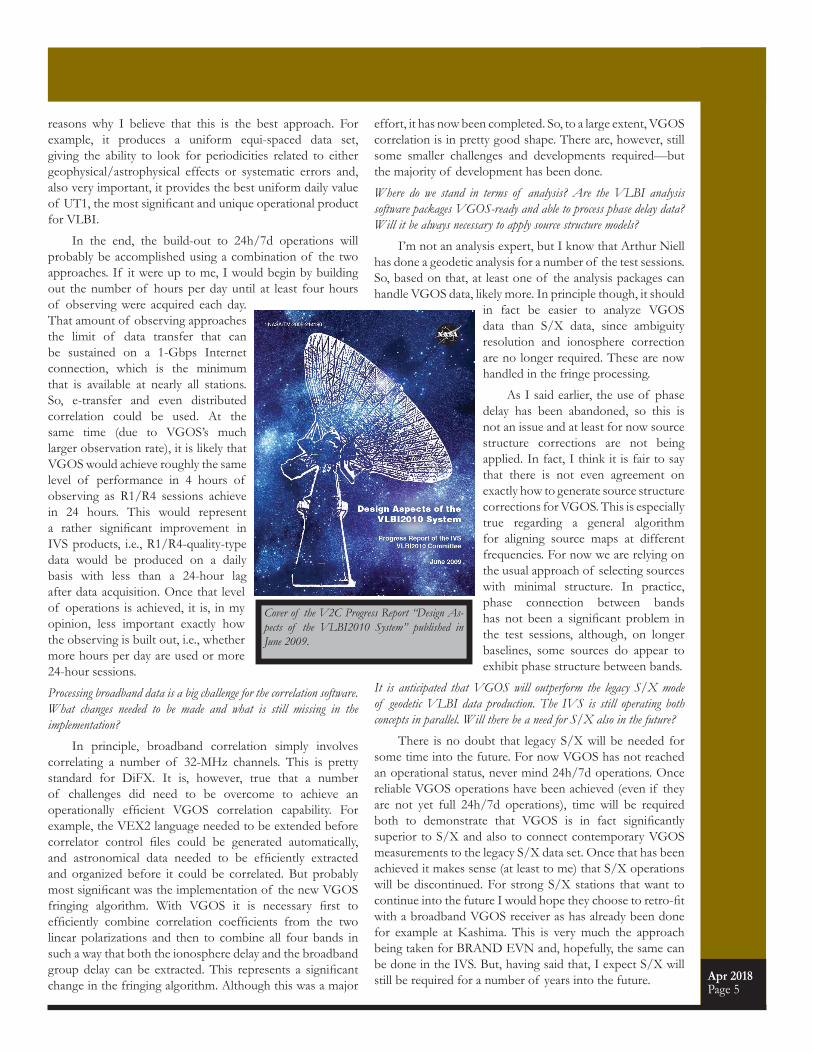
Cover of the V2C Progress Report “Design As-pects of the VLBI2010 System” published in June 2009.

Apr 2018Page 6
Views on VGOS ... “I well remember the IVS Directing Board meet-
ing in 2001 when the idea of a new VLBI system was brought up by Bill Petrachenko. Soon it became clear that the next generation geodetic VLBI should include all components of VLBI: antennas, receiving and recording systems, clocks, scheduling, correlation and data analysis, in other words, all hard- and software needed to effect a successful geodetic VLBI. As the most important mile-stone to VGOS, I consider the NASA report NASA/TM-2009-214180 “Design Aspects of the VLBI2010 Sys-tem” which contained all specifications and details of the new technology. Other breakthroughs were the various VGOS-type radio telescopes that have been established since 2010 and the first successful VGOS measurements on the baseline between Westford and the Goddard Geo-physical and Astronomical Observatory (GGAO). I be-lieve VGOS is an extremely important development but also a warrant for the vital future role of geodetic VLBI within the ensemble of space geodetic techniques.”
– Harald Schuh, IAG President
“In 2009, GGOS challenged the community with a bold statement that the terrestrial reference frame needs to be accurate to within 1 mm and stable to within 0.1 mm/yr. The IVS rose to this challenge and planned new VLBI stations and data acquisition and processing strate-gies designed to meet the GGOS goal. Today we are reap-ing the benefits of the far-sighted IVS planning with the new VGOS systems that are coming online. Congratula-tions IVS!”
– Richard Gross, GGOS Chair
Let’s go back to making predictions. What is your vision for the state of VGOS in, say, 2024? And what do you foresee to happen until then?
I think that VGOS is already approaching an operational state. The most important elements have already been put in place. Of course, some things still need to be done, like the upgrade to 1-GHz bands and 16-Gbps data rate and the implementation of stable or well calibrated uplink connections for the PCAL 5-MHz reference. The year 2024 is still six years away, so there should be no technological reason why these changes cannot be implemented by then. As far as the network is concerned, I think that twelve to sixteen stations should be operational in the next two to three years and that twenty to twenty-four will be ready by 2024. By then all the teething troubles and growing pains should be resolved so that reliable operations will be routine. To me the biggest unknowns for 2024 surround questions of what will happen with data transmission and correlation and whether the desire and operational funds will be available for 24h/7d operations. So what do I see if I look into my crystal ball? Provided that someone is there to push it, I believe that correlation resources will be available for 24h/7d operations; data transmission will still be a mix of e-transfer and module shipment (although many more stations will have 10-Gbps capability); there will be a network of twenty to twenty-four stations; and 24h/7d operations will be routine at many stations but not at all of them.
When do you think full 24h/7d VGOS operation will be implemented? And what is the framework needed for its implementation?
As I said earlier, I think that 24h/7d operations will be achieved by 2024 at least at many stations. Automation and remote station control will reduce the cost of operating stations making 24d/7h operations more realistic; more transmission bandwidth will make a fully distributed correlator a realistic and elegant option; and more human resources will be useful both for operating stations and correlators and doing analysis but also for developing automation and algorithms. It is also worth mentioning that the ability to achieve continuous frequency coverage from 2 to 14 GHz has become technologically feasible and economical. This extension beyond the VGOS recommendation should help mitigate some of the negative effects of both RFI and source structure.
Before finishing I would like to say that working on the VGOS definition and development was one of the most exciting and satisfying endeavours of my professional life. I would like to thank each and every one of you who have shared your knowledge, skill, passion, and good will towards making this dream a reality. It has been a privilege and pleasure to work with you. I am officially retiring in a few weeks but plan to continue to be involved as much as rock climbing, skiing, music, mountain biking, grandchildren, family, and so on will allow. Best of luck to you all!
Thank you Bill. All the best to you too!
Baseline or bassline: A tough choice for Bill in retirement.

Apr 2018Page 7
In early 2018, the Instituto Geográfico Nacional (IGN) has finally started the work to erect the support tower of its 13.2-m VGOS telescope for the Canary Is-lands. The chosen site is located in Artenara, at approxi-mately 2000 m altitude, on the island of Gran Canaria. The whole procedure was delayed for more than a year and a half, because the location inside a natural park required the completion of a number of environmental impact studies for the construction and the operation of the antenna. Fi-nal authorization was obtained in December 2017. During 2018, several works are foreseen; for instance, the design of the operations building and the civil works to prepare the site for the construction. The latter includes electrical lay-ing, soil preparation, trenches, tracks and founding together with surveillance on the environmental impact. On the other hand, the IGN deployed in 2017 one engineer at Gran Ca-naria to coordinate all the works. A collaboration agreement with the University of Las Palmas has been signed and as a consequence this engineer is temporarily hosted at their facilities. Meanwhile the telescope parts are already on the island, stored in several containers inside a big hangar near Las Palmas de Gran Canaria, waiting to be transported to the site and mounted once the tower is completed.
– Pablo de Vicente
Construction Work Has Started on Gran Canaria
Location of the new VGOS site on the island of Gran Canaria.
The Finnish Geospatial Research Institute (FGI) is building a new VGOS-compatible radio telescope at the Metsähovi Geodetic Research Station in Southern Finland. MT Mechatronics GmbH is in charge of the construction of the radio telescope. The installation of the telescope is ex-pected to start at the beginning of summer 2018. The broad-band receiver, the digital backend, and the other components of the signal chain are under development. The aim is to have the radio telescope operational by 2019. Currently, the foundation for the telescope and site preparations are ready. Meanwhile, FGI in co-operation with VTT/MIKES (the Finnish metrology institute that is responsible for keeping time in Finland) and Aalto University is studying the feasibili-ty of time and frequency distribution of the standard Finnish UTC time provided by MIKES to the VGOS telescope. This project, funded by the Academy of Finland, would allow the use of a VLBI radio telescope without a local H-maser as an on-site reference clock—while still fulfilling all performance requirements.
– Markku Poutanen
Base of the new radio telescope at Metsähovi before casting the concrete. Iron bars are firmly attached on the bedrock.
Mechatronics and FGI personnel checking the base of the Metsähovi radio telescope during a mid-winter snowstorm. Installation of the telescope is scheduled in the beginning of the summer.
New VGOS Telescope in Metsähovi
From the VGOS World...
Upcoming Meetings...
https://ivscc.gsfc.nasa.gov/meetings
EGU General AssemblyVienna, AustriaApril 8-13, 2018
Tenth IVS General Meeting Longyearbyen, NorwayJune 3-9, 2018
IAU General AssemblyVienna, Austria August 20-31, 2018
GGOS Days 2018Tsukuba, JapanOctober 2-4, 2018
AOV MeetingCanberra, AustraliaNovember 9-10, 2018
7th International VLBI Technology WorkshopKrabi, ThailandNovember 12-15, 2018

Apr 2018Page 8
The VGOS Station at ShanghaiThe construction of the Shanghai VGOS station has
been making progress since the April 2017 newsletter issue. However, due to some unforeseen circumstances, the progress is behind schedule by a few months. The photogrammetry work on the antenna main reflector and subreflector was completed on February 5. On March 29, cable-wrapping replacement and wiring was completed. That same day, the Russian hydrogen clock was starting to test for two weeks, and then it will be transported to Tianma. On March 30, a senior servo engineer from MT Mechatronics arrived in Shanghai to continue the debugging of the an-tenna servo control, he will stay for two weeks. The next steps are the deployment of the receiver, UDC, CDAS, and Mark 6 recorder. Also debugging of the operating control
system will be started.
– Guangli Wang
Workers are being lifted during the construction phase.
The newly erected VGOS telescope at Seshan.
VGOS Antennas at GGAO and KPGOThe NASA Space Geodesy Project (SGP) currently
operates two 12-m VGOS antennas as part of the NASA Space Geodesy Network (NSGN): one at the Goddard Geophysical and Astronomical Observatory (GGAO) in Maryland and a second at Kokee Park
Geophysical Observatory (KPGO) in Hawaii. GGAO was the one end of the proof-of-concept baseline for the first broadband signal chain tests (initially on the 5-m antenna); the other end was formed by the 20-m Westford antenna at MIT Haystack Observatory. Both antennas continue to support the activities related to VGOS research and development. The VGOS broadband signal chain at KPGO was largely built on the
experience from the proof-of-concept efforts. Both GGAO and KPGO as well as Westford successfully participated in the recent CONT17 VGOS sessions and they continue to participate in the current series of VGOS test sessions.
– Jim Long
The 12-m VGOS antennas at GGAO (left) and KPGO (top).
From the VGoS World...
Whatever you can do or dream you can, begin it. Boldness has genius, power, and magic in it.
- Johann Wolfgang von Goethe

Apr 2018Page 9
Arecibo Observatory Six Months After Hurricane Maria— Ganesh Rajagopalan, MIT Haystack Observatory
The iconic 305-m dish of the Arecibo Observatory is nestled among the karst hills of Puerto Rico, an island ter-ritory of the United States in the “hurricane alley” of the Atlantic Ocean. On Wednesday, September 20, 2017 it was hit by Category-5 hurricane, Maria. A NASA satellite pic-ture shows Maria covering the whole island. This Category-5 storm, the most powerful ever recorded to hit Puerto Rico, left a trail of destruction over the entire island causing power outages, catastrophic floods, severe damage to roads and bridges, and cutting off all communication links.
After learning that the eye of the storm had passed very close to the city of Arecibo, where winds gusted up to 155 mph, the astronomy community worldwide feared the worst for the Observatory. Within a week or two, all of the staff members of the Observatory and the Visitor Center
were accounted for and the families of those who had lost their homes were ac-commodated in the guest rooms on site. We were relieved to learn through Amateur radio contacts (via Prof. Jim Breakall of Penn State University) that the winds at the site had fortu-nately reached a maximum of only about 110 mph, below the 130 mph survival limit of the telescope, and that the suspended struc-
ture was mostly intact. Nev-ertheless, the 50+ year old 430-MHz line feed had bro-ken off during the passage
of the storm and fallen on to the dish surface, damaging about 20 panels and a few support cables. About one fifth of the line feed remained still in place. The 12-m VLBI Phase
Reference antenna (a Patriot dish similar to GGAO’s VGOS antenna at NASA/GSFC) was initially reported to be lost completely. However, it was later found that only the clad-ding of the back-up structure was displaced. The antenna was repaired after the storm.
Until the power grid was restored to the site in early December, observing runs with the telescope were conduct-ed using generator power, including VLBI with the orbiting Russian radio telescope, RadioAstron. By late December, the NASA-funded planetary radar system, the most power-ful in the world, was again operational and soon returned the best images to date of near-Earth asteroid 3200 Phaeth-on, thought to be the parent body for the Geminid meteor shower. Since then, numerous planetary radar runs have been made to study other near-Earth asteroids.
There is also some good news re-garding the Obser-vatory’s future, with the National Science Foundation (NSF) deciding to continue scientific operations there into the coming years, albeit with much reduced funding. From October 2011, the Arecibo Observatory had been operated by a consortium of SRI In-ternational, Universities Space Research Association (USRA) and Universidad Met-ropolitana (UMET), under a cooperative agreement with the NSF. However, from April 1, 2018, a new consortium led by the University of Central Florida, a private firm Yang Enter-prises Inc., and UMET has taken over the management of the Observatory under a new a cooperative agreement with the NSF. This new agreement is valued at $20.15 million over five years, subject to the availability of funds. NSF has also pledged additional funds for repairs following Maria.
It is now six months since Hurricane Maria struck Puer-to Rico, but there are still parts of the more remote regions of the island without power and even running water. It is go-ing to take many more months of dedicated and well-funded efforts to bring the island back to being “La Isla del Encanto – The Island of Enchantment”, to which millions of touristswill return year after year to enjoy its natural beauty and the friendly warmth of its inhabitants.
Acknowledgement: Thanks to Chris Salter, Tapasi Ghosh, and Luis Quintero for their input.
Arecibo’s 305-m dish. Photo: Arecibo Observatory.
Remaining one fifth of the Arecibo line feed still in place. Photo: Chris Salter/Tapasi Ghosh.
Satellite image of Hurricane Maria covering Puerto Rico. Image: NASA.
NeWS...

Apr 2018Page 10
So, with this copy you hold the paper version of the Anniversary Issue of the IVS Newsletter in your hands, or, you are viewing it in your preferred Internet browser online as a PDF file. Whatever your preference is, have you ever wondered how the Newsletter is done or how it comes into being? Here we try to address this kind of questions and provide you with a glimpse into the work of the editor team and the Newsletter production process.
First off, let’s say a few words about the people behind the Newsletter. The team was actually very stable over the years. The first ten issues were prepared and published by Nancy Vandenberg as General Editor, Hayo Hase as Feature Editor, and Heidi Johnson as Layout Editor. With Nancy about to retire, Issue #10 (December 2004) was a shared effort of Nancy and Dirk Behrend as General Editors. Then Dirk took over the full general editorship, before, in August 2013 (Issue #36), Kyla Armstrong joined the team as an additional General Editor. In short, Hayo and Heidi are the longest serving editors on the team, with Dirk following slightly behind and Kyla being the youngster.
As you noticed, the editors are not all working at the same location or even the same continent. For that, most of the interactions happen via e-mail and through phone calls. The work on a new issue starts about six weeks before the intended publication date of the first day of April, August, or December. With a lot of day-to-day activities crossing the table of the Coordinating Center, Dirk and Kyla make a first cut at a list of newsworthy topics for the upcoming issue and who could cover those in articles. The full editor team then discusses the suggestions
and finalizes the topics with potential authors. The General Editors then send out requests to the agreed upon authors asking them for a contribution with a deadline of typically two weeks prior to the publication date.
Hayo, as the Feature Editor, contacts the target group for the planned feature interview. For this, he prepares a list of interview questions which he presents either in a personal meeting or, more commonly, in an e-mail exchange. As of yet travelling to the IVS members to have personal conversations has not been necessary. But personal interactions at VLBI meetings have been very important for this kind of work.
Then the time is there when the contributions start to come in. Sometimes they arrive en masse, but typically the arrival stretches out over time. The degree of success of getting the contributions in on time, together with the workload of the editors, determines when the Newsletter issue can actually be completed. Another contributing factor is the level of editing needed for each incoming article. You can imagine that the level of English proficiency varies largely within the global community that the IVS is. However, as general editors we try to keep the changes at a minimum so that the charm of each contribution is preserved. This can be a challenge, as we want to get the grammar right and to ensure that it’s an
easy read—as a reader you don’t want to read a paragraph twice or more times to understand its meaning. Lastly, we do some fact checking. You’ll be surprised about the level of misnaming we encounter with institutions or IVS bodies.
Once all contributions have been edited by Dirk, the page layout work begins. As editor, Dirk specifies the order in which articles will appear, and Heidi typesets them in InDesign. Heidi places photos, graphics, and illustrations in the ideal layout, in consultation with Dirk, and together
they “typefit” or edit articles as necessary to fit the space available on each page. It was an early decision to have a printed version of the
Creating the Newsletter – A Look Behind the Curtain– Dirk Behrend, NVI, Inc.
NeWS...
General Editor: Dirk Behrend.
Feature Editor: Hayo Hase.
General Editor: Kyla Armstrong.

Apr 2018Page 11
NeWS...Newsletter as well as an online PDF version. This format basically puts boundary conditions, mostly for the length, on each Newsletter. In the last decade or so, each Newsletter issue was exactly eight pages long. The advantage of this approach is that it forces us to focus on essentials and to weed out things that may not be that important (of course,
this depends on the point of view).
RDBE-G: A VGOS Digital Backend– Alex Burns and Mike Poirier, MIT Haystack Observatory
For this edition, let’s talk about the RDBE-G. This is one of the new VGOS digital backends, replacing many ana-log components from the MK4 rack with one highly capable digital one. Instead of a formatter, decoder, and video con-verter, all the data goes through the RF distributor, then gets converted to a 2-GHz-wide band by the Up-Down Converter (more on that later), and after the Nyquist zone filter then en-ters as a 512-MHz signal (1 Gigasample) into the ADC of the RDBE-G in both polarizations. A nicely digitized spectrum leaves the ADC and enters the ROACH board, which has an FPGA and microprocessor. The FPGA is loaded with a Polyphase Filter Bank personality for geodesy and processes the digitized 512-MHz signal into sixteen 32-MHz channels that are time tagged and formatted to comply with the VDIF standard. In the end, the VDIF payload is encapsulated with additional formatting to comply with the VTP standard to either be recorded by a Mark 6 recording system or transmit-ted directly electronically. The microprocessor runs a server, which is what the FS computer communicates with, and also provides a nice display for the operator, with information including network, time, offsets, and input power levels. The server outputs all of this data in a broadcast message, us-ing multicast IP addresses, once per second, to be logged by the FS computer or another dedicated logging computer. To the operator, all of this happens behind the scenes, and the interaction is wholly with the server. Though the setup is completely automated at start-up, through the server the operator can change the personality (PFB or DDC) and can synchronize the unit with external timing signals. So there is more than enough data to ensure that the system is set up and ready to observe!
Front and Rear view of the RDBE-G.
Once the layout is complete and the editors are happy with the result, the PDF file is posted online. Further, Heidi prepares the print spreads with her InDesign desktop publishing software. These are used at Goddard to duplicate the Newsletter, before the printed copies can be mailed out to the members of the IVS community.
In short, the Newsletter creation takes about six weeks from start to finish. There are some flurries on the way, but the major bulk of the work is typically occurring the week directly before its publication. Given that other services such as the IDS (International DORIS Service) picked up on the idea and created their own version of a Newsletter, we are confident that the IVS Newsletter is a well-received tool to keep the community members abreast of the on-goings in the VLBI world. It may as well be the very fabric that keeps the IVS family together.
Layout Editor: Heidi Johnson.
The IVS Newsletter is published three times annually, in April, August, and December. Contributed articles, pictures, cartoons, and feedback are welcome at any time. Please send contributions to the General Editors (see below).
The editors reserve the right to edit contributions. The deadline for contributions is one month before the pu-blication date.General Editors: Dirk Behrend ([email protected]),
Kyla Armstrong ([email protected])Feature Editor: Hayo Hase ([email protected])Layout Editor: Heidi Johnson ([email protected])
The newsletter is published in color with live links on the IVS web site at
https://ivscc.gsfc.nasa.gov/.

April 2018Page 12
NeWS...
In April 1968, an historic VLBI experiment was conducted between MIT Haystack Observatory and Onsala Space Observatory. This occasion is to be noted as an important anniversary, although the observations
were not entirely successful in terms of usable data. VLBI was pioneered only a year before, with fringes obtained in 1967 between Haystack and Green Bank—one of several collaborations honored with the American Academy of Arts and Sciences 1971 Rumford Award. With the revolutionary technique known as switched frequency or bandwidth synthesis (Hinteregger and Rogers), the first wideband geodetic VLBI experiments at L-band frequencies were held in
1968.
The long and storied history of geodetic VLBI has been covered
at great length elsewhere (including IVS Newsletter issues #33 and #34, 2012), but it is fitting to highlight the 50th anniversary of the first transatlantic VLBI in this timely 50th issue of the IVS Newsletter. Both observatories will be celebrating the occasion on Thursday 5 April to honor the scientists and engineers in the U.S. and Sweden who made such achievements
possible and helped launch decades of successful VLBI experiments worldwide. Several people who contributed to the early VLBI development are still working today, including MIT's Alan Whitney and Harvard’s Jim Moran. Alan Whitney said,
“There was really no doubt that the concept [of VLBI] was sound, and it was a matter of implementing it properly. And there was a lot of confidence that it could be done, but with the realization that it would take quite a bit of effort and probably several tries before we got it
50 Years of Transatlantic Geodetic VLBI Experiments– Nancy Wolfe Kotary, MIT Haystack Observatory
right. I always felt optimistic about the potential for VLBI. There’s still a lot more to do in terms of improving the techniques; we’re going to learn a lot more as the VGOS system is deployed worldwide.”
Scientists working in VLBI development in the late sixties remembered it as an exciting period in their careers, including such details as the difficulties of working with the Mark 1’s half-inch magnetic tapes, which held 16 MB on a 12-inch reel, lasted for three minutes of observation, and presented many technical challenges. An experiment might cover hundreds or thousands of tape reels. Technology for correlation and data recording has progressed immensely since 1968—the Mark 6 would fill a Mark 1 tape in about 8 milliseconds—and the continual improvement shows no signs of slowing over the next decades. As Jim Moran said, “There is a press for increased bandwidth: there are tremendous possibilities for pushing the boundaries of VLBI. It is still a very rich field. It’s amazing that we’re continuously observing in VLBI 50 years later.”
Onsala and Haystack are looking forward with particular excitement to the regularly scheduled 5 April 2018 VGOS observation.
SPEED 720 kbps
MEDIA Half-inch-wide, 2400-foot reel tapes, 800 bits/inch
STORAGE 16 MB
RATE 480 tapes/day
CORRELATION Mainframe
1968
MARK I
SPEED 16,000,000 kbps (16 Gbps)
MEDIA Four 8-disk modules
STORAGE 320,000,000 MB (320 TB)
RATE 4 disk modules/day
CORRELATION Cluster or cloud
2018
MARK 6
50 YEARS OF GEODETIC VLBI
HAYSTACK–ONSALA MIT HAYSTACKMASSACHUSETTS,
USA
ONSALA–CHALMERS ONSALA, SWEDEN
MIT Haystack Observatory VLBI team in 2018.
https://[email protected]: 301-614-5939
fax: 301-286-0239
IVS Coordinating CenterNASA GSFCCode 61A.1
Greenbelt, MD 20771