environmental impact - idca
TRANSCRIPT

EnvironmentalImpact
LESSON PLAN FOR SUPPORTING QUESTION
Why are landforms important?
READ IOWA HISTORYEDUCATOR MATERIALS
2ND GRADE

2
READ IOWA HISTORY
About Read Iowa History
Through the Library of Congress Teaching with Primary Sources grant, the State Historical Society of Iowa developed Read Iowa History — free, downloadable K-5 lesson plans to build and develop reading and critical thinking skills with primary sources in the classroom.
Primary sources (from the digital Primary Source Sets collection) are used to help students learn from multiple perspectives, develop primary source-based claims and evidence, and to interpret documents and images of the past. These lessons were developed with the Iowa Core Social Studies and Literacy Standards. Each unit includes ready-to-use source material, worksheets, educator lesson plans and assessment tools and activities. You, the educator, are encouraged to explore the unit, and use materials as you see fit for your students. You are welcome to alter lesson plans, worksheets and assessments to best align with their curriculum.
Please check out the Primary Source Sets toolkit to learn more about using primary sources in the classroom.
What’s Included
Educator MaterialsSources are accompanied by an educator lesson plan. This plan includes: the unit compelling question, unit supporting question, objectives, background information, vocabulary lists or cards, a materials list and instructions. There also is a “formative assessment” to wrap up each part of the unit and to check for comprehension. You are welcome to use the activities that are suggested or create their own with the primary sources.
Student MaterialsMany of the unit instructions are accompanied by a worksheet that can be copied and distributed to students as they analyze the primary source(s) to assist in their application and comprehension. These worksheets are optional but may provide a structure for students to think critically about the primary sources they are analyzing. These reproduceable student worksheets are available in the Student Materials PDF (on website, below “Educator Materials”) for this topic.
Formative Assessments, Lesson Summative Assessment and Scoring OptionsThe formative assessments, lesson summative assessment and possible scoring options allow you to evaluate how students comprehend and apply the knowledge they learned from the individual primary source activities. Assessment instructions, example worksheet(s) and possible scoring options are located at the end of this Read Iowa History section. Reproduceable assessment worksheet(s) also are available in this topic’s Student Materials PDF.
Introduction to Read Iowa History
INTRODUCTION
Courtesy of Library of Congress, Kolb Bros., “Grand Canyon,Arizona,” 1913

3
READ IOWA HISTORY
Environmental Impact
INTRODUCTION
2nd Grade
OverviewThe physical landscape shapes the food people eat, the homes they build, the way they move around and the environment they live in. Students will investigate environmental history, which involves understanding relationships — and sometimes trade-offs — people make with the landscapes around them. Students also will use the perspectives of a historian, economist, geographer and political scientist to analyze images and documents.
Table of ContentsCompelling and Supporting Questions . . . . . . . . . . . . . . . . . . . . . . . . . . . . . . . . . . . . . . . . . . . . . . . . . . . . . . . . . . .4Standards and Objectives . . . . . . . . . . . . . . . . . . . . . . . . . . . . . . . . . . . . . . . . . . . . . . . . . . . . . . . . . . . . . . . . . . . . . .5Background Essay . . . . . . . . . . . . . . . . . . . . . . . . . . . . . . . . . . . . . . . . . . . . . . . . . . . . . . . . . . . . . . . . . . . . . . . . . . . . .6Pre-Lesson Activity 1: Source, Observe, Contextualize and Corroborate (SOCC) . . . . . . . . . . . . . . . . . . . . . 7
• SOCC Posters . . . . . . . . . . . . . . . . . . . . . . . . . . . . . . . . . . . . . . . . . . . . . . . . . . . . . . . . . . . . . . . . . . . . . . . . . . . . . . .8Pre-Lesson Activity 2: Think Like... Cards & Question Formulation Technique . . . . . . . . . . . . . . . . . . . . . .12
• Think Like... Cards . . . . . . . . . . . . . . . . . . . . . . . . . . . . . . . . . . . . . . . . . . . . . . . . . . . . . . . . . . . . . . . . . . . . . . . . . .14 • Worksheet, Think Like...Cards . . . . . . . . . . . . . . . . . . . . . . . . . . . . . . . . . . . . . . . . . . . . . . . . . . . . . . . . . . . . . . . .16
Part 1: “America, Its Soil,” 1946 . . . . . . . . . . . . . . . . . . . . . . . . . . . . . . . . . . . . . . . . . . . . . . . . . . . . . . . . . . . . . . . . .17 • Image, “America, Its Soil,” 1946 . . . . . . . . . . . . . . . . . . . . . . . . . . . . . . . . . . . . . . . . . . . . . . . . . . . . . . . . . . . . . . .18 • Worksheet, Analyze an Image . . . . . . . . . . . . . . . . . . . . . . . . . . . . . . . . . . . . . . . . . . . . . . . . . . . . . . . . . . . . . . . .19
Part 2: What Impacts the Development of a Community? . . . . . . . . . . . . . . . . . . . . . . . . . . . . . . . . . . . . . . . .20Part 3: Visualizing Landforms . . . . . . . . . . . . . . . . . . . . . . . . . . . . . . . . . . . . . . . . . . . . . . . . . . . . . . . . . . . . . . . . . .21
• Image, Sierra Nevada Mountain Pass . . . . . . . . . . . . . . . . . . . . . . . . . . . . . . . . . . . . . . . . . . . . . . . . . . . . . . . . . .23 • Image, Valley of the Mississippi River near Clinton, Iowa . . . . . . . . . . . . . . . . . . . . . . . . . . . . . . . . . . . . . . . . .24 • Image, Des Moines River Valley . . . . . . . . . . . . . . . . . . . . . . . . . . . . . . . . . . . . . . . . . . . . . . . . . . . . . . . . . . . . . . .25 • Image, Grand Canyon in Arizona . . . . . . . . . . . . . . . . . . . . . . . . . . . . . . . . . . . . . . . . . . . . . . . . . . . . . . . . . . . . . .26 • Image, Zion National Park in Washington County, Utah . . . . . . . . . . . . . . . . . . . . . . . . . . . . . . . . . . . . . . . . . .27 • Image, Sweet Corn Field near Marengo, Iowa . . . . . . . . . . . . . . . . . . . . . . . . . . . . . . . . . . . . . . . . . . . . . . . . . . .28 • Worksheet, Analyze an Image . . . . . . . . . . . . . . . . . . . . . . . . . . . . . . . . . . . . . . . . . . . . . . . . . . . . . . . . . . . . . . . .29
Part 4: Creating a U.S. Map with Landforms . . . . . . . . . . . . . . . . . . . . . . . . . . . . . . . . . . . . . . . . . . . . . . . . . . . . .30 • Image, United States Relief Location Map . . . . . . . . . . . . . . . . . . . . . . . . . . . . . . . . . . . . . . . . . . . . . . . . . . . . . .32 • Worksheet, Check for Understanding - Landforms . . . . . . . . . . . . . . . . . . . . . . . . . . . . . . . . . . . . . . . . . . . . . .33
Lesson Summative Assessment . . . . . . . . . . . . . . . . . . . . . . . . . . . . . . . . . . . . . . . . . . . . . . . . . . . . . . . . . . . . . . . .34 • Worksheet, Lesson Summative Assessment . . . . . . . . . . . . . . . . . . . . . . . . . . . . . . . . . . . . . . . . . . . . . . . . . . . .35 • Example, Lesson Summative Assessment . . . . . . . . . . . . . . . . . . . . . . . . . . . . . . . . . . . . . . . . . . . . . . . . . . . . . .36
Vocabulary Cards . . . . . . . . . . . . . . . . . . . . . . . . . . . . . . . . . . . . . . . . . . . . . . . . . . . . . . . . . . . . . . . . . . . . . . . . . . . . .37Additional Resources. . . . . . . . . . . . . . . . . . . . . . . . . . . . . . . . . . . . . . . . . . . . . . . . . . . . . . . . . . . . . . . . . . . . . . . . . .41
Unit Compelling QuestionHow does the way we live impact our environment?
Unit Supporting QuestionWhy are landforms important?? ?

4
Compelling and Supporting Questions INTRODUCTION
2nd Grade
How to Apply Read Iowa History Lessons to Other Primary SourcesThe origin of Read Iowa History lessons stem from the Primary Source Sets, which are a collection of primary sources that focus on a topic and are structured under a compelling question and multiple supporting questions (typically three). Five or six primary sources are used to address and help students answer a single supporting question. Read Iowa History takes one supporting question, the primary sources addressing that question and instructions (divided into parts) to integrate these primary sources in the classroom through different activities.
These lessons, instructions, worksheets, tools and assessment suggestions can be applied to all of the K-5 Primary Source Sets.
Unit Compelling QuestionThe compelling question drives students to discuss, inquire and investigate the topic of a unit of understanding.
How does the way we live impact our environment?
?
Unit Supporting QuestionsSupporting questions scaffold instruction to help students answer the compelling question. Their aim is to stimulate thought, to provoke inquiry and spark more questions. The supporting question that is highlighted above is the question that was used in this Read Iowa History. The bolded question below is the supporting question for this Read Iowa History unit.
1) Why are landforms important? 2) What are renewable and nonrenewable resources?3) What impact do people have on our environment?
?
Read Iowa History: Environmental ImpactThis Read Iowa History lesson addresses “How does the way we live impact our environment?” and “Why are landforms important?” and includes lesson plans, worksheets, suggested assessments and other tools.

5
READ IOWA HISTORY
Standards and Objectives
INTRODUCTION
Objectives • I can determine how to ask questions through disciplinary literacy lens. • I can identify a primary source. • I can analyze images related to landforms. • I can create a class landform map.
Iowa Core Social Studies StandardsNo. StandardSS.2.2. Generate supporting questions across the social studies disciplines related to compelling questions.
SS.2.3. Determine if a source is primary or secondary and distinguish whether it is mostly fact or opinion.
SS.2.4. Construct responses to compelling questions using reasoning, examples, and relevant details.
SS.2.5. Take group or individual action to help address local, regional, and/or global problems.
SS.2.6. Use deliberative and democratic procedures to make decisions about and act on civic problems in their classrooms.
SS.2.8. Explain the purpose of different government function.
SS.2.9. Develop an opinion on a decision about a local issue. (21st Century)
SS.2.11. Evaluate choices about how to use scarce resources that involve prioritizing wants and needs.
SS.2.13. Describe examples of the goods and services that governments provide.
SS.2.19. Make a prediction about the future based on past related events.
SS.2.21. Compare perspectives of people in the past to those in the present with regards to particular questions or issues.
SS.2.22. Identify context clues and develop a reasonable idea about who created the primary or secondary source, when they created it, where they created it and why they created it.
SS.2.23. Describe the intended and unintended consequences of using Iowa’s natural resources.
Iowa Core Literacy StandardsNo. Standard
RI.2.1 Ask and answer such questions as who, what, where, when, why, and how to demonstrate understanding of key details in a text.
RI.2.4 Determine the meaning of words and phrases in a text relevant to a grade 2 topic or subject area.
RI.2.5 Know and use various text features (e.g., captions, bold print, subheadings, glossaries, indexes, electronic menus, icons) to locate key facts or information in a text efficiently.
RI.2.7 Explain how specific images (e.g., a diagram showing how a machine works) contribute to and clarify a text.
W.2.2 Write informative/explanatory texts in which they introduce a topic, use facts and definitions to develop points, and provide a concluding statement or section.
W.2.8 Recall information from experiences or gather information from provided sources to answer a question.
SL.2.5 Create audio recordings of stories or poems; add drawings or other visual displays to stories or recounts of experiences when appropriate to clarify ideas, thoughts, and feelings.
SL.2.2 Recount or describe key ideas or details from a text read aloud or information presented orally or through other media.

6
READ IOWA HISTORY
Background Essay
INTRODUCTION
Utilize this background essay, in whole or in parts, with students to provide further context and understanding about why landforms are important and how people impact their environment. You can read it aloud to students, utilize excerpts and introduce the vocabulary words. The essay is also referenced in parts of this Read Iowa History to assist students in their interpretation and analysis of primary sources. “The land was ours before we were the land’s” wrote the poet Robert Frost. Since the earliest days of humans on Earth, people have adapted to the physical landscape around them. It shapes the food they eat, the homes they build, the way they move around and the environment they live in. Studying environmental history involves understanding relationships — and sometimes trade-offs — that people make with the landscapes around them.
The land itself is the most important factor in human settlement. Do we live in the mountains, on the plains, in the forest, on a river or on the beach? Or on an island? Rivers and oceans were the first human highways. Ships moved people and goods faster and easier than people and animals on land could. Mountains and forests impeded transportation, which could have been a problem or a benefit if it protected residents from outsiders. Ocean-front housing could provide a mild climate or subject inhabitants to brutal storms. Iowans are blessed with incredibly rich soil and rainfall while desert people must be creative to grow food or raise livestock. Where we live has a major impact on the lifestyle of any people.
The air humans breathe is also a factor in our environment. For most of human history, the quality of the air has not been impacted by human activity, but with the Industrial Revolution and a demand for energy from fossil fuels like coal or gasoline, people have polluted the air with carbon products that can create a variety of challenges, like smog or acid rain. Oxygen-depleting pollutants have reconfigured the layers of air surrounding the earth leading to warming temperatures and evolving rainfall patterns.
Water also is an important environmental factor. When water is in short supply, efforts sometimes divert rivers for agriculture or store it behind massive dams to create hydroelectric power. Fertilizer run-off from farm fields seeps into underwater water reserves or flows into rivers and streams altering natural balances.
Some energy sources like wind power or sun light are termed renewable energy sources because using them does not decrease their availability. Fuels derived from plant matter like wood, natural gas, oil or coal are nonrenewable sources because they can be depleted. For the most part, fossil fuels present the greatest environmental challenges because they increase the amount of carbon dioxide in the air. Nuclear fuels pose the danger of increased radioactivity when a reactor malfunctions and nuclear wastes create a problem for disposal. When nations were conducting nuclear tests in the atmosphere, radioactive drift traveled far beyond the test site to threaten resources thousands of miles away.
Environmental protection challenges a world divided into nation states because human activity can impact land, the air and water far beyond the site were the activity occurs. Keeping our world safe is a truly world challenge. Vocabulary Words
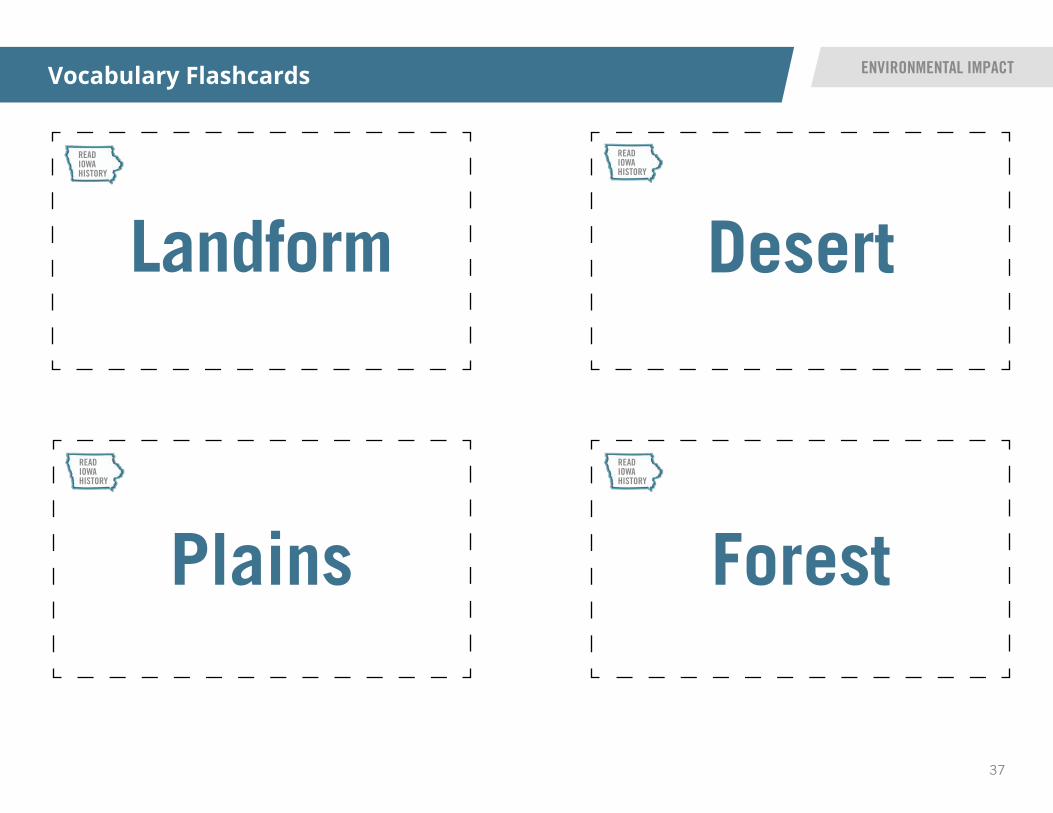
• Landform • Desert • Plains • Forest
• Valley • Canyon • Plateau

7
READ IOWA HISTORY
SOCC Strategy: The source, observe, contextualize and corroborate strategy will be applied to primary sources later on in this Read Iowa History. The SOCC posters will be part of later activities, but this pre-lesson activity could serve as a way to introduce students to core elements of the SOCC strategy and the information included on the posters.
The SOCC steps to analyze a primary source:
First, read the source. Students should be asked what they notice about the source.
Next, the class will observe and take a look at what they see. It can helpful to allow partners to look at the image while discussing what they see.
The third step is to contextualize. Students will use their prior knowledge and the author’s clues to infer who, what, when and where the primary source indicates. Students will use their prior knowledge and the author’s clues to infer who, what, when and where the primary source indicates.
Considering the disciplinary perspectives (historian, geographer, economist and political scientist) discussed in steps 1-4, ask students what questions they have? This is the corroborate part. They will ask questions and use other sources to research and find evidence related to the image.
2
2a
2b
2c
2d
Source, Observe, Contextualize and Corroborate (SOCC)
OverviewThis pre-lesson activity will illustrate a tool students can use to help them analyze primary sourcesin later parts of this Read Iowa History. The Source, Observe, Contextualize and Corroborate (SOCC)strategy provides a structured way to approach analysis with elementary students. This strategy isexplained more by the instructions below and with the posters to introduce students to the concept.
PRE-LESSON ACTIVITY 1 INSTRUCTIONS
Materials • SOCC posters (4)
Instructions1
Unit Compelling QuestionHow does the way we live impact our environment?
Unit Supporting QuestionWhy are landforms important?? ?

8
Source (SOCC) Poster PRE-LESSON ACTIVITY 1
This is one of the SOCC posters included to assist students with the Source, Observe, Contextualize and Corroborate technique in analyzing primary sources. A larger, printable version of this poster is available in the Student Materials PDF.
SourceUse available citation information to infer something about who, what, when and/or
where is represented in the primary source.
Consider why someone created this primary source.
9
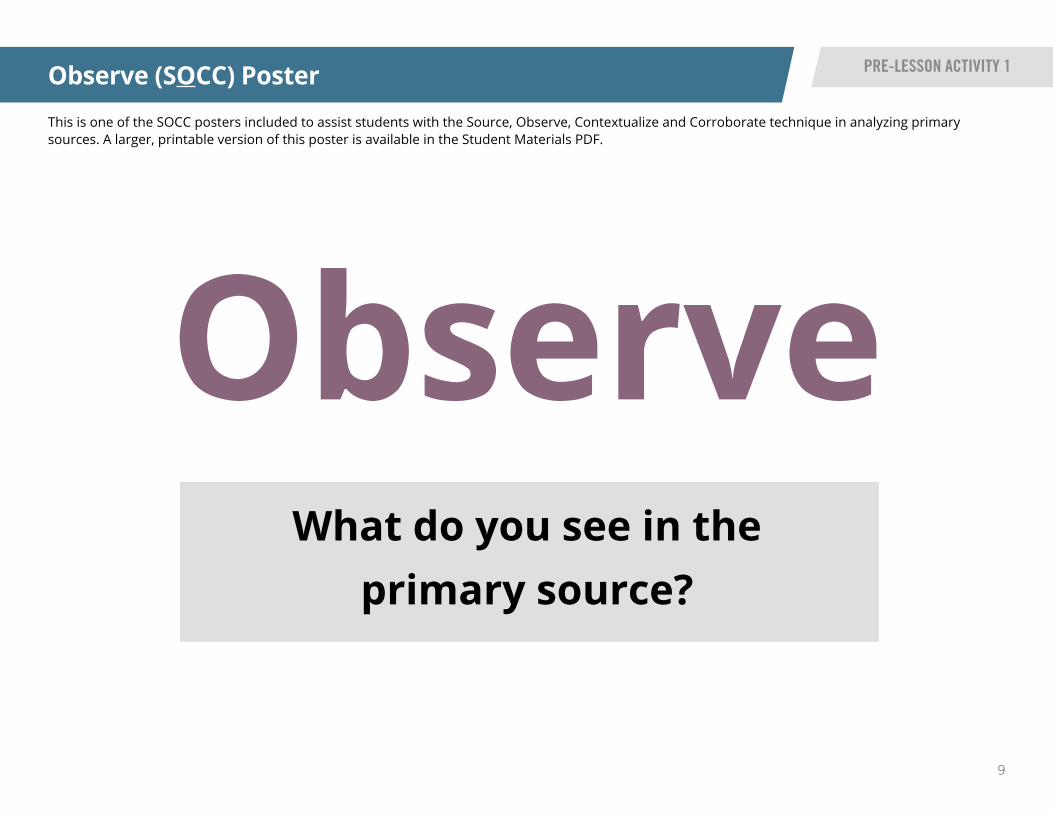
Observe (SOCC) Poster PRE-LESSON ACTIVITY 1
This is one of the SOCC posters included to assist students with the Source, Observe, Contextualize and Corroborate technique in analyzing primary sources. A larger, printable version of this poster is available in the Student Materials PDF.
ObserveWhat do you see in the
primary source?

10
Contextualize (SOCC) Poster PRE-LESSON ACTIVITY 1
This is one of the SOCC posters included to assist students with the Source, Observe, Contextualize and Corroborate technique in analyzing primary sources. A larger, printable version of this poster is available in the Student Materials PDF.
ContextualizeUse your prior knowledge and author’s clues to infer who, what, when and/or
where (something) about the primary source.
11
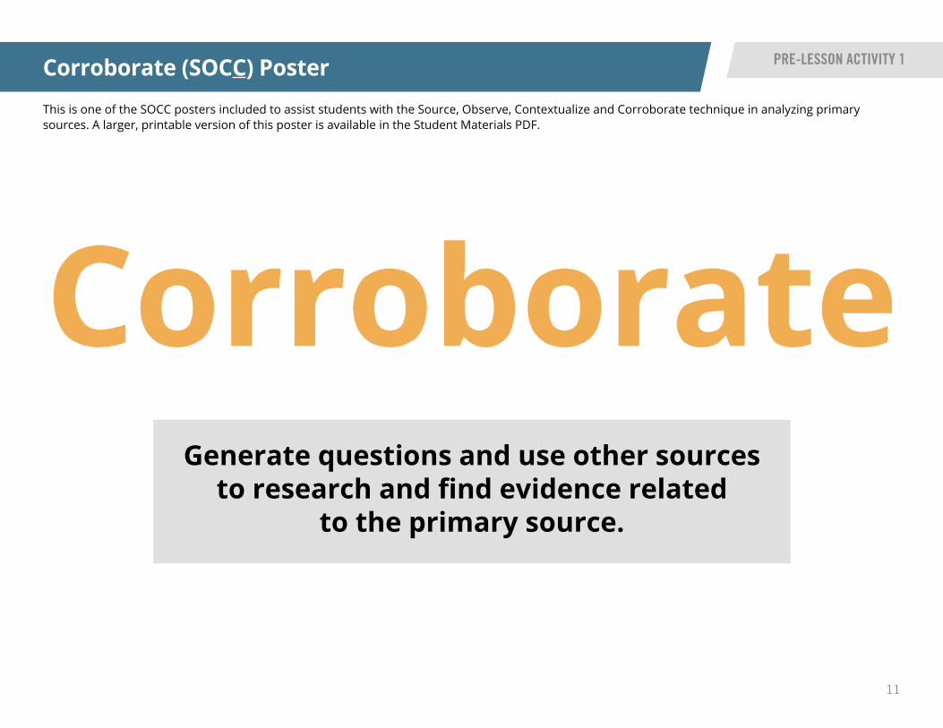
Corroborate (SOCC) Poster PRE-LESSON ACTIVITY 1
This is one of the SOCC posters included to assist students with the Source, Observe, Contextualize and Corroborate technique in analyzing primary sources. A larger, printable version of this poster is available in the Student Materials PDF.
CorroborateGenerate questions and use other sources
to research and find evidence related to the primary source.

12
READ IOWA HISTORY
Think Like... Cards: Before class, you will need to print off the ThinkLike... cards that read: geographer, economist, historian and politicalscientist. You will use the cards during class to represent differentdisciplines.
Distribute the Think Like... worksheet to each student. Create fourboxes on the whiteboard or chart paper that you will fill out with wordsand pictures as students answer each discipline’s questions.
Explain to students that they are going to look at social studies byinvestigating different perspectives. You will hold up each card and askquestions from each discipline while students consider key things thatmatch the discipline. They will draw in the boxes on the worksheet tohelp them remember each one.
With each card, discuss what the questions have in common, such as time, perspective and cause/effect. Record responses. After students have finished filling out their worksheets, pair them together so they can share about the four disciplines by using their answers.
Question Formulation Technique (QFT): This pre-lesson activity is meant to encourage students toask questions, which is an important step in them taking ownership of their learning. Prior to class, it isrecommended you watch the 12-minute QFT Instruction Video. In the video, a fourth-grade teacher uses QFTto learn more about what her students know or do not know about fractions.
Instructions continued on next page
1
3
4
5
Think Like... Cards & Question Formulation Technique
OverviewThis pre-lesson activity will illustrate tools students can use to help them analyze primary sources in later parts of Read Iowa History. One tool is the Think Like... cards, which students use to identifydisciplinary literacy perspectives, key vocabulary and questions asked by a historian, geographer,economist and political scientist. To prepare students to analyze images and documents, you can usethis activity to remind them that the impact of one’s experience shapes their perspective on differenttopics, such as how people impact the environment.
The other tool is the Question Formulation Technique (QFT), which was created by the RightQuestion Institute. The steps of the QFT are designed to stimulate three types of thinking: divergentthinking, convergent thinking and metacognitive thinking.
PRE-LESSON ACTIVITY 2 INSTRUCTIONS
Materials • Think Like... cards
• Think Like... worksheet
• Chart paper or whiteboard
• QFT Instruction Video
• Sim City timelapse video
Instructions
2
Unit Compelling QuestionHow does the way we live impact our environment?
Unit Supporting QuestionWhy are landforms important?? ?
13
READ IOWA HISTORY
Think Like... Cards & Question Formulation Technique
PRE-LESSON ACTIVITY 2 INSTRUCTIONS
Have the class watch the two-minute Sim City timelapse video. Use the QFT strategy to ask questions and assess the video with students. Follow the steps below to assist students in their analysis.
• Write as many student questions as you can on the board or on chart paper. • Do not stop to discuss, judge or answer any questions. • Write down every question exactly as stated, change any statements to questions. • Sort and prioritize questions.
After sharing the prioritized questions, discuss with students what social studies discipline that the question falls under. Use the Think Like... cards to assist with the inquiry. Post questions on chart paper for students to answer as they learn more.
6
Instructions continued
7

14
READ IOWA HISTORY
Think Like...Cards
PRE-LESSON ACTIVITY 2 ACTIVITY CARDS
This is are the State Historical Society of Iowa’s Think Like...Cards for the pre-lesson activity. The cards included focus on the perspective of a geographer, economist, political scientist and historian. A larger, printable version made for reproduction is available in the Student Materials PDF.
Think Like a GeographerA person who studies the environment and how it impacts people.
• Describe details about this location. What do you notice that can help figure out where this place is located? What is unique?
• Why would people move to or leave this place?
• How would people travel to this location? How has traveling to this location changed over time?
• Describe details about people who live here and how they impact the location? How does the location impact the people who live there?
Think Like an EconomistA person who studies the way people make decisions about money.
• Describe the people in relation to the location. What jobs or occupations do you think people had? Why do you say that? How do you think they met their needs and wants?
• How do decisions made by individuals affect themselves and the economy?
• How do decisions made by businesses affect people?
• How do jobs impact people and the economy? Describe what happens when jobs are lost.
15
READ IOWA HISTORY
Think Like...Cards
PRE-LESSON ACTIVITY 2 ACTIVITY CARDS
This is are the State Historical Society of Iowa’s Think Like...Cards for the pre-lesson activity. The cards included focus on the perspective of a geographer, economist, political scientist and historian. A larger, printable version made for reproduction is available in the Student Materials PDF.
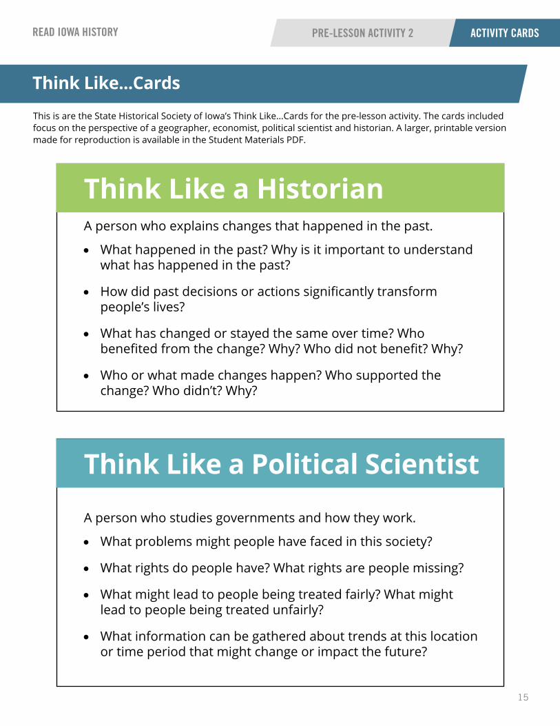
Think Like a Political Scientist
A person who studies governments and how they work.
• What problems might people have faced in this society?
• What rights do people have? What rights are people missing?
• What might lead to people being treated fairly? What might lead to people being treated unfairly?
• What information can be gathered about trends at this location or time period that might change or impact the future?
Think Like a HistorianA person who explains changes that happened in the past.
• What happened in the past? Why is it important to understand what has happened in the past?
• How did past decisions or actions significantly transform people’s lives?
• What has changed or stayed the same over time? Who benefited from the change? Why? Who did not benefit? Why?
• Who or what made changes happen? Who supported the change? Who didn’t? Why?

16
READ IOWA HISTORY
This is an example worksheet that corresponds with the instructions in the pre-lesson activity to assist students in recognizing the perspectives of varying disciplines. This version of the worksheet is for you, the educator, to fill out, add notes and utilize. A larger, printable version made for reproduction is available in the Student Materials PDF.
Think Like...
PRE-LESSON ACTIVITY 2 QUESTION SHEET
Think Like... Worksheet
A Geographer A Historian
An Economist A Political Scientist

17
READ IOWA HISTORY
Display the SOCC posters on a bulletin board or in some location that all students can view as each step is introduced. To help students analyze the image, it is suggested to have the class watch this Kid Citizen video about identifying and using primary sources.
Sort students into pairs. You will give each pair one copy of the primary source, “America, Its Soil.” This is so they can view the image while modeling how to source, observe, contextualize and corroborate the primary source.
Begin with source. Use the posters to guide students through the four steps. After contextualize, students will share responses and you will record their answers on the “Analyze an Image” worksheet.
Formative Assessment: Students will write questions on Post-it Notes. They will prioritize their questions by questions that will help answer the supporting question: What are landforms? Share the priority questions and post them on or around a copy of the “America, Its Soil” image. Students will answer their questions as they learn more throughout this unit. Consider displaying these on a bulletin board or on chart paper so students can refer back to answer them throughout their learning.
1
2
4
“America, Its Soil,” 1946
Source BackgroundThis 1946 illustration was created by artist Paul Sample, and is entitled, “America, Its Soil.” The image shows scenes of land use and farming superimposed on a map of the United States.
OverviewStudents will learn how to analyze an image using the Source, Observe, Contextualize and Corroborate (SOCC) strategy featured in the pre-lesson activity. This illustration provides the opportunity for students to start thinking about and asking questions about landforms, natural resources and where they are in the United States.
PART 1 INSTRUCTIONS
Materials • “America, Its Soil” image
• SOCC posters
• “Analyze an Image” worksheet
• Post-it Notes
• Suggested video: Kid Citizen video
Instructions
3
Unit Compelling QuestionHow does the way we live impact our environment?
Unit Supporting QuestionWhy are landforms important?? ?

18Courtesy of Library of Congress, Sample, Paul, “America, Its Soil,” 1946
“America, Its Soil,” 1946 PART 1
19
READ IOWA HISTORY
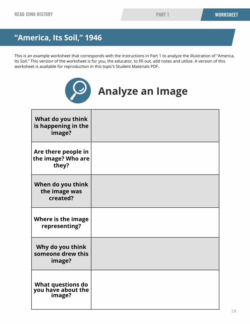
This is an example worksheet that corresponds with the instructions in Part 1 to analyze the illustration of “America, Its Soil.” This version of the worksheet is for you, the educator, to fill out, add notes and utilize. A version of this worksheet is available for reproduction in this topic’s Student Materials PDF.
Analyze an Image
“America, Its Soil,” 1946
PART 1 WORKSHEET
What do you think is happening in the
image?
Are there people in the image? Who are
they?
When do you think the image was
created?
Where is the image representing?
Why do you think someone drew this
image?
What questions do you have about the
image?

20
READ IOWA HISTORY
Students will perform a quick write activity in a notebook or on a piece of paper with their initial thoughts to the question: How can I have an impact on my community?
Have students apply the Question Formulation Technique (QFT) strategy to the primary source from Part 1, “America, Its Soil.” Display the image for students to view. Follow the steps from Pre-Lesson Activity 2 to assist students in their analysis of the image.
After sharing the prioritized questions, discuss with students what social studies discipline that the question falls under. Use the Think Like... cards to assist with the inquiry. Post questions on chart paper for students to answer as they learn more.
Formative Assessment: Students can post more priority questions on the chart paper to answer as they learn more throughout this Read Iowa History unit. Consider displaying these on a bulletin board or on chart paper so students can refer back to answer them.
1
2
3
44
What Impacts the Development of a Community?
OverviewStudents will write about what things impact their community. This will give you an idea of the knowledge students possess before learning anything related to the compelling question. The class will use the Question Formulation Technique (QFT) strategy used in Pre-Lesson Activity 2. Students also will consider what perspective (historian, economist, geographer or political scientist) relates most to their questions and they will prioritize them by most important questions that they will work to answer.
PART 2 INSTRUCTIONS
Materials • Notebooks or pieces of paper
• Think Like... cards
• Chart paper
• “America, Its Soil” image
Instructions
Unit Compelling QuestionHow does the way we live impact our environment?
Unit Supporting QuestionWhy are landforms important?? ?
21
READ IOWA HISTORY
Divide students into groups (three or four students per group). Each group will get one of the six primary source images. They will have one “Analyze an Image” worksheet per group.
Students will use the SOCC technique to analyze their images. They will use the worksheet to guide their inquiry.
Have students consider the disciplinary perspectives from the Think Like... cards. Ask students what questions they would have about their image specific to the individual disciplines.
Students will write three to four priority questions (QFT technique) on Post-it Notes or you will record their questions. Use the SOCC posters to guide student questions.
Instructions continued on next page
1
2
3
4
Visualizing Landforms
Source BackgroundsSource 1: This print shows a wilderness scene with a bear at the edge of a stream and waterfalls and mountains in the background. It is an image of a mountain pass in the Sierra Nevada Mountain Range near Lake Tahoe. This pass was a point on the Carson Trail during the California Gold Rush.
Source 2: This image captures the Mississippi River Valley near Clinton, Iowa, in 1899.
Source 3: This image, taken in 1901, shows a bird’s-eye view of the Des Moines River in Iowa.
Source 4: This 1913 image shows the Grand Canyon. A small boat can be seen floating on the Colorado River.
Source 5: This image, taken in 1993, shows Zion National Park in Washington County, Utah.
Source 6: This 2016 image shows a field of sweet corn near Marengo in Iowa County, Iowa.
OverviewStudents will analyze primary sources in small groups to visualize the landform definitions. Since there are six primary sources, use this opportunity to jigsaw the images and provide opportunities for students to collaborate. Students will act as experts on their images to share to the whole group. They will connect their images to the “American, Its Soil” illustration from Part 1 to make connections to where the landforms are located.
PART 3 INSTRUCTIONS
Materials • Six primary sources
• “Analyze an Image” worksheet
• Think Like... cards
• SOCC posters
• Post-it Notes
• “America, Its Soil” image
• String
Instructions
Unit Compelling QuestionHow does the way we live impact our environment?
Unit Supporting QuestionWhy are landforms important?? ?

22
READ IOWA HISTORY
Visualizing Landforms
PART 3 INSTRUCTIONS
Return to the whole class. Students will sit with their group, along with their landform image and worksheet. Each group will share their landform image and questions to the class. Stick Post-it Notes to the image and then determine where it is located on the “America, Its Soil” image from Part 1.
Use a string to connect the map to the images. At this time, introduce and post landform definitions from the vocabulary cards.
Formative Assessment: Share the images and questions on the Post-it Notes with the entire class. Consider displaying these on a bulletin board or on chart paper so students can refer back to answer them.
5
6
7
Instructions continued

23Courtesy of Library of Congress, Currier & Ives, “The mountain pass, Sierra Nevada,” 1867
Sierra Nevada Mountain Pass, 1867 PART 3

24Courtesy of Library of Congress, “Valley of the Mississippi, near Clinton, Iowa,” Detroit Publishing Co., 1899
Valley of the Mississippi River near Clinton, Iowa, 1899 PART 3

25Courtesy of Library of Congress, “Up the Des Moines Valley, From C. & N. W. Ry. viaduct,” Detroit Publishing Co., 1901
Des Moines River Valley, 1901 PART 3
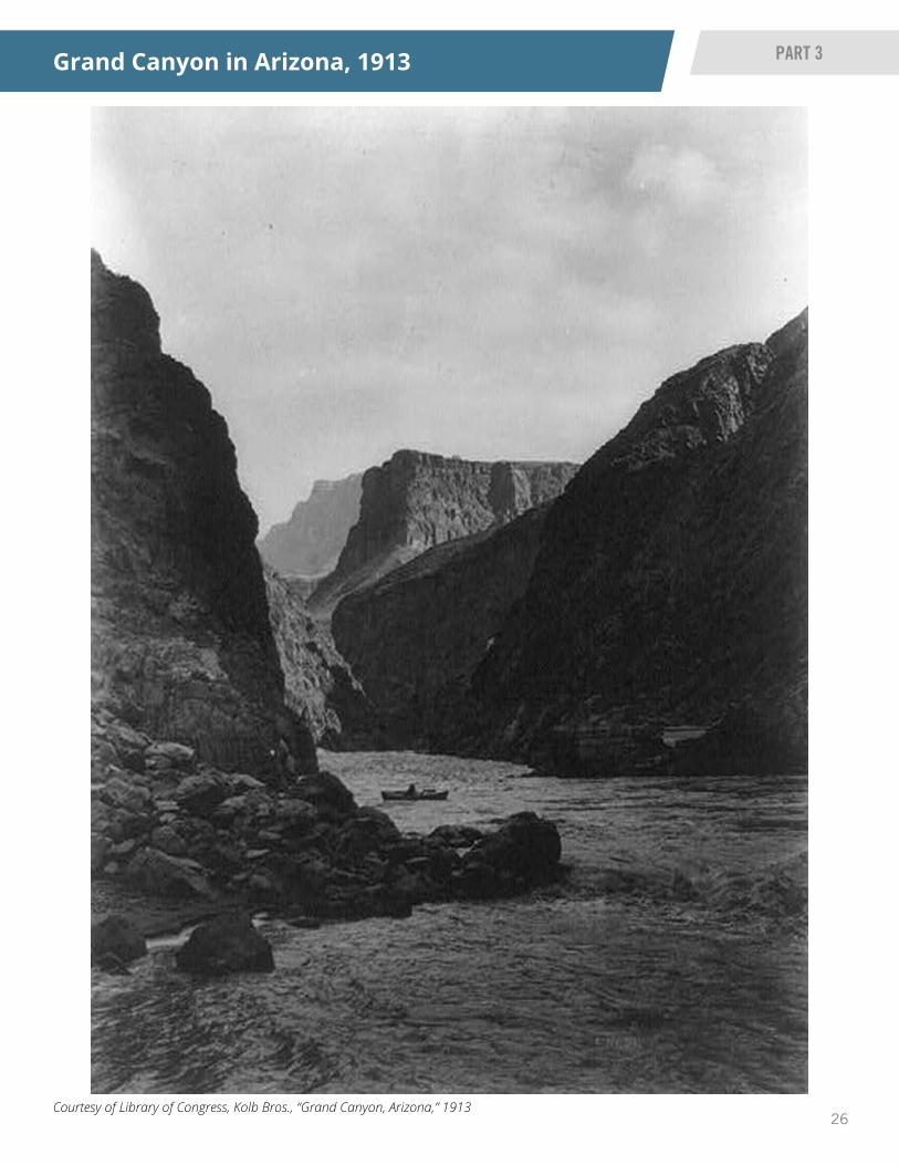
26Courtesy of Library of Congress, Kolb Bros., “Grand Canyon, Arizona,” 1913
Grand Canyon in Arizona, 1913 PART 3

27
Courtesy of Library of Congress, Grogan, Brian C., “5. View from Smithsonian Butte facing north along old road - Zion National Park Roads & Bridges, Springdale, Washington County, UT,” 1993
Zion National Park in Washington County, Utah, 1993 PART 3

28Courtesy of Library of Congress, Highsmith, Carol. M., “Vast field of sweet corn near Marengo in Iowa County, Iowa,” 8 August 2016
Sweet Corn Field near Marengo, Iowa, August 8, 2016 PART 3

29
READ IOWA HISTORY
This is an example worksheet that corresponds with the instructions in Part 3 to analyze the images of landforms. This version of the worksheet is for you, the educator, to fill out, add notes and utilize. A version of this worksheet is available for reproduction in this topic’s Student Materials PDF.
Analyze an Image
Analyze an Image Worksheet
PART 3 WORKSHEET
What do you think is happening in the
image?
Are there people in the image? Who are
they?
When do you think the image was
created?
Where is the image representing?
Why do you think someone drew this
image?
What questions do you have about the
image?

30
READ IOWA HISTORY
To assist students in designing landforms, multiple suggested resources are listed in the materials box. As you begin this lesson, make sure students take note of their previously generated questions to see if any can be answered.
Introduce students to the concept of a landform map by letting them view the U.S. relief location map.
Have students break up into small groups. Each group will create a U.S. relief map showing different landforms: plains, grasslands, mountains, deserts, plateaus, forests and oceans. They can use copies of the original relief map to make their group map to place their 3D landforms.
Students will use construction paper and/or other materials to make the landforms, and then tape them onto the map to show a visual representation of landforms on the map.
Hang their maps on a bulletin board, so it can be a visual representation as this module continues to unfold. You could also use student-analyzed images from Part 3 to tape on the blank map, too.
Formative Assessment: Observe how students create landforms and decide placement of them on the U.S. map. Have students complete the worksheet, “Check for Understanding - Landforms.”
Instructions continued on next page
2
3
6
Creating a U.S. Map with Landforms
OverviewStudents will design and review landforms. They will make a 3D model of the U.S. landforms. The land itself is the most important factor in human settlement. Do Iowans live in the mountains, on the plains, in the forest, on a river or on the beach? Rivers and oceans were the first human highways. Ships moved people and goods faster and easier than people and animals on land could. Mountains and forests impeded transportation, which could have been a problem or a benefit if it protected residents from outsiders. Ocean-front housing could provide a mild climate or subject inhabitants to brutal storms. Iowans are blessed with incredibly rich soil and rainfall while desert people must be creative to grow food or raise livestock. Where people live has a major impact on the lifestyle of any people. This activity will provide students the opportunity to create a map to reflect what they have learned about why landforms are important.
PART 4 INSTRUCTIONS
Materials • U.S. relief location map
• “Checking for Understanding - Landforms” worksheet
• Construction paper
• Tape and/or glue stick
• Suggested books: Looking at Landforms by Ellen Mitten, Introducing Landforms by Bobbie Kalman or A True Book: U.S. Landforms by Dana Meachen
• Suggested videos: Landforms Learn 360 (accessible through AEA) or Landforms, Hey!: Crash Course for Kids
Instructions
4
1
5
Unit Compelling QuestionHow does the way we live impact our environment?
Unit Supporting QuestionWhy are landforms important?? ?
31
READ IOWA HISTORY
Creating a U.S. Map with Landforms
PART 4 INSTRUCTIONS
Optional Formative Assessment: Print the landform vocabulary cards for students to glue in their worksheet’s chart or in a chart they create themselves. Print the primary sources used in this Read Iowa History unit (small size) and give to students to glue in or draw for the question: What is (insert landform)? Then, students will explain why the landform is important.
7
Instructions continued

32
United States Relief Location Map PART 4
This version of the United States Relief Location Map is for you, the educator, to fill out, add notes and utilize. A larger version of this map is available for reproduction in this topic’s Student Materials PDF.

33
READ IOWA HISTORY
This is an example worksheet that corresponds with the formative assessment instructions in Part 4. This version of the worksheet is for you, the educator, to fill out, add notes and utilize. A version of this worksheet is available for reproduction in this topic’s Student Materials PDF.
Check for Understanding - Landforms
Creating a U.S. Map with Landforms
PART 4 WORKSHEET
Landform Definition What does it look like? Why is it important?
Desert
Plains
Forest
Valley
Canyon
Plateau
34
READ IOWA HISTORY
Lesson Summative Assessment
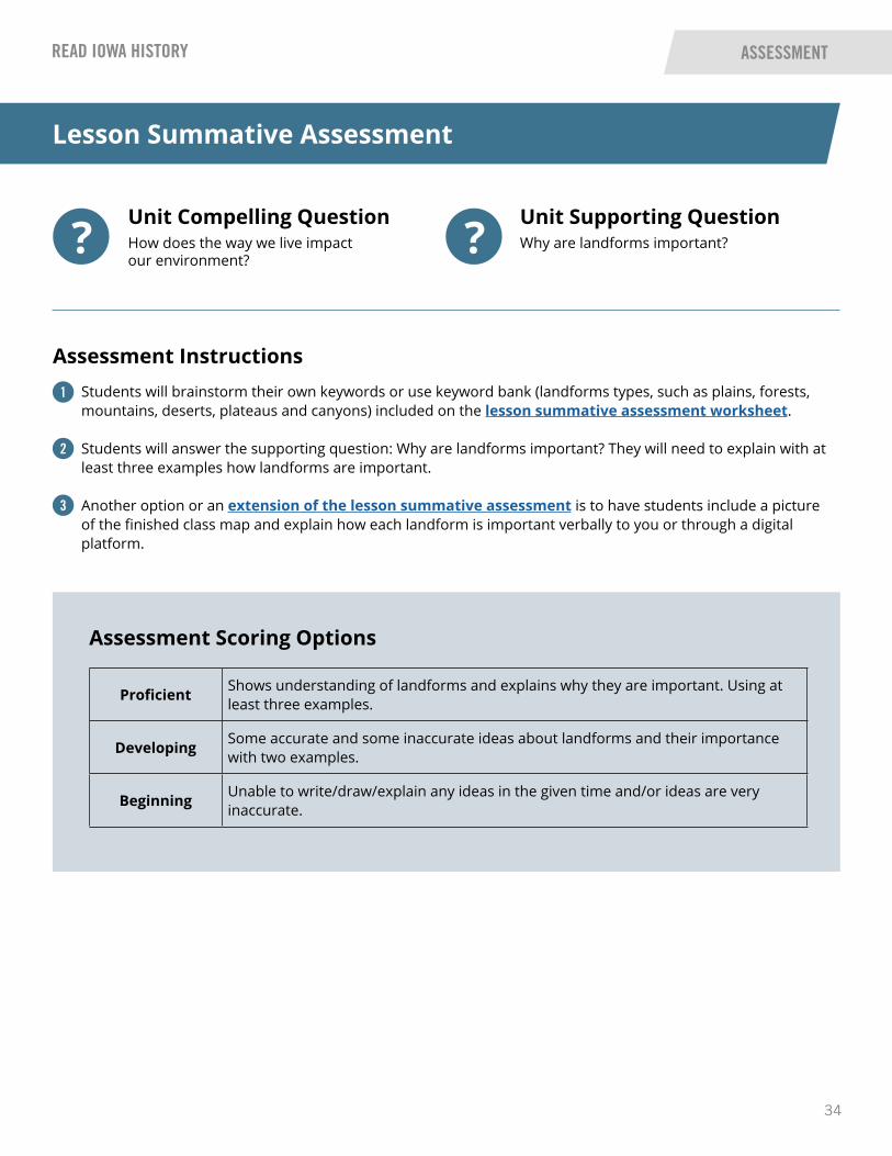
Proficient Shows understanding of landforms and explains why they are important. Using at least three examples.
Developing Some accurate and some inaccurate ideas about landforms and their importance with two examples.
Beginning Unable to write/draw/explain any ideas in the given time and/or ideas are very inaccurate.
ASSESSMENT
Students will brainstorm their own keywords or use keyword bank (landforms types, such as plains, forests, mountains, deserts, plateaus and canyons) included on the lesson summative assessment worksheet.
Students will answer the supporting question: Why are landforms important? They will need to explain with at least three examples how landforms are important.
Another option or an extension of the lesson summative assessment is to have students include a picture of the finished class map and explain how each landform is important verbally to you or through a digital platform.
1
Assessment Instructions
2
3
Assessment Scoring Options
Unit Compelling QuestionHow does the way we live impact our environment?
Unit Supporting QuestionWhy are landforms important?? ?

35
READ IOWA HISTORY
This is an example worksheet that corresponds with the lesson summative assessment. This version of the worksheet is for you, the educator, to fill out, add notes and utilize. A version of this worksheet is available for reproduction in this topic’s Student Materials PDF.
Lesson Summative Assessment
ASSESSMENT WORKSHEET
Word Bank landforms plains forests mountains deserts plateaus canyons
Supporting Question: Why are landforms important?
Proficient: Shows understanding of landforms and explains why they are important. Using at least three examples.
Developing: Some accurate and some inaccurate ideas about landforms and their importance with two examples.
Beginning: Unable to write/draw/explain any ideas in the given time and/or ideas are very inaccurate.

36
READ IOWA HISTORY
This is an example lesson summative assessment completed with a class map image. It also includes a possible example of what a student might say or write to assist you in your assessment.
Example Lesson Summative Assessment with Class Map
ASSESSMENT EXAMPLE
Word Bank landforms plains forests mountains deserts plateaus canyons
Supporting Question: Why are landforms important?
Example Student Response: There are many landforms on the Earth like the mountains, plains, forests and plateaus. Landforms provide homes to living things, natural resources and beauty. The plains are where many farms are located which gives us food. The plains are good for building houses, roads and railroads because of the flat area. Plateaus have lots of minerals. Mountains are important because many rivers begin from them. Rivers are important plants, animals and people. Forests provide trees that we need to live and breathe, and use for wood to build things.
37
Vocabulary Flashcards
Landform Desert
Plains
ENVIRONMENTAL IMPACT
READ IOWA HISTORY
READ IOWA HISTORY
READ IOWA HISTORY
READ IOWA HISTORY
Forest
38
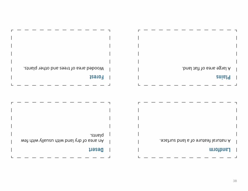
Desert Landform
Forest Plains
An area of dry land with usually with few plants.
Wooded area of trees and other plants.
A natural feature of a land surface.
A large area of flat land.

39
Vocabulary Flashcards
Valley Canyon
Plateau
ENVIRONMENTAL IMPACT
READ IOWA HISTORY
READ IOWA HISTORY
READ IOWA HISTORY
READ IOWA HISTORY

40
Canyon Valley
Plateau
A deep valley with steep sides, often with a stream flowing through it.
A low area between hills or mountains.
Elevated landform that rises above the surrounding area and has a flat top.

41
READ IOWA HISTORY
Additional Environmental Impact Resources for Educators
Environmental Impact Primary Source SetThis is a digital collection of primary and secondary sources about landforms and how people impact the environment. This Read Iowa History unit is based on this primary source set.
U.S. National Parks for Kids - LandformsThis website allows students to use an interactive map to research national parks throughout the country. This specific webpage focuses on landforms, such as mountain ranges, lakes and rivers.
What is a primary source? (LOC Kid Citizen)This website provides a brief introductory video to help children learn about what a primary source is and explore a few examples.
Using the Question Formulation Technique (QFT) for Formative AssessmentThis video was created by the The Right Question Institute and showcases a 4th-grade teacher in New Hampshire using the Question Formulation Technique (QFT) to learn more about what her students know or did not know about fractions.
Learn 360 - LandformsThis video is available through your local AEA. The educational video helps students learn about the different landforms in the United States.
Introducing Landforms by Bobbie KalmanThis book explains to young children why the land on Earth has different shapes in different places. Photographs and illustrations show examples of continents, mountains, valleys, plains and caves, as well as the forests, animals and water that may be found on each landform.
Looking at Landforms by Ellen MittenThis book encourages young readers to learn about various landforms through text and photos.
U.S. Landforms (TrueBooks: US Regions) by Dana Meachen RauThis book encourages readers to learn about the nation’s deserts, mountains and plains. There are numerous photographs of famous landmarks, such as California’s Death Valley and the hot water geysers of Yellowstone National Park.
ENVIRONMENTAL IMPACT